plan4all georama presentation at patras (12-13.09.2011)
TRANSCRIPT

Co-funded by the
Community programme
eContentplus
WP7 technical meeting
Manolis Viennas, External Partner
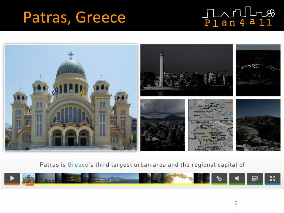
GEORAMA Patras, Greece
12.-13. September 2011
GEORAMA
1

GEORAMA Contribution
3

Hardware and Software
Server • virtual machine
• one processor 2 GHz
• 6 GB of RAM
Software • Windows Server 2008 64bit
• Tomcat 6.0.29 dedicated web server
• PostgreSQL Database Server
notice that the component is fully cross-platform
4

7.1 - Metadata Deployment
5

GEORAMA-Content Provider
• Existing metadata are copy of original data
provider data descriptions without changes
since Georama is no data owner.
• Initial datasets have been retrieved from
geodata.gov.gr
• Georama supports and re-distributes the
whole datasets through its own facilities and
infrastructure acquired for the Plan4All
project – plan4all.georama.org.gr 6

Metadata Portal Solutions
• local implementation
• OGC compliant
• SDI infrastructure based entirely on
open source software
• metadata portal solution: Geonetwork
7

Catalogue Services
• Catalogue services: Geonetwork
• allow creation, editing and search of metadata
8

Metadata Editing
Metadata storage is automatically kept by Geonetwork in the PostgreSQL 9

Metadata Search/Download
Interactive search/download: besides the consultation via CSW protocol, it is
possible to do an interactive direct search through the GeoNetwork web
interface, which allows also metadata download as PDF or XML. 10

Metadata Web Services
CWS: http://plan4all.georama.org.gr/geonetwork/srv/en/csw
11
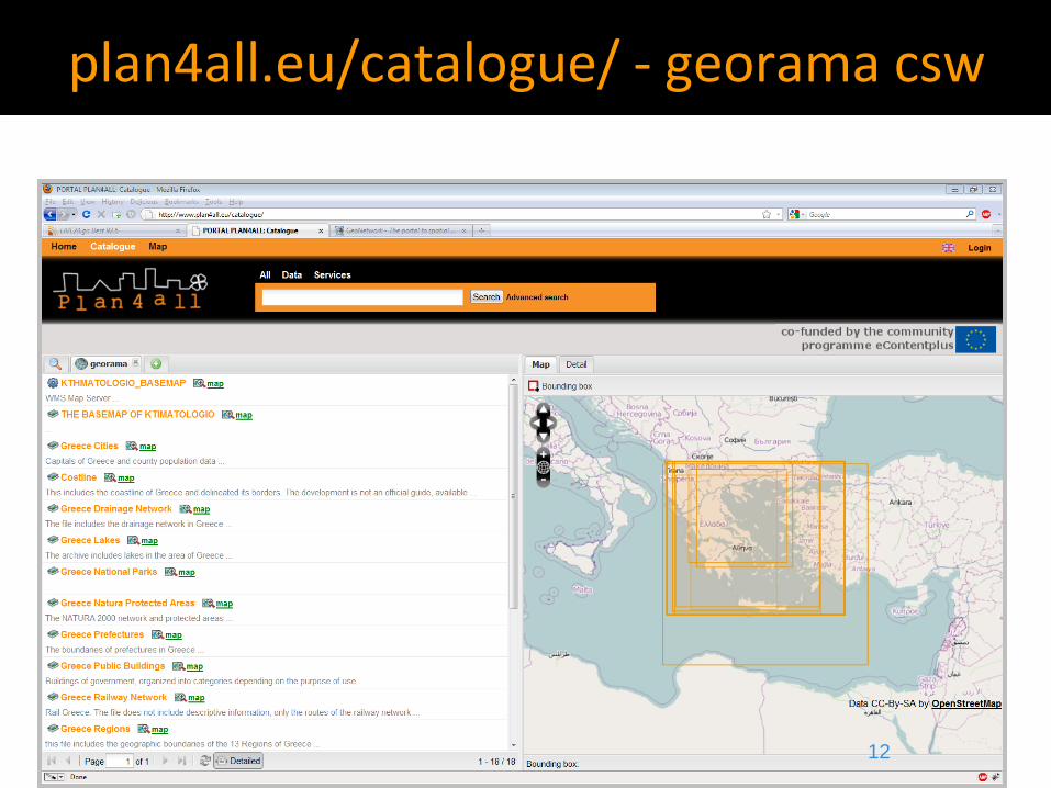
plan4all.eu/catalogue/ - georama csw
12
Metadata - Thesaurus
• There is currently no thesaurus supporting
multilingual discovery of data
• In meta-data system used GEMET thesaurus
and to extend search and identify capabilities
added keywords in local language
13

7.2 – Data Deployment
14

Source Data
• Source data: Corine Land Cover 2000 for
the whole Greece, which have been
finalized and updated constantly since 2004
by the Greek organization for cadastre and
chartography (www.okxe.gr). Data are
produced according Corine Land Cover
mapping requirements..
15

Source Data (2)
• Source data come from geodata.org.gr
and reproduced through Georama’s map
services
• ESRI Shapefile format
• Greek Grid GCS_GGRS_1987 projection
• The harmonisation process is built up on
the source data in the ESRI Shapefile
format. This file contains all important data
regarding land cover specification.
16
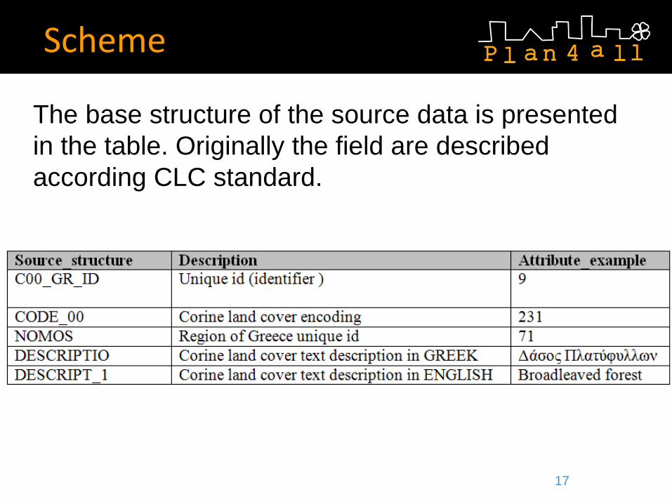
Scheme
The base structure of the source data is presented
in the table. Originally the field are described
according CLC standard.
17

Features and Code Lists
The table describe source data features, attributes and code
lists important for data transformation and harmonisation
18

Transformation Method
• Main tasks in transformation are simple manipulations with
attribute data and geometries.
• Actions are performed using ArcMap GIS software
(of course they can be performed using any other GIS
application completely or some parts from described process
steps)
Steps using ArcMap SW toolbox scripts:
1. Dissolve neighbour geometries with equal Corine Land Cover
codes (action is performed just for security reasons, such
cases in dataset should not be); During the transformation this
fact is verified
19

Transformation Method (2)
ArcMap SW showing
clc properties
including corine
Greek text
description for
categories 20

Transformation Method (3)
Verifying that all
polygons are
dissolved according
to corine area codes
21

Spatial transformation process
The spatial transformation are also needed due to the
fact that Greece holds all its data in a projected
Greek Grid format (GCS_GGRS_1987 ) which
required the following steps in order to be converted
to the final required projection:
1. Reprojecting to WGS84: EPSG: 36233;
2. Colour schemes are lost in the transition and need
to be recreated in the geoserver.
22

Transformation Scheme
Transformed shape file for corine Greece 23

Publication-Web Map Client
• The data publication is performed using Geoportal System
provided functionality:
• Search: search of data and metadata using Micka
metadata solution
• OGC services: CWS, WMS, WFS, WCS.
• Downloads: data file download, via HTTP, to use with local
applications.
• The data has been published in the WGS84 system
• As desktop client can be used any application able to use
OGC WMS, WFS or CSW services like ArcMap SW, gvSIG,
QuantumGIS, Open JUMP, uDig and other
24

Publication-Web Map Client
The harmonised data is published in a simple web map
application at http://plan4all.georama.org.gr
25

Publication - Web Services
• WMS 1.1.1 -
http://plan4all.georama.org.gr/geoserver/ows?servic
e=wms&version=1.1.1&request=GetCapabilities
• WFS 1.1.1 -
http://plan4all.georama.org.gr/geoserver/ows?servic
e=wfs&version=1.1.0&request=GetCapabilities
• All web services are available in
http://plan4all.georama.org.gr/geoserver
26

plan4all.eu/map – georama wms
Example of WMS (General land Use layer) service
connection using Plan4all portal map client:
27

Results
• Comments on Conceptual Models
• Model is well understandable because is similar to
Corine Land Cover that is well known and accessible
for reference.
• Recommended changes
• Multilingual code translation of corine areas has to be
further investigated
28

•8.3 – Validation of platform
29
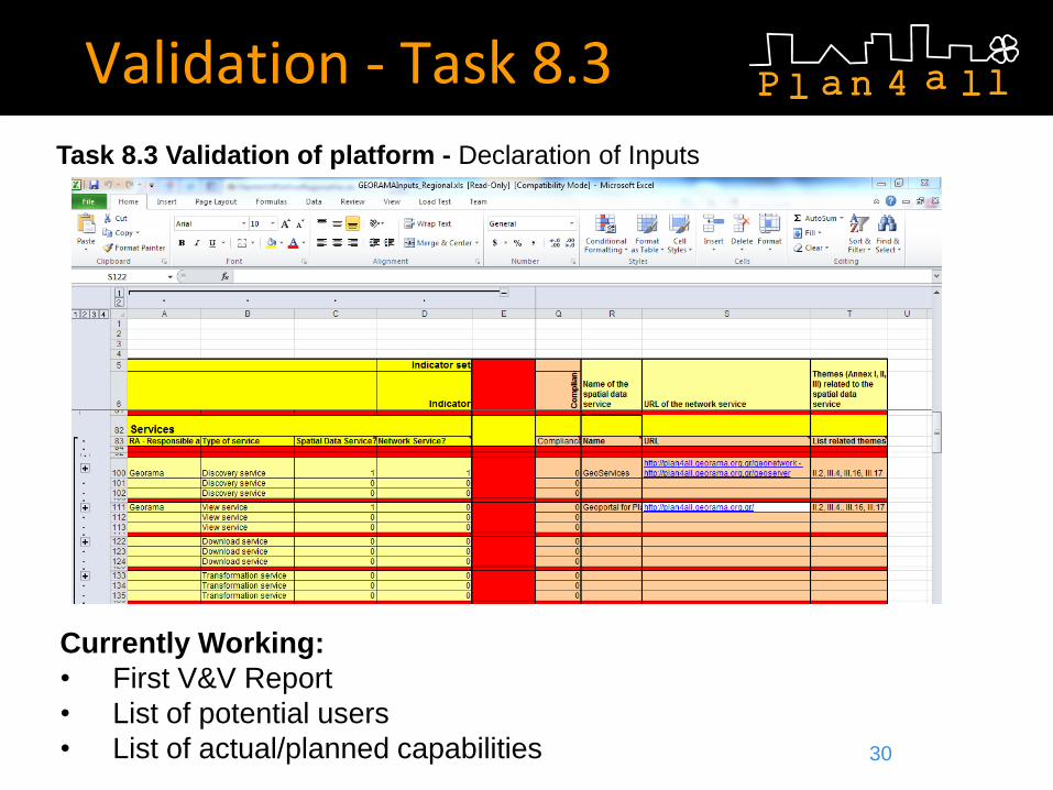
Validation - Task 8.3
Currently Working:
• First V&V Report
• List of potential users
• List of actual/planned capabilities
Task 8.3 Validation of platform - Declaration of Inputs
30