plan melbourne 2017-2050 draft inner south east …
TRANSCRIPT

Plan Melbourne 2017-2050 D R A F T I N N E R S O U T H E A S T M E T R O L A N D U S E F R A M E W O R K P L A N SUMMARY

D R A F T I N N E R S O U T H E A S T M E T R O L A N D U S E F R A M E W O R K P L A N - S U M M A R Y
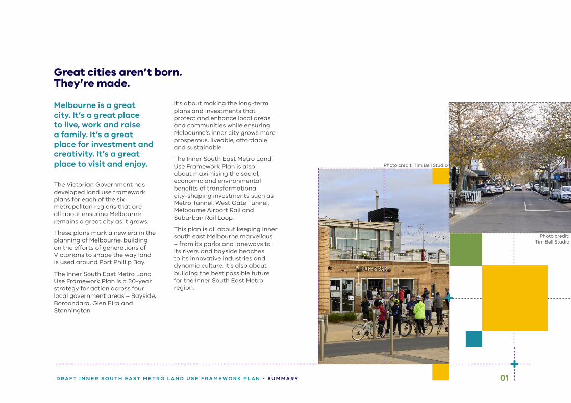
Photo credit: Tim Bell Studio
Photo credit: Tim Bell Studio
01D R A F T I N N E R S O U T H E A S T M E T R O L A N D U S E F R A M E W O R K P L A N - S U M M A R Y
Great cities aren’t born. They’re made.
Melbourne is a great city. It’s a great place to live, work and raise a family. It’s a great place for investment and creativity. It’s a great place to visit and enjoy.
The Victorian Government has developed land use framework plans for each of the six metropolitan regions that are all about ensuring Melbourne remains a great city as it grows.
These plans mark a new era in the planning of Melbourne, building on the efforts of generations of Victorians to shape the way land is used around Port Phillip Bay.
The Inner South East Metro Land Use Framework Plan is a 30-year strategy for action across four local government areas – Bayside, Boroondara, Glen Eira and Stonnington.
It’s about making the long-term plans and investments that protect and enhance local areas and communities while ensuring Melbourne’s inner city grows more prosperous, liveable, affordable and sustainable.
The Inner South East Metro Land Use Framework Plan is also about maximising the social, economic and environmental benefits of transformational city-shaping investments such as Metro Tunnel, West Gate Tunnel, Melbourne Airport Rail and Suburban Rail Loop.
This plan is all about keeping inner south east Melbourne marvellous – from its parks and laneways to its rivers and bayside beaches to its innovative industries and dynamic culture. It’s also about building the best possible future for the Inner South East Metro region.
Photo credit: Tim Bell Studio
Photo credit: Tim Bell Studio
02 D R A F T I N N E R S O U T H E A S T M E T R O L A N D U S E F R A M E W O R K P L A N - S U M M A R Y
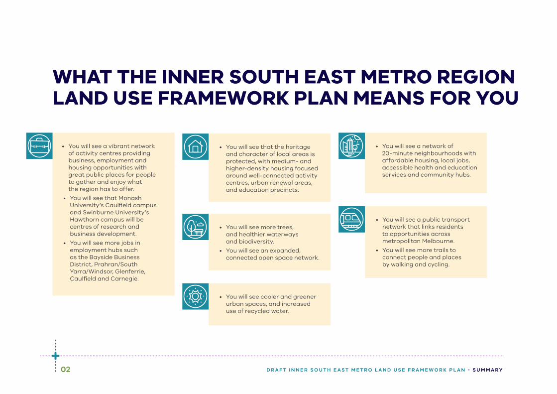
WHAT THE INNER SOUTH EAST METRO REGION LAND USE FRAMEWORK PLAN MEANS FOR YOU
• You will see a vibrant network of activity centres providing business, employment and housing opportunities with great public places for people to gather and enjoy what the region has to offer.
• You will see that Monash University’s Caulfield campus and Swinburne University’s Hawthorn campus will be centres of research and business development.
• You will see more jobs in employment hubs such as the Bayside Business District, Prahran/South Yarra/Windsor, Glenferrie, Caulfield and Carnegie.
• You will see that the heritage and character of local areas is protected, with medium- and higher-density housing focused around well-connected activity centres, urban renewal areas, and education precincts.
• You will see more trees, and healthier waterways and biodiversity.
• You will see an expanded, connected open space network.
• You will see a network of 20-minute neighbourhoods with affordable housing, local jobs, accessible health and education services and community hubs.
• You will see a public transport network that links residents to opportunities across metropolitan Melbourne.
• You will see more trails to connect people and places by walking and cycling.
• You will see cooler and greener urban spaces, and increased use of recycled water.
2
6
1
4
5
3
Sandringham
Hampton
BentleighBrighton-ChurchStreet
Brighton-BayStreet
GlenhuntlyCarnegie
ChadstoneElsternwick
Caulfield
Malvern/Armadale
Prahran/South Yarra
ToorakVillage
CamberwellJunction
Hawthorn-Glenferrie Road
Kew Junction
Swinburne
University
Hawthorn
Monash
University
Caulfield
Ricketts Point Marine Sanctuary
Port PhillipBay
YARRA RIVER
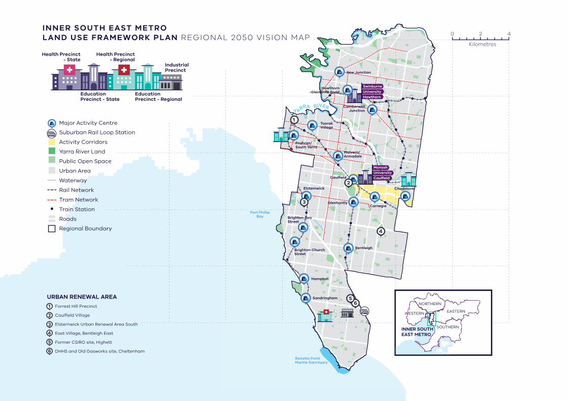
INNER SOUTH EAST METRO LAND USE FRAMEWORK PLAN REGIONAL 2050 VISION MAP
Major Activity Centre
Suburban Rail Loop Station
Activity Corridors
Yarra River Land
Public Open Space
Urban Area
Waterway
Rail Network
Tram Network
Train Station
Roads
Regional Boundary
URBAN RENEWAL AREA
1
2
3
4
5
6
Forrest Hill Precinct
Caulfield Village
Elsternwick Urban Renewal Area South
East Village, Bentleigh East
Former CSIRO site, Highett
DHHS and Old Gasworks site, Cheltenham
Education Precinct - Regional
Education Precinct - State
IndustrialPrecinct
Health Precinct- Regional
Health Precinct- State
0 2 4
Kilometres
EASTERN
SOUTHERNINNER SOUTHEAST METRO
NORTHERN
WESTERN
04 D R A F T I N N E R S O U T H E A S T M E T R O L A N D U S E F R A M E W O R K P L A N - S U M M A R Y
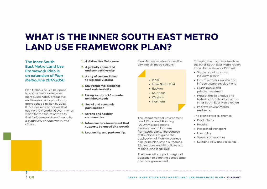
WHAT IS THE INNER SOUTH EAST METRO LAND USE FRAMEWORK PLAN?The Inner South East Metro Land Use Framework Plan is an extension of Plan Melbourne 2017-2050.
Plan Melbourne is a blueprint to ensure Melbourne grows more sustainable, productive and liveable as its population approaches 8 million by 2050. It includes nine principles that outline the Victorian Government’s vision for the future of the city that Melbourne will continue to be a global city of opportunity and choice.
1. A distinctive Melbourne
2. A globally connected and competitive city
3. A city of centres linked to regional Victoria
4. Environmental resilience and sustainability
5. Living locally in 20-minute neighbourhoods
6. Social and economic participation
7. Strong and healthy communities
8. Infrastructure investment that supports balanced city growth
9. Leadership and partnership.
Plan Melbourne also divides the city into six metro regions:
• Inner
• Inner South East
• Eastern
• Southern
• Western
• Northern
The Department of Environment, Land, Water and Planning (DELWP) is leading the development of land use framework plans. The purpose of the plans is to guide the application of Plan Melbourne’s nine principles, seven outcomes, 32 directions and 90 policies at a regional and local level.
The plans will support a regional approach to planning across state and local government.
This document summarises how the Inner South East Metro region Land Use Framework Plan will:
• Shape population and industry growth
• Inform plans for service and infrastructure development
• Guide public and private investment
• Protect the distinctive and historic characteristics of the Inner South East Metro region
• Improve environmental resilience.
The plan covers six themes:
• Productivity
• Housing
• Integrated transport
• Liveability
• Strong communities
• Sustainability and resilience.

BAYSIDE
STONNINGTON
GLENEIRA
BOROONDARA
Regional boundary
Local government area boundary
Urban Area
INNER SOUTH EAST METRO REGION
06 D R A F T I N N E R S O U T H E A S T M E T R O L A N D U S E F R A M E W O R K P L A N - S U M M A R Y
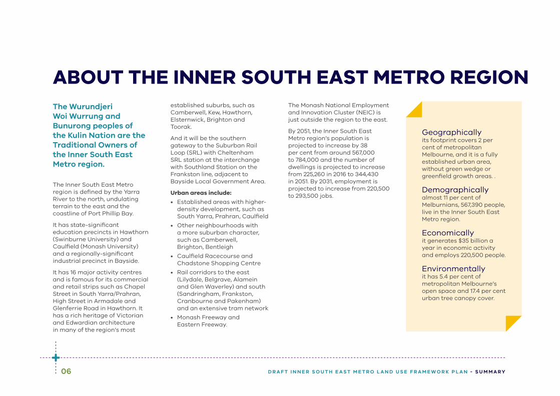
The Wurundjeri Woi Wurrung and Bunurong peoples of the Kulin Nation are the Traditional Owners of the Inner South East Metro region.
The Inner South East Metro region is defined by the Yarra River to the north, undulating terrain to the east and the coastline of Port Phillip Bay.
It has state-significant education precincts in Hawthorn (Swinburne University) and Caulfield (Monash University) and a regionally-significant industrial precinct in Bayside.
It has 16 major activity centres and is famous for its commercial and retail strips such as Chapel Street in South Yarra/Prahran, High Street in Armadale and Glenferrie Road in Hawthorn. It has a rich heritage of Victorian and Edwardian architecture in many of the region’s most
established suburbs, such as Camberwell, Kew, Hawthorn, Elsternwick, Brighton and Toorak.
And it will be the southern gateway to the Suburban Rail Loop (SRL) with Cheltenham SRL station at the interchange with Southland Station on the Frankston line, adjacent to Bayside Local Government Area.
Urban areas include:
• Established areas with higher-density development, such as South Yarra, Prahran, Caulfield
• Other neighbourhoods with a more suburban character, such as Camberwell, Brighton, Bentleigh
• Caulfield Racecourse and Chadstone Shopping Centre
• Rail corridors to the east (Lilydale, Belgrave, Alamein and Glen Waverley) and south (Sandringham, Frankston, Cranbourne and Pakenham) and an extensive tram network
• Monash Freeway and Eastern Freeway.
The Monash National Employment and Innovation Cluster (NEIC) is just outside the region to the east.
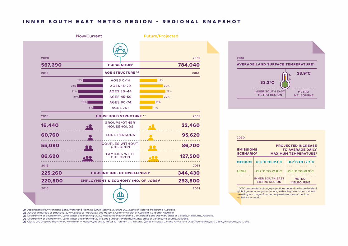
By 2051, the Inner South East Metro region’s population is projected to increase by 38 per cent from around 567,000 to 784,000 and the number of dwellings is projected to increase from 225,260 in 2016 to 344,430 in 2051. By 2031, employment is projected to increase from 220,500 to 293,500 jobs.
Geographicallyits footprint covers 2 per cent of metropolitan Melbourne, and it is a fully established urban area, without green wedge or greenfield growth areas. .
Demographicallyalmost 11 per cent of Melburnians, 567,390 people, live in the Inner South East Metro region.
Economicallyit generates $35 billion a year in economic activity and employs 220,500 people.
Environmentallyit has 5.4 per cent of metropolitan Melbourne’s open space and 17.4 per cent urban tree canopy cover.
ABOUT THE INNER SOUTH EAST METRO REGION
Future/ProjectedNow/Current
I N N E R S O U T H E A S T M E T R O R E G I O N - R E G I O N A L S N A P S H O T
2020 2051
2016
2016
POPULATION1
AGE STRUCTURE 1,2
HOUSEHOLD STRUCTURE 1,2
567,390 784,040
16,440 22,460
60,760 95,620
55,090 86,700
86,690 127,500
AGES 0-14
AGES 15-29
AGES 30-44
AGES 45-59
GROUPS/OTHER HOUSEHOLDS
LONE PERSONS
COUPLES WITHOUT CHILDREN
FAMILIES WITH CHILDREN
AGES 60-74
AGES 75+
2051
2051
HOUSING (NO. OF DWELLINGS)1 344,430225,260
2016 2031
EMPLOYMENT & ECONOMY (NO. OF JOBS)3 293,500220,500
2016 2051
17%
22%
21%
20%
15%
20%
22%
20%
13%
11%
13%
8%
AVERAGE LAND SURFACE TEMPERATURE4
INNER SOUTH EAST METRO REGION
METRO MELBOURNE
2018
33.3ºC
33.9ºC
EMISSIONSSCENARIO5
HIGH
MEDIUM +0.6˚C TO +2.1˚C
+1.2˚C TO +2.8˚C
+0.7˚C TO +2.7˚C
+1.3˚C TO +3.3˚C
INNER SOUTH EASTMETRO REGION
METRO MELBOURNE
PROJECTED INCREASETO AVERAGE DAILY
MAXIMUM TEMPERATURE5
2050
(1) Department of Environment, Land, Water and Planning (2021) Victoria in Future 2021, State of Victoria, Melbourne, Australia.(2) Australian Bureau of Statistics (2016) Census of Population and Housing, Commonwealth of Australia, Canberra, Australia.(3) Department of Environment, Land, Water and Planning (2020) Melbourne Industrial and Commercial Land Use Plan, State of Victoria, Melbourne, Australia.(4) Department of Environment, Land, Water and Planning (2018) Land Surface Temperature Data, State of Victoria, Melbourne, Australia.(5) Clarke JM, Grose M, Thatcher M, Hernaman V, Heady C, Round V, Rafter T, Trenham C & Wilson L. (2019). Victorian Climate Projections 2019 Technical Report, CSIRO, Melbourne, Australia.
* 2050 temperature change projections depend on future levels of global greenhouse gas emissions, with a 'high emissions scenario' resulting in a range of hotter temperatures than a 'medium emissions scenario’

08 D R A F T I N N E R S O U T H E A S T M E T R O L A N D U S E F R A M E W O R K P L A N - S U M M A R Y
The Victorian Government is currently implementing the largest transport infrastructure program in the state’s history.
City-shaping projects include:
• The West Gate Tunnel – creating a second river crossing to link the Western Metro region with the Port of Melbourne, CityLink and the CBD, and taking traffic pressures off the West Gate Bridge
• Level crossing removals including along the Frankston and Dandenong railway lines, reducing congestion and unlocking land for development
• Metro Tunnel – linking Melbourne’s south-east and Gippsland to the Sunbury line in Melbourne’s west and north-west
• North East Link – connecting Melbourne’s south-east to the Eastern Freeway, the Western Ring Road and Hume Freeway
• Melbourne Airport Rail – connecting Melbourne Airport to Victoria’s regional and metropolitan train network
• Suburban Rail Loop – connecting every major passenger railway line in Melbourne from the Frankston line in the south to the Werribee line in the west.
These city-shaping projects will improve access to jobs, education and social opportunities for residents in the Inner South East Metro region by better connecting the region with other areas of Melbourne and Victoria. They will create opportunities to maximise social, economic and environmental benefits.
CITY-SHAPING PROJECTS
Socially – bring jobs, services and leisure opportunities closer to where people live.
Economically – reduce transport congestion, boost productivity and create jobs.
Environmentally – cut commuting times, reduce transport emissions, promote public and active transport use, and create 20-minute neighbourhoods.

09D R A F T I N N E R S O U T H E A S T M E T R O L A N D U S E F R A M E W O R K P L A N - S U M M A R Y
Photo credit: Tim Bell Studio

10 D R A F T I N N E R S O U T H E A S T M E T R O L A N D U S E F R A M E W O R K P L A N - S U M M A R Y
INNER SOUTH EAST METRO REGION STRENGTHS AND CHALLENGES
ProductivityThe Inner South East Metro region has a vibrant local economy, with a network of major activity centres and health and education precincts. Protection of employment land is key, given that the region does not have greenfield sites or substantial areas of industrial land. New opportunities to expand, intensify and diversify employment activity need to be provided within the existing urban context.
Housing ChoiceThe region’s neighbourhoods are well established, with good services and infrastructure and the potential for higher-density housing around activity centres. More housing is needed to keep up with the growing population as well as more affordable and adaptable housing to meet housing needs of a diverse and aging population.
Integrated TransportThe region is well-served by existing road and public transport networks, and will benefit from planned transport investments. However, congestion is increasingly an issue. That is why infrastructure must be upgraded and pedestrian and cycling made more attractive to enable people to get around the region more easily.
11D R A F T I N N E R S O U T H E A S T M E T R O L A N D U S E F R A M E W O R K P L A N - S U M M A R Y
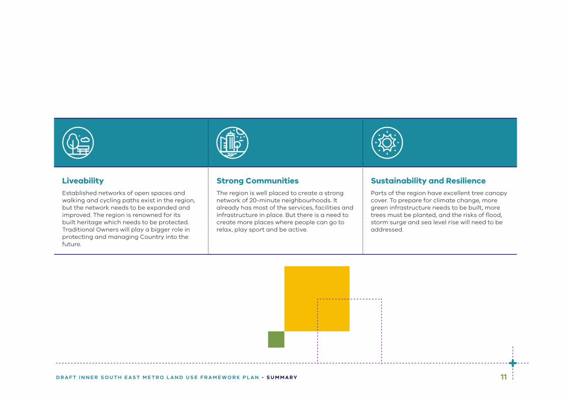
LiveabilityEstablished networks of open spaces and walking and cycling paths exist in the region, but the network needs to be expanded and improved. The region is renowned for its built heritage which needs to be protected. Traditional Owners will play a bigger role in protecting and managing Country into the future.
Strong CommunitiesThe region is well placed to create a strong network of 20-minute neighbourhoods. It already has most of the services, facilities and infrastructure in place. But there is a need to create more places where people can go to relax, play sport and be active.
Sustainability and ResilienceParts of the region have excellent tree canopy cover. To prepare for climate change, more green infrastructure needs to be built, more trees must be planted, and the risks of flood, storm surge and sea level rise will need to be addressed.
12 D R A F T I N N E R S O U T H E A S T M E T R O L A N D U S E F R A M E W O R K P L A N - S U M M A R Y
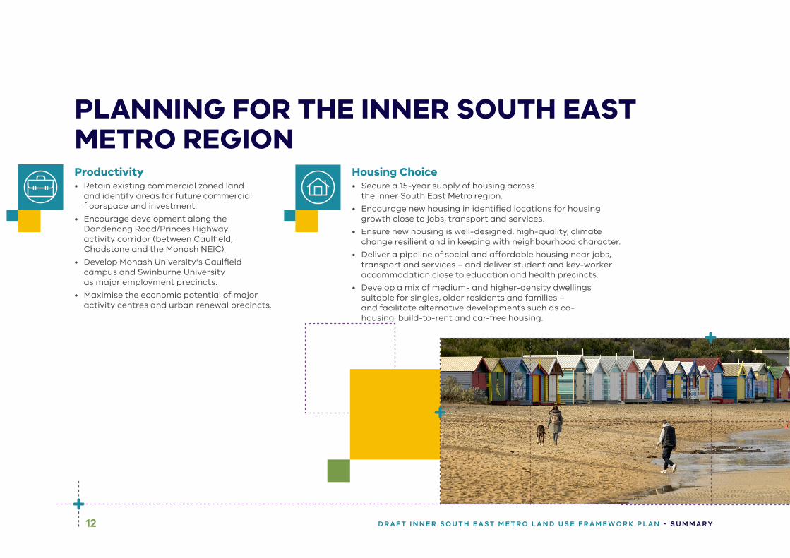
Productivity• Retain existing commercial zoned land
and identify areas for future commercial floorspace and investment.
• Encourage development along the Dandenong Road/Princes Highway activity corridor (between Caulfield, Chadstone and the Monash NEIC).
• Develop Monash University’s Caulfield campus and Swinburne University as major employment precincts.
• Maximise the economic potential of major activity centres and urban renewal precincts.
Housing Choice• Secure a 15-year supply of housing across
the Inner South East Metro region.
• Encourage new housing in identified locations for housing growth close to jobs, transport and services.
• Ensure new housing is well-designed, high-quality, climate change resilient and in keeping with neighbourhood character.
• Deliver a pipeline of social and affordable housing near jobs, transport and services – and deliver student and key-worker accommodation close to education and health precincts.
• Develop a mix of medium- and higher-density dwellings suitable for singles, older residents and families – and facilitate alternative developments such as co-housing, build-to-rent and car-free housing.
PLANNING FOR THE INNER SOUTH EAST METRO REGION

13D R A F T I N N E R S O U T H E A S T M E T R O L A N D U S E F R A M E W O R K P L A N - S U M M A R Y
Integrated Transport• Improve the road network – making more
room for cycling and public transport.
• Improve road, public and active transport connections and services.
• Create a network of walking and cycling tracks that link to public transport.
• Make regional freight movements more efficient.
Liveability• Create great civic spaces that
reflect the region’s environment and history – including the heritage of Aboriginal communities.
• Protect waterways and the Port Phillip Bay coastline.
• Expand the network of open spaces and trails – using linear parks to connect people to destinations and public transport.
• Support improvements and access to existing open space assets such as Caulfield Racecourse Reserve.
Photo credit: Tim Bell Studio
14 D R A F T I N N E R S O U T H E A S T M E T R O L A N D U S E F R A M E W O R K P L A N - S U M M A R Y
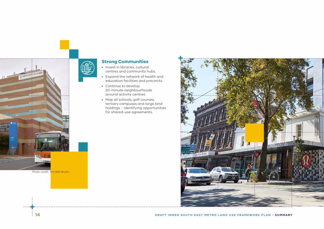
Strong Communities• Invest in libraries, cultural
centres and community hubs.
• Expand the network of health and education facilities and precincts.
• Continue to develop 20-minute neighbourhoods around activity centres.
• Map all schools, golf courses, tertiary campuses and large land holdings – identifying opportunities for shared-use agreements.
Photo credit: Tim Bell Studio
15D R A F T I N N E R S O U T H E A S T M E T R O L A N D U S E F R A M E W O R K P L A N - S U M M A R Y
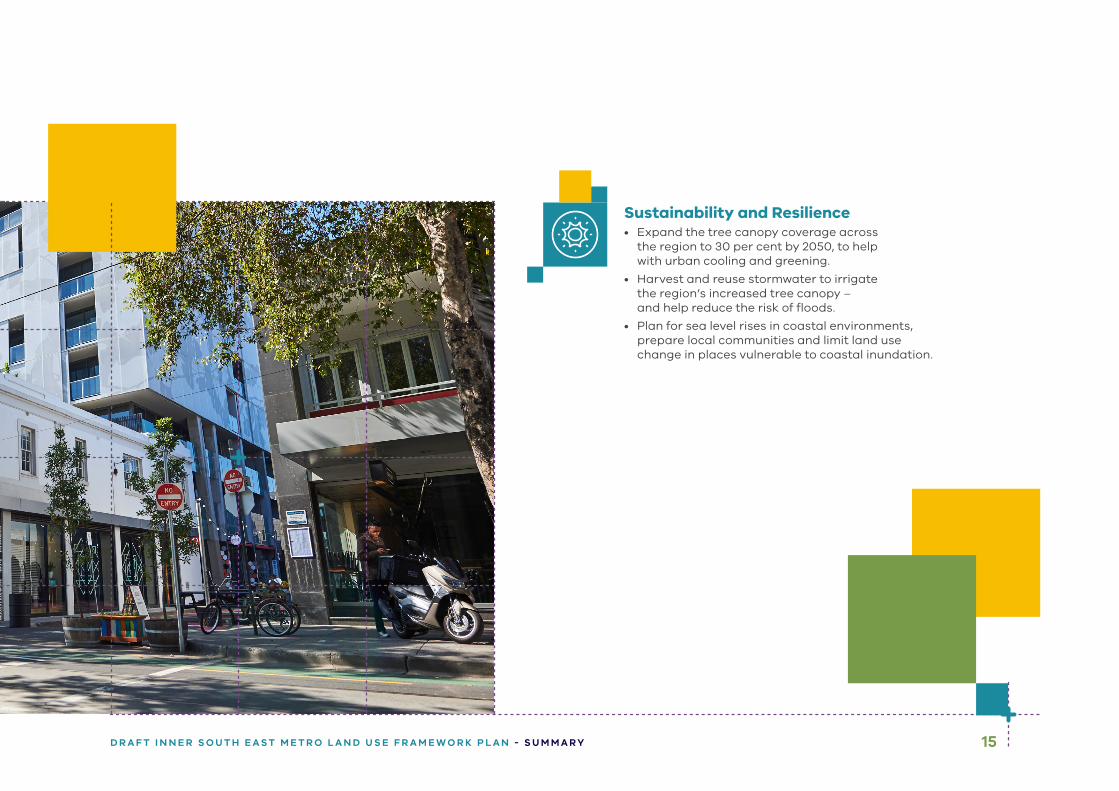
Sustainability and Resilience• Expand the tree canopy coverage across
the region to 30 per cent by 2050, to help with urban cooling and greening.
• Harvest and reuse stormwater to irrigate the region’s increased tree canopy – and help reduce the risk of floods.
• Plan for sea level rises in coastal environments, prepare local communities and limit land use change in places vulnerable to coastal inundation.
ISBN 978-1-76105-651-2 (pdf/online/MS word)
Submissions can be made online at engage.vic.gov.au
For any questions or assistance please contact [email protected]