ph.d. dissertation thesis environmental impact assessment
TRANSCRIPT

Ph.D. dissertation thesis
Environmental impact assessment based on soil indicators
Nikolett Szőllősi
Supervisor: Dr. habil Csaba Juhász
UNIVERSITY OF DEBRECEN Kerpely Kálmán Doctoral School Crop Production, Horticulture and Regional Sciences
Debrecen, 2014
2
1. BACKGROUND AND AIMS OF THE DISSERTATION
In the last 50 year the Common Agricultural Policy (CAP) became the most productive
Community achievement in European Union. In 1992 it was introduced for all Member
States as an “accompanying measure” to the Common Agricultural Policy (CAP)
reform called McSharry-reform. In 1997 thank to Agenda 2000, agricultural subsidies
are connected to environmental and rural development payments. In June of 2003
farmers could receive direct payments provided that they maintain their land in good
agricultural condition and comply with the standards on public health, animal and plant
health, the environment and animal welfare (cross-compliance) contained in the
Regulation (Jámbor és Harvey, 2010)..
So Agri-Environmental Programs have key role in how to motivate farmers to
implement sustainable farming practice by environmental related agricultural payments.
These have number of benefits. However, their ecological effects are less known and
not clear their operative efficiency (Jámbor és Harvey, 2010). So the ascertainment of
real environmental damages and the exploration of potential hazards are required to get
adequate political emphases on nature protection with parallel specific provisions in a
not environmental orientated social and economic system. This is confirmed by official
statement of European Commission that highlighted the role of environmental
indicators in communication (Smeets és Weterings, 1999).
Agriculture is in direct relation with environment so it has strong effect on it and in
parallel the state of nature basically determines the characteristic and efficiency of
agricultural activities. There always been environmental changing effects of agricultural
activities. However, intensity and impact areas of process resulted environmental
changes have wide range spatial and time variability (Kreybig, 1946).
Agricultural sector is pointed as polluter while even though it’s damaging effects, it
could contribute to protect the environment (Horváth, 1999). To detect these effects the
use of indices and indicators are required.
OECD (Organisation for economical CO-operation and Development) has set up the
pressure-state-response (PSR – Pressure – State – Response) model which emphases
anthropogenic originated environmental pollutions and answers to structure its work on
environmental policy and reporting. The modified version of PSR framework is being
used worldwide as a reporting tool. In 1994 OECD set up DPSIR model (Driving
3
forces-Pressure-State-Impact-Response) which helps to analyse and highlight
anthropogenic originated environmental cause-and-effect relationships.
Numbers of literatures are available how to use indicators in business sector in an
environmentally closed system. In the frame of environmental impact assessment
elaborated environmental indicator systems are used by companies. However,
agriculture is an environmentally opened system. Due to these conditions specific
analyses are required. Complexity of environmental analyses makes it almost
impossible to realize a measured data based and entirely exact environmental impact
assessment. Consequently the most of natural processes are approached by modelling
methods. To protect Hungary’s natural talent, soil tillage has key role in the field of
agricultural developments, environmental protection and environmental oriented crop
production. As soil is one of the most important production factor, it basically
determines the quality and the economic conditions of it. Different soil tillage systems,
methods and agricultural techniques have different impacts on soil parameters and on
soil water balance. In addition, we have to take it into account that energy and water
saving technologies are adequate only for economical and environmental oriented,
sustainable farming practice.
In the frame of my thesis crop production will be analysed, from the point of view of
DPSIR framework by my research adopted and developed agri-environmental
indicators.
My researches contribute to get more detailed information about research area, subject
main agri-environmental problems. In addition it could be basis for the area’s
development movements in the field of water management, agriculture and
environmental developments for the next EU programming period.

4
The aim of my work details:
General aim of my dissertation is the evaluation of crop production technology based on
some agri-environmental indicators, to get information about soil – soil moisture
content – biomass production system and give solution on how to decrease and
eliminate agri-environmental pollutions and contaminants.
- Evaluation of environmental impacts of crop production on
o soil state,
o soil water balance,
o biomass production by its cause and effect relations.
- Environmental impact assessment based on agri-environmental indicators in
different spatial levels:
o lysimeter experiment,
o half-laboratory experiment,
o soil tillage experiment.
- There will be environmental pollution analyses by concrete crop production
technologies.
- Crop production technology resulted agri-environment state will be estimated by
- soil state parameters,
- soil water balance,
- biomass production aspects, correlations in different years.
- Evaluation of crop production as agri-environmental driving force at landscape
level in different years by GIS methods.
- An own research implemented DPSIR frame indicator system will be compiled
which will be tested by practice in decision support process.
Give recommendation on how to improve agri-environmental subsidies in next EU
budget period.
5
2.RESEARCH METHODS
My agri-evironmental indicator based researches were made in Debrecen and in Karcag
area. My studies extend to laboratory measurement and landscape evaluation.
Treatments of daily impacts related experiment
To gain more detailed information on the impacts of different soil surface on
environmet in-situ measurements were done in a lysimeter experiment at the Lysimeter
State of Karcag Research Institute of the University of Debrecen, CASE. The
experiment was carried out between 26th and 27th August 2009. The soil type of the
investigated plot is meadow chernozem solonetzic in the deeper layers, a soil type that
is characteristic for the Trans-Tisza Region of Hungary. In this experiment in situ
measurements were carried out to separate environmental effects of bare and grass
covered soil surfaces (driving forces). State indicators were the following: soil- and air
temperature, soil moisture and soil CO2 emission.
Treatments of different soil cultivation based experiment
To get more detailed information on the effect of different soil cultivation processes in-
situ measurements were carried out at Institute of Water and Environmental
Management, University of Debrecen. The soil is sandy loam. All treatment had four
reputations and one control. Four different soil surface types were created as driving
forces and their effects on the environmental state. Soil loosening treatments were
loosening, ploughing in 20 cm and in 40 depths.
Closed soil surfaces and not closed soil surfaces were made. In addition the impacts of
soil compaction were measured as well.
There were treatments on different nitrogen level impacts on environmental state.
Ranges were 0 N, 50 N, 100 N and 150 N.
State indicators were the following: soil- and air temperature, soil moisture and soil CO2
emission.
Treatment of soil tillage experiment
In the Department for Soil Utilisation and Rural Development of Karcag Research
Institute of the University of Debrecen, Centre for Agricultural Sciences and
Engineering in close co-operation with the Department of Water- and Environmental
Management broad examination of new soil tillage methods was started in 1997 based
6
on the research achievements gained in the past decades. In 2007 a reduced cultivation
system and a conventional tillage system were used in that experiment (H-1) of 15 ha
divided into four plots:
Conventional tillage 34 m x 480 m 1.63 ha,
Conventional tillage 33 m x 480 m 1.58 ha
Reduced tillage 114 m x 480 m 5.47 ha,
Reduced tillage 114 m x 480 m 5.47 ha
Agri-environmental impacts of crop production technologies were analysed as driving
force indicators and pressure indicators. In order to determine the effects of the different
soil tillage operations as the elements of the prospective reduced tillage systems, we
designed and set a new, hopefully long-term, experiment (I-2) in 2007. The experiment
was set on a plot of 9.4 ha divided into four sub-plots according to the treatments. In
this experiment, tillage systems of direct seeding and reduced tillage based on mulching
were compared to the conventional cultivation system based on ploughing. The soil type
of the investigated plot is meadow chernozem solonetzic in the deeper layers. In case of
conventional tillage all the crop residues were baled and removed from the subplot, then
millet was sown conventionally. In the reduced tillage treatments direct seeding was
used but three different methods were applied regarding the fate of the crop residues: all
residues remained (mulch), remaining mulch and application of a mulch tiller and pure
direct seeding with no mulching.
Conventional tillage 73.3 x 480 m
Direct seeding 72.2 x 480 m
Mulch+ Direct seeding 65 x 480 m
Mulch+Mulchtiller+ Direct seeding 33 x 480 m
Measurements and used equipments
To determine soil respiration infrared based method was used which means that
different gas molecule absorbs on different wavelength (Burai, 2005).
One fraction of the experiment is to investigate the CO2-emission from the soil and the
soil state determined by the tillage operations, hence by measuring the CO2-emission
the effect of various tillage operations as the elements of different soil cultivation
systems on the microbiological activity of the soil can be judged by soil-plant system.
The CO2 gas emitted from the soil mainly originates from root respiration,
microbiological activity and decomposition of organic matters. So measurements were
7
carried out after harvesting to exclude root respiration processes. However, effects of
the different soil tillage operations were detectable.
An Oldham MX 21 PLUS infrared gas analyser was used to measure the
CO2-concentration of the air above the soil surface before and after a 30 minute-long
incubation period in Debrecen. For the spatial delimitation of the measuring area PVC
cylinders (Zsembeli, 2005) were applied. These were inserted to the soil in 10 cm depth.
In order to quantify this, in situ CO2-emission of the soil was measured by means of an
ANAGAS 98 infrared gas analyser in Karcag. For the spatial delimitation of the
measuring area the original cylinders (Zsembeli et al., 2005) were substituted with a
newly developed frame+bowl set. The metal frame is inserted into the soil (sharpened
bottom edge) down to 5.5 cm and the trough around the frame is filled with water. The
volume of the plastic bowls is approximately 2,800cm3, the diameter of the metal
frames is 20 cm. From measured concentration (ppm) values, CO2 emission
(g*m-2
*h-1
) was calculated by Flux formula.
Measurement of main abiotic indicators
Main soil physical and chemical parameters were measured at Institute of Water and
Environmental Management, University of Debrecen. The air and soil temperature were
detected by TESTO 925 digital thermometer. Soil moisture content was measured in
150 mm depth by TRIME-FM portable moisture measurement instrument.
Meteorology data were supplied by WEATHERLINK VANTAGE PRO2 system in
Debrecen.
At Karcag soil moisture is measured by TTN-M (40 cm depth), soil thermal (5 cm and
10 depths) and air thermal is measured by digital thermometer. In addition there is a
meteorology station at Karcag Research Institute.
Geodetic survey
There was a geodetic survey at B-5 parcel of Karcag Research Institute to get
information about the surface of an inland water spot and spatial correlations in July
2010. It has the GRID structure of the mesh 10 meters x 10 meters.
There is a Geodetic Control Point (GCP) at the building of Karcag Research Institute
which is registered by Institute of Geodesy, Cartography and Remote Sensing
(FÖMI). To get a more precision survey, a shp was created which contained a 10 meters
x 10 meters GRID structure by ArcGIS 9.2 and was copied to Trimble Uno GPS.
8
Landscape indicator based measurements
Direct physical indexes are terrain, hydrogeology, soil parameters, land use
(Kollányi, 2004) which are involved into my GIS analyses. Digital Evaluation Model
(DEM) based on 34 topographic map by contour line and point digitalization. Contour
lines were reclassed, aspect and slope categories were analysed too in ArcGIS 10.1.
software.
In IDRISI Selva Software 11 different slope categories and flow direction were
analysed in Karcag area.
In Karcag area there are 7 soil water monitoring devices were set up in 1950’s. So long
term time series could be. Analyses were implemented by Microsoft Office Excel and
Surfer 9.
Related to Karcag area LANDSAT ETM+ images were downloaded between 2003 and
2010. Ma analyses required images without black lines and without clouds. After this
selection I could measure two drought (2003 and 2007), two precipitated (2006, 2010)
and an average year (2009). LANDSAT7 ETM+ images were cut into the right size in
IDRISI Selva by a window based on Karcag area. This window was made in Arc GIS
10.1 by the map of Karcag inland watershed area. Based on Band3 and Band 4
Normalized Vegetation Indexes (NDVI) were calculated to get information on biomass
production state of Karcag area in different years. In addition I measured the correlation
between biomass production, land use and soil conditions. Soil conditions were defined
by Agrotopo map database. The following codes were used: code nr. 1. (soil type), code
nr. 3. (soil physical type), code nr. 7 (soil organic content t ha-1
).
Land use categories were determined by Corine CLC vector database 2000 and 2006.
This database was downloaded from the homepage of European Environmental Agency
(EEA).
A first these indicators were tested at H-1 parcel. So I could determine NDVI values
range to crop yields. Then I made landscape level evaluations.
Landscape level soil carbon stock change based on IPCC method
The amount of carbon stored in and emitted or removed from permanent cropland
basically depends on the crop type, the management practices, the soil variables and the
climate variables. The calculation method we used is based on the default factors given
in IPCC Good Practice Guidance for Land Use, Land-Use Change and Forestry

9
(LULUCF 2003). According to this method, the existing carbon stock (from the native
soil type and the climate characteristics) and the land use factor (from the land use type,
management and input features) must be determined.
The soil type was categorised as High Activity Clay Mineral Soil on the base of
AGROTOPO data base. In addition soil organic content determination based on
Agrotopo database as well in Karcag area. In the case of H-1 parcel, soil organic content
was determined for both soil tillage systems by laboratory measurements.
Soil types harmonised with the land use types of Corine CLC 2006 database to
determine the rate of arable land on different soil types in Karcag area. This
harmonisation process was made by IDRISI Selva software.
The climatic classing, the determination of the climate zone was done on the base of
climate maps made by the Hungarian Meteorological Service. As the mean annual
temperature of the investigated area is above 10°C and the annual precipitation is less
than the evapotranspiration, the factor of the category Warm Temperate Dry was
applied.
To choose the input factor that representing the agricultural practice of the region, the
characteristics of crop rotations were taken into consideration. According to the IPCC
Good Practice Guidance for LULUCF (2003), the input factors represent the effect of
changing carbon input to the soil, as a function of crop residue yield, bare-fallow
frequency, cropping intensity, or applying amendments. Therefore Low Input category
for conventional tillage, while Medium Input category for reduced tillage were applied
for the calculations.
According to the estimation method described in the IPCC Good Practice Guidance for
LULUCF (2003) – based on AGROTOPO map data base harmonisation – first the soil
organic C stocks (SOCref in t ha-1
) were estimated with default stock change factors
(FLU, FMG, FI) for the beginning. Then I made practical oriented recommendation on
how to increase soil carbon stock till the end of inventory time (20 years).
Compilation of research oriented DPSIR indicator system
On the bases of OECD and European Environmental Agency published DPSIR
framework, I implement to my researches an own DPSIR agri-environmental indicator
system. This indicator system bases on concrete measurements and analyses. Detailed
structure of it will be described in the frame of my results because it builds on my
previous outcomes and results.
10
3. MAIN OBSERVATION OF DISSERTATION
Agriculture is in direct interaction with environment as part of natural system. So it
has strong effects on nature. However, the characteristic and efficiency of agricultural
activities are entirely determined by elements and state of nature. Agricultural plant
production has plenty of environmental pollution and at the same time, it could
contribute to agriculture environmental protection.
Agri-environmental schemes has key role in agriculture related environmental
activities by the motivation of farmers to implement sustainable and good agricultural
practice. To detect these effects, use of indicators and indices are required. In 1994
OECD set up DPSIR model (Driving forces-Pressure-State-Impact-Response) which
helps to analyse and highlight anthropogenic originated environmental cause-and-effect
relationships.
In my thesis I estimated the environmental effects of plant production – as Driving
force of DPSIR – by subjected agri-environmental relationships.
My agriculture-environment indicator oriented researches were carried out in
Debrecen and in Karcag region. My research work covers lab measurements, field
experiment analyses in Karcag, GIS evaluation works and predictions based on IPCC
method in Karcag area.
Based on DPSIR model, I compiled a new agri-environmental indicator system
adapted to my researches.
My researches were carried out from laboratory measurements till landscape level at
Debrecen and at Karcag.
Based on DPSIR model, I compiled a new agri-environmental indicator system adapted
to my researches.
Group of Agricultural-environmental Driving forces contain the evaluation of climate
conditions, time series meteorology database, soil conditions, conventional and reduced
tillage systems and tillage based elements of plant production systems. Uses of
agricultural machinery, characteristics of nutrient management, pest control system
were estimated to confirm agricultural-environmental benefits of reduced tillage.
Group of Agricultural-environmental pollutions involve macro- and microeconomics
regulations, land use changes, lack of professional skills and decrease of wildlife.
Moreover, the following indicators were evaluated: air pollution and soil degradation
processes by agricultural machinery, inland water and ponds, changeable soil water
regime, year effects on yield (drought, high precipitation, average year).
11
Agricultural-environmental state indicators such as nha, power kWh, number of till,
diesel usage kg ha-1
were used to get information about positive or negative effects.
The state of soil-water system was characterised by the evaluation of soil state
parameters, soil resistivity, soil surface and inland water quality. Furthermore, the cause
and effect relationship was measured of CO2 emission of the soil, soil temperature and
soil moisture in different tillage systems.
Both uses of yield and NDVI indicators were suitable to characteristic the state of
different places in varies years. Agri-environmental state indicators of Karcag area were
the following: terrain conditions, area and ratio of different land uses based on Corine
database, NDVI indicators with correlation to land use and soil conditions (by Agrotopo
database). NDVI values were calculated by 3rd
and 4th
channel of LANDSAT images.
Moreover, based on IPCC method and soil organic content, soil carbon stocks were
calculated on arable lands of Karcag area. In addition I made an agri-environmental
friendly prediction on how to change land use to achieve higher soil carbon stock in 20
years time by agricultural-environmental effect indicators.
I’ve made recommendations on how to solve problems of inland water, reduce drought
damages by tillage and use of mulch technology. Importance of using manure and green
manure were highlighted.
To compensate agri-environmental risks and reduce environmental impacts, allowances
could be applied in the frame of Agri-Environmental Program and Natura 2000.
Agricultural-Environmental Response indicators were used to make recommendations
on next EU budget period. These were the following: promoting professional consultant
activity, organising regularly professional days for farmers to achieve a more efficient
communication between research institutes and farmers. In my opinion it is very
important to inform farmers about sector specific application opportunities and how to
do a good application. Getting subventions in the frame of Agri-Environmental
Program, contributes to implement the agri-environmental oriented and good farming
practice in wide range.
I made the following observations:
It was exhibited that daily impact of bare soil surface on environment is so much more
extreme. So it’s very important to avoid this surface type to keep the moisture content
of the soil and lower temperature to achieve better soil microbiological activity during
drought summer days.

12
On the bases of cultivation experiment, it is essential to use mulch technology and close
soil surface in drought periods.
In addition it was confirmed that in the case of conventional tillage the limitation factor
was soil temperature and in the case of loosening the soil moisture content was the
limitation factor. Consequently to achieve good soil transpiration conditions we should
take it into account that the aim is the less disturbance of the soil. The reasons are
agrotechnical methods indirectly increase CO2 emission of the soil. Indirect processes
like soil degradation (deflation, erosion), land drainage are resources of carbon
mobilisation.
Based on field level crop production analyses, reduced tillage has number of advantages
such as better energy consumption, lower mechanical inputs thus dwindle CO and CO2
emission. Our results generated from the CO2 emission measurements can contribute to
the reveal of environmental pollution of CO2 emission of the soil, hence agriculture
could be developed pursuing an environmental friendly way in the future by the use of
alternative tillage systems.
On arable lands, which based on conventional tillage, it is recommended to do nutrient
supplement by plants demand and soil analyses. Instead of using only N or NKP
fertilizers, macro and micro elements could contribute to higher yields with appropriate
quality. However, alternative solutions such as manure, green manures and/or mulch
technology contribute to management practices which build up soil C by increasing the
input of organic matter to soil and/or decrease soil organic matter decomposition rates.
When soil surface is covered by plant residues (mulch) erosion is avoid and organic
matters are kept into the soil. As organic matters have significant affect on soil
structure, buffer capacity, water retention ability, biological activity and nutrient
equilibrium it is recommended to use this technology widely in practice.
Since the biomass production and yields were similar on reduced tillage plots (H-1), so
energy saving management consumption result more cost saving than yield loss. In
addition there were higher harvested yield than in conventional tillage system.
Only those pesticides were used which are allowed by Agri-Environmental Program.
However it could be more environmental oriented practice by the application of
integrated pest management.
Based on my analyses, NDVI as vegetation index is suitable for biomass mapping and
separating plants inside a parcel. In addition NDVI values have correlation with soil
heterogeneity. Mixed pixels should leave out of consideration. On reduced tillage plots

13
higher biomass productivity was detected. However yields were similar to other plots.
So the amount of biomass quantity not changed in parallel with yield level in the
comparison of tillage systems. Consequently the use of mulch was exhibited by biomass
mapping. Both biomass vegetation index and yield level monitoring are suitable for
state agri-environmental indicators.
On the bases of different level measurements, the soil CO2 emission is appropriate
agri-environmental state indicator to detect differences of soil disturbances, soil tillage
systems and changing agricultural practice. Close correlation was demonstrated
between soil cultivation intensity and soil respiration. To gain more detailed
information an automated soil CO2 flux monitoring system is necessary.
DEM of Karcag area based results qualified for surface state oriented descriptions.
Studying the effect of different soil utilisation/cultivation methods on the carbon stocks
based on both IPCC method and Agrotopo map database are competent to use their
results as state indicators. It is recommended at Karcag area the conversion of a part of
arable land with conventional tillage into energy saving conservation systems affects
carbon stocks. Carbon stocks in soils can be significant and changes in stocks can occur
in conjunction with most management practices, including crop type and rotation,
tillage, drainage, residue management and organic amendments. The annual increase of
the carbon stock can be up to 0.55 t ha-1
if the conversion to reduced tillage practice is
combined with a higher input of organic matters e.g. annual cropping with cereals
where all crop residues are returned to the field. Or if residues are removed then
supplemental organic matter (e.g. manure, green manure) is added. However, green
manure practice is not so popular because of drought summers resulted risks on water
supplement of crops in dry tillage systems. I gave a recommendation for (experimental)
planting green manure e.g. winter rye/winter wheat with vetch (Lathyrus L.) or Lathyrus
sativus. The differences are considerable, hence all farmers who still follow
conventional soil tillage should think over whether the sustainability of crop production
would not requires the conversion into a soil protective, energy- and soil carbon stock
saving management practice.
Lowland area’s characteristic soil type is solonec soil. Parts of these are arable land. It
could be an environmental solution to change their land use to grassland. European
Union supports environmental oriented sustaining of these lands by allowances,
subventions. In addition these are long term solutions to increase C stock of the soil in
14
Karcag area. Based on my recommendation on 29 352.06 ha, in 20 years time,
35 330.42 t soil C stock rising is realizable.
In the case of landscape level NDVI evaluation, most of the NDVI values depended on
soil heterogeneity, year effect and indirectly it was affected by quantity and distribution
of precipitation.
For the next EU planning period, in the frame of next Agri-Environmental Program the
communication will have key role between research institute and farmers, consultant
and farmers. For the success of Agri-Environmantal Program, it is required to draw the
attention of farmers on the details and conditions of Agri-Environmental Program and
other agricultural related application opportunities and the way of successful realization.
In addition tax benefits, more subsidies, and joint implementation projects could help to
motivate farmers and agricultural firms to adopting new practices.
I verified the eligibility of DPSIR based agri-environmental indicator system which is
implemented, detailed and developed by my researches. In Karcag area I gave a
recommendation on its practical extension and adaptation.
4. NEW SCIENTIFIC RESULTS OF DISSERTATION
1. Analysed soil tillage systems were evaluated based on agri-environmental
indicators in Karcag area. I contributed to the numerical characterization of
environmental state, detection of environmental impact processes, and to
discover cause and effect relations of different soil tillage systems.
2. Adapted to my researches a DPSIR framework based, agri-environmental
indicator system was developed in different spatial level, which is suitable for
agri-environmental impact assessment evaluation in Karcag area and areas with
similar environmental conditions.
3. Based on geodetic survey of inland water spot, micro surface morphology and
the leaching of nutrient were detected by inland water samples. I contributed to
numerical characterization of inland water environmental impacts.
4. Correlation of yields and biomass production was determined based on
LANDSAT ETM+ images by NDVI incices. I contributed to the process of how
to get information about the correlation between biomass production and yields
5. Corine land use database, Agrotopo map database and LANDSAT ETM+
images collectively were integrated and used during the
15
spatial surface characterization and agri-environmental oriented impact
assessment at Karcag area by my research adapted DPSIR indicators in different
years. Theses evaluation are useful for decision support processes by
environmental oriented program planning and monitoring activities.
6. Based on both IPCC method and Agrotopo map database, soil reference carbon
stock was estimated at Karcag area. Consequently it is recommended at Karcag
area the conversion of one part of arable land with conventional tillage into
energy saving conservation systems affects carbon stocks. In addition
application of mulch technology and (or) supplemental organic matter are
necessary as well. On poor areas with solonec soil I gave a recommendation to
change land use to improved grassland and get subventions in the frame of
SAPS and Agri-Environmental Program by European Union.
5. PRACTICLE UTILIZATION OF RESULTS
1. I contributed to the numerical characterization of environmental state, detection
of environmental impact processes, and to discover cause and effect relations of
different soil tillage systems. This recommendation involves energy and cost
saving management consumptions with alternative solutions such as using more
manure, adopting green manures and/or mulch technology, less ploughing in
right depth and integrated pest control practice.
2. Adapted to my researches a DPSIR framework based, agri-environmental
indicator system was developed in different spatial level, which is suitable for
agri-environmental impact assessment evaluation in the field of agri-
environmental oriented decision support planning and monitoring activies.
3. Correlation of yields and biomass production was determined which promote
yield mapping improvements and the preparation of environmental oriented
developments.
4. Corine land use database, Agrotopo map database and LANDSAT ETM+
images collectively were integrated and used during the
spatial surface characterization and agri-environmental oriented impact
assessment at Karcag area. My results contribute to decision preparation and
decision support processes in the field of environmental oriented program
planning and monitoring activities.

16
5. Based on both IPCC method and Agrotopo map database, soil reference carbon
stock was estimated at Karcag area I gave solution on how to improve soil
carbon stock in practical way. The conversion of one part of arable land with
conventional tillage into energy saving conservation systems affects carbon
stocks. In addition application of mulch technology and (or) supplemental
organic matter (e.g. manure, green manure) are required. On poor areas with
solonec soil I gave a recommendation to change land use to improved grassland
and get subventions by European Union.
6. REFERENCES
1. Ángyán J.: 2003. A környezet és tájgazdálkodás agroökológiai, földhasználati
alapozása (Magyarország integrált földhasználati zónarendszerének kialakítása)
MTA doktori értekezés, Gödöllő, 162.
2. Kreybig L.: 1946. Mezőgazdasági természeti adottságainak és érvényesülésük a
növénytermesztésben. (Kiadta a Magyar Mezőgazdasági Művelődési Társaság).
Kulcsár Nyomda. Budapest.
3. Jámbor A. – Harvey D.: 2010. Review of the Challenges of CAP Reform.
Discussion Paper Series No. 27. Centre for Rural Economy, Newcastle
University, UK.
4. Horváth Zs.: 1999. Az Európai Közösség agrárpolitikai reformjának
környezetvédelmi aspektusai. In Tanulmányok Veres József egyetemi tanár 70.
születésnapjára. Szerk. Tóth Károly. Szeged, 1999. /Acta Universitatis
Szegediensis de Attila József nominatae. Acta juridica et politica. Tomus 55.
Fasc. 1-34./ 133-157.
5. Smeets, E. – Weterings, R.: 1999. Environmental indicators: Typology and
overview. Technical report, 25. European Environment Agency (EEA)
6. Burai P.: 2005. Távérzékelt adatforrások alkalmazása az agrár-
környezetvédelmi indikátorok meghatározásában. [In: Tamás J. – Németh T.
(Szerk.) Agrárkörnyezetvédelmi indikátorok elmélete és gyakorlatai
alkalmazása.] Debrecen. 139.
7. Zsembeli J. – Tuba G. – Juhász Cs. – Nagy I.: 2005. CO2-measurements in a soil
tillage experiment. Cereal Research Communications. 33. 1: 137-140.
8. Kollányi L.: 2004. Táji indikátorok alkalmazási lehetőségei a környezetállapot
értékeléshez. BKAE Tájtervezési és Területfejlesztési Tanszék. Budapest. 30.
17
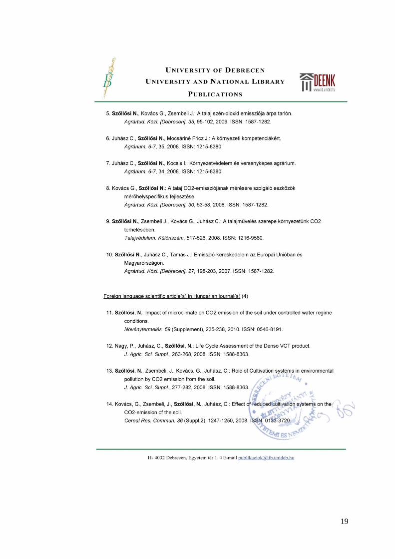
7.PUBLICATIONS RELATED TO THE DISSERTATION

18
19
20
21

22
23
24