phase i environmental site assessment...
TRANSCRIPT
PHASE I ENVIRONMENTAL SITE ASSESSMENT
Commercial and Light Industrial Development
Area North of Prairie Street Between Corbin and Shirley Avenues Northridge, California
AES Project No. 02-225
June 13, 2002 Revised
July 15, 2002
Submitted To:
PLANNING ASSOCIATES, INC. 4040 Vineland Avenue, Suite 108
Studio City, California 991604
Prepared By:
AMERICAN ENVIRONMENTAL SPECIALISTS, INC. 7400 Center Avenue, Suite #113
Huntington Beach, California 92647 (714) 379-3333
PREPARED BY:
____________________________________________________________ Kristen Williamson, REA No. 06451
REVIEWED BY:
_____________________________________________________________ James F. McClung, Jr. - President AES
REA No. 05032
i
EXECUTIVE SUMMARY
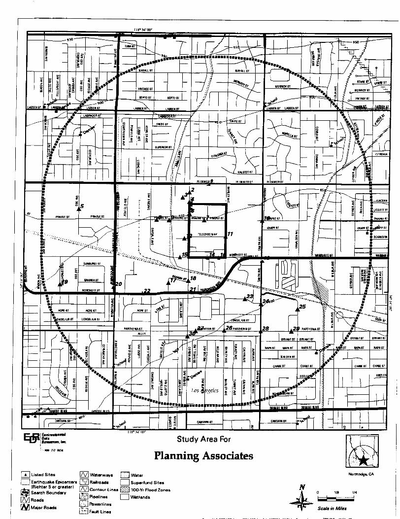
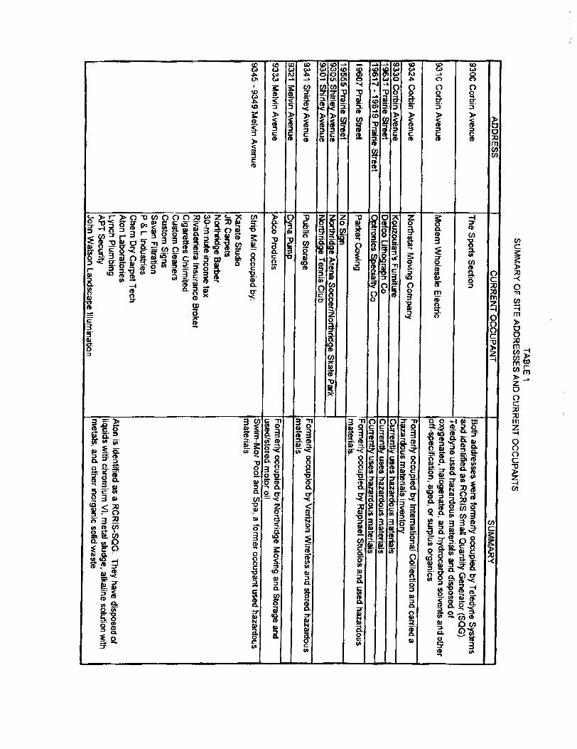
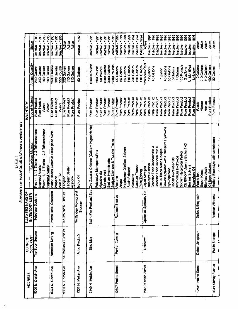
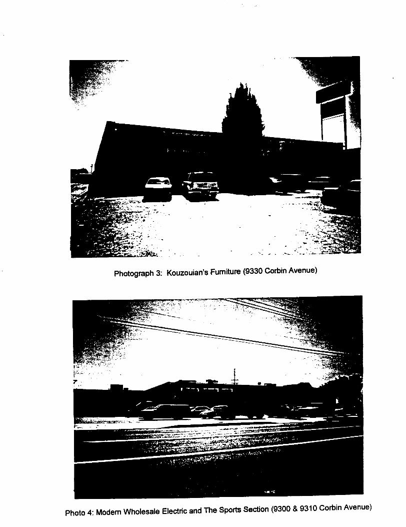
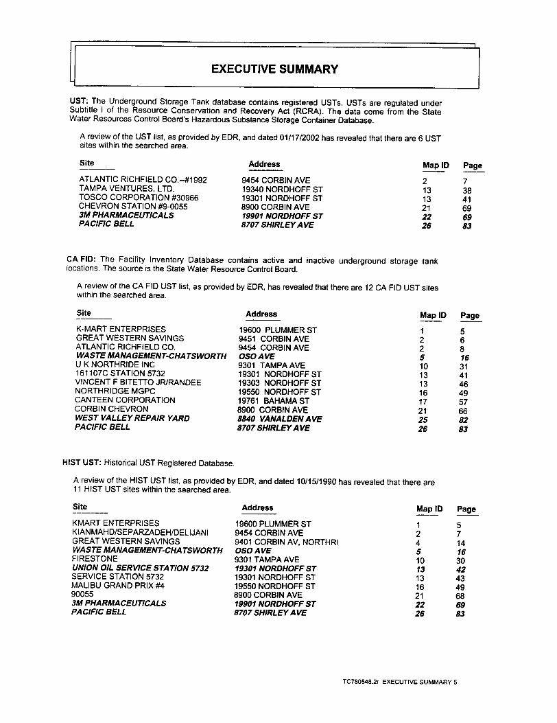
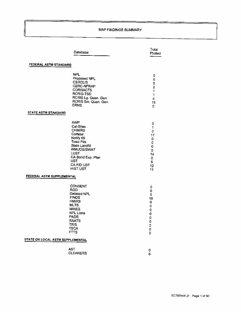
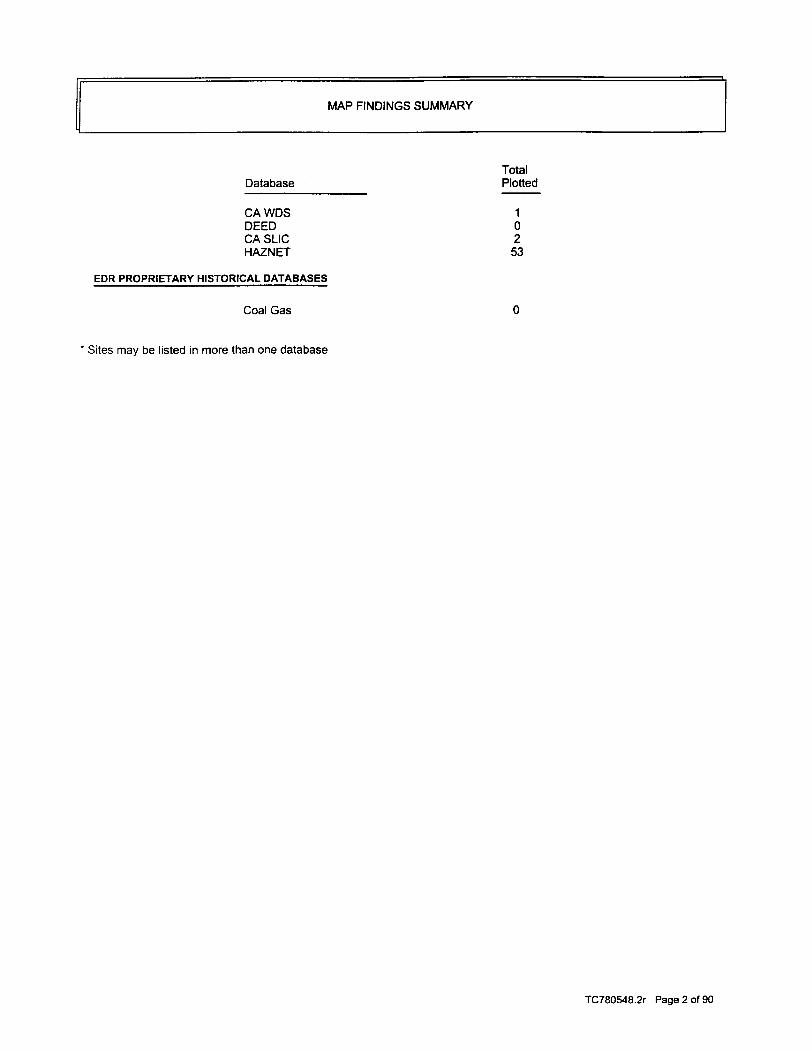
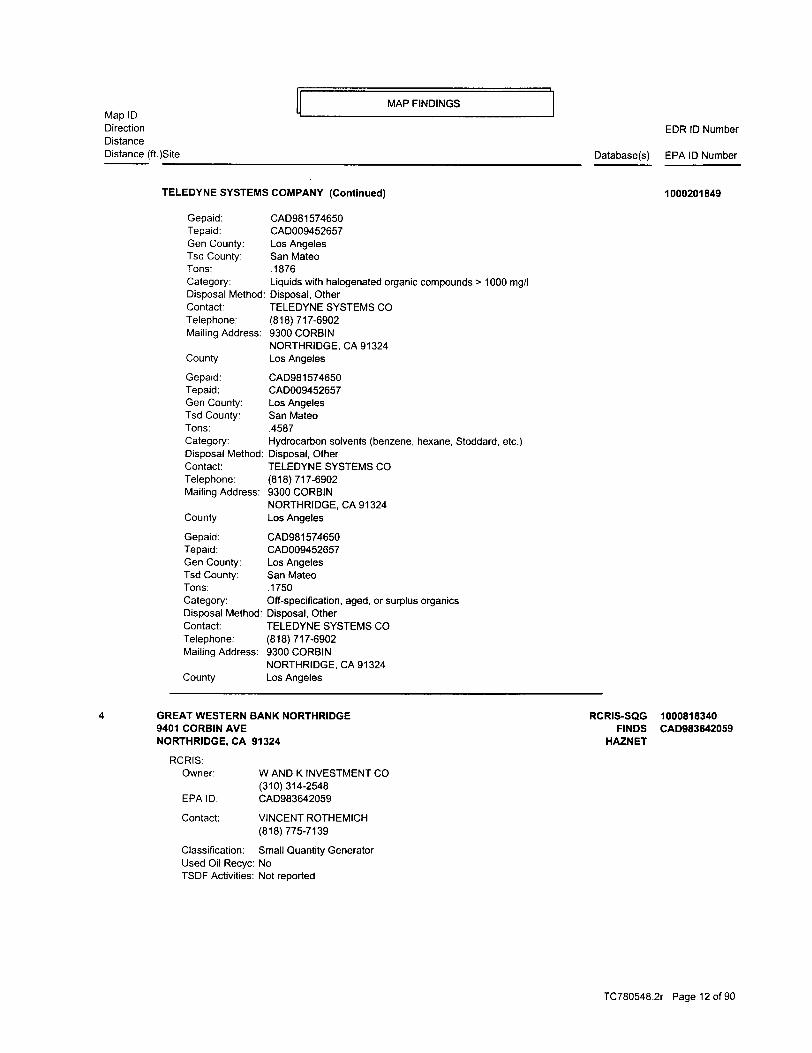
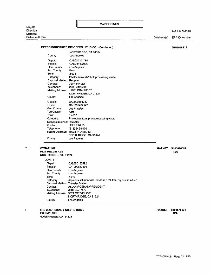
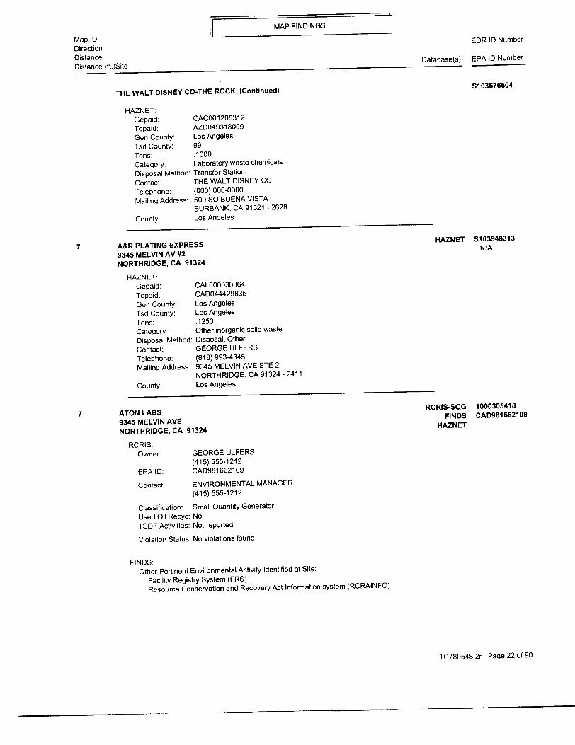
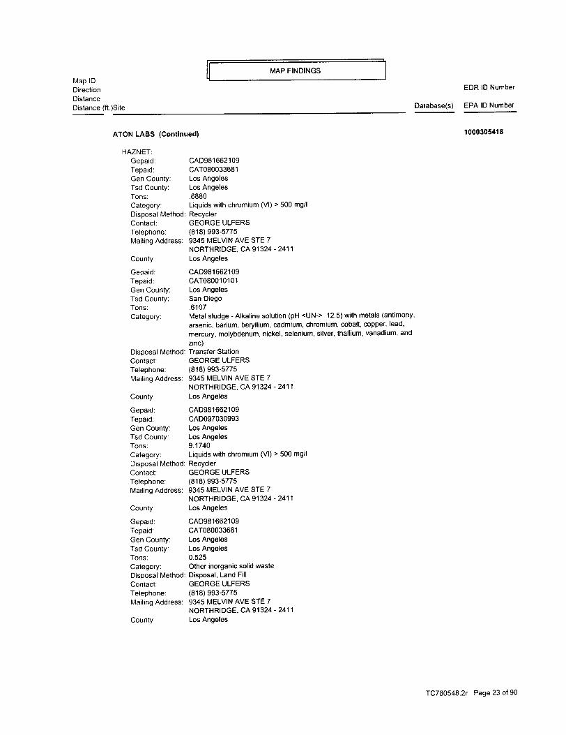
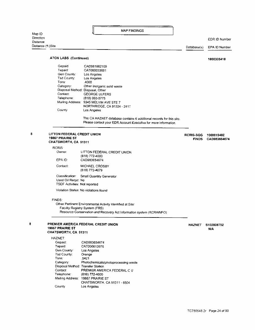
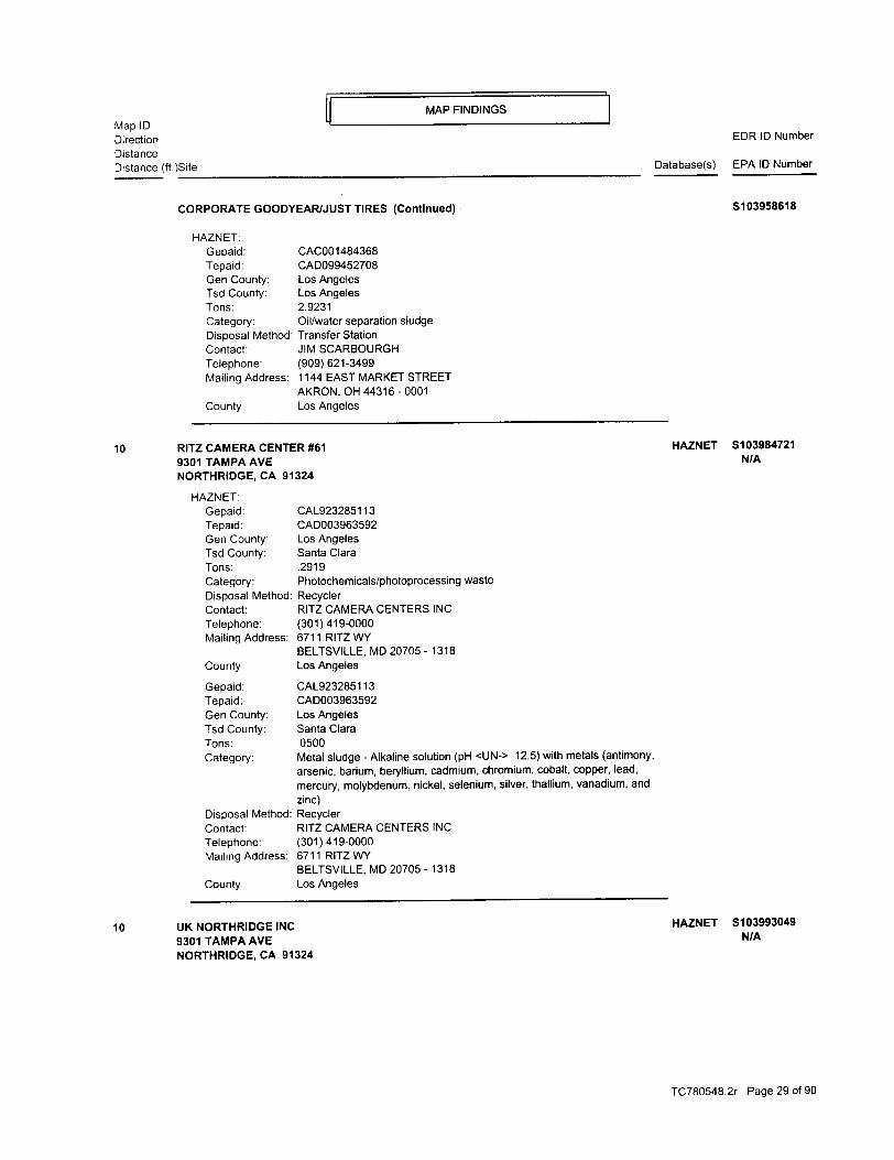
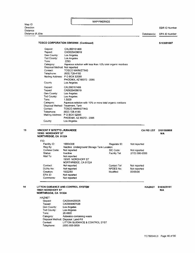
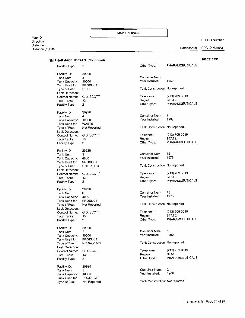
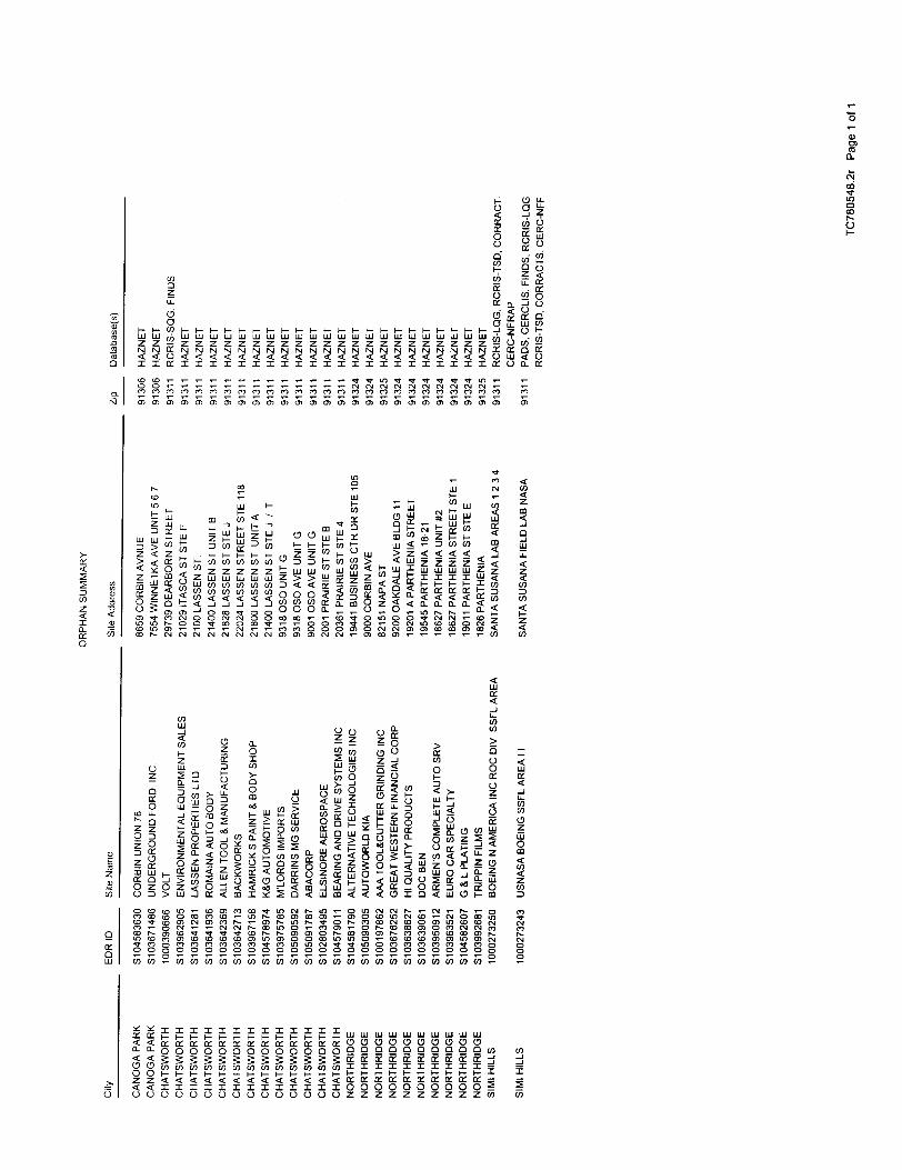
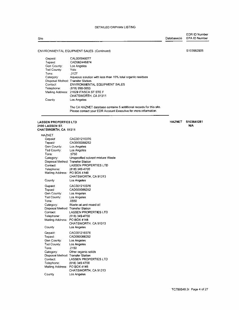
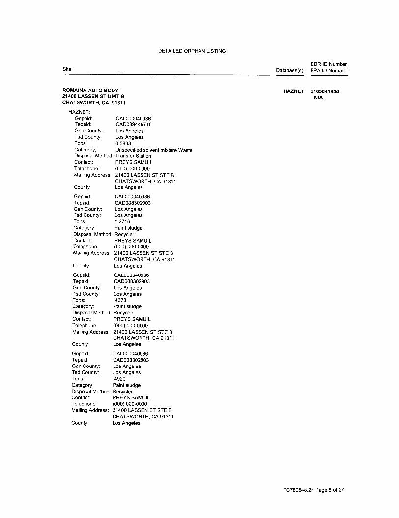
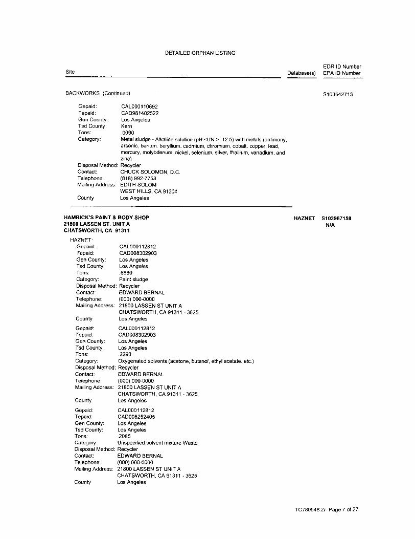
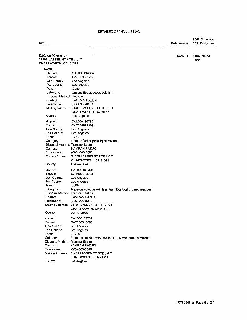
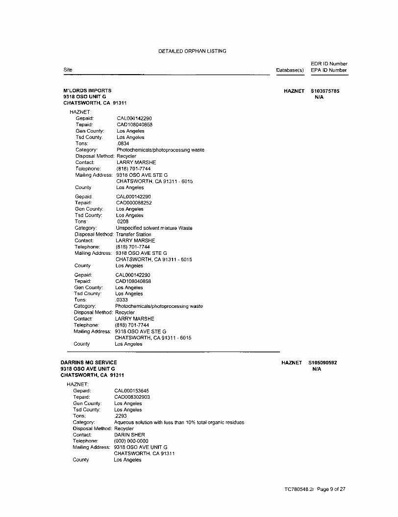
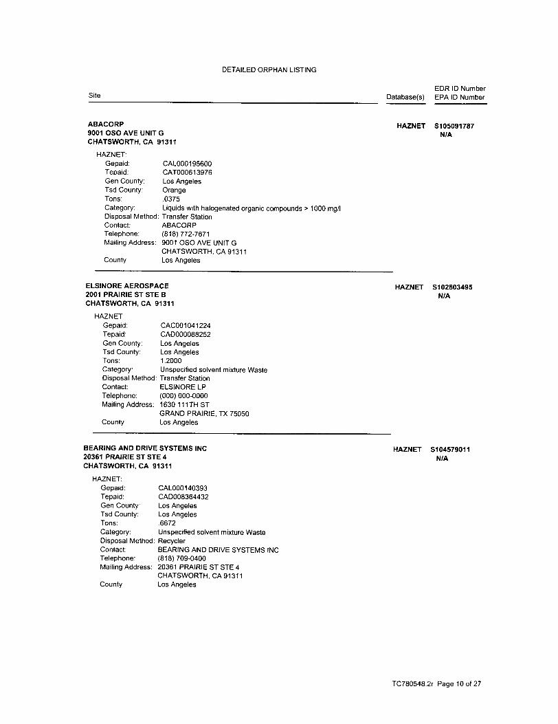
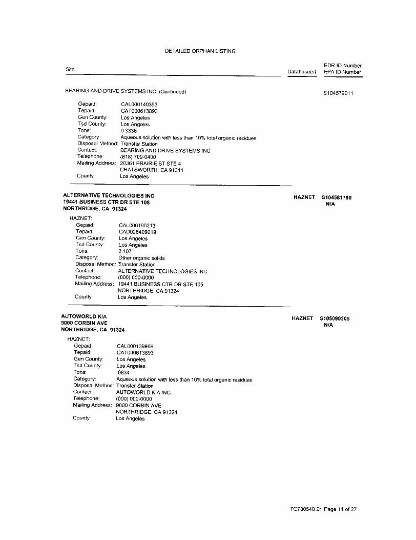
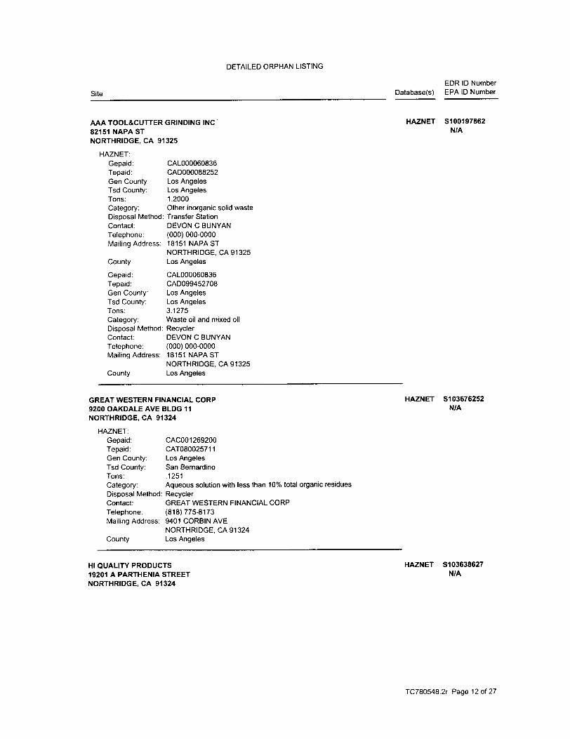
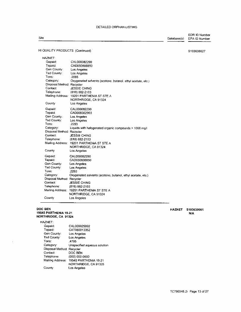
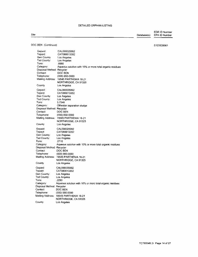
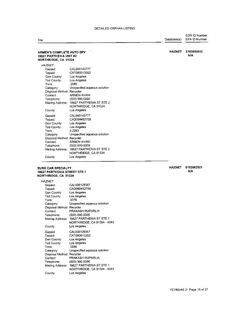
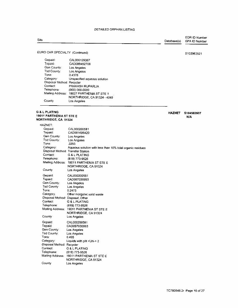
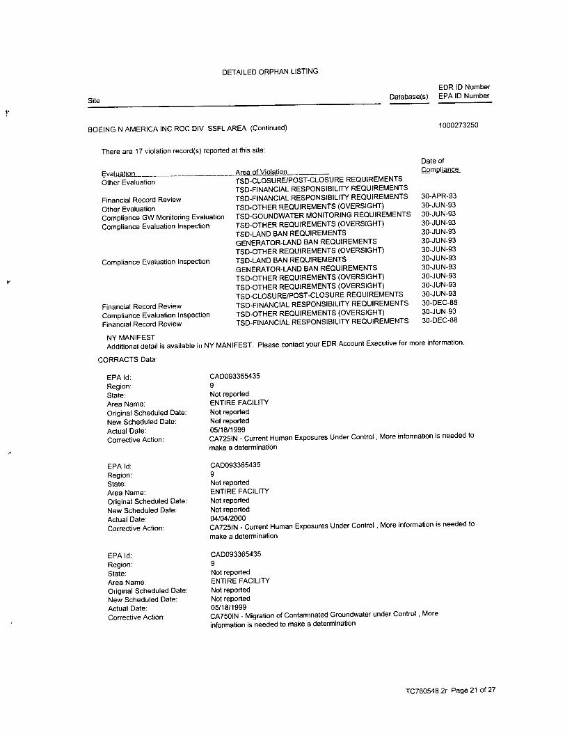
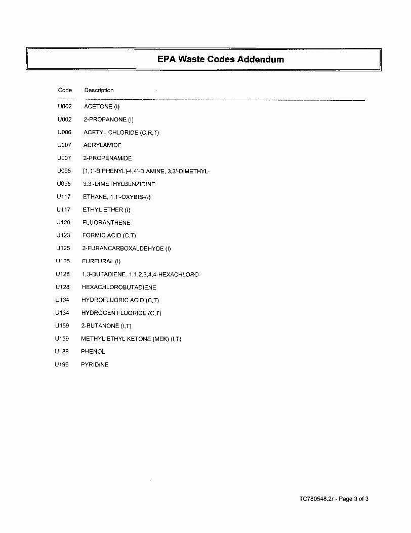
This report describes the results of a Phase I Environmental Site Assessment of the area north of Prairie Street between Corbin and Shirley Avenues in Northridge, California (Figures 1 and 2). The purpose of the assessment was to provide Planning Associates, Inc. with information regarding potential areas of environmental concern that may be associated with past and/or current land use, both on and in the vicinity of the property. A site and area reconnaissance was conducted on May 28, 2002. The property consists of fourteen parcels developed with several buildings occupied by commercial and light industrial businesses. The interiors of the buildings were not observed during the site reconnaissance. Table 1 summarizes the addresses of the site buildings and the current occupants. According to the City of Los Angeles Fire Department records, chemical compounds, including hazardous materials are or were used at least nine of the site addresses. The chemical compounds include motor oil, freon, propane, kerosene, paint thinner, lacquer thinner, resins, solvents, ink, and chlorine compounds used in pool maintenance, compounds containing potassium hydroxide, sodium hydroxide, potassium carbonate, sulfuric acid, hexane, photo development chemicals, and isopropyl alcohol. Tables 1 and 2 summarize the hazardous materials in either current or former use at the nine addresses. Commercial property is west of the site area, across Corbin Avenue, north of the site, and east of the site, across Shirley Avenue. Light Industrial property is south of the site, across Prairie Street. The site and surrounding area were developed in the late 1960s and early 1970s. Prior to development, the site was used for agriculture. Environmental Data Resources, Inc. (EDR) was retained to perform an environmental database search for locations identified as hazardous substance and/or hazardous waste facilities near the subject property. Two of the site addresses are identified as RCRIS Small Quantity Generators. Aton Laboratory is located at 9345 Melvin Avenue, in the strip mall in the northwest corner of the site and is also on the HAZNET Database. There are no violations reported for the facility. According to the databases, Aton Laboratory has disposed of liquids with chromium VI, metal sludge, alkaline solution with metals, and other inorganic solid waste. Teledyne Systems is identified at 9300 and 9310 Corbin Avenue, the current location of Modern Wholesale Electric and The Sports Section. The addresses are also on the FINDS and HAZNET databases. No violations have been reported for the facility. According to the databases, Teledyne disposed of oxygenated, halogenated, and hydrocarbon solvents and other off-specification, aged, or surplus organics. A review of information available at the Los Angeles City Fire Department (LAFD) indicates that underground storage tanks have not been registered at the site addresses.
ii
EDR identified several facilities located within the search distances specified in the American Society for Testing and Materials (ASTM); Standard Practice for Environmental Site Assessments: Phase I Site Assessment Process: ASTM Designation E1527-94. Based on the reported information, the off-site facilities identified by EDR do not constitute a “recognized environmental condition” as defined by ASTM. Several light industrial operations occur at the site and many hazardous compounds are either currently used or have been used at the site. This assessment did not identify evidence of a reported spill or release of the hazardous compounds used at the site. AES recommends that if the site use changes from light industrial or if the buildings are demolished, that a site assessment that includes soil sampling be conducted.
TABLE OF CONTENTS 1.0 Introduction ....................................................................................................................... 1 1.1 Purpose ...................................................................................................................... 1 1.2 Limitations and Exceptions of Assessment .............................................................. 1 1.3 Limiting Conditions and Methodology..................................................................... 1 2.0 Site Description................................................................................................................. 2 2.1 Site Location.............................................................................................................. 2 2.2 Site and Vicinity Characteristics ............................................................................... 2 2.3 Site Improvements..................................................................................................... 2 2.4 Environmental Liens ................................................................................................ 2 2.5 Current Uses of the Property..................................................................................... 2 2.6 Past Uses of the Property........................................................................................... 3 2.7 Current And Past Uses Of Adjoining Property......................................................... 3 3.0 Records Review ................................................................................................................ 3
3.1 Regulatory Agency Database Search......................................................................... 3 3.2 Physical Setting.......................................................................................................... 6 3.3 Historical Use ........................................................................................................... 6
4.0 Results Of Assessment ..................................................................................................... 6 4.1 Hazardous Substances In Connection with Identified Uses ..................................... 6 4.2 Hazardous Substances and Unidentified Containers ................................................ 7 4.3 Indications of Storage Tanks..................................................................................... 7 4.4 Indications of PCBs .................................................................................................. 7 4.5 Indications of Solid Waste ........................................................................................ 7 4.6 Results Of Suspect ACM Observations.................................................................... 7 4.7 Lead-Based Paint....................................................................................................... 7 4.8 Radon......................................................................................................................... 7 4.9 Other Conditions of Concern .................................................................................... 7 5.0 Summary and Conclusions ............................................................................................... 8 6.0 References ......................................................................................................................... 9 Appendices Appendix “A” Figures Appendix “B” Tables Appendix “C” Site Photographs Appendix “D” EDR Report
1
PHASE I ENVIRONMENTAL ASSESSMENT Commercial and Light Industrial Development
Northridge, California
1.0 INTRODUCTION This report presents the results of a Phase I Environmental Assessment (ESA) conducted in May and June 2002 of the commercial and light industrial area located north of Prairie Street between Corbin and Shirley Avenues in Northridge, California. The Phase I ESA report was prepared for Ms. Carrie Riordan of Planning Associates, Inc. (client). This assessment was performed in accordance with the “Standard Practice for Environmental Site Assessments: Phase I Environmental Site Assessment Process,” issued by the American Society for Testing and Materials (ASTM Standard E1527-00). 1.1 Purpose The purpose of the Phase I Environmental Assessment was to provide the client with information regarding potential areas of environmental concern that may be associated with past and/or current land use, both on and in the vicinity of the property. 1.2 Limitations and Exceptions of Assessment American Enviromental Specialists, Inc. (AES) is committed to providing quality, consulting services. However, Phase I Site Assessment work is not an exact science. The possibility of field and general conditions, beyond the control of AES, that affect our work or that present a concern for the safety of our employees, our consultants, building occupants, and the public at the site, and insurance constraints, requires that we qualify the services we provide with the following limitations: Reasonable effort is made by AES personnel to locate all suspect hazardous materials. However, for any facility the existence of unique or concealed hazardous materials and underground storage tanks are a possibility. This report was based on those conditions observed on the day(s) the field evaluation was accomplished. In the event that changes in the nature of the property have occurred, or additional relevant information about the property is subsequently discovered, the findings and recommendations contained in this report may not be valid unless these changes and additional relevant information are reviewed and the conclusion of this report is modified and verified in writing. 1.3 Limiting Conditions and Methodology Used The assessment was performed by Kristen Williamson, a California Registered Environmental Assessor with AES. The scope of services for this project was limited to the following tasks:
2
· A drive-by site reconnaissance performed to identify areas of potential environmental concern on the subject property. Access to the interiors of the buildings was not provided.
· Survey of the site vicinity to see if hazardous substances were observed or if conditions existed
which could impact the site; · A review of U.S. Geological Survey (USGS) topographic maps, aerial photographs, Los
Angeles Fire Department records, and other available documents to assess past land usage as it relates to the environmental condition of the property;
· A review of public records to identify sites of environmental concern on or within a radius of
the site as determined by ASTM.
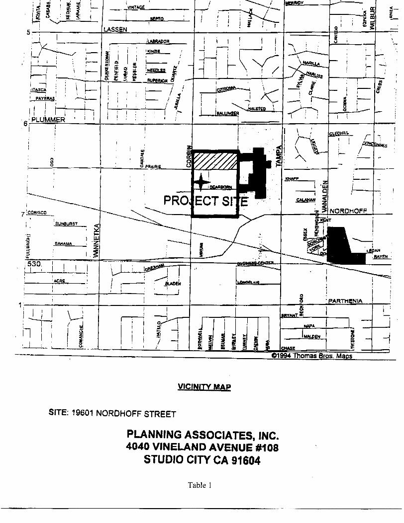
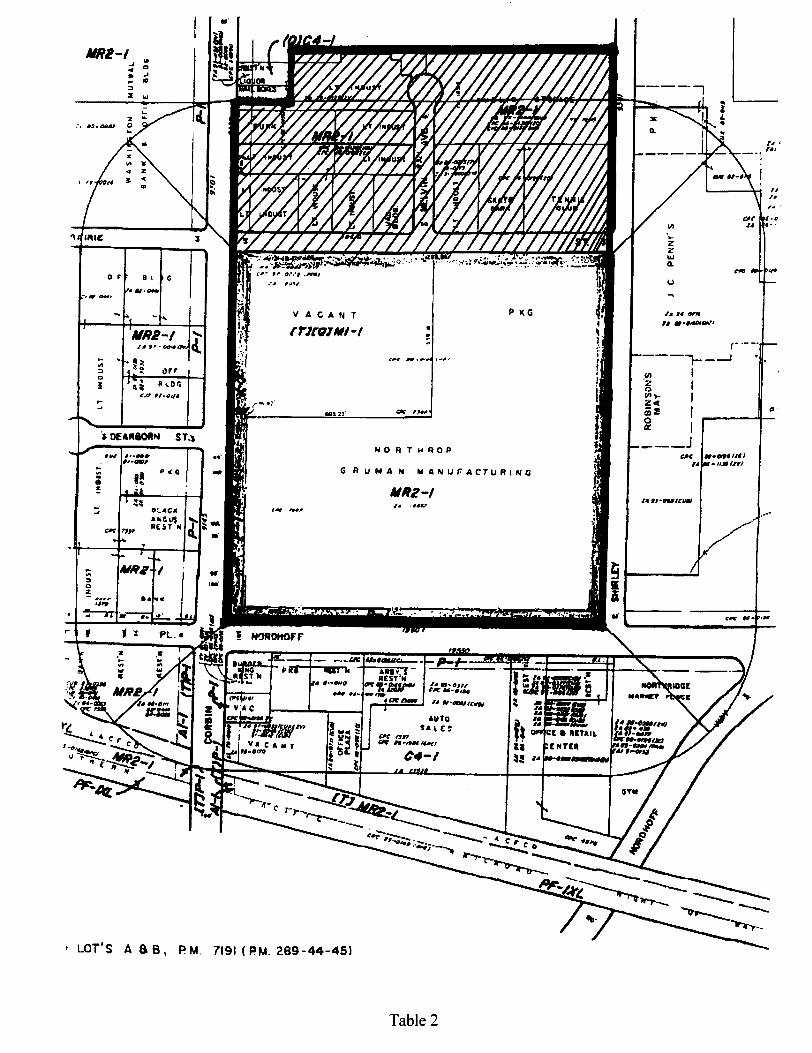
2.0 SITE DESCRIPTION 2.1 Site Location The site area is located north of Prairie Street between Corbin and Shirley Avenues in Northridge, California. Northridge is an unincorporated area in the city of Los Angeles. Figures 1 and 2 show the site location. 2.2 Site and Vicinity Characteristics The site is comprised of fourteen parcels zoned by the city of Los Angeles for light industrial development. Commercial and light industrial properties are north, east, south, and west of the site. 2.3 Site Improvements The property is improved with multiple buildings occupied by commercial and light industrial businesses. The buildings are separated by driveways alleyways, and parking areas. Melvin Avenue runs north to south through the center of the site area, dividing the site area approximately in two. 2.4 Environmental Liens At the present time, California does not have “State Super Lien Regulations”; whereby, there would be a state-imposed priority encumbrance against real property in order for California to recover the costs associated with a hazardous waste cleanup. 2.5 Current Uses of the Property The site use is light industrial and commercial. Table 1 lists the address, current occupant, and known hazardous materials usage for the site addresses.
3
2.6 Past Uses of the Subject Property The site area was originally developed with the current site buildings around 1970. Prior to construction of the current site buildings, the site use was agricultural. 2.7 Current and Past Uses of Adjoining Properties A K-Mart store is north of the site. The Northridge Fashion Center, a retail shopping mall is east of the site, across Shirley Avenue. Washington Mutual Bank is west of the site, across Corbin Avenue. A Northrop Grumman facility is south of the site, across Prairie Street. The Northrop Grumman facility is used for the design, production, and testing of components for guidance, identification, and control systems used in military aerospace applications. The Northrop Grumman facility was built in 1966. Prior to 1966, the property use was agricultural. The USGS map shows an oil tank on the Northrop Grumman property in 1952. The oil tank was likely aboveground and associated with the agricultural activities on the property. Previous site assessments of the Northrop Grumman property did not identify records for the tank. The Northridge Fashion Center buildings and the K-Mart building were constructed between 1967 and 1974. The Washington Mutual Bank Building was constructed between 1975 and 1989. Prior to the development of the adjoining properties, the adjoining property use was agricultural.
3.0 RECORDS REVIEW
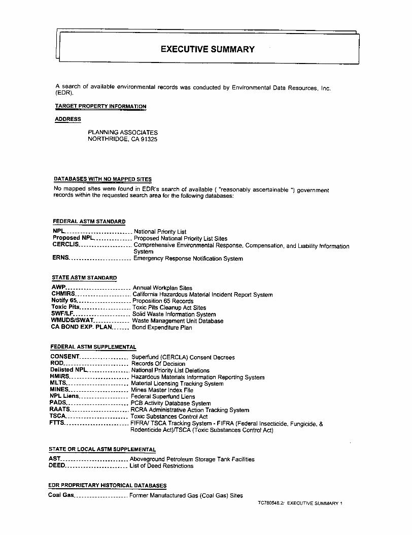
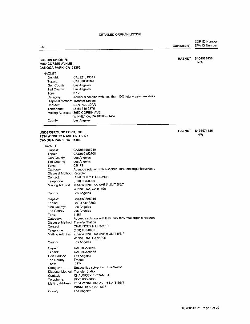
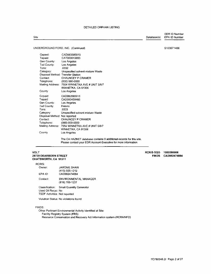
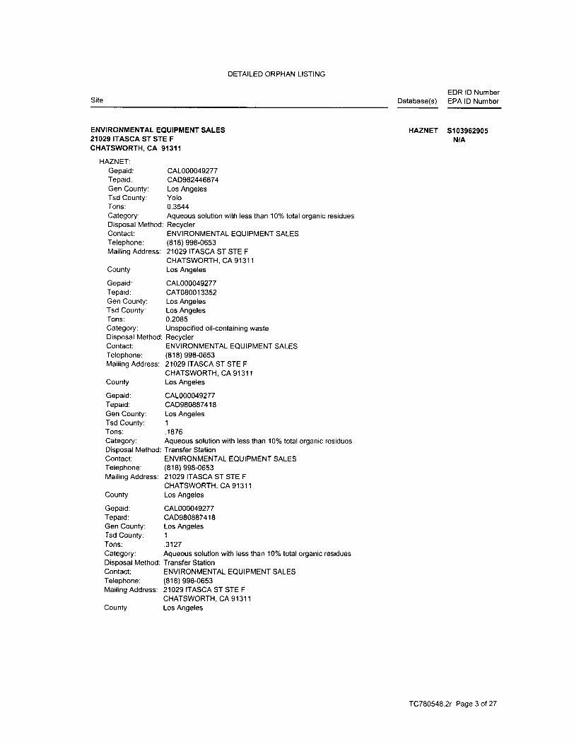
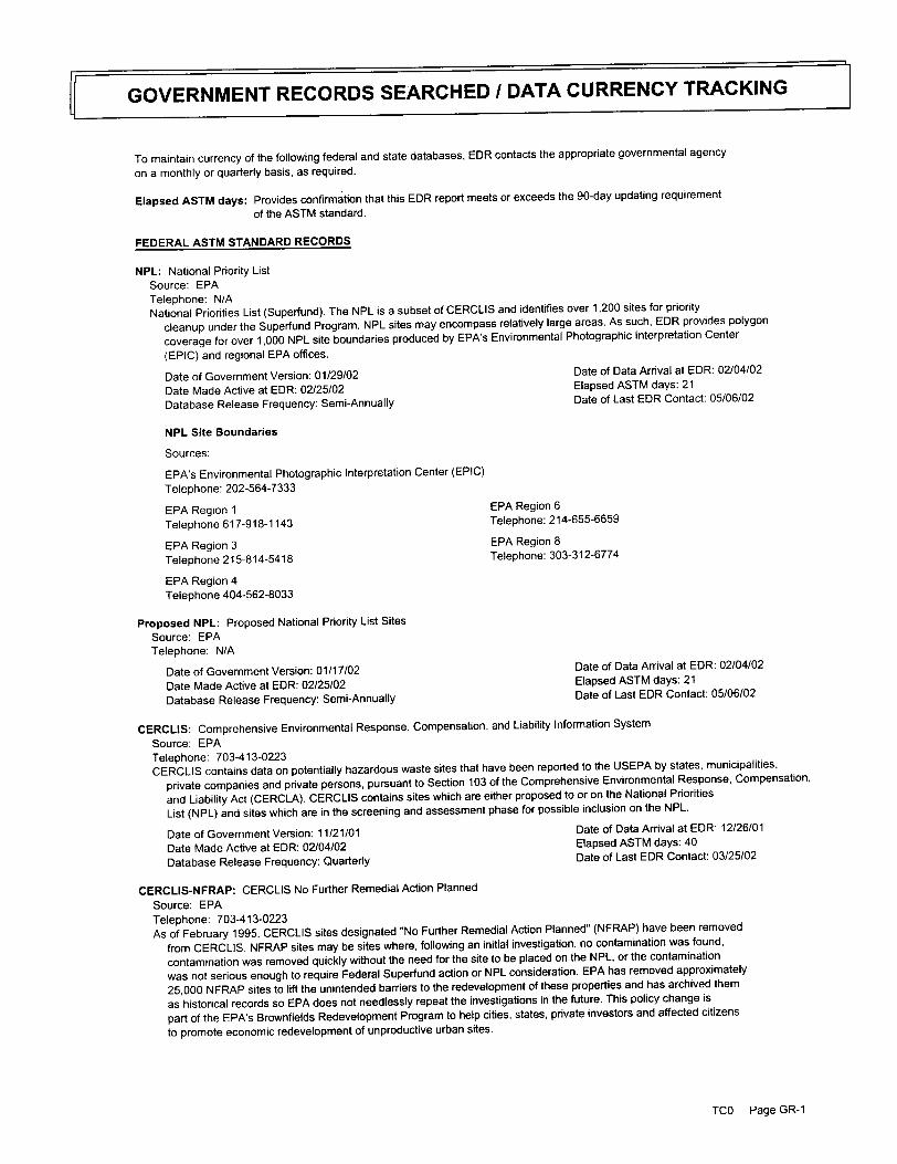
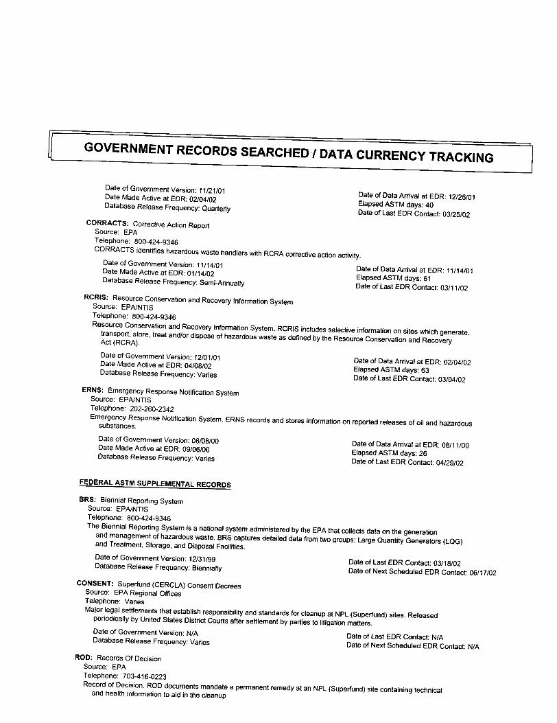
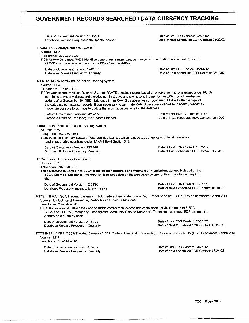
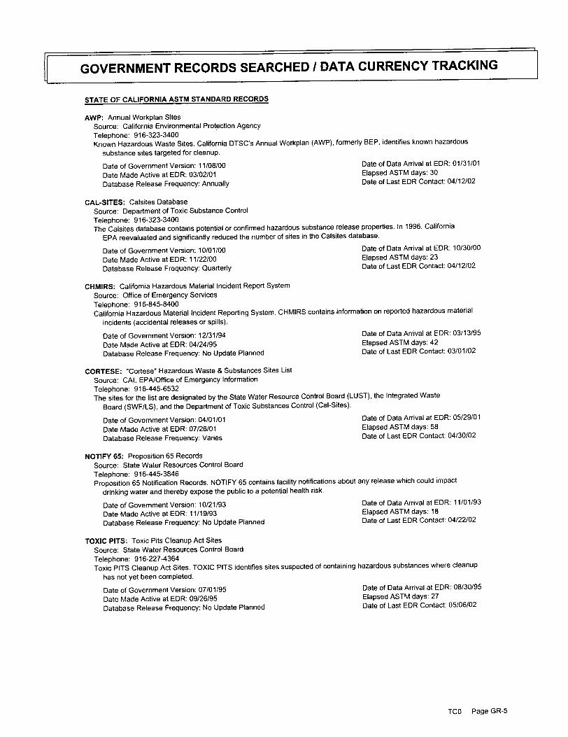
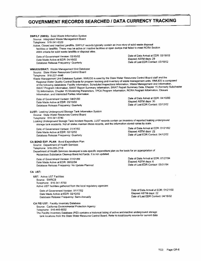
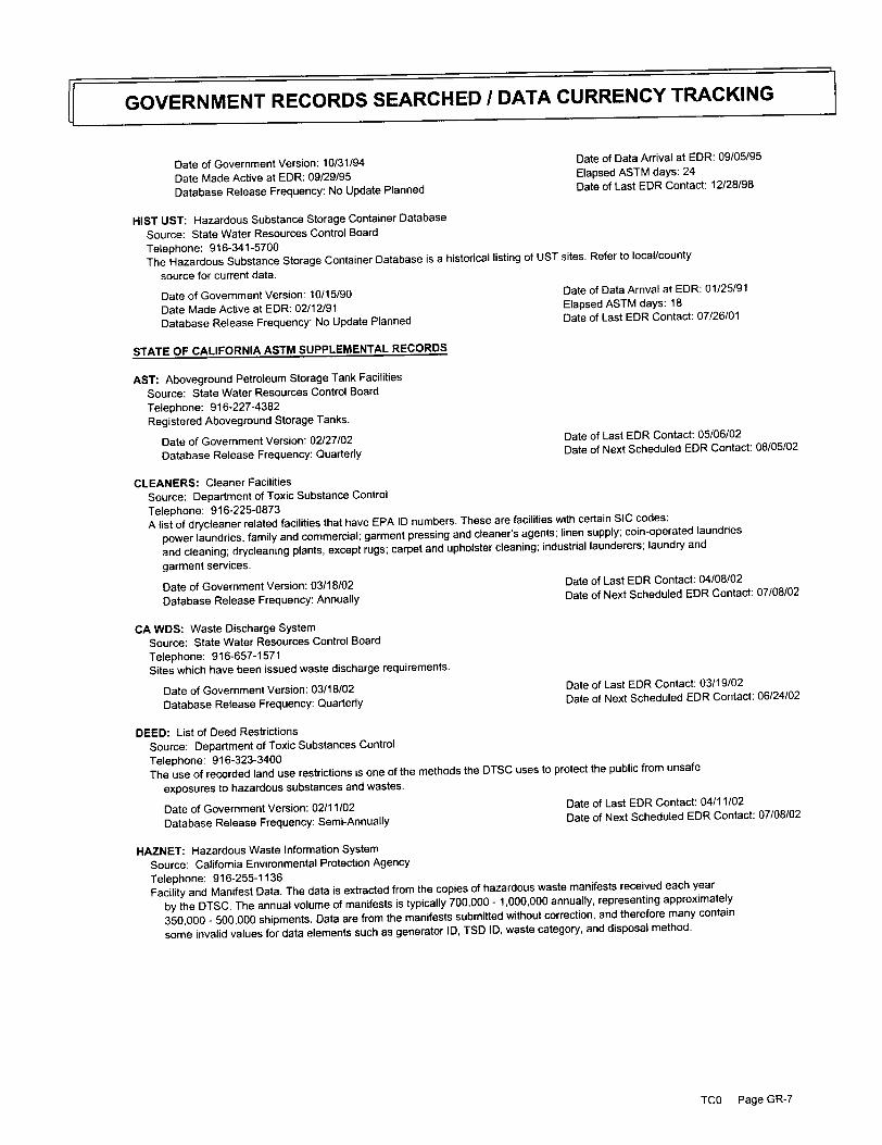
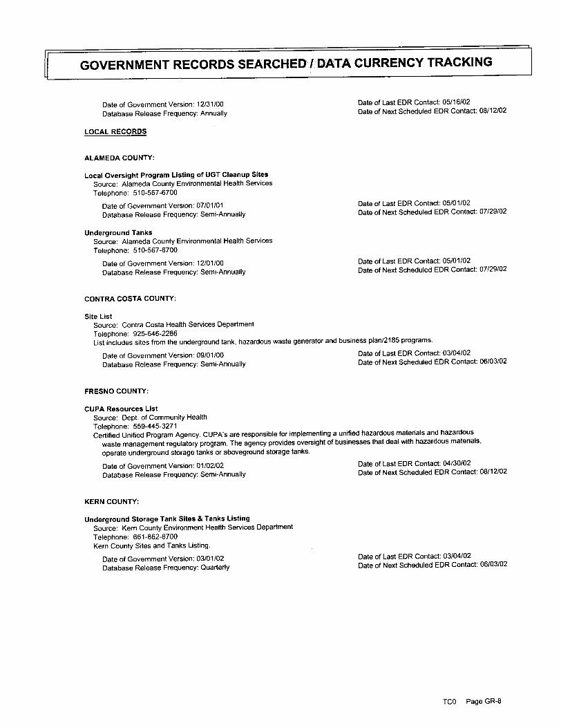
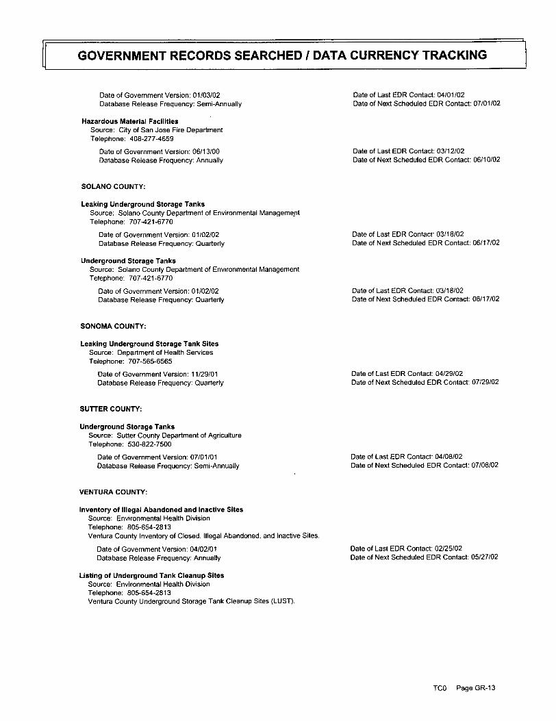
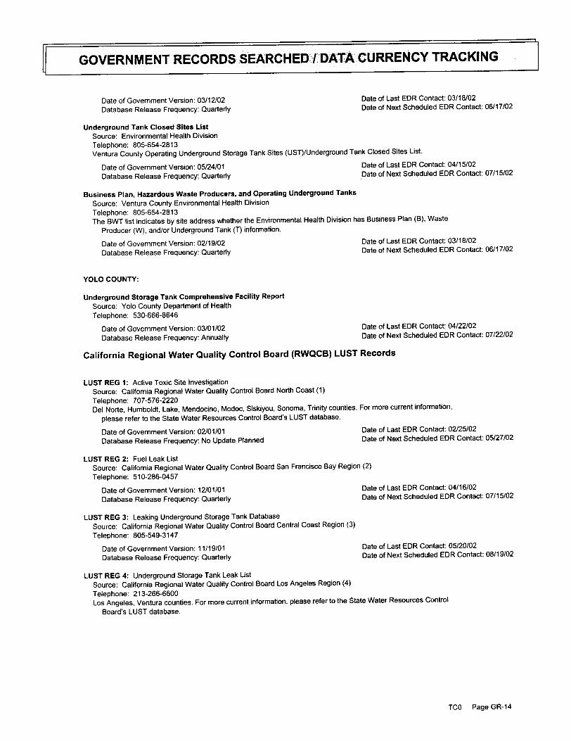
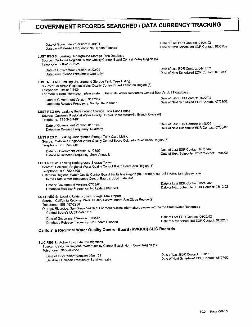
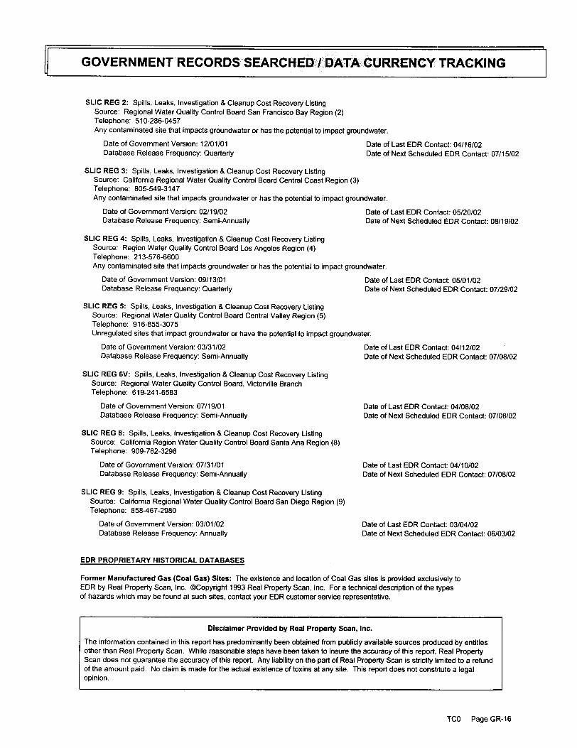
3.1 Regulatory Agency Database Search Environmental Data Resources, Inc. (EDR) was retained to perform an environmental database search for locations identified as hazardous substance and/or hazardous waste sites near the subject property. The search distance from the site was determined by ASTM standards. The EDR report contains additional lists beyond those specified in ASTM, which are discussed below if environmental concerns were noted. The complete EDR report including the names and descriptions of the agency lists searched, the search distance from the site, and the date the list was last updated is presented in Appendix D.
Regulatory List ASTM Search Distance Federal NPL 1 mile Federal CERCLIS List 0.5 mile Federal CERCLIS-NFRAP List Property and Adjoining Properties Federal RCRA CORRACTS TSD Facilities List 1.0 Mile Federal RCRA Generators List Property and Adjoining Properties
Federal ERNS List Site Only Annual Work Plan 1.0 Mile

4
CalSites 1.0 Mile State Landfill or Solid Waste Disposal Lists 0.5 mile State LUST 0.5 mile State registered UST List Property and Adjoining Properties
EDR did not identify properties within the specified search radius on the following lists:
• National Priorities List (NPL) • CERCLIS and CERCLIS-NFRAP Databases • Emergency Response Notification System (ERNS) • Federal RCRA Generators List • Annual Work Plan Database • State Registered UST List • State Landfill or Solid Waste Disposal Lists
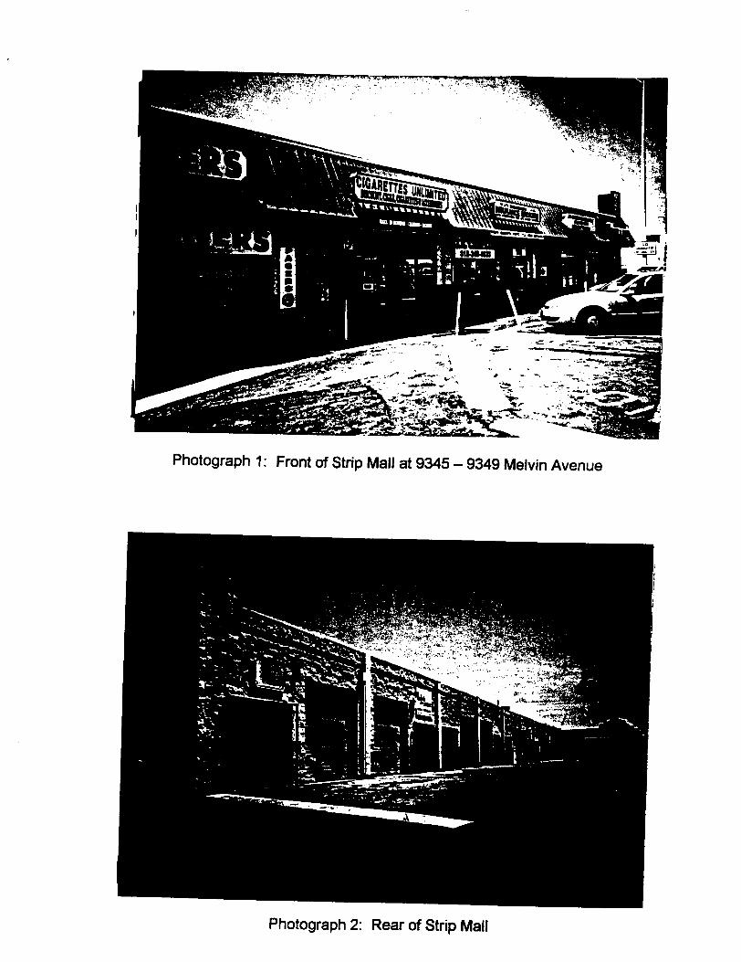
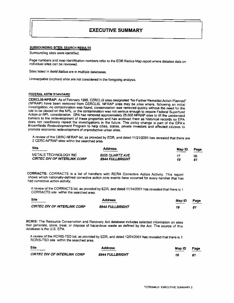
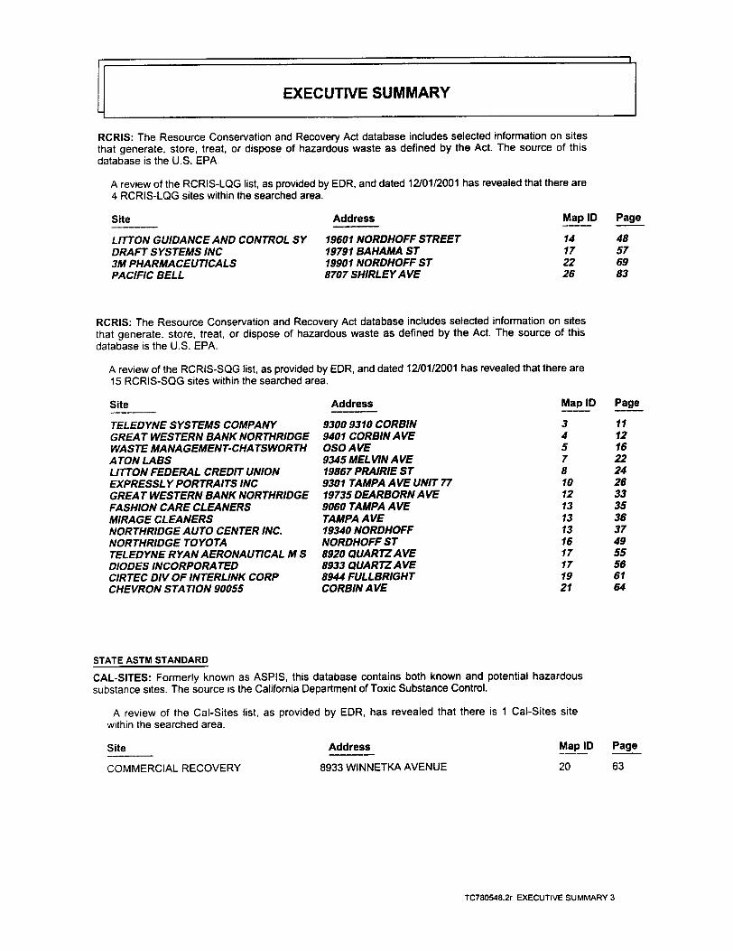
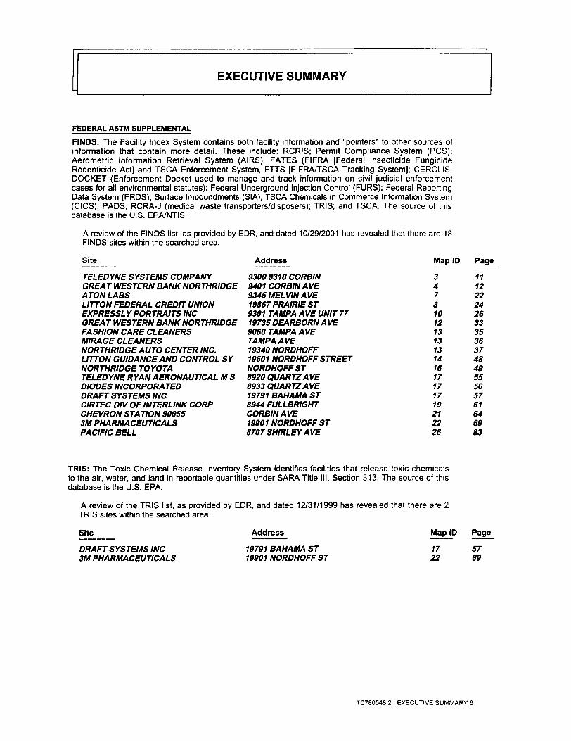
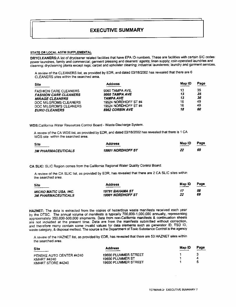
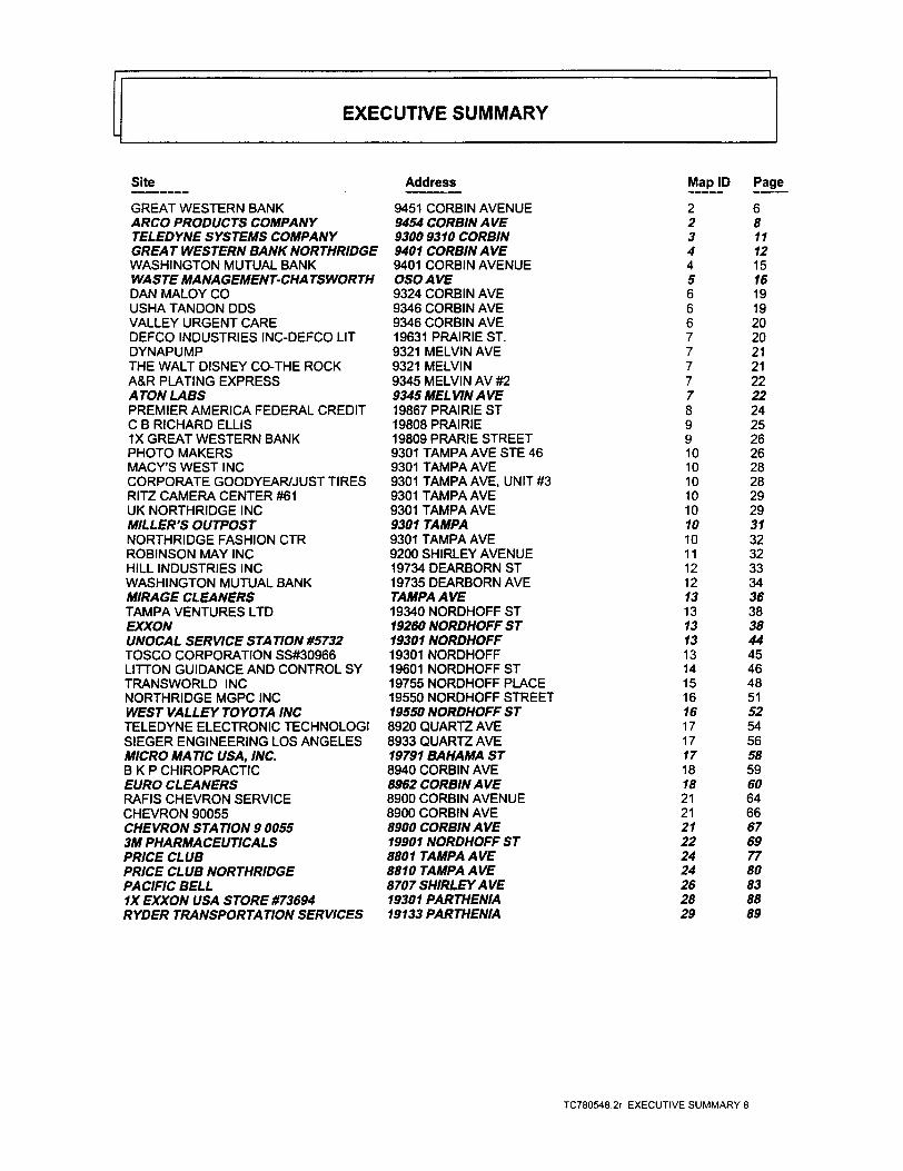
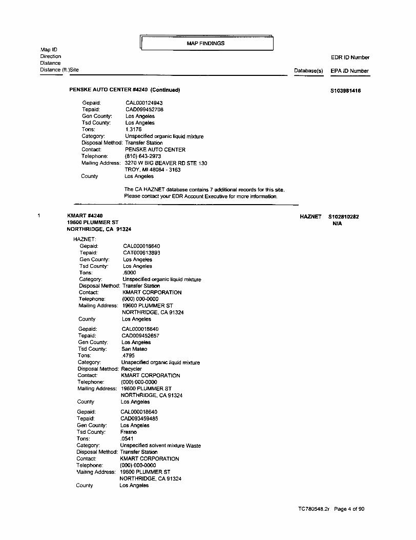
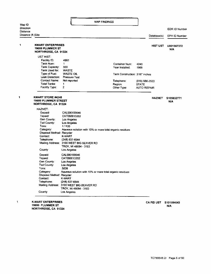
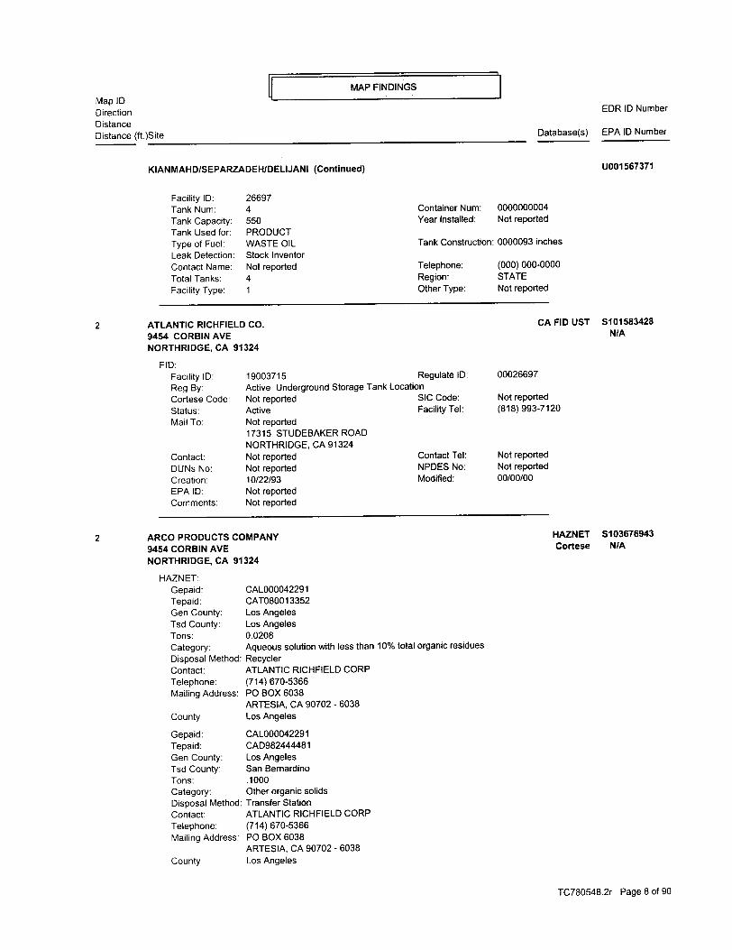
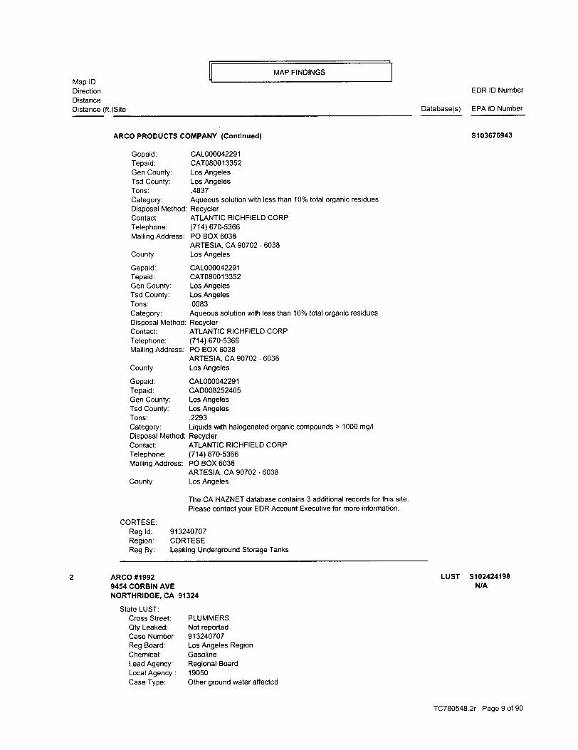
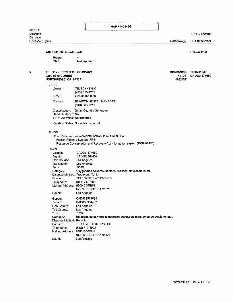
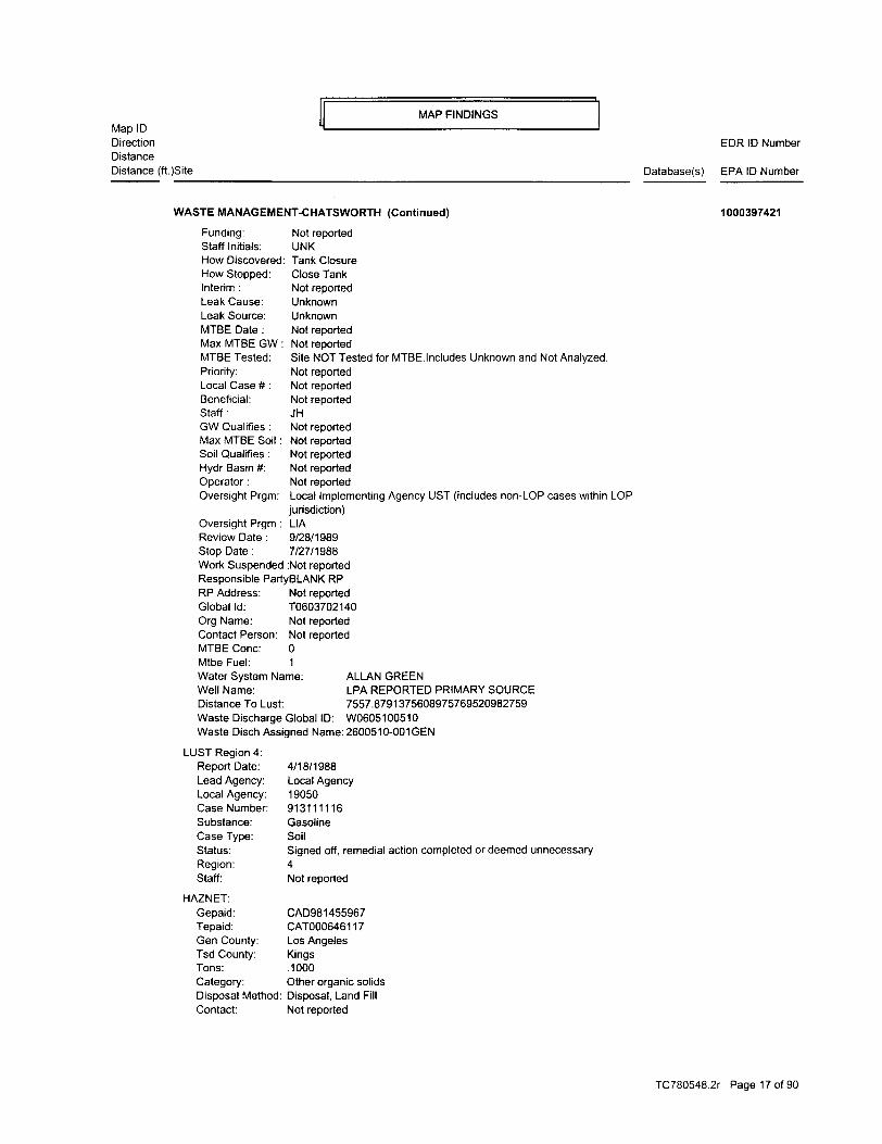
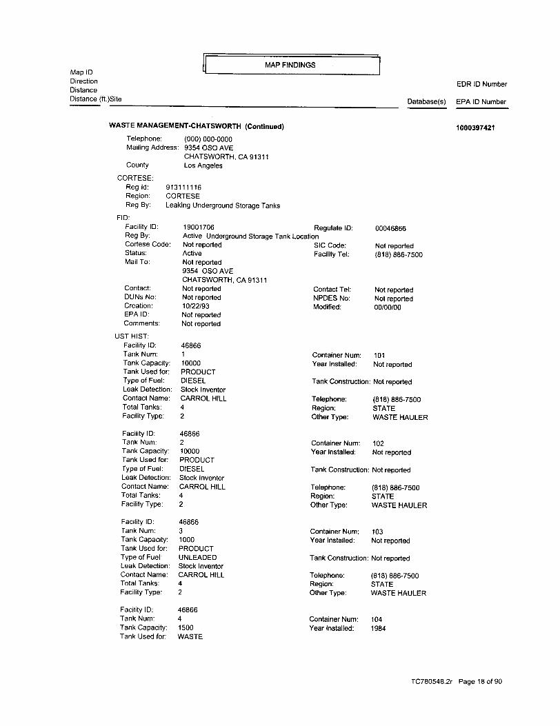
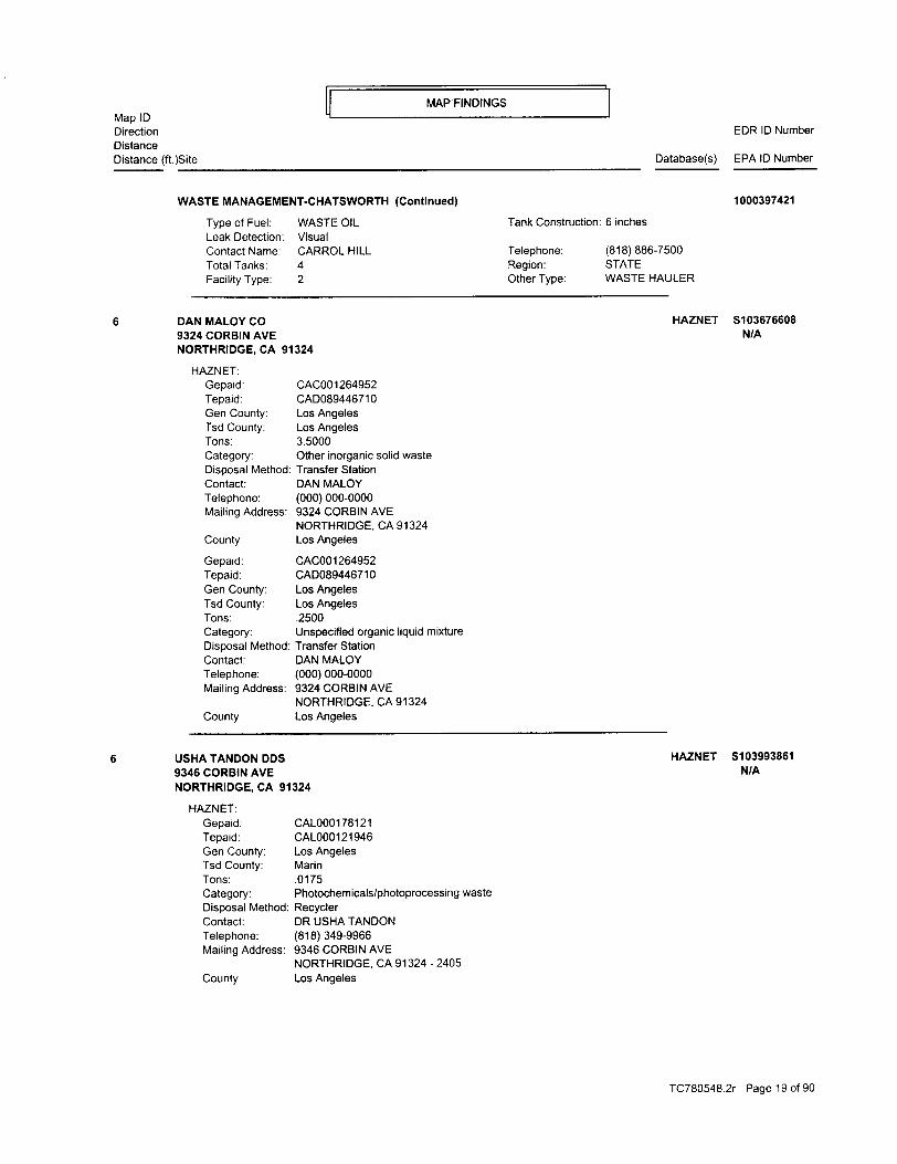
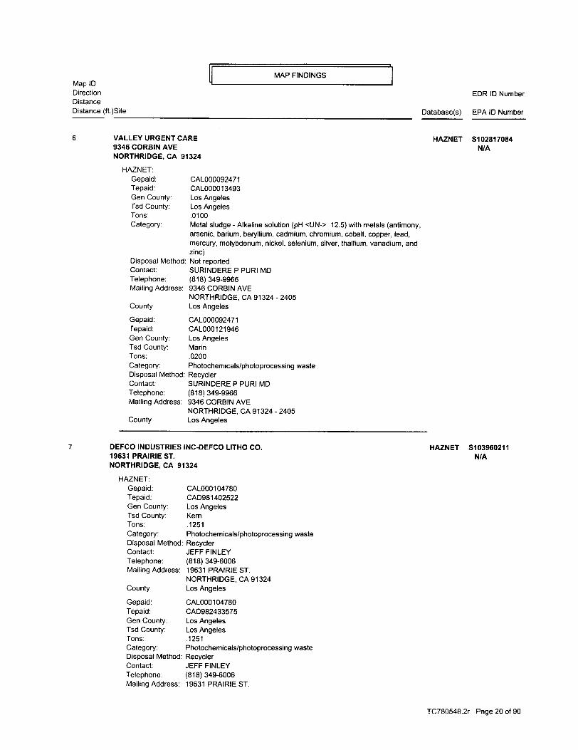
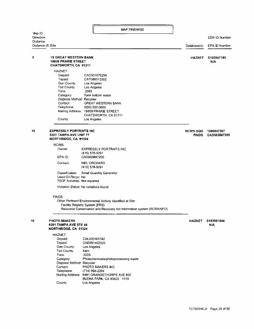
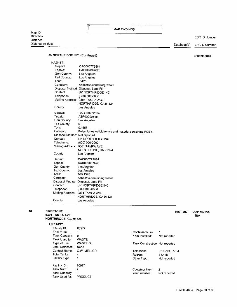
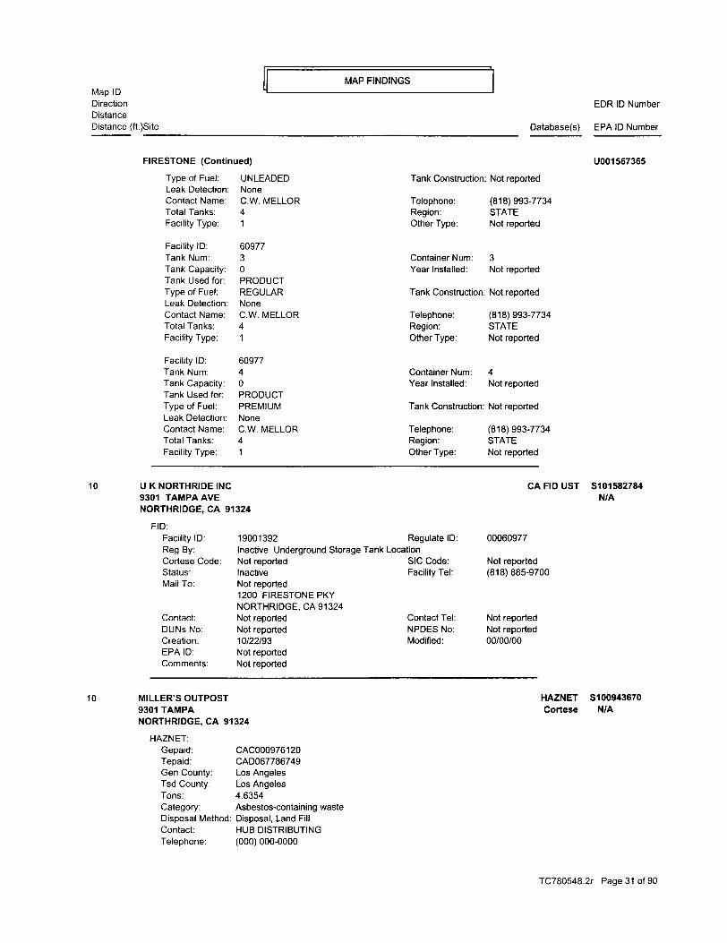
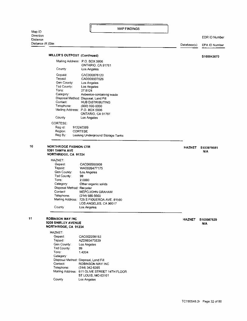
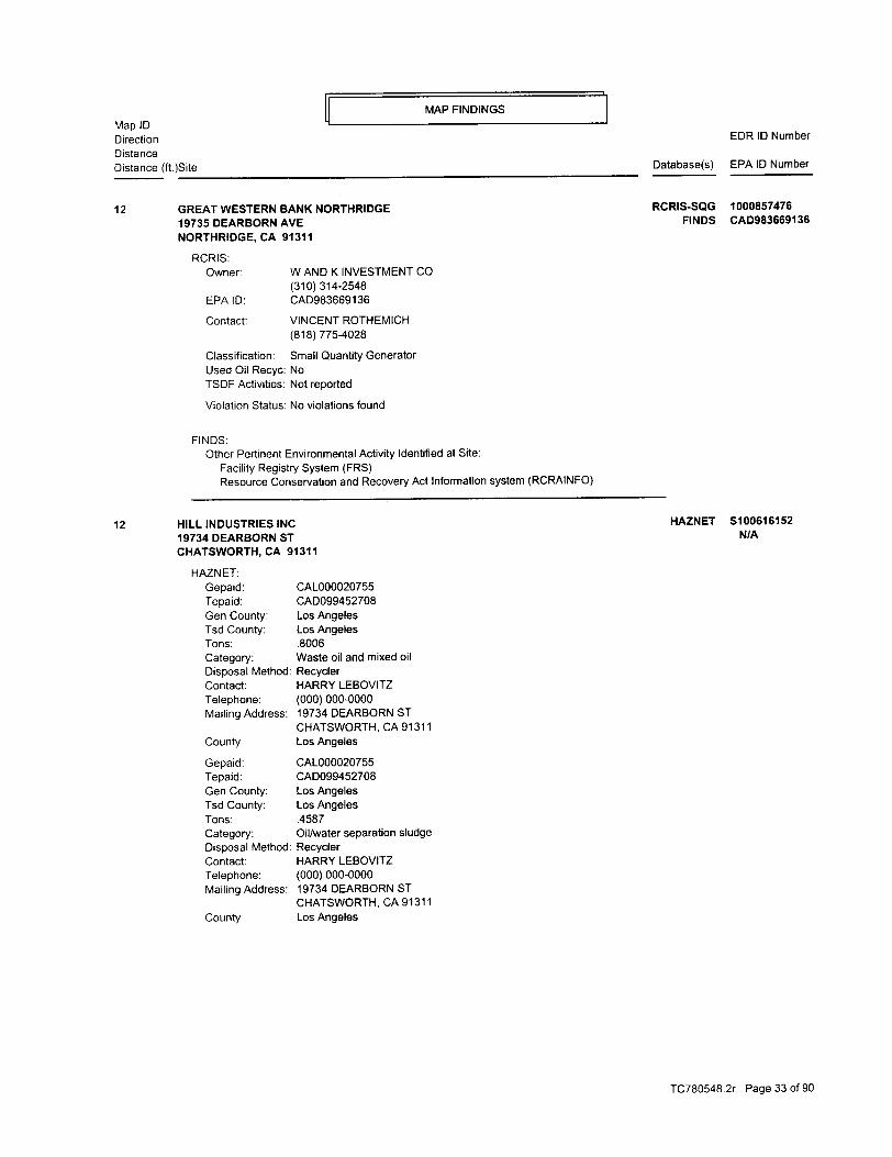
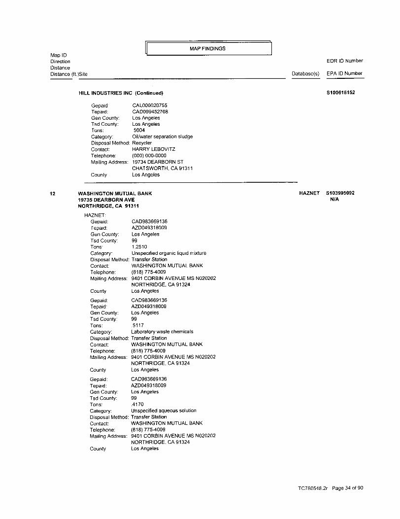
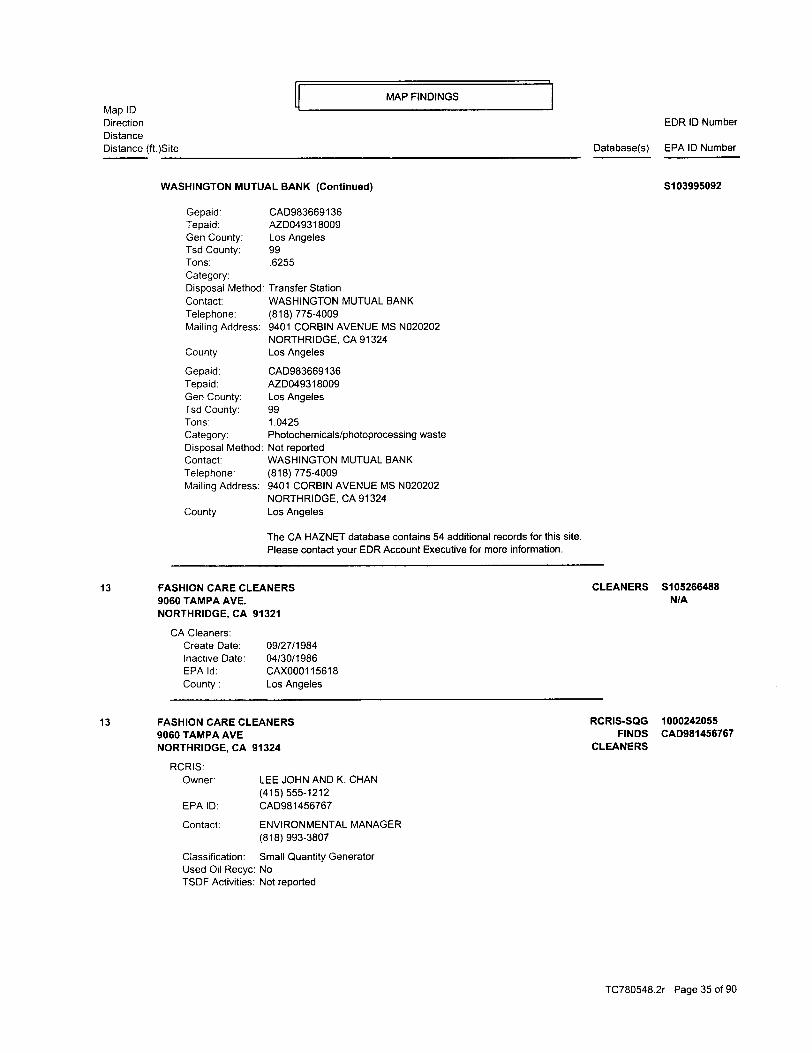
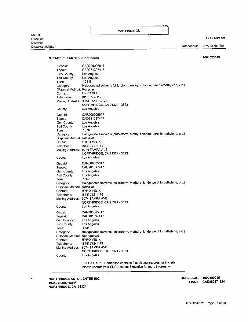
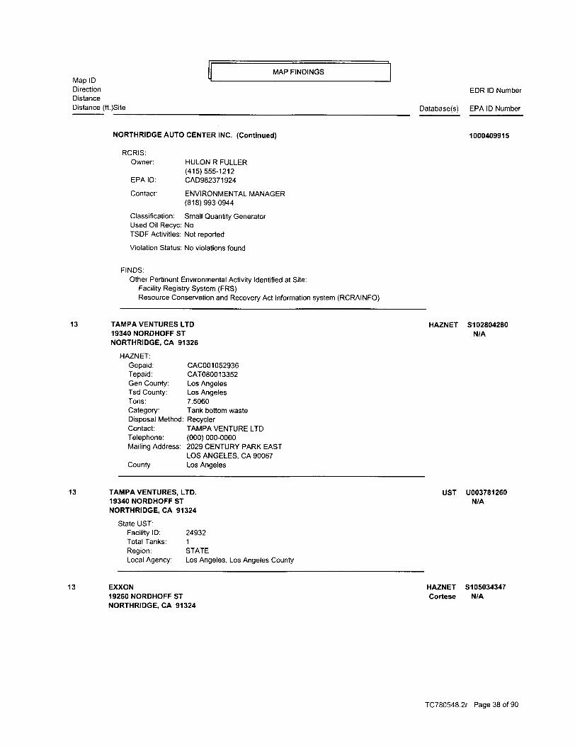
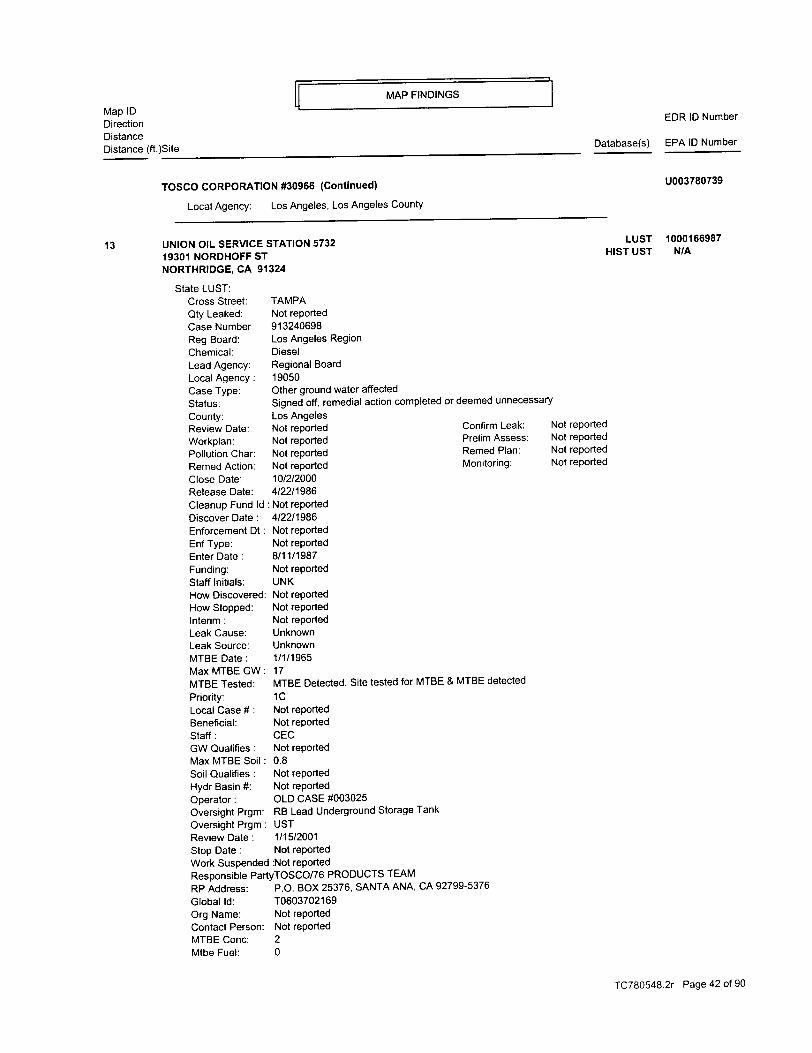
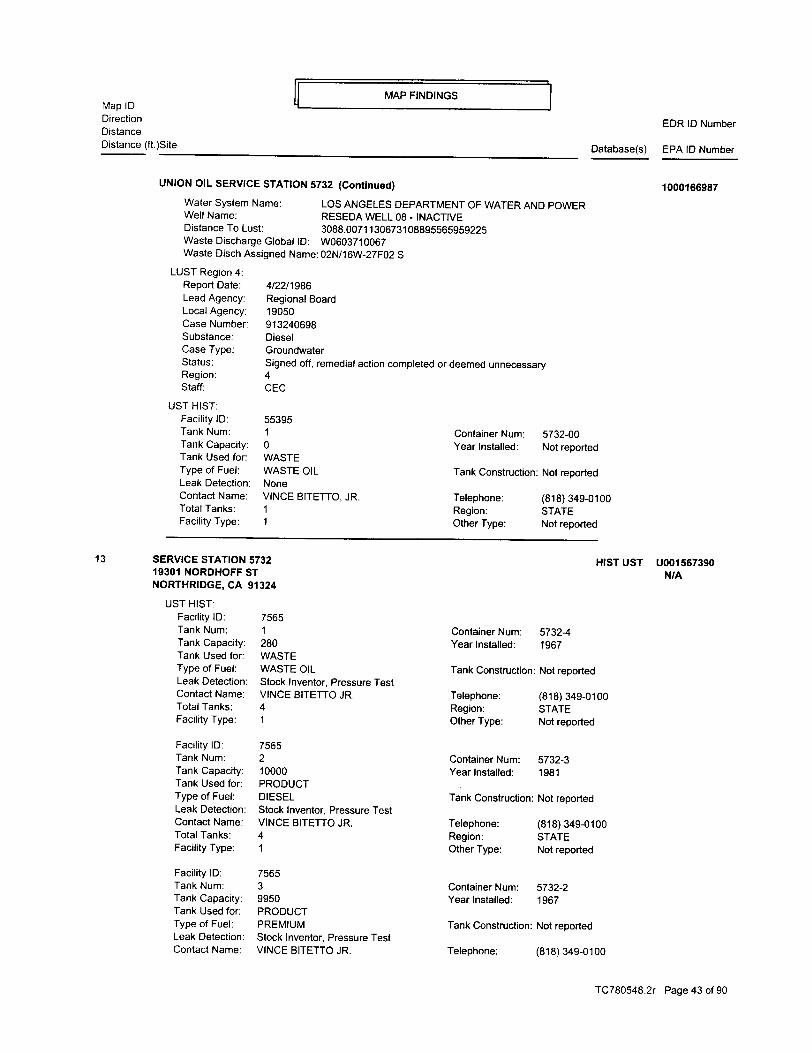
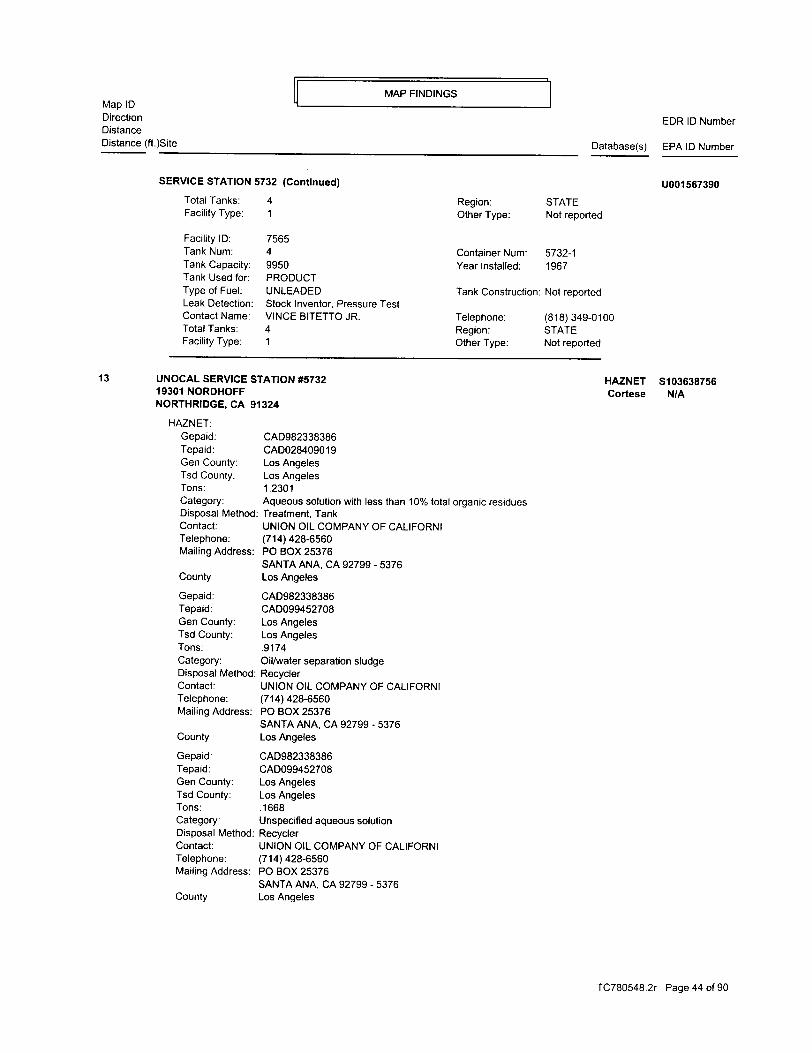
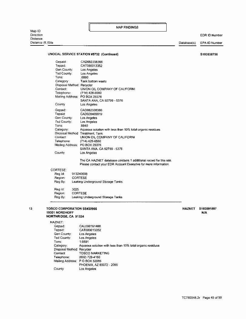
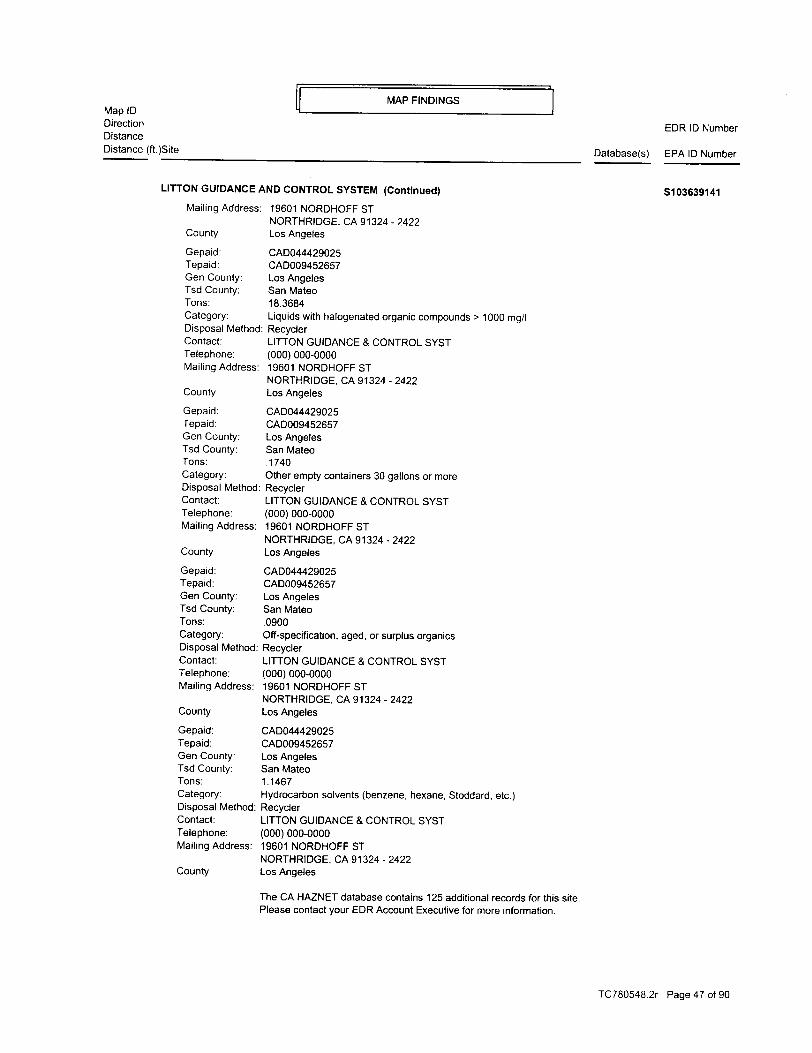
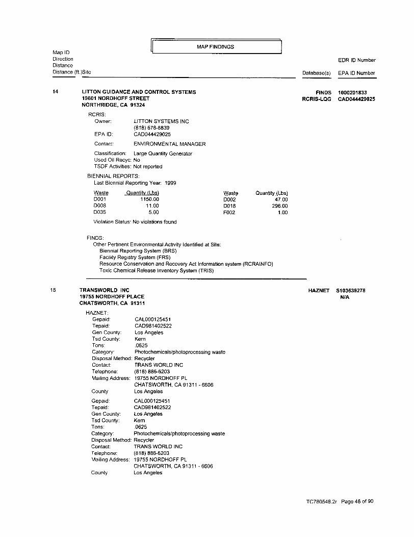
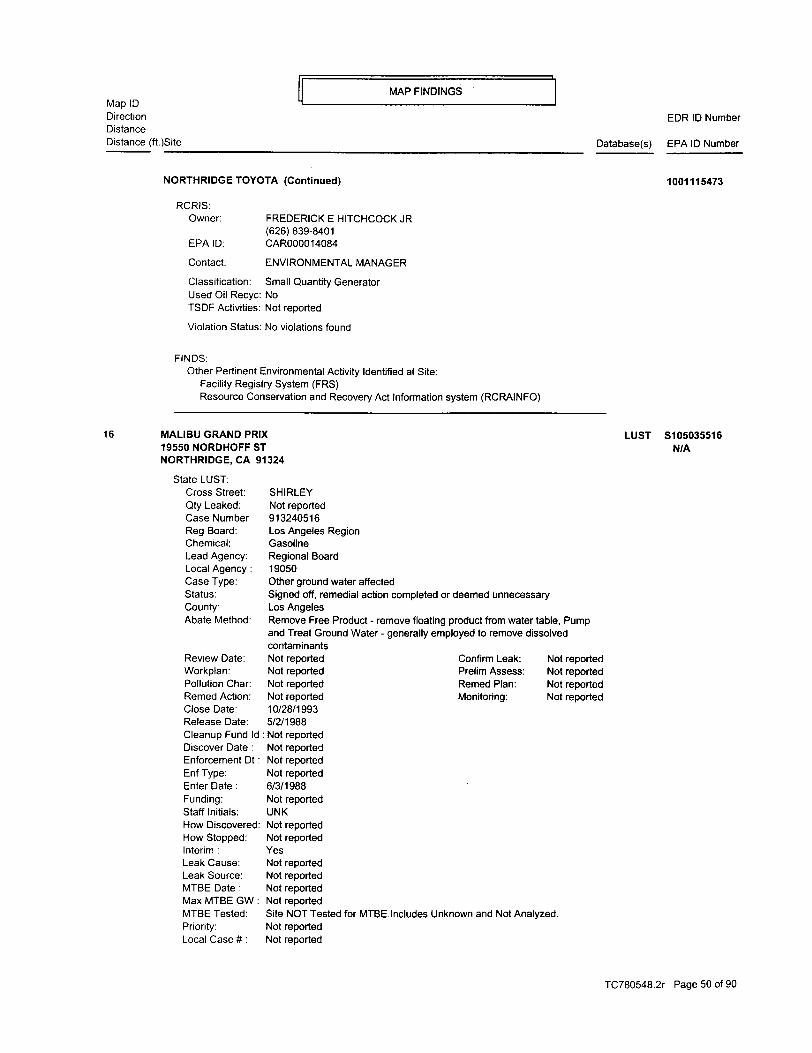
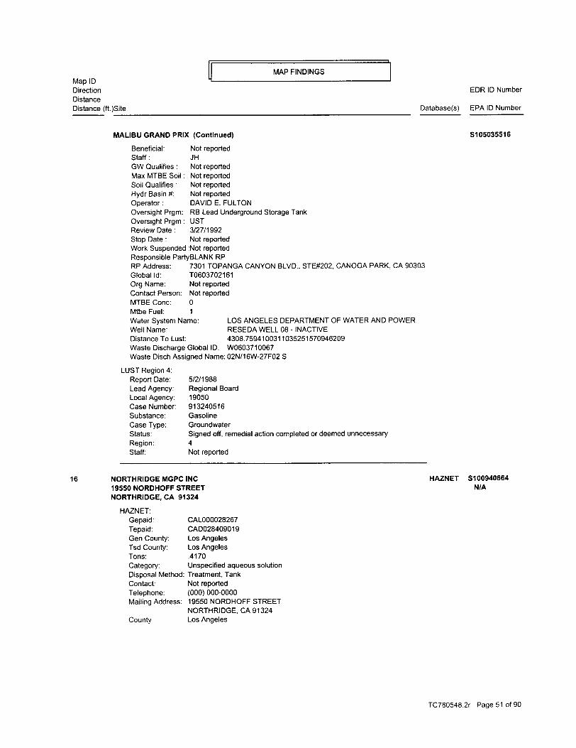
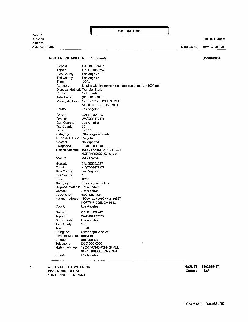
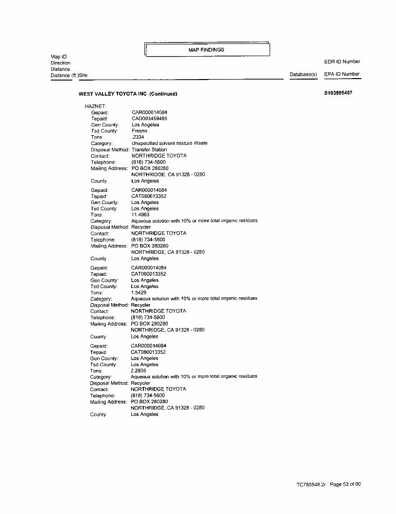
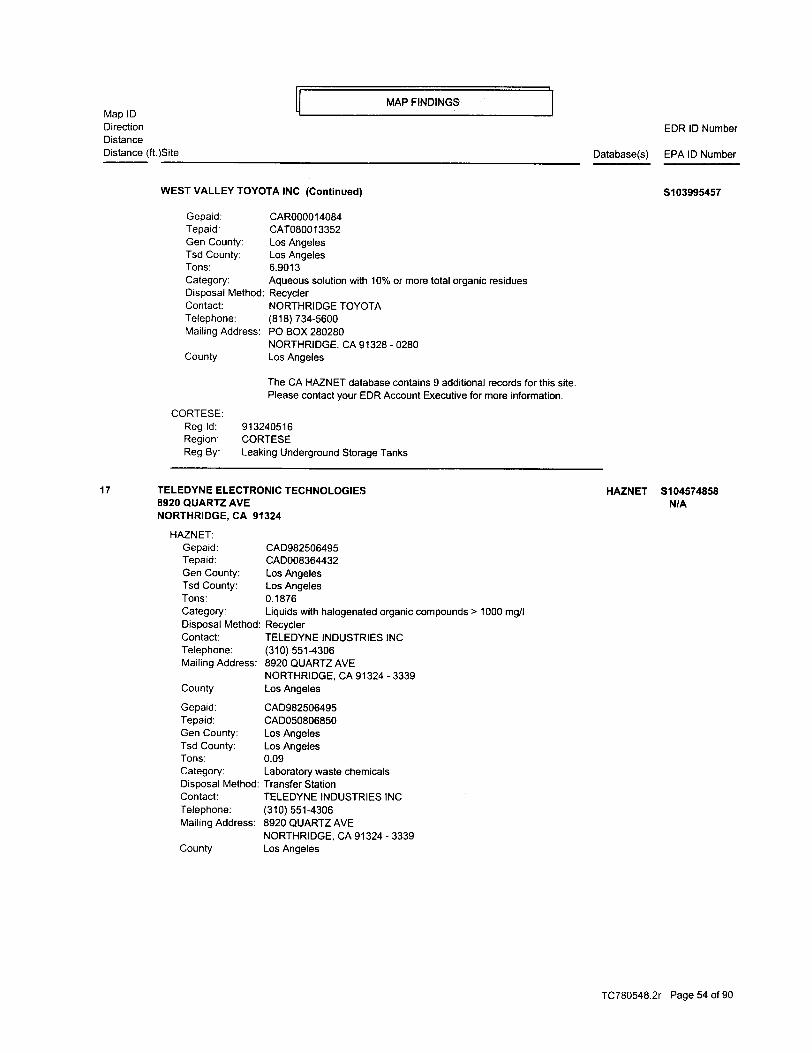
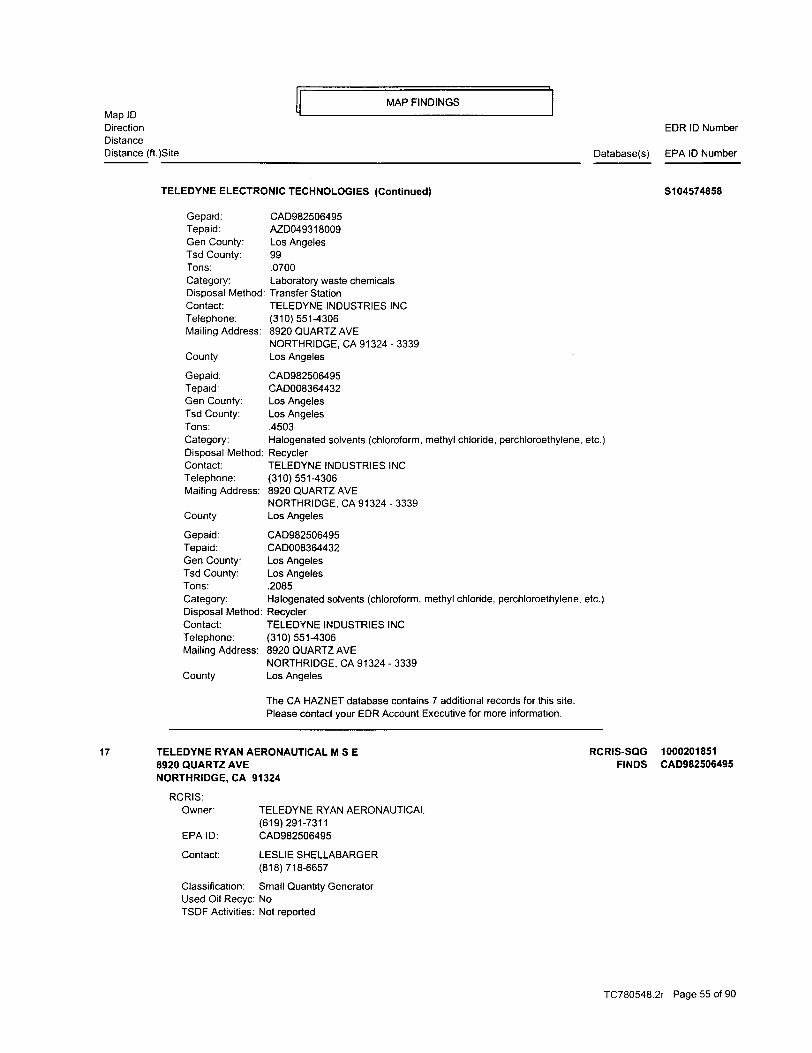
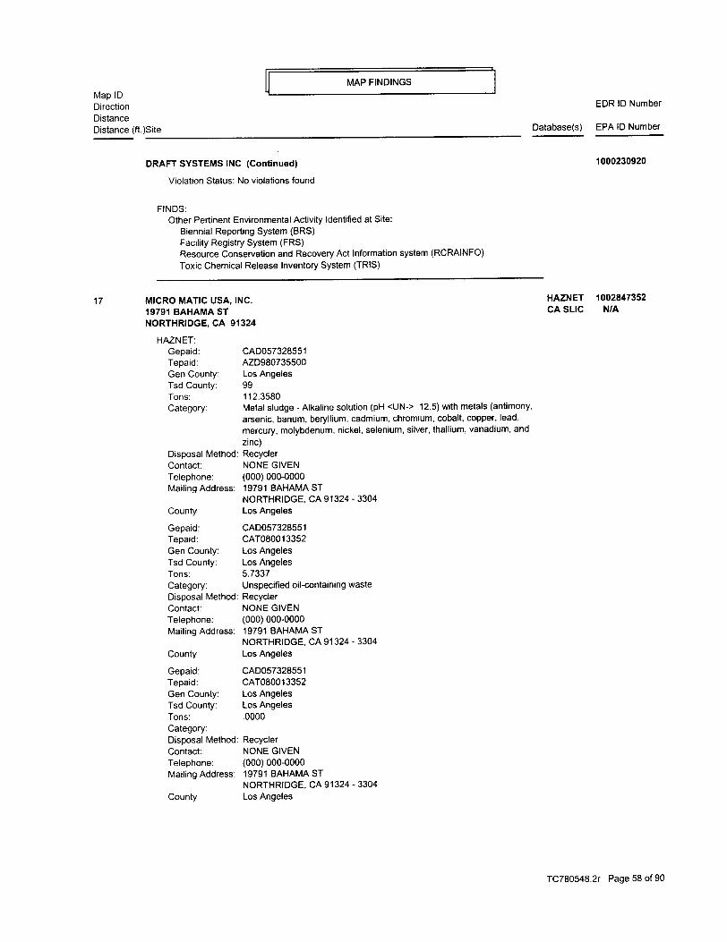
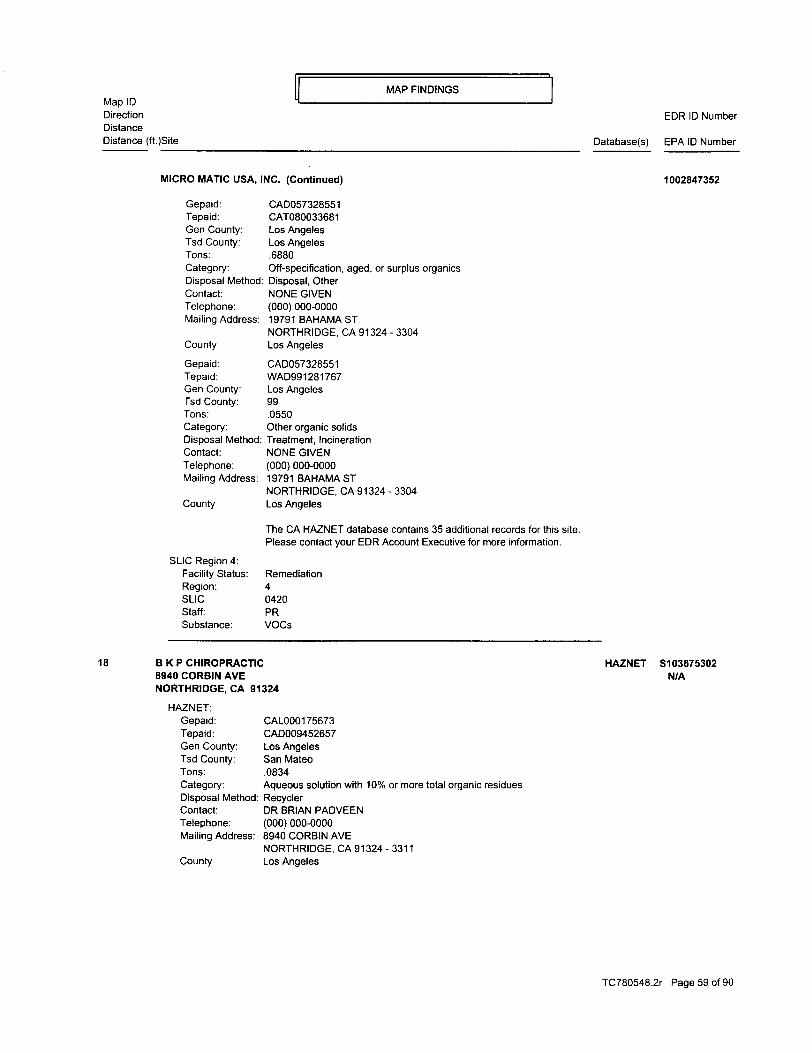
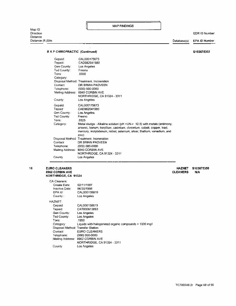
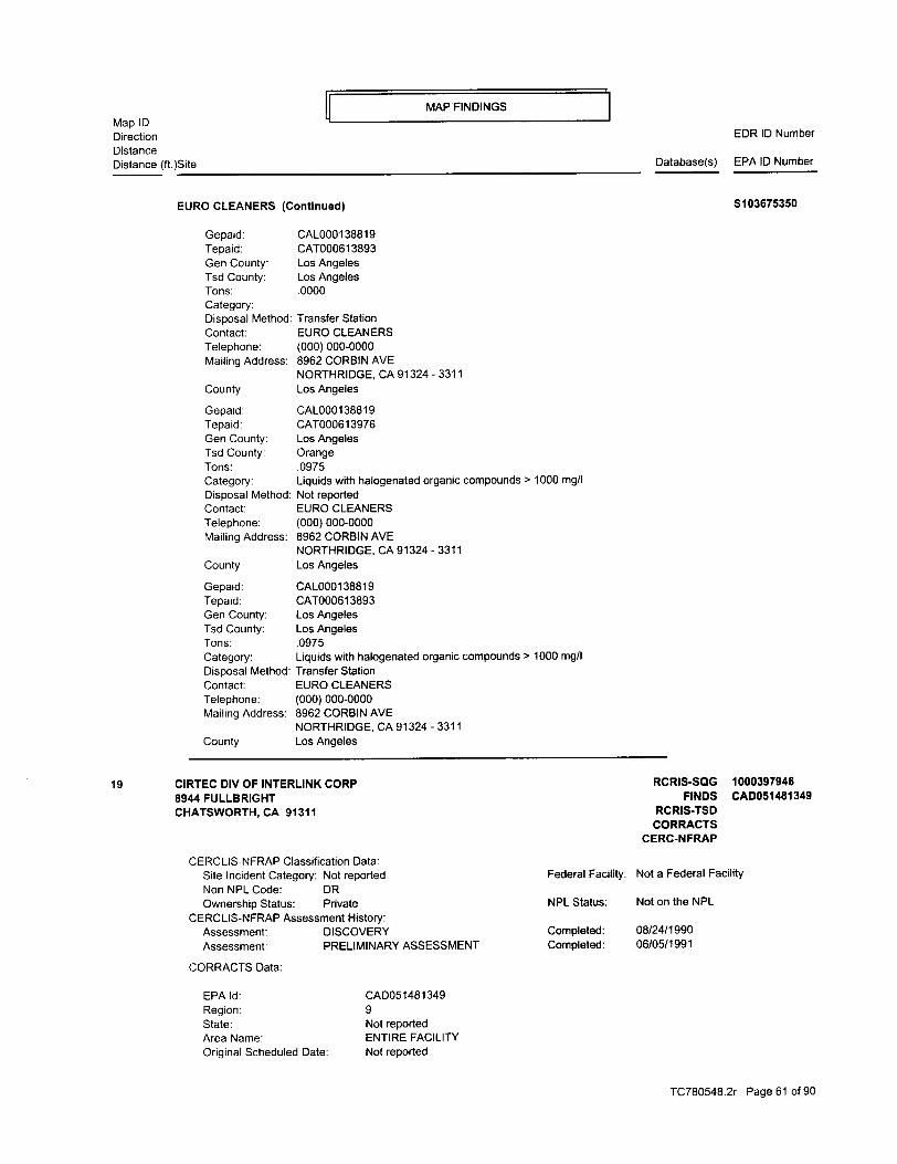
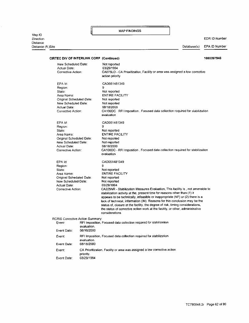
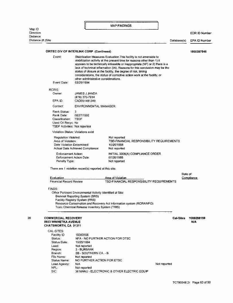
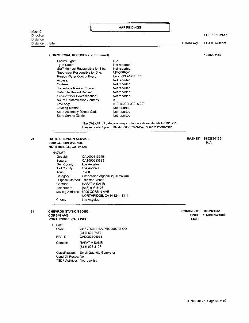
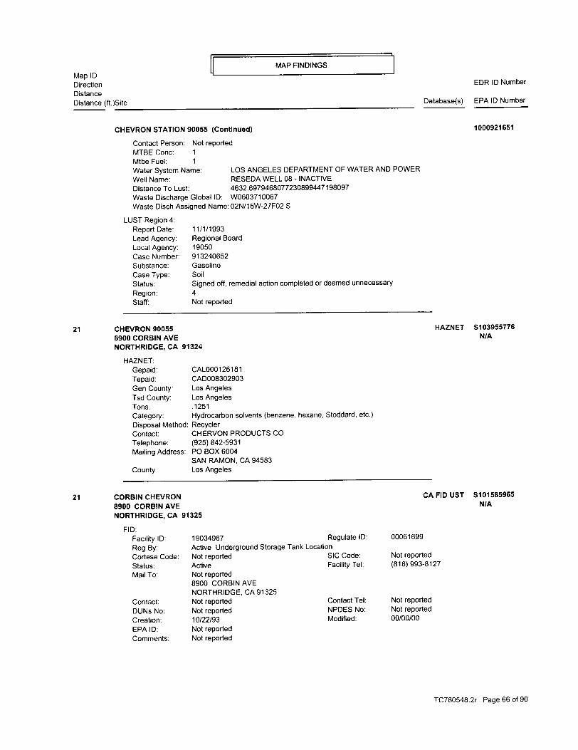
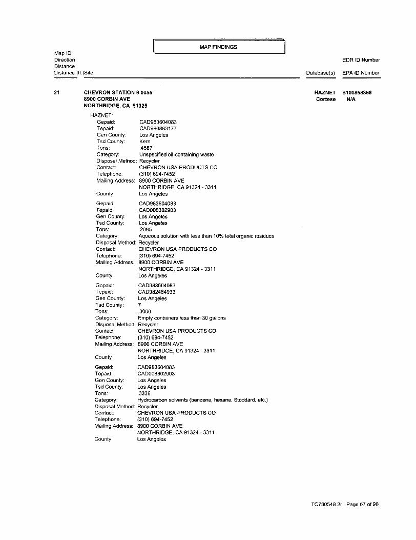
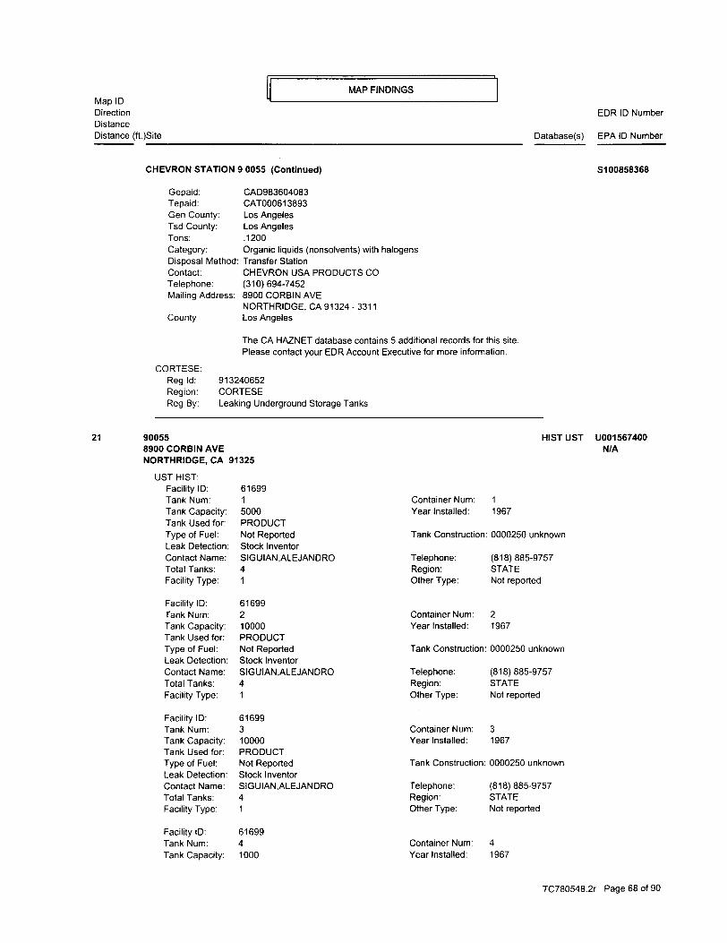
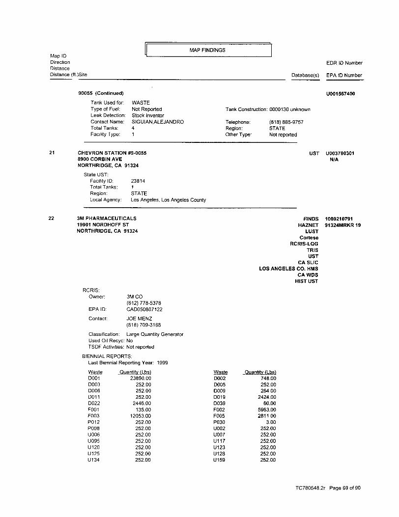
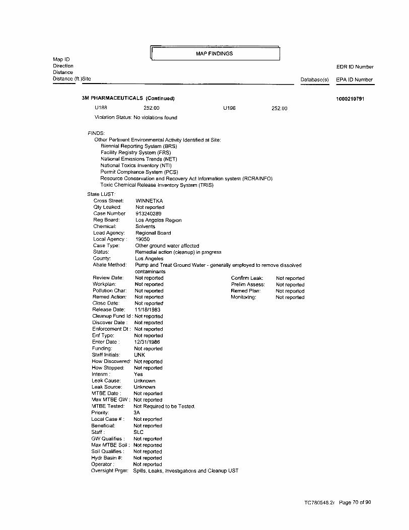
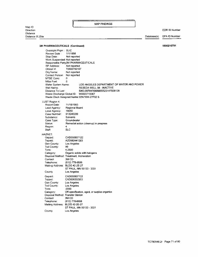
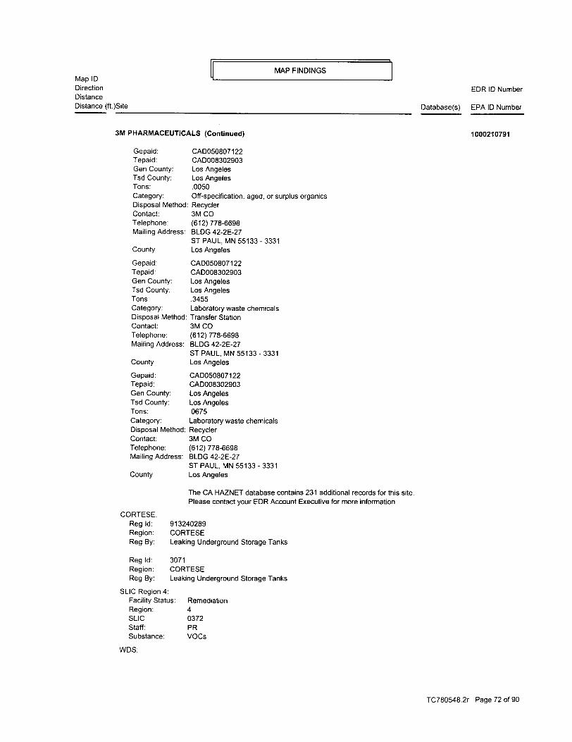
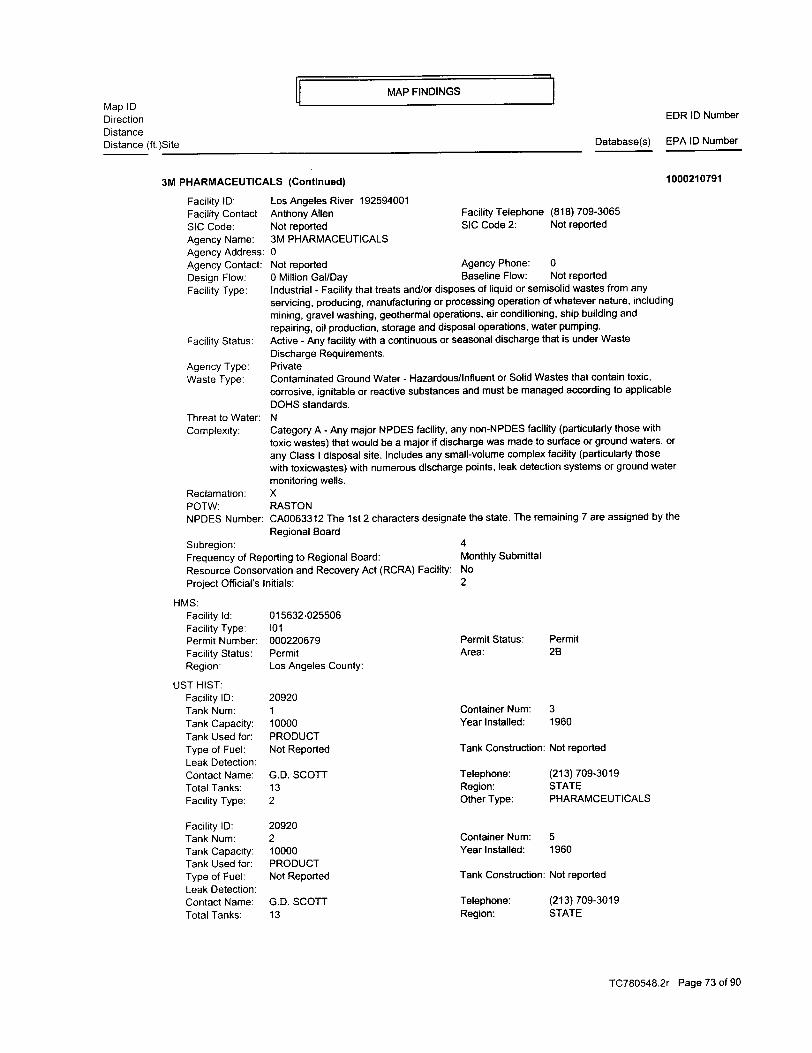
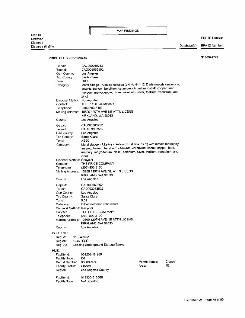
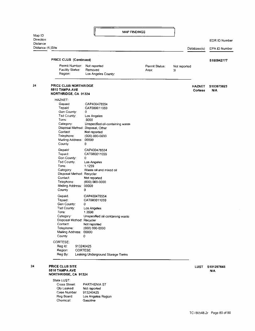
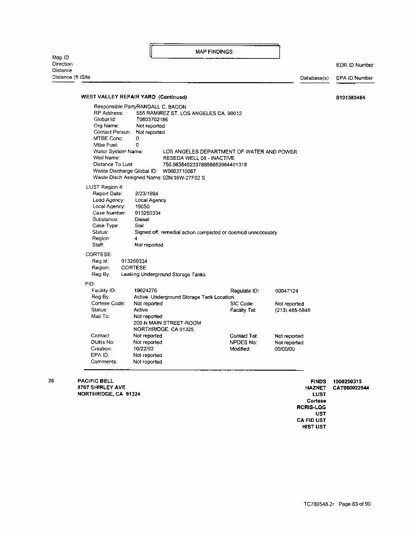
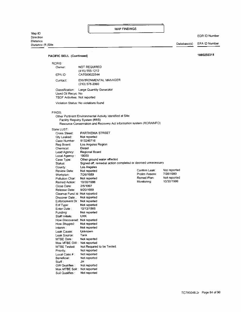
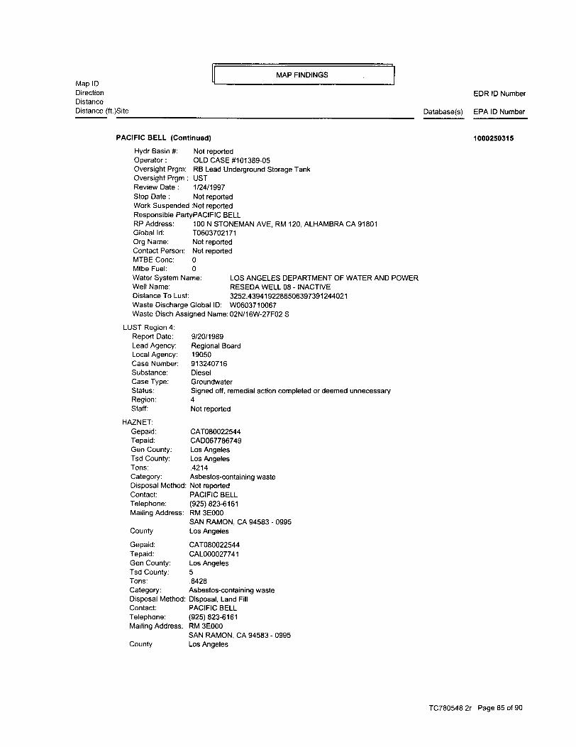
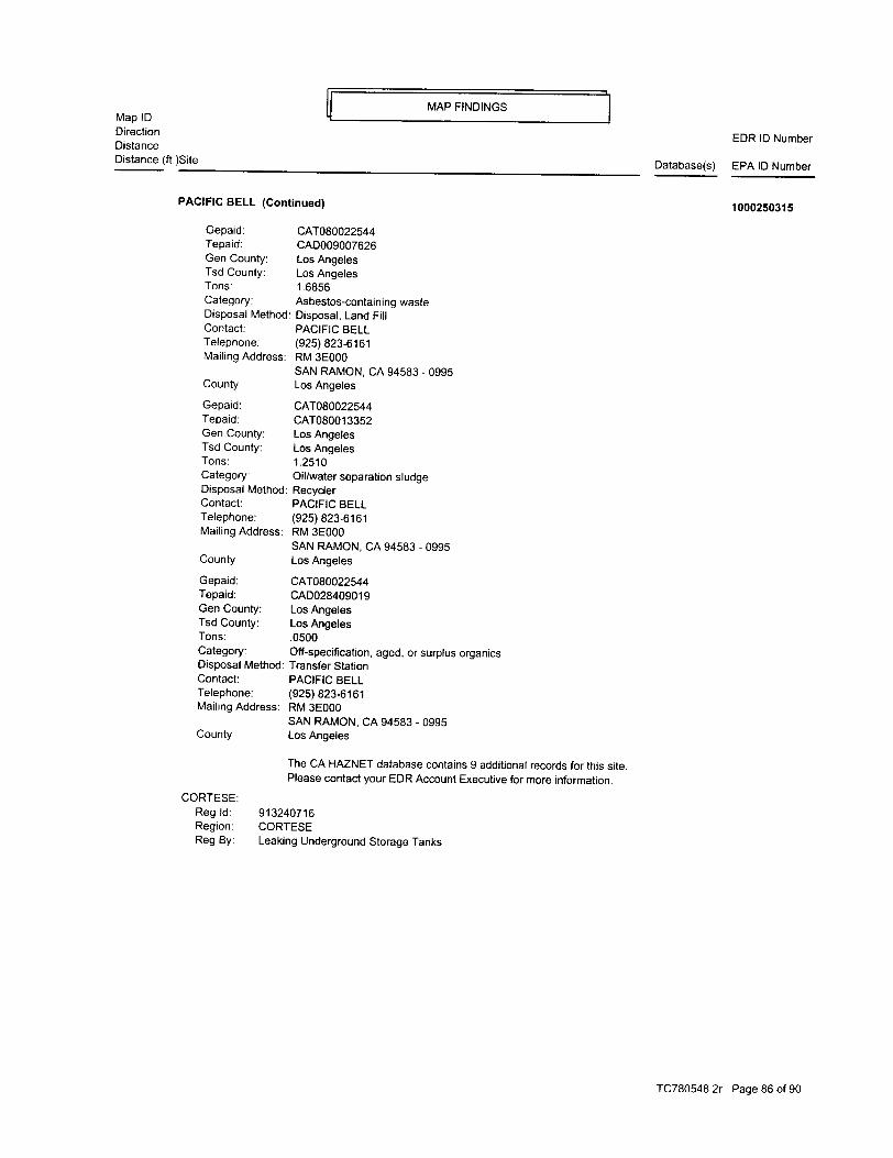
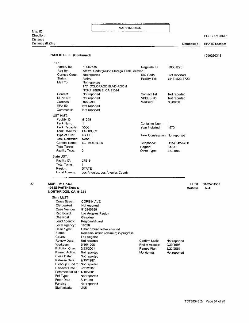
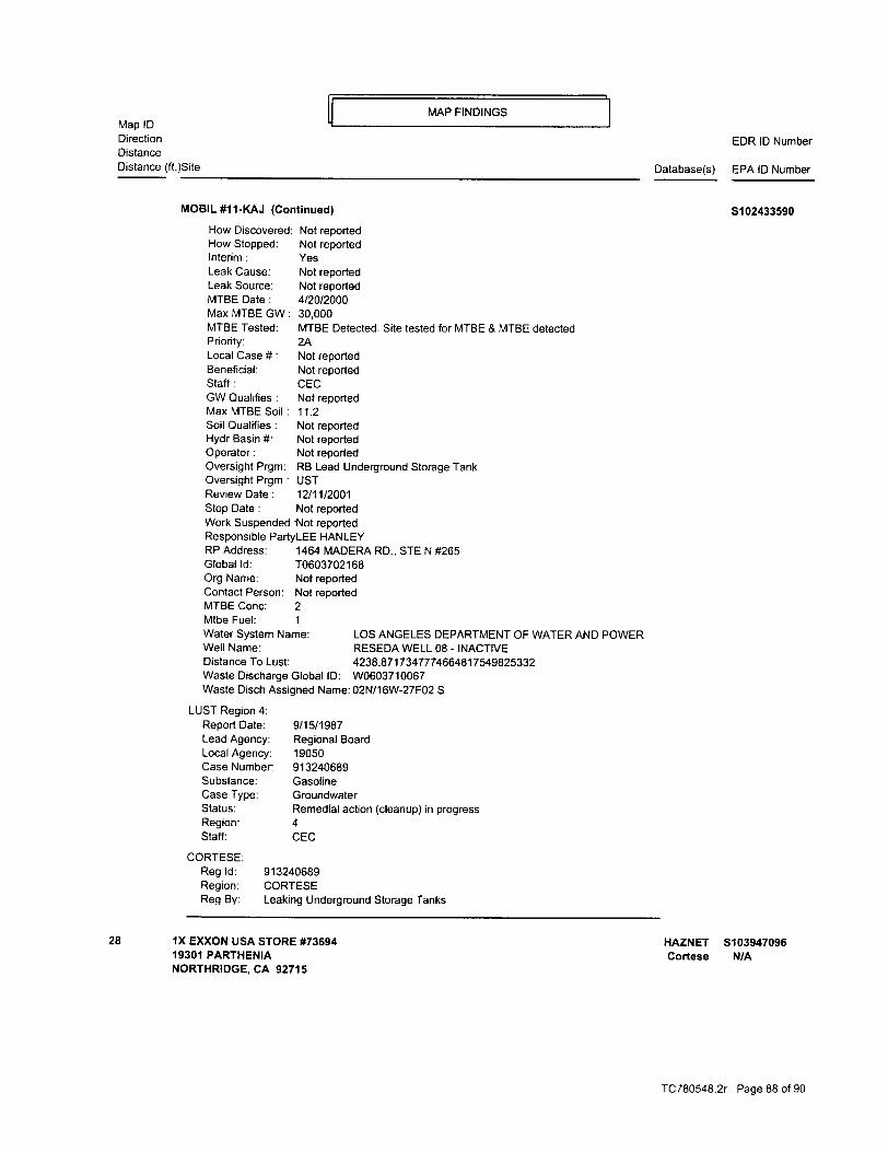
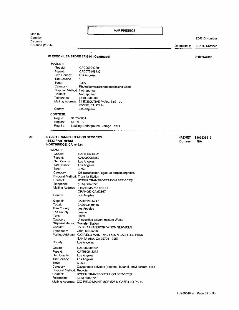
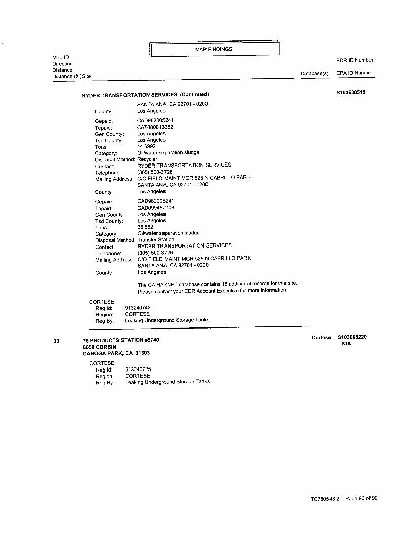
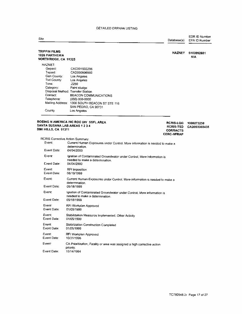
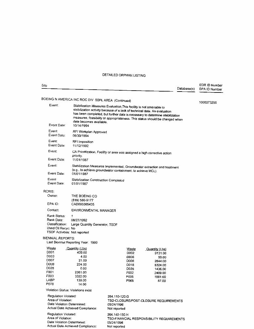
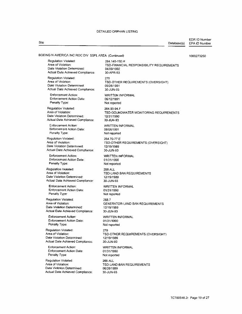
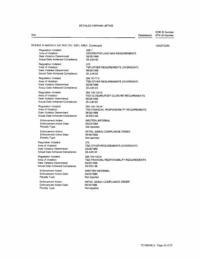
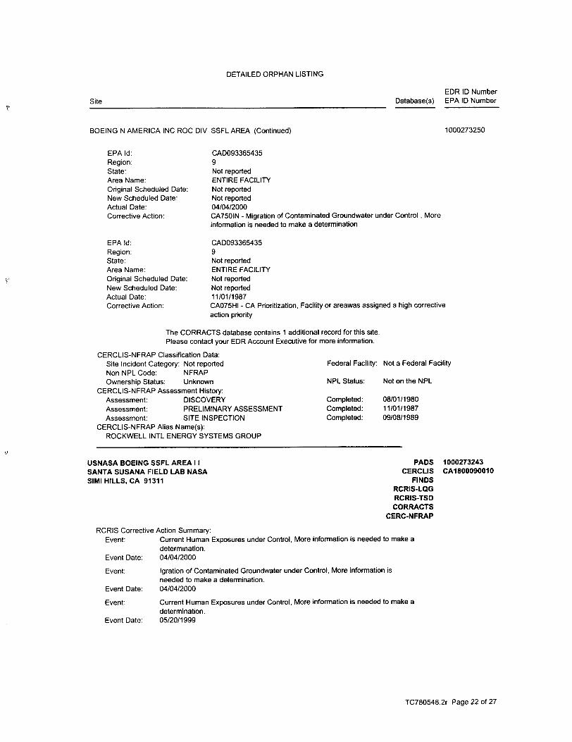
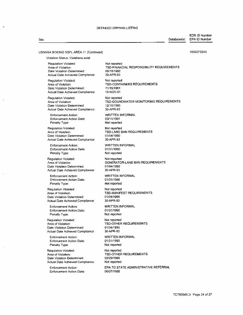
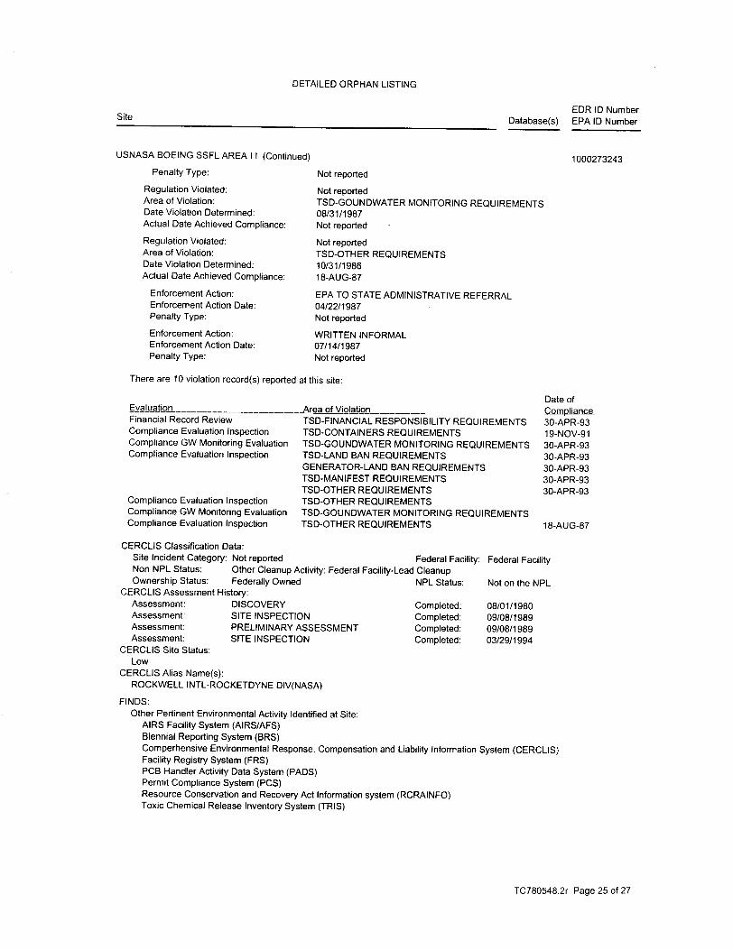
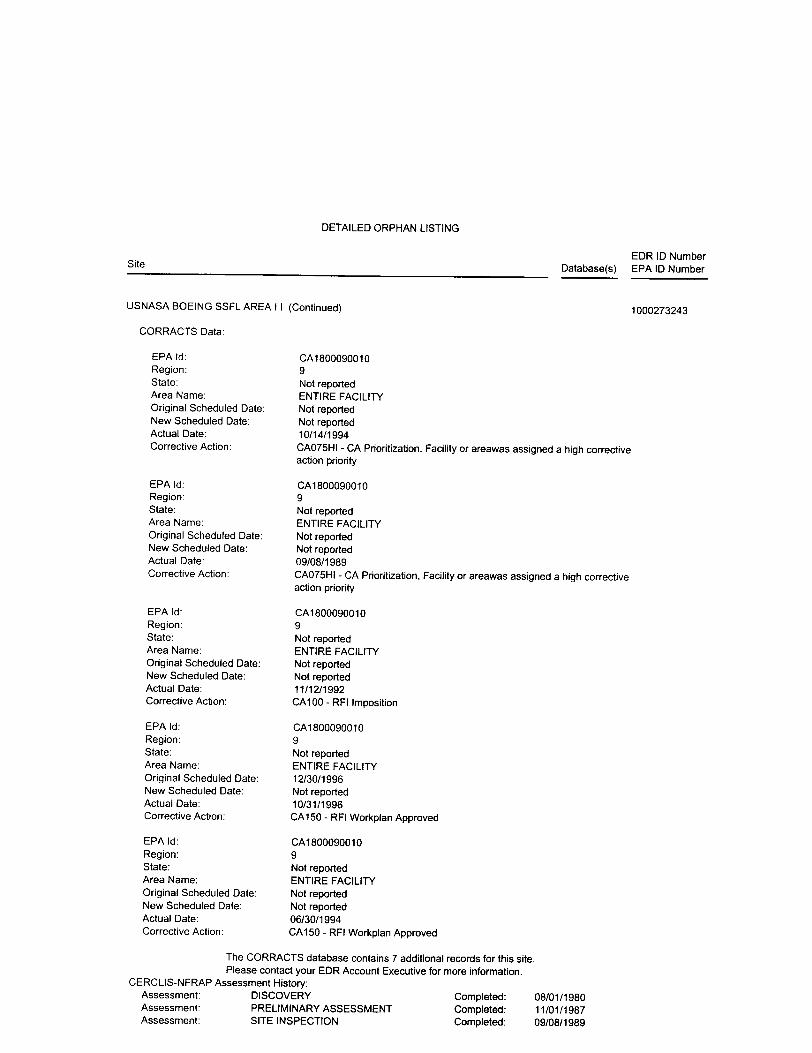
Two of the site addresses are identified on the RCRIS Small Quantity Generators List. Aton Laboratory is located at 9345 Melvin Avenue, in the strip mall in the northwest corner of the site and is also on the HAZNET Database. There are no violations reported for the facility. According to the databases, Aton Laboratory has disposed of liquids with chromium VI, metal sludge, alkaline solution with metals, and other inorganic solid waste. Teledyne Systems Company is identified at 9300 and 9310 Corbin Avenue, the current location of Modern Wholesale Electric and The Sports Section. The addresses are also on the FINDS and HAZNET databases. No violations have been reported for the facility. According to the databases, Teledyne disposed of oxygenated, halogenated, and hydrocarbon solvents and other off-specification, aged, or surplus organics. A summary of the facilities located within the ASTM-specified search radius identified by EDR search is summarized below. RCRA TSD and CORRACTS Databases The RCRA CORRACTS database is a listing of handlers with RCRA corrective action activity. The RCRA TSD database includes selected information for facilities that generate, store, treat, or dispose of hazardous waste. EDR identified one RCRA TSD and RCRA CORRACTS facility within a one-mile radius of the site. The facility, Cirtec Division of Interlink Corporation, is located about a mile southwest of the site area. The facility has been assigned a low corrective action priority. RCRA Generators Database Two of the adjacent properties are on the RCRA Generators list. The Northrop Grumman facility (identified as Litton Guidance and Control) is located south of the site area, across Prairie Street and is a large quantity generator. The facility is also on the HAZNET and FINDS databases. No
5
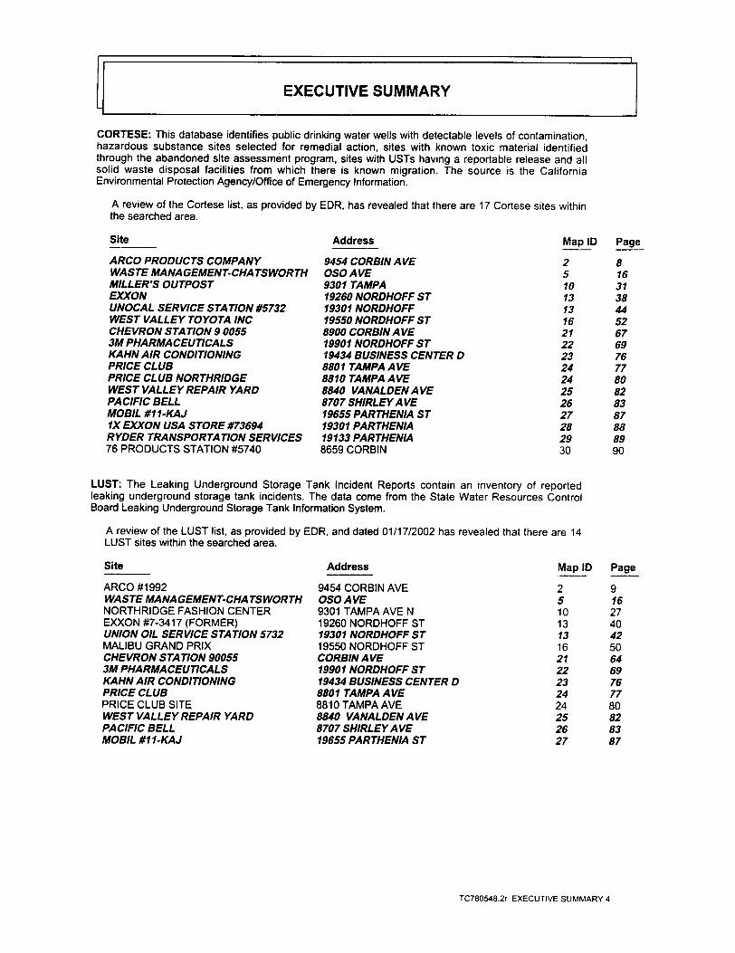
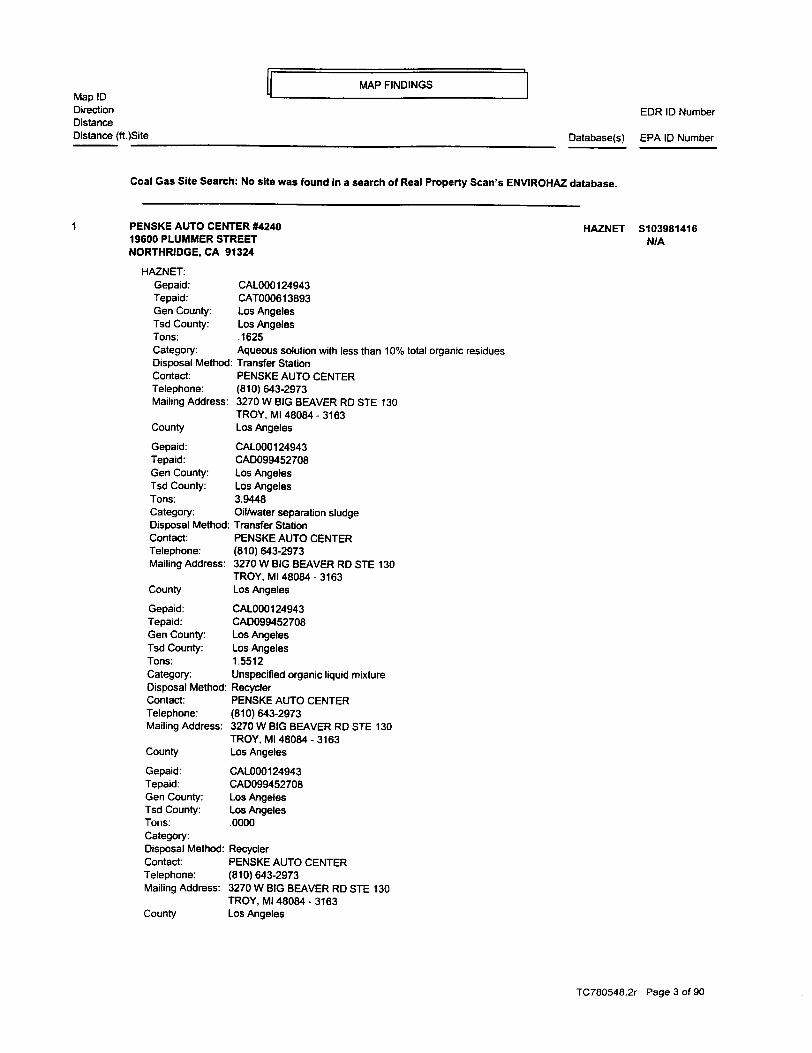
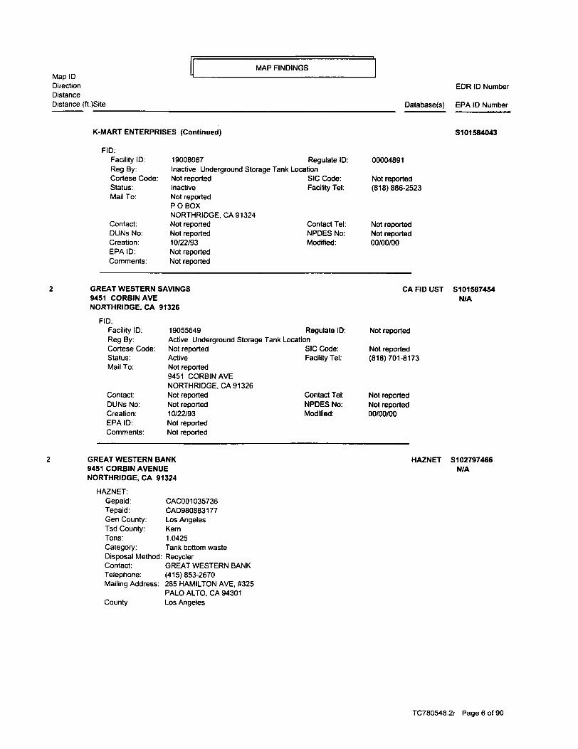
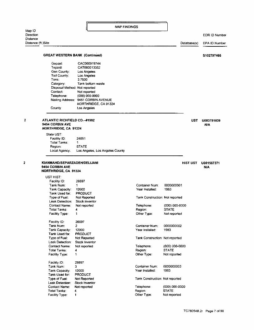
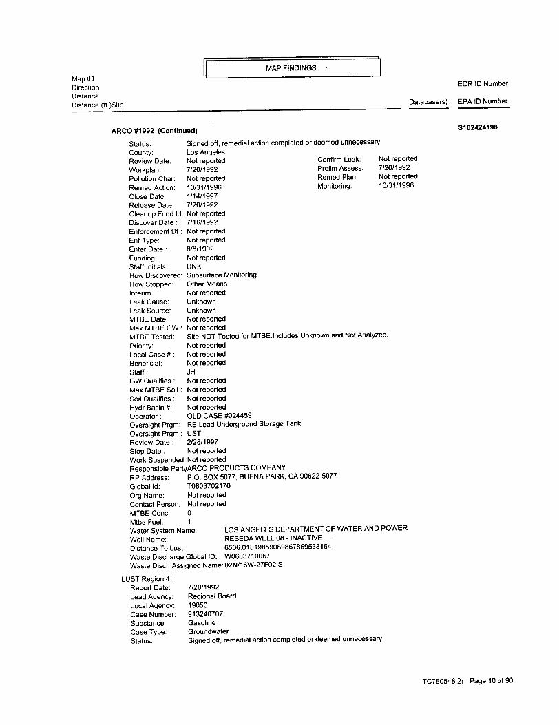
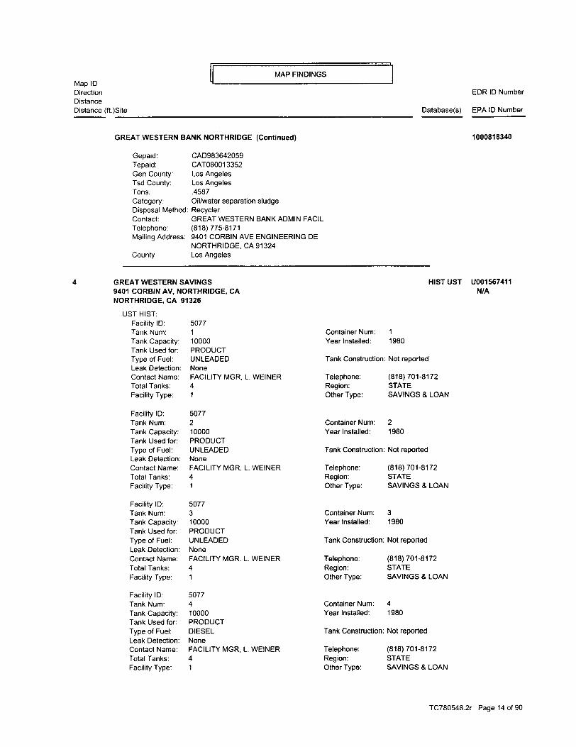
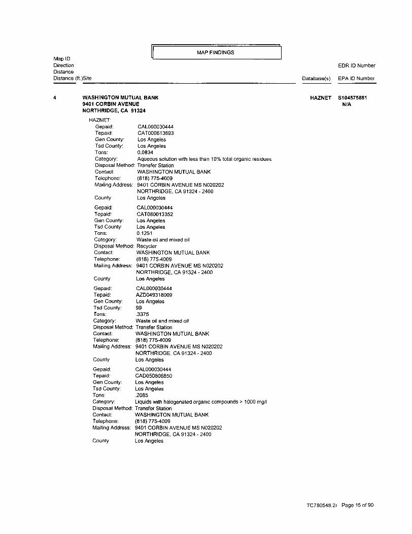
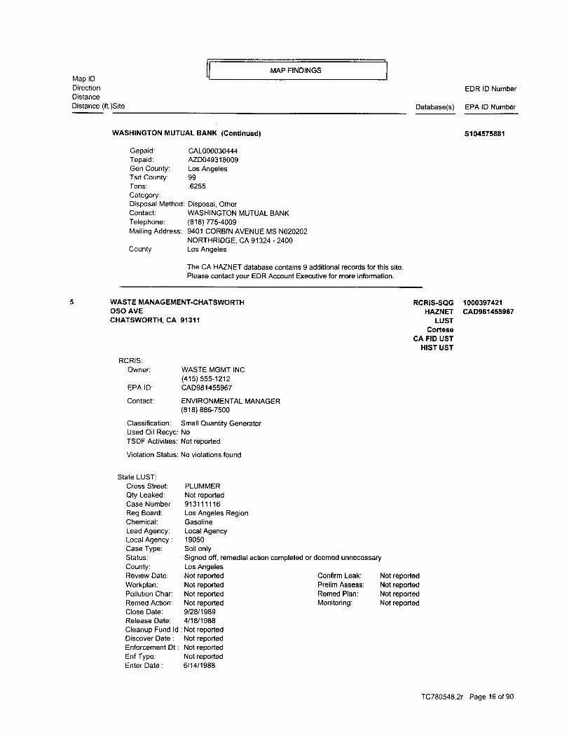
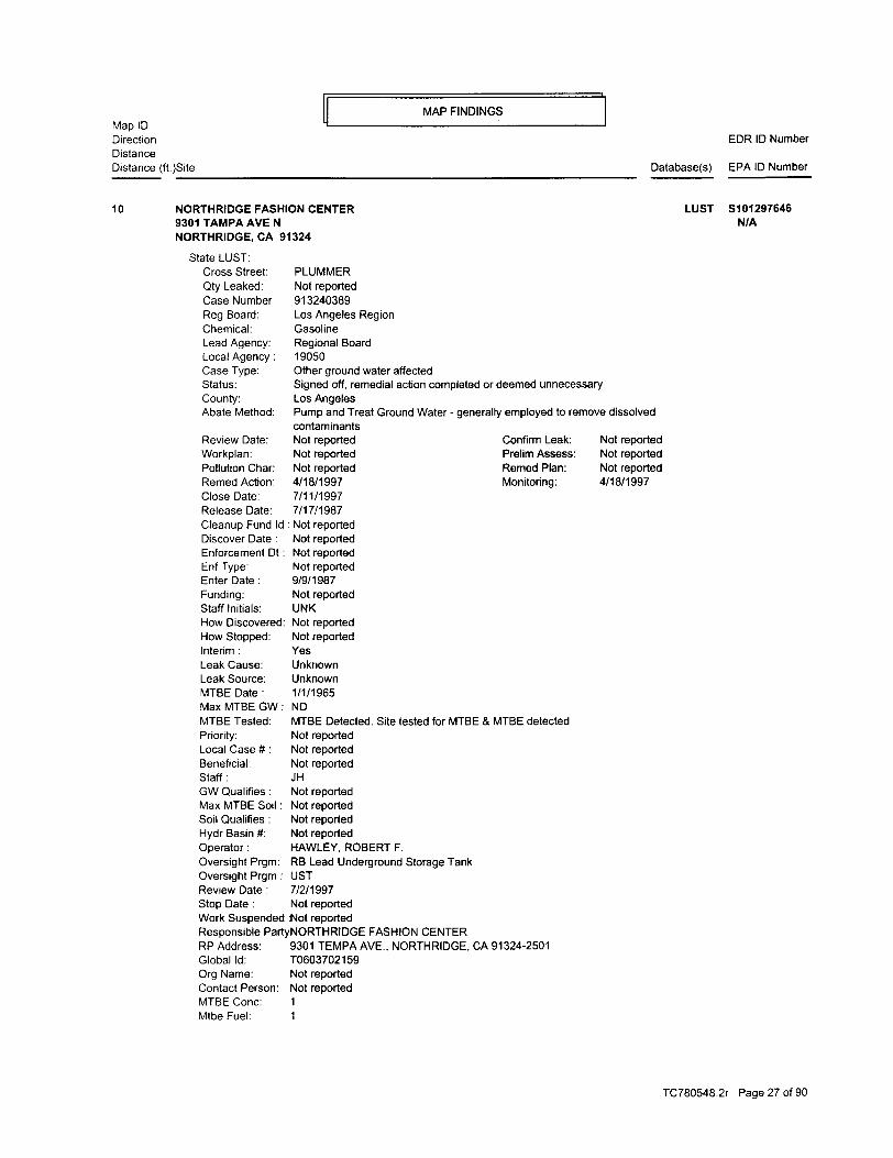
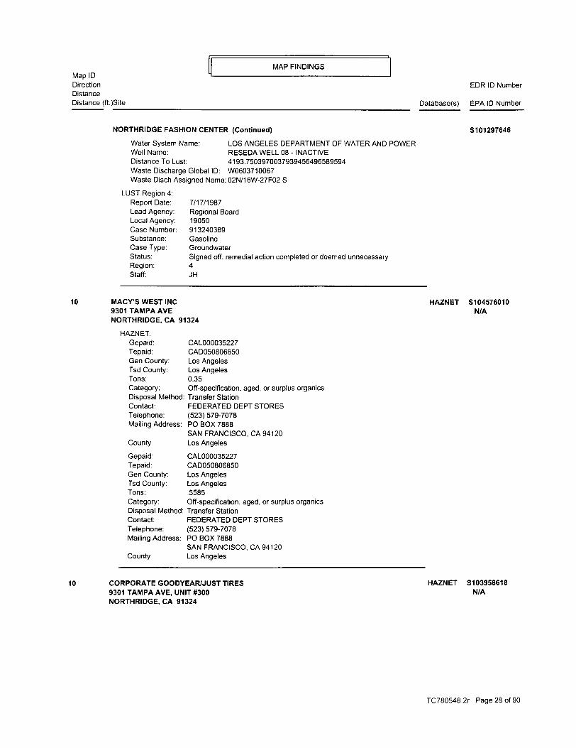
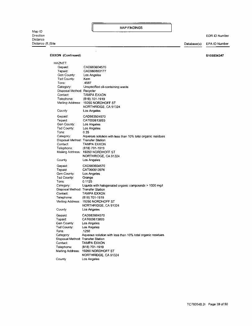
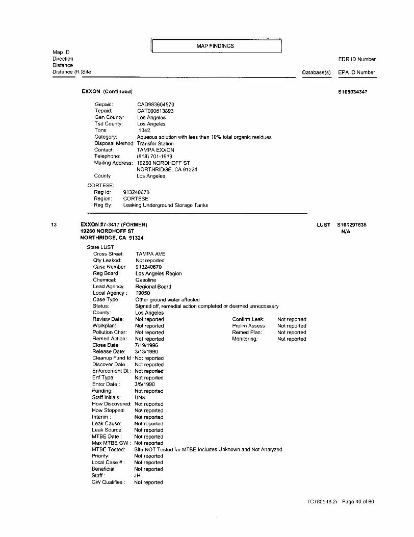
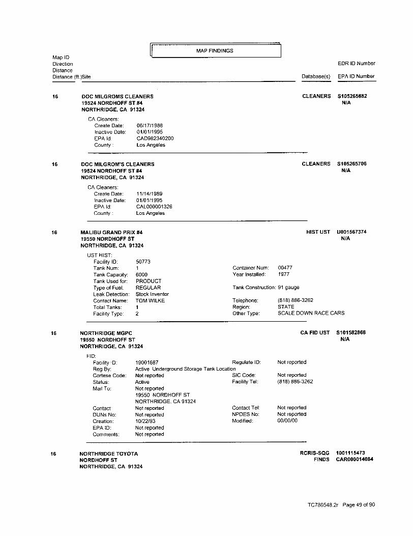
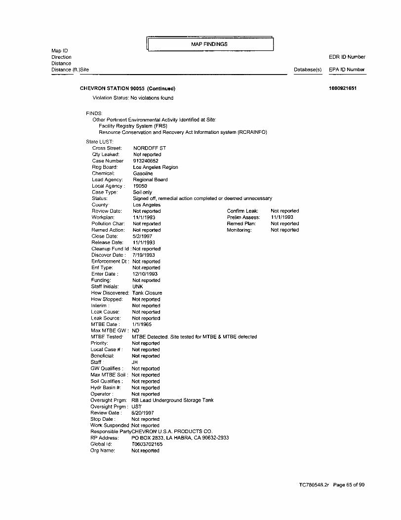
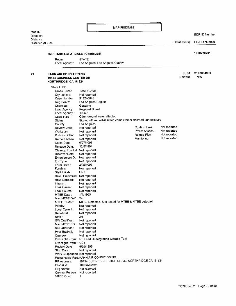
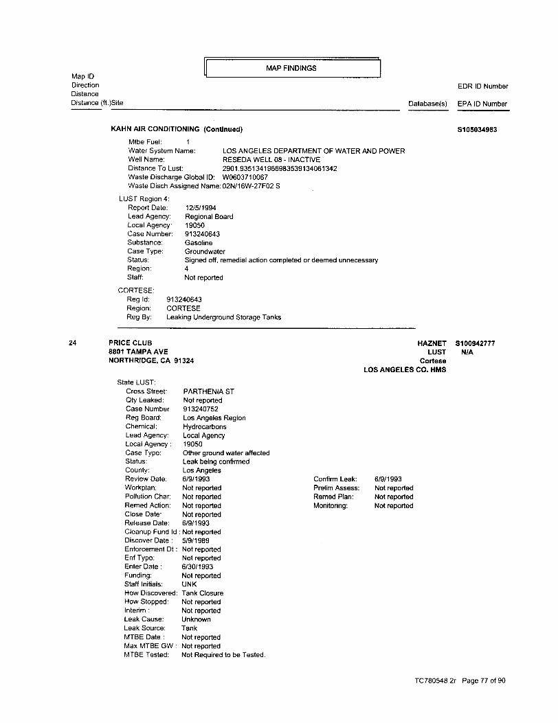
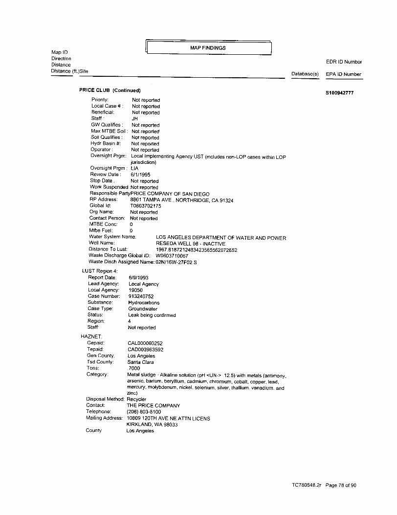
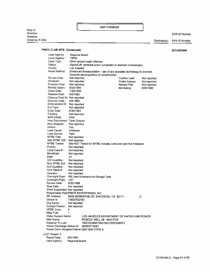
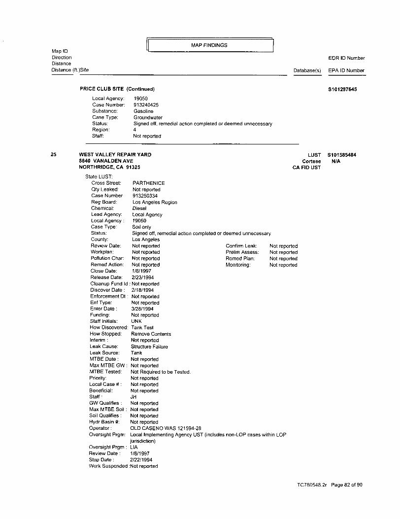
violations have been reported for the facility. According to the databases, Northrop Grumman has disposed of oxygenated, halogenated, and hydrocarbon solvents and other off-specification, aged, or surplus organics. Great Western Bank (also identified as Washington Mutual) is located west of the site area, across Corbin Avenue and is identified as a small quantity generator. They are also on the HAZNET, FINDS, and HIST UST databases. The HIST UST database identifies properties where one or more USTs have been removed. No violations are reported for the facility. According to the databases, the facility disposed of liquids with halogenated organic compounds, laboratory waste chemicals, waste oil, and tank bottom waste. Four USTs were previously operated at the facility. Three of the USTs contained gasoline and one contained diesel fuel. The USTs were installed in 1980. The year the USTs were removed is not reported. The facility address is not on the LUST list, indicating that there is not a reported leak associated with the former USTs. Historical UST (HIST UST) K-Mart (also identified as Penske Auto center), located north of the site area, is on the HIST UST and HAZNET databases. According to the databases, Penske Auto Center disposed of oil/water sludge, aqueous solutions with organic residue, solvent waste, and other organic compounds. The facility also operated a 500-gallon UST that contained waste oil. The UST was installed in 1968 and it is not reported when the UST was removed. California Leaking Underground Storage Tank (LUST) Report and Cortese List The California State Water Resources Control Board, in cooperation with the Office of Emergency Services, compiles lists of all leaks of hazardous substances from underground storage tanks in the State of California. The nine regional boards maintain information on all reported leak cases within their jurisdiction, both for those where the regional board and where other local agencies take the lead in overseeing investigations and remedial actions. The California Environmental Protection Agency's Department of Hazardous Materials Data Management collects the nine regional lists and publishes them as one database named LUST. EDR identified 14 LUST facilities. Twelve of these facilities are also on the Cortese list. No further action is required at eleven of the LUST facilities. The three active LUST facilities are located more than a half-mile from the site area. Cal-Sites Database One facility within one-mile of the site is identified on the Cal-Sites database. The facility, Commercial Recovery is located about three-quarters of a mile southwest of the site area. No further action is required at the facility. Based on the reported locations and status of the identified facilities, they are unlikely to impact soil or groundwater below the site area at this time.
6
3.2 Physical Setting According to the current USGS 7.5-Minute Series, Canoga Park, California Topographic Quadrangle (1952, photorevised 1967), the property is located at an elevation of approximately 855 feet above mean sea level. Topography in the area slopes toward the south-southeast. Depth to groundwater below the site area is unknown but is expected to follow topography and flow toward the south-southeast.
3.3 Historical Use A history of the property from 1929 to the present was constructed and is based on a review of the USGS topographic map and a review of aerial photos. Aerial photographs were reviewed at the California State University, Northridge map library. Photographs were available for the years 1928, 1938, 1949, 1952, 1960, 1975, and 1989. The following table summarizes the findings of the aerial photograph review:
YEAR SITE USE SOURCE
1989 Site area developed in current configuration Aerial Photo
1975 Site developed with most of the current site buildings Aerial Photo
1967 Site is undeveloped and used for agriculture USGS Map
1960 Site is undeveloped and used for agriculture Aerial Photo
1952 Site is undeveloped and used for agriculture Aerial Photo, USGS Map
1949 Site is undeveloped and used for agriculture Aerial Photo
1938 Site is undeveloped and used for agriculture Aerial Photo
1928 Site is undeveloped and used for agriculture Aerial Photo
4.0 RESULTS OF ASSESSMENT On May 28, 2002, Ms. Kristen Williamson performed a site reconnaissance to locate areas of potential environmental concern on the property and in surrounding areas. The site reconnaissance did not include the interiors of the buildings. The buildings were observed from the outside, primarily from the street or public right-of-way. Select features and locations were photographed during the reconnaissance and are included in Appendix “C”.. 4.1 Hazardous Substances in Connection With Identified Uses Because the interiors of the site buildings were not viewed, hazardous substances were not observed during the site reconnaissance. However, chemical compounds, including hazardous substances are known to currently be used or have been used in the past at nine of the site addresses.
7
LAFD records were requested for the sixteen site addresses. They have records or partial records for nine of the site addresses. A portion of the files for four of those addresses were destroyed because the occupant and user of hazardous materials no longer occupies the address. However, the inventory of compounds used was still available. The site address, current occupant, former occupant, and compounds used are summarized on Table 2. Compounds include motor oil, freon, propane, kerosene, paint thinner, lacquer thinner, resins, solvents, ink, chlorine compounds used in pool maintenance, compounds containing potassium hydroxide, sodium hydroxide, potassium carbonate, sulfuric acid, hexane, photo development chemicals, and isopropyl alcohol. 4.2 Hazardous Substance and Unidentified Containers Unidentified containers were not observed during the site reconnaissance. 4.3 Storage Tanks According to the LAFD’s records, USTs have never been registered at the sixteen site addresses. 4.4 Indications of PCBs Indications of PCBs were not observed during the site reconnaissance. Several pole-mounted transformers are located along Prairie Street and Melvin Avenue but are not located on the site properties. 4.5 Indications of Solid Waste Indications of unauthorized dumping or solid waste disposal were not observed during the site reconnaissance. 4.6 Results of Suspect ACM Observations An asbestos survey was not part of the scope of services for this assessment. 4.7 Lead-Based Paint Sampling for lead-based paint was not part of this assessment. 4.8 Radon Testing for radon was not included in the scope of this site assessment. 4.9 Other Conditions of Concern Other conditions of concern were not identified.
8
5.0 SUMMARY AND CONCLUSIONS
The following summary is based on a historical review, a search of federal, state, and local records, and a visual assessment of the site: A site and area reconnaissance was conducted on May 28, 2002. The property consists of fourteen parcels developed with several buildings occupied by commercial and light industrial businesses. The interiors of the buildings were not observed during the site reconnaissance. Table 1 summarizes the addresses of the site buildings and the current occupants. According to the City of Los Angeles Fire Department records, chemical compounds, including hazardous materials are or were used at least nine of the site addresses. The chemical compounds include motor oil, freon, propane, kerosene, paint thinner, lacquer thinner, resins, solvents, ink, and chlorine compounds used in pool maintenance, compounds containing potassium hydroxide, sodium hydroxide, potassium carbonate, sulfuric acid, hexane, photo development chemicals, and isopropyl alcohol. Tables 1 and 2 summarize the hazardous materials in either current or former use at the nine addresses. Commercial property is west of the site area, across Corbin Avenue, north of the site, and east of the site, across Shirley Avenue. Light Industrial property is south of the site, across Prairie Street. The site and surrounding area were developed in the late 1960s and early 1970s. Prior to development, the site was used for agriculture. Environmental Data Resources, Inc. (EDR) was retained to perform an environmental database search for locations identified as hazardous substance and/or hazardous waste facilities near the subject property. Two of the site addresses are identified as RCRIS Small Quantity Generators. Aton Laboratory is located at 9345 Melvin Avenue, in the strip mall in the northwest corner of the site and is also on the HAZNET Database. There are no violations reported for the facility. According to the databases, Aton Laboratory has disposed of liquids with chromium VI, metal sludge, alkaline solution with metals, and other inorganic solid waste. Teledyne Systems is identified at 9300 and 9310 Corbin Avenue, the current location of Modern Wholesale Electric and The Sports Section. The addresses are also on the FINDS and HAZNET databases. No violations have been reported for the facility. According to the databases, Teledyne disposed of oxygenated, halogenated, and hydrocarbon solvents and other off-specification, aged, or surplus organics. A review of information available at the Los Angeles City Fire Department (LAFD) indicates that underground storage tanks have not been registered at the site addresses. EDR identified several facilities located within the search distances specified in the American Society for Testing and Materials (ASTM); Standard Practice for Environmental Site Assessments: Phase I Site Assessment Process: ASTM Designation E1527-94. Based on the reported
9
information, the off-site facilities identified by EDR do not constitute a “recognized environmental condition” as defined by ASTM. Several light industrial operations occur at the site and many hazardous compounds are either currently used or have been used at the site. This assessment did not identify evidence of a reported spill or release of the hazardous compounds used at the site. AES recommends that if the site use changes from light industrial or if the buildings are demolished, that a site assessment that includes soil sampling be conducted.
6.0 REFERENCES
Thomas Bros. Maps, 1998, Los Angeles Street Guide & Directory: Thomas Bros. Maps, Irvine, CA. U.S. Geological Survey (USGS), 1952 and 1967, Canoga Park Quadrangle, California, 7.5-minute series (topographic): USGS, scale 1:24,000, 1 sheet. EDR Environmental Solutions, Inc., Report for the Site Area, May 31, 2002. California State University Map Library, Aerial Photographs for 1929, 1938, 1949, 1952, 1960, 1975, and 1989 Files available from the Los Angeles City Fire Department, Los Angeles, California
APPENDICES