part 2 strategy the regional - western australian …€¦ · · 2018-04-06the regional strategy...
TRANSCRIPT

PA R T 2 . T H E R E G I O N A L S T R AT E G Y
2Part 2
STRATEGYThe Regional
The Region will be based upon a
diverse and vibrant economy,
offering an attractive lifestyle with
a full range of services and
recreational opportunities, while
embracing environmental principles
“
”
Vision Statement for the Goldfields-Esperance Region
GOLDFIELDS – ESPERANCE REGIONAL
PLANNING STRATEGY
An overall vision statement and broad principles provide the
foundation for the Strategy. A policy framework will include
appropriate objectives, strategies and recommendations for the
natural environment and the coast, urban settlement and expansion,
heritage management, resource and industrial development and
community and regional infrastructure requirements.
A regional land use plan will set out the predominant use of land,
embracing multiple use concepts which will allow local decision-
makers a degree of flexibility in implementation.
Structure plans have been prepared for the City of Kalgoorlie-
Boulder and the Town of Esperance as a component of the
regional strategy. The land uses displayed in the structure plans
will be complementary to the overall regional strategy and current
approved local initiatives such as the town planning schemes, and
will have a 30-year time frame.
STUDY VISION AND PLANNING PRINCIPLESA clear vision statement, principles guiding the Strategy and
overall objective statements provide the foundations for the
Strategy and should be established as early as possible. The study
vision, principles and objectives are based on previously
completed strategies by the Ministry for Planning and the
Goldfields-Esperance Development Commission.
Planning provides a way to manage the impacts of growth by
seeking a balance between the individual ingredients of our
quality of life – the environment around us, the community we
live in and the wealth we enjoy. The achievement of such a balance
is a sound basis for the region’s sustainable development.
The principles set out below should guide future decision-making
through the strategies and actions for each principle. While each
principle is unlikely to be met equally in each instance, the best
outcome for the region’s future requires that proposals and plans
fully address each principle.
Community principle: To respond to social changes and
facilitate the creation of vibrant, accessible, safe and self-reliant
communities.
To achieve this principle, the Strategy process is designed to: monitor
the amount and rate of population growth; respond to the changing
needs of the population; improve the linkage between land use
planning and the provision of human services; provide a range of
housing opportunities; build a sense of community through the
design of accessible settlements and public facilities; and incorporate
opportunities for consultation, and include the views of local
communities and groups with specific needs in local plans.
Infrastructure principle: To facilitate strategic development by
ensuring that land use, transport and public utilities are
mutually supportive.
To achieve this principle, the Strategy process is designed to:
integrate land use and transport planning; provide efficient
freight transport routes and hubs; ensure the efficient, progressive
development and servicing of land; promote the development
and optimal use of strategic infrastructure; support the
development of major nodal urban settlements; ensure that the
provision of public utilities is based on economic and social
considerations; and promote public facilities as a means of
assisting the creation of regional wealth and providing cultural
benefits.
Environmental principle: To protect and enhance the key
natural and cultural assets of the region, and deliver to all
residents a high quality of life which is based on environmentally
sustainable principles.
The pursuit of the environmental strategies will contribute to a more
sustainable future. The strategy process is designed to: encourage the
use of energy sources which have minimal impact on the
environment; prevent further loss in biodiversity; ensure that air,
water and soil quality are protected and where necessary improved;
reduce consumption of materials and promote recycling; promote
management and protection of resources; protect landscape, open
space and public access; enhance the quality of life for all residents;
and protect the region’s cultural heritage.
Economic principle: To actively assist in the creation of regional
wealth, support the development of new industries and
encourage economic activity in accordance with sustainable
development principles.
To achieve this principle, the Strategy process is designed to:
provide flexibility in the planning system to meet the needs of
small business; minimise delays in government approval
processes; provide for the likely growth of downstream processing
industries and value adding industries; make allowance for the
needs of new industries and technologies; and support the further
development of the State’s centres of business, culture and
administration.
Regional development principle: To assist the development of
the region by taking account of the region’s special assets and
accommodating its individual requirements.
To achieve this principle, the Strategy aims to provide an
environment which encourages business to locate within the
region through the application of economic, social,
environmental and infrastructure objectives.
4.1
4.0
90
P A R T 2 – T H E R E G I O N A L S T R A T E G Y

STRATEGIC POLICY FRAMEWORK (STRATEGY,
ISSUES, OBJECTIVES AND RECOMMENDATIONS)
SETTLEMENTS AND COMMUNITY SERVICESThe growth and development of regions and major regional
centres is dependent on the availability of land and infrastructure
to facilitate and channel growth. All settlements in regional areas
should have access to essential services. Availability of services can
heighten the attraction of settlements, and improvements in the
level of services should be a fundamental objective.
Servicing the region is more efficient if higher order services are
focused in major regional or sub-regional centres. Lower order
settlements can be sustained through the provision of appropriate
and adequate services thereby encouraging continued settlement
within the region. Kalgoorlie-Boulder is the regional centre in the
settlement hierarchy, where higher level facilities supporting the
region will be concentrated. The focus of higher level facilities on
Kalgoorlie-Boulder does not preclude their location in other towns,
particularly the designated sub-regional centres within the region, or
another town in a particular case. The provision of adequate and
appropriate services in all the towns is supported.
Native title claims over the region have complicated development
of land resources in townsites. Strategies have been put in place by
the relevant government agencies to ensure that suitable land not
affected by native title claims is identified for development. In
townsites, where deep sewerage is available, residential
development at higher densities will be promoted by State and
local government. To provide a wider choice in housing, the
concepts of environmental design and energy-efficient housing
will be promoted.
In spite of its statistically large workforce, the region suffers from
a lack of resources to provide sufficient services in smaller centres
because many of the workers live outside the region. By
encouraging mineral exploration and mining companies to base
and house workers and their families in towns in the regional
centres such as Kalgoorlie-Boulder and Esperance, as opposed to
Perth, a more stable population could be achieved.
The remoteness of many towns in the region makes it difficult to
attract and retain staff to provide community services. Strategies
to enhance opportunities and upgrade facilities should be put in
place by State and local government.
Townscape improvement programs will be used to enhance the
unique identity of major towns.
Aboriginal communities in the region are faced with serious
issues of infrastructure provision, land use planning and
protection of heritage. Agreements are currently in place with the
three tiers of government to ensure appropriate local government
standards are met in the provision of power, water, housing and
municipal services. Priorities for the provision of services are
based on the Environmental Health Needs Survey (ATSIC, AAD,
Health Department of WA, Health and Family Services,
Homeswest, WAMA, 1998).
Improved coordination of planning and the provision of services
to Aboriginal communities is needed. Community layout plans
assist in this approach. The plans’ effectiveness needs to be
strengthened by a formal planning approach. A whole-of-
government approach to planning and service delivery to
Aboriginal communities is recommended.
5.1
5.0
91
P A R T 2 – T H E R E G I O N A L S T R A T E G Y
2

92
P A R T 2 – T H E R E G I O N A L S T R A T E G Y
Recommendations• Undertake consultation to determine the nature and extent of mineralisation to enable forward planning of
land releases in major towns and for major projects and infrastructure. (DOLA/DME/CME, LG)
• Continue to update the land supply register for Kalgoorlie-Boulder, Esperance and other towns as required.(LG, MfP, DOLA)
• Prepare Community Layout Plans for major Aboriginal communities in the region. (AAD, ATSIC, LG, MfP)
• Determine a whole-of-government approach to planning for Aboriginal communities including:• Responsibility for capital expenditure; maintenance; and coordination of program delivery of
infrastructure such as water, power, roads, local government services, airstrips, health services, housingand community facilities.
• Identification of a formal process for the preparation, consideration and implementation of CommunityLayout Plans.
(AAD, ATSIC, WAPC, LG, GEDC)
Objective• To transform towns and settlement in the region into self-sufficient and environmentally sustainable communities.
Principal Issues• Land release is made more complex because of the implications of the Native Title Act and the Mining Act.
• A proportion of the workforce is based outside the region, and works within the region on a fly-in/fly-out basis.
• There is a need to improve the standard of community infrastructure.
• The availability of adequate infrastructure (particularly water supply, sewerage, power and sealing of roads) and the
lack of infrastructure management throughout Aboriginal communities in the region needs to be addressed.
• There is a need for a whole-of-government approach to planning and service delivery to Aboriginal communities.
• Conservation of the character and improvement of townscape in the settlements is needed.
Guidelines• Review town planning schemes for each local government, to identify areas for future development, recognising
constraints on the land surrounding the townsite. (LG, MfP)
• Promote infill development and a range of lot sizes in each town to accommodate a variety of housing density and
types. (MfP/LG)
• Monitor land supply to provide cost-effective lots for residential, commercial and industrial development. (LG/DOLA,
MfP, WC)
• Support the implementation of the townscape improvement programs in towns where this has not been completed
such as Menzies and Kambalda. (LG, MfP)
• Promote the concepts of environmental design and energy-efficient housing in the development of urban areas.
(LG, GEDC, MfP)
• Involve local Aboriginal communities when planning for future land uses where appropriate, recognise their specific
needs in respect to statutory processes and allow for extended consultation time. (LG/MfP, AAD)
• Identify shortfalls in the provision of urban services and infrastructure in the urban settlements of the region and
promote the coordination of integrated programs for service provision. (GEDC/Mf/LG)

93
P A R T 2 – T H E R E G I O N A L S T R A T E G Y
2HERITAGE AND CULTURE STRATEGY
Conservation of the State’s heritage contributes to a sense of
community and quality of the environment. The region contains
numerous places of heritage significance associated with the
natural and built environment. Heritage places are a valuable
contribution to the scientific and educational understanding of our
past. They stimulate the cultural development of society, provide
diversity and interest in the region and are an essential component
of tourism.
The AAD has a legislative responsibility for the administration of
the Aboriginal Heritage Act. The region has not been subject to a
full Aboriginal heritage study and many more sites are yet to be
documented.
With respect to European heritage, the Heritage Council of Western
Australia has procedures for the protection of places of heritage and
cultural significance. The National Trust of Australia (WA)
contributes to the identification and protection of heritage places.
Urban heritage values, as outlined in Municipal Heritage
Inventories, are to be protected through local government town
planning schemes and government policies. The future planning of
the region should recognise these processes.
5.2
Recommendations• As part of major planning, management and development proposals, incorporate Aboriginal heritage,
including site protection and management, native title issues relating to heritage and monitoring ofapprovals or agreements relating to the Aboriginal Heritage Act. (AAD, LG, MfP)
• Promote the preparation of heritage inventories in town planning schemes to maximise the protection ofheritage places. (LG, MfP)
• Actively promote and facilitate the conservation of the regionally significant cultural heritage of the regionincluding the Burt and Hannan Street precincts and the Gwalia townsite. (HCWA, LG)
Objective• Identify, protect and manage all heritage areas.
Principal Issues• The need for comprehensive protection and enhancement of the region’s cultural and heritage values.
• Protection of the heritage of the region through the preparation of Municipal Heritage Inventories.
• Protection of the architecture typical of the region.
• Pressure for redevelopment of sites containing historic buildings in Kalgoorlie-Boulder and the potential for economic
re-use of historic buildings.
• Funding for the restoration of historic buildings.
• Responsibility for protection of Aboriginal heritage areas.
Guidelines• Protect urban heritage values, areas of regional landscape and areas of cultural and heritage significance – including
those places outlined in the Municipal Heritage Inventories – in accordance with the relative legislation, by
incorporation of appropriate provisions in town planning schemes and adoption of appropriate government policies.
(LG/HCWA, AAD, MfP)
• Identify and seek funding sources for the restoration of historic buildings throughout the region. (LG, HCWA)
TERRESTRIAL ENVIRONMENT PROTECTION AND
CONSERVATION STRATEGY
The environment of the region is diverse ranging from the desert
areas in the north-east, and the central Goldfields to the
Esperance sandplain and coastal areas along the south coast.
Integrated planning and management of the region should
contribute to the retention of land in an ecologically sustainable
state. It will be necessary to pursue best use options in terms of
land capability and suitability, conservation of soil and land
quality, rehabilitation of degraded areas, protection of natural and
remnant vegetation and the threat of the spread of dieback and
loss of biodiversity in coastal areas.
Freehold land which contains isolated pockets of remnant
vegetation can remain in private ownership but be part of the
integrated conservation system. Fundamental to an integrated
system is the protection of valuable representative examples of
natural systems, provision of ecological wildlife corridors and
reduction of land degradation. The need to protect remnant
vegetation generally applies to the southern part of the region
where extensive areas have been cleared for farming. This is
particularly important in the farming area near Esperance, where
the land is predominantly freehold and contains significant areas
of remnant vegetation, and where there is considerable demand
for subdivision and development for rural-residential purposes.
Clearing controls to assist in the preservation of wildlife habitat,
as well as controlling salinity, waterlogging and revegetation,
should be encouraged.
In the Esperance sub-region, increased run-off and rising water
tables resulting from agricultural clearing have a direct impact on
the water quality of the Esperance lakes. Salinity and waterlogging
are removing land from agricultural production and affecting the
coastal environment. Eutrophication6 and siltation are also
threatening the integrity of the lakes’ ecosystems.
The Esperance Lakes Nature Reserve Management Plan: 1999-2009
(CALM, 1999) provides recommendations for the management
of the lakes system. Part of the Lake Warden system of wetlands is
recognised as having international importance under the Ramsar
Convention.
The quality, salinity and reliability of groundwater varies
significantly throughout the Esperance area. There is evidence
that the saline water table is rising both on the coast and further
inland. The groundwater resource should be protected through
integrated management of the groundwater reserves west of
Esperance and surface water catchments to the north. Local
government planning controls over development, including
controls on the use of septic tanks and excessive fertilisers, should
also minimise the impact on groundwater.
A catchment planning strategy has been prepared for the
Esperance region by the Esperance Land Conservation District
Committee which aims to facilitate the most effective use of water
resources, minimise land and water degradation due to
imbalances in the hydrologic cycle, and implement sustainable
farming systems. This strategy will have a positive effect on a
number of environmental issues in the region and will be
promoted. The Lake Warden Catchment Recovery Plan is
currently being prepared under the coordination of CALM.
Saline and hypersaline groundwater is used extensively in the
Goldfields for mineral processing. Dewatering from pit and
underground operations occurs frequently and where the quality
of the water is inadequate for use as process water, or where there
is an excessive volume, the water is often discharged into salt lakes.
Sites which discharge mine dewater into salt lakes are licensed by
the DEP. As part of this licence the company is required to
demonstrate that the discharge is having no detrimental impact
on the lake through the provision of an annual report.
Groundwater abstraction is licensed and controlled by the Water
and Rivers Commission. Abstraction in the northern part of the
region exceeds recharge, and the groundwater from the
palaeochannels is being mined. The distribution of groundwater
resources is relatively even, with marginally higher resources
surrounding Leinster. Although sections of the palaeochannels
and tributaries are completely utilised by current borefields, there
is still scope for considerable development throughout the region.
Protection of water reserves, catchment areas and Aboriginal
water supplies will occur through the integration of proclaimed
water reserves, catchment areas and priority protection areas into
regional planning schemes and/or town planning schemes to
protect town and community water supplies for the future.
There is a need to manage the rangelands so as to preserve
biodiversity and ecological sustainability, protect water quality
and quantity and provide for rehabilitation of degraded areas.
This will occur through the implementation of sound
environmental objectives and will require various people, groups
and organisations to work together to achieve this goal.
The pastoral areas of the north-eastern goldfields are the subject of
the Rangeways Project currently being prepared. The project
commenced early in 1996 and is funded by the Land and Water
Research and Development Corporation and the Commonwealth
Department of Transport and Regional Services.
5.3
94
P A R T 2 – T H E R E G I O N A L S T R A T E G Y
6 Eutrophication – process whereby a richness in nutrients results in excessive plant growth, which kills animal life by deprivation of oxygen.

The project aims to address issues such as:
• The need to get government departments to work together to
achieve better management of the rangelands.
• Mining companies to work with local communities to achieve
community goals.
• Encouraging sustainable activities in the region.
• Important natural features should be protected.
• Water quality and quantity.
• Retention of native flora and fauna.
• Rehabilitation of minesites.
95
P A R T 2 – T H E R E G I O N A L S T R A T E G Y
2
Objectives• To facilitate appropriate funding to enable effective management and ensure that adequate and representative reserves
exist to conserve and protect the biophysical characteristics, and where appropriate provide for multiple use of natural
resources.
• To protect and provide for holistic and integrated management of the region’s conservation, ecological, recreation and
landscape values.
• To contribute to the protection of water catchment areas and the ecosystem of wetlands from increased run-off and
rising water tables, eutrophication and siltation.
• To secure and protect for urban use adequate water reserves of a quality suitable for potable supply.
• To protect remnant bushland, especially river corridors on unallocated Crown land.
Principal Issues• Land management techniques.
• The effects of agricultural clearing, including increased run-off, rising water tables and salinity, and impact on lakes’
water quality.
• Loss of biological diversity, particularly in the cleared agricultural, arid and semi-arid regions and the southern coastal
heaths.
• Prevention and management to reduce risk of the spread of dieback along the coastal areas of the region.
• Involvement of Aboriginal communities in environmental management initiatives.
• Protection and management of remnant bushland especially along river corridors.
• Connectivity and consolidation of CALM managed reserves.
• Protection of the outstanding surface and sub-surface karst features of the Nullarbor.
• Rangelands management, including protection of important natural features such as native flora and fauna, lack of
water quality and quantity, the need to rehabilitate mine sites.
• Provision of adequate and appropriate landfill sites.
Guidelines• Continue to manage and expand the conservation estate as outlined in the Goldfields Region: Regional Management
Plan and the South Coast Region: Regional Management Plan. (CALM)
• Support the catchment planning strategy developed for the Esperance Region by the Esperance Land Conservation
District Committee, including the Lake Warden Catchment Recovery Plan. (LG, MfP, AgWA, CALM)
• Continue remediation of rangeland degradation through the Land Conservation District Committees. (AgWA,
farmers/pastoralists)
• Support Agriculture WA in its rangeland monitoring and station management planning with land managers and
pastoralists, and the work of the Land Conservation District Committees and their catchment groups to address land
degradation in pastoral areas. (AgWA, CALM)
• Continue to utilise land management practices such as the Salinity Action Plan to prevent any further land degradation
and salinity, as well as rehabilitate existing degradation in conjunction with the State and local government.
(Farming/Pastoral community, AgWA, CALM)
• Introduce appropriate planning controls in the Shire of Ravensthorpe and Shire of Esperance Town Planning Schemes
to provide compatible land uses for the protection of the priority source areas and the Esperance Lakes. (MfP/LG)

96
P A R T 2 – T H E R E G I O N A L S T R A T E G Y
Recommendations• Prepare an Integrated Conservation Plan based on:
• Protecting, consolidating, enhancing and expanding reserves in the conservation estate to achievebiological representation of natural systems, associated wildlife and genetic diversity.
• Inclusion (where possible) of freehold and leasehold enclaves (where private or leasehold land issurrounded by or adjacent to conservation reserves) in the conservation estate by purchase, exchange orjoint management arrangements.
• Linking existing and proposed regional reserves through other public land and private land to provideecological linkages and public access.
• Protection of regionally important landscapes and important environmental systems in freehold land byappropriate zoning or policy controls.
• Management of coastal areas from Cape Arid to Ravensthorpe and further west against the threat of theloss of biodiversity that could be caused by the further spread of dieback in coastal areas.
• Preparation of an inventory of important remnant native vegetation in the Esperance sub-region,especially along river corridors, and nomination of mechanisms whereby these remnants can be protectedthrough clearing controls on subdivision, acquisition for reserves or voluntary agreements withlandowners.
• Provision of recreation and tourist areas which are compatible with conservation and landscapeprotection.
• Recognition of the nationally and internationally significant Nullarbor karst landscape.• Development of interpretive centres at the Nullarbor Plain, Recherche Archipelago, Goldfields Woodlands
and Salt Lakes.• Promotion of ecotourism opportunities.(CALM, MfP, AgWA, LG, DEP, WATC, GTA, ERTA)
• Prepare landscape management guidelines to identify and preserve the landscape values of the region andrequire new developments such as housing, industry or mining to be in harmony with existing landscapes.(MfP, CALM)
• Prepare a strategy to identify and protect wetlands and salt lakes based on geomorphic and ecologicalsystems and address the management issues relating to the habitat. (WRC, CALM, LG, DEP)
• Prepare a strategy to protect water catchment areas, particularly potable water from the groundwaterreserves around Menzies, Leonora and Laverton. (WRC, WC, CALM, LG, DEP)
• Formulate planning and management measures to reduce fire risk and manage wildfires on unallocated Crownland. (DOLA/CALM, FES)
• Identify and provide an appropriate site/s for landfill of a Class 3 and 4 category for waste management.(DEP, LG, MfP, DME)

COASTAL AND MARINE ENVIRONMENT
PROTECTION AND CONSERVATION STRATEGY
The south coast is significant for its environmental, visual
landscape, heritage and recreational values. There is growing
pressure on and demand for the attractions of the south coast area
particularly by tourists. There is a need to match the level of
development, access and usage of the coast with the retention of
the area’s pristine beauty and natural values.
The Department of Conservation and Land Management is the
managing agency for existing coastal conservation reserves
including the Fitzgerald River, Stokes, Cape Le Grand and Cape
Arid National Parks and island nature reserves in the Recherche
Archipelago, and is required by legislation to prepare and review
the management plans for the parks every 10 years.
The existing coastal management plans do not deal with current
recreation and development pressures, and preparation of new
coastal management plans funded by the Coastal Marine
Planning Programme is being considered. The need for a coastal
management plan to focus on the Esperance area, Hopetoun and
other nodes of development is required as a matter of priority.
The Report of the Marine Parks and Reserves Selection Working
Group (Wilson, 1994) recommends that the waters of the
Recherche Archipelago, excluding the Port of Esperance, be
considered for reservation as a marine reserve for multiple
purposes, including conservation of flora and fauna, and public
recreation. The proposed marine reserve would protect significant
seabed habitats, such as seagrass beds and the diverse wildlife
habitats, including those of colonies of sea lions, fur seals and
seabirds. It also provides a means for stakeholder/community
involvement in the management planning process.
The report also recommends that the coast about 50km east and
west of Twilight Cove be surveyed to assess the value of the area as
a potential marine reserve for the protection of marine flora and
fauna and coastal landforms.
There are proposals for mariculture7 development which could be
an important addition to the region’s economy. On the
detrimental side, there are potential impacts of disease and
pollution if the developments are not adequately monitored.
Aquaculture developments can be visually intrusive and care will
have to be taken in siting any developments to protect the visual
amenity of the extremely attractive Esperance area.
5.4
97
P A R T 2 – T H E R E G I O N A L S T R A T E G Y
2
Objectives• To protect the significant natural values of the south coast and its associated marine environment and require future
development to be undertaken in accord with ecologically sustainable principles.
• To provide for marine uses such as commercial fishing, aquaculture and tourism/recreation based on the principles of
ecologically sustainable development and protection of the area’s environmental values and visual amenity.
Principal Issues• The need for protection and management of significant marine environments, especially the Fitzgerald Biosphere
coastline and the Recherche Archipelago coastline, through reservation as multiple-use marine reserves.
• Inconsistent and conflicting planning and management between different government land management agencies.
• Increasing pressure for tourism and aquaculture developments and potential impact on the visual amenity of the
Esperance coastal scenery.
• Development of ecotourism opportunities.
• Protection of significant terrestrial environments, especially the unprotected coastal areas as well as existing
conservation reserves.
• Lack of a coastal management plan outside of National Parks.
Guidelines• Continue to prepare and review the management plans for national parks and coastal conservation reserves. (CALM)
• Protect significant terrestrial environments, especially the unprotected coastal areas as well as existing conservation
reserves, including the outstanding surface and sub-surface karst features of the Nullarbor. (CALM, MfP)
7 Mariculture is saltwater aquaculture. It is the growth of any seafood in the ocean. Examples include marine finfish, abalone, oysters, seaweed.
98
P A R T 2 – T H E R E G I O N A L S T R A T E G Y
ECONOMIC DEVELOPMENT STRATEGY
The economy of the region is based largely on mining and on the
development of other natural resources for basic raw materials
quarrying, agriculture, timber and wood production, fishing and
aquaculture, industry/downstream processing and tourism.
Resource development underpins the economy of the region and
its continuation and expansion are necessary if the region’s
economic growth is to continue.
5.5.1 Mineral Resources and Basic Raw Materials Strategy
Mineral exploration and development is determined by geological
setting, demand, market prices and changes in technology. It takes
many years to prove up economic deposits, which makes it
difficult to include mineral extraction in forward planning
concepts. Townsites and adjacent areas in the Goldfields-
Esperance Region which have been earmarked for urban
development may contain significant deposits of high value
minerals such as gold or nickel. Examples include Kalgoorlie-
Boulder, Menzies, Leonora, Laverton, Coolgardie, Kambalda,
Norseman and Ravensthorpe. This strategy supports exploration
to obtain a clear definition of areas with resource potential,
identifying priority mining tenements and time lines for
development to facilitate decisions on future urban areas and
rehabilitation requirements.
The preparation of basic raw material plans for key areas in the
region identifying adequate resources for the future development,
principally of Kalgoorlie-Boulder, Esperance and large scale
industrial activities in the region, is recommended. Such studies
will benefit community and industry by providing the basis for
protection from inadvertent sterilisation of important resources
by other land uses, including mineral development. They will
allow rational, orderly extraction of the basic raw material
resources and provide both producers and users with confidence
of assured supply.
Stringent rehabilitation rules apply to operating mines covering
the beginning, operational phase and completion of any project.
Companies must rehabilitate the minesite. Areas mined prior to
1989 did not have such controls applied, and remain without
rehabilitation. There is the possibility that the waste from those
areas will be re-mined in the future due to technological
improvements. In the interim, the DME is compiling an inventory
of disused mines and possibilities for their future rehabilitation.
5.5
Recommendations• Initiate the implementation of recommendations from the Report of the Marine Parks and Reserves Selection
Working Group (Wilson, 1994) regarding the following:• The waters of the Recherche Archipelago.• The waters adjacent to the Stokes National Park.• The waters adjacent to the Fitzgerald Biosphere Reserve and Twilight Cove.(SCMG/CALM/FWA, GEDC, MfP, LG)
• Initiate the implementation of recommendations from the South Coast Terrestrial and Marine ReservesIntegration Study regarding the following:• The waters adjacent to the Fitzgerald Biosphere reserve.• The waters between Israelite Bay and Point Culver.(SCMG/CALM/FWA, GEDC, MfP, LG)
• Prepare a regional coastal management plan which:• Focuses on the Esperance area, Hopetoun and other nodes of development.• Provides an integrated planning approach to coastal areas.(SCMG/MfP/CALM, LG, DEP)

5.5.2 Industrial Development
The Goldfields-Esperance Region is the base for many significant
industries. The Strategy will aim to promote the retention of
existing industry as well as future expansion areas. It supports the
identification and development of strategic industry in
Kalgoorlie-Boulder (in particular at the Mungari Industrial Park)
and in the Esperance area.
The opportunity exists to identify a major industrial area near
Esperance to accommodate growth in the economy and facilitate
downstream processing and manufacturing. A number of sites
have been identified and require further consideration by State
and local government. There is support for the development of
major industry in a strategic location near the port, existing
infrastructure and the townsite, with suitable road and rail access
linking the estate with the port; and for such development to be
designed to have a minimal impact on the environment.
A major industrial estate has been approved at Mungari, and is
ready for development. At this stage no major industry has been
located in the estate, which provides an outstanding location for
industrial development and downstream processing for the
central goldfields.
Provision is made for further general industrial development in
Parkeston in Kalgoorlie-Boulder (refer to Section 7.0).
The need for a site with a service function to the mining industry
has been outlined for the northern goldfields. A potential location
in the vicinity of the Leinster townsite has been identified in the
Northern Goldfields Mineral Province Study. There is an immediate
opportunity to provide a service centre within the northern
goldfields accommodating contractors, warehousing and support
services, together with some accommodation. This location is
convenient in terms of existing infrastructure and social base. Site
services can also be economically provided.
99
P A R T 2 – T H E R E G I O N A L S T R A T E G Y
2
Recommendations• Prepare a mineral resource inventory for the region in order to clarify what land is available for future
townsite expansion by:• Examining the potential of identified resource areas particularly in the Kalgoorlie-Boulder, Menzies,
Leonora, Laverton, Coolgardie, Kambalda, Norseman and Ravensthorpe townsites.• Clearly defining areas with resource potential, identified priority mining tenements and time lines for
development to facilitate decisions on future developments and rehabilitation requirements.(DME, CME, MfP, DOLA, DRD, DEP, LG, KB-CCI)
Objectives• To facilitate the identification and protection of major mineral resources and basic raw materials and minimise the
impact of their development, while maximising their economic impact on the region.
• To provide an integrated planning process for resource development projects.
Principal Issues• Potential conflict between mining exploration and urban growth and development.
• Access to, and assured supplies of, basic raw materials.
• Rehabilitation of previously mined areas.
Guidelines• Encourage the timely and continued exploration and assessment of land for mineral resources ahead of the creation
of urban areas. (DME, DRD, MfP, LG)
• Mining companies to continue to rehabilitate minesites following completion of mining activities. (DME, LG)
• Broker government support to aid the completion of mineral and resource development projects.
(GEDC/DME, DRD)
• Ensure basic raw material supplies near major regional towns are identified and protected for long term supply options
through the preparation of Basic Raw Materials Plans. (MfP, DME, LG, DRD)

The study identified the need for a centre to service the increased
mining activity and downstream processing anticipated in the
northern goldfields. It has been estimated that accommodation
for an additional 500-600 people will be required as a result of this
activity near Leinster.
Companies have indicated that a new service centre within 1.5
hours drive of the major mines and/or downstream processing
works would be beneficial in terms of reduction in down time and
the reduction in stocks of spare parts held at the mines.
The concept of further downstream processing of primary
products within the region is supported. All new industrial
projects should be assessed on the basis of their net economic,
social and environmental benefit to the region and its population.
High priority needs to be given to waste treatment and disposal
and pollution control mechanisms. The industrial site location
and characteristics of the treatment and disposal should take into
consideration surrounding land uses and population centres,
conservation areas, water catchments, soil characteristics and
groundwater levels. Industrial buffers should form part of the
industrial estate, but may be used for a variety of uses compatible
with the proposed or potential industrial activities.
100
P A R T 2 – T H E R E G I O N A L S T R A T E G Y
Recommendations• Identify general/light industry sites and buffers adjacent to the townsites or within/ adjacent to major
industrial estates as part of structure planning and town planning scheme reviews. (LG/LandCorp, DRD, DME,MfP, GERPCC, DOLA, KB-CCI)
• Carry out a study to evaluate suitable sites for strategic industrial development in close proximity to theEsperance port. (MfP/LG, DRD, LandCorp)
• Promote and facilitate the development of strategic industry at the Mungari Industrial Park. (DRD/LandCorp,GEDC, LG, MfP)
Objectives• To facilitate the downstream processing and manufacturing of major mineral resources, basic raw materials,
agriculture, pastoral, forestry and fishing industries.
• To encourage and provide for a wide range of industrial development in planned estates which minimise land use
conflicts and environmental impacts, and maximise the opportunity for efficient production.
• To maximise the service, infrastructure and transport opportunities for industrial development and minimise
conflicts with surrounding land uses.
Principal Issues• Diversification of the region’s economic base (i.e. beyond mining and agriculture).
• Future opportunities for downstream processing industries.
• Availability of sufficient land for industrial use.
• Industrial waste management.
Guidelines• Broker government support to create diverse, viable, and sustainable industries. (GEDC, DRD, DME, AgWA, LG)
• Provide adequate corridors to industrial areas, buffer zones and transport infrastructure, and identify them in town
planning schemes. (MfP, LG, DRD, GEDC, LandCorp, Transport)

5.5.3 Agriculture Strategy
The challenge for agriculture in the Esperance sub-region is to
develop the industry’s potential for production in a sustainable
way which minimises land degradation by waterlogging, salinity
and wind erosion and increases whole farm profitability.
The Esperance Region Catchment Planning Strategy (Platt, 1996),
and catchment planning strategies being developed by the various
Land Conservation District Committees (LCDCs) and catchment
groups in the sub-region provide reference documents for farmers
and other land managers to strategically focus their activities. They
assist land managers to identify the major catchments and land
systems in their area, management issues for long term
sustainability and a regional strategy for catchment planning.
The small catchment groups are becoming more active than their
parent LCDCs. The only long term way to arrest land degradation
problems is to treat them on a catchment basis. Catchment
planning encourages all landholders and major land and water
users in the catchment to understand what is happening in regard
to land use, economic activity and environmental and resource
condition. A catchment plan requires the participation preferably
of all the stakeholders in a catchment.
Many farmers within the catchments have changed practices and
are implementing works on the ground to combat waterlogging,
salinity and excess run-off. Much of this work has been done
according to farm plans with the catchment in mind. Many
farmers and research scientists are developing integrated farm
planning and management systems. While implementation is
continuing, it is important to commence proper monitoring of
water flows into the lakes to provide feedback to farmers and the
community on progress and likely trends for the future.
The Western Australian Salinity Action Plan (AgWA, CALM DEP
and WRC, 1996) aims to assist in the control and reversal of the
hydrological imbalance which leads to salinisation.
Productive agricultural land will be protected from ad hoc
subdivision, development and use, by identifying such land and the
preferred predominant uses and other suitable uses, based on land
capability and land suitability analysis and other relevant factors.
Two Limited Rural Strategies8 for the land adjacent to the
Esperance townsite have been prepared to identify the capability
and suitability of land for rural land uses. As further rural areas in
the region experience pressure for subdivision, they should also be
the subject of assessment. Under the WAPC’s Draft Agricultural
and Rural Planning Policy a Local Planning Strategy9 (forming
part of the town planning scheme) is required.
Other potential uses of productive agricultural land will be
considered through the process outlined above. This particularly
applies to the land surrounding Esperance where there is
considerable pressure for other uses. Evaluation of proposals
should focus on a clear demonstration that the longer term
benefits to the community will outweigh the benefits of retaining
the agricultural production of the land.
Catchment management is an essential part of land use planning.
Catchment management relates to the management of surface
water catchments. The surface water drainage divisions in the
region are:
• Nullarbor Basin
• Warburton Basin
• Salt Lake Basin
• Sandy Desert Basin
• Mackay Basin
• Esperance Coast
• Avon River
• Ninghan
• Albany Coast
As part of undertaking catchment planning, planning units
should be defined based on a range of physical and land use
characteristics. Planning and management guidelines can then be
prepared to guide landowners, government agencies and
decision-makers when considering changes to land use and
undertaking further detailed planning activities. It is
recommended that this exercise be undertaken. Land use
objectives and guidelines should also outline the range of uses that
are suitable and specific planning and management guidelines.
This will be a requirement of local planning strategies,
conservation strategies and management plans.
101
P A R T 2 – T H E R E G I O N A L S T R A T E G Y
2
8 Limited Rural Strategy – is prepared where there is pressure for change and development in rural land use. It may be prepared to facilitate the subdivision of specific parcels of rural land. Inthe WAPC’s Draft Agricultural and Rural Planning Policy, Limited Rural Strategies are now called Local Planning Strategies.
9 Local Planning Strategies are prepared as part of town planning schemes to provide the rationale for the most appropriate use and development of agricultural and rural land and the preferredpattern of rural settlement in accordance with the WAPC’s Draft Agricultural and Rural Planning Policy.

Objectives• To provide productive agricultural land with the capacity to respond to changes in the economy and retain its
important role in the regional economy.
• To develop a long term ecologically and economically sustainable industry.
Principal Issues• Protection and conservation of agricultural land.
• Land degradation resulting from inappropriate land use practices.
• Promotion of ecological sustainability in all rural land use activities.
• Maintenance of the importance of the agricultural industry in the region.
• Diversification of agricultural activity.
• Competing land uses such as hobby farming and rural living in agricultural areas.
Guidelines• Endorse and support the principles and aims of the Salinity Action Plan. (AgWA, WRC, LG, CALM, MfP)
• Support the actions of the Land Conservation District Committees and community landcare groups in arresting land
degradation and promoting land rehabilitation. (AgWA, WRC, LG, CALM, GEDC, MfP)
• Support the granting of tax incentives/concessions for farmers/landowners to carry out land rehabilitation. (AgWA,
WRC, LG, CALM, GEDC, MfP)
• Encourage regular monitoring of groundwater quality and maintain awareness of the results. (WRC, AgWA, LCDCs)
• Encourage the application of best practice processes in production. (AgWA, CALM, WRC, LCDCs)
• Encourage the development of rural strategies to identify and protect good-quality agricultural land from
incompatible land use developments and promote appropriate uses of agricultural land. (LG, MfP, AgWA)
102
P A R T 2 – T H E R E G I O N A L S T R A T E G Y
Recommendations• Prepare a detailed land use plan for the Esperance sub-region outlining:
• Planning units based on a range of physical and land use characteristics.• Planning and management guidelines to help landowners, government agencies and decision-makers
when considering changes to land use and undertaking further detailed planning activities.(MfP, WRC, AgWA, LG)
• Develop landcare plans for the Esperance sub-region based on:• Planning and management for the rehabilitation of salt-affected areas.• Incorporation of strategic revegetation and best practice processes.(AgWA, CALM, LG, SCRIPT)
• Prepare an agricultural development strategy for the Esperance sub-region to:• Promote the diversification of agriculture into other intensive uses (e.g. olives, seed potatoes,
floriculture and farm forestry).• Promote research and trials of alternative farming methods.• Examine the potential for water harvesting.• Encourage best practice management.(AgWA, LG, CALM, WRC, GEDC)

103
P A R T 2 – T H E R E G I O N A L S T R A T E G Y
25.5.4 Pastoral Strategy
The majority of land users in the pastoral areas and rangelands of
the region occupy land on a leasehold basis. With pastoral leases
due to expire in 2015, tenure uncertainty and depressed wool
prices have combined to make pastoralism difficult at present. In
addition many of the pastoralists in the region have native title
claims over their leases. The effect of native title on pastoral leases
is a significant issue affecting current and future planning.
Security of land tenure needs to be resolved to ensure long term
projects, investment and commitments to effective sustainable
management and landcare can proceed.
At present the wool industry on pastoral leases is not economically
or structurally viable and other income-producing activities are
needed (AgWA, 1998). The potential to improve wool production
on pastoral leases exists provided appropriate trials, improved
marketing and vegetation improvements continue to occur.
Pastoralists require encouragement to promote business skills to
develop niche markets and be more responsive to market
requirements.
Some rangeland properties are degraded due to past management
practices and policies. Environmentally fragile areas need to be
protected from grazing activities.
Pastoral land has the potential for multiple land use activities with
proper management. Land uses which are environmentally and
economically sustainable should be encouraged. There are a
number of possible new activities, including industries associated
with fish farming, citrus trees, plantation, forestry, cattle feed lots,
horticulture, agriculture and conservation, which could be
undertaken if environmentally acceptable and subject to normal
approvals processes, to reduce pressure on the bulk of the
rangeland areas. Horticulture in the rangelands is restricted by
freight costs and market access. The greatest opportunities for
success are likely to be those associated with expanding the land
management role, and diversification into activities that utilise
resources occurring naturally in the rangelands such as
sustainably harvesting kangaroos and emus, goat farming (with
careful management), timber, sandalwood plantations,
beekeeping, wildflowers, seed collecting, firewood collecting and
tourism. Provision of station-stay accommodation is an option to
supplement station income.
The use of old mine pits for alternative activities is a possibility.
Depending upon the water quality, suitable uses could be stock
water, finfish aquaculture, recreational fishing, irrigation water
and yabbie or marron farming.
Traditionally the pastoral industry has been a land user, and it is
now considered that it should become a land manager. Integrated
land management is the integration of the role of agencies such as
CALM to diversify management instead of land use. The
pastoralists or other custodians of the land should be the
managers of activities on the land such as conservation, mining
and exploration, tourism and fire within a sustainable land
management system. The concept of integrated land management
in the pastoral areas requires further consideration, particularly
by government in conjunction with pastoralists.
Actions which should be taken in the pastoral areas to improve the
current situation include:
• Support and promote government initiatives such as business
and industry development grants.
• Promote management for conservation and other integrated
land management activities (e.g. CALM Section 16A
Agreements, MOUs or other agreements negotiated by a
landholder under which CALM becomes involved in the
management of all or part of the property) as a land
management integration and diversification opportunity.
• Identify and fund regional priorities for fencing which
conforms with regional land use and conservation objectives
for domestic, native and feral animals.
• Support continuing industry research and development
projects (complete the Rangeways Project, Centre for the
Management of Arid Environments – Kalgoorlie).
• Support rangelands monitoring.
• Improve regional environment management.
The National Principles and Guidelines for Rangeland Management
(ANZECC and ARMCANZ, 1999) established a framework for
those with interests in the rangelands to develop strategies and
actions to manage change and ensure a viable legacy for future
generations. The challenge is to balance the diverse economic,
cultural and social needs of rangeland residents and users with the
need to maintain its natural resources and conserve our biological
and cultural heritage. The report lists three goals:
1. Conservation and management of the natural environment.
2. Sustainable economic activity.
3. Recognition and support for social, aesthetic, cultural and
heritage values, diversity and development.

Some of the key principles and values which underpin the report:
• Ecologically sustainable management of natural resources
should be the underlying principle, and the principle against
which commercial use of rangeland resources must be tested.
• While legislative and compliance responsibility for ecologically
sustainable management resides with government at all levels,
primary responsibility for natural resource management rests
with land users, in accordance with regional objectives,
planning processes and relevant legislation.
• While there is a place for both incentives and sanctions in
achieving changes in management in the public interest,
change is more constructively achieved through
encouragement than coercion.
• The aspirations and inherent rights of indigenous peoples,
their relationship with the rangelands, and the need for
culturally appropriate negotiation processes, must be
recognised.
• Prevention of any resource degradation is more effective than
rehabilitation.
• The precautionary principle should be adopted so that
decisions are based on the best data available, lean to the
conservative and do not result in irreversible loss of
opportunity.
The Rangeways Project is developing ways by which land users
can come together to implement planning decisions while
ensuring the best and fairest use and management of the
rangelands. Outcomes from this project will have practical
application in planning.
104
P A R T 2 – T H E R E G I O N A L S T R A T E G Y
Objectives• To develop a new land management system for the rangelands.
• To develop a viable diversified, integrated and sustainable pastoral and land management industry that retains its
important role in the regional economy and is to the benefit of future generations.
Principal Issues• Security of land tenure and native title issues.
• Resolution of conflict between mining, Aboriginal and pastoral interests.
• Economic viability of pastoral enterprises.
• Lack of financial resources to get pastoral enterprises started.
• Diversification of agricultural/pastoral products and effective land use.
• Sustainable land use and production.
Guidelines• Support the finalisation of the Rangeways Management Strategy. (Rangeways/GEDC, AgWA, PB, CALM, MfP)
• Encourage the development of appropriate trials, improved marketing and vegetation improvements to enable
pastoralists to develop niche markets. (AgWA, PB)
• Promote alternative land uses, if environmentally acceptable and subject to normal approval processes, such as fish
farming, citrus trees, plantation, forestry, cattle feed lots, horticulture, agriculture and conservation. Also activities
which utilise resources occurring naturally in the rangelands such as sustainably harvesting kangaroos and emus, goat
farming (with careful management), timber, sandalwood plantation, beekeeping, wildflowers, seed collecting,
firewood collecting and tourism. (AgWA, PB, CALM)
• Encourage improved management practices and develop policies for protection of environmentally fragile areas from
grazing activities. (CALM, AgWA, PB)
• Continue to progress the development of the Centre for Management of Arid Environments for research and teaching
in subjects linked to arid land management. (ED/Curtin University, GEDC, DOCAT)

5.5.5 Forestry
Timber Plantation StrategyThe southern part of the region, specifically the Esperance and
Ravensthorpe local government areas, have the natural attributes
to develop sustainable plantations and agroforestry on private
cleared farmland. Integrated farm forestry can be more profitable
than traditional grazing and offers the environmental advantages
of protection of land from degradation by wind and salinity.
Farm forestry is a suitable method of farm diversification in this
part of the region and provides opportunities for a value added
industry and manufacturing in the area.
Timber plantations are a land use which aids diversification of the
agricultural base, but also competes with traditional agricultural
use of land. The challenge faced by farmers, government and
industry in the Esperance sub-region is to develop a viable and
world competitive forestry industry based on integrated tree
plantings that complements existing farming practices, increases
whole farm profitability and optimises environmental stability.
In 1999 the medium rainfall zone (400mm-600mm) and the sand
plain in the Esperance area was targeted for CALM’s newest Farm
Forestry Program, the Maritime Pine Project, which is a key
component of the Salinity Action Plan. In 1999, 500 hectares of
Maritime Pine was planted and this should rise to around 2,000
hectares per year by 2001.
In the Goldfields sub-region sandalwood is the only timber
species trialed for plantations. There is some potential for a
plantation industry to develop in this part of the region following
trials of appropriate species.
There are a number of key areas for further research. In the short
to medium term these are:
• To continue monitoring tree survival and growth over the
current trial plot program being carried out by CALM, AgWA
and SEFF.
• To identify a range of already established farm forestry
plantings on farms and establish short and long term
monitoring of the most important ecological parameters (e.g.
water table depths, soil moisture, soil nutrients, subsoil
structure), forestry system, agricultural system, financial and
social parameters.
• To undertake resource inventory work and set up systems for
ongoing monitoring of plantings and harvest.
• To consider alternative commercial species.
• To carry out feasibility studies about further opportunities for
alternative methods of wood processing and local value adding.
Government should continue to contribute financial resources to
implement in whole or part sub-programs which are a part of the
overall development of the timber plantation industry. Over time
this responsibility will decline and where appropriate the function
will be taken on by the private sector.
Natural Forest Resource ProductionWith continued sustainable harvesting of the natural resource,
harvesting and processing of specialty woods such as sandalwood
and Goldfields Woodland species, there is potential for ongoing
development in the region allowing further regional diversification.
The natural forest resource should continue to be managed on a
sustainable basis.
105
P A R T 2 – T H E R E G I O N A L S T R A T E G Y
2Recommendations
• Assess and implement where appropriate the recommended actions within the National Principles andGuidelines for Rangeland Management. (PB/PGA/AgWA/CALM/DEP)
• Formulate and introduce a strategy based on the National Principles and Guidelines for RangelandManagement to:• Support and promote government initiatives such as business and industry development grants.• Seek additional funding support from government through the National Landcare Program.• Provide support for pastoralists in developing comprehensive station management and business plans.• Identify and fund regional priorities for fencing which conforms with regional land use and conservation
objectives for domestic, native and feral animals.• Promote management for conservation and other integrated land management activities.• Provide for the diversification of the pastoral industry.(AgWA, CALM, PB, PGA)
5.5.6 Fishing and Aquaculture Strategy
Aquaculture has diversified the regional economy and is growing
rapidly in regional areas of WA at approximately 10 per cent per
annum. This is particularly important because it is export
orientated, and can contribute to economic growth.
The development of aquaculture using inland saline waters is a
potential new industry that will add to the overall economic and
employment value of aquaculture production in the region.
The main issues from an economic and planning perspective are:
• Environmental management, including the evaporation of
saltwater.
• Access to feedstock, food and equipment.
• The availability of regional infrastructure for processing and
product handling.
• The possibility of creating smaller landholdings in rural areas
to provide an economic opportunity for development.
To encourage the development of the bluefin tuna industry as a
coastal aquaculture industry, a study into suitable sites (to address
the potential conflict with recreational and other users) has been
prepared. This study did not satisfy community concerns, and a
broader Aquaculture Development Strategy for the Esperance
sub-region is to be undertaken to identify suitable sites that will
not have a detrimental social or environmental impact. Fisheries
WA is preparing an aquaculture plan for the Recherche
Archipelago.
106
P A R T 2 – T H E R E G I O N A L S T R A T E G Y
Objective• To enable the timber resource from plantations and natural stands to become an important, integrated and sustainable
component of the region’s economy.
Principal Issues• The need to diversify the use of pastoral and agricultural land.
• Opportunities to develop a value added industry and manufacturing in the region.
Guidelines• Continue to research and promote the development of specialty timber industries in the Goldfields. (CALM,
Private sector)
Recommendations• Identify areas with potential and promote the benefits of timber plantations and agroforestry to the rural
community. (SEFF/AgWA, CALM)
• Facilitate the development of speciality timber industries based on sustainable utilisation of naturalresources. (CALM, GEDC, PB)

107
P A R T 2 – T H E R E G I O N A L S T R A T E G Y
2Objective
• To utilise the region’s recreational, commercial and aquaculture fisheries resource within ecologically sustainable limits
so that these activities do not conflict with one another, or with the conservation/tourism values of the area.
Principal Issues• Lack of resources allocated to policing recreational catches.
• Development of additional recreational fishing locations.
• Value adding to the region’s commercial fish catch.
• Protection of fish breeding grounds.
• Sustainability of the fish resource for professional, tourism and recreational purposes.
• Continuation of research and development of the aquaculture industry.
• The need to evaluate the environmental and economic viability of aquaculture developments taking into account the
visual amenity of the Esperance coastal scenery.
• The need to identify areas for inland aquaculture development.
• The need for coordination/integration of government processes relating to applications for fisheries development.
Guidelines• Sustain commercial and recreational fishing, aquaculture and fisheries habitats through sound environmental and
resource management practices. (FWA)
• Provide the future land and water requirements for the aquaculture industry. (FWA, MfP)
• Provide opportunities for integrated aquaculture, fishing and tourism ventures through appropriate town planning
scheme provisions. (LG, MfP, WATC)
Recommendations• Prepare a strategy for the development of aquaculture in inland/desert saline waters which addresses the
following:• Availability of project resource and funding.• The allocation of land and appropriate zoning for inland aquaculture development, including the ability
of farms to be subdivided to provide an economic opportunity for development.• Environmental management, including the disposal of saltwater.• Access to seedstock, food and markets.• Provision of appropriate infrastructure such as power.(FWA, DEP, AgWA, GEDC, CALM, LG)
• Evaluate the development of aquaculture along the south coast with consideration of the following:• Environmental management.• Allocation of appropriate sites with minimal conflict between the various users.• Economic viability.• Protection of the visual amenity of the Esperance coastal scenery.(FWA, CALM, DEP, AgWA, LG)
• Promote the coordination and integration of government processes and mechanisms for the considerationand development of aquaculture projects.(FWA, CALM, DEP, LG)

5.5.7 Tourism and Recreation Strategy
Tourism in the region has diversified over recent years as visitors
become more aware of the different attractions. Tourism has
major potential to diversify the economic base of the Goldfields-
Esperance Region.
To encourage visitors, particularly international tourists, to stay in
the region, more attractions will need to be developed which
highlight the region’s unique environment, including
ecotourism10 and heritage developments. The development of
integrated tourism products and a comprehensive marketing
strategy should be promoted. The Gwalia townsite and Windarra
nickel mine are examples of two important attractions in the
northern goldfields which have strong potential to attract more
tourists and should be promoted.
The region has significant ecotourism assets and has great potential
to develop these further. The desert areas have potential through
developing a cultural experience of desert life through contact with
Aboriginal people living on their homelands. At the same time this
would give Aboriginal people an opportunity to become involved
in economic development and strengthen their cultural identity.
The natural environment of the south coast has a distinctive
unspoilt beauty with a potential to develop ecologically sustainable
tourism that fosters environmental understanding, appreciation
and conservation. The South-West Eco-Museum concept is a
project initiated by the South-West Development Commission
aimed at fostering environmental and cultural understanding,
appreciation and conservation. It has developed into 19 Eco-
Museums at sites of environmental significance across the South-
West Region. A similar concept could be developed in the
Goldfields-Esperance Region.
The south coast with its spectacular scenery and natural
wilderness values has conservation, recreation and aesthetic
values that should be retained and protected. Conserving the
wilderness appeal of the south coast is an issue for CALM to
address through review of its management plans. The
identification of other coastal areas for conservation purposes is
an issue to be considered in the wider context of future coastal
management. The further potential for ecotourism is immense
and requires careful management.
The growth of the tourism industry requires improved tourist
infrastructure such as the upgrading of tourist roads and
provision of appropriate signage. There is also the need to reduce
conflicts between tourist traffic and heavy haulage vehicles.
A comprehensive tourism development strategy has been
prepared for the south-east part of the region, and is currently
being implemented. There is a need to develop a similar strategy
for the Goldfields sub-region, to provide a blueprint for future
tourism development and market positioning. The Goldfields
Tourism 2000 Plan is currently in preparation and should be
completed by the end of 2000.
Tourism statistics traditionally include business travellers, and
this is by far the biggest tourism market sector in the Goldfields.
This strategy acknowledges the positive economic benefits
delivered by business travellers, and recognises that Kalgoorlie-
Boulder needs to develop its tourism potential in other niche
markets including self drive, conferences and meetings, air
stopovers, as a campervan hub, and by maximising the benefits
resulting from new developments such as the Australian
Prospectors and Miners Hall of Fame.
108
P A R T 2 – T H E R E G I O N A L S T R A T E G Y
Objective• To promote the continued expansion of tourism, ecotourism and recreation where appropriate within the region
and provide supporting infrastructure.
Principal Issues• The requirement for additional accommodation in Kalgoorlie-Boulder during peak periods (e.g. conferences,
Goldfields Mining Expo).
• Increasing pressure for tourism on the south coast.
• Maximisation of tourism potential flowing from the development of the Outback Highway.
• The need to incorporate Aboriginal culture and heritage as an ecotourism opportunity to facilitate cross-cultural
understanding.
10 Ecotourism – has been defined as “Travel to remote or natural areas which aims to enhance understanding and appreciation of the natural environment and cultural heritage while avoidingdamage or deterioration of the experience for others (Figgis 1992).”

Guidelines• Develop coordinated regional tourism marketing strategies. (WATC, GTA, ERTA, GEDC, CCI)
• Promote agricultural tourism in the form of farm-stay accommodation. (WATC, GTA, ERTA)
109
P A R T 2 – T H E R E G I O N A L S T R A T E G Y
2
Recommendations• Prepare a coordinated tourism strategy for the Goldfields Region to:
• Identify future tourism development needs.• Identify appropriate locations for tourist facilities in areas with tourism potential.• Provide opportunities for nature-based tourism.• Promote the location and design of facilities which minimise adverse impacts on the landscape and
surrounding uses.• Make provision for appropriate land use and infrastructure.(GTA, WATC, GEDC, MfP, LG, KB-CCI)
• Identify suitable sites for the development of tourism and recreation infrastructure and development. (LG, MfP)
• Examine the Port of Esperance’s capacity to accommodate cruise ships, and undertake a cost/benefit analysisof infrastructure requirements. (Transport, ERTA, EspPA)
• Investigate Middle Island as a potential site for day-use ecotourism activities. (WATC, CALM, ERTA, EspPA)
• Identify the potential for development of ecotourism museums throughout the region on sites withecotourism significance similar to those that have been developed in the South-West Region.(GTA/ERTA/WATC, ONT)
• Prepare a development and management strategy for the Gwalia townsite to:• Provide for tourist facilities.• Ensure ongoing management.• Preserve its heritage.(WATC/LG, GTA, GEDC)
• Maintain existing roads and develop additional tourist routes in the region. (WATC, MRWA, LG)
• Investigate the setting up of a regional interpretative display at the Kalgoorlie-Boulder Airport and at theKalgoorlie-Boulder Railway Station. (GTA, WATC)
• Develop Wilson Street as a feature promenade from the Railway Station to Hannan Street. (LG, GTA, WATC)
• Address gaps in product provision including accommodation facilities for a variety of budgets, farm orstation-stay and other rural attractions. Package existing product to provide an overall tourism experience,adventure and ecotourism attractions, and conference facilities. (WATC, ERTA, GETA)
• Promote and encourage Aboriginal involvement in tourism initiatives. (WATC, GTA, GEDC, LG)
• Produce a tourism implementation strategy that identifies key development issues and achievable outcomes.(WATC, ERTA, GTA, GEDC, LG)

5.5.8 Regional Enterprise Development Strategy
There are considerable opportunities to strengthen the existing
economic sectors of the region’s economy. In addition, its vast
geographical area and diverse environment and cultural history
make the region a unique area for education, research and cultural
developments. The proposed and potential regional economic
initiatives outlined in Section 3.6.9 will improve the economic
base of the region and promote its unique characteristics.
The Centre for Management of Arid Environments (CMAE), for
example, will play an important role in fostering new service
industries based on rangeland management and soil technology.
The priority of the proposed centre is research and teaching
(training in land management and land use diversification in new
industries focused on arid shrublands). The CMAE can assist in
areas such as the pastoral industry, which is experiencing major
economic difficulties through substantial reduction in product
prices. The CMAE can play a crucial role in developing diversified
industries for the region through focusing community led
research and by acting as a conduit to national and international
markets and expertise which can provide access to new markets
and product ideas.
The region has a relatively large Aboriginal community and
opportunities exist for its involvement in regional enterprise
development. The consultation with Aboriginal communities that
occurred as part of this strategy identified economic
opportunities for Aboriginal people such as involvement in
ecotourism as a way of allowing traditional skills to be utilised.
Small business enterprises for passing tourists near Aboriginal
communities; involvement in cottage type industries such as
timber projects; and land management strategies, including
ranger training and rangelands management, are opportunities
with potential. This should be encouraged by vocational training,
through a combination of formal and on-the-job training.
Organisations such as the GEDC are instrumental in encouraging
the development of regional enterprises and economic
development. The GEDC can offer advice to operators of new
enterprises and pursue grants and other assistance available for
development of initiatives. The GEDC, in association with the
Kalgoorlie-Boulder Chamber of Commerce and the Industry
Supplies Office, has recently published a regional Industry
Capability Directory.
The directory aims to:
• Maximise local content in new and existing resource projects.
• Assist local businesses to tender successfully for a greater
proportion of this work.
• Encourage them to develop their capability to meet the needs
of major developers and operators.
• Promote the capability of the region’s businesses to project
developers and major contractors in the construction and
general engineering sectors.
The establishment of an Industry Development Centre in
Kalgoorlie-Boulder aims to increase local content in major
projects within the region.
With many large resource projects in the feasibility and
implementation stage throughout the region, local content is an
important issue. The Murrin Murrin, Cawse and Bulong Nickel
Projects, together with associated infrastructure, alone had an
estimated construction cost of almost $2 billion. While the
economic benefits of these and other resource projects are
important to Australia and Western Australia as a whole, it is also
important that communities and businesses in the region
maximise their opportunities.
The GEDC, in association with the Kalgoorlie-Boulder Chamber
of Commerce, is proposing to establish an Industrial
Development Centre which will reinforce the effectiveness of the
directory by providing an ongoing linkage between local service
companies and project developers. Regional Centres should have
land set aside for regional enterprises.
110
P A R T 2 – T H E R E G I O N A L S T R A T E G Y
Objectives• To promote the economic development of the region through the promotion of initiatives to assist industry or
developments unique to the region.
• To support the existing core industries of mining and agriculture and their service industries.
• Diversification of the regional economy to reduce dependence on the core industries.
Principal Issues• Availability of affordable land for the development of business enterprises.
• Retention of young leaders and potential business developers in the region.
Guidelines• The provision of land to accommodate proposed and future regional initiatives to be monitored by the proposed
Goldfields-Esperance Region Planning Coordinating Committee. (GERPCC)
• Continue to progress towards development of the Australian Prospectors and Miners Hall of Fame in Kalgoorlie-
Boulder. (GEDC, LG)
• Continue to encourage economic development and the development of regional enterprises by compiling information
and providing advice to operators of new enterprises or new entrants to the industry seeking to be established, and
pursue grants and other assistance available for development of initiatives. (GEDC, CCI)
• Encourage the involvement of Aboriginal communities – in ecotourism; small business enterprises for passing tourists
near Aboriginal communities; cottage type industries such as timber projects; and land management strategies,
including ranger training and rangelands management – by vocational training through a combination of formal and
on-the-job training. (GEDC, CCI, CALM, LG, WATC)
111
P A R T 2 – T H E R E G I O N A L S T R A T E G Y
2
Recommendations• Initiate strategies across government and industry which will encourage Aboriginal individuals and
communities to participate in and achieve economic and social benefit from development of the region,including:• Involvement in industry related vocational training (such as ranger training and rangelands
management), through a combination of formal and on-the-job training.• Involvement in ecotourism as a way of allowing traditional skills to be utilised.• Encouragement and training for small business enterprises for passing tourists near Aboriginal
communities.• Involvement in cottage type industries such as timber projects.(GEDC, CALM, Curtin, Community/Industry alliances, LG, KB-CCI)
• Identify suitable sites for the development of future regional enterprise initiatives. (LG, MfP, GEDC)

REGIONAL INFRASTRUCTURE STRATEGY
The improvement of regional infrastructure can assist in creating
regional wealth and providing community stability. Physical
infrastructure is the range of basic services required for settlement
and includes water and wastewater, power and energy, transport
i.e. road, rail, air and port, and telecommunications. Country
areas should have access to basic and essential services. From a
regional perspective it is essential that regional infrastructure is
upgraded and maintained to encourage and promote economic
development. The size of the Goldfields-Esperance Region and
the distances between towns
mean that the provision and maintenance of infrastructure within
the region is expensive. Much of the existing infrastructure is of a
lesser standard than in other parts of regional Australia, with the
exception of the two major centres, Kalgoorlie-Boulder and
Esperance. An Infrastructure Audit of service provision in the
region has identified gaps and future needs. Through the
identification of regional infrastructure needs in this Strategy the
Government will be better placed to make a commitment to
provide fundamental infrastructure to the region, and to foster
the continued development of the mining, agricultural, pastoral,
timber, fishing, aquaculture and tourism industries in the region.
5.6
112
P A R T 2 – T H E R E G I O N A L S T R A T E G Y
Objective• To facilitate timely and coordinated provision of regional infrastructure to meet current and future needs.
5.6.1 Water and Wastewater Strategy
Sourcing of water is severely limited, particularly in the Goldfields
sub-region, given its arid climate and limited saline groundwater.
Extensive study has been carried out to determine the availability
of water supplies in the region. There are three principal sources
of water to the region: pipeline – potable, harvested surface water
and palaeochannel – hypersaline.
The mining industry will continue to use the hypersaline water
supplied from the groundwater in the region until a financially
viable alternative is found. However, current hypersaline demand
is considerably in excess of the natural recharge rates. The region
will continue to rely on imported potable water unless the cost of
alternative supply methods is significantly reduced.
The Kalgoorlie-Boulder WaterLink Final Report has reviewed
opportunities for improvements to, and expansion of the existing
water supply including: a water pipeline from Esperance to
Kalgoorlie-Boulder; a desalination plant; and upgrading the
existing G&AWS pipeline as well as increasing storage capacity. It
aims to promote a more integrated approach to all aspects of
water supply, use and disposal within the eastern
Goldfields region.
The report recommends:
• The Esperance to Kalgoorlie-Boulder pipeline, probably in
the seawater form, be given further detailed consideration as
the next new source for industry. This should be progressed
relatively quickly in order to meet the needs of the emerging
nickel laterite second stage developments before alternate
sources are adopted.
• The G&AWS supply continue to be augmented in the short to
medium term.
• Other options such as wastewater reuse be progressed to meet
the needs of discrete markets as appropriate.
At this stage there does not appear to be any one option for the
future supply of water to the Goldfields. Water Corporation
conceptual studies suggest seawater could be piped to Kalgoorlie-
Boulder from Esperance for a price of between $0.70/kL and
$1.50/kL. The Goldfields Utilities Limited proposal to process sea
water and produce potable water could potentially provide water
at a cost of $2.00/kL, however this is conceptual and yet to be
proved. The proposal is progressing to the final feasibility stage.
Progression of any of the bulk water supply options (Esperance to
Kalgoorlie-Boulder pipelines, either sea water or desalinated) will
be dependent on demand. The gold industry has shown an
interest in seawater if it is priced between $0.70/kL and $0.90/kL.
Other options for water include piping desalinated sea water from
Perth to the Goldfields, and a Geraldton to Goldfields water pipeline.
For private producers to provide a dual supply for water, as a back-up
in the event of a supply shortage, incentives should be encouraged.
Eucla is the only town without a water scheme. The Government
should instruct the Office of Water Regulation to oversee the
implementation of a public water supply for Eucla, to make
potable water available for all residents.
Leonora, Laverton and Menzies currently have issues relating to
the quality of the water provided by the existing schemes,
especially as high nitrate levels pose health risks to pregnant
women. Water Corporation has indicated that water quality will
be marginally improved to these towns when the planned
upgrades to the schemes are completed. Water quality will still be
lower than urban standards but should be improved sufficiently
to meet health requirements on nitrates.

113
P A R T 2 – T H E R E G I O N A L S T R A T E G Y
2Objective
• To provide consumers and industry with an ongoing water supply at an appropriate cost and quality.
Principal Issues• Reliance on and increasing demand for water from the G&AWS and its sources.
• Poor quality of potable water supplies in the northern Goldfields.
• Lack of a public water supply in Eucla.
• Increasing use of palaeochannel water by the mining industry.
• The high levels of salt being brought to the surface due to the continuous use of hypersaline, palaeochannel water.
Recommendations• Improve to community standards the water quality at Leonora, Laverton and Menzies by reducing the high
concentration of nitrates and other trace elements when the schemes are upgraded. (WC, OWR)
• Implement strategies to reduce water usage and re-use wastewater for areas with limited potable water.(OWR, WRC, WC, LG)
• Identify and provide an alternative and reliable water supply option for Kalgoorlie-Boulder. (OWR, DRD, LG,KB-CCI)
• Devise regional management plans for water resources outside the Kalgoorlie-Boulder area. (WRC, WC)
• Examine mechanisms to introduce more competition into the water market in the Goldfields-EsperanceRegion. (OWR)
• Investigate individual water supply options for strategic locations within the region. (OWR, WC)
• Provide incentives for private producers to provide a dual supply for water. (OWR).
• Investigate options for a public water supply at Eucla. (OWR)

114
P A R T 2 – T H E R E G I O N A L S T R A T E G Y
5.6.2 Power and Energy
Power production and provision is a fundamental requirement to
facilitate growth in the region. The size of the region and the
distances between towns creates limitations for certain towns,
particularly those with a low or fluctuating population base.
The Government’s new policy for electricity supply in regional
areas of the State will encourage the introduction of private
generation and bring more competition into the energy market in
the region. This will particularly affect locations outside the grid
system such as Esperance, Hopetoun, Laverton, Leonora and
Menzies and will encourage innovative proposals from private
companies to reduce the cost of electricity generation to the
lowest level commercially possible.
The town of Leonora has a recently constructed gas-fired power
station. Further studies are required for the settlements that are
powered by diesel-generated electricity. Investigations into cost-
effective alternative sources of energy should be considered for
Menzies, Eucla and other remote settlements. An assessment
of the anticipated increase in demand for services and energy
infrastructure for the Ngaanyatjarraku local government
is required.
Alternative energy generation could include coal (deposits near
Salmon Gums) or wood (biomass) fired power stations, especially
for Esperance, in conjunction with forestry proposals and major
tree planting to address salinity issues. A trial by Western Power is
to be undertaken near Narrogin for this type of alternative power
generation.
Planning strategies need to be put in place to consider better
options for more equitable energy supply within the region. A 10-
year strategy is needed to determine how infrastructure should be
upgraded to meet future demands.
Recommendations• Investigate alternative energy options for potential future use in remote areas and review feasibility figures
to determine more cost-effective ways to introduce alternative energy sources. (OE)
• Investigate the co-location of a gas pipeline if and when a water pipeline is constructed between Kalgoorlie-Boulder and Esperance, to minimise the cost of and disruption associated with construction. (OE, Private sector)
• Investigate power supply options for strategic locations within the region. (OE)
• Provide opportunities for private producers to compete as suppliers of power. (OE)
• Prepare a 10-year strategy to:• Determine how electricity and gas infrastructure can be upgraded to meet future demands.• Consider all feasible options for energy supply to regional centres and options for a more equitable
energy supply.(OE, WP)
Objective• To provide consumers and industry with an ongoing power supply at an appropriate cost and quality.
Principal Issues• Increasing demand for power in remote locations that are only provided with diesel-generated power.

115
P A R T 2 – T H E R E G I O N A L S T R A T E G Y
25.6.3 Roads Strategy
The State Government has allocated funding for road expansion
and improvement within the region to provide a better road
system for industry and the community, to increase safety and
improve freight benefits. The Roads 2020 Regional Road
Development Strategies, Transform WA and The 1997 Road
Program – The Next 10 Years Investment have focused on actions
for the road network, and possible changes to complement the
development of other transport nodes.
The strategic road transport corridors in the region are depicted
in Figure 25. This outlines those roads which link the Goldfields-
Esperance Region to other regions and those which link or open
up key parts of the region. Staged development of the Roads 2020
and Transform WA road proposals will fulfil the road service
infrastructure needs of the Goldfields-Esperance Region.
Under the WA Road Program 1998/1999 – 2007/2008, $189.3
million has been allocated for road development in the
Goldfields-Esperance Region. Of this, $129.2 million has been
allocated for State roads and $60.1 million for local roads. This
strategy supports the proposals in the various strategies and
programs outlined.
Recommendations• Implement the recommendations of the Goldfields-Esperance Regional Transport Strategy, when completed,
Roads 2020 Strategies and the Transform WA Program. (MRWA, Transport, GEDC, LG, KB-CCI)
• Examine the issue of access for Aboriginal communities, particularly in relation to the possible future highlevel of road activity generated by mining companies. (MRWA, Transport, GEDC, Aboriginal communities)
Objective• To provide an appropriate regional road system to meet growth requirements of the region effectively and efficiently.
Principal Issues• Freight increases from increased mining activity, particularly in the northern Goldfields.
• The use of road or rail as the dominant transport mode for freight movements.
• Trade and tourism link to the Pilbara through upgrading the Goldfields Highway.
• Threats and opportunities through linking the northern goldfields with Geraldton via the Magnet-Sandstone-Leinster
Road.
• Protection of the transport corridor to the Esperance port.
• Provision of roads particularly to encourage tourism.
• The Outback Highway will provide a connection to Queensland and increase opportunities for tourism.

5.6.4 Rail Strategy
With continued growth in mining activity in
the Goldfields-Esperance Region, it is likely
that rail transport will be used increasingly by
the mining industry. The potential for rail
transport to increase its share of the future
freight load and/or take precedence over road
transport will be dependent on the quality of
rail infrastructure (particularly the Kalgoorlie-Esperance line)
and rail freight rates becoming more competitive.
The northern Goldfields region is expected to continue to
experience the most growth and place most pressure on existing
rail links. Transportation of large volumes of products used in
mineral processing, such as sulphur and ammonium sulphate, for
various nickel mining operations will be necessary.
The intention to sell the freight business of Westrail was
announced by State Cabinet in July 1998 following a study of the
options for its future. Potential benefits of the sale include the
possible creation of a private sector national rail freight company
based in Western Australia. Part of the condition of sale will
include a guarantee of service to regional and rural users.
The concept of the Leonora-Newman rail link has been
previously considered by government, and has been dismissed as
uneconomic. Such a line would link up with the existing track
from Port Hedland-Newman and Leonora-Esperance. There may
be opportunities for landbridging freight south from Port
Hedland, such as is being suggested for the Darwin-Alice Springs
Railway. The Leonora-Newman link (650km)
would be significantly cheaper to construct
than the proposed 1400km Darwin-Alice
Springs line (estimated in excess of $1 billion).
Extension of the railway line from Leonora to
Laverton as suggested in the Draft Goldfields-
Esperance Regional Transport Strategy requires
further consideration.
Intermodal operations in Kalgoorlie-Boulder are in a state of
transition with several development options possible. This should
include a terminal, and may include infrastructure and services,
such as maintenance, refuelling and general support services.
The optimal location for a single intermodal hub in Kalgoorlie-
Boulder is yet to be determined. Several options, including West
Kalgoorlie and Parkeston have been suggested, and will require
further investigation. Further work by Government and the
private sector is required in the development of intermodal
operations in the Kalgoorlie-Boulder area.
Improvements to passenger rail services will also be required. In
1999 the State Government announced that Westrail will purchase
new passenger trains which are capable of reaching 160km per
hour. The new train will cost $30 million and would reduce the
journey from Kalgoorlie-Boulder to Perth to about six hours.
A proposal to re-route the railway line from the centre of
Kalgoorlie-Boulder is being investigated. Loongana Lime has
prepared a preliminary plan for discusssion.
116
P A R T 2 – T H E R E G I O N A L S T R A T E G Y
Objective• To provide an appropriate regional rail system which effectively and efficiently meets the growth requirements of the region.
Principal Issues• Impact of the privatisation of Westrail.
• The capacity of existing rail infrastructure.
• Impact of the growth of mining activity on the level of service required.
Guidelines• Promote Kalgoorlie-Boulder as an inland port for the transfer of goods into and out of the region and State.
(Transport, GEDC, MfP)

117
P A R T 2 – T H E R E G I O N A L S T R A T E G Y
2Recommendations
• Review existing track infrastructure to enable it to handle heavy haulage of products from existing andfuture mining activities. (Transport, Westrail)
• Evaluate the impact of the sale of Westrail Freight Services on the region. (GEDC, Transport, KB-CCI)
• Upgrade the Kalgoorlie-Esperance rail link. (Transport, Westrail)
• Instigate a study to review regional growth and investigate the railway between Leonora-Leinster-Mt Keith-Newman. (GEDC, Transport, PDC, DRD, MfP)
• Investigate a rail connection from Leonora to Laverton. (Transport, Westrail, Anaconda Nickel, CME, DRD)
• Re-establish motor-rail facilities at Kalgoorlie, to facilitate rail-drive tourism. (Transport, Westrail, GTA, WATC)
5.6.5 Air Transport Strategy
Future air transport requirements in the region will be
determined by the establishment and/or development of
individual mining and industrial projects, principally in the
northern Goldfields sub-region, and by population growth in the
central and more southern parts of the region. It is anticipated
there will be an increased reliance on air transport as the region
develops. Fly-in/fly-out continues to increase, and as a result
aircraft landing areas and aerodromes will need to be upgraded.
Provision of air services will continue to be demand, driven
particularly by the resource and service sectors.
There would be value in strengthening Kalgoorlie-Boulder as an
air transportation hub with increased services to other
State/interstate destinations. Kalgoorlie-Boulder Airport should
continue to be promoted as the major aviation hub of the region
and the upgrading of infrastructure to meet growth in demand
for inter and intrastate services, freight handling and other
aviation opportunities should be undertaken. Land use planning
issues such as possible long term relocation of the airport and the
shortage of land for housing and industry in Kalgoorlie-Boulder
should be addressed. This regional plan recommends that further
investigation be undertaken to secure a suitable site for a possible
future airport.
There is a need to upgrade strategically located airports to all-
weather standard to meet access requirements and emergency
landings. Airstrips such as Leonora have been identified as
important community and mining industry airstrips that require
sealing and/or extension.
Maintenance of emergency airstrips is likely to continue to remain
a concern for local communities and airstrip owners. There is a
requirement for the State Government, in association with local
communities, to prepare a strategy to ensure that emergency
landings access to remote communities is achievable.
The following recommendations of the Goldfields-Esperance
Regional Transport Strategy (2000) are endorsed:
• Where possible, investigate, with mining companies, a joint
approach to identifying new airstrip locations that benefit
both mines and nearby communities and help to eliminate
the duplication of airstrip infrastructure.
• Determine long term land use planning requirements for
Kalgoorlie-Boulder Airport.
• Assess the need for inclusion of emergency airstrips along the
Western Australian section of the proposed Outback Highway
at the time the road is developed.

118
P A R T 2 – T H E R E G I O N A L S T R A T E G Y
Objective• Develop the region’s air transport network and infrastructure to meet the growing needs of the region.
Principal Issues• Maintenance of strategically located and emergency airstrips.
• Strengthening Kalgoorlie-Boulder Airport as an air transportation hub.
• The need to avoid land use conflict between airports and other land uses.
Guidelines• Continue to promote Kalgoorlie-Boulder Airport as the major aviation hub of the region and upgrade infrastructure
to meet growth in demand for inter and intrastate services and other aviation opportunities. (LG, Transport)
• Encourage the inception of a Kalgoorlie/Alice Springs flight to tap into the outback tourism market. (GTA, WATC, LG)
Recommendations• Undertake a study to identify a suitable alternative site for Kalgoorlie-Boulder regional airport.
(LG/Transport, KB-CCI)
• Examine the level of current and future use of airstrips in the region to prioritise airstrip upgrading to address:• All-weather availability of Regular Passenger Transport airports.• Re-sealing and possibly re-sheeting of the most frequently used airstrips within 5 to 10 years.• Ensure suitable lighting is installed at all airstrips.• Maintenance of airstrips along the Eyre Highway on the Nullarbor Plain.(Transport, WATC, GEDC)
• Improve the airstrips at Ravensthorpe, Hopetoun and Norseman as a priority, to improve Royal Flying DoctorService access. (Transport)

119
P A R T 2 – T H E R E G I O N A L S T R A T E G Y
25.6.6 Ports Strategy
Transport through the Port of Esperance is a major component in
several mining projects that export their product.
The Goldfields-Esperance Regional Transport Strategy (2000) has
identified possible improvements to efficiency at the Port of
Esperance. An assessment of the need for improved loading and
storage infrastructure at the port should be undertaken.
Land use planning for the port needs to take account of the
shortage of land for expansion, the possible need to use reclaimed
or alternative industrial land and the need to preserve a transport
corridor through Esperance to the port.
The Esperance port has expansion capability for the next 25 years,
and a second port is unlikely to be needed in this time frame. It is
anticipated that growth will stabilise at the port in the next few
years, though the upward trend should continue over the long
term. Two sites – Wylie Bay and Butty Head – have been identified
as potential locations for a future additional port, if new
development in the region requires increased capacity. However,
it is considered that the port’s operations do not need to be
changed at present, and proposed development work is expected
to satisfy requirements for the time horizon of this study.
Objective• To develop the region’s port infrastructure to meet the changing needs of industry, commerce and the community.
Principal Issues• Conflict with other marine and land uses.
• Possible improvements to ship loading efficiency.
• Provision of adequate and appropriate transport corridors to and from the port.
• Shortage of port land for future expansion.
Guideline• Undertake land use planning for the Port of Esperance which takes account of a shortage of land for expansion, the
possible need to use reclaimed or alternative industrial land and the need to preserve a transport corridor through
Esperance to the port (EspPA, LG, MfP, Transport, Westrail).
Recommendations• Assess the need for improved loading and storage infrastructure at the Port of Esperance to increase
efficiency and cater for increased demand. (EspPA, GEDC)
• Develop longer term plans for the possible expansion of berthing facilities and increased channel capabilitiesat the Port of Esperance. (EspPA, LG, MfP, Transport, GEDC)
• Complete the upgrading of Esperance port facilities and associated service corridor, as well as road and railtransport links to the Goldfields. (Transport, LG, MfP, Westrail, MRWA, EspPA, GEDC)
• Evaluate the need for future port facilities, through the Southern Cross-Esperance Regional Minerals ProvinceStudy . (DRD/GEDC/Transport, EspPA, DME, MfP, DEP, CALM, LG)
120
P A R T 2 – T H E R E G I O N A L S T R A T E G Y
Objective• To provide telecommunication infrastructure that will meet the needs and demands of consumers and industry in the
region.
Principal Issues• Poor telecommunications in the region.
• The need to update the region’s telecommunications with improvements in technology.
Recommendations • Establish telecentres at Leinster and Laverton to provide a range of Information Technology and
Telecommunications resources for public use, plus training courses, Help Line support and tele-healthfacilities. (DOCAT, GEDC)
• Facilitate the provision of a comprehensive telecommunications system (including a mobile telephone systemand high speed broad band data transmission) to cover all the towns, mining camps, pastoral and Aboriginalcommunities and principal highways of the region. (GEDC, Commonwealth Government’s RegionalTelecommunications Program, local mining companies, LG, Commonwealth and State regional developmentprograms)
5.6.7 Telecommunications
A Communications Audit- The Needs of Regional Western
Australians (The Bosche Group,1997) has confirmed the relative
disadvantages in communications access and service faced by
people in regional and remote areas, including the Goldfields-
Esperance Region, and particularly in its sparsely populated areas.
Improvements through installation of fibre optic cabling are
under way, but it will be a number of years before many remote
areas can access higher capacity cabling.
The impact of deregulation and competition in the region has
resulted in the provision of voice, data and video services at a
lower cost, and created the opportunity for private funding to
help pay for rural networks. The introduction of Optus into
themarketplace has not had a substantial impact but the 1997
deregulation allowing the entry of more telecommunications
companies into the Australian marketplace will result in
benefits, particularly to business users. Vodafone Globalstar
Satellite mobile phone system has recently been introduced
throughout Australia.
Apart from existing gaps in telecommunications services, the
combination of increased direct and indirect economic activity in
minerals, population expansion, increasing travel/tourism
through this region, and the worldwide trend toward greater
reliance on convenient and cheap communications, will increase
demand for telecommunications for the next 30 years. For
example, workers at the present and future mines will demand
better communications and entertainment facilities, and the
mining companies and telecommunications providers need to
address this.

121
P A R T 2 – T H E R E G I O N A L S T R A T E G Y
2
Objectives• To develop a regional waste management plan including identification and provision of local and regional facilities,
and the funding and implementation of initiatives aimed at the management and minimisation of the various waste
streams in the region, including;
• Municipal Solid Waste
• Household Hazardous Waste
• Liquid Waste
• Construction and Demolition Waste
• Organic Waste
• Commercial and Industrial Waste
• To identify existing contaminated sites within the region and develop, in conjunction with Government, an agreed
strategy for their eventual remediation and management.
• Identify and manage (through policy, and regulation where applicable) sites and industries with future and/or ongoing
contamination potential.
Principal Issues• Need to identify various wastes by source, volume and type.
• Need to explore waste management opportunities for each waste type or stream (including recycling, minimisation,
re-use, etc).
• Need for a coordinated regional waste management strategy.
• Need for a State waste management strategy (in development).
• Availability of information with regard to existing contaminated sites.
Recommendations• Establish a Regional Waste Management Council. (LG, DEP, GEDC)
• Develop a Regional Waste Management Plan, including the development of a Regional Waste ManagementCoordinator’s position per the Waste Management and Recycling Fund. (LG, DEP, GEDC)
5.6.8 Waste Management and Contaminated Sites
A lack of an overall State direction in strategic waste management
planning within which the region may have positioned regional
and local waste management initiatives, and issues such as
economics, distance and population have impacted on the overall
waste management performance of the region.
Various activities have been undertaken to address specific wastes,
but generally on an ad hoc basis, and locally rather than at a
regional level. This is most likely a result of the lack of a regional
waste management strategy, although the region’s local
authorities have evidenced regional cooperation on several
other issues.
There are obvious opportunities to conduct waste audits
throughout the region to determine the breadth of the issue and
subsequently develop participative waste management plans
inclusive of all the region’s municipalities.
Initiatives such as secondary processing, diversion, greenwaste
composting, biosolids use, liquid waste reprocessing or re-use and
many other opportunities should be looked at from a regional
perspective, within the economic advantages of greater volume
and coordinated sourcing or availability.
At least one of the major centres is currently investigating urban
recycling opportunities, and due to its remoteness, may well
provide some regional impetus for improvements in regional
recycling and minimisation.

122
P A R T 2 – T H E R E G I O N A L S T R A T E G Y
REGIONAL LAND USE PLAN
The regional land use strategy (Figure 27)
builds on the strategic policy framework of the
region plan, described in Part 2 of this report.
The strategy is broadly divided into the
following land use categories:
• Pastoral
• Agricultural
• Potential Intensive/Irrigated Agriculture
• Environmental Planning Priority Areas
• Marine Planning Priority Areas
• Settlement Hierarchy
• Aboriginal Areas
• Regional Infrastructure
The categories have been generalised to reflect the major land uses
at the regional level. Current land use activities and patterns are
much more complex than the categories suggest, but the strategy
reflects the main elements to present a concept of the region as a
whole, taking into account known trends and possible future
proposals and information regarding specific sites.
The process used to prepare the strategy has included both
objective and subjective assessment, and the values and opinions
of individuals, local governments and State Government agencies
have also contributed.
PASTORAL
Pastoral areas extend across the northern and
eastern portions of the shires of the region. The
rangelands are not only important agricultural
areas, but also are important for minerals and
basic raw materials. The need to formulate an
extractive industries policy to protect
important basic raw materials, with due regard to environmental
factors and surrounding and competing land uses is
acknowledged. The development of a strategic heavy industry site
at Mungari will focus interest on a range of potential industries
associated with minerals processing which may develop in the
region in the future.
AGRICULTURAL
Broadacre agriculture consists primarily of mixed use
grain/sheep/cattle areas, and is also the primary land use in the
Shires of Esperance and Ravensthorpe. These areas also contain
important minerals and basic raw materials which require
appropriate land use planning controls for their protection. On a
regional scale, it is difficult to represent the complexity and
diversity of rural activities across the region. The State Planning
Strategy identifies a large area in the south as subject to extreme
soil salinity risk, and supports land management as the way to
address this environmental issue. The actions recommended
within this strategy aim to achieve balance between productivity
and long-term conservation of valuable natural resources, with
involvement by a range of government and other agencies.
Promotion and support is provided for the protection of
broadacre areas from encroachment by incompatible uses
through land capability and landcare practices, including
programs to rehabilitate degraded areas.
6.2
6.16.0

Figure 26: Goldfields-Esperance Region
123
PA
RT
2 –
TH
E R
EG
ION
AL
ST
RA
TE
GY
2
Warburton
Eucla
Leinster
Leonora
Menzies
Laverton
KalgoorlieCoolgardie
Kambalda
NorsemanBalladonia
Ravensthorpe
HopetounEsperance
Southern Ocean
0 50
Produced by Project Mapping Section, LEGEND
N
Geographic & Planning Information Branch,Ministry for Planning, Perth, W.A. July 2000
Derived from Landsat TM Data (100 metre)
Topographic Data supplied by Departmentof Land Administration, W.A.
SCALE 1:40000
kilometres
100
GEOCENTRIC DATUM OF AUSTRALIA
Bands 741
Existing Road
Future Road
Study Boundarysupplied by Remote Sensing Service,Department of Land Administration, W.A.
ntw-map11//strat_pol/ /gerps/ /gef_fig26.gda94

Figure 27: Goldfields-Esperance Region Plan
124
PA
RT
2 –
TH
E R
EG
ION
AL
ST
RA
TE
GY
✶
Norseman
Coolgardie
Leonora
Laverton
Eucla
Kambalda
Leinster
Southern Ocean
Hopetoun
Menzies
Balladonia
Forrest
Kalgoorlie( See Enlargement )
Warburton
( See Enlargement )Esperance
Enlargement Not to Scale
for details of Land Use ZonesSee Figure 32 Esperance Structure Plan
N
PILBARA
MID-WEST
GASCOYNE
WHEATBELT
GREAT SOUTHERNSOUTH-WEST
PEELPERTH
KIMBERLEY
GOLDFIELDS-ESPERANCE
Kilometres
0 100
Pastoral Lease
Public Port
Regional Airport
Railway
Crown Reserve
Existing Strategic Tourist Road Network/Tourist Route to be Investigated
Air Strip
Strategic Industry Processing Site
LEGEND
Proposed Environmental Priority Management Area
Unallocated Crown Land
Gas Pipeline - Existing / Potential Extension
Existing Strategic Combined Freight and Tourist Road Network
Existing Strategic Freight Road Network /Possible Extension to be Investigated
Primary Mineralised Area
Index to Study Area
Aboriginal Managed Land
Conservation Estate
✶ Mt Walton IntractableWaste Disposal Site
Study Boundary
Marine Planning Priority Area
Agricultural Land
Proposed Intensive AgricultureAreas - Esperance
Non-Agriculture Freehold Land
Land Tenure Water Feature
Non-perennial Lake
Commonwealth Government
State Government
Regular PassengerTransit Airport
Produced by Project Mapping Section,Geographic & Planning Information Branch,Ministry for Planning, Perth, W.A. July 2000
ntw-map11//strat_pol/ /gerps/ /gef_fig27.npj
Source:
-Department of Land Administration, W.A.
Note:
Land Management, W.A.
Some Land Tenure categories derived fromDOLA’s Spatial Cadastral database are notvisible due to map scale.
-Department of Conservation and
-Agriculture W.A.
Ravensthorpe
Enlargement Not to Scale
See Figure 29 Kalgoorlie-Boulder Structure Planfor details of Land Use Zones

INTENSIVE AGRICULTURE
Intensive agricultural areas are important to the region. These
areas are limited natural resources which require protection from
competing land uses, including special rural and residential
development.
The State is committed to identifying and protecting productive
agricultural land for the longer term. The discussion paper,
Planning for Agricultural and Rural Land Use (1997), released for
public comment by the WAPC in November 1997 highlights the
need to identify areas of State and regional significance to ensure
that productive agricultural land is conserved and managed in the
long term.
The State Planning Strategy identifies these areas as agriculture
priority management areas which represent, subject to detailed
evaluation, areas of potential significance. The land use strategy
recommends further investigation to define areas of State and
regional significance, and that guidelines and information be
prepared to support the development and establishment of new
intensive agricultural activities. The Goldfields-Esperance Region
has an area identified for possible intensive agricultural use within
the Shire of Esperance.
ENVIRONMENTAL PLANNING PRIORITY AREAS
The region has many unique and valuable landscape features with
aesthetic, conservation and recreation value. Community
consultation emphasised the value of these features to residents
who regarded them as part of the region’s character and identity.
They are also an important contribution to the region’s appeal to
visitors and tourists.
Landscape features in the region are diverse and include:
• the coastline
• wetlands
• water reserves and catchment areas
• remnant vegetation
The conservation category comprises existing managed Crown
land (nature reserves, national parks and conservation parks), other
vested Crown reserves, some unallocated Crown land, together with
areas identified as significant wetlands and river systems.
MARINE PLANNING PRIORITY AREAS
The identification of significant marine environments recognises
the importance of these areas to the economy of the Goldfields-
Esperance Region. Areas of regional significance are the
Recherche Archipelago, and coastal areas near Fitzgerald River
National Park and Twilight Cove. Marine planning priority areas
have been identified as important environmental areas which
require integrated planning to balance resource and
environmental considerations.
6.5
6.4
6.3
125
P A R T 2 – T H E R E G I O N A L S T R A T E G Y
2

SETTLEMENT HIERARCHY
The land use strategy recognises the
importance of the region’s towns. Their
importance will increase as the region grows
and the changes will have social and economic
impacts. Anticipating the future of the region
will assist in planning at both local and regional
levels.
The towns have developed individual and distinct characters focused
on commercial, administrative or recreational activity. They provide
alternative lifestyles for people in the region as well as opportunities
for employment, recreation and tourism. The development of
townscape and, where relevant, coastal management plans is
important for the character and identity of each town as well as
contributing to the character of the region as a whole.
The suggested preferred settlement hierarchy is based upon
Kalgoorlie-Boulder as the regional centre and Esperance and
Leonora as sub-regional centres. Other centres are designated
district or local service centres. Aboriginal communities within
the region are also shown.
Urban development outside of the settlement hierarchy is not
proposed.
ABORIGINAL USE AREAS
There is recognition of areas which are currently managed by
Aboriginal interests, and a recommendation that these areas
should be managed as for any other land use, in an
environmentally sustainable manner.
REGIONAL INFRASTRUCTURE
The land use strategy recognises the major transport
infrastructure elements in the region. A network is formed by the
combination of water, power, roads, rail, airports, ports and
harbour facilities. The strategy identifies important links between
industrial locations, natural resources, urban centres and
recreation areas.
The regional infrastructure system focuses on Kalgoorlie-Boulder.
The structure plan for Kalgoorlie-Boulder was prepared to help
resolve current and avoid future land use conflicts, including
transport issues in the City. The structure plan considers a range
of transport issues, including the need for a northern and
realigned southern bypass to accommodate future traffic
movement and requirements. The traffic requirements of future
industrial areas are also addressed by the structure plan.
Water and PowerThe strategy recognises the importance of
water and power to the region and
recommended improvements to this system are
included.
RoadsThe strategy identifies the primary road system
which provides access from the region to the rest of the State and
interstate. The significance of the road system is recognised and
ongoing discussions regarding the extension of additional coastal
roads with associated coastal management, urban development
and environmental issues are acknowledged. Social, economic
and environmental implications which result from the
construction of additional links, are important for future
planning of the towns.
RailThe rail system is important to the region and has the potential to
be upgraded in the future.
PortsThe strategy identifies the existing port at Esperance and the need
to determine its potential for expansion. The port is expected to
satisfy requirements for the time horizon of this study. The
strategy also identifies boating facilities at Hopetoun which are
important for fishing and recreational purposes.
AirportsThe strategy acknowledges the importance of airport
infrastructure to the region. The Kalgoorlie-Boulder Airport is
currently the busiest regional airport in Western Australia, and
will cater for the region’s future requirements, complemented
by upgraded facilities in other locations, including Esperance
and Leinster, to enhance business and tourism opportunities in
the region.
Waste Management SitesThe strategy identifies the strategic waste management site at Mt
Walton, which is the State’s only Class 5 facility.
6.8
6.7
6.6
126
P A R T 2 – T H E R E G I O N A L S T R A T E G Y

KALGOORLIE-BOULDER STRUCTURE PLAN
INTRODUCTION
The Kalgoorlie-Boulder Structure Plan is a component of the
Goldfields-Esperance Regional Planning Strategy. It has been
prepared jointly between the Ministry for Planning and the City
of Kalgoorlie-Boulder and in consultation with the Goldfields-
Esperance Regional Planning Strategy Technical Working Group
and Steering Committee.
Substantial regional growth has occurred in the Goldfields-
Esperance Region over the past 20 years, and much of that growth
has gravitated towards the two major regional centres –
Kalgoorlie-Boulder and Esperance.
Kalgoorlie-Boulder (Figure 28) is the regional centre for the
Goldfields-Esperance Region. The population of the townsite is
expected to continue to grow at a steady rate, driven by the growth
of the mining industry in the surrounding areas and continued
local service industry expansion. The City includes the suburbs of
Hannans, Lamington, Piccadilly, Mullingar, Parkeston,
Williamstown, Kalgoorlie, Adeline, O’Connor, Somerville,
Fairways, Boulder, South Boulder and Fimiston.
In the past decade significant administrative and infrastructure
changes have occurred in Kalgoorlie-Boulder that impact on the
planning of the City. Major changes include:
• Amalgamation of Town of Kalgoorlie and Shire of Boulder.
• Transfer of airport from the Commonwealth to the City of
Kalgoorlie-Boulder.
• Construction of Anzac Drive.
• Completion of the Goldfields Gas Pipeline.
• Expansion of urban development in the Hannans area –
currently all developed.
The nature and function of Kalgoorlie-Boulder has changed. In
the past the City’s population comprised many short-stay
residents, however over time the community has become more
stable with an increasing long term population. Lifestyle is now a
major consideration in the planning and development of
Kalgoorlie-Boulder, and different lifestyles and recreational
pursuits need to be accommodated. Enhancement and promotion
of the Kalgoorlie-Boulder lifestyle can play a key role in ensuring
the long term viability of the City, by encouraging growth.
Potential land releases are constrained by a number of native title
claims and the provisions of the Mining Act. Concerns exist over
the time that will be required to resolve these issues. Other
constraints relate to the proposed Special Policy Area (covering
the interface between mining activities and urban development)
which could affect redevelopment plans in the northern
Boulder areas.
The City of Kalgoorlie-Boulder Town Planning Scheme was
approved by the Minister in 1997 and is the main statutory tool
for land use planning in the City. The City undertook an omnibus
amendment in 1998 and will undertake another in 2000.
Purpose of the Structure PlanThe purpose of the Kalgoorlie-Boulder Structure Plan is to
provide for future townsite expansion of land uses (residential,
special rural, industrial, commercial, parks and recreation and
conservation) and community and infrastructure coordination.
A target population of 60,000 has been adopted as a basis for
possible growth and development. The structure plan is designed
to guide development in the City of Kalgoorlie-Boulder for a 25-
year period, although it will be subject to regular reviews.
The study area for the structure plan is broadly marked by the
Pilbara-Goldfields gas pipeline (north-west), Anzac Drive (south)
and Parkeston/Fimiston localities (north-east). This extends
outside the present gazetted City boundary.
PLANNING OPPORTUNITIES AND CONSTRAINTS
The preparation of a structure plan requires the consideration of
the area’s physical, social and economic opportunities and
constraints. The physical and socio-economic profile of the
Goldfields-Esperance Region and in particular the City of
Kalgoorlie-Boulder is documented in recent planning studies
commissioned by the City, the Goldfields Regional Profile (GEDC,
1996b) and the Goldfields-Esperance Regional Infrastructure Audit
(GHD, 1998). A brief profile is provided in Part 3 of this report.
The following analysis is limited to providing only that
information that puts the Kalgoorlie-Boulder Structure Plan
study area into context.
ClimateThe City of Kalgoorlie-Boulder lies in the arid zone of WA and has
a mean annual rainfall of 252mm. There are two distinct seasons,
summer and winter and the coldest month is July (average
temperature range of 4.8 to 16.5 degrees Celsius) and the warmest
month is January (average temperature range 18.2 to 33.6 degrees
Celsius). Although it can rain at any time during the year, most of
the rain is received in the winter months. Occasionally the
remnants of cyclones from the north of the State (Pilbara) reach
the City and can bring intense summer rainstorms.
7.2
7.1
7.0
127
P A R T 2 – T H E R E G I O N A L S T R A T E G Y
2

LandformThe landform of Kalgoorlie-Boulder is
generally flat but with clearly noticeable rising
ground to the east and north-east. Gribble
Creek is the only significant drainage system
and it follows a broad, poorly defined path
through the City from north to south.
The high ground (412 m AHD) of dolerite rock along the eastern
boundary is enhanced by the massive tailing dumps associated
with mining (e.g. Mt Gleddon). The Hannans residential area is
undulating with several small peaks and ridges of 400 m AHD.
Natural high ground continues in the north-west section of the
City, where the gentle rising ground from Gribble Creek forms a
broad, flat ridge near the railway line and extending southwards to
the racecourse.
DrainageKalgoorlie-Boulder is situated within the Gribble Creek
Catchment and has an important influence on development in
the City because of the direction of stormwater flow through the
suburbs of Somerville, Adeline and Boulder. The lowest point is
about 360 m AHD at the Gribble Creek culvert under the railway
line near Hannan Street. The highest point of the Gribble Creek
Catchment is about 404 m AHD in the western edge of the study
area. Much of the low-lying area, including Hannan Street in the
City Centre, is subject to flooding during severe storms.
GeologyKalgoorlie-Boulder lies within the Eastern Goldfields Province of
the Yilgarn Craton. Geology is characterised by high
mineralisation Archaean greenstone belts aligned in a north-west
direction. Gold mining is closely associated with these greenstone
belts along the eastern edge of the City. Underground mining east
of Boulder/Maritana Roads, and vibration caused by blasting,
have an impact on current established urban areas. Future urban
areas identified in the north-west are constrained by possible
mineralisation. Exploratory drilling is taking place to determine
the existence of gold-bearing deposits.
SoilsKalgoorlie-Boulder is predominantly overlain by extensive flat
areas of colluvium consisting of red-brown clayey loams, silty
gravels and sands. Archaean rock is found as outcrops in the
north-east and in isolated areas in the west. Outcrops of laterite in
the form of breakaways, ridges and small hills are also widespread
in the north-east. Areas of major outcrops limit development
opportunities because of high development costs.
VegetationKalgoorlie-Boulder forms the eastern limit of
the South-West Botanical Province and abuts
the Eremaean Province. Referred to as the
‘Interzone’, vegetation here has characteristics
of both provinces. Vegetation is predominantly
regrowth of Eucalypt Woodland. Along the
northern boundary the Eucalypt Woodland,
regrowth forms an almost continuous belt of vegetation. Most
common types of Eucalypts are blackbutt, grey gum, salmon gum,
gimlet and mallee. The understorey is also rich in species
predominantly of saltbush, bluebush, broombush and tan wattle.
Casuarina and sandalwood are found in scattered locations.
Many of the land uses in the north-west of the study area (Rifle
Range, Explosives Reserve, Sewage Treatment and Rubbish Tip)
have used the vegetation as buffer. Preservation of the eucalypt
woodland will be important for natural habitat protection and
buffering against noise, dust and amenity.
Natural Conservation ValuesThe main areas with conservation values are the eucalypt
woodland (Karlkurla Bushland Park) in the north-west and the
Gribble Creek open space system. The protection of these areas is
primarily the responsibility of the City of Kalgoorlie-Boulder. The
Arboretum is also an important passive open space area and is the
responsibility of CALM.
Buffer ZonesA Safety Exclusion Zone has been proclaimed around the
Kalgoorlie Consolidated Gold Mines (KCGM) Super Pit. This
area is a protective buffer which excludes residential development
and allows commercial/industrial development on the basis that
the premises must be evacuated, as a risk management procedure,
during the brief and infrequent times when blasting is occurring
within a 400m distance. A Special Policy Area, to complement the
existing Safety Exclusion Zone, will be prepared. Input on mining
developments in the mineralised zones east of the City is being
sought from KCGM. Whilst there is a need to provide for
additional residential areas, the provision of adequate buffers
between residential and industrial land uses will need to be
accommodated.
Environmental IssuesCurrent sulphur dioxide (SO2) levels are generally below National
Environment Protection Measure (NEPM) criteria for residential
areas in Kalgoorlie. SO2 limits are unlikely to significantly restrict
further residential development because of the restrictions already
in place, however, the EPP for Kalgoorlie-Boulder should be
amended to include the identified future residential areas shown
in the Structure Plan.
128
P A R T 2 – T H E R E G I O N A L S T R A T E G Y

Noise from the nearby minesites and train marshalling yards at
West Kalgoorlie have an impact on future residential areas in the
north-west. Buffers will need to be retained.
The environment of the City is not excessively windy and there are
no significant changes in wind direction throughout the day.
Changes in wind direction are seasonal; in summer they are
predominantly easterlies and in winter westerlies. In an arid
environment like Kalgoorlie-Boulder, human activity contributes
to the generation of dust. Sources of dust include cleared areas,
degraded adjacent rangelands and old mine waste disposal areas.
The effects of these sources have been reduced through the
activities of the Goldfields Dust Abatement Committee, such as
re-vegetation programs.
Existing Infrastructure and ServicesKalgoorlie-Boulder is well provided with infrastructure and
services. These are capable of further upgrades and extensions.
The need to provide new infrastructure or expand existing
infrastructure will depend on the rate and scale of population
growth in the City and continued expansion of mining and
processing. A detailed assessment of the existing infrastructure is
discussed in Section 5.6 Regional Infrastructure Strategy. The
following is a summary of existing infrastructure available in
Kalgoorlie-Boulder.
• Roads – the Great Eastern Hwy/Hannan St (west) and
Goldfields Hwy/Broad Arrow Rd (north) and Coolgardie-
Esperance Hwy/Kambalda Rd (south) are the major regional
roads that enter the City. Anzac Drive forms part of the
Kalgoorlie-Boulder Bypass.
• Rail – the Trans Australian Railway from Perth to the Eastern
States passes through the City. The passenger terminal is
located in the City Centre, and is the obvious hub for this line,
the Kalgoorlie-Esperance line and the Kalgoorlie-Leonora line.
• Airport – the City is serviced by a well-equipped regional
airport, but is constrained by nearby residential areas.
• Water – the city is supplied (at relatively high cost) with
potable water from Mundaring Weir.
• Electricity – the South-West Integrated Network grid
provides electricity via a 220 kV transmission line from the
Muja Power Station to Western Power’s terminal in West
Kalgoorlie. Electricity from the gas power station at Parkeston
is used by mining customers and can be channelled into the
SWIN grid in emergencies.
• Natural Gas – the Goldfields Gas Transmission (GGT)
pipeline passes through the City and there is a program to
connect homes to natural gas.
• Sewerage – the City operates its own sewerage scheme and
almost all residential areas are linked to the Kalgoorlie-
Boulder Treatment Plant in Piccadilly Street or the South
Boulder site. An infill program is in place to connect all
houses to sewerage. The system also includes an effluent
recycling system for the watering of the City’s parks and ovals.
• Telecommunications – all telecommunications services are
available in the City.
• Community Services – health, education, recreation, police
and emergency services are available in the City.
History and PopulationIn 1893 gold was discovered at Mt Charlotte in Kalgoorlie. A gold
rush followed and in one decade the population of the region
reached 30,000 people. The town of Kalgoorlie was declared in
1894 and the twin town of Boulder in 1896. The area was declared
a municipality in 1895. Despite many hardships that followed,
major infrastructure projects, such as the Perth-Kalgoorlie railway
line and the Goldfields & Agriculture Water Supply (G&AWS)
pipeline from Mundaring Weir, were completed.
On 1 February 1989 the Town of Kalgoorlie and Shire of Boulder
amalgamated to form the City of Kalgoorlie-Boulder. The district
extends east to the WA/SA border and covers an area of 96,466
square kilometres. Kalgoorlie-Boulder is the administrative centre
and contains more than 95 per cent of the population of district.
According to the 1996 ABS Census Count the City of Kalgoorlie-
Boulder had a population of 28,807 which represents 53 per cent
of the Goldfields-Esperance Region population. As at June 1999
the estimated resident population of the City was 31,400 (ABS
2000). Population projections and estimates within the City are
open to speculation. Population figures from ABS are unlikely to
take into account fly-in/fly-out and contract workers, who are not
permanent residents, but have significant impacts on the City. The
City of Kalgoorlie-Boulder estimates its current population to be
about 33,000 people. Population levels in the City also have
capacity to increase with the sudden influx of people employed in
nearby resource projects, including the construction of the Cawse
and Bulong nickel projects.
129
P A R T 2 – T H E R E G I O N A L S T R A T E G Y
2

Current planning by the City of Kalgoorlie-
Boulder has identified that the City’s
population could double in the next 25 years.
The State Planning Strategy projects the
population of the City to increase to between
50,000 and 65,000 over the next 50 years.
Conservative population projections (based on
a medium growth scenario of 1.62 per cent)
predict the population will reach approximately 47,000 people by
the year 2026. Structure planning for the City of Kalgoorlie-
Boulder is based on the City reaching a population of 60,000
people. It will require more than 500ha of additional land. The
urban areas Kalgoorlie and Boulder will continue to attract the
bulk of population in the district.
Existing subdivision style consists of the traditional grid
residential design and the more recent cul-de-sac. The more
recently developed areas resemble suburbs of Perth and do not
reflect the older traditional character of Kalgoorlie-Boulder.
Housing stock in the Kalgoorlie-Boulder area consists principally
of fibro/wood/iron construction and new structures of mostly
brick/tile/iron construction.
The majority of dwellings are single homes, although an
increasing proportion of the population characteristic suggests a
need for alternative form and choice of housing.
Economic DevelopmentThe economy of Kalgoorlie-Boulder has fluctuated in line with
the fortunes of the resources sector. Investment in mining in the
City has resulted in parallel investment in major infrastructure,
service and general industry, retail and office development and
residential expansion. There is optimism in the City that has been
sustained over the past 20 years. It began to emerge with the
mining of nickel at nearby Kambalda and then followed with gold
as the drawcard for mining expansion and growth. Kalgoorlie-
Boulder is now providing a more diverse regional and social role
within the Goldfields-Esperance Region. Its economic base will
expand and strengthen as service industry, commerce and
processing develop to meet the demands of the region.
Diversification in tourism is also a significant growth area.
STRUCTURE PLAN
The following describes a structure plan for the
City of Kalgoorlie-Boulder to guide land use
and infrastructure coordination for the next
25 years. Figure 29 shows the land uses
outlined below.
Land Use
Urban
The residential category incorporates current and future areas and
it is anticipated that residential uses with single residences will
remain the primary activity.
Short-term urban land requirements are addressed in the City of
Kalgoorlie-Boulder Land Development Land Release Plan (WAPC,
1999). This land release program has identified areas generally not
constrained by native title which could be developed quickly for
residential purposes. The program caters for the creation of about
280 lots per annum.
The City of Kalgoorlie-Boulder is currently preparing a housing
strategy which will identify housing trends. In areas close to the
town centre and where lot shapes and sizes are appropriate,
opportunities exist for urban redevelopment. It is anticipated that
6,000 people could be accommodated through this process. This
will ensure a range of housing density and choice is provided.
Long term urban expansion areas are based on the proposals in
the North West Sector Structure Plan prepared by DOLA in 1993.
It identifies that “the only direction for significant urban
expansion in Kalgoorlie-Boulder is to the north-west. The land is
ideal for residential development. It is elevated, visually attractive,
well removed from the dust and noise of mining operations and
close to existing and proposed shopping and recreational
amenities”.
The structure plan identifies land for future urban use to
accommodate population growth and maintain a cohesive urban
form. The area has the capacity to house between 25,000 to 30,000
people. This is based on the assumption of a yield of seven
dwellings per gross hectare, with an occupancy of three people per
dwelling. Long term residential requirements could be met
further north of the proposed outer ring road.
7.3
130
P A R T 2 – T H E R E G I O N A L S T R A T E G Y

Native title and mineral prospectivity issues are major constraints
to development. In June 1999 the National Native Title Tribunal
announced that the parties involved in the claims over the Crown
land known as the North West Sector and the portion of
Hampton location had reached a voluntary agreement. This
agreement represents significant progress, although further NTA
procedural requirements remain to be addressed. Similarly
mining tenement clearances have been given for the northern half
of the future urban areas. The retention of the eucalypt woodland
during subdivision is to be encouraged for aesthetic reasons, for
amenity, for dust abatement and natural habitat protection.
Restricted Residential
This category applies to the existing historic Williamstown
residential area. The town has heritage value but is constrained by
its location in a mineralised zone. It is intended that the existing
residential use should continue in the short to medium term only.
Expansion or redevelopment of the residential area should not be
permitted.
Special Residential
Special Residential areas are located primarily in West Kalgoorlie
and Somerville. These are low density residential areas. These
areas have been retained because they provide a suitable buffer
between the railway, industrial areas, the airport and sewage
treatment site, and future urban neighbourhoods. They also
provide for a semi-rural lifestyle choice.
The structure plan shows land for future Special Residential use
north of the study area, situated between the railway line and the
Eastern Bypass road. The area is suitable for low-density
development and would be particularly suited to equestrian
applications (commercial equestrian and/or private dwellings
with adjacent paddock). The Special Residential use also provides
a buffer between the Goldfields Highway/industry and the
residential areas at Hannans.
Town Centre/Commercial
The retail structure of Kalgoorlie-Boulder is dominated by the
two traditional centres of Kalgoorlie and Boulder. The Central
Kalgoorlie Area focuses on the Hannan Street-Maritana Street
intersection and is the major administrative and retailing area for
the whole region. The Boulder town centre focuses on the Burt
and Lane Street intersection and supports retailing on a
neighbourhood scale. The historical and heritage character of the
Boulder streetscape would enhance the potential for
redevelopment of the area. The development of the north-west
sector for residential use will create the demand for
neighbourhood-scale retail centres to be developed.
The Town Centre will be expanded to allow for additional
Commercial/Mixed Business areas. The Town Centre category
focuses on consolidation of existing uses along Hannan Street
whilst allowing for expansion; uses to include retail, administrative,
commercial, educational and entertainment uses. The Town Centre
will continue to play an important primary role in the City of
Kalgoorlie-Boulder and the Goldfields-Esperance Region.
District level Commercial/Mixed Business focuses on the Town of
Boulder, Boulder Road and between Hannan Street and the
railway to the west of the Town Centre. These areas will continue
to provide an important role as the second major business centre
in the City. The historic Burt Street is of significant heritage value
and presents opportunities for a major entertainment precinct to
be developed. Hannan Street and the Town of Boulder are suitable
for ‘shop-top’ style development incorporating a mix of
residential and commercial uses. Potential land use conflicts can
be minimised through provisions in the TPS.
Local level Commercial/Mixed Business uses exist in the area
between Hannans and Lamington. Future local level
Commercial/Mixed Business areas are proposed for O’Connor
and in the north-west sector where the development should
comprise local retail facilities.
131
P A R T 2 – T H E R E G I O N A L S T R A T E G Y
2
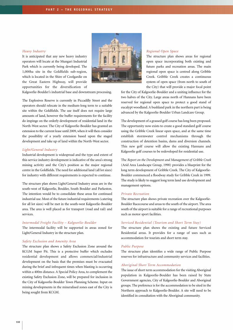
132
P A R T 2 – T H E R E G I O N A L S T R A T E G Y
Heavy Industry
It is anticipated that any new heavy industry
operators will locate at the Mungari Industrial
Park which is currently being developed. The
1,000ha site in the Goldfields sub-region,
which is located in the Shire of Coolgardie on
the Great Eastern Highway, will provide
opportunities for the diversification of
Kalgoorlie-Boulder’s industrial base and downstream processing.
The Explosives Reserve is currently in Piccadilly Street and the
operators should relocate in the medium-long term to a suitable
site within the Goldfields. The use itself does not require large
amounts of land, however the buffer requirements for the facility
do impinge on the orderly development of residential land in the
North-West sector. The City of Kalgoorlie-Boulder has granted an
extension to the current lease until 2009, when it will then consider
the possibility of a yearly extension based upon the staged
development and take up of land within the North-West sector.
Light/General Industry
Industrial development is widespread and the type and extent of
this service industry development is indicative of the area’s strong
mining activity and the City’s position as the major regional
centre in the Goldfields. The need for additional land (all lot sizes)
for industry with different requirements is expected to continue.
The structure plan shows Light/General Industry areas are in the
south-west of Kalgoorlie, Boulder, South Boulder and Parkeston.
The intention would be to consolidate these areas for continued
industrial use. Most of the future industrial requirements (catering
for all lot sizes) will be met in the south-west Kalgoorlie-Boulder
area. The area is well placed as for transport (road and rail) and
services.
Intermodal Freight Facility – Kalgoorlie-Boulder
The intermodal facility will be supported in areas zoned for
Light/General Industry in the structure plan.
Safety Exclusion and Amenity Area
The structure plan shows a Safety Exclusion Zone around the
KCGM Super Pit. This is a protective buffer which excludes
residential development and allows commercial/industrial
development on the basis that the premises must be evacuated
during the brief and infrequent times when blasting is occurring
within a 400m distance. A Special Policy Area, to complement the
existing Safety Exclusion Zone, will be prepared for inclusion in
the City of Kalgoorlie-Boulder Town Planning Scheme. Input on
mining developments in the mineralised zones east of the City is
being sought from KCGM.
Regional Open Space
The structure plan shows areas for regional
open space incorporating both existing and
future parks and recreation areas. The main
regional open space is centred along Gribble
Creek. Gribble Creek creates a continuous
system of open space (from north to south of
the City) that will provide a major focal point
for the City of Kalgoorlie-Boulder and a uniting influence for the
two halves of the City. Large areas north of Hannans have been
reserved for regional open space to protect a good stand of
eucalypt woodland. A bushland park in the northern part is being
advanced by the Kalgoorlie-Boulder Urban Landcare Group.
The development of a grassed golf course has long been proposed.
The opportunity now exists to create a good standard golf course
using the Gribble Creek linear open space, and at the same time
establish stormwater control mechanisms through the
construction of detention basins, dams and diversion channels.
This new golf course will allow the existing Hannans and
Kalgoorlie golf courses to be redeveloped for residential use.
The Report on the Development and Management of Gribble Creek
(Arid Area Landscape Group, 1990) provides a blueprint for the
long term development of Gribble Creek. The City of Kalgoorlie-
Boulder commenced a floodway study for Gribble Creek in 1999.
The study is likely to suggest long term land use development and
management options.
Private Recreation
The structure plan shows private recreation over the Kalgoorlie-
Boulder Racecourse and areas to the south of the airport. The area
south of the airport is suitable for a range of recreational purposes
such as motor sport facilities.
Serviced Residential (Tourism and Short Term Stay)
The structure plan shows the existing and future Serviced
Residential areas. It provides for a range of uses such as
accommodation for tourists and short term stay.
Public Purpose
The structure plan identifies a wide range of Public Purpose
reserves for infrastructure and community services and facilities.
Aboriginal Short Term Accommodation
The issue of short term accommodation for the visiting Aboriginal
population in Kalgoorlie-Boulder has been raised by State
Government agencies, City of Kalgoorlie-Boulder and Aboriginal
groups. The preference is for the accommodation to be sited in the
Northern approach to Kalgoorlie-Boulder. A site will need to be
identified in consultation with the Aboriginal community.
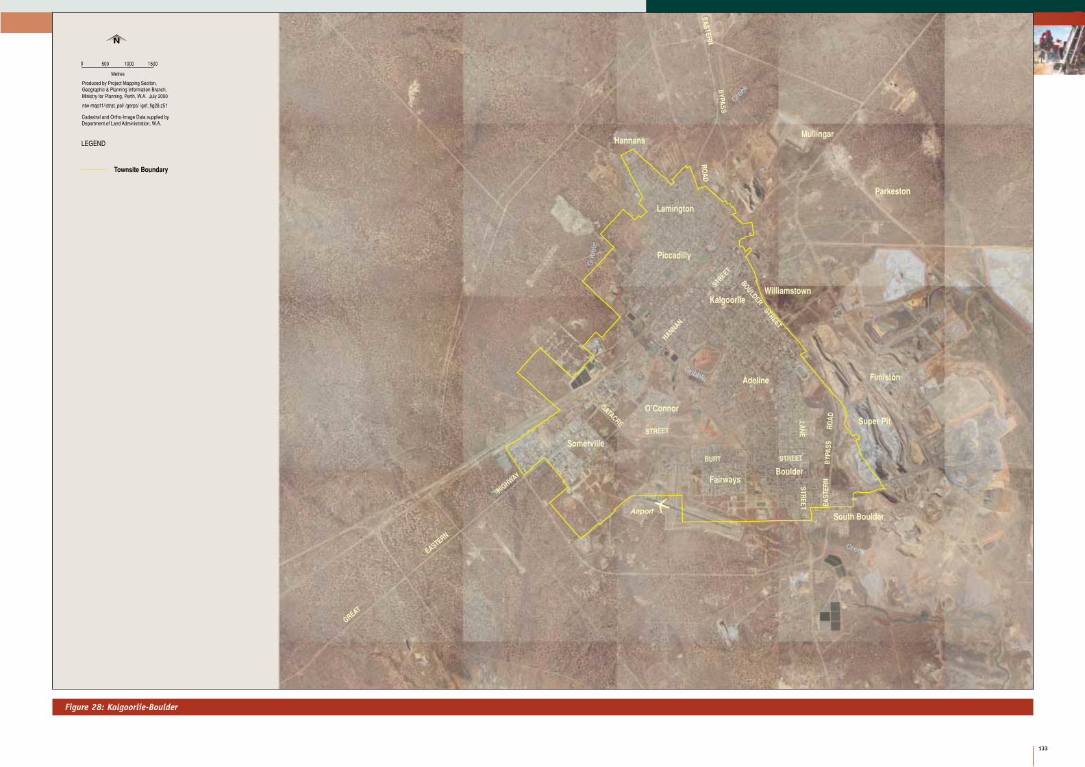
Figure 28: Kalgoorlie-Boulder
133
P A R T 2 – T H E R E G I O N A L S T R A T E G Y
2
STREET
HANNAN
BOULDER
STREET
LA
NE
ST
RE
ET
GATACRE
STREET
BURT STREET
EA
ST
ER
NB
YP
AS
SR
OA
D
GREAT
EASTERN
HIGHWAY
EA
ST
ER
N
BY
PA
SS
RO
AD
South Boulder
Boulder
FimistonAdeline
Somerville
Mullingar
Kalgoorlie
Piccadilly
Parkeston
O’Connor
Fairways
Williamstown
Cree
k
Gribble
Creek
Lamington
Airport
Hannans
Gribble
0
Metres
Produced by Project Mapping Section,
N
500 1000 1500
Geographic & Planning Information Branch,Ministry for Planning, Perth, W.A. July 2000
ntw-map11//strat_pol/ /gerps/ /gef_fig28.z51
LEGEND
Townsite Boundary
Super Pit
Department of Land Administration, W.A.Cadastral and Ortho-Image Data supplied by

Figure 29: Kalgoorlie-Boulder Structure Plan
134
P A R T 2 – T H E R E G I O N A L S T R A T E G Y
STREET
HANNAN
BOULDER
STREET
FEDERALRO
ADLAN
ESTR
EET
GATACRE
STREET
BURT STREET
EAST
ERN
BYPA
SSRO
AD
HIGHWAY
EASTERN
BYPASS
ROAD
PICCADILL
Y
ST
H
CEM PS
WP
CC
C
PS
PS
ES
P
CEM
Racecourse
PS
PS
HS
CP PS
PS
WSD
MP
RT
South Boulder
Boulder
FimistonAdeline
Somerville
Mullingar
Kalgoorlie
Piccadilly
Parkeston
O’Connor
Fairways
Williamstown
WSDWSD
WSD
PS
PS
PS
Creek
Gribble
Creek
WSD
Effluent Ponds
FS
Lamington
Airport
Hannans
Peters Hill
Reafforestation
Grib
ble
WSD
Education
Precinct
CEM
WSD
QRY
WSD
WSD
C
PS
RP500 m buffer
Bushland ParkKarlkurla
Wastewater
800 m
buffe
r
Explo
sives
500 m bufferWastewater
GREAT
EASTERN
Cemetery
Water,Sewage and Drainage
Sub Station/Power Terminal
Prison
Quarry
H
WP
RT
P
ES
CEM
WSD
QRY
Townsite Boundary
MP Municipal Purpose
CP Community Purpose
Major Water Mains
Main Drainage
Town Centre
Commercial/Mixed Business - Existing
Commercial/Mixed Business - Future
Light/General Industry - Existing
Light/General Industry - Future
Regional Open Space - Existing
Regional Open Space - Future
Public Utilities
C
HS
PS
Railway
Gas Pipeline
Transmission Line - Existing
Mine Safety Exclusion
Airport
Existing Sewerage Pumpstation
Major Sewer Mains
Power Station
Western Power SubstationPrivate Recreation
Restricted Residential
Rural - Mining
Railway Reserve
Serviced Residential
Special Residential - Future
0
Metres
Produced by Project Mapping Section,
LEGEND
N
Existing
500 1000 1500
be regarded as indicative only.Note :- Future land uses shown are to
College
High School
Primary School
Hospital
Possible Residential Access
InfrastructureLand Use
Future
Wastewater Treatment
Rubbish Tip
Department of Minerals and Energy W.A.Source:- Western Power.
Agriculture Department, W.A.
Special Residential - Existing
Urban - Existing
Urban - Future
Primary Regional Road
Other Regional Road
Water Supply Storage Tank - Existing
Water Supply Storage Tank - Future
RP Railway Purposes
Geographic & Planning Information Branch,Ministry for Planning, Perth, W.A. July 2000
ntw-map11//strat_pol/ /gerps/ /gef_fig29.z51
Emergency Services
Buffer
Serviced Residential - Future
Primary Regional Road - Future
Buffers around key roads and
will vary from location to location.industry are indicative only - they

Rural-Mining
The area outside the City of Kalgoorlie-Boulder is included as
Rural-Mining. This reflects current and future land use for
mining predominantly in a Rural zone.
Infrastructure and ServicesAll servicing agencies have indicated that the existing
infrastructure has sufficient capacity to service the current short-
term projected populations. In the longer term some services will
require upgrading and new ones will need to be constructed to
sustain a population of 60,000 people. The structure plan
recognises and accommodates these infrastructure requirements.
Road Network
New roads will be required as urban development occurs. The
main consideration will be the outer ring road, district distributor
roads and grade separations crossing the railway line and the
Great Eastern Highway.
The structure plan shows the North-West Bypass as a continuous
outer ring road providing a direct link from the Great Eastern
Highway to the Goldfields Highway. The alignment has been
chosen in consultation with the City of Kalgoorlie-Boulder,
MRWA and Transport WA, but the exact course will be subject to
detailed surveying. This road follows the alignment of the GGT
pipeline and Western Power transmission lines. A service corridor
about 200 metres wide is required to protect the road and utilities,
and encourage other public utilities to use this common
alignment in the future.
The Structure Plan also recognises the long standing proposal to
realign the Eastern Bypass. The relocation of the Eastern Bypass
was recommended in the Golden Mile Mining Development
Conceptual Plan (1992) in order to allow for the ongoing
development of the Fimiston Pit operations. KCGM is now at the
point where the realignment of the road must occur in order for
operations to continue in the long term and the proposal is under
active consideration.
Detailed design plans for the realigned Bypass have been prepared
and have been endorsed by the relevant government agencies. The
proposal is to be formally recognised in the City’s TPS through the
Amendment process. The recognition of the Bypass on the
Kalgoorlie-Boulder Structure Plan ensures that the plan reflects
this strategically important infrastructure development for the
Golden Mile.
The structure plan also shows district distributor roads linking the
old established areas with proposed ones in the north-west. The
district distributor road concept unites and consolidates the City
by facilitating good movement of traffic between existing/future
residential areas, the City Centre and other commercial and
industrial areas.
District distributor roads link residential cells and give access to
the internal local distributor roads of each neighbourhood.
Details of district and local distributor roads will form part of an
outline for development plans in each neighbourhood.
The Kalgoorlie-Boulder Traffic Modelling Study conclusions
represent the road network and configuration scenario justified
for the ultimate population of the structure plan. Road
construction and upgrading will be dictated by the actual
population reached (see Figure 30).
Rail
Kalgoorlie-Boulder is a major railway junction between the
Eastern States, Perth, the northern and southern parts of WA. The
railway at Kalgoorlie-Boulder provides many of the services and
meets many of the needs of the mining industry and towns within
its catchment area. Westrail, National Rail, SCT and Toll Rail use
the rail system for transfer of products into and out of the region
and for passengers.
A proposal for a new high-speed train linking Perth and
Kalgoorlie-Boulder was announced by the Minister for Transport
in 1999. The new Prospector, scheduled to commence operations
in 2003, will be capable of reaching speeds in excess of 150 km/h.
It will significantly improve passenger travel between the two
cities, subject to rail track upgrades to accommodate theses
speeds. The train will be capable of cutting up to two hours off the
existing journey time. The new $30 million train will consist of six
power units to replace the five existing power cars and three trailer
cars which have been in operation since 1971.
The railway system will continue to play an important part in the
economy of Kalgoorlie-Boulder. The location of the line and the
amount of land set aside for railway purposes has implications for
the future planning of adjacent areas. The structure plan endorses
the retention of the existing railway reserve.
135
P A R T 2 – T H E R E G I O N A L S T R A T E G Y
2

Figure 30: Kalgoorlie-Boulder Traffic Modelling
136
P A R T 2 – T H E R E G I O N A L S T R A T E G Y
BOORARA RD
PREM
IER S
T
PICCADILL
Y
GATACRE
ANZAC
GRAEME
PERCY
ST
McCLEERY
BROADWOOD ST
HWY
EASTERN
GREAT
CELEBR
ATION
RD
ST
HARE
ST
ST
RDWILLIAMSTOWN
WILSON
ST
FEDERAL RD
STST
LIONEL
MAX
WEL
L S
T
ST
ST
LION
EL
STLAN
E
KEEG
AN S
T
JOHNSTON ST
STBURT
DRIVE
EASTERN
BYPASS RD
BULONG
EASTERN
BYPASS RD
RD
OUTRAM ST
EASTERNBYPASS RD
BLACK ST
0
Produced by Project Mapping Section,
1
N
Geographic & Planning Information Branch,
2
YARRI
RD
HAWKINS ST
HANNAN
ST BOULDER
RD
VIVIAN ST
Primary Distributor
District Distributor
Local Distributor/Local RoadMinistry for Planning, Perth, W.A. July 2000
Road Hierarchy - BSD Consultants
THROSSELL
Kilometres
ntw-map11//strat_pol/ /gerps/ /gef_fig30.z51
Railway Line
2006 Road Network
2011 Road Network
2026 Road Network
LEGEND
Hierarchy Staging
RD
STO
’CO
NN
OR

137
P A R T 2 – T H E R E G I O N A L S T R A T E G Y
2Kalgoorlie-Boulder Airport
The Kalgoorlie-Boulder Airport has the highest passenger
movement of all the regional centres in WA. The Draft Kalgoorlie-
Boulder Airport Master Plan (1997) predicts that 336,900
passengers will pass through the airport in 2010. Upgrading to the
terminal building was completed to alleviate congestion during
peak periods. The airport can meet demand for the next 20 years
but beyond this, may need complete relocation.
The noise contours and aircraft paths in the nearby residential
areas could prove to be a major constraint for major airport
extensions and upgrades in the future. The structure plan
supports upgrades to the airport based on the Airport Master
Plan. It also supports further investigations to secure a suitable site
elsewhere for a possible future airport.
Water
The City’s water supplies are inadequate. Residents are often the
first to be affected by water restrictions. Longer restrictions are
also likely to have a significant impact on industry and have the
capacity to affect production. The current water supply
infrastructure is a priority for the City and will need urgent
upgrading to maintain demand.
The WaterLink Project is reviewing opportunities for
improvements to, and expansion of the existing water supply
including: a water pipeline from Esperance to Kalgoorlie-Boulder;
a desalination plant; and upgrading the existing G&AWS pipeline
as well as increasing storage capacity. A secondary water supply
needs to be determined in the short term.
The Goldfields Utilities Limited proposal to process sea water and
produce potable water, is conceptual and yet to be proved. The
proposal is progressing to the final feasibility stage.
A site for a possible desalination plant and storage facility near
Kalgoorlie-Boulder should be investigated.
Water Corporation is currently upgrading the G&AWS Main
Conduit to increase water supply capacity into Kalgoorlie.
The Mt Percy tank is the primary supply storage for the City water
supply which consists of a network of distribution and
reticulation mains. Mt Charlotte reservoir supplies primarily
mine services to the north and east. The standby reservoirs in
lower Hannan Street are seasonal balancing storages and also
provide reserve storage. Water is pumped to Mt Percy and Mt
Charlotte during summer when the supply capacity of the
G&AWS Main Conduit from Mundaring is less than the
Kalgoorlie-Boulder demand.
The Water Corporation’s ongoing reticulation and main
replacement in the older parts of the City has improved supply
pressures and reduced interruptions through burst mains, and
there are no immediate supply restrictions in extending
reticulation services to new residential areas in the north-west
sector.
Sewerage
The City of Kalgoorlie-Boulder operates the City’s wastewater
collection, treatment and effluent re-use systems. Sewerage is
principally a gravity system with the majority of the City now
sewered. The unsewered areas are being addressed through an
infill program and extensions to the network to support new
development.
There are some capacity limitations in the original collection
systems, particularly north of the railway line in Piccadilly, which
creates a constraint for several proposals. New catchment pump
station and collection mains will be required for residential
developments at Hannans. Future residential areas in the north-
west sector will require either upgrades to the treatment plant and
trunk main or the construction of a stand-alone treatment plant.
The City of Kalgoorlie-Boulder is currently assessing the sewerage
infrastructure as a result of increased residential densities in the
older established areas such as Lamington and Boulder.
Power
Kalgoorlie-Boulder is connected on the South-West Integrated
Network grid via a 220 kV transmission line from Muja to the
West Kalgoorlie Terminal Station. The 220 kV supply is then
stepped down and distributed to the Piccadilly substation via a
132 kV transmission network. Urban expansion areas will require
extensions of the grid to supply power. Upgrades to the existing
network will also be needed to cope with summer peak demands.
Western Power has an approved future plan for Transmission and
Distribution Network requirements to cater for new
developments in the City.
The City has access to gas supplies via the new gas pipeline. This
provides opportunities for the reticulation of natural gas to
existing and proposed urban and industrial areas. AlintaGas is
currently installing a gas network for domestic customers.
AlintaGas will carry out the works in two stages with the major
consumers, City Centre and surrounding areas as the first priority
followed by the rest of the City. Indications are that gas will be
available to 95 per cent of potential users by the year 2001.

138
P A R T 2 – T H E R E G I O N A L S T R A T E G Y
Community Services
Kalgoorlie-Boulder is well provided with
community infrastructure and services,
however:
• Additional schools and higher education
facilities will need to be planned as part of
future urban expansions and industry
requirements.
• Upgrading and development of health care facilities will be
required to improve the quality of life.
• Better social, recreation and cultural facilities will be required
to meet the needs of the community.
The structure plan shows an Education Precinct area in the north-
west sector. The precinct would be suitable for a high school
(private or public) with possible playing fields and other
institutional uses utilising the adjoining open space. Additional
primary school sites should be defined in the neighbourhoods
during the preparation of the outline development plans.
Telecommunications
Telecommunications are vital to the effective functioning of
Kalgoorlie-Boulder as the regional centre and to the sparsely
populated and remote areas of the region. Key areas for
improvement include mobile phone facilities on regional
routes and extensions of the fibre optic network between Perth
and Kalgoorlie.
KALGOORLIE-BOULDER STRUCTURE PLAN
IMPLEMENTATION
Outline Development Plans (local area planning) are an essential
part of the implementation of the structure plan. Experience has
shown that without these plans, it is very difficult to get a
coordinated approach through the rezoning and subdivision
process to provide those facilities which transcends the need of
any developers’ particular subdivision application. The area
covered by the Kalgoorlie-Boulder Structure Plan can
conveniently be divided into a number of neighbourhood cells.
Outline Development Plans (ODP) should adopt the broad
principles contained in the structure plan and focus on an overall
district layout that contributes to a clustering of highly
interconnected neighbourhoods, typically of about 400-450
metre radius, that support the city centre. Primary schools should
be provided in accordance with the Education
Department of WA standards, currently one
site per 1,500 to 1,800 housing units.
Preliminary planning for the North-West
Sector has indicated a need for one primary
school for every two neighbourhoods. Primary
schools should be located conveniently to the
catchment area they are intended to serve, and
so as to maximise the walkable catchment area.
The preparation of Outline Development Plans is generally the
responsibility of developers/landowners and may include the
shire. The Ministry for Planning is prepared to offer help and
guidance. Design principles including road design, landscaping
and buffers should be developed in consultation with the
community. A review of the future residential cells needs to
incorporate the findings of the Gribble Creek Floodway Study and
Liveable Neighbourhoods objectives.
Kalgoorlie-Boulder has many examples of its history and
development. It includes natural landscape features, built
architecture and general streetscape. An understanding of the
Aboriginal and non-Aboriginal heritage is an important
consideration for detailed planning in the City of Kalgoorlie-
Boulder.
The Ministry for Planning provided assistance in September 1999,
in facilitating a non-binding Enquiry-by-Design workshop, in co-
ordination with the City of Kalgoorlie-Boulder and DOLA, to
develop a concept ODP for the North West Sector of Kalgoorlie-
Boulder. The Liveable Neighbourhoods trial policy planning
approach was adopted in the exploration of the staging and
neighbourhood structuring of this Sector of the City in the
context of the draft Kalgoorlie-Boulder Structure Plan and a
medium population growth scenario.
In brief, the workshop considered reinforcement of the Kalgoorlie
and Boulder town centres through improved street connections,
established key urban design principles in accordance with
Liveable Neighbourhoods objectives and local circumstances for
the planning of the North West Sector, and tested design options
for developer marketability.
A report entitled the Kalgoorlie-Boulder Enquiry-by-Design
workshop, Working Paper 2 (December 1999), gives a detailed
account of the workshop proceedings and outcomes, and is
available from the MfP.
7.4
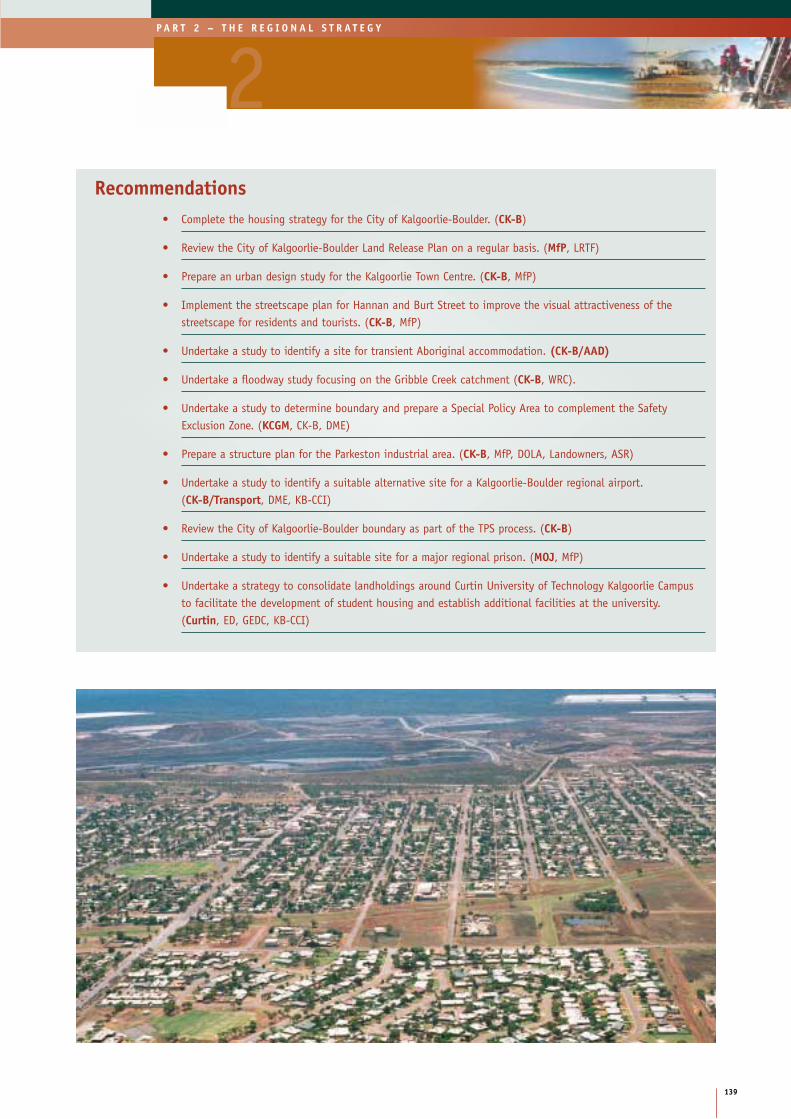
139
P A R T 2 – T H E R E G I O N A L S T R A T E G Y
2Recommendations
• Complete the housing strategy for the City of Kalgoorlie-Boulder. (CK-B)
• Review the City of Kalgoorlie-Boulder Land Release Plan on a regular basis. (MfP, LRTF)
• Prepare an urban design study for the Kalgoorlie Town Centre. (CK-B, MfP)
• Implement the streetscape plan for Hannan and Burt Street to improve the visual attractiveness of thestreetscape for residents and tourists. (CK-B, MfP)
• Undertake a study to identify a site for transient Aboriginal accommodation. (CK-B/AAD)
• Undertake a floodway study focusing on the Gribble Creek catchment (CK-B, WRC).
• Undertake a study to determine boundary and prepare a Special Policy Area to complement the SafetyExclusion Zone. (KCGM, CK-B, DME)
• Prepare a structure plan for the Parkeston industrial area. (CK-B, MfP, DOLA, Landowners, ASR)
• Undertake a study to identify a suitable alternative site for a Kalgoorlie-Boulder regional airport.(CK-B/Transport, DME, KB-CCI)
• Review the City of Kalgoorlie-Boulder boundary as part of the TPS process. (CK-B)
• Undertake a study to identify a suitable site for a major regional prison. (MOJ, MfP)
• Undertake a strategy to consolidate landholdings around Curtin University of Technology Kalgoorlie Campusto facilitate the development of student housing and establish additional facilities at the university. (Curtin, ED, GEDC, KB-CCI)

ESPERANCE STRUCTURE PLAN
INTRODUCTION
The Esperance Structure Plan is a component
of the Goldfields-Esperance Regional Planning
Strategy. It has been prepared jointly by the
Ministry for Planning and the Shire of
Esperance and in consultation with the Goldfields-Esperance
Regional Planning Strategy Technical Working Group and
Steering Committee.
Substantial regional growth has occurred in the Goldfields-
Esperance Region over the past 20 years, and much of that growth
has gravitated towards the two major regional centres –
Kalgoorlie-Boulder and Esperance. Esperance is the largest
population centre in the south-east. The Town of Esperance is
made up of the suburbs of Castletown, Chadwick, Esperance,
Nulsen, Sinclair and West Beach.
Esperance’s growth has not been as rapid as that of Kalgoorlie-
Boulder but is steady. Growth in the agricultural sector has
contributed. Esperance services the agricultural community and
is an important gateway for the export and import of resources
and other goods through the port. Other industries include
tourism, fishing, meat processing and salt extraction. The town’s
pleasant seaside location offers comfortable living and provides a
good standard of facilities and services. Esperance is emerging as
an important location for retirees.
Esperance is one of the two sub-regional centres of the Goldfields-
Esperance Region.
Long term growth prospects for Esperance suggest the
continuation of current patterns. Its pleasant location has the
potential to attract a mix of age groups and family groups, similar
to Albany. Most of the future urban land is not affected by native
title claims. The Shire of Esperance owns land and takes an active
role in development.
Purpose of the Structure PlanThe purpose of the Esperance Structure Plan is to provide for
future townsite expansion of land uses (urban, special residential,
rural, industrial, commercial, parks and recreation and
conservation) and community and service infrastructure
coordination.
A target population of 25,000 has been adopted
as a basis for possible growth and development.
The structure plan is designed to guide
development in the Town of Esperance for a
25-year period, although it will be subject to
regular review.
The study area for the structure plan is
bounded by the Pink Lake and Lake Warden System (north) and
the coastline (south), generally covering the present gazetted
townsite.
PLANNING OPPORTUNITIES AND CONSTRAINTS
The preparation of a structure plan requires the consideration of
the area’s physical, social and economic opportunities and
constraints. The physical and socioeconomic profile of the
Goldfields-Esperance Region and in particular the Shire of
Esperance is documented in recent planning studies
commissioned by the shire, the South-East Coast Regional Profile
(GEDC, 1996) and the Goldfields-Esperance Regional
Infrastructure Audit (GHD, 1998). A brief profile is provided in
chapter 3 of this report. The following analysis is limited to
providing only that information that puts the Town of Esperance
Structure Plan study area into context.
ClimateThe Esperance climate is described as Mediterranean with average
temperatures ranging from 8.5 to 17.5 degrees Celsius in winter
and 15.3 to 25.7 degrees Celsius in summer. The town receives
about 625mm of rainfall annually, with the wettest period being
from May to August. Although it enjoys a mild climate, Esperance
is a windy town. Western Power’s decision to establish wind
turbine generators to supplement the existing power grid was a
result of consistent wind speeds year-round at Esperance.
LandformThe landform of Esperance is low lying, with level to gently
inclined sandplains. The coast is characterised by windswept sand
dunes with isolated granite outcrops. The coast is backed by a low
escarpment and the coastal hinterland features a line of salt lakes,
which are not connected to the sea.
DrainageThere are no major river systems in the study area. Bandy Creek is
the only significant watercourse in the eastern sector of the study
area, and flows from Station Lake southwards to the boat harbour.
8.2
8.1
8.0
140
P A R T 2 – T H E R E G I O N A L S T R A T E G Y

Water ResourcesThe quality and reliability of groundwater supplies varies
significantly. The Esperance Sandplain close to the coast west of
the town contains the best quality water. In the eastern part,
supplies are generally restricted and saline. The Quaternary
coastal sand deposits west of Esperance are the principal source of
the town’s water supply. The water is regarded as hard with less
than 1,000 parts per million of dissolved salt. Supply rates are
usually small due to the fine-grained character and silty nature of
the water-bearing horizons. A series of borefields supply water to
the Town of Esperance.
A Draft Water Source Protection Plan has been prepared by the
Water and Rivers Commission which outlines a protection plan
for the Esperance water reserve. The plan establishes the level of
protection required within drinking water source areas and
provides a basis for establishing compatible land uses within the
water reserve at Esperance.
GeologyEsperance lies within the Fraser Orogen geological unit. The study
area is underlain by granite and gneiss which outcrop at Dempster
and Wylie Heads. Throughout most of the study area, these rocks
are blanketed by recent deposits of coastal limestone and
windblown sand. Brown coal is found close to the town (50km
north) and occurs within ancient drainage channels that overlie
the rocks of the Fraser Orogen unit. Gypsum and salt occur in
beds of the surrounding salt lakes. Although there are extensive
salt deposits most are regarded as uneconomic in comparison
with the low-cost solar salt production in the north of the State,
however 10,000 tonnes are extracted annually from Pink Lake on
a commercial basis.
SoilsEsperance is part of the Sandplain Soil Unit and comprises:
• Alluvium – silt and clay deposit around the Lakes area.
• Foredune Sand – consists of the bare, mobile coastal sand and
blowouts.
• Coastal Dune Sand – covers most of the study area and
consists of white quartz sand on the coastal dunes, coastal
plain and lower plateau.
• Eolianite – submerged beach rock and marine sand appears as
a coastal scarp.
• Coastal Hill Dune – coastal sand forming long parallel dunes
on the coastal plain.
• Granite intrusions – appear on the headlands.
The depth of sand is variable and this in turn affects agricultural
productivity. Most of the soils in the study area are part of the
Coastal Dune Sand group and have limited agricultural value. The
low agricultural value of the soils is reflected in current land use
patterns. The Coastal Dune Sand and Coastal Hill Dune groups
are where most residential and rural-residential areas occur and
are capable of further development.
VegetationMuch of the study area has been cleared and developed for
agriculture, residential and industrial uses. Esperance is part of
the South-West Botanical Province. The remnant vegetation is
made up of a low but richly diverse heath interspersed with bushy
mallee. The coastal dune system and extensive areas of Crown
land west of the townsite and south of Pink Lake is naturally
vegetated.
Coastal dune areas consist of mainly low scrub vegetation of
wattles, tea tree thickets and banksia that have stabilised the
dunes. In more protected areas, low Peppermint woodlands,
redheart mallee and redwood are found. In other places there are
dune blowouts of various sizes. The Sandplain comprises mainly
dense low-lying scrub and thickets of bush and trees. The salt lake
system is fringed by samphire and surrounded by stands of salt
water paperbark.
Environmental and Landscape FeaturesThe most significant environmental and landscape features in
the study area include the lake system, the coastal dune system
and the coastline.
The Lakes area occurs in the north and consists of Pink Lake, Lake
Warden, Windabout Lakes, Wheatfields Lake, Woody Lake and
Station Lake. The lakes have environmental and landscape
significance with Lake Warden System being listed as a wetlands of
international importance under the Ramsar convention.
The Coastal Dune System has some limited and marked changes
in topography and areas of natural vegetation. The dunes are
fragile and in some locations extend several kilometres inland.
While some coastal areas offer good views, the environmental
sensitivity and vulnerability of large parts of the area precludes
urban development.
The coastline is regarded as one of the most scenic in WA, if not
Australia. The coastal areas in the study area comprise mainly
reserved land and therefore the use of the coastline for other large-
scale development is limited.
141
P A R T 2 – T H E R E G I O N A L S T R A T E G Y
2

Existing Infrastructure and ServicesEsperance is well provided with infrastructure
and services, which are capable of further
upgrades and extensions. The need to provide
new infrastructure, or expand existing
infrastructure will depend on the rate and scale
of population growth in the town and industry
requirements. The following is a summary of
existing infrastructure and services in Esperance.
• Roads – Coolgardie/Esperance Hwy provides the towns’s
primary road link to the north and the Eastern States. The
South Coast Hwy connects Esperance with Ravensthorpe and
Albany.
• Rail – links Esperance with the Goldfields and is mainly used
for the transport of agricultural products, minerals (iron ore
and nickel concentrates) and petroleum. The railway line is
old and in need of major upgrading. The Government has
committed $42m to resleeper the line, and $35m to upgrade
the line has been guaranteed in legislation.
• Public Transport – Westrail provides a bus service from
Esperance to Kalgoorlie-Boulder and Esperance to Perth (via
Albany). A local taxi service is available.
• Esperance Airport – is 21km north of the town and is owned
and managed by the Shire of Esperance. Skywest Airlines has
regular flights from Perth to Esperance.
• Water – is supplied by the Water Corporation from
underground borefields. It is sourced from 35 production
bores as part of the Esperance water reserve. Extension of the
wellfield to the west is planned by the Water Corporation.
• Electricity – is supplied by a Western Power station using light
diesel fuel and wind generation. Power is available throughout
the townsite and extends throughout the study area generally
via the road system.
• Gas – is available in bottles for domestic use. The location of
major industry and/or mining development close to
Esperance will create opportunities for extensions of the gas
pipeline from Kalgoorlie.
• Sewerage – the system is owned and operated by the Water
Corporation. A wastewater treatment plant is located between
the centre of Esperance and Castletown, and consists of a
primary and secondary oxidation pond. The system also
includes an effluent recycling system for the watering of some
of the town’s parks and ovals. An extension of this system is
being considered.
• Telecommunications – services such as televison and radio
reception, telephone, newspapers and telecentres are available
in the town.
• Community Services – health, education,
recreation, police and emergency services are
available in the town.
History and PopulationIn the mid to late 1800s Esperance and the
surrounding area was first utilised for grazing.
In the late 1800s sealers and whalers used
Esperance Bay as a harbour, and it later became a disembarkation
point for prospectors during the gold rush in the 1890s. The town
had started to develop as a port and recreation centre. A steady
flow of traffic northwards developed and the local population
increased. When the Perth to Kalgoorlie railway was constructed
in 1897, Esperance became less significant and began to evolve as
a holiday destination for the Goldfields population. In 1925 the
railway from Salmon Gums to Esperance was completed and the
town became a major agricultural port. The Great Depression
stalled development but in the 1950s significant overseas
investment, principally American, spurred agricultural
development of the sandplains.
According to the 1996 ABS Census Count the population of the
town of Esperance was 8,647 which represents more than 20 per
cent of the Goldfields-Esperance Region population. As at June
1999 the estimated resident population of the Shire was 13,070
(ABS, 2000). The Shire of Esperance estimates the current
population of the town to be between 10,000 and 10,500 people.
Current planning by the Shire of Esperance has identified that the
Town of Esperance could accommodate population growth up to
30,000 people by the year 2026. Based on the medium growth
scenario the town’s population could grow to over 18,000 people
by the year 2026. Planning is based on the town reaching a
population of 25,000 people. It will require more than 300ha of
additional land for residential purposes.
Economic DevelopmentThe town development expanded due to its proximity to the
Goldfields, and more recently as a result of the growth of
agriculture and its attraction as a tourist destination. The role of
Esperance has broadened and it is providing a more diverse sub-
regional role within the Goldfields-Esperance Region. Agriculture
will continue to be the dominant industry. The town’s economy is
also diversifying to incorporate commerce, manufacturing,
finance, tourism, fishing and mineral processing. Esperance is
alsoa major port town for the wider region.
142
P A R T 2 – T H E R E G I O N A L S T R A T E G Y
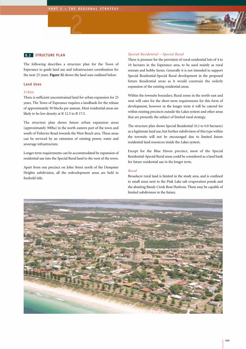
STRUCTURE PLAN
The following describes a structure plan for the Town of
Esperance to guide land use and infrastructure coordination for
the next 25 years. Figure 32 shows the land uses outlined below.
Land Uses
Urban
There is sufficient unconstrained land for urban expansion for 25
years. The Town of Esperance requires a landbank for the release
of approximately 50 blocks per annum. Most residential areas are
likely to be low density at R 12.5 to R 17.5.
The structure plan shows future urban expansion areas
(approximately 300ha) in the north-eastern part of the town and
south of Fisheries Road towards the West Beach area. These areas
can be serviced by an extension of existing power, water and
sewerage infrastructure.
Longer term requirements can be accommodated by expansion of
residential use into the Special Rural land to the west of the town.
Apart from one precinct on John Street north of the Dempster
Heights subdivision, all the redevelopment areas are held in
freehold title.
Special Residential – Special Rural
There is pressure for the provision of rural-residential lots of 4 to
10 hectares in the Esperance area, to be used mainly as rural
retreats and hobby farms. Generally it is not intended to support
Special Residential-Special Rural development in the proposed
future Residential areas as it would constrain the orderly
expansion of the existing residential areas.
Within the townsite boundary, Rural zones in the north-east and
west will cater for the short-term requirements for this form of
development, however in the longer term it will be catered for
within existing precincts outside the Lakes system and other areas
that are presently the subject of limited rural strategy.
The structure plan shows Special Residential (0.2 to 0.8 hectares)
as a legitimate land use, but further subdivision of this type within
the townsite will not be encouraged due to limited future
residential land resources inside the Lakes system.
Except for the Blue Haven precinct, most of the Special
Residential-Special Rural areas could be considered as a land bank
for future residential use in the longer term.
Rural
Broadacre rural land is limited in the study area, and is confined
to small areas next to the Pink Lake salt evaporation ponds and
the abutting Bandy Creek Boat Harbour. These may be capable of
limited subdivision in the future.
8.3
143
P A R T 2 – T H E R E G I O N A L S T R A T E G Y
2
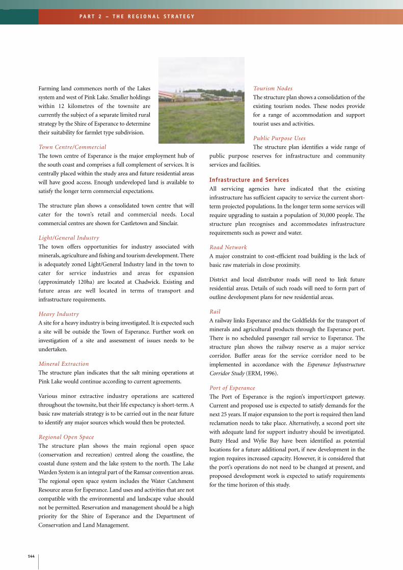
Farming land commences north of the Lakes
system and west of Pink Lake. Smaller holdings
within 12 kilometres of the townsite are
currently the subject of a separate limited rural
strategy by the Shire of Esperance to determine
their suitability for farmlet type subdivision.
Town Centre/Commercial
The town centre of Esperance is the major employment hub of
the south coast and comprises a full complement of services. It is
centrally placed within the study area and future residential areas
will have good access. Enough undeveloped land is available to
satisfy the longer term commercial expectations.
The structure plan shows a consolidated town centre that will
cater for the town’s retail and commercial needs. Local
commercial centres are shown for Castletown and Sinclair.
Light/General Industry
The town offers opportunities for industry associated with
minerals, agriculture and fishing and tourism development. There
is adequately zoned Light/General Industry land in the town to
cater for service industries and areas for expansion
(approximately 120ha) are located at Chadwick. Existing and
future areas are well located in terms of transport and
infrastructure requirements.
Heavy Industry
A site for a heavy industry is being investigated. It is expected such
a site will be outside the Town of Esperance. Further work on
investigation of a site and assessment of issues needs to be
undertaken.
Mineral Extraction
The structure plan indicates that the salt mining operations at
Pink Lake would continue according to current agreements.
Various minor extractive industry operations are scattered
throughout the townsite, but their life expectancy is short-term. A
basic raw materials strategy is to be carried out in the near future
to identify any major sources which would then be protected.
Regional Open Space
The structure plan shows the main regional open space
(conservation and recreation) centred along the coastline, the
coastal dune system and the lake system to the north. The Lake
Warden System is an integral part of the Ramsar convention areas.
The regional open space system includes the Water Catchment
Resource areas for Esperance. Land uses and activities that are not
compatible with the environmental and landscape value should
not be permitted. Reservation and management should be a high
priority for the Shire of Esperance and the Department of
Conservation and Land Management.
Tourism Nodes
The structure plan shows a consolidation of the
existing tourism nodes. These nodes provide
for a range of accommodation and support
tourist uses and activities.
Public Purpose Uses
The structure plan identifies a wide range of
public purpose reserves for infrastructure and community
services and facilities.
Infrastructure and ServicesAll servicing agencies have indicated that the existing
infrastructure has sufficient capacity to service the current short-
term projected populations. In the longer term some services will
require upgrading to sustain a population of 30,000 people. The
structure plan recognises and accommodates infrastructure
requirements such as power and water.
Road Network
A major constraint to cost-efficient road building is the lack of
basic raw materials in close proximity.
District and local distributor roads will need to link future
residential areas. Details of such roads will need to form part of
outline development plans for new residential areas.
Rail
A railway links Esperance and the Goldfields for the transport of
minerals and agricultural products through the Esperance port.
There is no scheduled passenger rail service to Esperance. The
structure plan shows the railway reserve as a major service
corridor. Buffer areas for the service corridor need to be
implemented in accordance with the Esperance Infrastructure
Corridor Study (ERM, 1996).
Port of Esperance
The Port of Esperance is the region’s import/export gateway.
Current and proposed use is expected to satisfy demands for the
next 25 years. If major expansion to the port is required then land
reclamation needs to take place. Alternatively, a second port site
with adequate land for support industry should be investigated.
Butty Head and Wylie Bay have been identified as potential
locations for a future additional port, if new development in the
region requires increased capacity. However, it is considered that
the port’s operations do not need to be changed at present, and
proposed development work is expected to satisfy requirements
for the time horizon of this study.
144
P A R T 2 – T H E R E G I O N A L S T R A T E G Y

Figure 31: Esperance
145
P A R T 2 – T H E R E G I O N A L S T R A T E G Y
2Bandy
Creek
PINK
LAKE
ROAD
HIGHWAY
SOUTH
COAST
ROAD
SHELDON ROAD
HA
RB
OU
RR
OA
D
FISHERIES
RO
AD
GO
LDFI
ELD
S
ROAD
RO
AD
TWILIGHT BEACH
ROAD
TH
E
ESPL
ANADE
Nulsen
Dempster Head
Lover’s Beach
Second Beach
Blue Haven Beach
Boat Harbour
Salmon Beach
Esperance
Sinclair
ChadwickCastletown
Lake WardenWindabout Lake
Wheatfield Lake
NO
RS
EM
AN
Woody Lake
Esperance
Bay
SOUTHERN OCEAN
Pink Lake
West Beach
MONJINGUP (COLLIER)ROAD
CO
LLIER
0
Metres
Produced by Project Mapping Section,
N
250 500 750 1000
Townsite Boundary
Geographic & Planning Information Branch,Ministry for Planning, Perth, W.A. July 2000
Port of Esperance
ntw-map11//strat_pol/ /gerps/ /gef_fig31.z51
Department of Land Administration, W.A.Cadastral and Ortho-Image Data supplied by

Figure 32: Esperance Structure Plan
146
P A R T 2 – T H E R E G I O N A L S T R A T E G Y
1
23
PS
PS
PS
PS
CEM
HS
H
WP
FS
SS
SS
SPS
WS
SPS
SPS
SPS
WSD
WSD
WSD
WSD
SL
WSD
M
ASS
AH
HOPA
T
PP
DP
DP
WSD
YFC
WSD
HOSPS
SPS
WP
Bandy
Creek
Salt Evaporator
PINK
LAKE
ROAD
HIGHWAY
SOUTH
COAST
ROAD
SHELDONROAD
HARBOURH
ARBO
UR
ROAD
FISHERIES
ROAD
GOLD
FIEL
DS
ROAD
ROAD
TWILIGHT BEACH
ROAD
THE
ESPL
ANAD
E
Nulsen
Dempster Head
Lover’s BeachWest Beach
Hughes StepsSecond Beach
Blue Haven Beach
Fourth Beach
Boat Harbour
Racecourse
Golfcourse
Golfcourse
Salmon Beach
Rifle Range
Esperance
Sinclair
ChadwickCastletown
Lake Warden
Windabout Lake
Wheatfield Lake
NO
RSEM
AN
Woody Lake
ROAD
Esperance
Bay
SOUTHERN OCEAN
Pink Lake
West Beach
MONJINGUP (COLLIER)ROAD
COLLIER SPS
SPS
0
Metres
Produced by Project Mapping Section,
N
250 500 750 1000
1
LEGEND
Special Rural
Rural
Tourist Node
Light/General Industry - Existing
SPS
FS
PS
H
SS
WP
M
Public School
Western Power
Hospital
Meteorologic
School Site
Fire Station
33Kv Powerline
Infrastucture
Land Use
Port Installation/Railway
Sewerage Pipeline
Water Pipeline
PP
ASS
HO
PA
T
WSD
DP
AH
Agricultural School Site
Aged Hostel
Depot
Hall/Office
Parking
Public Pound
Telstra
YFC Youth and Family Centre
SL Slipway and Launching Site
Groundwater Zone Boundary
Monitoring Bore
Decommissioned Production Bore
Regional Open Space - Future
Tourist Node - Future
Light/General Industry - Future
Port Buffer
Regional Open Space - Existing
Boat Harbour
Salt Harvesting
Special Residential
Townsite Boundary
Groundwater Boundary Area
Note:- Future Land Uses shown are to
be regarded as indicative only.
Railway
Public Utilities
Existing
Source:- Western Power, Water Corporation.
Town Centre/Commercial
Urban - Existing
Urban - Future
HS High School
Geographic & Planning Information Branch,Ministry for Planning, Perth, W.A. July 2000
Primary Regional Road
Other Regional Road
Sewerage Pumping Station Site
Water Supply/Sewerage/Drainage
Existing SeweragePumping Station
GWTP Ground Water Treatment Plant
GWTP
GWTP
500 m Buffer
Community Recreation
Water Supply Production Bore
Water Supply Storage Tank
ntw-map11//strat_pol/ /gerps/ /gef_fig32.dgn500 m Wastewater Buffer
RT
RT
Quarry
Rubbish Tip
QRY
QRY

Airport
The Esperance Airport is outside the study area. It has a sealed
runway and the current location has the capacity for
improvements. The terminal and runway have been upgraded to
facilitate the current demand and anticipated growth in current
numbers. The local government estimates about 7 per cent annual
tourism growth.
Water Supply
A water scheme utilising a series of borefields supplies water to the
Town of Esperance. Water supplies are limited and new sources
are marginal in terms of quality and quantity. Additional
borefields close to the townsite will need to be found to
accommodate future residential and industrial development. The
structure plan shows the main water catchment areas as regional
open space, which will require appropriate controls in the TPS.
Water storage at Dempster Head will be increased significantly in
the short to medium term and may lead to visual impacts.
The WaterLink Project is reviewing opportunities for
improvements to, and expansion of the existing water supply
including: a water pipeline from Esperance to Kalgoorlie-Boulder;
a desalination plant; and upgrading the existing G&AWS pipeline
as well as increasing storage capacity. The Goldfields Utilities
Limited proposal to process sea water and produce potable water
could potentially provide water, however this is conceptual and
yet to be proved. The proposal is progressing to the final feasibility
stage. A site for a desalination plant near Esperance should be
investigated and secured.
Sewerage
More than 60 per cent of the town is connected to a sewerage
scheme. An infill program is under way to connect other areas.
There is one wastewater treatment plant in the Town of Esperance
and the Water Corporation has recently installed mechanical
aeration in the primary pond to increase the capacity of the
treatment plant from 560 kL/day (2500 people) to 1800 kL/day
(8000 people).
The Water Corporation’s long term plans will involve:
• The development of a new Wastewater Treatment Plant
(WWTP) near the shire tip.
• Stage two development of current WWTP to increase capacity
to meet the needs of 15,000 people.
• Development of a second treatment site when the existing
plant reaches its capacity.
These further developments will meet the needs of about 35,000
people.
Power
Electricity is the major energy supply in the town. Esperance is the
only centre where an alternative method of power generation
(wind) is used. It is estimated that wind generation saves about 1.2
million litres of diesel per year in Esperance. High costs in the initial
construction stages constrain alternative power supply options.
Demand for power already exceeds the capacity of the current
source in Esperance and additional diesel generators are often hired
to meet peak demand.
The Port of Esperance has installed its own electricity generation plant
in response to the increase in electricity charges for larger users.
A new State Government policy for electricity supply was recently
announced for regional areas not on the grid system. The policy
maintains the Government’s commitment to the uniform tariff for
all residential customers and all small to medium sized businesses
supplied by Western Power.
Extensions of the gas transmission line to Esperance (and thus the
construction of a gas-fired power station) would be viable if mining
developments in the Ravensthorpe area chose to source power from
Esperance, and/or if the sea water pipeline were to proceed, which
would require power for pumping and desalination.
Much of the existing infrastructure, except the wind farm, needs to
be replaced. A site for power generation should be investigated
and secured.
Community Services
Esperance is well provided with community infrastructure and
services, however:
• Additional schools and higher education facilities will need to
be planned as part of future urban expansions and industry
requirements.
• Upgrading and development of health care facilities will be
required to improve the quality of life, and additional aged care
facilities will be needed to meet demands.
• Social, recreational and cultural facilities will be required to
meet the needs of the town.
Telecommunications
Telecommunications are vital to the effective functioning of
Esperance and the sparsely populated surrounding areas. Key areas
for improvement include mobile phone facilities on regional routes.
147
P A R T 2 – T H E R E G I O N A L S T R A T E G Y
2

ESPERANCE STRUCTURE PLAN
IMPLEMENTATION
Outline development plans are an essential part
of the implementation of the structure plan.
Experience has shown that without these plans,
it is very difficult to get a coordinated approach
through the rezoning and subdivision process
to provide those facilities which transcends the need of any
developers’ particular subdivision application. The area covered
by the Esperance Structure Plan can conveniently be divided into
a number of neighbourhood cells.
Outline Development Plans (ODP) should adopt the broad
principles contained in the structure plan and focus on an overall
district layout that contributes to a clustering of highly
interconnected neighbourhoods, typically of about 400-450
metre radius, that support the town centre. Primary schools
should be provided in accordance with the Education
Department of WA standards, currently one site per 1,500 to
1,800 housing units. Primary schools should be located
conveniently to the catchment area they are intended to serve, and
so as to maximise the walkable catchment area.
The preparation of Outline Development Plans is generally the
responsibility of developers/landowners and may include the local
government. The Ministry for Planning is prepared to offer help
and guidance. Design principles including road design,
landscaping and buffers should be developed in consultation with
the community.
Esperance has many examples of its history and
development. It includes natural landscape
features, built architecture and general
streetscape. An understanding of the
Aboriginal and European heritage is an
important consideration for detailed planning
in Esperance.
The Ministry for Planning provided assistance
in October 1999 in facilitating a non-binding Enquiry-by-Design
workshop in co-ordination with the Shire of Esperance. The
Liveable Neighbourhoods trial policy planning approach was
adopted in the exploration of the staging and neighbourhood
structuring of Development Area No.13 (Ormonde Street) in the
context of the draft Esperance Structure Plan.
In brief, the workshop considered reinforcement of the Esperance
town centre through improved street connections, established key
urban design principles in accordance with Liveable
Neighbourhoods objectives and local circumstances for
Development Area No.13, and tested design options for developer
marketability, including a possible canal estate.
A report entitled the Esperance Enquiry-by-Design workshop,
Working Paper 3 (December 1999), gives a detailed account of the
workshop proceedings and outcomes, and is available from the MfP.
8.4
148
P A R T 2 – T H E R E G I O N A L S T R A T E G Y
Recommendations• Prepare a land development program for Esperance for land use supply and coordination of physical and
human service infrastructure for a five-year period. (MfP, LG, GEDC)
• Following identification of an appropriate site through the Regional Power Procurement Process, the siteshould be recognised in the Esperance Town Planning Scheme. (OE, LG, MfP)
• Identify and confirm the suitability of a site for the development of a water desalination plant to service theGoldfields-Esperance region. (OWR, Proponent, WRC, LG, DEP)