part 2, chapter 2 traffic analysis no. 650-000-001 project development and environment manual...
TRANSCRIPT

Topic No. 650-000-001 Project Development and Environment Manual Traffic Analysis Effective: June14, 2017
Traffic Analysis Table of Contents
PART 2, CHAPTER 2
TRAFFIC ANALYSIS
TABLE OF CONTENTS
2.1 OVERVIEW ....................................................................................................... 2-1
2.1.1 Purpose ................................................................................................ 2-1
2.1.2 Definitions ............................................................................................. 2-2
2.2 PROCEDURE .................................................................................................... 2-3
2.2.1 Traffic Analysis Objectives .................................................................... 2-5
2.2.2 Level of Traffic Analysis Assessment .................................................. 2-5
2.2.2.1 Traffic Analysis Scope ........................................................... 2-5
2.2.2.2 Adopting Planning Phase Traffic Analyses ............................ 2-6
2.2.3 Performance Measures of Effectiveness .............................................. 2-7
2.2.4 Traffic Analysis Tools ............................................................................ 2-8
2.2.5 Data Collection ..................................................................................... 2-9
2.2.5.1 Types of Data Collection ..................................................... 2-11
2.2.5.2 Duration of Data Collection .................................................. 2-13
2.2.6 Project Traffic Forecasting .................................................................. 2-15
2.2.6.1 Forecasting using a Travel Demand Model ......................... 2-15
2.2.6.2 Forecasting without Travel Demand Models ....................... 2-17
2.2.6.3 Calculating AADT and DDHV .............................................. 2-17
2.2.6.4 Re-evaluating Traffic Analysis ............................................. 2-19
2.2.7 Traffic Analysis ................................................................................... 2-20
2.2.7.1 Capacity Exceeds Traffic Demand ...................................... 2-20
2.2.7.2 Traffic Demand Exceeds Capacity ...................................... 2-21

Topic No. 650-000-001 Project Development and Environment Manual Traffic Analysis Effective: June 14, 2017
Traffic Analysis Table of Contents
2.2.8 Safety Analysis ................................................................................... 2-21
2.2.8.1 Historical Crash Analysis ..................................................... 2-21
2.2.8.2 Quantitative Safety Analysis ................................................ 2-22
2.2.9 Environmental Analyses ..................................................................... 2-23
2.2.10 Project Traffic Analysis Report ........................................................... 2-23
2.2.10.1 Traffic Analysis Assumptions ............................................... 2-24
2.2.10.2 Project Traffic Analysis Report Outline ................................ 2-25
2.3 REFERENCES ................................................................................................ 2-26
2.4 FORMS ........................................................................................................... 2-27
2.5 HISTORY ........................................................................................................ 2-27
LIST OF FIGURES
Figure 2.1 Sample Project Traffic Analysis Report Cover Page ................................. 2-28
Figure 2.2 Project Traffic Assumption Summary ........................................................ 2-29

Topic No. 650-000-001 Project Development and Environment Manual Traffic Analysis Effective: June14, 2017
Traffic Analysis 2-1
PART 2, CHAPTER 2
TRAFFIC ANALYSIS
2.1.1 Purpose
Pursuant to 23 United States Code (U.S.C.) § 327 and the implementing Memorandum of Understanding (MOU) executed on December 14, 2016, the Florida Department of Transportation (FDOT) has assumed Federal Highway Administration’s (FHWA’s) responsibilities under the National Environmental Policy Act (NEPA) for highway projects on the State Highway System (SHS) and Local Agency Program (LAP) projects off the SHS. In general, FDOT’s assumption includes all highway projects in Florida whose source of federal funding comes from FHWA or which constitute a federal action through FHWA. This includes responsibilities for environmental review, interagency consultation and other activities pertaining to the review or approval of NEPA actions. Consistent with law and the MOU, FDOT will be the Lead Federal Agency for highway projects with approval authority resting in the Office of Environmental Management (OEM).
This chapter provides guidance for preparing the traffic analysis for Project Development and Environment (PD&E) Studies. Specifically, the chapter covers scoping the traffic analysis effort, traffic data requirements, analysis methodology and documentation.
Traffic analysis is an evaluation of the interaction between demand and supply of a transportation facility to determine how efficient the facility is serving the demand. This analysis forms the basis for evaluating the performance of project alternatives and design concepts based on demand, capacity, operational performance, environmental impacts, and safety concerns. Traffic analysis is one of the methods used to evaluate transportation needs during the Planning phase and PD&E Study. Additionally, traffic analysis produces data needed to support project-level environmental analyses such as noise and air quality impacts.
Traffic analysis is one of the critical activities for a PD&E Study and can impact the project schedule. It is important that the Project Manager understand the effort associated with traffic data collection, forecasting and analysis. Each transportation project is unique and the approach for individual projects might differ. As such, when developing the project traffic data and performing the corresponding analysis, there must always be a balance between the project’s goals and objectives, available schedule and budget, and the complexity of the analysis to be performed. The Project Manager should always reach an early agreement with project reviewers and the lead agency on the traffic analysis approach and parameters for the analysis. Such agreement is vital to project success as it helps to avoid misunderstanding between traffic analysts and reviewers of traffic analysis reports that may negatively impact the project development schedule.

Topic No. 650-000-001 Project Development and Environment Manual Traffic Analysis Effective: June 14, 2017
Traffic Analysis 2-2
This chapter references guidance from other FDOT procedures, manuals and handbooks, along with national guidance such as the Highway Capacity Manual (HCM) and FHWA’s Traffic Analysis Toolbox. The chapter is intended for transportation practitioners who perform traffic analyses for FDOT projects and possess sufficient knowledge of traffic flow theory and traffic engineering including guidance documented in FDOT and national publications.
2.1.2 Definitions
The following definitions apply to terminology used in this chapter:
Annual Average Daily Traffic (AADT) - The total volume of traffic on a highway segment for one year, divided by the number of days in the year. This volume is usually estimated by adjusting a short-term traffic count with weekly and monthly factors.
Average Daily Traffic (ADT) - The total traffic volume during a given time period (more than a day and less than a year) divided by the number of days in that time period.
Axle Correction Factor - The factor developed to adjust vehicle axle sensor-based data for the incidence of vehicles with more than two axles, or the estimate of total axles based on automatic vehicle classification data divided by the total number of vehicles counted.
Crash Modification Factor (CMF) – A multiplicative factor used to compute the expected number of crashes after implementing a given countermeasure at a specific site.
Design Hour - An hour with a traffic volume that represents a reasonable value for designing the geometric and control elements of a facility.
Design Year - The year for which the project is designed; usually 20 years from the Opening Year, but may be any time within a range of years from the present (for restoration type projects) to 20 years in the future (for new construction type projects).
Directional Design Hour Volume (DDHV) - The traffic volume expected to use a highway segment during the design hour of the design year in the peak direction.
Directional Distribution (D Factor) - The percentage of the total two-way peak hour traffic that occurs in the peak direction.
Level of Service (LOS) - A quantitative stratification of a performance measure that represents quality of service of a transportation facility measured on an A-F scale, with LOS A representing the best operating conditions from the traveler’s perspective and LOS F the worst.
Model Output Conversion Factor (MOCF) - A factor used to convert the traffic volumes generated by a travel demand forecasting model in Peak Season Weekday Average Daily Traffic (PSWADT) to AADT. The MOCF is the average of the 13 consecutive weeks during which the highest weekday volumes occur and when the sum of Seasonal Factors (SF) for those 13 weeks are the lowest. MOCF is used during model validation to convert

Topic No. 650-000-001 Project Development and Environment Manual Traffic Analysis Effective: June 14, 2017
Traffic Analysis 2-3
AADT to PSWADT for the base year model network should also be used for adjusting future year model volume.
Peak Season Weekday Average Daily Traffic (PSWADT) - The average weekday traffic during the peak season. Florida Standard Urban Transportation Model Structure (FSUTMS) traffic assignment volume represents PSWADT projections for the roadways represented in the model highway network. For Project Traffic Forecasting Reports, the PSWADT should be converted to AADT using a MOCF. Although not all FSUTMS models report traffic assignment volume in PSWADT, there are currently several model outputs throughout the State that require conversion from PSWADT to AADT using MOCF.
Peak Spreading – The expansion of peak period of traffic, from the traditional one-hour peak to multi-hour peak period, as the demand to use the facility surpasses capacity.
R-Squared Value - A statistical measure of how well the fitted regression line approximates the real data points.
Regression Analysis – A statistical process for estimating the relationship between a dependent variable and an independent variable.
Seasonal Factor (SF) - Parameters used to adjust base counts which consider travel behavior fluctuations by day of the week and month of the year.
Standard K (K Factor) - A factor used to convert AADT to a peak hour volume. Standard K values are statewide fixed parameters that depend on the general area types (location) and facility types (roadway characteristics). Values less than 9% typically represent a multi-hour peak period rather than a peak hour. Standard K does not apply to emergency evacuation routes and managed lanes.
Statewide Acceleration Transformation (SWAT) – FDOT project management approach which streamlines project delivery by following a structured process to develop project scopes and schedules; reduce duplicative work, perform initial data collection and analysis ahead of PD&E, or concurrently perform design activities with PD&E when possible.
Truck Factor (T24) – The percentage of truck traffic during a 24-hour period.
Traffic Saturation – Refers to traffic operating conditions in which the traffic demand is equal to or exceeds the capacity of a facility.
Traffic analysis for a PD&E Study includes developing objectives of analysis, identifying key performance measures to evaluate the project alternatives, determining analysis approach and tools to be used, determining data needs, collecting and analyzing data and documenting the results. Procedures for traffic analysis are found in the following publications:

Topic No. 650-000-001 Project Development and Environment Manual Traffic Analysis Effective: June 14, 2017
Traffic Analysis 2-4
HCM – Published by the Transportation Research Board, the HCM contains concepts, guidelines and methods for computing LOS for freeways, highways (two-lane and multilane), urban streets and intersections (signalized and unsignalized).
FDOT Traffic Analysis Handbook – The FDOT Traffic Analysis Handbook provides guidance and general requirements for the uniform application of traffic analysis tools for roadway corridor, interchange and intersection projects.
FDOT Project Traffic Forecasting Procedure, Topic No. 525-030-120 – The Project Traffic Forecasting Procedure offers guidelines and techniques for forecasting traffic (with and without a travel demand model), calculating Annual Average Daily Traffic (AADT) from short term counts, calculating Directional Design Hourly Volumes (DDHVs), estimating intersection turning movements and calculating Equivalent Single Axle Load (ESAL) forecasts.
FHWA Traffic Analysis Toolbox – The FHWA Traffic Analysis Toolbox includes a Primer that presents a high-level overview of the different types of traffic analysis tools. The Toolbox also provides guidance on the selection of and application of traffic analysis tools, interpretation of performance measures and other pertinent information.
FDOT Traffic Engineering Manual (TEM), Topic No. 750-000-005 – The TEM provides traffic engineering standards and guidelines to be used for SHS by FDOT. It provides guidance for signs, signals, markings and specialized traffic operational topics.
FDOT Manual of Uniform Traffic Studies (MUTS), Topic No. 750-020-007 – The purpose of the MUTS is to establish minimum standards for conducting traffic engineering studies for roads under the jurisdiction of FDOT. In addition, local government traffic engineering agencies are recommended and encouraged to use the MUTS as a guideline for conducting studies within their area of responsibility.
American Association of State Highway and Transportation Officials (AASHTO) Highway Safety Manual (HSM) – The HSM provides a variety of methods for quantitatively estimating crash frequency or severity at a variety of locations.
Transit Capacity and Quality of Service Manual (TCQSM), Transit Cooperative Highway Research Program Report 165 – The TCQSM provides quantitative techniques for calculating the capacity and other operational characteristics of bus, rail, demand-responsive, and ferry transit services, as well as transit stops, stations, and terminals.

Topic No. 650-000-001 Project Development and Environment Manual Traffic Analysis Effective: June 14, 2017
Traffic Analysis 2-5
2.2.1 Traffic Analysis Objectives
Given the importance of traffic forecasting and analysis in the PD&E Study schedule, the Project Manager should meet with the project team at the beginning of the project to establish the traffic analysis objectives. The composition of the project team will vary depending on the type of project, but will generally include FDOT planning and PD&E staff and consultant traffic staff. The objectives of the traffic analysis must reflect the purpose and need for the project and be measurable. Measurable objectives are essential for a comparable evaluation of project alternatives.
Before establishing traffic analysis objectives, the Project Manager and project team must review the purpose and need for the project, previously completed planning studies and the Efficient Transpiration Decision Making (ETDM) Programming Screen Summary Report. These documents are essential to determining the scope of work.
2.2.2 Level of Traffic Analysis Assessment
2.2.2.1 Traffic Analysis Scope
PD&E Studies vary in size and type, resulting in project traffic forecasting and analysis with varying levels of detail. FDOT’s Project Manager should develop the scope of the traffic analysis effort based on the need for the project and the analysis objectives. The items that inform the traffic analysis scope are traffic study limits, design years, air quality and noise analysis requirements, and special components for traffic analysis, such as freight, transit, origin-destination data.
Traffic forecasts and analysis may be prepared as part of a planning study or advanced prior to the PD&E Study. Therefore, FDOT’s Project Manager must review and consider previously completed traffic analysis activities when determining the level of analysis needed during the PD&E phase.
The scope or level of traffic analysis includes the methodology, tools and documentation. This decision should be made after reviewing any previously completed planning and traffic operational studies in the project area. Additionally, the following items must be reviewed when determining the level of effort needed to conduct traffic analysis:
Elements that relate to the transportation problem being analyzed and the project need.
Traffic analyses conducted prior to the PD&E phase to determine their adequacy for inclusion in the PD&E Study as per 23 Code of Federal Regulations (CFR) Part 450 and 23 U.S.C § 168. See Part 1, Chapter 4 Project Development Process for more guidance.
Existing operating conditions to determine the degree of traffic saturation.

Topic No. 650-000-001 Project Development and Environment Manual Traffic Analysis Effective: June 14, 2017
Traffic Analysis 2-6
Facility type and geographic context. This includes review of current or future major traffic generators in the vicinity of the project.
Presence of Intelligent Transportation Systems (ITS) technology.
Proposed improvements for the project.
Need for tolling.
Therefore, the Project Manager should begin with an understanding of what level of analysis is needed and use that information to develop the data collection effort. For instance, with regard to future traffic projections, a PD&E Study for a rural corridor may only require the forecast of daily traffic demand in order to evaluate alternatives. An express lanes PD&E Study would require the forecast of peak period traffic volumes for both general use lanes (non-tolled lanes) and for the express lanes (variable tolled lanes). Additionally, a PD&E Study for an over-saturated intersection or corridor may require extending both geographic area of analysis and analysis time period to accommodate actual traffic demand and bottlenecks.
It is advisable for the Project Manager to work with various stakeholders and decision makers to understand the expected outcome of the study. This will help to reach agreement on analysis methods and assumptions early in the process which is vital to the success of the project. Additionally, the Project Manager must consider other analyses (economic, air and noise) which are dependent on the output of the traffic analysis and incorporate them into the scope. The Project Manager should prepare the traffic analysis schedule and estimate the staff hours based on the agreed upon traffic analysis scope.
2.2.2.2 Adopting Planning Phase Traffic Analyses
Project traffic analysis may be prepared prior to the PD&E phase as part of a corridor, feasibility, or Interchange Access Request (IAR). In addition, traffic analysis are conducted to determine transportation problems as part of a system-wide transportation needs plan. These planning studies may also be used to support the purpose and need for projects, see Part 1, Chapter 4, Project Development Process. Some of the traffic operational studies performed during the Planning phase have the same level of detail as those conducted during a PD&E Study. For instance, an IAR traffic analysis for the interstate system follows a process that is agreed upon by FHWA, FDOT and the interchange access applicant. During the project scope development stage, the Project Manager should explore opportunities to reuse or incorporate by reference detailed planning analyses (such as those prepared in support of IAR studies) in the PD&E Study.
Title 23 U.S.C. § 168 and 23 CFR Part 450 allow for decisions and analyses conducted during transportation planning to be used for the NEPA study. More information on how to adopt planning products is found in Part 1, Chapter 4, Project Development Process. It is essential for FDOT’s Project Manager to review the traffic analysis conducted during the Planning phase and determine its applicability in the PD&E Study early in the scope

Topic No. 650-000-001 Project Development and Environment Manual Traffic Analysis Effective: June 14, 2017
Traffic Analysis 2-7
development stage. The Project Manager should also coordinate with planning staff when determining applicability of the planning products.
2.2.3 Performance Measures of Effectiveness
Assessment and comparison of project alternatives require the selection of performance Measures of Effectiveness (MOEs) that fit the goals and objectives of the analysis. The traffic analysis computes MOEs that are used to quantify the existing and future operating conditions of the project. The appropriate MOEs help to compare and contrast the performance of various alternatives in achieving a project’s traffic operational objectives.
One of the primary MOEs is Level of Service (LOS). However, LOS is not effective when the facility is characterized with oversaturated conditions where the demand to use the facility exceeds capacity. Typically in urban areas, traffic analysis may result in LOS F for all alternatives, which will not help in differentiating between alternatives. Under such conditions, the Project Manager must select the appropriate MOEs based on the needs and context of the individual project. It is important that all stakeholders associated with the project agree to the MOEs selected before the project team begins the analysis, since data requirements and traffic analysis tools are closely related to MOEs.
A highway traffic analysis can also use the following MOEs:
Throughput
Vehicle Miles of Travel
Volume/capacity ratio
Travel time
Travel speed
Total delay at intersections
Queue length
Number of stops
Density
Travel time variance
Travel time reliability
Hours of congestion
Typical MOEs for safety analysis include:

Topic No. 650-000-001 Project Development and Environment Manual Traffic Analysis Effective: June 14, 2017
Traffic Analysis 2-8
Actual crash rate
Number of fatalities
Crash severity level
Economic loss
Typical MOEs for transit analysis include:
Passenger trips
Average headway
% of population served
Total fare box revenue
Passenger wait time
Travel reliability
Vehicle loads
Span of service
Typical MOEs for environmental/economic analyses include:
Vehicle Miles of Travel
Vehicle Hours of Delay
Vehicles Hours of Travel
Travel speed
Mobile Source Emissions
Number of crashes
Travel time saving
2.2.4 Traffic Analysis Tools
Traffic analysis can vary from looking up service volume tables for LOS to detailed microsimulation analysis. The tools selected for conducting the traffic analysis must correlate the complexity of the project and the magnitude of the traffic problem. Sophisticated tools and methods such as microsimulation must be used only for very

Topic No. 650-000-001 Project Development and Environment Manual Traffic Analysis Effective: June 14, 2017
Traffic Analysis 2-9
complex problems such as those that require interactions of road users or involve oversaturated, congested conditions. The default tool for the analysis should be HCM-based tools, as they are least complex and require less data. The traffic analyst must also consider limitations of the tools when selecting proper analysis methods that meet the project needs. The Project Manager and project team should refrain from selecting a simple tool that does not fit the analysis objectives.
The most common tools available to FDOT include:
Generalized Service Volume Tables, found in the Quality / Level of Service Handbook and Florida’s LOS Planning Software (LOSPLAN) may be used for general planning level analyses and high-level concepts screening. These tools should not be used for operational analyses.
Highway Capacity Software (HCS) based on the most recent HCM, Synchro and SIDRA are primary tools for analysis of locations that are isolated, not congested or do not require an understanding of interactions between various users.
CORSIM and VISSIM, are primarily tools for analyzing areas that require an understanding of interactions between various users or transportation systems and/or experience oversaturated, congested conditions. These tools can also analyze unconventional project concepts or the performance of the entire network/system.
HSM tools such as spreadsheets, Crash Modification Factors (CMF), and Safety Analyst which can be used to conduct quantitative safety analyses.
The Traffic Analysis Handbook contains guidance for selecting the proper traffic analysis tools. Depending on project conditions or needs, the analysis may use tools other than those listed in this section or discussed in the Traffic Analysis Handbook. Prior to using alternative tools not listed in the Traffic Analysis Handbook, the traffic analyst must submit a request and provide justification to FDOT’s Project Manager.
2.2.5 Data Collection
Data required for traffic analysis depends on various factors such as project context, project limits, analysis methods, and performance MOEs. At the outset of the project, FDOT’s Project Manager and project team must gather all existing available traffic information from FDOT databases, past studies, prior projects, and other analysis performed within the project area. This information is essential to understanding general
knowledge of the project area and identifying any gaps in data that must be included in a data collection plan. Even when review of existing data indicates the data is sufficient, the project team must conduct field reviews. Field observations are necessary to confirm data and review driving characteristics and operational conditions. Aerial and satellite imagery can provide useful information about physical characteristics of the analysis area but they should not replace field reviews.

Topic No. 650-000-001 Project Development and Environment Manual Traffic Analysis Effective: June 14, 2017
Traffic Analysis 2-10
The data collection effort should consider all modes of transportation that exist or are planned within the project limits. FDOT’s Complete Streets Policy, Topic No. 000-625-017 requires that roadways accommodate all modes and users of all ages and abilities. Therefore, depending on project context, data collection should include information about transit stops, boarding and alighting, headways, pedestrian counts and bicycle counts, as appropriate. Data related to pedestrian generators and attractors should be considered in urban contexts.
The data collection plan must include the traffic analysis area, which may exceed the project limits. Examples of traffic studies where the data collection plan must extend beyond the PD&E Study limits are:
Interchange Access Request Studies - Interchange access requests may require analysis of the interchanges upstream and downstream of the project location and the crossroad up to one half-mile in either direction of the proposed access change. The geographic breadth of the analysis should be coordinated with the District’s Interchange Review Coordinator (IRC), FHWA, and OEM (for projects on the interstate system). See Interchange Access Request Users Guide for more guidance.
New Corridor Studies - New corridor studies require a general understanding of the total demand, operations, and safety for the corridor traffic analysis area, which includes roadways parallel to or intersecting with the proposed roadway.
Bottlenecked and Oversaturated Roadway Facilities - The analysis area must include operational constraint points or sections (limited physical capacity) that restrict the roadway from processing the traffic demand, thus causing recurring congestion. The constraints may require extension of the analysis area beyond the predefined area of influence. Downstream bottlenecks cause queue spillbacks, while upstream bottlenecks may meter the flow and cause demand starvation within the project area.
Coordinated Freeways and Arterials – Project sections or points that are part of a coordinated arterial and/or Coordinated Freeways and Arterials (CFA) network may require extension of the traffic analysis area to include coordinated signals.
Lane Repurposing – Project converting (repurposing) existing lanes to dedicated bus lanes, parking lanes, or bicycle lanes may require a system wide analysis to evaluate the impact of traffic diverting to adjacent major roadways.
Projects with Transit Routes – Transit ridership on a project is based on several factors including accessibility (a measure of how an individual can pursue a desired mode at a desired location at a desired time). Accessibility can include park and ride lots and transfer between modes, which may be located outside the PD&E Study limits. Additionally, terminal stations where transfers take place may be located outside the PD&E Study limits.

Topic No. 650-000-001 Project Development and Environment Manual Traffic Analysis Effective: June 14, 2017
Traffic Analysis 2-11
Once the data collection study area has been defined, the next step is to decide what type of information is to be collected. The tools used to develop and analyze alternatives also affect the data collection effort. Microsimulation analyses require more detailed data than analytical methods or HCM-based tools. The data collection plan for a microsimulation analysis must contemplate and include data needed for the proper calibration and validation of the model to be used in the analysis.
2.2.5.1 Types of Data Collection
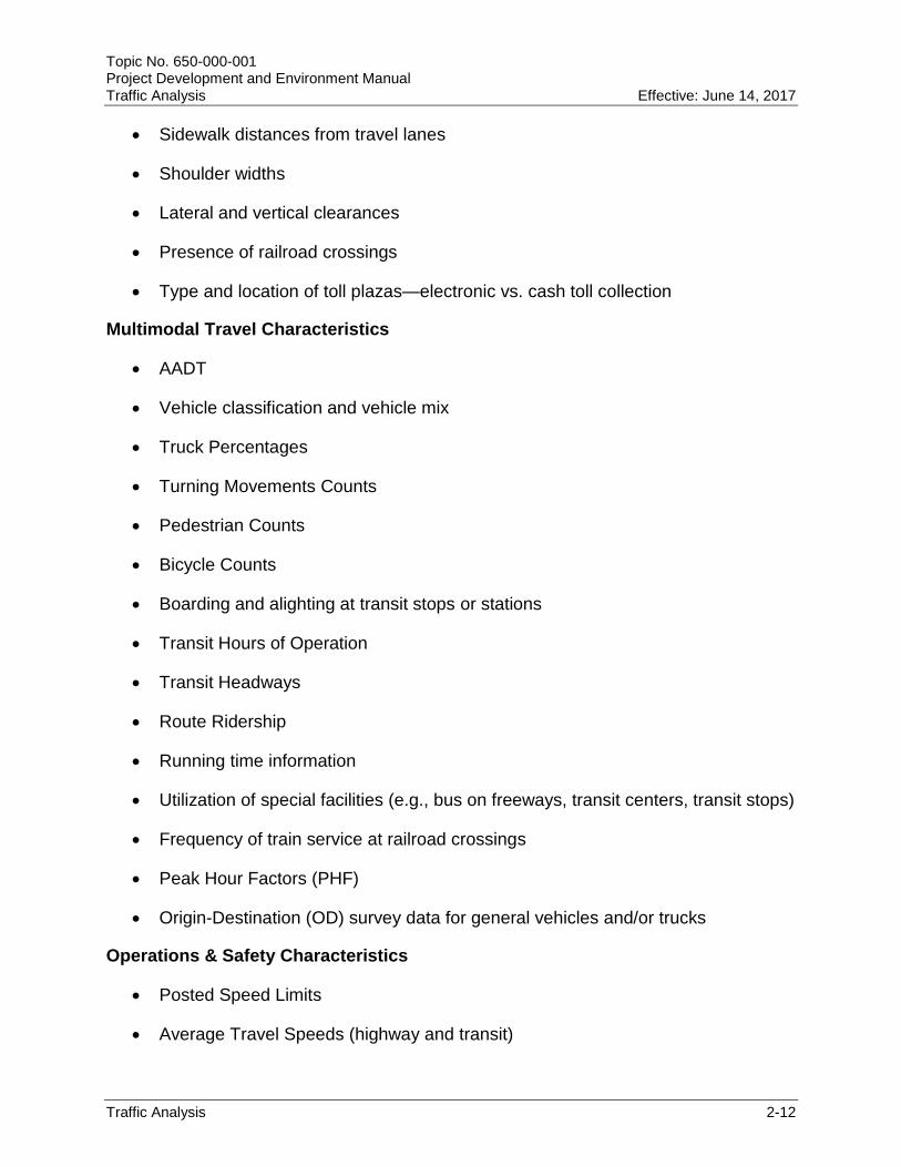
The data collection effort can be divided into three categories - roadway characteristics, multimodal travel characteristics, and operations and safety characteristics. The type of traffic analysis will determine the requirement and level of detail in which elements in each category are to be collected. The following are the data elements for each category.
Roadway Characteristics
Number of lanes
Lane widths
Presence of auxiliary lanes
Length of auxiliary lanes
Intersection types (signalized, stop controlled, roundabout, grade separated)
Predominant land use types (existing and future) adjacent to corridor
Roadway geometrics (curvature, intersection configuration, grades)
Number of turn lanes
Turn lane storage lengths
Presence of on-street parking
Presence of transit lanes
Presence of transit stops
Type of transit stops (bus bays or bus stops)
Presence of bicycle lanes
Bicycle lane width
Presence of sidewalks
Topic No. 650-000-001 Project Development and Environment Manual Traffic Analysis Effective: June 14, 2017
Traffic Analysis 2-12
Sidewalk distances from travel lanes
Shoulder widths
Lateral and vertical clearances
Presence of railroad crossings
Type and location of toll plazas—electronic vs. cash toll collection
Multimodal Travel Characteristics
AADT
Vehicle classification and vehicle mix
Truck Percentages
Turning Movements Counts
Pedestrian Counts
Bicycle Counts
Boarding and alighting at transit stops or stations
Transit Hours of Operation
Transit Headways
Route Ridership
Running time information
Utilization of special facilities (e.g., bus on freeways, transit centers, transit stops)
Frequency of train service at railroad crossings
Peak Hour Factors (PHF)
Origin-Destination (OD) survey data for general vehicles and/or trucks
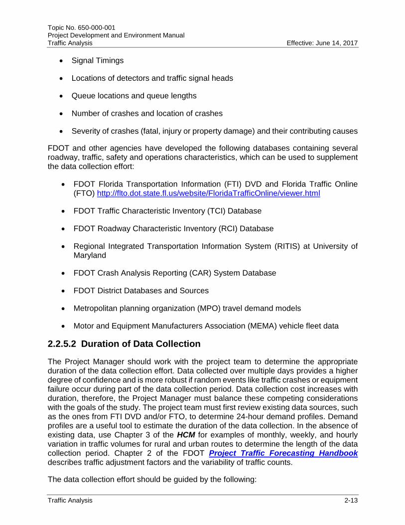
Operations & Safety Characteristics
Posted Speed Limits
Average Travel Speeds (highway and transit)
Topic No. 650-000-001 Project Development and Environment Manual Traffic Analysis Effective: June 14, 2017
Traffic Analysis 2-13
Signal Timings
Locations of detectors and traffic signal heads
Queue locations and queue lengths
Number of crashes and location of crashes
Severity of crashes (fatal, injury or property damage) and their contributing causes
FDOT and other agencies have developed the following databases containing several roadway, traffic, safety and operations characteristics, which can be used to supplement the data collection effort:
FDOT Florida Transportation Information (FTI) DVD and Florida Traffic Online (FTO) http://flto.dot.state.fl.us/website/FloridaTrafficOnline/viewer.html
FDOT Traffic Characteristic Inventory (TCI) Database
FDOT Roadway Characteristic Inventory (RCI) Database
Regional Integrated Transportation Information System (RITIS) at University of Maryland
FDOT Crash Analysis Reporting (CAR) System Database
FDOT District Databases and Sources
Metropolitan planning organization (MPO) travel demand models
Motor and Equipment Manufacturers Association (MEMA) vehicle fleet data
2.2.5.2 Duration of Data Collection
The Project Manager should work with the project team to determine the appropriate duration of the data collection effort. Data collected over multiple days provides a higher degree of confidence and is more robust if random events like traffic crashes or equipment failure occur during part of the data collection period. Data collection cost increases with duration, therefore, the Project Manager must balance these competing considerations with the goals of the study. The project team must first review existing data sources, such as the ones from FTI DVD and/or FTO, to determine 24-hour demand profiles. Demand profiles are a useful tool to estimate the duration of the data collection. In the absence of existing data, use Chapter 3 of the HCM for examples of monthly, weekly, and hourly variation in traffic volumes for rural and urban routes to determine the length of the data collection period. Chapter 2 of the FDOT Project Traffic Forecasting Handbook describes traffic adjustment factors and the variability of traffic counts.
The data collection effort should be guided by the following:

Topic No. 650-000-001 Project Development and Environment Manual Traffic Analysis Effective: June 14, 2017
Traffic Analysis 2-14
The FDOT Project Traffic Forecasting Handbook recommends that traffic counts be collected on Tuesday, Wednesday, or Thursday. To ensure the data is representative of average (typical) traffic conditions, traffic counts should not be collected during the summer or on holidays since travel patterns during these times cannot be assumed to be representative of typical weekdays.
A 72-hour period is recommended for traffic counts. Collection of data over a 72-hour period is preferred over single-day to avoid poor and faulty information (data) due to equipment failures, human errors, traffic incidents, among other reasons. However, if the roadway is a typical commuter traffic route and there is adequate history (5 to 10 years) of traffic counts, a 24-hour to 48-hour count may be sufficient. A 24-hour to 48-hour traffic count must be validated against historical counts.
Classification counts from a Telemetered Traffic Monitoring Site (TTMS) or Portable Traffic Monitoring Site (PTMS) can be used as long as such site exists within the vicinity of the project. In absence of a permanent count station, 72 consecutive hours of vehicle classification counts should be collected. Counts for less than 72 hours are not recommended because of random variations that may be brought about by equipment failures, human errors, traffic incidents, among other reasons.
Intersection turning movements should generally be collected during the AM and PM peak periods for 72-hour period. For urban arterials serving predominantly commuter traffic, turning movement counts over a 24-hour to 48-hour period may be sufficient provided there is historical validation data. If heavy truck traffic is anticipated in the study area, truck counts should also be collected as part of the intersection turning movement count.
Roadways serving commercial uses, shopping centers, and schools may peak during the midday period or during the weekends. The Project Manager should review the traffic count synopsis report from the FTI DVD and/or FTO to determine if midday turning movement counts are required.
If there is no history of traffic counts, conduct a 72-hour approach and departure counts at the intersection to allow extrapolation of the peak hour turning movements from the daily turning movements.
Intersection turning movement counts must include bicycle and pedestrian movements. Bicycle and Pedestrian usage varies considerably with location. Peak period counts may be adequate in areas with light pedestrian/bicycle usage. Downtown areas, university campuses, and areas with heavy pedestrian and/or bicycle usage should be counted for an 8-hour period.
Crash data should be obtained for the most recent five years. If five years of crash data are not available, use a minimum of three years with a corresponding explanation. Due to changes to the Florida Traffic Crash Report implemented by

Topic No. 650-000-001 Project Development and Environment Manual Traffic Analysis Effective: June 14, 2017
Traffic Analysis 2-15
the Department of Highway Safety and Motor Vehicles in 2011, it may not be possible to compare certain fields like crash type across five years.
Transit projects can vary from new fixed guideway systems to Bus Rapid Transit (BRT) projects. The data collection for such projects depends on the type of project. For areas with existing transit service, the traffic analyst should consult with the local transit agency before beginning any data collection. Transit agencies and providers are required to develop a 10-year Transit Development Plan (TDP). These TDPs usually contain a significant amount of data that can be used for transit studies, such as socio-economic data, transportation system characteristics, market research and system surveys, public transportation service performance and trends, among other useful information. The data collection effort may vary among routes depending on the ridership. For example, low ridership routes may only require a 7 to 10-day period of data collection to capture a sufficiently robust sample of responses. Additional details about data collection activities for environmental analysis can be found in Part 1, Chapter 14, Transit Project Delivery.
2.2.6 Project Traffic Forecasting
Project traffic forecasting is the process of estimating the future year traffic demand for a given project. It includes estimating daily volumes and peak hour demand volumes. Daily volumes are represented by AADT while peak hour demand is represented as Design Hour Volume (DHV). Transportation practitioners use AADT and DHV to not only determine geometric features of the roadway, but also assess operational performance of the facility.
There are two options for forecasting traffic volumes:
With a Travel Demand Model
Without a Travel Demand Model
The Project Traffic Forecasting Handbook details FDOT’s traffic forecasting process for both options. Documentation of traffic forecasts and analysis must detail the selection of the preferred forecasting method, as well as the application of said method in the analysis.
2.2.6.1 Forecasting using a Travel Demand Model
Traffic forecasting for a project must begin with the most recently adopted version of a travel demand model. This model should have been used to develop the most recent Long Range Transportation Plan (LRTP). This model represents the latest planning assumptions regarding population, employment, land use, transportation plans, and revenue, and is referred to as the “adopted model”.

Topic No. 650-000-001 Project Development and Environment Manual Traffic Analysis Effective: June 14, 2017
Traffic Analysis 2-16
Before using any travel demand model, the traffic analyst must determine if the model meets the area wide validation standards established by FDOT’s Systems Traffic Modeling Office and published in the FSUTMS-Cube Framework Phase II – Model Calibration and Validation Standards Report.
With the development of the Florida Statewide Model, all 67 counties within the State of Florida are now covered by at least one travel demand model. The determination of the preferred model for each study is dependent on a number of factors, such as project location, analysis years, available data, transportation mode (e.g., freight, transit, automobile). District Planning Office concurrence on the preferred travel demand model is required prior to commencing the traffic forecasting process.
Finally, most of the travel demand models are validated to Peak Season Weekday Average Daily Traffic (PSWADT).The PSWADT traffic volumes generated by the model must be converted to AADT using the Model Output Conversion Factor (MOCF). In such cases, the following formula shall be applied:
AADT = PSWADT * MOCF
Subarea or Corridor Validation
Some travel demand models may require subarea or corridor validation to improve the forecast within the project limits. Subarea validation is needed when the model meet area-wide validation standards but fail on specific area or corridor under study. In a subarea or corridor validation, a smaller area or corridor is extracted from the regional model and the validation process is restarted with the goal of improving statistics such as demand/count ratios, Root Mean Square Error (RMSE), estimated-over-absorbed transit trips. The subarea or corridor validation effort is not as intensive as a regional, MPO or county model validation, because it uses a smaller roadway network. Further information about the Subarea/Corridor Validation standards can be found in the FSUTMS-Cube Framework Phase II – Model Calibration and Validation Standards.
Additional details regarding forecasting using a travel demand model can be found in Chapter 3 of the Project Traffic Forecasting Handbook.
Time of Day Model
Travel demand models were originally designed to produce future travel demand at the daily level. Most of the analysis done to determine geometric requirements of roadways and intersections is done for the design hour. Until recently, the process of converting AADT to peak hour assumed that 10% of the AADT occurred during the peak hour. While this process produces reasonable results in smaller urbanized areas where the peak period is limited to one hour, it fails in highly congested urban areas where the peak period spreads beyond the typical one hour.
The broadening of traffic flow profiles to multiple-hour peak periods is referred to as peak spreading. As the traffic congestion worsens during the peak hour, many drivers either leave early or delay the trip to avoid the peak hour. In some cases, they seek an

Topic No. 650-000-001 Project Development and Environment Manual Traffic Analysis Effective: June 14, 2017
Traffic Analysis 2-17
alternative route or switch modes. As a result, the traffic generally traveling during the peak hour shifts to the adjacent shoulder hours.
To address multi-hour congestion problems, many urban areas have developed a Time of Day (TOD) model that forecasts traffic for the AM peak period, midday period, PM peak period and night/rest of the day period. Most TOD models add trip assignments for all time periods together to approximate daily traffic. TOD models require traffic count data by time of day to ensure accurate validation by each time period. This adds to the level of complexity for validation checks and the Project Manager should consult with District Planning Office or MPO traffic modeling staff before using the TOD model.
2.2.6.2 Forecasting without Travel Demand Models
Projects located in areas without an MPO travel demand model or in areas where the Florida Statewide Model or the MPO travel demand model is not performing well may have to rely on a combination of historic traffic trends or population growth for traffic forecasting.
Historic Trend Projections
The historic trends analysis should be based on a minimum of 10 years of data. A regression analysis is performed on the most recent 10 years of traffic counts in order to obtain a trend equation. Any obvious outliers should be removed from the data set and an explanation provided. Only trend equations with an R-square value of at least 75% should be used to estimate the future year traffic volumes. Trend analysis is not sensitive to capacity constraints or new capacity and care should be exercised when projected traffic demand exceeds capacity.
Growth Rates
Historic trends analysis works well for areas with stable land use, transportation network and growth patterns. In areas that are experiencing substantial growth, construction of parallel facilities and changes in land use should consider growth rates based on population and employment growth.
Once the growth rate has been determined and checked for reasonableness, it can then be applied to a given base year count and projected forward to the future analysis years.
For additional details, see Chapter 4 of the Project Traffic Forecasting Handbook.
2.2.6.3 Calculating AADT and DDHV
AADT
Traffic counts are usually collected over a 24-to 72-hour period through the placement of portable traffic counters. These counters are usually rubber hoses placed across the roadway that record the number of axles.
Topic No. 650-000-001 Project Development and Environment Manual Traffic Analysis Effective: June 14, 2017
Traffic Analysis 2-18
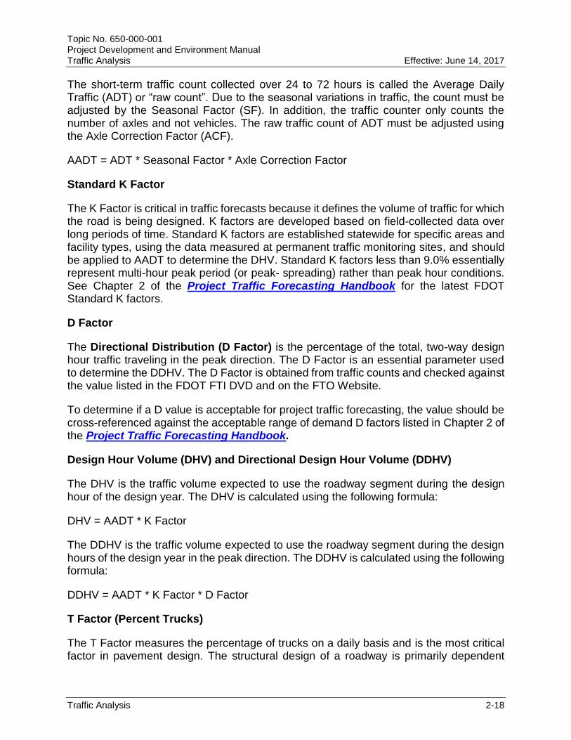
The short-term traffic count collected over 24 to 72 hours is called the Average Daily Traffic (ADT) or “raw count”. Due to the seasonal variations in traffic, the count must be adjusted by the Seasonal Factor (SF). In addition, the traffic counter only counts the number of axles and not vehicles. The raw traffic count of ADT must be adjusted using the Axle Correction Factor (ACF).
AADT = ADT * Seasonal Factor * Axle Correction Factor
Standard K Factor
The K Factor is critical in traffic forecasts because it defines the volume of traffic for which the road is being designed. K factors are developed based on field-collected data over long periods of time. Standard K factors are established statewide for specific areas and facility types, using the data measured at permanent traffic monitoring sites, and should be applied to AADT to determine the DHV. Standard K factors less than 9.0% essentially represent multi-hour peak period (or peak- spreading) rather than peak hour conditions. See Chapter 2 of the Project Traffic Forecasting Handbook for the latest FDOT Standard K factors.
D Factor
The Directional Distribution (D Factor) is the percentage of the total, two-way design hour traffic traveling in the peak direction. The D Factor is an essential parameter used to determine the DDHV. The D Factor is obtained from traffic counts and checked against the value listed in the FDOT FTI DVD and on the FTO Website.
To determine if a D value is acceptable for project traffic forecasting, the value should be cross-referenced against the acceptable range of demand D factors listed in Chapter 2 of the Project Traffic Forecasting Handbook.
Design Hour Volume (DHV) and Directional Design Hour Volume (DDHV)
The DHV is the traffic volume expected to use the roadway segment during the design hour of the design year. The DHV is calculated using the following formula:
DHV = AADT * K Factor
The DDHV is the traffic volume expected to use the roadway segment during the design hours of the design year in the peak direction. The DDHV is calculated using the following formula:
DDHV = AADT * K Factor * D Factor
T Factor (Percent Trucks)
The T Factor measures the percentage of trucks on a daily basis and is the most critical factor in pavement design. The structural design of a roadway is primarily dependent

Topic No. 650-000-001 Project Development and Environment Manual Traffic Analysis Effective: June 14, 2017
Traffic Analysis 2-19
upon on the heavy axle loads generated by commercial traffic and the T Factor measures the percentage of trucks on a daily basis.
For traffic analysis, the Design Hour Truck (DHT) Factor is used to convert trucks to passenger car equivalents. The DHT is calculated by dividing the T Factor by 2 because the percentage of trucks in the traffic is not evenly distributed throughout the day.
2.2.6.4 Re-evaluating Traffic Analysis
The majority of traffic forecasting and analysis should be completed during the PD&E phase. Once the traffic forecast and analysis is completed, the subsequent phases (Design and Construction) should use the same traffic data for design and operational purposes such as designing turn lanes, signal timing, or traffic control plans.
As transportation projects advances, they may require a re-evaluation as described in Part 1, Chapter 13, Re-evaluations. During re-evaluation, the Project Manager and the project team must decide if the traffic forecast and analysis prepared for the project needs to be updated.
The validity of traffic forecasts and analysis depends on changed conditions brought on by:
Substantial “macro-level” changes in the economy and driving habits since the project traffic forecast was prepared. Examples include the effects of economic recession, a substantial change in gas prices potentially affecting travel demand or implementation of an alternative travel mode.
Substantial change in land uses or growth within the study area. For example, large scale developments, such as sector plans, approved near the study area which have the potential to change traffic generation and/or travel patterns.
Substantial changes in the scope of work. For example, the addition of a new alternative that was not previously considered when the traffic model was developed. Model adjustment may be necessary to incorporate changes in trip patterns anticipated within the study area.
Substantial changes in the transportation network near the study area. For example, the construction of major beltways or by-pass routes. Traffic reports prepared before and after the network was changed may contain substantial differences in trip distribution patterns.
Adoption of a new LRTP and regional travel demand model when the project traffic forecast is more than five years old. An update of the LRTP represents the latest planning assumptions regarding population, employment and land use, and coordinates transportation planning activities within and outside of the MPO area. If the traffic forecast is more than five years old and the MPO has adopted a new LRTP, the Project Manager and the traffic analyst should perform a sensitivity

Topic No. 650-000-001 Project Development and Environment Manual Traffic Analysis Effective: June 14, 2017
Traffic Analysis 2-20
analysis of revised input and model assumptions to determine the magnitude of differences from prior analyses and their effects on past project decisions.
The Project Manager should use conditions discussed above as a guide to determine the validity of previously completed traffic analysis. The project team may conduct sensitivity tests to assess the magnitude of differences from prior analyses resulting from use of new data and their effects on past decisions. The Project Manager and project team must consider any difference in the results to deliver the project decision. The focus should be on consistent conclusions from the analysis, rather than on any minor numerical differences between two different travel demand models outputs. If there is no substantial change in the traffic forecast, the study team would simply document the change and the sensitivity analysis results in the project file and proceed with the next phase of the project.
If there is a substantial change in the traffic forecast, the Project Manager must coordinate with OEM to address the need for re-evaluating the traffic analysis for the project. The re-evaluation of traffic analysis may require changes to the analysis methodology, data inputs and assumptions in order to update the traffic analysis to be consistent with the latest LRTP. The Project Manager should document decisions reached with OEM and other project stakeholders.
2.2.7 Traffic Analysis
Traffic analysis includes capacity and operational analysis to determine how well the project alternatives are meeting the project purpose and need. Detailed evaluation of project alternatives should only proceed on viable or feasible project alternatives (see Part 2, Chapter 3, Engineering Analysis). Also, the same assumptions and a similar set of tools should be consistently applied to perform traffic analysis for different alternatives in a project.
Depending on the project, the analysis may use the methodologies in the HCM or a more sophisticated tool such as microsimulation to analyze the interactions between different users on an entire network.
The decision on selecting the appropriate tool for the project depends on the analysis objectives and the available resources/data. Chapter 4 of the FDOT Traffic Analysis Handbook describes the various tools available and provides guidance on selecting the proper analysis tools.
2.2.7.1 Capacity Exceeds Traffic Demand
In scenarios where the roadway capacity exceeds traffic demand, all the traffic is accommodated during the time interval under study. There is no spillback of any queues or congestion from one segment affecting adjacent segments.
In such situation, analytical tools like the HCS that can quickly compute LOS and other operational MOEs for individual segments or isolated points should be used. HCS can compute LOS for uninterrupted flow facilities, interrupted flow facilities and multimodal
Topic No. 650-000-001 Project Development and Environment Manual Traffic Analysis Effective: June 14, 2017
Traffic Analysis 2-21
transportation facilities (e.g., pedestrian, bicycle, and transit). HCS guidance on how to conduct analytical analysis is available in the HCM and its accompanied software HCS.
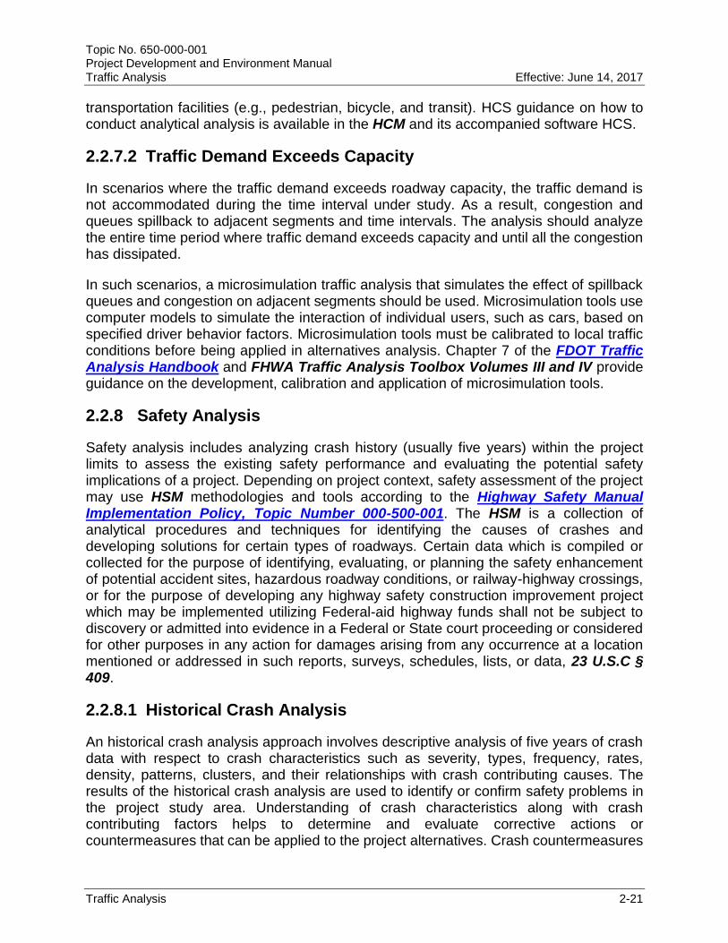
2.2.7.2 Traffic Demand Exceeds Capacity
In scenarios where the traffic demand exceeds roadway capacity, the traffic demand is not accommodated during the time interval under study. As a result, congestion and queues spillback to adjacent segments and time intervals. The analysis should analyze the entire time period where traffic demand exceeds capacity and until all the congestion has dissipated.
In such scenarios, a microsimulation traffic analysis that simulates the effect of spillback queues and congestion on adjacent segments should be used. Microsimulation tools use computer models to simulate the interaction of individual users, such as cars, based on specified driver behavior factors. Microsimulation tools must be calibrated to local traffic conditions before being applied in alternatives analysis. Chapter 7 of the FDOT Traffic Analysis Handbook and FHWA Traffic Analysis Toolbox Volumes III and IV provide guidance on the development, calibration and application of microsimulation tools.
2.2.8 Safety Analysis
Safety analysis includes analyzing crash history (usually five years) within the project limits to assess the existing safety performance and evaluating the potential safety implications of a project. Depending on project context, safety assessment of the project may use HSM methodologies and tools according to the Highway Safety Manual Implementation Policy, Topic Number 000-500-001. The HSM is a collection of analytical procedures and techniques for identifying the causes of crashes and developing solutions for certain types of roadways. Certain data which is compiled or collected for the purpose of identifying, evaluating, or planning the safety enhancement of potential accident sites, hazardous roadway conditions, or railway-highway crossings, or for the purpose of developing any highway safety construction improvement project which may be implemented utilizing Federal-aid highway funds shall not be subject to discovery or admitted into evidence in a Federal or State court proceeding or considered for other purposes in any action for damages arising from any occurrence at a location mentioned or addressed in such reports, surveys, schedules, lists, or data, 23 U.S.C § 409.
2.2.8.1 Historical Crash Analysis
An historical crash analysis approach involves descriptive analysis of five years of crash data with respect to crash characteristics such as severity, types, frequency, rates, density, patterns, clusters, and their relationships with crash contributing causes. The results of the historical crash analysis are used to identify or confirm safety problems in the project study area. Understanding of crash characteristics along with crash contributing factors helps to determine and evaluate corrective actions or countermeasures that can be applied to the project alternatives. Crash countermeasures

Topic No. 650-000-001 Project Development and Environment Manual Traffic Analysis Effective: June 14, 2017
Traffic Analysis 2-22
must be selected based on their appropriateness and effectiveness to address specific safety issues and project goals.
The future conditions analysis should examine the safety performance of the alternatives based on project context which includes future traffic volumes, proposed geometrics, modal needs, and traffic control conditions as appropriate. Future conditions analysis must include a discussion of the proposed design context, traffic operational performance and users of the facility. Additionally, safety assessment for future conditions must examine how the proposed alternatives improve upon any existing or potential safety problems. This will include comparison of existing conditions safety performance to that of future no-build and future build conditions.
2.2.8.2 Quantitative Safety Analysis
Quantitative safety analysis involves using HSM-based methods that incorporate site specific characteristics and mathematical functions such as Safety Performance Functions (SPFs) and Crash Modification Factors (CMFs) to objectively estimate safety performance measures. A SPF is an equation used to predict the average number of crashes per year at a location as a function of traffic exposure (e.g., volumes of vehicles, bicyclists, pedestrians). It allows an estimation of future safety conditions. A CMF is a multiplicative factor used to compute the expected number of crashes after implementing a given countermeasure at a specific site. It allows estimation of the effectiveness of safety improvements.
The HSM based methods are detailed and require a thorough knowledge and experience in their applications and limitations. The advantage of these methods is their ability to make relative comparisons between various project alternatives based on the change in the number of crashes or combinations of crash severities for different contexts. The HSM continues to evolve and does not offer the ability to evaluate change on safety performance for every project scenario or context. In some cases, the SPF may require adjustments to Florida conditions because they were developed using national data and may not reflect average Florida conditions. Users of the HSM should refer to the State Safety Office for publication of the current Florida specific SPF calibration factors.
HSM can be used to support the following project development activities:
Evaluate purpose and need for the project
Develop and refine the project alternatives
Analyze and evaluate project alternatives
The HSM Part C predicted methods can calculate historic and anticipated future safety performance of the project. HSM Part C is applicable to rural two-lane highways, rural multilane highways, suburban and urban arterials, freeways, and interchanges. HSM has specific guidance regarding how to estimate future crashes with and without safety improvements. Additionally, the human factors fundamentals published in the HSM can

Topic No. 650-000-001 Project Development and Environment Manual Traffic Analysis Effective: June 14, 2017
Traffic Analysis 2-23
help traffic analysts identify safety-specific needs for the projects and estimate the potential for safety improvements.
Development and screening of alternatives can use HSM predictive methods to quantify the anticipated change in crash frequency and/or severity as the result of changes in geometric features or traffic conditions. If an assessment for a safety-specific project shows that some alternatives would have a negligible or adverse effect on safety performance, those alternatives can be eliminated. The documentation needed to support the elimination of alternatives could therefore include the information derived from the HSM methods.
Another method for quantifying safety impacts of project alternatives is a relative comparison of CMFs. This method estimates the relative magnitude of potential safety impacts based on the anticipated percent change in crash frequency based on applicable CMFs. CMFs are published in the HSM Part D and FHWA’s Crash Modification Factors Clearinghouse website which include a star rating to indicate their quality. CMFs are also used to compare relative safety benefits of potential mitigation measures when selecting a strategy to address an identified safety issue. This method is relatively simple to apply, and when used appropriately can objectively support proposed improvements. CMFs are applicable to roadway segments, intersections, interchanges, special facilities, and various geometric situations.
2.2.9 Environmental Analyses
Environmental impact analyses such as land use, air quality, and noise depend on the outputs of traffic forecasting and analysis. The most common traffic data required for environmental analyses are AADT, peak hour volumes, peak truck hour volumes and traffic classification. Typical MOEs from the traffic analysis that are used for environmental analyses are listed in Section 2.2.3. The Project Manager should work with the District Environmental Manager and other environmental subject matter experts to determine the scale of traffic data needed for various environmental analyses.
2.2.10 Project Traffic Analysis Report
The Project Traffic Analysis Report documents the assumptions, methods, traffic forecasts, design traffic, and results of the traffic analysis for the project in plain language and in an easily understood format. It summarizes the data collection effort, input parameters, traffic analysis tools, existing conditions, development of future traffic forecasts, and traffic operational and safety analyses of project alternatives. The report must use the Technical Report Cover Page, Form No. 650-050-38 as the cover sheet of the report. A sample Project Traffic Analysis Report cover page is provided in Figure 2-1). Traffic analysis reports support decisions regarding project actions. Therefore, the report should concisely present the results of the traffic analysis in a manner that can be readily understood by a variety of audiences. Discussion of the analysis results should be focused and avoid unnecessary information. Additionally, the report should include text that discusses information presented in tables and figures (charts, maps, and diagrams). MOEs presented in tables and figures should be clear, concise, and simple. The report

Topic No. 650-000-001 Project Development and Environment Manual Traffic Analysis Effective: June 14, 2017
Traffic Analysis 2-24
should include other supporting technical data and output from analysis tools in the appendices. Additionally, highly detailed information such as data used to prepare figures and tabular summaries should be placed in the appendices.
The scope of the report depends on the size and complexity of the project, and whether traffic analyses conducted prior to the PD&E phase are going to be incorporated. Regardless of the complexity, the traffic analysis report should summarize the items presented in Section 2.2.10.2. The Project Traffic Analysis Report must be signed and sealed by a professional engineer in accordance with Chapter 471, Florida Statutes (F.S.).
Traffic analysis reports for projects that are not complex can include the results of traffic forecasting. The approach to documentation (i.e., one Project Traffic Analysis Report or multiple technical memoranda) should be included in the scope and agreed upon by the FDOT Project Manager and project team. For complex projects, traffic forecasting and traffic analysis may be prepared under different project tasks and teams. For such projects, it is recommended that traffic forecasting results and traffic analysis be documented in different technical memoranda or reports. See the Project Traffic Forecasting Handbook on how to prepare a Project Traffic Forecasting Memorandum.
Quality control review for Project Traffic Analysis Reports should include reviewing methods and assumptions used to develop the analysis, inputs, reasonableness of results, and completeness of the results. The review of reasonableness of traffic projections should include examining and comparing observed traffic and historical trends, proposed roadway and transit network improvements, and land use projections. Refer to the FDOT Traffic Analysis Handbook for checklists that may aid the review process.
2.2.10.1 Traffic Analysis Assumptions
The assumptions used to prepare the traffic analysis including traffic projections should be documented so that a reviewer can easily understand the methodology, input values, and analysis results. It is essential for the Project Manager to reach consensus with the project team and lead agency regarding the assumptions during the scope development stage of the project. The Project Traffic Assumption Form, Form No. 650-050-39 in Figure 2-2, can be used to summarize the assumptions.
The following should be included in the traffic analysis assumptions summary as appropriate.
1. Traffic Forecasting Assumptions Summary
a. Traffic forecast method - Travel demand model, historic trend or growth rates
b. For the travel demand model:

Topic No. 650-000-001 Project Development and Environment Manual Traffic Analysis Effective: June 14, 2017
Traffic Analysis 2-25
i. Date of adoption of LRTP
ii. Model base year
iii. Horizon year of the travel demand model
iv. MPO website which includes documentation of the LRTP
c. Changes in land use, economy, population, and employment since the travel demand model was built.
d. Data Collection Year
e. Analysis years – opening year, design year and interim year (for phased projects)
f. MOCF
g. K Factor
h. D Factor
i. T Factor
2. Traffic (operational and safety) analysis assumptions summary should include:
a. Study Area (i.e., Project limits, traffic study area, influence area)
b. Key input parameters
c. Calibration and validation parameters
d. Analysis method and/or tools
e. Analysis periods
f. Performance MOE
2.2.10.2 Project Traffic Analysis Report Outline
The following is an outline for the Project Traffic Analysis Report. The report should have headings and subheadings to effectively delineate the sections appropriate to the level of analysis.
1. Executive Summary – Summary of analysis results.
2. Traffic Analysis Assumptions – Summary of assumptions for input parameters, analysis years, analysis methodology.

Topic No. 650-000-001 Project Development and Environment Manual Traffic Analysis Effective: June 14, 2017
Traffic Analysis 2-26
3. Introduction – Brief description of the project with a project location map, traffic analysis objectives, including a project location map.
4. Traffic Analysis Method – Discussion of assumptions and analysis methodology including analysis years, traffic study area, data required, analysis tools including version, and MOE.
5. Existing Conditions Analysis – Summary of balanced turning movement counts for the study intersections/interchanges under existing conditions. Summary of operational and safety analyses for the existing conditions. Microsimulation analysis should also include base model development and calibration documentation. Calibration may be submitted as a standalone document.
6. Development of future year traffic forecast – Depending on the scale of the project, this may be developed and submitted as a standalone document, in which case it should be referenced within the Project Traffic Analysis Report.
7. Alternatives Analysis – Description of project alternatives, assigning of project traffic volumes to alternatives. Summary of operational and safety analyses for each project alternative.
8. Summary of Analysis Results – Discussion of advantages and disadvantages of alternatives with respect to the traffic analysis objectives and goals.
9. Appendix – Raw data used to prepare input and analysis summaries. Other supporting data/information.
American Association of State Highway and Transportation Officials (AASHTO), 2010 Highway Safety Manual
FDOT, 2008, FSUTMS-Cube Framework Phase II – Model Calibration and Validation Standards. http://www.fsutmsonline.net/images/uploads/reports/FR2_FDOT_Model_CalVal_Standards_Final_Report_10.2.08.pdf
FDOT, Highway Safety Manual Implementation Policy, Topic Number 000-500-001.
FDOT, Manual on Uniform Traffic Studies, Topic No. 750-020-007. http://www.fdot.gov/traffic/TrafficServices/Studies/MUTS/MUTS%20Final%2001.2016.pdf
FDOT, 2014. Project Traffic Forecasting Handbook. http://www.dot.state.fl.us/planning/statistics/trafficdata/ptf.pdf
FDOT, 2014. Traffic Analysis Handbook. http://www.dot.state.fl.us/planning/statistics/trafficdata/ptf.pdf

Topic No. 650-000-001 Project Development and Environment Manual Traffic Analysis Effective: June 14, 2017
Traffic Analysis 2-27
FDOT, Traffic Engineering Manual, Topic No. 750-000-005. http://www.fdot.gov/traffic/TrafficServices/Studies/TEM/TEM.shtm
FDOT, Efficient Transportation Decision Making Manual, Topic No. 650-000-002. http://www.fdot.gov/environment/pubs/etdm/etdmmanual.shtm
FHWA, 2013. Traffic Monitoring Guide. https://www.fhwa.dot.gov/policyinformation/tmguide/tmg_2013/
FHWA, 2004. Traffic Analysis Toolbox Series. http://ops.fhwa.dot.gov/trafficanalysistools/
Memorandum of Agreement Between FHWA and FDOT Concerning the State of Florida’s Participation in the Surface Transportation Project Delivery Program Pursuant to 23 U.S.C. 327, December 14, 2016. http://www.fdot.gov/environment/pubs/Executed-FDOT-NEPA-Assignment-MOU-2016-1214.pdf
Regional Integrated Transportation Information at University of Maryland. http://www.ritis.org
Title 23, CFR § 450, Appendix A. Linking the Transportation Planning and NEPA Processes. http://www.ecfr.gov/cgi-bin/text-idx?SID=ffd5a70592b8f07eb3d383a5e441e880&mc=true&node=pt23.1.450&rgn=div5
Transportation Research Board (TRB), 2010. Highway Capacity Manual
Washington State Transportation Center, 1998, Peak Spreading Analysis, Review of Relevant Issues and Synthesis of Current Practice
Project Traffic Assumption Form, Form No. 650-050-39
Technical Report Cover Page, Form No. 650-050-38
*To be completed in SWEPT
Note: Hyperlinks are only for those with FDOT Intranet access only. Those without Intranet access may view or download forms at: http://www.fdot.gov/procedures/. Sign in is required.
7/24/2016

Topic No. 650-000-001 Project Development and Environment Manual Traffic Analysis Effective: June 14, 2017
Traffic Analysis 2-28
PROJECT TRAFFIC ANALYSIS REPORT
Florida Department of Transportation
District X
Project Title
Limits of Project
County, Florida
Financial Management Number: XXXXX-X
ETDM Number: XXXXXX
The environmental review, consultation, and other actions required by applicable federal
environmental laws for this project are being, or have been, carried out by FDOT pursuant
to 23 U.S.C. § 327 and a Memorandum of Understanding dated December 14, 2016 and
executed by FHWA and FDOT.
(Insert digital signature block)
Figure Error! No text of specified style in document..1 Sample Project Traffic Analysis Report Cover Page

Topic No. 650-000-001 Project Development and Environment Manual Traffic Analysis Effective: June 14, 2017
Traffic Analysis 2-29
Traffic forecast for the project was developed using:
☐ Travel Demand Model ☐ Growth Rates
Type of Travel Demand Model Used:
☐ Metropolitan Planning Model
☐ Other Model
_______________________________
Refer to appropriate section of Project Traffic Analysis Report that discusses growth rates
Is the travel demand model based on the latest adopted Long Range Transportation Plan?
☐ YES ☐ NO
________ Date when MPO adopted the latest Long Range Transportation Plan
Explain why?
________ Base Year of Travel Demand Model
________ Horizon Year of Travel Demand Model
Long Range Transportation Plan documentation is available at (provide web address): ________________________________________
Traffic Data and Factors
Standard K = _______________ D Factor = ______________________ TDaily = _____________________
Data Collection Year = ________ Opening Year = ______________ Interim Year = _______________ Design Year = _______________
Discuss any changes in land use, economics, population and employment data since the model was built
Traffic Analysis Assumptions
Discuss study area, data calibration/validation parameters, analysis tools, analysis periods and MOEs
Figure Error! No text of specified style in document..2 Project Traffic Assumption
Summary