part 1 - time, speed and distances (chapter 8) part 2 - the … · coastal navigation session 3....
TRANSCRIPT
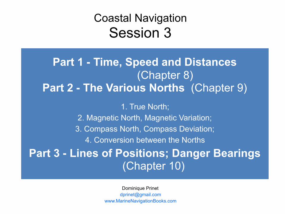
Part 1 - Time, Speed and Distances (Chapter 8)
Part 2 - The Various Norths (Chapter 9) 1. True North;
2. Magnetic North, Magnetic Variation; 3. Compass North, Compass Deviation;
4. Conversion between the Norths
Part 3 - Lines of Positions; Danger Bearings (Chapter 10)
Dominique Prinet [email protected]
www.MarineNavigationBooks.com
Coastal Navigation Session 3
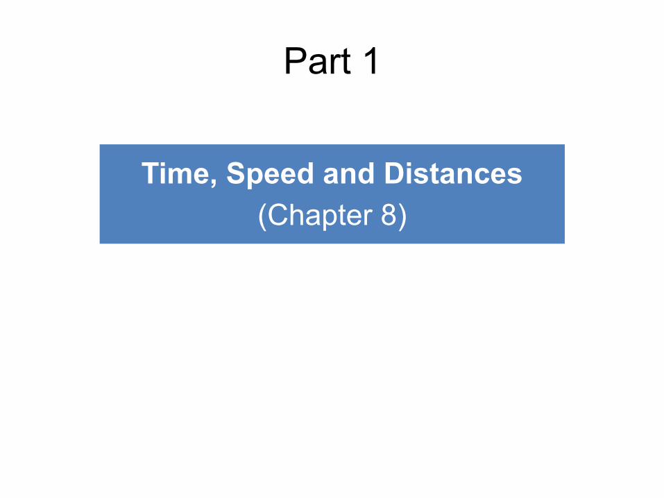
Time, Speed and Distances (Chapter 8)
Part 1
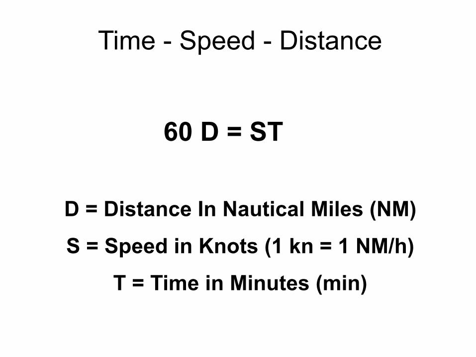
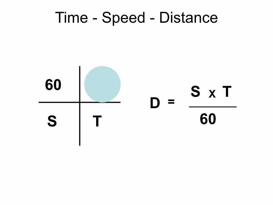
Time - Speed - Distance
60 D = ST
D = Distance In Nautical Miles (NM)
S = Speed in Knots (1 kn = 1 NM/h)
T = Time in Minutes (min)

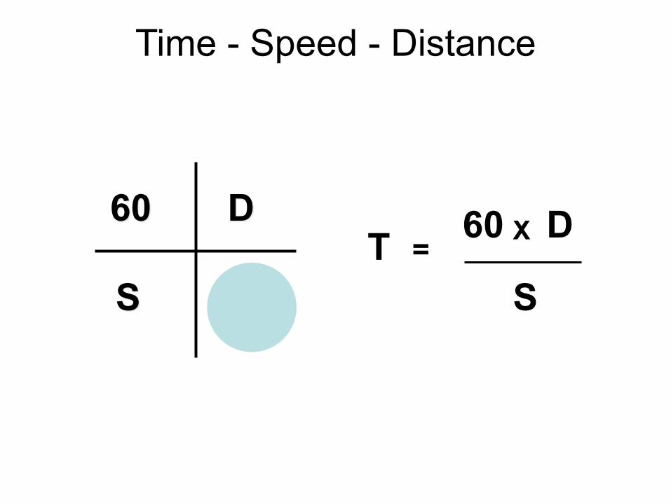
Time - Speed - Distance
60 D
S TS 60 DX
T=
Time - Speed - Distance
60 D
S T S
60 DXT =
Time - Speed - Distance
60 D
S T
S
60D
X T=
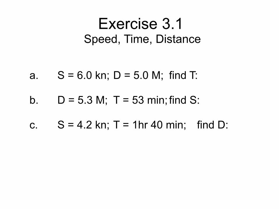
a. S = 6.0 kn; D = 5.0 M; find T:
b. D = 5.3 M; T = 53 min; find S:
c. S = 4.2 kn; T = 1hr 40 min; find D:
Exercise 3.1 Speed, Time, Distance
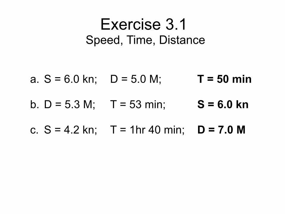
a. S = 6.0 kn; D = 5.0 M; T = 50 min
b. D = 5.3 M; T = 53 min; S = 6.0 kn
c. S = 4.2 kn; T = 1hr 40 min; D = 7.0 M
Exercise 3.1 Speed, Time, Distance
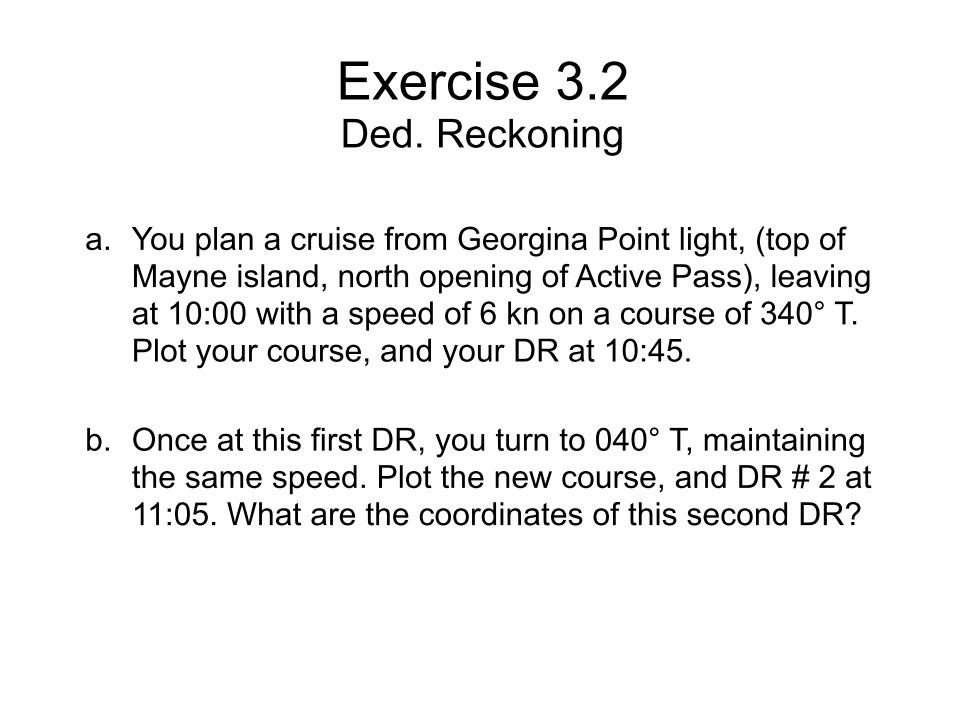
a. You plan a cruise from Georgina Point light, (top of Mayne island, north opening of Active Pass), leaving at 10:00 with a speed of 6 kn on a course of 340° T. Plot your course, and your DR at 10:45. b. Once at this first DR, you turn to 040° T, maintaining the same speed. Plot the new course, and DR # 2 at 11:05. What are the coordinates of this second DR?
Exercise 3.2 Ded. Reckoning
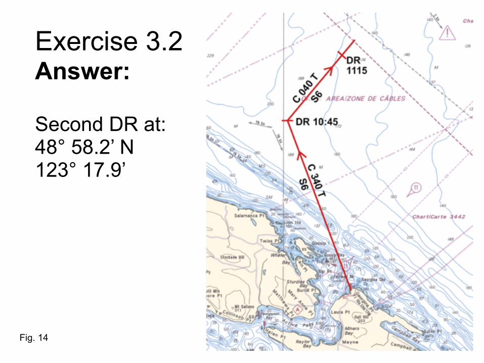
Exercise 3.2 Answer: Second DR at: 48° 58.2’ N 123° 17.9’
Fig. 14
Part 2 - The Various Norths (Chapter 9) 1. True North; 2. Magnetic North, Magnetic Variation; 3. Compass North, Compass Deviation; 4. Conversion between the Norths
Part 2
1. True NorthDirection of the Geographical Pole
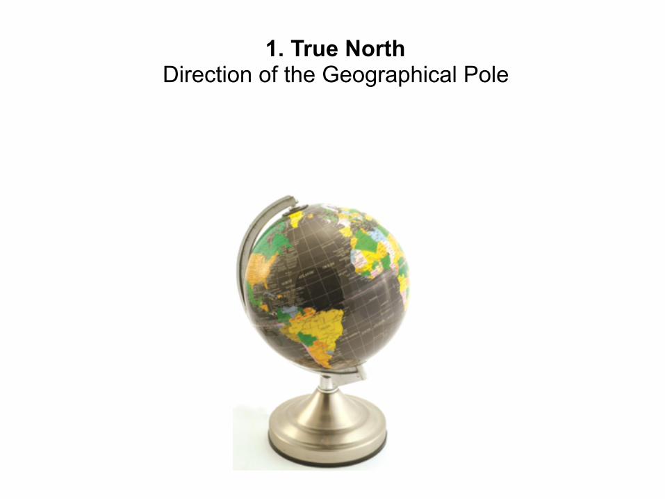
2. Magnetic North
Area of Convergence of the Earth’s Magnetic Lines

Angle (E. or W.) between True North & Magnetic North
Magnetic Variation
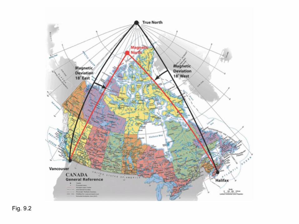
Fig. 9.2
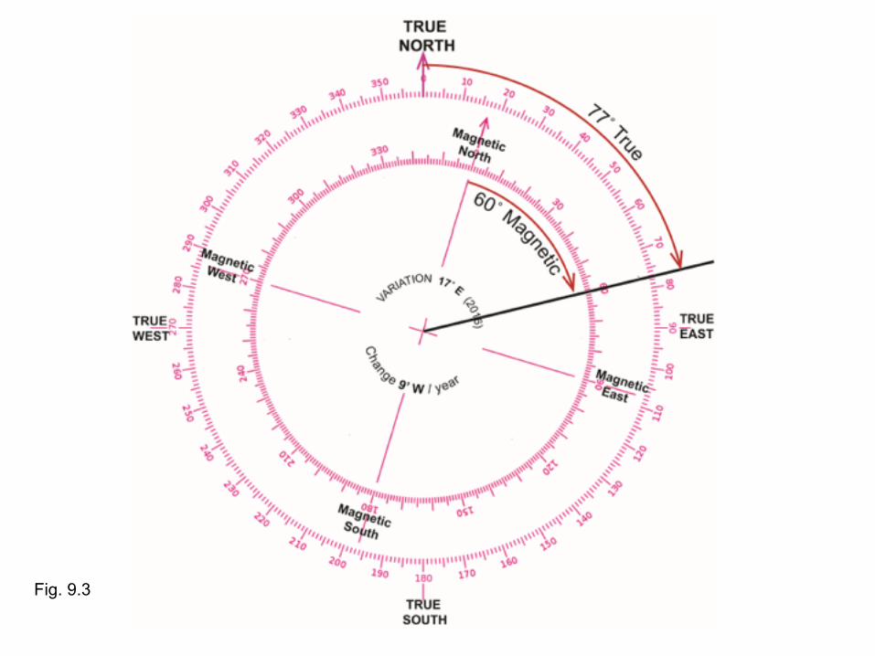
Fig. 9.3
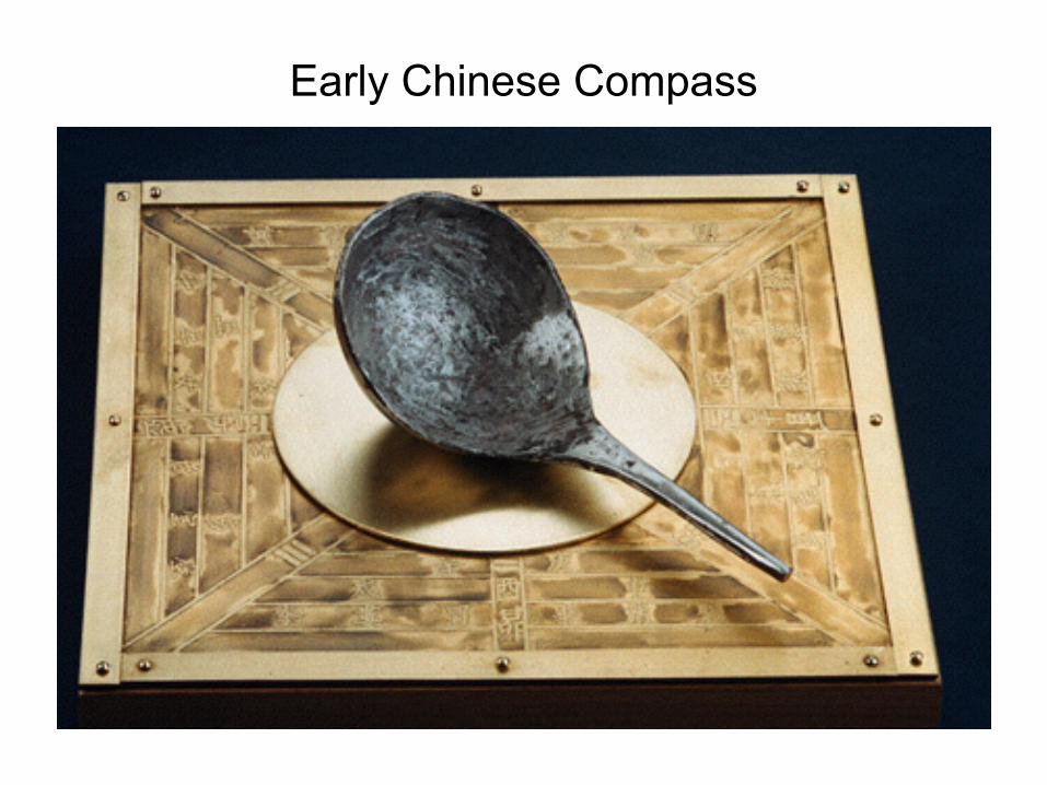
Early Chinese Compass
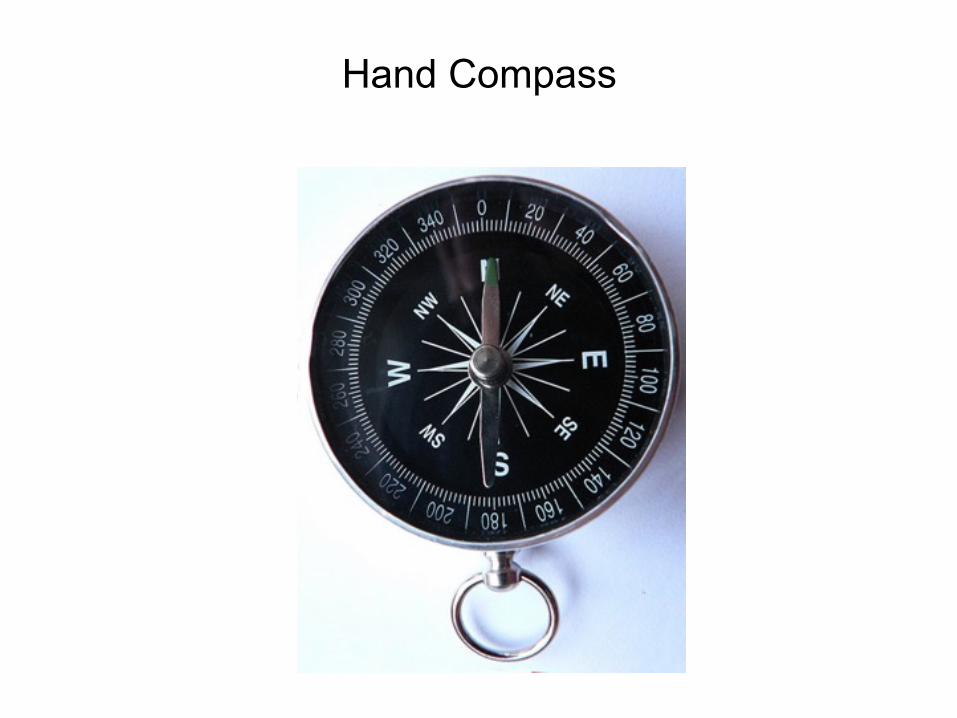
Hand Compass
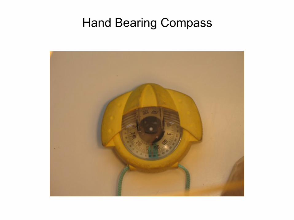
Hand Bearing Compass
Hand Bearing Compass
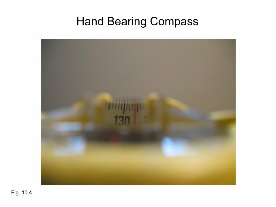
Fig. 10.4
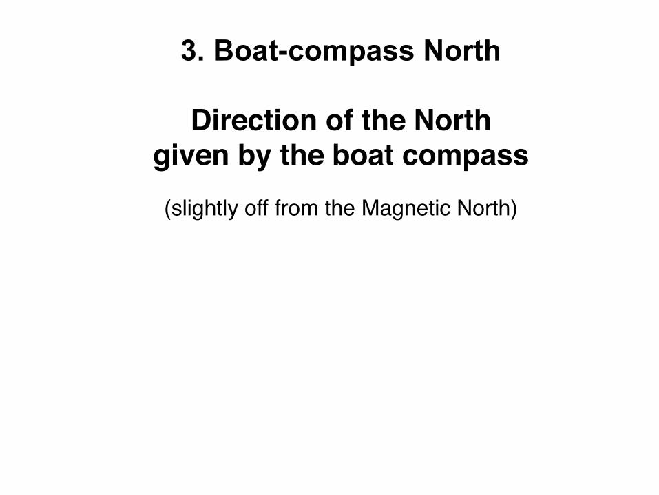
3. Boat-compass North
Direction of the North given by the boat compass(slightly off from the Magnetic North)
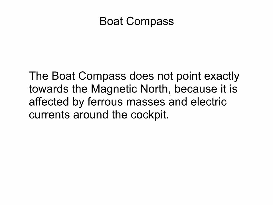
The Boat Compass does not point exactly towards the Magnetic North, because it is affected by ferrous masses and electric currents around the cockpit.
Boat Compass
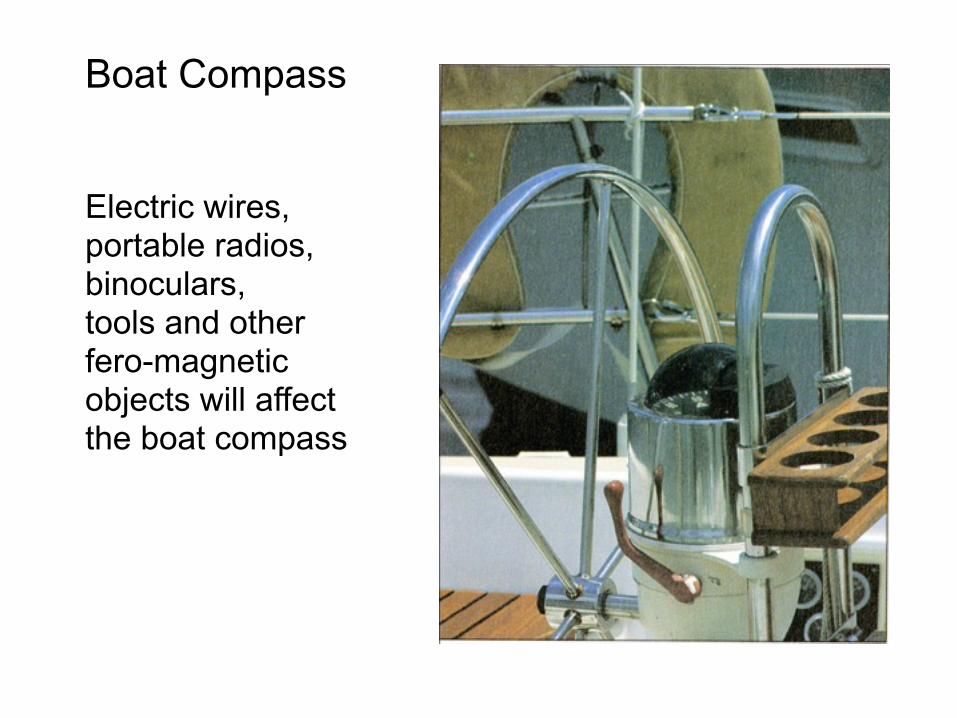
Electric wires, portable radios, binoculars, tools and other fero-magnetic objects will affect the boat compass
Boat Compass
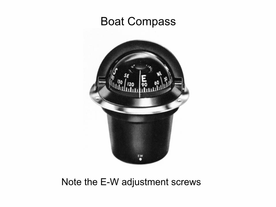
Note the E-W adjustment screws
Boat Compass
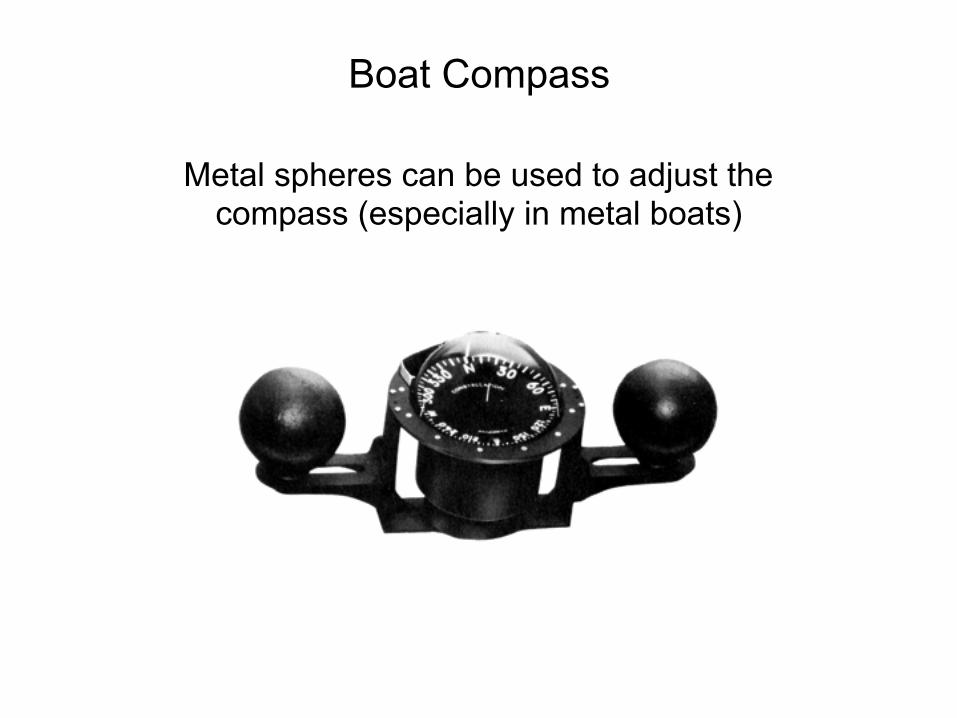
Metal spheres can be used to adjust the compass (especially in metal boats)
Boat Compass
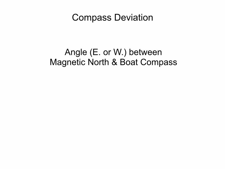
Angle (E. or W.) between Magnetic North & Boat Compass
Compass Deviation
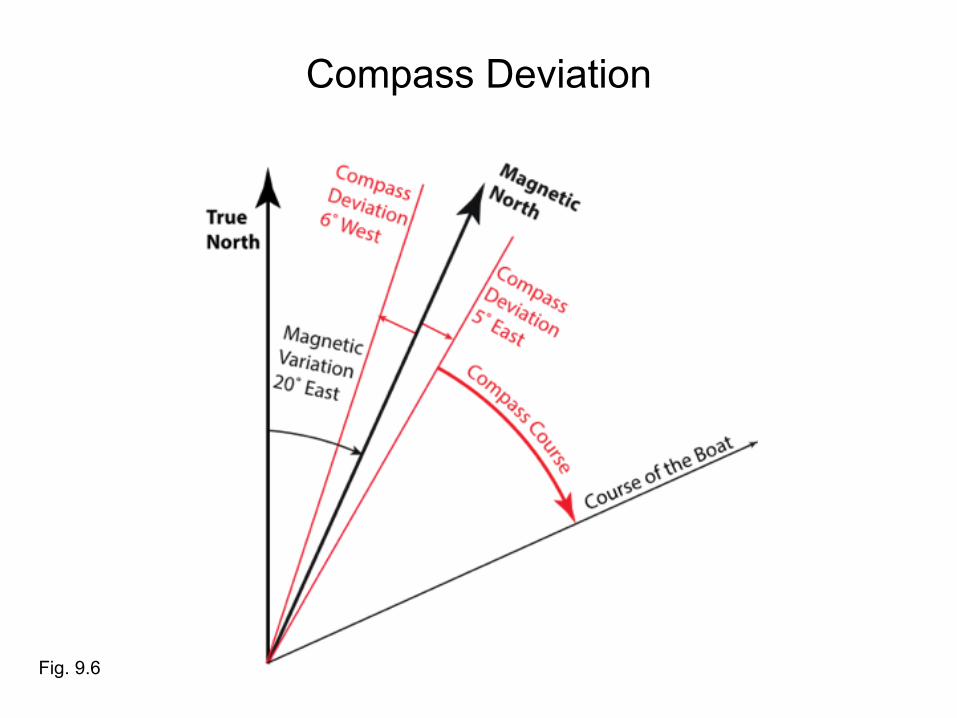
Compass Deviation
Fig. 9.6
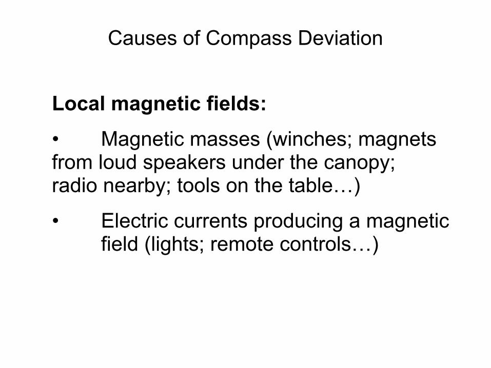
Local magnetic fields: • Magnetic masses (winches; magnets from loud speakers under the canopy; radio nearby; tools on the table…)
• Electric currents producing a magnetic field (lights; remote controls…)
Causes of Compass Deviation
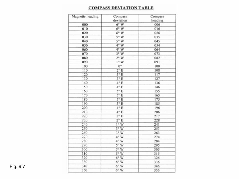
Fig. 9.7

4. Conversion between the Norths
-True to Magnetic; Magnetic to True -Magnetic to Compass; Compass to Magnetic -True to Compass; Compass to True

Fig. 9.8A, p. 60
Compass Deviation
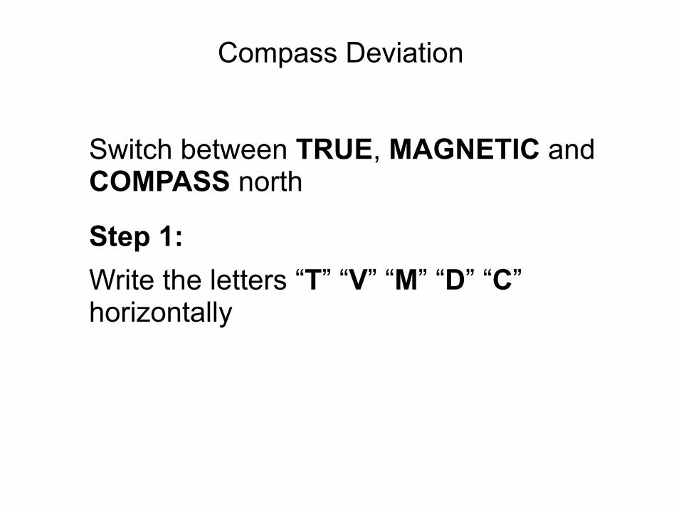
Switch between TRUE, MAGNETIC and COMPASS north
Step 1: Write the letters “T” “V” “M” “D” “C” horizontally
Compass Deviation
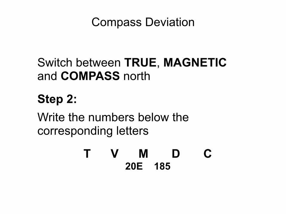
Switch between TRUE, MAGNETIC and COMPASS north
Step 2: Write the numbers below the corresponding letters
T V M D C 20E 185
Compass Deviation
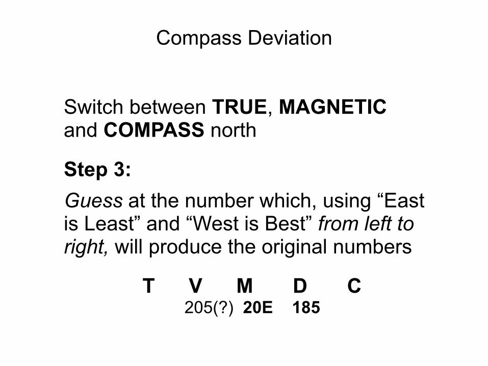
Switch between TRUE, MAGNETIC and COMPASS north
Step 3: Guess at the number which, using “East is Least” and “West is Best” from left to right, will produce the original numbers
T V M D C 205(?) 20E 185
Compass Deviation
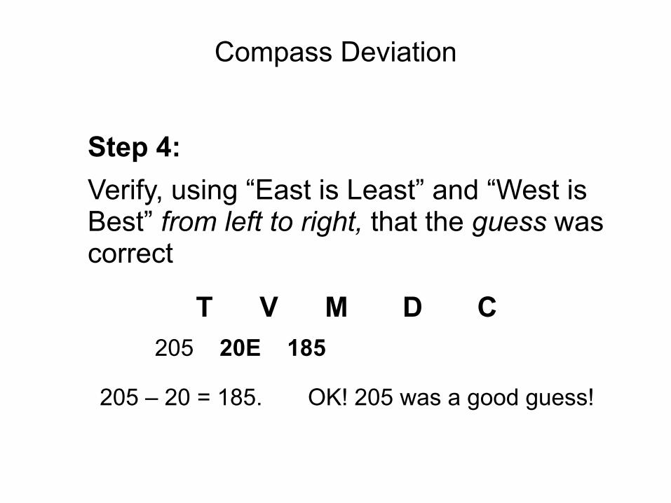
Step 4: Verify, using “East is Least” and “West is Best” from left to right, that the guess was correct
T V M D C 205 20E 185
205 – 20 = 185. OK! 205 was a good guess!
Compass Deviation

Examples
T V M D C226 22 E
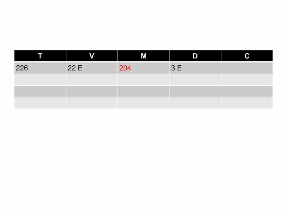
T V M D C226 22 E 204 3 E
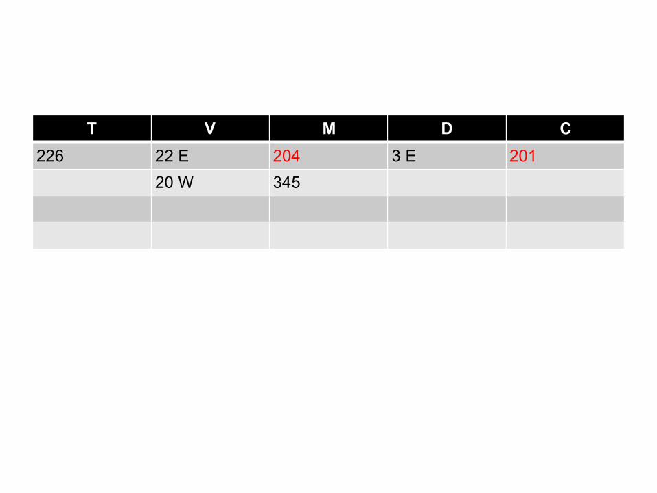
T V M D C226 22 E 204 3 E 201
20 W 345

T V M D C226 22 E 204 3 E 201325 20 W 345 4 W
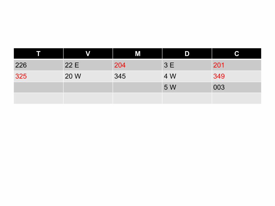
T V M D C226 22 E 204 3 E 201325 20 W 345 4 W 349
5 W 003
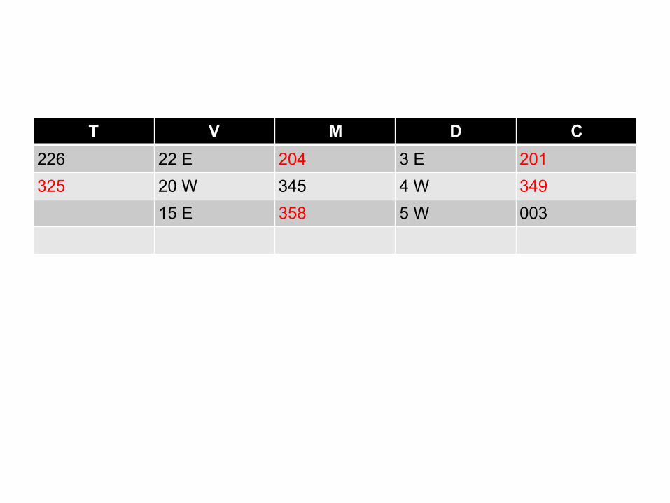
T V M D C226 22 E 204 3 E 201325 20 W 345 4 W 349
15 E 358 5 W 003
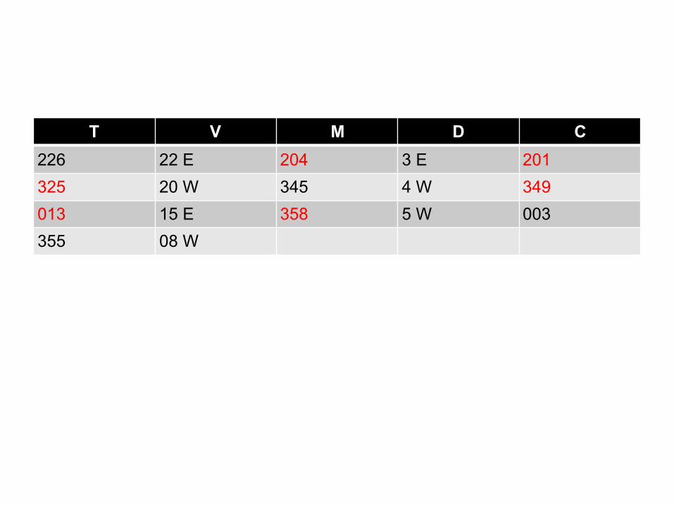
T V M D C226 22 E 204 3 E 201325 20 W 345 4 W 349013 15 E 358 5 W 003355 08 W
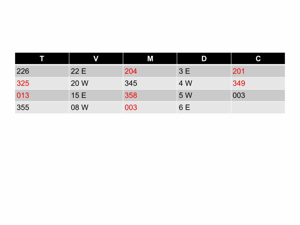
T V M D C226 22 E 204 3 E 201325 20 W 345 4 W 349013 15 E 358 5 W 003355 08 W 003 6 E
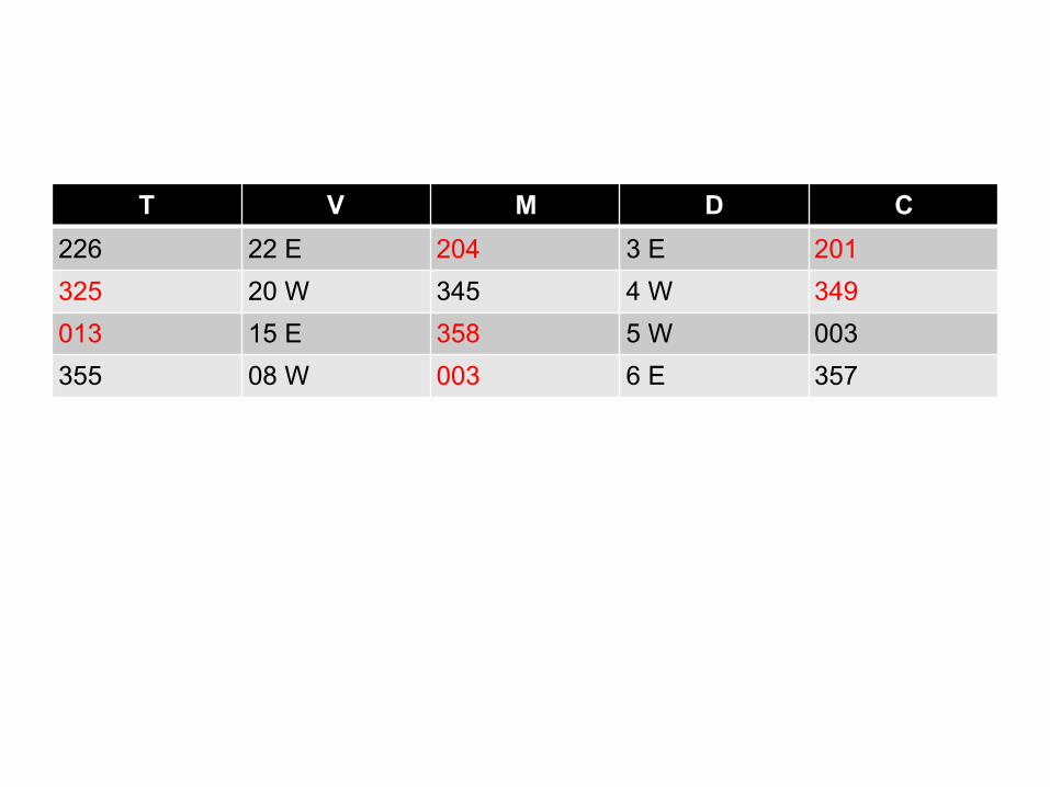
T V M D C226 22 E 204 3 E 201325 20 W 345 4 W 349013 15 E 358 5 W 003355 08 W 003 6 E 357
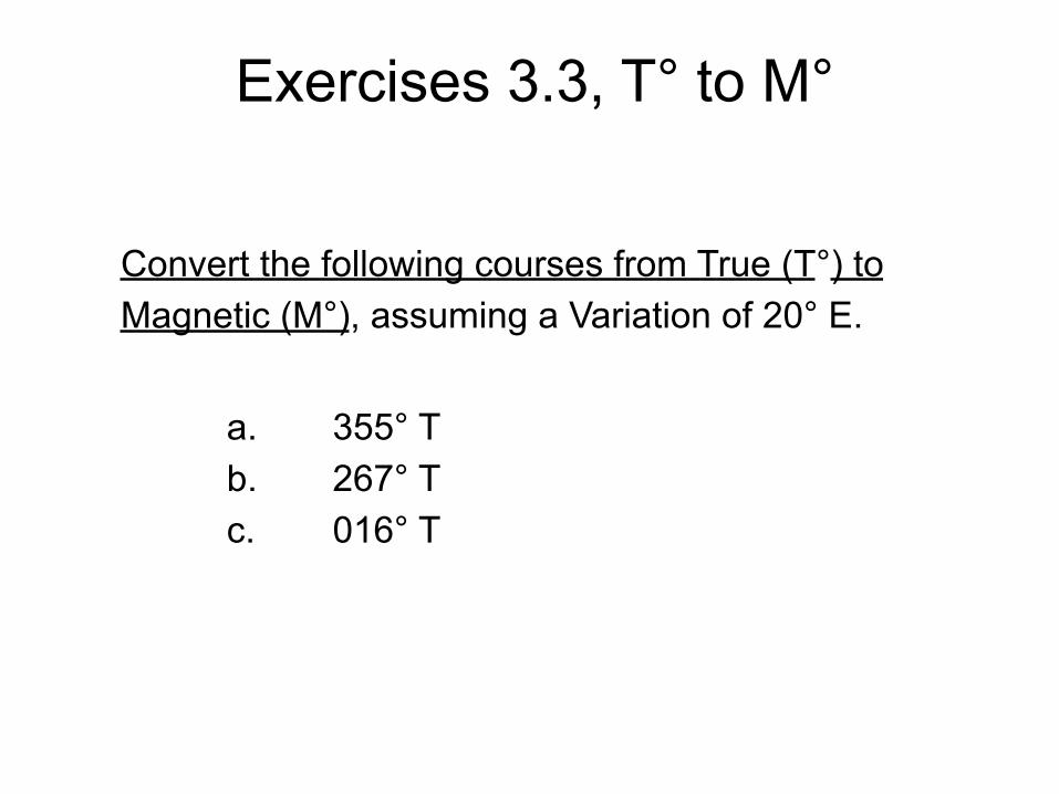
Convert the following courses from True (T°) to Magnetic (M°), assuming a Variation of 20° E. a. 355° T b. 267° T c. 016° T
Exercises 3.3, T° to M°
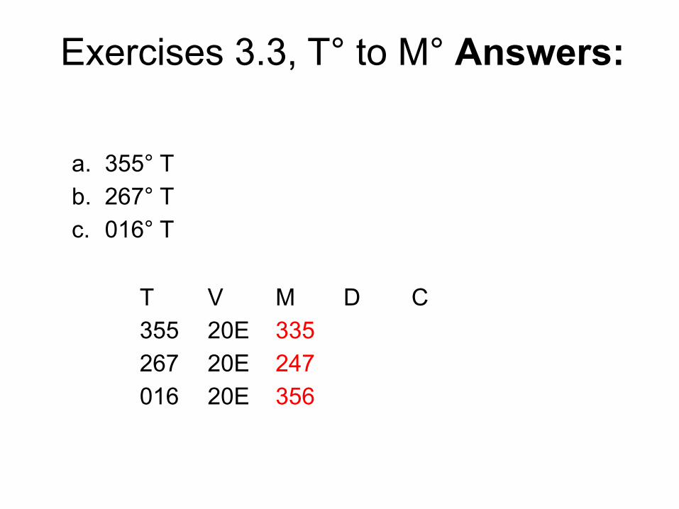
a. 355° T b. 267° T c. 016° T
T V M D C 355 20E 335 267 20E 247 016 20E 356
Exercises 3.3, T° to M° Answers:
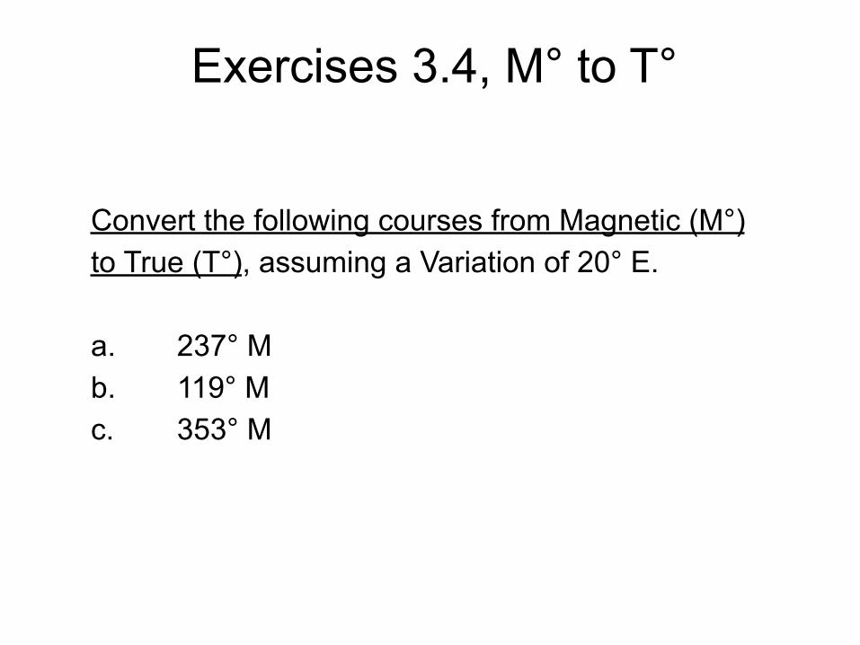
Convert the following courses from Magnetic (M°) to True (T°), assuming a Variation of 20° E. a. 237° M b. 119° M c. 353° M
Exercises 3.4, M° to T°
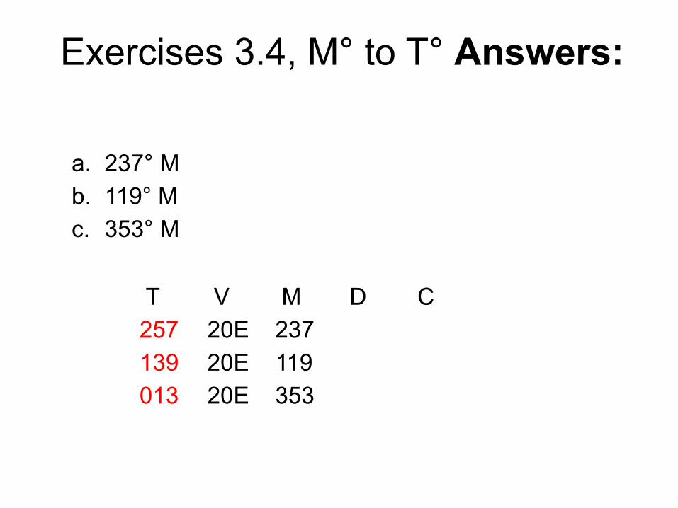
a. 237° M b. 119° M c. 353° M
T V M D C 257 20E 237 139 20E 119 013 20E 353
Exercises 3.4, M° to T° Answers:
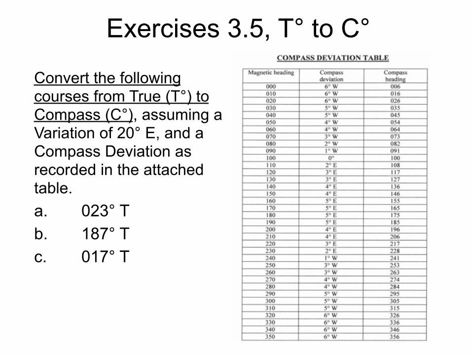
Convert the following courses from True (T°) to Compass (C°), assuming a Variation of 20° E, and a Compass Deviation as recorded in the attached table. a. 023° T b. 187° T c. 017° T
Exercises 3.5, T° to C°
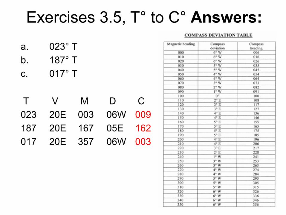
a. 023° T b. 187° T c. 017° T
T V M D C 023 20E 003 06W 009 187 20E 167 05E 162 017 20E 357 06W 003
Exercises 3.5, T° to C° Answers:
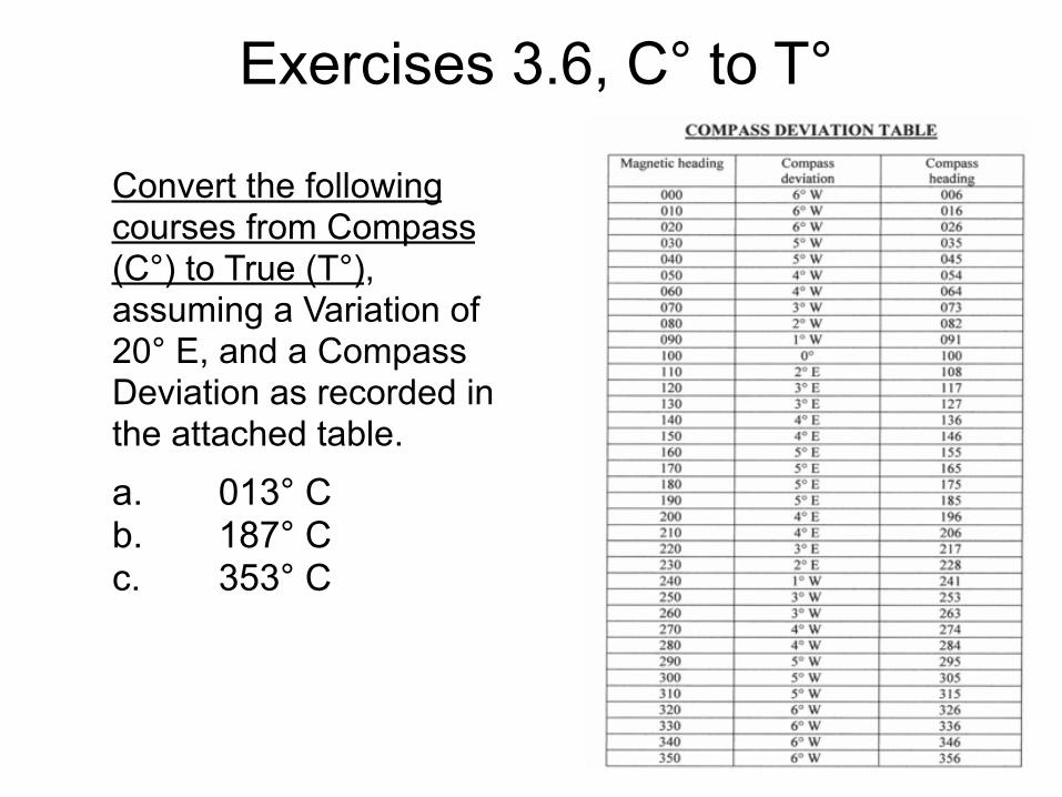
Convert the following courses from Compass (C°) to True (T°), assuming a Variation of 20° E, and a Compass Deviation as recorded in the attached table.
a. 013° C b. 187° C c. 353° C
Exercises 3.6, C° to T°
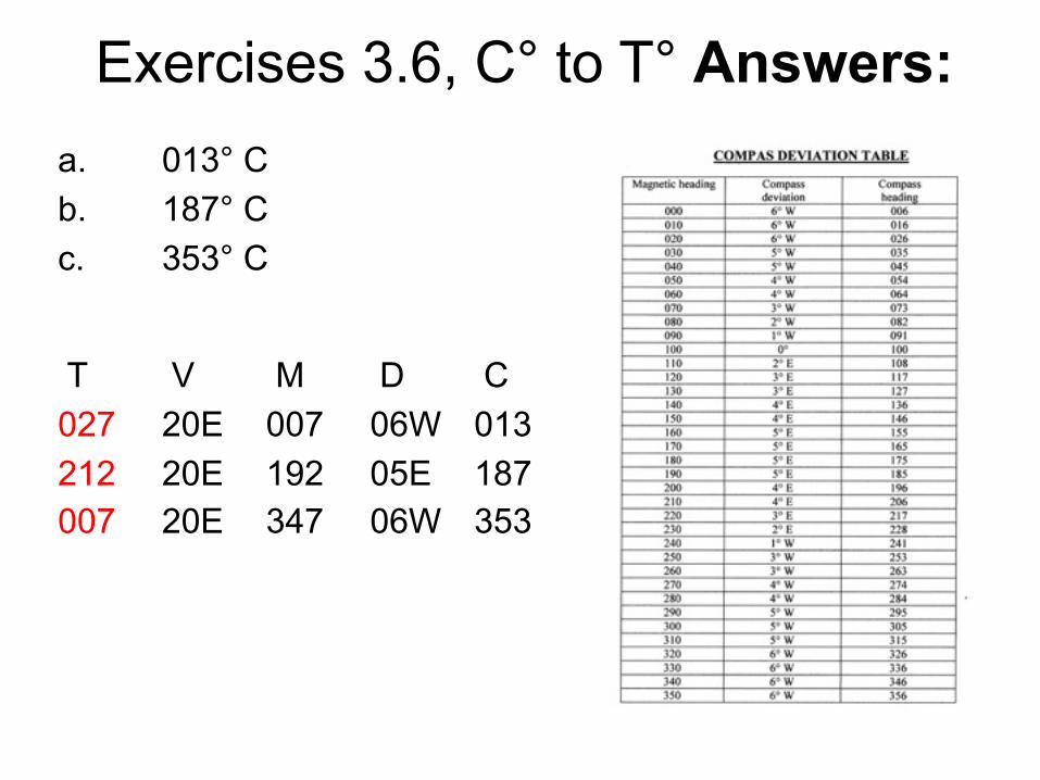
a. 013° C b. 187° C c. 353° C
T V M D C 027 20E 007 06W 013 212 20E 192 05E 187 007 20E 347 06W 353
Exercises 3.6, C° to T° Answers:
Lines of Position; Danger Bearings (Chapter 10)
Part 3
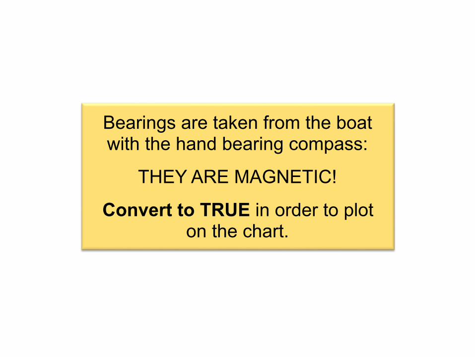
Bearings are taken from the boat with the hand bearing compass:
THEY ARE MAGNETIC!
Convert to TRUE in order to plot on the chart.
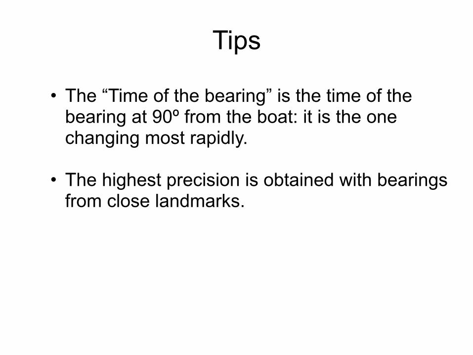
• The “Time of the bearing” is the time of the bearing at 90º from the boat: it is the one changing most rapidly.
• The highest precision is obtained with bearings from close landmarks.
Tips
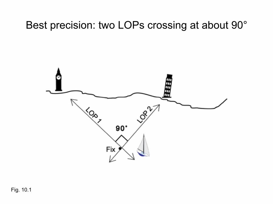
Best precision: two LOPs crossing at about 90°
Fig. 10.1
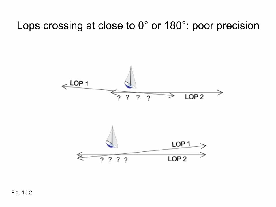
Lops crossing at close to 0° or 180°: poor precision
Fig. 10.2
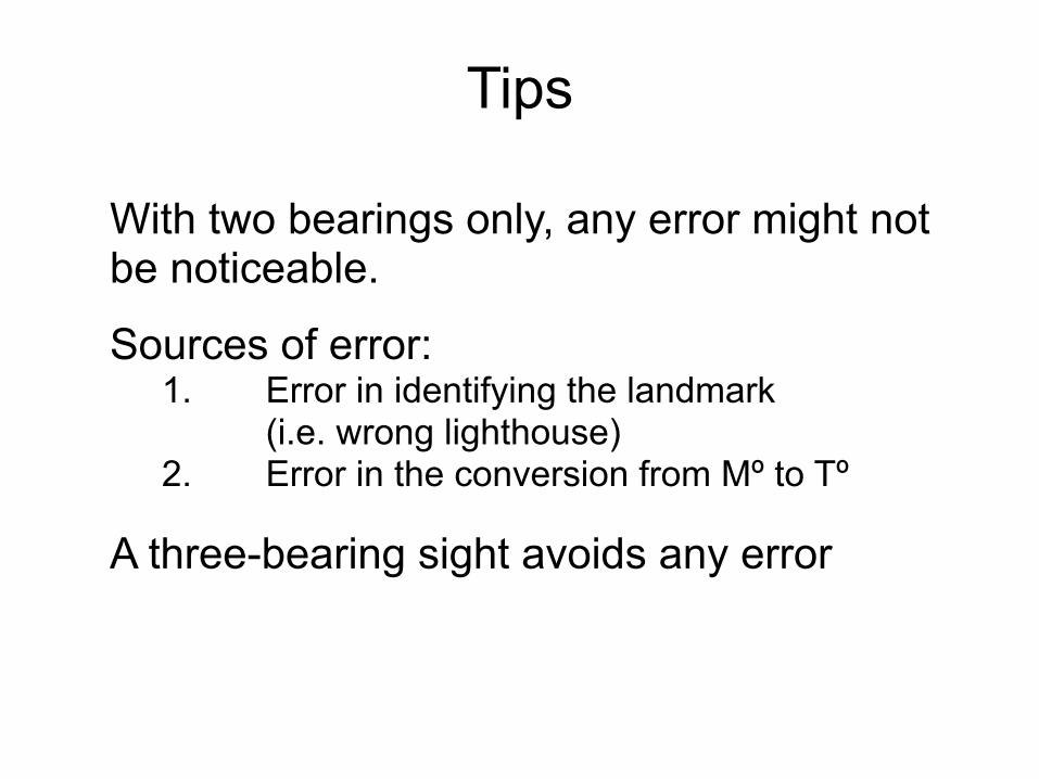
With two bearings only, any error might not be noticeable.
Sources of error: 1. Error in identifying the landmark (i.e. wrong lighthouse) 2. Error in the conversion from Mº to Tº
A three-bearing sight avoids any error
Tips
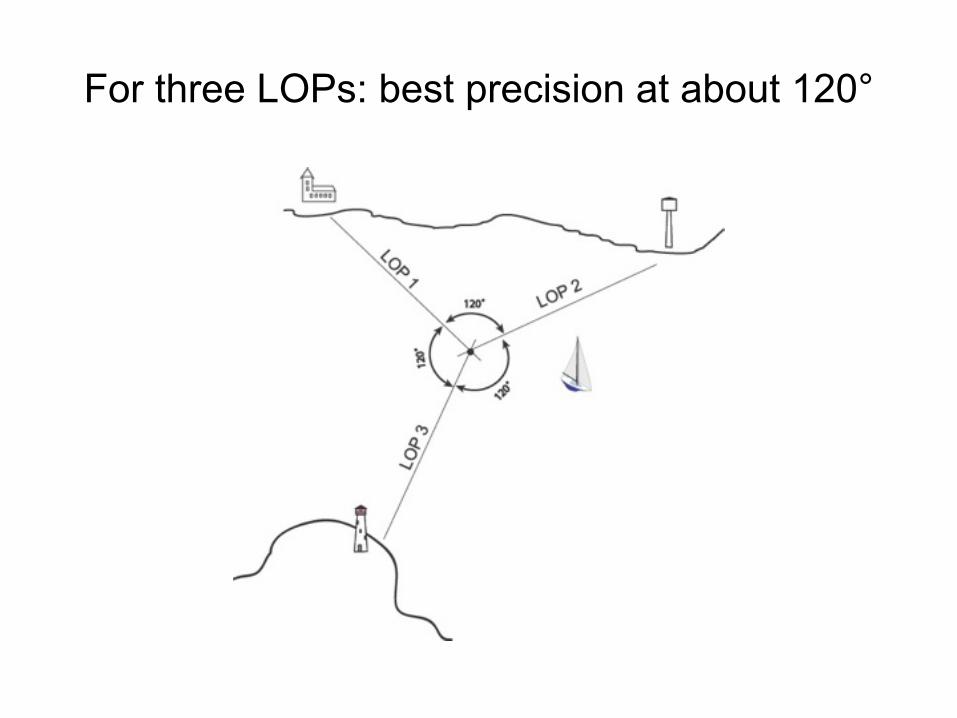
For three LOPs: best precision at about 120°
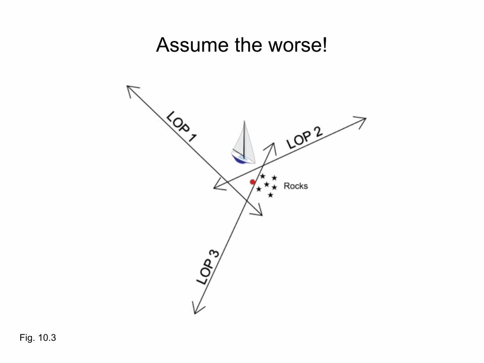
Assume the worse!
Fig. 10.3
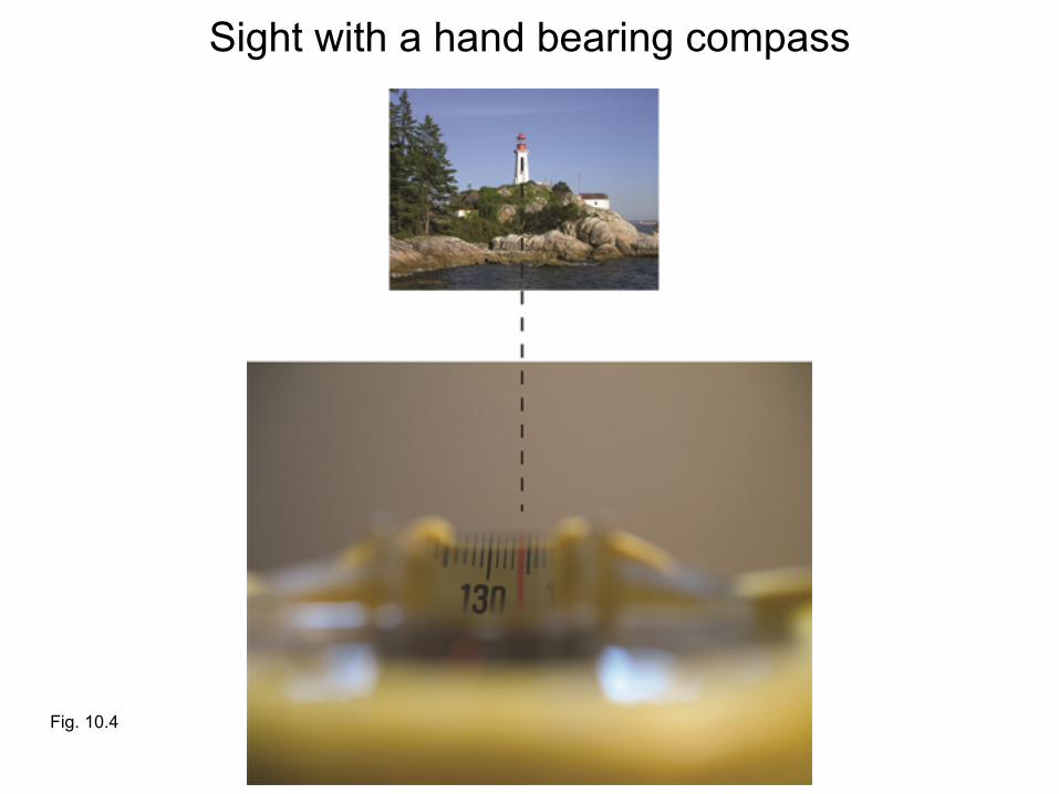
Fig. 10.4
Sight with a hand bearing compass

Fig. 10.5
Place the edge of the protractor on the landmark, North up. Mark the center of the protractor (pencil in the small hole)

Fig. 10.6
Draw the LOP from the landmark to the center and beyond.

Fig. 10.7
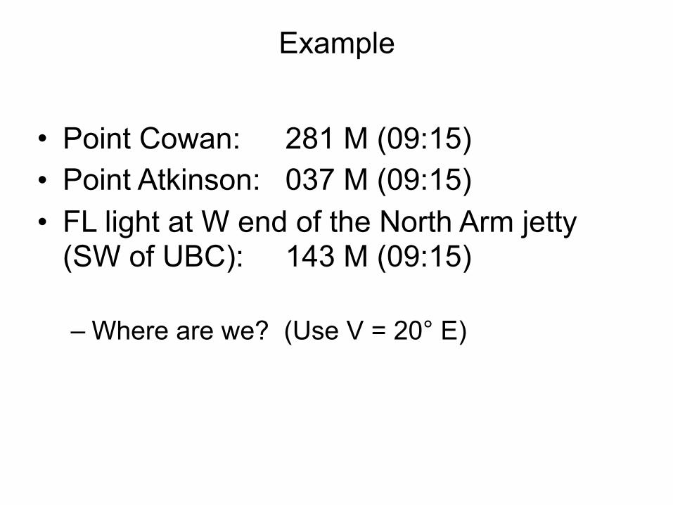
Example
• Point Cowan: 281 M (09:15) • Point Atkinson: 037 M (09:15) • FL light at W end of the North Arm jetty
(SW of UBC): 143 M (09:15)
– Where are we? (Use V = 20° E)
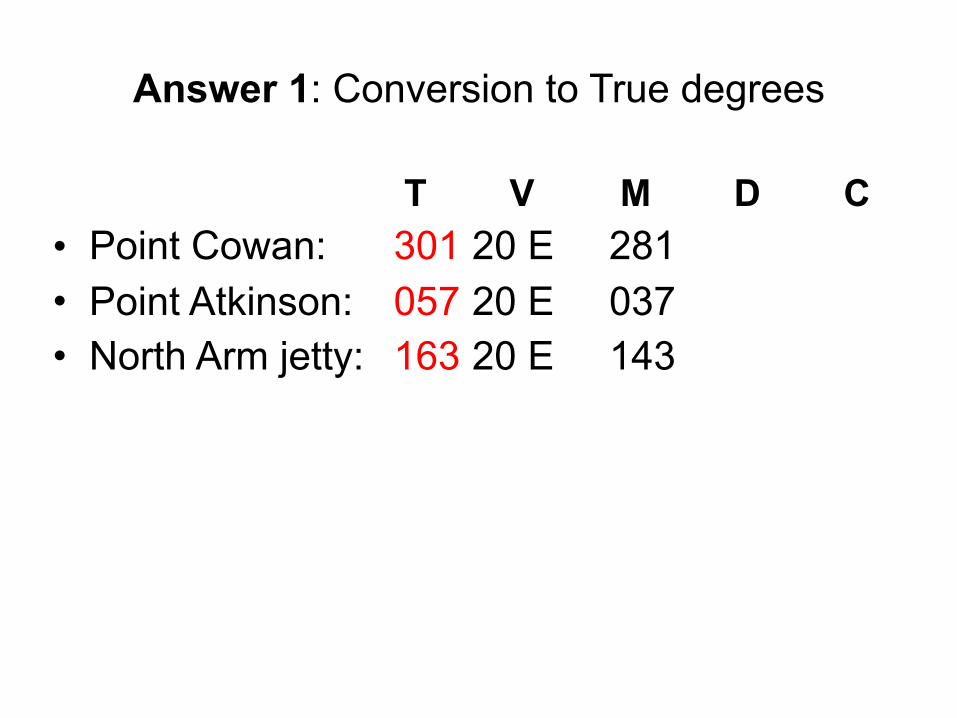
Answer 1: Conversion to True degrees
T V M D C • Point Cowan: 301 20 E 281 • Point Atkinson: 057 20 E 037 • North Arm jetty: 163 20 E 143

Answer 2: plot Fix: 49° 18.8’ N - 123° 18.3’ W
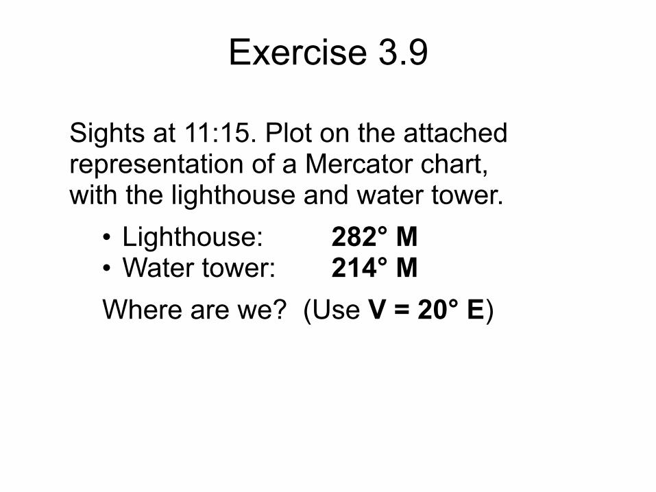
Exercise 3.9
Sights at 11:15. Plot on the attached representation of a Mercator chart, with the lighthouse and water tower.
• Lighthouse: 282° M • Water tower: 214° M Where are we? (Use V = 20° E)
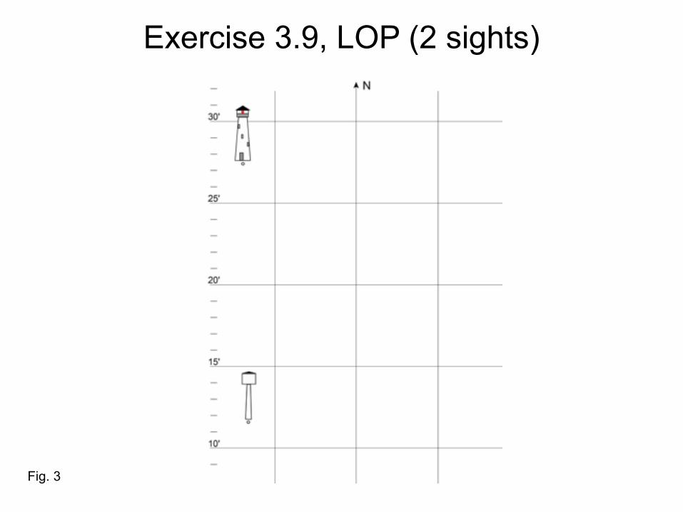
Exercise 3.9, LOP (2 sights)
Fig. 3
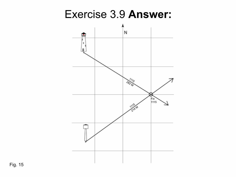
Exercise 3.9 Answer:
Fig. 15
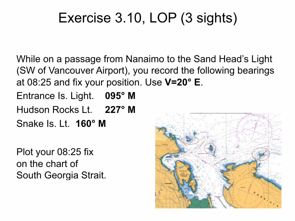
Exercise 3.10, LOP (3 sights)
While on a passage from Nanaimo to the Sand Head’s Light (SW of Vancouver Airport), you record the following bearings at 08:25 and fix your position. Use V=20° E. Entrance Is. Light. 095° M Hudson Rocks Lt. 227° M Snake Is. Lt. 160° M
Plot your 08:25 fix on the chart of South Georgia Strait.
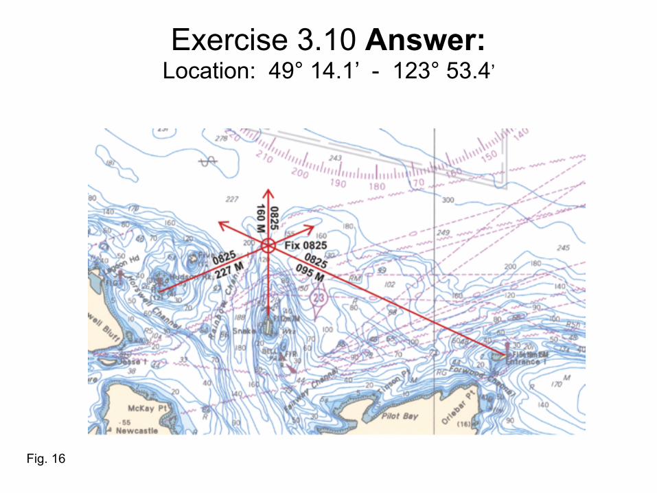
Exercise 3.10 Answer:Location: 49° 14.1’ - 123° 53.4’
Fig. 16
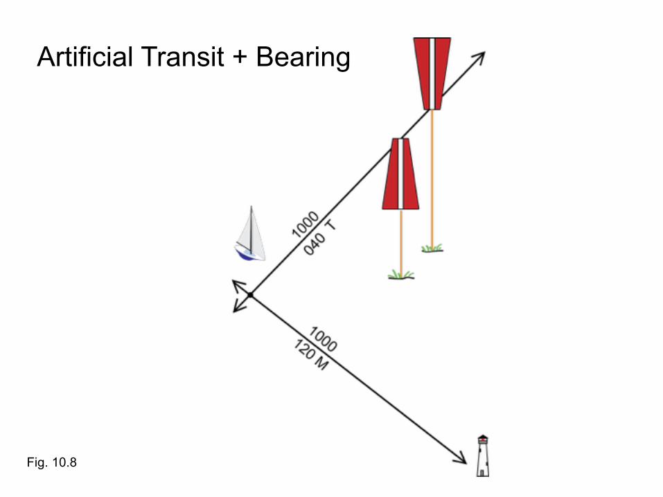
Artificial Transit + Bearing
Fig. 10.8
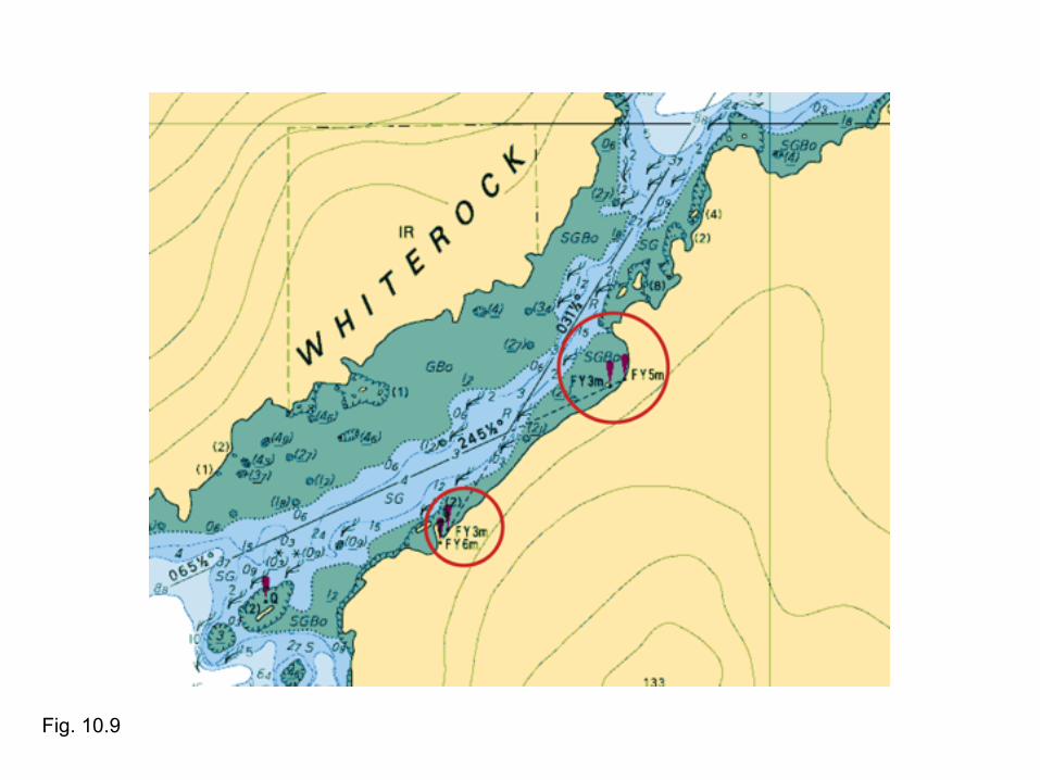
Fig. 10.9

Natural Transit + Bearing
Fig. 10.10
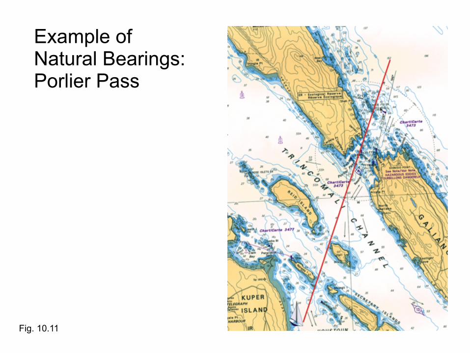
Example of Natural Bearings: Porlier Pass
Fig. 10.11
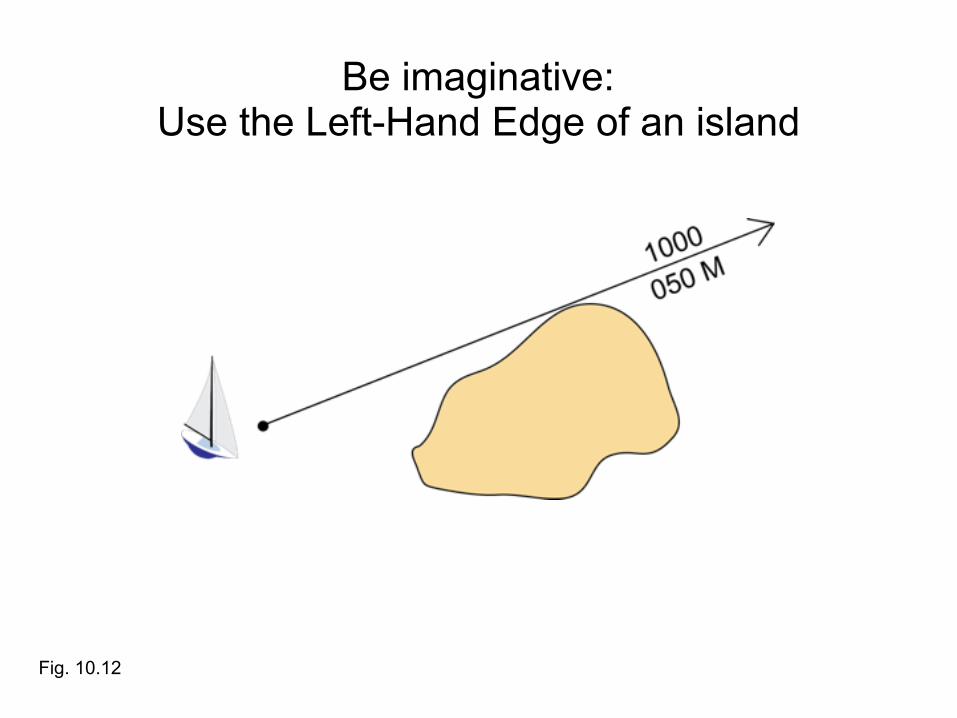
Be imaginative:Use the Left-Hand Edge of an island
Fig. 10.12

Be imaginative (2):Use the Right-Hand Edge of an island
Fig. 10.13
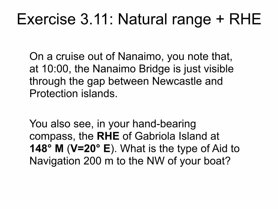
Exercise 3.11: Natural range + RHE
On a cruise out of Nanaimo, you note that, at 10:00, the Nanaimo Bridge is just visible through the gap between Newcastle and Protection islands.
You also see, in your hand-bearing compass, the RHE of Gabriola Island at 148° M (V=20° E). What is the type of Aid to Navigation 200 m to the NW of your boat?
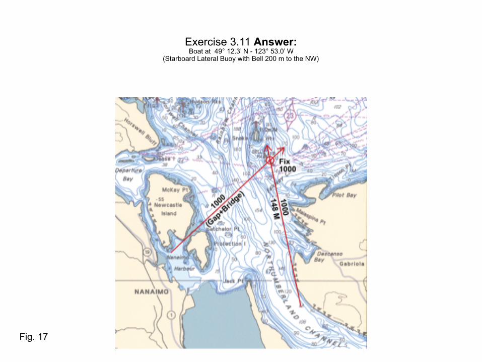
Exercise 3.11 Answer: Boat at 49° 12.3’ N - 123° 53.0’ W
(Starboard Lateral Buoy with Bell 200 m to the NW)
Fig. 17
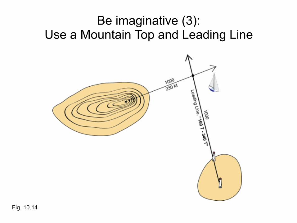
Be imaginative (3):Use a Mountain Top and Leading Line
Fig. 10.14

Be imaginative (4):Use a Bearing and a Depth Contour Line
Fig. 10.15

Exercise 3.12: Sight + Depth
Sight on Point Atkinson at 08:00 = 025° M Depth: 100 m
Where are we? (Use V = 20° E)
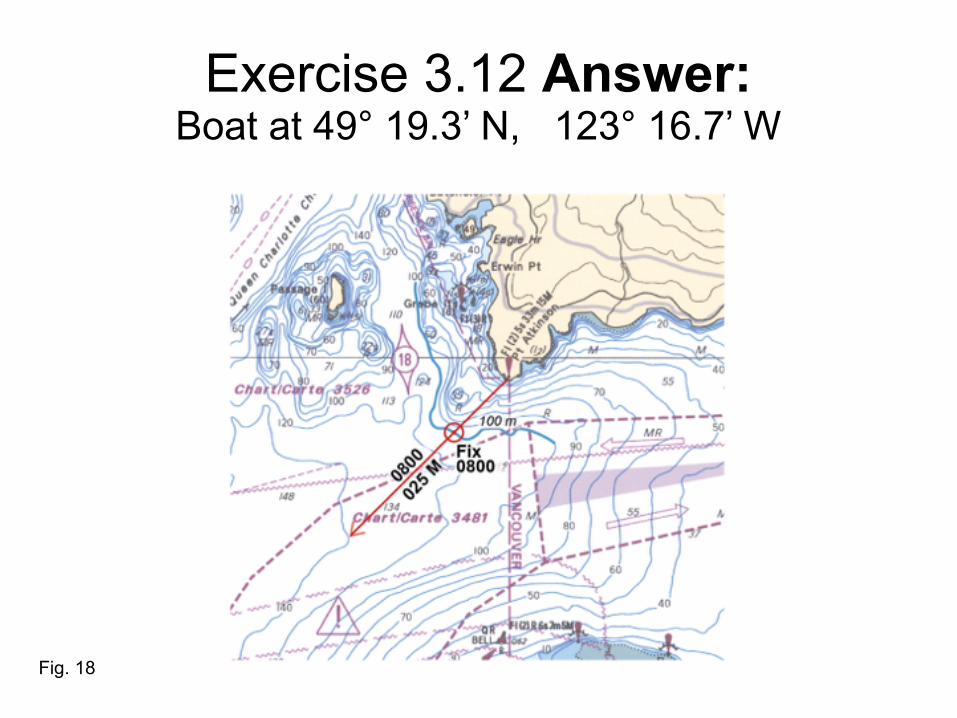
Exercise 3.12 Answer: Boat at 49° 19.3’ N, 123° 16.7’ W
Fig. 18
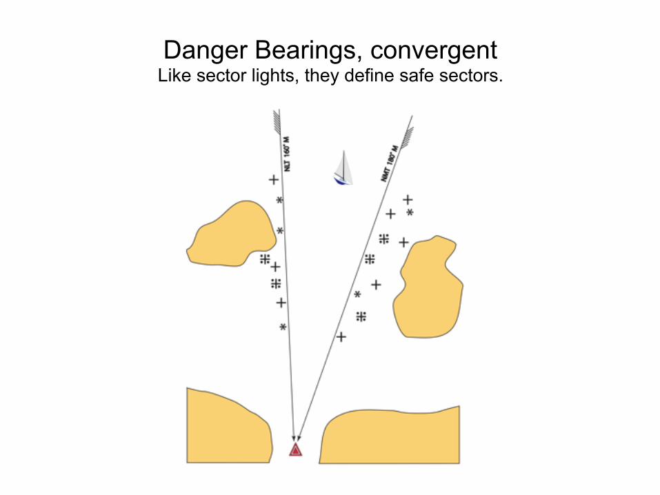
Danger Bearings, convergentLike sector lights, they define safe sectors.
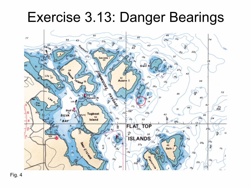
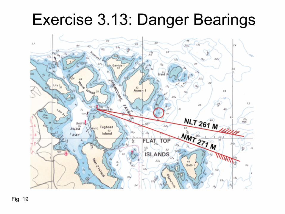
Exercise 3.13: Danger Bearings
3.13 Danger Bearings: Plan your safe entrance into Silva Bay, using the attached detailed chart for the area: From a position ENE of Bath Island (right edge of the chart), you want to enter Silva Bay. Plot the NLT and NMT danger-bearing lines which will ensure at least 05 m depth N of Bath Island, and S of Acorn Island including its adjacent shallows to the East. Give the limiting angles (Danger Bearings) in degrees M (assume V=20º E). Take your sights on the Green Light (FLG) at the entrance of Silva Bay.
Exercise 3.13: Danger Bearings
Fig. 4
Exercise 3.13: Danger Bearings
Fig. 19

End of Session 3