origin of tsunami - andhra pradesh · origin of tsunami. what are natural ... causes a tsunami can...
TRANSCRIPT

ORIGIN OF TSUNAMI
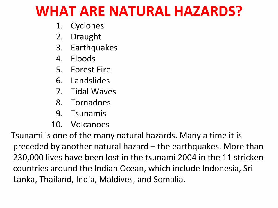
WHAT ARE NATURAL HAZARDS?1. Cyclones2. Draught3. Earthquakes4. Floods5. Forest Fire6. Landslides7. Tidal Waves8. Tornadoes9. Tsunamis
10. Volcanoes Tsunami is one of the many natural hazards. Many a time it is
preceded by another natural hazard – the earthquakes. More than 230,000 lives have been lost in the tsunami 2004 in the 11 stricken countries around the Indian Ocean, which include Indonesia, Sri Lanka, Thailand, India, Maldives, and Somalia.
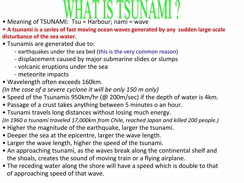
• Meaning of TSUNAMI: Tsu = Harbour; nami = wave• A tsunami is a series of fast moving ocean waves generated by any sudden large-scale disturbance of the sea water. • Tsunamis are generated due to:
- earthquakes under the sea bed (this is the very common reason)- displacement caused by major submarine slides or slumps- volcanic eruptions under the sea- meteorite impacts
• Wavelength often exceeds 160km. (In the case of a severe cyclone it will be only 150 m only)• Speed of the Tsunamis 950km/hr (@ 200m/sec) if the depth of water is 4km.• Passage of a crust takes anything between 5 minutes o an hour.• Tsunami travels long distances without losing much energy.(In 1960 a tsunami traveled 17,000km from Chile, reached Japan and killed 200 people.) • Higher the magnitude of the earthquake, larger the tsunami.• Deeper the sea at the epicentre, larger the wave length.• Larger the wave length, higher the speed of the tsunami.• An approaching tsunami, as the waves break along the continental shelf and the shoals, creates the sound of moving train or a flying airplane.• The receding water along the shore will have a speed which is double to that of approaching speed of that wave.

Highest or tallestThe tallest tsunami ever recorded is the 1958 Lituya Bay mega tsunami, which had a record height of 524 m.The only other recent mega tsunamis are the 1980 Spirit Lake mega tsunami, which measured 260 m tall and the 1963 Vajont Dam mega tsunami which had an initial height of 250 m.DeadliestThe deadliest tsunami in recorded history was the 2004 Indian Ocean tsunami, which killed almost 230,000 people in eleven countries. The 365 CE Mediterranean tsunami's death toll may have been much higher.When was the most recent tsunami?The 16 September 2015 magnitude 8.3 Off Illapel, Chile earthquake (31.570°S, 71.654°W, depth 25 km) occurred at 22.55 UTC and generated a tsunami that was observed all over the Pacific region and caused damage locally.

Contact ITICNOAA IRCNWS / ITIC1845 Wasp Boulevard, Building 176Honolulu Hawaii 96818 United States
[email protected]+1 (808) 725-6050+1 (808) 725-6055http://www.tsunamiwave.org
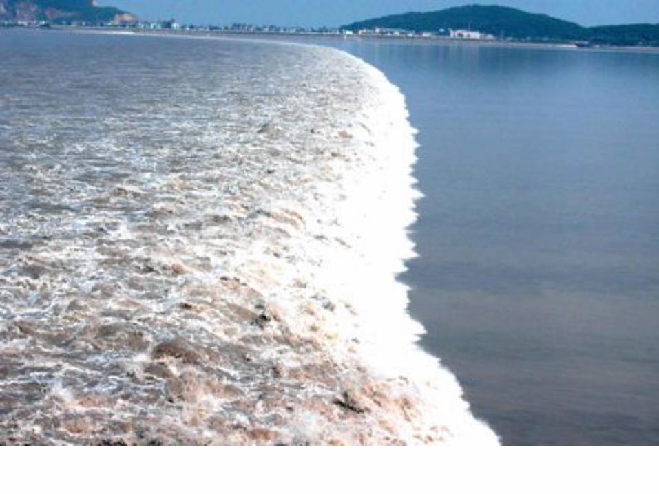

An illustration of the rhythmic "drawback" of surface water associated with a wave. It follows that a very large drawback
may herald the arrival of a very large wave.

THE SEA RECEDES AT BHOGAPURAM MANDAL, VIZIANAGARAM Dt. BY 300 m
Note: If the sea recedes more means the approaching wave is more powerful

When the wave enters shallow water, it slows down and its amplitude (height) increases.
Note: If you are in a vessel/boat do not try to enter shallow waters, instead move towards deeper waters

A tsunami wave flows toward the shore after a small earthquake in the Sunda Strait of Indonesia. Tsunamis are often mistakenly called tidal waves, but they are not caused by the gravitational forces involved in tides. Instead, tsunamis are believed to be caused by a tilting of the ocean floor, undersea landslides, or undersea volcanic eruptions.
TSUNAMI WAVE


CausesA tsunami can be generated by any disturbance that displaces a large mass of water, such as an earthquake, landslide or meteor impact.Tsunamis can be generated when the sea floor abruptly deforms and vertically displaces the overlying water. Tectonic earthquakes are a particular kind of earthquake that are associated with the earth's crust deformation; when these earthquakes occur beneath the sea, the water above the deformed area is displaced from its equilibrium position. Waves are formed as the displaced water mass, which acts under the influence of to regain its equilibrium. When large areas of the sea floor elevate or subside, a tsunami can be created. Large vertical movements of the earth's crust can occur at plate boundaries. Plates interact along these boundaries called "faults". Around the margins of the Pacific Ocean, for example, denser oceanic plates slip under continental plates in a process known as subduction. Subduction earthquakes are particularly effective in generating tsunamis.Submarine landslides, which often accompany large earthquakes, as well as collapses of volcanic edifices, can also disturb the overlying water column as sediment and rock slump downslope and are redistributed across the sea floor. Similarly, a violent submarine volcanic eruption can uplift a water column and generate a tsunami. Large landslides and cosmic-body impacts can disturb the water from above, as momentum from falling debris is transferred to the water into which the debris falls. Generally speaking, tsunamis generated from these mechanisms, unlike the Pacific-wide tsunamis caused by some earthquakes, dissipate quickly and rarely affect coastlines distant from the source area.

PLATE TECFTONICS• Deep within the earth at a depth range of 100 to 350 km from the surface, lies a viscous layer of the earth, the asthenosphere, which has fluidlike properties. • Above this layer rests the rigid lithosphere, which includes the crust. The lithosphere is 'floating' on the asthenosphere. However the lithosphere is not a continuous shell around the globe. It comprises of seven major and several minor distinct plates. • The plates are in constant motion relative to each other and this motion is the cause of most of the phenomena in the earth's crust. The interior of the plate is stable and the edges are usually the site of intense deformation.• There are three kinds of plate boundaries or plate margins. These are called convergent margins, divergent margins and transform fault margins.

LEGEND: --- Divergent Margin; --- Convergent Margin
--- Transform Fault Margin
PLATE BOUNDARIES

WHAT IS AN EARTHQUAKE ?An earthquake is a sudden movement of the ground that releases elastic energy stored in rocks and generates seismic waves.After the initial ground movement along the fault, seismic waves propagate outward and vibrate the ground.


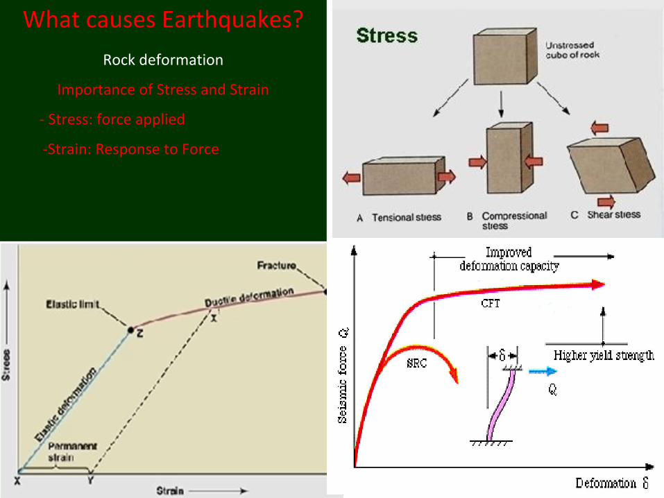
What causes Earthquakes?
Rock deformation
Importance of Stress and Strain
- Stress: force applied
-Strain: Response to Force

EARTHQUAKE ANATOMY
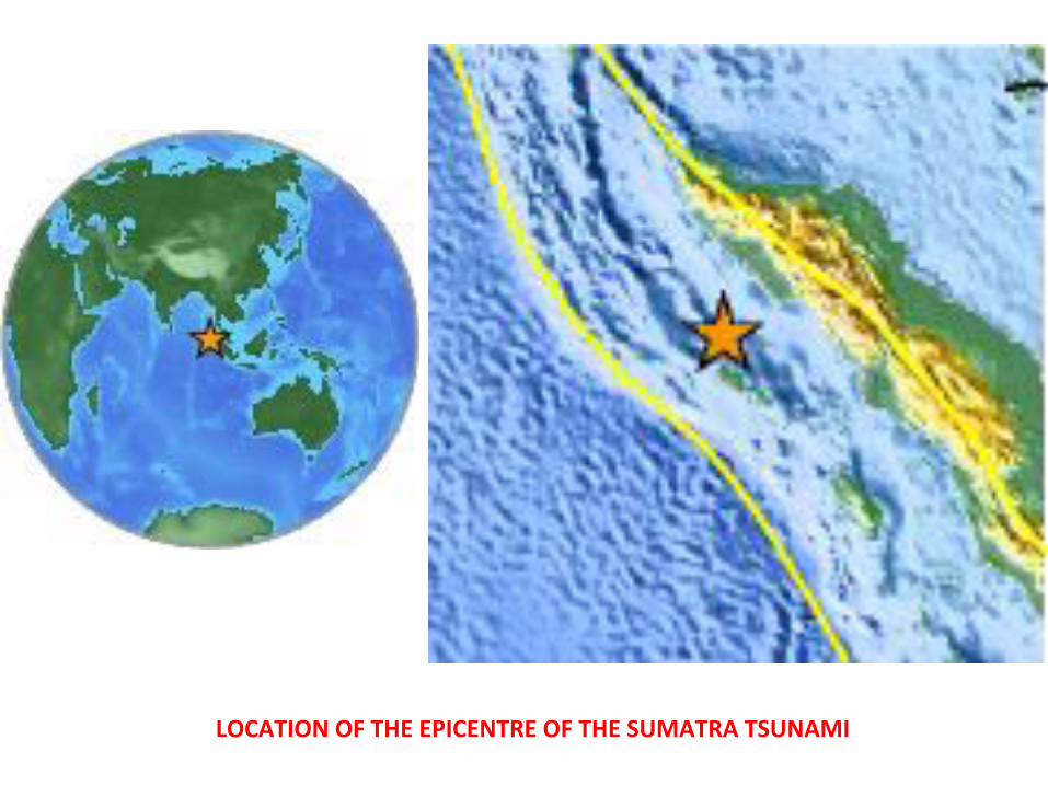
LOCATION OF THE EPICENTRE OF THE SUMATRA TSUNAMI


• Magnitude of the earthquake 9.0 on Richter Scale.• Depth of the Focus is 10 km.• 5th Largest earthquake since the beginning of 20th century.• Biggest in the last 40 years.• Epicentre is at West Coast of Northern Sumatra.• This Tsunami travelled at about 700 km/hr and took two hours to
reach the Indian shore.• At Indonesia convergent plate boundary exists and along this interface the Sumatra earthquake has occurred.• The sub-duction of the Austral-Indian Plate under the Eurasian Plate is taking place.• At the epicentre off Sumatra, the australasian plate has risen by 20m and this slip is found to occur for 1200 km length along the plate boundary.
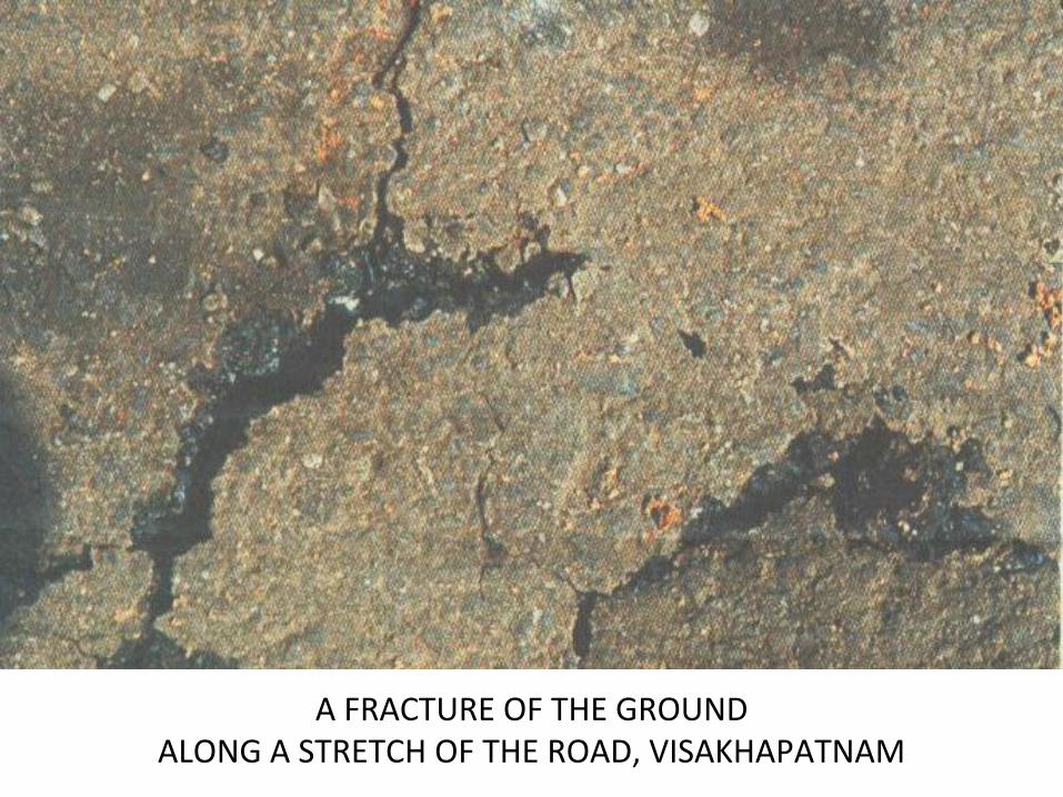
A FRACTURE OF THE GROUND ALONG A STRETCH OF THE ROAD, VISAKHAPATNAM

EARTHQUAKE OFF THE WEST COAST OF NORTERN SUMATRA (2,028 KM SOUTH EAST OF CHENNAI) AT 6.28 INDIAN STANDARD TIME

S waves travel typically 60% of the speed of P waves.

The precise speed varies according to the region of the Earth's interior, from less than 6 km/s in the Earth's crust to 13 km/s through the core.Velocity tends to increase with depth and ranges from approximately 2 to 8 km/s in the Earth's crust, up to 13 km/s in the deep mantle.Granite.
Density: 2.7 P-wave velocity: 4500-6000 m/sec
S-wave velocity: 2500-3300 m/secBasalt
Density: 2.7-3.1 P-wave velocity: 5000-6000 m/sec
S-wave velocity: 2800-3400 m/sec

SEQUENCE OF EVENTS THAT HAVE TAKEN PLACE

Tsunami Warning Timeline Here is a timeline showing what Pacific Tsunami Warning Center geophysicists knew, when they learned it, and how they responded. (Hawai'i Standard Time Dec. 25 — some times are approximate) 2:59 p.m. — Magnitude 9 earthquake occurs in the Indian Ocean near Sumatra. (Initially calculated at 8.) 3:07 p.m. — On-duty personnel at Pacific Tsunami Warning Center receive automatic alerts of large quake. 3:10 p.m. — Warning center issues e-mail notice with preliminary earthquake information. E-mail goes to Pacific nations, news media, government agencies, individual subscribers. 3:14 p.m. — Warning center issues to its Pacific Ocean partners a bulletin that no tsunami threat exists in the Pacific. 4:04 p.m. — Warning center bulletin revises quake to 8.5, warns of possible tsunami near the epicenter. 4:30 p.m. — Warning center reaches Australia Emergency Management, which confirms it is already aware of quake. 5:30 p.m. — News reports of casualties in Sri Lanka on the Internet give Warning Center first confirmation that a destructive tsunami exists. 5:45 p.m. — Warning Center alerts U.S. Pacific Command in Honolulu, and receives query from Sri Lanka navy commander asking about further waves generated by aftershocks. 6 p.m. — U.S. ambassador in Sri Lanka calls Warning Center to arrange notification in case of aftershocks, and reports the embassy will notify Sri Lanka prime minister's office. 7:25 p.m. — Australian-owned Cocos Island tide gauge, one of very few gauges in the Indian Ocean, gives a modest 1 1/2-foot wave reading from trough to crest. Harvard University Seismology Department reports earthquake magnitude at 8.9. 7:45 p.m. — Warning center warns Australia Bureau of Meteorology of increased calculated quake strength and the Cocos reading, and possibility of tsunami strike on Australian west coast. 8 p.m. — Warning center reports to the U.S. Pacific Command the increased magnitude and Indian Ocean tsunami threat. 8:15 p.m. — Australian Bureau of Meteorology reports it has issued tsunami alert for nation's west coast. 8:20 p.m. — Warning center learns from National Weather Service that military observed no tsunami at Diego Garcia in central Indian Ocean. 10:15 p.m. — Warning center alerts U.S. State Department operations office about threat to Madagascar and Africa; warning center alerts U.S. embassies in Madagascar and Mauritius via conference call. Source: NOAA


TIME (IST) MAGNITUDE LOCATION6.287.187.457.528.048.068.218.298.389.51
11.5212.3713.0814.5015.4916.35
9.05.95.86.05.85.86.05.96.17.35.75.75.86.56.26.3
Off W.Coast of N. Sumatra N.SumatraAndaman IslandsNicobar IslandsOff W.Coast of N.SumatraAndaman IslandsAndaman IslandsOff W.Coast of N. SumatraAndaman IslandsNicobar IslandsAndaman IslandsAndaman IslandsAndaman IslandsNicobar IslandsAndaman IslandsAndaman Islands
THE DAY OF QUAKES

SOURCE: US NATIONAL OCEANIC AND ATMOSPHERIC ADMINISTRATION PACIFIC MARINE ENVIRONMENTAL LABORATORY, US NATIONAL DATA BUOY CENTER; © 2004 KRT

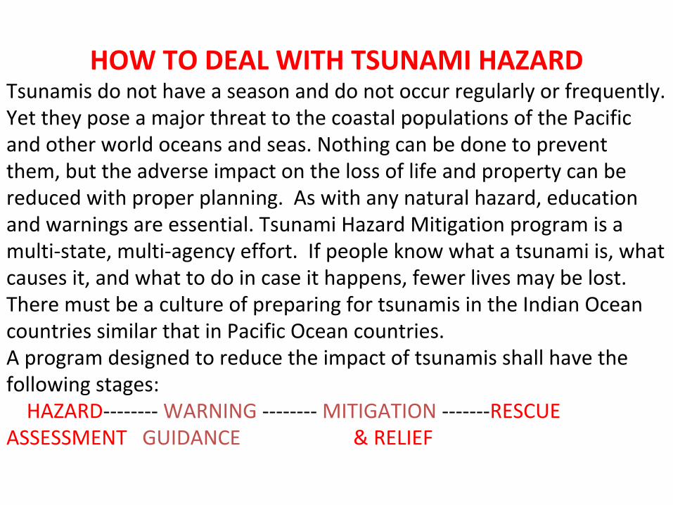
HOW TO DEAL WITH TSUNAMI HAZARDTsunamis do not have a season and do not occur regularly or frequently. Yet they pose a major threat to the coastal populations of the Pacific and other world oceans and seas. Nothing can be done to prevent them, but the adverse impact on the loss of life and property can be reduced with proper planning. As with any natural hazard, education and warnings are essential. Tsunami Hazard Mitigation program is a multi-state, multi-agency effort. If people know what a tsunami is, what causes it, and what to do in case it happens, fewer lives may be lost. There must be a culture of preparing for tsunamis in the Indian Ocean countries similar that in Pacific Ocean countries.A program designed to reduce the impact of tsunamis shall have the following stages: HAZARD-------- WARNING -------- MITIGATION -------RESCUE ASSESSMENT GUIDANCE & RELIEF

WHAT TO DO AND WHAT NOT TO DONo animal can be noticed nearby because they can be alarmed by their smart senses. Guide the residents to higher ground after feeling the initial temblor.The waves come menacingly onto the shore or the sea recedes far from the shore.Stay out of the water.Don’t panic over.Move to higher ground.Issue repeated warnings to the community by radio, TV, cell phones, press, and email. Initiate relief efforts and clean-up operations. Manage relief task by delegating responsibilities among the organizations and volunteers.Look for survivors.Guide the survivors to reach rescue camps.Photograph and bury the dead at the earliest before regal mortem sets in. Have the bleaching powder and chlorination tablets to treat the effected area and water resourcesStop all vehicular traffic except the rescue vehicles to avoid traffic jams.Arrange medical teams including doctors, paramedical, and teams of volunteers to treat the effected.Make available essential commodities properly packed for dispatch to the victims. Make all the modes of transport ready including airplanes for any eventuality.Set up sufficient relief camps with proper back up support chain.Arrange for preparation of ready to eat food and drinking water sachets for transport to every nook and corner of the effected area along with essential medicals.Identify a base hospital to help the severely wounded.

ENVIRONMENTAL DAMAGE ASSESSMENT(Most of the damage is irreversible)
• Disturbed Natural Ecosystems- Aboriginal tribes- Erosion along certain beaches- Damaged Flora and Fauna- Migratory birds visiting the lakes and lagoons in the region dissapeared- damaged coral reefs in the entire Indian Ocean- damaged mangroves- effected species of marine animals, for example
Leather-back turtle whose nesting season is between Dec and Jan. Rare species of crocodiles
• Marooned low lying areas• Threat to Health
- salination of the soil – surface or deeper- Salination of drinking water- Swamped and poisoned fresh water resources
- Solid waste- Liquid waste- Industrial chemicals
• Destroyed sewage treatment plants• Changed landscape

CONCLUSIONSTsunami is a natural hazard, which itself is due to another natural hazard called earthquake. Both the earthquakes and the tsunamis are inevitable evils, which the mankind has to learn to live with.An earthquake is a sudden movement of the ground that releases elastic energy stored in rocks that generates seismic waves. If such a failure of considerably higher magnitude takes place in a region where an oceanic plate converges with a continental plate, tsunami generates and propagates across that ocean basin striking the shorelines causing untold hardship, loss of property and life.Now, the world has the necessary technology and expertise in monitoring the occurrence of a tsunami within fifteen minutes after receiving the telemetric signal, about the ocean bottom pressure variations, from any of the series of buoys installed in the concerned ocean basin.If we develop a culture among the coastal communities living along the shorelines to respond appropriately loss of life can be avoided and loss of property can be minimized. Because of greater penetration of the mobile phone, SMS based Warning Effort will be an ideal and timely communication to the people. However, large scale damage to the ecosystem in the region takes place and most of such damage is irreversible. Threat to health of the communities is imminent. It will take considerable time and effort to upgrade the marooned low-lying areas including agricultural lands and surface water bodies. The grief stricken communities suffer psychological disorders such as acute stress, bereavement, grief and anxiety for several months.

CONCLUSIONS CONTD…Tsunami is a natural hazard which can’t avoid and the destruction it causes to the property could not be avoided; but it could have been minimised. However, deaths can be avoided to minimised, could there been an early warning. Even though the equipment costs dearly, an early warning system can be installed and maintained by the national governments in coordination with each other. In addition to this it is necessary to develop a culture among the people to respond appropriately in the event any natural calamity like tsunamis, earthquakes, etc.,The wide spread casualties and damage in the Indian coastal regions could not be prevented due to lack o( prior knowledge about the Tsunami and the absence of any alert system in the Indian Ocean like the one in the Pacific Ocean. With a well organized Tsunami warning system and communications network it would be possible to issue warning and initiate evacuation in the event of a Tsunami occurrence in future.

Contact ITICNOAA IRCNWS / ITIC1845 Wasp Boulevard, Building 176Honolulu Hawaii 96818 United States
[email protected]+1 (808) 725-6050+1 (808) 725-6055http://www.tsunamiwave.org