ordinance no. 17-27 an ordinance approving the …
TRANSCRIPT

1
ORDINANCE NO. 17-27 AN ORDINANCE APPROVING THE DESCRIPTION AND SURVEY OF LANDS
NECESSARY FOR WIDENING, CONSTRUCTING, RECONSTRUCTING AND MAINTAINING 151ST STREET AND MUR-LEN ROAD GEOMETRIC IMPROVEMENTS WITH SIGNAL PROJECT, DESIGNATED IN RESOLUTION NO. 17-1033, PASSED AND APPROVED BY THE GOVERNING BODY ON THE 2ND DAY OF MAY, 2017, PROJECT NO. 3-C-105-12.
BE IT ORDAINED BY THE GOVERNING BODY OF THE CITY OF OLATHE, KANSAS: SECTION ONE: The description and survey of lands necessary to acquire permanent road right-of-way, permanent utility easements, and temporary construction easements for widening, constructing, reconstructing and maintaining the 151st Street and Mur-Len Road Geometric Improvements with Signal Project as prepared by the City Engineer and filed with the City Clerk pursuant to Resolution No. 17-1033, adopted by the Governing Body of the City of Olathe, Kansas, on the 2nd day of May, 2017, is hereby approved. SECTION TWO: The action of the Governing Body of the City of Olathe, Kansas, in acquiring permanent road right-of-way, permanent utility easements, and temporary construction easements for widening, constructing, reconstructing and maintaining the 151st Street and Mur-Len Road Geometric Improvements with Signal Project has been declared necessary by the Governing Body. SECTION THREE: The acquisition of permanent road right-of-way, permanent utility easements, and temporary construction easements for the widening, constructing, reconstructing and maintaining the 151st Street and Mur-Len Road Geometric Improvements with Signal Project is all in accordance with and under the provisions of Chapter 26 of the Kansas Statutes Annotated. SECTION FOUR: That there is hereby declared to be public necessity to acquire by Eminent Domain Proceedings for the purpose of widening, constructing, reconstructing and maintaining the 151st Street and Mur-Len Road Geometric Improvements with Signal Project the land hereinafter described:

2
151ST & MUR-LEN GEOMETRIC IMPROVEMENTS – TRACT NO. 1 OWNERSHIP: Trustees of the First Baptist
Church of Olathe, Kansas PARTIES IN POSSESSION: Trustees of the First Baptist
Church of Olathe, Kansas SITUS ADDRESS: 2024 E. 151st Street Olathe, KS 66062 JOHNSON COUNTY PARCEL ID NUMBER: DP25500000 0009 LIENHOLDER: None EASEMENT HOLDER: Kansas City Power & Light Company Surewest Kansas Operations,
LLC a/k/a/ Surewest Kansas Holdings, Inc. n/k/a Consolidated Communications, Inc.
Atmos Energy Corporation Southwestern Bell Telephone
Company d/b/a AT&T Kansas
Comcast of Missouri, Inc. f/k/a Jones Communications of Missouri, Inc.
Google Fiber Kansas, LLC Sprint a/k/a Centurylink Communications, LLC f/k/a Qwest
Communications Company, LLC
TW Telecom of Kansas City LLC n/k/a Level 3 Communications
Zayo Group, LLC f/k/a American Fiber Systems, Inc.

3
151ST & MUR-LEN GEOMETRIC IMPROVEMENTS – TRACT NO. 1 (continued)
TEMPORARY CONSTRUCTION EASEMENT DESCRIPTION:
All of the North 10 feet of the South 30 feet of the East 70 feet of Lot 9, FIRST BAPTIST CHURCH ADDITION, a subdivision in the City of Olathe, Johnson County, Kansas, described as follows: TOTAL TEMPORARY CONSTRUCTION EASEMENT AREA: 700 square feet, more or less.

4
151ST & MUR-LEN GEOMETRIC IMPROVEMENTS – TRACT NO. 2 OWNERSHIP: Capitol Federal Savings and
Loan Association PARTIES IN POSSESSION: Capitol Federal Savings and
Loan Association SITUS ADDRESS: 2100 E. 151st Street Olathe, KS 66062 JOHNSON COUNTY PARCEL ID NUMBER: DP12300000 0005B LIENHOLDER: None EASEMENT HOLDER: Cayot’s Corner OTV Enterprises, Inc. n/k/a Lifepointe Church, Inc. Kansas City Power & Light Company Surewest Kansas Operations,
LLC a/k/a/ Surewest Kansas Holdings, Inc. n/k/a Consolidated Communications, Inc.
Atmos Energy Corporation Southwestern Bell Telephone
Company d/b/a AT&T Kansas
Comcast of Missouri, Inc. f/k/a Jones Communications of Missouri, Inc.
Google Fiber Kansas, LLC Sprint a/k/a Centurylink Communications, LLC f/k/a Qwest
Communications Company, LLC

5
151ST & MUR-LEN GEOMETRIC IMPROVEMENTS – TRACT NO. 2 (continued)
TW Telecom of Kansas City LLC
n/k/a Level 3 Communications
Zayo Group, LLC f/k/a American Fiber Systems, Inc.
TEMPORARY CONSTRUCTION EASEMENT DESCRIPTION:
All that part of Lot 5, CAYOT'S CORNER, a subdivision in the City of Olathe, Johnson County, Kansas, described as follows: Commencing at the Southwest comer of said Lot 5; thence North O 1 ° 51 'l 3" West, along the West line of said Lot 5, a distance of 10.00 feet to the Point of Beginning; thence North 01°51'13" West, continuing along the West line of said Lot 5, a distance of 15.00 feet to a point on the North line of the South 25.00 feet thereof; thence North 87°09'27" East, along the North line of the South 25.00 feet of said Lot 5, a distance of 65.00 feet; thence South 02°50'33" East, departing the North line of the South 25.00 feet of said Lot 5, a distance of 10.00 feet; thence North 87°09'27" East a distance of 120.00 feet; thence South 02°50'33" East a distance of 3.87 feet to a point on the North line of 10-feet wide right-of way granted to the City of Olathe, filed with the Johnson County, Kansas Register of Deeds on August 15, 1986, as Instrument No. 1631714, in Volume 2404 at Page 963; thence South 84°17'29" West, along the North line of said 10-feet wide right-of-way, a distance of 22.63 feet; thence South 87°09'27" West, continuing along the North line of said 10-feet wide right-of-way, a distance of 162.66 feet to the Point of Beginning. The bearings used in this description are Grid North based on the Kansas State Plane Coordinate System, North Zone, NAD 83. TOTAL TEMPORARY CONSTRUCTION EASEMENT AREA: 1,564 square feet, more or less.

6
151ST & MUR-LEN GEOMETRIC IMPROVEMENTS – TRACT NO. 3
OWNERSHIP: Cayot’s Corner, a General
Partnership PARTIES IN POSSESSION: BK Olathe, LLC n/k/a CVS Health SITUS ADDRESS: 1785 S. Mur-Len Road Olathe, KS 66062 JOHNSON COUNTY PARCEL ID NUMBER: DP12300000 0005 LIENHOLDER: Metcalf Bank EASEMENT HOLDER: Kansas City Power & Light Company Capitol Federal Savings and
Loan Association (Easement & Maintenance Agreement with Cayot’s Corner – same as on Tract #2)
OTV Enterprises, Inc. n/k/a Lifepointe Church, Inc.
Surewest Kansas Operations, LLC a/k/a/ Surewest Kansas Holdings, Inc. n/k/a Consolidated Communications, Inc.
Atmos Energy Corporation Southwestern Bell Telephone
Company d/b/a AT&T Kansas
Comcast of Missouri, Inc. f/k/a Jones Communications of Missouri, Inc.
Google Fiber Kansas, LLC

7
151ST & MUR-LEN GEOMETRIC IMPROVEMENTS – TRACT NO. 3 (continued)
Sprint a/k/a Centurylink Communications, LLC f/k/a Qwest
Communications Company, LLC
TW Telecom of Kansas City LLC n/k/a Level 3 Communications
Zayo Group, LLC f/k/a American Fiber Systems, Inc.
RIGHT-OF-WAY DESCRIPTION:
The bearings used in this description are Grid North based on the Kansas State Plane Coordinate System, North Zone, NAD 83. TOTAL RIGHT-OF-WAY AREA: 1,352 square feet, more or less.

8
151ST & MUR-LEN GEOMETRIC IMPROVEMENTS – TRACT NO. 4
OWNERSHIP: Kenneth Walterman PARTIES IN POSSESSION: Kenneth Walterman SITUS ADDRESS: 16609 W. 150th Terrace Olathe, KS 66062 JOHNSON COUNTY PARCEL ID NUMBER: DP00600006 0021 LIENHOLDER: MERS as Nominee for Capwest
Mortgage Corporation
EASEMENT HOLDER: Kansas City Power & Light Company Surewest Kansas Operations,
LLC a/k/a/ Surewest Kansas Holdings, Inc. n/k/a Consolidated Communications, Inc.
Atmos Energy Corporation Southwestern Bell Telephone
Company d/b/a AT&T Kansas
Comcast of Missouri, Inc. f/k/a Jones Communications of Missouri, Inc.
Google Fiber Kansas, LLC Sprint a/k/a Centurylink Communications, LLC f/k/a Qwest
Communications Company, LLC
TW Telecom of Kansas City LLC n/k/a Level 3 Communications
Zayo Group, LLC f/k/a American Fiber Systems, Inc.

9
151ST & MUR-LEN GEOMETRIC IMPROVEMENTS – TRACT NO. 4 (continued)
RIGHT-OF-WAY DESCRIPTION:
TOTAL RIGHT-OF-WAY AREA: 901 square feet, more or less.
PERMANENT UTILITY EASEMENT DESCRIPTION:
TOTAL PERMANENT UTILITY EASEMENT AREA: 311 square feet, more or less.

10
151ST & MUR-LEN GEOMETRIC IMPROVEMENTS – TRACT NO. 4 (continued)
TEMPORARY CONSTRUCTION EASEMENT DESCRIPTION:
TOTAL TEMPORARY CONSTRUCTION EASEMENT AREA: 1,131 square feet, more or less.

11
151ST & MUR-LEN GEOMETRIC IMPROVEMENTS – TRACT NO. 5
OWNERSHIP: Joseph P. Sullivan, Jr. and
Michelle R. Sullivan, husband and wife
PARTIES IN POSSESSION: Joseph P. Sullivan, Jr. and
Michelle R. Sullivan SITUS ADDRESS: 16605 W. 150th Terrace Olathe, KS 66062 JOHNSON COUNTY PARCEL ID NUMBER: DP00600006 0022 LIENHOLDER: MERS as Nominee for Quicken
Loans, Inc. EASEMENT HOLDER: Kansas City Power & Light Company Surewest Kansas Operations,
LLC a/k/a/ Surewest Kansas Holdings, Inc. n/k/a Consolidated Communications, Inc.
Atmos Energy Corporation Southwestern Bell Telephone
Company d/b/a AT&T Kansas
Comcast of Missouri, Inc. f/k/a Jones Communications of Missouri, Inc.
Google Fiber Kansas, LLC Sprint a/k/a Centurylink Communications, LLC f/k/a Qwest
Communications Company, LLC

12
151ST & MUR-LEN GEOMETRIC IMPROVEMENTS – TRACT NO. 5 (continued)
TW Telecom of Kansas City LLC
n/k/a Level 3 Communications
Zayo Group, LLC f/k/a American Fiber Systems, Inc.
RIGHT-OF-WAY DESCRIPTION:
TOTAL RIGHT-OF-WAY AREA: 990 square feet, more or less.
PERMANENT UTILITY EASEMENT DESCRIPTION:
TOTAL PERMANENT UTILITY EASEMENT AREA: 302 square feet, more or less.

13
151ST & MUR-LEN GEOMETRIC IMPROVEMENTS – TRACT NO. 5 (continued)
TEMPORARY CONSTRUCTION EASEMENT DESCRIPTION:
TOTAL TEMPORARY CONSTRUCTION EASEMENT AREA: 1,278 square feet, more or less.
14
151ST & MUR-LEN GEOMETRIC IMPROVEMENTS – TRACT NO. 6
OWNERSHIP: Rodney M. Pierce and Robin G.
Pierce, husband and wife PARTIES IN POSSESSION: Rodney M. Pierce and Robin G.
Pierce, husband and wife SITUS ADDRESS: 16601 W. 150th Terrace Olathe, KS 66062 JOHNSON COUNTY PARCEL ID NUMBER: DP00600006 0023 LIENHOLDER: MERS as Nominee for NBH
Bank, N.A. EASEMENT HOLDER: Kansas City Power & Light Company Surewest Kansas Operations,
LLC a/k/a/ Surewest Kansas Holdings, Inc. n/k/a Consolidated Communications, Inc.
Atmos Energy Corporation Southwestern Bell Telephone
Company d/b/a AT&T Kansas
Comcast of Missouri, Inc. f/k/a Jones Communications of Missouri, Inc.
Google Fiber Kansas, LLC Sprint a/k/a Centurylink Communications, LLC f/k/a Qwest
Communications Company, LLC
TW Telecom of Kansas City LLC n/k/a Level 3 Communications

15
151ST & MUR-LEN GEOMETRIC IMPROVEMENTS – TRACT NO. 6 (continued)
Zayo Group, LLC f/k/a American Fiber Systems, Inc.
RIGHT-OF-WAY DESCRIPTION:
TOTAL RIGHT-OF-WAY AREA: 493 square feet, more or less.
PERMANENT UTILITY EASEMENT DESCRIPTION:
TOTAL PERMANENT UTILITY EASEMENT AREA: 104 square feet, more or less.

16
151ST & MUR-LEN GEOMETRIC IMPROVEMENTS – TRACT NO. 6 (continued)
TEMPORARY CONSTRUCTION EASEMENT DESCRIPTION:
TOTAL TEMPORARY CONSTRUCTION EASEMENT AREA: 1,395 square feet, more or less.

17
151ST & MUR-LEN GEOMETRIC IMPROVEMENTS – TRACT NO. 7
OWNERSHIP: Kelly Ward Roberts and Patricia
L. Roberts, husband and wife PARTIES IN POSSESSION: Kelly Ward Roberts and Patricia
L. Roberts SITUS ADDRESS: 15028 S. Bradley Drive Olathe, KS 66062 JOHNSON COUNTY PARCEL ID NUMBER: DP00600006 0028 LIENHOLDER: First Horizon Home Loan
Corporation d/b/a First Horizon Lending Center assigned to U.S. Bank Trust, N.A., as Trustee for LSF9 Master Participation Trust
EASEMENT HOLDER: Kansas City Power & Light Company Surewest Kansas Operations,
LLC a/k/a/ Surewest Kansas Holdings, Inc. n/k/a Consolidated Communications, Inc.
Atmos Energy Corporation Southwestern Bell Telephone
Company d/b/a AT&T Kansas
Comcast of Missouri, Inc. f/k/a Jones Communications of Missouri, Inc.
Google Fiber Kansas, LLC Sprint a/k/a Centurylink Communications, LLC f/k/a Qwest
Communications Company, LLC

18
151ST & MUR-LEN GEOMETRIC IMPROVEMENTS – TRACT NO. 7 (continued)
TW Telecom of Kansas City LLC
n/k/a Level 3 Communications
Zayo Group, LLC f/k/a American Fiber Systems, Inc.
TEMPORARY CONSTRUCTION EASEMENT DESCRIPTION:
TOTAL TEMPORARY CONSTRUCTION EASEMENT AREA: 533 square feet, more or less.

19
151ST & MUR-LEN GEOMETRIC IMPROVEMENTS – TRACT NO. 8
OWNERSHIP: CRE Heritage Square, LLC, a
Delaware Limited Liability Company
PARTIES IN POSSESSION: Pride Cleaners Crazy Good Eats SITUS ADDRESS: 16695 W. 151st Street Olathe, KS 66062 JOHNSON COUNTY PARCEL ID NUMBER: DP31400000 0002 LIENHOLDER: General American Life Insurance
Company assigned to John Hancock Life Insurance Company
EASEMENT HOLDER: Terra Venture Partners, a Kansas
General Partnership Carl Wooderson, Jr. Pauline Wooderson Kansas City Power & Light
Company Surewest Kansas Operations,
LLC a/k/a/ Surewest Kansas Holdings, Inc. n/k/a Consolidated Communications, Inc.
Atmos Energy Corporation Southwestern Bell Telephone
Company d/b/a AT&T Kansas
Comcast of Missouri, Inc. f/k/a Jones Communications of Missouri, Inc.

20
151ST & MUR-LEN GEOMETRIC IMPROVEMENTS – TRACT NO. 8 (continued)
Google Fiber Kansas, LLC Sprint a/k/a Centurylink Communications, LLC f/k/a Qwest
Communications Company, LLC
TW Telecom of Kansas City LLC n/k/a Level 3 Communications
Zayo Group, LLC f/k/a American Fiber Systems, Inc.
RIGHT-OF-WAY DESCRIPTION:
All that part of Lot 2, HERITAGE SQUARE, a subdivision in the City of Olathe, Johnson County, Kansas, described as follows: Beginning at the Northwest corner of said Lot 2; thence South 02°13'48" East, along the West line of said Lot 2, a distance of 152.56 feet to the Southwest corner thereof; thence North 87°43'07" East, along the South line of said Lot 2, a distance of 10.00 feet; thence North 02°13'48" West, along the East line of the West 10.00 feet of said Lot 2, a distance of 131.84 feet; thence North 33°39'48" East a distance of 25.59 feet to a point on the North line of said Lot 2; thence South 87°43'46" West, along the North line of said Lot 2, a distance of 25.00 feet to the Point of Beginning. Containing 1,681 square feet, more or less. The bearings used in this description are Grid North based on the Kansas State Plane Coordinate System, North Zone, NAD83. TOTAL RIGHT-OF-WAY AREA: 1,681 square feet, more or less.
TEMPORARY CONSTRUCTION EASEMENT DESCRIPTION:
All that part of Lot 2, HERITAGE SQUARE, a subdivision in the City of Olathe, Johnson County, Kansas, described as follows:

21
151ST & MUR-LEN GEOMETRIC IMPROVEMENTS – TRACT NO. 8 (continued)
Commencing at the Northwest corner of said Lot 2; thence North 87°43'46" East, along the North line of said Lot 2, a distance of 25.00 feet to the Point of Beginning; thence South 33°39'48" West a distance of 25.59 feet; thence South 02°13'48" East, along the East line of the West 10.00 feet of said Lot 2, a distance of 131.84 feet to a point on the South line of said Lot 2; thence North 87°43'07" East, along the South line of said Lot 2, a distance of 5.00 feet; thence North 02°13'48" West, along the East line of the West 15.00 feet of said Lot 2, a distance of 127.56 feet; thence North 36°24'51" East a distance of 32.03 feet to a point on the North line of said Lot 2; thence South 87°43'46" West, along the North line of said Lot 2, a distance of 10.00 feet to the Point of Beginning. Containing 857 square feet, more or less. The bearings used in this description are Grid North based on the Kansas State Plane Coordinate System, North Zone, NAD83. TOTAL TEMPORARY CONSTRUCTION EASEMENT AREA: 857 square feet, more or less.

22
151ST & MUR-LEN GEOMETRIC IMPROVEMENTS – TRACT NO. 9
OWNERSHIP: CRE Heritage Square, LLC, a
Delaware Limited Liability Company
PARTIES IN POSSESSION: Unknown SITUS ADDRESS: 16665 W. 151st Street Olathe, KS 66062 JOHNSON COUNTY PARCEL ID NUMBER: DP31400000-0001 LIENHOLDER: General American Life Insurance
Company assigned to John Hancock Life Insurance Company
EASEMENT HOLDER: Terra Venture Partners, a Kansas
General Partnership Carl Wooderson, Jr. Pauline Wooderson Kansas City Power & Light Company Surewest Kansas Operations,
LLC a/k/a/ Surewest Kansas Holdings, Inc. n/k/a Consolidated Communications, Inc.
Atmos Energy Corporation Southwestern Bell Telephone
Company d/b/a AT&T Kansas
Comcast of Missouri, Inc. f/k/a Jones Communications of Missouri, Inc.
Google Fiber Kansas, LLC

23
151ST & MUR-LEN GEOMETRIC IMPROVEMENTS – TRACT NO. 9 (continued)
Sprint a/k/a Centurylink Communications, LLC f/k/a Qwest
Communications Company, LLC
TW Telecom of Kansas City LLC n/k/a Level 3 Communications
Zayo Group, LLC f/k/a American Fiber Systems, Inc.
RIGHT-OF-WAY DESCRIPTION:
All of the West 10.00 feet of Lot 1, HERITAGE SQUARE, a subdivision in the City of Olathe, Johnson County, Kansas. Containing 5,020 square feet, more or less. TOTAL RIGHT-OF-WAY AREA: 5,020 square feet, more or less.
TEMPORARY CONSTRUCTION EASEMENT DESCRIPTION:
All that part of Lot 1, HERITAGE SQUARE, a subdivision in the City of Olathe, Johnson County, Kansas, described as follows: Commencing at the Northwest corner of said Lot 1; thence North 87°43'07" East, along the North line of said Lot 1, a distance of 10.00 feet to the Point of Beginning; thence South 02°13'48" East, along the East line of the West 10.00 feet of said Lot 1, a distance of 270.33 feet; thence North 36°58'57" East a distance of 55.36 feet; thence North 02°13'48" West, along the East line of the West 45.00 feet of said Lot 1, a distance of 50.00 feet; thence South 87°46'12" West a distance of 20.00 feet; thence North 02°13'48" West, along the East line of the West 25.00 feet of said Lot 1, a distance of 70.00 feet; thence South 87°46'12" West a distance of 10.00 feet; thence North 02°13'48" West, along the East line of the West 15.00 feet of said Lot 1, a distance of 107.44 feet to a point on the North line of said Lot 1; thence South 87°43'07" West, along the North line of said Lot 1, a distance of 5.00 feet to the Point of Beginning. Containing 4,088 square feet, more or less. The bearings used in this description are Grid North based on the Kansas State Plane Coordinate System, North Zone, NAD83. TOTAL TEMPORARY CONSTRUCTION EASEMENT AREA: 4,088 square feet, more or less.

24
151ST & MUR-LEN GEOMETRIC IMPROVEMENTS – TRACT NO. 10
OWNERSHIP: Raymond Dean Dees PARTIES IN POSSESSION: Raymond Dean Dees SITUS ADDRESS: 2142 E. 151st Terrace Olathe, KS 66062 JOHNSON COUNTY PARCEL ID NUMBER: DP68500008 0009 LIENHOLDER: MERS as Nominee for Nationstar
Mortgage LLC EASEMENT HOLDER: Kansas City Power & Light Company Surewest Kansas Operations,
LLC a/k/a/ Surewest Kansas Holdings, Inc. n/k/a Consolidated Communications, Inc.
Atmos Energy Corporation Southwestern Bell Telephone
Company d/b/a AT&T Kansas
Comcast of Missouri, Inc. f/k/a Jones Communications of Missouri, Inc.
Google Fiber Kansas, LLC Sprint a/k/a Centurylink Communications, LLC f/k/a Qwest
Communications Company, LLC
TW Telecom of Kansas City LLC n/k/a Level 3 Communications
Zayo Group, LLC f/k/a American Fiber Systems, Inc.

25
151ST & MUR-LEN GEOMETRIC IMPROVEMENTS – TRACT NO. 10 (continued)
TEMPORARY CONSTRUCTION EASEMENT DESCRIPTION:
TOTAL TEMPORARY CONSTRUCTION EASEMENT AREA: 1,150 square feet, more or less.

26
151ST & MUR-LEN GEOMETRIC IMPROVEMENTS – TRACT NO. 11
OWNERSHIP: 151st Street DMP LLC, a Kansas
Limited Liability Company PARTIES IN POSSESSION: Austin’s Bar & Grill Q Cleaners Long Life Foot Massage High Plains Supply Harvest Moon 31st Century Niche Jewelry Bella Nails Younger Liquor KAT Tae Kawn Do Mr. Goodcents Enchanted Gifts SITUS ADDRESS: 2103 E. 151st Street Olathe, KS 66062 JOHNSON COUNTY PARCEL ID NUMBER: DP68600000 0006 LIENHOLDER: Bank of Kansas City, N.A. EASEMENT HOLDER: Kansas City Power & Light Company Surewest Kansas Operations,
LLC a/k/a/ Surewest Kansas Holdings, Inc. n/k/a Consolidated Communications, Inc.
Atmos Energy Corporation Southwestern Bell Telephone
Company d/b/a AT&T Kansas
Comcast of Missouri, Inc. f/k/a Jones Communications of Missouri, Inc.
Google Fiber Kansas, LLC

27
151ST & MUR-LEN GEOMETRIC IMPROVEMENTS – TRACT NO. 11 (continued)
Sprint a/k/a Centurylink Communications, LLC f/k/a Qwest
Communications Company, LLC
TW Telecom of Kansas City LLC n/k/a Level 3 Communications
Zayo Group, LLC f/k/a American Fiber Systems, Inc.
RIGHT-OF-WAY DESCRIPTION:
TOTAL RIGHT-OF-WAY AREA: 97 square feet, more or less.

28
151ST & MUR-LEN GEOMETRIC IMPROVEMENTS – TRACT NO. 11 (continued)
PERMANENT UTILITY EASEMENT DESCRIPTION:
TOTAL PERMANENT UTILITY EASEMENT AREA: 204 square feet, more or less.
TEMPORARY CONSTRUCTION EASEMENT DESCRIPTION:

29
151ST & MUR-LEN GEOMETRIC IMPROVEMENTS – TRACT NO. 11 (continued)
The bearings used in this description are Grid North based on the Kansas State Plane Coordinate System, North Zone, NAD 83. TOTAL TEMPORARY CONSTRUCTION EASEMENT AREA: 2,492 square feet, more or less.

30
151ST & MUR-LEN GEOMETRIC IMPROVEMENTS – TRACT NO. 12
OWNERSHIP: 151st Street DMP LLC, a Kansas
Limited Liability Company PARTIES IN POSSESSION: Pizza Hut Dr. Cory Koch, Chiropractic Lifestyle Center E-Care Dentistry AHI Insurance Group Surya Yoga A Tender Touch SITUS ADDRESS: 2137 E. 151st Street Olathe, KS 66062 JOHNSON COUNTY PARCEL ID NUMBER: DP68600000 0003 LIENHOLDER: Bank of Kansas City, N.A. EASEMENT HOLDER: Kansas City Power & Light Company Surewest Kansas Operations,
LLC a/k/a/ Surewest Kansas Holdings, Inc. n/k/a Consolidated Communications, Inc.
Atmos Energy Corporation Southwestern Bell Telephone
Company d/b/a AT&T Kansas
Comcast of Missouri, Inc. f/k/a Jones Communications of Missouri, Inc.
Google Fiber Kansas, LLC Sprint a/k/a Centurylink Communications, LLC f/k/a Qwest
Communications Company, LLC

31
151ST & MUR-LEN GEOMETRIC IMPROVEMENTS – TRACT NO. 12 (continued)
TW Telecom of Kansas City LLC
n/k/a Level 3 Communications
Zayo Group, LLC f/k/a American Fiber Systems, Inc.
RIGHT-OF-WAY DESCRIPTION:
TOTAL RIGHT-OF-WAY AREA: 582 square feet, more or less.
TEMPORARY CONSTRUCTION EASEMENT DESCRIPTION:

32
151ST & MUR-LEN GEOMETRIC IMPROVEMENTS – TRACT NO. 12 (continued)
TOTAL TEMPORARY CONSTRUCTION EASEMENT AREA: 1,999 square feet, more or less.

33
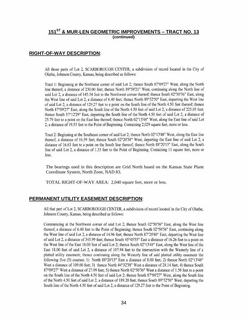
151ST & MUR-LEN GEOMETRIC IMPROVEMENTS – TRACT NO. 13
OWNERSHIP: 7-Eleven, Inc., a Texas
Corporation PARTIES IN POSSESSION: 7-Eleven, Inc. SITUS ADDRESS: 2151 E. 151st Street Olathe, KS 66062 JOHNSON COUNTY PARCEL ID NUMBERS: DP68600000 0001 & DP68600000 0002 LIENHOLDER: None EASEMENT HOLDER: Kansas City Power & Light Company Surewest Kansas Operations,
LLC a/k/a/ Surewest Kansas Holdings, Inc. n/k/a Consolidated Communications, Inc.
Atmos Energy Corporation Southwestern Bell Telephone
Company d/b/a AT&T Kansas
Comcast of Missouri, Inc. f/k/a Jones Communications of Missouri, Inc.
Google Fiber Kansas, LLC Sprint a/k/a Centurylink Communications, LLC f/k/a Qwest
Communications Company, LLC
TW Telecom of Kansas City LLC n/k/a Level 3 Communications
Zayo Group, LLC f/k/a American Fiber Systems, Inc.
34
151ST & MUR-LEN GEOMETRIC IMPROVEMENTS – TRACT NO. 13 (continued)
RIGHT-OF-WAY DESCRIPTION:
The bearings used in this description are Grid North based on the Kansas State Plane Coordinate System, North Zone, NAD 83.
TOTAL RIGHT-OF-WAY AREA: 2,040 square feet, more or less.
PERMANENT UTILITY EASEMENT DESCRIPTION:

35
151ST & MUR-LEN GEOMETRIC IMPROVEMENTS – TRACT NO. 13
(continued) The bearings used in this description are Grid North based on the Kansas State Plane Coordinate System, North Zone, NAD 83. TOTAL PERMANENT UTILITY EASEMENT AREA: 4,971 square feet, more or less.
TEMPORARY CONSTRUCTION EASEMENT DESCRIPTION:

36
151ST & MUR-LEN GEOMETRIC IMPROVEMENTS – TRACT NO. 13 (continued)
TOTAL TEMPORARY CONSTRUCTION EASEMENT AREA: 4,516 square feet, more or less.

37
151ST & MUR-LEN GEOMETRIC IMPROVEMENTS – TRACT NO. 14
OWNERSHIP: Crown Development, a Kansas
Partnership PARTIES IN POSSESSION: Crown Realty
Debbie Swinney – State Farm Insurance Agency
SITUS ADDRESS: No Situs Address JOHNSON COUNTY PARCEL ID NUMBER: DP68600000 0011 LIENHOLDER: Miami County National Bank of
Paola assigned to Great Southern Bank
EASEMENT HOLDER: Kansas City Power & Light Company Surewest Kansas Operations,
LLC a/k/a/ Surewest Kansas Holdings, Inc. n/k/a Consolidated Communications, Inc.
Atmos Energy Corporation Southwestern Bell Telephone
Company d/b/a AT&T Kansas
Comcast of Missouri, Inc. f/k/a Jones Communications of Missouri, Inc.
Google Fiber Kansas, LLC Sprint a/k/a Centurylink Communications, LLC f/k/a Qwest
Communications Company, LLC
TW Telecom of Kansas City LLC n/k/a Level 3 Communications

38
151ST & MUR-LEN GEOMETRIC IMPROVEMENTS – TRACT NO. 14 (continued)
Zayo Group, LLC f/k/a American Fiber Systems, Inc.
RIGHT-OF-WAY DESCRIPTION:
TOTAL RIGHT-OF-WAY AREA: 956 square feet, more or less.
PERMANENT UTILITY EASEMENT DESCRIPTION:

39
151ST & MUR-LEN GEOMETRIC IMPROVEMENTS – TRACT NO. 14
(continued) TOTAL PERMANENT UTILITY EASEMENT AREA: 2,109 square feet, more or less.
TEMPORARY CONSTRUCTION EASEMENT DESCRIPTION:
TOTAL TEMPORARY CONSTRUCTION EASEMENT AREA: 818 square feet, more or less.

40
SECTION FIVE: The City Attorney for the City of Olathe, Kansas, is hereby directed, authorized and instructed to make proper application to a Judge of the District Court of Johnson County, Kansas, for the acquisition of permanent road right-of-way, permanent utility easements, and temporary construction easements for the widening, constructing, reconstructing and maintaining the 151st Street and Mur-Len Road Geometric Improvements with Signal Project, praying for condemnation thereof and the appointment of three disinterested residents of the county to assess, determine the damages and compensation resulting from such condemnation and for such other proceedings as may be required by law. SECTION SIX: This Ordinance shall take effect and be in force from and after its passage and publication as provided by law. PASSED by the Governing Body this 16th day of May, 2017. SIGNED by the Mayor this 16th day of May, 2017. __________________________ Michael E. Copeland
Mayor ATTEST: _______________________ David F. Bryant, III Deputy City Clerk (SEAL) APPROVED AS TO FORM: _______________________ Ronald R. Shaver City Attorney Publish one time and return one Proof of Publication to the City Clerk, one to Public Works, and one to the City Attorney.