openstreetmap data for navigation guidance and trekking
TRANSCRIPT

OpenStreetMap Data for Navigation Guidance and Trekking
State of the Map Asia 2016UP Diliman, Philippines2nd October 2016

What is Schadow1 Expeditions
• A travel and mapping advocacy resource for the Philippines
• Started in 2012 to document experiences in the Philippines while mapping communities, trails, and areas of interest.
• Mapping advocacy started back in 2005 and contributing mapping data to Google Maps, Roadguide Philippines, OpenStreetMap, Waze

What is Schadow1 Expeditions
• In 2011, we have chosen OpenStreetMap as the choice for contributing our mapping data for being open sourced, crowdsourced and free.
• In 2009, OSM data has been extracted and converted to Garmin offline maps.
• In 2013, Schadow1 Expeditions has taken the task and improved the extraction, conversion and compilation.
• OSM-based Garmin map of the Philippines released in a weekly-basis.
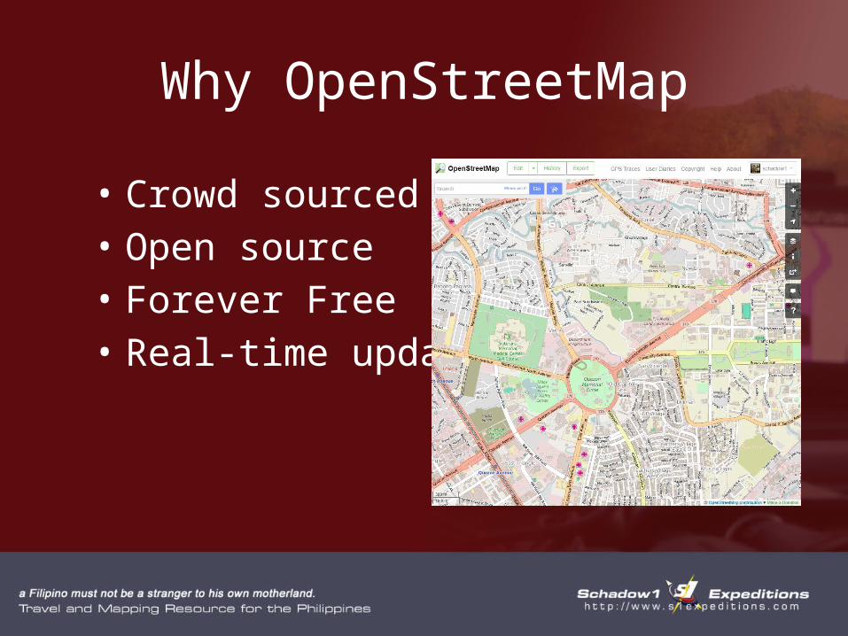
Why OpenStreetMap
• Crowd sourced• Open source• Forever Free• Real-time updates

• Over 1000 contributors nationwide• About 30 regular contributors nationwide• Contributors came from various professions
with a goal of helping his countrymen through mapping data.
• With these contributors, Philippine data has tremendously increased over a span of a few years.
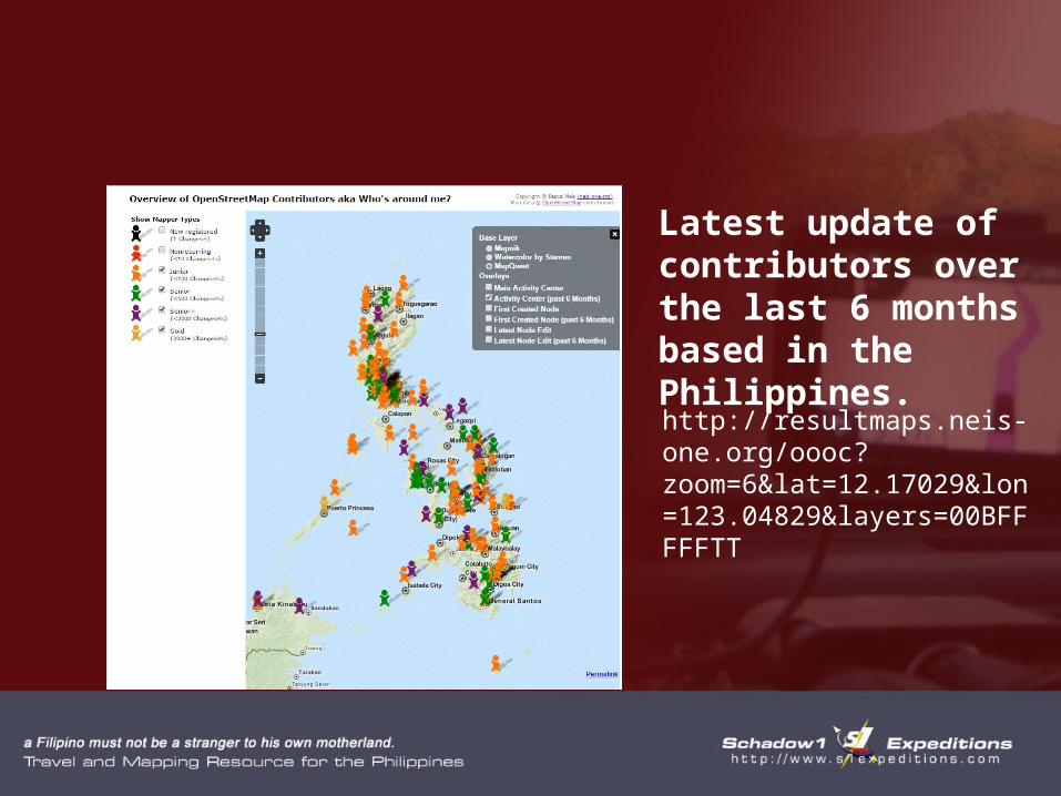
Latest update of contributors over the last 6 months based in the Philippines.
http://resultmaps.neis-one.org/oooc?zoom=6&lat=12.17029&lon=123.04829&layers=00BFFFFFTT
SCHADOW1 EXPEDITIONS MAPSSome of our Contributions from our Mapping Expeditions

Apo-Talomo Traverse
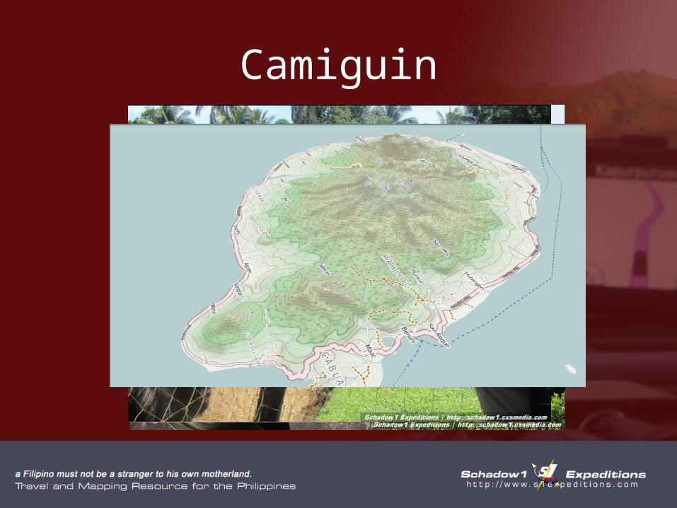
Camiguin

Palay-Palay Mataas na Gulod Range

Jomalig Island

Our Contributions

Our Contributions
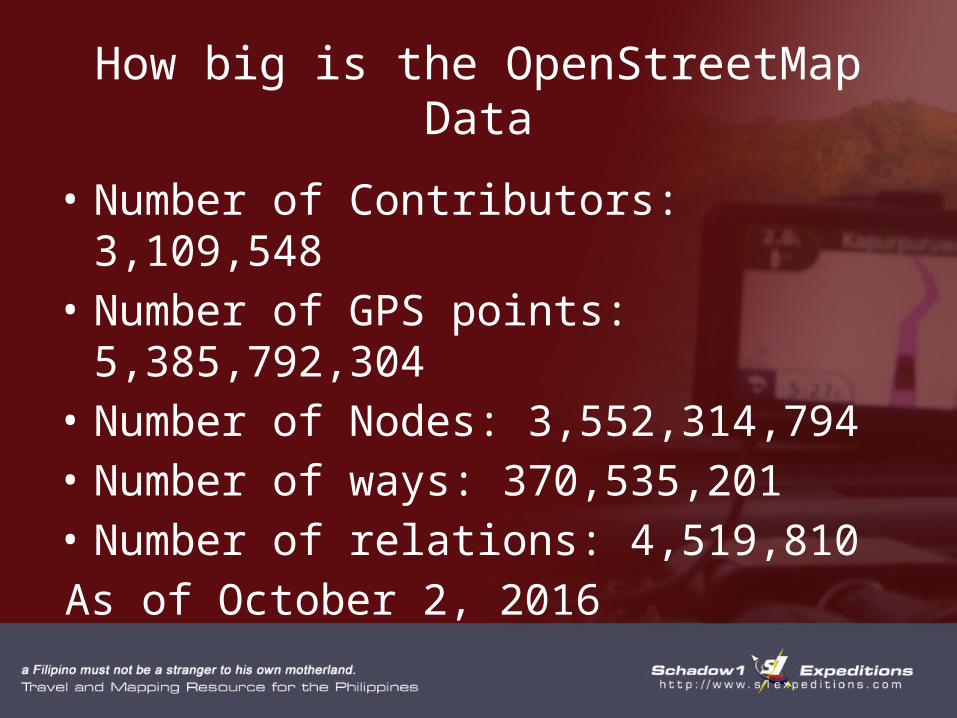
How big is the OpenStreetMap Data
• Number of Contributors: 3,109,548• Number of GPS points: 5,385,792,304• Number of Nodes: 3,552,314,794• Number of ways: 370,535,201• Number of relations: 4,519,810As of October 2, 2016
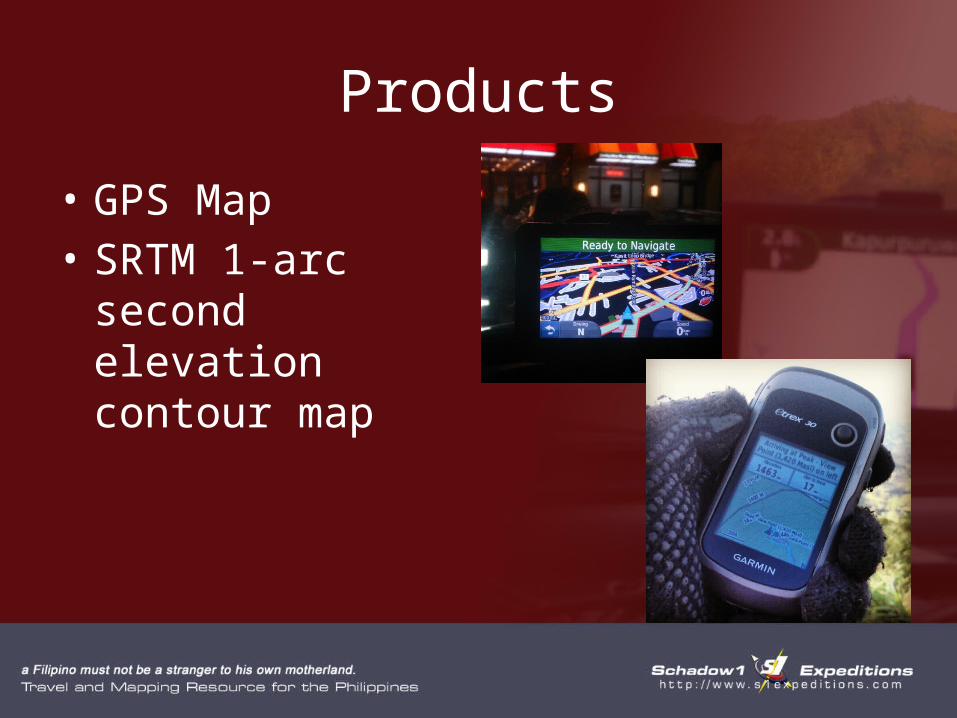
Products
• GPS Map• SRTM 1-arc second
elevation contour map

Routable GPS Map of the Philippines
• Frequently updated (about once a week)
• Established mountain trails are easily distuingishable
• More frequent during humanitarian activations.
• Evacuation Centers are shown during humanitarian activation version of the maps.
• Searchable places of interests (POIs) with telephone numbers if available which can be used to call the establishments if your GPS is connected through Bluetooth to your phone for hands-free operation

Evacuation Centers

Evacuation Centers

Elevation Contour Map of the Philippines (30-meter accuracy)
• Initial version released in 2014 based from SRTM 3-arc second accuracy (90m) with voids fixed using Aster GDEM Data
• 2nd and latest version released in 2015 based on SRTM 1-arcsecond accuracy (30m)

Sibuyan Island Elevation Contour
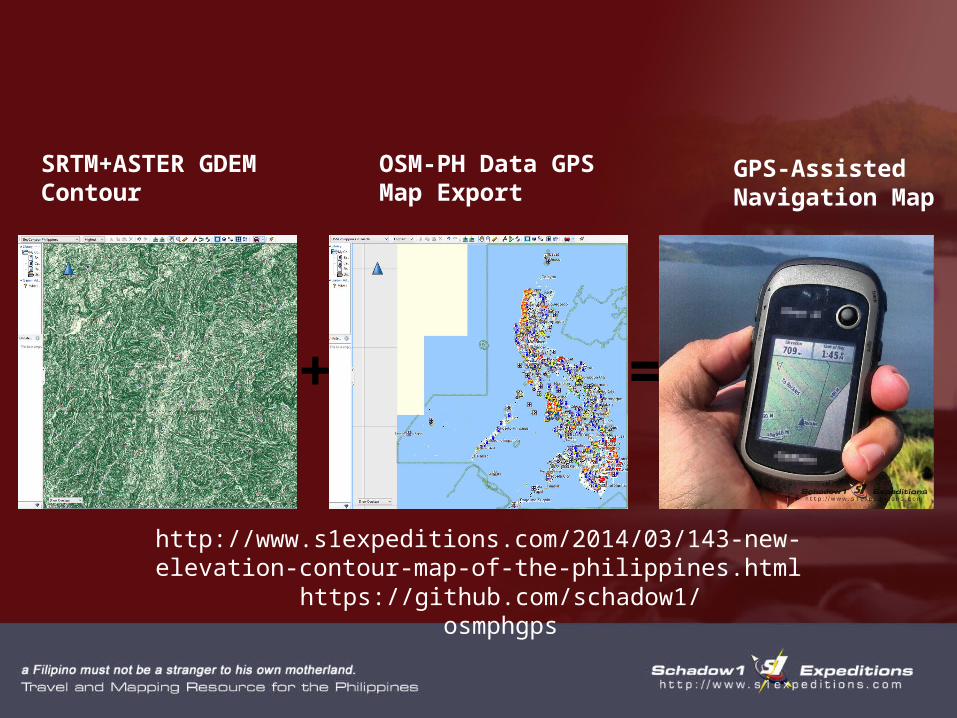
+ =
SRTM+ASTER GDEM Contour
OSM-PH Data GPS Map Export
GPS-Assisted Navigation Map
http://www.s1expeditions.com/2014/03/143-new-elevation-contour-map-of-the-philippines.html
https://github.com/schadow1/osmphgps

During Humanitarian Activations
• Humanitarian Activations are activated through HOT.
• When the activation is in the Philippines, mapping contributors are directed to update specific locations that can be hit by disaster.
• Schadow1 Expeditions releases daily updates of the GPS map to reflect map changes from the activation.

Citations
• Humanitarian OpenStreetMap Team
• The Guardian• Al Jazeera• Philippines Humanitarian
Response (OCHA)

• Using OSM Data for navigation guidance during humanitarian missions
• http://www.s1expeditions.com/2013/11/113-osmforhumanitarianmissions.html
Schadow1 Expeditionshttp://www.s1expeditions.comhttps://www.facebook.com/s1expeditionshttp://twitter.com/schadow1http://Instagram.com/schadow1
Download GPS Map of the PhilippinesElevation Contour (1 arc second accuracy)Speed limitshttp://www.s1expeditions.com/p/openstreetmaps.html

Ervin MalicdemPhilippine Travel and Mapping Advocate,
Schadow1 [email protected]
A Filipino must not be a stranger to his own motherland.