open workshop 1st freewat user and developers international … · 2017-12-26 · ada pandele,...
TRANSCRIPT
Open Workshop
1st FREEWAT User and Developers International
WorkshopSeptember 21st 2017
IDAEA. CID - CSIC
16 Jordi Girona. 08034 Barcelona
Taken from: http://travessa-pirineus.blogspot.com.es/2014/08/dia-15-de-lospitalet-al-refugi-de-juclar.html
BANAT PLAIN – THE ROMANIAN CASE STUDY
FREEWAT PLATFORM APPLICATION
National Institute of Hydrology and
Water Management,
Ada Pandele, Marian Minciuna, Emil Radu,Irina Serpescu, Valentina Manea, Teodora Ionel,
Teodora Vasile, Catalina Radu
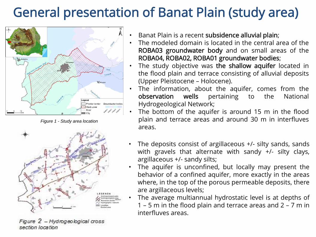
General presentation of Banat Plain (study area)
• Banat Plain is a recent subsidence alluvial plain;• The modeled domain is located in the central area of the
ROBA03 groundwater body and on small areas of theROBA04, ROBA02, ROBA01 groundwater bodies;
• The study objective was the shallow aquifer located inthe flood plain and terrace consisting of alluvial deposits(Upper Pleistocene – Holocene).
• The information, about the aquifer, comes from theobservation wells pertaining to the NationalHydrogeological Network;
• The bottom of the aquifer is around 15 m in the floodplain and terrace areas and around 30 m in interfluvesareas.
• The deposits consist of argillaceous +/- silty sands, sandswith gravels that alternate with sandy +/- silty clays,argillaceous +/- sandy silts;
• The aquifer is unconfined, but locally may present thebehavior of a confined aquifer, more exactly in the areaswhere, in the top of the porous permeable deposits, thereare argillaceous levels;
• The average multiannual hydrostatic level is at depths of1 – 5 m in the flood plain and terrace areas and 2 – 7 m ininterfluves areas.
Figure 1 - Study area location
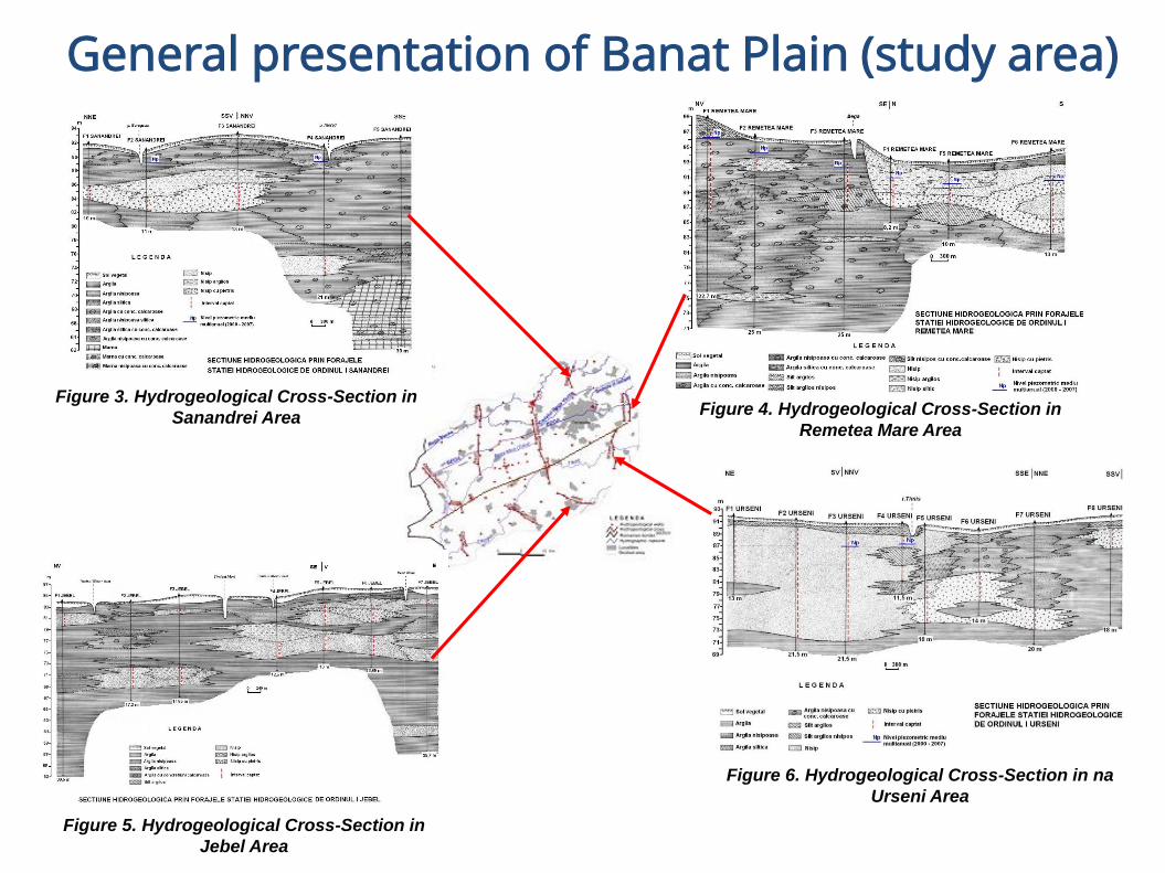
General presentation of Banat Plain (study area)
Figure 6. Hydrogeological Cross-Section in na
Urseni Area
Figure 4. Hydrogeological Cross-Section in
Remetea Mare Area
Figure 3. Hydrogeological Cross-Section in
Sanandrei Area
Figure 5. Hydrogeological Cross-Section in
Jebel Area
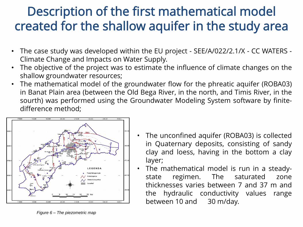
Description of the first mathematical model created for the shallow aquifer in the study area
Figure 6 – The piezometric map
• The unconfined aquifer (ROBA03) is collectedin Quaternary deposits, consisting of sandyclay and loess, having in the bottom a claylayer;
• The mathematical model is run in a steady-state regimen. The saturated zonethicknesses varies between 7 and 37 m andthe hydraulic conductivity values rangebetween 10 and 30 m/day.
• The case study was developed within the EU project - SEE/A/022/2.1/X - CC WATERS -Climate Change and Impacts on Water Supply.
• The objective of the project was to estimate the influence of climate changes on theshallow groundwater resources;
• The mathematical model of the groundwater flow for the phreatic aquifer (ROBA03)in Banat Plain area (between the Old Bega River, in the north, and Timis River, in thesourth) was performed using the Groundwater Modeling System software by finite-difference method;
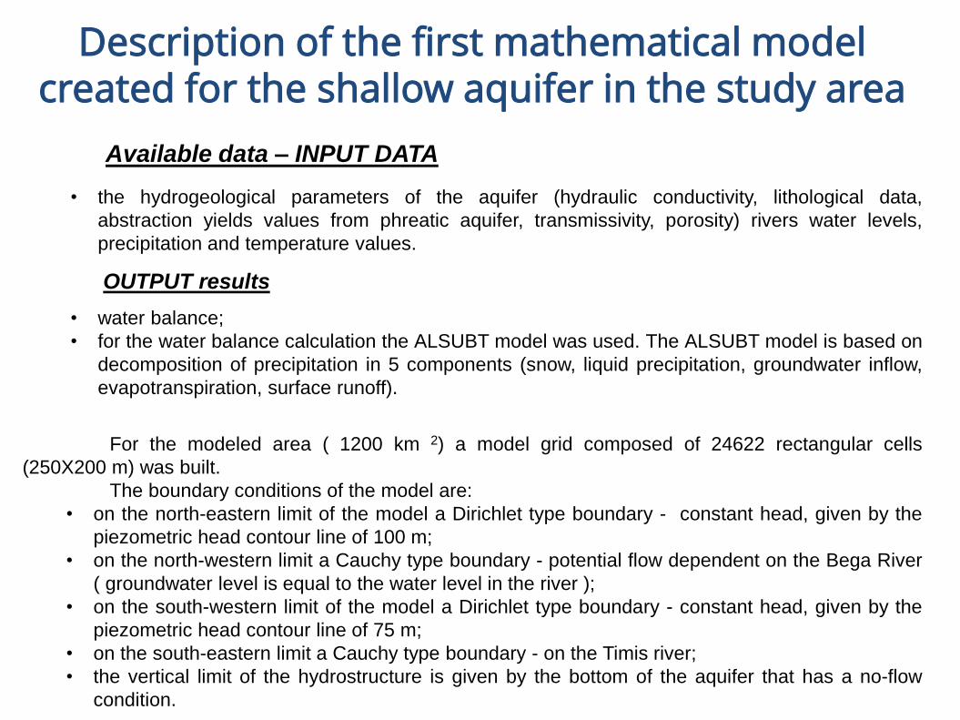
Description of the first mathematical model created for the shallow aquifer in the study area
Available data – INPUT DATA
• the hydrogeological parameters of the aquifer (hydraulic conductivity, lithological data,
abstraction yields values from phreatic aquifer, transmissivity, porosity) rivers water levels,
precipitation and temperature values.
OUTPUT results
• water balance;
• for the water balance calculation the ALSUBT model was used. The ALSUBT model is based on
decomposition of precipitation in 5 components (snow, liquid precipitation, groundwater inflow,
evapotranspiration, surface runoff).
For the modeled area ( 1200 km 2) a model grid composed of 24622 rectangular cells
(250X200 m) was built.
The boundary conditions of the model are:
• on the north-eastern limit of the model a Dirichlet type boundary - constant head, given by the
piezometric head contour line of 100 m;
• on the north-western limit a Cauchy type boundary - potential flow dependent on the Bega River
( groundwater level is equal to the water level in the river );
• on the south-western limit of the model a Dirichlet type boundary - constant head, given by the
piezometric head contour line of 75 m;
• on the south-eastern limit a Cauchy type boundary - on the Timis river;
• the vertical limit of the hydrostructure is given by the bottom of the aquifer that has a no-flow
condition.
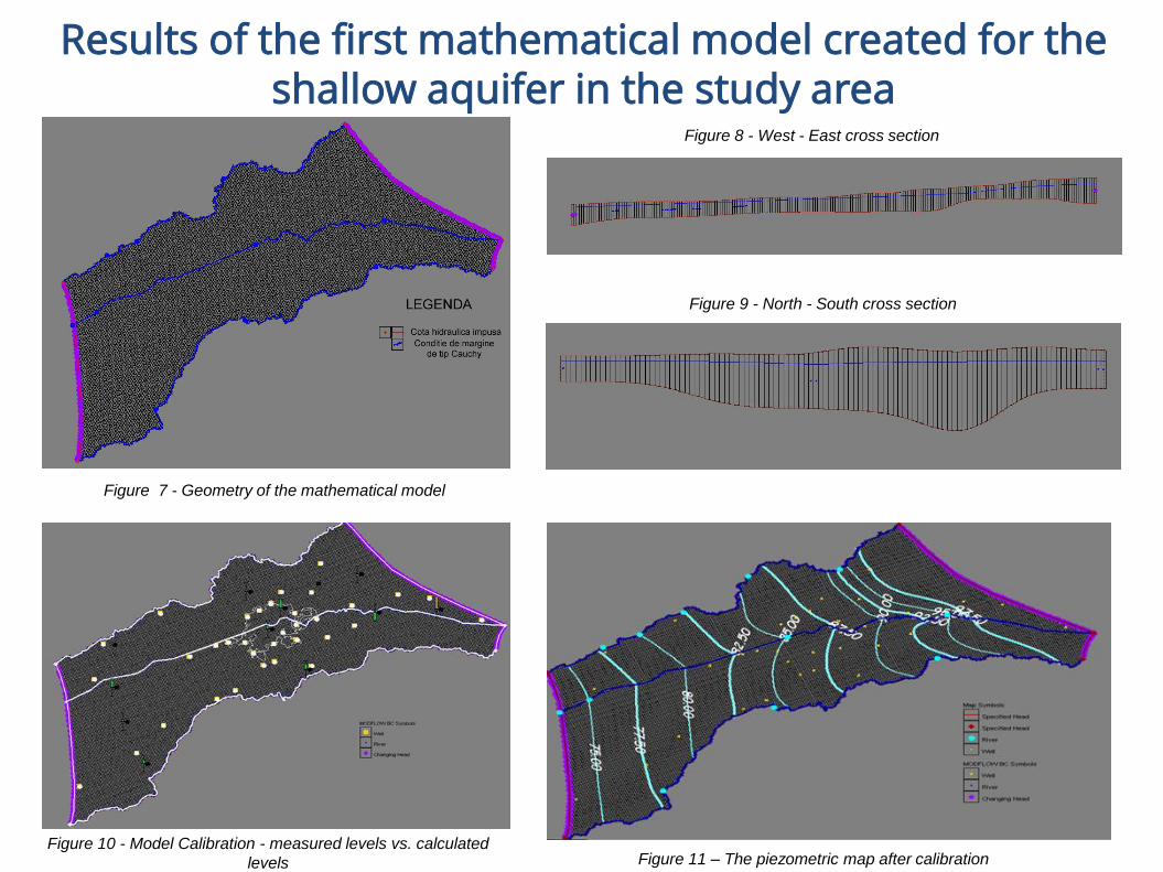
Results of the first mathematical model created for theshallow aquifer in the study area
Figure 7 - Geometry of the mathematical model
Figure 8 - West - East cross section
Figure 9 - North - South cross section
Figure 10 - Model Calibration - measured levels vs. calculated
levels Figure 11 – The piezometric map after calibration

Application of the FREEWAT Platform in Banat Plain (Romanian case study)
The shallow aquifer, with a good status from a quantitative point of view, is
mainly used as a water supply source for drinking water, for domestic use, as well in
industrial and agricultural activities.
The FREEWAT platform will allow the evaluation of groundwater resources of
the shallow aquifer and their availability for any future necessities.
LocationWestern part of Romania,
Central part of Banat Plain
Groundwater
bodies
ROBA01
ROBA02
ROBA03
ROBA04
Surface 1200 km2
Rivers
Old Bega
Timiș
Bega
Figure 12 – Study Area Location
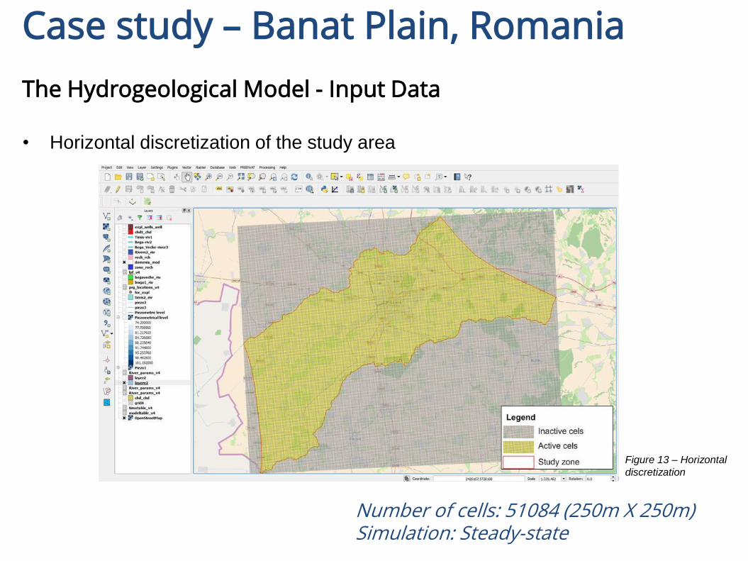
Case study – Banat Plain, Romania
The Hydrogeological Model - Input Data
• Horizontal discretization of the study area
Number of cells: 51084 (250m X 250m)Simulation: Steady-state
Figure 13 – Horizontal
discretization
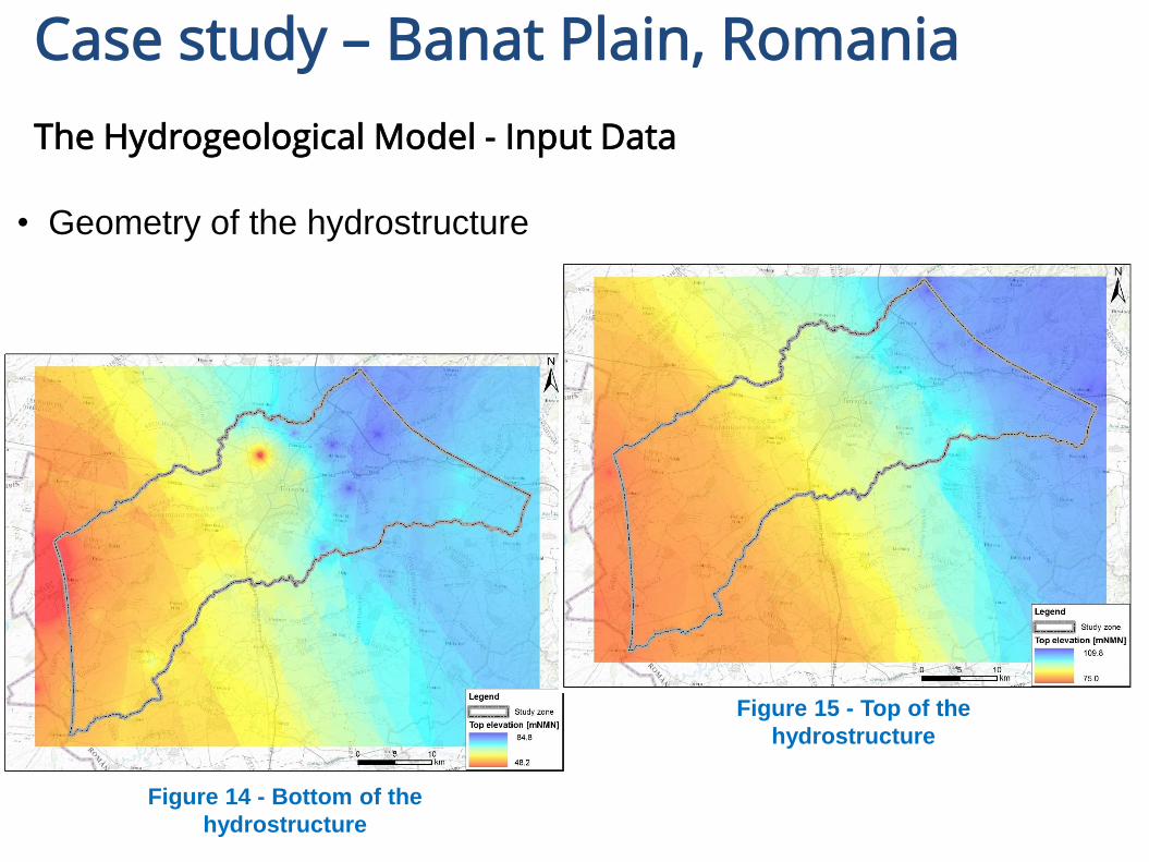
Case study – Banat Plain, Romania
The Hydrogeological Model - Input Data
• Geometry of the hydrostructure
Figure 15 - Top of the
hydrostructure
Figure 14 - Bottom of the
hydrostructure

Case study – Banat Plain, Romania
The Hydrogeological Model - Input Data
• Hydraulic
conductivity
Kx=Ky (10-30 m/day)
Kz (0.2 - 3.02 m/day)
Figure 16 – Horizontal variation of hydraulic conductivity
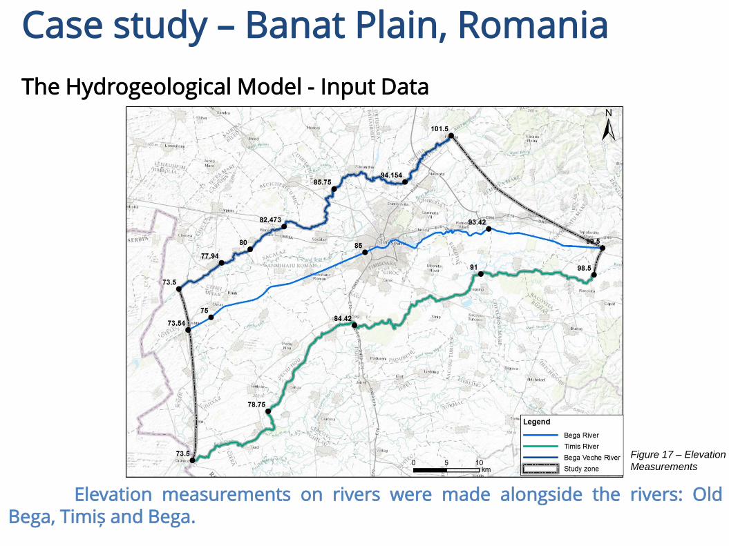
Case study – Banat Plain, Romania
The Hydrogeological Model - Input Data
Elevation measurements on rivers were made alongside the rivers: OldBega, Timiș and Bega.
Figure 17 – Elevation
Measurements

Case study – Banat Plain, Romania
The Hydrogeological Model - Input Data
• Piezometric
level
Figure 18 – The piezometric map resulted by interpolating the data collected
on the field
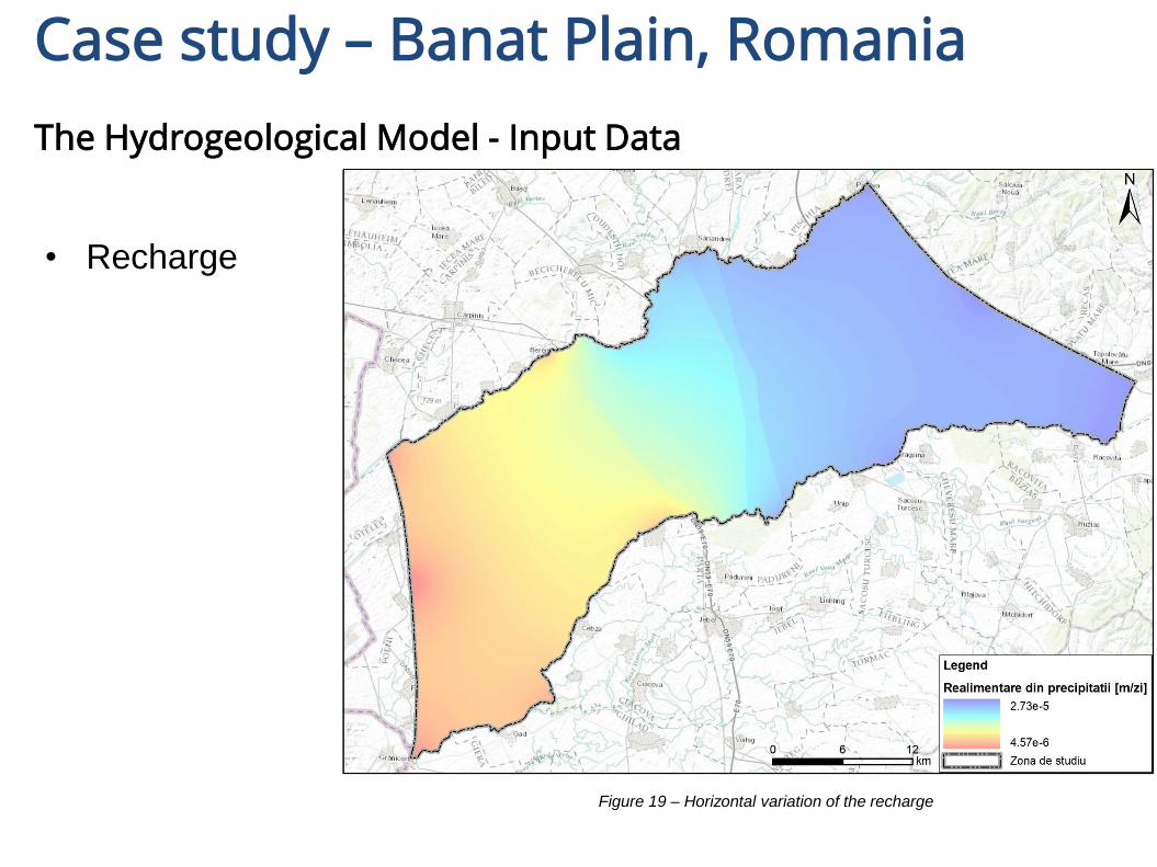
Case study – Banat Plain, Romania
The Hydrogeological Model - Input Data
• Recharge
Figure 19 – Horizontal variation of the recharge
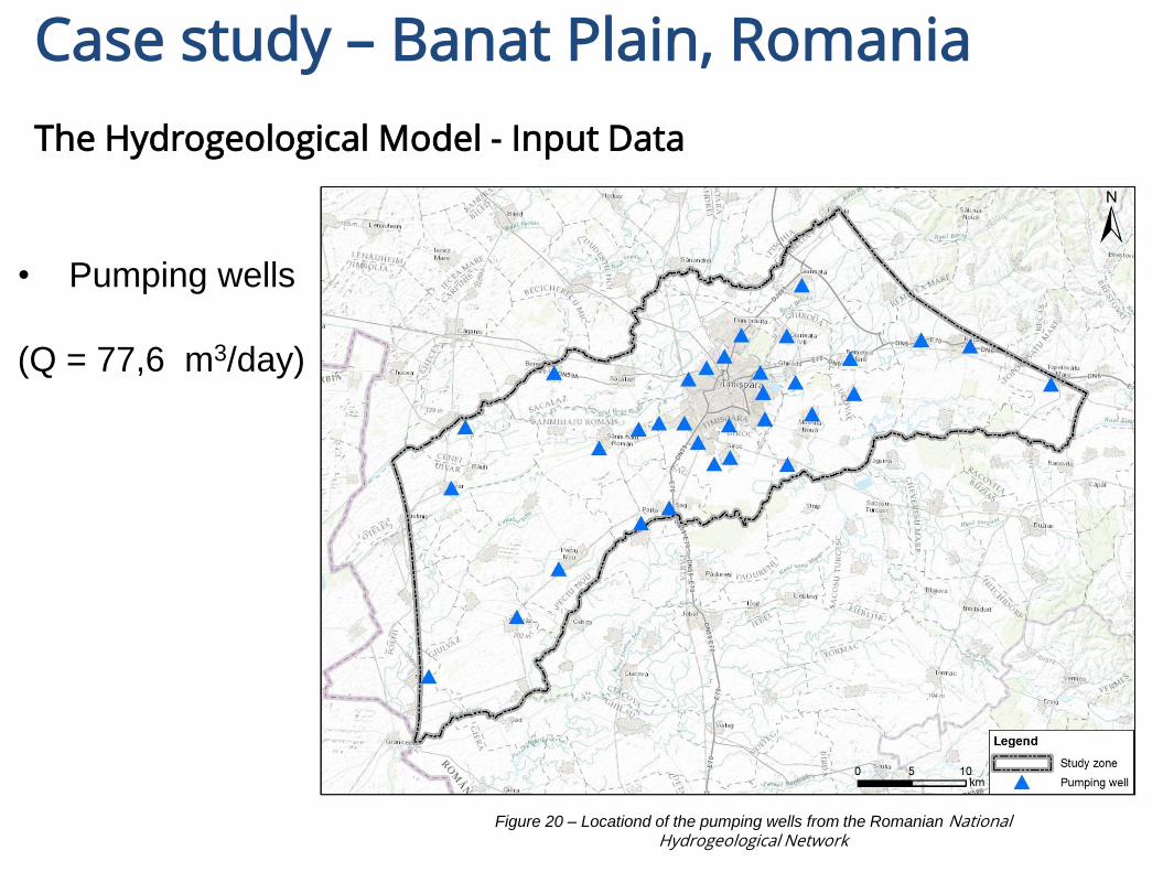
Case study – Banat Plain, Romania
The Hydrogeological Model - Input Data
• Pumping wells
(Q = 77,6 m3/day)
Figure 20 – Locationd of the pumping wells from the Romanian National Hydrogeological Network
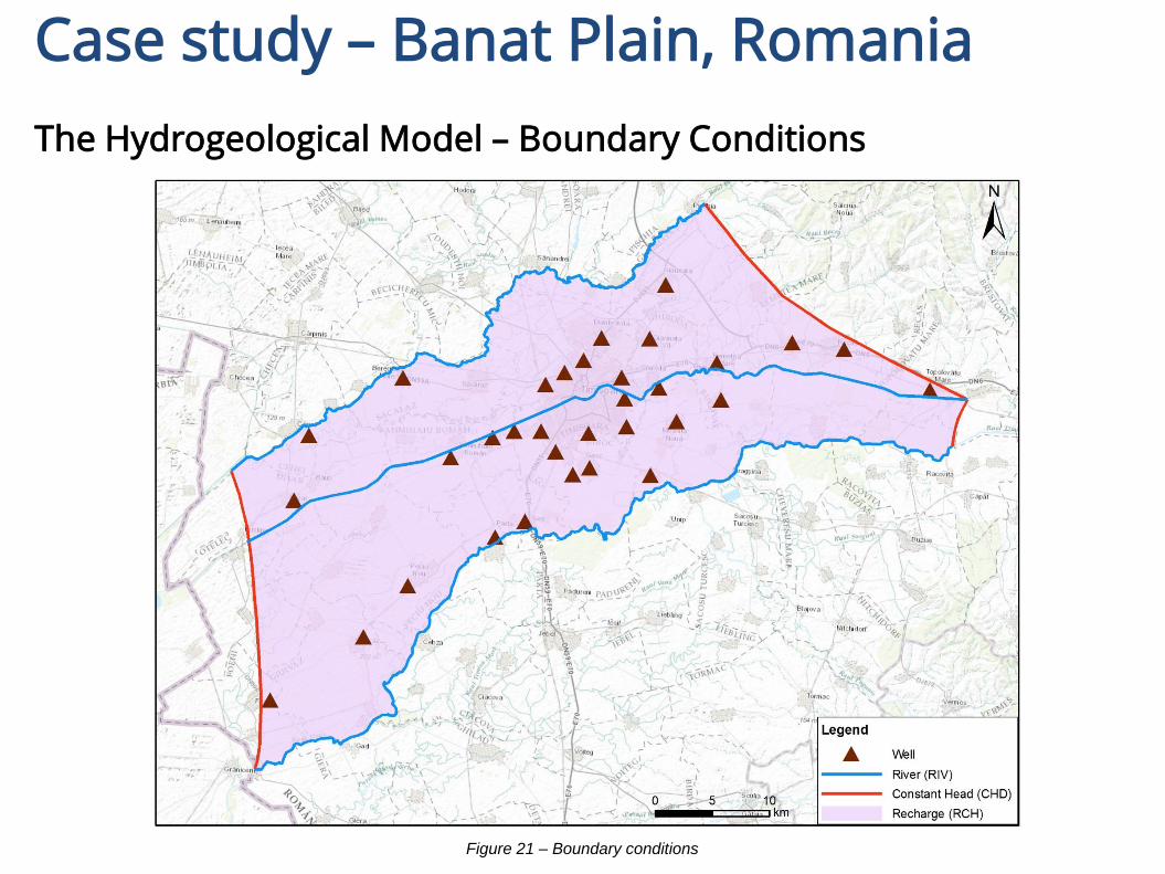
Case study – Banat Plain, Romania
The Hydrogeological Model – Boundary Conditions
Figure 21 – Boundary conditions

Case study – Banat Plain, Romania
Run Model
Figure 22 – Selected Boundary Conditions for simulationg the groundwater flow

Case study – Banat Plain, Romania
Results
Figure 23 – Piezometric map and flow budget for the calibrated model
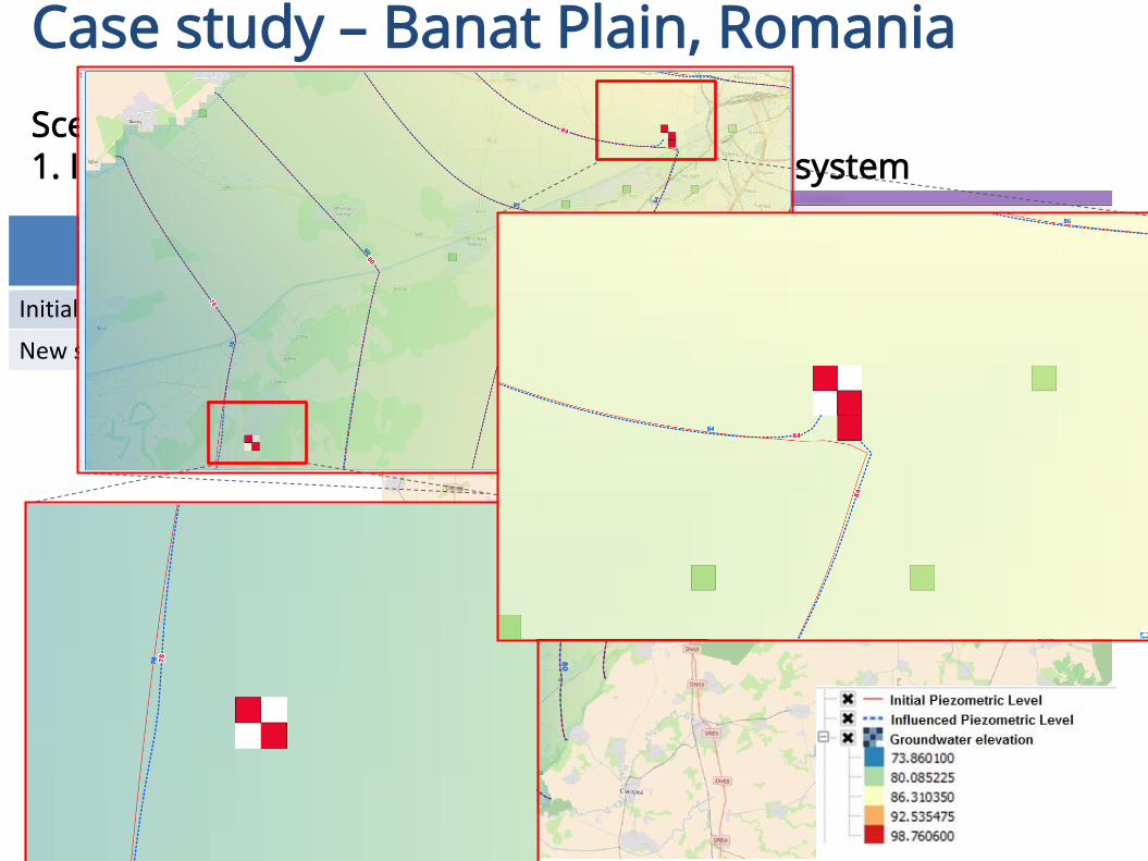
Figure 24 – Piezometric map for scenario 1
Case study – Banat Plain, Romania
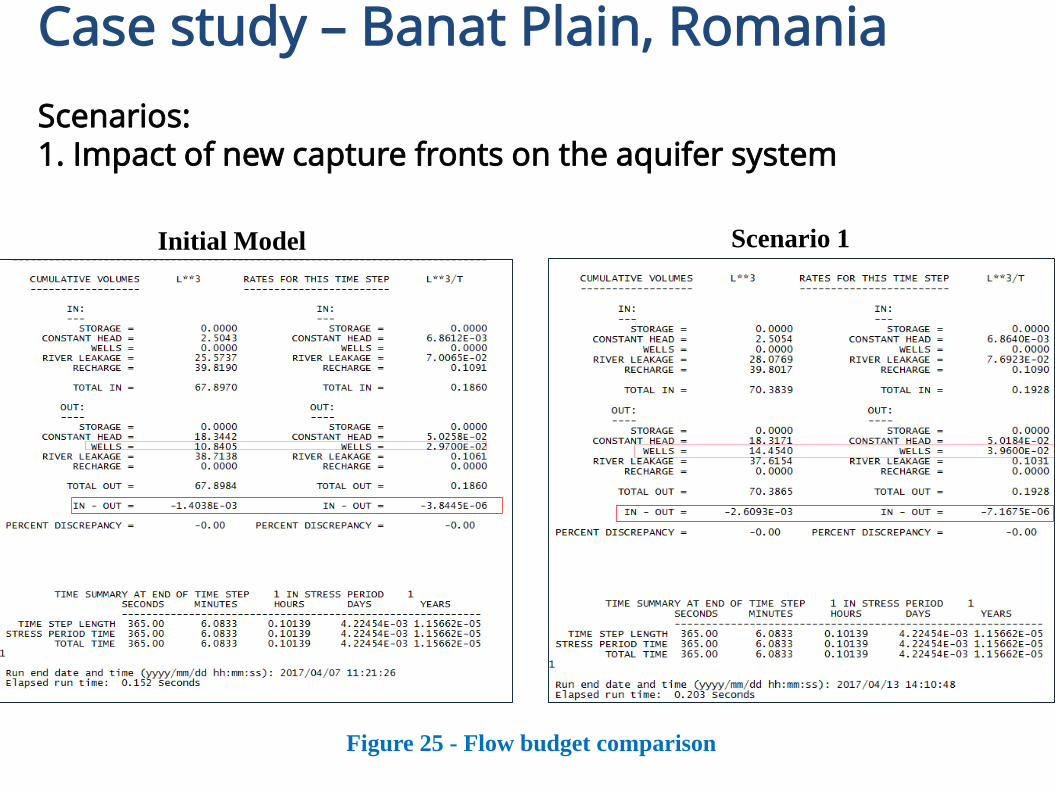
Scenarios: 1. Impact of new capture fronts on the aquifer system
Wells Q m3/day
Initial Wells 0,0009
New simulation 0,03
Case study – Banat Plain, Romania
Scenarios: 1. Impact of new capture fronts on the aquifer system
Scenario 1Initial Model
Figure 25 - Flow budget comparison
Case study – Banat Plain, Romania
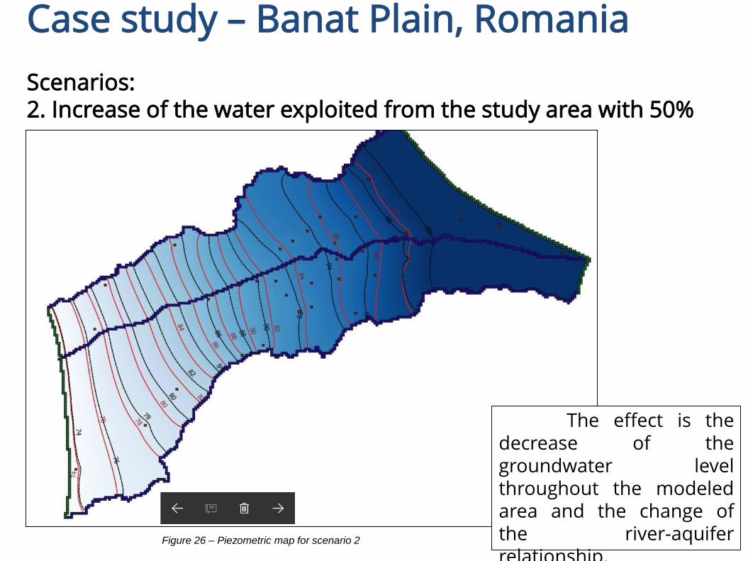
Scenarios: 2. Increase of the water exploited from the study area with 50%
The effect is thedecrease of thegroundwater levelthroughout the modeledarea and the change ofthe river-aquiferrelationship.
Figure 26 – Piezometric map for scenario 2
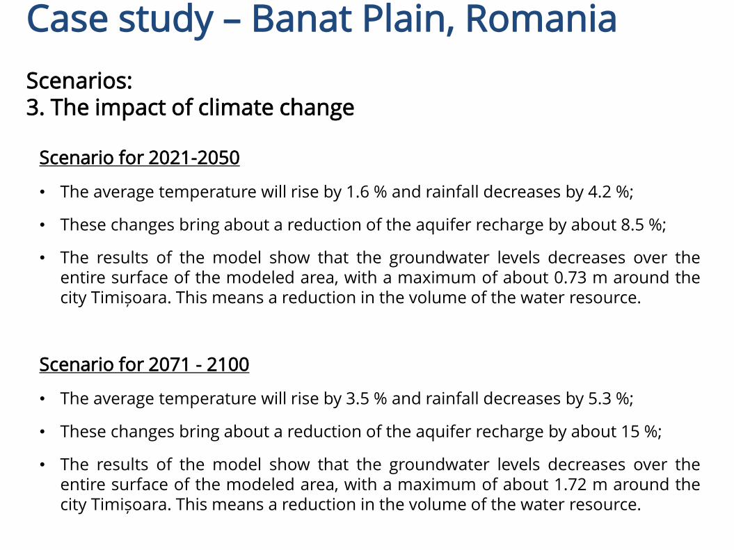
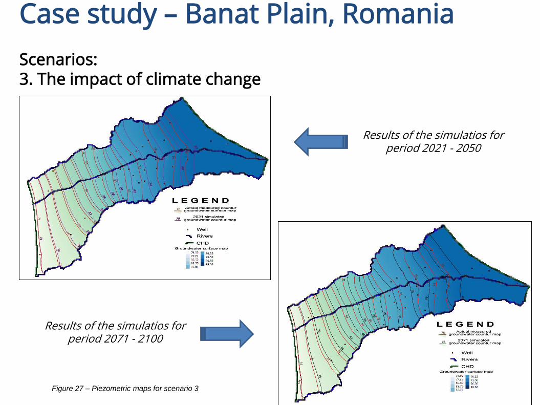
Scenario for 2021-2050
• The average temperature will rise by 1.6 % and rainfall decreases by 4.2 %;
• These changes bring about a reduction of the aquifer recharge by about 8.5 %;
• The results of the model show that the groundwater levels decreases over theentire surface of the modeled area, with a maximum of about 0.73 m around thecity Timișoara. This means a reduction in the volume of the water resource.
Scenario for 2071 - 2100
• The average temperature will rise by 3.5 % and rainfall decreases by 5.3 %;
• These changes bring about a reduction of the aquifer recharge by about 15 %;
• The results of the model show that the groundwater levels decreases over theentire surface of the modeled area, with a maximum of about 1.72 m around thecity Timișoara. This means a reduction in the volume of the water resource.
Case study – Banat Plain, Romania
Scenarios: 3. The impact of climate change
Case study – Banat Plain, Romania
Scenarios: 3. The impact of climate change
Results of the simulatios for period 2021 - 2050
Results of the simulatios for period 2071 - 2100
Figure 27 – Piezometric maps for scenario 3

• 17 International Multidisciplinary Scientific GeoConference SGEM2017, 27 June – 6 July 2017, „Utilization of the FREEWAT Platform -FREE open-source tool for groundwater resource management,within pilot area Banat Plain”;
Case study – Banat Plain, Romania
Disemination
• NIHWM Scientific Conference: Water, vital resource and risk factor –perspectives of integrated management, Bucharest, 11 – 12 of October2016, „FREEWAT - FREE and open source software tools for WATerresource management project – objectives and partial results” ;
• National Workshop: EU H2020 FREEWATPlatform for water resoursemanagement, Bucharest, 7 of September2017.
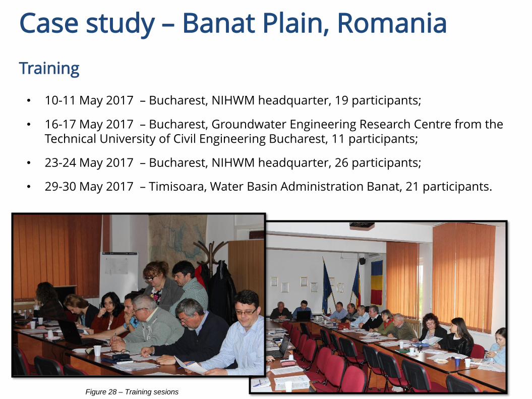
• 10-11 May 2017 – Bucharest, NIHWM headquarter, 19 participants;
• 16-17 May 2017 – Bucharest, Groundwater Engineering Research Centre from the Technical University of Civil Engineering Bucharest, 11 participants;
• 23-24 May 2017 – Bucharest, NIHWM headquarter, 26 participants;
• 29-30 May 2017 – Timisoara, Water Basin Administration Banat, 21 participants.
Case study – Banat Plain, Romania
Training
Figure 28 – Training sesions
Thank you for your attention!