open source spatial etl -...
TRANSCRIPT
camptocamp SA / 15. octobre 2007 / www.camptocamp.com / [email protected]
Spatial Data Integrator powered by
Open Source Spatial ETL
2
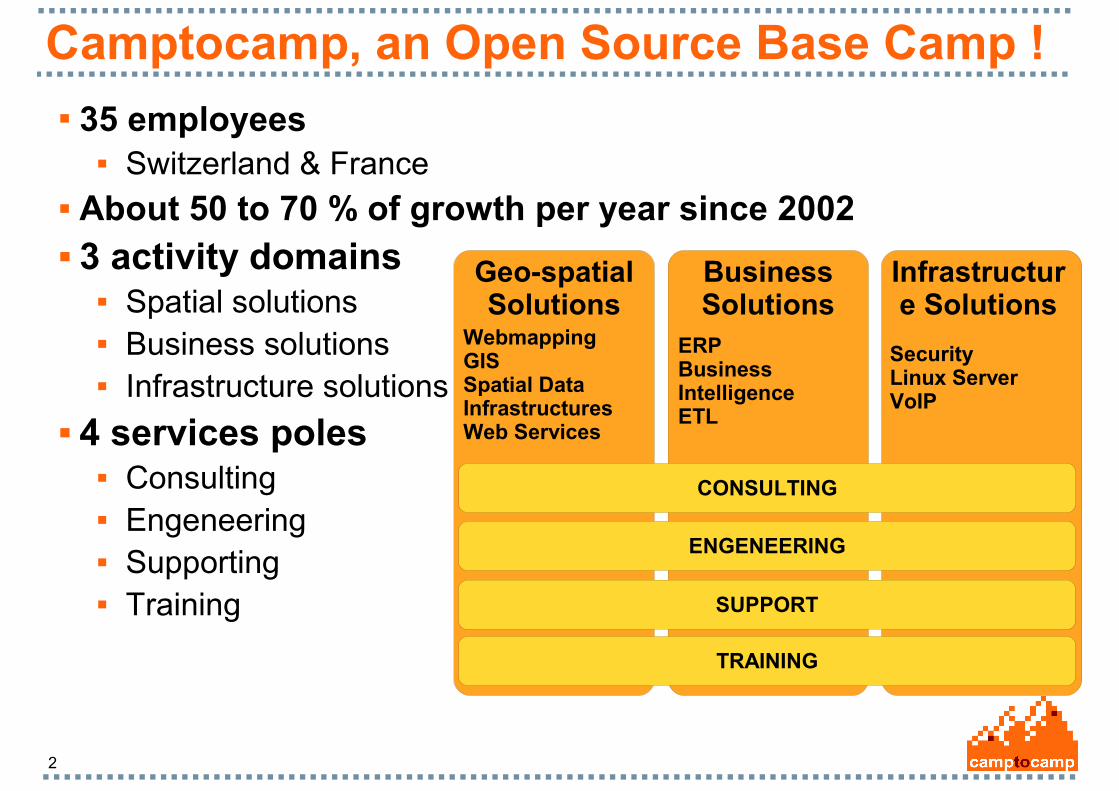
Camptocamp, an Open Source Base Camp ! 35 employees
Switzerland & France About 50 to 70 % of growth per year since 2002 3 activity domains
Spatial solutions Business solutions Infrastructure solutions
4 services poles Consulting Engeneering Supporting Training
Geo-spatial Solutions
Infrastructure Solutions
Business Solutions
CONSULTING
ENGENEERING
SUPPORT
TRAINING
WebmappingGIS Spatial Data InfrastructuresWeb Services
ERPBusiness IntelligenceETL
SecurityLinux ServerVoIP
3
Talend overview
Talend is the first provider of open source data integration software
Located in France, USA, Germany, China VC-funded 50 employees
First product release: 2006 Leader in open source data integration
Rival large established proprietary players
4
Why Spatial Data Integration
Data integration is a key process Data volumes in exponential growth Diversity and heterogeneity of data sources Data processing plays a major role in implementing GIS projects Consolidating and aggregating spatial data with data from other
sources is often required GIS data integration situation
Use command or hand-made script from various tools and libraries gdal/ogr commands, fwtools, postgis command, ...
Proprietary Spatial ETL such as FME Lack of Open Source global geo-spatial data integrator
Spatial Data Integrator, Powered by Talend is now available!
5
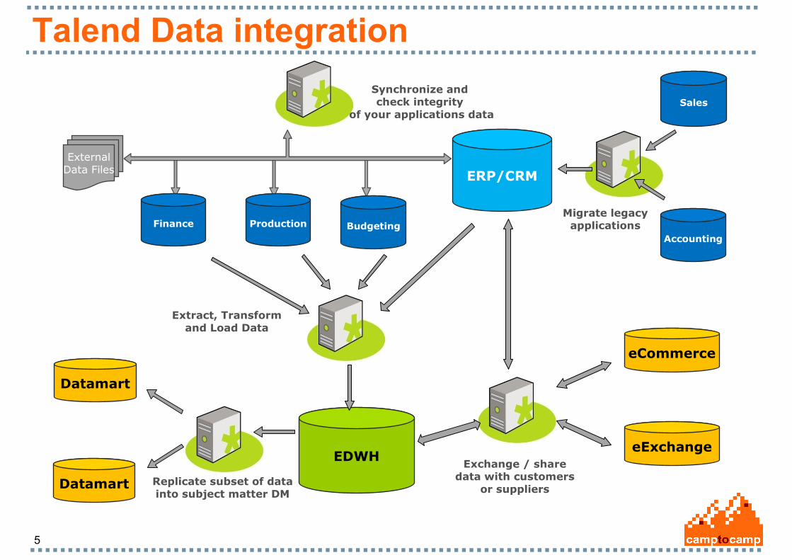
Talend Data integration
Synchronize and check integrity
of your applications data
ExternalData Files
Migrate legacyapplications
Sales
Accounting
Finance Production Budgeting
EDWH
Extract, Transform and Load Data
ERP/CRM
Replicate subset of datainto subject matter DM
Datamart
Datamart
Exchange / sharedata with customers
or suppliers
eCommerce
eExchange
6
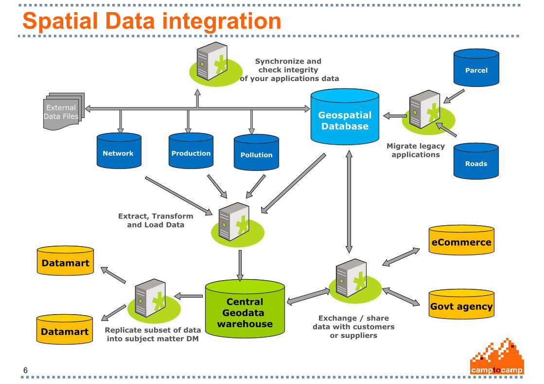
Spatial Data integration
Synchronize and check integrity
of your applications data
ExternalData Files
Migrate legacyapplications
Parcel
Roads
Network Production Pollution
CentralGeodata
warehouse
Extract, Transform and Load Data
GeospatialDatabase
Replicate subset of datainto subject matter DM
Datamart
Datamart
Exchange / sharedata with customers
or suppliers
eCommerce
Govt agency
7
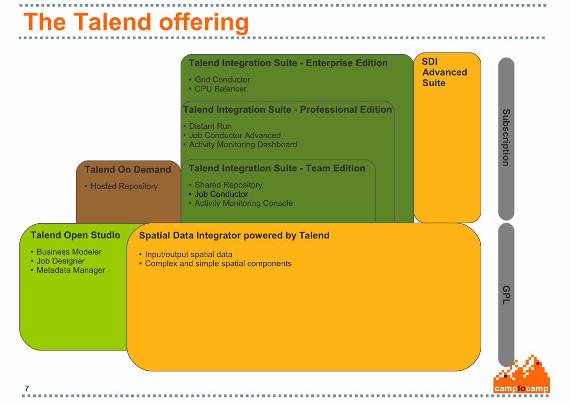
The Talend offering
Talend Integration Suite - Enterprise Edition
• Grid Conductor• CPU Balancer
Talend Integration Suite - Professional Edition
• Distant Run• Job Conductor Advanced• Activity Monitoring Dashboard
Talend Integration Suite - Team Edition
• Shared Repository• Job Conductor• Activity Monitoring Console
Talend On Demand
• Hosted Repository
Talend Open Studio
• Business Modeler• Job Designer• Metadata Manager
Su
bscrip
tion
G
PL
Spatial Data Integrator powered by Talend
• Input/output spatial data• Complex and simple spatial components
SDIAdvancedSuite
8
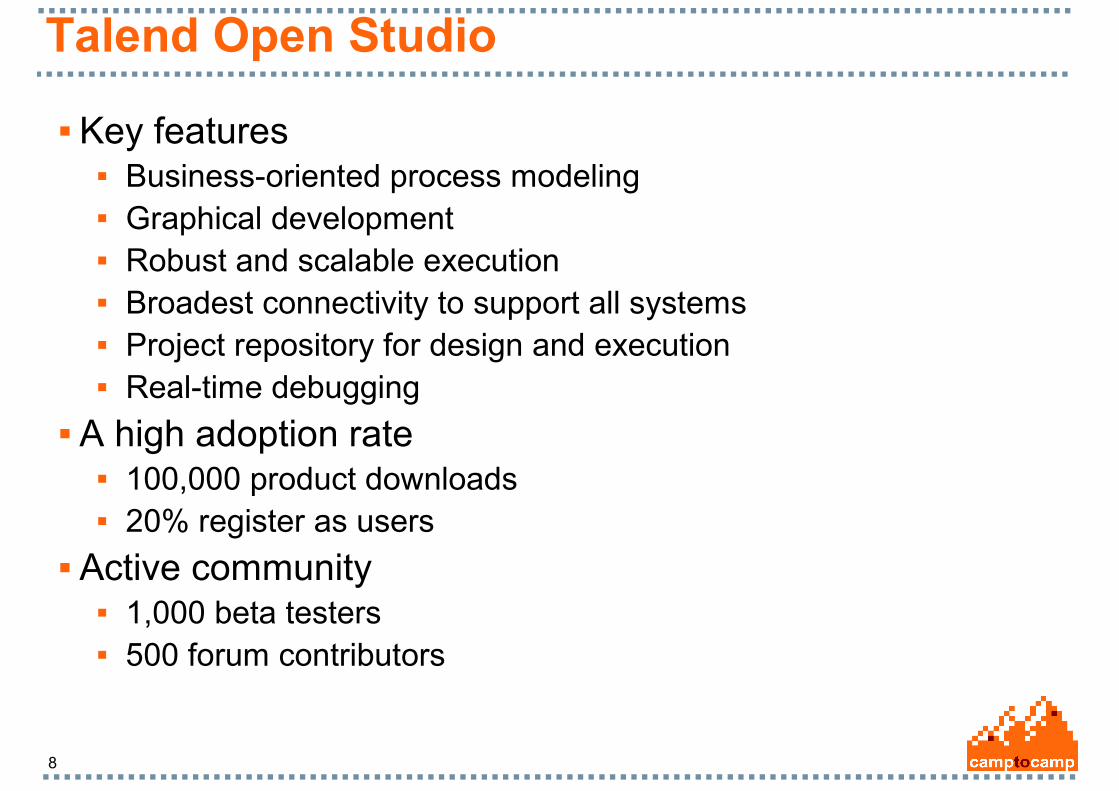
Talend Open Studio
Key features Business-oriented process modeling Graphical development Robust and scalable execution Broadest connectivity to support all systems Project repository for design and execution Real-time debugging
A high adoption rate 100,000 product downloads 20% register as users
Active community 1,000 beta testers 500 forum contributors

9
Talen Open Studio architecture
p 9 # :2 7 / 0 4 / 2 0 0 7
T a l e n d O p e n S t u d i o A r c h i t e c t u r e
Talend Open Studio
Business
Model
XML
Job
XML …
Perl
Jet Template
Java
Jet Template
C
Jet Template
Perl Program
Java Program
C Program
Storage
CodeGenerator
GeneratedProgram
GUI
Pre
lim
inary
skil
ls:
JA
VA
1.5
+
Pre
lim
inary
skil
ls:
Perl
5.8
10
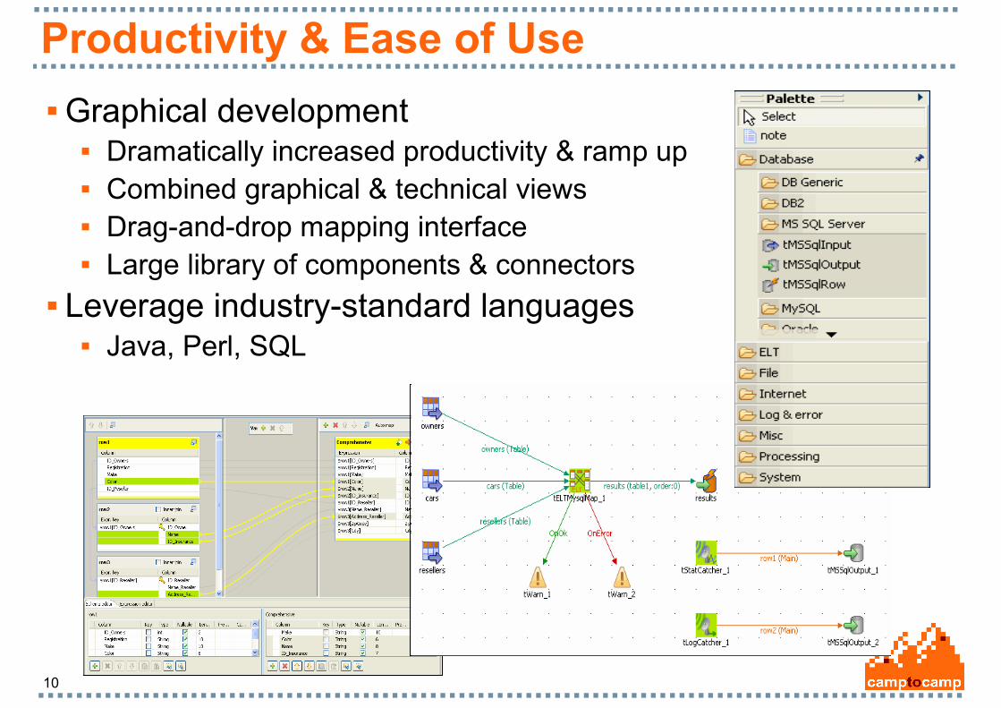
Productivity & Ease of Use
Graphical development Dramatically increased productivity & ramp up Combined graphical & technical views Drag-and-drop mapping interface Large library of components & connectors
Leverage industry-standard languages Java, Perl, SQL
11
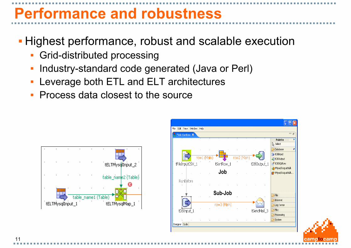
Performance and robustness
Highest performance, robust and scalable execution Grid-distributed processing Industry-standard code generated (Java or Perl) Leverage both ETL and ELT architectures Process data closest to the source
p 9 # :2 7 / 0 4 / 2 0 0 7
J o b D e s i g n e r : b e s t p r a c t i c e s
A job: components connected together
Job
Sub-Job

12
Versatility through Connectivity
Broadest connectivity to support all systems 100+ connectors available out of the box
Business Applications: SugarCRM, SalesForce.com, LDAP…
RDBMS: Oracle, MySQL, DB2, SQL Server, Sybase, Ingres,
PostgreSQL… Web:
Web Services, FTP, HTTP, POP, SMTP… Files:
Delimited, positional, XML, Excel…

13
Spatial Data Integrator - SDI
Talend Open Studio with geo-spatial extensions SDI integrates a new family of vector and raster geo components
Based on reliable open source tools: Java Topology Suite GeoTools GRASS
14
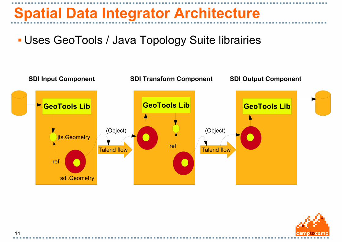
Spatial Data Integrator Architecture
Uses GeoTools / Java Topology Suite librairies
GeoTools Lib
jts.Geometry
sdi.Geometry
SDI Input Component
GeoTools Lib
SDI Transform Component
GeoTools Lib
SDI Output Component
Talend flowTalend flow
ref
(Object)
ref
(Object)
15
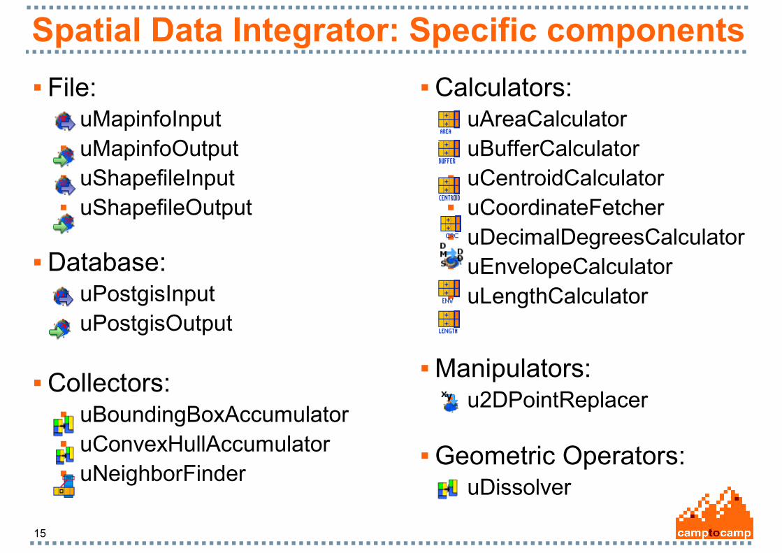
Spatial Data Integrator: Specific components
Calculators: uAreaCalculator uBufferCalculator uCentroidCalculator uCoordinateFetcher uDecimalDegreesCalculator uEnvelopeCalculator uLengthCalculator
Collectors: uBoundingBoxAccumulator uConvexHullAccumulator uNeighborFinder
Database: uPostgisInput uPostgisOutput
File: uMapinfoInput uMapinfoOutput uShapefileInput uShapefileOutput
Manipulators: u2DPointReplacer
Geometric Operators: uDissolver
16
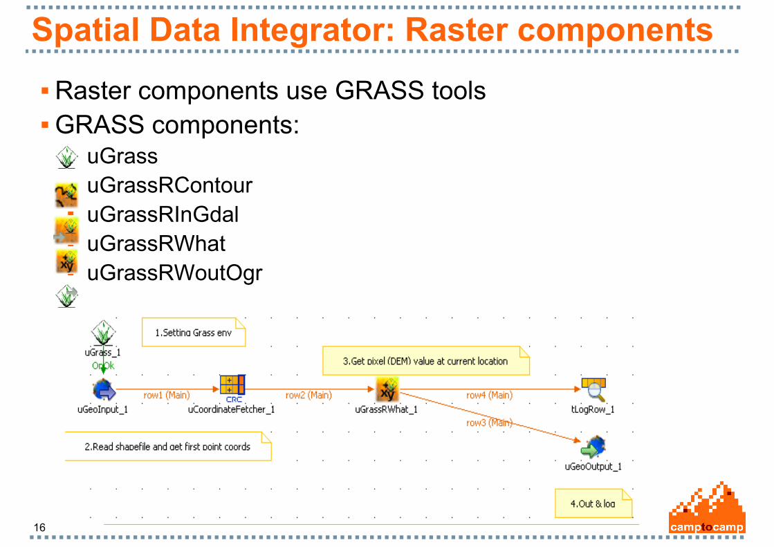
Spatial Data Integrator: Raster components
Raster components use GRASS tools GRASS components:
uGrass uGrassRContour uGrassRInGdal uGrassRWhat uGrassRWoutOgr
17
Spatial Data Integrator strengths
Fast and efficient User-friendly Interface Easily customizable jobs (code generation) Benefits of « classical » ETL features Fully Open Source (GPL licence) Scalable High level of support by Camptocamp and Talend

18
Perspectives
Development of new components: Simple and complex components New input and output formats Community contribution
Spatial data viewer (uDig) Raster components optimization (JGrass) Integration of high-end Talend features:
Load balancing, Job conductor, Grid conductor Integration in Entreprise Service Bus (ESB) systems (PEtALS)
19
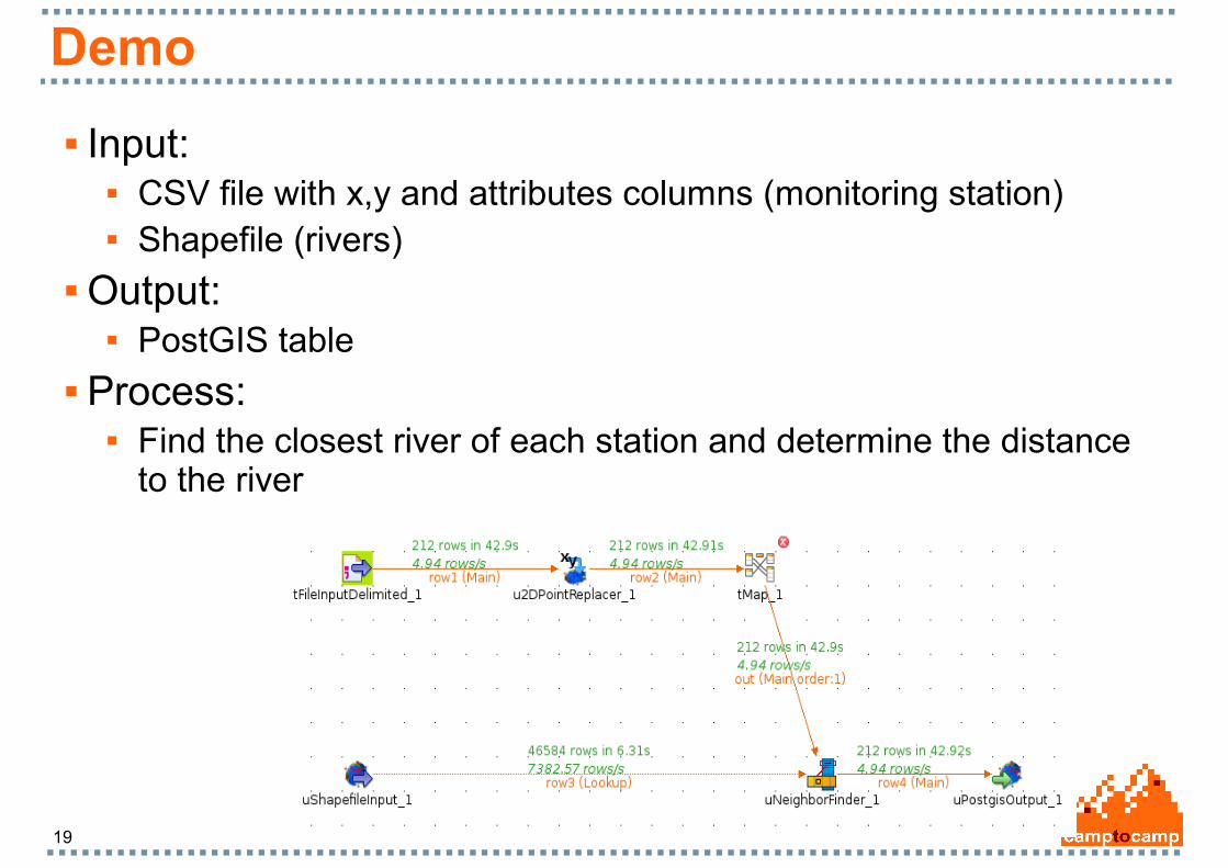
Demo
Input: CSV file with x,y and attributes columns (monitoring station) Shapefile (rivers)
Output: PostGIS table
Process: Find the closest river of each station and determine the distance
to the river
20
Spatial Data Integrator project
Community infrastructure is being set up. Register your interest to be informed:
www.camptocamp.com/sdi

21
Contacts
Camptocamp: David Jonglez, [email protected] Claude Philipona, claude.philipona@camptocamp www.camptocamp.com/sdi