office of the deputy director agriculture ... of the deputy director agriculture guna (madhya...
TRANSCRIPT
OFFICE OF THE DEPUTY DIRECTOR AGRICULTURE GUNA (MADHYA PRADESH)
Pradhan Mantri Krishi Sinchayee Yojana (PMKSY)

%% 'kqHkdkeuk lans'k %%
;g izlUurk dh ckr gS ^iz/kkuea=h df"k flapkbZ ;kstuk^ ds varxZr df"k foHkkx] ty lalk/ku] okVj'ksM] eujsxk ,oa vU; foHkkxksa ls vfHk"kj.k ds rgr gekjs ftys ds fdlkuksa dks csgrj flapkbZ lqfo/kk miyC/k djkus ds ikou mn~ns'; ls flafpr {ks= esa of) rFkk flapkbZ ds lk/kuksa dk leqfpr fodkl gsrq bl ;kstuk dks fØ;kfUor fd;k tk jgk gSA blh ifjis{; esa ftys dh flapkbZ ;kstuk rS;kj dh x;h gSA ftlds varxZr gj [ksr dks ikuh] ty dh ,d&,d cwan dk mi;ksx dj o"kkZ vk/kkfjr df"k {ks=ksa esa flapkbZ lqfo/kk of) djrs gq, flapkbZ jdcs esa of) ,oa d"kdksa ds leqfpr fodkl ds fy;s ehy dk iRFkj lkfcr gksxhA
eSa iz/kkuea=h df"k flapkbZ ;kstuk dh lQyrk dh 'kqHkdkeuk izsf"kr djrk gwWA ¼xksiky HkkxZo½ ea=h] iapk;r ,oa xzkeh.k fodkl] lkekftd U;k;] fu%'kDr tu dY;k.k ,oa lgdkfjrk foHkkx izHkkjh ea=h] ftyk xquk

iii
ACKNOWLEDGEMENT Pradhan Mantri Krishi Sinchayee Yojana (PMKSY) a flagship
programme of Government of India to create infrastructure in relation to conserve productive soil from erosion and rain water harvesting along with ground water recharge by arresting the runoff and allow it to flow in natural drainage system with a non erosive velocity. Strategy formulated for repair, renovation and reconstruction of water bodies/distribution channels for greater efficiency and development of command area of existing irrigation projects as well as new surface minor irrigation schemes.
This irrigation benefit is targeted to achieve end to end solutions by amalgamation of Accelerated Irrigation Benefit Programme, PMKSY (Har khet ko Pani), PMKSY (Per Drop More Crop) and PMKSY (Watershed Development) and MGNREGA.
I hope the District Irrigation Plan will provide a milestone in the development of surface and sub surface water reserve and its conjunctive use for the richness of ecosystem.
(Rajesh Jain) District Collector,
Guna Madhya Pradesh
iv
Table of Content Pradhan Mantri Krishi Sinchayee Yojana .................................................................................... i 1.1.1 Pradhan MantriKrishiSinchayeeYojana .......................................................................... i
List of Tables ........................................................................................................................ vi List of Figures ...................................................................................................................... vii Contributors ........................................................................................................................ viii Chapter- 1 General Information of the District ..................................................................... 18
1.2 District Profile ...................................................................................................................... 18
1.3 Demography ......................................................................................................................... 21
1.4 Biomass and Live Stock ....................................................................................................... 23
1.5 Agro-Ecology, Climate, Hydrology and Topography: ........................................................... 26
1.6 Slope .................................................................................................................................... 31
1.7 Geomorphology .................................................................................................................... 33
1.8 Geology ............................................................................................................................... 37
1.9 Soil ...................................................................................................................................... 37
1.10 Soil Depth ............................................................................................................................ 39
1.11 Soil Texture .......................................................................................................................... 41
1.12 Soil Erosion .......................................................................................................................... 42
1.13 Land Use .............................................................................................................................. 44
1.14 Land Capability .................................................................................................................... 52
1.15 Drainage ............................................................................................................................... 55
2 Chapter - 2 District Water Profile .................................................................................. 60
2.1 Crop Water Requirement ...................................................................................................... 61
3 Chapter - 3 Water Availability....................................................................................... 64
3.1 Surface Water Scenario ........................................................................................................ 64
3.2 Status of Surface Water Availability ..................................................................................... 64
4.2.1 Pre Monsoon Depth to Water Levels ........................................................................... 67 4.2.2 Post Monsoon Water Levels ........................................................................................ 68 4.3 Ground Water Resources............................................................................................. 69 4.4 Ground Water Quality .................................................................................................... 71 4.4.1 Quality of Ground water for Irrigation ......................................................................... 71

v
4.5 Status of Ground water Development ............................................................................. 71 Table- 6 Status of Irrigation ................................................................................................. 71 4 Chapter- 4 -Water Requirement/ Demand ...................................................................... 73
4.1 Domestic Water Demand ...................................................................................................... 73
4.2 Crop water Demand: ............................................................................................................. 74
4.3 Livestock Water Demand: .................................................................................................... 75
4.4 Industrial Water Demand ...................................................................................................... 76
4.5 Water Demand of The Guna District for Various Sectors 2015 ............................................. 77
4.6 Water Budget ....................................................................................................................... 78
4.7 Structure Proposed ............................................................................................................ 79
4.8 Water Saving ...................................................................................................................... 79
4.9 Crop Pattern ……………………………………………………………………………………………………………………. 80
5 Chapter -5 Strategic Action Plan ................................................................................... 82
5.1 Methodology ........................................................................................................................ 82

vi
List of Tables
Table 1 District Details 19 Table 2 Demography details 21 Table 1-3 Block Wise Total Population 22 Table 1-4 Large Animals of Guna District 24 Table 1-5 Water Consumption by Different Category of Livestock 26 Table 1-6 Normal Climatic Conditions in The District 27 Table 1-7 Temperature 28 Table 8 Average Annual Rainfall in Guna District 30 Table 1-9 Slope Category 31 Table 1-10 Block Wise Slope Class Categories in % 31 Table 11 Geology of Guna District 37 Table 1-12 Soil Type of Guna District (Area in %) 38 Table 13 Landuse Guna District 52 Table 14 Length of Rivers 55 Table 15 Sub Basin Wise Watersheds 58 Table 16 Watersheds of Guna District 58 Table 17 No of Existing Water Resources Structures 59 Table 18 Guna District Crop Irrigation Status 61 Table 19 Crop Irrigation System 62 Table 20 Block Wise Irrigation Status 63 Table 21 Existing Dams and Description 66 Table 22 No. of Ground Water Observations Wells 71 Table 23 Water Demand of The District for Various Sectors (Projected 2020) 77 Table 24 Water Storage 79 Table 25 Water Storage 79 Table 26 Water Saving 80 Table 27 Crop Pattern 80 Table 29 Proposed Work By Irrigation Department 84 Table 30 Block Wise Component 85 Table 31 Component Wise Cost 87 Table 32 Block Wise Command Area Created 87
vii
List of Figures
Figure 0-1 Location Map of Guna District 20 Figure 0-2 Monthly Average Temperature (1969-2004) 29 Figure 0-3 Trend of annual rainfall (1971-2004) 29 Figure-1-0-4 Soil Depth of Guna District 40 Figure 1-0-5 Block Wise Landuse Classification 51 Figure 1-0-6 Land Capability Classification of Guna District 54 Figure 1-0-7 Drainage Map of Guna District 56 Figure 1-0-8 Surface Water body of Guna District 57 Figure 3-1 Ground Water Resources Guna District 70

viii
Contributors
DIP COMPILED AND PREPARED BY
CENTRE FOR GIS TECHNOLOGY RAIPUR
CHHATTISGARH
Contact- +91-7714023036 [email protected] www.cggistech.com

ix
Executive Summery The major objective of PMKSY is to achieve convergence of investments in
irrigation at the field level, Expand cultivable area under assured irrigation, improve on-farm
water use efficiency to reduce wastage of water, enhance the adoption of precision-irrigation
and other water saving technologies (More crop per drop), enhance recharge of aquifers and
introduce sustainable water conservation practices by exploring the feasibility of reusing
treated municipal waste water for peri-urban agriculture and attract greater private investment
in precision irrigation system.
PMKSY has been conceived amalgamating ongoing schemes viz. Accelerated
Irrigation Benefit Programme (AIBP) of the Ministry of Water Resources, River Development
& Ganga Rejuvenation (MoWR, RD&GR), Integrated Watershed Management Programme
(IWMP) of Department of Land Resources (DoLR) and the On Farm Water Management
(OFWM) of Department of Agriculture and Cooperation (DAC).
Ministry of Agriculture, and the Ministry of water Resources and Rural Development
will implement the scheme. In addition, the Ministry of Rural Development is to mainly
undertake rainwater conservation, construction of farm pond, water harvesting structures,
small check dams and contour bunding etc. and MoWR, RD &GR, is to undertake various
measures for creation of assured irrigation source, construction of diversion canals, field
channels, water diversion/lift irrigation, including development of water distribution systems.
Ministry of Agriculture will promote efficient water conveyance and precision water
application devices like drips, sprinklers, pivots, rain-guns in the farm “(Jal Sinchan)”,
construction of micro-irrigation structures to supplement source creation activities, extension
activities for promotion of scientific moisture conservation and agronomic measures
Programme architecture of PMKSY will be to adopt a ‘decentralized State level
planning and projected execution’ structure that will allow States to draw up their own
irrigation development plans based on District Irrigation Plan (DIP) and State Irrigation Plan
(SIP). It will be operative as convergence platform for all water sector activities including
drinking water & sanitation, MGNREGS, application of science etc. through comprehensive
plan. State Level Sanctioning Committee (SLSC) chaired by the Chief Secretary of the State
will vested with the authority to oversee its implementation and sanction projects.
The programme will supervise and monitored by an Inter-Ministerial National
Steering Committee (NSC) constituted under the Chairmanship of Prime Minister with Union
Ministers from concerned Ministries. A National Executive Committee (NEC) will constitute
x
under the Chairmanship of Vice Chairman, NITI Aayog to oversee programme
implementation, allocation of resources, inter-ministerial coordination, monitoring &
performance assessment, addressing administrative issues etc.
Components and responsible Ministries/ Departments 1. AIBP by MoWR, RD &GR To focus on faster completion of ongoing Major and
Medium Irrigation including National Projects.
2. PMKSY (Har Khet ko Pani) by MoWR,RD&GR Creation of new water sources
through Minor Irrigation (both surface and ground water)
Repair, restoration and renovation of water bodies.
Strengthening carrying capacity of traditional water sources.
Construction rainwater harvesting structures.
Command area development. At least 10% of the command area to be covered
under micro/precision irrigation
Strengthening and creation of distribution network from source to the farm.
Improvement of water management and distribution system for water bodies to
take advantage of the available source, which is not tap to its fullest capacity
(deriving benefits from low hanging fruits).
Diversion of water from source of different location where it is plenty to
nearby water scarce areas, lift irrigation from water bodies/rivers at lower
elevation to supplement requirements beyond IWMP and MGNREGS
irrespective of irrigation command.
Creation and rejuvenation of traditional water storage systems like Jal Mandir
(Gujarat), Khatri, Kuhl (H.P.), Zabo (Nagaland), Eri, Ooranis (T.N.), Dongs
(Assam), Katas, Bandhas (Odisha and M.P.) etc. at feasible locations.
3. PMKSY (Watershed) by Dept. of Land Resources, MoRD Waterharvesting
structures such as check dams, Nala bund, Farm ponds, Peripheral bund, Marginal Bund,
Pond andTanks etc.
Capacity building, Entry point activities, Ridge area treatment, Drainage line
treatment, Soil and moisture conservation, Nursery raising, Afforestation, Horticulture,

xi
Pasture development, Livelihood activities for the assest-less persons and production system
& micro enterprises for small and marginal farmers etc.
Effective rainfall management like field bunding, contour bunding/trenching,
staggered trenching, land levelling, mulching etc.
4. PMKSY(Per drop more crop) by Dept. of Agriculture & Cooperation, MoA
Programme management, preparation of State/District Irrigation Plan, approval of
annual action plan, Monitoring etc.
Promoting efficient water conveyance and precision water application devices
like drips, sprinklers, pivots, rain-guns in the farm (Jal Sinchan).
Topping up of input cost of civil construction beyond permissible limit (40%),
under MGNREGA for activities like lining inlet, outlet, silt traps distribution
system etc.
Construction of micro irrigation structures to supplement source creation
activities including tube wells and dug wells (in areas where ground water is
available and not under semi critical /critical /over exploited category of
development) which are not supported under PMKSY (WR), PMKSY
(Watershed) and MGNREGS.
Secondary storage structures at tail end of canal system to store water when
available in abundance (rainy season) or from perennial sources like streams
for use during dry periods through effective on-farm water management.
Water lifting devices like diesel/ electric/ solar pump sets including water
carriage pipes.
Extension activities for promotion of scientific moisture conservation and
agronomic measures including cropping alignment to maximise use of
available water including rainfall and minimise irrigation requirement (Jal
sarankchan).
Capacity building, training for encouraging potential use water source through
technological, agronomic and management practices including community
irrigation.
xii
Awareness campaign on water saving technologies, practices, programmes
etc., organisation of workshops, conferences, publication of booklets,
pamphlets, success stories, documentary, advertisements etc.
Improved/innovative distribution system like pipe and box outlet system with
controlled outlet and other activities of enhancing water use efficiency.
District Irrigation Plans (DIPs) District Irrigation Plans (DIPs) shall be the cornerstone for planning and
implementation of PMKSY. DIPs will identify the gaps in irrigation infrastructure after
taking consideration of the District Agriculture Plans (DAPs) which already prepared for
Rashtriya Krishi Vikas Yojana (RKVY).
The Irrigation infrastructures which are currently available and resources that will be
added during XII Plan from other ongoing schemes (both State and Central).like Mahatma
Gandhi National Rural Employment Guarantee Scheme (MGNREGS), Rashtriya Krishi
Vikash Yojana (RKVY), Rural Infrastructure Development Fund (RIDF), Member of
Parliament Local Area Development (MPLAD) Scheme, Member of Legislative Assembly
Local Area Development (MLALAD) Scheme, Local body funds etc. will also considered.
The gaps identified under Strategic Research & Extension Plan (SREGP) will used in
the preparation of DIP.
DIPs will present holistic irrigation development perspective of the district outlining
medium to long term development plans integrating three components viz. water sources,
distribution network and water use applications incorporating all usage of water like drinking
& domestic use, irrigation and industry.
Preparation of DIP will take up as joint exercise of all participating departments. DIP
will form the compendium of all existing and proposed water resources network system in the
district.
The DIPs will prepared at the block and the district levels. Keeping in the view of the
convenience of map preparation and data collection, the work will primarily done at block
level. Block wise irrigation plan is to be prepared depending on the available and potential
water resources and water requirement for agriculture sector prioritising the activities based
on socio-economic and location specific requirement. In case of planning is made based on
basin/sub basin level, the comprehensive irrigation plan may cover more than one district.

xiii
The activities identified in the basin/sub-basin plan can further segregated into
district/block level action plans. Use of satellite imagery, Topo sheets and available database
may appropriately utilised for developing irrigation plans at least on pilot basis to begin with
and subsequently may extended to all projects.
Background, Hon’ble President of India in his address to the joint Session of the Parliament of 16th
Lok Sabha indicated, “Each drop of water is precious. Government is committed to giving
high priority to water security. It will complete the long pending irrigation projects on priority
and launch the ‘Pradhan Mantri Krishi Sinchayee Yojana’ with the motto of ‘Har Khet Ko
Paani’. There is a need of serious consideration to all options including linking of rivers,
where feasible for ensuring optimal use of our water resources to prevent the recurrence of
floods and drought. By harnessing rainwater through Jal Sanchay and Jal Sinchav can nurture
water conservation and ground water recharge. Micro irrigation will ensure ‘Per drop-More
crop’. Nearly 141m.Ha of net area shown in the country, about 65 million hectare (45%)
are presently covered under irrigation. Substantial dependency on rainfall makes cultivation in
unirrigated areas a high risk, less productive profession. Empirical evidences suggest to
assured farmers to invest more in farming technology and inputs leading to productivity
enhancement and increased farm income. The overreaching vision of Pradhan Mantri Krishi
Sinchayee Yojana (PMKSY) is to ensure access to some means of protective irrigation to all
agricultural farms in the country, to produce ‘per drop more crop’, thus bringing much desired
rural prosperity.
Vision, To use the available water resources in the district at the maximum potential in an
efficient way catering to the basic needs of every living being and enhancing the livelihoods
of rural population to the maximum extent thus alleviating poverty in a sustainable way
without compromising the interests of future generations.
Objective,
The broad objectives of PMKSY is to -
a) Achieve convergence of investments in irrigation at the field level (preparation of
district level and, if required, sub district level water use plans).
b) Enhance the physical access of water on the farm and expand cultivable area under
assured irrigation (Har Khet ko pani),

xiv
c) Integration of water source, distribution and its efficient use, to make best use of
water through appropriate technologies and practices.
d) Improve on-farm water use efficiency to reduce wastage and increase availability
both in duration and in extent,
e) Enhance the adoption of precision-irrigation and other water saving technologies
(More crop per drop).
f) Enhance recharge of aquifers and introduce sustainable water conservation
practices
g) Ensure the integrated development of rain fed areas using the watershed approach
towards soil and water conservation, regeneration of ground water, arresting runoff, providing
livelihood options and other NRM activities.
h) Promote extension activities relating to water harvesting, water management and
crop alignment for farmers and grass root level field functionaries.
i) To explore the feasibility of reusing treated municipal wastewater for peri-urban
agriculture,
j) Attract greater private investments in irrigation.
This will increase agricultural production and productivity and enhance farm income.
Strategy /approach
To achieve above objectives, PMKSY will strategize by focussing on end-to end
solution in irrigation supply chain, viz. water sources, distribution network, efficient farm
level applications, extension services on new technologies & information. Broadly, PMKSY
will focus on-
a) Creation of new water sources, repair, restoration and renovation of defunct water
sources, construction of water harvesting structures, secondary & micro storage, groundwater
development, enhancing potentials of traditional water bodies at village level like Jal Mandir
(Gujarat), Khatri, Kuhl (H.P.),Zabo (Nagaland); Eri, Ooranis (T.N.),Dongs (Assam), Katas,
Bandhas (Odisha and M.P.) etc.
b) Developing/augmenting distribution network where irrigation sources (both
assured and protective) are available or created.

xv
c) Promotion of scientific moisture conservation and run off control measures to
improve ground water recharge to create opportunities for farmer to access recharged water
through shallow tube/dug wells.
d) Promoting efficient water conveyance and field application devices within the
farm, underground piping system, Drip & Sprinklers, pivots, rain-guns and other application
devices etc.
e) Encouraging community irrigation through registered user groups/farmer producers’
organisations/NGOs.
f) Farmer oriented activities like capacity building, training and exposure visits,
demonstrations, farm schools, skill development in efficient water and crop management
practices (crop alignment) including large-scale awareness on more crop per drop of water
through mass media campaign, exhibitions, field days, and extension activities through short
animation films etc.
g) The previously mentioned areas only outline the broad contours of PMKSY;
combination of interventions may be required depending on location specific conditions and
requirements, which will identified through District and State Irrigation Plans.
Methodology:
The preparation of District Irrigation plan is an integration of geospatial technology, Space application technologies and spatial and non-spatial data.
1. Transformation of available thematic information (district provided Gyan data)
on to the village level on Bhuvan portal and extract geo-referenced village map data.
2. Integration of thematic layers with socio-economic data for classification of
area into specific composite land units on village level.
3. Preparation of appropriate action plan based on potential of composite land units
and developmental needs of study area in based on available data.
4. Field visit to validate the recommended measures with respect to the ground
situation and requirement of the local people.
5. Finalization of development plans based on field observation.

xvi
Available thematic information for preparation for water resource and land resources
and development plan.
Land use / land cover map
Groundwater potential map
Soil map - depth, texture, erosion and land capability
Slope map.
High-resolution Satellite imaginary through Bhuvan portal.
Lithology.
Hydro geomorphology.
Area for development of water resources structure geospatial technology has been
used in this process first identify the area of crop land based on high resolution satellite data
and then identify the irrigated area by different source of irrigation methods. To identify the
unirrigated area an overlay method is used. District irrigation plan covers the following
planning component of the district in sustainable development approach:
Increase in vegetation/biomass in the district.
More number of surface water bodies in district.
Shift from annual crop to perennial.
Increase in the extent of crop area.
Improvement in the soil moisture availability
Reclamation of wastelands.
Convergence of investments in irrigation at the field level.
Enhance the physical access of water on the farm and expand cultivable area under
assured irrigation (Har Khet ko Pani)
Best use of water through appropriate technologies and practices.
Improve on-farm water use efficiency.
Enhance the adoption of precision-irrigation and other water saving technologies
(More crop per drop).

xvii
Enhance recharge of aquifers and introduce sustainable water conservation practices.
Ensure the integrated development of rain fed areas.
Promote extension activities relating to water harvesting, water management and crop
alignment for farmers and grass root level field functionaries.
Explore the feasibility of reusing treated municipal waste water for peri-urban
agriculture,
Attract greater private investments in irrigation.

18
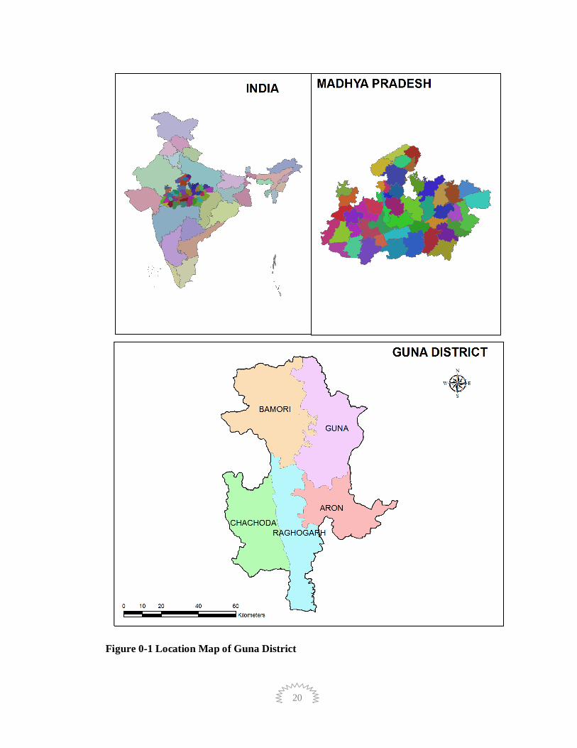
1.2 District Profile The Guna district is located on the north-eastern part of Malwa Plateau between the Parbati
and the Betwa. As its eastern part has some cultural affinity with Jhansi and Sagar, it as also
referred sometimes as Bundelkhand. Mathematically, the district is situated between the
latitudes 23.53' 5"N and 25.6 55"N., and longitudes 76.48'30"E. and 78.15'40"E.
The eastern and western boundaries of the district are well defined by the rivers. The Betwa
flows along the eastern boundary of Guna, separating it from Sagar district, and Lalitpur and
Jhansi districts of Uttar Pradesh. The Parbati is the main river flowing along the western
boundary, touching Rajgarh district of Madhya Pradesh and Jhalawar and Kota districts of
Rajasthan, Shivpuri district and Shahabad tehsil of Kota district are located in the north
where as Vidisha, Bhopal and Rajgarh lies to the South and Ashoknagar district touches from
east. By and large the eastern and western boundaries are inter-Statal Boundaries.
Guna is located in Gwalior division. In the district Guna , Aron, Raghogarh,
Madhusudhangarh, Bamori, Chachauda and Kumbhraj are the 7 tehsils and Guna , Aaron,
Raghogarh, Chachauda, Bamori are 5 blocks. The number of inhabited villages in the district
are 1264 and the total of 425 village panchayats. Five district panchayats and two
municipalties also three town panchayats in the district. There are four Assembly seats in the
district.
Upsanchalak Farmer Welfare and Agriculture Development (Krishi Vibhag) was
established in 1965 in district Guna. Following Scheme are available in Agriculture
Department
1. Aisopam Yojna
2. Surajdhara Yojna
3. Makka Vikas
4. Annpurna Yojna
5. Balram Talab
Chapter- 1 General Information of the District

19
Table 1 District Details
Geographical Area 630766 Ha
Latitude and longitude (D.M.S.) 23.53' 5"N and 25.6 55"N
76.48'30"E. and 78.15'40"E.
Area under Forest (ha) 101383
Area under Agriculture use (ha) 404603
Total net Sown Area (ha) 339801
Net Irrigated Area (Kharif/Rabi) (ha)
232457
Net Rainfed Area (ha) 107344
Stored Surface water (BCM) 0.287023
Stored Ground water (BCM) 0.71020
Rainfall (mm) 1042.7
20
Figure 0-1 Location Map of Guna District

21
1.3 Demography An official Census 2011 detail of Guna, a district of Madhya Pradesh has been
released by Directorate of Census Operations in Madhya Pradesh. Enumeration of key
persons was also done by census officials in Guna District of Madhya Pradesh.
In 2011, Guna had population of 1,241,519 out of which male and female were
649,362 and 592,157 respectively. In 2001 census, Guna had a population of 977,827 of
which males were 517,388 and remaining 460,439 were females. Guna District population
constituted 1.71 percent of total Madhya Pradesh population. In 2001 census, this figure for
Guna District was at 1.62 percent of Maharashtra population.
There was change of 26.97 percent in the population compared to population as per 2001. In the previous census of India 2001, Guna District recorded increase of 30.20 percent to its population compared to 1991.
Table 2 Demography details
Description 2011 2001
Actual Population 1,241,519 977,827
Male 649,362 517,388
Female 592,157 460,439
Population Growth 26.97% 30.20%
Area Sq. Km 6,390 6,390
Density/km2 194 153
Proportion to Madhya Pradesh Population 1.71% 1.62%
Sex Ratio (Per 1000) 912 890
Child Sex Ratio (0-6 Age) 910 930
Average Literacy 63.23 57.64
Male Literacy 74.05 72.08
Female Literacy 51.36 41.24
Total Child Population (0-6 Age) 207,177 191,484
Male Population (0-6 Age) 108,473 99,229

22
Description 2011 2001
Female Population (0-6 Age) 98,704 92,255
Literates 653,980 453,233
Male Literates 400,537 301,394
Female Literates 253,443 151,839
Child Proportion (0-6 Age) 16.69% 19.58%
Boys Proportion (0-6 Age) 16.70% 19.18%
Girls Proportion (0-6 Age) 16.67% 20.04%
Source: Census of India 2011
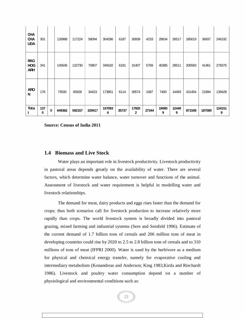
Table 1-3 Block Wise Total Population
Name of the
Block
Name of
the village
Covered
Code of Village Covered
Population SC ST General Total
Male Female Chi.* Total No. of Household
No. of Memb
ers
No. of Household
No. of Memb
ers
No. of Household
No. of Membe
rs
No. of Househ
old
No. of Membe
rs
GUNA
299 212129 193264 126262 531655 13287 66439 8803 61227 39675 277727 61765 405393
BAMORI
253 89120 83011 39831 211962 3968 19843 7452 52163 14303 100125 25723 172131
23
CHACHAUDA
301 128968 117224 58094 304286 6187 30939 4233 29634 26517 185619 36937 246192
RAGHOGARH
341 145645 132730 70807 349182 6181 31407 5769 40385 29511 206583 41461 278375
ARON
176 73500 65928 34423 173851 6114 30574 1087 7400 14493 101454 21694 139428
Total
1370 0 649362 592157 329417 157093
6 35737 179202 27344 19080
9 12449
9 871508 187580 1241519
Source: Census of India 2011
1.4 Biomass and Live Stock Water plays an important role in livestock productivity. Livestock productivity
in pastoral areas depends greatly on the availability of water. There are several
factors, which determine water balance, water turnover and functions of the animal.
Assessment of livestock and water requirement is helpful in modelling water and
livestock relationships.
The demand for meat, dairy products and eggs rises faster than the demand for
crops; thus both scenarios call for livestock production to increase relatively more
rapidly than crops. The world livestock system is broadly divided into pastoral
grazing, mixed farming and industrial systems (Sere and Seinfeld 1996). Estimate of
the current demand of 1.7 billion tons of cereals and 206 million tons of meat in
developing countries could rise by 2020 to 2.5 to 2.8 billion tons of cereals and to 310
millions of tons of meat (IFPRI 2000). Water is used by the herbivore as a medium
for physical and chemical energy transfer, namely for evaporative cooling and
intermediary metabolism (Konandreas and Anderson; King 1983,Kirda and Riechardt
1986). Livestock and poultry water consumption depend on a number of
physiological and environmental conditions such as:
24
• Type and size of animal or bird
• Physiological state (lactating, pregnant or growing)
• Activity level
• Type of diet-dry hay, silage or lush pasture
• Temperature-hot summer days above 25 0C can sometimes double the water
consumption of animals.
• Water quality - palatability and salt content
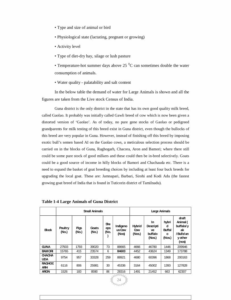
In the below table the demand of water for Large Animals is shown and all the
figures are taken from the Live stock Census of India.
Guna district is the only district in the state that has its own good quality milk breed,
called Gaolao. It probably was initially called Gawli breed of cow which is now been given a
distorted version of ‘Gaolao’. As of today, no pure gene stocks of Gaolao or pedigreed
grandparents for milk testing of this breed exist in Guna district, even though the bullocks of
this breed are very popular in Guna. However, instead of finishing off this breed by imposing
exotic bull’s semen based AI on the Gaolao cows, a meticulous selection process should be
carried on in the blocks of Guna, Raghogarh, Chacora, Aron and Bamori; where there still
could be some pure stock of good milkers and these could then be in-bred selectively. Goats
could be a good source of income in hilly blocks of Bamori and Chachauda etc. There is a
need to expand the basket of goat breeding choices by including at least four buck breeds for
upgrading the local goat. These are: Jamnapari, Barbari, Sirohi and Kodi Adu (the fastest
growing goat breed of India that is found in Tuticorin district of Tamilnadu).
Table 1-4 Large Animals of Guna District
Small Animals Large Animals
Block Poultry (No.)
Pigs (No.)
Goats (No.)
Sheeps (No.
)
Indigenous Cow (Nos)
Hybrid Cow
(Nos.)
In Descripti
ve buffalo (Nos.)
hybrid
Buffalo
(Nos.)
draft Animal ( buffalo/y
ak /Bulls/any other (nos)
GUNA 27503 1793 39020 73 88665 4666 46780 1446 209946 BAMORI 15765 415 23574 6 84603 4452 43624 1349 173788 CHACHAUDA 9754 957 33328 259 88921 4680 60396 1868 200163
RAGHOGARH 6116 806 25981 30 45336 3164 45002 1393 127828
ARON 1526 183 8590 86 28316 1491 21452 663 62307

25
TOTAL 60664 4154 130493 454 335841 18453 217254 6719 774032 Source: Livestock Census of India 2011

26
Table 1-5 Water Consumption by Different Category of Livestock
Water Consumptions by Animals / Birds S. N.
Livestock Category
Water requirement Range
Average Water Use L/ Day
1 Poultry 0.16-0.24 0.2 2 Small Animals 13-20 16.5 3 Large Animals 39-59 49
Source: Adapted from Nutrient requirements of poultry, Sheep, Cattles. 9th edition. Washington, D.C.: National Research Council, 1994
1.5 Agro-Ecology, Climate, Hydrology and Topography: Agro-ecology is the study of ecological processes that operate in agricultural
production systems. The prefix agro- refers to agriculture. Bringing ecological
principles to bear in agro-ecosystems can suggest novel management approaches that
will not considered. Agro-ecology is the application of ecological concepts and
methodological design for long-term enhancement and management of soil fertility
and agriculture productivity. It provides a strategy to increase diversified agro-
ecosystem. Therefore, it is benefiting the effect of the incorporation of plant and
animal biodiversity, nutrient recycling; biomass creation and growth with natural
resource systems based on legumes, trees, and incorporation of livestock. These all
make the basis of a sustainable agriculture and aim to improve the food system and
societal sustainability. The agro-ecology supports production of both a huge quantity
and diversity of good quality of food, thread and medicinal crops, together with
family utilization and the market for economic and nutritionally at risk populations.
Sustainable agricultural practices have to tackle the conservation of biodiversity,
enhanced ecological functions, social tolerance, self-reliance, fairness, improved
quality of life and economic productivity of crops and live- stock. Sustainability of
agriculture critical from the food point of view and ecological security at the regional
scale.
Guna has been divided into three Agri-ecological zones; The Janpads of Guna
and Bamori come under zone-I which has only minor millets production of Kodo-
Kutki-Nizer; The second zone comprising of Raghogarh, Aron and Chachauda
blocks has Soybeans- Wheat-Jowar crop circle, Guna is situated on a plateau,
surrounded by the lush green fields, rivers and sagaun trees. Guna is surrounded by
dense forest with diverse flora and fauna. Bamboo, Teak, Harra, Salbeej, Tendu Patta,

27
are the 10 major forest wealth. Basically it is classified into two categories, dense
forest and degraded forest. Dense forest is restricted to eastern and western part of the
district. Degraded forest occur both the dense forested area and area close to other
land use. There are five types of soils present in the district. Alluvial soil is commonly
associated with rivers and streams. Silty soil is occurring on the bank of river Parwati
near Kumbraj town. Lateritic Soil is occurring in the eastern and south-western part of
the district. Sandy soil is associated with Pench and Kanhan rivers. Black cotton soil
is occurring in the central, northern and southern parts of the district. Soil of recent
origin is developed in low-lying valleys. A hot summer and general dryness
characterize the climate of the area, except during the southwest monsoon season. The
year may be divided into four seasons. The cold season, December to February is
followed by the hot season from March to about the middle of June. The period from
the middle of June to September is the south-west monsoon season. October and
November form the post monsoon or transition period.
The normal annual rainfall of Guna district is 1087.2 mm. The district
receives maximum rainfall during south-west monsoon period i.e. June to September.
About 85.7 % of the annual rainfall falls during monsoon season. Only 14.3 % of the
annual rainfall takes place between Octobers to May period. Thus, surplus water for
ground water recharge is available only during the southwest monsoon period. The
normal maximum temperature noticed during the month of May is 39.40 C and
minimum during the month of December 9.80 C. The normal annual mean minimum
and maximum temperatures has been worked out as 18.20 C and 30.60 C
respectively. During the south-west monsoon season, the relative humidity generally
exceeds 87% (August month) and the rest of the year is drier. The driest part of the
year is the summer season, when relative humidity is less than 33%. May is the driest
month of the year.
Table 1-6 Normal Climatic Conditions in The District S. Parameters Jan Feb Mar April May June July Aug Sept Oct Nov Dec Annual
No.
1. Maximum 24.7 28.0 33.3 38.3 41.3 38.6 31.7 29.7 31.1 32.5 29.3 25.9 32.0 Temp (0C)
2. Minimum 7.7 10.1 15.4 20.8 25.6 26.5 24.0 23.2 22.0 17.4 11.6 8.1 17.7 Temp (0C)
3. Relative 65 53 38 27 31 41 85 90 81 61 56 65 59 Humidity (%)
28
4. Wind 5.4 6.7 7.5 8.7 11.3 14.2 12.2 10.6 7.9 5.0 4.3 4.4 8.1 Velocity (km/h)
5. Rain fall 14.3 7.1 5.8 3.4 10.1 97.0 348.7 345.0 170.2 22.3 12.1 6.5 1042.5 (mm) Source IMD &ICAR Department Raipur
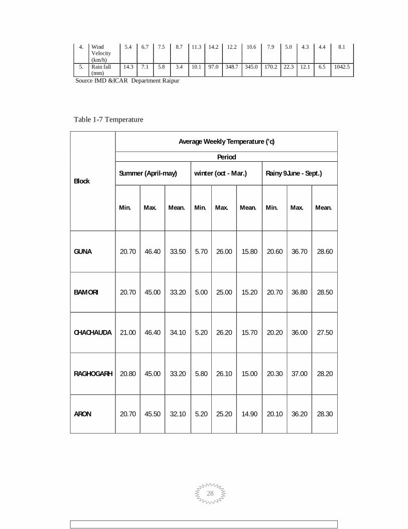
Table 1-7 Temperature
Block
Average Weekly Temperature ('c)
Period
Summer (April-may) winter (oct - Mar.) Rainy 9June - Sept.)
Min. Max. Mean. Min. Max. Mean. Min. Max. Mean.
GUNA 20.70 46.40 33.50 5.70 26.00 15.80 20.60 36.70 28.60
BAMORI 20.70 45.00 33.20 5.00 25.00 15.20 20.70 36.80 28.50
CHACHAUDA 21.00 46.40 34.10 5.20 26.20 15.70 20.20 36.00 27.50
RAGHOGARH 20.80 45.00 33.20 5.80 26.10 15.00 20.30 37.00 28.20
ARON 20.70 45.50 32.10 5.20 25.20 14.90 20.10 36.20 28.30
29
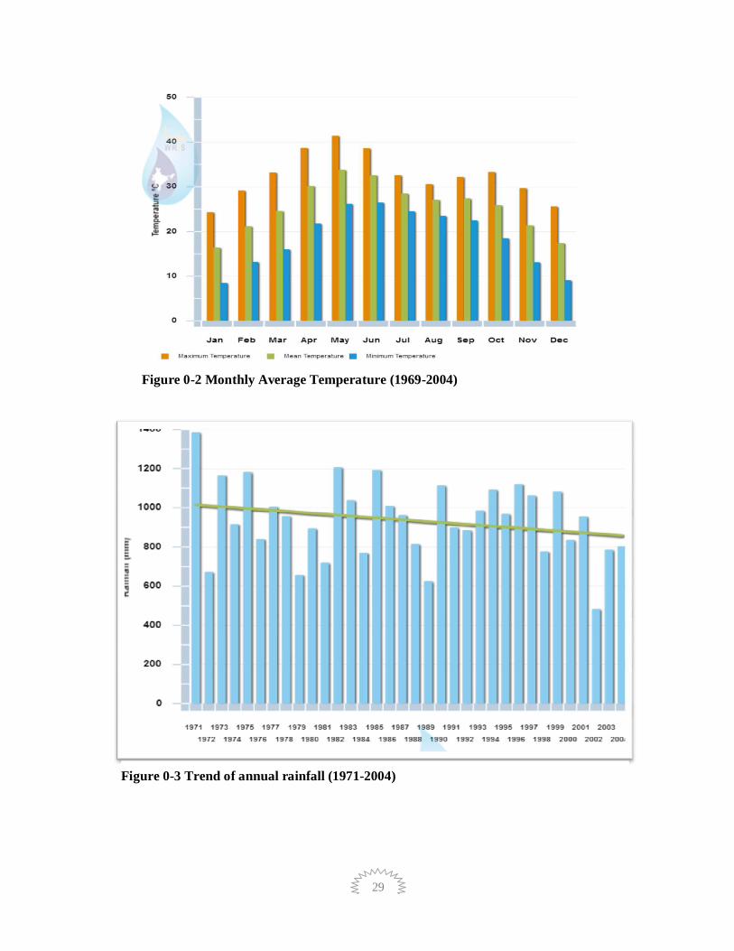
Figure 0-2 Monthly Average Temperature (1969-2004)
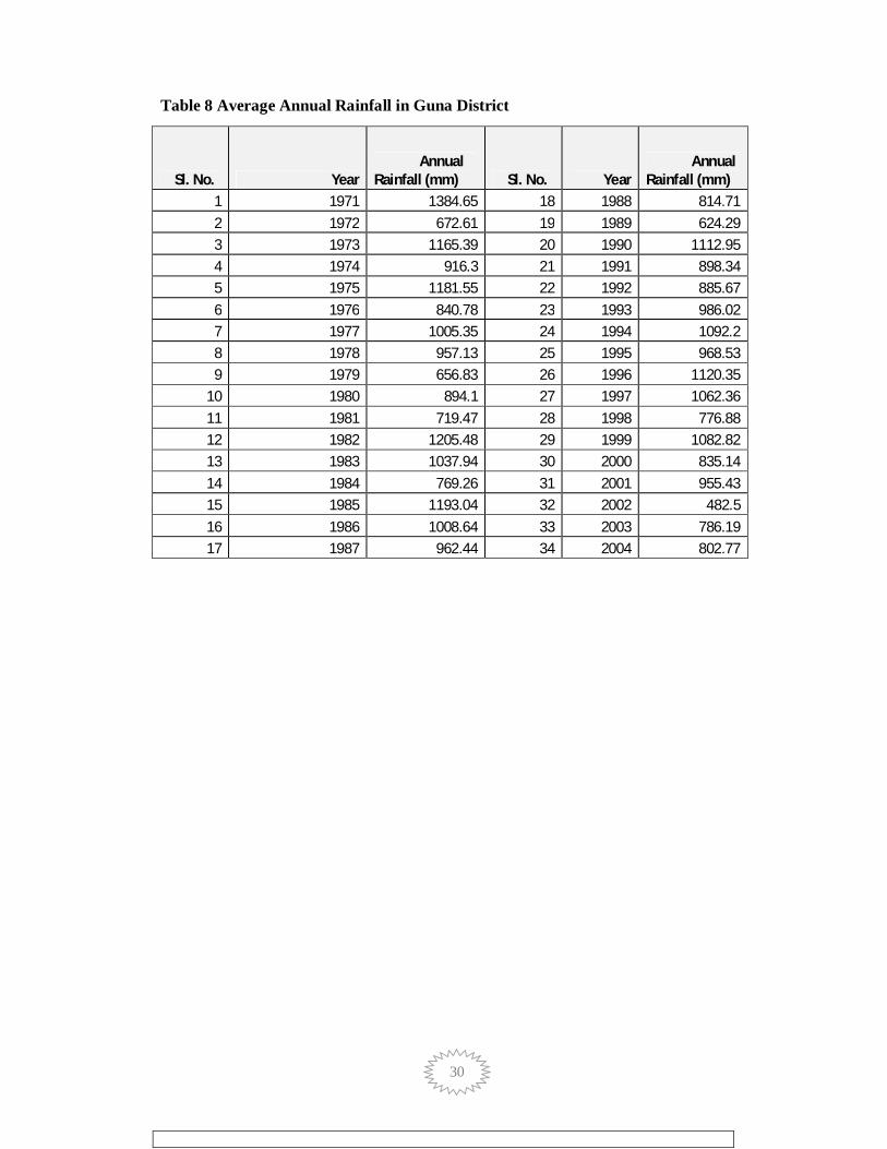
Figure 0-3 Trend of annual rainfall (1971-2004)
30
Table 8 Average Annual Rainfall in Guna District
Sl. No. Year Annual
Rainfall (mm) Sl. No. Year Annual
Rainfall (mm) 1 1971 1384.65 18 1988 814.71 2 1972 672.61 19 1989 624.29 3 1973 1165.39 20 1990 1112.95 4 1974 916.3 21 1991 898.34 5 1975 1181.55 22 1992 885.67 6 1976 840.78 23 1993 986.02 7 1977 1005.35 24 1994 1092.2 8 1978 957.13 25 1995 968.53 9 1979 656.83 26 1996 1120.35
10 1980 894.1 27 1997 1062.36 11 1981 719.47 28 1998 776.88 12 1982 1205.48 29 1999 1082.82 13 1983 1037.94 30 2000 835.14 14 1984 769.26 31 2001 955.43 15 1985 1193.04 32 2002 482.5 16 1986 1008.64 33 2003 786.19 17 1987 962.44 34 2004 802.77

31
1.6 Slope Slope of land is also one of the important physiographic aspects influencing
the landuse of an area. The effect of slope on agriculture may be both direct and
indirect. The most obvious direct influence of slope is in the form of the restrained on
cultivation and accessibility. The indirect effect of slope manifests itself in
pedological and climatic modification including the position of water table,
development of soils, air drainage, and relative freedom from frost. This classification
gives information regarding slope percent classes in the study area. The general slope
of the area in the northerly.
Table 1-9 Slope Category
Slope Category Slope class
Nearly level 0-1 %
Very gently sloping 1-3 %
Gently sloping 3-8 %
Strongly sloping 8-15 %
Mod. steep to steep 15-35 %
Steep sloping 35-45 %
Very Steep sloping >45 %
Source: Based on ISRO NRIS data standards
Table 1-10 Block Wise Slope Class Categories in %
SLOPE CLASS ARON BAMORI CHACHAUDA GUNA RAGHOGARH Grand Total
0-1 Percent 73 78 62 59 63 67 1-3 Percent 15 16 20 25 20 19 3-5 Percent 4 2 6 4 5 4 5-10 Percent 7 3 10 7 9 7 10-15 Percent 0 0 2 2 2 1 15-35 Percent 0 0 1 3 2 1 Grand Total 100 100 100 100 100 100 Source: Based on NRSC Carto DEM

32

33
1.7 Geomorphology Geomorphology is one of the critical theme information for all the application
projects. Hence, the geomorphic maps proposed to be prepared would cater to the
different resource information needs of the country like geo-environment, geo-
engineering, geohazards, mineral and ground water exploration and also
interdisciplinary themes like soil, land use / land cover and forest, etc.
Geomorphology plays an important role in various fields of planning. One of the
major themes is the irrigation development wherein the geomorphological guides are
used as one of the indicator zone for site selection. The understanding of subsurface
geology is a primary requirement for planning exploration and exploitation strategies.
The basement structure highs manifest itself on the surface as geomorphic anomaly
like annular drainage pattern, radial pattern, sudden change in the river course etc.
Landforms of fluvial origin
The word fluvial is used in earth science to refer to processes and landforms
produced by running water. As with other surficial processes, running water can
either erode material from the earth’s landscape, or deposit layers of sediment. The
resulting landforms can be further classified as either erosional landforms or
depositional landforms. The incredible power of running water in carving various
erosional and depositional landforms is well known. Although the quantity of water in
stream is small at one time during the course of the year, very large volumes of water
moves through the channel and they form an important component in the hydrological
cycle. The fluvial dissection of the landscape consists of valleys and their included
channel ways organized into a system of connection known as a drainage network.
Drainage networks display many types of quantitative regularity that are useful in
analyzing both the fluvial systems and the terrains that they dissect. The following are
some of the important landforms definition of fluvial origin.
Braided bar
A stream that divides into or follows an interlacing or tangled network of
several, small, branching and reuniting shallow channels separated from each other by
branch islands or channel bars, resembling in plan the strands of a complex braid.
Such systems are generally believed to indicate the inability to carry its entire load
34
such as an overloaded and aggrading stream flowing in a wide channel on a flood
plain.
Landforms of Denudational Origin
Landform of denudational origin is formed where the denudation process
dominates over the other process. Most of the landform resulting due to this process is
the combined effect of mechanical and chemical weathering. Denudation is the
process of removal of material by erosion and weathering. This has direct influence
on the relief of the area especially in the reduction of relief to the base level. The
agents are mostly water, ice and wind. The major factors affecting denudation are
geology, climate, tectonics and anthropogenic effects. All rocks and minerals at or
near surface are attacked by physical and chemical process. The effect of this process
is not everywhere because of rocks varying resistance to change. As a result
weathering and erosion yield number of landforms, which have typical shape and
forms. Weathering is an essential part of the rock cycle. The parent material, or rock-
weathered material is disaggregated to form smaller fragments and some of the
minerals are dissolved and removed by the agent of water. This removal of material is
erosionis accomplished by running water, wind, glacier etc. The weathering provides
a raw material for the sedimentary rock and soil. Important denudational landforms to
be mapped are explained below.
Pediment
A broad, flat or gently sloping, rock floored erosion surface or plain of low
relief, typically developed by sub aerial agents (including running water) in an arid or
semiarid region at the base of an abrupt and receding mountain front or plateau
escarpment, and underlain by bedrock (occasionally by older alluvial deposits) that
may be bare but more often partly mantled with a and discontinuous veneer of
alluvium derived from the upland masses and in transit across the surface.
Pediment-Inselberg Complex
The pediments dotted by numerous inselberg of small sizes, which makes it
difficult to distinguish from the pediments. Hence, it is called as a complex of
pediment and inselberg.

35
Pediplain
An extensive, multi-concave, rock cut erosion surface formed by the
coalescence of two or more adjacent pediments representing the (the “pen plain”)
mature stage of the erosion cycle.
Landform of structural origin
Landform of structural origin is related to structural aspect of the area. Most of
the landforms under this class has genesis related to underlying structure. Structure
plays an important role for reducing the resistance of rock, which manifests itself in
different geomorphic forms. Some of the variation is minor and some are in mega
scale. The mega scale forms have a dramatic effect on the genesis of landforms and
hence mapping of such forms indirectly indicates the structural set up of the area. The
mega scale structural features like fault and fold depending on its type plays an
important role in genesis of structural landform. The influence of geologic structures
on the development and appearance of landscapes is prominent. The influence of
geologic structures ranges from large features, which exert a dominant influence on
the form of an entire landscape, to small features, which affect an individual landform
and the geomorphic processes operating on it. The structural control could be active
structures whose form is directly impressed on the modern landscape or ancient
structural features whose influence on a modern landscape is due primarily to
differential erosion.
Dissected Structural Hills and Valleys
Hills and valleys, which are originated due to tectonic process and are highly
dissected by the drainage lines. This can be further classified as highly, moderately
and low dissection depending on the density of joints and drainage. Mostly this will
interpreted from a planimetric satellite data and the classification is highly subjective.
Intrusive bodies (Lines) Basic Dyke
Intrusive features that are emplaced within the pre-existing fractures or where
the fluid pressure is great enough for them to form their own fracture during
36
emplacements. They are discordant bodies. The concordant equivalents are sill and
mostly form sheet like plutons.
Fracture/Lineament
All linear features are to be interpreted from the image. The cultural features
like road, railway line, high-tension lines etc. are to be excluded. The line segment
may not be a single continuous line; rather it has to be shown as discontinuous line
segments. Line segments from remote sensing data can be identified mainly based on
their linear nature, presence of moisture, alignment of vegetation, alignment of ponds,
straight stream segments, etc. However, interpretation of line segments is to be done
in conjunction with other diagnostic criteria, such as channel offset, bank erosion and
down-cutting of channel along lineament, warping and displacement of sediment
layer, an branching of river course, abrupt change of river course, presence of dry
channel in an active river course, channel rejuvenation and land subsidence, linear
ridges, scarp surface, linear alignment of water bodies and straight channel segments.
Very small (magnitude) linear features frequently observed in the image. They
correspond to minor faults, fractures, joints and bedding traces in the rock.
Geomorphologically they are expressed as linear alignments of local depressions/
ponds and tonal changes in soil and vegetation. Large linear features.
Adjacent/coincides with regional trends/ structural features. It cuts across various
geomorphic units in both time and space.
37
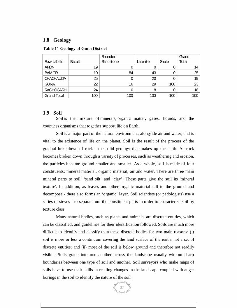
1.8 Geology Table 11 Geology of Guna District
Row Labels Basalt Bhander Sandstone Laterite Shale
Grand Total
ARON 19 0 0 0 14 BAMORI 10 84 43 0 25 CHACHAUDA 25 0 20 0 19 GUNA 22 16 29 100 23 RAGHOGARH 24 0 8 0 18 Grand Total 100 100 100 100 100
1.9 Soil Soil is the mixture of minerals, organic matter, gases, liquids, and the
countless organisms that together support life on Earth.
Soil is a major part of the natural environment, alongside air and water, and is
vital to the existence of life on the planet. Soil is the result of the process of the
gradual breakdown of rock - the solid geology that makes up the earth. As rock
becomes broken down through a variety of processes, such as weathering and erosion,
the particles become ground smaller and smaller. As a whole, soil is made of four
constituents: mineral material, organic material, air and water. There are three main
mineral parts to soil, ‘sand silt’ and ‘clay’. These parts give the soil its 'mineral
texture'. In addition, as leaves and other organic material fall to the ground and
decompose - there also forms an ‘organic’ layer. Soil scientists (or pedologists) use a
series of sieves to separate out the constituent parts in order to characterise soil by
texture class.
Many natural bodies, such as plants and animals, are discrete entities, which
can be classified, and guidelines for their identification followed. Soils are much more
difficult to identify and classify than these discrete bodies for two main reasons: (i)
soil is more or less a continuum covering the land surface of the earth, not a set of
discrete entities; and (ii) most of the soil is below ground and therefore not readily
visible. Soils grade into one another across the landscape usually without sharp
boundaries between one type of soil and another. Soil surveyors who make maps of
soils have to use their skills in reading changes in the landscape coupled with auger
borings in the soil to identify the nature of the soil.

38
There are several ways of classifying a soil, from the simple to the complex. A
soil type may be as simple as ‘a sandy soil’ or ‘a clayey soil’ and this is often the
perception of many land users, such as farmers or civil engineers, who see it as
material they have to deal with to achieve an end result, such as the growing of a crop
of wheat, or the building a road. Simple classifications tend to be of local and
restricted relevance only. At the other end of the spectrum is the soil scientist who
needs to understand how soils have formed, which types occur where, and for what
the different types of soil can be used. The soil scientist seeks a much broader
understanding, with the aim of underpinning the use and preservation of this
important natural resource, and this has manifested itself in a number of detailed soil
classification systems worldwide.
Soils have many important functions. Perhaps the best appreciated is the
function to support the growth of agricultural and horticultural crops. Soil is the
mainstay of agriculture and horticulture, forming as it does the medium in which
growth and ultimately the yield of food producing crops occurs. Farmers and
gardeners have worked with their soils over many centuries to produce increasing
amounts of food to keep pace with the needs of a burgeoning world population. The
soil's natural cycles go a long way in ensuring that the soil can provide an adequate
physical, chemical and biological medium for crop growth. The farmer and
horticulturalist have also become skilled in managing soils so that these natural cycles
can be added to as necessary to facilitate adequate soil support and increasing yield to
enhance production.
Table 1-12 Soil Type of Guna District (Area in %)
Soil Texture ARON BAMORI CHACHAUDA GUNA RAGHOGARH Grand Total
Clayey 11 8 30 12 20 16 Clayey Skeletal 1 0 5 1 2 2 Coarse Loamy 0 0 0 1 0 0 Fine 52 33 27 34 38 36 Fine Loamy 11 1 3 7 14 7 Fine Silty 2 5 0 4 0 3 Laomy 16 42 22 21 18 25 Loamy Skeletal 5 8 11 17 5 10 Others 1 2 2 2 3 2 Grand Total 100 100 100 100 100 100

39
Source: NBSS & LUP Nagpur
1.10 Soil Depth The mean depth of the soil layer within the sampling area is assessed by
studying conditions in the terrain, both on the test area and in its immediate vicinity.
The soil depth on the test area (humus layer + mineral soil) is specified as one of the
following four classes:
Deep soil Mean soil depth greater than 70 cm. Bedrock outcrop lacking in both the test area and its immediate vicinity with similar topography.
Fairly shallow soil Mean soil depth 20-70 cm. Occasional visible bedrock outcrop present. If there is only one bedrock outcrop it must lie wholly or partly within the test area.
Very shallow soil Mean soil depth less than 20 cm. Frequent occurrence of bedrock outcrop. At least one bedrock outcrop within the test area. The soil may be deep within small fissures in the bedrock.
Varying soil depth Wide variation in soil depth within the test area due to broad crevasses in the bedrock, which occasionally emerges as outcrop at the surface.

40
Figure-1-0-4 Soil Depth of Guna District
Source: NRSC and ISRO BhuvanPortel

41
1.11 Soil Texture Soil texture is a qualitative classification tool used in both the field and laboratory to determine classes for agricultural soils based on their physical texture. The classes are distinguished in the field by the "textural feel" which can be further clarified by separating the relative proportions of sand, silt and clay using grading sieves: The Particle-size distribution (PSD). The class is then used to determine crop suitability and to approximate the soils responses to environmental and management conditions such as drought or calcium (lime) requirements
Soil texture has an important role in nutrient management because it
influences nutrient retention. For instance, finer textured soils tend to have greater
ability to store soil nutrients.
In our discussion on soil mineral composition, we mentioned that the mineral
particles of a soil are present in a wide range of size. Recall that the fine earth fraction
includes all soil particles that are less than 2 mm. Soil particles within this fraction are
further divided into the 3 separate size classes, which includes sand, silt, and clay.
The size of sand particles range between 2.0 and 0.05 mm; silt, 0.05 mm and 0.002
mm; and clay, less than 0.002 mm. Notice that clay particles may be over one
thousand times smaller than sand particles. This difference in size is largely due to the
type of parent material and the degree of weathering. Sand particles are generally
primary minerals that have not undergone much weathering. On the other hand, clay
particles are secondary minerals that are the products of the weathering of primary
minerals. As weathering continues, the soil particles break down and become smaller
and smaller.
Soil texture is the relative proportions of sand, silt, or clay in a soil. The soil
textural class is a grouping of soils based upon these relative proportions. Soils with
the finest texture are called clay soils, while soils with the coarsest texture are called
sands. However, a soil that has a relatively even mixture of sand, silt, and clay and
exhibits the properties from each separate is called a loam. There are different types
of loams, based upon which soil separate is most abundantly present. If the
percentages of clay, silt, and sand in a soil are known (primarily through laboratory
analysis), you may use the textural triangle to determine the texture class of your soil.

42
1.12 Soil Erosion Soil Erosion is one form of soil degradation. Soil erosion is a naturally
occurring process that affects all landforms. In agriculture, soil erosion refers to the
wearing away of a field's topsoil by the natural physical forces of weather and wind or
through forces associated with farming activities such as tillage.
Erosion, whether it is by water, wind or tillage, involves three distinct actions
– soil detachment, movement and deposition. Topsoil, which is high in organic
matter, fertility and soil life, is relocated elsewhere "on-site" where it builds up over
time or is carried "off-site" where it fills in drainage channels. Soil erosion reduces
cropland productivity and contributes to the pollution of adjacent watercourses,
wetlands, and lakes.
Soil erosion can be a slow process that continues relatively unnoticed or can
occur at an alarming rate, causing serious loss of topsoil. Soil compaction, low
organic matter, loss of soil structure, poor internal drainage, salinisation, and soil
acidity problems are other serious soil degradation conditions that can accelerate the
soil erosion process. The greater the intensity and duration of a rainstorm, the higher
the erosion potential. The impact of raindrops on the soil surface can break down soil
aggregates and disperse the aggregate material. Lighter aggregate materials such as
very fine sand, silt, clay and organic matter are easily removed by the raindrop splash
and runoff water; greater raindrop energy or runoff amounts are required to move
larger sand and gravel particles.
Soil movement by rainfall (raindrop splash) is usually greatest and most
noticeable during short-duration, high-intensity thunderstorms. Although the erosion
caused by long-lasting and less-intense storms is not usually as spectacular or
noticeable as that produced during thunderstorms, the amount of soil loss can be
significant, especially when compounded over time.
Soil erosion is a surface feature which signifies the loss of soil from the
particular area. Estimation of the soul loss is important to understand the degree of
soil degradation, which restricts the land for potential agricultural use. The soil
erosion affects adversely to fertility status and land use. In Guna district, the major
part of area 38% falls under severe to very severe erosion and 45% area fall slight to
moderate soil erosion, expected soil loss is (5- 15 tonnes/ha/year). In severe erosion
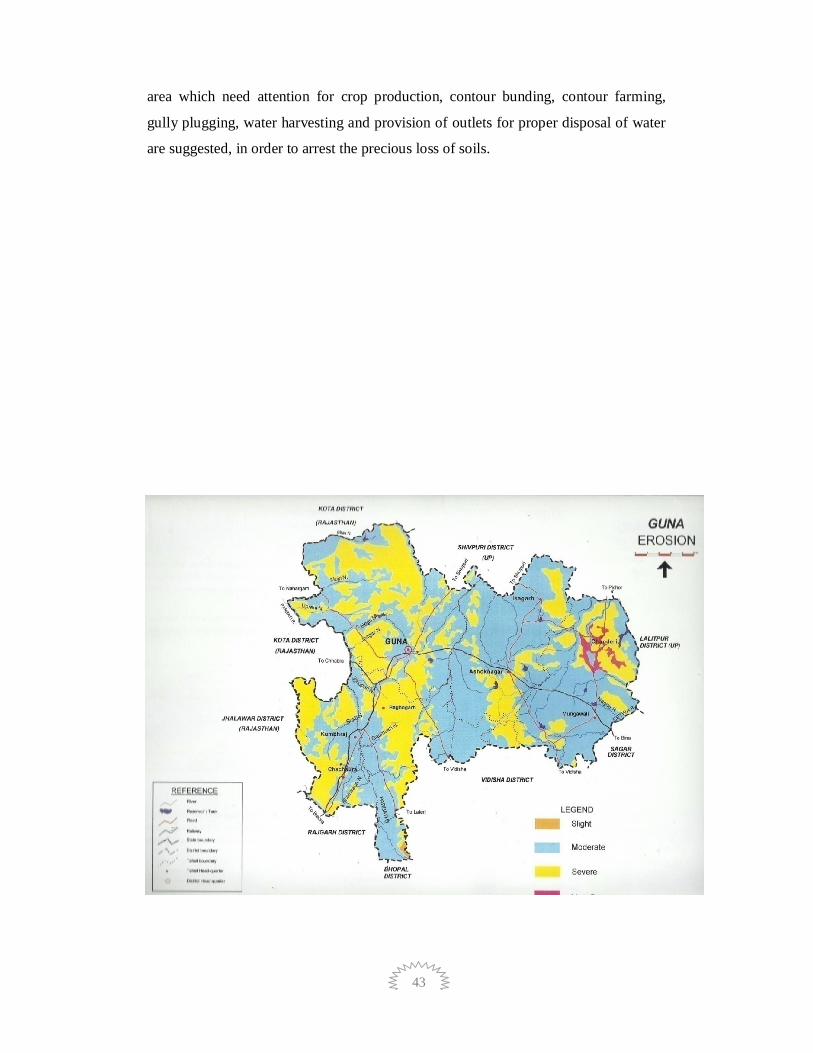
43
area which need attention for crop production, contour bunding, contour farming,
gully plugging, water harvesting and provision of outlets for proper disposal of water
are suggested, in order to arrest the precious loss of soils.

44
1.13 Land Use Concept of Land Use
Land use is a function of four variables, land, water, air and man, each plays in
its own role in composing its life history. Land constitutes its body, water runs
through its veins like blood, air gives it oxygen and man acts as the dynamic actor to
reflect its types, pattern and distribution. Land varies in altitudes, forms and
expressions. Man has played his part on land to portray the different phases of his ties
with it. The Homo sapiens moved from one topography to another where climate,
flora and fauna also changed. He used land, flora and fauna to fit his limited wants.
Men multiplied, their wants increased and become complex, the uses of land also
increased, methods and technology also changed. Man was making his own map on
the face of the earth to portray his link, adaptation, creation and destruction. Man has
cleared the forest for shifting (Jhum) cultivation. He then used the land for large-scale
farming, small-scale farming, intensive farming, mixed farming, dry farming, etc. He
has used the land for one crop or another is a minor landuse problem, but to use each
plot of land for the right cultivation under optimum conditions to obtain optimum
yield is a significant problem. Man has learnt the use of grasslands, semi-arid and arid
lands to his own advantage by applying improved methodology and utilisation of his
accomplishments.
Over a period of time, basically geographic pattern of agricultural landuse are
the outcome of concurrent interaction between the variable combinations of natural
condition and human circumstances. Primarily, these are influenced by natural
condition and thereafter affected by human circumstances because of their colonizing
capability. The human circumstances are mainly responsible for dynamism in
agriculture landuse or changing cropland occupancy. Therefore, efficient cropland
occupancy, say cropping pattern, implies the most successful use of agriculture land,
consequent upon development of irrigation facilities and application of modern
methods of farm technology. The key to the most important aspect of landuse lies in
the relation of population to land. The crux of the review, therefore, refers to the study
of the problems in use of land by man. According to R.H. Best, the term land use
deals with the spatial aspects of human activities on the Land and with the way in
which the land surface is adapted or could be adapted, to serve human needs. This

45
leads one back to the village farm and farmer, to the fields, gardens, pastures, fallow
land, and forest and to the isolated farmstead (Freeman, 1960). The land use shifts
from agricultural uses to residential, industrial, transportation, and neighbourhood
retail and service activities due to urbanization. A true nature of these dynamic
qualities in land use emerges from a historical survey designed to reveal the
successive development of inherent characteristics of land because 'some changes are
short lived whereas others represent a more constant demand' (Jackson, 1963).
Land Use Classification
The conservation and development of land resource is in area needs special
focus. It needs well thought and rational planning, which in turn depends upon minute
observation of land use pattern. The aim of this study is clear visualization of local
land environment. The intense and focused study of the details of land use puts us in a
position to conserve the important elements of the nature, which otherwise lead in a
direction of destruction and consequently threaten the social strata. The present study
focuses mainly on dimension, which is very important from the sustainability point of
view that is distribution of different groups of land use, i.e. their ratios in the region.
Therefore, it becomes very complex and diversified to study all the groups available
at micro-level, homogenous groups are generalized to reduce the number of groups,
and these simplified groups of land use are called generalized land use classification.
World Land Use Classification mainly recognizes nine categories. These are
Settlement and Associated Non Agricultural Land, Horticulture, Tree and Permanent
Crops, Crop Land, Improved Permanent Pasture, Improved Grazing Land, Wood
Land, Swamps and Marshes, Unproductive Land.
In India, a standard classification system is yet to develop. National Atlas and
The land use classification presented by All India Soil and Land Use Survey 1970 is
as follows:
1. Forest Land (F) F1 Without Canopy F2 Sparse Forest F3 General Forest F4
Fully Stocked Top Canopy
2. Cultivated land (CC) C1 Single Cropped C2 Double Cropped C3 Triple
Cropped
3. Terraced Land (T) T1 Poorly Bounded Land T2 Poor Terracing Measures
T3 Bench Terraces
4. Waste Land (W) W1 Fit for Cultivation W2 Unfit for Cultivation

46
5. Pasture Land (P) P Pasture and Grazing Land H Hay Land When the Grass
Periodically Cut P1 With Young Shrubs P2 With Well Grows Shrubs T Thorny Lands
and Heavy Canopy Shrubs.
Land use classification by Statistical Department of Government of India.
I. Geographical Area - Area calculated by Survey Department.
II. Reported Area (Statistical area related to land use)
1. Forest
2. Land not Available for Cultivation
a) Land Put to Non- Agricultural Use,
b) Barren and Uncultivable Land,
3. Other Uncultivable and excluding Fallow Land
a) Permanent Pastures and Other Grazing Land,
b) Miscellaneous Tree Crops and Gardens,
c) Culturable Waste Land.
4. Fallow Land a) Fallow Other than Current Fallow b) Current Fallow
5. Cultivated Land a) Net Sown Area, b) Area Sown More Than Once.
I. Net Irrigated Area.
II. Total Irrigated Area.
The analysis of land use in the present study is based on district statistical
magazine, data available at block level and revenue office. Following categories of
land use have been recognised in the study area. In the analysis of land use pattern
study has been adopted at block level: Forest Cover, Barren and cultivable waste land,
Current Fallow land, Other Fallow land, Barren & uncultivable Land, Land put to
non-agricultural Use, Pastures and Grazing Land, Area under bush, forest & garden,
Net area sown.
Built-Up Land
It is an area of human habitation developed due to non-agricultural use and
that has a cover of buildings, transport and communication, utilities in association
with water, vegetation and vacant lands. For delineating built – up land built up
polygons interpreted under settlement.
Built-Up Area (Rural)
These are the lands used for human settlement and are of size comparatively
less than the urban settlements of which more than 80% of the people are involved in

47
the primary activity of agriculture. All the agricultural villages covering 5 hectares
area and more are included in this category. These are the built-up areas, smaller,
mainly associated with agriculture and allied sectors and non-commercial activities
with population size less than 5000, generally lack supporting facilities that are
unique to urban areas like hospitals, industries (large and medium scale), institutional
etc. They appear in dark bluish green in the core built-up area and bluish in the
periphery size varies from small to big; irregular and discontinuous in appearance;
can be seen in clusters con-contiguous or scattered.
Built-up Land (Urban)
All places with a municipality, corporation or cantonment or which are
notified as town areas and all other places, which satisfy the criteria of a minimum
population of 5000, at least 75 percent of whose male working population is non-
agricultural and having a density of population of at least 400 per sq. km. are placed
under this category (Census of India). It comprises areas of intensive use with much
of the land covered by intensive use and covered by structures. It includes residential,
recreational, public & semi-public, transportation, communication and isolated areas
such as parks, playgrounds, open spaces and vegetated areas. Dantewara city area is
classified in this class.
Agricultural Land
These are the lands primarily used for farming and for production of food,
fibre, and other commercial and horticultural crops. It includes land under crops
(irrigated and unirrigated, fallow, plantation etc.).
Cropland
These are the areas with standing crop as on the date of satellite overpass.
Cropped areas appear in bright red to red in colour with varying shape and size in a
contiguous to non-contiguous pattern. They are widely distributed in different
terrains; prominently appear in the irrigated areas irrespective of the source of
irrigation.
Forest
These are the areas bearing an association predominantly of trees and other
vegetation types (within the notified forest boundaries) capable of producing timber
and other forest produce. They comprise of thick and dense canopy of tall trees,
48
which can be evergreen, semi evergreen or deciduous (moist/dry/thorn). Evergreen
forest includes both coniferous and tropical broadleaved evergreen species and
predominantly remains green throughout the year. Semi-evergreen is a forest type that
includes a combination of evergreen and deciduous species with the former
dominating the canopy cover. Deciduous forest types are of predominantly composed
of species, which shed their leaves once a year, especially during summer. They
exhibit bright red to dark red in colour in varying sizes, smooth to medium texture
depending on the crown density, contiguous to non-contiguous in pattern based on
their location. The size can be irregular and discontinuous occupying medium relief
mountain/hill slopes within the notified areas. Forest blank are the openings amidst
forest areas, devoid of tree cover, observed as openings of assorted size and shapes as
manifested on the imagery. They appear in light yellow to light brown in tone,
generally small in size. They possess regular to irregular shape, scattered in the
forested areas. Most of these areas are seen along hill tops/slopes midst forest areas.
Forest blanks are also to be included in this category.
Dense/Closed
This category includes all the areas where the canopy cover/density is more
than 40%.
Open/Degraded
This category includes all the forest areas where the canopy cover/density
ranges between 10 – 40%.
Wastelands
Wasteland is described as degraded land which can be brought under
vegetative cover with reasonable effort and which is currently underutilized and land
which is deteriorating for lack of appropriate water and soil management or an
account of natural causes. Wastelands can result from inherent / imposed disabilities
such as by location, environment.
Dense Scrub
These areas possess shallow and skeletal soils, at times chemically degraded,
extremes of slopes, severely eroded and lands subjected to excessive aridity with
scrubs dominating the landscape. They have a tendency for intermixing with cropped
areas .

49
Open Scrub
This category has a similar description as mentioned in the earlier class
excepting that they possess sparse vegetation or devoid of scrub and have a thin soil
cover.
Barren/Rocky/Stony Waste
These are rock exposures of varying lithology often barren and devoid of soil
and vegetation cover. They occur amidst hill-forests as openings or as isolated
exposures on plateau and plains. Such lands can be easily discriminated from other
categories of wastelands because of their characteristic spectral response. They appear
in greenish blue to yellow to brownish in colour depending on the rock type. They
vary in size with irregular to discontinuous shape with a linear to contiguous or
dispersed pattern. They are located in steep isolated hillocks/hill slopes, crests,
plateau and eroded plains associated with barren and exposed rocky/stony wastes,
lateritic outcrops, mining and quarrying sites.
Water Bodies
This category comprises areas with surface water, either impounded in the
form of ponds, lakes and reservoirs or flowing as streams, rivers, canals etc. These are
seen clearly on the satellite image in blue to dark blue or cyan colour depending on
the depth of water.
River /Stream/Canal
Rivers/streams are natural course of water flowing on the land surface along a
definite channel/slope regularly or intermittently towards a sea in most cases or a lake
or an inland basin in desert areas or a marsh or another river. Depending upon the
nature of availability of water, rivers are sub-divided into perennial or seasonal. They
appear in light to dark blue in colour, long, narrow to wide depending on the size of
the river. They appear in contiguous, at times nonlinear pattern and associated with
drainage pattern on hill slopes, flood plains or uplands, at times with vegetation along
the banks.
Lakes / Ponds
These are accumulation of water in a depression of various sizes either natural
or saline Lakes / ponds are those that retain water in them either for one season or
throughout the year and usually not subject to extreme fluctuation in water level.

50
Ponds are body of water limited in size, either natural or artificial, regular in shape,
smaller in size than a lake, generally located near settlements.
Reservoir / Tanks
Reservoir is an artificial lake created by construction of a dam across the river
specifically for irrigation, and water supply for domestic/industrial needs, flood
control, etc., either singly or in combination. Tanks are small lakes of impounded
water ways constructed on land surface for irrigation. They appear in light blue to
dark blue depending on the depth from small to large sizes. They possess regular to
irregular shape dispersed to linear, occupying lowlands, plains. They are associated
with croplands, low lands and reservoirs surrounded by hills with or without
vegetation.

51
Figure 1-0-5 Block Wise Landuse Classification
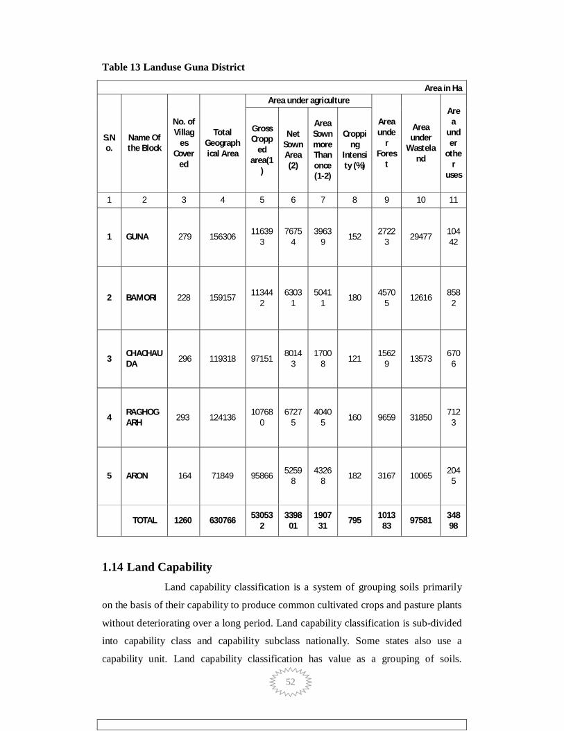
52
Table 13 Landuse Guna District
Area in Ha
S.No.
Name Of the Block
No. of Villag
es Cover
ed
Total Geographical Area
Area under agriculture
Area unde
r Fores
t
Area under
Wasteland
Area
under
other
uses
Gross Cropp
ed area(1
)
Net Sown Area (2)
Area Sown more Than once (1-2)
Cropping
Intensity (%)
1 2 3 4 5 6 7 8 9 10 11
1 GUNA 279 156306 116393
76754
39639 152 2722
3 29477 10442
2 BAMORI 228 159157 113442
63031
50411
180 45705
12616 8582
3 CHACHAUDA 296 119318 97151
80143
17008 121
15629 13573
6706
4 RAGHOGARH 293 124136
107680
67275
40405 160 9659 31850
7123
5 ARON 164 71849 95866 52598
43268 182 3167 10065 204
5
TOTAL 1260 630766 53053
2 3398
01 1907
31 795 1013
83 97581 348
98
1.14 Land Capability Land capability classification is a system of grouping soils primarily
on the basis of their capability to produce common cultivated crops and pasture plants
without deteriorating over a long period. Land capability classification is sub-divided
into capability class and capability subclass nationally. Some states also use a
capability unit. Land capability classification has value as a grouping of soils.
53
National Resource Inventory information, Farmland Protection Policy Act, and many
field office technical guides have been assembled according to these classes. The
system has been adopted in many textbooks and has wide public acceptance. Some
state legislation has used the system for various applications. All map unit
components, including miscellaneous areas, are assigned a capability class and
subclass.Land capability units can be used to differentiate subclasses at the discretion
of the state. Capability class and subclass are assigned to map unit components in the
national soil information system.
Classes and definitions:
Class I soils have slight limitations that restrict their use.
Class II soils have moderate limitations that reduce the choice of plants or
require moderate conservation practices.
Class III soils have severe limitations that reduce the choice of plants or
require special conservation practices, or both.
Class IV soils have very severe limitations that restrict the choice of plants or
require very careful management, or both.
Class V soils have little or no hazard of erosion but have other limitations,
impractical to remove, that limit their use mainly to pasture, range, forestland, or
wildlife food and cover.
Class VI soils have severe limitations that make them generally unsuited to
cultivation and that limit their use mainly to pasture, range, forestland, or wildlife
food and cover.
Class VII soils have very severe limitations that make them unsuited to
cultivation and that restrict their use mainly to grazing, forestland, or wildlife.
Class VIII soils and miscellaneous areas have limitations that preclude their
use for commercial plant production and limit their use to recreation, wildlife, or
water supply or for aesthetic purposes.

54
Figure 1-0-6 Land Capability Classification of Guna District

55
1.15 Drainage In geomorphology, a drainage system is the pattern formed by
the streams, rivers, and lakes in a particular drainage basin. They are governed by the
topography of the land, whether a particular region is dominated by hard or soft rocks,
and the gradient of the land. Geomorphologists and hydrologists often view streams
as being part of drainage basins. A drainage basin is the topographic region from
which a stream receives runoff, through flow, and groundwater flow. Drainage basins
are divided from each other by topographic barriers called a watershed. A watershed
represents all of the stream tributaries that flow to some location along the stream
channel. The number, size, and shape of the drainage basins found in an area varies
and the larger the topographic map.
Table 14 Length of Rivers
Sl. No. River Name Length (km.) Sl. No. River Name
Length (km.)
1 Banriya 13.39 25 Mojri 25.79 2 Barni 7.57 26 Nahari 6.18 3 Bhader 14.24 27 Negri 53.89 4 Bhainsua N 43.66 28 Niwari N 29.89 5 Burh 20.75 29 Orr 2.34
6 Chamari 0.08 30 Panha Jhoro 3.98
7 Chopan 63.13 31 Pararia 8.82 8 Dharma Jhoro 0.26 32 Parbati 97.51 9 Dubraj 6.64 33 Patna 6.97
10 Gaumukh 21.25 34 Piriya 3.82 11 Ghura 7.09 35 Purenl 35.29 12 Gochi N 34.38 36 Puthi N 0.14 13 Gomukh 3 37 Ramhwa 2.63 14 Jamnota 35.32 38 Retri 23.36 15 Jamra 6.88 39 Senduwa 34.75 16 Jhagar 23.06 40 Sind 35.12 17 Kalapani 4.62 41 Sukait 37.78 18 Kanera 16.23 42 Sukh 31.24 19 Kanthi 12.15 43 Tem 31.48 20 Katai 28.4 44 Ukhwa 1.76 21 Khapriya 10.86 45 Ulti 2.9 22 Kharia 18.26 46 Underi 6 23 Khod Ka Johra 8.29 47 Upreni 20.76 24 Kuno 30.97 48 Vaiya 12.51
Total 945.39

56
Figure 1-0-7 Drainage Map of Guna District

57
Figure 1-0-8 Surface Water body of Guna District

58
Table 15 Sub Basin Wise Watersheds
Sl. No. Basin Sub-Basin No. of Watersheds
Area (Sq. km.)
1 Ganga Basin Chambal Lower
Sub 1 569.32 Basin
2 Ganga Basin Kali Sindh and 11 4394.12 others up to Confluence with Parbati Sub Basin
3 Ganga Basin Yamuna Lower
Sub 4 1096.63 Basin
4 Total Area - - 6060.07
Table 16 Watersheds of Guna District
Sl. No. Sub-Basin WaterShed Code Area (Sq. km.)
1 Chambal Lower Sub Basin C2ACHL01 569.322 Kali Sindh and others up to C2AKAS58 2.26
Confluence with Parbati Sub Basin 3 Kali Sindh and others up to C2AKAS57 466.18
Confluence with Parbati Sub Basin 4 Kali Sindh and others up to C2AKAS54 632.79
Confluence with Parbati Sub Basin 5 Kali Sindh and others up to C2AKAS53 719.12
Confluence with Parbati Sub Basin 6 Kali Sindh and others up to C2AKAS49 166.76
Confluence with Parbati Sub Basin 7 Kali Sindh and others up to C2AKAS50 415.40
Confluence with Parbati Sub Basin 8 Kali Sindh and others up to C2AKAS24 208.30
Confluence with Parbati Sub Basin 9 Kali Sindh and others up to C2AKAS51 608.12
Confluence with Parbati Sub Basin 10 Kali Sindh and others up to C2AKAS27 9.37
Confluence with Parbati Sub Basin 11 Kali Sindh and others up to C2AKAS52 915.01
Confluence with Parbati Sub Basin 12 Kali Sindh and others up to C2AKAS55 250.81
Confluence with Parbati Sub Basin 13 Yamuna Lower Sub Basin C2AYAL10 2.7014 Yamuna Lower Sub Basin C2AYAL34 303.8715 Yamuna Lower Sub Basin C2AYAL14 33.8516 Yamuna Lower Sub Basin C2AYAL33 756.2117 Total Area - 6060.07

59
Table 17 No of Existing Water Resources Structures
Sl. No. Type of Asset No. of Assets
1 No. of Dams 13 2 No. of Barrages 0 3 No. of Weirs 0 4 No. of Anicuts 0 5 No. of Lifts 0 6 No. of Powerhouse 0

60
2 Chapter - 2 District Water Profile
Irrigation is the artificial application of water to the land or soil. It is used to
assist in the growing of agricultural crops, maintenance of landscapes, and re
vegetation of disturbed soils in dry areas and during periods of inadequate rainfall.
There is a great necessity of irrigation in Indian agriculture. India has a great diversity
and variety of climate and weather conditions. These conditions range from extreme
of heat to extreme of cold and from extreme dryness to excessive rainfall. Irrigation is
the need of Indian agriculture.
Uncertainty of Monsoon rainfall both in time and in place.
Irregularity in distribution of rainfall throughout the year.
Excessive rainfall causing flood.
Draught is an annual event in some areas.
India is a land of Rabi Crops. However, there is not rainfall in winter
months.
Some soils need more water.
Introduction of H.Y.V seeds and multiple cropping need water
throughout the year.
The types of Irrigation mainly practiced in India are:
Tanks
(a) Sichhni (b) Donga
Well
(a) Dug well (b) Tube Well (i) Shallow (ii) Deep
Canal
(a) Perennial (b) Non-Perennial
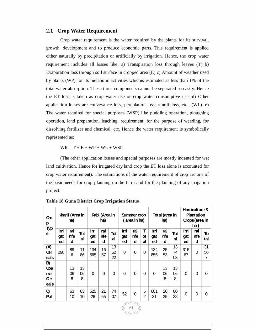
61
2.1 Crop Water Requirement Crop water requirement is the water required by the plants for its survival,
growth, development and to produce economic parts. This requirement is applied
either naturally by precipitation or artificially by irrigation. Hence, the crop water
requirement includes all losses like: a) Transpiration loss through leaves (T) b)
Evaporation loss through soil surface in cropped area (E) c) Amount of weather used
by plants (WP) for its metabolic activities whichis estimated as less than 1% of the
total water absorption. These three components cannot be separated so easily. Hence
the ET loss is taken as crop water use or crop water consumptive use. d) Other
application losses are conveyance loss, percolation loss, runoff loss, etc., (WL). e)
The water required for special purposes (WSP) like puddling operation, ploughing
operation, land preparation, leaching, requirement, for the purpose of weeding, for
dissolving fertilizer and chemical, etc. Hence the water requirement is symbolically
represented as:
WR = T + E + WP + WL + WSP
(The other application losses and special purposes are mostly indented for wet
land cultivation. Hence for irrigated dry land crop the ET loss alone is accounted for
crop water requirement). The estimations of the water requirement of crop are one of
the basic needs for crop planning on the farm and for the planning of any irrigation
project.
Table 18 Guna District Crop Irrigation Status
Crop Type
Kharif (Area in ha)
Rabi (Area in ha)
Summer crop ( area in ha)
Total (area in ha)
Horticulture & Plantation
Crops (area in ha )
Irrigated
rainfed
Total
Irrigated
rainfed
Total
Irrigated
rainfed
Total
Irrigated
rainfed
Total
Irrigated
rainfed
Total
(A) Cereals
290 896
1186
134565
1657
136222
0 0 0 134855
2553
137408
31567 0
31567
B) Coarse Cereals
13068
13068
0 0 0 0 0 0 0 13068
13068
0 0 0
C) Pul 63
10 6310
52528
2155
7407 52 0 5
2 60131
2025
8038 0 0 0
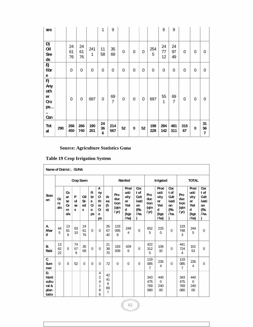
62
ses 1 9 8 9
D) Oil Seeds
246176
246176
2411
1158
3569 0 0 0 254
5
247712
249749
0 0 0
E) fibre
0 0 0 0 0 0 0 0 0 0 0 0 0 0
F) Any other Crops….. Can
0 0 697 0 697 0 0 0 697 55
1 697 0 0 0
Total
290 266450
266740
190201
24366
214567 52 0 52 198
228 284142
481311
31567 0
31567
Source: Agriculture Statistics Guna
Table 19 Crop Irrigation System
Name of District ; GUNA
Season
Crop Sown Rainfed Irrigated TOTAL
Cereals
Coarse Cereals
Pulses
Oil Seeds
Fibre Crops
Any Other Crops
Area (ha)
Production (qtn/yr)
Productivity or Yield (kgs/ha)
Cost of Cultivation (Rs./ha.)
Production (qtn/yr)
Productivity or Yield (kgs/ha)
Cost of Cultivation (Rs./ha.)
Production (qtn/yr)
Productivity or Yield (kgs/ha)
Cost of Cultivation (Rs./ha.)
A. Kharif
445
13819
6310
246176
0 0 266740
133095
8
2494 0 652
5 225
0 0 133748
3
2445 0
B. Rabi
136222
0 74079
3569 0 0
213870
193939
4296 0
422312
5
10632 0
441724
4
10153 0
C. Summer
0 0 52 0 0 0 72 0 0 0 119085
7
2354 0
119085
7
2354 0
D. Horticultural & plantatio
42419 6
42419
697
343475 769080
4400
24000
343475 769080
4400
24000
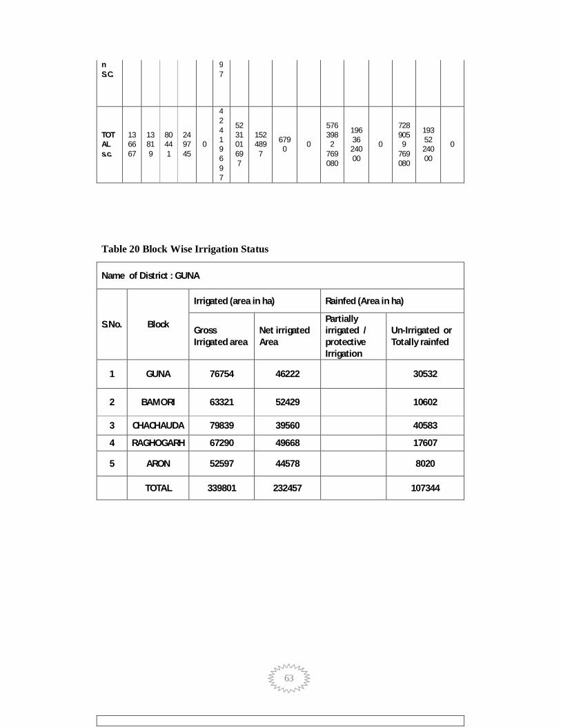
63
n S.C.
97
TOTAL s.c.
136667
13819
80441
249745
0
42419 697
523101 697
152489
7
6790 0
576398
2 769080
19636
24000
0
728905
9 769080
19352 24000
0
Table 20 Block Wise Irrigation Status
Name of District : GUNA
S.No. Block
Irrigated (area in ha) Rainfed (Area in ha)
Gross Irrigated area
Net irrigated Area
Partially irrigated / protective Irrigation
Un-Irrigated or Totally rainfed
1 GUNA 76754 46222 30532
2 BAMORI 63321 52429 10602
3 CHACHAUDA 79839 39560 40583
4 RAGHOGARH 67290 49668 17607
5 ARON 52597 44578 8020
TOTAL 339801 232457 107344

64
3 Chapter - 3 Water Availability
3.1 Surface Water Scenario Surface water is water on the surface of the planet such as in a stream, river,
lake, wetland, or pond/tank. It can be contrasted with groundwater and atmospheric
water. Non-saline surface water is replenished by precipitation and by recruitment
from ground-water. It is lost through evaporation, seepage into the ground where it
becomes ground-water, used by plants for transpiration, extracted by mankind for
agriculture, living, industry etc. or discharged to the sea where it becomes saline.
To derive Surface Water volume basically, we measure volumes and surface
areas of a set of farm ponds and tanks, and then develop relationships between surface
areas and volumes. After that using these relationships, calculated volumes of the
whole study region surface water bodies based on our remote-sensing surface area.
3.2 Status of Surface Water Availability Surface water is water that is found in lakes, rivers, streams, ponds, and other
natural watercourses. This valuable resource provides drinking water, water supply,
and supports important industries such as fishing, farming and electric power
generation. Surface water supports various recreational activities such as swimming
and boating, and provides habitat for aquatic life. Overall, a clean, abundant supply of
surface water supports the health of humans and aquatic ecosystems, a strong
economy, and provides a high quality of life for any region.

65
Name of Block Stored surface
water(BCM)
Stored
ground(BCM) Total
Guna 0.106852137 0.1568150
5 0.263667187
Bamori 0.077019785 0.1561505
2 0.233170305
Raghogarh 0.027251932 0.0910478 0.118299732
Chachauda 0.036254971 0.1464098 0.182664771
Aron 0.071535344 0.1597843
95 0.231319739
Total 0.31891417 0.710207565 1.029121735
Source :District Irrigation and Agriculture Office Records
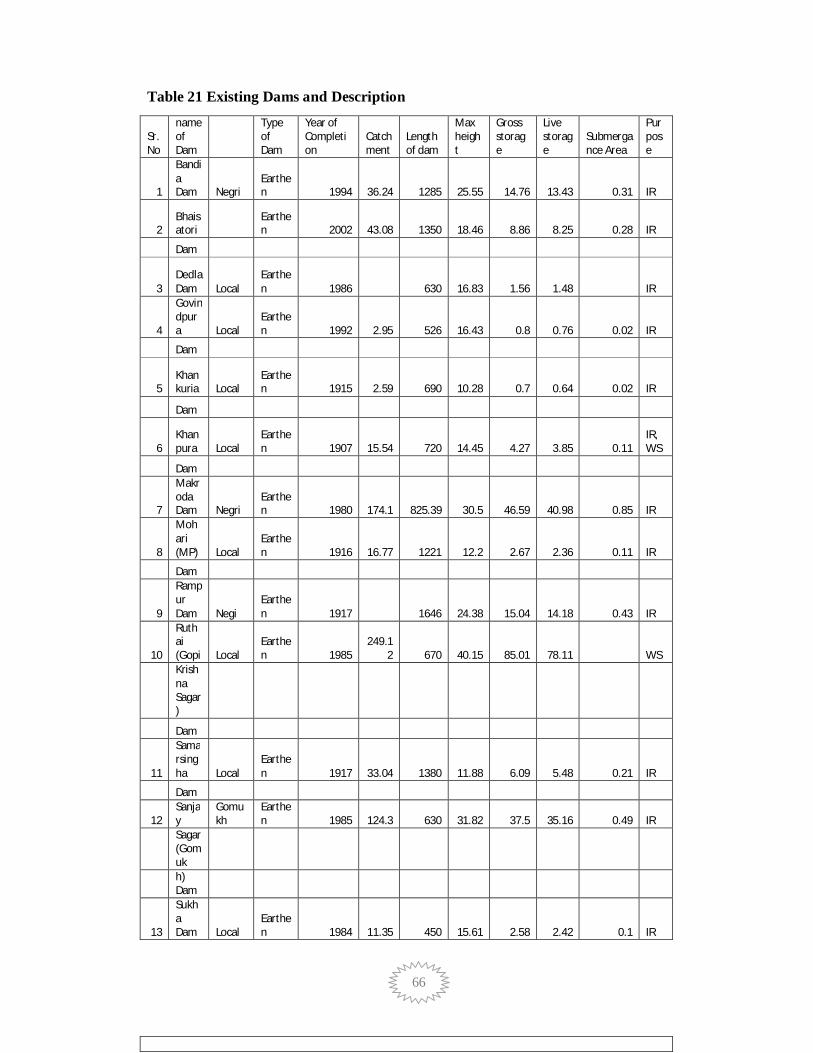
66
Table 21 Existing Dams and Description
Sr. No
name of Dam
Type of Dam
Year of Completion
Catchment
Length of dam
Max height
Gross storage
Live storage
Submergance Area
Purpose
1
Bandia Dam Negri
Earthen 1994 36.24 1285 25.55 14.76 13.43 0.31 IR
2 Bhaisatori
Earthen 2002 43.08 1350 18.46 8.86 8.25 0.28 IR
Dam
3 Dedla Dam Local
Earthen 1986 630 16.83 1.56 1.48 IR
4
Govindpura Local
Earthen 1992 2.95 526 16.43 0.8 0.76 0.02 IR
Dam
5 Khankuria Local
Earthen 1915 2.59 690 10.28 0.7 0.64 0.02 IR
Dam
6 Khanpura Local
Earthen 1907 15.54 720 14.45 4.27 3.85 0.11
IR,WS
Dam
7
Makroda Dam Negri
Earthen 1980 174.1 825.39 30.5 46.59 40.98 0.85 IR
8
Mohari (MP) Local
Earthen 1916 16.77 1221 12.2 2.67 2.36 0.11 IR
Dam
9
Rampur Dam Negi
Earthen 1917 1646 24.38 15.04 14.18 0.43 IR
10
Ruthai (Gopi Local
Earthen 1985
249.12 670 40.15 85.01 78.11 WS
Krishna Sagar)
Dam
11
Samarsingha Local
Earthen 1917 33.04 1380 11.88 6.09 5.48 0.21 IR
Dam
12 Sanjay
Gomukh
Earthen 1985 124.3 630 31.82 37.5 35.16 0.49 IR
Sagar(Gomuk
h) Dam
13
Sukha Dam Local
Earthen 1984 11.35 450 15.61 2.58 2.42 0.1 IR

67
4.2.1 Pre Monsoon Depth to Water Levels
The depth to water levels during the pre monsoon period varies from 2.95
(village Akoda N lat.770 11’, E long 240 51’) to 17.40 ( village Myana E lat 770 27’,
E long 240 51’) m.bgl. The depth to water level of about 56.25% of the wells is in the
range of 6.50 to 12 m.bgl., 31.25% of the wells are falling in depth to water level
range of 12 to 17 m.bgl and in the remaining wells depth to water is between 15 and
17.40 m.bgl. The pre monsoon depth to water level map is shown in Fig

68
4.2.2 Post Monsoon Water Levels
The depth to water levels during the post monsoon period varies from 2.85
(Village Berkheri) to 17.4 (village Myana E lat 770 27’, E long 240 51’) m.bgl. The
depth to water level of 56.25% of the wells is between 2.85 and 5.78 m.bgl. 31.25% of
the wells are falling in the depth to water level range of 6.00 to 10.00 m.bgl, and in the
remaining wells depth to water falls between 10.00 and 17.4 m.bgl. The post monsoon
depth to water level map is shown in Fig .

69
4.3 Ground Water Resources
Dynamic ground water resources of the district have been estimated for base year
- 2008 / 09 on block-wise basis. There are five number of assessment units (block) in the
district which fall under non-command (96 %) and command (4.% Bamhori and Guna)
units. All blocks of the district are categorized as safe blocks. The highest stage of ground
water development is computed as 69 % in Guna block.. The Net ground water
availability in the district is 71,020 ham and ground water draft for all uses is 40,459
ham, making stage of ground water development 57 % (54 % in 2003/04) as a whole for
district. After making allocation for future domestic and industrial supply for next 25
years, balance available ground water for future irrigation would be 29,337 ham at 50 %
stage of ground water development’s safe limits in the district.
Table No. 5 Block wise Ground Water Resources District/ Sub-unit Net Annual Existing Existing Existing Provision Net Ground Stage of
Assessment Command/ Ground Gross Gross Gross for water Ground Unit Non- water Ground Ground Ground domestic, Availability water
Command/ Availability water water water and for future Development % (ham) Draft for Draft for Draft industrial irrigation d Irrigation Domestic for All requirement development (ham) & uses supply to (ham) Industrial (ham) next 25 year water (2033) Supply (ham) (ham)
Command
Aron Non-Command 10493 3345 400 3745 575 6573 36
Block Total 10493 3345 400 3745 575 6573 36
Command 2603 220 37 257 49 2334 10
Bamori Non-Command 14610 8143 438 8581 649 5819 59
Block Total 17214 8363 475 8838 698 8153 51
Command
Chachauda Non-Command 14453 8523 723 9246 912 5019 64
Block Total 14453 8523 723 9246 912 5019 64
Command
Guna Non-Command 14566 9496 578 10075 712 4358 69
Block Total 14566 9496 578 10075 712 4358 69
Command 2854 323 52 375 106 2425 13
Raghogarh Non-Command 11439 7554 626 8180 1075 2810 72
Block Total 14294 7878 678 8555 1182 5234 60
District Total 71020 37605 2855 40459 4078 29337 57

70
Figure 3-1 Ground Water Resources Guna District

71
4.4 Ground Water Quality
Ground Water quality in Guna district is assessed by CGWB on the basis of water
samples collected from twenty-five numbers of hydrograph stations. Ground water is generally
medium to high saline as electric conductivity values vary between 353 to 2443 micro mhos/cm.
High EC of more than 1500 micro mhos/cm was found in three dug well of Barod (1704 micro
mhos/cm), Panchi (1709 micro mhos/cm) and Khakariya (2643 micro mhos/cm) villages.
Constituents like Fluoride, Sulphate, calcium and Magnesium were within the safe limit for
drinking water as per BIS standards. Nitrate in the ground water varies from 6.4 to 332mg/l.
nitrate more than 100 mg/l was found at Husainpur (332 mg/l) and Mau (313 mg/l) villages.
High nitrate in ground water appears due to the use of fertilizers etc. The total hardness of
ground water is under safe limit of BIS standards. High chloride of more than 250 mg/l was
found at Barod, Panchi & Khakariya villages.
Table 22 No. of Ground Water Observations Wells
Sl. No. Block Name No. of Observation Wells
1 Aron 3 2 Bamori 5 3 Chachauda 4 4 Guna 8 5 Raghogarh 4 Total No. Wells in the District 24
4.4.1 Quality of Ground water for Irrigation
High SAR is not good for irrigation as it lead to Sodium hazards. Water samples fall in
C2S 1, C3S1 & C4S 1 classes of US salinity diagram. The ground water in the district is safe for
irrigation purpose but proper drainage system is required where EC is high.
4.5 Status of Ground water Development
Block wise status of irrigation by Canals, Tube wells, Dug wells and Ponds as on year
2011) is given in table .
Table- 6 Status of Irrigation

72
S.no. Block Number Number of Number of Dug Number Number of of Canal/ Tube wells/ wells/ of Ponds/ other Irrigated Irrigated Irrigated Area in Irrigated sources/ Area in Area in sq. sq. km Area in Irrigated in sq. km km sq. km Area in sq. km
1. Guna 8.70 159.13 43.28 5.57 43.78 4 2477 2882 5
2. Bamori 97.65 209.46 10.65 4.57 38.74 7 3636 1449 11
3. Aron 3.5 71.27 10.74 1.08 34.31 3 1012 1547 1
4. Raghogarh 80.14 45.53 150.64 24.32 108.07 3 642 6517 8
5. Chachouda 9 11.22 97.84 3.14 18.32 5 278 5373 7 Total 199.01 569 401 38.68 22 8561 24646 32 258.45 Total % Irrigation 13.4 38.4 27.1 3.04 18.1
Ground water is the main source of irrigation in the district and about 64.94% of the
irrigation is from either through the dug well or tube wells. Till 1960 farmers were depended
mostly on monsoon rainfall and a few dug wells were exited. The deeper aquifers were totally
unexploited in the year 1960 but after that ground water development in the district progressed.
The total number of dug wells and tube wells in the year 2006 for irrigation purpose are 17768
and 8045 respectively.
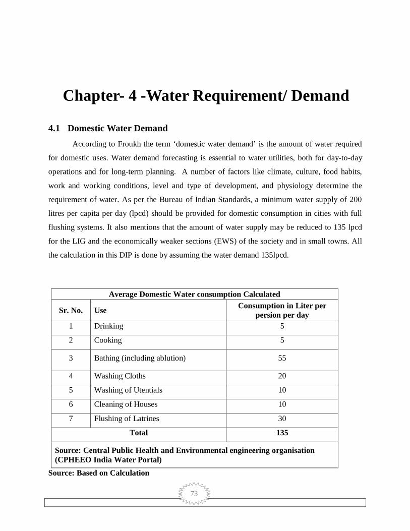
73
4 Chapter- 4 -Water Requirement/ Demand
4.1 Domestic Water Demand According to Froukh the term ‘domestic water demand’ is the amount of water required
for domestic uses. Water demand forecasting is essential to water utilities, both for day-to-day
operations and for long-term planning. A number of factors like climate, culture, food habits,
work and working conditions, level and type of development, and physiology determine the
requirement of water. As per the Bureau of Indian Standards, a minimum water supply of 200
litres per capita per day (lpcd) should be provided for domestic consumption in cities with full
flushing systems. It also mentions that the amount of water supply may be reduced to 135 lpcd
for the LIG and the economically weaker sections (EWS) of the society and in small towns. All
the calculation in this DIP is done by assuming the water demand 135lpcd.
Average Domestic Water consumption Calculated
Sr. No. Use Consumption in Liter per persion per day
1 Drinking 5
2 Cooking 5
3 Bathing (including ablution) 55
4 Washing Cloths 20
5 Washing of Utentials 10
6 Cleaning of Houses 10
7 Flushing of Latrines 30
Total 135
Source: Central Public Health and Environmental engineering organisation (CPHEEO India Water Portal)
Source: Based on Calculation

74
Graph 4-1 Consumption of Water per Person
4.2 Crop water Demand: It is essential to know the water requirement of a crop which isthe total quantity of water
required from its sowing time up to harvest. Naturally different crops may have different water
requirements at different places of the same country, depending upon the climate, type of soil,
method of cultivation, effective rain etc. The total water required for crop growth isnot uniformly
distributed over its entire life span which is also called crop period.Actually, the watering stops
same time before harvest and the time duration from the first irrigation during sowing up to the
last before harvest is called base period. Though crop period is slightly more than the base
period, they do not differ from practical purposes.
The total depth of water required to raise a crop over a unit area of land is usually called
delta. Some typical values of delta for common crops in some regions of India are as follows:
Soyabeen
•700mm to 800mm for heavy soils or high water table
•800mm to 850mm for medium soils
•850 to 900 for light soils or deep water table
•950mm for upland conditions
Wheat
0102030405060
Drinking Cooking Bathing (including abloution)
Washing Cloths
Washing of Utentials
Cleaning of Houses
Flushing of Laterines
Wat
er R
equi
rem
ent
Uses
Consumption in Liter per persion per day

75
•250mm to 400mm in northern India
•500mm to 600mm in Central India
Barley: 450mm
Maize
•100mm during rainy season
•500mm during winter season
•900mm during summer season
•Cotton: 400 – 500mm
Sugarcane
•1400mm to 1500mm in Bihar
•1600mm to 1700mm in Andhra Pradesh
•1700mm to 1800mm in Punjab
•2200mm to 2400mm in Madhya Pradesh
•2800mm to 3000mm in Maharashtra
This information is based on Handbook of Agriculture(fifth edition, 2000) published by
the Indian Council of Agricultural Research.
Crop water requirement is calculated based on water depth required for each crop.
4.3 Livestock Water Demand: Global trend in animal production indicates a rapid and massive increase in the
consumption of livestock products. It is predicted that meat and milk consumptionwill grow at
2.8 and 3.3% per annum, respectively, in developing countries like Indiawhere the whole system
of rural economy has revolved around livestock production. Providing enough quality water is
essential for good livestock husbandry. Water makes up 80% of the blood, regulates body
temperature and is vital for organ functions such as digestion, waste removal and the absorption

76
of nutrients. Understanding daily livestock watering needs is key when designing a livestock
watering system.
The daily water requirement of livestock varies significantly among animal species. The
animal's size and growth stage will have a strong influence on daily water intake. Consumption
rates can be affected by environmental and management factors. Air temperature, relative
humidity and the level of animal exertion or production level are examples of these factors. The
quality of the water, which includes temperature, salinity and impurities affecting taste and
odour, will also have an effect. The water content of the animal's diet will influence its drinking
habits. Feed with a relatively high moisture content decreases the quantity of drinking water
required.
Given that drinking water needs are species-, farm- and management-specific, many
producers today are opting to install water-metering equipment to obtain accurate measurements
of water use. If medication is ever provided through the livestock's watering system, the meter
can be used to ensure proper dose rates.
Table 4.5 gives block water demand for livestock for current year and for 2020. Number
of livestock as per 2011 census is 1089804. Estimation is done based on livestock water demand
which is different for types of animals. There is no additional water requirement as stored water
is more than water requirement. 25% of water is reserved for this purpose in all current and
future structures.
4.4 Industrial Water Demand In Madhya Pradesh, industry is the second highest consumer of water. The main
sources of water for the industrial sector are groundwater and surface water. Groundwater has
emerged as an important source to meet the water requirements of industries. Choice of source of
water depends on the availability of sufficient and regular supply of water and the cost of water
from the source. While the running cost of surface water is mainly the price paid to the
supplier—the municipal bodies; the cost of groundwater is the extraction cost—energy used
(electricity/diesel). Since the prices of all the inputs, water, electricity, and diesel are
administered or regulated by the government, the inefficient use of water remains a normal
practice. Since the surface water supply from municipal sources is not sufficiently guaranteed,
industrial units tend to depend on groundwater.

77
4.5 Water Demand of The Guna District for Various Sectors 2015
Block Componants
Total BCM
Domestic Crop Livestock Industrial Power Generation
GUNA 0.013901 0.2857452 0.00003448363 0.00000135000 0 0.299682 BAMORI 0.010654 0.2619331 0.00002854467 0.00000015000 0 0.272616 CHACHAUDA 0.012665 0.29765125 0.00032802677 0.00000090000 0 0.310645 RAGHOGARH 0.013364 0.27383915 0.00020988324 0.00000287500 0 0.287416 ARON 0.006896 0.26669552 0.00001023392 0.00000015000 0 0.273602 Total 0.05748 1.38586422 0.000611172 0.000005425 0 1.443961
Table 23 Water Demand of The District for Various Sectors (Projected 2020)
Block Componants
Total BCM Domestic Crop Livestock Industrial
Power Generation
GUNA 0.01487407 0.302889912 0.00003620781 0.00000145800 0 0.317802
BAMORI 0.01139978 0.277649086 0.00002997190 0.00000016200 0 0.289079
CHACHAUDA 0.01355155 0.315510325 0.00034442811 0.00000097200 0 0.329407 RAGHOGARH 0.01429948 0.290269499 0.00022037740 0.00000310500 0 0.304792 ARON 0.00737872 0.282697251 0.00001074562 0.00000016200 0 0.290087
Total 0.0615036 1.469016073 0.000641731 0.000005859 0 1.531167 Source: Based on Data Computation

78
4.6 Water Budget
Name of Block
Total Water
Availability
(BCM)
Water Demand (BCM) Water Gap (BCM)
Present Projected
(2020) Present
Projected
(2020)
GUNA 0.263667187 0.299682034 0.317801648 0.03601485 0.05413446
BAMORI 0.233170305 0.272615795 0.289079 0.03944549 0.05590869
CHACHAUDA 0.118299732 0.310645177 0.329407275 0.19234544 0.21110754
RAGHOGARH 0.182664771 0.287415908 0.304792461 0.10475114 0.12212769
ARON 0.231319739 0.273601904 0.290086879 0.04228216 0.05876714
Total District 1.029121735 1.443960817 1.531167263 0.41483908 0.50204553

79
4.7 Table 24
4.8
Structures Proposed: Water Storage
Total water storage 0.9826 BCM
Structure Total no.Water
storage/structure (cum)
Total water Storage (cum)
Farm Ponds/Dabries 9460 900 0.0051084
Check Dam/Nala
Band502 4800 0.00144576
Percolation Tanks 665 112500 0.0448875
Anicut/Stopdam/Diversion 56 450000 0.01512
Minor Irrigation tanks 229 5100000 0.70074
Dam/Canal Renovation 34 40960 0.000835584
Pond deepening 5297 67500 0.2145285
Total 16243 0.982665744
Table 25

80
Table 26
4.9
Structures Proposed: Water Saving
Total water saving = 0.0768 BCM
* Source: Present Status and Future Requirement of Farm Equipment for Crop Production, MM Pandey, Central Institute of Agricultural Engineering, Bhopal
Co m p o n en t No . o f s tru ctu res Wa ter Sa v in g / w o rk (cu m )
To ta l Sa vin g in (BCM)
Drip Irrig a tio n 1 0 6 0 0 3 0 0 0 0 .0 3 1 8
Sp rin klers 2 2 5 0 0 2 0 0 0 0 .0 4 53 3 1 0 0 5 0 0 0 0 .0 7 6 8
Table 27

81
4.10
Proposed Crop Pattern
* Computed based on assumption as per ICAR and KVK recommendations
Crop Area Sown Present
(In Ha)
Area Sown
Projected
(In Ha)
Increase in Area
(In Ha)
Soyabeen 236920 210000 -26920
Wheat 115450 120000 4550
Maize 15720 25000 9280
Pulses 98830 110830 12000
Musturd 6980 16980 10000
Horticulture crops
Vegetable & Fruits 31567 36487 4920
Total 505467 519297 13830
82
5 Chapter -5 Strategic Action Plan
Major crop in the district is Soyabeen and pulses crop, which consumes 500 mm of
water. If in place of Soyabeen, crops like maize, and oilseeds are sown, for the same available
water, cropped area can be increased to double times . Changing crop pattern will also improve
soil fertility and reduces crop vulnerability to droughts and diseases.
In this regard, it may be mentioned that the water sector has very strong linkages with all
other developmental activities. In view of fast changing development scenario, it is emphasized
that the key priorities and identified strategies cannot be considered as static and firm. These
need to be reviewed and improved upon from time to time. In this regard a comprehensive
“Strategic Plan for District Irrigation” has been prepared through geospatial approach:
5.1 Methodology Diverse research methodologies using RS and GIS have been applied by different authors
to identify potential rainwater harvestings in remote and data scarce areas; in most of these
methods, thematic maps are derived from remote sensing data and integrated in GIS to evaluate
suitable sites for rainwater harvesting. Remote sensing is of immense use for natural resources
mapping and generating necessary spatial database required as an input for GIS analysis. GIS is a
tool for collecting, storing and analyzing spatial and non - spatial data, and developing a model
based on local factors can be used to evaluate appropriate natural resources development and
management action plans. Both these techniques can complement each other to be used as an
effective tool for selecting suitable sites for water harvesting structures.
In assessment of proposed rainwater harvesting structures potential using GIS and RS,
outlines six key factors that require to be integrated into a GIS framework in order. to
successfully develop a suitable model for RWH. This include; rainfall, hydrology (rainfall-runoff
relationships), slope, land cover, soils (texture, structure, depth) and socio-economics of the area
under consideration.

83
The following criteria have been followed for making decision on selecting suitable site
for various water harvesting structures as per Integrated Mission for Sustainable Development
(IMSD) guidelines.
Check dams
The slope should be less than 15 percent.
The land use may be barren, shrub land and riverbed.
The infiltration rate of the soil should be less.
The type of soil should be sandy clay loam.
Percolation tanks and nala bunds
The slope should be less than 10 percent.
The infiltration rate of the soil should be moderately high.
The land use / cover may be barren or scrub land.
The type of soil should be silt loam.
The suitability of WHS sites can be confirmed as the site is located on second and third
order drainage and satisfies the conditions of land use, soil type and slope as per IMSD
guidelines.Water harvesting structures are extremely important to conserve precious natural
resources like, soil and water, which is depleting day by day at alarming rate. The following
table provide strategic action plan for irrigation for each block as well as for whole district and
estimated costs and period of implementation.
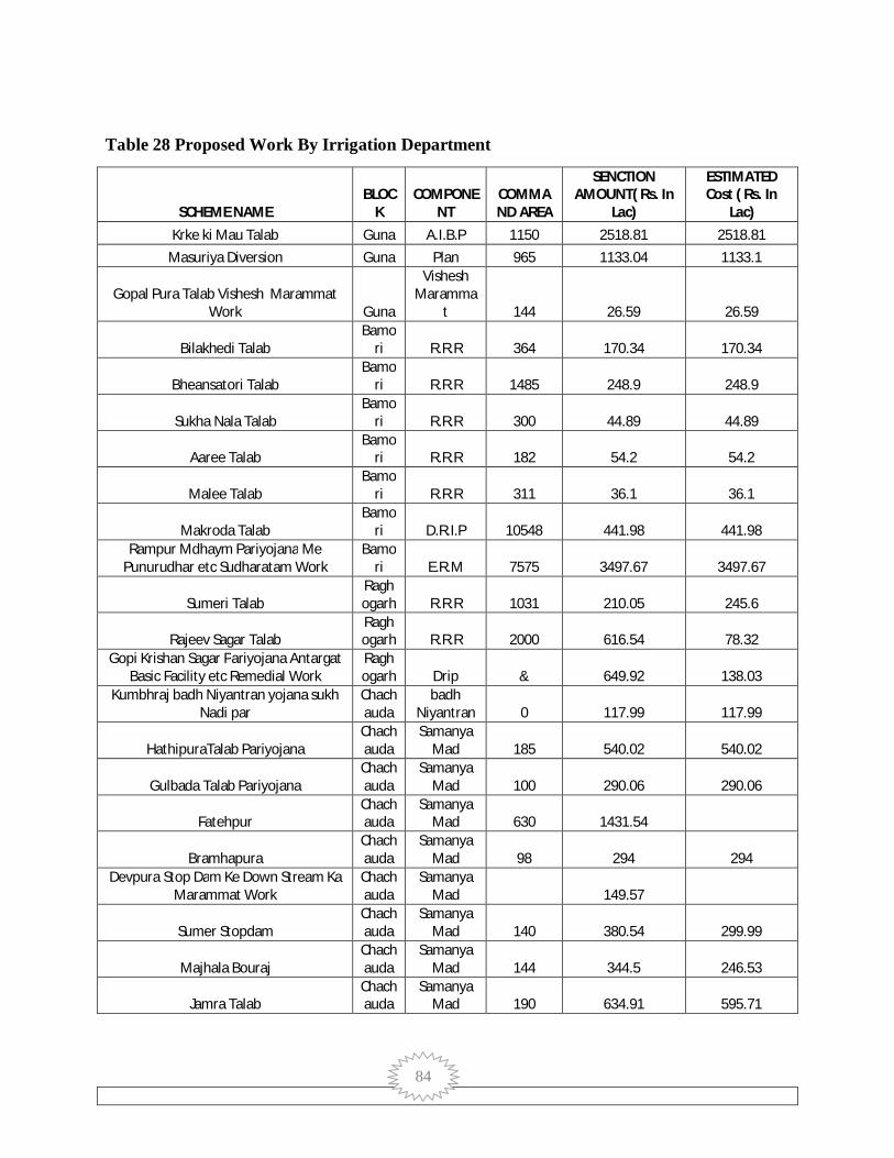
84
Table 28 Proposed Work By Irrigation Department
SCHEME NAME BLOC
K COMPONE
NT COMMAND AREA
SENCTION AMOUNT( Rs. In
Lac)
ESTIMATED Cost ( Rs. In
Lac) Krke ki Mau Talab Guna A.I.B.P 1150 2518.81 2518.81
Masuriya Diversion Guna Plan 965 1133.04 1133.1
Gopal Pura Talab Vishesh Marammat Work Guna
Vishesh Maramma
t 144 26.59 26.59
Bilakhedi Talab Bamo
ri R.R.R 364 170.34 170.34
Bheansatori Talab Bamo
ri R.R.R 1485 248.9 248.9
Sukha Nala Talab Bamo
ri R.R.R 300 44.89 44.89
Aaree Talab Bamo
ri R.R.R 182 54.2 54.2
Malee Talab Bamo
ri R.R.R 311 36.1 36.1
Makroda Talab Bamo
ri D.R.I.P 10548 441.98 441.98 Rampur Mdhaym Pariyojana Me
Punurudhar etc Sudharatam Work Bamo
ri E.R.M 7575 3497.67 3497.67
Sumeri Talab Raghogarh R.R.R 1031 210.05 245.6
Rajeev Sagar Talab Raghogarh R.R.R 2000 616.54 78.32
Gopi Krishan Sagar Pariyojana Antargat Basic Facility etc Remedial Work
Raghogarh Drip & 649.92 138.03
Kumbhraj badh Niyantran yojana sukh Nadi par
Chachauda
badh Niyantran 0 117.99 117.99
HathipuraTalab Pariyojana Chachauda
Samanya Mad 185 540.02 540.02
Gulbada Talab Pariyojana Chachauda
Samanya Mad 100 290.06 290.06
Fatehpur Chachauda
Samanya Mad 630 1431.54
Bramhapura Chachauda
Samanya Mad 98 294 294
Devpura Stop Dam Ke Down Stream Ka Marammat Work
Chachauda
Samanya Mad 149.57
Sumer Stopdam Chachauda
Samanya Mad 140 380.54 299.99
Majhala Bouraj Chachauda
Samanya Mad 144 344.5 246.53
Jamra Talab Chachauda
Samanya Mad 190 634.91 595.71

85
Following data provides water potential created if proposed strategic action plan is
implemented.
Table 29 Block Wise Component
Blocks Concerned Ministry/ Department Component Total
ARON DoLR-MoRD Convergence with MGNREGA 31426
PMKSY Watershed 6211 DoLR-MoRD Total 37637 MOA &FW- DAC&FW Per drop more crop (Micro Irrigation) 5770
Per drop more crop
(Supplementary water management activities)
3088
MOA &FW- DAC&FW Total 8858 MoWR AIBP 6328 Har khet ko pani 4430 MoWR Total 10758
Total 57253 BAMORI DoLR-MoRD Convergence with MGNREGA 46515
PMKSY Watershed
8213
DoLR-MoRD Total 54728 MOA &FW- DAC&FW Per drop more crop (Micro Irrigation) 3688
Per drop more crop
(Supplementary water management activities)
2076.75
MOA &FW- DAC&FW Total 5764.75 MoWR AIBP 3090.53 Har khet ko pani 1969 MoWR Total 5059.53
Total 65552.28 CHACHAUDA DoLR-MoRD Convergence with MGNREGA 19277
PMKSY Watershed
15118
DoLR-MoRD Total 34395 MOA &FW- DAC&FW Per drop more crop (Micro Irrigation) 8164

86
Per drop more crop
(Supplementary water management activities)
4228.25
MOA &FW- DAC&FW Total 12392.25 MoWR AIBP 2317 Har khet ko pani 3647 MoWR Total 5964
Total 52751.25 GUNA DoLR-MoRD Convergence with MGNREGA 38511
PMKSY Watershed 5475
DoLR-MoRD Total 43986 MOA &FW- DAC&FW Per drop more crop (Micro Irrigation) 2425
Per drop more crop
(Supplementary water management activities)
1587.5
MOA &FW- DAC&FW Total 4012.5 MoWR AIBP 2855.05 Har khet ko pani 1313 MoWR Total 4168.05
Total 52166.55 RAGHOGARH DoLR-MoRD Convergence with MGNREGA 31031
PMKSY Watershed 4585
DoLR-MoRD Total 35616 MOA &FW- DAC&FW Per drop more crop (Micro Irrigation) 2303
Per drop more crop
(Supplementary water management activities)
1306.5
MOA &FW- DAC&FW Total 3609.5 MoWR AIBP 2669 Har khet ko pani 1477 MoWR Total 4146
Total 43371.5 Grand Total 271094.58

87
Table 30 Component Wise Cost
Ministry/Department Estimated cost
(in Lakhs Rs.)
DoLR-MoRD 206362
MOA &FW- DAC&FW 34637
MoWR 30095.58
Grand Total 271094.58
Table 31 Block Wise Command Area Created
Blocks Command Area (ha.)
ARON 23653
BAMORI 25843
CHACHAUDA 27869
GUNA 26365
RAGHOGARH 22311
Grand Total 126041
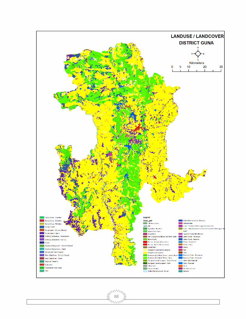
88
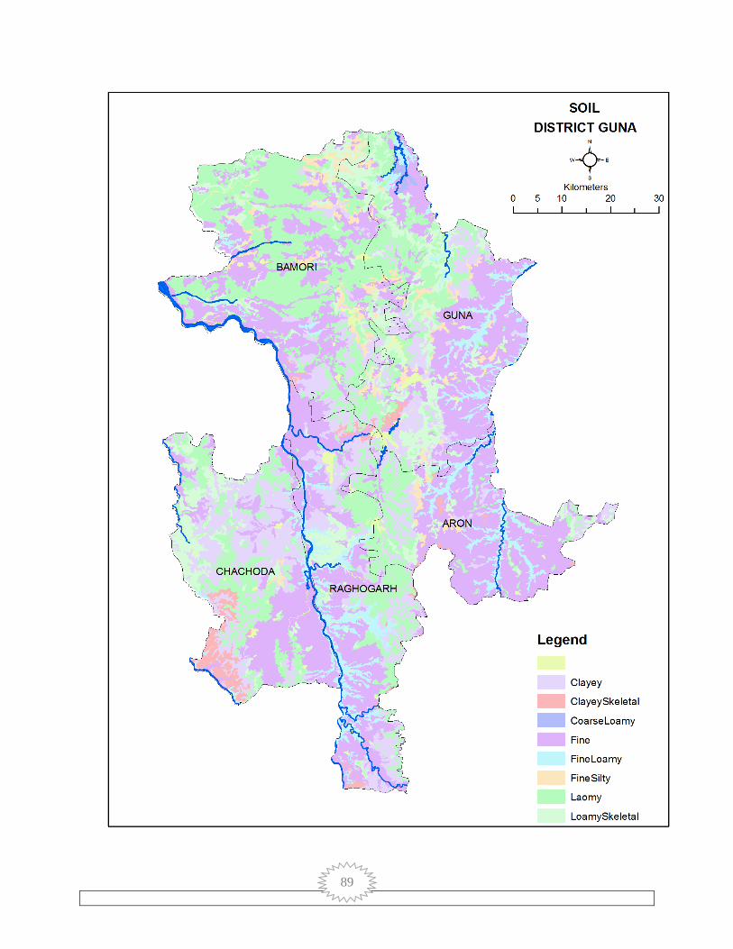
89

90
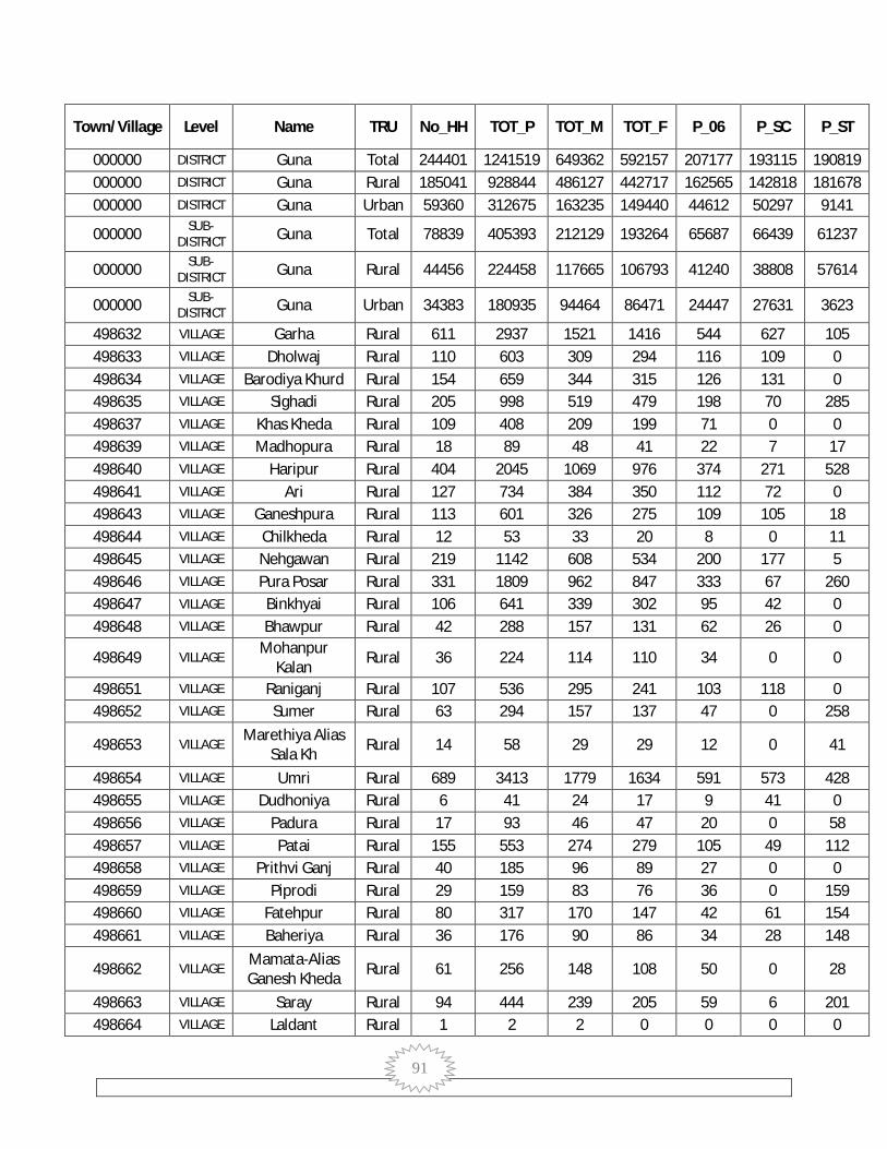
91
Town/Village Level Name TRU No_HH TOT_P TOT_M TOT_F P_06 P_SC P_ST
000000 DISTRICT Guna Total 244401 1241519 649362 592157 207177 193115 190819 000000 DISTRICT Guna Rural 185041 928844 486127 442717 162565 142818 181678 000000 DISTRICT Guna Urban 59360 312675 163235 149440 44612 50297 9141
000000 SUB-DISTRICT Guna Total 78839 405393 212129 193264 65687 66439 61237
000000 SUB-DISTRICT Guna Rural 44456 224458 117665 106793 41240 38808 57614
000000 SUB-DISTRICT Guna Urban 34383 180935 94464 86471 24447 27631 3623
498632 VILLAGE Garha Rural 611 2937 1521 1416 544 627 105 498633 VILLAGE Dholwaj Rural 110 603 309 294 116 109 0 498634 VILLAGE Barodiya Khurd Rural 154 659 344 315 126 131 0 498635 VILLAGE Sighadi Rural 205 998 519 479 198 70 285 498637 VILLAGE Khas Kheda Rural 109 408 209 199 71 0 0 498639 VILLAGE Madhopura Rural 18 89 48 41 22 7 17 498640 VILLAGE Haripur Rural 404 2045 1069 976 374 271 528 498641 VILLAGE Ari Rural 127 734 384 350 112 72 0 498643 VILLAGE Ganeshpura Rural 113 601 326 275 109 105 18 498644 VILLAGE Chilkheda Rural 12 53 33 20 8 0 11 498645 VILLAGE Nehgawan Rural 219 1142 608 534 200 177 5 498646 VILLAGE Pura Posar Rural 331 1809 962 847 333 67 260 498647 VILLAGE Binkhyai Rural 106 641 339 302 95 42 0 498648 VILLAGE Bhawpur Rural 42 288 157 131 62 26 0
498649 VILLAGE Mohanpur
Kalan Rural 36 224 114 110 34 0 0
498651 VILLAGE Raniganj Rural 107 536 295 241 103 118 0 498652 VILLAGE Sumer Rural 63 294 157 137 47 0 258
498653 VILLAGE Marethiya Alias
Sala Kh Rural 14 58 29 29 12 0 41
498654 VILLAGE Umri Rural 689 3413 1779 1634 591 573 428 498655 VILLAGE Dudhoniya Rural 6 41 24 17 9 41 0 498656 VILLAGE Padura Rural 17 93 46 47 20 0 58 498657 VILLAGE Patai Rural 155 553 274 279 105 49 112 498658 VILLAGE Prithvi Ganj Rural 40 185 96 89 27 0 0 498659 VILLAGE Piprodi Rural 29 159 83 76 36 0 159 498660 VILLAGE Fatehpur Rural 80 317 170 147 42 61 154 498661 VILLAGE Baheriya Rural 36 176 90 86 34 28 148
498662 VILLAGE Mamata-Alias Ganesh Kheda Rural 61 256 148 108 50 0 28
498663 VILLAGE Saray Rural 94 444 239 205 59 6 201 498664 VILLAGE Laldant Rural 1 2 2 0 0 0 0

92
498665 VILLAGE Amrohi Rural 141 875 441 434 185 0 762 498666 VILLAGE Kandhai Rural 27 193 100 93 49 0 193 498667 VILLAGE Kotra Rural 47 199 105 94 23 0 191 498668 VILLAGE Chak Deopur Rural 111 611 317 294 148 0 61
498669 VILLAGE Chak
Hanumatpura Rural 60 321 164 157 63 0 0
498670 VILLAGE Chandan Bhent Rural 33 228 108 120 64 25 200 498671 VILLAGE Tajpur Rural 21 117 59 58 20 0 117 498672 VILLAGE Deopur Rural 173 887 470 417 174 206 0 498673 VILLAGE Dhamkan Rural 19 116 52 64 26 0 116
498674 VILLAGE Pipal Khedi
(Umri) Rural 49 258 133 125 58 0 84
498675 VILLAGE Banna Kheda Rural 179 939 469 470 218 12 82 498676 VILLAGE Bawarauda Rural 169 854 438 416 157 18 11 498677 VILLAGE Bhidra Rural 120 576 295 281 120 0 256 498678 VILLAGE Bheron Ghhati Rural 221 1169 590 579 307 0 0 498679 VILLAGE Makrawada Rural 139 700 359 341 143 95 0 498680 VILLAGE Makraudi Rural 58 268 145 123 65 0 184 498681 VILLAGE Mali (Umri) Rural 51 335 165 170 67 0 153 498682 VILLAGE Hathi Khudam Rural 92 458 258 200 73 1 337
498683 VILLAGE Miyanwalijhiriya Alias nayagaon Rural 27 184 103 81 40 0 27
498684 VILLAGE Ratanpura
(Umri) Rural 74 404 216 188 69 123 0
498685 VILLAGE Hanumatpura Rural 15 67 38 29 14 7 0 498686 VILLAGE Kheri Khata Rural 272 1435 712 723 333 12 1331 498687 VILLAGE Tanda Rural 125 785 400 385 234 3 757 498688 VILLAGE Naghera Rural 92 479 251 228 117 0 467
498689 VILLAGE Patana
(Bhadora) Rural 78 353 179 174 80 0 201
498690 VILLAGE Bagoniya Rural 138 775 391 384 196 0 743 498691 VILLAGE Bandha Rural 114 574 289 285 125 0 421 498692 VILLAGE Biroli Rural 110 502 262 240 116 3 471
498693 VILLAGE Biloda
(Bhadora) Rural 88 460 240 220 110 0 458
498694 VILLAGE Mahodra Rural 339 1994 1013 981 517 2 1972 498695 VILLAGE Rai Rural 201 964 484 480 241 0 953 498696 VILLAGE Sherpur Rural 42 187 102 85 47 0 0 498697 VILLAGE Hastnapur Rural 28 161 86 75 31 0 160 498698 VILLAGE Ikodiya (Sisri) Rural 121 510 275 235 100 0 507 498699 VILLAGE Udaipri Rural 126 772 394 378 183 0 771 498700 VILLAGE Kherar Kheda Rural 55 238 129 109 49 0 235 498701 VILLAGE Gadariya Rural 83 535 263 272 103 0 535

93
Kondar 498702 VILLAGE Ganeshkheda Rural 42 285 129 156 81 0 285 498703 VILLAGE Chhinaira Rural 15 78 38 40 14 0 78 498704 VILLAGE Jalampur Rural 148 890 462 428 220 0 873 498705 VILLAGE Tilwara Rural 71 352 171 181 73 25 289 498706 VILLAGE Dinola Rural 76 507 242 265 108 0 406 498707 VILLAGE Nakatpur Rural 107 404 201 203 85 0 404 498708 VILLAGE Pipriya (Sirsi) Rural 143 858 454 404 169 11 838 498709 VILLAGE Barodiya (Sirsi) Rural 90 444 225 219 119 0 417 498710 VILLAGE Marki Mahu Rural 631 3156 1639 1517 625 464 1350
498711 VILLAGE Myapur Alias
Dhanwadi Rural 161 711 363 348 145 1 659
498712 VILLAGE Sangai Rural 51 263 139 124 66 0 263 498713 VILLAGE Ajit Kheda Rural 31 212 102 110 33 0 212 498714 VILLAGE Atakhedi Rural 32 188 102 86 37 0 188 498715 VILLAGE Kalchheri Rural 116 629 309 320 135 0 628 498716 VILLAGE Karnawata Rural 76 384 192 192 75 45 329 498717 VILLAGE Kilampur Rural 95 488 223 265 65 0 463
498719 VILLAGE Nayagaon Alias
Paronda Rural 169 671 346 325 147 45 510
498721 VILLAGE Budera Rural 29 124 65 59 24 0 124 498722 VILLAGE Barbatu Rural 45 180 95 85 34 0 171 498723 VILLAGE Bharatpur Rural 27 129 64 65 20 8 121 498724 VILLAGE Rehpura Rural 157 787 414 373 158 4 781 498725 VILLAGE Saloda Rural 68 251 130 121 37 0 85 498726 VILLAGE Suator Rural 229 1319 680 639 302 1 1313 498727 VILLAGE Sighhariya Rural 31 165 90 75 29 0 165
498728 VILLAGE Hanumat Kheda
(Sirsi) Rural 115 495 241 254 110 0 484
498729 VILLAGE Karke Ki Mahu Rural 126 685 342 343 136 170 103 498730 VILLAGE Karili Rural 143 778 392 386 142 0 773 498732 VILLAGE Khiriya (Sirsi) Rural 26 192 109 83 52 0 192 498733 VILLAGE Chak Porkho Rural 30 135 60 75 35 0 116 498734 VILLAGE Chentbari Rural 51 306 150 156 53 0 306 498735 VILLAGE Chidrau Rural 65 206 113 93 30 0 204 498736 VILLAGE Jamdera Rural 51 307 145 162 78 0 307 498737 VILLAGE Tarapur Rural 95 592 296 296 151 0 592 498738 VILLAGE Deogarh Rural 165 790 411 379 137 0 777 498739 VILLAGE Nagda Rural 154 649 338 311 114 122 250 498740 VILLAGE Barkheda (Sirsi) Rural 86 368 186 182 99 0 368 498741 VILLAGE Berkhedi (Sirsi) Rural 74 309 163 146 56 0 309 498742 VILLAGE Porkho Rural 63 318 160 158 86 0 307

94
498743 VILLAGE Madai Rural 95 529 272 257 140 8 468 498744 VILLAGE Mehra Rural 12 61 31 30 4 0 61 498745 VILLAGE Sirsi Rural 319 1441 784 657 221 82 624 498746 VILLAGE Ladakheda Rural 110 446 228 218 91 0 441 498747 VILLAGE Akloun Rural 73 425 208 217 111 41 169 498748 VILLAGE Badi Kanthi Rural 35 205 106 99 44 0 0 498749 VILLAGE Chhoti Kanthi Rural 67 378 203 175 82 0 377 498750 VILLAGE Chandera Rural 35 210 112 98 26 0 118 498751 VILLAGE Dastoli Ghhat Rural 68 352 188 164 70 0 113 498752 VILLAGE Dastoli Ber Rural 103 524 270 254 95 148 89 498753 VILLAGE Badera Rural 146 652 361 291 149 47 550 498754 VILLAGE Banskhedi (Sirsi) Rural 70 360 189 171 99 0 360 498755 VILLAGE Musredi Rural 111 573 297 276 110 0 527 498756 VILLAGE Majhola Rural 100 486 226 260 110 15 332 498757 VILLAGE Ratanpur Rural 94 473 242 231 74 0 473 498758 VILLAGE Rajela Rural 29 163 83 80 31 82 2 498759 VILLAGE Sandkheda Rural 143 972 533 439 137 188 171 498760 VILLAGE Sanwada Rural 183 996 532 464 153 143 289 498761 VILLAGE Kundora Rural 117 673 349 324 142 0 375 498762 VILLAGE Gomchi Kheda Rural 71 331 167 164 70 2 320 498763 VILLAGE Chirkheda Rural 68 376 198 178 53 0 0 498764 VILLAGE Tinsyai Rural 202 1108 585 523 187 138 164 498765 VILLAGE Durgapur Rural 151 848 448 400 195 0 842 498766 VILLAGE Basar Rural 97 629 346 283 137 34 449 498767 VILLAGE Morkhedi Rural 85 434 223 211 80 423 1 498768 VILLAGE Singpur Rural 109 693 350 343 147 234 87 498769 VILLAGE Singhar-Pur Rural 64 512 264 248 133 72 353
498770 VILLAGE Haripur (Myana) Rural 41 226 118 108 31 0 226
498771 VILLAGE Hansalpur Rural 31 203 98 105 56 0 203
498772 VILLAGE Hirnoda (Myana) Rural 52 281 158 123 63 8 0
498773 VILLAGE Kala Pahad Rural 73 438 237 201 111 0 415 498774 VILLAGE Gadla Rural 108 591 311 280 143 0 590 498775 VILLAGE Khajuri Rural 195 1195 658 537 170 261 28 498776 VILLAGE Takanera Rural 799 4354 2284 2070 857 945 355
498777 VILLAGE Shahpur (Myana) Rural 112 703 367 336 99 247 0
498778 VILLAGE Khonkar Rural 196 981 505 476 141 249 16 498779 VILLAGE Nasira Rural 209 838 428 410 168 220 327 498780 VILLAGE Padaman Khedi Rural 141 690 353 337 88 0 0 498781 VILLAGE Banskhedi Rural 147 547 289 258 115 108 231

95
(Myana) 498782 VILLAGE Richhai Rural 106 412 209 203 73 0 0 498783 VILLAGE Lahar Ghat Rural 113 537 279 258 86 67 0 498784 VILLAGE Sendhua Rural 135 763 386 377 144 312 3 498785 VILLAGE Myana Rural 1516 8247 4285 3962 1341 1255 26 498786 VILLAGE Chak Madhopur Rural 209 884 452 432 203 74 469 498787 VILLAGE Dungasara Rural 489 2190 1130 1060 359 528 214 498788 VILLAGE Pali Rural 47 320 149 171 69 1 274 498789 VILLAGE Madhopur Rural 16 81 44 37 13 0 7 498790 VILLAGE Agara Rural 117 634 339 295 140 17 598 498791 VILLAGE Jhiroli Rural 45 251 128 123 51 0 249 498792 VILLAGE Tajpur Rural 30 168 84 84 41 0 167 498793 VILLAGE Piproda Rural 42 171 82 89 31 1 160 498794 VILLAGE Bhadora Rural 838 3822 1990 1832 647 997 811 498795 VILLAGE Sartala Rural 62 379 197 182 95 0 373 498796 VILLAGE Hansli Rural 55 310 159 151 66 1 216 498797 VILLAGE Khargpur Rural 102 545 263 282 146 0 495 498798 VILLAGE Dunai Rural 66 337 173 164 54 18 0 498799 VILLAGE Dhamnar Rural 461 2497 1324 1173 390 880 1 498800 VILLAGE Raipur Rural 22 137 72 65 40 2 135 498801 VILLAGE Sutai Rural 6 31 15 16 5 0 0 498802 VILLAGE Khutiyawad Rural 445 2072 1093 979 277 685 1 498803 VILLAGE Gwar Kheda Rural 43 231 114 117 26 0 0 498804 VILLAGE Minkhiya Rural 70 413 228 185 75 224 3 498805 VILLAGE Lahar Kota Rural 143 920 481 439 175 170 350 498806 VILLAGE Gajipur Rural 232 959 487 472 166 242 0 498807 VILLAGE Jamra Rural 282 1134 580 554 171 251 3 498808 VILLAGE Barkheda Sapha Rural 173 828 438 390 160 358 1 498809 VILLAGE Sagoriya Rural 255 1379 733 646 251 231 334 498810 VILLAGE Andela Rural 7 31 16 15 3 29 0 498811 VILLAGE Ahamedpur Rural 81 415 213 202 77 28 0 498812 VILLAGE Poonam Khedi Rural 180 994 520 474 146 323 0 498813 VILLAGE Manpur Rural 155 785 419 366 122 239 16 498814 VILLAGE Hinotiya Rural 283 1484 762 722 275 480 210 498815 VILLAGE Padariya Rural 179 687 384 303 70 299 0 498816 VILLAGE Kundol Rural 192 896 472 424 119 182 11 498817 VILLAGE Doshpur Rural 73 402 208 194 37 108 0 498818 VILLAGE Magrana Rural 327 1563 824 739 213 124 228 498819 VILLAGE Ukawad Rural 297 1638 868 770 203 426 14 498820 VILLAGE Gajnai Rural 330 1581 782 799 268 388 0 498821 VILLAGE Gopalpur Rural 113 597 325 272 115 91 0
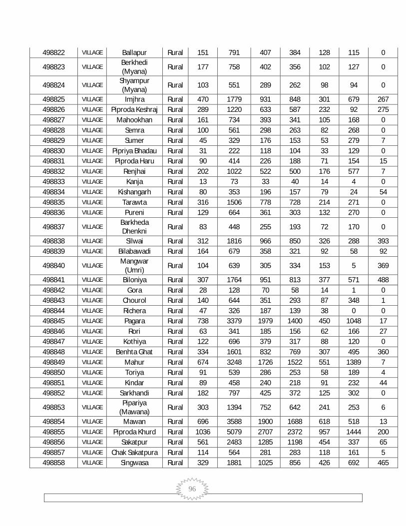
96
498822 VILLAGE Ballapur Rural 151 791 407 384 128 115 0
498823 VILLAGE Berkhedi (Myana) Rural 177 758 402 356 102 127 0
498824 VILLAGE Shyampur (Myana) Rural 103 551 289 262 98 94 0
498825 VILLAGE Imjhra Rural 470 1779 931 848 301 679 267 498826 VILLAGE Piproda Keshraj Rural 289 1220 633 587 232 92 275 498827 VILLAGE Mahookhan Rural 161 734 393 341 105 168 0 498828 VILLAGE Semra Rural 100 561 298 263 82 268 0 498829 VILLAGE Sumer Rural 45 329 176 153 53 279 7 498830 VILLAGE Pipriya Bhadau Rural 31 222 118 104 33 129 0 498831 VILLAGE Piproda Haru Rural 90 414 226 188 71 154 15 498832 VILLAGE Renjhai Rural 202 1022 522 500 176 577 7 498833 VILLAGE Kanja Rural 13 73 33 40 14 4 0 498834 VILLAGE Kishangarh Rural 80 353 196 157 79 24 54 498835 VILLAGE Tarawta Rural 316 1506 778 728 214 271 0 498836 VILLAGE Pureni Rural 129 664 361 303 132 270 0
498837 VILLAGE Barkheda Dhenkni Rural 83 448 255 193 72 170 0
498838 VILLAGE Silwai Rural 312 1816 966 850 326 288 393 498839 VILLAGE Bilabawadi Rural 164 679 358 321 92 58 92
498840 VILLAGE Mangwar
(Umri) Rural 104 639 305 334 153 5 369
498841 VILLAGE Biloniya Rural 307 1764 951 813 377 571 488 498842 VILLAGE Gora Rural 28 128 70 58 14 1 0 498843 VILLAGE Chourol Rural 140 644 351 293 87 348 1 498844 VILLAGE Richera Rural 47 326 187 139 38 0 0 498845 VILLAGE Pagara Rural 738 3379 1979 1400 450 1048 17 498846 VILLAGE Rori Rural 63 341 185 156 62 166 27 498847 VILLAGE Kothiya Rural 122 696 379 317 88 120 0 498848 VILLAGE Benhta Ghat Rural 334 1601 832 769 307 495 360 498849 VILLAGE Mahur Rural 674 3248 1726 1522 551 1389 7 498850 VILLAGE Toriya Rural 91 539 286 253 58 189 4 498851 VILLAGE Kindar Rural 89 458 240 218 91 232 44 498852 VILLAGE Sarkhandi Rural 182 797 425 372 125 302 0
498853 VILLAGE Pipariya
(Mawana) Rural 303 1394 752 642 241 253 6
498854 VILLAGE Mawan Rural 696 3588 1900 1688 618 518 13 498855 VILLAGE Piproda Khurd Rural 1036 5079 2707 2372 957 1444 200 498856 VILLAGE Sakatpur Rural 561 2483 1285 1198 454 337 65 498857 VILLAGE Chak Sakatpura Rural 114 564 281 283 118 161 5 498858 VILLAGE Singwasa Rural 329 1881 1025 856 426 692 465

97
498859 VILLAGE Binayak Khedi Rural 480 2256 1186 1070 545 549 883 498860 VILLAGE Muhalpur Rural 219 1506 787 719 243 403 0 498861 VILLAGE Mahoogarha Rural 222 996 528 468 176 162 43 498862 VILLAGE Bamoribugurj Rural 171 771 395 376 124 77 0 498863 VILLAGE Sojna Rural 178 1186 780 406 147 151 190 498864 VILLAGE Gader Rural 217 1074 559 515 221 22 891 498865 VILLAGE Panj Rural 94 535 281 254 96 1 14 498866 VILLAGE Jaitpur Rural 57 231 114 117 49 63 0 498867 VILLAGE Borkheda Gird Rural 34 259 144 115 62 0 0 498868 VILLAGE Mitepura Rural 37 170 86 84 47 0 107 498869 VILLAGE Sonthi Rural 93 533 282 251 101 3 129 498870 VILLAGE Hirapur Rural 36 168 89 79 29 11 131 498871 VILLAGE Hilagna Rural 256 1175 615 560 174 79 166 498876 VILLAGE Bajrangarh Rural 1840 7955 4110 3845 1345 1605 710 498877 VILLAGE Okhari Khedi Rural 17 72 40 32 15 0 0 498878 VILLAGE Gadla Gird Rural 218 857 457 400 208 0 820 498879 VILLAGE Deori Dang Rural 162 684 364 320 164 0 471 498880 VILLAGE Jhir Rural 64 289 145 144 59 0 1 498881 VILLAGE Nohar Rural 108 474 245 229 107 0 0 498882 VILLAGE Dhur Dhuru Rural 81 388 207 181 63 37 0 498883 VILLAGE Mirjapur Rural 54 211 119 92 47 40 0 498884 VILLAGE Gid Khoh Rural 125 533 268 265 124 0 34 498885 VILLAGE Bhilera Rural 90 353 182 171 88 11 303 498886 VILLAGE Jeta Dongar Rural 22 127 65 62 21 46 0 498887 VILLAGE Anandpur Rural 76 410 206 204 96 4 388 498888 VILLAGE Kankra Rural 24 122 59 63 22 11 8
498889 VILLAGE Gopalpur Taktaiya Rural 91 442 235 207 76 123 0
498890 VILLAGE Genhu Kheda
Gird Rural 165 898 465 433 139 164 107
498891 VILLAGE Chandol Rural 81 468 250 218 89 71 0 498892 VILLAGE Badli Rural 49 253 132 121 46 0 0 498893 VILLAGE Benhta Jhir Rural 118 764 429 335 163 244 111 498894 VILLAGE Khejra (Guna) Rural 420 2243 1228 1015 378 323 0 498895 VILLAGE Nensuhaya Rural 80 438 232 206 76 68 4 498896 VILLAGE Pita Khedi Rural 47 261 131 130 53 17 4 498897 VILLAGE Piproda Kalan Rural 136 755 404 351 141 514 7 498898 VILLAGE Mohari Rural 93 488 250 238 121 291 0 498899 VILLAGE Karod Rural 526 2986 1574 1412 436 808 10 498900 VILLAGE Ikodiya Rural 118 662 351 311 89 252 0 498901 VILLAGE Khiriya Gird Rural 80 415 230 185 63 124 0 498902 VILLAGE Deurimar Rural 136 655 339 316 84 283 11
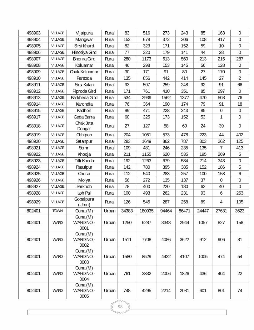
98
498903 VILLAGE Vijaipura Rural 83 516 273 243 85 163 0 498904 VILLAGE Mangwar Rural 152 678 372 306 108 417 0 498905 VILLAGE Sirsi Khurd Rural 82 323 171 152 59 10 0 498906 VILLAGE Hinotiya Gird Rural 77 320 179 141 44 28 0 498907 VILLAGE Bhonra Gird Rural 280 1173 613 560 213 215 287 498908 VILLAGE Koluamar Rural 46 298 153 145 56 128 0 498909 VILLAGE Chak-Koluamar Rural 30 171 91 80 27 170 0 498910 VILLAGE Parsoda Rural 135 856 442 414 145 27 2 498911 VILLAGE Sirsi Kalan Rural 93 507 259 248 92 91 66 498912 VILLAGE Piproda Gird Rural 171 761 410 351 85 297 0 498913 VILLAGE Barkheda Gird Rural 534 2939 1562 1377 470 508 76 498914 VILLAGE Karondia Rural 76 364 190 174 79 91 18 498915 VILLAGE Kadhon Rural 99 471 228 243 85 0 0 498917 VILLAGE Geda Barra Rural 60 325 173 152 53 1 0
498918 VILLAGE Chak Jeta Dongar Rural 27 127 58 69 24 39 0
498919 VILLAGE Chhipon Rural 204 1051 573 478 223 44 402 498920 VILLAGE Satanpur Rural 283 1649 862 787 303 262 125 498921 VILLAGE Semri Rural 109 481 246 235 135 7 413 498922 VILLAGE Khooja Rural 211 1155 620 535 195 269 5 498923 VILLAGE Tilli Kheda Rural 192 1263 679 584 214 343 0 498924 VILLAGE Rasulpur Rural 142 780 395 385 152 186 5 498925 VILLAGE Chorai Rural 112 540 283 257 100 158 6 498926 VILLAGE Moiya Rural 56 272 135 137 37 0 0 498927 VILLAGE Sarkhoh Rural 78 400 220 180 62 40 0 498928 VILLAGE Loh Pal Rural 100 493 262 231 93 6 253
498929 VILLAGE Gopalpura
(Umri) Rural 126 545 287 258 89 4 105
802401 TOWN Guna (M) Urban 34383 180935 94464 86471 24447 27631 3623
802401 WARD Guna (M)
WARD NO.-0001
Urban 1250 6287 3343 2944 1057 827 158
802401 WARD Guna (M)
WARD NO.-0002
Urban 1511 7708 4086 3622 912 906 81
802401 WARD Guna (M)
WARD NO.-0003
Urban 1580 8529 4422 4107 1005 474 54
802401 WARD Guna (M)
WARD NO.-0004
Urban 761 3832 2006 1826 436 404 22
802401 WARD Guna (M)
WARD NO.-0005
Urban 748 4295 2214 2081 601 801 74

99
802401 WARD Guna (M)
WARD NO.-0006
Urban 630 3437 1779 1658 417 276 5
802401 WARD Guna (M)
WARD NO.-0007
Urban 1001 5544 2914 2630 894 867 26
802401 WARD Guna (M)
WARD NO.-0008
Urban 1659 9139 4793 4346 1540 1330 93
802401 WARD Guna (M)
WARD NO.-0009
Urban 407 2169 1084 1085 219 382 8
802401 WARD Guna (M)
WARD NO.-0010
Urban 581 3301 1694 1607 367 389 6
802401 WARD Guna (M)
WARD NO.-0011
Urban 302 1677 871 806 184 184 18
802401 WARD Guna (M)
WARD NO.-0012
Urban 391 2103 1084 1019 205 36 7
802401 WARD Guna (M)
WARD NO.-0013
Urban 363 2033 1039 994 217 6 0
802401 WARD Guna (M)
WARD NO.-0014
Urban 431 2133 1111 1022 191 67 5
802401 WARD Guna (M)
WARD NO.-0015
Urban 318 1832 928 904 179 33 0
802401 WARD Guna (M)
WARD NO.-0016
Urban 583 2998 1527 1471 301 119 17
802401 WARD Guna (M)
WARD NO.-0017
Urban 410 1999 1046 953 181 44 5
802401 WARD Guna (M)
WARD NO.-0018
Urban 1154 6263 3274 2989 853 586 11
802401 WARD Guna (M)
WARD NO.-0019
Urban 997 5319 2782 2537 935 664 17
802401 WARD Guna (M)
WARD NO.-0020
Urban 2594 13242 7002 6240 1809 1074 358
802401 WARD Guna (M)
WARD NO.- Urban 1104 5368 2770 2598 600 225 19

100
0021
802401 WARD Guna (M)
WARD NO.-0022
Urban 951 4881 2623 2258 611 1293 62
802401 WARD Guna (M)
WARD NO.-0023
Urban 1287 6714 3526 3188 1101 2400 310
802401 WARD Guna (M)
WARD NO.-0024
Urban 1369 7180 3780 3400 1163 2648 260
802401 WARD Guna (M)
WARD NO.-0025
Urban 929 4642 2418 2224 697 1794 197
802401 WARD Guna (M)
WARD NO.-0026
Urban 517 2818 1413 1405 349 196 3
802401 WARD Guna (M)
WARD NO.-0027
Urban 650 3191 1632 1559 347 475 56
802401 WARD Guna (M)
WARD NO.-0028
Urban 786 3923 2051 1872 457 271 80
802401 WARD Guna (M)
WARD NO.-0029
Urban 1932 10301 5432 4869 1583 2084 141
802401 WARD Guna (M)
WARD NO.-0030
Urban 681 3640 1834 1806 585 872 25
802401 WARD Guna (M)
WARD NO.-0031
Urban 1011 4912 2536 2376 556 230 569
802401 WARD Guna (M)
WARD NO.-0032
Urban 529 2795 1433 1362 240 150 51
802401 WARD Guna (M)
WARD NO.-0033
Urban 505 2440 1295 1145 240 175 37
802401 WARD Guna (M)
WARD NO.-0034
Urban 890 5079 2576 2503 688 872 1
802401 WARD Guna (M)
WARD NO.-0035
Urban 2255 12114 6398 5716 1866 2466 694
802401 WARD Guna (M)
WARD NO.-0036
Urban 578 3032 1627 1405 358 532 46
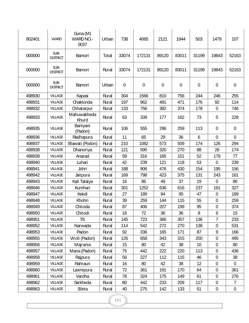
101
802401 WARD Guna (M)
WARD NO.-0037
Urban 738 4065 2121 1944 503 1479 107
000000 SUB-DISTRICT Bamori Total 33074 172131 89120 83011 31199 19843 52163
000000 SUB-DISTRICT Bamori Rural 33074 172131 89120 83011 31199 19843 52163
000000 SUB-DISTRICT Bamori Urban 0 0 0 0 0 0 0
498930 VILLAGE Kapasi Rural 304 1566 810 756 244 246 255 498931 VILLAGE Chaklonda Rural 197 962 491 471 176 92 114 498932 VILLAGE Chhatarpur Rural 133 756 382 374 178 0 746
498933 VILLAGE Mahuwakheda
Khurd Rural 63 339 177 162 73 0 228
498935 VILLAGE Baniyani (Padon) Rural 106 555 296 259 113 0 0
498936 VILLAGE Radhapura Rural 11 65 29 36 6 0 0 498937 VILLAGE Silawati (Podon) Rural 210 1082 573 509 174 126 294 498938 VILLAGE Dhanoriya Rural 121 590 320 270 88 26 174 498939 VILLAGE Anarad Rural 59 316 165 151 52 179 77 498940 VILLAGE Luhari Rural 42 239 121 118 53 0 239 498941 VILLAGE Johri Rural 188 906 476 430 154 195 156 498942 VILLAGE Jaitpura Rural 169 798 423 375 131 243 161 498943 VILLAGE Kali Talaiya Rural 16 86 49 37 19 0 86 498946 VILLAGE Kumhari Rural 301 1252 636 616 237 161 327 498947 VILLAGE Kekdi Rural 27 189 94 95 47 0 189 498948 VILLAGE Khohri Rural 39 259 144 115 55 0 259 498949 VILLAGE Chitoda Rural 87 406 207 199 95 0 374 498950 VILLAGE Chitodi Rural 16 72 36 36 8 6 15 498951 VILLAGE Tili Rural 145 723 366 357 136 7 233 498952 VILLAGE Narwada Rural 114 542 272 270 138 0 531 498953 VILLAGE Padon Rural 92 336 165 171 87 9 166 498955 VILLAGE Viroli (Padon) Rural 126 658 343 315 200 0 495 498956 VILLAGE Majrania Rural 15 80 42 38 10 0 80 498957 VILLAGE Mana (Padon) Rural 75 442 222 220 113 0 436 498958 VILLAGE Rajpura Rural 56 227 112 115 46 0 38 498959 VILLAGE Rahraun Rural 16 80 42 38 12 0 0 498960 VILLAGE Laxmipura Rural 72 361 191 170 64 0 361 498961 VILLAGE Vardha Rural 78 324 175 149 61 0 276 498962 VILLAGE Sarkheda Rural 80 442 233 209 117 0 7 498963 VILLAGE Sileta Rural 40 275 142 133 51 0 0

102
498966 VILLAGE Karra Kheda Rural 193 1014 526 488 245 39 954 498967 VILLAGE Chakari Rural 128 794 414 380 223 0 794 498968 VILLAGE Chhikari Rural 114 686 349 337 139 0 686 498969 VILLAGE Paronda Rural 43 242 115 127 69 0 242 498970 VILLAGE Barwan Rural 214 1245 640 605 212 278 329 498971 VILLAGE Baghuriya Rural 228 1155 618 537 214 338 584 498972 VILLAGE Ratwara Rural 100 515 260 255 138 72 438 498973 VILLAGE Bishnwada Rural 472 2340 1232 1108 400 279 484 498974 VILLAGE Dehri (Bamori) Rural 124 816 386 430 166 9 807
498975 VILLAGE Barkheda (Bamori) Rural 71 465 221 244 108 0 456
498976 VILLAGE Pura Luhari Rural 41 299 149 150 81 0 297 498977 VILLAGE Luhari Rural 39 229 119 110 54 0 229 498978 VILLAGE Kisanpur Barkui Rural 34 202 102 100 47 0 185 498979 VILLAGE Patan Rural 134 717 365 352 109 130 0 498980 VILLAGE Banskhedi Rural 87 552 295 257 83 52 376 498981 VILLAGE Gadlamar Rural 33 215 105 110 33 1 214 498985 VILLAGE Saretha Rural 27 134 68 66 18 0 1 498986 VILLAGE Gopalpur Rural 71 438 220 218 87 0 438 498988 VILLAGE Gehun Kheda Rural 71 470 248 222 110 0 470 498989 VILLAGE Nagphani Saliya Rural 136 630 326 304 105 56 146 498990 VILLAGE Vithalpur Rural 123 667 363 304 80 189 160 498991 VILLAGE Bhotupura Rural 152 866 447 419 125 66 751 498992 VILLAGE Dongri Rural 136 1022 520 502 252 0 1013 498993 VILLAGE Salaiya Rai Rural 85 502 257 245 90 2 495 498994 VILLAGE Gadala Ujari Rural 294 1759 912 847 287 593 363 498996 VILLAGE Kusun Khoh Rural 73 478 236 242 90 0 478 498997 VILLAGE Sonkhara Rural 277 1573 825 748 267 321 170 498998 VILLAGE Kawar Bamori Rural 178 1107 573 534 194 39 666 498999 VILLAGE Dibiya Manpur Rural 116 750 377 373 137 294 0
499001 VILLAGE Baraudiya (Bamori) Rural 169 1062 543 519 155 84 217
499002 VILLAGE Kharra Kheda Rural 139 832 434 398 154 126 176 499003 VILLAGE Dhimar Pura Rural 193 996 512 484 195 182 447
499004 VILLAGE Dumawan (Bamori) Rural 185 1178 603 575 264 3 1174
499005 VILLAGE Paranth Rural 319 1793 965 828 270 271 484 499006 VILLAGE Dehra Rural 177 1069 533 536 231 30 817 499007 VILLAGE Morkhedi Rural 58 311 150 161 80 0 311 499009 VILLAGE Kakarua Dang Rural 57 307 156 151 63 0 306 499010 VILLAGE Ata Khedi Rural 101 758 375 383 173 0 756 499011 VILLAGE Nonpura Rural 91 530 271 259 89 67 0

103
499012 VILLAGE Hinotiya Rural 48 265 134 131 51 0 121 499013 VILLAGE Dongarpur Rural 142 955 484 471 187 55 300 499014 VILLAGE Kherla Rural 244 1530 788 742 238 303 266 499018 VILLAGE Akoda Rural 240 1178 625 553 231 94 430 499019 VILLAGE Khadela Rural 268 1457 771 686 243 193 153 499020 VILLAGE Badanpur Rural 39 283 150 133 53 0 283 499021 VILLAGE Bhensatori Rural 51 309 167 142 66 0 309 499022 VILLAGE Bagheri Rural 104 653 333 320 137 118 110 499023 VILLAGE Nonera Rural 273 1428 737 691 279 198 344 499024 VILLAGE Khutiyari Rural 108 658 340 318 119 49 184 499025 VILLAGE Muhal Kaloni Rural 978 4640 2383 2257 759 617 1112 499026 VILLAGE Panchora Rural 268 1146 589 557 192 177 188 499027 VILLAGE Darawla Rural 138 695 363 332 90 0 0 499028 VILLAGE Rampur Rural 225 828 387 441 118 277 62 499029 VILLAGE Shyampur Rural 105 534 283 251 91 56 165 499030 VILLAGE Ukawad Khurd Rural 124 719 375 344 133 114 49 499031 VILLAGE Khairoda Rural 36 260 131 129 65 1 256 499032 VILLAGE Bilauda Rural 66 388 206 182 49 113 5 499033 VILLAGE Ukawad Kalan Rural 236 1047 556 491 150 210 60 499034 VILLAGE Dongar Khedi Rural 85 390 193 197 63 4 71 499035 VILLAGE Bamori Rural 1123 5465 2875 2590 961 909 794 499036 VILLAGE Prayagpur Rural 22 129 71 58 39 0 129 499037 VILLAGE Karamda Rural 84 472 245 227 96 76 299 499038 VILLAGE Karamdi Rural 54 324 156 168 64 0 324 499040 VILLAGE Jhumka Rural 139 778 408 370 172 10 106 499041 VILLAGE Gwarkheda Rural 145 798 419 379 145 24 196 499042 VILLAGE Tuiya Kheda Rural 59 369 200 169 68 13 40 499043 VILLAGE Doharda Rural 89 509 261 248 108 111 158 499044 VILLAGE Panehti Rural 219 1146 604 542 253 24 638 499045 VILLAGE Bongla Rural 26 153 81 72 38 0 153 499046 VILLAGE Madhi Kheda Rural 82 484 248 236 126 1 481 499047 VILLAGE Machhriya Rural 134 707 359 348 120 59 0 499050 VILLAGE Londera Rural 186 988 523 465 165 99 210 499051 VILLAGE Kalora Rural 310 1643 840 803 325 277 596 499052 VILLAGE Umrdha Rural 103 513 269 244 96 69 134 499053 VILLAGE Ganeshpura Rural 98 550 269 281 90 108 111 499054 VILLAGE Kudka Rural 61 333 165 168 55 45 64 499055 VILLAGE Tumada Rural 68 363 199 164 61 60 93 499056 VILLAGE Bandha Rural 52 310 169 141 68 0 159 499057 VILLAGE Bhidra Rural 231 1182 586 596 225 53 245 499058 VILLAGE Pipal Khedi Rural 18 89 41 48 22 0 89

104
499059 VILLAGE Fatehgarh Rural 917 4391 2256 2135 683 629 655 499060 VILLAGE Bawadi Kheda Rural 129 727 376 351 123 165 48 499061 VILLAGE Bilkheda Rural 199 1007 507 500 216 426 3 499062 VILLAGE Jhiri Rural 261 1085 549 536 179 418 0 499064 VILLAGE Mamla Rural 149 749 390 359 148 41 93 499065 VILLAGE Jageswari Rural 126 620 320 300 120 156 0 499066 VILLAGE Dobra Rural 100 489 255 234 90 0 280 499068 VILLAGE Digdoli Rural 158 1057 530 527 260 0 1030 499069 VILLAGE Gandhotri Rural 3 32 19 13 4 0 0 499070 VILLAGE Mirwada Rural 71 365 192 173 73 0 5 499071 VILLAGE Rampuriya Rural 68 334 160 174 84 10 322 499072 VILLAGE Lakhana Khedi Rural 45 199 100 99 34 0 9
499073 VILLAGE Sakatpur
(Fatehgarh) Rural 12 57 25 32 12 0 0
499075 VILLAGE Hamirpur Rural 285 1554 809 745 287 104 307 499076 VILLAGE Pathi Rural 164 781 404 377 127 64 176 499077 VILLAGE Anapura Rural 65 311 177 134 30 51 71 499078 VILLAGE Semra Rural 57 325 181 144 49 40 185 499079 VILLAGE Sonda Rural 46 258 129 129 59 0 0 499082 VILLAGE Bindarada Rural 19 103 50 53 17 6 26 499083 VILLAGE Ajronda Rural 214 1047 550 497 196 189 424 499084 VILLAGE Kohan Rural 98 509 259 250 77 38 100 499085 VILLAGE Baniyani Rural 215 935 474 461 157 199 245 499086 VILLAGE Chak Parsikheda Rural 122 532 269 263 104 1 326 499087 VILLAGE Pakhar Rural 69 332 171 161 60 47 0 499088 VILLAGE Bhaupura Rural 78 387 197 190 84 19 0 499089 VILLAGE Bhumra Khedi Rural 52 290 144 146 54 0 98 499090 VILLAGE Gudha Rural 70 402 200 202 66 0 104 499091 VILLAGE Kusepur Rural 388 1874 980 894 336 396 534 499092 VILLAGE Magroda Rural 742 3413 1824 1589 542 215 703 499093 VILLAGE Kishanpura Rural 124 776 404 372 140 105 146 499094 VILLAGE Kansal Rural 93 502 243 259 101 0 0 499095 VILLAGE Chak Kansal Rural 220 1194 604 590 253 61 0 499096 VILLAGE Takodiya Rural 134 793 415 378 133 29 212
499097 VILLAGE Dehri
(Fatehgarh) Rural 14 92 53 39 23 0 0
499098 VILLAGE Nibhera Rural 20 96 55 41 13 40 0 499099 VILLAGE Nibheri Rural 179 784 406 378 86 12 429 499100 VILLAGE Ramnagar Rural 199 839 458 381 131 70 228 499101 VILLAGE Semrakheda Rural 80 377 194 183 71 28 82 499102 VILLAGE Dumawan Rural 98 457 231 226 88 0 15 499103 VILLAGE Pathriya Rural 48 269 139 130 26 6 7

105
499104 VILLAGE Bhonra
(Rampur) Rural 200 1129 580 549 165 121 2
499105 VILLAGE Laloni Rural 385 1749 917 832 310 162 287 499106 VILLAGE Churela Rural 188 921 505 416 156 87 204 499107 VILLAGE Piplya Rural 96 459 261 198 70 0 0 499108 VILLAGE Chak Piplya Rural 6 24 14 10 8 0 0 499109 VILLAGE Bhura Khedi Rural 130 668 348 320 110 1 0 499110 VILLAGE Brija Bamori Rural 17 67 40 27 7 0 0 499111 VILLAGE Vaneh Rural 206 1216 613 603 192 22 33 499112 VILLAGE Suhaya Rural 223 1256 665 591 201 62 154 499113 VILLAGE Dhadhan Khedi Rural 239 1404 714 690 170 105 39 499114 VILLAGE Moi Rural 139 777 396 381 136 125 195 499115 VILLAGE Dhanoriya Rural 205 1109 574 535 170 58 149 499116 VILLAGE Chak Khurdon Rural 106 512 281 231 82 207 0 499117 VILLAGE Parwah Rural 397 2476 1295 1181 364 228 189 499118 VILLAGE Endwara Rural 93 606 324 282 90 124 108
499119 VILLAGE Bans Khedi (Rampur) Rural 167 1251 661 590 199 122 77
499120 VILLAGE Ratnagir Rural 203 1034 539 495 188 282 16 499121 VILLAGE Imaliya Rural 195 846 422 424 147 12 0 499122 VILLAGE Jhagar Rural 362 2020 1015 1005 343 405 155 499123 VILLAGE Kanari Rural 92 419 228 191 75 99 0 499124 VILLAGE Kanera Rural 29 143 79 64 29 0 0
499125 VILLAGE Chak
Vishvanagar Rural 158 1007 507 500 196 847 0
499126 VILLAGE Bilakhedi Rural 69 416 208 208 91 416 0 499127 VILLAGE Baksanpur Rural 76 340 187 153 67 52 125
499128 VILLAGE Mundra
Hanuman Rural 251 1573 822 751 257 106 0
499129 VILLAGE Modka Rural 110 561 290 271 90 24 0 499130 VILLAGE Suja Khedi Rural 146 823 436 387 120 106 20 499131 VILLAGE Muradpur Rural 463 2504 1285 1219 458 999 164 499132 VILLAGE Barodiya Kalan Rural 118 510 280 230 78 0 73 499133 VILLAGE Am Kheda Rural 102 519 267 252 97 37 2 499134 VILLAGE Khejra Baba Rural 238 1146 614 532 197 551 24 499135 VILLAGE Gola Khedi Rural 352 1405 751 654 240 105 1 499136 VILLAGE Patna Rural 137 639 340 299 105 28 36 499137 VILLAGE Papawan Rural 32 167 92 75 31 10 0 499138 VILLAGE Bamori Khurd Rural 82 289 163 126 54 0 0 499139 VILLAGE Berkhedi Rural 405 1755 902 853 305 109 821 499140 VILLAGE Borkheda Dang Rural 72 316 168 148 74 0 0 499141 VILLAGE Bhatodiya Rural 122 586 295 291 108 45 0
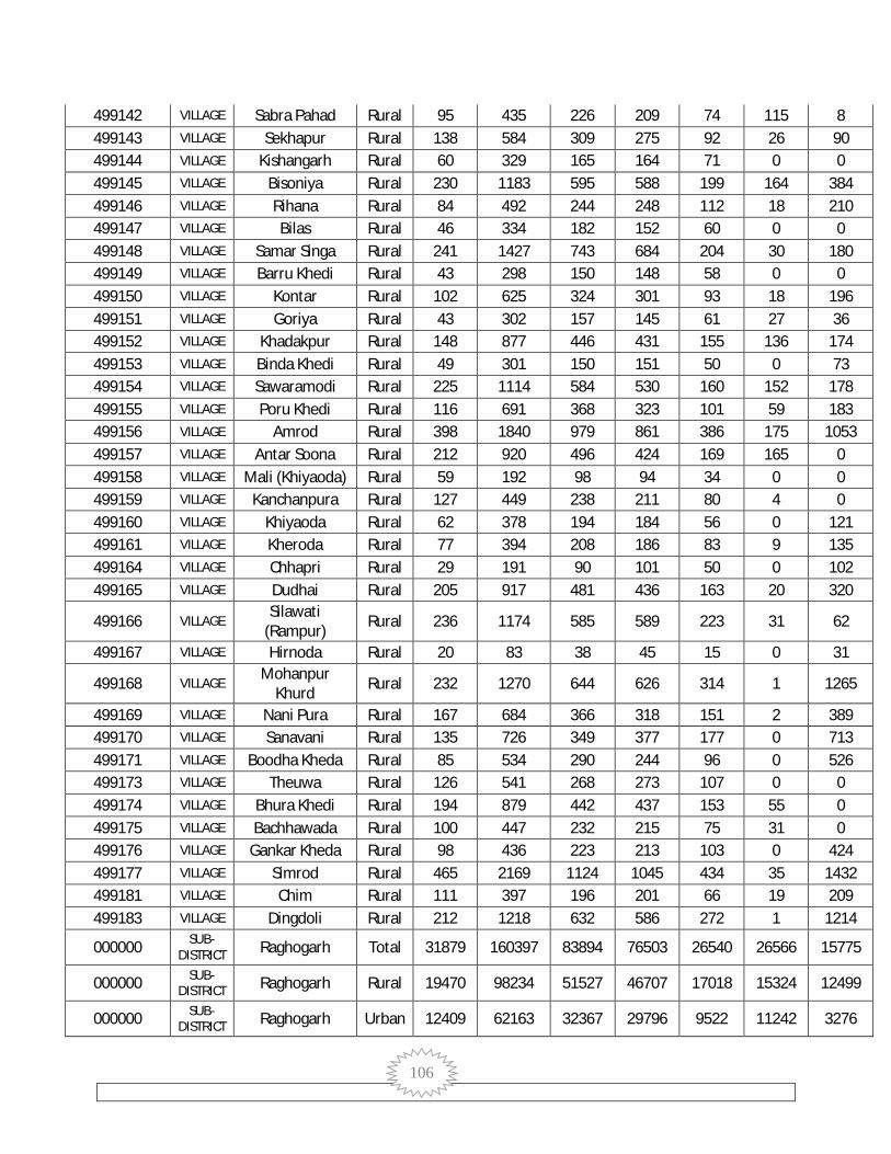
106
499142 VILLAGE Sabra Pahad Rural 95 435 226 209 74 115 8 499143 VILLAGE Sekhapur Rural 138 584 309 275 92 26 90 499144 VILLAGE Kishangarh Rural 60 329 165 164 71 0 0 499145 VILLAGE Bisoniya Rural 230 1183 595 588 199 164 384 499146 VILLAGE Rihana Rural 84 492 244 248 112 18 210 499147 VILLAGE Bilas Rural 46 334 182 152 60 0 0 499148 VILLAGE Samar Singa Rural 241 1427 743 684 204 30 180 499149 VILLAGE Barru Khedi Rural 43 298 150 148 58 0 0 499150 VILLAGE Kontar Rural 102 625 324 301 93 18 196 499151 VILLAGE Goriya Rural 43 302 157 145 61 27 36 499152 VILLAGE Khadakpur Rural 148 877 446 431 155 136 174 499153 VILLAGE Binda Khedi Rural 49 301 150 151 50 0 73 499154 VILLAGE Sawaramodi Rural 225 1114 584 530 160 152 178 499155 VILLAGE Poru Khedi Rural 116 691 368 323 101 59 183 499156 VILLAGE Amrod Rural 398 1840 979 861 386 175 1053 499157 VILLAGE Antar Soona Rural 212 920 496 424 169 165 0 499158 VILLAGE Mali (Khiyaoda) Rural 59 192 98 94 34 0 0 499159 VILLAGE Kanchanpura Rural 127 449 238 211 80 4 0 499160 VILLAGE Khiyaoda Rural 62 378 194 184 56 0 121 499161 VILLAGE Kheroda Rural 77 394 208 186 83 9 135 499164 VILLAGE Chhapri Rural 29 191 90 101 50 0 102 499165 VILLAGE Dudhai Rural 205 917 481 436 163 20 320
499166 VILLAGE Silawati
(Rampur) Rural 236 1174 585 589 223 31 62
499167 VILLAGE Hirnoda Rural 20 83 38 45 15 0 31
499168 VILLAGE Mohanpur
Khurd Rural 232 1270 644 626 314 1 1265
499169 VILLAGE Nani Pura Rural 167 684 366 318 151 2 389 499170 VILLAGE Sanavani Rural 135 726 349 377 177 0 713 499171 VILLAGE Boodha Kheda Rural 85 534 290 244 96 0 526 499173 VILLAGE Theuwa Rural 126 541 268 273 107 0 0 499174 VILLAGE Bhura Khedi Rural 194 879 442 437 153 55 0 499175 VILLAGE Bachhawada Rural 100 447 232 215 75 31 0 499176 VILLAGE Gankar Kheda Rural 98 436 223 213 103 0 424 499177 VILLAGE Simrod Rural 465 2169 1124 1045 434 35 1432 499181 VILLAGE Chim Rural 111 397 196 201 66 19 209 499183 VILLAGE Dingdoli Rural 212 1218 632 586 272 1 1214
000000 SUB-DISTRICT Raghogarh Total 31879 160397 83894 76503 26540 26566 15775
000000 SUB-DISTRICT Raghogarh Rural 19470 98234 51527 46707 17018 15324 12499
000000 SUB-DISTRICT Raghogarh Urban 12409 62163 32367 29796 9522 11242 3276

107
499184 VILLAGE Godalpur Rural 303 1555 817 738 320 959 38 499185 VILLAGE Chandan Khiriya Rural 43 215 110 105 45 215 0 499186 VILLAGE Khejra Guruji Rural 127 626 331 295 105 37 0 499187 VILLAGE Chanda Khedi Rural 13 76 42 34 15 0 0 499188 VILLAGE Khiriya Rural 176 1006 520 486 152 135 0 499190 VILLAGE Sarvarpur Rural 103 555 291 264 82 50 13 499191 VILLAGE Bamooriya Rural 22 124 63 61 17 0 0 499192 VILLAGE Dharnawada Rural 536 2996 1535 1461 437 321 13 499193 VILLAGE Sanotiya Rural 159 827 426 401 149 394 0 499194 VILLAGE Bhulay Rural 310 1503 781 722 233 90 306 499195 VILLAGE Kotra Rural 35 190 96 94 29 0 0 499196 VILLAGE Bala Bhaint Rural 285 1468 742 726 226 177 1 499198 VILLAGE Murlipura Rural 6 37 20 17 4 0 0 499199 VILLAGE Shekhpur Rural 37 177 94 83 41 0 0 499201 VILLAGE Kabulpura Rural 73 348 185 163 53 38 0 499202 VILLAGE Kakwasa Rural 259 1427 760 667 226 215 0 499203 VILLAGE Brisingpura Rural 87 392 210 182 85 0 0 499204 VILLAGE Dawatpura Rural 99 453 230 223 66 52 0 499205 VILLAGE Rajna Khedi Rural 75 283 143 140 52 39 0 499206 VILLAGE Bhadauri Rural 349 1829 986 843 318 222 253 499208 VILLAGE Chaura Khedi Rural 118 568 291 277 118 35 145 499209 VILLAGE Todi Rural 372 1746 910 836 341 694 376 499210 VILLAGE Umariya Rural 235 1123 595 528 281 82 854 499211 VILLAGE Gora Rural 124 683 354 329 112 59 116 499212 VILLAGE Dehri Rural 135 697 386 311 163 5 21 499213 VILLAGE Ajroda Rural 115 391 204 187 63 0 0 499214 VILLAGE Ruthiyai Rural 82 434 217 217 78 57 88 499215 VILLAGE Duhawad Rural 164 831 427 404 165 110 0 499216 VILLAGE Ghoghar Rural 122 632 325 307 123 8 0 499217 VILLAGE Puraina Rural 241 1148 593 555 175 705 0 499218 VILLAGE Puraini Rural 29 188 88 100 24 0 0 499219 VILLAGE Pagara Rural 254 1477 771 706 246 244 151 499220 VILLAGE Daurana Rural 500 2494 1290 1204 465 354 394 499221 VILLAGE Gadarwara Rural 52 229 127 102 35 0 81 499223 VILLAGE Anandpur Rural 72 297 138 159 59 0 218 499225 VILLAGE Nadner Rural 147 777 420 357 160 84 186 499226 VILLAGE Dhay Rural 22 92 52 40 19 0 0 499227 VILLAGE Khastiwada Rural 32 181 94 87 29 0 0 499228 VILLAGE Malsiya Todi Rural 44 215 122 93 41 0 14 499229 VILLAGE Kudaiya Rural 3 13 10 3 1 0 0 499230 VILLAGE Udaypuri Rural 158 724 380 344 108 47 0

108
499231 VILLAGE Sakatpur Rural 219 1085 554 531 179 398 0 499232 VILLAGE Fattukhedi Rural 46 217 112 105 46 0 0 499233 VILLAGE Belka Rural 196 943 496 447 152 138 181 499234 VILLAGE Ikodiya Rural 76 324 164 160 62 0 0 499235 VILLAGE Brisingpura Rural 89 426 208 218 77 80 0 499236 VILLAGE Tuman Khedi Rural 94 427 215 212 64 43 0 499237 VILLAGE Bhaisana Rural 237 1271 685 586 238 214 0 499238 VILLAGE Ahir Khedi Rural 105 659 335 324 125 58 43 499239 VILLAGE Bholapura Rural 102 470 242 228 79 38 94 499240 VILLAGE Mohanpur Rural 21 82 46 36 15 0 0 499241 VILLAGE Rughnathpura Rural 183 1924 1470 454 105 21 6 499242 VILLAGE Shripura Rural 94 468 242 226 61 38 0 499245 VILLAGE Badarpur Rural 80 530 274 256 101 0 0 499246 VILLAGE Palpur Rural 62 295 151 144 54 19 0 499247 VILLAGE Awan Rural 1164 5563 2862 2701 880 565 3 499248 VILLAGE Shujalgarh Rural 4 15 9 6 0 0 0 499249 VILLAGE Khushalpur Rural 20 105 47 58 14 0 0 499250 VILLAGE Barrya Rural 105 496 269 227 85 40 3 499251 VILLAGE Bhera Khedi Rural 130 775 417 358 130 64 8 499252 VILLAGE Bishanpura Rural 8 59 33 26 8 0 0 499254 VILLAGE Hajratpur Rural 2 2 2 0 0 0 0 499255 VILLAGE Sawari Nath Rural 206 1023 532 491 193 31 0 499256 VILLAGE Jaitpur Rural 81 431 222 209 69 206 0 499257 VILLAGE Chandan Bhent Rural 122 525 266 259 96 440 0 499258 VILLAGE Nauhar Rural 88 459 231 228 64 10 0 499259 VILLAGE Balakheda Rural 105 524 268 256 86 22 0 499260 VILLAGE Kamarpura Rural 29 167 85 82 20 0 0 499261 VILLAGE Achkalpur Rural 115 513 274 239 72 121 15 499262 VILLAGE Kadaiya Rural 175 752 379 373 126 297 8 499263 VILLAGE Naganpur Rural 92 408 187 221 106 0 0 499264 VILLAGE Thikariya Kheda Rural 4 18 11 7 2 0 8 499266 VILLAGE Pipal Khedi Rural 70 375 184 191 93 0 362 499267 VILLAGE Bargiya Kheda Rural 174 825 421 404 217 0 817 499269 VILLAGE Ram Nagar Rural 677 3733 1924 1809 703 634 215 499270 VILLAGE Mirpur Rural 91 453 232 221 90 0 0 499271 VILLAGE Semra Rural 111 611 313 298 97 193 12 499272 VILLAGE Sar Sahela Rural 128 715 374 341 108 0 0 499273 VILLAGE Jairampura Rural 30 130 70 60 18 38 0 499274 VILLAGE Mer Khedi Rural 57 254 139 115 44 101 31 499275 VILLAGE Sawat Khedi Rural 221 1016 542 474 192 178 0 499276 VILLAGE Basantpura Rural 84 377 195 182 62 0 375

109
499277 VILLAGE Raghupur Rural 47 233 115 118 58 0 233 499278 VILLAGE Chanpura Rural 112 632 316 316 137 0 632 499279 VILLAGE Haripur Rural 4 22 11 11 2 0 0
499280 VILLAGE Kishanganj Alias
Motipur Rural 133 663 351 312 95 13 216
499281 VILLAGE Shorampura Rural 92 383 206 177 61 60 0 499282 VILLAGE Sakoniya Rural 76 426 212 214 100 137 69 499283 VILLAGE Narayanpura Rural 92 349 191 158 73 22 20 499284 VILLAGE Nimkhedi Rural 51 240 127 113 53 88 12 499285 VILLAGE Mohmmadpur Rural 22 131 68 63 36 0 0 499286 VILLAGE Sundar Khedi Rural 203 950 487 463 155 189 22 499287 VILLAGE Gujar Khedi Rural 38 198 110 88 39 11 22 499289 VILLAGE Govindpura Rural 256 1148 589 559 154 698 9 499290 VILLAGE Barkhedi Rural 89 502 265 237 72 30 0 499291 VILLAGE Munhasa Rural 61 336 175 161 53 0 0 499292 VILLAGE Prem Garh Rural 93 509 270 239 63 54 30 499293 VILLAGE Sita Khedi Rural 107 488 229 259 67 175 7 499294 VILLAGE Parkana Rural 259 1509 792 717 221 202 1 499295 VILLAGE Rajpura Rural 66 405 213 192 83 17 0 499296 VILLAGE Peelaghata Rural 86 506 263 243 92 22 67 499297 VILLAGE Fekara Rural 73 402 205 197 54 47 0 499298 VILLAGE Jaisalmer Rural 50 295 155 140 61 0 295 499299 VILLAGE Gawari Rural 493 2056 1055 1001 341 376 99 499300 VILLAGE Rampura Rural 48 229 121 108 38 0 0 499301 VILLAGE Sagar Rural 146 730 368 362 105 72 62 499302 VILLAGE Sujapura Rural 78 416 228 188 56 174 35 499303 VILLAGE Ditalwada Rural 233 1257 688 569 196 26 105 499304 VILLAGE Doba Rural 156 774 408 366 156 249 0 499305 VILLAGE Fajalpur Rural 86 406 210 196 66 35 55 499306 VILLAGE Piplya Rural 125 689 345 344 127 64 0 499307 VILLAGE Barkheda Rural 217 1101 582 519 189 322 251 499308 VILLAGE Aamliyawada Rural 461 1901 1014 887 301 527 137 499309 VILLAGE Parsoliya Rural 341 1640 824 816 333 0 1638 499310 VILLAGE Bhukani Rural 131 620 313 307 89 1 619 499311 VILLAGE Mahu Rural 140 553 297 256 106 115 37 499312 VILLAGE Raghopura Rural 31 153 83 70 26 0 21 499313 VILLAGE Pipal Khedi Rural 189 1071 560 511 174 159 62 499314 VILLAGE Barsat Rural 659 3506 1791 1715 563 726 119 499315 VILLAGE Bahadargarh Rural 66 403 200 203 61 304 48 499316 VILLAGE Chaura Khedi Rural 113 662 340 322 81 94 4 499317 VILLAGE Kishangarh Rural 87 444 239 205 100 0 0

110
499318 VILLAGE Sompur Rural 54 256 125 131 60 0 0 499319 VILLAGE Kolua Rural 30 150 80 70 34 2 0 499320 VILLAGE Chauopada Rural 48 218 110 108 45 38 16 499321 VILLAGE Khajuri Rural 83 404 205 199 82 136 11 499322 VILLAGE Gondiya Rural 132 689 388 301 126 0 489 499323 VILLAGE Thapna Rural 31 114 61 53 16 15 0 499324 VILLAGE Ambeh Rural 37 173 93 80 41 0 0 499325 VILLAGE Marothiaya Rural 44 204 106 98 45 0 204 499326 VILLAGE Padru Rural 18 89 49 40 17 0 0 499327 VILLAGE Gaumukh Rural 108 420 233 187 84 71 0 499328 VILLAGE Karondiya Rural 37 167 90 77 37 0 166 499329 VILLAGE Barkhua Rural 60 235 122 113 54 0 0 499330 VILLAGE Berkhedi Danga Rural 119 575 307 268 111 12 291 499331 VILLAGE Datya Rural 52 253 136 117 50 0 0 499332 VILLAGE Kunda Rural 96 457 248 209 93 0 0 499333 VILLAGE Dhirdeh Rural 41 168 90 78 48 0 6 499334 VILLAGE Bandargarha Rural 146 624 338 286 137 13 21 499335 VILLAGE Kumariya Rural 27 135 72 63 28 1 0 499336 VILLAGE Lathya Rural 60 269 147 122 54 0 0 499337 VILLAGE Khairai Rural 199 1106 558 548 217 138 444 499338 VILLAGE Isartoda Rural 95 512 246 266 118 17 473 499339 VILLAGE Ganeshpura Rural 50 226 122 104 39 38 2 499340 VILLAGE Budhauriya Rural 204 957 508 449 170 1 0 499341 VILLAGE Kundai Parsa Rural 74 423 219 204 81 418 0
802402 TOWN Raghogarh -Vijaypur (M) Urban 12409 62163 32367 29796 9522 11242 3276
802402 WARD
Raghogarh -Vijaypur (M) WARD NO.-
0001
Urban 453 2421 1250 1171 405 1381 145
802402 WARD
Raghogarh -Vijaypur (M) WARD NO.-
0002
Urban 541 2917 1495 1422 417 344 44
802402 WARD
Raghogarh -Vijaypur (M) WARD NO.-
0003
Urban 279 1569 818 751 241 103 5
802402 WARD
Raghogarh -Vijaypur (M) WARD NO.-
0004
Urban 280 1321 698 623 141 80 3

111
802402 WARD
Raghogarh -Vijaypur (M) WARD NO.-
0005
Urban 404 2201 1136 1065 311 45 85
802402 WARD
Raghogarh -Vijaypur (M) WARD NO.-
0006
Urban 443 2255 1167 1088 340 249 66
802402 WARD
Raghogarh -Vijaypur (M) WARD NO.-
0007
Urban 248 1226 632 594 175 313 6
802402 WARD
Raghogarh -Vijaypur (M) WARD NO.-
0008
Urban 146 737 401 336 98 43 6
802402 WARD
Raghogarh -Vijaypur (M) WARD NO.-
0009
Urban 306 1620 837 783 243 422 18
802402 WARD
Raghogarh -Vijaypur (M) WARD NO.-
0010
Urban 402 2014 1009 1005 268 741 99
802402 WARD
Raghogarh -Vijaypur (M) WARD NO.-
0011
Urban 1104 5349 2958 2391 886 640 264
802402 WARD
Raghogarh -Vijaypur (M) WARD NO.-
0012
Urban 294 1642 850 792 324 6 97
802402 WARD
Raghogarh -Vijaypur (M) WARD NO.-
0013
Urban 469 2602 1305 1297 473 708 55
802402 WARD
Raghogarh -Vijaypur (M) WARD NO.-
0014
Urban 856 3830 2037 1793 591 315 49
802402 WARD
Raghogarh -Vijaypur (M) WARD NO.-
0015
Urban 544 2909 1487 1422 525 510 4
802402 WARD Raghogarh -Vijaypur (M) WARD NO.-
Urban 516 3171 1657 1514 511 476 38

112
0016
802402 WARD
Raghogarh -Vijaypur (M) WARD NO.-
0017
Urban 933 4461 2266 2195 806 1891 183
802402 WARD
Raghogarh -Vijaypur (M) WARD NO.-
0018
Urban 381 1493 753 740 95 204 105
802402 WARD
Raghogarh -Vijaypur (M) WARD NO.-
0019
Urban 604 2258 1152 1106 121 454 230
802402 WARD
Raghogarh -Vijaypur (M) WARD NO.-
0020
Urban 436 1724 913 811 175 158 114
802402 WARD
Raghogarh -Vijaypur (M) WARD NO.-
0021
Urban 542 2841 1479 1362 550 296 456
802402 WARD
Raghogarh -Vijaypur (M) WARD NO.-
0022
Urban 498 2443 1300 1143 371 415 535
802402 WARD
Raghogarh -Vijaypur (M) WARD NO.-
0023
Urban 716 3601 1908 1693 551 411 478
802402 WARD
Raghogarh -Vijaypur (M) WARD NO.-
0024
Urban 1014 5558 2859 2699 904 1037 191
000000 SUB-DISTRICT Maksoodangarh Total 24012 117978 61751 56227 20647 18754 24610
000000 SUB-DISTRICT Maksoodangarh Rural 24012 117978 61751 56227 20647 18754 24610
000000 SUB-DISTRICT Maksoodangarh Urban 0 0 0 0 0 0 0
499343 VILLAGE Aligarh Rural 33 167 85 82 25 0 28 499344 VILLAGE Daulat Pura Rural 151 774 410 364 152 257 0 499345 VILLAGE Shergarh Rural 22 119 60 59 17 104 0 499346 VILLAGE Khejda Rural 198 1069 564 505 147 122 2 499347 VILLAGE Devipura Rural 34 149 86 63 22 0 127 499348 VILLAGE Pareva Rural 288 1695 888 807 235 297 1 499349 VILLAGE Todra Rural 460 2293 1189 1104 340 266 12

113
499350 VILLAGE Salota Rural 373 1890 1007 883 343 473 222 499351 VILLAGE Tedoni Rural 55 279 131 148 68 0 178 499352 VILLAGE Mahmod Nagar Rural 77 391 212 179 64 1 390 499353 VILLAGE Kanthi Rural 229 1160 604 556 222 1 1159 499354 VILLAGE Berkhedi Rural 149 744 368 376 158 1 743 499355 VILLAGE Laxmanpura Rural 102 639 310 329 130 0 639 499356 VILLAGE Devipura Rural 14 75 37 38 11 0 75 499357 VILLAGE Sehar Kheda Rural 87 418 226 192 73 0 415 499358 VILLAGE Gopalgarh Rural 60 347 184 163 68 2 345 499359 VILLAGE Kergarh Rural 191 816 417 399 171 0 599 499360 VILLAGE Barchha Rural 80 333 174 159 42 81 174 499361 VILLAGE Mahadeopura Rural 32 162 77 85 22 0 162 499362 VILLAGE Ladaiya Kheda Rural 36 177 88 89 33 0 177 499363 VILLAGE Pahadgarh Rural 13 83 42 41 14 0 83 499364 VILLAGE Sarari Rural 63 290 145 145 52 0 290 499365 VILLAGE Gadher Rural 218 1093 589 504 194 14 1078 499366 VILLAGE Balrampura Rural 73 377 191 186 73 1 376 499367 VILLAGE Nimkhedi Rural 45 266 126 140 55 0 0 499369 VILLAGE Rampura Rural 32 159 77 82 29 4 0 499370 VILLAGE Mansha Khedi Rural 89 444 236 208 99 0 0 499372 VILLAGE Bapcha Rural 183 830 443 387 135 123 4 499373 VILLAGE Khedli Maidani Rural 48 215 115 100 43 13 0 499374 VILLAGE Natariyai Rural 74 354 188 166 39 18 7 499375 VILLAGE Bairwas Rural 151 815 432 383 122 163 0 499376 VILLAGE Dhaparyai Rural 95 629 333 296 116 98 0 499377 VILLAGE Sallamgarh Rural 29 175 99 76 30 0 0 499378 VILLAGE Ballam Garh Rural 11 91 47 44 22 0 0 499379 VILLAGE Raja Hedi Rural 108 598 324 274 88 179 0 499380 VILLAGE Dhina Khedi Rural 249 1400 740 660 203 399 0 499381 VILLAGE Meru Khedi Rural 70 377 199 178 53 84 0 499382 VILLAGE Jagru Rural 165 967 546 421 153 214 0 499383 VILLAGE Kudai Maru Rural 69 344 189 155 47 46 0 499384 VILLAGE Ganeshpura Rural 87 426 228 198 67 2 5 499385 VILLAGE Tajpura Rural 44 263 140 123 35 0 0 499386 VILLAGE Shankarpura Rural 78 434 227 207 71 10 0 499387 VILLAGE Piproda Rural 97 409 219 190 70 192 37 499389 VILLAGE Morwas Rural 164 730 377 353 163 170 158 499390 VILLAGE Uniganjpura Rural 200 885 465 420 187 62 683 499391 VILLAGE Dewapura Rural 46 256 132 124 48 1 255 499392 VILLAGE Dhiratpur Rural 29 162 87 75 28 0 0 499393 VILLAGE Mohanpur Rural 57 320 166 154 36 68 0
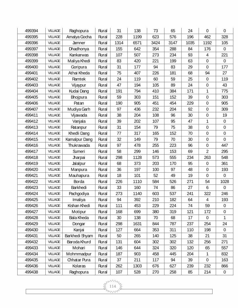
114
499394 VILLAGE Raghopura Rural 31 138 73 65 24 0 0 499395 VILLAGE Amalya Gocha Rural 228 1199 623 576 196 462 328 499396 VILLAGE Jamner Rural 1314 6571 3424 3147 1035 1192 105 499397 VILLAGE Dhadhonya Rural 155 642 354 288 84 176 0 499398 VILLAGE Kankarwas Rural 107 507 273 234 93 4 221 499399 VILLAGE Maliya Khedi Rural 83 420 221 199 63 0 0 499400 VILLAGE Goripura Rural 31 177 94 83 29 0 177 499401 VILLAGE Athai Kheda Rural 75 407 226 181 68 94 27 499402 VILLAGE Ramtek Rural 24 119 60 59 25 0 119 499403 VILLAGE Vijaypur Rural 47 194 105 89 24 0 43 499404 VILLAGE Kudai Dang Rural 191 794 410 384 171 1 775 499405 VILLAGE Bhojpura Rural 59 303 151 152 39 0 303 499406 VILLAGE Patan Rural 190 905 451 454 229 0 905 499407 VILLAGE Mudiya Garh Rural 97 436 232 204 92 0 309 499411 VILLAGE Vijawada Rural 38 204 108 96 30 0 19 499412 VILLAGE Vanjala Rural 39 202 107 95 47 1 0 499413 VILLAGE Ratanpur Rural 31 154 79 75 38 0 0 499414 VILLAGE Khedli Dang Rural 77 317 165 152 70 0 0 499415 VILLAGE Kamalpur Dang Rural 32 149 79 70 30 0 0 499416 VILLAGE Thukrawada Rural 97 478 255 223 96 0 447 499417 VILLAGE Sumeri Rural 58 299 146 153 69 2 295 499418 VILLAGE Jharpai Rural 298 1128 573 555 234 263 548 499419 VILLAGE Jalalpur Rural 68 373 203 170 95 0 361 499420 VILLAGE Manpura Rural 36 197 100 97 48 0 193 499421 VILLAGE Mauhapura Rural 18 101 52 49 19 0 0 499422 VILLAGE Borda Rural 226 1110 584 526 271 54 1028 499423 VILLAGE Barkhedi Rural 33 160 74 86 27 6 0 499424 VILLAGE Pachgodiya Rural 273 1140 603 537 241 322 246 499425 VILLAGE Imaliya Rural 94 392 210 182 64 4 193 499426 VILLAGE Kishan Khedi Rural 111 453 229 224 74 59 0 499427 VILLAGE Motipur Rural 168 699 380 319 121 172 0 499428 VILLAGE Bala Kheda Rural 30 138 70 68 17 0 1 499429 VILLAGE Dongar Rural 298 1631 844 787 237 254 24 499430 VILLAGE Kanjai Rural 127 664 353 311 110 198 0 499431 VILLAGE Barkhedi Shyam Rural 50 265 140 125 38 21 31 499432 VILLAGE Baroda Khurd Rural 131 604 302 302 132 256 271 499433 VILLAGE Mohari Rural 146 644 324 320 120 65 557 499434 VILLAGE Mohmmadpur Rural 187 903 458 445 204 1 832 499435 VILLAGE Chhatar Pura Rural 37 211 117 94 39 0 163 499436 VILLAGE Kolaras Rural 262 1303 676 627 239 232 866 499438 VILLAGE Raghopura Rural 107 528 270 258 85 214 0

115
499439 VILLAGE Govindpura Rural 98 536 265 271 108 0 455 499440 VILLAGE Torai Rural 214 1145 606 539 185 251 10 499441 VILLAGE Udaypura Rural 39 247 129 118 54 52 0 499442 VILLAGE Niwari Rural 29 145 76 69 27 3 0 499443 VILLAGE Kadai Kheda Rural 42 205 108 97 40 3 104 499444 VILLAGE Siya Khedi Rural 134 656 329 327 92 61 9 499445 VILLAGE Godiya Rural 92 463 251 212 70 63 9 499446 VILLAGE Shyampur Rural 82 356 191 165 44 85 30 499447 VILLAGE Higona Rural 121 658 355 303 109 89 0
499448 VILLAGE Kamalpura
Maidani Rural 41 233 120 113 33 8 87
499450 VILLAGE Khair Khedi Rural 93 500 262 238 78 119 5 499451 VILLAGE Karela Rural 184 919 494 425 146 124 1 499452 VILLAGE Dewapura Rural 43 230 123 107 33 25 0 499453 VILLAGE Kajaliya Rural 154 793 415 378 119 249 25 499454 VILLAGE Bala Khedi Rural 4 11 6 5 1 0 0 499455 VILLAGE Agarpura Rural 128 646 329 317 97 83 7 499456 VILLAGE Nalkheda Rural 299 1604 849 755 269 602 4 499457 VILLAGE Shripura Rural 133 683 365 318 110 189 4 499458 VILLAGE Maksudangarh Rural 2115 10917 5688 5229 1789 2010 356 499459 VILLAGE Surajpura Rural 24 106 56 50 23 0 18 499460 VILLAGE Ganesh Pura Rural 156 894 468 426 140 371 68 499461 VILLAGE Amargarh Rural 27 148 81 67 26 1 10 499462 VILLAGE Garkheda Rural 256 1461 756 705 255 428 15 499463 VILLAGE Bapchi Rural 64 380 210 170 91 74 4 499464 VILLAGE Rampura Rural 21 103 54 49 24 73 0 499465 VILLAGE Kaharpura Rural 55 216 110 106 48 13 0 499467 VILLAGE Emnakhedi Rural 100 483 248 235 87 262 0 499468 VILLAGE Mahua Kheda Rural 200 801 417 384 131 101 0 499469 VILLAGE Kharagpura Rural 37 139 72 67 32 0 0 499470 VILLAGE Deopur Rural 10 65 38 27 14 0 0 499471 VILLAGE Budhoriya Rural 77 477 247 230 70 74 39 499472 VILLAGE Mant Rural 53 271 157 114 37 61 0 499473 VILLAGE Parwariya Rural 325 1559 791 768 283 598 8 499474 VILLAGE Barod Rural 480 2121 1110 1011 369 175 236 499475 VILLAGE Budhana Rural 205 1110 575 535 214 459 345 499476 VILLAGE Virpura Rural 67 402 224 178 59 0 0 499477 VILLAGE Kolua Rural 83 432 236 196 68 101 0 499478 VILLAGE Imaliya Rural 53 353 192 161 48 48 39 499479 VILLAGE Chandpura Rural 101 450 229 221 77 221 194 499480 VILLAGE Bhagwanpura Rural 77 353 185 168 72 0 353 499481 VILLAGE Bhagwatipura Rural 292 1263 637 626 279 2 1239
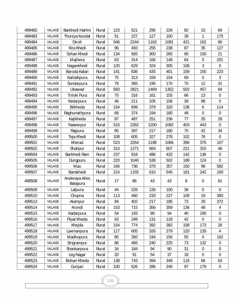
116
499482 VILLAGE Barkhedi Hathni Rural 123 521 295 226 82 15 69 499483 VILLAGE Thuniya Kundal Rural 51 227 127 100 39 1 175 499484 VILLAGE Diroli Rural 546 2244 1163 1081 421 162 80 499485 VILLAGE Kita Khedi Rural 96 493 255 238 87 35 127 499486 VILLAGE Sohan Khedi Rural 134 565 300 265 95 150 21 499487 VILLAGE Majhera Rural 63 314 166 148 64 0 201 499488 VILLAGE Nagankhedi Rural 120 629 324 305 108 3 0 499489 VILLAGE Baroda Kalan Rural 141 836 435 401 159 150 223 499490 VILLAGE Kailashpura Rural 75 313 159 154 69 0 3 499491 VILLAGE Sundarpura Rural 76 365 195 170 70 12 31 499492 VILLAGE Ukawad Rural 583 2821 1469 1352 502 457 84 499493 VILLAGE Triloki Pura Rural 75 316 161 155 66 13 0 499494 VILLAGE Kedarpura Rural 46 211 105 106 39 98 0 499495 VILLAGE Bilkheda Rural 154 699 379 320 138 6 114 499496 VILLAGE Raghunathpura Rural 68 374 194 180 48 0 0 499497 VILLAGE Kajikheda Rural 87 487 251 236 77 35 28 499498 VILLAGE Naseerpur Rural 515 2282 1200 1082 403 443 5 499499 VILLAGE Rajpura Rural 85 397 217 180 75 42 34 499500 VILLAGE Teja Khedi Rural 108 605 327 278 102 76 0 499501 VILLAGE Kherad Rural 523 2264 1198 1066 396 375 107 499502 VILLAGE Shahpur Rural 313 1271 664 607 221 315 46 499504 VILLAGE Barkhedi Ram Rural 237 918 486 432 142 136 0 499505 VILLAGE Durgpura Rural 220 1040 538 502 189 124 0 499506 VILLAGE Mau Rural 166 736 379 357 150 98 582 499507 VILLAGE Banskhedi Rural 214 1155 610 545 181 242 100
499508 VILLAGE Anderaya Alies
Balapura Rural 17 86 43 43 8 0 81
499509 VILLAGE Lalpura Rural 44 226 126 100 36 0 0 499510 VILLAGE Chopna Rural 113 460 233 227 108 19 383 499513 VILLAGE Alampur Rural 84 402 217 185 73 29 372 499514 VILLAGE Krondi Rural 153 715 356 359 136 48 4 499515 VILLAGE Kadarpura Rural 54 193 99 94 40 190 0 499516 VILLAGE Pipal Kheda Rural 63 249 131 118 42 0 0 499517 VILLAGE Khejda Rural 154 774 392 382 158 173 26 499518 VILLAGE Laxmanpura Rural 117 605 326 279 120 135 4 499519 VILLAGE Madhopura Rural 85 350 194 156 55 0 162 499520 VILLAGE Singrampur Rural 86 465 240 225 73 132 0 499521 VILLAGE Shankarpura Rural 34 184 94 90 31 0 0 499522 VILLAGE Leg Nagar Rural 20 91 54 37 18 0 0 499523 VILLAGE Bishan Kheda Rural 138 743 394 349 118 66 63 499524 VILLAGE Gunjari Rural 100 526 286 240 97 179 0

117
499525 VILLAGE Khair Kheda Rural 161 944 498 446 178 198 0
000000 SUB-DISTRICT Kumbhraj Total 23015 118804 62265 56539 19428 13872 8554
000000 SUB-DISTRICT Kumbhraj Rural 19572 99097 52025 47072 16297 11045 7637
000000 SUB-DISTRICT Kumbhraj Urban 3443 19707 10240 9467 3131 2827 917
499526 VILLAGE Khanpura Rural 114 646 338 308 97 12 0 499527 VILLAGE Tari Patni Rural 48 333 176 157 57 10 0 499528 VILLAGE Khedi Ghata Rural 140 771 398 373 168 0 0 499529 VILLAGE Budha Kheda Rural 52 217 117 100 35 0 0 499530 VILLAGE Jamonya Jagir Rural 216 946 491 455 172 103 0 499531 VILLAGE Motipura Rural 60 292 149 143 67 0 117 499532 VILLAGE Banka Kheda Rural 121 624 320 304 100 7 0 499533 VILLAGE Jhinkni Rural 131 551 308 243 73 0 0 499534 VILLAGE Kamalpura Rural 52 233 126 107 33 0 0 499535 VILLAGE Sevanya Rural 152 581 313 268 114 0 0
499536 VILLAGE Bansaheda
Khurd Rural 406 1974 1029 945 320 366 16
499537 VILLAGE Bansaheda
Kalan Rural 129 575 288 287 66 227 0
499538 VILLAGE Kolukhedi Rural 205 1016 538 478 122 36 0 499539 VILLAGE Khedi Kalan Rural 331 1884 978 906 283 43 0 499540 VILLAGE Dhasya Khedi Rural 87 464 273 191 69 15 0
499541 VILLAGE Jogipura Alias
Dant Rural 46 277 146 131 40 0 0
499542 VILLAGE Talawada
(Najdik Ambeh) Rural 229 1043 532 511 144 65 0
499543 VILLAGE Karmodiya Rural 141 670 329 341 121 50 0 499544 VILLAGE Khajuriya Rural 145 561 286 275 127 84 0 499545 VILLAGE Khedi Abha Rural 101 546 291 255 80 14 0 499546 VILLAGE Kulambeh Rural 28 151 81 70 16 0 0 499547 VILLAGE Bhogipura Rural 118 588 320 268 80 13 0 499548 VILLAGE Ambeh Rural 155 750 394 356 132 0 0 499549 VILLAGE Karadya Rural 120 545 289 256 112 67 0 499550 VILLAGE Kenkdi Viran Rural 133 742 374 368 158 38 0 499551 VILLAGE Banjari Kalan Rural 91 439 236 203 80 4 0 499552 VILLAGE Motipura Abad Rural 142 657 336 321 111 0 0 499553 VILLAGE Solyabeh Rural 65 337 164 173 66 0 337 499554 VILLAGE Jhiri Rural 241 1277 621 656 228 107 55
499555 VILLAGE Kherbeh
Kumbhraj Rural 85 426 216 210 67 0 0
499556 VILLAGE Bakanya Rural 283 1439 750 689 259 328 160 499557 VILLAGE Pura Bakaniya Rural 24 136 69 67 26 83 0
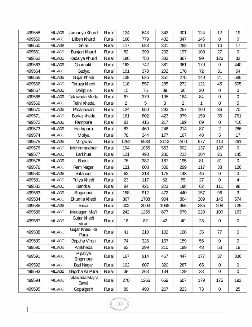
118
499558 VILLAGE Jamonya Khurd Rural 124 643 342 301 124 12 19 499559 VILLAGE Lilbeh Khurd Rural 168 779 432 347 146 0 0 499560 VILLAGE Solai Rural 117 583 301 282 110 10 17 499561 VILLAGE Banjari Khurd Rural 82 399 202 197 108 27 0 499562 VILLAGE Kadaiya Khurd Rural 180 750 383 367 99 126 32 499563 VILLAGE Gaumukh Rural 163 742 381 361 179 0 440 499564 VILLAGE Gadya Rural 101 378 202 176 72 31 54 499565 VILLAGE Gujar Khedi Rural 138 626 351 275 149 21 580 499566 VILLAGE Tatuza Khedi Rural 118 557 285 272 121 45 505 499567 VILLAGE Dolipura Rural 15 75 39 36 20 0 0 499568 VILLAGE Talawada Meda Rural 67 379 195 184 84 0 0 499569 VILLAGE Telni Kheda Rural 2 5 3 2 1 0 5 499570 VILLAGE Patanawari Rural 124 550 293 257 100 36 70 499571 VILLAGE Borka Kheda Rural 161 802 423 379 159 35 761 499572 VILLAGE Rampura Rural 81 416 217 199 89 0 416 499573 VILLAGE Hathipura Rural 83 460 246 214 87 2 286 499574 VILLAGE Moiya Rural 78 344 177 167 48 5 17 499575 VILLAGE Mirgwas Rural 1252 5983 3112 2871 977 413 261 499576 VILLAGE Mohmmadpur Rural 194 1055 553 502 137 137 0 499577 VILLAGE Barkhua Rural 121 493 280 213 104 26 145 499578 VILLAGE Banet Rural 76 382 187 195 81 81 0 499579 VILLAGE Ram Nagar Rural 121 608 309 299 117 38 126 499580 VILLAGE Sutanadi Rural 62 318 175 143 46 0 0 499581 VILLAGE Tulya Khedi Rural 23 117 62 55 27 0 4 499582 VILLAGE Bandrai Rural 84 421 223 198 62 111 98 499583 VILLAGE Singanpur Rural 158 912 472 440 157 96 3 499584 VILLAGE Bhumla Khedi Rural 367 1708 904 804 309 145 574 499585 VILLAGE Sanai Rural 402 2004 1048 956 285 208 125 499586 VILLAGE Madagan Mafi Rural 242 1256 677 579 228 100 163
499587 VILLAGE Gujar Khedi
Viran Rural 18 82 42 40 23 0 0
499588 VILLAGE Gujar Khedi Ka
Pura Rural 41 210 102 108 35 77 0
499589 VILLAGE Bapcha Viran Rural 74 326 167 159 55 0 0 499590 VILLAGE Amkheda Rural 83 399 210 189 48 53 19
499591 VILLAGE Pipaliya
Singanpur Rural 167 914 467 447 177 37 336
499592 VILLAGE Bad Nagar Rural 102 607 320 287 65 0 0 499593 VILLAGE Bapcha Ka Pura Rural 38 263 134 129 33 0 0
499594 VILLAGE Talawada Majra
Sanai Rural 270 1266 659 607 179 175 193
499595 VILLAGE Gopalgarh Rural 89 490 267 223 73 0 25

119
499596 VILLAGE Bhojpura Rural 63 290 142 148 40 0 0 499597 VILLAGE Gasauni Rural 46 241 124 117 24 58 7
499598 VILLAGE Talawada Najdik
Sanai Rural 19 108 56 52 14 0 0
499599 VILLAGE Pipalkhedi Kalan Rural 160 759 380 379 133 23 47 499600 VILLAGE Jhareda Rural 154 872 448 424 114 149 15 499601 VILLAGE Manda Kheda Rural 89 525 273 252 104 62 0 499602 VILLAGE Mohanpur Rural 175 858 468 390 142 98 0 499603 VILLAGE Tagarya Khurd Rural 27 182 91 91 23 0 8 499604 VILLAGE Badaud Rural 402 2412 1306 1106 348 342 0 499605 VILLAGE Ankkhedi Rural 172 964 487 477 157 173 0 499606 VILLAGE Behda Beh Rural 174 891 461 430 107 83 0 499607 VILLAGE Kadaiya Kalan Rural 57 308 176 132 41 45 0 499608 VILLAGE Lama Kheda Rural 216 1016 550 466 146 461 0 499609 VILLAGE Hotya Khedi Rural 47 275 133 142 38 26 0 499610 VILLAGE Balguda Rural 90 398 217 181 60 108 116 499611 VILLAGE Jogirada Rural 163 718 392 326 97 100 0 499612 VILLAGE Chholya Rural 44 175 89 86 32 0 0 499613 VILLAGE Bahukhedi Rural 244 1128 598 530 193 105 0 499614 VILLAGE Kishanpura Rural 73 361 192 169 35 87 3 499615 VILLAGE Khejra Rama Rural 310 1456 746 710 240 126 0
499616 VILLAGE Ganeshpura
Kanthar Rural 51 282 143 139 48 17 0
499617 VILLAGE Bandrua Rural 82 429 226 203 65 22 0 499618 VILLAGE Biryai Rural 306 1572 838 734 274 581 0 499619 VILLAGE Virpur Rural 51 211 99 112 42 92 0 499620 VILLAGE Badagaon Rural 266 1415 751 664 204 78 173 499621 VILLAGE Khiriya Kherat Rural 85 516 274 242 71 40 0 499623 VILLAGE Bhamavad Rural 497 2781 1481 1300 467 585 0 499625 VILLAGE Dehri Kumbhraj Rural 130 727 374 353 131 180 0 499626 VILLAGE Kekadya Kalan Rural 119 654 343 311 124 134 0 499627 VILLAGE Manak Chouk Rural 132 590 302 288 79 49 0 499628 VILLAGE Hanumat Kheda Rural 194 994 589 405 114 336 0 499629 VILLAGE Gulwada Rural 410 2290 1158 1132 417 596 20 499630 VILLAGE Tundaweh Rural 82 459 233 226 76 38 1 499631 VILLAGE Bilanga Khedi Rural 76 436 253 183 79 0 0 499632 VILLAGE Amrit Khedi Rural 67 223 127 96 42 3 0 499633 VILLAGE Amlya Rural 187 920 492 428 118 206 0 499634 VILLAGE Tagariya Kalan Rural 88 453 237 216 88 36 3 499635 VILLAGE Umariya Kalan Rural 83 439 227 212 70 230 0 499636 VILLAGE Just Khedi Rural 126 705 367 338 140 99 204 499637 VILLAGE Golyaheda Rural 190 733 368 365 117 237 0

120
499638 VILLAGE Khedli Tanka Rural 109 646 324 322 111 38 0 499639 VILLAGE Kunja Kheda Rural 86 491 269 222 68 29 106 499640 VILLAGE Ghorla Kheda Rural 80 497 236 261 86 0 352 499641 VILLAGE Ghorla Khedi Rural 70 388 194 194 54 19 0 499642 VILLAGE Tulsi Khedi Rural 170 889 457 432 142 110 10 499643 VILLAGE Barkheda Rural 108 663 339 324 103 106 35
499644 VILLAGE Ganeshpura
Chak Rural 10 49 32 17 13 0 49
499645 VILLAGE Chandpura Rural 31 162 87 75 26 0 74 499646 VILLAGE Mudiya Kheda Rural 55 259 154 105 27 2 0 499647 VILLAGE Parwariya Rural 69 351 193 158 49 5 0 499648 VILLAGE Keshopura Rural 43 247 133 114 40 10 0 499649 VILLAGE Chaupna Rural 69 347 182 165 67 63 116 499650 VILLAGE Intkhedi Khurd Rural 68 358 191 167 63 21 92 499651 VILLAGE Ghata Khedi Rural 30 155 80 75 26 0 0 499652 VILLAGE Nenwas Rural 48 248 152 96 37 0 0 499653 VILLAGE Madagan Khalsa Rural 63 357 198 159 60 0 0 499654 VILLAGE Mogra Rural 54 280 145 135 38 3 0 499655 VILLAGE Kudara Rural 185 921 497 424 135 50 85 499656 VILLAGE Kudari Rural 68 418 231 187 88 124 0 499657 VILLAGE Gadyapura Rural 75 379 196 183 63 0 20 499658 VILLAGE Bilakhedi Rural 66 345 184 161 46 24 6 499659 VILLAGE Bhaunrasa Rural 41 215 122 93 24 0 0 499660 VILLAGE Roda Khedi Rural 98 509 257 252 77 77 0 499661 VILLAGE Sopra Rural 39 231 126 105 40 0 0 499662 VILLAGE Intkhedi Kalan Rural 41 228 132 96 39 0 0 499663 VILLAGE Alli Khedi Rural 99 583 296 287 75 71 0 499664 VILLAGE Kana Khedi Rural 190 899 472 427 160 74 0 499665 VILLAGE Kurwai Rural 94 442 231 211 85 83 6 499666 VILLAGE Gorya Kheda Rural 129 888 475 413 142 123 13 499667 VILLAGE Sihari Rural 81 517 285 232 70 28 0 499668 VILLAGE Manpura Rural 58 337 182 155 69 25 0 499669 VILLAGE Sanka Kalan Rural 123 688 360 328 110 129 1 499670 VILLAGE Kekadya Khurd Rural 79 359 174 185 49 39 3 499671 VILLAGE Upree Rural 346 1563 845 718 224 88 94 499672 VILLAGE Mundra Rural 88 403 211 192 60 13 0 499673 VILLAGE Khatakya Rural 196 968 513 455 187 164 19 499674 VILLAGE Khejda Behra Rural 112 647 342 305 90 31 0 499675 VILLAGE Nijampur Rural 77 411 199 212 63 172 0 802403 TOWN Kumbhraj (NP) Urban 3443 19707 10240 9467 3131 2827 917
802403 WARD Kumbhraj (NP)
WARD NO.- Urban 586 2885 1518 1367 540 1398 220

121
0001
802403 WARD Kumbhraj (NP)
WARD NO.-0002
Urban 307 1787 933 854 308 229 161
802403 WARD Kumbhraj (NP)
WARD NO.-0003
Urban 266 1490 795 695 235 128 144
802403 WARD Kumbhraj (NP)
WARD NO.-0004
Urban 190 1234 595 639 178 162 44
802403 WARD Kumbhraj (NP)
WARD NO.-0005
Urban 305 1675 868 807 272 81 26
802403 WARD Kumbhraj (NP)
WARD NO.-0006
Urban 286 1787 956 831 267 152 18
802403 WARD Kumbhraj (NP)
WARD NO.-0007
Urban 114 737 358 379 77 24 44
802403 WARD Kumbhraj (NP)
WARD NO.-0008
Urban 161 970 494 476 157 7 172
802403 WARD Kumbhraj (NP)
WARD NO.-0009
Urban 112 588 308 280 70 0 0
802403 WARD Kumbhraj (NP)
WARD NO.-0010
Urban 181 1087 561 526 191 124 0
802403 WARD Kumbhraj (NP)
WARD NO.-0011
Urban 105 648 324 324 90 0 7
802403 WARD Kumbhraj (NP)
WARD NO.-0012
Urban 108 586 306 280 99 22 15
802403 WARD Kumbhraj (NP)
WARD NO.-0013
Urban 107 687 349 338 69 6 0
802403 WARD Kumbhraj (NP)
WARD NO.-0014
Urban 108 680 344 336 66 0 6
802403 WARD Kumbhraj (NP)
WARD NO.-0015
Urban 507 2866 1531 1335 512 494 60
000000 SUB-DISTRICT Aron Total 28123 139428 73500 65928 23577 30574 7400
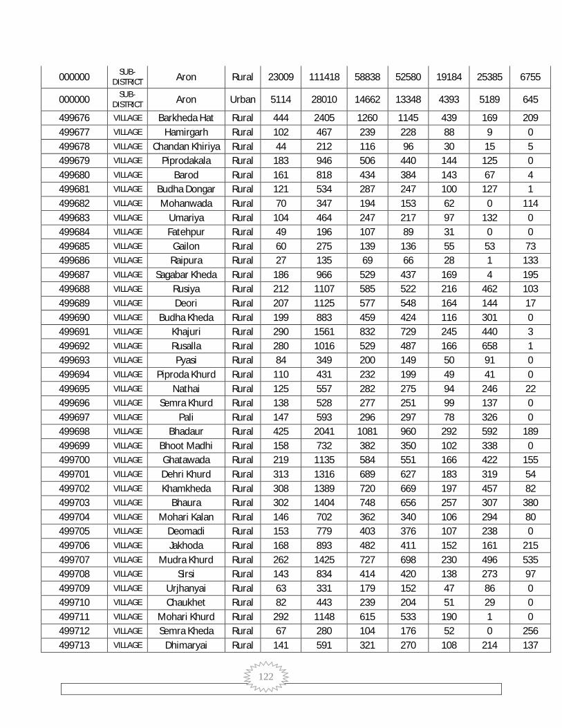
122
000000 SUB-DISTRICT Aron Rural 23009 111418 58838 52580 19184 25385 6755
000000 SUB-DISTRICT Aron Urban 5114 28010 14662 13348 4393 5189 645
499676 VILLAGE Barkheda Hat Rural 444 2405 1260 1145 439 169 209 499677 VILLAGE Hamirgarh Rural 102 467 239 228 88 9 0 499678 VILLAGE Chandan Khiriya Rural 44 212 116 96 30 15 5 499679 VILLAGE Piprodakala Rural 183 946 506 440 144 125 0 499680 VILLAGE Barod Rural 161 818 434 384 143 67 4 499681 VILLAGE Budha Dongar Rural 121 534 287 247 100 127 1 499682 VILLAGE Mohanwada Rural 70 347 194 153 62 0 114 499683 VILLAGE Umariya Rural 104 464 247 217 97 132 0 499684 VILLAGE Fatehpur Rural 49 196 107 89 31 0 0 499685 VILLAGE Gailon Rural 60 275 139 136 55 53 73 499686 VILLAGE Raipura Rural 27 135 69 66 28 1 133 499687 VILLAGE Sagabar Kheda Rural 186 966 529 437 169 4 195 499688 VILLAGE Rusiya Rural 212 1107 585 522 216 462 103 499689 VILLAGE Deori Rural 207 1125 577 548 164 144 17 499690 VILLAGE Budha Kheda Rural 199 883 459 424 116 301 0 499691 VILLAGE Khajuri Rural 290 1561 832 729 245 440 3 499692 VILLAGE Rusalla Rural 280 1016 529 487 166 658 1 499693 VILLAGE Pyasi Rural 84 349 200 149 50 91 0 499694 VILLAGE Piproda Khurd Rural 110 431 232 199 49 41 0 499695 VILLAGE Nathai Rural 125 557 282 275 94 246 22 499696 VILLAGE Semra Khurd Rural 138 528 277 251 99 137 0 499697 VILLAGE Pali Rural 147 593 296 297 78 326 0 499698 VILLAGE Bhadaur Rural 425 2041 1081 960 292 592 189 499699 VILLAGE Bhoot Madhi Rural 158 732 382 350 102 338 0 499700 VILLAGE Ghatawada Rural 219 1135 584 551 166 422 155 499701 VILLAGE Dehri Khurd Rural 313 1316 689 627 183 319 54 499702 VILLAGE Khamkheda Rural 308 1389 720 669 197 457 82 499703 VILLAGE Bhaura Rural 302 1404 748 656 257 307 380 499704 VILLAGE Mohari Kalan Rural 146 702 362 340 106 294 80 499705 VILLAGE Deomadi Rural 153 779 403 376 107 238 0 499706 VILLAGE Jakhoda Rural 168 893 482 411 152 161 215 499707 VILLAGE Mudra Khurd Rural 262 1425 727 698 230 496 535 499708 VILLAGE Sirsi Rural 143 834 414 420 138 273 97 499709 VILLAGE Urjhanyai Rural 63 331 179 152 47 86 0 499710 VILLAGE Chaukhet Rural 82 443 239 204 51 29 0 499711 VILLAGE Mohari Khurd Rural 292 1148 615 533 190 1 0 499712 VILLAGE Semra Kheda Rural 67 280 104 176 52 0 256 499713 VILLAGE Dhimaryai Rural 141 591 321 270 108 214 137
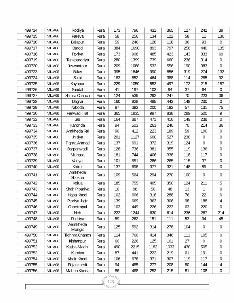
123
499714 VILLAGE Ikodiya Rural 173 796 431 365 127 242 39 499715 VILLAGE Pareva Rural 58 256 134 122 58 11 136 499716 VILLAGE Balapur Rural 59 246 128 118 36 93 0 499717 VILLAGE Barod Rural 384 1690 893 797 256 440 135 499718 VILLAGE Roriya Rural 173 908 485 423 143 333 69 499719 VILLAGE Tankparoriya Rural 280 1399 739 660 236 314 0 499720 VILLAGE Jaswantpur Rural 209 1088 532 556 190 383 0 499723 VILLAGE Salay Rural 395 1846 990 856 319 274 132 499724 VILLAGE Sarai Rural 183 852 464 388 114 285 92 499725 VILLAGE Kayapur Rural 229 1050 553 497 172 215 157 499726 VILLAGE Sandal Rural 41 197 103 94 37 64 0 499727 VILLAGE Semra Chanch Rural 124 539 292 247 70 223 36 499728 VILLAGE Dagrai Rural 160 928 485 443 148 230 0 499729 VILLAGE Niboda Rural 87 382 200 182 57 131 75 499730 VILLAGE Panwadi Hat Rural 365 1835 997 838 289 500 9 499732 VILLAGE Jasi Rural 164 887 471 416 149 238 0 499733 VILLAGE Karonda Rural 94 503 263 240 70 214 36 499734 VILLAGE Amkheda Rai Rural 90 412 223 189 59 106 0 499735 VILLAGE Jhitiya Rural 201 1127 600 527 236 0 0 499736 VILLAGE Tighra Ahmad Rural 137 691 372 319 124 0 0 499737 VILLAGE Barpanwadi Rural 128 736 381 355 119 136 0 499738 VILLAGE Muhasa Rural 181 744 406 338 118 117 0 499739 VILLAGE Vanyai Rural 101 551 286 265 115 37 0 499740 VILLAGE Khirni Rural 137 698 377 321 148 89 0
499741 VILLAGE Amkheda
Sookha Rural 109 564 294 270 100 0 0
499742 VILLAGE Kolua Rural 185 755 405 350 124 211 5 499743 VILLAGE Shah Pipariya Rural 16 98 50 48 13 1 0 499744 VILLAGE Hapa Khedi Rural 102 606 318 288 76 22 0 499745 VILLAGE Pipriya Jagir Rural 139 669 363 306 98 188 4 499746 VILLAGE Chhetrapal Rural 103 449 226 223 63 220 0 499747 VILLAGE Neb Rural 222 1244 630 614 236 267 214 499748 VILLAGE Padriya Rural 59 262 151 111 53 94 45
499749 VILLAGE Aamkheda
Mungis Rural 125 592 314 278 104 0 0
499750 VILLAGE Tighhra Chanch Rural 114 760 414 346 111 105 0 499751 VILLAGE Kishanpur Rural 60 226 125 101 27 0 0 499752 VILLAGE Kasba-Madhi Rural 490 2215 1182 1033 430 505 0 499753 VILLAGE Karaiya Rural 87 441 222 219 61 191 0 499754 VILLAGE Khair Khedi Rural 106 678 371 307 119 117 0 499755 VILLAGE Rajankhedi Rural 94 485 277 208 80 144 4 499756 VILLAGE Mahua Kheda Rural 86 468 253 215 81 108 0

124
499757 VILLAGE Rusalli Kalan Rural 324 1338 730 608 217 470 0 499758 VILLAGE Dehri Kalan Rural 397 2085 1114 971 398 787 1 499759 VILLAGE Ankkheda Rural 96 516 279 237 87 235 0 499760 VILLAGE Taharpur Rural 155 649 347 302 139 95 0 499761 VILLAGE Chopana Rural 63 410 209 201 52 200 0 499762 VILLAGE Khejra Munda Rural 86 555 277 278 88 293 0 499763 VILLAGE Chitawar Rural 134 613 331 282 115 0 0 499764 VILLAGE Khiriya Dagi Rural 442 1975 1050 925 280 688 0 499765 VILLAGE Bakan Rural 140 840 444 396 116 96 88 499766 VILLAGE Kundauli Rural 277 1332 710 622 225 522 12 499767 VILLAGE Hinotiya Rural 247 1200 643 557 227 256 0 499768 VILLAGE Raipur Kalan Rural 121 517 290 227 94 154 0 499769 VILLAGE Gehnu Kheda Rural 145 633 331 302 134 471 1 499770 VILLAGE Patleshwar Rural 295 1340 661 679 228 416 49 499771 VILLAGE Govindpur Rural 188 913 511 402 165 68 8 499772 VILLAGE Hadipur Rural 144 758 394 364 110 180 0 499773 VILLAGE Mudra Mata Rural 441 1902 1006 896 363 494 0 499774 VILLAGE Paharua Rural 134 795 421 374 145 125 0 499775 VILLAGE Khairai Rural 155 696 366 330 165 103 96 499776 VILLAGE Rusalli Khurd Rural 190 920 489 431 165 201 0 499777 VILLAGE Bindrawan Rural 196 1062 572 490 154 669 8 499778 VILLAGE Rampur Rural 493 2274 1199 1075 359 526 10 499779 VILLAGE Jaswantpur Rural 104 553 293 260 108 408 0
499780 VILLAGE Mahua Kheda
Khurd Rural 36 256 133 123 54 20 0
499781 VILLAGE Banskhedi Rural 131 570 301 269 113 0 0 499782 VILLAGE Imaliya Rural 182 838 438 400 178 114 0 499783 VILLAGE Rijoda Rural 374 1732 909 823 326 394 0 499784 VILLAGE Sungayai Rural 203 1116 594 522 222 350 0 499785 VILLAGE Shahwajpur Rural 103 434 211 223 92 54 39 499787 VILLAGE Banvir Khedi Rural 246 1059 559 500 174 425 0 499788 VILLAGE Amoda Rural 103 721 384 337 140 153 0 499789 VILLAGE Ramgir Khurd Rural 49 204 104 100 32 28 0 499790 VILLAGE Aras Kheda Rural 88 373 208 165 70 14 0 499791 VILLAGE Budhaina Rural 96 463 237 226 101 10 0 499792 VILLAGE Guraiya Rural 52 233 126 107 44 53 11 499793 VILLAGE Bamooriya Rural 132 923 510 413 150 275 162 499794 VILLAGE Jhajhon Rural 502 2096 1091 1005 359 434 61 499795 VILLAGE Piproda Maina Rural 158 766 407 359 151 0 0 499796 VILLAGE Ramgir Kalan Rural 211 923 469 454 139 272 4 499797 VILLAGE Chirola Rural 162 586 299 287 67 0 0 499798 VILLAGE Kumharyai Rural 151 694 368 326 114 143 0
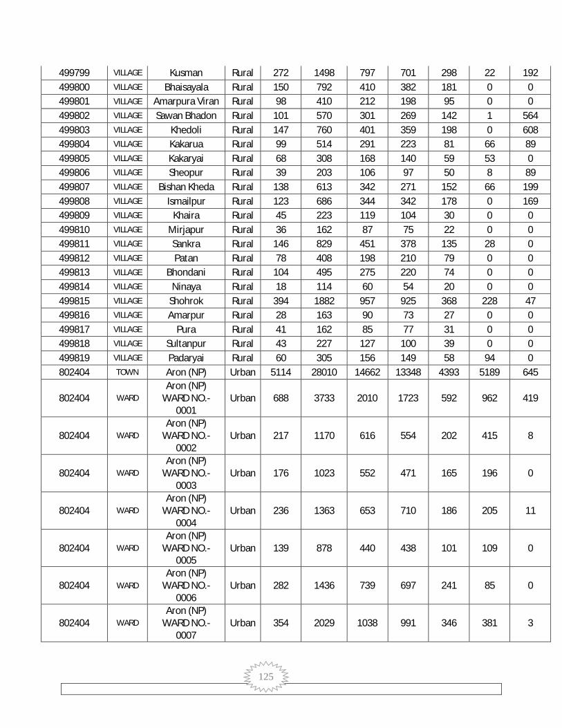
125
499799 VILLAGE Kusman Rural 272 1498 797 701 298 22 192 499800 VILLAGE Bhaisayala Rural 150 792 410 382 181 0 0 499801 VILLAGE Amarpura Viran Rural 98 410 212 198 95 0 0 499802 VILLAGE Sawan Bhadon Rural 101 570 301 269 142 1 564 499803 VILLAGE Khedoli Rural 147 760 401 359 198 0 608 499804 VILLAGE Kakarua Rural 99 514 291 223 81 66 89 499805 VILLAGE Kakaryai Rural 68 308 168 140 59 53 0 499806 VILLAGE Sheopur Rural 39 203 106 97 50 8 89 499807 VILLAGE Bishan Kheda Rural 138 613 342 271 152 66 199 499808 VILLAGE Ismailpur Rural 123 686 344 342 178 0 169 499809 VILLAGE Khaira Rural 45 223 119 104 30 0 0 499810 VILLAGE Mirjapur Rural 36 162 87 75 22 0 0 499811 VILLAGE Sankra Rural 146 829 451 378 135 28 0 499812 VILLAGE Patan Rural 78 408 198 210 79 0 0 499813 VILLAGE Bhondani Rural 104 495 275 220 74 0 0 499814 VILLAGE Ninaya Rural 18 114 60 54 20 0 0 499815 VILLAGE Shohrok Rural 394 1882 957 925 368 228 47 499816 VILLAGE Amarpur Rural 28 163 90 73 27 0 0 499817 VILLAGE Pura Rural 41 162 85 77 31 0 0 499818 VILLAGE Sultanpur Rural 43 227 127 100 39 0 0 499819 VILLAGE Padaryai Rural 60 305 156 149 58 94 0 802404 TOWN Aron (NP) Urban 5114 28010 14662 13348 4393 5189 645
802404 WARD Aron (NP)
WARD NO.-0001
Urban 688 3733 2010 1723 592 962 419
802404 WARD Aron (NP)
WARD NO.-0002
Urban 217 1170 616 554 202 415 8
802404 WARD Aron (NP)
WARD NO.-0003
Urban 176 1023 552 471 165 196 0
802404 WARD Aron (NP)
WARD NO.-0004
Urban 236 1363 653 710 186 205 11
802404 WARD Aron (NP)
WARD NO.-0005
Urban 139 878 440 438 101 109 0
802404 WARD Aron (NP)
WARD NO.-0006
Urban 282 1436 739 697 241 85 0
802404 WARD Aron (NP)
WARD NO.-0007
Urban 354 2029 1038 991 346 381 3

126
802404 WARD Aron (NP)
WARD NO.-0008
Urban 207 1215 629 586 179 115 10
802404 WARD Aron (NP)
WARD NO.-0009
Urban 270 1532 806 726 242 236 0
802404 WARD Aron (NP)
WARD NO.-0010
Urban 254 1410 731 679 223 81 18
802404 WARD Aron (NP)
WARD NO.-0011
Urban 245 1312 687 625 178 294 19
802404 WARD Aron (NP)
WARD NO.-0012
Urban 266 1408 721 687 147 45 25
802404 WARD Aron (NP)
WARD NO.-0013
Urban 605 3220 1778 1442 502 406 48
802404 WARD Aron (NP)
WARD NO.-0014
Urban 617 3143 1664 1479 534 825 57
802404 WARD Aron (NP)
WARD NO.-0015
Urban 558 3138 1598 1540 555 834 27
000000 SUB-DISTRICT Chachaura Total 25459 127388 66703 60685 20099 17067 21080
000000 SUB-DISTRICT Chachaura Rural 21448 105528 55201 50327 16980 13659 20400
000000 SUB-DISTRICT Chachaura Urban 4011 21860 11502 10358 3119 3408 680
499820 VILLAGE Jagipura Alias
Motipura Rural 90 438 229 209 90 24 413
499821 VILLAGE Pipalyaweh Rural 62 324 166 158 79 50 138 499822 VILLAGE Umarya Khurd Rural 122 589 303 286 115 57 410 499823 VILLAGE Fatehpur Rural 218 1037 556 481 208 10 1027 499824 VILLAGE Kari Karar Rural 94 443 218 225 75 0 443 499825 VILLAGE Lilweh Kalan Rural 83 392 204 188 70 2 389 499826 VILLAGE Batawada Rural 599 2623 1360 1263 410 274 370 499827 VILLAGE Kankarya Rural 140 672 364 308 109 14 309 499828 VILLAGE Jalalpura Rural 273 1303 685 618 230 13 1289 499829 VILLAGE Sagodi Rural 110 468 257 211 99 27 441 499830 VILLAGE Awalheda Rural 55 305 146 159 49 0 79
499831 VILLAGE Pipal Khedi
Khurd Rural 87 431 214 217 76 5 403
499832 VILLAGE Pipalheda Dang Rural 151 759 403 356 106 18 439 499833 VILLAGE Bisatpur Rural 106 489 252 237 84 53 0

127
499834 VILLAGE Jhukri Rural 74 307 150 157 58 0 115 499835 VILLAGE Kusumpura Rural 218 901 449 452 168 22 877 499836 VILLAGE Jhukra Rural 198 900 440 460 165 81 806 499837 VILLAGE Magron Rural 89 509 252 257 76 0 2 499838 VILLAGE Sagodya Rural 59 246 122 124 30 31 0 499839 VILLAGE Pipalya Khushal Rural 80 391 197 194 71 0 391 499840 VILLAGE Balawali Rural 81 383 196 187 79 1 357 499841 VILLAGE Umarthana Rural 196 936 492 444 156 51 825 499842 VILLAGE Doryapura Rural 80 413 225 188 79 0 413 499843 VILLAGE Khanpura Rural 77 386 190 196 85 59 206 499844 VILLAGE Talawali Rural 108 485 246 239 84 13 471 499845 VILLAGE Naipura Khurd Rural 22 75 36 39 9 0 75 499846 VILLAGE Kala Pipal Rural 274 1455 765 690 337 53 798 499847 VILLAGE Brahmapura Rural 167 699 365 334 128 26 673 499848 VILLAGE Kudriya Rural 63 348 171 177 75 3 211 499849 VILLAGE Pipalya Moti Rural 213 1017 499 518 211 36 971 499850 VILLAGE Junapani Rural 182 831 437 394 174 1 664 499851 VILLAGE Hinoti Rural 40 173 96 77 35 0 173
499852 VILLAGE Merya Khedi
Khurd Rural 295 1189 617 572 215 92 728
499853 VILLAGE Nesh Kalan Rural 214 986 513 473 190 43 568 499854 VILLAGE Semli Bhoj Rural 43 194 99 95 31 0 33 499855 VILLAGE Shyampura Rural 70 324 170 154 37 1 0 499856 VILLAGE Kamalpur Dang Rural 70 352 210 142 54 7 0 499857 VILLAGE Kulambeh Rural 87 425 217 208 88 7 0 499858 VILLAGE Bijnipura Rural 292 1413 754 659 208 737 159 499859 VILLAGE Maheshpura Rural 161 920 478 442 145 137 28 499860 VILLAGE Damdampura Rural 28 172 91 81 31 7 45
499861 VILLAGE Khatoolo (Nagriy) Rural 313 1923 1013 910 302 786 16
499862 VILLAGE Muhasa Khurd Rural 203 886 470 416 141 13 618 499863 VILLAGE Barkhedi Mafi Rural 300 1628 842 786 266 271 21 499864 VILLAGE Dedla Rural 326 1760 955 805 273 81 0 499865 VILLAGE Ramdi Rural 226 1224 670 554 175 192 80 499866 VILLAGE Hardol Khedi Rural 47 261 137 124 50 0 0 499867 VILLAGE Ramda Rural 61 389 207 182 61 79 4 499868 VILLAGE Aigari Rural 42 212 105 107 23 8 5 499869 VILLAGE Khejda Khurd Rural 75 437 238 199 41 40 1 499870 VILLAGE Ajgara Rural 130 661 341 320 81 202 0 499871 VILLAGE Jamonya Kalan Rural 126 737 408 329 95 75 11
499872 VILLAGE Khejda Kalan
Rani Rural 445 2090 1121 969 324 219 36
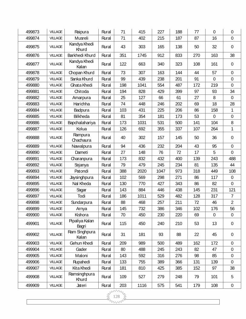
128
499873 VILLAGE Raipura Rural 71 415 227 188 77 0 0 499874 VILLAGE Musreli Rural 71 402 215 187 87 16 0
499875 VILLAGE Kandya Khedi
Khurd Rural 43 303 165 138 50 32 0
499876 VILLAGE Barkhedi Khurd Rural 351 1745 912 833 270 163 38
499877 VILLAGE Kandya Khedi
Kalan Rural 122 663 340 323 108 161 0
499878 VILLAGE Chopan Khurd Rural 73 307 163 144 44 57 0 499879 VILLAGE Sanka Khurd Rural 99 439 238 201 91 0 0 499880 VILLAGE Ghata Khedi Rural 198 1041 554 487 172 219 0 499881 VILLAGE Chitoda Rural 194 828 429 399 97 93 34 499882 VILLAGE Amarpura Rural 25 127 66 61 27 8 0 499883 VILLAGE Harichha Rural 74 448 246 202 69 18 28 499884 VILLAGE Badpura Rural 103 431 225 206 86 158 1 499885 VILLAGE Bilkheda Rural 81 354 181 173 53 0 0 499886 VILLAGE Bapchalahariya Rural 173 1031 531 500 141 104 8 499887 VILLAGE Kolua Rural 126 692 355 337 107 264 1
499888 VILLAGE Rampura
Chachaura Rural 40 302 157 145 50 36 0
499889 VILLAGE Nawalpura Rural 94 436 232 204 43 95 0 499890 VILLAGE Dameti Rural 27 148 76 72 17 5 0 499891 VILLAGE Charanpura Rural 173 832 432 400 139 243 488 499892 VILLAGE Sejanya Rural 79 479 245 234 81 135 44 499893 VILLAGE Patondi Rural 388 2020 1047 973 318 449 108 499894 VILLAGE Jaysinghpura Rural 102 569 298 271 86 117 0 499895 VILLAGE Nal Kheda Rural 130 770 427 343 86 82 0 499896 VILLAGE Sagar Rural 143 884 446 438 145 231 121 499897 VILLAGE Todi Rural 186 1011 529 482 128 317 7 499898 VILLAGE Sundarpura Rural 88 468 257 211 72 46 2 499899 VILLAGE Arnya Rural 145 732 386 346 102 176 56 499900 VILLAGE Kishora Rural 70 450 230 220 69 0 0
499901 VILLAGE Pipaliya Kalan
Bagri Rural 115 450 240 210 53 13 0
499902 VILLAGE Ram Singhpura
Kalan Rural 31 181 93 88 22 45 0
499903 VILLAGE Gehun Khedi Rural 209 989 500 489 162 172 0 499904 VILLAGE Gader Rural 80 488 245 243 82 47 0 499905 VILLAGE Maloni Rural 143 592 316 276 98 85 0 499906 VILLAGE Rupahedi Rural 133 755 389 366 131 139 0 499907 VILLAGE Kita Khedi Rural 181 810 425 385 152 97 38
499908 VILLAGE Ramsinghpura
Khurd Rural 109 527 279 248 79 101 5
499909 VILLAGE Jateri Rural 203 1116 575 541 179 108 0

129
499910 VILLAGE Pura Lakhanwas Rural 77 327 169 158 43 53 0
499911 VILLAGE Vinagaw (Nagriy) Rural 176 1003 522 481 134 149 0
499912 VILLAGE Bhensuwa Rural 144 908 448 460 162 314 49 499913 VILLAGE Lahareha Rural 170 842 463 379 114 98 0 499914 VILLAGE Badodiya Rural 95 463 236 227 78 130 0 499915 VILLAGE Sanwalpura Rural 82 503 260 243 56 0 0 499916 VILLAGE Naipura Kalan Rural 30 189 100 89 20 0 0 499917 VILLAGE Muhasa Kalan Rural 146 776 405 371 96 126 0 499918 VILLAGE Bamori Rural 43 206 109 97 29 0 0 499919 VILLAGE Penchi Rural 582 2689 1363 1326 351 345 1 499920 VILLAGE Mohmmadpura Rural 38 234 118 116 34 0 0 499921 VILLAGE Jhorda Rural 69 335 178 157 37 46 0 499922 VILLAGE Kirwada Rural 117 538 285 253 86 48 118 499923 VILLAGE Netya Khedi Rural 285 1166 623 543 161 96 317 499924 VILLAGE Kotra Rural 240 1243 642 601 181 236 17 499925 VILLAGE Gonyaweh Rural 68 262 141 121 21 0 0 499926 VILLAGE Ubha Pan Rural 54 184 98 86 37 0 0 499927 VILLAGE Polas Rural 6 24 14 10 1 0 0 499928 VILLAGE Amaser Rural 214 1027 530 497 155 43 891 499929 VILLAGE Gunjari Rural 130 521 273 248 77 67 119 499930 VILLAGE Konya Dang Rural 111 496 255 241 97 0 495 499931 VILLAGE Pagdi Rural 109 502 274 228 98 44 0 499932 VILLAGE Murela Rural 674 2887 1438 1449 544 137 86 499933 VILLAGE Borda Rural 59 310 167 143 52 51 0 499934 VILLAGE Pakhriyapura Rural 140 729 373 356 79 78 2 499935 VILLAGE Kherbeh Rural 67 297 157 140 51 77 0 499936 VILLAGE Nesh Khurd Rural 40 171 95 76 24 0 0 499937 VILLAGE Singapura Rural 136 645 333 312 95 49 0 499938 VILLAGE Jogipura Rural 153 762 384 378 150 94 216 499939 VILLAGE Sonaheda Rural 142 638 329 309 85 292 0
499940 VILLAGE Manpura -Chachaura Rural 74 305 163 142 72 91 208
499941 VILLAGE Pipalya Najdik
Kotra Rural 149 741 381 360 115 23 0
499942 VILLAGE Kankan Heru Rural 129 602 300 302 76 254 0 499943 VILLAGE Udo Khedi Rural 61 293 156 137 55 95 0 499944 VILLAGE Parewa Rural 72 355 194 161 43 40 0 499945 VILLAGE Narayanpura Rural 126 714 387 327 111 47 1 499946 VILLAGE Jujhrapura Rural 60 240 124 116 21 0 3 499947 VILLAGE Lachhoni Rural 89 456 250 206 58 8 8 499948 VILLAGE Konya Kalan Rural 246 1333 712 621 212 117 17

130
499949 VILLAGE Kadaiya
Chachaura Rural 95 440 228 212 87 14 0
499950 VILLAGE Merya Khedi
Kalan Rural 114 553 281 272 88 64 5
499951 VILLAGE Dokarya Khedi Rural 61 289 146 143 44 19 0 499952 VILLAGE Bhanpura Baba Rural 92 427 223 204 53 28 0 499953 VILLAGE Bhanpura Mina Rural 57 302 168 134 71 141 1 499954 VILLAGE Biba Khedi Rural 149 768 407 361 122 189 28 499955 VILLAGE Lakhori Rural 158 590 310 280 98 119 98 499956 VILLAGE Dehri Rural 244 1191 617 574 153 325 1 499957 VILLAGE Dabarya Rural 82 312 153 159 40 64 0 499958 VILLAGE Kodyapura Rural 122 655 364 291 100 0 150 499959 VILLAGE Barkhua Rural 199 914 483 431 133 83 0 499960 VILLAGE Teligaon Rural 451 2584 1353 1231 427 382 11 499961 VILLAGE Asa Khedi Rural 24 132 67 65 20 0 0 499962 VILLAGE Lakhanwar Rural 267 1000 558 442 136 62 0 499963 VILLAGE Ratodhana Rural 202 1077 579 498 171 244 1 499964 VILLAGE Kakrua Rural 83 442 242 200 65 22 0 499965 VILLAGE Ramteri Rural 184 881 466 415 126 138 0 499966 VILLAGE Khejra Kalan Rural 206 1132 623 509 197 57 0 499967 VILLAGE Higoni Rural 143 651 363 288 102 22 0 499968 VILLAGE Chopankala Rural 220 1005 498 507 185 390 46 499969 VILLAGE Bapcha Vikram Rural 254 1121 611 510 227 95 1
802405 TOWN Chachaura-
Binaganj (NP) Urban 4011 21860 11502 10358 3119 3408 680
802405 WARD
Chachaura-Binaganj (NP) WARD NO.-
0001
Urban 185 998 522 476 113 0 4
802405 WARD
Chachaura-Binaganj (NP) WARD NO.-
0002
Urban 267 1462 769 693 260 364 112
802405 WARD
Chachaura-Binaganj (NP) WARD NO.-
0003
Urban 225 1154 619 535 167 36 10
802405 WARD
Chachaura-Binaganj (NP) WARD NO.-
0004
Urban 179 1002 540 462 158 0 0
802405 WARD Chachaura-
Binaganj (NP) WARD NO.-
Urban 116 678 351 327 85 12 1

131
0005
802405 WARD
Chachaura-Binaganj (NP) WARD NO.-
0006
Urban 140 844 436 408 112 0 6
802405 WARD
Chachaura-Binaganj (NP) WARD NO.-
0007
Urban 263 1491 761 730 223 468 18
802405 WARD
Chachaura-Binaganj (NP) WARD NO.-
0008
Urban 339 1727 938 789 202 119 176
802405 WARD
Chachaura-Binaganj (NP) WARD NO.-
0009
Urban 565 3178 1713 1465 448 573 188
802405 WARD
Chachaura-Binaganj (NP) WARD NO.-
0010
Urban 402 2239 1184 1055 329 272 94
802405 WARD
Chachaura-Binaganj (NP) WARD NO.-
0011
Urban 175 894 465 429 118 0 0
802405 WARD
Chachaura-Binaganj (NP) WARD NO.-
0012
Urban 308 1588 817 771 240 456 26
802405 WARD
Chachaura-Binaganj (NP) WARD NO.-
0013
Urban 187 955 484 471 113 218 4
802405 WARD
Chachaura-Binaganj (NP) WARD NO.-
0014
Urban 222 1286 675 611 200 325 22
802405 WARD
Chachaura-Binaganj (NP) WARD NO.-
0015
Urban 438 2364 1228 1136 351 565 19

132
SR.NO. STATE DName BlkName NEAREST VILLAGE
AREA (sqm) LONGITUDE LATTITUDE
1 MP Guna RAGHOGARH 2052.285655 77° 17' 16.219" E
23° 56' 10.731" N
2 MP Guna RAGHOGARH 205785.9047 77° 17' 12.177" E
23° 56' 34.785" N
3 MP Guna RAGHOGARH 27958.13282 77° 11' 10.290" E
23° 56' 50.591" N
4 MP Guna RAGHOGARH 162528.3544 77° 16' 46.334" E
24° 5' 10.249" N
5 MP Guna CHACHAUDA Dabarya 1253.126559 77° 3' 35.391" E
24° 6' 16.658" N
6 MP Guna CHACHAUDA Dabarya 3538.556532 77° 3' 31.883" E
24° 6' 17.415" N
7 MP Guna CHACHAUDA Ramda 3088.631889 77° 2' 2.936" E
24° 16' 2.170" N
8 MP Guna CHACHAUDA Bhensuwa 4398.881826 77° 1' 7.503" E
24° 7' 58.074" N
9 MP Guna RAGHOGARH 10844.37448 77° 12' 53.720" E
24° 9' 10.798" N
10 MP Guna CHACHAUDA Ratodhana 9017.910765 77° 7' 54.913" E
24° 9' 39.226" N
11 MP Guna CHACHAUDA Lahareha 4300.497877 77° 2' 17.294" E
24° 9' 40.354" N
12 MP Guna RAGHOGARH 3292.727267 77° 14' 57.726" E
24° 10' 17.417" N
13 MP Guna CHACHAUDA Khatoolo (Nagriy)
2264.222379 77° 2' 22.407" E
24° 11' 29.028" N
14 MP Guna CHACHAUDA Bijnipura 6506.340207 77° 0' 38.015" E
24° 13' 12.997" N
15 MP Guna RAGHOGARH 2210.84699 77° 12' 19.424" E
24° 14' 43.080" N
16 MP Guna RAGHOGARH 2088.703085 77° 13' 3.008" E
24° 15' 36.043" N
17 MP Guna ARON 16623.27635 77° 27' 2.672" E
24° 17' 57.391" N
18 MP Guna ARON 3925.503323 77° 34' 25.881" E
24° 18' 30.314" N
19 MP Guna ARON Tankparoriya 3955.363365 77° 31' 21.609" E
24° 20' 7.156" N
20 MP Guna RAGHOGARH 8569.78867 77° 9' 40.004" E
24° 20' 28.666" N
21 MP Guna CHACHAUDA Barkhedi Khurd
2569.80017 77° 4' 51.573" E
24° 20' 34.018" N
22 MP Guna ARON 5110.187314 77° 34' 46.171" E
24° 20' 49.435" N

133
23 MP Guna CHACHAUDA Alli Khedi 5996.02865 77° 3' 10.001" E
24° 21' 2.008" N
24 MP Guna ARON 2707.913111 77° 37' 45.076" E
24° 21' 29.246" N
25 MP Guna RAGHOGARH 2252.822229 77° 9' 26.583" E
24° 21' 20.659" N
26 MP Guna RAGHOGARH Chanpura 25513.30827 77° 8' 49.418" E
24° 23' 7.574" N
27 MP Guna ARON 10593.87816 77° 19' 22.330" E
24° 24' 50.565" N
28 MP Guna ARON 1872.682158 77° 24' 29.239" E
24° 24' 42.090" N
29 MP Guna RAGHOGARH 5522.159661 77° 9' 33.802" E
24° 26' 10.666" N
30 MP Guna RAGHOGARH 11898.62385 77° 9' 33.573" E
24° 26' 6.048" N
31 MP Guna ARON Umariya 11844.90404 77° 18' 49.177" E
24° 27' 6.976" N
32 MP Guna ARON 7342.288972 77° 20' 59.013" E
24° 28' 33.018" N
33 MP Guna ARON 6379.131367 77° 21' 19.569" E
24° 28' 23.294" N
34 MP Guna CHACHAUDA Tagariya Kalan 2633.596423 77° 0' 36.137" E
24° 27' 58.576" N
35 MP Guna RAGHOGARH 56656.51459 77° 9' 13.946" E
24° 29' 2.599" N
36 MP Guna RAGHOGARH 37036.87797 77° 9' 4.283" E
24° 29' 5.174" N
37 MP Guna RAGHOGARH 7365.789427 77° 10' 20.111" E
24° 34' 3.224" N
38 MP Guna BAMORI Bamori Khurd 67823.77448 77° 11' 29.582" E
24° 35' 48.919" N
39 MP Guna GUNA Garha 11537.53575 77° 12' 11.846" E
24° 36' 54.081" N
40 MP Guna GUNA Garha 6493.37657 77° 12' 5.801" E
24° 36' 53.397" N
41 MP Guna GUNA Garha 4319.578684 77° 13' 14.599" E
24° 37' 7.969" N
42 MP Guna BAMORI Bilas 14448.60481 77° 12' 35.314" E
24° 39' 26.733" N
43 MP Guna BAMORI Bilas 1856.896075 77° 12' 32.947" E
24° 40' 3.574" N
44 MP Guna GUNA Gora 4773.956253 77° 24' 49.544" E
24° 40' 46.474" N
45 MP Guna GUNA Gora 4504.259883 77° 24' 36.674" E
24° 40' 32.581" N
46 MP Guna BAMORI Dhadhan 11908.51374 77° 7' 24° 41'
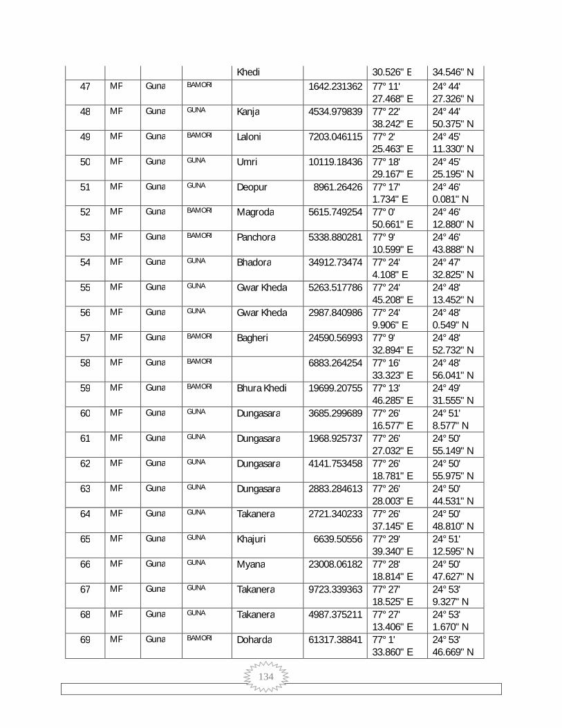
134
Khedi 30.526" E 34.546" N 47 MP Guna BAMORI 1642.231362 77° 11'
27.468" E 24° 44' 27.326" N
48 MP Guna GUNA Kanja 4534.979839 77° 22' 38.242" E
24° 44' 50.375" N
49 MP Guna BAMORI Laloni 7203.046115 77° 2' 25.463" E
24° 45' 11.330" N
50 MP Guna GUNA Umri 10119.18436 77° 18' 29.167" E
24° 45' 25.195" N
51 MP Guna GUNA Deopur 8961.26426 77° 17' 1.734" E
24° 46' 0.081" N
52 MP Guna BAMORI Magroda 5615.749254 77° 0' 50.661" E
24° 46' 12.880" N
53 MP Guna BAMORI Panchora 5338.880281 77° 9' 10.599" E
24° 46' 43.888" N
54 MP Guna GUNA Bhadora 34912.73474 77° 24' 4.108" E
24° 47' 32.825" N
55 MP Guna GUNA Gwar Kheda 5263.517786 77° 24' 45.208" E
24° 48' 13.452" N
56 MP Guna GUNA Gwar Kheda 2987.840986 77° 24' 9.906" E
24° 48' 0.549" N
57 MP Guna BAMORI Bagheri 24590.56993 77° 9' 32.894" E
24° 48' 52.732" N
58 MP Guna BAMORI 6883.264254 77° 16' 33.323" E
24° 48' 56.041" N
59 MP Guna BAMORI Bhura Khedi 19699.20755 77° 13' 46.285" E
24° 49' 31.555" N
60 MP Guna GUNA Dungasara 3685.299689 77° 26' 16.577" E
24° 51' 8.577" N
61 MP Guna GUNA Dungasara 1968.925737 77° 26' 27.032" E
24° 50' 55.149" N
62 MP Guna GUNA Dungasara 4141.753458 77° 26' 18.781" E
24° 50' 55.975" N
63 MP Guna GUNA Dungasara 2883.284613 77° 26' 28.003" E
24° 50' 44.531" N
64 MP Guna GUNA Takanera 2721.340233 77° 26' 37.145" E
24° 50' 48.810" N
65 MP Guna GUNA Khajuri 6639.50556 77° 29' 39.340" E
24° 51' 12.595" N
66 MP Guna GUNA Myana 23008.06182 77° 28' 18.814" E
24° 50' 47.627" N
67 MP Guna GUNA Takanera 9723.339363 77° 27' 18.525" E
24° 53' 9.327" N
68 MP Guna GUNA Takanera 4987.375211 77° 27' 13.406" E
24° 53' 1.670" N
69 MP Guna BAMORI Doharda 61317.38841 77° 1' 33.860" E
24° 53' 46.669" N
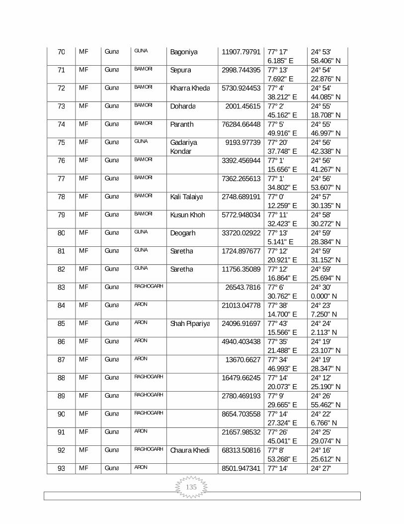
135
70 MP Guna GUNA Bagoniya 11907.79791 77° 17' 6.185" E
24° 53' 58.406" N
71 MP Guna BAMORI Sepura 2998.744395 77° 13' 7.692" E
24° 54' 22.876" N
72 MP Guna BAMORI Kharra Kheda 5730.924453 77° 4' 38.212" E
24° 54' 44.085" N
73 MP Guna BAMORI Doharda 2001.45615 77° 2' 45.162" E
24° 55' 18.708" N
74 MP Guna BAMORI Paranth 76284.66448 77° 5' 49.916" E
24° 55' 46.997" N
75 MP Guna GUNA Gadariya Kondar
9193.97739 77° 20' 37.748" E
24° 56' 42.338" N
76 MP Guna BAMORI 3392.456944 77° 1' 15.656" E
24° 56' 41.267" N
77 MP Guna BAMORI 7362.265613 77° 1' 34.802" E
24° 56' 53.607" N
78 MP Guna BAMORI Kali Talaiya 2748.689191 77° 0' 12.259" E
24° 57' 30.135" N
79 MP Guna BAMORI Kusun Khoh 5772.948034 77° 11' 32.423" E
24° 58' 30.272" N
80 MP Guna GUNA Deogarh 33720.02922 77° 13' 5.141" E
24° 59' 28.384" N
81 MP Guna GUNA Saretha 1724.897677 77° 12' 20.921" E
24° 59' 31.152" N
82 MP Guna GUNA Saretha 11756.35089 77° 12' 16.864" E
24° 59' 25.694" N
83 MP Guna RAGHOGARH 26543.7816 77° 6' 30.762" E
24° 30' 0.000" N
84 MP Guna ARON 21013.04778 77° 38' 14.700" E
24° 23' 7.250" N
85 MP Guna ARON Shah Pipariya 24096.91697 77° 43' 15.566" E
24° 24' 2.113" N
86 MP Guna ARON 4940.403438 77° 35' 21.488" E
24° 19' 23.107" N
87 MP Guna ARON 13670.6627 77° 34' 46.993" E
24° 19' 28.347" N
88 MP Guna RAGHOGARH 16479.66245 77° 14' 20.073" E
24° 12' 25.190" N
89 MP Guna RAGHOGARH 2780.469193 77° 9' 29.665" E
24° 26' 55.462" N
90 MP Guna RAGHOGARH 8654.703558 77° 14' 27.324" E
24° 22' 6.766" N
91 MP Guna ARON 21657.98532 77° 26' 45.041" E
24° 25' 29.074" N
92 MP Guna RAGHOGARH Chaura Khedi 68313.50816 77° 8' 53.268" E
24° 16' 25.612" N
93 MP Guna ARON 8501.947341 77° 14' 24° 27'
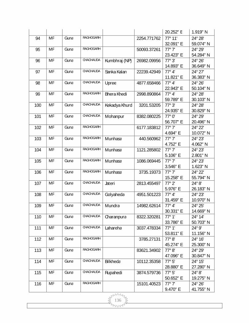
136
20.252" E 1.919" N 94 MP Guna RAGHOGARH 2254.771762 77° 11'
32.091" E 24° 28' 59.074" N
95 MP Guna RAGHOGARH 50093.37261 77° 7' 23.423" E
24° 29' 54.284" N
96 MP Guna CHACHAUDA Kumbhraj (NP) 26982.09956 77° 3' 14.893" E
24° 26' 36.649" N
97 MP Guna CHACHAUDA Sanka Kalan 22239.42949 77° 4' 11.821" E
24° 27' 36.383" N
98 MP Guna CHACHAUDA Upree 4877.658466 77° 4' 22.943" E
24° 26' 50.104" N
99 MP Guna RAGHOGARH Bhera Khedi 2998.890864 77° 4' 59.789" E
24° 28' 30.103" N
100 MP Guna CHACHAUDA Kekadya Khurd 3201.53205 77° 3' 24.935" E
24° 28' 30.829" N
101 MP Guna CHACHAUDA Mohanpur 8382.080225 77° 0' 56.707" E
24° 29' 20.496" N
102 MP Guna RAGHOGARH 6177.183812 77° 7' 4.694" E
24° 22' 10.072" N
103 MP Guna RAGHOGARH Munhasa 440.560962 77° 7' 4.752" E
24° 23' 4.062" N
104 MP Guna RAGHOGARH Munhasa 1121.285802 77° 7' 5.106" E
24° 23' 2.801" N
105 MP Guna RAGHOGARH Munhasa 1086.069445 77° 7' 3.546" E
24° 23' 1.623" N
106 MP Guna RAGHOGARH Munhasa 3735.19373 77° 7' 15.258" E
24° 22' 55.794" N
107 MP Guna CHACHAUDA Jateri 2813.455497 77° 2' 5.976" E
24° 8' 26.183" N
108 MP Guna CHACHAUDA Golyaheda 4951.501223 77° 4' 31.459" E
24° 23' 10.970" N
109 MP Guna CHACHAUDA Mundra 14982.62614 77° 4' 30.331" E
24° 25' 14.669" N
110 MP Guna CHACHAUDA Charanpura 8322.320281 77° 1' 33.786" E
24° 14' 50.703" N
111 MP Guna CHACHAUDA Lahareha 3037.478334 77° 1' 53.811" E
24° 9' 11.156" N
112 MP Guna RAGHOGARH 3785.27131 77° 8' 45.274" E
24° 16' 25.300" N
113 MP Guna RAGHOGARH 83621.34902 77° 8' 47.096" E
24° 29' 30.847" N
114 MP Guna CHACHAUDA Bilkheda 10112.35358 77° 5' 28.880" E
24° 15' 27.280" N
115 MP Guna CHACHAUDA Rupahedi 3874.579736 77° 5' 50.652" E
24° 8' 19.275" N
116 MP Guna RAGHOGARH 15101.40523 77° 7' 9.470" E
24° 26' 41.755" N

137
117 MP Guna CHACHAUDA Khejda Kalan Rani
13130.76628 77° 4' 17.884" E
24° 19' 48.397" N
118 MP Guna CHACHAUDA Hanumat Kheda
29352.78063 77° 2' 26.742" E
24° 29' 17.051" N
119 MP Guna CHACHAUDA Bhensuwa 4997.401679 77° 0' 42.717" E
24° 8' 30.026" N
120 MP Guna ARON 13041.17126 77° 27' 31.407" E
24° 28' 4.045" N
121 MP Guna ARON 6040.548066 77° 27' 38.725" E
24° 25' 1.687" N
122 MP Guna ARON 11904.18933 77° 27' 57.308" E
24° 24' 9.715" N
123 MP Guna ARON Aron (NP) 17079.39109 77° 27' 36.830" E
24° 20' 39.794" N
124 MP Guna ARON Gehnu Kheda 2919.299447 77° 28' 14.252" E
24° 18' 13.722" N
125 MP Guna ARON 8408.718112 77° 27' 50.911" E
24° 18' 29.942" N
126 MP Guna ARON 1036.994111 77° 19' 40.248" E
24° 26' 31.051" N
127 MP Guna ARON 4334.216121 77° 19' 37.191" E
24° 26' 9.206" N
128 MP Guna ARON Gailon 1496.273793 77° 19' 37.602" E
24° 25' 26.793" N
129 MP Guna ARON 4072.245694 77° 19' 23.973" E
24° 24' 9.538" N
130 MP Guna ARON 13405.29845 77° 19' 20.694" E
24° 24' 13.704" N
131 MP Guna ARON Jhajhon 6724.19489 77° 19' 44.815" E
24° 22' 45.909" N
132 MP Guna RAGHOGARH 15000.65626 77° 18' 53.747" E
24° 16' 15.457" N
133 MP Guna RAGHOGARH 8223.171437 77° 18' 52.660" E
24° 16' 42.267" N
134 MP Guna ARON 4686.535327 77° 17' 35.962" E
24° 18' 54.697" N
135 MP Guna ARON 7400.071864 77° 19' 4.136" E
24° 19' 33.036" N
136 MP Guna ARON Jhajhon 14467.39138 77° 18' 47.185" E
24° 21' 10.032" N
137 MP Guna ARON 6064.584165 77° 17' 31.133" E
24° 21' 3.538" N
138 MP Guna ARON Jhajhon 1693.175231 77° 17' 32.622" E
24° 22' 0.883" N
139 MP Guna ARON Jhajhon 3221.272051 77° 17' 31.519" E
24° 21' 57.730" N
140 MP Guna ARON Jhajhon 6723.687443 77° 17' 24° 21'
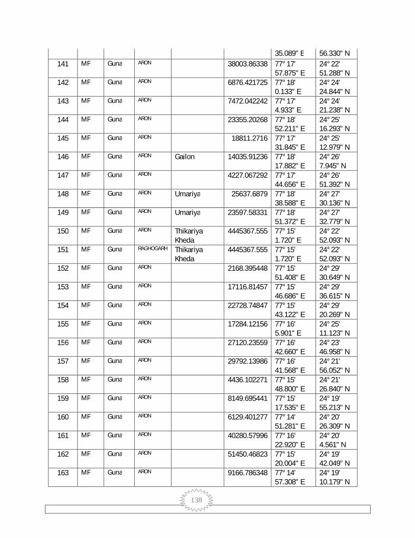
138
35.089" E 56.330" N 141 MP Guna ARON 38003.86338 77° 17'
57.875" E 24° 22' 51.288" N
142 MP Guna ARON 6876.421725 77° 18' 0.133" E
24° 24' 24.844" N
143 MP Guna ARON 7472.042242 77° 17' 4.933" E
24° 24' 21.238" N
144 MP Guna ARON 23355.20268 77° 18' 52.211" E
24° 25' 16.293" N
145 MP Guna ARON 18811.2716 77° 17' 31.845" E
24° 25' 12.979" N
146 MP Guna ARON Gailon 14035.91236 77° 18' 17.882" E
24° 26' 7.945" N
147 MP Guna ARON 4227.067292 77° 17' 44.656" E
24° 26' 51.392" N
148 MP Guna ARON Umariya 25637.6879 77° 18' 38.588" E
24° 27' 30.136" N
149 MP Guna ARON Umariya 23597.58331 77° 18' 51.372" E
24° 27' 32.779" N
150 MP Guna ARON Thikariya Kheda
4445367.555 77° 15' 1.720" E
24° 22' 52.093" N
151 MP Guna RAGHOGARH Thikariya Kheda
4445367.555 77° 15' 1.720" E
24° 22' 52.093" N
152 MP Guna ARON 2168.395448 77° 15' 51.408" E
24° 29' 30.649" N
153 MP Guna ARON 17116.81457 77° 15' 46.686" E
24° 29' 36.615" N
154 MP Guna ARON 22728.74847 77° 15' 43.122" E
24° 29' 20.269" N
155 MP Guna ARON 17284.12156 77° 16' 5.901" E
24° 25' 11.123" N
156 MP Guna ARON 27120.23559 77° 16' 42.660" E
24° 23' 46.958" N
157 MP Guna ARON 29792.13986 77° 16' 41.568" E
24° 21' 56.052" N
158 MP Guna ARON 4436.102271 77° 15' 48.800" E
24° 21' 26.840" N
159 MP Guna ARON 8149.695441 77° 15' 17.535" E
24° 19' 55.213" N
160 MP Guna ARON 6129.401277 77° 14' 51.281" E
24° 20' 26.309" N
161 MP Guna ARON 40280.57996 77° 16' 22.920" E
24° 20' 4.561" N
162 MP Guna ARON 51450.46823 77° 15' 20.004" E
24° 19' 42.049" N
163 MP Guna ARON 9166.786348 77° 14' 57.308" E
24° 19' 10.179" N
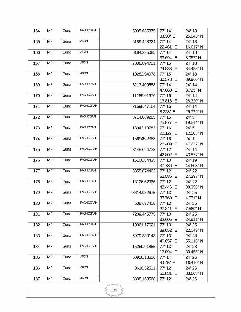
139
164 MP Guna RAGHOGARH 5005.635375 77° 14' 3.830" E
24° 18' 25.845" N
165 MP Guna ARON 6189.428224 77° 14' 22.461" E
24° 18' 16.617" N
166 MP Guna ARON 6184.235085 77° 14' 33.694" E
24° 18' 3.057" N
167 MP Guna ARON 2006.894721 77° 15' 24.833" E
24° 18' 34.483" N
168 MP Guna ARON 10282.94078 77° 15' 30.573" E
24° 18' 39.960" N
169 MP Guna RAGHOGARH 5213.409588 77° 14' 47.080" E
24° 14' 3.725" N
170 MP Guna RAGHOGARH 11189.01676 77° 16' 13.816" E
24° 14' 28.320" N
171 MP Guna RAGHOGARH 21698.47164 77° 16' 8.223" E
24° 14' 25.779" N
172 MP Guna RAGHOGARH 8714.089265 77° 15' 25.977" E
24° 5' 19.544" N
173 MP Guna RAGHOGARH 18943.19783 77° 16' 22.127" E
24° 5' 12.503" N
174 MP Guna RAGHOGARH 156945.2383 77° 16' 26.409" E
24° 1' 47.232" N
175 MP Guna RAGHOGARH 3449.024733 77° 12' 42.802" E
24° 14' 43.877" N
176 MP Guna RAGHOGARH 15106.84435 77° 13' 37.736" E
24° 19' 44.603" N
177 MP Guna RAGHOGARH 8855.074462 77° 12' 52.585" E
24° 22' 27.297" N
178 MP Guna RAGHOGARH 18126.62966 77° 12' 42.446" E
24° 22' 38.358" N
179 MP Guna RAGHOGARH 3614.932675 77° 13' 33.760" E
24° 25' 4.031" N
180 MP Guna RAGHOGARH 5057.37415 77° 13' 27.341" E
24° 25' 7.569" N
181 MP Guna RAGHOGARH 7209.445775 77° 13' 32.605" E
24° 25' 24.911" N
182 MP Guna RAGHOGARH 10061.17621 77° 13' 38.052" E
24° 25' 22.049" N
183 MP Guna RAGHOGARH 6979.830143 77° 13' 40.657" E
24° 28' 55.116" N
184 MP Guna RAGHOGARH 15259.91855 77° 13' 17.094" E
24° 28' 30.455" N
185 MP Guna ARON 60936.18526 77° 14' 4.045" E
24° 26' 16.410" N
186 MP Guna ARON 9610.52511 77° 12' 55.831" E
24° 26' 33.603" N
187 MP Guna ARON 3838.158568 77° 12' 24° 26'

140
40.364" E 32.247" N 188 MP Guna RAGHOGARH 8963.711414 77° 12'
53.562" E 24° 26' 11.633" N
189 MP Guna ARON Sawari Nath 83664.99031 77° 12' 47.580" E
24° 26' 17.570" N
190 MP Guna RAGHOGARH Sawari Nath 83664.99031 77° 12' 47.580" E
24° 26' 17.570" N
191 MP Guna RAGHOGARH 6384.517369 77° 12' 56.128" E
24° 25' 24.393" N
192 MP Guna RAGHOGARH 21941.6912 77° 12' 19.164" E
24° 25' 3.257" N
193 MP Guna RAGHOGARH Naganpur 24061.59543 77° 12' 33.868" E
24° 24' 37.307" N
194 MP Guna RAGHOGARH 4995.116496 77° 13' 39.141" E
24° 24' 44.093" N
195 MP Guna RAGHOGARH 2312.578262 77° 13' 29.214" E
24° 24' 30.697" N
196 MP Guna ARON 6498.740354 77° 13' 52.257" E
24° 21' 1.105" N
197 MP Guna RAGHOGARH 5695.670283 77° 13' 11.882" E
24° 17' 22.238" N
198 MP Guna RAGHOGARH 31342.86257 77° 13' 50.045" E
24° 15' 45.217" N
199 MP Guna RAGHOGARH 2221.524637 77° 12' 21.323" E
24° 14' 51.278" N
200 MP Guna RAGHOGARH 2082.160833 77° 12' 20.829" E
24° 14' 48.029" N
201 MP Guna RAGHOGARH 7828.780203 77° 14' 27.818" E
24° 12' 29.267" N
202 MP Guna RAGHOGARH 4195.54984 77° 14' 18.939" E
24° 12' 32.796" N
203 MP Guna RAGHOGARH 10526.08611 77° 14' 19.315" E
24° 10' 59.065" N
204 MP Guna RAGHOGARH 6157.434881 77° 14' 18.521" E
24° 10' 22.761" N
205 MP Guna RAGHOGARH 4613.731216 77° 14' 11.188" E
24° 9' 51.974" N
206 MP Guna RAGHOGARH 2751.70619 77° 12' 51.910" E
24° 9' 45.453" N
207 MP Guna RAGHOGARH 15459.66404 77° 11' 34.390" E
24° 8' 54.457" N
208 MP Guna RAGHOGARH 21438.9435 77° 11' 9.581" E
24° 13' 56.492" N
209 MP Guna RAGHOGARH 8072.936437 77° 11' 1.474" E
24° 19' 42.879" N
210 MP Guna RAGHOGARH 5451.005429 77° 9' 39.003" E
24° 25' 45.587" N
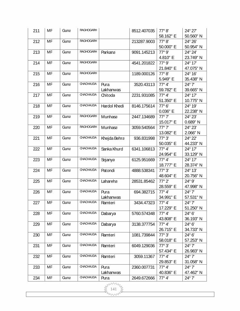
141
211 MP Guna RAGHOGARH 8512.407035 77° 8' 58.162" E
24° 27' 50.560" N
212 MP Guna RAGHOGARH 213287.9003 77° 8' 50.000" E
24° 26' 50.954" N
213 MP Guna RAGHOGARH Parkana 9091.145213 77° 9' 4.810" E
24° 24' 23.749" N
214 MP Guna RAGHOGARH 4541.201822 77° 9' 21.840" E
24° 17' 47.075" N
215 MP Guna RAGHOGARH 1189.000126 77° 8' 5.949" E
24° 16' 35.438" N
216 MP Guna CHACHAUDA Pura Lakhanwas
3520.43113 77° 4' 59.782" E
24° 7' 39.665" N
217 MP Guna CHACHAUDA Chitoda 2231.931085 77° 4' 51.350" E
24° 17' 10.775" N
218 MP Guna CHACHAUDA Hardol Khedi 8146.175614 77° 6' 0.036" E
24° 19' 22.238" N
219 MP Guna RAGHOGARH Munhasa 2447.134689 77° 7' 15.017" E
24° 23' 0.689" N
220 MP Guna RAGHOGARH Munhasa 3059.540564 77° 7' 13.082" E
24° 23' 2.066" N
221 MP Guna CHACHAUDA Khejda Behra 936.831998 77° 3' 50.035" E
24° 22' 44.233" N
222 MP Guna CHACHAUDA Sanka Khurd 6341.106813 77° 4' 24.954" E
24° 17' 33.129" N
223 MP Guna CHACHAUDA Sejanya 6125.951669 77° 4' 18.777" E
24° 17' 28.374" N
224 MP Guna CHACHAUDA Patondi 4888.538341 77° 3' 48.604" E
24° 13' 20.756" N
225 MP Guna CHACHAUDA Lahareha 28531.85462 77° 2' 28.559" E
24° 9' 47.998" N
226 MP Guna CHACHAUDA Pura Lakhanwas
694.382715 77° 4' 34.991" E
24° 7' 57.531" N
227 MP Guna CHACHAUDA Ramteri 3434.47323 77° 4' 17.229" E
24° 7' 51.250" N
228 MP Guna CHACHAUDA Dabarya 5760.574348 77° 4' 43.808" E
24° 6' 36.193" N
229 MP Guna CHACHAUDA Dabarya 3138.377754 77° 4' 26.715" E
24° 6' 34.733" N
230 MP Guna CHACHAUDA Ramteri 1081.739844 77° 3' 58.018" E
24° 6' 57.253" N
231 MP Guna CHACHAUDA Ramteri 6049.129036 77° 3' 57.434" E
24° 7' 26.983" N
232 MP Guna CHACHAUDA Ramteri 3059.11367 77° 4' 29.853" E
24° 7' 31.058" N
233 MP Guna CHACHAUDA Pura Lakhanwas
2360.007731 77° 4' 40.836" E
24° 7' 47.462" N
234 MP Guna CHACHAUDA Pura 2649.672666 77° 4' 24° 7'
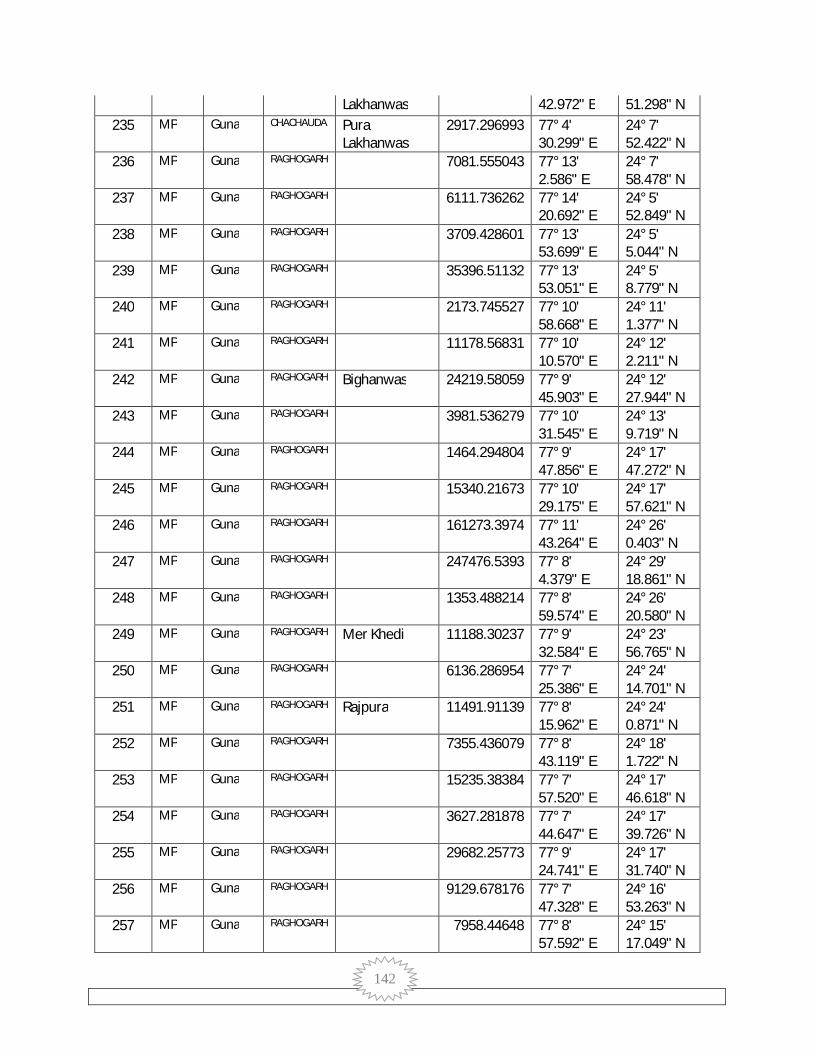
142
Lakhanwas 42.972" E 51.298" N 235 MP Guna CHACHAUDA Pura
Lakhanwas 2917.296993 77° 4'
30.299" E 24° 7' 52.422" N
236 MP Guna RAGHOGARH 7081.555043 77° 13' 2.586" E
24° 7' 58.478" N
237 MP Guna RAGHOGARH 6111.736262 77° 14' 20.692" E
24° 5' 52.849" N
238 MP Guna RAGHOGARH 3709.428601 77° 13' 53.699" E
24° 5' 5.044" N
239 MP Guna RAGHOGARH 35396.51132 77° 13' 53.051" E
24° 5' 8.779" N
240 MP Guna RAGHOGARH 2173.745527 77° 10' 58.668" E
24° 11' 1.377" N
241 MP Guna RAGHOGARH 11178.56831 77° 10' 10.570" E
24° 12' 2.211" N
242 MP Guna RAGHOGARH Bighanwas 24219.58059 77° 9' 45.903" E
24° 12' 27.944" N
243 MP Guna RAGHOGARH 3981.536279 77° 10' 31.545" E
24° 13' 9.719" N
244 MP Guna RAGHOGARH 1464.294804 77° 9' 47.856" E
24° 17' 47.272" N
245 MP Guna RAGHOGARH 15340.21673 77° 10' 29.175" E
24° 17' 57.621" N
246 MP Guna RAGHOGARH 161273.3974 77° 11' 43.264" E
24° 26' 0.403" N
247 MP Guna RAGHOGARH 247476.5393 77° 8' 4.379" E
24° 29' 18.861" N
248 MP Guna RAGHOGARH 1353.488214 77° 8' 59.574" E
24° 26' 20.580" N
249 MP Guna RAGHOGARH Mer Khedi 11188.30237 77° 9' 32.584" E
24° 23' 56.765" N
250 MP Guna RAGHOGARH 6136.286954 77° 7' 25.386" E
24° 24' 14.701" N
251 MP Guna RAGHOGARH Rajpura 11491.91139 77° 8' 15.962" E
24° 24' 0.871" N
252 MP Guna RAGHOGARH 7355.436079 77° 8' 43.119" E
24° 18' 1.722" N
253 MP Guna RAGHOGARH 15235.38384 77° 7' 57.520" E
24° 17' 46.618" N
254 MP Guna RAGHOGARH 3627.281878 77° 7' 44.647" E
24° 17' 39.726" N
255 MP Guna RAGHOGARH 29682.25773 77° 9' 24.741" E
24° 17' 31.740" N
256 MP Guna RAGHOGARH 9129.678176 77° 7' 47.328" E
24° 16' 53.263" N
257 MP Guna RAGHOGARH 7958.44648 77° 8' 57.592" E
24° 15' 17.049" N
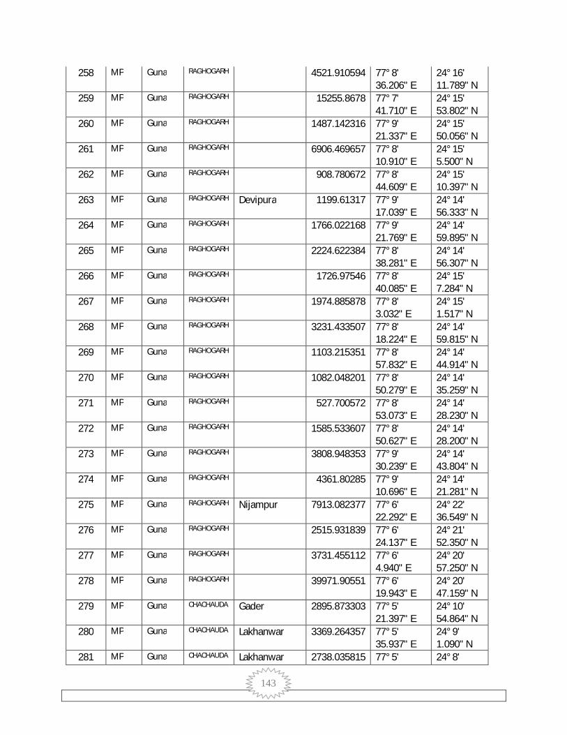
143
258 MP Guna RAGHOGARH 4521.910594 77° 8' 36.206" E
24° 16' 11.789" N
259 MP Guna RAGHOGARH 15255.8678 77° 7' 41.710" E
24° 15' 53.802" N
260 MP Guna RAGHOGARH 1487.142316 77° 9' 21.337" E
24° 15' 50.056" N
261 MP Guna RAGHOGARH 6906.469657 77° 8' 10.910" E
24° 15' 5.500" N
262 MP Guna RAGHOGARH 908.780672 77° 8' 44.609" E
24° 15' 10.397" N
263 MP Guna RAGHOGARH Devipura 1199.61317 77° 9' 17.039" E
24° 14' 56.333" N
264 MP Guna RAGHOGARH 1766.022168 77° 9' 21.769" E
24° 14' 59.895" N
265 MP Guna RAGHOGARH 2224.622384 77° 8' 38.281" E
24° 14' 56.307" N
266 MP Guna RAGHOGARH 1726.97546 77° 8' 40.085" E
24° 15' 7.284" N
267 MP Guna RAGHOGARH 1974.885878 77° 8' 3.032" E
24° 15' 1.517" N
268 MP Guna RAGHOGARH 3231.433507 77° 8' 18.224" E
24° 14' 59.815" N
269 MP Guna RAGHOGARH 1103.215351 77° 8' 57.832" E
24° 14' 44.914" N
270 MP Guna RAGHOGARH 1082.048201 77° 8' 50.279" E
24° 14' 35.259" N
271 MP Guna RAGHOGARH 527.700572 77° 8' 53.073" E
24° 14' 28.230" N
272 MP Guna RAGHOGARH 1585.533607 77° 8' 50.627" E
24° 14' 28.200" N
273 MP Guna RAGHOGARH 3808.948353 77° 9' 30.239" E
24° 14' 43.804" N
274 MP Guna RAGHOGARH 4361.80285 77° 9' 10.696" E
24° 14' 21.281" N
275 MP Guna RAGHOGARH Nijampur 7913.082377 77° 6' 22.292" E
24° 22' 36.549" N
276 MP Guna RAGHOGARH 2515.931839 77° 6' 24.137" E
24° 21' 52.350" N
277 MP Guna RAGHOGARH 3731.455112 77° 6' 4.940" E
24° 20' 57.250" N
278 MP Guna RAGHOGARH 39971.90551 77° 6' 19.943" E
24° 20' 47.159" N
279 MP Guna CHACHAUDA Gader 2895.873303 77° 5' 21.397" E
24° 10' 54.864" N
280 MP Guna CHACHAUDA Lakhanwar 3369.264357 77° 5' 35.937" E
24° 9' 1.090" N
281 MP Guna CHACHAUDA Lakhanwar 2738.035815 77° 5' 24° 8'
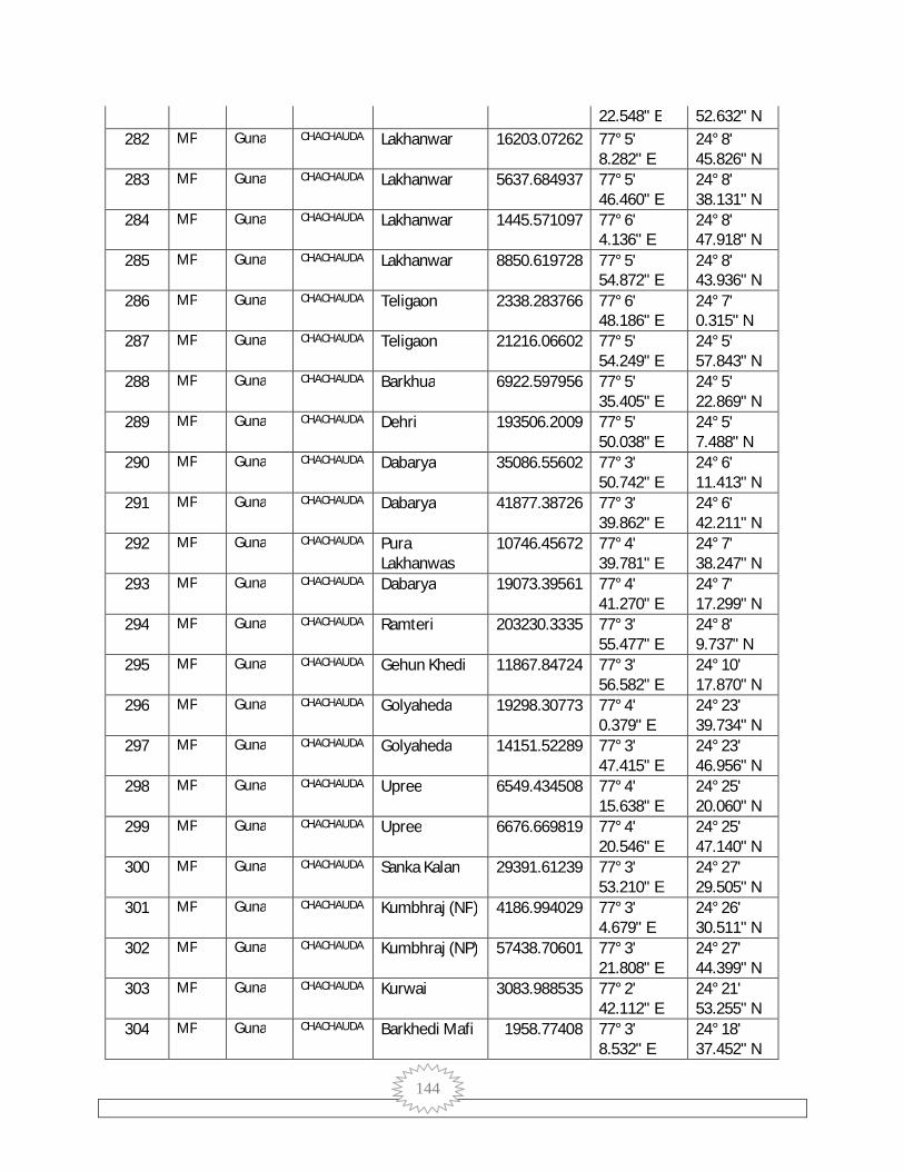
144
22.548" E 52.632" N 282 MP Guna CHACHAUDA Lakhanwar 16203.07262 77° 5'
8.282" E 24° 8' 45.826" N
283 MP Guna CHACHAUDA Lakhanwar 5637.684937 77° 5' 46.460" E
24° 8' 38.131" N
284 MP Guna CHACHAUDA Lakhanwar 1445.571097 77° 6' 4.136" E
24° 8' 47.918" N
285 MP Guna CHACHAUDA Lakhanwar 8850.619728 77° 5' 54.872" E
24° 8' 43.936" N
286 MP Guna CHACHAUDA Teligaon 2338.283766 77° 6' 48.186" E
24° 7' 0.315" N
287 MP Guna CHACHAUDA Teligaon 21216.06602 77° 5' 54.249" E
24° 5' 57.843" N
288 MP Guna CHACHAUDA Barkhua 6922.597956 77° 5' 35.405" E
24° 5' 22.869" N
289 MP Guna CHACHAUDA Dehri 193506.2009 77° 5' 50.038" E
24° 5' 7.488" N
290 MP Guna CHACHAUDA Dabarya 35086.55602 77° 3' 50.742" E
24° 6' 11.413" N
291 MP Guna CHACHAUDA Dabarya 41877.38726 77° 3' 39.862" E
24° 6' 42.211" N
292 MP Guna CHACHAUDA Pura Lakhanwas
10746.45672 77° 4' 39.781" E
24° 7' 38.247" N
293 MP Guna CHACHAUDA Dabarya 19073.39561 77° 4' 41.270" E
24° 7' 17.299" N
294 MP Guna CHACHAUDA Ramteri 203230.3335 77° 3' 55.477" E
24° 8' 9.737" N
295 MP Guna CHACHAUDA Gehun Khedi 11867.84724 77° 3' 56.582" E
24° 10' 17.870" N
296 MP Guna CHACHAUDA Golyaheda 19298.30773 77° 4' 0.379" E
24° 23' 39.734" N
297 MP Guna CHACHAUDA Golyaheda 14151.52289 77° 3' 47.415" E
24° 23' 46.956" N
298 MP Guna CHACHAUDA Upree 6549.434508 77° 4' 15.638" E
24° 25' 20.060" N
299 MP Guna CHACHAUDA Upree 6676.669819 77° 4' 20.546" E
24° 25' 47.140" N
300 MP Guna CHACHAUDA Sanka Kalan 29391.61239 77° 3' 53.210" E
24° 27' 29.505" N
301 MP Guna CHACHAUDA Kumbhraj (NP) 4186.994029 77° 3' 4.679" E
24° 26' 30.511" N
302 MP Guna CHACHAUDA Kumbhraj (NP) 57438.70601 77° 3' 21.808" E
24° 27' 44.399" N
303 MP Guna CHACHAUDA Kurwai 3083.988535 77° 2' 42.112" E
24° 21' 53.255" N
304 MP Guna CHACHAUDA Barkhedi Mafi 1958.77408 77° 3' 8.532" E
24° 18' 37.452" N
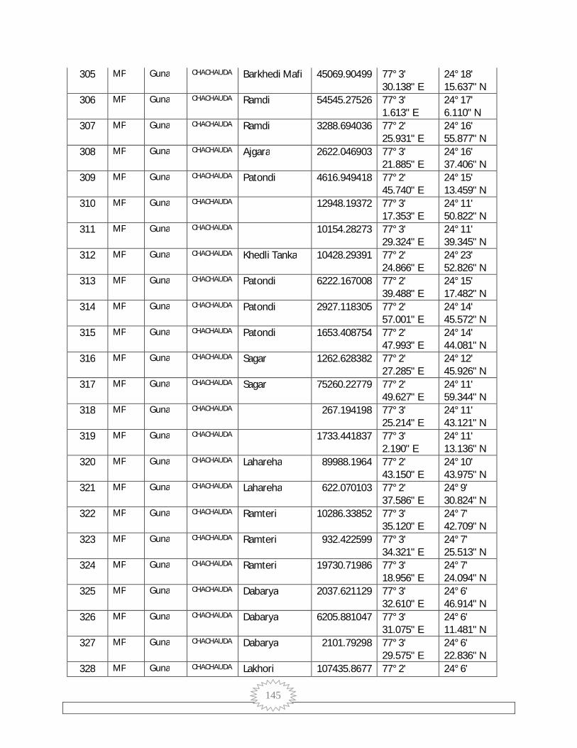
145
305 MP Guna CHACHAUDA Barkhedi Mafi 45069.90499 77° 3' 30.138" E
24° 18' 15.637" N
306 MP Guna CHACHAUDA Ramdi 54545.27526 77° 3' 1.613" E
24° 17' 6.110" N
307 MP Guna CHACHAUDA Ramdi 3288.694036 77° 2' 25.931" E
24° 16' 55.877" N
308 MP Guna CHACHAUDA Ajgara 2622.046903 77° 3' 21.885" E
24° 16' 37.406" N
309 MP Guna CHACHAUDA Patondi 4616.949418 77° 2' 45.740" E
24° 15' 13.459" N
310 MP Guna CHACHAUDA 12948.19372 77° 3' 17.353" E
24° 11' 50.822" N
311 MP Guna CHACHAUDA 10154.28273 77° 3' 29.324" E
24° 11' 39.345" N
312 MP Guna CHACHAUDA Khedli Tanka 10428.29391 77° 2' 24.866" E
24° 23' 52.826" N
313 MP Guna CHACHAUDA Patondi 6222.167008 77° 2' 39.488" E
24° 15' 17.482" N
314 MP Guna CHACHAUDA Patondi 2927.118305 77° 2' 57.001" E
24° 14' 45.572" N
315 MP Guna CHACHAUDA Patondi 1653.408754 77° 2' 47.993" E
24° 14' 44.081" N
316 MP Guna CHACHAUDA Sagar 1262.628382 77° 2' 27.285" E
24° 12' 45.926" N
317 MP Guna CHACHAUDA Sagar 75260.22779 77° 2' 49.627" E
24° 11' 59.344" N
318 MP Guna CHACHAUDA 267.194198 77° 3' 25.214" E
24° 11' 43.121" N
319 MP Guna CHACHAUDA 1733.441837 77° 3' 2.190" E
24° 11' 13.136" N
320 MP Guna CHACHAUDA Lahareha 89988.1964 77° 2' 43.150" E
24° 10' 43.975" N
321 MP Guna CHACHAUDA Lahareha 622.070103 77° 2' 37.586" E
24° 9' 30.824" N
322 MP Guna CHACHAUDA Ramteri 10286.33852 77° 3' 35.120" E
24° 7' 42.709" N
323 MP Guna CHACHAUDA Ramteri 932.422599 77° 3' 34.321" E
24° 7' 25.513" N
324 MP Guna CHACHAUDA Ramteri 19730.71986 77° 3' 18.956" E
24° 7' 24.094" N
325 MP Guna CHACHAUDA Dabarya 2037.621129 77° 3' 32.610" E
24° 6' 46.914" N
326 MP Guna CHACHAUDA Dabarya 6205.881047 77° 3' 31.075" E
24° 6' 11.481" N
327 MP Guna CHACHAUDA Dabarya 2101.79298 77° 3' 29.575" E
24° 6' 22.836" N
328 MP Guna CHACHAUDA Lakhori 107435.8677 77° 2' 24° 6'

146
3.638" E 12.234" N 329 MP Guna CHACHAUDA Bhensuwa 3075.251645 77° 1'
46.435" E 24° 8' 40.631" N
330 MP Guna CHACHAUDA Lahareha 2051.350149 77° 2' 14.215" E
24° 11' 1.278" N
331 MP Guna CHACHAUDA Sagar 8386.583329 77° 2' 32.887" E
24° 11' 56.069" N
332 MP Guna CHACHAUDA Kumbhraj (NP) 9846.837366 77° 2' 29.497" E
24° 26' 22.289" N
333 MP Guna CHACHAUDA Kumbhraj (NP) 3046.531662 77° 2' 35.028" E
24° 26' 45.486" N
334 MP Guna CHACHAUDA Hanumat Kheda
5453.015045 77° 2' 20.886" E
24° 29' 47.797" N
335 MP Guna CHACHAUDA Sagar 12311.92466 77° 2' 10.720" E
24° 13' 19.407" N
336 MP Guna CHACHAUDA Sagar 26563.75434 77° 2' 3.427" E
24° 12' 47.881" N
337 MP Guna CHACHAUDA Umariya Kalan 2149.234026 77° 1' 40.310" E
24° 26' 18.638" N
338 MP Guna CHACHAUDA Kunja Kheda 25600.02715 77° 0' 46.399" E
24° 25' 55.858" N
339 MP Guna CHACHAUDA Gorya Kheda 4786.191557 77° 1' 39.103" E
24° 23' 35.132" N
340 MP Guna CHACHAUDA Kudara 4253.995668 77° 1' 9.109" E
24° 19' 32.434" N
341 MP Guna CHACHAUDA Dedla 3362.32257 77° 1' 17.187" E
24° 17' 25.714" N
342 MP Guna CHACHAUDA Charanpura 596407.3535 77° 1' 47.545" E
24° 13' 56.761" N
343 MP Guna CHACHAUDA Sagar 38857.17438 77° 1' 46.689" E
24° 12' 34.140" N
344 MP Guna CHACHAUDA Bhensuwa 10653.57992 77° 1' 14.575" E
24° 8' 43.487" N
345 MP Guna CHACHAUDA Bhensuwa 3171.427027 77° 1' 40.302" E
24° 8' 23.543" N
346 MP Guna CHACHAUDA Dokarya Khedi 6942.732354 77° 1' 14.497" E
24° 7' 45.303" N
347 MP Guna CHACHAUDA Narayanpura 2640.229256 77° 1' 13.935" E
24° 4' 35.744" N
348 MP Guna CHACHAUDA Narayanpura 7221.795376 77° 1' 9.751" E
24° 4' 46.301" N
349 MP Guna CHACHAUDA Muhasa Khurd 2795.31696 77° 0' 18.281" E
24° 18' 58.520" N
350 MP Guna CHACHAUDA Dedla 637.259091 77° 0' 42.121" E
24° 18' 10.862" N
351 MP Guna CHACHAUDA Dedla 3851.728847 77° 0' 43.000" E
24° 17' 52.012" N

147
352 MP Guna CHACHAUDA Dedla 5305.890389 77° 0' 16.980" E
24° 17' 8.418" N
353 MP Guna CHACHAUDA Dedla 13948.86858 77° 0' 42.365" E
24° 16' 32.711" N
354 MP Guna CHACHAUDA Dedla 522859.435 77° 0' 27.613" E
24° 15' 29.837" N
355 MP Guna CHACHAUDA Charanpura 6317.053456 77° 0' 22.677" E
24° 14' 29.262" N
356 MP Guna CHACHAUDA Bijnipura 15496.89349 77° 0' 27.379" E
24° 13' 30.277" N
357 MP Guna CHACHAUDA Maheshpura 315590.8364 77° 0' 4.294" E
24° 11' 50.292" N
358 MP Guna CHACHAUDA Merya Khedi Kalan
3123.359181 77° 0' 9.568" E
24° 6' 28.029" N
359 MP Guna CHACHAUDA Merya Khedi Kalan
8560.639776 77° 0' 30.212" E
24° 6' 17.924" N
360 MP Guna CHACHAUDA Merya Khedi Kalan
11723.24559 77° 0' 9.827" E
24° 5' 55.315" N
361 MP Guna RAGHOGARH 96507.45815 77° 13' 42.878" E
24° 22' 51.764" N
362 MP Guna RAGHOGARH 728344.7968 77° 17' 22.910" E
24° 10' 49.291" N
363 MP Guna GUNA Pureni 11903.98531 77° 24' 57.862" E
24° 42' 57.787" N
364 MP Guna RAGHOGARH 6038.603588 77° 4' 56.101" E
24° 31' 57.489" N
365 MP Guna RAGHOGARH 21598.90786 77° 5' 1.103" E
24° 31' 52.809" N
366 MP Guna GUNA Khutiyawad 2763.058755 77° 25' 32.970" E
24° 46' 2.972" N
367 MP Guna GUNA 40524.13643 77° 21' 22.132" E
24° 38' 22.786" N
368 MP Guna GUNA Chorai 493950.4458 77° 19' 52.983" E
24° 30' 20.855" N
369 MP Guna GUNA Deori Dang 13812.58283 77° 19' 48.407" E
24° 36' 29.631" N
370 MP Guna GUNA 20391.0348 77° 14' 23.811" E
24° 33' 42.214" N
371 MP Guna RAGHOGARH 20391.0348 77° 14' 23.811" E
24° 33' 42.214" N
372 MP Guna GUNA Chirkheda 35558.55782 77° 26' 8.590" E
24° 55' 1.141" N
373 MP Guna GUNA Gadariya Kondar
24143.01111 77° 20' 24.193" E
24° 57' 4.294" N
374 MP Guna GUNA Jalampur 18430.9894 77° 19' 47.219" E
24° 58' 18.907" N
375 MP Guna GUNA Pita Khedi 8865.562038 77° 23' 24° 36'
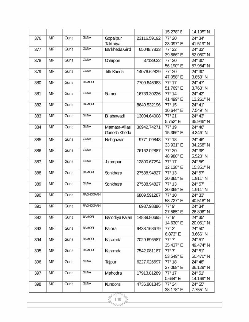
148
15.278" E 14.195" N 376 MP Guna GUNA Gopalpur
Taktaiya 23116.59192 77° 20'
23.097" E 24° 34' 41.519" N
377 MP Guna GUNA Barkheda Gird 65048.7833 77° 22' 39.866" E
24° 33' 52.060" N
378 MP Guna GUNA Chhipon 37139.32 77° 20' 56.190" E
24° 30' 57.954" N
379 MP Guna GUNA Tilli Kheda 14076.62829 77° 20' 47.058" E
24° 30' 3.853" N
380 MP Guna BAMORI 7709.846983 77° 17' 51.769" E
24° 47' 3.763" N
381 MP Guna GUNA Sumer 16739.30226 77° 14' 41.499" E
24° 42' 13.261" N
382 MP Guna BAMORI 8640.532196 77° 15' 10.644" E
24° 41' 7.549" N
383 MP Guna GUNA Bilabawadi 13004.64008 77° 21' 5.752" E
24° 43' 35.946" N
384 MP Guna GUNA Mamata-Alias Ganesh Kheda
30942.74271 77° 19' 15.366" E
24° 46' 4.346" N
385 MP Guna GUNA Nehgawan 9771.09848 77° 18' 33.931" E
24° 46' 34.268" N
386 MP Guna GUNA 76162.02887 77° 20' 48.986" E
24° 38' 5.528" N
387 MP Guna GUNA Jalampur 12800.67294 77° 17' 12.138" E
24° 56' 15.351" N
388 MP Guna BAMORI Sonkhara 27538.94827 77° 13' 30.365" E
24° 57' 1.911" N
389 MP Guna GUNA Sonkhara 27538.94827 77° 13' 30.365" E
24° 57' 1.911" N
390 MP Guna RAGHOGARH 6809.591287 77° 10' 58.727" E
24° 33' 40.518" N
391 MP Guna RAGHOGARH 6937.98886 77° 9' 27.565" E
24° 34' 26.896" N
392 MP Guna BAMORI Barodiya Kalan 14889.80695 77° 9' 14.630" E
24° 35' 20.051" N
393 MP Guna BAMORI Kalora 9438.168679 77° 2' 6.873" E
24° 50' 8.666" N
394 MP Guna BAMORI Karamda 7029.696587 77° 7' 35.437" E
24° 51' 49.474" N
395 MP Guna BAMORI Karamda 7542.081187 77° 7' 53.549" E
24° 51' 50.470" N
396 MP Guna GUNA Tajpur 6227.026697 77° 18' 37.068" E
24° 48' 36.129" N
397 MP Guna GUNA Mahodra 17913.81289 77° 17' 0.644" E
24° 51' 14.169" N
398 MP Guna GUNA Kundora 4736.901845 77° 24' 38.178" E
24° 55' 7.755" N

149
399 MP Guna GUNA Kundora 5673.446294 77° 24' 47.131" E
24° 55' 44.243" N
400 MP Guna GUNA Barodiya (Sirsi) 15961.50161 77° 21' 17.656" E
24° 54' 26.162" N
401 MP Guna GUNA Morkhedi 46851.14898 77° 25' 50.048" E
24° 51' 22.264" N
402 MP Guna GUNA Singpur 9685.426532 77° 25' 12.058" E
24° 54' 4.686" N
403 MP Guna GUNA Bhadora 8267.395492 77° 23' 8.350" E
24° 49' 30.955" N
404 MP Guna GUNA 23242.25907 77° 23' 51.521" E
24° 50' 36.609" N
405 MP Guna GUNA Dungasara 32510.83219 77° 24' 59.525" E
24° 50' 56.442" N
406 MP Guna GUNA Dungasara 7990.823911 77° 26' 18.803" E
24° 50' 15.629" N
407 MP Guna GUNA 7620.032073 77° 24' 26.184" E
24° 50' 22.741" N
408 MP Guna GUNA Dungasara 58664.5101 77° 24' 31.988" E
24° 49' 59.726" N
409 MP Guna GUNA Gwar Kheda 10526.71239 77° 24' 55.014" E
24° 48' 3.578" N
410 MP Guna GUNA Dungasara 18841.6856 77° 26' 7.616" E
24° 48' 18.200" N
411 MP Guna GUNA Mamata-Alias Ganesh Kheda
5811.540171 77° 20' 7.613" E
24° 46' 26.163" N
412 MP Guna BAMORI Badanpur 9731.267455 77° 10' 56.755" E
24° 52' 39.768" N
413 MP Guna BAMORI Sepura 1746.932722 77° 12' 38.522" E
24° 55' 19.765" N
414 MP Guna BAMORI Sepura 15592.87706 77° 12' 37.126" E
24° 55' 7.521" N
415 MP Guna BAMORI Gadala Ujari 4426.649139 77° 12' 3.417" E
24° 55' 35.479" N
416 MP Guna BAMORI Chhatarpur 7663.33063 77° 0' 48.110" E
24° 54' 46.668" N
417 MP Guna BAMORI 6411.158797 77° 1' 52.186" E
24° 55' 56.198" N
418 MP Guna BAMORI Chhatarpur 11243.0772 77° 0' 17.190" E
24° 55' 41.161" N
419 MP Guna BAMORI 34732.98331 77° 1' 51.981" E
24° 55' 33.650" N
420 MP Guna BAMORI Kusun Khoh 6450.356438 77° 11' 57.256" E
24° 58' 41.325" N
421 MP Guna BAMORI 10404.708 77° 8' 42.301" E
24° 57' 51.276" N
422 MP Guna BAMORI Saretha 48063.20923 77° 9' 24° 59'
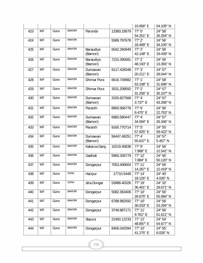
150
10.956" E 54.105" N 423 MP Guna BAMORI Paronda 13383.19579 77° 0'
54.251" E 24° 58' 26.254" N
424 MP Guna BAMORI 5589.797678 77° 2' 18.499" E
24° 56' 34.105" N
425 MP Guna BAMORI Baraudiya (Bamori)
6042.260949 77° 2' 42.148" E
24° 56' 19.439" N
426 MP Guna BAMORI Baraudiya (Bamori)
7215.395681 77° 2' 48.193" E
24° 56' 13.355" N
427 MP Guna BAMORI Dumawan (Bamori)
9117.428348 77° 3' 20.211" E
24° 57' 28.044" N
428 MP Guna BAMORI Dhimar Pura 6616.749982 77° 1' 53.108" E
24° 58' 31.696" N
429 MP Guna BAMORI Dhimar Pura 3531.208592 77° 2' 31.256" E
24° 57' 30.107" N
430 MP Guna BAMORI Dumawan (Bamori)
3155.827568 77° 4' 3.737" E
24° 57' 43.268" N
431 MP Guna BAMORI Paranth 8900.566778 77° 6' 9.475" E
24° 56' 22.753" N
432 MP Guna BAMORI Dumawan (Bamori)
6983.580447 77° 4' 34.594" E
24° 57' 26.346" N
433 MP Guna BAMORI Paranth 9165.770714 77° 5' 57.925" E
24° 55' 59.422" N
434 MP Guna BAMORI Dumawan (Bamori)
56447.49251 77° 4' 55.637" E
24° 57' 5.457" N
435 MP Guna BAMORI Kakarua Dang 10219.45838 77° 9' 7.968" E
24° 56' 12.541" N
436 MP Guna BAMORI Gadhali 5960.336779 77° 12' 7.884" E
24° 56' 50.120" N
437 MP Guna BAMORI Dongarpur 7053.406604 77° 11' 14.267" E
24° 56' 12.419" N
438 MP Guna GUNA Haripur 17710.5448 77° 14' 18.126" E
24° 40' 4.026" N
439 MP Guna GUNA Jeta Dongar 53988.40326 77° 19' 36.401" E
24° 32' 29.671" N
440 MP Guna BAMORI Dongarpur 5082.363406 77° 10' 26.675" E
24° 56' 55.084" N
441 MP Guna BAMORI Dongarpur 6788.982592 77° 10' 30.033" E
24° 56' 53.294" N
442 MP Guna BAMORI Dongarpur 3749.887171 77° 11' 9.761" E
24° 56' 51.611" N
443 MP Guna BAMORI Sepura 22450.12233 77° 12' 48.897" E
24° 54' 54.677" N
444 MP Guna BAMORI Dongarpur 8456.042094 77° 10' 41.275" E
24° 55' 6.026" N

151
445 MP Guna BAMORI Dongarpur 30646.38388 77° 9' 51.895" E
24° 55' 11.449" N
446 MP Guna BAMORI Dehra 18305.37671 77° 8' 44.588" E
24° 54' 52.590" N
447 MP Guna BAMORI Mahuwakheda Khurd
14934.04826 77° 0' 12.879" E
24° 53' 3.127" N
448 MP Guna BAMORI Saretha 14674.18087 77° 9' 18.842" E
24° 59' 31.839" N
449 MP Guna GUNA 11992.79015 77° 15' 31.766" E
24° 59' 35.489" N
450 MP Guna GUNA Chidrau 15806.34281 77° 16' 18.539" E
24° 59' 14.950" N
451 MP Guna GUNA Tilwara 12316.32043 77° 18' 23.997" E
24° 58' 29.875" N
452 MP Guna BAMORI Dumawan (Bamori)
132732.2345 77° 5' 7.070" E
24° 58' 2.305" N
453 MP Guna BAMORI Kawar Bamori 5140.636195 77° 6' 57.958" E
24° 57' 51.292" N
454 MP Guna BAMORI 23147.74324 77° 8' 55.188" E
24° 58' 1.875" N
455 MP Guna BAMORI Kakarua Dang 153536.5499 77° 9' 28.650" E
24° 56' 57.960" N
456 MP Guna BAMORI Paranth 24538.07779 77° 6' 34.582" E
24° 56' 39.468" N
457 MP Guna BAMORI Dongarpur 8670.751405 77° 9' 55.498" E
24° 56' 30.311" N
458 MP Guna BAMORI Dongarpur 5637.992347 77° 11' 31.070" E
24° 56' 39.121" N
459 MP Guna GUNA 31775.21047 77° 18' 42.609" E
24° 55' 43.807" N
460 MP Guna BAMORI Sonkhara 28813.86732 77° 13' 24.228" E
24° 56' 4.797" N
461 MP Guna BAMORI Gadala Ujari 24365.40034 77° 11' 44.490" E
24° 56' 16.691" N
462 MP Guna BAMORI Dongarpur 52702.06679 77° 9' 43.636" E
24° 56' 0.817" N
463 MP Guna BAMORI Doharda 17695.88508 77° 2' 57.419" E
24° 55' 14.378" N
464 MP Guna BAMORI Ratai 20702.9979 77° 7' 19.750" E
24° 55' 18.158" N
465 MP Guna BAMORI Kherla 123678.4134 77° 11' 46.577" E
24° 55' 20.430" N
466 MP Guna BAMORI Amrod 4029761.819 77° 11' 18.115" E
24° 46' 7.840" N
467 MP Guna GUNA Naghera 125007.5714 77° 15' 14.237" E
24° 55' 8.038" N

152
468 MP Guna GUNA Chirkheda 8827.353428 77° 25' 45.188" E
24° 55' 17.488" N
469 MP Guna GUNA Haripur (Myana)
44655.33271 77° 26' 4.243" E
24° 55' 24.420" N
470 MP Guna BAMORI Nonpura 18554.04866 77° 9' 36.134" E
24° 53' 59.655" N
471 MP Guna BAMORI Nonpura 15599.98315 77° 9' 49.314" E
24° 53' 52.043" N
472 MP Guna GUNA Gadla 8649.532911 77° 27' 5.393" E
24° 54' 1.454" N
473 MP Guna GUNA Sherpur 23041.41175 77° 14' 58.044" E
24° 53' 21.561" N
474 MP Guna BAMORI Nonpura 216184.972 77° 9' 25.613" E
24° 53' 14.942" N
475 MP Guna BAMORI Khadela 44158.76108 77° 9' 2.739" E
24° 53' 18.598" N
476 MP Guna GUNA Tanda 37663.19746 77° 18' 28.522" E
24° 52' 19.049" N
477 MP Guna GUNA Bandha 136938.9558 77° 17' 9.440" E
24° 51' 59.211" N
478 MP Guna BAMORI Mundol 1245340.542 77° 12' 8.710" E
24° 52' 24.173" N
479 MP Guna GUNA Mundol 1245340.542 77° 12' 8.710" E
24° 52' 24.173" N
480 MP Guna BAMORI Gwarkheda 4682.126424 77° 5' 43.440" E
24° 52' 4.890" N
481 MP Guna BAMORI Kalora 12506.83732 77° 1' 7.887" E
24° 51' 21.296" N
482 MP Guna BAMORI Kalora 1380405.701 77° 0' 43.488" E
24° 51' 41.809" N
483 MP Guna BAMORI Bamori 30740.75287 77° 8' 8.095" E
24° 51' 16.716" N
484 MP Guna BAMORI Bamori 4573.239442 77° 8' 24.403" E
24° 51' 17.511" N
485 MP Guna BAMORI Bamori 28859.61096 77° 9' 12.466" E
24° 51' 0.744" N
486 MP Guna GUNA Mahodra 17402.34185 77° 16' 53.407" E
24° 49' 59.196" N
487 MP Guna GUNA Mahodra 23458.17009 77° 15' 36.360" E
24° 50' 10.116" N
488 MP Guna BAMORI Bagheri 16708.05618 77° 8' 8.177" E
24° 49' 43.472" N
489 MP Guna BAMORI Kundi Kheda 2271.984258 77° 5' 51.553" E
24° 50' 12.684" N
490 MP Guna BAMORI Boodha Kheda 19908.39694 77° 13' 52.852" E
24° 48' 59.042" N
491 MP Guna BAMORI 16016.93473 77° 17' 24° 49'
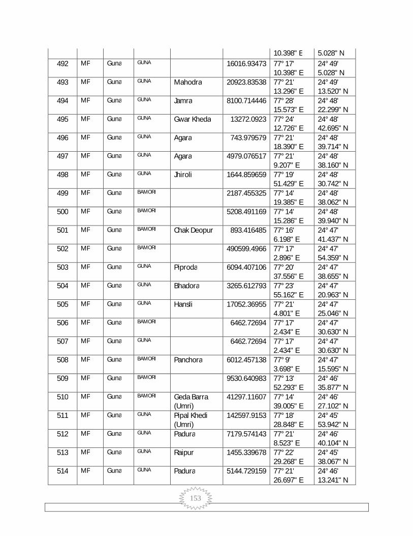
153
10.398" E 5.028" N 492 MP Guna GUNA 16016.93473 77° 17'
10.398" E 24° 49' 5.028" N
493 MP Guna GUNA Mahodra 20923.83538 77° 21' 13.296" E
24° 49' 13.520" N
494 MP Guna GUNA Jamra 8100.714446 77° 28' 15.573" E
24° 48' 22.299" N
495 MP Guna GUNA Gwar Kheda 13272.0923 77° 24' 12.726" E
24° 48' 42.695" N
496 MP Guna GUNA Agara 743.979579 77° 21' 18.390" E
24° 48' 39.714" N
497 MP Guna GUNA Agara 4979.076517 77° 21' 9.207" E
24° 48' 38.160" N
498 MP Guna GUNA Jhiroli 1644.859659 77° 19' 51.429" E
24° 48' 30.742" N
499 MP Guna BAMORI 2187.455325 77° 14' 19.385" E
24° 48' 38.062" N
500 MP Guna BAMORI 5208.491169 77° 14' 15.286" E
24° 48' 39.940" N
501 MP Guna BAMORI Chak Deopur 893.416485 77° 16' 6.198" E
24° 47' 41.437" N
502 MP Guna BAMORI 490599.4966 77° 17' 2.896" E
24° 47' 54.359" N
503 MP Guna GUNA Piproda 6094.407106 77° 20' 37.556" E
24° 47' 38.655" N
504 MP Guna GUNA Bhadora 3265.612793 77° 23' 55.162" E
24° 47' 20.963" N
505 MP Guna GUNA Hansli 17052.36955 77° 21' 4.801" E
24° 47' 25.046" N
506 MP Guna BAMORI 6462.72694 77° 17' 2.434" E
24° 47' 30.630" N
507 MP Guna GUNA 6462.72694 77° 17' 2.434" E
24° 47' 30.630" N
508 MP Guna BAMORI Panchora 6012.457138 77° 9' 3.698" E
24° 47' 15.595" N
509 MP Guna BAMORI 9530.640983 77° 13' 52.293" E
24° 46' 35.877" N
510 MP Guna BAMORI Geda Barra (Umri)
41297.11607 77° 14' 39.005" E
24° 46' 27.102" N
511 MP Guna GUNA Pipal Khedi (Umri)
142597.9153 77° 18' 28.848" E
24° 45' 53.942" N
512 MP Guna GUNA Padura 7179.574143 77° 21' 8.523" E
24° 46' 40.104" N
513 MP Guna GUNA Raipur 1455.339678 77° 22' 29.268" E
24° 45' 38.067" N
514 MP Guna GUNA Padura 5144.729159 77° 21' 26.697" E
24° 46' 13.241" N
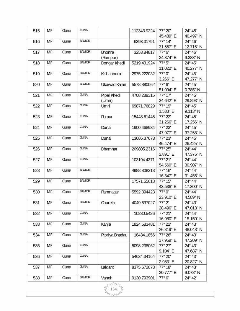
154
515 MP Guna GUNA 112343.9224 77° 20' 45.489" E
24° 45' 40.497" N
516 MP Guna BAMORI 6393.31791 77° 14' 31.567" E
24° 46' 12.716" N
517 MP Guna BAMORI Bhonra (Rampur)
3253.84817 77° 6' 24.874" E
24° 46' 9.388" N
518 MP Guna BAMORI Dongar Khedi 5219.431924 77° 5' 11.022" E
24° 45' 40.277" N
519 MP Guna BAMORI Kishanpura 2975.222032 77° 0' 3.266" E
24° 45' 47.277" N
520 MP Guna BAMORI Ukawad Kalan 5578.880062 77° 6' 51.094" E
24° 45' 0.785" N
521 MP Guna GUNA Pipal Khedi (Umri)
4708.289315 77° 17' 34.642" E
24° 45' 29.893" N
522 MP Guna GUNA Umri 69871.76829 77° 19' 1.533" E
24° 45' 9.113" N
523 MP Guna GUNA Raipur 15448.61446 77° 22' 31.266" E
24° 45' 17.256" N
524 MP Guna GUNA Dunai 1900.468984 77° 23' 47.977" E
24° 45' 37.258" N
525 MP Guna GUNA Dunai 13686.37678 77° 23' 46.474" E
24° 45' 26.425" N
526 MP Guna GUNA Dhamnar 209805.2316 77° 25' 3.891" E
24° 44' 47.375" N
527 MP Guna GUNA 103194.4371 77° 21' 54.560" E
24° 44' 30.907" N
528 MP Guna BAMORI 4988.808318 77° 16' 16.347" E
24° 44' 31.455" N
529 MP Guna BAMORI 17571.55613 77° 15' 43.536" E
24° 44' 17.300" N
530 MP Guna BAMORI Ramnagar 5592.894423 77° 0' 23.910" E
24° 44' 4.589" N
531 MP Guna BAMORI Churela 4049.637027 77° 2' 28.496" E
24° 43' 47.013" N
532 MP Guna GUNA 10230.5426 77° 21' 16.980" E
24° 44' 15.150" N
533 MP Guna GUNA Kanja 1824.583481 77° 22' 26.319" E
24° 43' 48.048" N
534 MP Guna GUNA Pipriya Bhadau 18434.1856 77° 26' 37.959" E
24° 43' 47.209" N
535 MP Guna GUNA 5098.238062 77° 27' 9.104" E
24° 43' 47.687" N
536 MP Guna GUNA 54634.34164 77° 20' 2.983" E
24° 43' 20.827" N
537 MP Guna GUNA Laldant 8375.672078 77° 18' 20.777" E
24° 43' 9.078" N
538 MP Guna BAMORI Vaneh 9130.793901 77° 6' 24° 42'
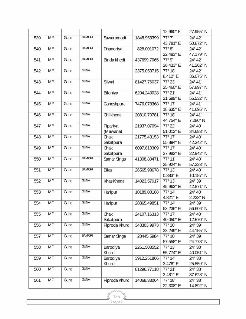
155
12.960" E 27.955" N 539 MP Guna BAMORI Sawaramodi 1848.953399 77° 7'
43.781" E 24° 42' 50.872" N
540 MP Guna BAMORI Dhanoriya 828.001072 77° 8' 22.483" E
24° 42' 47.179" N
541 MP Guna BAMORI Binda Khedi 437699.7065 77° 9' 26.433" E
24° 42' 41.262" N
542 MP Guna GUNA 2375.053715 77° 18' 8.412" E
24° 42' 36.075" N
543 MP Guna GUNA Silwai 81427.76037 77° 23' 25.460" E
24° 41' 57.897" N
544 MP Guna GUNA Biloniya 6204.243028 77° 21' 21.599" E
24° 41' 55.532" N
545 MP Guna GUNA Ganeshpura 7476.078368 77° 17' 18.635" E
24° 41' 41.695" N
546 MP Guna GUNA Chilkheda 20810.70781 77° 18' 44.754" E
24° 41' 7.286" N
547 MP Guna GUNA Pipariya (Mawana)
21937.07094 77° 22' 51.012" E
24° 40' 34.683" N
548 MP Guna GUNA Chak Sakatpura
21775.43153 77° 17' 55.894" E
24° 40' 42.342" N
549 MP Guna GUNA Chak Sakatpura
6097.813309 77° 17' 37.982" E
24° 40' 22.942" N
550 MP Guna BAMORI Samar Singa 41308.80471 77° 11' 35.924" E
24° 40' 57.323" N
551 MP Guna BAMORI Bilas 26565.98678 77° 13' 0.383" E
24° 40' 10.187" N
552 MP Guna GUNA Khas Kheda 14023.57017 77° 13' 45.963" E
24° 39' 42.871" N
553 MP Guna GUNA Haripur 10189.08188 77° 14' 4.821" E
24° 40' 2.233" N
554 MP Guna GUNA Haripur 28865.49851 77° 14' 53.236" E
24° 39' 56.606" N
555 MP Guna GUNA Chak Sakatpura
24107.16313 77° 17' 40.050" E
24° 40' 12.570" N
556 MP Guna GUNA Piproda Khurd 348303.9973 77° 20' 33.249" E
24° 39' 44.155" N
557 MP Guna BAMORI Samar Singa 28445.5984 77° 10' 57.558" E
24° 39' 24.778" N
558 MP Guna GUNA Barodiya Khurd
2261.503552 77° 13' 55.774" E
24° 38' 40.051" N
559 MP Guna GUNA Barodiya Khurd
3912.251866 77° 14' 3.478" E
24° 38' 25.559" N
560 MP Guna GUNA 81296.77118 77° 21' 3.481" E
24° 38' 37.628" N
561 MP Guna GUNA Piproda Khurd 14068.33064 77° 18' 22.308" E
24° 38' 14.892" N

156
562 MP Guna GUNA Dholwaj 55316.14158 77° 14' 21.758" E
24° 37' 47.440" N
563 MP Guna GUNA Garha 9822.496528 77° 12' 27.626" E
24° 38' 1.215" N
564 MP Guna BAMORI Bhatodiya 5144.214253 77° 12' 24.571" E
24° 38' 9.491" N
565 MP Guna BAMORI Modka 6680.697941 77° 8' 52.145" E
24° 37' 52.870" N
566 MP Guna BAMORI Sabra Pahad 8483.005693 77° 9' 27.135" E
24° 37' 7.190" N
567 MP Guna GUNA Bamoribugurj 20507.49952 77° 15' 27.086" E
24° 37' 40.190" N
568 MP Guna GUNA Guna (M) 20824.22836 77° 16' 9.478" E
24° 37' 27.045" N
569 MP Guna GUNA Guna (M) 5195.093511 77° 16' 55.300" E
24° 37' 21.718" N
570 MP Guna GUNA Nensuhaya 11133.15986 77° 23' 45.734" E
24° 37' 10.313" N
571 MP Guna GUNA Mohari 91595.96143 77° 24' 29.134" E
24° 36' 50.820" N
572 MP Guna GUNA Khejra (Guna) 43929.1039 77° 22' 8.577" E
24° 36' 56.457" N
573 MP Guna GUNA Khejra (Guna) 94889.21605 77° 21' 6.761" E
24° 36' 34.589" N
574 MP Guna GUNA Guna (M) 124517.864 77° 19' 33.367" E
24° 36' 55.711" N
575 MP Guna GUNA Deori Dang 27165.68942 77° 19' 56.770" E
24° 36' 39.156" N
576 MP Guna GUNA Sonthi 14517.4222 77° 14' 16.451" E
24° 36' 10.846" N
577 MP Guna GUNA Bajrangarh 5065.903063 77° 16' 59.220" E
24° 36' 15.585" N
578 MP Guna GUNA Bajrangarh 4564.068828 77° 17' 59.226" E
24° 35' 53.448" N
579 MP Guna RAGHOGARH 8193.759165 77° 7' 46.977" E
24° 30' 25.297" N
580 MP Guna GUNA Bajrangarh 2973.207206 77° 14' 58.208" E
24° 35' 23.150" N
581 MP Guna GUNA Bajrangarh 5489.379333 77° 14' 51.573" E
24° 35' 40.920" N
582 MP Guna ARON Jaitpur 4483088.295 77° 15' 18.778" E
24° 32' 34.058" N
583 MP Guna GUNA Jaitpur 4483088.295 77° 15' 18.778" E
24° 32' 34.058" N
584 MP Guna RAGHOGARH Jaitpur 4483088.295 77° 15' 18.778" E
24° 32' 34.058" N
585 MP Guna GUNA Karod 1249.412622 77° 26' 24° 34'

157
3.426" E 54.260" N 586 MP Guna GUNA Garha 5093.080199 77° 12'
52.493" E 24° 34' 19.567" N
587 MP Guna RAGHOGARH 19957.77374 77° 11' 2.130" E
24° 34' 24.196" N
588 MP Guna RAGHOGARH 234.690122 77° 9' 51.792" E
24° 33' 58.190" N
589 MP Guna RAGHOGARH 936.879696 77° 9' 57.134" E
24° 33' 52.856" N
590 MP Guna RAGHOGARH 872.902833 77° 7' 16.244" E
24° 34' 3.600" N
591 MP Guna RAGHOGARH 19275.71543 77° 6' 9.736" E
24° 33' 50.719" N
592 MP Guna RAGHOGARH 4792.409088 77° 10' 18.456" E
24° 33' 18.461" N
593 MP Guna RAGHOGARH 24459.73778 77° 10' 8.980" E
24° 33' 15.233" N
594 MP Guna RAGHOGARH 5343.725284 77° 13' 46.469" E
24° 33' 43.185" N
595 MP Guna GUNA Koluamar 10944.10608 77° 27' 59.249" E
24° 32' 50.322" N
596 MP Guna GUNA Satanpur 54272.1229 77° 21' 59.013" E
24° 33' 15.265" N
597 MP Guna RAGHOGARH 32508.50405 77° 12' 12.692" E
24° 32' 59.618" N
598 MP Guna RAGHOGARH 12155.49089 77° 10' 38.913" E
24° 32' 37.605" N
599 MP Guna RAGHOGARH 6320.49405 77° 5' 59.165" E
24° 32' 47.283" N
600 MP Guna RAGHOGARH 4240.379577 77° 6' 3.638" E
24° 32' 40.424" N
601 MP Guna RAGHOGARH Murlipura 5475.311535 77° 5' 55.834" E
24° 32' 41.263" N
602 MP Guna RAGHOGARH 46156.69035 77° 10' 16.000" E
24° 31' 59.278" N
603 MP Guna RAGHOGARH 45578.17894 77° 9' 59.003" E
24° 31' 53.520" N
604 MP Guna ARON 48827.3391 77° 14' 24.736" E
24° 31' 16.571" N
605 MP Guna RAGHOGARH 9807.244263 77° 10' 10.426" E
24° 31' 24.298" N
606 MP Guna RAGHOGARH 13430.48512 77° 8' 0.702" E
24° 31' 15.254" N
607 MP Guna RAGHOGARH 17480.89712 77° 9' 20.136" E
24° 30' 59.893" N
608 MP Guna ARON 4156.106808 77° 14' 39.917" E
24° 30' 17.268" N

158
609 MP Guna ARON 23529.54283 77° 14' 40.511" E
24° 30' 25.079" N
610 MP Guna RAGHOGARH 24406.332 77° 11' 54.378" E
24° 30' 30.934" N
611 MP Guna CHACHAUDA Hanumat Kheda
8963.867894 77° 2' 12.835" E
24° 30' 6.451" N
612 MP Guna GUNA Bajrangarh 4709.250481 77° 16' 56.461" E
24° 34' 43.929" N
613 MP Guna GUNA Bajrangarh 11618.43221 77° 16' 49.131" E
24° 35' 6.118" N
614 MP Guna GUNA Bajrangarh 11801.04538 77° 17' 15.698" E
24° 35' 14.765" N
615 MP Guna GUNA Bajrangarh 11564.77696 77° 17' 25.112" E
24° 35' 1.948" N
616 MP Guna GUNA Bajrangarh 3484.337857 77° 17' 6.209" E
24° 34' 58.306" N
617 MP Guna GUNA Bajrangarh 2773.100864 77° 17' 9.676" E
24° 34' 54.248" N
618 MP Guna GUNA Mitepura 28994.5529 77° 18' 18.385" E
24° 34' 42.702" N
619 MP Guna GUNA Kankra 10463.48928 77° 22' 27.223" E
24° 34' 34.199" N
620 MP Guna GUNA Benhta Jhir 12143.26368 77° 22' 7.336" E
24° 35' 31.536" N
621 MP Guna BAMORI Muradpur 22652.13159 77° 9' 55.263" E
24° 35' 43.920" N
622 MP Guna BAMORI Sabra Pahad 23653.5159 77° 9' 7.202" E
24° 37' 16.492" N
623 MP Guna BAMORI Samar Singa 1167351.724 77° 9' 57.117" E
24° 39' 1.038" N
624 MP Guna GUNA Badli 23939.95436 77° 20' 23.812" E
24° 34' 23.931" N
625 MP Guna GUNA Badli 45794.40092 77° 20' 24.219" E
24° 33' 55.229" N
626 MP Guna GUNA Jeta Dongar 55249.88422 77° 19' 51.192" E
24° 32' 43.016" N
627 MP Guna GUNA Karondia 113387.6923 77° 21' 32.415" E
24° 31' 21.161" N
628 MP Guna GUNA Chhipon 45780.80294 77° 20' 44.699" E
24° 30' 41.571" N
629 MP Guna RAGHOGARH 169109.1539 77° 9' 37.204" E
24° 30' 25.741" N
630 MP Guna GUNA 13141.95669 77° 21' 24.148" E
24° 44' 25.278" N
631 MP Guna GUNA 71396.13242 77° 21' 10.861" E
24° 44' 24.593" N
632 MP Guna GUNA Umri 415352.7523 77° 19' 24° 44'

159
32.456" E 11.950" N 633 MP Guna GUNA Karili 12640.98105 77° 16'
19.712" E 25° 0' 14.695" N
634 MP Guna GUNA Karili 13677.00131 77° 15' 58.189" E
25° 0' 17.480" N
635 MP Guna GUNA 2684.370965 77° 16' 45.824" E
25° 4' 5.473" N
636 MP Guna GUNA Musredi 3542.969951 77° 15' 27.404" E
25° 5' 44.500" N
637 MP Guna GUNA Musredi 1583.1099 77° 15' 33.966" E
25° 5' 54.739" N
638 MP Guna GUNA Musredi 2257.327998 77° 15' 28.463" E
25° 5' 59.931" N
639 MP Guna BAMORI Gopalpur 16458.9346 77° 9' 9.985" E
25° 3' 41.421" N
640 MP Guna BAMORI Vithalpur 100571.9597 77° 10' 18.587" E
25° 5' 42.202" N
641 MP Guna BAMORI Vithalpur 66576.4064 77° 10' 29.369" E
25° 5' 52.195" N
642 MP Guna GUNA 9511.436266 77° 17' 4.029" E
25° 3' 57.103" N
643 MP Guna GUNA 10066.90215 77° 17' 7.863" E
25° 4' 13.248" N
644 MP Guna GUNA Marki Mahu 73870.53384 77° 18' 8.948" E
25° 1' 11.794" N
645 MP Guna GUNA Marki Mahu 24912.55766 77° 18' 29.434" E
25° 0' 2.463" N
646 MP Guna GUNA Barkheda (Sirsi)
4467.371228 77° 16' 37.826" E
25° 0' 14.664" N
647 MP Guna GUNA 8095.380954 77° 15' 59.244" E
25° 2' 25.709" N
648 MP Guna GUNA 2074.812413 77° 16' 17.374" E
25° 3' 22.242" N
649 MP Guna GUNA 4962.318428 77° 16' 13.356" E
25° 3' 34.604" N
650 MP Guna GUNA 22390.98982 77° 16' 38.416" E
25° 4' 53.229" N
651 MP Guna GUNA 8755.815412 77° 15' 42.907" E
25° 5' 37.758" N
652 MP Guna GUNA 15580.26555 77° 16' 16.161" E
25° 5' 55.503" N
653 MP Guna GUNA 7992.930039 77° 15' 47.712" E
25° 5' 58.056" N
654 MP Guna GUNA Musredi 13672.43155 77° 15' 6.655" E
25° 6' 0.226" N
655 MP Guna GUNA Musredi 16286.11806 77° 15' 10.871" E
25° 5' 38.330" N

160
656 MP Guna GUNA 11324.32874 77° 15' 28.450" E
25° 5' 18.292" N
657 MP Guna GUNA Musredi 9658.126947 77° 14' 59.765" E
25° 5' 21.630" N
658 MP Guna GUNA 6883.34769 77° 14' 52.616" E
25° 5' 4.866" N
659 MP Guna GUNA 31584.36927 77° 15' 34.274" E
25° 1' 53.119" N
660 MP Guna GUNA 10727.24128 77° 15' 3.025" E
25° 2' 0.784" N
661 MP Guna GUNA Ladakheda 2752.273788 77° 14' 17.390" E
25° 0' 40.506" N
662 MP Guna GUNA Ladakheda 7497.419338 77° 14' 23.508" E
25° 0' 39.508" N
663 MP Guna GUNA Ladakheda 2209.685295 77° 14' 2.060" E
25° 0' 42.837" N
664 MP Guna GUNA Ladakheda 3262.73944 77° 14' 14.905" E
25° 0' 48.118" N
665 MP Guna GUNA Ladakheda 2420.966246 77° 14' 9.652" E
25° 0' 52.741" N
666 MP Guna GUNA Ladakheda 32593.89446 77° 14' 9.999" E
25° 0' 59.673" N
667 MP Guna GUNA Ladakheda 23945.68427 77° 13' 54.704" E
25° 0' 51.488" N
668 MP Guna GUNA Deogarh 6682.489895 77° 12' 16.468" E
25° 0' 25.104" N
669 MP Guna GUNA Deogarh 4272.756179 77° 12' 45.191" E
25° 0' 28.196" N
670 MP Guna GUNA Ajit Kheda 1627.934341 77° 12' 41.661" E
25° 1' 36.097" N
671 MP Guna GUNA Kalchheri 12528.3135 77° 12' 11.956" E
25° 2' 14.058" N
672 MP Guna GUNA Kalchheri 29699.19785 77° 12' 59.407" E
25° 2' 33.863" N
673 MP Guna GUNA Karri 13358.65113 77° 13' 37.112" E
25° 2' 24.295" N
674 MP Guna GUNA Karnawata 4958.457719 77° 13' 32.836" E
25° 2' 46.875" N
675 MP Guna BAMORI Dongri 15023.52244 77° 12' 35.608" E
25° 3' 53.509" N
676 MP Guna BAMORI Vithalpur 2664.713305 77° 11' 13.736" E
25° 5' 44.247" N
677 MP Guna BAMORI Vithalpur 1743.570767 77° 11' 30.503" E
25° 5' 27.652" N
678 MP Guna BAMORI Vithalpur 50419.57331 77° 10' 53.169" E
25° 5' 18.891" N
679 MP Guna BAMORI Vithalpur 32470.21145 77° 11' 25° 5'

161
4.946" E 19.158" N 680 MP Guna BAMORI Vithalpur 6159.876232 77° 10'
29.964" E 25° 4' 50.883" N
681 MP Guna BAMORI Bhotupura 154993.414 77° 10' 30.217" E
25° 4' 39.200" N
682 MP Guna BAMORI Dongri 20424.88383 77° 11' 13.656" E
25° 4' 2.376" N
683 MP Guna BAMORI Dongri 4144.518624 77° 11' 40.643" E
25° 4' 15.040" N
684 MP Guna BAMORI Bhotupura 27780.9119 77° 10' 30.555" E
25° 4' 7.211" N
685 MP Guna BAMORI Bhotupura 10217.16122 77° 10' 38.434" E
25° 3' 26.134" N
686 MP Guna GUNA Suator 10797.60518 77° 10' 31.915" E
25° 2' 14.492" N
687 MP Guna GUNA Ajit Kheda 9426.756014 77° 11' 29.473" E
25° 1' 48.862" N
688 MP Guna GUNA Ajit Kheda 11601.38602 77° 11' 35.602" E
25° 1' 51.545" N
689 MP Guna GUNA Deogarh 22433.43703 77° 10' 48.418" E
25° 1' 10.496" N
690 MP Guna BAMORI Patan 84766.0096 77° 9' 1.425" E
25° 0' 6.233" N
691 MP Guna BAMORI Saretha 33747.76234 77° 9' 11.760" E
25° 0' 46.219" N
692 MP Guna BAMORI Saretha 78114.17202 77° 9' 52.728" E
25° 0' 45.144" N
693 MP Guna BAMORI Saretha 39766.51138 77° 9' 41.656" E
25° 0' 56.008" N
694 MP Guna GUNA Saretha 12472.66365 77° 9' 55.496" E
25° 1' 8.612" N
695 MP Guna GUNA Ajit Kheda 29263.83193 77° 9' 50.727" E
25° 1' 14.725" N
696 MP Guna GUNA Rehpura 8463.14755 77° 10' 11.432" E
25° 1' 23.347" N
697 MP Guna BAMORI Gopalpur 23638.1174 77° 9' 14.690" E
25° 2' 25.174" N
698 MP Guna BAMORI Gopalpur 61109.40536 77° 9' 14.441" E
25° 1' 54.173" N
699 MP Guna BAMORI Bhotupura 12917.85711 77° 8' 53.659" E
25° 5' 5.104" N
700 MP Guna BAMORI 3404.261053 77° 7' 54.821" E
25° 4' 46.570" N
701 MP Guna BAMORI Nagphani Saliya
2612.772676 77° 7' 57.683" E
25° 4' 40.358" N
702 MP Guna BAMORI Nagphani Saliya
14366.83769 77° 8' 6.030" E
25° 4' 39.510" N

162
703 MP Guna BAMORI Nagphani Saliya
1062341.737 77° 8' 16.917" E
25° 3' 25.807" N
704 MP Guna BAMORI Kisanpur Barkui
3503.487054 77° 7' 47.505" E
25° 2' 57.313" N
705 MP Guna BAMORI Kisanpur Barkui
8409.982079 77° 7' 55.329" E
25° 2' 53.530" N
706 MP Guna BAMORI Banskhedi 11950.38038 77° 7' 51.032" E
25° 1' 4.398" N
707 MP Guna BAMORI Banskhedi 55280.3334 77° 7' 51.592" E
25° 0' 59.230" N
708 MP Guna BAMORI Banskhedi 16551.66868 77° 8' 5.115" E
25° 1' 22.438" N
709 MP Guna BAMORI Banskhedi 3895.204839 77° 7' 53.056" E
25° 1' 20.347" N
710 MP Guna BAMORI Banskhedi 1748.7581 77° 8' 7.958" E
25° 0' 28.824" N
711 MP Guna BAMORI Bishnwada 17462.5743 77° 7' 9.776" E
25° 0' 27.240" N
712 MP Guna BAMORI Bishnwada 10240.12621 77° 5' 53.489" E
25° 0' 14.438" N
713 MP Guna BAMORI Bishnwada 16416.5343 77° 5' 51.820" E
25° 0' 3.598" N
714 MP Guna BAMORI Bishnwada 3450.462153 77° 6' 47.253" E
25° 0' 29.772" N
715 MP Guna BAMORI Dehri (Bamori) 14905.70403 77° 5' 17.711" E
25° 0' 42.229" N
716 MP Guna BAMORI Dehri (Bamori) 2690.564304 77° 5' 22.221" E
25° 1' 4.065" N
717 MP Guna BAMORI Gadlamar 27147.81342 77° 6' 38.004" E
25° 1' 4.709" N
718 MP Guna BAMORI Barkheda (Bamori)
31639.83443 77° 6' 17.934" E
25° 1' 46.790" N
719 MP Guna BAMORI Dehri (Bamori) 13943.81686 77° 5' 50.870" E
25° 2' 1.107" N
720 MP Guna BAMORI Dehri (Bamori) 11155.79779 77° 5' 33.106" E
25° 2' 3.923" N
721 MP Guna BAMORI Barkheda (Bamori)
16350.99511 77° 6' 46.662" E
25° 2' 18.241" N
722 MP Guna BAMORI Dehri (Bamori) 1918.063119 77° 6' 0.521" E
25° 2' 35.710" N
723 MP Guna BAMORI Dehri (Bamori) 997.227655 77° 5' 55.944" E
25° 2' 49.305" N
724 MP Guna BAMORI Luhari 5294.288041 77° 5' 31.042" E
25° 2' 56.835" N
725 MP Guna BAMORI Dehri (Bamori) 5209.800847 77° 5' 39.647" E
25° 2' 56.868" N
726 MP Guna BAMORI Luhari 67544.16742 77° 4' 25° 0'

163
8.998" E 59.695" N 727 MP Guna BAMORI Kakruamar 4958.411365 77° 5'
15.973" E 25° 0' 26.387" N
728 MP Guna BAMORI Kakruamar 9563.656356 77° 5' 9.924" E
25° 0' 28.564" N
729 MP Guna BAMORI Kakruamar 14845.17675 77° 4' 49.563" E
25° 0' 24.475" N
730 MP Guna BAMORI Barwan 11716.14687 77° 0' 27.571" E
25° 2' 49.946" N
731 MP Guna CHACHAUDA Batawada 415878.1738 76° 53' 9.562" E
24° 19' 15.063" N
732 MP Guna CHACHAUDA Kadaiya Khurd 41509.51804 76° 50' 45.901" E
24° 19' 18.653" N
733 MP Guna BAMORI Bhaupura 9263.890778 76° 59' 47.994" E
24° 46' 1.591" N
734 MP Guna BAMORI Mirwada 33832.5763 76° 49' 41.441" E
24° 48' 47.202" N
735 MP Guna BAMORI Digdoli 7358.307986 76° 50' 19.845" E
24° 49' 6.918" N
736 MP Guna BAMORI Dobra 8745.578268 76° 51' 38.368" E
24° 48' 52.605" N
737 MP Guna BAMORI Dobra 14947.05359 76° 51' 56.714" E
24° 48' 37.767" N
738 MP Guna BAMORI Umrdha 1381.641359 76° 58' 47.007" E
24° 50' 39.489" N
739 MP Guna BAMORI Sileta 2741.928257 76° 58' 16.244" E
24° 56' 27.303" N
740 MP Guna BAMORI Sileta 6801.951699 76° 58' 5.063" E
24° 56' 25.915" N
741 MP Guna BAMORI Sileta 6668.438113 76° 58' 1.441" E
24° 56' 5.230" N
742 MP Guna CHACHAUDA Gasauni 1273.363745 76° 56' 6.892" E
24° 24' 25.935" N
743 MP Guna CHACHAUDA Murela 8013.052964 76° 54' 18.341" E
24° 7' 9.312" N
744 MP Guna CHACHAUDA Murela 2317.665581 76° 55' 21.131" E
24° 7' 25.828" N
745 MP Guna CHACHAUDA Kankan Heru 11828.06787 76° 59' 14.446" E
24° 4' 18.956" N
746 MP Guna CHACHAUDA Kadaiya Chachaura
9487.582045 76° 59' 58.591" E
24° 3' 43.664" N
747 MP Guna CHACHAUDA Kherbeh 3341.70689 76° 58' 42.890" E
24° 3' 25.648" N
748 MP Guna CHACHAUDA Magron 3443.783102 76° 59' 10.706" E
24° 13' 6.884" N
749 MP Guna CHACHAUDA Doryapura 69314.7557 76° 56' 26.860" E
24° 13' 2.066" N

164
750 MP Guna CHACHAUDA Kulambeh 19363.47555 76° 59' 35.206" E
24° 14' 32.813" N
751 MP Guna CHACHAUDA Kamalpur Dang
4764.738779 76° 57' 47.921" E
24° 16' 14.375" N
752 MP Guna CHACHAUDA Madagan Khalsa
1670.594391 76° 58' 33.781" E
24° 20' 5.707" N
753 MP Guna CHACHAUDA Mohmmadpur 8451.404524 76° 57' 21.161" E
24° 19' 57.975" N
754 MP Guna CHACHAUDA Pipaliya Singanpur
10087.09297 76° 58' 10.347" E
24° 27' 9.570" N
755 MP Guna CHACHAUDA Bakanya 11136.91032 76° 51' 42.296" E
24° 23' 58.571" N
756 MP Guna CHACHAUDA Mirgwas 4159.256102 76° 56' 2.685" E
24° 21' 21.724" N
757 MP Guna BAMORI Paronda 17226.56896 76° 59' 47.204" E
24° 59' 22.673" N
758 MP Guna BAMORI Hankla 13725.65943 76° 54' 2.862" E
24° 56' 7.534" N
759 MP Guna BAMORI Hamirpur 27145.00336 76° 52' 9.278" E
24° 46' 15.225" N
760 MP Guna BAMORI Kohan 10680.75827 76° 56' 32.962" E
24° 46' 49.947" N
761 MP Guna BAMORI Pakhar 11761.80892 76° 56' 25.446" E
24° 46' 50.028" N
762 MP Guna BAMORI Digdoli 9558.143085 76° 50' 54.935" E
24° 49' 6.447" N
763 MP Guna BAMORI Dobra 11424.37948 76° 52' 41.960" E
24° 49' 41.042" N
764 MP Guna BAMORI Pipal Khedi 15397.92549 76° 57' 14.950" E
24° 48' 19.889" N
765 MP Guna BAMORI Fatehgarh 15695.73307 76° 58' 3.121" E
24° 48' 43.917" N
766 MP Guna BAMORI Digdoli 11049.31736 76° 50' 58.188" E
24° 49' 49.711" N
767 MP Guna BAMORI Luhari 6474.621197 76° 57' 32.978" E
24° 58' 2.622" N
768 MP Guna BAMORI Luhari 20068.01198 76° 58' 2.875" E
24° 57' 43.786" N
769 MP Guna BAMORI Narwada 5380.821169 76° 54' 12.505" E
24° 57' 12.979" N
770 MP Guna BAMORI Ratwara 16086.4196 76° 57' 47.683" E
24° 59' 8.475" N
771 MP Guna BAMORI Vardha 5374.406552 76° 58' 25.147" E
24° 58' 56.131" N
772 MP Guna BAMORI Karra Kheda 13783.00479 76° 59' 31.053" E
24° 59' 48.155" N
773 MP Guna BAMORI 10063.88874 76° 53' 24° 59'

165
40.219" E 6.036" N 774 MP Guna BAMORI Sarkheda 22736.09595 76° 53'
50.427" E 24° 59' 48.569" N
775 MP Guna BAMORI Hamirpur 38518.01101 76° 51' 30.033" E
24° 45' 17.283" N
776 MP Guna BAMORI Hamirpur 8931.336795 76° 51' 49.559" E
24° 46' 30.721" N
777 MP Guna BAMORI Umrdha 13897.66841 76° 57' 33.489" E
24° 50' 24.263" N
778 MP Guna BAMORI Bandha 448567.8263 76° 57' 47.779" E
24° 51' 20.588" N
779 MP Guna BAMORI Chaklonda 11083.18757 76° 57' 43.494" E
24° 53' 10.856" N
780 MP Guna BAMORI Kapasi 2517.658585 76° 58' 5.144" E
24° 53' 29.871" N
781 MP Guna BAMORI Kapasi 25047.7323 76° 58' 26.331" E
24° 53' 43.560" N
782 MP Guna BAMORI Anarad 28384.00116 76° 56' 19.942" E
24° 54' 17.512" N
783 MP Guna BAMORI Sileta 13685.1332 76° 57' 50.190" E
24° 56' 1.675" N
784 MP Guna BAMORI Vardha 22786.04178 76° 58' 33.639" E
24° 57' 19.725" N
785 MP Guna BAMORI 5326.942143 76° 56' 2.658" E
24° 58' 38.316" N
786 MP Guna CHACHAUDA Singapura 24130.26929 76° 57' 19.692" E
24° 4' 43.578" N
787 MP Guna CHACHAUDA Gunjari 2518.964911 76° 57' 42.870" E
24° 8' 8.977" N
788 MP Guna CHACHAUDA Gonyaweh 3385.018343 76° 57' 2.340" E
24° 6' 33.237" N
789 MP Guna CHACHAUDA Gonyaweh 3417.598255 76° 56' 28.848" E
24° 6' 21.583" N
790 MP Guna CHACHAUDA Murela 5293.753412 76° 56' 4.428" E
24° 6' 9.114" N
791 MP Guna CHACHAUDA Murela 2427.208109 76° 56' 29.053" E
24° 5' 41.100" N
792 MP Guna CHACHAUDA Gonyaweh 26664.65659 76° 56' 46.327" E
24° 5' 47.211" N
793 MP Guna CHACHAUDA Jhorda 8684.598657 76° 57' 22.166" E
24° 7' 13.037" N
794 MP Guna CHACHAUDA Brahmapura 8107.493296 76° 56' 31.833" E
24° 7' 34.186" N
795 MP Guna CHACHAUDA Nesh Kalan 18606.11994 76° 56' 22.272" E
24° 7' 46.989" N
796 MP Guna CHACHAUDA Pipalya Moti 6288.976368 76° 56' 0.039" E
24° 10' 36.947" N

166
797 MP Guna CHACHAUDA Merya Khedi Khurd
8267.727395 76° 55' 7.356" E
24° 9' 56.992" N
798 MP Guna CHACHAUDA Merya Khedi Khurd
32934.29211 76° 55' 33.457" E
24° 9' 49.596" N
799 MP Guna CHACHAUDA Merya Khedi Khurd
57469.29687 76° 55' 30.797" E
24° 8' 58.694" N
800 MP Guna CHACHAUDA Amaser 4748.741057 76° 56' 59.623" E
24° 8' 32.117" N
801 MP Guna CHACHAUDA Naipura Kalan 9490.185427 76° 58' 17.747" E
24° 8' 41.562" N
802 MP Guna CHACHAUDA Naipura Kalan 9011.188062 76° 58' 25.533" E
24° 8' 52.401" N
803 MP Guna CHACHAUDA Naipura Kalan 3720.236688 76° 58' 31.068" E
24° 9' 1.441" N
804 MP Guna CHACHAUDA Bamori 132084.2529 76° 59' 33.886" E
24° 10' 17.254" N
805 MP Guna CHACHAUDA Chachaura -Binaganj (NP)
13872.7663 76° 59' 38.912" E
24° 11' 1.788" N
806 MP Guna CHACHAUDA Chachaura -Binaganj (NP)
19064.32251 76° 58' 48.624" E
24° 11' 48.013" N
807 MP Guna CHACHAUDA Batawada 8033.837558 76° 53' 54.001" E
24° 15' 2.564" N
808 MP Guna CHACHAUDA Sagodi 3110.597575 76° 55' 1.361" E
24° 14' 20.734" N
809 MP Guna CHACHAUDA Doryapura 10500.86532 76° 56' 31.816" E
24° 13' 42.548" N
810 MP Guna CHACHAUDA Pipalya Khushal
6298.011358 76° 56' 33.587" E
24° 13' 58.226" N
811 MP Guna CHACHAUDA Shyampura 10353.2486 76° 57' 16.150" E
24° 13' 45.888" N
812 MP Guna CHACHAUDA Umarthana 3520.830279 76° 57' 17.254" E
24° 13' 42.658" N
813 MP Guna CHACHAUDA Damdampura 2821.574948 76° 58' 24.677" E
24° 13' 59.158" N
814 MP Guna CHACHAUDA Damdampura 1261.702191 76° 58' 48.134" E
24° 14' 7.509" N
815 MP Guna CHACHAUDA Damdampura 2312.193023 76° 58' 42.681" E
24° 14' 9.412" N
816 MP Guna CHACHAUDA Damdampura 8088.339679 76° 58' 4.829" E
24° 13' 59.446" N
817 MP Guna CHACHAUDA Shyampura 265050.6416 76° 57' 39.363" E
24° 14' 0.505" N
818 MP Guna CHACHAUDA Shyampura 10207.65975 76° 58' 14.291" E
24° 14' 24.277" N
819 MP Guna CHACHAUDA Shyampura 18142.48104 76° 58' 3.112" E
24° 14' 20.002" N

167
820 MP Guna CHACHAUDA Shyampura 25992.47817 76° 58' 1.211" E
24° 14' 30.881" N
821 MP Guna CHACHAUDA Shyampura 58875.80903 76° 57' 51.249" E
24° 14' 46.438" N
822 MP Guna CHACHAUDA Pipalya Khushal
3687.799152 76° 57' 10.797" E
24° 15' 21.468" N
823 MP Guna CHACHAUDA Pipalya Khushal
13142.53672 76° 57' 7.718" E
24° 15' 12.693" N
824 MP Guna CHACHAUDA Kamalpur Dang
1139.938352 76° 58' 14.341" E
24° 15' 31.278" N
825 MP Guna CHACHAUDA Magron 19639.32484 76° 59' 56.102" E
24° 13' 25.581" N
826 MP Guna CHACHAUDA Damdampura 2311.142222 76° 58' 40.153" E
24° 13' 9.494" N
827 MP Guna CHACHAUDA Damdampura 9777.410985 76° 58' 31.245" E
24° 13' 3.789" N
828 MP Guna CHACHAUDA Umarthana 3437.366786 76° 57' 39.487" E
24° 13' 35.829" N
829 MP Guna CHACHAUDA Umarthana 8339.049008 76° 57' 47.896" E
24° 13' 24.352" N
830 MP Guna CHACHAUDA Umarthana 4840.101827 76° 57' 11.077" E
24° 13' 10.082" N
831 MP Guna CHACHAUDA Umarthana 53232.62015 76° 57' 2.565" E
24° 12' 40.299" N
832 MP Guna CHACHAUDA Umarthana 236018.3988 76° 58' 7.905" E
24° 12' 19.306" N
833 MP Guna CHACHAUDA Batawada 5438.518757 76° 52' 55.631" E
24° 16' 6.965" N
834 MP Guna CHACHAUDA Awalheda 3947.789093 76° 56' 23.101" E
24° 17' 8.383" N
835 MP Guna CHACHAUDA Awalheda 29247.47921 76° 56' 13.003" E
24° 18' 10.344" N
836 MP Guna CHACHAUDA Kankarya 31320.57363 76° 54' 12.115" E
24° 17' 20.018" N
837 MP Guna CHACHAUDA Kusumpura 13456.89626 76° 55' 7.202" E
24° 15' 47.735" N
838 MP Guna CHACHAUDA Kusumpura 44382.65013 76° 56' 25.373" E
24° 15' 46.042" N
839 MP Guna CHACHAUDA Kusumpura 111251.2582 76° 56' 42.758" E
24° 16' 29.633" N
840 MP Guna CHACHAUDA Pipalheda Dang
6277.55996 76° 57' 11.699" E
24° 17' 21.522" N
841 MP Guna CHACHAUDA Pipalheda Dang
17030.93858 76° 57' 15.236" E
24° 17' 23.164" N
842 MP Guna CHACHAUDA Kamalpur Dang
20325.48085 76° 58' 9.933" E
24° 15' 32.218" N
843 MP Guna CHACHAUDA Kamalpur 2910.612014 76° 59' 24° 15'

168
Dang 0.461" E 43.930" N 844 MP Guna CHACHAUDA Kamalpur
Dang 24090.33504 76° 59'
15.203" E 24° 17' 21.212" N
845 MP Guna CHACHAUDA Pipal Khedi Khurd
3380.654145 76° 58' 0.553" E
24° 18' 32.998" N
846 MP Guna CHACHAUDA Pipal Khedi Khurd
6257.222169 76° 57' 57.093" E
24° 18' 47.816" N
847 MP Guna CHACHAUDA Pipal Khedi Khurd
5435.836358 76° 56' 11.070" E
24° 20' 15.167" N
848 MP Guna CHACHAUDA Sutanadi 3835.530154 76° 59' 19.732" E
24° 20' 52.217" N
849 MP Guna CHACHAUDA 3558.12247 76° 56' 36.239" E
24° 22' 8.394" N
850 MP Guna CHACHAUDA 2172.226914 76° 56' 45.599" E
24° 21' 48.497" N
851 MP Guna CHACHAUDA 2336.660138 76° 56' 37.297" E
24° 21' 54.710" N
852 MP Guna CHACHAUDA Banet 6923.484338 76° 57' 0.996" E
24° 22' 46.393" N
853 MP Guna CHACHAUDA Muhasa Khurd 6924.709486 76° 59' 18.919" E
24° 19' 11.422" N
854 MP Guna CHACHAUDA Nenwas 5354.733542 76° 57' 56.312" E
24° 19' 17.690" N
855 MP Guna CHACHAUDA Nenwas 2537.85248 76° 57' 34.255" E
24° 19' 31.454" N
856 MP Guna CHACHAUDA Pipal Khedi Khurd
55897.36758 76° 57' 3.850" E
24° 19' 36.105" N
857 MP Guna CHACHAUDA Mohmmadpur 17500.90929 76° 56' 57.407" E
24° 20' 48.236" N
858 MP Guna CHACHAUDA 2874.697212 76° 57' 2.253" E
24° 21' 18.486" N
859 MP Guna CHACHAUDA 4324.636999 76° 56' 20.087" E
24° 21' 20.069" N
860 MP Guna CHACHAUDA Mirgwas 40811.49408 76° 55' 19.378" E
24° 21' 34.904" N
861 MP Guna CHACHAUDA Mirgwas 148692.7537 76° 51' 27.650" E
24° 20' 10.535" N
862 MP Guna CHACHAUDA Mirgwas 16366.70042 76° 51' 1.866" E
24° 20' 43.935" N
863 MP Guna CHACHAUDA Mirgwas 21357.18496 76° 50' 37.631" E
24° 20' 43.565" N
864 MP Guna CHACHAUDA Mirgwas 76287.46642 76° 52' 13.620" E
24° 21' 57.245" N
865 MP Guna CHACHAUDA Mirgwas 2937.654133 76° 51' 55.162" E
24° 22' 38.773" N
866 MP Guna CHACHAUDA Bakanya 12423.5045 76° 51' 22.513" E
24° 24' 51.804" N

169
867 MP Guna CHACHAUDA Mirgwas 144009.3042 76° 52' 50.925" E
24° 23' 10.475" N
868 MP Guna CHACHAUDA Mirgwas 765.4904 76° 56' 12.437" E
24° 23' 54.328" N
869 MP Guna CHACHAUDA Gasauni 2000.111192 76° 56' 28.513" E
24° 24' 37.978" N
870 MP Guna CHACHAUDA Gasauni 2194.386534 76° 56' 32.434" E
24° 24' 18.445" N
871 MP Guna CHACHAUDA Gasauni 7788.119667 76° 56' 25.277" E
24° 24' 21.624" N
872 MP Guna CHACHAUDA Tulya Khedi 3978.74194 76° 58' 46.154" E
24° 25' 1.805" N
873 MP Guna CHACHAUDA Tulya Khedi 4437.038714 76° 58' 42.576" E
24° 25' 0.896" N
874 MP Guna CHACHAUDA Gopalgarh 17788.37193 76° 55' 51.699" E
24° 25' 10.486" N
875 MP Guna CHACHAUDA Singanpur 8453.728331 76° 56' 56.617" E
24° 25' 23.728" N
876 MP Guna CHACHAUDA Talawada Majra Sanai
240582.1246 76° 56' 35.925" E
24° 26' 19.253" N
877 MP Guna CHACHAUDA Jogipura Alias Dant
9191.445189 76° 49' 50.119" E
24° 31' 47.521" N
878 MP Guna CHACHAUDA Jogipura Alias Dant
24928.2923 76° 50' 3.554" E
24° 31' 49.255" N
879 MP Guna BAMORI Sarkheda 8922.001938 76° 53' 24.599" E
25° 1' 59.494" N
880 MP Guna BAMORI Baghuriya 25224.8161 76° 59' 13.275" E
25° 1' 9.528" N
881 MP Guna BAMORI Ratwara 32602.64947 76° 56' 12.327" E
25° 0' 11.426" N
882 MP Guna BAMORI Rahraun 43296.44053 76° 57' 37.631" E
25° 1' 19.348" N
883 MP Guna BAMORI Tili 19805.54644 76° 54' 6.773" E
25° 1' 47.784" N
884 MP Guna BAMORI Baghuriya 76122.99182 76° 58' 39.593" E
25° 2' 51.575" N
885 MP Guna BAMORI Baghuriya 4315.569521 76° 59' 26.559" E
25° 3' 50.011" N
886 MP Guna BAMORI Sumer 7734864.117 77° 16' 56.427" E
24° 42' 43.322" N
887 MP Guna GUNA Sumer 7734864.117 77° 16' 56.427" E
24° 42' 43.322" N
888 MP Guna CHACHAUDA Bhojpura 3745135.054 76° 55' 54.734" E
24° 32' 59.283" N
889 MP Guna ARON 7219.05088 77° 15' 25.145" E
24° 22' 16.282" N
890 MP Guna ARON Thikariya 4445367.555 77° 15' 24° 22'
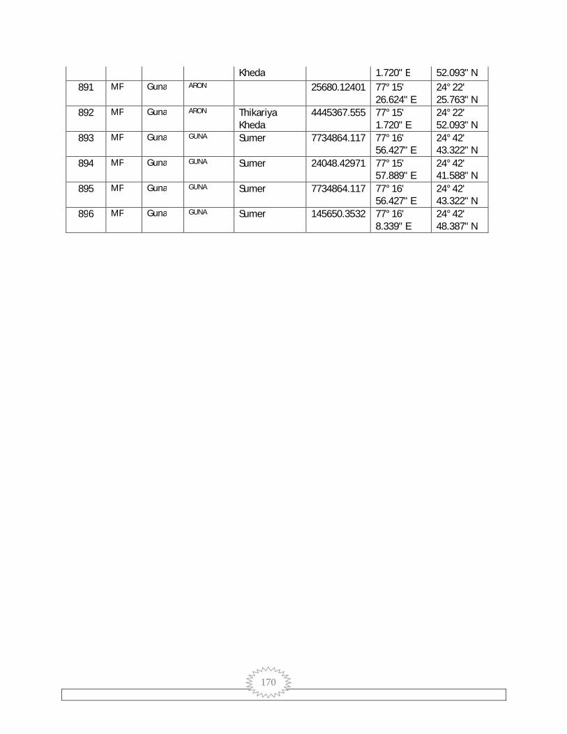
170
Kheda 1.720" E 52.093" N 891 MP Guna ARON 25680.12401 77° 15'
26.624" E 24° 22' 25.763" N
892 MP Guna ARON Thikariya Kheda
4445367.555 77° 15' 1.720" E
24° 22' 52.093" N
893 MP Guna GUNA Sumer 7734864.117 77° 16' 56.427" E
24° 42' 43.322" N
894 MP Guna GUNA Sumer 24048.42971 77° 15' 57.889" E
24° 42' 41.588" N
895 MP Guna GUNA Sumer 7734864.117 77° 16' 56.427" E
24° 42' 43.322" N
896 MP Guna GUNA Sumer 145650.3532 77° 16' 8.339" E
24° 42' 48.387" N

171
SR.NO. VillName DName TsilName BlkName GPName VillCode11 X Y
1 Bhimkheda (OG) (Part)
Guna Mahidpur GUNA BHEMAKHEDA 471381 77° 16' 29.610"
E
25° 3' 14.786"
N 2 Vithalpur Guna Bamori BAMORI BITTHALPUR 498990 77° 10'
49.912" E
25° 5' 27.939"
N 3 Musredi Guna Guna GUNA MAJHOLA 498755 77° 14'
10.349" E
25° 5' 24.873"
N 4 Bhotupura Guna Bamori BAMORI DONGARI 498991 77° 9'
43.297" E
25° 4' 8.218"
N 5 Majhola Guna Guna GUNA MAJHOLA 498756 77° 16'
46.011" E
25° 5' 21.054"
N 6 Akloun Guna Guna GUNA MAJHOLA 498747 77° 15'
56.222" E
25° 5' 16.015"
N 7 Nagphani
Saliya Guna Bamori BAMORI BITTHALPUR 498989 77° 8'
9.386" E
25° 4' 5.336"
N 8 Gehun Kheda Guna Bamori BAMORI DONGARI 498988 77° 12'
7.839" E
25° 4' 23.456"
N 9 Dastoli Ghhat Guna Guna GUNA SANWADA 498751 77° 17'
21.709" E
25° 4' 31.923"
N 10 Baghuriya Guna Bamori BAMORI MARI 498971 76° 59'
14.947" E
25° 2' 19.412"
N 11 Badera Guna Guna GUNA MAJHOLA 498753 77° 14'
27.089" E
25° 4' 10.378"
N 12 Barwan Guna Bamori BAMORI BARWAN 498970 77° 1'
32.360" E
25° 2' 26.191"
N 13 Dastoli Ber Guna Guna GUNA SANWADA 498752 77° 17'
27.992" E
25° 4' 9.152"
N 14 Dongri Guna Bamori BAMORI DONGARI 498992 77° 11'
43.411" E
25° 3' 24.630"
N 15 Hanumat
Kheda (Sirsi) Guna Guna GUNA JOHARI 498728 77° 14'
21.254" E
25° 3' 48.616"
N 16 Barbatu Guna Guna GUNA NAYAGAON 498722 77° 17'
50.735" E
25° 3' 49.424"
N 17 Gopalpur Guna Bamori BAMORI MARI 498986 77° 9' 25° 2'

172
11.108" E
51.224" N
18 Salaiya Rai Guna Bamori BAMORI BITTHALPUR 498993 77° 7' 37.200"
E
25° 3' 11.634"
N 19 Saloda Guna Guna GUNA NAYAGAON 498725 77° 16'
30.486" E
25° 3' 42.719"
N 20 Dehri (Bamori) Guna Bamori BAMORI KALORA 498974 77° 5'
39.388" E
25° 2' 0.620"
N 21 Barkheda
(Bamori) Guna Bamori BAMORI MOHANPUR 498975 77° 6'
33.567" E
25° 2' 21.172"
N 22 Luhari Guna Bamori BAMORI DEHRI 498977 77° 4'
1.691" E
25° 2' 10.619"
N 23 Sighhariya Guna Guna GUNA NAYAGAON 498727 77° 15'
30.544" E
25° 3' 34.015"
N 24 Badi Kanthi Guna Guna GUNA SANWADA 498748 77° 18'
3.446" E
25° 3' 25.737"
N 25 Bharatpur Guna Guna GUNA KALECHHARI 498723 77° 14'
2.206" E
25° 3' 17.778"
N 26 Rajela Guna Guna GUNA SANDKHEDA 498758 77° 18'
32.781" E
25° 3' 18.658"
N 27 Budera Guna Guna GUNA NAYAGAON 498721 77° 16'
38.935" E
25° 3' 16.471"
N 28 Karnawata Guna Guna GUNA GAOWARKHEDA 498716 77° 13'
19.360" E
25° 2' 47.032"
N 29 Suator Guna Guna GUNA REHAPURA 498726 77° 10'
15.172" E
25° 2' 16.030"
N 30 Rahraun Guna Bamori BAMORI GAOWARKHEDA 498959 76° 57'
24.273" E
25° 2' 1.512"
N 31 Nayagaon Alias
Paronda Guna Guna GUNA NAYAGAON 498719 77° 15'
25.889" E
25° 3' 3.210"
N 32 Kisanpur Barkui Guna Bamori BAMORI KISHANPURA 498978 77° 7'
54.594" E
25° 2' 15.635"
N 33 Chhoti Kanthi Guna Guna GUNA SANWADA 498749 77° 18'
31.605" E
25° 2' 49.898"
N 34 Kilampur Guna Guna GUNA KALECHHARI 498717 77° 11'
34.753" 25° 2'
18.459"

173
E N
35 Kalchheri Guna Guna GUNA KALECHHARI 498715 77° 12' 32.478"
E
25° 2' 5.630"
N 36 Tili Guna Bamori BAMORI TILI 498951 76° 55'
9.175" E
25° 1' 21.405"
N 37 Atakhedi Guna Guna GUNA DEHRA 498714 77° 16'
57.100" E
25° 2' 36.387"
N 38 Pura Luhari Guna Bamori BAMORI DEHRI 498976 77° 4'
44.668" E
25° 2' 21.734"
N 39 Sarkheda Guna Bamori BAMORI TILI 498962 76° 53'
23.992" E
25° 0' 26.088"
N 40 Ratwara Guna Bamori BAMORI CHHIKARI 498972 76° 57'
2.117" E
25° 0' 2.899"
N 41 Sandkheda Guna Guna GUNA SANDKHEDA 498759 77° 18'
25.517" E
25° 2' 11.615"
N 42 Gadlamar Guna Bamori BAMORI PATAN 498981 77° 6'
27.875" E
25° 1' 3.644"
N 43 Ajit Kheda Guna Guna GUNA KALECHHARI 498713 77° 11'
23.418" E
25° 1' 16.239"
N 44 Sanwada Guna Guna GUNA SANWADA 498760 77° 18'
22.564" E
25° 1' 46.869"
N 45 Banskhedi Guna Bamori BAMORI SANWADA 498980 77° 8'
10.758" E
25° 1' 4.499"
N 46 Chhikari Guna Bamori BAMORI CHHIKARI 498968 77° 0'
30.534" E
25° 0' 36.816"
N 47 Rehpura Guna Guna GUNA REHAPURA 498724 77° 10'
6.594" E
25° 1' 20.700"
N 48 Ratanpur Guna Guna GUNA SANDKHEDA 498757 77° 16'
49.252" E
25° 1' 30.887"
N 49 Kharrawata Guna Bamori BAMORI BITTHALPUR 498987 77° 12'
17.300" E
25° 5' 30.359"
N 50 Karri Guna Guna GUNA KALECHHARI 498718 77° 13'
36.747" E
25° 1' 34.945"
N 51 Karra Kheda Guna Bamori BAMORI DHANWADI 498966 76° 58'
58.593" E
25° 0' 6.068"
N
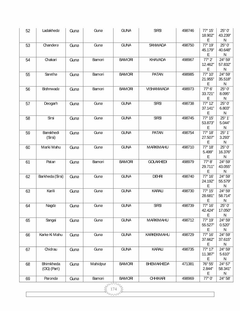
174
52 Ladakheda Guna Guna GUNA SIRSI 498746 77° 15' 18.902"
E
25° 0' 43.239"
N 53 Chandera Guna Guna GUNA SANWADA 498750 77° 19'
45.179" E
25° 0' 40.648"
N 54 Chakari Guna Bamori BAMORI KHAVADA 498967 77° 2'
12.462" E
24° 59' 57.832"
N 55 Saretha Guna Bamori BAMORI PATAN 498985 77° 10'
21.955" E
24° 59' 35.518"
N 56 Bishnwada Guna Bamori BAMORI VISHANWADA 498973 77° 6'
33.721" E
25° 0' 8.095"
N 57 Deogarh Guna Guna GUNA SIRSI 498738 77° 12'
37.141" E
25° 0' 6.803"
N 58 Sirsi Guna Guna GUNA SIRSI 498745 77° 15'
53.873" E
25° 1' 5.044"
N 59 Banskhedi
(Sirsi) Guna Guna GUNA PATAN 498754 77° 18'
27.507" E
25° 1' 3.293"
N 60 Marki Mahu Guna Guna GUNA MARKIMAHU 498710 77° 18'
5.499" E
25° 0' 16.376"
N 61 Patan Guna Bamori BAMORI GOLAKHEDI 498979 77° 8'
29.711" E
24° 59' 43.055"
N 62 Barkheda (Sirsi) Guna Guna GUNA DEHRI 498740 77° 16'
24.192" E
24° 59' 55.579"
N 63 Karili Guna Guna GUNA KARALI 498730 77° 15'
28.681" E
24° 59' 58.714"
N 64 Nagda Guna Guna GUNA SIRSI 498739 77° 16'
42.424" E
25° 0' 17.050"
N 65 Sangai Guna Guna GUNA MARKIMAHU 498712 77° 19'
55.527" E
24° 59' 0.520"
N 66 Karke Ki Mahu Guna Guna GUNA KARKEKIMAHU 498729 77° 16'
37.662" E
24° 59' 37.615"
N 67 Chidrau Guna Guna GUNA KARALI 498735 77° 17'
11.387" E
24° 59' 5.610"
N 68 Bhimkheda
(OG) (Part) Guna Mahidpur BAMORI BHEMAKHEDA 471381 76° 55'
2.844" E
24° 57' 58.341"
N 69 Paronda Guna Bamori BAMORI CHHIKARI 498969 77° 0' 24° 58'

175
17.406" E
47.115" N
70 Berkhedi (Sirsi) Guna Guna GUNA BHURAKHEDI 498741 77° 16' 43.994"
E
24° 59' 45.110"
N 71 Vardha Guna Bamori BAMORI VARDHA 498961 76° 58'
37.268" E
24° 57' 45.511"
N 72 Bhimkheda
(OG) (Part) Guna Mahidpur GUNA BHEMAKHEDA 471381 77° 14'
56.618" E
24° 57' 56.678"
N 73 Bhimkheda
(OG) (Part) Guna Mahidpur GUNA BHEMAKHEDA 471381 77° 18'
51.861" E
24° 59' 29.967"
N 74 Dumawan
(Bamori) Guna Bamori BAMORI DUMAVAN 499004 77° 4'
11.926" E
24° 57' 53.048"
N 75 Mehra Guna Guna GUNA KARALI 498744 77° 13'
20.922" E
24° 59' 27.942"
N 76 Tilwara Guna Guna GUNA UDAYPURI 498705 77° 18'
18.323" E
24° 58' 50.474"
N 77 Bhimkheda
(OG) (Part) Guna Mahidpur BAMORI BHEMAKHEDA 471381 77° 8'
47.966" E
24° 58' 5.521"
N 78 Kusun Khoh Guna Bamori BAMORI SONKHARA 498996 77° 12'
34.365" E
24° 58' 22.202"
N 79 Kawar Bamori Guna Bamori BAMORI KABAR BAMORI 498998 77° 6'
48.786" E
24° 58' 5.132"
N 80 Dhimar Pura Guna Bamori BAMORI JOHARI 499003 77° 2'
3.263" E
24° 57' 57.139"
N 81 Majrania Guna Bamori BAMORI GAOWARKHEDA 498956 76° 55'
39.981" E
24° 58' 55.026"
N 82 Kumhari Guna Bamori BAMORI PADON 498946 76° 58'
11.577" E
24° 58' 50.239"
N 83 Jalampur Guna Guna GUNA UDAYPURI 498704 77° 18'
25.494" E
24° 56' 37.245"
N 84 Chentbari Guna Guna GUNA KARKEKIMAHU 498734 77° 16'
36.057" E
24° 57' 51.158"
N 85 Narwada Guna Bamori BAMORI NARVADA 498952 76° 52'
50.812" E
24° 57' 20.151"
N 86 Laxmipura Guna Bamori BAMORI NARVADA 498960 76° 55'
42.159" 24° 58' 31.643"
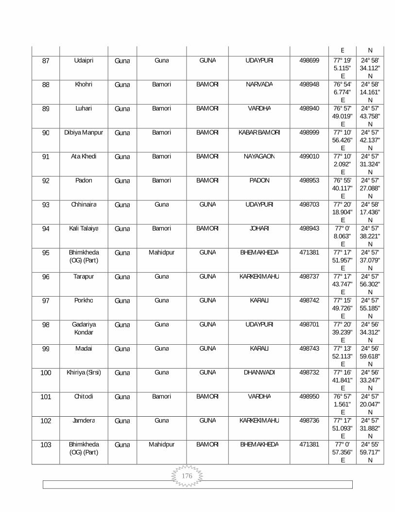
176
E N
87 Udaipri Guna Guna GUNA UDAYPURI 498699 77° 19' 5.115"
E
24° 58' 34.112"
N 88 Khohri Guna Bamori BAMORI NARVADA 498948 76° 54'
6.774" E
24° 58' 14.161"
N 89 Luhari Guna Bamori BAMORI VARDHA 498940 76° 57'
49.019" E
24° 57' 43.758"
N 90 Dibiya Manpur Guna Bamori BAMORI KABAR BAMORI 498999 77° 10'
56.426" E
24° 57' 42.137"
N 91 Ata Khedi Guna Bamori BAMORI NAYAGAON 499010 77° 10'
2.092" E
24° 57' 31.324"
N 92 Padon Guna Bamori BAMORI PADON 498953 76° 55'
40.117" E
24° 57' 27.088"
N 93 Chhinaira Guna Guna GUNA UDAYPURI 498703 77° 20'
18.904" E
24° 58' 17.436"
N 94 Kali Talaiya Guna Bamori BAMORI JOHARI 498943 77° 0'
8.063" E
24° 57' 38.221"
N 95 Bhimkheda
(OG) (Part) Guna Mahidpur GUNA BHEMAKHEDA 471381 77° 17'
51.957" E
24° 57' 37.079"
N 96 Tarapur Guna Guna GUNA KARKEKIMAHU 498737 77° 17'
43.747" E
24° 57' 56.302"
N 97 Porkho Guna Guna GUNA KARALI 498742 77° 15'
49.726" E
24° 57' 55.185"
N 98 Gadariya
Kondar Guna Guna GUNA UDAYPURI 498701 77° 20'
39.239" E
24° 56' 34.312"
N 99 Madai Guna Guna GUNA KARALI 498743 77° 13'
52.113" E
24° 56' 59.618"
N 100 Khiriya (Sirsi) Guna Guna GUNA DHANWADI 498732 77° 16'
41.841" E
24° 56' 33.247"
N 101 Chitodi Guna Bamori BAMORI VARDHA 498950 76° 57'
1.561" E
24° 57' 20.047"
N 102 Jamdera Guna Guna GUNA KARKEKIMAHU 498736 77° 17'
51.093" E
24° 57' 31.882"
N 103 Bhimkheda
(OG) (Part) Guna Mahidpur BAMORI BHEMAKHEDA 471381 77° 0'
57.356" E
24° 55' 59.717"
N

177
104 Sonkhara Guna Bamori BAMORI SONKHARA 498997 77° 13' 33.203"
E
24° 55' 47.901"
N 105 Paranth Guna Bamori BAMORI PARANTH 499005 77° 6'
5.403" E
24° 55' 21.979"
N 106 Kakarua Dang Guna Bamori BAMORI DEHRA 499009 77° 8'
39.284" E
24° 56' 23.922"
N 107 Baraudiya
(Bamori) Guna Bamori BAMORI BARODIA 499001 77° 3'
22.148" E
24° 56' 7.417"
N 108 Sileta Guna Bamori BAMORI VARDHA 498963 76° 57'
24.144" E
24° 55' 58.574"
N 109 Dongarpur Guna Bamori BAMORI DONGARPUR 499013 77° 10'
3.928" E
24° 55' 50.621"
N 110 Chitoda Guna Bamori BAMORI VARDHA 498949 76° 56'
45.873" E
24° 56' 49.235"
N 111 Viroli (Padon) Guna Bamori BAMORI NARVADA 498955 76° 52'
43.275" E
24° 56' 40.990"
N 112 Johri Guna Bamori BAMORI JOHARI 498941 77° 0'
27.930" E
24° 56' 39.392"
N 113 Chak Porkho Guna Guna GUNA KARALI 498733 77° 15'
19.258" E
24° 56' 47.834"
N 114 Kekdi Guna Bamori BAMORI PADON 498947 76° 55'
7.908" E
24° 56' 29.476"
N 115 Gadala Ujari Guna Bamori BAMORI GADLAUJARI 498994 77° 12'
3.826" E
24° 56' 1.854"
N 116 Kundora Guna Guna GUNA SINGPUR 498761 77° 24'
34.984" E
24° 55' 43.761"
N 117 Jaitpura Guna Bamori BAMORI GADLA GIRD 498942 77° 0'
47.870" E
24° 56' 10.763"
N 118 Dhanoriya Guna Bamori BAMORI SILAWATI KAPASI 498938 76° 58'
53.295" E
24° 55' 15.633"
N 119 Naghera Guna Guna GUNA RAI 498688 77° 15'
15.961" E
24° 55' 29.176"
N 120 Anarad Guna Bamori BAMORI SILAWATI KAPASI 498939 76° 55'
58.325" E
24° 55' 0.162"
N 121 Kherar Kheda Guna Guna GUNA CHHIKARI 498700 77° 21' 24° 55'

178
44.352" E
20.697" N
122 Mana (Padon) Guna Bamori BAMORI PADON 498957 76° 55' 15.160"
E
24° 55' 51.035"
N 123 Ikodiya (Sisri) Guna Guna GUNA DHANWADI 498698 77° 18'
22.023" E
24° 56' 2.302"
N 124 Haripur
(Myana) Guna Guna GUNA SINGPUR 498770 77° 26'
21.873" E
24° 55' 34.734"
N 125 Kharra Kheda Guna Bamori BAMORI BARODIA 499002 77° 4'
25.988" E
24° 54' 12.966"
N 126 Chhatarpur Guna Bamori BAMORI KAPASI 498932 76° 59'
52.857" E
24° 54' 14.853"
N 127 Silawati
(Podon) Guna Bamori BAMORI SILAWATI KAPASI 498937 76° 57'
49.609" E
24° 55' 2.531"
N 128 Bhimkheda
(OG) (Part) Guna Mahidpur GUNA BHEMAKHEDA 471381 77° 16'
27.293" E
24° 53' 3.043"
N 129 Kherla Guna Bamori BAMORI DONGARPUR 499014 77° 11'
33.568" E
24° 55' 7.870"
N 130 Chirkheda Guna Guna GUNA SINGPUR 498763 77° 26'
25.469" E
24° 54' 56.248"
N 131 Ganeshkheda Guna Guna GUNA PURAPOSAR 498702 77° 20'
56.053" E
24° 55' 34.693"
N 132 Doharda Guna Bamori BAMORI DORDA 499043 77° 2'
31.545" E
24° 54' 9.011"
N 133 Barodiya (Sirsi) Guna Guna GUNA DHANWADI 498709 77° 20'
12.892" E
24° 54' 11.219"
N 134 Dehra Guna Bamori BAMORI DEHRA 499006 77° 7'
45.650" E
24° 54' 30.881"
N 135 Bagoniya Guna Guna GUNA RAI 498690 77° 16'
58.294" E
24° 54' 1.867"
N 136 Tuiya Kheda Guna Bamori BAMORI DORDA 499042 77° 0'
47.858" E
24° 54' 59.037"
N 137 Kala Pahad Guna Guna GUNA TAKNERA 498773 77° 24'
1.614" E
24° 54' 32.697"
N 138 Sherpur Guna Guna GUNA KHERIKHETA 498696 77° 15'
7.836" 24° 53' 58.236"

179
E N
139 Bhensatori Guna Bamori BAMORI AMODA 499021 77° 13' 2.717"
E
24° 53' 39.484"
N 140 Kapasi Guna Bamori BAMORI KAPASI 498930 76° 57'
24.992" E
24° 53' 41.728"
N 141 Pipriya (Sirsi) Guna Guna GUNA PARWAHA 498708 77° 21'
54.760" E
24° 53' 36.308"
N 142 Badanpur Guna Bamori BAMORI AMODA 499020 77° 10'
56.455" E
24° 52' 59.401"
N 143 Gadla Guna Guna GUNA TAKNERA 498774 77° 27'
11.864" E
24° 53' 48.526"
N 144 Nonpura Guna Bamori BAMORI MOHANPUR 499011 77° 9'
57.261" E
24° 53' 43.798"
N 145 Morkhedi Guna Bamori BAMORI TINSAIYAI 499007 77° 8'
34.762" E
24° 53' 58.517"
N 146 Rajpura Guna Bamori BAMORI PADON 498958 76° 55'
36.122" E
24° 53' 42.194"
N 147 Hansalpur Guna Guna GUNA SINGPUR 498771 77° 23'
11.186" E
24° 53' 45.499"
N 148 Singpur Guna Guna GUNA SINGPUR 498768 77° 25'
23.249" E
24° 53' 36.581"
N 149 Biloda
(Bhadora) Guna Guna GUNA PANCHORA 498693 77° 13'
19.998" E
24° 52' 58.985"
N 150 Mahuwakheda
Khurd Guna Bamori BAMORI KAPASI 498933 76° 59'
35.848" E
24° 52' 55.450"
N 151 Khadela Guna Bamori BAMORI KHADELA 499019 77° 8'
38.968" E
24° 52' 47.701"
N 152 Karamda Guna Bamori BAMORI KALECHHARI 499037 77° 6'
54.418" E
24° 52' 37.072"
N 153 Biroli Guna Guna GUNA KHERIKHETA 498692 77° 14'
4.848" E
24° 53' 7.785"
N 154 Takanera Guna Guna GUNA TAKNERA 498776 77° 27'
8.611" E
24° 52' 4.212"
N 155 Chaklonda Guna Bamori BAMORI CHAKLODA 498931 76° 57'
25.060" E
24° 51' 55.536"
N

180
156 Radhapura Guna Bamori BAMORI CHAKLODA 498936 76° 55' 36.273"
E
24° 52' 59.890"
N 157 Basar Guna Guna GUNA TINSAIYAI 498766 77° 24'
3.056" E
24° 53' 2.107"
N 158 Kheri Khata Guna Guna GUNA KHERIKHETA 498686 77° 17'
53.579" E
24° 53' 27.546"
N 159 Tanda Guna Guna GUNA RAI 498687 77° 18'
30.149" E
24° 52' 32.452"
N 160 Bhimkheda
(OG) (Part) Guna Mahidpur GUNA BHEMAKHEDA 471381 77° 25'
13.174" E
24° 52' 25.370"
N 161 Karamdi Guna Bamori BAMORI GAOWARKHEDA 499038 77° 4'
38.885" E
24° 52' 25.169"
N 162 Rai Guna Guna GUNA RAI 498695 77° 19'
58.253" E
24° 52' 21.980"
N 163 Bongla Guna Bamori BAMORI DORDA 499045 77° 3'
12.643" E
24° 52' 17.487"
N 164 Hinotiya Guna Bamori BAMORI SINGPUR 499012 77° 9'
53.702" E
24° 52' 38.927"
N 165 Kalora Guna Bamori BAMORI KALECHHARI 499051 77° 1'
27.447" E
24° 51' 16.881"
N 166 Singhar-Pur Guna Guna GUNA TINSAIYAI 498769 77° 24'
51.197" E
24° 53' 11.791"
N 167 Myapur Alias
Dhanwadi Guna Guna GUNA DHANWADI 498711 77° 21'
53.446" E
24° 53' 10.369"
N 168 Tinsyai Guna Guna GUNA TINSAIYAI 498764 77° 23'
50.737" E
24° 51' 42.875"
N 169 Tumada Guna Bamori BAMORI KUDKA 499055 76° 59'
41.981" E
24° 51' 48.042"
N 170 Madhi Kheda Guna Bamori BAMORI GAOWARKHEDA 499046 77° 7'
52.976" E
24° 52' 18.755"
N 171 Akoda Guna Bamori BAMORI AMODA 499018 77° 12'
0.453" E
24° 51' 31.228"
N 172 Dinola Guna Guna GUNA UDAYPURI 498706 77° 21'
51.334" E
24° 51' 54.023"
N 173 Hastnapur Guna Guna GUNA KHERIKHETA 498697 77° 14' 24° 52'

181
17.311" E
26.704" N
174 Hirnoda (Myana)
Guna Guna GUNA SINGPUR 498772 77° 25' 15.196"
E
24° 52' 29.525"
N 175 Khajuri Guna Guna GUNA KHAJURI 498775 77° 29'
39.154" E
24° 51' 40.860"
N 176 Shahpur
(Myana) Guna Guna GUNA KHAJURI 498777 77° 32'
36.553" E
24° 51' 55.776"
N 177 Baniyani
(Padon) Guna Bamori BAMORI KOHAN 498935 76° 58'
28.718" E
24° 52' 10.359"
N 178 Khairoda Guna Bamori BAMORI KONTAR 499031 77° 10'
9.648" E
24° 51' 34.243"
N 179 Kudka Guna Bamori BAMORI KUDKA 499054 76° 58'
47.811" E
24° 51' 29.547"
N 180 Gwarkheda Guna Bamori BAMORI GAOWARKHEDA 499041 77° 5'
59.983" E
24° 51' 33.201"
N 181 Bandha Guna Guna GUNA RAI 498691 77° 16'
52.447" E
24° 51' 41.409"
N 182 Morkhedi Guna Guna GUNA DEHRA 498767 77° 25'
58.249" E
24° 51' 38.871"
N 183 Patana
(Bhadora) Guna Guna GUNA KHERIKHETA 498689 77° 18'
19.650" E
24° 52' 5.198"
N 184 Sendhua Guna Guna GUNA PADMANKHEDI 498784 77° 31'
23.544" E
24° 51' 20.268"
N 185 Bamori Guna Bamori BAMORI BAMORI 499035 77° 8'
23.589" E
24° 50' 54.957"
N 186 Bhimkheda
(OG) (Part) Guna Mahidpur RAGHOGARH BHEMAKHEDA 471381 77° 33'
36.534" E
24° 52' 3.081"
N 187 Durgapur Guna Guna GUNA SINGPUR 498765 77° 25'
24.711" E
24° 51' 55.967"
N 188 Mahodra Guna Guna GUNA MAHODRA 498694 77° 18'
53.864" E
24° 50' 22.674"
N 189 Bandha Guna Bamori BAMORI KUDKA 499056 76° 57'
43.179" E
24° 50' 57.120"
N 190 Machhriya Guna Bamori BAMORI GAOWARKHEDA 499047 77° 4'
23.772" 24° 50' 34.265"

182
E N
191 Umrdha Guna Bamori BAMORI BHINDA 499052 76° 57' 21.277"
E
24° 50' 8.513"
N 192 Sanavani Guna Bamori BAMORI MOHANPUR 499170 77° 14'
27.370" E
24° 50' 42.287"
N 193 Bhimkheda
(OG) (Part) Guna Mahidpur GUNA BHEMAKHEDA 471381 77° 23'
17.755" E
24° 50' 23.759"
N 194 Dungasara Guna Guna GUNA DUNGSARA 498787 77° 25'
36.122" E
24° 49' 39.388"
N 195 Fatehgarh Guna Bamori BAMORI FETHEPUR 499059 76° 58'
47.473" E
24° 48' 43.459"
N 196 Prayagpur Guna Bamori BAMORI BAMORI 499036 77° 10'
35.075" E
24° 50' 14.281"
N 197 Myana Guna Guna GUNA MAYANA 498785 77° 28'
16.245" E
24° 49' 48.673"
N 198 Mamla Guna Bamori BAMORI BABRIKHEDA 499064 76° 55'
32.004" E
24° 49' 53.319"
N 199 Padaman Khedi Guna Guna GUNA PADMANKHEDI 498780 77° 29'
59.470" E
24° 50' 15.803"
N 200 Bhidra Guna Bamori BAMORI BINDRA 499057 76° 57'
58.357" E
24° 49' 37.642"
N 201 Panehti Guna Bamori BAMORI KALORA 499044 77° 3'
4.507" E
24° 48' 26.382"
N 202 Nasira Guna Guna GUNA PADMANKHEDI 498779 77° 30'
58.637" E
24° 50' 16.084"
N 203 Madhopur Guna Guna GUNA HARIPUR 498789 77° 22'
42.873" E
24° 50' 45.632"
N 204 Bawadi Kheda Guna Bamori BAMORI BABRIKHEDA 499060 76° 54'
16.683" E
24° 48' 43.417"
N 205 Pali Guna Guna GUNA DUNGSARA 498788 77° 23'
22.053" E
24° 50' 31.313"
N 206 Bagheri Guna Bamori BAMORI BAGARI 499022 77° 8'
33.187" E
24° 49' 18.728"
N 207 Bhura Khedi Guna Bamori BAMORI SIRSI 499174 77° 13'
41.510" 24° 49' 40.127"

183
E N
208 Mohanpur Khurd
Guna Bamori BAMORI MOHANPUR 499168 77° 14' 32.531"
E
24° 50' 18.120"
N 209 Chak
Madhopur Guna Guna GUNA DUNGSARA 498786 77° 24'
13.224" E
24° 50' 20.998"
N 210 Dobra Guna Bamori BAMORI BILKHEDA 499066 76° 52'
21.608" E
24° 48' 53.842"
N 211 Digdoli Guna Bamori BAMORI DIGDOLI 499068 76° 50'
33.601" E
24° 48' 54.632"
N 212 Bhimkheda
(OG) (Part) Guna Mahidpur BAMORI BHEMAKHEDA 471381 77° 14'
25.002" E
24° 45' 27.465"
N 213 Mirwada Guna Bamori BAMORI DIGDOLI 499070 76° 49'
9.009" E
24° 48' 40.070"
N 214 Khutiyari Guna Bamori BAMORI BAGARI 499024 77° 7'
18.827" E
24° 49' 5.536"
N 215 Dehri
(Fatehgarh) Guna Bamori BAMORI DEHRI 499097 77° 1'
13.158" E
24° 48' 48.306"
N 216 Gomchi Kheda Guna Guna GUNA DUNGSARA 498762 77° 23'
17.460" E
24° 49' 59.553"
N 217 Nibheri Guna Bamori BAMORI KANSAL 499099 77° 0'
2.725" E
24° 48' 43.612"
N 218 Darawla Guna Bamori BAMORI RAMPUR 499027 77° 11'
1.946" E
24° 48' 30.544"
N 219 Raniganj Guna Guna GUNA NEGMA 498651 77° 12'
24.609" E
24° 49' 43.877"
N 220 Londera Guna Bamori BAMORI LODERA 499050 77° 5'
36.919" E
24° 49' 38.984"
N 221 Sartala Guna Guna GUNA AGARA 498795 77° 19'
4.035" E
24° 48' 11.626"
N 222 Richhai Guna Guna GUNA PADMANKHEDI 498782 77° 30'
2.744" E
24° 49' 13.712"
N 223 Bhadora Guna Guna GUNA BHADORA 498794 77° 22'
52.445" E
24° 48' 15.702"
N 224 Boodha Kheda Guna Bamori BAMORI KONTAR 499171 77° 14'
29.711" E
24° 48' 59.012"
N

184
225 Bilauda Guna Bamori BAMORI KHERIKHETA 499032 77° 6' 18.055"
E
24° 47' 55.724"
N 226 Makraudi Guna Guna GUNA MAKRAWADA 498680 77° 15'
5.861" E
24° 49' 36.762"
N 227 Amrod Guna Bamori BAMORI AMROD 499156 77° 12'
33.633" E
24° 48' 26.767"
N 228 Lahar Ghat Guna Guna GUNA LEHARGHAT 498783 77° 30'
31.465" E
24° 49' 1.861"
N 229 Jageswari Guna Bamori BAMORI BILKHEDA 499065 76° 56'
2.644" E
24° 48' 45.832"
N 230 Pipal Khedi Guna Bamori BAMORI PATHI 499058 76° 57'
31.019" E
24° 48' 12.221"
N 231 Nonera Guna Bamori BAMORI BAGARI 499023 77° 9'
55.493" E
24° 48' 56.996"
N 232 Tajpur Guna Guna GUNA AGARA 498792 77° 18'
27.191" E
24° 48' 18.357"
N 233 Jhiroli Guna Guna GUNA AGARA 498791 77° 19'
55.826" E
24° 48' 14.752"
N 234 Amrohi Guna Guna GUNA BINDRA 498665 77° 15'
19.553" E
24° 49' 15.475"
N 235 Minkhiya Guna Guna GUNA LEHARKOTA 498804 77° 26'
2.950" E
24° 49' 10.565"
N 236 Gwar Kheda Guna Guna GUNA LEHARKOTA 498803 77° 24'
42.395" E
24° 47' 28.659"
N 237 Bhidra Guna Guna GUNA BHINDA 498677 77° 15'
59.099" E
24° 49' 1.983"
N 238 Tajpur Guna Guna GUNA BINDRA 498671 77° 17'
46.857" E
24° 48' 55.126"
N 239 Sagoriya Guna Guna GUNA JAMRA 498809 77° 26'
46.476" E
24° 48' 11.875"
N 240 Agara Guna Guna GUNA AGARA 498790 77° 21'
10.043" E
24° 48' 28.263"
N 241 Nibhera Guna Bamori BAMORI KANSAL 499098 76° 59'
36.618" E
24° 47' 56.791"
N 242 Jhumka Guna Bamori BAMORI LODERA 499040 77° 4' 24° 47'

185
49.181" E
44.530" N
243 Khonkar Guna Guna GUNA LEHARGHAT 498778 77° 29' 42.972"
E
24° 48' 7.425"
N 244 Panchora Guna Bamori BAMORI PANCHORA 499026 77° 9'
11.791" E
24° 47' 22.942"
N 245 Jhiri Guna Bamori BAMORI BABRIKHEDA 499062 76° 56'
25.970" E
24° 47' 43.710"
N 246 Jamra Guna Guna GUNA JAMRA 498807 77° 28'
11.291" E
24° 47' 45.172"
N 247 Dhamkan Guna Guna GUNA BINDRA 498673 77° 17'
42.329" E
24° 48' 30.962"
N 248 Piprodi Guna Guna GUNA MARI 498659 77° 16'
18.113" E
24° 48' 26.434"
N 249 Lakhana Khedi Guna Bamori BAMORI DIGDOLI 499072 76° 49'
31.871" E
24° 47' 25.516"
N 250 Magroda Guna Bamori BAMORI MAGRODA 499092 77° 1'
3.934" E
24° 46' 36.884"
N 251 Banskhedi
(Myana) Guna Guna GUNA LEHARGHAT 498781 77° 30'
35.447" E
24° 47' 24.220"
N 252 Hansli Guna Guna GUNA AGARA 498796 77° 21'
8.398" E
24° 47' 39.447"
N 253 Sakatpur
(Fatehgarh) Guna Bamori BAMORI DIGDOLI 499073 76° 52'
7.315" E
24° 47' 31.911"
N 254 Lahar Kota Guna Guna GUNA LEHARKOTA 498805 77° 25'
35.213" E
24° 47' 33.486"
N 255 Bilkheda Guna Bamori BAMORI BILKHEDA 499061 76° 54'
38.959" E
24° 47' 9.866"
N 256 Piproda Guna Guna GUNA AGARA 498793 77° 20'
39.690" E
24° 47' 8.315"
N 257 Bawarauda Guna Guna GUNA CHEKDEVPUR 498676 77° 16'
21.990" E
24° 47' 44.115"
N 258 Rampur Guna Bamori BAMORI RAMPUR 499028 77° 10'
53.377" E
24° 46' 45.756"
N 259 Kansal Guna Bamori BAMORI KANSAL 499094 76° 59'
43.522" 24° 46' 58.692"
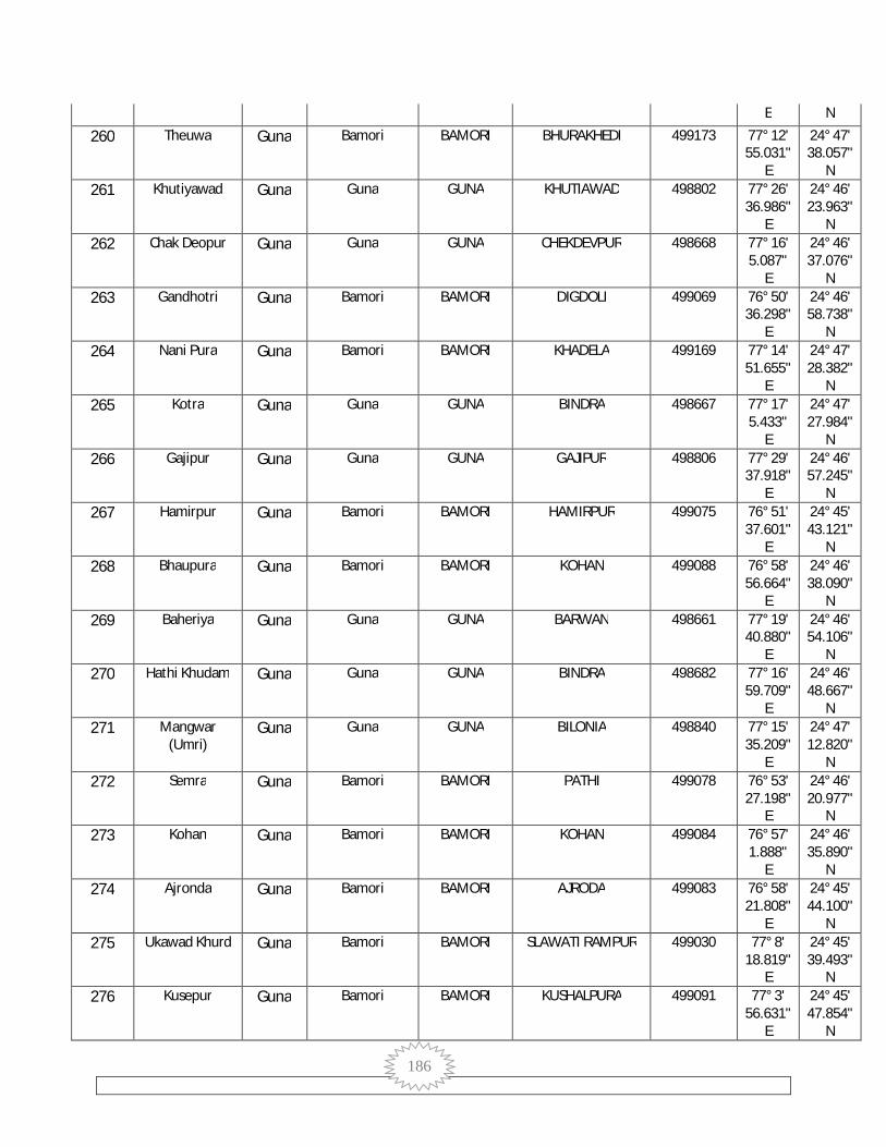
186
E N
260 Theuwa Guna Bamori BAMORI BHURAKHEDI 499173 77° 12' 55.031"
E
24° 47' 38.057"
N 261 Khutiyawad Guna Guna GUNA KHUTIAWAD 498802 77° 26'
36.986" E
24° 46' 23.963"
N 262 Chak Deopur Guna Guna GUNA CHEKDEVPUR 498668 77° 16'
5.087" E
24° 46' 37.076"
N 263 Gandhotri Guna Bamori BAMORI DIGDOLI 499069 76° 50'
36.298" E
24° 46' 58.738"
N 264 Nani Pura Guna Bamori BAMORI KHADELA 499169 77° 14'
51.655" E
24° 47' 28.382"
N 265 Kotra Guna Guna GUNA BINDRA 498667 77° 17'
5.433" E
24° 47' 27.984"
N 266 Gajipur Guna Guna GUNA GAJIPUR 498806 77° 29'
37.918" E
24° 46' 57.245"
N 267 Hamirpur Guna Bamori BAMORI HAMIRPUR 499075 76° 51'
37.601" E
24° 45' 43.121"
N 268 Bhaupura Guna Bamori BAMORI KOHAN 499088 76° 58'
56.664" E
24° 46' 38.090"
N 269 Baheriya Guna Guna GUNA BARWAN 498661 77° 19'
40.880" E
24° 46' 54.106"
N 270 Hathi Khudam Guna Guna GUNA BINDRA 498682 77° 16'
59.709" E
24° 46' 48.667"
N 271 Mangwar
(Umri) Guna Guna GUNA BILONIA 498840 77° 15'
35.209" E
24° 47' 12.820"
N 272 Semra Guna Bamori BAMORI PATHI 499078 76° 53'
27.198" E
24° 46' 20.977"
N 273 Kohan Guna Bamori BAMORI KOHAN 499084 76° 57'
1.888" E
24° 46' 35.890"
N 274 Ajronda Guna Bamori BAMORI AJRODA 499083 76° 58'
21.808" E
24° 45' 44.100"
N 275 Ukawad Khurd Guna Bamori BAMORI SLAWATI RAMPUR 499030 77° 8'
18.819" E
24° 45' 39.493"
N 276 Kusepur Guna Bamori BAMORI KUSHALPURA 499091 77° 3'
56.631" E
24° 45' 47.854"
N

187
277 Sutai Guna Guna GUNA DHAMNAR 498801 77° 23' 10.878"
E
24° 46' 45.297"
N 278 Nehgawan Guna Guna GUNA NEGMA 498645 77° 18'
24.958" E
24° 46' 35.657"
N 279 Pakhar Guna Bamori BAMORI KOHAN 499087 76° 55'
50.428" E
24° 46' 26.743"
N 280 Gudha Guna Bamori BAMORI KUSHALPURA 499090 77° 2'
45.845" E
24° 46' 21.546"
N 281 Muhal Kaloni Guna Bamori BAMORI HOHAL KALONI 499025 77° 7'
6.700" E
24° 46' 12.497"
N 282 Anapura Guna Bamori BAMORI PATHI 499077 76° 54'
58.226" E
24° 46' 19.424"
N 283 Padura Guna Guna GUNA MARI 498656 77° 21'
22.576" E
24° 46' 16.332"
N 284 Simrod Guna Bamori BAMORI SIMROD 499177 77° 15'
42.092" E
24° 46' 51.667"
N 285 Barkheda
Sapha Guna Guna GUNA GAJIPUR 498808 77° 30'
44.261" E
24° 46' 10.473"
N 286 Chak Kansal Guna Bamori BAMORI KANSAL 499095 76° 59'
52.939" E
24° 46' 19.291"
N 287 Poonam Khedi Guna Guna GUNA MANPUR 498812 77° 28'
48.916" E
24° 46' 11.545"
N 288 Raipur Guna Guna GUNA DHAMNAR 498800 77° 22'
37.519" E
24° 45' 55.368"
N 289 Dongar Khedi Guna Bamori BAMORI UKAWADKALAN 499034 77° 5'
13.368" E
24° 45' 14.026"
N 290 Bhonra
(Rampur) Guna Bamori BAMORI BHONRA 499104 77° 6'
19.410" E
24° 45' 14.412"
N 291 Dunai Guna Guna GUNA DHAMNAR 498798 77° 23'
41.001" E
24° 45' 51.473"
N 292 Bindarada Guna Bamori BAMORI PATHI 499082 76° 54'
36.755" E
24° 46' 3.987"
N 293 Mamata-Alias
Ganesh Kheda Guna Guna GUNA MARI 498662 77° 19'
33.681" E
24° 46' 13.500"
N

188
294 Baniyani Guna Bamori BAMORI CHAKLODA 499085 76° 57' 5.465"
E
24° 45' 45.772"
N 295 Deopur Guna Guna GUNA CHEKDEVPUR 498672 77° 16'
28.534" E
24° 45' 57.051"
N 296 Laloni Guna Bamori BAMORI LALONI 499105 77° 2'
12.777" E
24° 45' 30.761"
N 297 Pipal Khedi
(Umri) Guna Guna GUNA FETHEPUR 498674 77° 17'
50.059" E
24° 45' 48.092"
N 298 Ukawad Guna Guna GUNA UKAWAD 498819 77° 31'
38.967" E
24° 45' 16.546"
N 299 Chandan Bhent Guna Guna GUNA BINDRA 498670 77° 18'
20.185" E
24° 46' 21.731"
N 300 Silawati
(Rampur) Guna Bamori BAMORI SLAWATI RAMPUR 499166 77° 9'
27.593" E
24° 45' 30.521"
N 301 Dhamnar Guna Guna GUNA DHAMNAR 498799 77° 24'
57.456" E
24° 45' 3.166"
N 302 Bhumra Khedi Guna Bamori BAMORI AJRODA 499089 76° 59'
26.590" E
24° 45' 30.128"
N 303 Bhimkheda
(OG) (Part) Guna Mahidpur GUNA BHEMAKHEDA 471381 77° 20'
14.614" E
24° 45' 47.408"
N 304 Piproda Haru Guna Guna GUNA RENJHAI 498831 77° 27'
23.466" E
24° 45' 4.076"
N 305 Pathi Guna Bamori BAMORI PATHI 499076 76° 54'
7.243" E
24° 45' 21.698"
N 306 Andela Guna Guna GUNA MANPUR 498810 77° 28'
57.027" E
24° 46' 8.173"
N 307 Kishanpura Guna Bamori BAMORI DEHRI 499093 76° 59'
49.818" E
24° 45' 8.463"
N 308 Umri Guna Guna GUNA MARI 498654 77° 18'
58.199" E
24° 44' 59.336"
N 309 Antar Soona Guna Bamori BAMORI KHAVADA 499157 77° 12'
27.775" E
24° 45' 53.762"
N 310 Ahamedpur Guna Guna GUNA MANPUR 498811 77° 29'
22.025" E
24° 45' 17.143"
N

189
311 Chak Parsikheda
Guna Bamori BAMORI AJRODA 499086 76° 59' 29.212"
E
24° 45' 37.463"
N 312 Bhimkheda
(OG) (Part) Guna Mahidpur GUNA BHEMAKHEDA 471381 77° 20'
33.296" E
24° 43' 55.413"
N 313 Bhura Khedi Guna Bamori BAMORI SIRSI 499109 77° 3'
4.168" E
24° 44' 10.573"
N 314 Hirnoda Guna Bamori BAMORI KONTAR 499167 77° 10'
0.414" E
24° 44' 41.689"
N 315 Ukawad Kalan Guna Bamori BAMORI UKAWADKALAN 499033 77° 7'
19.504" E
24° 44' 49.800"
N 316 Khargpur Guna Guna GUNA DHAMNAR 498797 77° 23'
49.381" E
24° 45' 2.974"
N 317 Ramnagar Guna Bamori BAMORI RAMNAGAR 499100 77° 0'
37.483" E
24° 44' 0.644"
N 318 Kandhai Guna Guna GUNA MAKRAWADA 498666 77° 16'
35.529" E
24° 45' 26.647"
N 319 Sumer Guna Guna GUNA PURAPOSAR 498652 77° 16'
11.345" E
24° 42' 42.393"
N 320 Kanchanpura Guna Bamori BAMORI KHAVADA 499159 77° 12'
25.807" E
24° 44' 17.955"
N 321 Dudhoniya Guna Guna GUNA MARI 498655 77° 21'
1.031" E
24° 45' 19.776"
N 322 Manpur Guna Guna GUNA MANPUR 498813 77° 28'
24.783" E
24° 44' 45.183"
N 323 Kanja Guna Guna GUNA PURENI 498833 77° 22'
24.165" E
24° 44' 16.094"
N 324 Churela Guna Bamori BAMORI CHURELA 499106 77° 2'
25.787" E
24° 43' 5.407"
N 325 Mali (Khiyaoda) Guna Bamori BAMORI KHAVADA 499158 77° 12'
50.381" E
24° 45' 1.732"
N 326 Gankar Kheda Guna Bamori BAMORI SIMROD 499176 77° 14'
58.916" E
24° 45' 1.615"
N 327 Banna Kheda Guna Guna GUNA MAKRAWADA 498675 77° 17'
1.121" E
24° 45' 2.593"
N 328 Takodiya Guna Bamori BAMORI KISHANPURA 499096 76° 59' 24° 44'
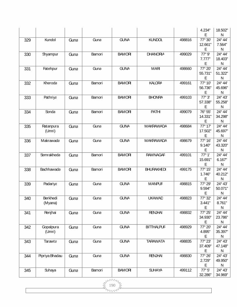
190
4.234" E
18.502" N
329 Kundol Guna Guna GUNA KUNDOL 498816 77° 30' 12.661"
E
24° 44' 7.564"
N 330 Shyampur Guna Bamori BAMORI DHANORIA 499029 77° 9'
7.777" E
24° 44' 18.403"
N 331 Fatehpur Guna Guna GUNA MARI 498660 77° 20'
55.731" E
24° 44' 51.322"
N 332 Kheroda Guna Bamori BAMORI KALORA 499161 77° 10'
56.736" E
24° 44' 45.696"
N 333 Pathriya Guna Bamori BAMORI BHONRA 499103 77° 3'
57.338" E
24° 43' 55.258"
N 334 Sonda Guna Bamori BAMORI PATHI 499079 76° 55'
14.331" E
24° 44' 34.298"
N 335 Ratanpura
(Umri) Guna Guna GUNA MAKRAWADA 498684 77° 17'
17.502" E
24° 44' 45.697"
N 336 Makrawada Guna Guna GUNA MAKRAWADA 498679 77° 16'
9.140" E
24° 44' 43.320"
N 337 Semrakheda Guna Bamori BAMORI RAMNAGAR 499101 77° 1'
15.691" E
24° 44' 6.167"
N 338 Bachhawada Guna Bamori BAMORI BHURAKHEDI 499175 77° 15'
1.746" E
24° 44' 40.212"
N 339 Padariya Guna Guna GUNA MANPUR 498815 77° 29'
9.594" E
24° 43' 50.071"
N 340 Berkhedi
(Myana) Guna Guna GUNA UKAWAD 498823 77° 32'
3.441" E
24° 44' 8.761"
N 341 Renjhai Guna Guna GUNA RENJHAI 498832 77° 25'
34.930" E
24° 44' 23.786"
N 342 Gopalpura
(Umri) Guna Guna GUNA BITTHALPUR 498929 77° 20'
4.895" E
24° 44' 35.397"
N 343 Tarawta Guna Guna GUNA TARAWATA 498835 77° 23'
37.409" E
24° 43' 47.148"
N 344 Pipriya Bhadau Guna Guna GUNA RENJHAI 498830 77° 26'
2.729" E
24° 43' 49.950"
N 345 Suhaya Guna Bamori BAMORI SUHAYA 499112 77° 5'
32.286" 24° 43' 34.969"

191
E N
346 Hinotiya Guna Guna GUNA HINOTIYA 498814 77° 27' 59.300"
E
24° 43' 41.197"
N 347 Patai Guna Guna GUNA MARI 498657 77° 21'
19.853" E
24° 44' 23.718"
N 348 Poru Khedi Guna Bamori BAMORI SAVARAMODI 499155 77° 6'
36.857" E
24° 43' 29.691"
N 349 Mali (Umri) Guna Guna GUNA MAKRAWADA 498681 77° 16'
2.555" E
24° 44' 14.921"
N 350 Sawaramodi Guna Bamori BAMORI SAVARAMODI 499154 77° 7'
49.933" E
24° 43' 28.101"
N 351 Bhimkheda
(OG) (Part) Guna Mahidpur GUNA BHEMAKHEDA 471381 77° 27'
32.370" E
24° 42' 26.690"
N 352 Laldant Guna Guna GUNA MARI 498664 77° 18'
2.647" E
24° 43' 30.126"
N 353 Saray Guna Guna GUNA MARI 498663 77° 21'
21.992" E
24° 44' 3.533"
N 354 Dumawan Guna Bamori BAMORI RAMNAGAR 499102 77° 1'
24.601" E
24° 43' 13.088"
N 355 Kontar Guna Bamori BAMORI KONTAR 499150 77° 9'
18.519" E
24° 43' 34.005"
N 356 Pureni Guna Guna GUNA PURENI 498836 77° 24'
57.517" E
24° 43' 17.355"
N 357 Hanumatpura Guna Guna GUNA MAKRAWADA 498685 77° 20'
6.750" E
24° 43' 57.296"
N 358 Bheron Ghhati Guna Guna GUNA MAKRAWADA 498678 77° 16'
43.726" E
24° 42' 57.394"
N 359 Brija Bamori Guna Bamori BAMORI PARWAHA 499110 77° 4'
28.472" E
24° 43' 12.766"
N 360 Gajnai Guna Guna GUNA GAJNAI 498820 77° 30'
53.366" E
24° 43' 30.461"
N 361 Bilabawadi Guna Guna GUNA BILONIA 498839 77° 21'
38.362" E
24° 43' 2.540"
N 362 Gopalpur Guna Guna GUNA GOPALPUR 498821 77° 32'
15.911" E
24° 43' 21.448"
N

192
363 Silwai Guna Guna GUNA SILAWATI 498838 77° 23' 25.795"
E
24° 42' 35.170"
N 364 Binda Khedi Guna Bamori BAMORI SANWADA 499153 77° 9'
44.782" E
24° 43' 0.916"
N 365 Ari Guna Guna GUNA NEGMA 498641 77° 19'
36.678" E
24° 43' 26.164"
N 366 Khiyaoda Guna Bamori BAMORI KHAVADA 499160 77° 11'
53.894" E
24° 43' 20.748"
N 367 Bhimkheda
(OG) (Part) Guna Mahidpur GUNA BHEMAKHEDA 471381 77° 18'
37.958" E
24° 42' 40.277"
N 368 Chak Piplya Guna Bamori BAMORI CHURELA 499108 77° 3'
38.109" E
24° 42' 49.514"
N 369 Shyampur
(Myana) Guna Guna GUNA GOPALPUR 498824 77° 31'
35.528" E
24° 42' 42.781"
N 370 Dhanoriya Guna Bamori BAMORI DHANORIA 499115 77° 8'
32.950" E
24° 42' 47.113"
N 371 Chak
Hanumatpura Guna Guna GUNA MAKRAWADA 498669 77° 18'
3.684" E
24° 43' 20.505"
N 372 Doshpur Guna Guna GUNA KUNDOL 498817 77° 28'
52.586" E
24° 42' 59.516"
N 373 Barkheda
Dhenkni Guna Guna GUNA PURENI 498837 77° 25'
46.280" E
24° 42' 26.677"
N 374 Vaneh Guna Bamori BAMORI BANEH 499111 77° 6'
23.750" E
24° 42' 22.537"
N 375 Dudhai Guna Bamori BAMORI KHAVADA 499165 77° 13'
19.835" E
24° 43' 9.134"
N 376 Magrana Guna Guna GUNA MAGRANA 498818 77° 30'
4.803" E
24° 42' 22.106"
N 377 Kishangarh Guna Guna GUNA PURENI 498834 77° 27'
3.409" E
24° 43' 9.787"
N 378 Bisoniya Guna Bamori BAMORI BISONIYA 499145 77° 12'
51.590" E
24° 41' 51.353"
N 379 Bhimkheda
(OG) (Part) Guna Mahidpur BAMORI BHEMAKHEDA 471381 77° 5'
9.809" E
24° 41' 47.257"
N

193
380 Rihana Guna Bamori BAMORI KHADGPUR 499146 77° 10' 29.123"
E
24° 41' 54.294"
N 381 Bhimkheda
(OG) (Part) Guna Mahidpur BAMORI BHEMAKHEDA 471381 77° 9'
36.976" E
24° 42' 28.408"
N 382 Chhapri Guna Bamori BAMORI CHHIKARI 499164 77° 13'
51.911" E
24° 42' 42.470"
N 383 Dhadhan Khedi Guna Bamori BAMORI DHANANKHEDI 499113 77° 7'
40.529" E
24° 41' 45.830"
N 384 Piplya Guna Bamori BAMORI DHANWADI 499107 77° 2'
48.764" E
24° 42' 30.064"
N 385 Semra Guna Guna GUNA MAHUKHAN 498828 77° 28'
36.883" E
24° 42' 13.344"
N 386 Jhagar Guna Bamori BAMORI JHAGAR 499122 77° 8'
22.465" E
24° 40' 44.256"
N 387 Mohanpur
Kalan Guna Guna GUNA NEGMA 498649 77° 20'
3.332" E
24° 42' 36.002"
N 388 Parwah Guna Bamori BAMORI PARWAHA 499117 77° 3'
35.973" E
24° 41' 46.459"
N 389 Biloniya Guna Guna GUNA BILONIA 498841 77° 21'
6.926" E
24° 41' 18.559"
N 390 Ganeshpura Guna Bamori BAMORI UDAYPURI 499053 77° 11'
34.749" E
24° 42' 17.807"
N 391 Kishangarh Guna Bamori BAMORI BISONIYA 499144 77° 12'
54.767" E
24° 42' 12.702"
N 392 Prithvi Ganj Guna Guna GUNA MARI 498658 77° 20'
16.168" E
24° 42' 14.181"
N 393 Khadakpur Guna Bamori BAMORI KHADGPUR 499152 77° 9'
50.980" E
24° 41' 26.813"
N 394 Mahookhan Guna Guna GUNA MAHUKHAN 498827 77° 27'
14.932" E
24° 42' 13.109"
N 395 Sumer Guna Guna GUNA GOPALPUR 498829 77° 31'
19.553" E
24° 41' 41.169"
N 396 Samar Singa Guna Bamori BAMORI SAMBHARSINGA 499148 77° 10'
58.222" E
24° 40' 9.487"
N 397 Richera Guna Guna GUNA RICHHERA 498844 77° 25' 24° 41'
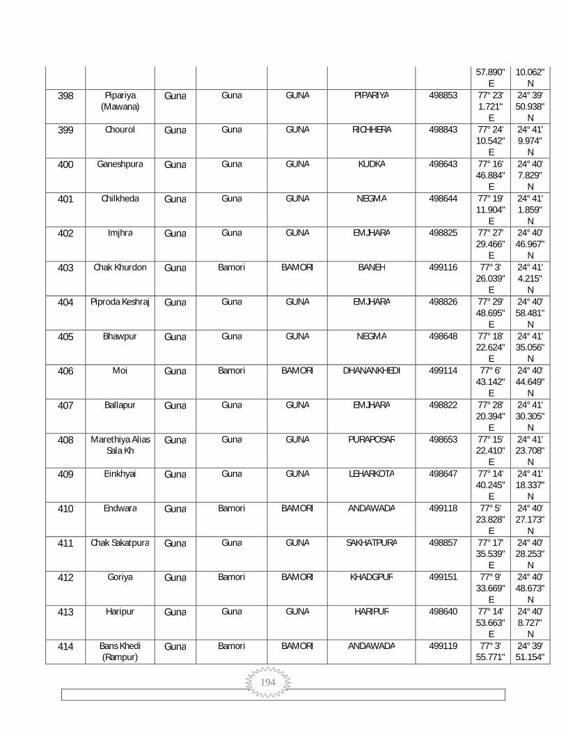
194
57.890" E
10.062" N
398 Pipariya (Mawana)
Guna Guna GUNA PIPARIYA 498853 77° 23' 1.721"
E
24° 39' 50.938"
N 399 Chourol Guna Guna GUNA RICHHERA 498843 77° 24'
10.542" E
24° 41' 9.974"
N 400 Ganeshpura Guna Guna GUNA KUDKA 498643 77° 16'
46.884" E
24° 40' 7.829"
N 401 Chilkheda Guna Guna GUNA NEGMA 498644 77° 19'
11.904" E
24° 41' 1.859"
N 402 Imjhra Guna Guna GUNA EMJHARA 498825 77° 27'
29.466" E
24° 40' 46.967"
N 403 Chak Khurdon Guna Bamori BAMORI BANEH 499116 77° 3'
26.039" E
24° 41' 4.215"
N 404 Piproda Keshraj Guna Guna GUNA EMJHARA 498826 77° 29'
48.695" E
24° 40' 58.481"
N 405 Bhawpur Guna Guna GUNA NEGMA 498648 77° 18'
22.624" E
24° 41' 35.056"
N 406 Moi Guna Bamori BAMORI DHANANKHEDI 499114 77° 6'
43.142" E
24° 40' 44.649"
N 407 Ballapur Guna Guna GUNA EMJHARA 498822 77° 28'
20.394" E
24° 41' 30.305"
N 408 Marethiya Alias
Sala Kh Guna Guna GUNA PURAPOSAR 498653 77° 15'
22.410" E
24° 41' 23.708"
N 409 Binkhyai Guna Guna GUNA LEHARKOTA 498647 77° 14'
40.245" E
24° 41' 18.337"
N 410 Endwara Guna Bamori BAMORI ANDAWADA 499118 77° 5'
23.828" E
24° 40' 27.173"
N 411 Chak Sakatpura Guna Guna GUNA SAKHATPURA 498857 77° 17'
35.539" E
24° 40' 28.253"
N 412 Goriya Guna Bamori BAMORI KHADGPUR 499151 77° 9'
33.669" E
24° 40' 48.673"
N 413 Haripur Guna Guna GUNA HARIPUR 498640 77° 14'
53.663" E
24° 40' 8.727"
N 414 Bans Khedi
(Rampur) Guna Bamori BAMORI ANDAWADA 499119 77° 3'
55.771" 24° 39' 51.154"

195
E N
415 Bilas Guna Bamori BAMORI BISONIYA 499147 77° 12' 38.997"
E
24° 40' 10.293"
N 416 Gora Guna Guna GUNA RICHHERA 498842 77° 24'
56.357" E
24° 40' 17.664"
N 417 Barru Khedi Guna Bamori BAMORI CHURELA 499149 77° 9'
10.710" E
24° 40' 13.308"
N 418 Pura Posar Guna Guna GUNA PURAPOSAR 498646 77° 15'
51.694" E
24° 40' 38.191"
N 419 Piproda Khurd Guna Guna GUNA PIPRODA KHURDA 498855 77° 18'
51.390" E
24° 39' 23.348"
N 420 Singwasa Guna Guna GUNA PIPRODA KHURDA 498858 77° 21'
33.315" E
24° 39' 32.730"
N 421 Ratnagir Guna Bamori BAMORI RATNAGIR 499120 77° 5'
59.480" E
24° 39' 31.818"
N 422 Bhimkheda
(OG) (Part) Guna Mahidpur GUNA BHEMAKHEDA 471381 77° 28'
22.631" E
24° 39' 0.298"
N 423 Pagara Guna Guna GUNA PAGARA 498845 77° 26'
30.609" E
24° 39' 6.736"
N 424 Baksanpur Guna Bamori BAMORI SUJAKHEDI 499127 77° 8'
56.319" E
24° 39' 32.404"
N 425 Sakatpur Guna Guna GUNA SAKHATPURA 498856 77° 18'
50.030" E
24° 40' 15.964"
N 426 Chak
Vishvanagar Guna Bamori BAMORI VISHWANAGAR 499125 77° 7'
26.927" E
24° 39' 11.530"
N 427 Benhta Ghat Guna Guna GUNA BEHANTAGHAT 498848 77° 28'
36.625" E
24° 40' 8.635"
N 428 Khas Kheda Guna Guna GUNA HARIPUR 498637 77° 13'
8.567" E
24° 39' 18.265"
N 429 Suja Khedi Guna Bamori BAMORI SUJAKHEDI 499130 77° 9'
29.312" E
24° 39' 14.431"
N 430 Toriya Guna Guna GUNA TORIYA 498850 77° 24'
42.833" E
24° 38' 52.734"
N 431 Barodiya Khurd Guna Guna GUNA SINGADHI 498634 77° 13'
58.493" 24° 38' 56.264"

196
E N
432 Madhopura Guna Guna GUNA DUNGSARA 498639 77° 16' 29.758"
E
24° 39' 26.363"
N 433 Imaliya Guna Bamori BAMORI RATNAGIR 499121 77° 4'
54.633" E
24° 38' 42.908"
N 434 Bhatodiya Guna Bamori BAMORI SHEKHPUR 499141 77° 12'
15.452" E
24° 38' 38.955"
N 435 Bhimkheda
(OG) (Part) Guna Mahidpur BAMORI BHEMAKHEDA 471381 77° 9'
52.182" E
24° 38' 36.195"
N 436 Bhimkheda
(OG) (Part) Guna Mahidpur GUNA BHEMAKHEDA 471381 77° 20'
46.587" E
24° 37' 56.981"
N 437 Sekhapur Guna Bamori BAMORI SHEKHPUR 499143 77° 10'
54.627" E
24° 38' 28.539"
N 438 Kanari Guna Bamori BAMORI VISHWANAGAR 499123 77° 6'
50.329" E
24° 38' 7.819"
N 439 Bilakhedi Guna Bamori BAMORI VISHWANAGAR 499126 77° 5'
40.412" E
24° 37' 55.973"
N 440 Modka Guna Bamori BAMORI SUJAKHEDI 499129 77° 8'
34.083" E
24° 38' 3.129"
N 441 Garha Guna Guna GUNA GADA 498632 77° 12'
24.716" E
24° 36' 52.966"
N 442 Rori Guna Guna GUNA BEHANTAGHAT 498846 77° 28'
25.642" E
24° 38' 59.745"
N 443 Mundra
Hanuman Guna Bamori BAMORI MUNDRAHANUMAN 499128 77° 7'
40.065" E
24° 38' 41.664"
N 444 Mawan Guna Guna GUNA MAVAN 498854 77° 23'
10.438" E
24° 38' 47.014"
N 445 Bhimkheda
(OG) (Part) Guna Mahidpur RAGHOGARH BHEMAKHEDA 471381 77° 12'
12.142" E
24° 15' 38.348"
N 446 Kanera Guna Bamori BAMORI VISHWANAGAR 499124 77° 5'
44.775" E
24° 38' 31.051"
N 447 Sighadi Guna Guna GUNA SINGADHI 498635 77° 15'
0.057" E
24° 38' 36.869"
N 448 Bamoribugurj Guna Guna GUNA MAHUGADA 498862 77° 15'
34.407" 24° 37' 55.042"

197
E N
449 Sarkhandi Guna Guna GUNA TORIYA 498852 77° 26' 13.518"
E
24° 37' 45.022"
N 450 Piproda Kalan Guna Guna GUNA PIPRODA KALAN 498897 77° 23'
45.600" E
24° 37' 37.978"
N 451 Kindar Guna Guna GUNA TORIYA 498851 77° 24'
44.508" E
24° 37' 54.424"
N 452 Khejra (Guna) Guna Guna GUNA KHEJRABABA 498894 77° 21'
50.582" E
24° 37' 9.741"
N 453 Berkhedi Guna Bamori BAMORI BAIRKHEDI 499139 77° 10'
30.127" E
24° 37' 29.060"
N 454 Dholwaj Guna Guna GUNA SINGADHI 498633 77° 14'
6.650" E
24° 37' 41.718"
N 455 Kothiya Guna Guna GUNA BEHANTAGHAT 498847 77° 28'
1.451" E
24° 37' 56.839"
N 456 Binayak Khedi Guna Guna GUNA VINAYAK KHEDI 498859 77° 18'
57.436" E
24° 37' 43.682"
N 457 Papawan Guna Bamori BAMORI BAIRKHEDI 499137 77° 9'
44.894" E
24° 36' 59.022"
N 458 Khejra Baba Guna Bamori BAMORI KHEJRABABA 499134 77° 7'
46.707" E
24° 36' 50.098"
N 459 Mahoogarha Guna Guna GUNA MAHUGADA 498861 77° 14'
8.131" E
24° 37' 12.715"
N 460 Hilagna Guna Guna GUNA HILAGNA 498871 77° 15'
15.000" E
24° 37' 12.651"
N 461 Mahur Guna Guna GUNA MAHUR 498849 77° 26'
50.966" E
24° 36' 47.493"
N 462 Sabra Pahad Guna Bamori BAMORI MURADPUR 499142 77° 8'
55.135" E
24° 36' 45.245"
N 463 Mohari Guna Guna GUNA PIPRODA KALAN 498898 77° 24'
28.864" E
24° 36' 36.803"
N 464 Nensuhaya Guna Guna GUNA PIPRODA KALAN 498895 77° 23'
14.477" E
24° 36' 46.165"
N 465 Muhalpur Guna Guna GUNA VINAYAK KHEDI 498860 77° 19'
42.664" 24° 37' 10.648"

198
E N
466 Chandan Khiriya
Guna Raghogarh RAGHOGARH KHEJDA GURUJI 499185 77° 6' 27.915"
E
24° 36' 58.164"
N 467 Sojna Guna Guna GUNA VINAYAK KHEDI 498863 77° 17'
39.732" E
24° 36' 34.965"
N 468 Hirapur Guna Guna GUNA HILAGNA 498870 77° 16'
5.143" E
24° 36' 43.083"
N 469 Sonthi Guna Guna GUNA PANJ 498869 77° 14'
25.266" E
24° 36' 24.182"
N 470 Nihalgarh Guna Guna GUNA KALECHHARI 498720 77° 13'
36.247" E
25° 1' 20.919"
N 471 Kakruamar Guna Bamori BAMORI PATAN 498983 77° 4'
28.660" E
24° 59' 58.990"
N 472 Sesupura Guna Bamori BAMORI PATAN 498984 77° 7'
19.806" E
24° 59' 33.934"
N 473 Norai Guna Bamori BAMORI PATAN 498982 77° 5'
40.624" E
24° 58' 53.587"
N 474 Kota (Padon) Guna Bamori BAMORI PADON 498965 76° 56'
51.920" E
24° 57' 46.767"
N 475 Khaira Guna Guna GUNA KARALI 498731 77° 14'
46.868" E
24° 57' 49.706"
N 476 Gadhali Guna Bamori BAMORI GADLAUJARI 498995 77° 12'
3.603" E
24° 56' 59.847"
N 477 Kunwarpur Guna Bamori BAMORI KABAR BAMORI 499000 77° 11'
2.537" E
24° 57' 11.415"
N 478 Bukhari Guna Bamori BAMORI SAMBHARSINGA 498954 76° 57'
37.388" E
24° 56' 56.773"
N 479 Ratai Guna Bamori BAMORI DEHRA 499008 77° 7'
35.721" E
24° 55' 44.811"
N 480 Mahuwa Kheda
Kalan Guna Bamori BAMORI JOHARI 498944 77° 1'
50.152" E
24° 56' 42.532"
N 481 Hankla Guna Bamori BAMORI NARVADA 498964 76° 54'
7.297" E
24° 55' 37.828"
N 482 Hanumat
Kheda Guna Bamori BAMORI NAYAGAON 498945 77° 0'
58.173" 24° 55' 44.656"
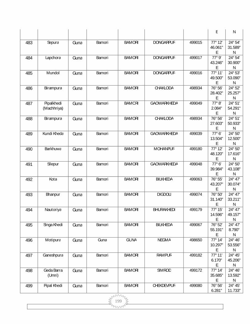
199
E N
483 Sepura Guna Bamori BAMORI DONGARPUR 499015 77° 12' 46.061"
E
24° 54' 31.589"
N 484 Lapchora Guna Bamori BAMORI DONGARPUR 499017 77° 9'
43.246" E
24° 54' 30.900"
N 485 Mundol Guna Bamori BAMORI DONGARPUR 499016 77° 11'
49.500" E
24° 53' 53.090"
N 486 Birampura Guna Bamori BAMORI CHAKLODA 498934 76° 56'
28.402" E
24° 52' 25.257"
N 487 Pipalkhedi
(Machhriya) Guna Bamori BAMORI GAOWARKHEDA 499049 77° 8'
2.084" E
24° 51' 54.291"
N 488 Birampura Guna Bamori BAMORI CHAKLODA 498934 76° 56'
27.603" E
24° 51' 50.933"
N 489 Kundi Kheda Guna Bamori BAMORI GAOWARKHEDA 499039 77° 6'
13.504" E
24° 50' 12.500"
N 490 Barkhuwa Guna Bamori BAMORI MOHANPUR 499180 77° 12'
48.120" E
24° 50' 17.616"
N 491 Silepur Guna Bamori BAMORI GAOWARKHEDA 499048 77° 6'
39.984" E
24° 50' 43.108"
N 492 Kota Guna Bamori BAMORI BILKHEDA 499063 76° 55'
43.207" E
24° 47' 30.074"
N 493 Bhanpur Guna Bamori BAMORI DIGDOLI 499074 76° 50'
31.140" E
24° 47' 33.211"
N 494 Nautoriya Guna Bamori BAMORI BHURAKHEDI 499179 77° 15'
14.596" E
24° 47' 49.157"
N 495 Singa Khedi Guna Bamori BAMORI BILKHEDA 499067 76° 52'
55.191" E
24° 47' 8.790"
N 496 Motipura Guna Guna GUNA NEGMA 498650 77° 14'
10.297" E
24° 46' 53.556"
N 497 Ganeshpura Guna Bamori BAMORI RAMPUR 499182 77° 11'
6.170" E
24° 45' 45.206"
N 498 Geda Barra
(Umri) Guna Bamori BAMORI SIMROD 499172 77° 14'
35.685" E
24° 46' 13.592"
N 499 Pipal Khedi Guna Bamori BAMORI CHEKDEVPUR 499080 76° 56'
6.281" 24° 45' 11.733"

200
E N
500 Bilaikheda Guna Bamori BAMORI SIMROD 499178 77° 14' 59.100"
E
24° 45' 25.953"
N 501 Kolukhedi Guna Bamori BAMORI PATHI 499081 76° 54'
29.444" E
24° 44' 27.538"
N 502 Deopur
(Khiyaoda) Guna Bamori BAMORI KHAVADA 499162 77° 13'
39.453" E
24° 44' 19.312"
N 503 Khiriya Guna Guna GUNA NEGMA 498642 77° 20'
14.035" E
24° 43' 7.151"
N 504 Ratanpura
(Khiyaoda) Guna Bamori BAMORI KHAVADA 499163 77° 11'
40.279" E
24° 42' 49.592"
N 505 Maharajpura Guna Guna GUNA HARIPUR 498638 77° 16'
6.664" E
24° 41' 40.216"
N 506 Chak Sighadi Guna Guna GUNA HARIPUR 498636 77° 15'
5.553" E
24° 38' 47.821"
N 507 Deori Dang Guna Guna GUNA GADLA GIRD 498879 77° 19'
22.059" E
24° 36' 6.872"
N 508 Borkheda Dang Guna Bamori BAMORI BAIRKHEDI 499140 77° 10'
21.602" E
24° 36' 33.845"
N 509 Godalpur Guna Raghogarh RAGHOGARH KHEJDA GURUJI 499184 77° 4'
48.032" E
24° 36' 39.080"
N 510 Borkheda Gird Guna Guna GUNA PANJ 498867 77° 14'
11.844" E
24° 36' 39.374"
N 511 Bamori Khurd Guna Bamori BAMORI BAIRKHEDI 499138 77° 11'
0.329" E
24° 35' 48.745"
N 512 Chanda Khedi Guna Raghogarh RAGHOGARH KHIRIYA 499187 77° 5'
46.117" E
24° 36' 25.880"
N 513 Am Kheda Guna Bamori BAMORI KHEJRABABA 499133 77° 6'
54.198" E
24° 36' 8.612"
N 514 Gader Guna Guna GUNA HILAGNA 498864 77° 13'
25.944" E
24° 35' 44.802"
N 515 Muradpur Guna Bamori BAMORI MURADPUR 499131 77° 8'
55.911" E
24° 35' 47.410"
N 516 Bajrangarh Guna Guna GUNA BAJRANGARH 498876 77° 16'
33.540" E
24° 35' 21.432"
N

201
517 Benhta Jhir Guna Guna GUNA GENHUKHEDA GIRD 498893 77° 22' 13.864"
E
24° 36' 1.664"
N 518 Karod Guna Guna GUNA KAROD 498899 77° 26'
2.026" E
24° 35' 17.317"
N 519 Pita Khedi Guna Guna GUNA KHEJRABABA 498896 77° 23'
37.815" E
24° 36' 3.773"
N 520 Jhir Guna Guna GUNA GADLA GIRD 498880 77° 20'
46.274" E
24° 36' 8.654"
N 521 Patna Guna Bamori BAMORI PATAN 499136 77° 7'
15.474" E
24° 35' 29.797"
N 522 Khejra Guruji Guna Raghogarh RAGHOGARH KHEJDA GURUJI 499186 77° 5'
50.848" E
24° 35' 48.468"
N 523 Chandol Guna Guna GUNA GOAPL PUR
TALTAIYA 498891 77° 20'
45.192" E
24° 35' 32.411"
N 524 Genhu Kheda
Gird Guna Guna GUNA GENHUKHEDA GIRD 498890 77° 23'
34.359" E
24° 35' 0.847"
N 525 Vijaipura Guna Guna GUNA MANGWAR 498903 77° 28'
10.628" E
24° 35' 10.433"
N 526 Gadla Gird Guna Guna GUNA GADLA GIRD 498878 77° 19'
38.104" E
24° 35' 13.863"
N 527 Barodiya Kalan Guna Bamori BAMORI MURADPUR 499132 77° 8'
54.628" E
24° 35' 0.749"
N 528 Panj Guna Guna GUNA PANJ 498865 77° 13'
31.299" E
24° 34' 37.728"
N 529 Anandpur Guna Guna GUNA GOAPL PUR
TALTAIYA 498887 77° 21'
26.165" E
24° 35' 10.609"
N 530 Khiriya Guna Raghogarh RAGHOGARH KHIRIYA 499188 77° 5'
2.286" E
24° 35' 16.077"
N 531 Kankra Guna Guna GUNA GOAPL PUR
TALTAIYA 498888 77° 21'
58.936" E
24° 34' 46.685"
N 532 Dharnawada Guna Raghogarh RAGHOGARH DHARNWADA 499192 77° 5'
44.540" E
24° 35' 5.826"
N 533 Gola Khedi Guna Bamori BAMORI GOLAKHEDI 499135 77° 7'
21.562" E
24° 34' 34.506"
N
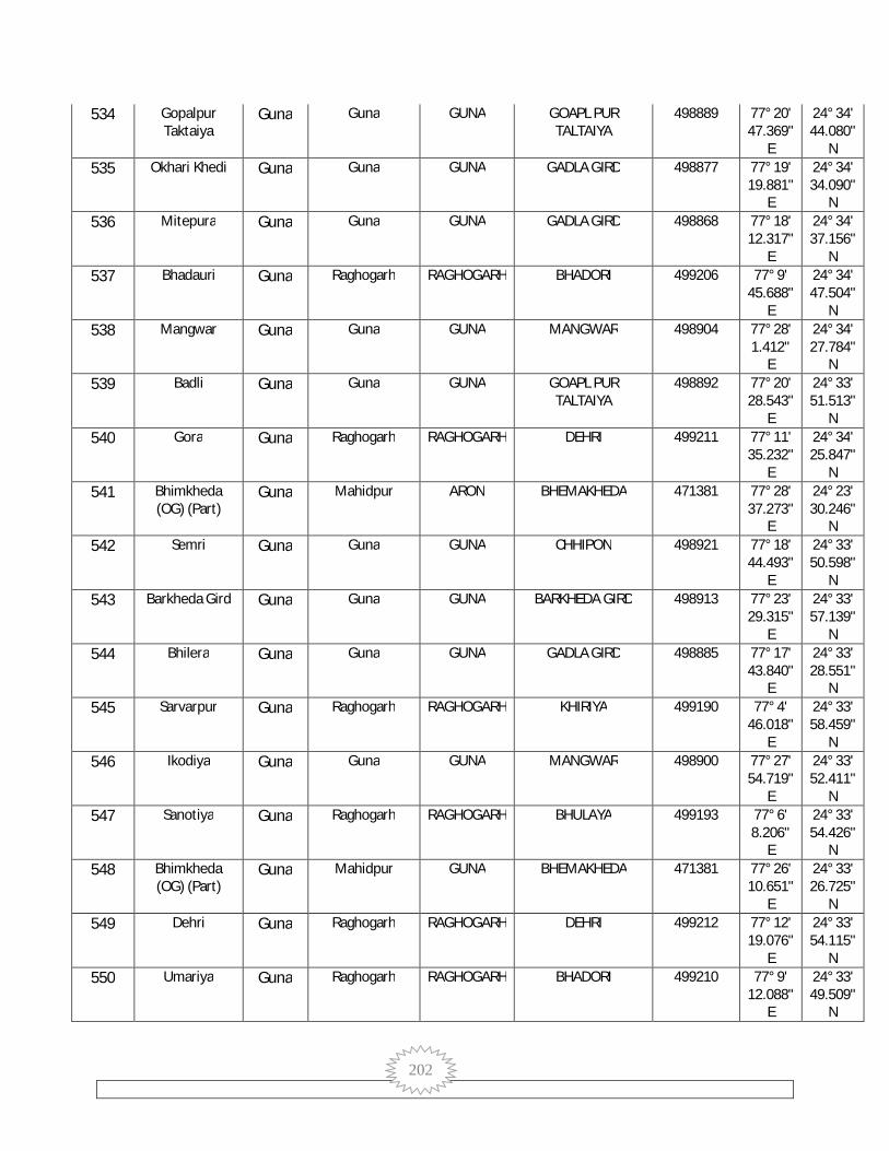
202
534 Gopalpur Taktaiya
Guna Guna GUNA GOAPL PUR TALTAIYA
498889 77° 20' 47.369"
E
24° 34' 44.080"
N 535 Okhari Khedi Guna Guna GUNA GADLA GIRD 498877 77° 19'
19.881" E
24° 34' 34.090"
N 536 Mitepura Guna Guna GUNA GADLA GIRD 498868 77° 18'
12.317" E
24° 34' 37.156"
N 537 Bhadauri Guna Raghogarh RAGHOGARH BHADORI 499206 77° 9'
45.688" E
24° 34' 47.504"
N 538 Mangwar Guna Guna GUNA MANGWAR 498904 77° 28'
1.412" E
24° 34' 27.784"
N 539 Badli Guna Guna GUNA GOAPL PUR
TALTAIYA 498892 77° 20'
28.543" E
24° 33' 51.513"
N 540 Gora Guna Raghogarh RAGHOGARH DEHRI 499211 77° 11'
35.232" E
24° 34' 25.847"
N 541 Bhimkheda
(OG) (Part) Guna Mahidpur ARON BHEMAKHEDA 471381 77° 28'
37.273" E
24° 23' 30.246"
N 542 Semri Guna Guna GUNA CHHIPON 498921 77° 18'
44.493" E
24° 33' 50.598"
N 543 Barkheda Gird Guna Guna GUNA BARKHEDA GIRD 498913 77° 23'
29.315" E
24° 33' 57.139"
N 544 Bhilera Guna Guna GUNA GADLA GIRD 498885 77° 17'
43.840" E
24° 33' 28.551"
N 545 Sarvarpur Guna Raghogarh RAGHOGARH KHIRIYA 499190 77° 4'
46.018" E
24° 33' 58.459"
N 546 Ikodiya Guna Guna GUNA MANGWAR 498900 77° 27'
54.719" E
24° 33' 52.411"
N 547 Sanotiya Guna Raghogarh RAGHOGARH BHULAYA 499193 77° 6'
8.206" E
24° 33' 54.426"
N 548 Bhimkheda
(OG) (Part) Guna Mahidpur GUNA BHEMAKHEDA 471381 77° 26'
10.651" E
24° 33' 26.725"
N 549 Dehri Guna Raghogarh RAGHOGARH DEHRI 499212 77° 12'
19.076" E
24° 33' 54.115"
N 550 Umariya Guna Raghogarh RAGHOGARH BHADORI 499210 77° 9'
12.088" E
24° 33' 49.509"
N

203
551 Chaura Khedi Guna Raghogarh RAGHOGARH TODI 499208 77° 8' 38.629"
E
24° 33' 46.621"
N 552 Bhimkheda
(OG) (Part) Guna Mahidpur GUNA BHEMAKHEDA 471381 77° 15'
16.238" E
24° 33' 23.480"
N 553 Satanpur Guna Guna GUNA SATANPUR 498920 77° 21'
54.747" E
24° 32' 57.315"
N 554 Todi Guna Raghogarh RAGHOGARH TODI 499209 77° 8'
39.357" E
24° 33' 37.623"
N 555 Hinotiya Gird Guna Guna GUNA PARSODA 498906 77° 24'
4.846" E
24° 33' 13.314"
N 556 Jaitpur Guna Guna GUNA JOHARI 498866 77° 16'
14.223" E
24° 32' 57.191"
N 557 Chak-Koluamar Guna Guna GUNA DEVRIMAR 498909 77° 26'
42.904" E
24° 33' 35.522"
N 558 Bhimkheda
(OG) (Part) Guna Mahidpur RAGHOGARH BHEMAKHEDA 471381 77° 13'
36.585" E
24° 33' 27.497"
N 559 Jeta Dongar Guna Guna GUNA CHHIPON 498886 77° 19'
0.630" E
24° 32' 47.513"
N 560 Bhimkheda
(OG) (Part) Guna Mahidpur RAGHOGARH BHEMAKHEDA 471381 77° 11'
48.600" E
24° 33' 22.264"
N 561 Kotra Guna Raghogarh RAGHOGARH DAWAT PURA 499195 77° 5'
58.411" E
24° 33' 16.933"
N 562 Parsoda Guna Guna GUNA PARSODA 498910 77° 25'
23.204" E
24° 33' 24.045"
N 563 Deurimar Guna Guna GUNA DEVRIMAR 498902 77° 27'
9.588" E
24° 33' 19.342"
N 564 Piproda Khurd Guna Aron ARON NATHAI 499694 77° 28'
35.985" E
24° 33' 13.493"
N 565 Bhimkheda
(OG) (Part) Guna Mahidpur RAGHOGARH BHEMAKHEDA 471381 77° 11'
19.593" E
24° 33' 5.236"
N 566 Bhimkheda
(OG) (Part) Guna Mahidpur ARON BHEMAKHEDA 471381 77° 16'
14.348" E
24° 24' 15.635"
N 567 Koluamar Guna Guna GUNA DEVRIMAR 498908 77° 27'
7.483" E
24° 32' 45.899"
N 568 Geda Barra Guna Guna GUNA CHHIPON 498917 77° 17' 24° 32'
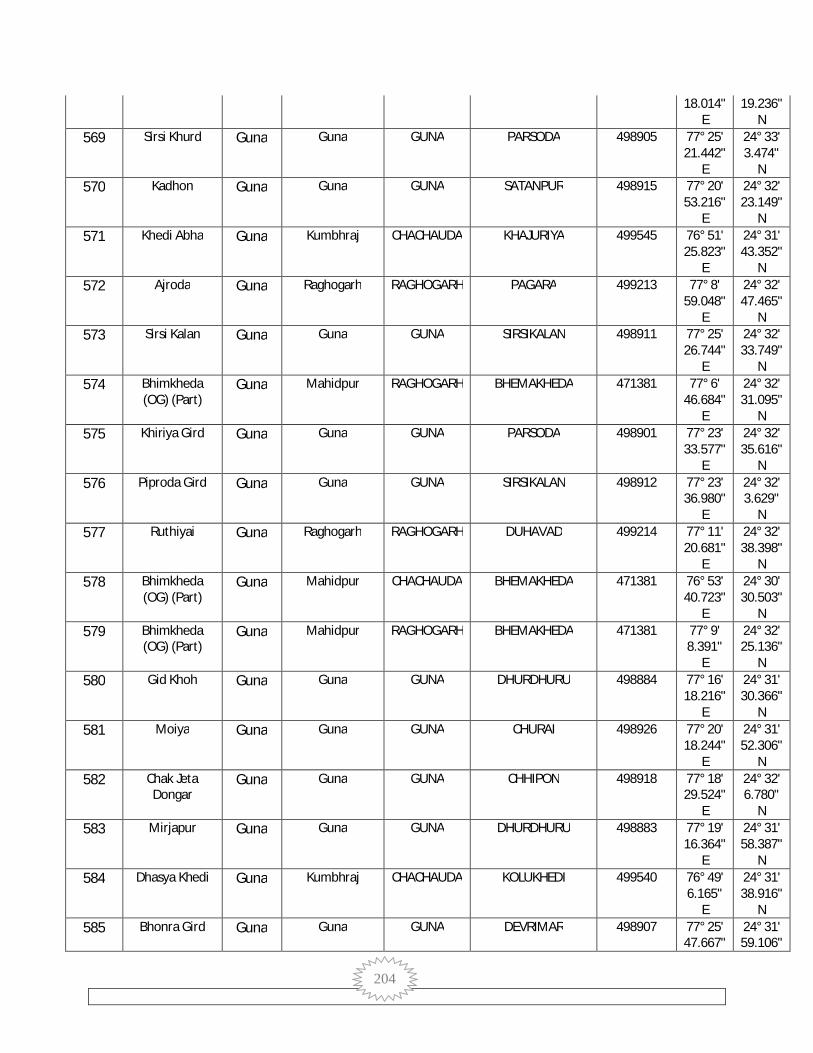
204
18.014" E
19.236" N
569 Sirsi Khurd Guna Guna GUNA PARSODA 498905 77° 25' 21.442"
E
24° 33' 3.474"
N 570 Kadhon Guna Guna GUNA SATANPUR 498915 77° 20'
53.216" E
24° 32' 23.149"
N 571 Khedi Abha Guna Kumbhraj CHACHAUDA KHAJURIYA 499545 76° 51'
25.823" E
24° 31' 43.352"
N 572 Ajroda Guna Raghogarh RAGHOGARH PAGARA 499213 77° 8'
59.048" E
24° 32' 47.465"
N 573 Sirsi Kalan Guna Guna GUNA SIRSIKALAN 498911 77° 25'
26.744" E
24° 32' 33.749"
N 574 Bhimkheda
(OG) (Part) Guna Mahidpur RAGHOGARH BHEMAKHEDA 471381 77° 6'
46.684" E
24° 32' 31.095"
N 575 Khiriya Gird Guna Guna GUNA PARSODA 498901 77° 23'
33.577" E
24° 32' 35.616"
N 576 Piproda Gird Guna Guna GUNA SIRSIKALAN 498912 77° 23'
36.980" E
24° 32' 3.629"
N 577 Ruthiyai Guna Raghogarh RAGHOGARH DUHAVAD 499214 77° 11'
20.681" E
24° 32' 38.398"
N 578 Bhimkheda
(OG) (Part) Guna Mahidpur CHACHAUDA BHEMAKHEDA 471381 76° 53'
40.723" E
24° 30' 30.503"
N 579 Bhimkheda
(OG) (Part) Guna Mahidpur RAGHOGARH BHEMAKHEDA 471381 77° 9'
8.391" E
24° 32' 25.136"
N 580 Gid Khoh Guna Guna GUNA DHURDHURU 498884 77° 16'
18.216" E
24° 31' 30.366"
N 581 Moiya Guna Guna GUNA CHURAI 498926 77° 20'
18.244" E
24° 31' 52.306"
N 582 Chak Jeta
Dongar Guna Guna GUNA CHHIPON 498918 77° 18'
29.524" E
24° 32' 6.780"
N 583 Mirjapur Guna Guna GUNA DHURDHURU 498883 77° 19'
16.364" E
24° 31' 58.387"
N 584 Dhasya Khedi Guna Kumbhraj CHACHAUDA KOLUKHEDI 499540 76° 49'
6.165" E
24° 31' 38.916"
N 585 Bhonra Gird Guna Guna GUNA DEVRIMAR 498907 77° 25'
47.667" 24° 31' 59.106"

205
E N
586 Bhimkheda (OG) (Part)
Guna Mahidpur CHACHAUDA BHEMAKHEDA 471381 77° 3' 52.484"
E
24° 31' 58.644"
N 587 Badagaon Guna Kumbhraj CHACHAUDA BADAGAON 499620 77° 3'
39.642" E
24° 31' 50.163"
N 588 Duhawad Guna Raghogarh RAGHOGARH DUHAVAD 499215 77° 13'
5.936" E
24° 32' 4.377"
N 589 Kenkdi Viran Guna Kumbhraj CHACHAUDA KEKDIVIRAN 499550 76° 49'
11.261" E
24° 31' 26.541"
N 590 Jogipura Alias
Dant Guna Kumbhraj CHACHAUDA KOLUKHEDI 499541 76° 50'
20.612" E
24° 30' 42.313"
N 591 Bhamavad Guna Kumbhraj CHACHAUDA BHAMAVAD 499623 77° 4'
7.116" E
24° 31' 21.748"
N 592 Bhojpura Guna Kumbhraj CHACHAUDA MADAGANMAFI 499596 76° 54'
51.026" E
24° 30' 44.811"
N 593 Pagara Guna Raghogarh RAGHOGARH PAGARA 499219 77° 10'
54.920" E
24° 31' 54.847"
N 594 Balguda Guna Kumbhraj CHACHAUDA BAHUKHEDI 499610 77° 3'
34.308" E
24° 31' 21.592"
N 595 Karondia Guna Guna GUNA SATANPUR 498914 77° 21'
28.690" E
24° 31' 32.633"
N 596 Bhimkheda
(OG) (Part) Guna Mahidpur RAGHOGARH BHEMAKHEDA 471381 77° 8'
54.747" E
24° 31' 51.592"
N 597 Nohar Guna Guna GUNA DHURDHURU 498881 77° 22'
13.580" E
24° 31' 4.199"
N 598 Chhipon Guna Guna GUNA CHHIPON 498919 77° 20'
6.113" E
24° 31' 3.924"
N 599 Nathai Guna Aron ARON NATHAI 499695 77° 26'
59.121" E
24° 31' 37.959"
N 600 Datya Guna Raghogarh ARON BANDARGADA 499331 77° 14'
24.264" E
24° 31' 31.890"
N 601 Tundaweh Guna Kumbhraj CHACHAUDA GULWADA 499630 77° 2'
9.716" E
24° 30' 59.897"
N 602 Bhimkheda
(OG) (Part) Guna Mahidpur RAGHOGARH BHEMAKHEDA 471381 77° 8'
52.849" E
24° 31' 25.266"
N
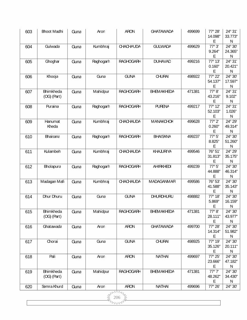
206
603 Bhoot Madhi Guna Aron ARON GHATAWADA 499699 77° 28' 14.098"
E
24° 31' 33.773"
N 604 Gulwada Guna Kumbhraj CHACHAUDA GULWADA 499629 77° 3'
9.264" E
24° 30' 24.365"
N 605 Ghoghar Guna Raghogarh RAGHOGARH DUHAVAD 499216 77° 13'
0.160" E
24° 31' 20.421"
N 606 Khooja Guna Guna GUNA CHURAI 498922 77° 22'
54.137" E
24° 30' 17.597"
N 607 Bhimkheda
(OG) (Part) Guna Mahidpur RAGHOGARH BHEMAKHEDA 471381 77° 8'
43.216" E
24° 31' 9.102"
N 608 Puraina Guna Raghogarh RAGHOGARH PURENA 499217 77° 12'
52.103" E
24° 31' 1.026"
N 609 Hanumat
Kheda Guna Kumbhraj CHACHAUDA MANAKCHOK 499628 77° 2'
0.260" E
24° 29' 49.314"
N 610 Bhaisana Guna Raghogarh RAGHOGARH BHAISANA 499237 77° 5'
8.825" E
24° 30' 51.260"
N 611 Kulambeh Guna Kumbhraj CHACHAUDA KHAJURIYA 499546 76° 51'
31.813" E
24° 29' 35.175"
N 612 Bholapura Guna Raghogarh RAGHOGARH AHIRKHEDI 499239 77° 5'
44.888" E
24° 30' 46.314"
N 613 Madagan Mafi Guna Kumbhraj CHACHAUDA MADAGANMAFI 499586 76° 53'
41.588" E
24° 30' 35.143"
N 614 Dhur Dhuru Guna Guna GUNA DHURDHURU 498882 77° 18'
5.869" E
24° 30' 16.159"
N 615 Bhimkheda
(OG) (Part) Guna Mahidpur RAGHOGARH BHEMAKHEDA 471381 77° 8'
28.111" E
24° 30' 43.977"
N 616 Ghatawada Guna Aron ARON GHATAWADA 499700 77° 28'
14.314" E
24° 30' 51.982"
N 617 Chorai Guna Guna GUNA CHURAI 498925 77° 19'
35.126" E
24° 30' 20.111"
N 618 Pali Guna Aron ARON NATHAI 499697 77° 25'
23.666" E
24° 30' 47.182"
N 619 Bhimkheda
(OG) (Part) Guna Mahidpur RAGHOGARH BHEMAKHEDA 471381 77° 7'
48.262" E
24° 30' 34.430"
N 620 Semra Khurd Guna Aron ARON NATHAI 499696 77° 26' 24° 30'

207
12.209" E
42.379" N
621 Daurana Guna Raghogarh RAGHOGARH DORANA 499220 77° 10' 53.150"
E
24° 30' 30.325"
N 622 Puraini Guna Raghogarh RAGHOGARH PURENA 499218 77° 12'
56.780" E
24° 30' 29.190"
N 623 Tilli Kheda Guna Guna GUNA TILLI KHEDA 498923 77° 21'
27.943" E
24° 30' 1.314"
N 624 Kunda Guna Raghogarh ARON BANDARGADA 499332 77° 16'
46.330" E
24° 30' 21.768"
N 625 Bhimkheda
(OG) (Part) Guna Mahidpur RAGHOGARH BHEMAKHEDA 471381 77° 7'
9.280" E
24° 30' 13.953"
N 626 Ahir Khedi Guna Raghogarh RAGHOGARH AHIRKHEDI 499238 77° 6'
52.094" E
24° 30' 13.284"
N 627 Bapcha Viran Guna Kumbhraj CHACHAUDA MADAGANMAFI 499589 76° 54'
39.657" E
24° 29' 40.672"
N 628 Bhimkheda
(OG) (Part) Guna Mahidpur RAGHOGARH BHEMAKHEDA 471381 77° 8'
16.250" E
24° 30' 6.443"
N 629 Dehri
Kumbhraj Guna Kumbhraj CHACHAUDA KAKADYAKALAN 499625 77° 4'
12.682" E
24° 29' 18.027"
N 630 Dhirdeh Guna Raghogarh ARON BANDARGADA 499333 77° 15'
36.195" E
24° 30' 1.495"
N 631 Sarkhoh Guna Guna GUNA TILLI KHEDA 498927 77° 20'
1.479" E
24° 29' 41.859"
N 632 Mohanpur Guna Raghogarh RAGHOGARH DAWAT PURA 499240 77° 7'
55.397" E
24° 29' 55.569"
N 633 Gadarwara Guna Raghogarh RAGHOGARH DORANA 499221 77° 10'
30.768" E
24° 29' 51.177"
N 634 Badarpur Guna Raghogarh RAGHOGARH AWAN 499245 77° 5'
11.010" E
24° 29' 46.580"
N 635 Bhimkheda
(OG) (Part) Guna Mahidpur RAGHOGARH BHEMAKHEDA 471381 77° 8'
5.800" E
24° 29' 41.953"
N 636 Bhadaur Guna Aron ARON BHADOR 499698 77° 24'
43.327" E
24° 29' 47.742"
N 637 Manak Chouk Guna Kumbhraj CHACHAUDA MANAKCHOK 499627 77° 2'
48.612" 24° 28' 57.248"

208
E N
638 Anandpur Guna Raghogarh RAGHOGARH NANDNER 499223 77° 13' 56.682"
E
24° 29' 36.202"
N 639 Loh Pal Guna Guna GUNA DHURDHURU 498928 77° 18'
40.865" E
24° 29' 12.943"
N 640 Bandargarha Guna Raghogarh ARON BANDARGADA 499334 77° 15'
26.424" E
24° 29' 36.405"
N 641 Bhimkheda
(OG) (Part) Guna Mahidpur RAGHOGARH BHEMAKHEDA 471381 77° 10'
32.409" E
24° 29' 33.558"
N 642 Kekadya Kalan Guna Kumbhraj CHACHAUDA KAKADYAKALAN 499626 77° 3'
52.185" E
24° 28' 42.998"
N 643 Talawada
Najdik Sanai Guna Kumbhraj CHACHAUDA JHARADA 499598 76° 53'
37.151" E
24° 28' 19.188"
N 644 Rasulpur Guna Guna GUNA TILLI KHEDA 498924 77° 22'
54.356" E
24° 28' 59.538"
N 645 Gujar Khedi
Viran Guna Kumbhraj CHACHAUDA AAMKHEDA 499587 76° 53'
24.220" E
24° 28' 40.637"
N 646 Gujar Khedi Ka
Pura Guna Kumbhraj CHACHAUDA MADAGANMAFI 499588 76° 53'
21.344" E
24° 29' 13.163"
N 647 Dehri Khurd Guna Aron ARON DEHRI KHURD 499701 77° 28'
18.197" E
24° 29' 34.908"
N 648 Mohanpur Guna Kumbhraj CHACHAUDA MOHANPUR 499602 77° 0'
56.945" E
24° 29' 10.504"
N 649 Just Khedi Guna Kumbhraj CHACHAUDA TAGRAYAKALAN 499636 77° 1'
25.333" E
24° 28' 11.100"
N 650 Bhogipura Guna Kumbhraj CHACHAUDA KHAJURIYA 499547 76° 51'
38.501" E
24° 28' 14.567"
N 651 Bhimkheda
(OG) (Part) Guna Mahidpur RAGHOGARH BHEMAKHEDA 471381 77° 9'
22.256" E
24° 29' 19.424"
N 652 Palpur Guna Raghogarh RAGHOGARH SOURAMPURA 499246 77° 5'
25.389" E
24° 29' 16.871"
N 653 Nadner Guna Raghogarh RAGHOGARH NANDNER 499225 77° 13'
40.927" E
24° 29' 13.993"
N 654 Tagarya Khurd Guna Kumbhraj CHACHAUDA MOHANPUR 499603 77° 0'
46.054" 24° 28' 33.977"

209
E N
655 Bhimkheda (OG) (Part)
Guna Mahidpur RAGHOGARH BHEMAKHEDA 471381 77° 10' 43.507"
E
24° 29' 7.490"
N 656 Bhimkheda
(OG) (Part) Guna Mahidpur RAGHOGARH BHEMAKHEDA 471381 77° 9'
4.596" E
24° 29' 4.118"
N 657 Kekadya Khurd Guna Kumbhraj CHACHAUDA KAKDYAKURD 499670 77° 3'
34.407" E
24° 28' 10.518"
N 658 Bhimkheda
(OG) (Part) Guna Mahidpur RAGHOGARH BHEMAKHEDA 471381 77° 8'
43.224" E
24° 28' 55.066"
N 659 Khaira Guna Aron ARON PATAN 499809 77° 17'
23.489" E
24° 28' 59.370"
N 660 Dhay Guna Raghogarh RAGHOGARH DUHAVAD 499226 77° 14'
29.768" E
24° 28' 55.078"
N 661 Khastiwada Guna Raghogarh RAGHOGARH NANDNER 499227 77° 13'
49.406" E
24° 28' 54.262"
N 662 Bhimkheda
(OG) (Part) Guna Mahidpur RAGHOGARH BHEMAKHEDA 471381 77° 12'
6.885" E
24° 28' 50.742"
N 663 Bhera Khedi Guna Raghogarh CHACHAUDA BERAKHEDI 499251 77° 5'
0.675" E
24° 27' 23.609"
N 664 Pipalkhedi
Kalan Guna Kumbhraj CHACHAUDA JHARADA 499599 76° 55'
16.711" E
24° 28' 7.073"
N 665 Malsiya Todi Guna Raghogarh RAGHOGARH NANDNER 499228 77° 13'
33.696" E
24° 28' 40.946"
N 666 Umariya Guna Aron ARON SAGABARKHEDA 499683 77° 18'
39.604" E
24° 27' 38.143"
N 667 Bhimkheda
(OG) (Part) Guna Mahidpur RAGHOGARH BHEMAKHEDA 471381 77° 8'
54.048" E
24° 28' 32.321"
N 668 Shripura Guna Raghogarh RAGHOGARH NALKHEDA 499242 77° 9'
35.972" E
24° 28' 31.823"
N 669 Awan Guna Raghogarh RAGHOGARH AWAN 499247 77° 7'
0.502" E
24° 28' 27.881"
N 670 Bhimkheda
(OG) (Part) Guna Mahidpur RAGHOGARH BHEMAKHEDA 471381 77° 12'
16.254" E
24° 28' 30.795"
N 671 Sanai Guna Kumbhraj CHACHAUDA SANAI 499585 76° 53'
25.796" 24° 26' 53.845"

210
E N
672 Tagariya Kalan Guna Kumbhraj CHACHAUDA TAGRAYAKALAN 499634 77° 0' 36.055"
E
24° 27' 45.540"
N 673 Hamirgarh Guna Aron ARON BARKHEDAHAT 499677 77° 19'
52.180" E
24° 28' 25.967"
N 674 Kudaiya Guna Raghogarh RAGHOGARH ACHKALPUR 499229 77° 13'
50.847" E
24° 28' 22.610"
N 675 Rusiya Guna Aron ARON DEVRI 499688 77° 24'
16.038" E
24° 28' 24.394"
N 676 Rughnathpura Guna Raghogarh RAGHOGARH KANJIKHEDA 499241 77° 9'
32.571" E
24° 28' 14.388"
N 677 Jhareda Guna Kumbhraj CHACHAUDA JHARADA 499600 76° 59'
3.498" E
24° 27' 50.089"
N 678 Manda Kheda Guna Kumbhraj CHACHAUDA MOHANPUR 499601 76° 59'
34.977" E
24° 27' 58.254"
N 679 Budha Kheda Guna Aron ARON BUDAKHEDA 499690 77° 27'
29.112" E
24° 28' 20.007"
N 680 Shujalgarh Guna Raghogarh RAGHOGARH ACHKALPUR 499248 77° 8'
39.518" E
24° 28' 6.629"
N 681 Mirjapur Guna Aron ARON PATAN 499810 77° 17'
46.108" E
24° 28' 11.396"
N 682 Deori Guna Aron ARON DEVRI 499689 77° 25'
52.705" E
24° 28' 9.819"
N 683 Sanka Kalan Guna Kumbhraj CHACHAUDA KAKDYAKURD 499669 77° 3'
52.732" E
24° 27' 19.926"
N 684 Upree Guna Kumbhraj CHACHAUDA UPRICHAK 499671 77° 4'
10.592" E
24° 26' 2.119"
N 685 Kumariya Guna Raghogarh ARON KUSMAT 499335 77° 16'
2.203" E
24° 28' 2.633"
N 686 Isartoda Guna Raghogarh ARON KHERAI 499338 77° 13'
42.548" E
24° 28' 0.010"
N 687 Solyabeh Guna Kumbhraj CHACHAUDA JHIRI 499553 76° 51'
15.563" E
24° 26' 41.001"
N 688 Amlya Guna Kumbhraj CHACHAUDA AMALYA 499633 77° 0'
8.577" E
24° 26' 57.152"
N
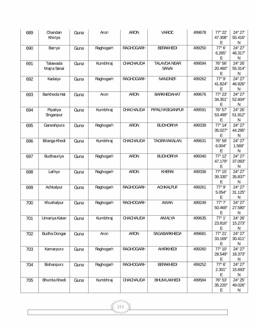
211
689 Chandan Khiriya
Guna Aron ARON VAROD 499678 77° 22' 47.308"
E
24° 27' 55.416"
N 690 Barrya Guna Raghogarh RAGHOGARH BERAKHEDI 499250 77° 6'
6.265" E
24° 27' 46.317"
N 691 Talawada
Majra Sanai Guna Kumbhraj CHACHAUDA TALAVDA NEAR
SANAI 499594 76° 56'
20.460" E
24° 26' 55.314"
N 692 Kadaiya Guna Raghogarh RAGHOGARH NANDNER 499262 77° 9'
41.824" E
24° 27' 46.926"
N 693 Barkheda Hat Guna Aron ARON BARKHEDAHAT 499676 77° 23'
34.351" E
24° 27' 52.604"
N 694 Pipaliya
Singanpur Guna Kumbhraj CHACHAUDA PIPALIYASIGANPUR 499591 76° 57'
53.499" E
24° 26' 51.912"
N 695 Ganeshpura Guna Raghogarh ARON BUDHORIYA 499339 77° 14'
35.027" E
24° 27' 44.295"
N 696 Bilanga Khedi Guna Kumbhraj CHACHAUDA TAGRAYAKALAN 499631 76° 59'
6.004" E
24° 27' 1.569"
N 697 Budhauriya Guna Raghogarh ARON BUDHORIYA 499340 77° 12'
47.179" E
24° 27' 37.093"
N 698 Lathya Guna Raghogarh ARON KHERAI 499336 77° 15'
39.330" E
24° 27' 35.837"
N 699 Achkalpur Guna Raghogarh RAGHOGARH ACHKALPUR 499261 77° 9'
5.054" E
24° 27' 31.125"
N 700 Khushalpur Guna Raghogarh RAGHOGARH AWAN 499249 77° 7'
50.469" E
24° 27' 27.580"
N 701 Umariya Kalan Guna Kumbhraj CHACHAUDA AMALYA 499635 77° 1'
23.816" E
24° 26' 15.273"
N 702 Budha Dongar Guna Aron ARON SAGABARKHEDA 499681 77° 21'
33.169" E
24° 27' 30.411"
N 703 Kamarpura Guna Raghogarh RAGHOGARH AHIRKHEDI 499260 77° 10'
28.549" E
24° 27' 18.373"
N 704 Bishanpura Guna Raghogarh RAGHOGARH BERAKHEDI 499252 77° 6'
2.301" E
24° 27' 15.693"
N 705 Bhumla Khedi Guna Kumbhraj CHACHAUDA BHUMLAKHEDI 499584 76° 53'
35.220" E
24° 25' 49.026"
N

212
706 Fatehpur Guna Aron ARON SAGABARKHEDA 499684 77° 17' 24.854"
E
24° 27' 17.268"
N 707 Mohanwada Guna Aron ARON SAGABARKHEDA 499682 77° 19'
48.861" E
24° 27' 15.080"
N 708 Hajratpur Guna Raghogarh RAGHOGARH AWAN 499254 77° 8'
7.874" E
24° 26' 58.408"
N 709 Khairai Guna Raghogarh ARON KHERAI 499337 77° 15'
1.192" E
24° 26' 58.683"
N 710 Khajuri Guna Aron ARON KHAJURI 499691 77° 26'
20.172" E
24° 27' 3.990"
N 711 Nauhar Guna Raghogarh RAGHOGARH NOHAR 499258 77° 9'
20.151" E
24° 26' 55.326"
N 712 Sankra Guna Aron ARON PATAN 499811 77° 16'
13.980" E
24° 26' 58.640"
N 713 Piprodakala Guna Aron ARON VAROD 499679 77° 24'
38.358" E
24° 27' 2.167"
N 714 Manpura Guna Kumbhraj CHACHAUDA KAKDYAKURD 499668 77° 3'
27.492" E
24° 26' 19.977"
N 715 Barod Guna Aron ARON VAROD 499680 77° 22'
48.842" E
24° 26' 58.122"
N 716 Rusalla Guna Aron ARON BUDAKHEDA 499692 77° 27'
58.385" E
24° 26' 53.785"
N 717 Raipura Guna Aron ARON SAGABARKHEDA 499686 77° 19'
47.735" E
24° 26' 44.412"
N 718 Kundai Parsa Guna Raghogarh ARON BANDARGADA 499341 77° 11'
19.721" E
24° 26' 38.812"
N 719 Barkheda Guna Kumbhraj CHACHAUDA BARKHEDAKALAN 499643 76° 59'
50.384" E
24° 25' 58.811"
N 720 Gopalgarh Guna Kumbhraj CHACHAUDA PIPALIYASIGANPUR 499595 76° 55'
17.239" E
24° 25' 27.333"
N 721 Singanpur Guna Kumbhraj CHACHAUDA SINGANPUR 499583 76° 57'
38.784" E
24° 25' 11.472"
N 722 Amrit Khedi Guna Kumbhraj CHACHAUDA AMALYA 499632 76° 58'
56.437" E
24° 25' 49.168"
N

213
723 Shorampura Guna Raghogarh RAGHOGARH SOURAMPURA 499281 77° 6' 24.441"
E
24° 26' 18.441"
N 724 Gailon Guna Aron ARON SAGABARKHEDA 499685 77° 19'
3.485" E
24° 25' 44.936"
N 725 Kunja Kheda Guna Kumbhraj CHACHAUDA TULSIKHEDI 499639 77° 0'
48.481" E
24° 25' 2.229"
N 726 Sagabar Kheda Guna Aron ARON SAGABARKHEDA 499687 77° 20'
40.211" E
24° 26' 22.382"
N 727 Semra Guna Raghogarh RAGHOGARH SARSHELA 499271 77° 9'
25.937" E
24° 26' 10.721"
N 728 Jaitpur Guna Raghogarh RAGHOGARH SAVARINATH 499256 77° 11'
23.558" E
24° 26' 11.772"
N 729 Sar Sahela Guna Raghogarh RAGHOGARH SARSHELA 499272 77° 8'
28.664" E
24° 26' 9.793"
N 730 Amoda Guna Aron ARON AMODA 499788 77° 23'
21.049" E
24° 26' 12.215"
N 731 Sawari Nath Guna Raghogarh RAGHOGARH SAVARINATH 499255 77° 12'
43.639" E
24° 26' 4.912"
N 732 Tulsi Khedi Guna Kumbhraj CHACHAUDA TULSIKHEDI 499642 77° 2'
48.735" E
24° 25' 4.380"
N 733 Chandan Bhent Guna Raghogarh RAGHOGARH SAVARINATH 499257 77° 10'
53.568" E
24° 25' 57.331"
N 734 Bhondani Guna Aron ARON PATAN 499813 77° 17'
27.289" E
24° 25' 59.890"
N 735 Banvir Khedi Guna Aron ARON VANVIRKHEDI 499787 77° 22'
16.855" E
24° 26' 1.705"
N 736 Deomadi Guna Aron ARON JAKHODA 499705 77° 29'
21.233" E
24° 25' 59.577"
N 737 Ghorla Kheda Guna Kumbhraj CHACHAUDA BARKHEDAKALAN 499640 76° 59'
31.521" E
24° 24' 51.032"
N 738 Mundra Guna Kumbhraj CHACHAUDA UPRICHAK 499672 77° 4'
39.707" E
24° 24' 44.543"
N 739 Jairampura Guna Raghogarh RAGHOGARH NARAYANPURA 499273 77° 8'
9.000" E
24° 25' 40.815"
N
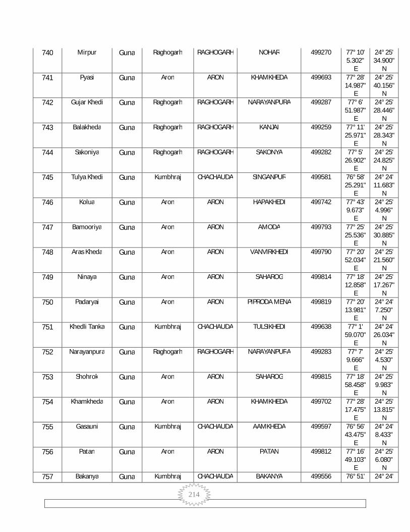
214
740 Mirpur Guna Raghogarh RAGHOGARH NOHAR 499270 77° 10' 5.302"
E
24° 25' 34.900"
N 741 Pyasi Guna Aron ARON KHAMKHEDA 499693 77° 28'
14.987" E
24° 25' 40.156"
N 742 Gujar Khedi Guna Raghogarh RAGHOGARH NARAYANPURA 499287 77° 6'
51.987" E
24° 25' 28.446"
N 743 Balakheda Guna Raghogarh RAGHOGARH KANJAI 499259 77° 11'
25.971" E
24° 25' 28.343"
N 744 Sakoniya Guna Raghogarh RAGHOGARH SAKONYA 499282 77° 5'
26.902" E
24° 25' 24.825"
N 745 Tulya Khedi Guna Kumbhraj CHACHAUDA SINGANPUR 499581 76° 58'
25.291" E
24° 24' 11.683"
N 746 Kolua Guna Aron ARON HAPAKHEDI 499742 77° 43'
9.673" E
24° 25' 4.996"
N 747 Bamooriya Guna Aron ARON AMODA 499793 77° 25'
25.536" E
24° 25' 30.885"
N 748 Aras Kheda Guna Aron ARON VANVIRKHEDI 499790 77° 20'
52.034" E
24° 25' 21.560"
N 749 Ninaya Guna Aron ARON SAHAROG 499814 77° 18'
12.858" E
24° 25' 17.267"
N 750 Padaryai Guna Aron ARON PIPRODA MENA 499819 77° 20'
13.981" E
24° 24' 7.250"
N 751 Khedli Tanka Guna Kumbhraj CHACHAUDA TULSIKHEDI 499638 77° 1'
59.070" E
24° 24' 26.034"
N 752 Narayanpura Guna Raghogarh RAGHOGARH NARAYANPURA 499283 77° 7'
9.666" E
24° 25' 4.530"
N 753 Shohrok Guna Aron ARON SAHAROG 499815 77° 18'
58.458" E
24° 25' 9.983"
N 754 Khamkheda Guna Aron ARON KHAMKHEDA 499702 77° 28'
17.475" E
24° 25' 13.815"
N 755 Gasauni Guna Kumbhraj CHACHAUDA AAMKHEDA 499597 76° 56'
43.475" E
24° 24' 8.433"
N 756 Patan Guna Aron ARON PATAN 499812 77° 16'
49.103" E
24° 25' 6.080"
N 757 Bakanya Guna Kumbhraj CHACHAUDA BAKANYA 499556 76° 51' 24° 24'
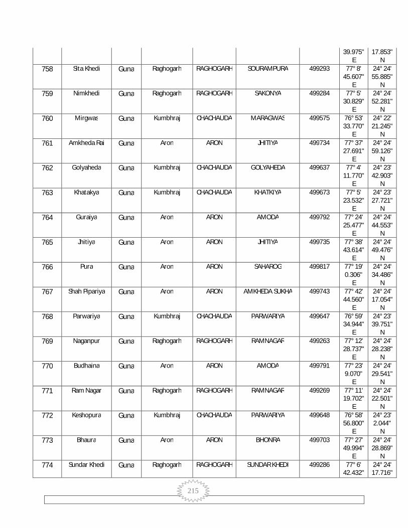
215
39.975" E
17.853" N
758 Sita Khedi Guna Raghogarh RAGHOGARH SOURAMPURA 499293 77° 8' 45.607"
E
24° 24' 55.885"
N 759 Nimkhedi Guna Raghogarh RAGHOGARH SAKONYA 499284 77° 5'
30.829" E
24° 24' 52.281"
N 760 Mirgwas Guna Kumbhraj CHACHAUDA MARAGWAS 499575 76° 53'
33.770" E
24° 22' 21.245"
N 761 Amkheda Rai Guna Aron ARON JHITIYA 499734 77° 37'
27.691" E
24° 24' 59.126"
N 762 Golyaheda Guna Kumbhraj CHACHAUDA GOLYAHEDA 499637 77° 4'
11.770" E
24° 23' 42.903"
N 763 Khatakya Guna Kumbhraj CHACHAUDA KHATKIYA 499673 77° 5'
23.532" E
24° 23' 27.721"
N 764 Guraiya Guna Aron ARON AMODA 499792 77° 24'
25.477" E
24° 24' 44.553"
N 765 Jhitiya Guna Aron ARON JHITIYA 499735 77° 38'
43.614" E
24° 24' 49.476"
N 766 Pura Guna Aron ARON SAHAROG 499817 77° 19'
0.306" E
24° 24' 34.486"
N 767 Shah Pipariya Guna Aron ARON AMKHEDA SUKHA 499743 77° 42'
44.560" E
24° 24' 17.054"
N 768 Parwariya Guna Kumbhraj CHACHAUDA PARWARIYA 499647 76° 59'
34.944" E
24° 23' 39.751"
N 769 Naganpur Guna Raghogarh RAGHOGARH RAMNAGAR 499263 77° 12'
28.737" E
24° 24' 28.238"
N 770 Budhaina Guna Aron ARON AMODA 499791 77° 23'
9.070" E
24° 24' 29.541"
N 771 Ram Nagar Guna Raghogarh RAGHOGARH RAMNAGAR 499269 77° 11'
19.702" E
24° 24' 22.501"
N 772 Keshopura Guna Kumbhraj CHACHAUDA PARWARIYA 499648 76° 58'
56.800" E
24° 23' 2.044"
N 773 Bhaura Guna Aron ARON BHONRA 499703 77° 27'
49.994" E
24° 24' 28.869"
N 774 Sundar Khedi Guna Raghogarh RAGHOGARH SUNDAR KHEDI 499286 77° 6'
42.432" 24° 24' 17.716"

216
E N
775 Ghorla Khedi Guna Kumbhraj CHACHAUDA BARKHEDAKALAN 499641 77° 0' 36.496"
E
24° 23' 45.743"
N 776 Govindpura Guna Raghogarh RAGHOGARH GOVINDPURA 499289 77° 8'
4.136" E
24° 24' 16.665"
N 777 Gorya Kheda Guna Kumbhraj CHACHAUDA KANAKHEDI 499666 77° 1'
44.838" E
24° 23' 16.006"
N 778 Parkana Guna Raghogarh RAGHOGARH PARKANA 499294 77° 9'
11.671" E
24° 24' 14.056"
N 779 Kishangarh Guna Raghogarh ARON GODIYA 499317 77° 16'
4.356" E
24° 24' 16.731"
N 780 Kana Khedi Guna Kumbhraj CHACHAUDA KANAKHEDI 499664 77° 2'
42.003" E
24° 23' 17.964"
N 781 Khejda Behra Guna Kumbhraj CHACHAUDA GOLYAHEDA 499674 77° 3'
25.548" E
24° 22' 59.389"
N 782 Mohari Kalan Guna Aron ARON SIRSI 499704 77° 26'
33.598" E
24° 24' 6.540"
N 783 Rajpura Guna Raghogarh RAGHOGARH PILAGHATA 499295 77° 8'
3.360" E
24° 23' 53.522"
N 784 Tighra Ahmad Guna Aron ARON MUHANSHA 499736 77° 38'
38.879" E
24° 24' 7.699"
N 785 Salay Guna Aron ARON SALAY 499723 77° 30'
50.216" E
24° 24' 4.007"
N 786 Hapa Khedi Guna Aron ARON HAPAKHEDI 499744 77° 42'
20.063" E
24° 23' 40.797"
N 787 Sultanpur Guna Aron ARON SAHAROG 499818 77° 20'
4.548" E
24° 23' 57.311"
N 788 Thikariya
Kheda Guna Raghogarh RAGHOGARH SAKONYA 499264 77° 14'
53.925" E
24° 23' 49.879"
N 789 Bandrai Guna Kumbhraj CHACHAUDA SINGANPUR 499582 76° 57'
31.311" E
24° 23' 13.438"
N 790 Ramgir Kalan Guna Aron ARON RAMGIRKALAN 499796 77° 22'
29.178" E
24° 23' 51.331"
N 791 Pura Bakaniya Guna Kumbhraj CHACHAUDA BAKANYA 499557 76° 51'
14.767" 24° 23' 21.582"

217
E N
792 Prem Garh Guna Raghogarh RAGHOGARH NARAYANPURA 499292 77° 6' 45.086"
E
24° 23' 41.483"
N 793 Amkheda
Sookha Guna Aron ARON AMKHEDA SUKHA 499741 77° 40'
41.681" E
24° 23' 56.147"
N 794 Moiya Guna Kumbhraj CHACHAUDA MARAGWAS 499574 76° 51'
20.251" E
24° 22' 49.120"
N 795 Mer Khedi Guna Raghogarh RAGHOGARH SOURAMPURA 499274 77° 9'
39.606" E
24° 23' 39.463"
N 796 Ganeshpura
Chak Guna Kumbhraj CHACHAUDA PARWARIYA 499644 77° 1'
2.379" E
24° 23' 1.778"
N 797 Barkhedi Guna Raghogarh RAGHOGARH SAKONYA 499290 77° 7'
47.615" E
24° 23' 35.661"
N 798 Ramgir Khurd Guna Aron ARON VANVIRKHEDI 499789 77° 22'
6.581" E
24° 23' 41.513"
N 799 Barkhua Guna Raghogarh ARON BARKHEDI DANG 499329 77° 16'
25.021" E
24° 23' 38.596"
N 800 Bhaisayala Guna Aron ARON JHAJHON 499800 77° 18'
9.717" E
24° 23' 39.293"
N 801 Bargiya Kheda Guna Raghogarh RAGHOGARH MOTIPURA 499267 77° 12'
58.940" E
24° 23' 32.657"
N 802 Sawat Khedi Guna Raghogarh RAGHOGARH SAWATKHEDI 499275 77° 10'
52.824" E
24° 23' 27.215"
N 803 Mohmmadpur Guna Raghogarh RAGHOGARH MOHAMMADPUR 499285 77° 6'
30.542" E
24° 23' 24.458"
N 804 Mudiya Kheda Guna Kumbhraj CHACHAUDA PARWARIYA 499646 77° 0'
13.156" E
24° 22' 42.575"
N 805 Chanpura Guna Raghogarh RAGHOGARH CHAINPURA 499278 77° 9'
6.979" E
24° 23' 19.240"
N 806 Pipal Khedi Guna Raghogarh RAGHOGARH PIPALKHEDI 499266 77° 12'
11.465" E
24° 23' 17.692"
N 807 Jhajhon Guna Aron ARON JHAJHON 499794 77° 18'
46.998" E
24° 21' 54.196"
N 808 Sandal Guna Aron ARON SARARI 499726 77° 30'
36.401" 24° 23' 22.393"

218
E N
809 Chandpura Guna Kumbhraj CHACHAUDA PARWARIYA 499645 77° 0' 37.556"
E
24° 22' 18.492"
N 810 Banet Guna Kumbhraj CHACHAUDA RAMNAGAR BY
LODHAPUR 499578 76° 57'
8.206" E
24° 22' 39.143"
N 811 Mudra Khurd Guna Aron ARON MUNDRAKHURD 499707 77° 29'
1.433" E
24° 23' 17.058"
N 812 Kayapur Guna Aron ARON SARARI 499725 77° 32'
29.228" E
24° 23' 16.555"
N 813 Jakhoda Guna Aron ARON JAKHODA 499706 77° 27'
49.455" E
24° 23' 14.088"
N 814 Munhasa Guna Raghogarh RAGHOGARH SUNDAR KHEDI 499291 77° 7'
1.788" E
24° 22' 58.530"
N 815 Ram Nagar Guna Kumbhraj CHACHAUDA RAMNAGAR BY
LODHAPUR 499579 76° 58'
5.891" E
24° 22' 15.936"
N 816 Kandya Khedi
Khurd Guna Chachaura CHACHAUDA BARKHEDAKURD 499875 77° 4'
5.227" E
24° 22' 25.410"
N 817 Khirni Guna Aron ARON AMKHEDA SUKHA 499740 77° 40'
8.305" E
24° 23' 9.005"
N 818 Barkhedi Khurd Guna Chachaura CHACHAUDA BARKHEDAKURD 499876 77° 4'
42.903" E
24° 21' 42.541"
N 819 Sompur Guna Raghogarh ARON CHOPADA 499318 77° 16'
32.045" E
24° 22' 57.816"
N 820 Barpanwadi Guna Aron ARON MUHANSHA 499737 77° 36'
59.470" E
24° 23' 4.981"
N 821 Nijampur Guna Kumbhraj CHACHAUDA KHATKIYA 499675 77° 5'
39.297" E
24° 22' 20.099"
N 822 Sarai Guna Aron ARON SARARI 499724 77° 34'
26.696" E
24° 23' 1.053"
N 823 Muhasa Guna Aron ARON MUHANSHA 499738 77° 38'
56.265" E
24° 23' 0.711"
N 824 Piproda Maina Guna Aron ARON PIPRODA MENA 499795 77° 20'
55.715" E
24° 22' 51.542"
N 825 Basantpura Guna Raghogarh RAGHOGARH CHAINPURA 499276 77° 11'
22.925" E
24° 22' 44.943"
N
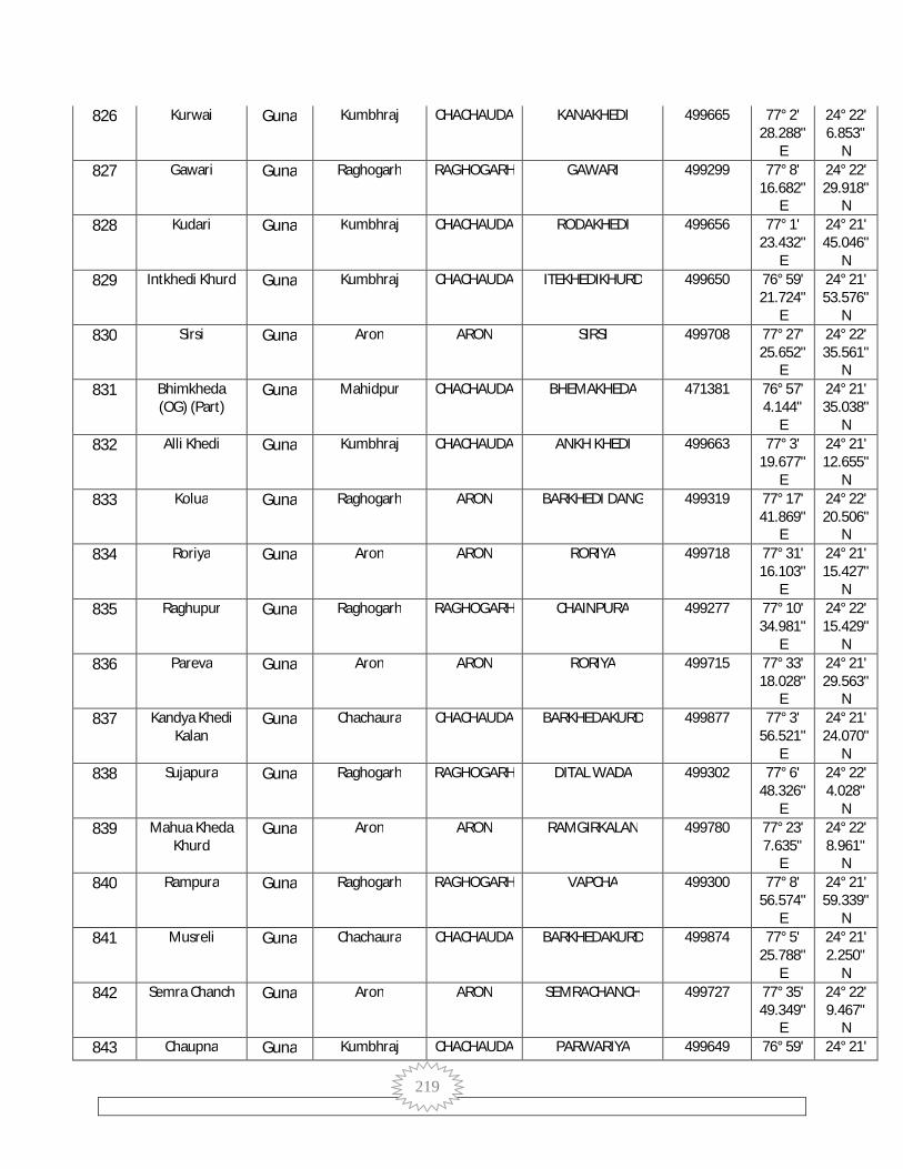
219
826 Kurwai Guna Kumbhraj CHACHAUDA KANAKHEDI 499665 77° 2' 28.288"
E
24° 22' 6.853"
N 827 Gawari Guna Raghogarh RAGHOGARH GAWARI 499299 77° 8'
16.682" E
24° 22' 29.918"
N 828 Kudari Guna Kumbhraj CHACHAUDA RODAKHEDI 499656 77° 1'
23.432" E
24° 21' 45.046"
N 829 Intkhedi Khurd Guna Kumbhraj CHACHAUDA ITEKHEDIKHURD 499650 76° 59'
21.724" E
24° 21' 53.576"
N 830 Sirsi Guna Aron ARON SIRSI 499708 77° 27'
25.652" E
24° 22' 35.561"
N 831 Bhimkheda
(OG) (Part) Guna Mahidpur CHACHAUDA BHEMAKHEDA 471381 76° 57'
4.144" E
24° 21' 35.038"
N 832 Alli Khedi Guna Kumbhraj CHACHAUDA ANKH KHEDI 499663 77° 3'
19.677" E
24° 21' 12.655"
N 833 Kolua Guna Raghogarh ARON BARKHEDI DANG 499319 77° 17'
41.869" E
24° 22' 20.506"
N 834 Roriya Guna Aron ARON RORIYA 499718 77° 31'
16.103" E
24° 21' 15.427"
N 835 Raghupur Guna Raghogarh RAGHOGARH CHAINPURA 499277 77° 10'
34.981" E
24° 22' 15.429"
N 836 Pareva Guna Aron ARON RORIYA 499715 77° 33'
18.028" E
24° 21' 29.563"
N 837 Kandya Khedi
Kalan Guna Chachaura CHACHAUDA BARKHEDAKURD 499877 77° 3'
56.521" E
24° 21' 24.070"
N 838 Sujapura Guna Raghogarh RAGHOGARH DITAL WADA 499302 77° 6'
48.326" E
24° 22' 4.028"
N 839 Mahua Kheda
Khurd Guna Aron ARON RAMGIRKALAN 499780 77° 23'
7.635" E
24° 22' 8.961"
N 840 Rampura Guna Raghogarh RAGHOGARH VAPCHA 499300 77° 8'
56.574" E
24° 21' 59.339"
N 841 Musreli Guna Chachaura CHACHAUDA BARKHEDAKURD 499874 77° 5'
25.788" E
24° 21' 2.250"
N 842 Semra Chanch Guna Aron ARON SEMRACHANCH 499727 77° 35'
49.349" E
24° 22' 9.467"
N 843 Chaupna Guna Kumbhraj CHACHAUDA PARWARIYA 499649 76° 59' 24° 21'

220
57.852" E
14.633" N
844 Ghata Khedi Guna Kumbhraj CHACHAUDA ITEKHEDIKHURD 499651 76° 58' 24.672"
E
24° 21' 10.651"
N 845 Bilakhedi Guna Kumbhraj CHACHAUDA RODAKHEDI 499658 77° 0'
39.245" E
24° 20' 54.198"
N 846 Chauopada Guna Raghogarh ARON CHOPADA 499320 77° 16'
1.532" E
24° 21' 50.580"
N 847 Kishanganj
Alias Motipur Guna Raghogarh RAGHOGARH MOTIPURA 499280 77° 12'
47.924" E
24° 21' 46.535"
N 848 Bhaunrasa Guna Kumbhraj CHACHAUDA KUNDARA 499659 77° 2'
15.349" E
24° 21' 17.407"
N 849 Vanyai Guna Aron ARON AMKHEDA SUKHA 499739 77° 39'
3.302" E
24° 21' 57.809"
N 850 Fekara Guna Raghogarh RAGHOGARH PILAGHATA 499297 77° 10'
55.731" E
24° 21' 44.709"
N 851 Semra Kheda Guna Aron ARON DHIMARIYAI 499712 77° 29'
13.741" E
24° 21' 53.299"
N 852 Imaliya Guna Aron ARON IMALIYA 499782 77° 24'
36.942" E
24° 21' 49.748"
N 853 Patanawari Guna Kumbhraj CHACHAUDA KADAIYAKHURD 499570 76° 50'
13.168" E
24° 21' 5.947"
N 854 Dagrai Guna Aron ARON DAGRAI 499728 77° 37'
19.185" E
24° 21' 53.247"
N 855 Balapur Guna Aron ARON RORIYA 499716 77° 32'
29.430" E
24° 21' 20.104"
N 856 Sutanadi Guna Kumbhraj CHACHAUDA RAMNAGAR BY
LODHAPUR 499580 76° 59'
2.899" E
24° 20' 54.564"
N 857 Sihari Guna Kumbhraj CHACHAUDA ALLIKHEDI 499667 77° 2'
35.279" E
24° 20' 17.885"
N 858 Haripur Guna Raghogarh RAGHOGARH PILAGHATA 499279 77° 9'
34.590" E
24° 21' 28.024"
N 859 Banskhedi Guna Aron ARON IMALIYA 499781 77° 21'
37.124" E
24° 21' 33.296"
N 860 Niboda Guna Aron ARON SEMRACHANCH 499729 77° 36'
9.972" 24° 21' 37.761"

221
E N
861 Barkhua Guna Kumbhraj CHACHAUDA RAMNAGAR BY LODHAPUR
499577 76° 54' 5.764"
E
24° 20' 29.593"
N 862 Peelaghata Guna Raghogarh RAGHOGARH PILAGHATA 499296 77° 10'
38.095" E
24° 21' 19.800"
N 863 Ditalwada Guna Raghogarh RAGHOGARH DITAL WADA 499303 77° 6'
43.487" E
24° 21' 14.626"
N 864 Dhimaryai Guna Aron ARON DHIMARIYAI 499713 77° 29'
25.198" E
24° 21' 25.885"
N 865 Jasi Guna Aron ARON DAGRAI 499732 77° 37'
55.180" E
24° 21' 25.260"
N 866 Piplya Guna Raghogarh RAGHOGARH SAGAR 499306 77° 8'
8.049" E
24° 21' 10.079"
N 867 Mohmmadpur Guna Kumbhraj CHACHAUDA MOHAMADPUR 499576 76° 56'
50.926" E
24° 20' 35.083"
N 868 Amarpur Guna Aron ARON SAHAROG 499816 77° 16'
29.810" E
24° 21' 6.941"
N 869 Rijoda Guna Aron ARON RIJODA 499783 77° 23'
41.492" E
24° 21' 8.214"
N 870 Kumharyai Guna Aron ARON KHERAI 499798 77° 21'
16.033" E
24° 21' 6.642"
N 871 Ikodiya Guna Aron ARON DHIMARIYAI 499714 77° 29'
22.283" E
24° 20' 44.387"
N 872 Jaisalmer Guna Raghogarh RAGHOGARH PILAGHATA 499298 77° 12'
0.417" E
24° 20' 56.995"
N 873 Khajuri Guna Raghogarh ARON GODIYA 499321 77° 13'
42.402" E
24° 20' 54.159"
N 874 Gadyapura Guna Kumbhraj CHACHAUDA RODAKHEDI 499657 77° 0'
37.968" E
24° 20' 14.176"
N 875 Mogra Guna Kumbhraj CHACHAUDA ITEKHEDIKHURD 499654 76° 57'
46.866" E
24° 19' 58.764"
N 876 Kadaiya Khurd Guna Kumbhraj CHACHAUDA KADAIYAKHURD 499562 76° 50'
31.981" E
24° 19' 38.029"
N 877 Amarpura
Viran Guna Aron ARON KAKRUA 499801 77° 18'
21.866" 24° 20' 49.632"
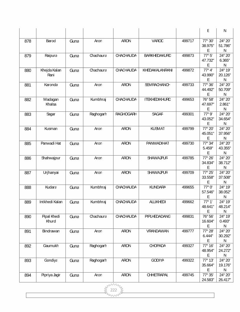
222
E N
878 Barod Guna Aron ARON VAROD 499717 77° 30' 38.975"
E
24° 20' 51.786"
N 879 Raipura Guna Chachaura CHACHAUDA BARKHEDAKURD 499873 77° 5'
47.732" E
24° 20' 6.365"
N 880 Khejda Kalan
Rani Guna Chachaura CHACHAUDA KHEDAKALANRANI 499872 77° 4'
43.990" E
24° 19' 20.126"
N 881 Karonda Guna Aron ARON SEMRACHANCH 499733 77° 36'
44.492" E
24° 20' 50.709"
N 882 Madagan
Khalsa Guna Kumbhraj CHACHAUDA ITEKHEDIKHURD 499653 76° 58'
47.697" E
24° 20' 2.861"
N 883 Sagar Guna Raghogarh RAGHOGARH SAGAR 499301 77° 9'
43.052" E
24° 20' 34.654"
N 884 Kusman Guna Aron ARON KUSMAT 499799 77° 20'
45.051" E
24° 20' 37.956"
N 885 Panwadi Hat Guna Aron ARON PANWADIHAT 499730 77° 34'
5.459" E
24° 20' 43.355"
N 886 Shahwajpur Guna Aron ARON SHAWAJPUR 499785 77° 26'
34.834" E
24° 20' 38.712"
N 887 Urjhanyai Guna Aron ARON SHAWAJPUR 499709 77° 25'
33.558" E
24° 20' 37.508"
N 888 Kudara Guna Kumbhraj CHACHAUDA KUNDARA 499655 77° 0'
57.546" E
24° 19' 38.052"
N 889 Intkhedi Kalan Guna Kumbhraj CHACHAUDA ALLIKHEDI 499662 77° 1'
48.641" E
24° 19' 48.214"
N 890 Pipal Khedi
Khurd Guna Chachaura CHACHAUDA PIPLHEDADANG 499831 76° 56'
16.604" E
24° 19' 0.493"
N 891 Bindrawan Guna Aron ARON VRANDAWAN 499777 77° 28'
6.444" E
24° 20' 30.292"
N 892 Gaumukh Guna Raghogarh ARON CHOPADA 499327 77° 16'
48.954" E
24° 20' 24.272"
N 893 Gondiya Guna Raghogarh ARON GODIYA 499322 77° 13'
35.664" E
24° 20' 19.176"
N 894 Pipriya Jagir Guna Aron ARON CHHETRAPAL 499745 77° 35'
24.583" 24° 20' 26.417"
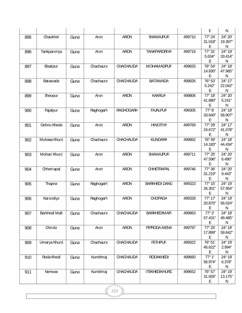
223
E N
895 Chaukhet Guna Aron ARON SHAWAJPUR 499710 77° 24' 31.018"
E
24° 20' 19.397"
N 896 Tankparoriya Guna Aron ARON TANKPARORIYA 499719 77° 31'
5.634" E
24° 19' 33.414"
N 897 Bisatpur Guna Chachaura CHACHAUDA MOHAMADPUR 499833 76° 54'
14.830" E
24° 18' 47.965"
N 898 Batawada Guna Chachaura CHACHAUDA BATAWADA 499826 76° 53'
5.242" E
24° 17' 22.042"
N 899 Sheopur Guna Aron ARON KAKRUA 499806 77° 18'
41.880" E
24° 20' 5.241"
N 900 Fajalpur Guna Raghogarh RAGHOGARH FAJALPUR 499305 77° 8'
33.640" E
24° 19' 58.907"
N 901 Gehnu Kheda Guna Aron ARON HINOTIYA 499769 77° 29'
24.672" E
24° 17' 41.078"
N 902 Muhasa Khurd Guna Chachaura CHACHAUDA KUNDARA 499862 76° 59'
14.183" E
24° 18' 44.434"
N 903 Mohari Khurd Guna Aron ARON SHAWAJPUR 499711 77° 25'
47.596" E
24° 20' 6.490"
N 904 Chhetrapal Guna Aron ARON CHHETRAPAL 499746 77° 36'
31.219" E
24° 20' 9.443"
N 905 Thapna Guna Raghogarh ARON BARKHEDI DANG 499323 77° 15'
26.301" E
24° 19' 57.954"
N 906 Karondiya Guna Raghogarh ARON CHOPADA 499328 77° 17'
20.870" E
24° 19' 56.024"
N 907 Barkhedi Mafi Guna Chachaura CHACHAUDA BARKHEDIMAFI 499863 77° 2'
57.431" E
24° 18' 49.485"
N 908 Chirola Guna Aron ARON PIPRODA MENA 499797 77° 25'
17.899" E
24° 19' 59.642"
N 909 Umarya Khurd Guna Chachaura CHACHAUDA FETHPUR 499822 76° 51'
45.622" E
24° 19' 2.994"
N 910 Roda Khedi Guna Kumbhraj CHACHAUDA RODAKHEDI 499660 77° 1'
56.974" E
24° 19' 6.378"
N 911 Nenwas Guna Kumbhraj CHACHAUDA ITEKHEDIKHURD 499652 76° 57'
31.926" E
24° 19' 13.175"
N
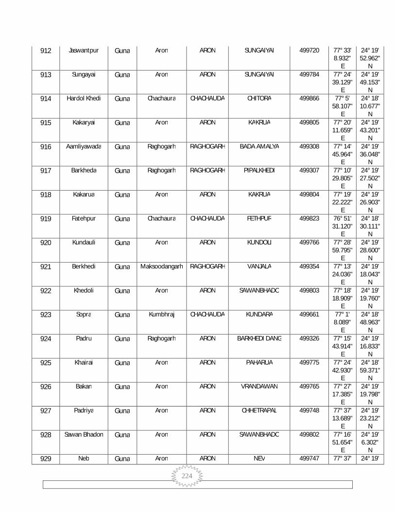
224
912 Jaswantpur Guna Aron ARON SUNGAIYAI 499720 77° 33' 8.932"
E
24° 19' 52.962"
N 913 Sungayai Guna Aron ARON SUNGAIYAI 499784 77° 24'
39.129" E
24° 19' 49.153"
N 914 Hardol Khedi Guna Chachaura CHACHAUDA CHITORA 499866 77° 5'
58.107" E
24° 18' 10.677"
N 915 Kakaryai Guna Aron ARON KAKRUA 499805 77° 20'
11.659" E
24° 19' 43.201"
N 916 Aamliyawada Guna Raghogarh RAGHOGARH BADA AMALYA 499308 77° 14'
45.964" E
24° 19' 36.048"
N 917 Barkheda Guna Raghogarh RAGHOGARH PIPALKHEDI 499307 77° 10'
29.805" E
24° 19' 27.502"
N 918 Kakarua Guna Aron ARON KAKRUA 499804 77° 19'
22.222" E
24° 19' 26.903"
N 919 Fatehpur Guna Chachaura CHACHAUDA FETHPUR 499823 76° 51'
31.120" E
24° 18' 30.111"
N 920 Kundauli Guna Aron ARON KUNDOLI 499766 77° 28'
59.795" E
24° 19' 28.600"
N 921 Berkhedi Guna Maksoodangarh RAGHOGARH VANJALA 499354 77° 13'
24.036" E
24° 19' 18.043"
N 922 Khedoli Guna Aron ARON SAWANBHADO 499803 77° 18'
18.909" E
24° 19' 19.760"
N 923 Sopra Guna Kumbhraj CHACHAUDA KUNDARA 499661 77° 1'
8.089" E
24° 18' 48.963"
N 924 Padru Guna Raghogarh ARON BARKHEDI DANG 499326 77° 15'
43.914" E
24° 19' 16.833"
N 925 Khairai Guna Aron ARON PAHARUA 499775 77° 24'
42.930" E
24° 18' 59.371"
N 926 Bakan Guna Aron ARON VRANDAWAN 499765 77° 27'
17.385" E
24° 19' 19.798"
N 927 Padriya Guna Aron ARON CHHETRAPAL 499748 77° 37'
13.689" E
24° 19' 23.212"
N 928 Sawan Bhadon Guna Aron ARON SAWANBHADO 499802 77° 16'
51.654" E
24° 19' 6.302"
N 929 Neb Guna Aron ARON NEV 499747 77° 37' 24° 19'

225
30.041" E
12.646" N
930 Sanka Khurd Guna Chachaura CHACHAUDA KHEDAKALANRANI 499879 77° 4' 17.550"
E
24° 18' 14.333"
N 931 Ambeh Guna Raghogarh ARON BARKHEDI DANG 499324 77° 15'
12.967" E
24° 18' 55.463"
N 932 Bishan Kheda Guna Aron ARON KAKRUA 499807 77° 19'
50.225" E
24° 18' 57.368"
N 933 Awalheda Guna Chachaura CHACHAUDA PIPLHEDADANG 499830 76° 55'
57.967" E
24° 17' 42.350"
N 934 Aamkheda
Mungis Guna Aron ARON CHHETRAPAL 499749 77° 38'
24.670" E
24° 18' 57.478"
N 935 Parsoliya Guna Raghogarh RAGHOGARH PARSOLIYA 499309 77° 12'
8.641" E
24° 18' 45.309"
N 936 Dedla Guna Chachaura CHACHAUDA DEDLA 499864 77° 0'
39.272" E
24° 17' 7.074"
N 937 Kasba-Madhi Guna Aron ARON KASBAMADI 499752 77° 35'
42.487" E
24° 18' 50.436"
N 938 Jaswantpur Guna Aron ARON SUNGAIYAI 499779 77° 24'
33.969" E
24° 18' 25.155"
N 939 Marothiaya Guna Raghogarh ARON CHOPADA 499325 77° 14'
37.077" E
24° 18' 39.008"
N 940 Rusalli Kalan Guna Aron ARON RUSSALI KALAN 499757 77° 32'
14.900" E
24° 18' 45.348"
N 941 Kari Karar Guna Chachaura CHACHAUDA FETHPUR 499824 76° 51'
53.672" E
24° 17' 30.626"
N 942 Rampur Guna Aron ARON RAMPUR 499778 77° 27'
24.286" E
24° 18' 41.070"
N 943 Ismailpur Guna Aron ARON SAWANBHADO 499808 77° 18'
53.598" E
24° 18' 36.383"
N 944 Kishanpur Guna Aron ARON KASBAMADI 499751 77° 36'
17.541" E
24° 18' 32.668"
N 945 Ramdi Guna Chachaura CHACHAUDA RAMDI 499865 77° 2'
33.267" E
24° 17' 25.035"
N 946 Bhimkheda
(OG) (Part) Guna Mahidpur RAGHOGARH BHEMAKHEDA 471381 77° 23'
43.816" 24° 18' 18.683"

226
E N
947 Ankkheda Guna Aron ARON RUSSALI KALAN 499759 77° 32' 10.425"
E
24° 18' 17.924"
N 948 Pipalheda Dang Guna Chachaura CHACHAUDA PIPLHEDADANG 499832 76° 57'
32.181" E
24° 17' 23.447"
N 949 Paharua Guna Aron ARON PAHARUA 499774 77° 24'
56.144" E
24° 17' 49.494"
N 950 Jamonya Kalan Guna Chachaura CHACHAUDA CHITORA 499871 77° 4'
20.669" E
24° 18' 1.125"
N 951 Barsat Guna Raghogarh RAGHOGARH BARSAT 499314 77° 8'
28.640" E
24° 18' 1.671"
N 952 Kamalpur Dang Guna Chachaura CHACHAUDA MAHESHPURA 499856 76° 58'
46.498" E
24° 16' 23.091"
N 953 Karaiya Guna Aron ARON KARAIYA 499753 77° 34'
37.434" E
24° 18' 12.201"
N 954 Bhukani Guna Raghogarh RAGHOGARH PARSOLIYA 499310 77° 13'
3.730" E
24° 17' 58.901"
N 955 Kankarya Guna Chachaura CHACHAUDA BATAWADA 499827 76° 54'
19.610" E
24° 16' 55.190"
N 956 Bahadargarh Guna Raghogarh RAGHOGARH BARSAT 499315 77° 7'
29.850" E
24° 17' 49.075"
N 957 Mahua Kheda Guna Aron ARON KARAIYA 499756 77° 37'
1.318" E
24° 18' 3.501"
N 958 Devipura Guna Maksoodangarh RAGHOGARH TODRA 499356 77° 17'
0.133" E
24° 17' 50.701"
N 959 Dehri Kalan Guna Aron ARON DEHRI KALAN 499758 77° 30'
31.114" E
24° 17' 54.757"
N 960 Berkhedi
Danga Guna Raghogarh ARON BARKHEDI DANG 499330 77° 15'
21.204" E
24° 17' 46.501"
N 961 Sejanya Guna Chachaura CHACHAUDA RAMDI 499892 77° 3'
56.193" E
24° 16' 48.336"
N 962 Chitoda Guna Chachaura CHACHAUDA CHITORA 499881 77° 4'
48.503" E
24° 16' 37.238"
N 963 Govindpur Guna Aron ARON PATLESHWAR 499771 77° 28'
55.743" 24° 17' 49.451"

227
E N
964 Khair Khedi Guna Aron ARON KARAIYA 499754 77° 32' 51.237"
E
24° 17' 49.208"
N 965 Khejra Munda Guna Aron ARON CHOPNA 499762 77° 33'
23.356" E
24° 17' 45.480"
N 966 Raghopura Guna Raghogarh RAGHOGARH PIPALKHEDI 499312 77° 11'
16.740" E
24° 17' 33.225"
N 967 Ghata Khedi Guna Chachaura CHACHAUDA GHATAKHEDI 499880 77° 6'
44.555" E
24° 16' 23.948"
N 968 Rusalli Khurd Guna Aron ARON PAHARUA 499776 77° 24'
57.384" E
24° 16' 45.773"
N 969 Amarpura Guna Chachaura CHACHAUDA GHATAKHEDI 499882 77° 5'
43.491" E
24° 16' 57.101"
N 970 Lilweh Kalan Guna Chachaura CHACHAUDA JALALPURA 499825 76° 52'
7.066" E
24° 16' 18.372"
N 971 Gopalgarh Guna Maksoodangarh RAGHOGARH BALRAMPURA 499358 77° 17'
20.954" E
24° 17' 17.313"
N 972 Sehar Kheda Guna Maksoodangarh RAGHOGARH BALRAMPURA 499357 77° 18'
52.131" E
24° 17' 18.062"
N 973 Kusumpura Guna Chachaura CHACHAUDA KUSUMPURA 499835 76° 56'
1.352" E
24° 16' 1.371"
N 974 Ajgara Guna Chachaura CHACHAUDA AJGARA 499870 77° 3'
32.030" E
24° 16' 6.243"
N 975 Aigari Guna Chachaura CHACHAUDA AJGARA 499868 77° 2'
48.711" E
24° 16' 18.405"
N 976 Kanthi Guna Maksoodangarh RAGHOGARH LAXMANPURA 499353 77° 13'
10.658" E
24° 16' 56.622"
N 977 Chopana Guna Aron ARON CHOPNA 499761 77° 31'
54.844" E
24° 17' 1.267"
N 978 Mudra Mata Guna Aron ARON MUDRAMATA 499773 77° 27'
0.636" E
24° 15' 48.503"
N 979 Taharpur Guna Aron ARON CHOPNA 499760 77° 30'
12.732" E
24° 16' 58.225"
N 980 Pipal Khedi Guna Raghogarh RAGHOGARH KARONDI 499313 77° 10'
14.743" E
24° 16' 45.367"
N

228
981 Mahu Guna Raghogarh RAGHOGARH MAHU 499311 77° 12' 1.221"
E
24° 16' 45.915"
N 982 Ramda Guna Chachaura CHACHAUDA AJGARA 499867 77° 1'
52.155" E
24° 16' 7.035"
N 983 Badpura Guna Chachaura CHACHAUDA GHATAKHEDI 499884 77° 5'
41.505" E
24° 16' 4.589"
N 984 Chaura Khedi Guna Raghogarh RAGHOGARH PIPALKHEDI 499316 77° 8'
53.301" E
24° 16' 31.560"
N 985 Raipur Kalan Guna Aron ARON HINOTIYA 499768 77° 29'
14.841" E
24° 16' 40.487"
N 986 Tighhra Chanch Guna Aron ARON KARAIYA 499750 77° 35'
2.076" E
24° 16' 34.821"
N 987 Pipalya Khushal Guna Chachaura CHACHAUDA KUSUMPURA 499839 76° 57'
7.680" E
24° 15' 1.274"
N 988 Laxmanpura Guna Maksoodangarh RAGHOGARH LAXMANPURA 499355 77° 14'
57.099" E
24° 16' 20.310"
N 989 Patleshwar Guna Aron ARON PATLESHWAR 499770 77° 26'
33.828" E
24° 16' 25.760"
N 990 Barchha Guna Maksoodangarh RAGHOGARH BALRAMPURA 499360 77° 16'
20.568" E
24° 16' 18.891"
N 991 Khanpura Guna Chachaura CHACHAUDA MAGRON 499843 77° 1'
11.086" E
24° 15' 27.840"
N 992 Hadipur Guna Aron ARON MUDRAMATA 499772 77° 25'
56.902" E
24° 15' 12.362"
N 993 Rajankhedi Guna Aron ARON KHIRIYADANGI 499755 77° 33'
29.450" E
24° 16' 21.571"
N 994 Hinotiya Guna Aron ARON HINOTIYA 499767 77° 28'
53.442" E
24° 15' 40.067"
N 995 Kulambeh Guna Chachaura CHACHAUDA MAGRON 499857 76° 59'
32.509" E
24° 15' 2.544"
N 996 Daulat Pura Guna Maksoodangarh RAGHOGARH KHEJDA 499344 77° 8'
31.241" E
24° 15' 57.838"
N 997 Aligarh Guna Maksoodangarh RAGHOGARH TODRA 499343 77° 9'
45.249" E
24° 15' 58.161"
N 998 Khiriya Dagi Guna Aron ARON KHIRIYADANGI 499764 77° 33' 24° 16'

229
5.093" E
5.902" N
999 Sagodi Guna Chachaura CHACHAUDA JHUKRA 499829 76° 54' 28.857"
E
24° 14' 54.903"
N 1000 Mahmod Nagar Guna Maksoodangarh RAGHOGARH LAXMANPURA 499352 77° 12'
47.242" E
24° 15' 54.848"
N 1001 Chopan Khurd Guna Chachaura CHACHAUDA KOLUA 499878 77° 4'
46.086" E
24° 14' 54.348"
N 1002 Patondi Guna Chachaura CHACHAUDA PATODI 499893 77° 3'
25.280" E
24° 14' 15.578"
N 1003 Balrampura Guna Maksoodangarh RAGHOGARH BALRAMPURA 499366 77° 15'
14.481" E
24° 15' 48.120"
N 1004 Bilkheda Guna Chachaura CHACHAUDA KOLUA 499885 77° 5'
53.899" E
24° 15' 18.331"
N 1005 Khejda Khurd Guna Chachaura CHACHAUDA AJGARA 499869 77° 2'
3.569" E
24° 15' 14.926"
N 1006 Mahadeopura Guna Maksoodangarh RAGHOGARH BALRAMPURA 499361 77° 16'
38.125" E
24° 15' 44.667"
N 1007 Salota Guna Maksoodangarh RAGHOGARH SALOTA 499350 77° 11'
24.987" E
24° 15' 41.647"
N 1008 Chitawar Guna Aron ARON KHIRIYADANGI 499763 77° 30'
56.874" E
24° 15' 46.402"
N 1009 Shergarh Guna Maksoodangarh RAGHOGARH KHEJDA 499345 77° 8'
48.389" E
24° 15' 23.972"
N 1010 Kolua Guna Chachaura CHACHAUDA KOLUA 499887 77° 6'
11.019" E
24° 14' 42.029"
N 1011 Sagodya Guna Chachaura CHACHAUDA JALALPURA 499838 76° 55'
47.582" E
24° 14' 24.158"
N 1012 Todra Guna Maksoodangarh RAGHOGARH TODRA 499349 77° 9'
42.880" E
24° 15' 17.148"
N 1013 Tedoni Guna Maksoodangarh RAGHOGARH SALOTA 499351 77° 11'
34.930" E
24° 15' 12.349"
N 1014 Khejda Guna Maksoodangarh RAGHOGARH KHEJDA 499346 77° 7'
52.168" E
24° 15' 7.077"
N 1015 Nawalpura Guna Chachaura CHACHAUDA NALKHEDA 499889 77° 6'
41.964" 24° 14' 13.643"
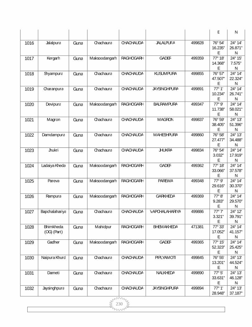
230
E N
1016 Jalalpura Guna Chachaura CHACHAUDA JALALPURA 499828 76° 54' 16.235"
E
24° 14' 26.871"
N 1017 Kergarh Guna Maksoodangarh RAGHOGARH GADER 499359 77° 18'
14.368" E
24° 15' 7.575"
N 1018 Shyampura Guna Chachaura CHACHAUDA KUSUMPURA 499855 76° 57'
47.507" E
24° 14' 22.324"
N 1019 Charanpura Guna Chachaura CHACHAUDA JAYSINGHPURA 499891 77° 1'
10.234" E
24° 14' 26.741"
N 1020 Devipura Guna Maksoodangarh RAGHOGARH BALRAMPURA 499347 77° 9'
11.738" E
24° 14' 58.021"
N 1021 Magron Guna Chachaura CHACHAUDA MAGRON 499837 76° 59'
38.405" E
24° 13' 51.396"
N 1022 Damdampura Guna Chachaura CHACHAUDA MAHESHPURA 499860 76° 58'
27.477" E
24° 13' 34.488"
N 1023 Jhukri Guna Chachaura CHACHAUDA JHUKRA 499834 76° 54'
3.032" E
24° 14' 17.919"
N 1024 Ladaiya Kheda Guna Maksoodangarh RAGHOGARH GADER 499362 77° 18'
33.066" E
24° 14' 37.578"
N 1025 Pareva Guna Maksoodangarh RAGHOGARH PAREWA 499348 77° 9'
29.616" E
24° 14' 30.370"
N 1026 Rampura Guna Maksoodangarh RAGHOGARH GARKHEDA 499369 77° 8'
9.283" E
24° 14' 29.570"
N 1027 Bapchalahariya Guna Chachaura CHACHAUDA VAPCHALAHARIYA 499886 77° 7'
3.321" E
24° 12' 39.791"
N 1028 Bhimkheda
(OG) (Part) Guna Mahidpur RAGHOGARH BHEMAKHEDA 471381 77° 33'
17.052" E
24° 14' 41.157"
N 1029 Gadher Guna Maksoodangarh RAGHOGARH GADER 499365 77° 15'
52.323" E
24° 14' 25.425"
N 1030 Naipura Khurd Guna Chachaura CHACHAUDA PIPLYAMOTI 499845 76° 55'
13.201" E
24° 13' 44.524"
N 1031 Dameti Guna Chachaura CHACHAUDA NALKHEDA 499890 77° 5'
33.631" E
24° 13' 46.128"
N 1032 Jaysinghpura Guna Chachaura CHACHAUDA JAYSINGHPURA 499894 77° 1'
28.948" 24° 13' 37.187"
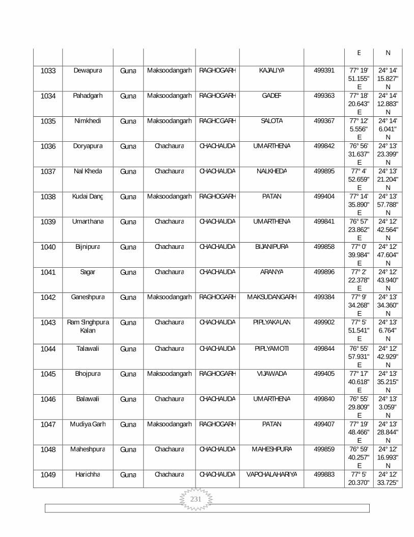
231
E N
1033 Dewapura Guna Maksoodangarh RAGHOGARH KAJALIYA 499391 77° 19' 51.155"
E
24° 14' 15.827"
N 1034 Pahadgarh Guna Maksoodangarh RAGHOGARH GADER 499363 77° 18'
20.643" E
24° 14' 12.883"
N 1035 Nimkhedi Guna Maksoodangarh RAGHOGARH SALOTA 499367 77° 12'
5.556" E
24° 14' 6.041"
N 1036 Doryapura Guna Chachaura CHACHAUDA UMARTHENA 499842 76° 56'
31.637" E
24° 13' 23.399"
N 1037 Nal Kheda Guna Chachaura CHACHAUDA NALKHEDA 499895 77° 4'
52.659" E
24° 13' 21.204"
N 1038 Kudai Dang Guna Maksoodangarh RAGHOGARH PATAN 499404 77° 14'
35.890" E
24° 13' 57.788"
N 1039 Umarthana Guna Chachaura CHACHAUDA UMARTHENA 499841 76° 57'
23.862" E
24° 12' 42.564"
N 1040 Bijnipura Guna Chachaura CHACHAUDA BIJANIPURA 499858 77° 0'
39.984" E
24° 12' 47.604"
N 1041 Sagar Guna Chachaura CHACHAUDA ARANYA 499896 77° 2'
22.378" E
24° 12' 43.940"
N 1042 Ganeshpura Guna Maksoodangarh RAGHOGARH MAKSUDANGARH 499384 77° 9'
34.268" E
24° 13' 34.360"
N 1043 Ram Singhpura
Kalan Guna Chachaura CHACHAUDA PIPLYAKALAN 499902 77° 5'
51.541" E
24° 13' 6.764"
N 1044 Talawali Guna Chachaura CHACHAUDA PIPLYAMOTI 499844 76° 55'
57.931" E
24° 12' 42.929"
N 1045 Bhojpura Guna Maksoodangarh RAGHOGARH VIJAWADA 499405 77° 17'
40.618" E
24° 13' 35.215"
N 1046 Balawali Guna Chachaura CHACHAUDA UMARTHENA 499840 76° 55'
29.809" E
24° 13' 3.059"
N 1047 Mudiya Garh Guna Maksoodangarh RAGHOGARH PATAN 499407 77° 19'
48.466" E
24° 13' 28.844"
N 1048 Maheshpura Guna Chachaura CHACHAUDA MAHESHPURA 499859 76° 59'
40.257" E
24° 12' 16.993"
N 1049 Harichha Guna Chachaura CHACHAUDA VAPCHALAHARIYA 499883 77° 5'
20.370" 24° 12' 33.725"
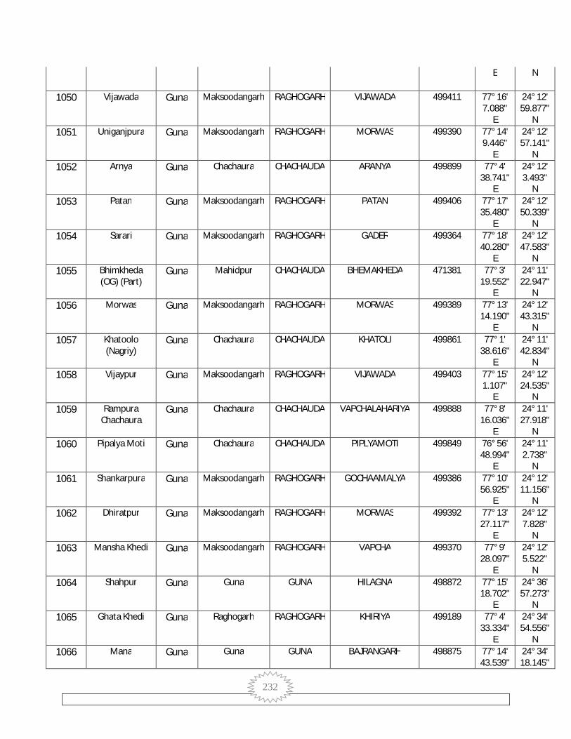
232
E N
1050 Vijawada Guna Maksoodangarh RAGHOGARH VIJAWADA 499411 77° 16' 7.088"
E
24° 12' 59.877"
N 1051 Uniganjpura Guna Maksoodangarh RAGHOGARH MORWAS 499390 77° 14'
9.446" E
24° 12' 57.141"
N 1052 Arnya Guna Chachaura CHACHAUDA ARANYA 499899 77° 4'
38.741" E
24° 12' 3.493"
N 1053 Patan Guna Maksoodangarh RAGHOGARH PATAN 499406 77° 17'
35.480" E
24° 12' 50.339"
N 1054 Sarari Guna Maksoodangarh RAGHOGARH GADER 499364 77° 18'
40.280" E
24° 12' 47.583"
N 1055 Bhimkheda
(OG) (Part) Guna Mahidpur CHACHAUDA BHEMAKHEDA 471381 77° 3'
19.552" E
24° 11' 22.947"
N 1056 Morwas Guna Maksoodangarh RAGHOGARH MORWAS 499389 77° 13'
14.190" E
24° 12' 43.315"
N 1057 Khatoolo
(Nagriy) Guna Chachaura CHACHAUDA KHATOLI 499861 77° 1'
38.616" E
24° 11' 42.834"
N 1058 Vijaypur Guna Maksoodangarh RAGHOGARH VIJAWADA 499403 77° 15'
1.107" E
24° 12' 24.535"
N 1059 Rampura
Chachaura Guna Chachaura CHACHAUDA VAPCHALAHARIYA 499888 77° 8'
16.036" E
24° 11' 27.918"
N 1060 Pipalya Moti Guna Chachaura CHACHAUDA PIPLYAMOTI 499849 76° 56'
48.994" E
24° 11' 2.738"
N 1061 Shankarpura Guna Maksoodangarh RAGHOGARH GOCHAAMALYA 499386 77° 10'
56.925" E
24° 12' 11.156"
N 1062 Dhiratpur Guna Maksoodangarh RAGHOGARH MORWAS 499392 77° 13'
27.117" E
24° 12' 7.828"
N 1063 Mansha Khedi Guna Maksoodangarh RAGHOGARH VAPCHA 499370 77° 9'
28.097" E
24° 12' 5.522"
N 1064 Shahpur Guna Guna GUNA HILAGNA 498872 77° 15'
18.702" E
24° 36' 57.273"
N 1065 Ghata Khedi Guna Raghogarh RAGHOGARH KHIRIYA 499189 77° 4'
33.334" E
24° 34' 54.556"
N 1066 Mana Guna Guna GUNA BAJRANGARH 498875 77° 14'
43.539" 24° 34' 18.145"

233
E N
1067 Katariya Guna Guna GUNA BAJRANGARH 498874 77° 15' 52.477"
E
24° 33' 56.329"
N 1068 Basari Guna Guna GUNA GADLA GIRD 498873 77° 16'
49.217" E
24° 33' 53.539"
N 1069 Soda Khedi Guna Raghogarh RAGHOGARH BHADORI 499207 77° 8'
39.789" E
24° 33' 59.417"
N 1070 Binayak Khedi Guna NULL CHACHAUDA NULL 499622 77° 3'
34.249" E
24° 32' 3.827"
N 1071 Gardha Kheda Guna Guna GUNA CHHIPON 498916 77° 18'
9.187" E
24° 31' 19.294"
N 1072 Kandai Guna NULL CHACHAUDA NULL 499624 77° 4'
20.844" E
24° 30' 15.125"
N 1073 Barkhuwa
Khurd Guna Raghogarh RAGHOGARH DORANA 499222 77° 13'
52.127" E
24° 29' 52.734"
N 1074 Chetabarri Guna Raghogarh RAGHOGARH AWAN 499243 77° 7'
24.412" E
24° 29' 39.748"
N 1075 Judariya Guna Raghogarh RAGHOGARH NANDNER 499224 77° 13'
14.752" E
24° 29' 34.663"
N 1076 Ismailpur Guna Raghogarh RAGHOGARH RAMNAGAR 499244 77° 7'
29.999" E
24° 29' 19.132"
N 1077 Rampura Guna Raghogarh RAGHOGARH AWAN 499253 77° 7'
34.666" E
24° 26' 53.233"
N 1078 Yakoobpura Guna Raghogarh RAGHOGARH GOVINDPURA 499288 77° 7'
3.182" E
24° 24' 42.910"
N 1079 Motibah Guna Raghogarh ARON KHERAI 499342 77° 17'
13.337" E
24° 24' 21.775"
N 1080 Islam Nagar Guna Raghogarh RAGHOGARH AWAN 499268 77° 12'
59.115" E
24° 23' 52.184"
N 1081 Chitarwas Guna Aron ARON SALAY 499722 77° 32'
56.564" E
24° 23' 30.984"
N 1082 Dilwarpur Guna Raghogarh RAGHOGARH RAMNAGAR 499265 77° 13'
53.137" E
24° 23' 15.666"
N 1083 Higoniya Guna Aron ARON SALAY 499721 77° 31'
5.875" E
24° 22' 59.467"
N
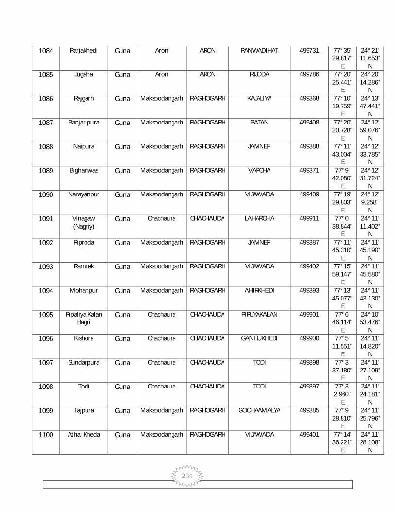
234
1084 Parjakhedi Guna Aron ARON PANWADIHAT 499731 77° 35' 29.817"
E
24° 21' 11.653"
N 1085 Jugaha Guna Aron ARON RIJODA 499786 77° 20'
25.441" E
24° 20' 14.286"
N 1086 Rajgarh Guna Maksoodangarh RAGHOGARH KAJALIYA 499368 77° 10'
19.759" E
24° 13' 47.441"
N 1087 Banjaripura Guna Maksoodangarh RAGHOGARH PATAN 499408 77° 20'
20.728" E
24° 12' 59.076"
N 1088 Naipura Guna Maksoodangarh RAGHOGARH JAMNER 499388 77° 11'
43.004" E
24° 12' 33.785"
N 1089 Bighanwas Guna Maksoodangarh RAGHOGARH VAPCHA 499371 77° 9'
42.080" E
24° 12' 31.724"
N 1090 Narayanpur Guna Maksoodangarh RAGHOGARH VIJAWADA 499409 77° 19'
29.803" E
24° 12' 9.258"
N 1091 Vinagaw
(Nagriy) Guna Chachaura CHACHAUDA LAHARCHA 499911 77° 0'
38.844" E
24° 11' 11.402"
N 1092 Piproda Guna Maksoodangarh RAGHOGARH JAMNER 499387 77° 11'
45.310" E
24° 11' 45.190"
N 1093 Ramtek Guna Maksoodangarh RAGHOGARH VIJAWADA 499402 77° 15'
59.147" E
24° 11' 45.580"
N 1094 Mohanpur Guna Maksoodangarh RAGHOGARH AHIRKHEDI 499393 77° 13'
45.077" E
24° 11' 43.130"
N 1095 Pipaliya Kalan
Bagri Guna Chachaura CHACHAUDA PIPLYAKALAN 499901 77° 6'
46.114" E
24° 10' 53.476"
N 1096 Kishora Guna Chachaura CHACHAUDA GANHUKHEDI 499900 77° 5'
11.551" E
24° 11' 14.820"
N 1097 Sundarpura Guna Chachaura CHACHAUDA TODI 499898 77° 3'
37.180" E
24° 11' 27.109"
N 1098 Todi Guna Chachaura CHACHAUDA TODI 499897 77° 3'
2.960" E
24° 11' 24.181"
N 1099 Tajpura Guna Maksoodangarh RAGHOGARH GOCHAAMALYA 499385 77° 9'
28.810" E
24° 11' 25.796"
N 1100 Athai Kheda Guna Maksoodangarh RAGHOGARH VIJAWADA 499401 77° 14'
36.221" E
24° 11' 28.108"
N

235
1101 Kudai Maru Guna Maksoodangarh RAGHOGARH DHINA KHEDI 499383 77° 12' 4.664"
E
24° 11' 20.211"
N 1102 Lahareha Guna Chachaura CHACHAUDA LAHARCHA 499913 77° 1'
59.872" E
24° 10' 18.690"
N 1103 Maloni Guna Chachaura CHACHAUDA PIPLYAKALAN 499905 77° 8'
13.522" E
24° 10' 10.181"
N 1104 Raghopura Guna Maksoodangarh RAGHOGARH MORWAS 499394 77° 13'
6.459" E
24° 11' 13.709"
N 1105 Junapani Guna Chachaura CHACHAUDA MERIYAKHEDIA 499850 76° 55'
13.785" E
24° 10' 16.190"
N 1106 Vanjala Guna Maksoodangarh RAGHOGARH VANJALA 499412 77° 17'
59.935" E
24° 11' 14.729"
N 1107 Bamori Guna Chachaura CHACHAUDA MUHANSHAKALAN 499918 76° 59'
56.327" E
24° 9' 48.062"
N 1108 Ratanpur Guna Maksoodangarh RAGHOGARH VIJAWADA 499413 77° 19'
56.573" E
24° 11' 14.570"
N 1109 Goripura Guna Maksoodangarh RAGHOGARH VANJALA 499400 77° 14'
55.566" E
24° 11' 10.904"
N 1110 Gader Guna Chachaura CHACHAUDA GANHUKHEDI 499904 77° 5'
58.422" E
24° 10' 36.082"
N 1111 Gehun Khedi Guna Chachaura CHACHAUDA GANHUKHEDI 499903 77° 4'
29.106" E
24° 10' 29.289"
N 1112 Hinoti Guna Chachaura CHACHAUDA PIPLYAMOTI 499851 76° 56'
21.966" E
24° 10' 46.623"
N 1113 Asa Khedi Guna Chachaura CHACHAUDA RATODHANA 499961 77° 5'
6.322" E
24° 10' 1.724"
N 1114 Maliya Khedi Guna Maksoodangarh RAGHOGARH MALIYAKHEDI 499399 77° 14'
28.302" E
24° 10' 52.910"
N 1115 Sumeri Guna Maksoodangarh RAGHOGARH VANJALA 499417 77° 16'
46.862" E
24° 10' 52.250"
N 1116 Jamner Guna Maksoodangarh RAGHOGARH JAMNER 499396 77° 13'
4.377" E
24° 10' 45.218"
N 1117 Konya Dang Guna Chachaura CHACHAUDA AMASER 499930 76° 56'
53.457" E
24° 10' 8.942"
N
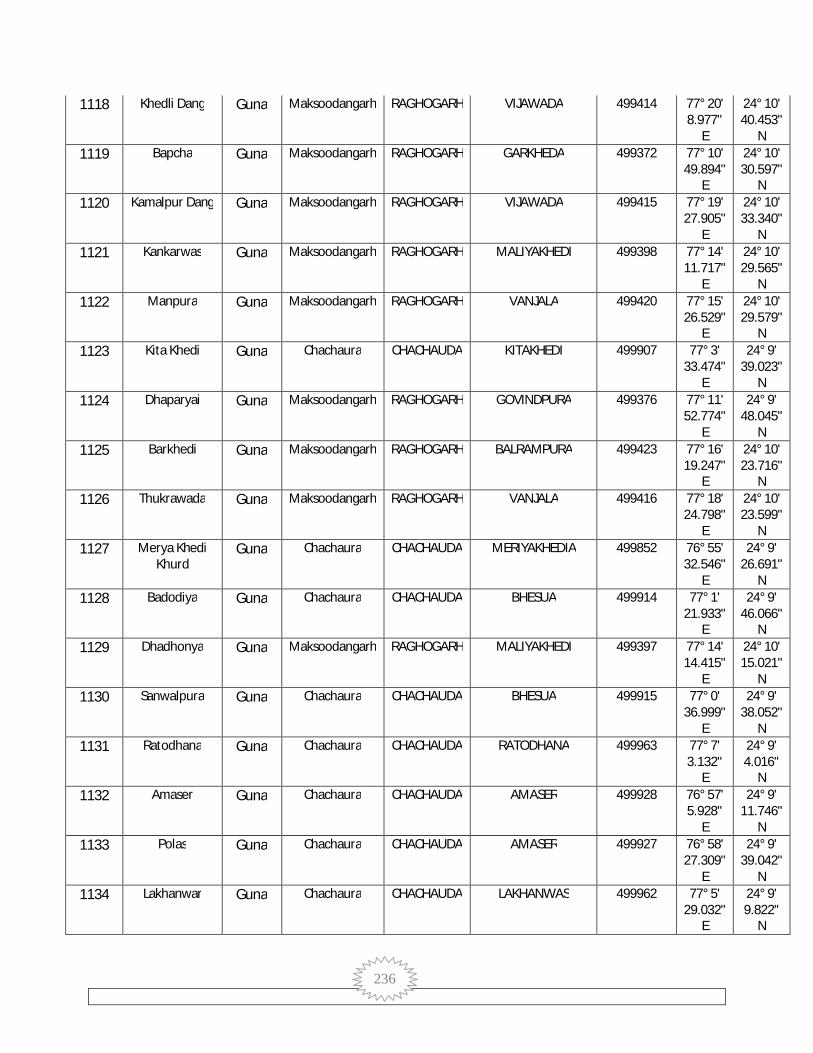
236
1118 Khedli Dang Guna Maksoodangarh RAGHOGARH VIJAWADA 499414 77° 20' 8.977"
E
24° 10' 40.453"
N 1119 Bapcha Guna Maksoodangarh RAGHOGARH GARKHEDA 499372 77° 10'
49.894" E
24° 10' 30.597"
N 1120 Kamalpur Dang Guna Maksoodangarh RAGHOGARH VIJAWADA 499415 77° 19'
27.905" E
24° 10' 33.340"
N 1121 Kankarwas Guna Maksoodangarh RAGHOGARH MALIYAKHEDI 499398 77° 14'
11.717" E
24° 10' 29.565"
N 1122 Manpura Guna Maksoodangarh RAGHOGARH VANJALA 499420 77° 15'
26.529" E
24° 10' 29.579"
N 1123 Kita Khedi Guna Chachaura CHACHAUDA KITAKHEDI 499907 77° 3'
33.474" E
24° 9' 39.023"
N 1124 Dhaparyai Guna Maksoodangarh RAGHOGARH GOVINDPURA 499376 77° 11'
52.774" E
24° 9' 48.045"
N 1125 Barkhedi Guna Maksoodangarh RAGHOGARH BALRAMPURA 499423 77° 16'
19.247" E
24° 10' 23.716"
N 1126 Thukrawada Guna Maksoodangarh RAGHOGARH VANJALA 499416 77° 18'
24.798" E
24° 10' 23.599"
N 1127 Merya Khedi
Khurd Guna Chachaura CHACHAUDA MERIYAKHEDIA 499852 76° 55'
32.546" E
24° 9' 26.691"
N 1128 Badodiya Guna Chachaura CHACHAUDA BHESUA 499914 77° 1'
21.933" E
24° 9' 46.066"
N 1129 Dhadhonya Guna Maksoodangarh RAGHOGARH MALIYAKHEDI 499397 77° 14'
14.415" E
24° 10' 15.021"
N 1130 Sanwalpura Guna Chachaura CHACHAUDA BHESUA 499915 77° 0'
36.999" E
24° 9' 38.052"
N 1131 Ratodhana Guna Chachaura CHACHAUDA RATODHANA 499963 77° 7'
3.132" E
24° 9' 4.016"
N 1132 Amaser Guna Chachaura CHACHAUDA AMASER 499928 76° 57'
5.928" E
24° 9' 11.746"
N 1133 Polas Guna Chachaura CHACHAUDA AMASER 499927 76° 58'
27.309" E
24° 9' 39.042"
N 1134 Lakhanwar Guna Chachaura CHACHAUDA LAKHANWAS 499962 77° 5'
29.032" E
24° 9' 9.822"
N

237
1135 Jharpai Guna Maksoodangarh RAGHOGARH JHARPAI 499418 77° 16' 38.812"
E
24° 9' 57.836"
N 1136 Khedli Maidani Guna Maksoodangarh RAGHOGARH VAPCHA 499373 77° 10'
17.984" E
24° 9' 53.950"
N 1137 Imaliya Guna Maksoodangarh RAGHOGARH KANJAI 499425 77° 13'
38.700" E
24° 9' 51.824"
N 1138 Naipura Kalan Guna Chachaura CHACHAUDA MUHANSHAKALAN 499916 76° 58'
41.947" E
24° 9' 0.989"
N 1139 Gunjari Guna Chachaura CHACHAUDA AMASER 499929 76° 57'
48.542" E
24° 8' 28.938"
N 1140 Jalalpur Guna Maksoodangarh RAGHOGARH VIJAWADA 499419 77° 16'
0.234" E
24° 9' 46.043"
N 1141 Kudriya Guna Chachaura CHACHAUDA KUDALYA 499848 76° 55'
48.926" E
24° 8' 30.187"
N 1142 Natariyai Guna Maksoodangarh RAGHOGARH VAIRWAS 499374 77° 10'
35.656" E
24° 9' 37.326"
N 1143 Kakrua Guna Chachaura CHACHAUDA RATODHANA 499964 77° 8'
56.253" E
24° 9' 0.461"
N 1144 Semli Bhoj Guna Chachaura CHACHAUDA KALAPIPAL 499854 76° 55'
10.819" E
24° 9' 18.871"
N 1145 Mauhapura Guna Maksoodangarh RAGHOGARH VANJALA 499421 77° 17'
27.220" E
24° 9' 32.106"
N 1146 Jateri Guna Chachaura CHACHAUDA JATERI 499909 77° 2'
45.963" E
24° 8' 20.266"
N 1147 Bhensuwa Guna Chachaura CHACHAUDA BHESUA 499912 77° 1'
24.663" E
24° 8' 27.951"
N 1148 Bairwas Guna Maksoodangarh RAGHOGARH VAIRWAS 499375 77° 10'
25.850" E
24° 9' 20.813"
N 1149 Pachgodiya Guna Maksoodangarh RAGHOGARH PACHGODIA 499424 77° 15'
9.442" E
24° 9' 21.122"
N 1150 Amalya Gocha Guna Maksoodangarh RAGHOGARH GOCHAAMALYA 499395 77° 12'
54.351" E
24° 9' 15.910"
N 1151 Kala Pipal Guna Chachaura CHACHAUDA KALAPIPAL 499846 76° 54'
37.263" E
24° 8' 8.599"
N

238
1152 Ramsinghpura Khurd
Guna Chachaura CHACHAUDA JATERI 499908 77° 3' 50.362"
E
24° 8' 43.349"
N 1153 Kishan Khedi Guna Maksoodangarh RAGHOGARH PACHGODIA 499426 77° 14'
3.505" E
24° 9' 0.862"
N 1154 Borda Guna Maksoodangarh RAGHOGARH BARODKALAN 499422 77° 17'
3.372" E
24° 9' 1.284"
N 1155 Sallamgarh Guna Maksoodangarh RAGHOGARH DHINA KHEDI 499377 77° 10'
25.386" E
24° 8' 53.380"
N 1156 Muhasa Kalan Guna Chachaura CHACHAUDA MUHANSHAKALAN 499917 76° 59'
10.779" E
24° 8' 26.897"
N 1157 Chopankala Guna Chachaura CHACHAUDA KHEDAKALAN 499968 77° 8'
7.316" E
24° 8' 2.390"
N 1158 Pura
Lakhanwas Guna Chachaura CHACHAUDA KITAKHEDI 499910 77° 4'
59.310" E
24° 8' 3.400"
N 1159 Penchi Guna Chachaura CHACHAUDA PENCHI 499919 77° 0'
2.985" E
24° 8' 5.685"
N 1160 Khejra Kalan Guna Chachaura CHACHAUDA KHEDAKALAN 499966 77° 9'
29.311" E
24° 7' 16.911"
N 1161 Jagru Guna Maksoodangarh RAGHOGARH JANGRU 499382 77° 12'
31.624" E
24° 8' 37.094"
N 1162 Nesh Kalan Guna Chachaura CHACHAUDA KUDALYA 499853 76° 56'
2.926" E
24° 7' 43.809"
N 1163 Mohmmadpura Guna Chachaura CHACHAUDA MUHANSHAKALAN 499920 76° 58'
36.576" E
24° 7' 50.374"
N 1164 Rupahedi Guna Chachaura CHACHAUDA LAKHANWAS 499906 77° 6'
16.966" E
24° 7' 56.982"
N 1165 Motipur Guna Maksoodangarh RAGHOGARH PACHGODIA 499427 77° 14'
18.001" E
24° 8' 31.700"
N 1166 Dongar Guna Maksoodangarh RAGHOGARH DONGAR MOTIPUR 499429 77° 16'
44.726" E
24° 8' 32.831"
N 1167 Ramteri Guna Chachaura CHACHAUDA KITAKHEDI 499965 77° 3'
48.368" E
24° 7' 29.247"
N 1168 Brahmapura Guna Chachaura CHACHAUDA KUDALYA 499847 76° 56'
58.467" E
24° 7' 41.093"
N

239
1169 Meru Khedi Guna Maksoodangarh RAGHOGARH DHINA KHEDI 499381 77° 12' 47.973"
E
24° 8' 22.707"
N 1170 Ballam Garh Guna Maksoodangarh RAGHOGARH DHINA KHEDI 499378 77° 10'
45.091" E
24° 8' 16.664"
N 1171 Bala Kheda Guna Maksoodangarh RAGHOGARH NOHAR 499428 77° 15'
58.652" E
24° 8' 13.702"
N 1172 Kirwada Guna Chachaura CHACHAUDA KOTRA 499922 76° 59'
24.742" E
24° 7' 25.517"
N 1173 Dokarya Khedi Guna Chachaura CHACHAUDA KONYAKALAYAN 499951 77° 0'
51.348" E
24° 7' 33.320"
N 1174 Teligaon Guna Chachaura CHACHAUDA TELIGAON 499960 77° 6'
7.220" E
24° 6' 46.202"
N 1175 Murela Guna Chachaura CHACHAUDA MURELA 499932 76° 54'
46.743" E
24° 6' 38.185"
N 1176 Bhanpura Mina Guna Chachaura CHACHAUDA MERIYAKHEDIKALAN 499953 77° 1'
58.878" E
24° 7' 20.816"
N 1177 Dhina Khedi Guna Maksoodangarh RAGHOGARH DHINA KHEDI 499380 77° 11'
43.933" E
24° 7' 46.498"
N 1178 Jhorda Guna Chachaura CHACHAUDA MUHANSHAKALAN 499921 76° 57'
59.385" E
24° 7' 8.637"
N 1179 Raja Hedi Guna Maksoodangarh RAGHOGARH JANGRU 499379 77° 11'
10.193" E
24° 7' 38.949"
N 1180 Pagdi Guna Chachaura CHACHAUDA MURELA 499931 76° 53'
56.883" E
24° 7' 18.998"
N 1181 Dabarya Guna Chachaura CHACHAUDA DABARYA 499957 77° 4'
5.542" E
24° 6' 31.460"
N 1182 Kanjai Guna Maksoodangarh RAGHOGARH KANJAI 499430 77° 15'
42.865" E
24° 7' 29.786"
N 1183 Merya Khedi
Kalan Guna Chachaura CHACHAUDA MERIYAKHEDIKALAN 499950 77° 0'
46.634" E
24° 6' 44.827"
N 1184 Ubha Pan Guna Chachaura CHACHAUDA NATYAKHEDI 499926 76° 56'
35.896" E
24° 6' 50.032"
N 1185 Lakhori Guna Chachaura CHACHAUDA DABARYA 499955 77° 2'
28.131" E
24° 6' 26.119"
N

240
1186 Kotra Guna Chachaura CHACHAUDA KOTRA 499924 76° 59' 6.572"
E
24° 6' 16.875"
N 1187 Siya Khedi Guna Maksoodangarh RAGHOGARH SIYAKHEDI 499444 77° 12'
43.818" E
24° 7' 10.654"
N 1188 Barkhedi
Shyam Guna Maksoodangarh RAGHOGARH KANJAI 499431 77° 14'
6.015" E
24° 7' 8.117"
N 1189 Gonyaweh Guna Chachaura CHACHAUDA NATYAKHEDI 499925 76° 57'
7.157" E
24° 6' 13.703"
N 1190 Baroda Khurd Guna Maksoodangarh RAGHOGARH KANJAI 499432 77° 14'
14.888" E
24° 6' 58.424"
N 1191 Higona Guna Maksoodangarh RAGHOGARH KAREWA 499447 77° 11'
1.758" E
24° 6' 58.214"
N 1192 Dehri Guna Chachaura CHACHAUDA DEHRI 499956 77° 7'
11.980" E
24° 5' 54.464"
N 1193 Bhimkheda
(OG) (Part) Guna Mahidpur RAGHOGARH BHEMAKHEDA 471381 77° 15'
9.287" E
24° 6' 57.549"
N 1194 Mohari Guna Maksoodangarh RAGHOGARH MOHAMMADPUR 499433 77° 17'
0.884" E
24° 6' 55.964"
N 1195 Netya Khedi Guna Chachaura CHACHAUDA NATYAKHEDI 499923 76° 58'
1.898" E
24° 5' 49.377"
N 1196 Lachhoni Guna Chachaura CHACHAUDA NARAYANPURA 499947 77° 1'
3.814" E
24° 6' 13.506"
N 1197 Kadai Kheda Guna Maksoodangarh RAGHOGARH KOLARAS 499443 77° 14'
25.403" E
24° 6' 45.203"
N 1198 Parewa Guna Chachaura CHACHAUDA NARAYANPURA 499944 76° 59'
41.467" E
24° 6' 2.953"
N 1199 Godiya Guna Maksoodangarh RAGHOGARH SIYAKHEDI 499445 77° 12'
54.587" E
24° 6' 37.530"
N 1200 Mohmmadpur Guna Maksoodangarh RAGHOGARH NARAYANPURA 499434 77° 16'
24.915" E
24° 6' 37.490"
N 1201 Kamalpura
Maidani Guna Maksoodangarh RAGHOGARH KAREWA 499448 77° 11'
15.233" E
24° 6' 31.656"
N 1202 Higoni Guna Chachaura CHACHAUDA BAPCHAVIKRAM 499967 77° 9'
39.970" E
24° 6' 9.856"
N

241
1203 Niwari Guna Maksoodangarh RAGHOGARH MOHAMMADPUR 499442 77° 14' 35.061"
E
24° 6' 24.679"
N 1204 Jujhrapura Guna Chachaura CHACHAUDA NARAYANPURA 499946 77° 1'
32.721" E
24° 5' 30.100"
N 1205 Shyampur Guna Maksoodangarh RAGHOGARH SIYAKHEDI 499446 77° 12'
34.640" E
24° 6' 6.989"
N 1206 Konya Kalan Guna Chachaura CHACHAUDA KONYAKALAYAN 499948 77° 2'
37.649" E
24° 5' 19.450"
N 1207 Bapcha Vikram Guna Chachaura CHACHAUDA BAPCHAVIKRAM 499969 77° 9'
49.278" E
24° 5' 21.204"
N 1208 Pipalya Najdik
Kotra Guna Chachaura CHACHAUDA KANKANHERU 499941 76° 59'
48.889" E
24° 5' 5.561"
N 1209 Narayanpura Guna Chachaura CHACHAUDA NARAYANPURA 499945 77° 0'
41.885" E
24° 4' 46.264"
N 1210 Udaypura Guna Maksoodangarh RAGHOGARH TORAI 499441 77° 14'
5.367" E
24° 6' 0.258"
N 1211 Biba Khedi Guna Chachaura CHACHAUDA DEHRI 499954 77° 8'
3.552" E
24° 5' 27.360"
N 1212 Kodyapura Guna Chachaura CHACHAUDA DABARYA 499958 77° 4'
1.637" E
24° 5' 13.403"
N 1213 Khair Khedi Guna Maksoodangarh RAGHOGARH KAJALIYA 499450 77° 11'
20.718" E
24° 5' 48.820"
N 1214 Chhatar Pura Guna Maksoodangarh RAGHOGARH MOHAMMADPUR 499435 77° 16'
51.742" E
24° 5' 43.954"
N 1215 Singapura Guna Chachaura CHACHAUDA SONAHEDA 499937 76° 56'
38.725" E
24° 5' 4.073"
N 1216 Barkhua Guna Chachaura CHACHAUDA DABARYA 499959 77° 5'
13.862" E
24° 5' 8.961"
N 1217 Nesh Khurd Guna Chachaura CHACHAUDA PAKHARIYAPURA 499936 76° 57'
36.644" E
24° 5' 1.980"
N 1218 Karela Guna Maksoodangarh RAGHOGARH KAREWA 499451 77° 12'
7.879" E
24° 5' 28.614"
N 1219 Kolaras Guna Maksoodangarh RAGHOGARH KOLARAS 499436 77° 16'
18.843" E
24° 5' 26.208"
N

242
1220 Dewapura Guna Maksoodangarh RAGHOGARH MORWAS 499452 77° 11' 41.409"
E
24° 5' 13.303"
N 1221 Jogipura Guna Chachaura CHACHAUDA SONAHEDA 499938 76° 58'
32.189" E
24° 4' 38.311"
N 1222 Kankan Heru Guna Chachaura CHACHAUDA KANKANHERU 499942 76° 59'
24.644" E
24° 4' 17.769"
N 1223 Kajaliya Guna Maksoodangarh RAGHOGARH KAJALIYA 499453 77° 12'
16.241" E
24° 4' 59.902"
N 1224 Sonaheda Guna Chachaura CHACHAUDA SONAHEDA 499939 76° 57'
7.720" E
24° 4' 26.974"
N 1225 Bala Khedi Guna Maksoodangarh RAGHOGARH KAJALIYA 499454 77° 11'
32.455" E
24° 4' 53.348"
N 1226 Raghopura Guna Maksoodangarh RAGHOGARH TORAI 499438 77° 15'
42.808" E
24° 4' 51.579"
N 1227 Torai Guna Maksoodangarh RAGHOGARH TORAI 499440 77° 14'
28.200" E
24° 4' 48.783"
N 1228 Pakhriyapura Guna Chachaura CHACHAUDA PAKHARIYAPURA 499934 76° 58'
2.790" E
24° 3' 56.747"
N 1229 Agarpura Guna Maksoodangarh RAGHOGARH KAJALIYA 499455 77° 11'
11.559" E
24° 4' 16.330"
N 1230 Govindpura Guna Maksoodangarh RAGHOGARH KOLARAS 499439 77° 16'
7.896" E
24° 4' 16.169"
N 1231 Udo Khedi Guna Chachaura CHACHAUDA KANKANHERU 499943 76° 59'
0.938" E
24° 3' 46.184"
N 1232 Nalkheda Guna Maksoodangarh RAGHOGARH NALKHEDA 499456 77° 13'
52.528" E
24° 3' 59.942"
N 1233 Kherbeh Guna Chachaura CHACHAUDA PAKHARIYAPURA 499935 76° 58'
35.857" E
24° 3' 31.971"
N 1234 Maksudangarh Guna Maksoodangarh RAGHOGARH MAKSUDANGARH 499458 77° 14'
32.994" E
24° 3' 55.025"
N 1235 Kadaiya
Chachaura Guna Chachaura CHACHAUDA MERIYAKHEDIKALAN 499949 76° 59'
37.364" E
24° 3' 21.500"
N 1236 Borda Guna Chachaura CHACHAUDA PAKHARIYAPURA 499933 76° 58'
21.218" E
24° 3' 3.986"
N

243
1237 Bhanpura Baba Guna Chachaura CHACHAUDA MERIYAKHEDIKALAN 499952 76° 58' 47.920"
E
24° 2' 54.137"
N 1238 Shripura Guna Maksoodangarh RAGHOGARH AHIRKHEDI 499457 77° 13'
53.730" E
24° 3' 14.999"
N 1239 Garkheda Guna Maksoodangarh RAGHOGARH GARKHEDA 499462 77° 12'
23.515" E
24° 3' 10.598"
N 1240 Surajpura Guna Maksoodangarh RAGHOGARH NALKHEDA 499459 77° 15'
7.167" E
24° 3' 10.283"
N 1241 Bapchi Guna Maksoodangarh RAGHOGARH VAPCHA 499463 77° 11'
39.556" E
24° 3' 4.698"
N 1242 Amargarh Guna Maksoodangarh RAGHOGARH MAKSUDANGARH 499461 77° 14'
4.971" E
24° 2' 54.198"
N 1243 Ganesh Pura Guna Maksoodangarh RAGHOGARH GOCHAAMALYA 499460 77° 15'
2.414" E
24° 2' 43.012"
N 1244 Budhoriya Guna Maksoodangarh RAGHOGARH PARWARIYA 499471 77° 13'
44.853" E
24° 2' 35.411"
N 1245 Rampura Guna Maksoodangarh RAGHOGARH GAWARI 499464 77° 12'
34.435" E
24° 2' 16.478"
N 1246 Mant Guna Maksoodangarh RAGHOGARH PARWARIYA 499472 77° 14'
5.934" E
24° 2' 5.237"
N 1247 Virpura Guna Maksoodangarh RAGHOGARH KITAKHEDI 499476 77° 11'
45.170" E
24° 2' 1.641"
N 1248 Deopur Guna Maksoodangarh RAGHOGARH GARKHEDA 499470 77° 13'
2.814" E
24° 1' 40.937"
N 1249 Imaliya Guna Maksoodangarh RAGHOGARH KITAKHEDI 499478 77° 12'
19.034" E
24° 1' 25.192"
N 1250 Budhana Guna Maksoodangarh RAGHOGARH BAROD 499475 77° 15'
52.636" E
24° 1' 30.988"
N 1251 Kaharpura Guna Maksoodangarh RAGHOGARH AMENAKHEDI 499465 77° 11'
44.866" E
24° 1' 22.261"
N 1252 Kharagpura Guna Maksoodangarh RAGHOGARH AMENAKHEDI 499469 77° 13'
25.494" E
24° 1' 13.644"
N 1253 Parwariya Guna Maksoodangarh RAGHOGARH PARWARIYA 499473 77° 16'
7.117" E
24° 0' 55.102"
N
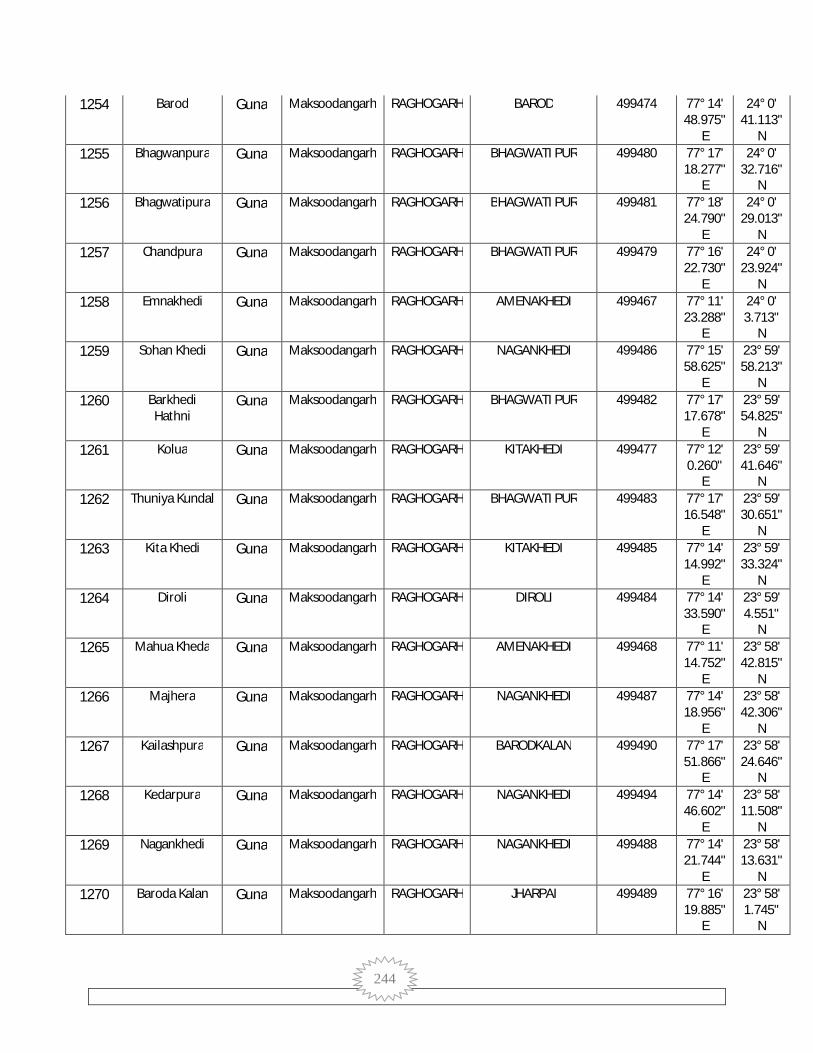
244
1254 Barod Guna Maksoodangarh RAGHOGARH BAROD 499474 77° 14' 48.975"
E
24° 0' 41.113"
N 1255 Bhagwanpura Guna Maksoodangarh RAGHOGARH BHAGWATI PUR 499480 77° 17'
18.277" E
24° 0' 32.716"
N 1256 Bhagwatipura Guna Maksoodangarh RAGHOGARH BHAGWATI PUR 499481 77° 18'
24.790" E
24° 0' 29.013"
N 1257 Chandpura Guna Maksoodangarh RAGHOGARH BHAGWATI PUR 499479 77° 16'
22.730" E
24° 0' 23.924"
N 1258 Emnakhedi Guna Maksoodangarh RAGHOGARH AMENAKHEDI 499467 77° 11'
23.288" E
24° 0' 3.713"
N 1259 Sohan Khedi Guna Maksoodangarh RAGHOGARH NAGANKHEDI 499486 77° 15'
58.625" E
23° 59' 58.213"
N 1260 Barkhedi
Hathni Guna Maksoodangarh RAGHOGARH BHAGWATI PUR 499482 77° 17'
17.678" E
23° 59' 54.825"
N 1261 Kolua Guna Maksoodangarh RAGHOGARH KITAKHEDI 499477 77° 12'
0.260" E
23° 59' 41.646"
N 1262 Thuniya Kundal Guna Maksoodangarh RAGHOGARH BHAGWATI PUR 499483 77° 17'
16.548" E
23° 59' 30.651"
N 1263 Kita Khedi Guna Maksoodangarh RAGHOGARH KITAKHEDI 499485 77° 14'
14.992" E
23° 59' 33.324"
N 1264 Diroli Guna Maksoodangarh RAGHOGARH DIROLI 499484 77° 14'
33.590" E
23° 59' 4.551"
N 1265 Mahua Kheda Guna Maksoodangarh RAGHOGARH AMENAKHEDI 499468 77° 11'
14.752" E
23° 58' 42.815"
N 1266 Majhera Guna Maksoodangarh RAGHOGARH NAGANKHEDI 499487 77° 14'
18.956" E
23° 58' 42.306"
N 1267 Kailashpura Guna Maksoodangarh RAGHOGARH BARODKALAN 499490 77° 17'
51.866" E
23° 58' 24.646"
N 1268 Kedarpura Guna Maksoodangarh RAGHOGARH NAGANKHEDI 499494 77° 14'
46.602" E
23° 58' 11.508"
N 1269 Nagankhedi Guna Maksoodangarh RAGHOGARH NAGANKHEDI 499488 77° 14'
21.744" E
23° 58' 13.631"
N 1270 Baroda Kalan Guna Maksoodangarh RAGHOGARH JHARPAI 499489 77° 16'
19.885" E
23° 58' 1.745"
N

245
1271 Kherad Guna Maksoodangarh RAGHOGARH KHERAD 499501 77° 10' 56.879"
E
23° 57' 54.485"
N 1272 Bilkheda Guna Maksoodangarh RAGHOGARH NAGANKHEDI 499495 77° 13'
3.868" E
23° 57' 41.325"
N 1273 Sundarpura Guna Maksoodangarh RAGHOGARH BARODKALAN 499491 77° 17'
29.216" E
23° 57' 30.257"
N 1274 Triloki Pura Guna Maksoodangarh RAGHOGARH BARODKALAN 499493 77° 15'
1.820" E
23° 57' 21.061"
N 1275 Raghunathpura Guna Maksoodangarh RAGHOGARH AHIRKHEDI 499496 77° 10'
45.863" E
23° 57' 4.989"
N 1276 Khejda Guna Maksoodangarh RAGHOGARH KARONDI 499517 77° 14'
10.684" E
23° 57' 5.423"
N 1277 Ukawad Guna Maksoodangarh RAGHOGARH UKAVAD 499492 77° 16'
15.237" E
23° 56' 44.291"
N 1278 Kajikheda Guna Maksoodangarh RAGHOGARH KANJIKHEDA 499497 77° 11'
5.939" E
23° 56' 40.565"
N 1279 Pipal Kheda Guna Maksoodangarh RAGHOGARH KARONDI 499516 77° 13'
39.753" E
23° 56' 37.251"
N 1280 Naseerpur Guna Maksoodangarh RAGHOGARH NASIRPUR 499498 77° 13'
2.430" E
23° 56' 17.670"
N 1281 Kadarpura Guna Maksoodangarh RAGHOGARH KARONDI 499515 77° 15'
32.395" E
23° 56' 17.574"
N 1282 Krondi Guna Maksoodangarh RAGHOGARH KARONDI 499514 77° 14'
26.117" E
23° 56' 3.310"
N 1283 Madhopura Guna Maksoodangarh RAGHOGARH KHERKHEDA 499519 77° 16'
31.606" E
23° 56' 0.466"
N 1284 Singrampur Guna Maksoodangarh RAGHOGARH KHERKHEDA 499520 77° 17'
47.547" E
23° 55' 59.676"
N 1285 Laxmanpura Guna Maksoodangarh RAGHOGARH VISHANKHEDA 499518 77° 15'
34.686" E
23° 55' 51.046"
N 1286 Shankarpura Guna Maksoodangarh RAGHOGARH VISHANKHEDA 499521 77° 16'
26.830" E
23° 55' 38.054"
N 1287 Shahpur Guna Maksoodangarh RAGHOGARH SHAHPURA 499502 77° 12'
53.119" E
23° 55' 33.532"
N

246
1288 Alampur Guna Maksoodangarh RAGHOGARH MAHU 499513 77° 14' 32.639"
E
23° 55' 32.905"
N 1289 Leg Nagar Guna Maksoodangarh RAGHOGARH VISHANKHEDA 499522 77° 16'
40.537" E
23° 55' 10.973"
N 1290 Rajpura Guna Maksoodangarh RAGHOGARH KANJIKHEDA 499499 77° 14'
6.025" E
23° 55' 7.071"
N 1291 Khair Kheda Guna Maksoodangarh RAGHOGARH KHERKHEDA 499525 77° 17'
35.556" E
23° 55' 1.867"
N 1292 Bishan Kheda Guna Maksoodangarh RAGHOGARH VISHANKHEDA 499523 77° 15'
5.356" E
23° 54' 58.225"
N 1293 Gunjari Guna Maksoodangarh RAGHOGARH VISHANKHEDA 499524 77° 14'
45.908" E
23° 54' 24.588"
N 1294 Barkhedi Ram Guna Maksoodangarh RAGHOGARH SHAHPURA 499504 77° 13'
8.056" E
23° 54' 13.041"
N 1295 Chopna Guna Maksoodangarh RAGHOGARH MAHU 499510 77° 17'
32.291" E
23° 54' 9.786"
N 1296 Lalpura Guna Maksoodangarh RAGHOGARH KHERKHEDA 499509 77° 18'
20.091" E
23° 54' 7.449"
N 1297 Teja Khedi Guna Maksoodangarh RAGHOGARH KANJIKHEDA 499500 77° 12'
12.628" E
23° 53' 47.999"
N 1298 Banskhedi Guna Maksoodangarh RAGHOGARH DURGAPURA 499507 77° 16'
40.349" E
23° 53' 43.178"
N 1299 Anderaya Alies
Balapura Guna Maksoodangarh RAGHOGARH MAHU 499508 77° 18'
24.281" E
23° 53' 41.519"
N 1300 Durgpura Guna Maksoodangarh RAGHOGARH DURGAPURA 499505 77° 14'
17.571" E
23° 53' 29.760"
N 1301 Mau Guna Maksoodangarh RAGHOGARH BADA AMALYA 499506 77° 16'
53.235" E
23° 53' 22.514"
N 1302 Bhairogarh Guna Maksoodangarh RAGHOGARH VIJAWADA 499410 77° 18'
40.684" E
24° 11' 40.630"
N 1303 Ramgarh Guna Maksoodangarh RAGHOGARH VAPCHA 499449 77° 15'
28.392" E
24° 5' 53.067"
N 1304 Gangna Guna Maksoodangarh RAGHOGARH MOHAMMADPUR 499437 77° 16'
52.653" E
24° 4' 56.340"
N

247
1305 Harikheda Guna Maksoodangarh RAGHOGARH GARKHEDA 499466 77° 11' 26.850"
E
24° 0' 35.899"
N 1306 Jamirajpura Guna Maksoodangarh RAGHOGARH SHAHPURA 499503 77° 11'
24.773" E
23° 56' 19.881"
N 1307 Sankta Guna Maksoodangarh RAGHOGARH MAHU 499512 77° 16'
3.185" E
23° 54' 17.463"
N 1308 Tanda Barri Guna Maksoodangarh RAGHOGARH KARONDI 499511 77° 15'
42.890" E
23° 53' 37.809"
N 1309 Guna CHACHAUDA 76° 59'
53.506" E
24° 11' 17.240"
N 1310 Guna (M) Guna GUNA 802401 77° 18'
7.070" E
24° 37' 38.460"
N 1311 Raghogarh -
Vijaypur (M) Guna RAGHOGARH 802402 77° 10'
38.718" E
24° 29' 4.455"
N 1312 Kumbhraj (NP) Guna CHACHAUDA 802403 77° 2'
26.344" E
24° 27' 16.701"
N 1313 Aron (NP) Guna ARON 802404 77° 25'
48.456" E
24° 22' 47.109"
N 1314 Chachaura-
Binaganj (NP) Guna CHACHAUDA 802405 76° 58'
27.927" E
24° 11' 10.160"
N