of the santa fe trail - nps.gov
TRANSCRIPT
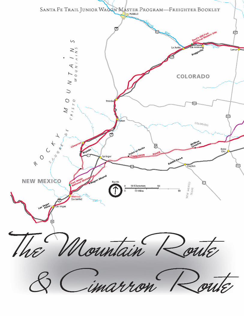
OF THE SANTA FE TRAILWhen traders moved west from Missouri on the Santa Fe Trail, they traveled out of the tall grass prairie and onto the buffalo grass-covered plains. In this area, there were buffalo herds, Plains Indians, and limited water sources. On William Becknells first trip in 1821, he brought a pack train of horses. He followed the Arkansas River west into present-day Colorado and then crossed the Sangre de Cristo Mountains into New Mexico. This became known as the Mountain Route or the Bent s Fort Route.
In 1822, William Becknell took his second trip with farm wagons. Because of the heavy load of his wagons, he took a different route. Becknell crossed the Arkansas River and moved the caravan toward the Cimarron River. Between the two stretches of the rivers, it was difficult to find
reliable water. Mexican traders called this area the Jornada, meaning “a days journey.” This part of the Santa Fe Trail became known as the Cimarron Route, and later the Cimarron Cutoff. Cimarron is a Spanish word for wild and unruly.
The Cimarron Crossing of the Arkansas River was the half-waypoint of the journey between Independence and Santa Fe. In the earlier years of the trail, the Arkansas River crossing was the international boundary between United States and Mexico. After the Mexican War in 1846- 1848, you didn't enter another country when crossing the Arkansas River. The United States now owned the beginning and the end of the trail territory. The Mountain and Cimarron Routes joined together at Fort Union in New Mexico before they entered into the city of Santa Fe.
Santa Fe Trail Junior Wagon Master Program—Freighter Booklet
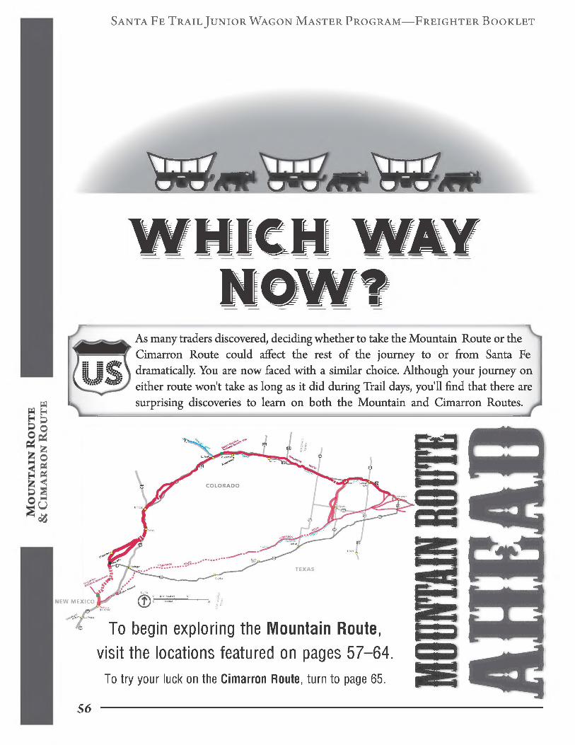
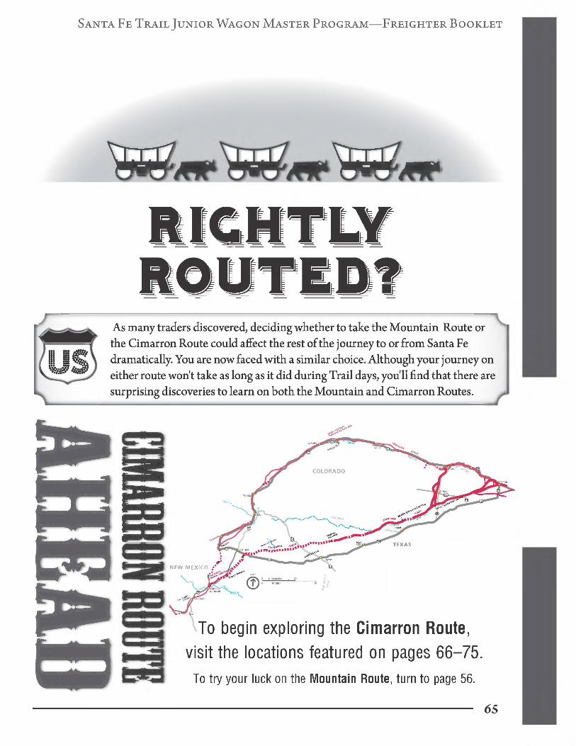
As many traders discovered, deciding whether to take the Mountain Route or the Cimarron Route could affect the rest of the journey to or from Santa Fe dramatically. You are now faced with a similar choice. Although your journey on either route won't take as long as it did during Trail days, you'll find that there are surprising discoveries to learn on both the Mountain and Cimarron Routes.
& C
ima
rr
on
Ro
ut
e
NEW MEX
To begin exploring the Mountain Route, visit the locations featured on pages 57-64.
To try your luck on the Cimarron Route, turn to page 65.
56

Santa Fe Trail Junior Wagon Master Program—Freighter Booklet
KANSAS (MOUNTAIN ROUTE)
US Hwy 50 to the town of Cimarron, Kansas. Turn south on KS Hwy 23, also called Main Street. Proceed through Cimarron to the south end of Main Street. Cimarron Crossing Park is on the right to the west
There are several places where the traders crossed the Arkansas River and headed southwest toward Santa Fe on the Cimarron Route. Three major areas to ford the river were used and known as the lower, middle,
and upper crossings, although there were several other crossings. Although Cimarron Crossing's middle crossing area was used most frequently, it was actually just one of the many river crossings.
Trade GoodsStudy the Kansas Historical Marker and then answer the questions below.
In 1824, what Trade Goods to Santa Fe Exchanged Goods to Missouri
trade goods were taken in wagons to Santa Fe?
& C
ima
rr
on
Ro
ut
e
What was brought back and sold in
Missouri?
Santa Fe Trail Association _57
Fort Dodge/Dodge City/Cimarron Chapter
Santa Fe Trail Junior Wagon Master Program—Freighter Booklet
on the mountain route
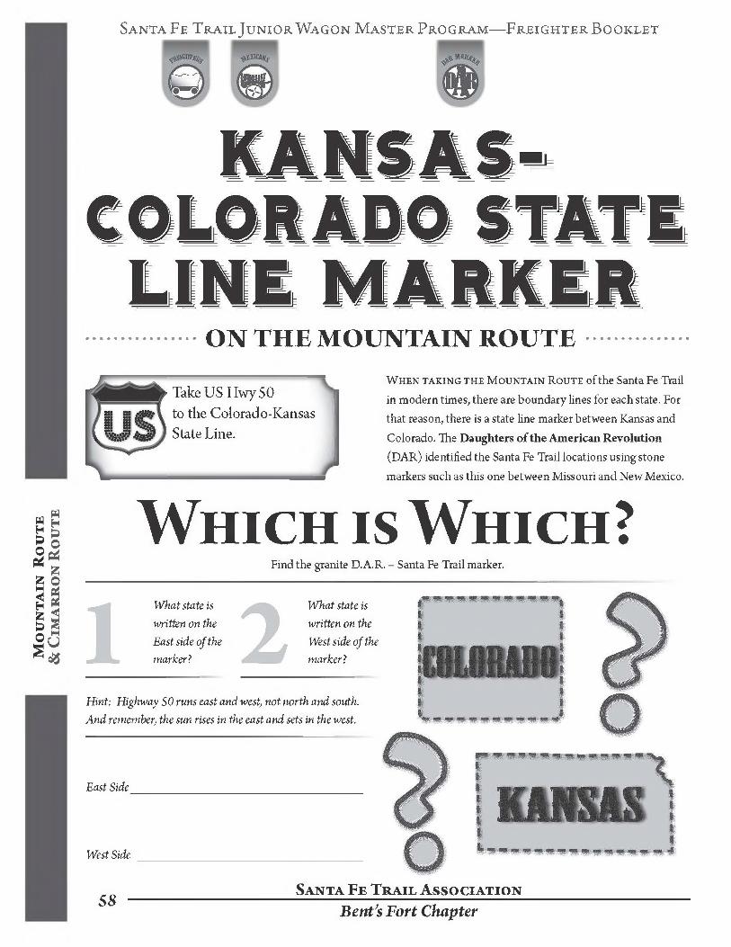
Take US Hwy 50 to the Colorado-Kansas State Line.
When taking the Mountain Route ofthe Santa Fe Trail in modern times, there are boundary lines for each state. For that reason, there is a state line marker between Kansas and Colorado. The Daughters of the American Revolution (DAR) identified the Santa Fe Trail locations using stone markers such as this one between Missouri and New Mexico.
Mo
un
ta
in Ro
ut
e
& C
ima
rr
on
Ro
ut
e Which is Which?Find the granite D.A.R. - Santa Fe Trail marker.
What state is written on the East side ofthe marker?
What state is written on the West side ofthe marker?
Hint: Highway 50 runs east and west, not north and south.
And remember, the sun rises in the east and sets in the west.
East Side___________________________________________
West Side __________________________________________
Santa Fe Trail Association$8 Bent's Fort Chapter
Santa Fe Trail Junior Wagon Master Program—Freighter Booklet
COLORADO (MOUNTAIN ROUTE)
Located in downtown Lamar, just east of Main Street (US Hwy 50/287) on East Beech Street The Colorado Visitors Center is in the old depot building.
109 E. Beech Street Lamar, CO 81052(719) 336-3483
Lamar, Colorado is south of the Arkansas River and near the Santa Fe Trail. Lamar was founded in 1886, after trading on the Santa Fe Trail was diminished due to the railroad reaching Santa Fe in 1880. The town was
organized by the Santa Fe Railroad as a rail head for shipping cattle. The National and the Goodnight cattle trails passed near here. Therefore, Lamar represents the end ofthe Santa Fe Trail era.
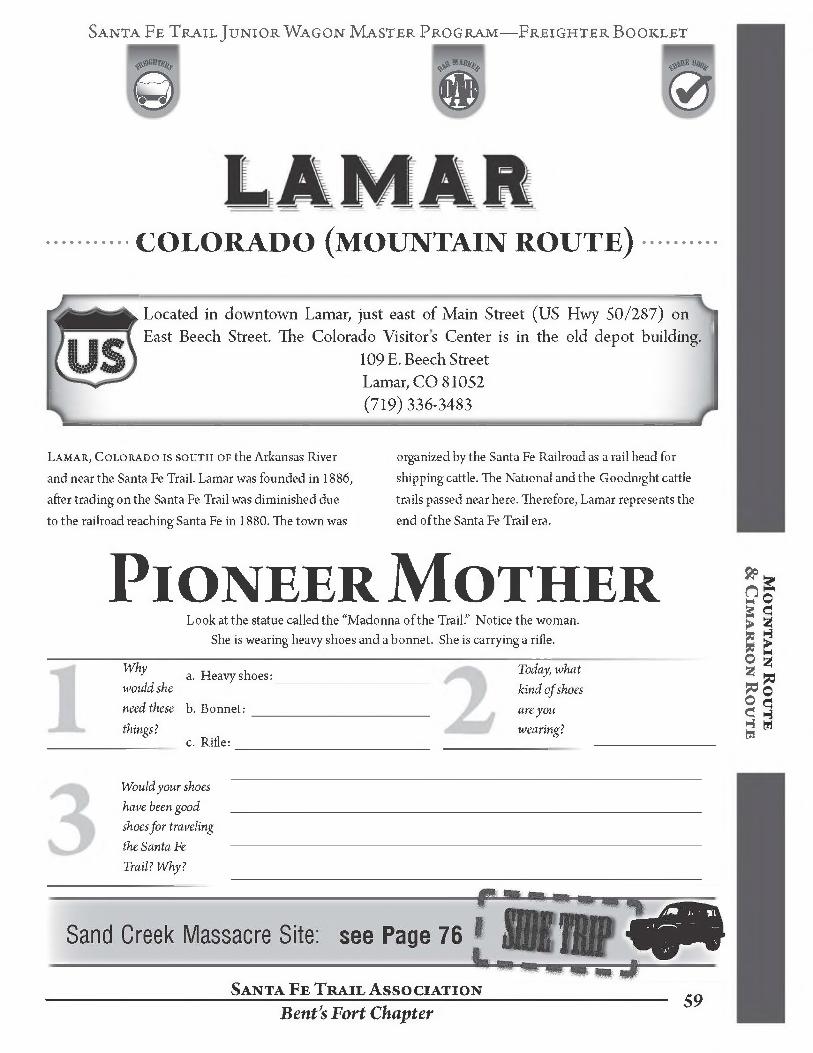
Pioneer MotherLook at the statue called the “Madonna ofthe Trail.” Notice the woman.
She is wearing heavy shoes and a bonnet. She is carrying a rifle.
Why
would she need these
things?
a. Heavy shoes:_______________________
b. Bonnet: __________________________
c. Rifle:_____________________________
Today, what kind of shoes are you wearing?
Mo
un
ta
in Ro
ut
e &
Cim
ar
ro
n Ro
ut
e
Would your shoes
have been good ______________________________________________________________________________shoes for traveling
the Santa Fe ------------------------------------------------------------------------------------------------------------------------Trail? Why?
Santa Fe Trail Association
Bent's Fort Chapter59
Santa Fe Trail Junior Wagon Master Program—Freighter Booklet
COLORADO (MOUNTAIN ROUTE)From La Junta, Colorado: from US Hwy 50; take CO 109 North one mile to CO 194, then east 6 miles. From Las Animas, Colorado: on U.S. Hwy 50 to CO 194, travel west 13 miles.
35110 CO Highway 194 East La Junta, CO 81050
(719) 383-5010
Mo
un
ta
in R
ou
te
&
Cim
ar
ro
n R
ou
te
The mountain route was the rugged, northern route
of the Santa Fe Trail. Brothers Charles and William Bent
and Ceran Saint Vrain built an adobe structure near the
Arkansas River in 1833. This structure came to be known
as Bent’s Old Fort, and is sometimes described as Castle
of the Plains. The adobe walls were fourteen feet high and
the central courtyard was surrounded by lower and upper
levels of rooms. Behind the fort, there was an adobe corral
for animals. On top of the high walls, prickly pear cacti
were planted to keep out invaders.
In the 1830 s and 1840’s, Bent’s Old Fort was on the
boundary line between the United States and Mexico. It
was six hundred miles from the nearest town in Missouri.
William Bent managed the fort and traded with Indians, Mexicans, and trappers for furs, mules, buffalo robes, blankets, and horses. It was a place for people to stop and rest while traveling on different trails. In 1846, Susan Magoffin, wife of a Santa Fe Trail trader, recovered from an injury here. In her diary, she left detailed descriptions of Bent’s Fort. Army Engineer, Lt. James Abert, a government map maker, drew detailed maps of the fort. Between these two fort visitors, Bent’s Fort could be reconstructed with great accuracy. William Bent abandoned this fort in 1849 and built Bent’s New Fort in 1853, forty miles downstream on the Arkansas River from his first fort. In 1976, the National Park Service reconstructed Bent’s Old Fort on the original location. Now it is called Bent’s Old Fort National Historic Site.
Visiting a National Historic SitePick up a Bent's Old Fort Junior Ranger booklet. Ask one of the staff members to sign this page. Enjoy your visit to the fort and consider the completion of the Junior Ranger booklet as part of the requirement for the Junior Wagon Master Program. Signature of Bent’s Old Fort staff member
Santa Fe Trail Association60 Bent’s Fort Chapter

Santa Fe Trail Junior Wagon Master Pro gram—FreighterBooklet
COLORADO (MOUNTAIN ROUTE)
From U.S. Hwy 50, turn south onto Bent's Avenue/Main Street of Las Animas, Colorado. Then proceed 2 miles south on CO 101. Boggsville will be on the northeast side of the road. The Pioneer Historical Society of Bent County now owns the Boggsville site and the Thomas Boggs and John Prowers houses have been structurally restored through fundraisings.
Boggsville, located on the Purgatoire River, was first used as a campsite by the Plains Indians. With the fur trade vanishing, many former mountain men found work raising livestock. Through his wife’s government land grant connections, Thomas Boggs started his ranch near the river on a branch of the Santa Fe Trail. It became known as Boggsville after he and his wife, Rumalda Luna
Bent Boggs, built their first ho me. John Wesley Prowers moved to the Boggs’s ranch in 1867 along with frontiersman Kit Carson and his family. A year later, with Carson in poor health, his wife, Josefa, died from childbirth complications. Kit died several weeks later at nearby Fort Lyon. Thomas Boggs was the executor of Carson's will.
What’s in a Name?Pick up tour brochures from the front porch of the Boggs House.
8i Cim
ar
ro
n Ro
ut
e
Santa Fe Trail Association Bent’s Fort Chapter
Santa Fe Trail Junior Wagon Master Program—Freighter Booklet
COLORADO (MOUNTAIN ROUTE)
Take 1-25 and US Proceed to 312 Main Contact the museum
Hwy350; US Hwy 350 becomes Main Street. Street. The complex is on the south side of the street, for information or appointments for off-season tours. 312 East Main Street, P.O. Box 377
Trinidad, Colorado 81082 (719)846-7217
Mo
un
ta
in R
ou
te
&
Cim
ar
ro
n R
ou
te
Trinidad, Colorado was founded iNl862by Felipe
Baca. This village sits at the base of Fishers Peakon the
Santa Fe Trail. All wagons going through Raton Pass to
Santa Fe came through the Trinidad area. The Trinidad
History Museum overlooks the Santa Fe Trail and is a
complex of four different attractions: the Baca House,
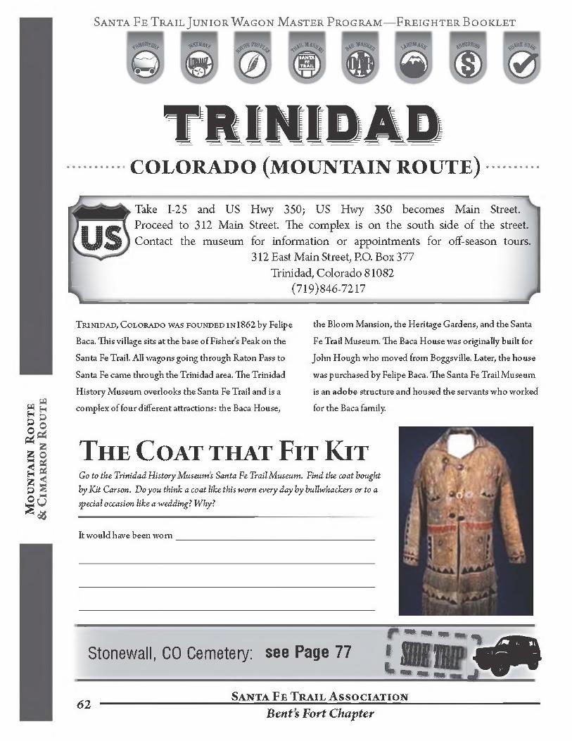
The Coat that Fit KitGo to the. Trinidad History Museums Santa Fe Trail Museum. Find the coat bought by Kit Carson. Do you think a coat like this worn every day by bullwhackers or to a special occasion like a wedding? Why?
It would have been worn__________________________________________
the Bloom Mansion, the Heritage Gardens, and the Santa
Fe Trail Museum. The Baca House was originally built for
John Hough who moved from Boggsville. Later, the house
was purchased by Felipe Baca. The Santa Fe Trail Museum
is an adobe structure and housed the servants who worked
for the Baca family.
Stonewall, CO Cemetery: see Page 77
Santa Fe Trail Association62Bents Fort Chapter
Santa Fe Trail Junior Wagon Master Program—Freighter Booklet
NEW MEXICO (mountain route)Travel along 1-25 and take Exit #366 at Watrous. Then turn west and
proceed eight miles on NM 161.P.O. Box 127, Watrous, New Mexico 87753
(505) 425-8025
During the forty years of its existence, Fort Union hosted three different forts. The first fort was established in 1851 and became the Military Department Headquarters, replacing Fort Marcy in Santa Fe. The fort was known as the "guardian of the Santa Fe Trail," protecting travelers from Indian raids. The first fort was built near the foot of the long ridge (west of the current Visitors’ Center) and some ruins can still be seen. This fort is open once a year for visitors. In 1861, the Star Fort east of the first fort was built.
This second earthwork structure had an eight-pointed star design. This was built as a defense fort during the Civil War although no Confederate attacks ever took
place at this site. In 1863, adjoining the Star Fort on the north, the third fort was built and became the largest military depot in the American Southwest. It functioned as a troop station for soldiers, and supply depot of goods and weapons for distribution to other Western forts. Fort
Union closed in 1891 after the railroad reached Watrous in 1879.
Visiting a National Historic SitePick up a Fort Union Junior Ranger booklet. Ask one of the staff7 members to sign this page. Enjoy your visit to the fort and the Junior Ranger booklet as part of the requirement for the Junior Wagon Master Program. Signature of Fort Union staff member
Corazon de los Caminos ChapterSanta Fe Trail Association
63
Santa Fe Trail Junior Wagon Master Program—FreighterBooklet
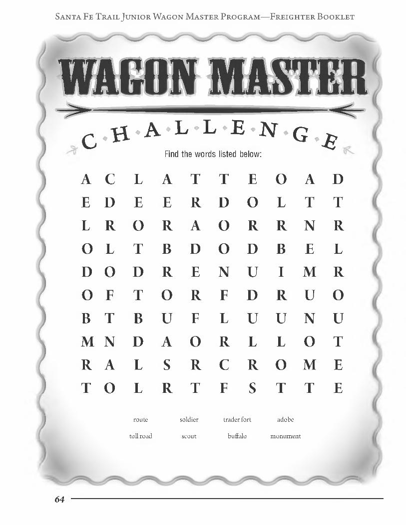
ChallengeFind the words listed below:
A С L A T T E О A DE D E E R D О L T TL R О R A О R R N RО L T В D О D В E LD О D R E N U I M RО F T О R F D R U ОВ T В U F L U U N UM N D A О R L L О TR A L S R C R О M ET О L R T F S T T E
soldier trader fort adobe
scout buffalo monument
route
toll road
64
Santa Fe Trail Junior Wagon Master Program—Freighter Booklet
As many traders discovered, deciding whether to take the Mountain Route or the Cimarron Route could affect the rest of the journey to or from Santa Fe dramatically. You are now faced with a similar choice. Although your journey on either route won’t take as long as it did during Trail days, you'll find that there are surprising discoveries to learn on both the Mountain and Cimarron Routes.
NEW MEXICO
TEXAS
To begin exploring the Cimarron Route, visit the locations featured on pages 66-75.
To try your luck on the Mountain Route, turn to page 56.
65
Santa Fe Trail Junior Wagon Master Program—Freighter Booklet
ELKHART, KANSAS (CIMARRON ROUTE)
& C
ima
rr
on
Ro
ut
e
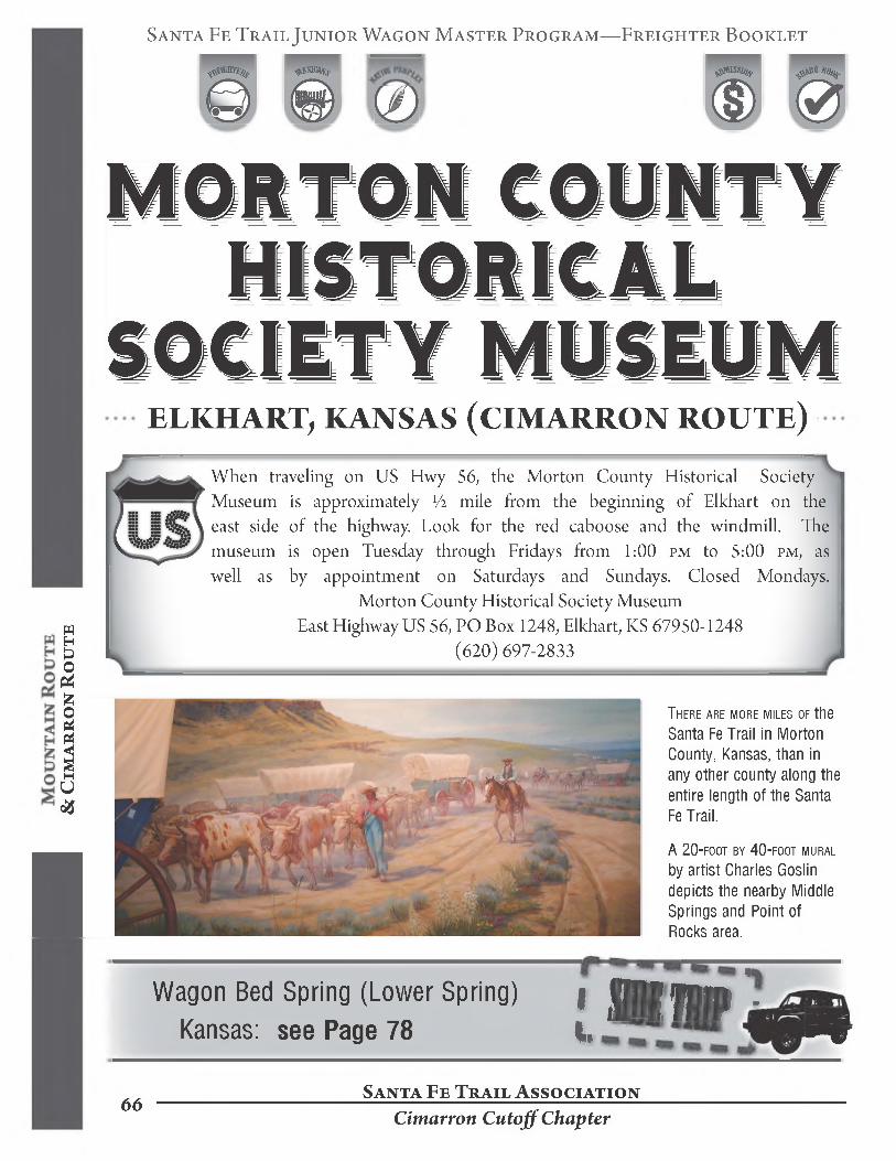
When traveling on US Hwy 56, the Morton County Historical Society Museum is approximately 1/2 mile from the beginning of Elkhart on the east side of the highway. Look for the red caboose and the windmill. The museum is open Tuesday through Fridays from 1:00 pm to 5:00 pm, as well as by appointment on Saturdays and Sundays. Closed Mondays.
Morton County Historical Society Museum East Highway US 56, PO Box 1248, Elkhart, KS 67950-1248
(620) 697-2833
There are more miles of the Santa Fe Trail in Morton County, Kansas, than in any other county along the entire length of the Santa Fe Trail.
A 20-foot by 40-foot mural by artist Charles Goslin depicts the nearby Middle Springs and Point of Rocks area.
Wagon Bed Spring (Lower Spring) Kansas: see Page 78
Santa Fe Trail Association66
Cimarron Cutoff Chapter
Santa Fe Trail Junior Wagon Master Program—FreighterBooklet
Animals on the Trail„ , _ _ List the different animals that you see. DoGo to the Santa Fe Trail room. ' 7
, з you think you could still see these animalsSit and look at the mural and z z,. out on the road today ?its surroundings. z
Mural
Animals
Seen by Trail Traveler? Yes or No
Draw your favorite animal below.
Seen today? Yes or No
Mo
un
ta
in Ro
ut
e &
Cim
ar
ro
n Ro
ut
e
Santa Fe Trail Association
Cimarron Cutoff Chapter67

Santa Fe Trail J uni or Wagon Master Program—Freighter Booklet
KANSAS (CIMARRON ROUTE)
& C
ima
rr
on
Ro
ut
e
To Middle Spring: From US Hwy 56 in Elkhart, Kansas, proceed to the traffic light and turn right on Morton Street, the main street of town. Go through the town and at the “T” intersection, turn right on Baca Street and join KS Hwy 27 heading north. You can miss going through town by taking KS Hwy 27 off US 56 and go north. At approximately eight miles north, cross the Cimarron River and see many limestone markers on both sides of the road showing you exactly where the Santa Fe Trail runs. One half mile past the bridge, turn left on a dirt road. This is USDA Forest Service land and is part of the Cimarron National Grassland. Proceed about two miles. A small road intercepts from the right or north. Turn right and go approximately 14 mile. Middle Spring is on the right.
To Point of Rocks: Go back to the intersection and turn right (west). There are more limestone markers here showing the trail. Go 1 1/2 miles to the top of the hill. Take the left fork into the Point of Rocks turn around
BEWARE OF RATTLESNAKES & WATCH WHERE YOU WALKMiddle Spring was a vital water stop on the Cimarron Route, also called the Dry Route. This area, fed by natural springs, had water all year long. There were three springs: the lower, middle and upper springs. The lower spring was also known as Wagon Bed Spring. The upper spring was known as Flag Spring. Middle Spring had no other name. Because the Cimarron River usually had no water at this point (it runs underground in this area), the springs were essential to survival on this route of the Santa Fe Trail.
Point of Rocks is a landmark. There are several places on the Santa Fe Trail called the Point of Rocks. From the top ofthe Point of Rocks, there is a good view ofthe Cimarron River valley and the many ruts passing between the base of the bluff and the river. Notice the series of little hills called the Cimarron Breaks. There is a steep hiking trail leading down the face of the bluff. At the bottom is a DAR marker, which was rededicated in 1997. When travelers on the trail saw the Point of Rocks, they knew they were close to finding water at Middle Spring.
Autograph Rock, Boise City, OK: see Page 79»Santa Fe Trail Association
68Cimarron Cutoff Chapter
Santa Fe Trail Junior Wagon Master Program—FreighterBooklet
As the River RunsGo to Point of Rocks. Stand on the point and look out.
Find the river. How do you
know where the river is?
I know the river is there because: _____________________________________________
________ Yes, I saw water in the Cimarron River bed.
________ No, I didn’t see water in the Cimarron Riverbed.
Is there water in the Cimarron River?
Try drawing the Cimarron River in the space below.
Mo
un
ta
in Ro
ut
e &
Cim
ar
ro
n Ro
ut
e

Santa Fe Trail Junior Wagon Master Program—Freighter Booklet
NEW MEXICO (CIMARRON ROUTE)
From Boise City, Oklahoma: Leave Boise City on US 412/56/64 toward Clayton, New Mexico. Continue for approximately 40 miles. Turn right on NM 406/NM 18. Continue to follow NM 406 for 18 1/2 miles.
Traveling from Clayton, New Mexico: Go east out of the town of Clayton on Main Street/US 412/56/64 for a little over three miles. Turn left on NM 406/NM 18. Continue to follow NM 406 for 18 1/2 miles.
Mo
un
ta
in R
ou
te
Turn right into the pasture. THIS IS PRIVATE PROPERTY. PLEASE CLOSE THE GATE BEHIND YOU, as there could be livestock in the pasture. Follow the ranch road for a little over 1/2 mile, passing the stock tank and windmill. Park your car near the tall square monument. Walk down the dirt ramp to the crossing. .
BEWARE OF RATTLESNAKES & WATCH WHERE YOU WALKMcNees Crossing is a rock bed crossing on the North Canadian River. Other crossing places had only dirt bottoms and wagons would get stuck, so most travelers preferred to cross here. If you stand on the rock bed edge of the river and lookup the hill and to the east, you can see ruts coming into the crossing from two sides of the hill. Look at the riverbed—some say the marks in the rocks are from the heavy wagons that crossed here. The dirt ramp leading down to the crossing has been cut by all of the wagon traffic - this cut is 25 feet wide and eight feet deep.
In the fall of 1828, two scouts for a wagon train heading from Santa Fe to Missouri went ahead of the train to see if there was water and grass for all of the animals on
70
the wagon train. These scouts were Robert McNees and Daniel Monroe. There was water and grass, so the two men sat down on the bank of the river to rest and wait for the wagon train to arrive.
They fell asleep. An Indian hunting party came across the men. McNees was killed and Monroe was severely wounded. The wagon train found the two men and buried McNees somewhere in this area. Monroe was put aboard a wagon and cared for as the train continued northward. He did not survive his wounds and died when the train was near the Cimarron River. The deaths of these men caused the traders to ask the army for more protection.
Santa Fe Trail Association
Cimarron Cutoff Chapter

Santa Fe Trail Junior Wagon Master Program—Freighter Booklet
Watching for the Wagon Train
Walk down to the North Canadian River crossing. With your parents help, look across and up the hill to the right. You can see the ruts coming down to the crossing. Imagine you are a scout watching the train arrive.
I see:
What do What do What doyou see? you hear? you smell?
Would you want to take a nap here?
I hear: ___________________________________________________________________________________________
I smell:___________________________________________________________________________________________
Mo
un
ta
in Ro
ut
e &
Cim
ar
ro
n Ro
ut
e
I would_______would not_______ take a nap here because________________________________________________
Santa Fe Trail Association---------------------------------------------------------------------------------------------------------- 71
Cimarron Cutoff Chapter
Santa Fe Trail Junior Wagon Master Program—Freighter Booklet
NEW MEXICO (CIMARRON ROUTE)
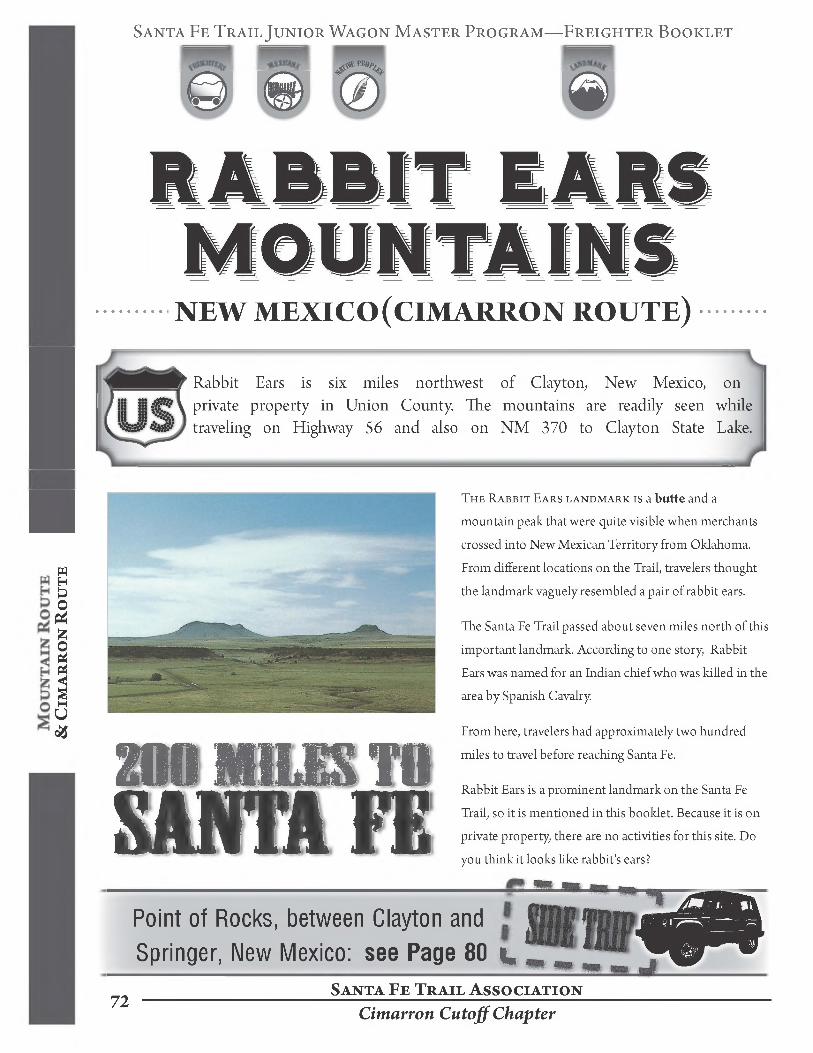
Rabbit Ears is six miles northwest of Clayton, New Mexico, on private property in Union County The mountains are readily seen while traveling on Highway 56 and also on NM 370 to Clayton State Lake.
& C
ima
rr
on
Ro
ut
e
200 MILES TOSanta Fe
The Rabbit Ears landmark is a butte and a
mountain peak that were quite visible when merchants
crossed into New Mexican Territory from Oklahoma.
From different locations on the Trail, travelers thought
the landmark vaguely resembled a pair of rabbit ears.
The Santa Fe Trail passed about seven miles north of this
important landmark. According to one story, Rabbit
Ears was named for an Indian chief who was killed in the
area by Spanish Cavalry
From here, travelers had approximately two hundred
miles to travel before reaching Santa Fe.
Rabbit Ears is a prominent landmark on the Santa Fe
Trail, so it is mentioned in this booklet. Because it is on
private property, there are no activities for this site. Do
you think it looks like rabbit's ears?
Point of Rocks, between Clayton and Springer, New Mexico: see Page 80
Santa Fe Trail Association72
Cimarron Cutoff Chapter

Santa Fe Trail Junior Wagon Master Program—Freighter Booklet
Rabbit EarsU
и
))

Santa Fe Trail Junior Wagon Master Program—Freighter Booklet
NEW MEXICO (CIMARRON ROUTE)
Travel on 1-25 and then take exit number 387 for Wagon Mound Drive through the town of Wagon Mound on NM 120 for a distance of approximately seven-tenths of a mile. Finally, turn right into the cemeteries
Wagon Mound is a volcanic rock landmark and from a distance it reminded travelers on the Santa Fe Trail of a large wagon pulled by draft animals. A spring at the base of the mountain made it an excellent rest stop and camp site.
Near here, in 1849, a Jicarilla Apache princess and daughter of Chief Lobo Blanco was killed while in the custody of the U.S. Army
& C
ima
rr
on
Ro
ut
e Tales of Two Cemeteries
The village of Wagon Mound in Mora County was first settled in the 1860 s. East of the village are two cemeteries. The cemetery on the left is called the Protestant Hillside Cemetery. The cemetery on the right is called the Catholic Santa Clara Cemetery.In the Catholic cemetery, there is a white tombstone ofthe Santa Fe Trail freighter Charles Fraker who was active in the Trail trade during the later years. The two cemeteries reflect two cultures involved in trade on the Santa Fe Trail.
At the same place in May of 1850, ten teamsters accompanying a mail wagon were attacked and killed by Chief Lobo Blanco and his warriors in retaliation for the death of his daughter.
Days later, a military patrol came upon the scattered remains and government mail. This was the first attack on a mail wagon on the Santa Fe Trail.
With some pieces of paper and the side ofthe crayon, make four stone rubbings, two from each cemetery. Use gravestones of people who would have lived during the Santa Fe Trail from 1821 to
1880. Label your stone rubbings with the name ofthe cemetery, you name, and today's date. Place them in the pocket of your folder.
Santa Fe Trail Association 74 Corazon de los Caminos Chapter
Santa Fe Trail Junior Wagon Master Program—Freighter Booklet
NEW MEXICO (CIMARRON ROUTE)To reach Las Vegas, New Mexico, drive on 1-25. Take exit number 345. Keep right at the fork to go on NM 65/W/E University Ave. Go 1/2 mile and turn right onto 7th Street/NM-518/NM-65. Turn left onto National Ave/NM-65; go 1/2 mile. Turn right onto N. Gonzales Street/Plaza Street. The plaza is on the left.
The translation of Las Vegas from the Spanish is “the meadows.” In this area, William Becknell and his men came through a gap from the Sangre de Cristo Mountains and were met by a Mexican military patrol and their commander in 1821. Becknell s group was escorted to Santa Fe to sell their goods. Mexico had won its independence from Spain and Santa Fe was now open to trade with the Americans.
Las Vegas was established in 1835 after a group of settlers received a land grant from the Mexican government. The Santa Fe Trail went through the old original settlement plaza, in the center of town, which was a key trading spot on the Santa Fe Trail. For eastern traders, Las Vegas was the town toward the end of the Trail. For western traders, it was first town after leaving Santa Fe.
During the 1846 Mexican-American War, General Stephen Watts Kearny, came down the mountain route and marched his army to the central plaza. On top of a flat roof, he announced that Las Vegas was now the property of the United States. His army came through the same gap as Becknell. It is now known as Kearny’s Gap.
Between Las Vegas and Mora sits the mountain of Hermit’s Peak. In the mid 1860s, Giovanni Maria Augustini from Italy lived on the summit in a cave.He traveled from Council Grove with a Santa Fe Trail caravan and lived as a hermit on this mountain. He claimed to be a holy man and carved trinkets and traded them for food. He left this area and moved to the Organ Mountains in southern New Mexico. Augustini was murdered in 1869.
Bridge to History
Mo
un
ta
in Ro
ut
e &
Cim
ar
ro
n Ro
ut
e
Walk back to the bridge over the Gallinas River on National Avenue. Watch out for cars. There are three inscriptions on the bridge.
What are the topics of these three inscriptions?
Circle the topics which are related to the Santa Fe Trail.
Kearny’s Gapsee Page 81
a.
b.
c.
Santa Fe Trail Association
Corazon de los Caminos Chapter 75
Santa Fe Trail Junior Wagon Master Program—FreighterBooklet
Explore More—Take a Santa Fe TrailIf you're near Lamar (page 59) visit:
Sand Creek Massacre National Historic Site
The Sand Creek Massacre Site is a National Park Service site in Kiowa County, Colorado. To visit the site, follow Colorado State Hwy 96 east off Hwy 287 near Eads, or west off Hwy 385 at Sheridan Lake. Near Chivington, turn north onto County Road (CR) 54/Chief White Antelope Way or at Brandon, turn north onto CR 59. Follow these roads to their intersections with CR W. The park entrance is along CR Wa mile east (right) of CR 54 or several miles west (left) of CR 59.
910 Wansped, Eads, Colorado 81036 (714) 729-3003
During the 1850’s and 1860’s, the population growth of the Colorado Territory increased due to the discovery of gold and silver in the Rocky Mountains. The Colorado Territory Governor, John Evans, wanted the Cheyenne and Arapaho hunting grounds available for white development. The Indians refused to sell their lands and move to the reservations for settlement. The angered Indians attacked wagon trains, stagecoach lines, and mining camps. The governor requested that Coloneljohn Chivington and his volunteer militiamen go out and talk to the Indians about giving up their lands. At Camp Weld, outside of Denver, the Indian representatives met with Evans and Chivington on September 28,1864.
No treaties were signed and the Cheyenne and Arapaho, thinking they would have protection of Fort Lyon, traveled to Sand Creek to set-up their village. Chivington knew that the Indians had surrendered. On November 29,1864, under Chivington's command, around seven hundred men from the Colorado Territory Militia attacked and destroyed an encampment of Cheyenne and Arapaho Indians at Sand Creek in southeastern Colorado Territory. Over one hundred Indians were killed: most ofthem were old men, woman, and children, including Cheyenne Chief Yellow Wolf as well as his brother. Chivington resigned from military service but he was never convicted for the Sand Creek killings.
Santa Fe Trail Association 76
Bent's Fort Chapter
Santa Fe Trail Junior Wagon Master Program—Freighter Booklet
If you're near Trinidad (page 62) visit:
Photo Filename/Date:
Stonewall Cemetery, Colorado
Take CO 12 west of Trinidad approximately forty miles to the town of Stonewall. Just before the town on the north side of the road is the unmarked entrance gate. The dirt road leads to the cemetery which is one-half mile from the highway. Please close all gates after passing through in your vehicle.
Marion Sloan (Russell) was born onjanuary 26,1845, in Peoria, Illinois. In 1852, Marion and her brother, Will, accompanied their mother, Eliza, on a trip to California going down the Santa Fe Trail. Due to a robbery in Albuquerque, Eliza did not take the children to California but instead ran a boarding house in both Albuquerque and Santa Fe. This was one ofthe five trips that Marion took on the Santa Fe Trail from childhood through her teenage years. In Santa Fe, Marion was one of the few Anglo-Americans to attend the Loretto Academy for girls. During her stay in New Mexico Territory, she met Kit Carson and French Bishop Jean-Baptiste Lamy.
Marion found her true love when she and her mother were living at Fort Union where Marion's mom cooked for unmarried officers. Marion married Richard Russell at the Fort Union Chapel in 1865 and spent her honeymoon at Camp Nichols in Oklahoma Territory. When Richard was mustered out ofthe army, they established a trading post along with partner Mr.
Santa Fe Trail Association
Bents Fort Chapter
De Hague at Tecolote on the Santa Fe Trail south of Las Vegas. After DeHague ran away with the store's money, the Russell family sold the trading post and moved to southern Colorado just west of Trinidad. Here they established a cattle ranch and called it Stonewall. During the Maxwell land grant disputes, Marion Sloan (Russell) s husband was shot while carrying a white flag of truce as he walked toward the hotel to have a meeting with the land grant committee. He died five days later and was buried in the Stonewall Cemetery. Marion continued to raise her children and live on the ranch. In her later years, she went over the Santa Fe Trail again but this time in an automobile. Marion dictated her memoirs to her daughter-in-law, Winnie Russell, and this book is called The Land of Enchantment which gives the modern reader vivid descriptions of the Santa Fe Trail era. In 1936, Marion died of injuries from a car accident at the age of ninety-one and is buried alongside her husband in the Stonewall Cemetery.
77
Santa Fe Trail Junior Wagon Master Program—Freighter Booklet
Explore More—Take a Santa Fe Trail
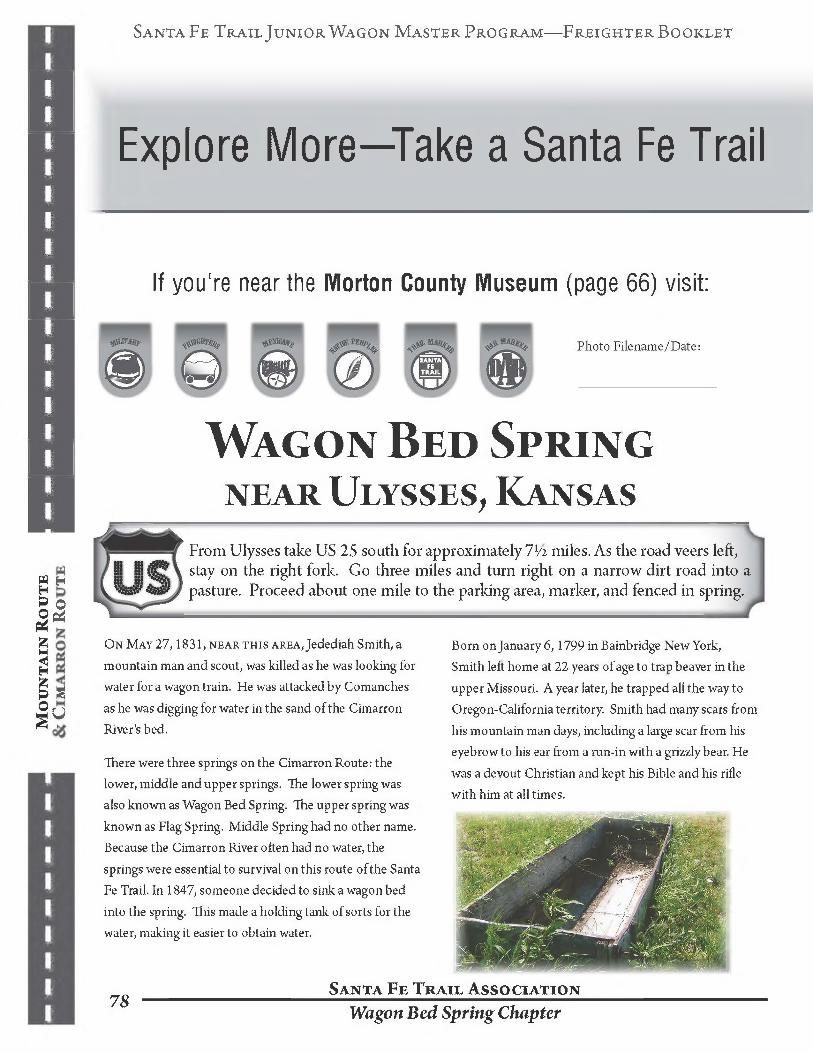
If you're near the Morton County Museum (page 66) visit:
Wagon Bed Springnear Ulysses, Kansas
Mo
un
ta
in R
ou
te
From Ulysses take US 25 south for approximately 7 1/2 miles. As the road veers left, stay on the right fork. Go three miles and turn right on a narrow dirt road into a pasture. Proceed about one mile to the parking area, marker, and fenced in spring.
On May 27,1831, near this area, Jedediah Smith, a mountain man and scout, was killed as he was looking for water for a wagon train. He was attacked by Comanches as he was digging for water in the sand of the Cimarron River's bed.
There were three springs on the Cimarron Route: the lower, middle and upper springs. The lower spring was also known as Wagon Bed Spring. The upper spring was known as Flag Spring. Middle Spring had no other name. Because the Cimarron River often had no water, the springs were essential to survival on this route of the Santa Fe Trail. In 1847, someone decided to sink a wagon bed into the spring. This made a holding tank of sorts for the water, making it easier to obtain water.
Born on January 6,1799 in Bainbridge New York,Smith left home at 22 years of age to trap beaver in the upper Missouri. A year later, he trapped all the way to Oregon-California territory. Smith had many scars from his mountain man days, including a large scar from his eyebrow to his ear from a run-in with a grizzly bear. He was a devout Christian and kept his Bible and his rifle with him at all times.
Santa Fe Trail Asso ciation 7S Wagon Bed Spring Chapter

Santa Fe Trail Junior Wagon Master Program—FreighterBooklet
If you're near Middle Spring & Point of Rocks, KS (page 68) visit:
Photo Filename/Date:
Autograph Rocknear Boise City, Oklahoma
From Boise City, Oklahoma, take 325 West four miles to 23 Rd. Turn right on 23 Rd. Proceed four miles. Pavement ends. Turn Left on EW 15 Rd. At the “T” turn right on NS 21 Road. Proceed to Sharps Ranch.YOU ARE REQUIRED TO SET UP AN APPOINTMENT BEFORE
SEEING THIS SITE, WHICH IS ON PRIVATE PROPERTY.To set up an appointment please call one of two of the following organizations:
Cimarron Heritage Center Cimarron County Chamber of Commerce1300 N Cimarron Street 6 North East SquareBoise City, OK 73933 Boise City, OK 73933
(580) 544-3479 (580) 544-3344
Mo
un
ta
in Ro
ut
e
Cold Springs Creek, a tributary of the Cimarron River, was a well-known campsite located in what became known as the Panhandle of Oklahoma. People camped here because of the nearness of water and protection from attack by the high cliffs. Numerous people carved their names on the sandstone wall of the cliffs. The signatures came from soldiers, teamsters, gold seekers, and others
traveling on the Santa Fe Trail. Because of all the names carved in the rock, Cold Springs Creek became known as Autograph Rock. The name written most often was F. B. Delgado. He owned a mule and ox train that freighted up and down on the trail. Autograph Rock is part of the Santa Fe National Historic Trail and is located on a ranch owned by Dan and Carol Sharp.
79Santa Fe Trail Association
Cimarron Cutoff Chapter
Santa Fe Trail Junior Wagon Master Program—Freighter Booklet
Explore More—Take a Santa Fe Trail
If you're passing Rabbit Ears (page 72) keep going to visit:
Point of RocksBetween Clayton & Springer, NM
Located in Colfax County, approximately 25 miles northeast of Springer. To access the site, proceed approximately 20 miles east from Springer along US Hwy 56 (Santa Fe Trail) to County Road C-52 (Windmill Road), at mile marker 23. Turn north and travel for approximately seven miles on C 52. Between miles six and seven, there is a deep swale that crosses the road. Turn right (northeast) on C 54 and drive two miles, turn North one mile to the site.
HCR 60, Box 27, Springer, New Mexico 87747
BEWARE OF RATTLESNAKES & WATCH WHERE YOU WALK
Points of Rocks, New Mexico, is a mesa above low and rolling hills with a spring at its base. Next to the mesa on the eastern side is a landmark, the ridge of Hogback Butte. Santa Fe Trail caravans and Indian buffalo hunting parties would camp near the rocks which provided an excellent view of the Rocky Mountains plus a year-round spring available to the campers. This was also near the site of the White Family Ambush in 1849 by Jicarilla Apache Indians. They killed six people includingjames White and William Callaway and captured Ann White
and her daughter. Kit Carson guided the military party to the Apache camp to rescue mother and daughter but Mrs. White was found dead. The child was never found.In present day, one can see the following: Jicarilla Apache Indian tipi-ring marks in the rocks, Santa Fe Trail ruts, the grave of Isaac Allen who died in 1848 and eleven unmarked graves. It is located on the ranch of Faye Gaines and the late Pete Gaines in Colfax County. Even though this site is on private land, access is unrestricted. An outdoor kiosk along with a picnic shelter is also on the site.
Santa Fe Trail Association Corazon de los Caminos Chapter

Santa Fe Trail Junior Wagon Master Program—FreighterBooklet
If you're near Las Vegas (page 75) visit:
Kearny’s GapFrom the southwest corner of the plaza proceed out Pacific Street to Hwy NM 85 (Grand Avenue). Turn right on NM 85, when approaching the Interstate 25 ramp, go left and follow the frontage road (do not take the 1-25 on-ramp). After passing under the interstate highway, turn right; continue for two-tenths of a mile and turn right again, going back over the interstate (NM 283). Continue to follow the road toward the gap between the two mountains. Stop at the marker on the right side of the road. Go back the way you came in—there is no alternate route back to 1-25
William Becknell and fellow Missouri traders passed through this spot on November 13,1821. It was here that they were met by Mexican militia under the command of Captain Pedro Gallego. Becknell officially learned that Mexico was no longer controlled by Spain. The militia escorted the traders into Santa Fe and thus started the international trade route between the United States and Mexico.
In 1846, during the Mexican-American War, General Stephen W. Kearny’s famed Army of the West also passed through this area. They were on their way to declare Santa Fe as part ofthe United States.
Santa Fe Trail Association
U.S. Flag of 1846
Corazon de los Caminos Chapter81