october 3, 2006 outreach updates climate science in the public interest uw climate impacts group...
Post on 22-Dec-2015
215 views
TRANSCRIPT

October 3, 2006www.cses.washington.edu/cig
Outreach Updates
Climate Science in the Public Interest
http://www.yakima.net/ UW Climate Impacts Group UW Climate Impacts Group
UW Climate Impacts Group
UW Climate Impacts Group
UW Climate Impacts Group
Lara Whitely Binder
Climate Impacts Group
Center for Science in the Earth System
October 3, 2006

October 3, 2006www.cses.washington.edu/cig
The importance of adaptation

October 3, 2006www.cses.washington.edu/cig
Why Adaptive Planning?
• Decisions with long-term impacts are being made every day
• Significant impacts of climate change projected within decades, i.e., the timescale of adaptation planning
• Significant time is required for motivating and developing adaptive capacity and for implementing changes
• Increasing evidence that it will cost more to retrofit for climate resilience than to build it in in the first place

October 3, 2006www.cses.washington.edu/cig
Setting the course for adaptation: A guidebook for planning for climate change
• Provides detailed description of why and how to prepare for global warming at the local/regional scale
• Collaboration between UW Climate Impacts Group and King County, Washington
• To be published by ICLEI – Local Governments for Sustainability
• Anticipated completion date: Late 2006
Common barriers to planning for climate change – and their antidotes
Strategies for reviewing current policies and procedures for implementing adaptive responses
Strategies for developing interest and support for planning
Tips for managing the risk & uncertainty associated with global warming
Guidelines for identifying, reviewing and applying scientific information on climate impacts in your region
Sector-specific adaptation strategies and planning resources
Content includes

October 3, 2006www.cses.washington.edu/cig
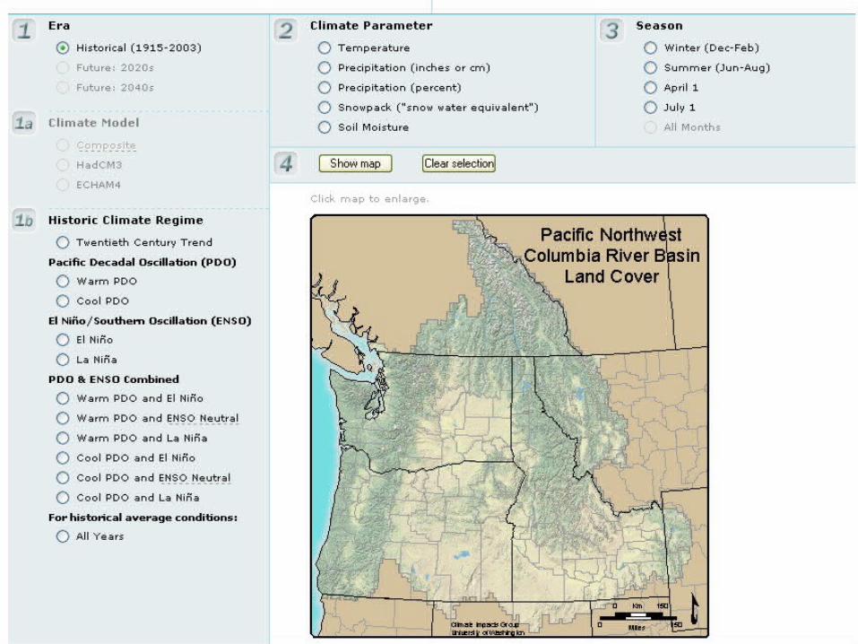
PNW Climate Maps
• GIS tool delivers sub-regionally based information on climate and climate impacts.
• Mapping past and future patterns of PNW climate, including future climate scenarios.
• Numerous data layers:– Elevation, hydrography (rivers/lakes),
watershed boundaries, vegetation and land cover, soils, land ownership, political boundaries
• Benefit: Designed to aid planning efforts by providing information about the patterns of variability and change at a variety of spatial scales
October 3, 2006www.cses.washington.edu/cig

October 3, 2006www.cses.washington.edu/cig

October 3, 2006www.cses.washington.edu/cig
More information on PNW climate impacts and planning for climate change is available from
The Climate Impacts Group
www.cses.washington.ed/cig