obis, a global biodiversity data-sharing platform for abnj
TRANSCRIPT

Ocean Biogeographic Information SystemA global biodiversity data-sharing platform
Photo credits Sonke Johnsen and Charles Messing
IOC side event BBNJ 23 June 2015, Paris
Ward Appeltans
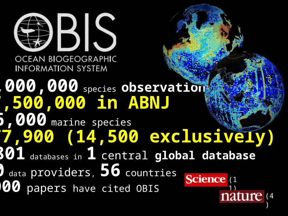
43,000,000 species observations7,500,000 in ABNJ116,000 marine species77,900 (14,500 exclusively)1,801 databases in 1 central global database500 data providers, 56 countries
1,000 papers have cited OBIS(11)
(4)

Census of Marine Life2000 - 2010
OBIS was established as the data repository and information dissemination system for
CoML
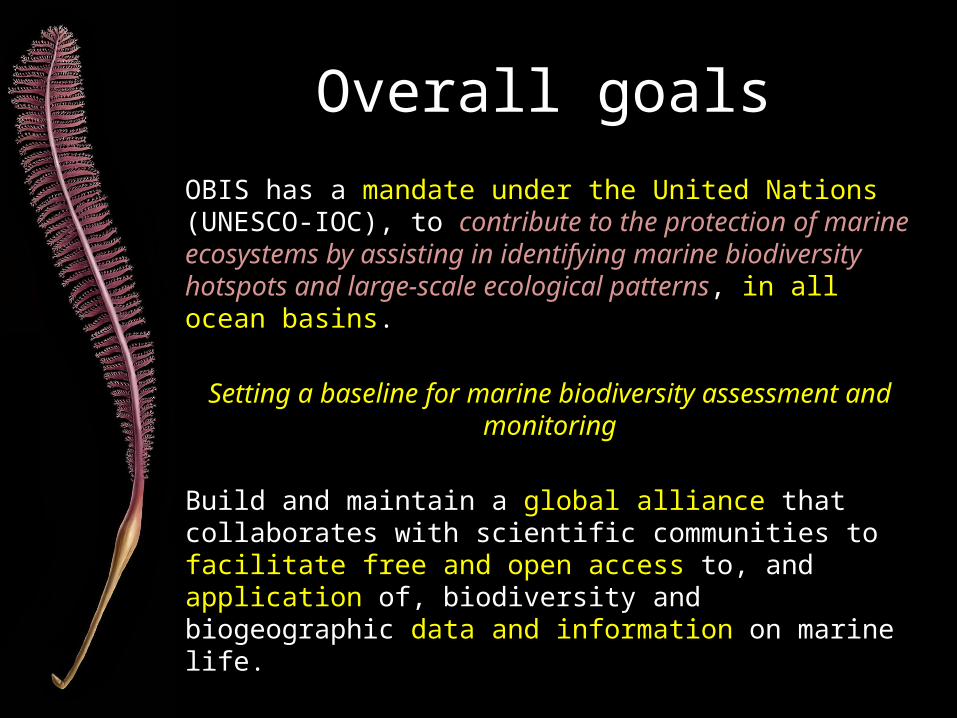
Overall goals
OBIS has a mandate under the United Nations (UNESCO-IOC), to contribute to the protection of marine ecosystems by assisting in identifying marine biodiversity hotspots and large-scale ecological patterns, in all ocean basins.
Setting a baseline for marine biodiversity assessment and monitoring
Build and maintain a global alliance that collaborates with scientific communities to facilitate free and open access to, and application of, biodiversity and biogeographic data and information on marine life.
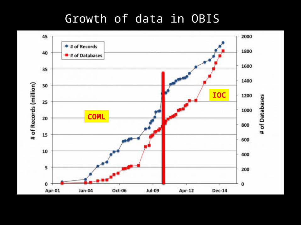
Growth of data in OBIS
COML
IOC
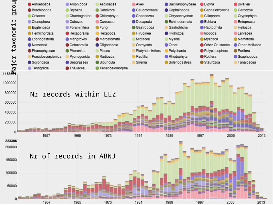
Nr records within EEZ
Nr of records in ABNJ
Maj
or ta
xono
mic
gro
ups
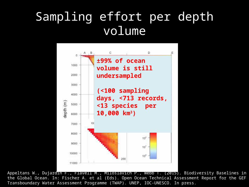
Sampling effort per depth volume
Appeltans W., Dujardin F., Flavell M., Miloslavich P., Webb T. (2015). Biodiversity Baselines in the Global Ocean. In: Fischer A. et al (Eds). Open Ocean Technical Assessment Report for the GEF Transboundary Water Assessment Programme (TWAP). UNEP, IOC-UNESCO. In press.
±99% of ocean volume is still undersampled
(<100 sampling days, <713 records, <13 species per 10,000 km3)
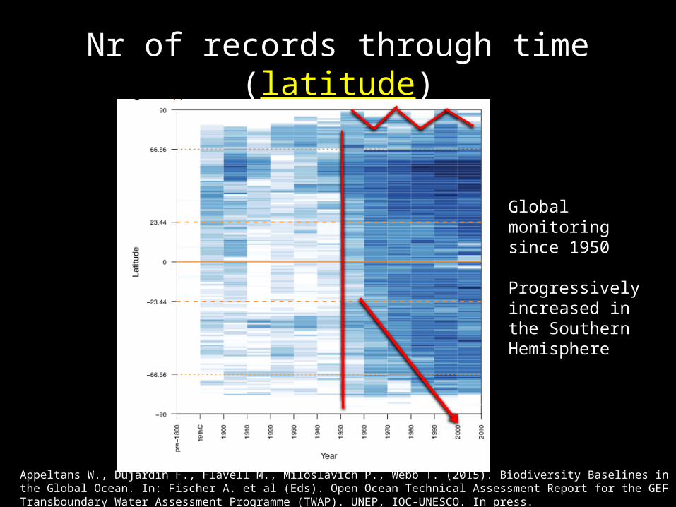
Nr of records through time (latitude)
Global monitoring since 1950
Progressively increased in the Southern Hemisphere
Appeltans W., Dujardin F., Flavell M., Miloslavich P., Webb T. (2015). Biodiversity Baselines in the Global Ocean. In: Fischer A. et al (Eds). Open Ocean Technical Assessment Report for the GEF Transboundary Water Assessment Programme (TWAP). UNEP, IOC-UNESCO. In press.
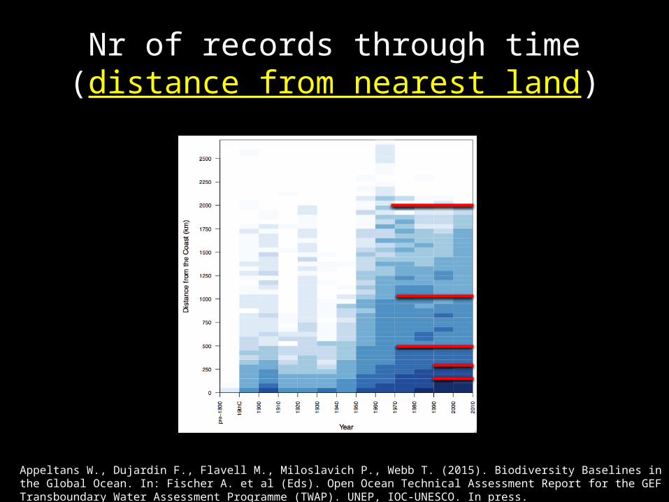
Nr of records through time (distance from nearest land)
Appeltans W., Dujardin F., Flavell M., Miloslavich P., Webb T. (2015). Biodiversity Baselines in the Global Ocean. In: Fischer A. et al (Eds). Open Ocean Technical Assessment Report for the GEF Transboundary Water Assessment Programme (TWAP). UNEP, IOC-UNESCO. In press.
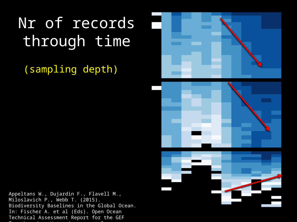
Nr of records through time(sampling depth)
Appeltans W., Dujardin F., Flavell M., Miloslavich P., Webb T. (2015). Biodiversity Baselines in the Global Ocean. In: Fischer A. et al (Eds). Open Ocean Technical Assessment Report for the GEF Transboundary Water Assessment Programme (TWAP). UNEP, IOC-UNESCO. In press.
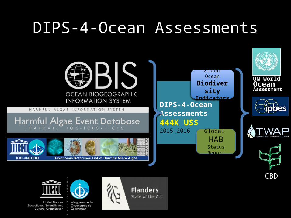
DIPS-4-Ocean Assessments
DIPS-4-Ocean Assessments444K US$2015-2016 Global
HABStatus Report
Global Ocean
BiodiversityIndicators
UN WorldOceanAssessment
CBD
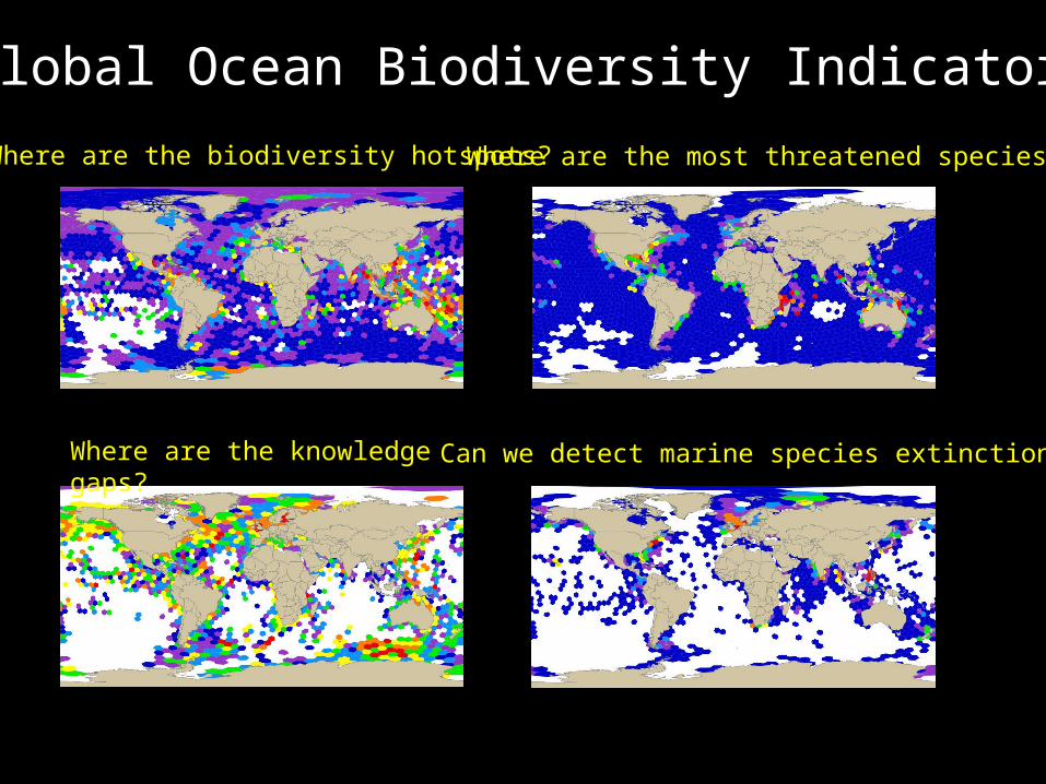
Global Ocean Biodiversity Indicators
Where are the biodiversity hotspots?
Where are the knowledge gaps?
Where are the most threatened species?
Can we detect marine species extinctions?
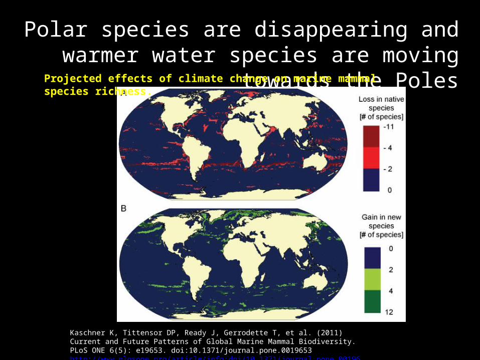
Polar species are disappearing and warmer water species are moving towards the Poles
Kaschner K, Tittensor DP, Ready J, Gerrodette T, et al. (2011) Current and Future Patterns of Global Marine Mammal Biodiversity. PLoS ONE 6(5): e19653. doi:10.1371/journal.pone.0019653http://www.plosone.org/article/info:doi/10.1371/journal.pone.0019653
Projected effects of climate change on marine mammal species richness.

Wisz et al. Nature Climate Change 5, 261–265 (2015)
Arctic warming will promote Atlantic–Pacific fish interchange
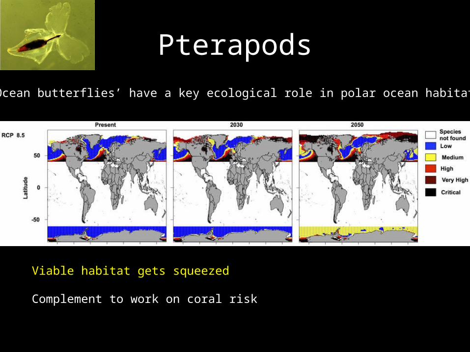
Pterapods‘Ocean butterflies’ have a key ecological role in polar ocean habitats
Viable habitat gets squeezed
Complement to work on coral riskIllustrative of knowledge gap
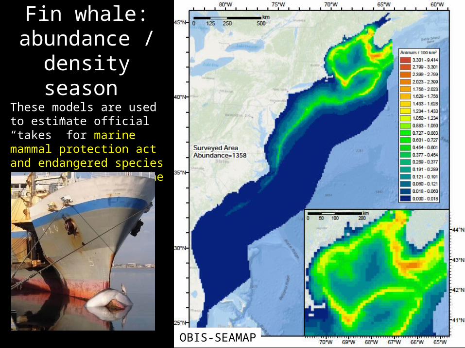
Fin whale: abundance /
density season These models are used to estimate official “takes” for marine mammal protection act and endangered species act regulations in the USA
OBIS-SEAMAP
From Dunn et al. 2011
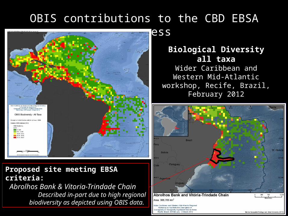
OBIS contributions to the CBD EBSA process
Biological Diversity all taxaWider Caribbean and Western Mid-Atlantic workshop, Recife,
Brazil, February 2012
Proposed site meeting EBSA criteria: Abrolhos Bank & Vitoria-Trindade ChainDescribed in-part due to high regional biodiversity
as depicted using OBIS data.
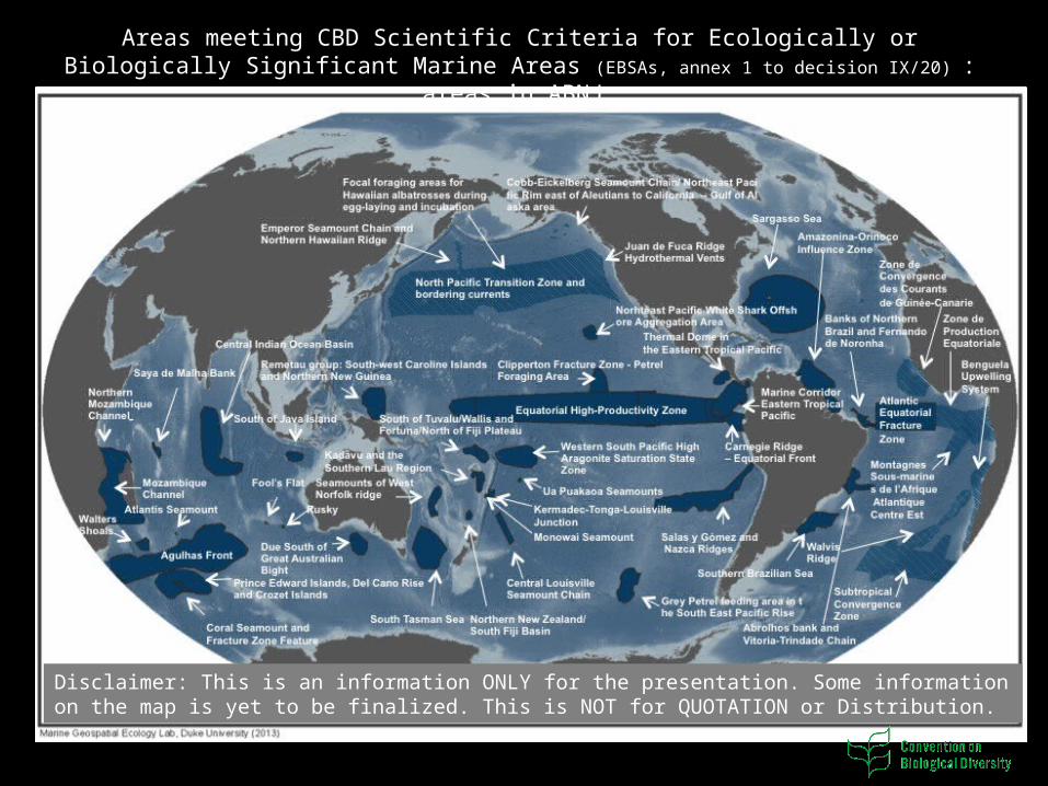
Disclaimer: This is an information ONLY for the presentation. Some information on the map is yet to be finalized. This is NOT for QUOTATION or Distribution.
Areas meeting CBD Scientific Criteria for Ecologically or Biologically Significant Marine Areas (EBSAs,
annex 1 to decision IX/20) : areas in ABNJ
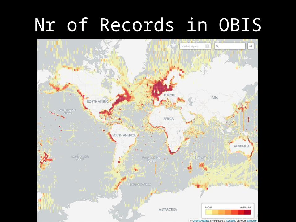
Nr of Records in OBIS
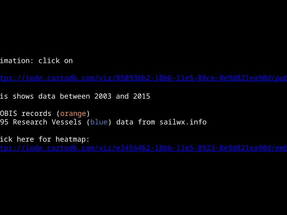
Animation: click on
https://iode.cartodb.com/viz/850936b2-18b6-11e5-88ce-0e9d821ea90d/public_map
This shows data between 2003 and 2015
• OBIS records (orange)• 95 Research Vessels (blue) data from sailwx.info
Click here for heatmap:https://iode.cartodb.com/viz/e3456462-18bb-11e5-8923-0e9d821ea90d/embed_map

95 Research Vessels (2003-2015)
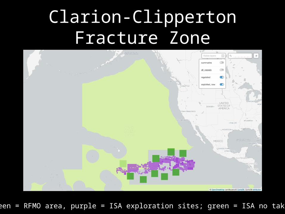
Clarion-Clipperton Fracture Zone
Light green = RFMO area, purple = ISA exploration sites; green = ISA no take zones
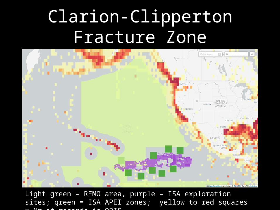
Clarion-Clipperton Fracture Zone
Light green = RFMO area, purple = ISA exploration sites; green = ISA APEI zones; yellow to red squares = Nr of records in OBIS
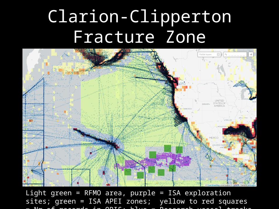
Clarion-Clipperton Fracture Zone
Light green = RFMO area, purple = ISA exploration sites; green = ISA APEI zones; yellow to red squares = Nr of records in OBIS; blue = Research vessel tracks
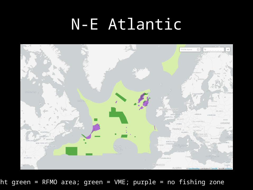
N-E Atlantic
Light green = RFMO area; green = VME; purple = no fishing zone

N-E Atlantic
Light green = RFMO area; green = VME; purple = no fishing zone; yellow to red squares = Nr of records in OBIS
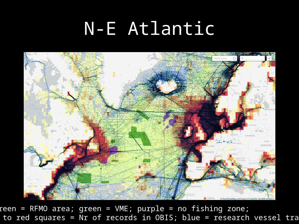
N-E Atlantic
Light green = RFMO area; green = VME; purple = no fishing zone; yellow to red squares = Nr of records in OBIS; blue = research vessel tracks

S-E Atlantic
Light green = RFMO area; green = VME; purple = no fishing zone;

S-E Atlantic
Light green = RFMO area; green = VME; purple = no fishing zone; yellow to red squares = Nr of records in OBIS
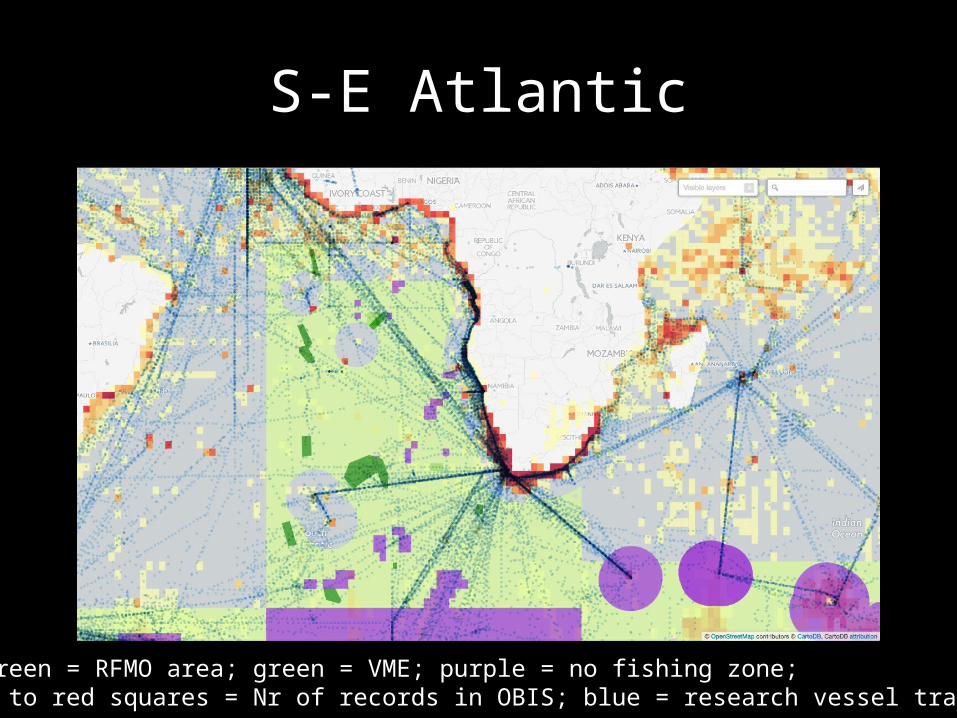
S-E Atlantic
Light green = RFMO area; green = VME; purple = no fishing zone; yellow to red squares = Nr of records in OBIS; blue = research vessel tracks
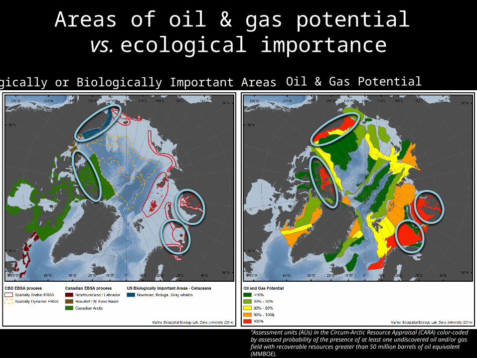
Areas of oil & gas potential vs. ecological importance
Ecologically or Biologically Important Areas Oil & Gas Potential
"Assessment units (AUs) in the Circum-Arctic Resource Appraisal (CARA) color-coded by assessed probability of the presence of at least one undiscovered oil and/or gas field with recoverable resources greater than 50 million barrels of oil equivalent (MMBOE).
USGS 2008/2011. Circum-Arctic Resource Appraisal: Estimates of undiscovered oil and gas north of the Arctic Circle.
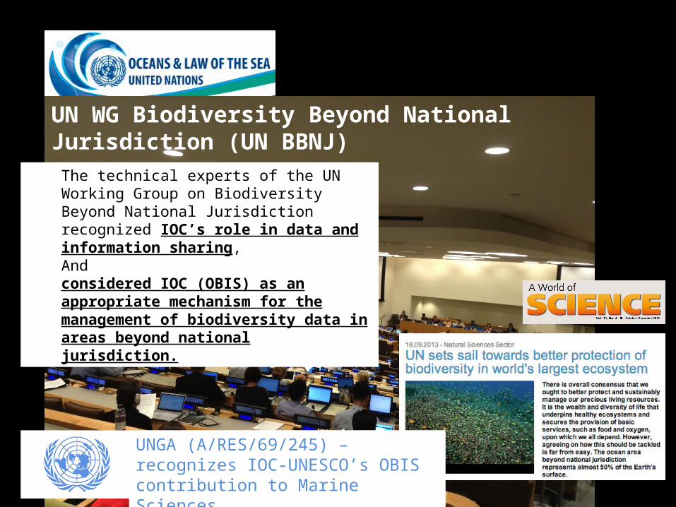
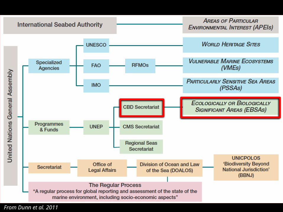
UN WG Biodiversity Beyond National Jurisdiction (UN BBNJ)
The technical experts of the UN Working Group on Biodiversity Beyond National Jurisdiction recognized IOC’s role in data and information sharing, And considered IOC (OBIS) as an appropriate mechanism for the management of biodiversity data in areas beyond national jurisdiction.
UNGA (A/RES/69/245) – recognizes IOC-UNESCO’s OBIS contribution to Marine Sciences
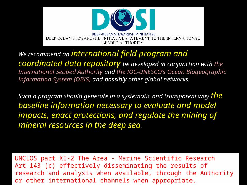
We recommend an international field program and coordinated data repository be developed in conjunction with the International Seabed Authority and the IOC-UNESCO's Ocean Biogeographic Information System (OBIS) and possibly other global networks.
Such a program should generate in a systematic and transparent way the baseline information necessary to evaluate and model impacts, enact protections, and regulate the mining of mineral resources in the deep sea.
UNCLOS part XI-2 The Area - Marine Scientific Research Art 143 (c) effectively disseminating the results of research and analysis when available, through the Authority or other international channels when appropriate.

Benefit sharing : funding a global deep-ocean data repository