nsgic march 9, 2008 1 advancing statewide spatial data infrastructures in support of the national...
TRANSCRIPT

NSGIC March 9, 2008NSGIC March 9, 2008 11
Advancing Statewide Spatial Data Advancing Statewide Spatial Data Infrastructures in Support of the National Infrastructures in Support of the National
Spatial Data Infrastructure (NSDI)Spatial Data Infrastructure (NSDI)
Developing StrategicDeveloping Strategic (and Business) (and Business) PlansPlans
March 2008March 2008

© Applied Geographics, 2006, 2008© Applied Geographics, 2006, 2008 NSGIC March 25, 2008NSGIC March 25, 2008 22
IntroductionsIntroductions
• Michael TernerMichael Terner, Executive Vice President, Executive Vice President• Steve AndersonSteve Anderson, Vice President, Vice President
• Also with us is Also with us is Rich GradyRich Grady, President, President
Boston, Massachusettswww.appgeo.comwww.appgeo.com

NSGIC March 9, 2008NSGIC March 9, 2008 33
AgendaAgenda
8:30 : 8:508:30 : 8:50 FGDC Intro FGDC Intro
8:50 : 9:208:50 : 9:20 Strategic Plan TemplateStrategic Plan Template
9:20 : 9:509:20 : 9:50Lessons LearnedLessons Learned
9:50 : 10:059:50 : 10:05 Questions and AnswersQuestions and Answers
*** B R E A K ****** B R E A K ***
10:30 : 11:4510:30 : 11:45 Business Planning SessionBusiness Planning Session

© Applied Geographics, 2006, 2008© Applied Geographics, 2006, 2008 NSGIC March 25, 2008NSGIC March 25, 2008 44
CAP Grant Supported Strategic CAP Grant Supported Strategic Planning in a nutshellPlanning in a nutshell
• FGDCFGDC wants to create a National Spatial Data Infrastructure wants to create a National Spatial Data Infrastructure ((NSDI)NSDI)
• State Spatial Data Infrastructure State Spatial Data Infrastructure SSDI’sSSDI’s are are criticalcritical to success to success of NSDIof NSDI
• Strategic Strategic planningplanning will aid will aid process process of building SSDI’sof building SSDI’s
• Thus,Thus, states states need to need to self-assessself-assess and developand develop a strategica strategic plan plan
• FGDCFGDC willwill SupportSupport Strategic Planning via Strategic Planning via CAP grantsCAP grants
• BUT, FGDC wants strategic BUT, FGDC wants strategic plansplans to be to be similarsimilar in structure in structure• Allowing state-by-state Allowing state-by-state comparison/contrastcomparison/contrast
• In partnership with In partnership with NSGICNSGIC they created they created templatestemplates• And require their use for CAP supported Strategic PlanningAnd require their use for CAP supported Strategic Planning

© Applied Geographics, 2006, 2008© Applied Geographics, 2006, 2008 NSGIC March 25, 2008NSGIC March 25, 2008 55
What was done to create templates?What was done to create templates?
• Multi-state steering committee guidanceMulti-state steering committee guidance Key guidance: Key guidance: “One size does “One size does notnot fit all” fit all”
• Document ReviewDocument Review Other Strategic & Business Plans, I-PlansOther Strategic & Business Plans, I-Plans
• Including: NC, GA, IN, KY, ME, OR, CT, RI, MD, MAIncluding: NC, GA, IN, KY, ME, OR, CT, RI, MD, MA
• Review past experiencesReview past experiences By contractorsBy contractors By committee membersBy committee members
• Drafted TemplatesDrafted Templates
• WIKI: CollaborationWIKI: Collaboration To edit and refine contentTo edit and refine content Process commentsProcess comments
• Produced Final DocsProduced Final Docs Approved by NSGIC/FGDCApproved by NSGIC/FGDC

© Applied Geographics, 2006, 2008© Applied Geographics, 2006, 2008 NSGIC March 25, 2008NSGIC March 25, 2008 66
• OneOne Strategic PlanStrategic Plan, potentially , potentially manymany Business PlansBusiness Plans
• Strategic PlanStrategic Plan • WhatWhat and and WhyWhy• Vision & GoalsVision & Goals• The “big picture” and overall contextThe “big picture” and overall context
• Business PlanBusiness Plan • How, WhenHow, When, and , and How MuchHow Much• Aimed at those who approve and fundAimed at those who approve and fund• Details of initiative(s) emergeDetails of initiative(s) emerge• Presented as a business casePresented as a business case
• Strategic planning process determinesStrategic planning process determineswhich business plan comes firstwhich business plan comes first
The NSGIC TemplatesThe NSGIC TemplatesThe one-two punch of Strategic & Business PlansThe one-two punch of Strategic & Business Plans

© Applied Geographics, 2006, 2008© Applied Geographics, 2006, 2008 NSGIC March 25, 2008NSGIC March 25, 2008 77
To implement a Statewide Spatial Data Infrastructure (SSDI)
consistent with appropriate national standards
Primary Strategic Goal
GOAL 1:Establish GIO position, clarify
statutory authority
GOAL 2:Develop improved
statewide elevation data
GOAL 3:Pursue goal 3
Business Plan DetailsBusiness Plan DetailsBusiness Plan DetailsBusiness Plan Details
SP
SP
BP
BPProgrammatic Goals
Strategic Plan vs. Business PlanStrategic Plan vs. Business Plan
• Business plans should relate to Strategic objectivesBusiness plans should relate to Strategic objectives• Business Plans come from goals• You can have more then one Business PlanYou can have more then one Business Plan
Benefits
Justification
ROI
Cost/Benefit
Implementation PlanCosts
Requirements
Risks

© Applied Geographics, 2006, 2008© Applied Geographics, 2006, 2008 NSGIC March 25, 2008NSGIC March 25, 2008 88
Strategic Planning ContextStrategic Planning Context
• Take an overall look at GIS in Take an overall look at GIS in My StateMy State• GIS GIS success storiessuccess stories at all levels of government at all levels of government
What are the ingredients for success?What are the ingredients for success?
• Identify Identify challenges and gapschallenges and gaps What are these and how do we overcome them?What are these and how do we overcome them?
• How does How does My StateMy State fit into the larger national picture fit into the larger national picture and relevant Federal initiativesand relevant Federal initiatives• National Spatial Data Infrastructure (NSDI)National Spatial Data Infrastructure (NSDI)
• Strategic Planning Process must be “locally relevant”Strategic Planning Process must be “locally relevant”• It can’t be just about NSDIIt can’t be just about NSDI
© Applied Geographics, 2006, 2008© Applied Geographics, 2006, 2008 NSGIC March 25, 2008NSGIC March 25, 2008 99
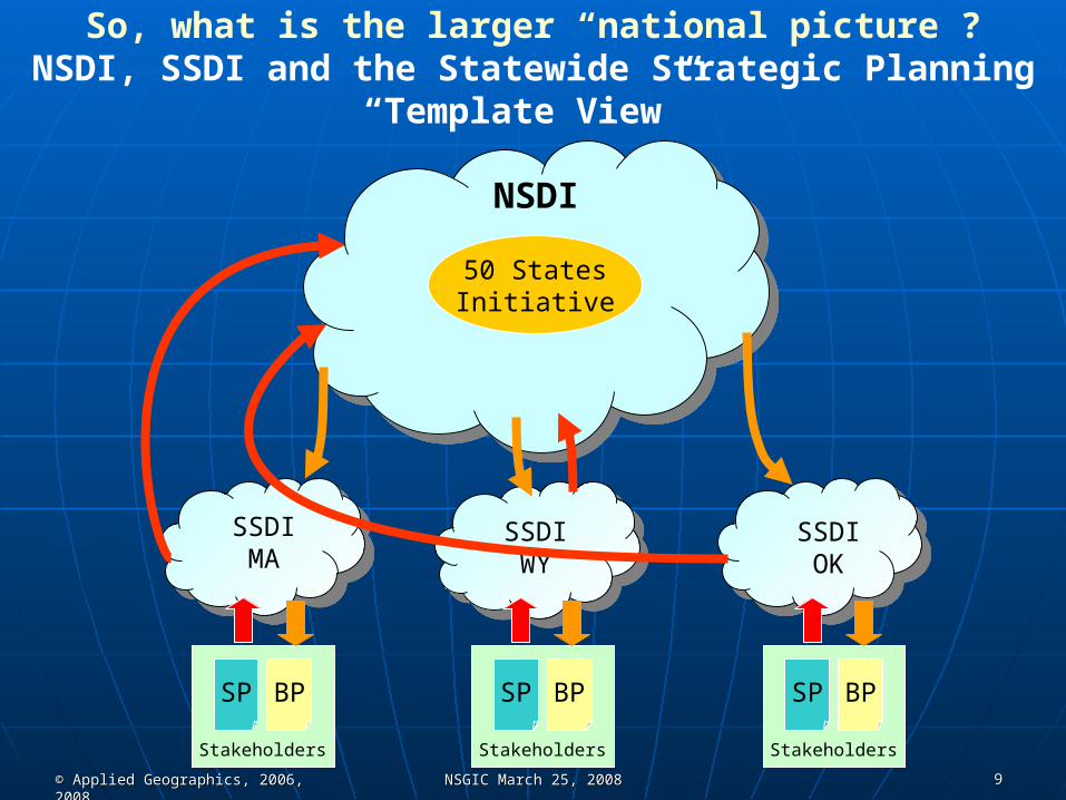
So, what is the larger “national picture”?NSDI, SSDI and the Statewide Strategic Planning
“Template View”
NSDI
50 StatesInitiative
SSDIMA
SSDIWY
SSDIOK
SP BP
Stakeholders
SP BP
Stakeholders
SP BP
Stakeholders

© Applied Geographics, 2006, 2008© Applied Geographics, 2006, 2008 NSGIC March 25, 2008NSGIC March 25, 2008 1010
NSDI
50 StatesInitiative
SSDICA
SSDINC
SSDINew York
Rye
New York City
WestchesterCounty• Data sharing between levels Data sharing between levels
of governmentof government• The best data are localThe best data are local• Local rolls up to regional/stateLocal rolls up to regional/state• States roll up to NationalStates roll up to National
FederalFederal Centric Outlook: Centric Outlook:NSDI and Statewide Spatial NSDI and Statewide Spatial
Data InfrastructuresData Infrastructures

© Applied Geographics, 2006, 2008© Applied Geographics, 2006, 2008 NSGIC March 25, 2008NSGIC March 25, 2008 1111
NSDI
50 StatesInitiative
SSDICA
SSDINJ
New YorkStatewide Spatial
Data Infrastructure(NYSSDI)
Rye
ClintonCounty
Westchester County
• Data sharing between Data sharing between levels of governmentlevels of government• The best data are localThe best data are local
• Local rolls up to regional/stateLocal rolls up to regional/state
• SSDI’s linked to other state SDI’s SSDI’s linked to other state SDI’s and National SDIand National SDI
New York City
Albany
State Centric Outlook:State Centric Outlook: Statewide Spatial Data Infrastructure Statewide Spatial Data Infrastructure
Makes Sense for States!Makes Sense for States!Courtesy of Bill Johnson, NYCSCICCourtesy of Bill Johnson, NYCSCIC

© Applied Geographics, 2006, 2008© Applied Geographics, 2006, 2008 NSGIC March 25, 2008NSGIC March 25, 2008 1212
NSDI Supply Chain OutlookNSDI Supply Chain Outlook
NSDI Goal: Cross-Governmental Data Sharing
DATA CONSUMERS
LOCAL STATE FEDERAL
DATA PRODUCERS

© Applied Geographics, 2006, 2008© Applied Geographics, 2006, 2008 NSGIC March 25, 2008NSGIC March 25, 2008 1313
What is the What is the PurposePurpose of a of a Strategic PlanStrategic Plan??
• Identify and articulate a Identify and articulate a VisionVision
• Identify and articulate Identify and articulate Long Term GoalsLong Term Goals
• Determine Determine ProgrammaticProgrammatic Goals Goals• What needs to happen to achieve the long-term Vision?What needs to happen to achieve the long-term Vision?
• Identifies Identifies RisksRisks
• Develop Develop StrategiesStrategies for for Overcoming RisksOvercoming Risks
• Provide a Provide a ProcessProcess or or Feedback LoopFeedback Loop for Adjustmentfor Adjustment• The process itself is valuableThe process itself is valuable
• Engage stakeholder communityEngage stakeholder community“Plans are nothing;
planning is everything”
http://www.whitehouse.gov/history/presidents/de34.html
© Applied Geographics, 2006, 2008© Applied Geographics, 2006, 2008 NSGIC March 25, 2008NSGIC March 25, 2008 1414
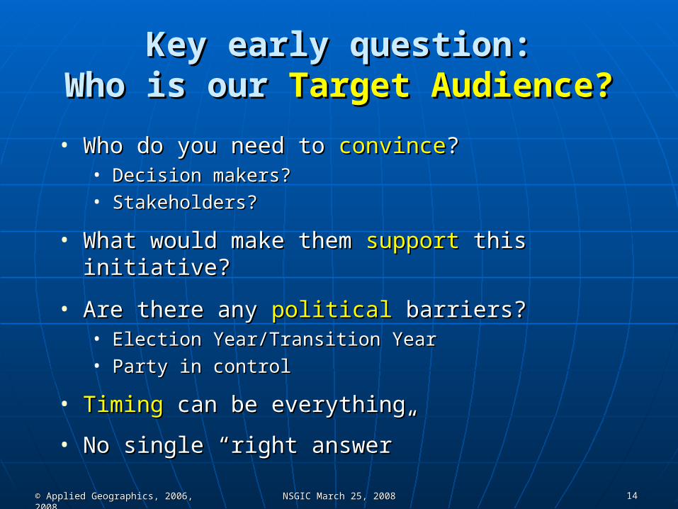
Key early question:Key early question:Who is our Who is our Target Audience?Target Audience?
• Who do you need to Who do you need to convinceconvince??• Decision makers?Decision makers?• Stakeholders?Stakeholders?
• What would make them What would make them supportsupport this initiative? this initiative?
• Are there any Are there any politicalpolitical barriers? barriers?• Election Year/Transition YearElection Year/Transition Year• Party in controlParty in control
• TimingTiming can be everything can be everything
• No single “right answer”No single “right answer”

© Applied Geographics, 2006, 2008© Applied Geographics, 2006, 2008 NSGIC March 25, 2008NSGIC March 25, 2008 1515
2
3
5
4
1 = Iterative2 = Inclusive3 = Is Approved4 = Supported5 = Flows to the business plan
1
Strategic Planning Strategic Planning Process MapProcess Map

© Applied Geographics, 2006, 2008© Applied Geographics, 2006, 2008 NSGIC March 25, 2008NSGIC March 25, 2008 1616
What does the What does the Strategic Plan Strategic Plan Template Template achieve?achieve?
• Provides a Provides a Consistent FrameworkConsistent Framework for Articulating: for Articulating:
• Purpose and driversPurpose and drivers
• Roles of participantsRoles of participants
• Strengths & WeaknessesStrengths & Weaknesses
• Objectives and long-term VisionObjectives and long-term Vision
• Values (e.g. “free flow of data”)Values (e.g. “free flow of data”)

© Applied Geographics, 2006, 2008© Applied Geographics, 2006, 2008 NSGIC March 25, 2008NSGIC March 25, 2008 1717
Let’s take a look inside the Let’s take a look inside the Template…Template…
Straightforward high-level outline of 7 sectionsStraightforward high-level outline of 7 sections
1.1. Executive SummaryExecutive Summary
2.2. Strategic Planning MethodologyStrategic Planning Methodology
3.3. Current SituationCurrent Situation
4.4. Vision and GoalsVision and Goals
5.5. RequirementsRequirements
6.6. Implementation ProgramImplementation Program
7.7. AppendicesAppendices
© Applied Geographics, 2006, 2008© Applied Geographics, 2006, 2008 NSGIC March 25, 2008NSGIC March 25, 2008 1818
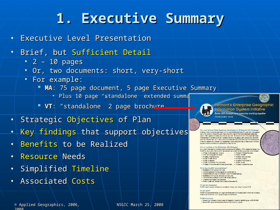
1. Executive Summary1. Executive Summary• Executive Level PresentationExecutive Level Presentation
• Brief, but Brief, but Sufficient DetailSufficient Detail• 2 – 10 pages2 – 10 pages• Or, two documents: short, very-shortOr, two documents: short, very-short• For example: For example:
MAMA: 75 page document, 5 page Executive Summary: 75 page document, 5 page Executive Summary• Plus 10 page “standalone” extended summaryPlus 10 page “standalone” extended summary
VTVT: “standalone” 2 page brochure: “standalone” 2 page brochure
• Strategic Strategic ObjectivesObjectives of Plan of Plan
• Key findingsKey findings that support objectives that support objectives
• BenefitsBenefits to be Realized to be Realized
• ResourceResource Needs Needs
• Simplified Simplified TimelineTimeline
• Associated Associated CostsCosts

© Applied Geographics, 2006, 2008© Applied Geographics, 2006, 2008 NSGIC March 25, 2008NSGIC March 25, 2008 1919
Attendance by Venue
Rochester, 33, 20%
NYC, 35, 22%
Long Island, 16, 10%
Lake Placid, 20, 12%
Highland, 17, 10%
Albany, 41, 26%
New York GIS Strategic Plan Workshop Participation by venue
2. Strategic Planning Methodology2. Strategic Planning Methodology
• Process followedProcess followed to develop the plan to develop the plan• Who “owns”, or approves the plan?Who “owns”, or approves the plan?
• Emphasize processEmphasize process not the not the situationsituation
• StakeholderStakeholder identification and input identification and input• Open, transparent processOpen, transparent process
• ConstraintsConstraints or limitations or limitations
• Core methodologyCore methodology• Stakeholder sessions/workshopsStakeholder sessions/workshops• InterviewsInterviews• SurveysSurveys• Analysis/synthesis/deliberationAnalysis/synthesis/deliberation• AuthoringAuthoring

© Applied Geographics, 2006, 2008© Applied Geographics, 2006, 2008 NSGIC March 25, 2008NSGIC March 25, 2008 2020
3. Current Situation3. Current Situation• Assessment of the situationAssessment of the situation
• WhoWho are we? are we? Stakeholder community characterizationStakeholder community characterization
• WhereWhere are we? are we? GIS and governance historyGIS and governance history Relative to NSGIC/FGDC 9-criteriaRelative to NSGIC/FGDC 9-criteria Framework data set statusFramework data set status
• Identify relevant issues Identify relevant issues where GIS matterswhere GIS matters What’s on the governor’s agenda?What’s on the governor’s agenda? We’re not doing this for the “sake of GIS”, we’re doing this because GIS helps We’re not doing this for the “sake of GIS”, we’re doing this because GIS helps
policy, planning, decision makingpolicy, planning, decision making
• SWOTSWOT• SStrengths and trengths and WWeaknesseseaknesses• OOpportunities and pportunities and TThreatshreats• Generally, one of the meatier sections of the planGenerally, one of the meatier sections of the plan
What’s going wellWhat’s going well Where are the gaps/problems?Where are the gaps/problems?

© Applied Geographics, 2006, 2008© Applied Geographics, 2006, 2008 NSGIC March 25, 2008NSGIC March 25, 2008 2121
4. Vision and Goals4. Vision and Goals• Overarching goal is Overarching goal is SSDISSDI
• Or is it?Or is it?
• Vision Statement/DefinitionVision Statement/Definition• Statement of valuesStatement of values• EmphasisEmphasis added added
• Articulating Articulating programmaticprogrammatic goals goals• What is needed to achieve the vision?What is needed to achieve the vision?
• Series of projects and initiativesSeries of projects and initiatives
• Defining Defining stepssteps to get there to get there
• Realistic Realistic shortshort and and long-termlong-term horizonshorizons
• These are your These are your recommendationsrecommendations
The Kansas Geographic Information System Partnership initiative will be a
collaborative effort among the statewide geospatial community that
delivers robust, map-based, geospatial information and services to support
policy and decision making at all levels of government, to provide access to
public information and to enhance the safety, economy, environment and
quality of life in Kansas.

© Applied Geographics, 2006, 2008© Applied Geographics, 2006, 2008 NSGIC March 25, 2008NSGIC March 25, 2008 2222
5. Requirements5. Requirements• Generally, comes after sections 3 and 4 are completedGenerally, comes after sections 3 and 4 are completed
• Section 3: Identifies status, strengths and weaknessesSection 3: Identifies status, strengths and weaknesses• Section 4: Identifies Vision and recommendationsSection 4: Identifies Vision and recommendations• That’s the “hard part”That’s the “hard part”
• Once there’s consensus on what to do, this is a straightforward Once there’s consensus on what to do, this is a straightforward enumeration of new requirements to make progressenumeration of new requirements to make progress
• And, an assessment of existing resources available to supportAnd, an assessment of existing resources available to support
1.1. Assessment of existing technical Assessment of existing technical infrastructureinfrastructure
2.2. DataData Requirements Requirements
3.3. TechnologyTechnology Requirements Requirements
4.4. HumanHuman Resource Resource Requirements Requirements
5.5. StandardsStandards
6.6. OrganizationalOrganizational Needs Needs• Executive supportExecutive support• CoordinationCoordination• PolicyPolicy• StaffingStaffing• BudgetBudget• OutreachOutreach• Risk assessmentRisk assessment

© Applied Geographics, 2006, 2008© Applied Geographics, 2006, 2008 NSGIC March 25, 2008NSGIC March 25, 2008 2323
6. Implementation Program6. Implementation Program• Should be Should be high-levelhigh-level
• Business Plan(s) provide the Business Plan(s) provide the detailsdetails
• General General timelinetimeline showing dependencies showing dependencies• Phased approachPhased approach• Strategic plan may layout a 5+ year programStrategic plan may layout a 5+ year program
• General budget showing itemized magnitude of expendituresGeneral budget showing itemized magnitude of expenditures• Present cost rangesPresent cost ranges
• Marketing the programMarketing the program
• Measuring successMeasuring success

© Applied Geographics, 2006, 2008© Applied Geographics, 2006, 2008 NSGIC March 25, 2008NSGIC March 25, 2008 2424
Lesson’s LearnedLesson’s LearnedObservations from the School of Hard KnocksObservations from the School of Hard Knocks
Overview observationsOverview observations
• Template is an effective toolTemplate is an effective tool and does and does notnot force one size force one size to fit allto fit all• Extract the essence of sectionsExtract the essence of sections• Tune to local conditions and prioritiesTune to local conditions and priorities• Adjust semanticsAdjust semantics
Sec. 3.1 “Who Are We” Sec. 3.1 “Who Are We” “Who is the New York Geospatial “Who is the New York Geospatial Stakeholder Community”Stakeholder Community”
• The The process itself is valuableprocess itself is valuable• Opportunity for state program to “connect” with stakeholdersOpportunity for state program to “connect” with stakeholders• Stakeholder participation has generally exceeded expectationsStakeholder participation has generally exceeded expectations• Choose your “Steering Committee” carefullyChoose your “Steering Committee” carefully
Team building opportunityTeam building opportunity There’s a lot of work to doThere’s a lot of work to do

© Applied Geographics, 2006, 2008© Applied Geographics, 2006, 2008 NSGIC March 25, 2008NSGIC March 25, 2008 2525
Lesson’s LearnedLesson’s LearnedOn Contractor InvolvementOn Contractor Involvement
• There’s a full spectrum of possibilities that have There’s a full spectrum of possibilities that have delivered effective resultsdelivered effective results• State takes lead (TX)State takes lead (TX)
Potential support by temp/academic staffPotential support by temp/academic staff Is outside “objectivity” desirable?Is outside “objectivity” desirable?
• State takes lead with contractor “coaching” and facilitation (UT)State takes lead with contractor “coaching” and facilitation (UT) Many states report “facilitator is critical”Many states report “facilitator is critical”
• VT: “allows us (state program) to participate like everyone else”VT: “allows us (state program) to participate like everyone else”
• State divides work with contractor (MA, CO, VT)State divides work with contractor (MA, CO, VT) Co-authoringCo-authoring State-led workshopsState-led workshops
• Contractor leads the effort (KS, NH, DC, CA)Contractor leads the effort (KS, NH, DC, CA) State logistical support, committee involvement and editingState logistical support, committee involvement and editing

© Applied Geographics, 2006, 2008© Applied Geographics, 2006, 2008 NSGIC March 25, 2008NSGIC March 25, 2008 2626
Lesson’s LearnedLesson’s LearnedOn Process GovernanceOn Process Governance
• Who’s plan is it anyway?Who’s plan is it anyway?• State GIS Program’s plan?State GIS Program’s plan?• State Coordinating Body’s plan?State Coordinating Body’s plan?• ““On behalf” of all GIS Stakeholders?On behalf” of all GIS Stakeholders?
• Who is managing the project? Who is managing the project? • i.e. Who has final editorial control?i.e. Who has final editorial control?• Most often, a “Strategic Plan Steering Committee”Most often, a “Strategic Plan Steering Committee”
Who convenes this committee?Who convenes this committee?• Sometimes a sub-committee of the State Coordinating BodySometimes a sub-committee of the State Coordinating Body
Who sits on the committee?Who sits on the committee?• In UT, 5 (plus state program staff)In UT, 5 (plus state program staff)• In MA, 27 (plus state program staff)In MA, 27 (plus state program staff)

© Applied Geographics, 2006, 2008© Applied Geographics, 2006, 2008 NSGIC March 25, 2008NSGIC March 25, 2008 2727
Lesson’s LearnedLesson’s LearnedOn Stakeholder InputOn Stakeholder Input
• Many potential forumsMany potential forums• On-line On-line surveyssurveys (UT, CT, FL, MO, CA, IN) (UT, CT, FL, MO, CA, IN)
• Individual Individual interviewsinterviews w/ key stakeholders w/ key stakeholders
• Smaller, Smaller, focus groupsfocus groups around an issue around an issue• Larger, public “Larger, public “stakeholder information stakeholder information
gathering sessionsgathering sessions”” How diverse and vocal is your community?How diverse and vocal is your community?
• 7 sessions in CA7 sessions in CA• 6 sessions in NY, CO and MA6 sessions in NY, CO and MA• 5 session in VT5 session in VT• 3 sessions in CT, FL (600+ participants)3 sessions in CT, FL (600+ participants)• 2 sessions in NH, UT, KS, DC2 sessions in NH, UT, KS, DC
• Final reviewFinal review of the document of the document
• What info are you trying to collect?What info are you trying to collect?• Characterize the state of GIS (SWOT)Characterize the state of GIS (SWOT)• Identify prioritiesIdentify priorities• Assess the potential for consensusAssess the potential for consensus• Solicit new ideas directlySolicit new ideas directly
Availability/Costs for parcel data

© Applied Geographics, 2006, 2008© Applied Geographics, 2006, 2008 NSGIC March 25, 2008NSGIC March 25, 2008 2828
Lesson’s LearnedLesson’s LearnedVisioningVisioning
• Can be more challenging than it soundsCan be more challenging than it sounds• Do you know what is wanted/needed?Do you know what is wanted/needed?
Looking for stakeholder ratificationLooking for stakeholder ratification
• Do you need to do original discovery?Do you need to do original discovery?
• What is the “Vision thing”?What is the “Vision thing”?• Succinct statement (a la a Mission Statement)?Succinct statement (a la a Mission Statement)?• Lengthier and more descriptive? Pictorial?Lengthier and more descriptive? Pictorial?• Opportunity to state values (a la KS)Opportunity to state values (a la KS)• Does it sound like NSDI?Does it sound like NSDI?• Should be informed by the SWOTShould be informed by the SWOT

© Applied Geographics, 2006, 2008© Applied Geographics, 2006, 2008 NSGIC March 25, 2008NSGIC March 25, 2008 2929
Lesson’s LearnedLesson’s LearnedGoals DevelopmentGoals Development
• How do programmatic goals flow from the Vision?How do programmatic goals flow from the Vision?• Review the SWOTReview the SWOT
LeverageLeverage strengths strengths AddressAddress weaknesses weaknesses SeizeSeize opportunities opportunities
• Think in terms of “projects”Think in terms of “projects” What projects do we need to complete to realize the Vision?What projects do we need to complete to realize the Vision?
• How do we prioritize? How do we gain consensus?How do we prioritize? How do we gain consensus?• Listen carefully; Don’t be afraid to take a first stab at itListen carefully; Don’t be afraid to take a first stab at it
• Ask the stakeholders/committee for inputAsk the stakeholders/committee for input Stakeholders respect an open process and appreciate a Stakeholders respect an open process and appreciate a
common sense approachcommon sense approach

© Applied Geographics, 2006, 2008© Applied Geographics, 2006, 2008 NSGIC March 25, 2008NSGIC March 25, 2008 3030
??Questions and AnswersQuestions and Answers

© Applied Geographics, 2006, 2008© Applied Geographics, 2006, 2008 NSGIC March 25, 2008NSGIC March 25, 2008 3131
Copyright Notice Copyright Notice Slides 1 through 28Slides 1 through 28
The Strategic Plan Template, Business Plan Template, Strategic Planning The Strategic Plan Template, Business Plan Template, Strategic Planning Process Map, Performance Score Card and slides 1 through 69 in this Process Map, Performance Score Card and slides 1 through 69 in this presentation are the Intellectual Property of Applied Geographics, Inc. presentation are the Intellectual Property of Applied Geographics, Inc. and therefore Copyrighted, unless otherwise indicated.and therefore Copyrighted, unless otherwise indicated.
Applied Geographics has granted to the FGDC, NSGIC, all states and Applied Geographics has granted to the FGDC, NSGIC, all states and equivalent entities, and their subdivisions, the right to use, reproduce and equivalent entities, and their subdivisions, the right to use, reproduce and distribute the strategic and business plan templates and the training distribute the strategic and business plan templates and the training program materials that were delivered under this contract.program materials that were delivered under this contract.
All permitted copies shall be reproduced with all titles, logos, copyright All permitted copies shall be reproduced with all titles, logos, copyright notices, trademark notices, and legends included in the original materials notices, trademark notices, and legends included in the original materials and list Applied Geographics as the source.and list Applied Geographics as the source.