november 16 , 2016 global wildfire information system...
TRANSCRIPT

November 16th, 2016 – Global Wildfire Information System (GWIS) Meeting
INPE´s FireProgram new webpages
www.inpe.br/queimadas

Vegetation fires on a typical day in west Brazil and Bolivia as presented by INPE´s Fire Monitoring Program

Thousands of fires on a typical day in the burniong season

Some key characteristics of INPE´s Fire Program:
- Result of a continuous evolution of satellitemonitoring of fire pixels since the late 1980s.
- Adapted to new IT techniques every 5 years.
- Developed with the users, for the users.
- It´s a local/regional operational system
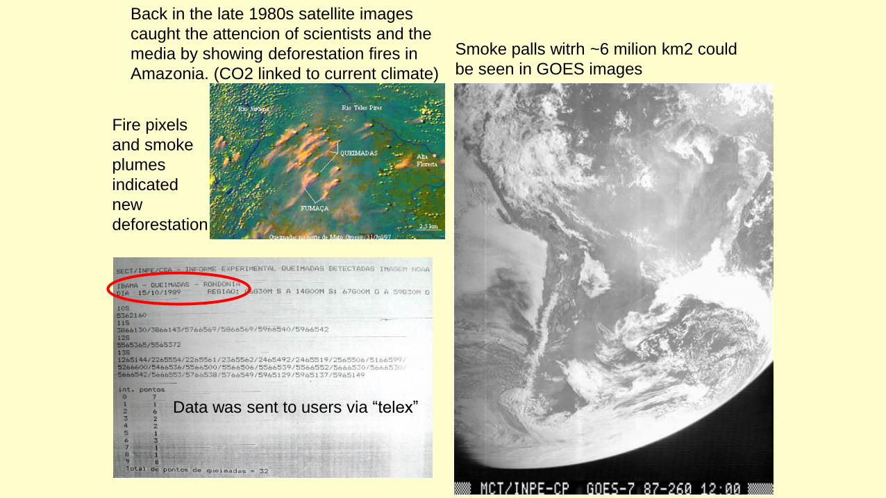
Back in the late 1980s satellite images
caught the attencion of scientists and the
media by showing deforestation fires in
Amazonia. (CO2 linked to current climate)
Smoke palls witrh ~6 milion km2 could
be seen in GOES images
Fire pixels
and smoke
plumes
indicated
new
deforestation
Data was sent to users via “telex”

TELEX ???


Some of you may have noticed a large forest fire on Tuesday, Nov/14/2016, raging in the SE ofSantiago.
Let´s use it as a starting point to show some of the options at INPE´s Fire Program new webpage

Some of you may have noticed a large forest fire yesterday, Tuesday, Nov/14/2016, raging in the SE of Santiago.

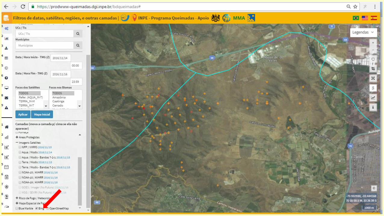

Interaction with Google Earth is one of the many features included

By the way, concerning fires, how is this year in Chile compared to previous ones?

By the way, in the last two days, where fires occured in Chilean states ?

By the way, in the last two days, where fires occured in Chilean counties ?

By the way, here in the metropolitan region of Santiago, when fires occurred this year ?

By the way, what is the Fire Risk Index for Chile today ?


Change to animation of fire front advanceand burned area estimate, Ilha do Bananal, 2016

For those who still do not buy that fire pixels are related to burned área:(data for Landsat scene 221_67; TERRA + AQUA fire pixels)
y = 0,0066x - 66,813R² = 0,9365
0
200
400
600
800
1000
1200
1400
0 50.000 100.000 150.000 200.000
Fire
Pix
els
Burned Area, ha
2005
Série1
Linear (Série1)
y = 0,0029x + 24,803R² = 0,8527
0
200
400
600
800
0 50.000100.000150.000200.000250.000
Fire
Pix
els
Burned Area, ha
2006
Série1
Linear (Série1)
y = 0,0049x - 128,24R² = 0,9485
0
200
400
600
800
1000
1200
1400
1600
0 100.000 200.000 300.000 400.000
Fire
Pix
els
Burned Area, ha
2007
Série1
Linear (Série1)
y = 0,0067x - 73,478R² = 0,8627
0
100
200
300
400
500
0 20.000 40.000 60.000 80.000100.000
Fire
Pix
els
Burned Area, ha
2008
Série1
Linear (Série1)
y = 0,0051x - 13,296R² = 0,9816
0
100
200
300
400
500
0 20.000 40.000 60.000 80.000100.000
Fire
Pix
els
Burned Area, ha
2009
Série1
Linear (Série1)
y = 0,005x - 28,832R² = 0,9136
0
100
200
300
400
500
600
700
800
900
1000
0 50.000 100.000 150.000 200.000
Fire
Pix
els
Burned Area, ha
2010
Série1
Linear (Série1)
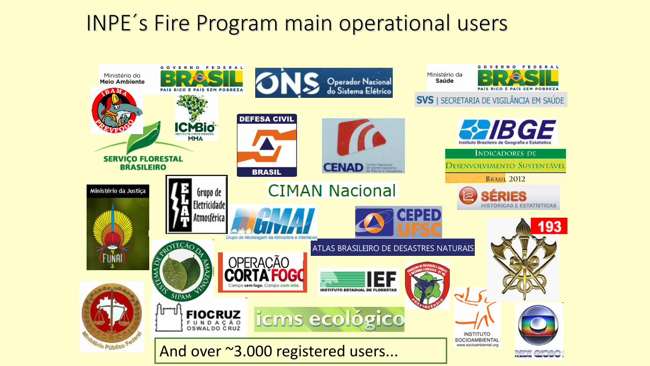
INPE´s Fire Program main operational users
And over ~3.000 registered users...

Examples of users that rely on INPE´s operational Fire Monitoring Program:IBAMA, IBGE, Ministery of Health, ONS, etc.

Constant increase in the number o users

CIMAN - a recent special
product suited for a
federal initiative that
integrates many different
regional agencies .
Two-way communications
was a key innovation.

Examples of state actions based on the monitoring of fire pixels

Low resolution (01 km) Burned Area automatic products. Version 1.0 is well advanced for all biomes in the country. Error +/- 30%

Medium resolution (30 m) Burned Area products.Version 1.0 is well advancedfor the Cerrado/Savannah biome. Error +/- 10%


Exemplo do potencial dos produtos de área queimada na estimativa da degradação de áreas naturais e antrópicas

Estimates of smoke fromvegetation fires with BRAMMS (c/o Saulo Freitas & Karla Longo, GMAI-INPE)

Finally, a few current concerns: non-vegetation fires

Finally, a few current concerns: non-vegetation fires

Finally, a few current concerns: non-vegetation fires

Detection and mapping ofunderstory low intensity fires is a difficult task with satellite images.This 2010 event in the Amazon forestat the (river) Xingu Natnl. Park in central Brazil shown by the INPE FireSystem had only a few fire pixels thatdid not represent the advance of firefronts for weeks in a row.The concentric patterns showthe propagation of fires from a central location.At the lower right side, thedeforested area is clearly theorigin of the fire.The many sources of fires along theriver bed probablyresulted from the misuse of fire bythe indigenous population.
Fire Pixels
Fire PixelsFire affected forest
Finally, a few current concerns: undetected vegetation fires

Detection and mapping of understory low intensity fires is a difficulttask with satellite images – not even VIIRS 375 m can detect them!(Landsat-8/OLI 225_69, 28/May/2015,
Finally, a few current concerns: undetected vegetation fires

Local and Regional training is also a major activity, such as in this ACTO –Amazon Cooperation TreatyOrganization held last month

Future Plans at INPE´s Queimadas Program
2016 – Inclusion of METOP-B/Europe & FY-3A&B chinese satélites for active fire detection.
2016 – Operational Burned Area products with low (~1km) and médium (~30m) resolution,Version1.0 with database access.(support from MMA Brazi,l GIZ-Alemanha, and FAPESP)
2016-17 – New inteligente platform for monitoring and decision making withTERRA-MA2-Q (INPE-DPI) Versão 1.0, answering MMA guidelines.(support from MMA, World Bank and DEFRA-UK)
2016-18 – Improvement of special products, e.g. CIMAN (Min. Integração) e SISAM (Min. Saude)
2017 – Burned Area products with 300 m resolution from PROBA-V e VIIRS.
(support from CNPq-Ciência s/Fronteira with ISA-Lisboa-Portugal, and FAPESP)
2016-18 – Imrovement of the Fire Risk products.(support from MCTI, World Bank and FIP)
2017 – Integration to INPE´s PRODES, DEGRAD, DETEX, TerraClass/Amazon, etc.
2017-?? – New satélites (GOES-R, JPSS, TET etc) and Technologies for active fire and burnedárea detection/mapping, etc...

http://gofc-fire.umd.edu/meeting/static/GOFC_Fire_IT_2016/index.php
Objectives:
The GOFC-GOLD-Fire Mapping and Monitoring Theme is aimed at refining and articulating the international
observation requirements and making the best possible use of fire products from the existing and future satellite
observing systems, for fire management, policy decision-making and global change research.
GOFC-GOLD is promoting self-organized regional networks of data users, data brokers and providers, where
closer linkages and collaborations are established with emphasis on an improved understanding of user
requirements and product quality. GOFC-GOLD-Fire is pursuing, in a joint effort with the Committee on Earth
Observing Satellites (CEOS) Working Group on Calibration and Validation (WGCV) Land Product Validation
(LPV) subgroup, the coordinated validation of fire products by standardized protocols.
• Active fires and burnt area characterization from polar and geostationary satellite data;• Calibration and validation of satellite fire products;• Global geostationary network and fire products;• Fire observations from new satellite instruments – algorithms and refinements;• Fire radiative energy products from polar and geostationary data;• Global fire early warning system;• Fire management with focus on reducing emissions from deforestation and forest degradation activities;• Satellite fire data outreach, dissemination and activities –requirements and challenges.
In conclusion: Mutual interest between GOFC-GOLD-FIRE & INPE´s Fire Program:

Thank you !
www.inpe.br/queimadas