norwegian inspire implementation some best practices · norwegian inspire implementation – some...
TRANSCRIPT

Norwegian INSPIRE implementation –some best practices
Olaf Østensen, Kartverket
INSPIRE conference, Ljubljana, 21-09-2015
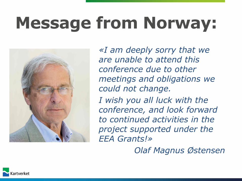
Message from Norway:
«I am deeply sorry that weare unable to attend thisconference due to othermeetings and obligations wecould not change.
I wish you all luck with theconference, and look forward to continued activities in theproject supported under theEEA Grants!»
Olaf Magnus Østensen

INSPIRE and Norway
INSPIRE implementation was simplified as a natural
continuation of a long term national collaboration:
• Standardization from mid 80’ties
• Geovekst (collaboration across public sector) from 1995
• Arealis including the environmental agencies since 1996
• Culminating with Norway digital since 2005
Norway digital today is a formal
collaboration under contract between
all public sector institutions with an interest
in geospatial information
– users and producers
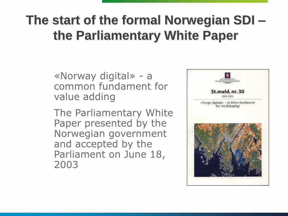
«Norway digital» - a common fundament for value adding
The Parliamentary White Paper presented by the Norwegian government and accepted by the Parliament on June 18, 2003
The start of the formal Norwegian SDI –
the Parliamentary White Paper
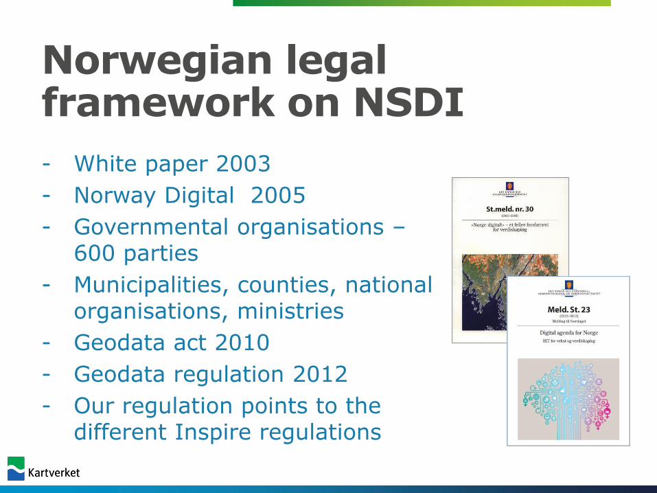
Norwegian legal framework on NSDI
- White paper 2003
- Norway Digital 2005
- Governmental organisations –600 parties
- Municipalities, counties, nationalorganisations, ministries
- Geodata act 2010
- Geodata regulation 2012
- Our regulation points to thedifferent Inspire regulations
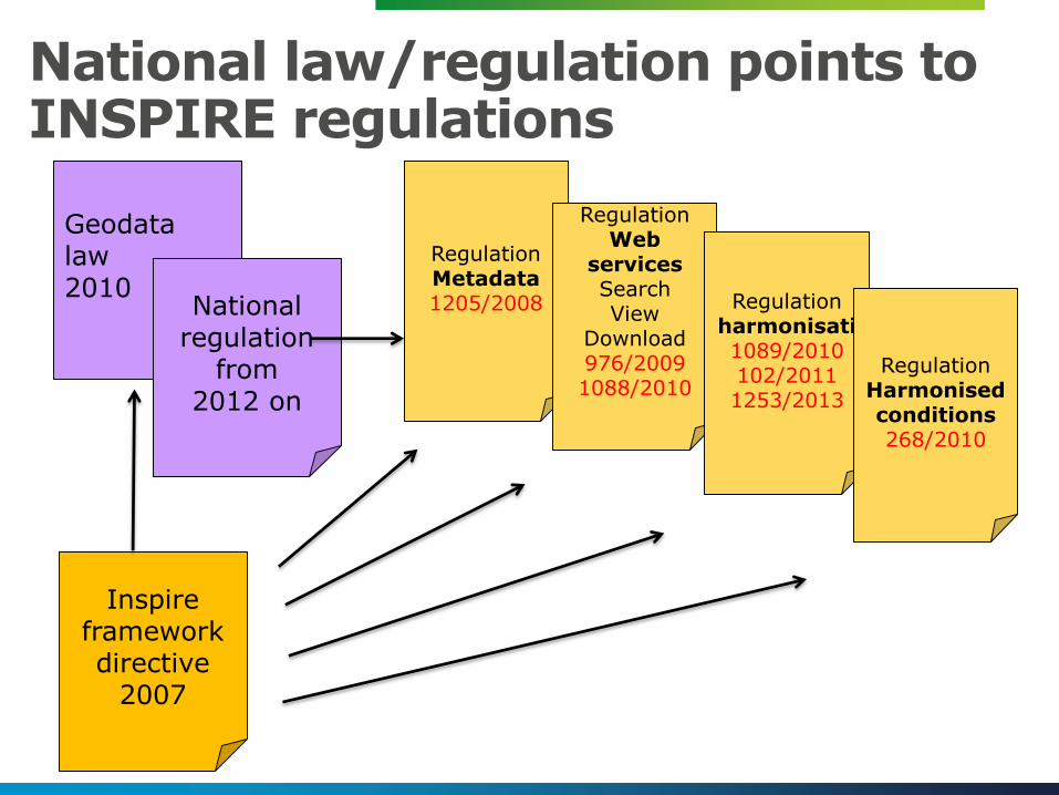
National law/regulation points to INSPIRE regulations
Geodata law2010
Inspire frameworkdirective
2007
RegulationMetadata1205/2008
RegulationWeb
servicesSearchView
Download976/20091088/2010
Regulationharmonisati1089/2010102/20111253/2013
RegulationHarmonisedconditions268/2010
National regulation
from2012 on
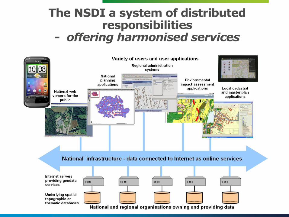
The NSDI a system of distributed responsibilities
- offering harmonised services

Decentralised - many organisations to implement
• We don’t have one central data base and centralised web service ”motor”
• Each organisation to deliver
• Need to stick to standards
• They need to understand
• They need guidance
• They need follow up..

Guidance and support

NSDI Tecnical frameworkdocument
• Statements of the– Overall idea and architecture
• Technical requirements
– Data sets, services, documentation
• Formal time schedule for requirements– What to be delivered when
• National adjustments and agreements– how do we understand Inspire
• Needs to be dynamic – things change…..
• Points to national guidance documents
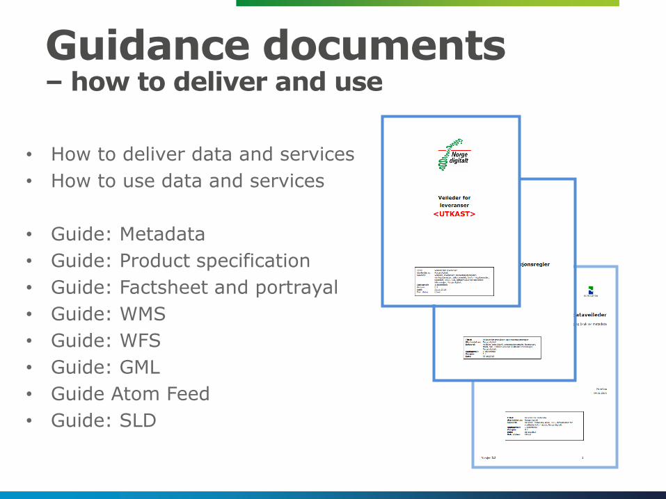
Guidance documents– how to deliver and use
• How to deliver data and services
• How to use data and services
• Guide: Metadata
• Guide: Product specification
• Guide: Factsheet and portrayal
• Guide: WMS
• Guide: WFS
• Guide: GML
• Guide Atom Feed
• Guide: SLD
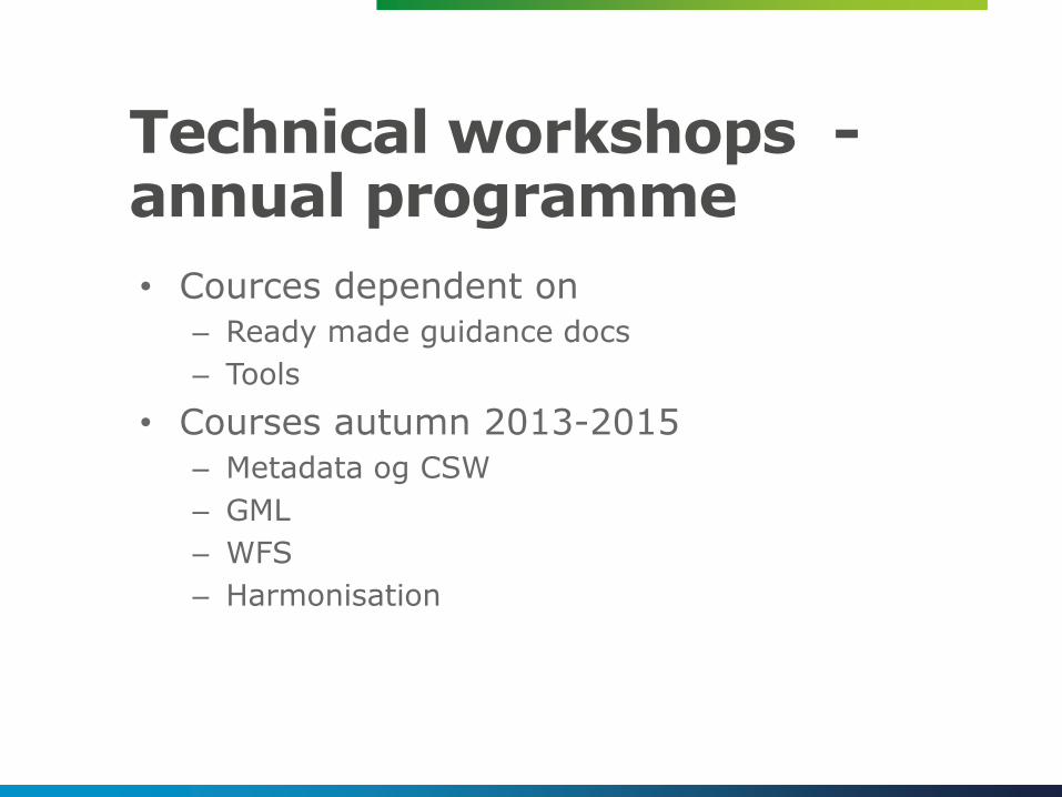
Technical workshops -annual programme
• Cources dependent on
– Ready made guidance docs
– Tools
• Courses autumn 2013-2015
– Metadata og CSW
– GML
– WFS
– Harmonisation
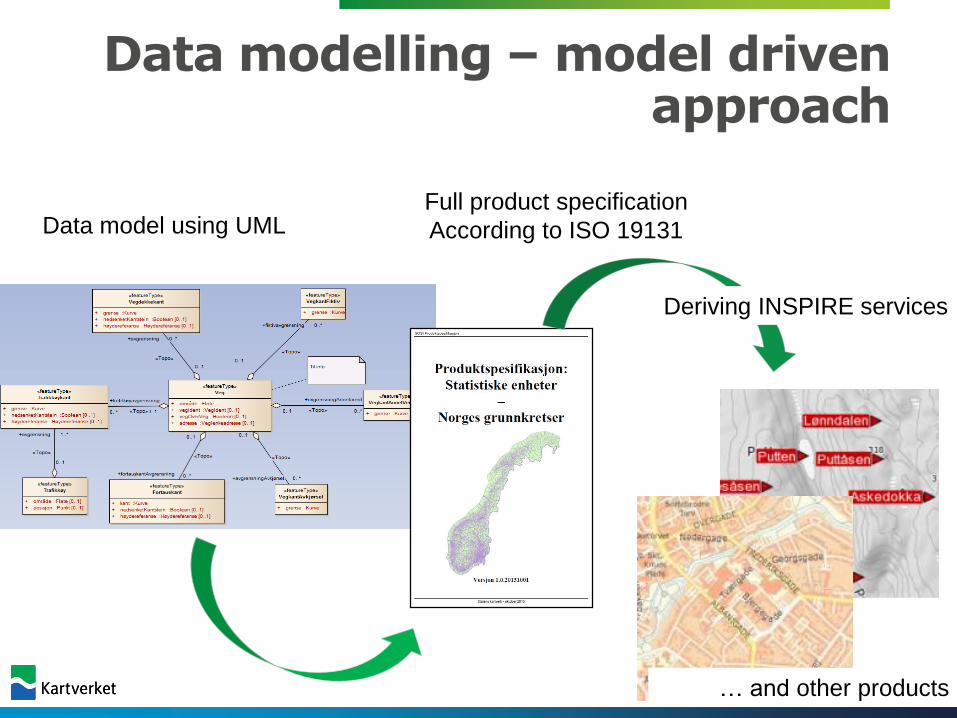
Data modelling –model drivenapproach
Data model using UMLFull product specification
According to ISO 19131
Deriving INSPIRE services
… and other products

Clients and applications

Geonorge
The Geoportal = the Hub
Geonorge
Kartverket
ND-parties
Private companies
GIS vendors
Govern-ment/
Ministry(KMD)
Othercountries
Inspire
Voluntaryorgani-sations
Munici-palities
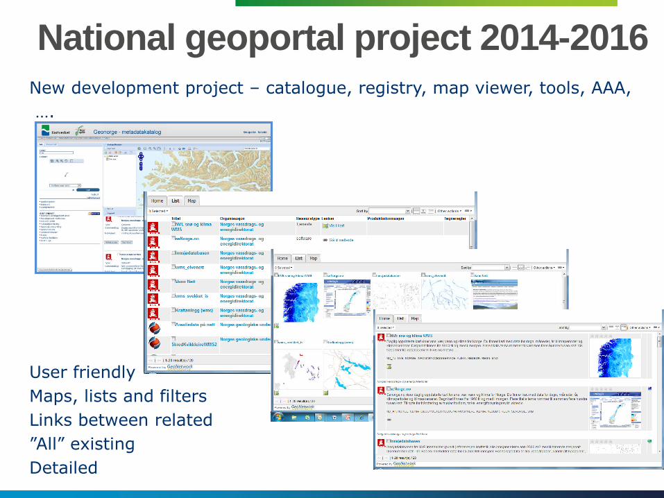
National geoportal project 2014-2016
New development project – catalogue, registry, map viewer, tools, AAA,
….
User friendly
Maps, lists and filters
Links between related
”All” existing
Detailed
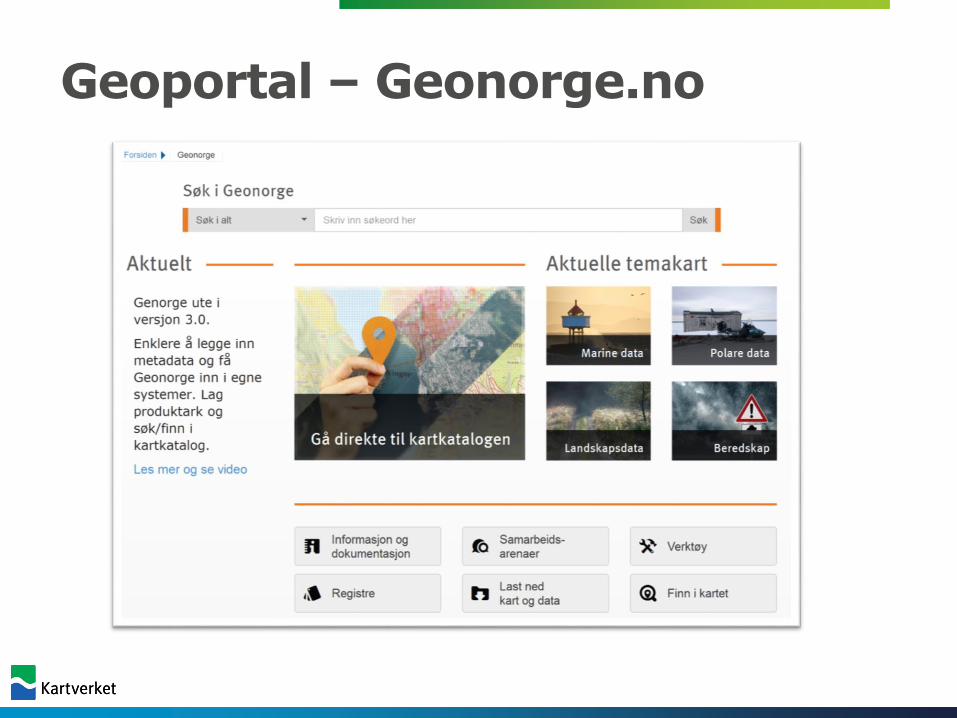
Geoportal – Geonorge.no
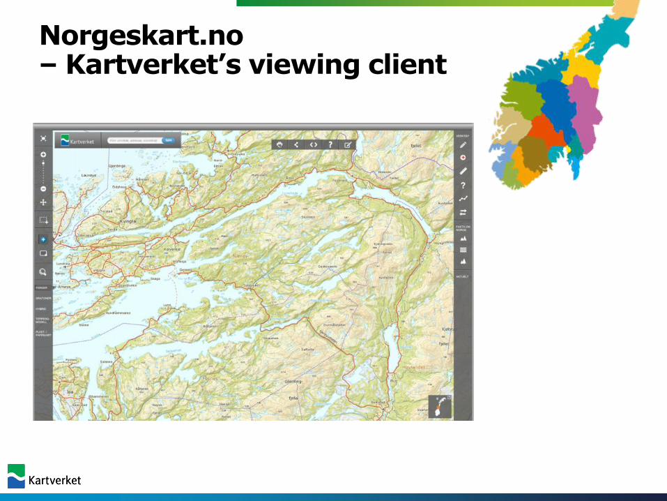
Norgeskart.no – Kartverket’s viewing client
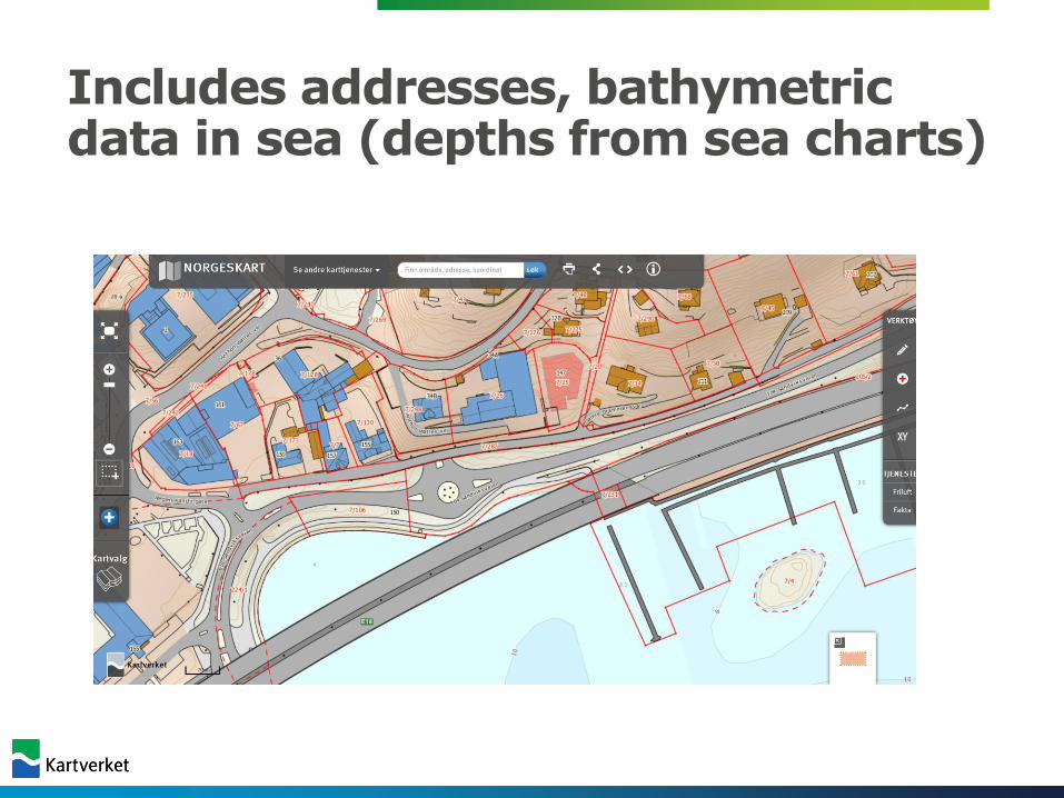
Includes addresses, bathymetricdata in sea (depths from sea charts)
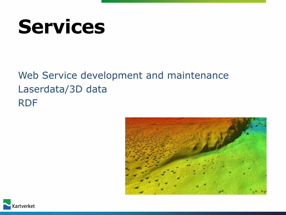
Services
Web Service development and maintenance
Laserdata/3D data
RDF
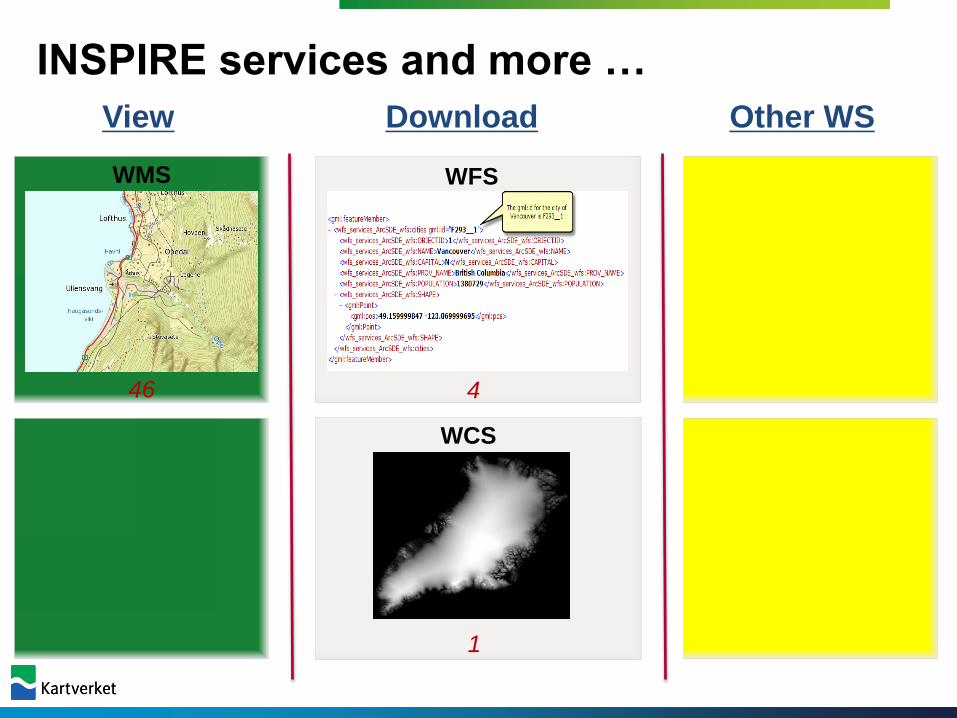
INSPIRE services and more …
WMS
WMTS
WFS
WCS
WPS
WS
46 4 1
10110
View Download Other WS

Infrastructure
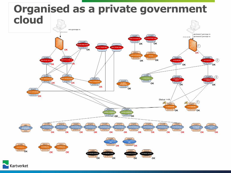
Organised as a private governmentcloud
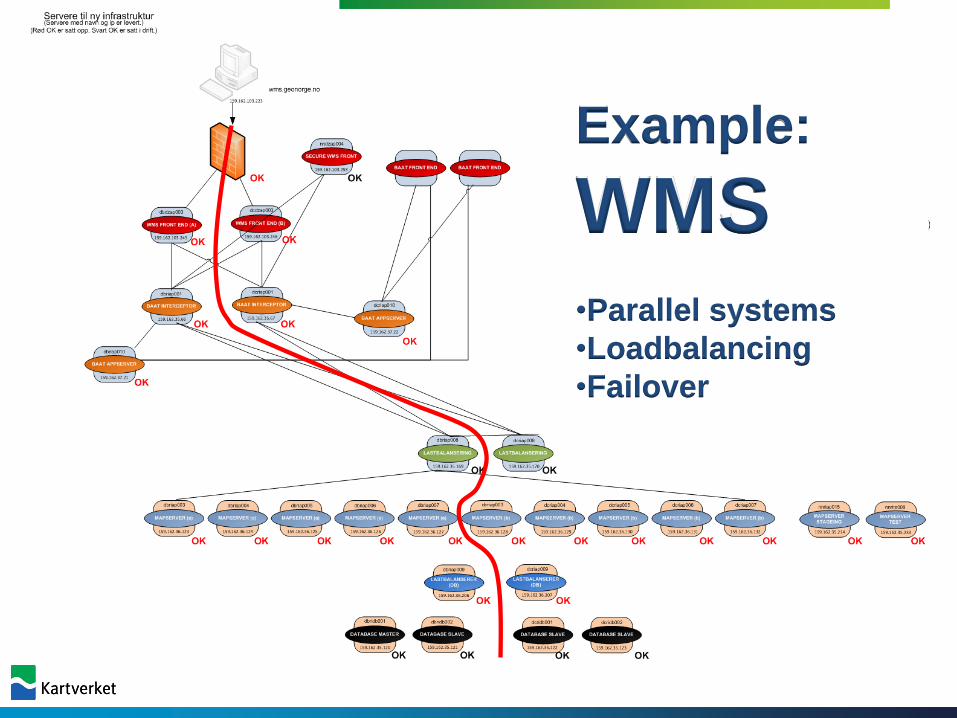
Example:
WMS•Parallel systems
•Loadbalancing
•Failover
Status today• The new, modern geoportal in operation –
covering metadata far beyond INSPIRE requirements
• Hundreds of wms services covering almost all the 34 INSPIRE themes
• Operated by the individual agencies
• WFS downloading services emerging – The European Location Framework project – ELF –a driving force
Summary – success factors
• Based on a more than 20 years of closecollaboration in public sector – and private!
• Standards were developed withparticipation from the full community
• A wms infrastructure introduced alreadyfrom 2000 and onwards
• Supporting activities – guidancedocuments, courses, collaboration fora
• Key principle – involve the communityon an equal basis!
Thank you for your attention!