north star vol. 8, no. 3 (1989)
DESCRIPTION
ÂTRANSCRIPT

Non-Profit Org. u .s. Postage
PAID Permit No. 47
Caledonia, Ml 49316 Newsletter of the
North Country Trail Association

We began our tour of the trail route at the Pennsylvania State line near Negly, Ohio. From Negly, the trail is proposed to follow an abandoned railroad right-of-way south to Frederick town. The Ohio DNR is attempting to purchase the right-of-way, in part because of its value for the North Country NST. The right-of-way is one identified as having high potential in the Rails-to-Trails Conservancy's recent report on the North Country Trail. There is a competing proposal to purchase the right-of way by the Little Beaver Creek Valley Railroad and Historical Society of Darlington, Pennsylvania. They wish to operate a tourist railroad using a steam locomotive. Mr. John Coskey, their vice-president and operation manager, attended the Tues day evening public information meeting.
At Fredericktown, the trail route will enter the Vodrey Trust lands and follow Little Beaver Creek to the State Park. An existing certified segment of the North Country NST follows the creek and canal through the State park. One of the locks in the park, Lusk's Lock, is in an an excellent state of preservation. Be yond the park the canal lies in primarily private ownership. "1t traverses rural lands and will make a very scenic trail route. Private ownership tends to be in large parcels, thus reducing the number of landowners who will have to be contacted for permission to route the trail across their lands. Mr. Stewart and association members already know many of the owners and have received tentative permission for the trail. One landowner with over a mile of the canal operates a private campground that will serve well the overnight needs of hikers. His tract also includes one of two tunnels on the canal. Over time, the entrances have filled in and are now covered. He hopes to excavate one of the entraces to reveal the stonework and promote it as a point of historical interest. Another tunnel over 1 mile in length passes under several landowners. Its entraces are also covered.
Several long stretches of 'canal between Lisbon and Minerva lie adjacent to US30. It is not known at this time whether they are within the publicly-owned right-of-way. Points of historic interest lie all along the canal. In the village of Hanoverton, there is a street which for several blocks is lined with magnificent historic buildings.
The outlook for the trail in Columbiana County is excellent. H the right elements fall into place in a timely fashion, and judging the enthusiasm of local supporters, it could be possible to have 30-40 miles of trail completed across the county in 1-2 years. Mr. Stewart and local supporters hope to develop the trail on a fast track and then move west into Carrol, Stark and Tuscarawas Counties. From what I have seen thus far, I am very encouraged about their ability to do so.
Page5 saw the opportunity to coordinate efforts to preserve the canal and establish the trail. Unlike other historic canal rights-of-way in Ohio, the Sandy and Beaver Canal is not state-owned.
During the 2-day visit, Baird Stewart, Jim Sprague, other members of the canal association and I toured the entire North Country NST route through Columbiana County. On Tuesday evening, we conducted a public information meeting about the North Country NST in Beaver Creek State Park. Blaine Gerdes, trail coordinator in the Ohio Department of Natural Resources' Office of Outdoor Recreation Services in Columbus, attended and assisted in conducting the meeting. About 30 people attended the meeting, including William Vodrey mas a reporter for the Lisbon Morning Journal. Mr. Vodrey's family operates the Vodrey trust which owns and manages 4,650 acres in the Little Beaver Creek valley. Their preservation of this land contributed in part to the Little Beaver Creek's outstanding values which led to its inclusion in the National Wild and Scenic· Rivers system. Now, this same land can provide a, sizable portion of the North Country NST route in Columbiana County.
There was great interest in the trail at the meeting. Mr. Stewart requested and got volunteers to serve on a "Columbiana County North Country National Scenic Trail Development Committee.'' They have already contacted many landowners with portions of the canal on their properties. The night following the public meeting, the Columbiana County Board of Commissioners passed a resolution of suport for the North Country NST.
On July 11-12, I traveled to Columbiana County in northeast ern Ohio to meet with citizens and public officials interested in developing the North Country NST from the Pennsylvania State line westward to the point where the trail intersects the Buckeye Trail at Zoar in Tuscarawas County. The meeting resulted from letters to me and to Jim Sprague, president of the Buckeye Trail Association, from Mr. R. Baird Stewart of Salem, Ohio, a member of the Sandy and Beaver Canal Association. Mr. Stewart became aware that the North Country NST is proposed to follow the right-of-way of the old Sandy and Beaver Canal and
I'd like to report to the North Country Trail Association about two interesting trips I took to Ohio in July.
On July 26-29, I attended the Second National Rails-to-Trails Conference in Dayton, Ohio. Approximately 300 people attend ed, including a good representation from various offices of the Park Service. General sessions and workshops were very informative, covering pertinent and timely topics. The size of the rails-to-trails movement and- its so~stication has grown signif icantly in just the 21 months since the first national conference.
While it is not possible withill the scope of this report to summarize the valuable information received during the confer ence sessions or to report on all the significant contacts made, there are three items about the North Country National Scenic Trail I do want to report on:
The first keynote speaker was Ohio Governor Richard Celeste. He gave a good and enthusiastic speech about outdoor· recrea tion and trails. As he was closing his remarks, he enumerated some of his commitments and Ohio's commitments to the development of expanded trail opportunities; My attention was completely captivated when he said, "Ohio is fully committed to completing the development of the North Country Trail. " NEVER before have I heard an expression of support for the North Country NST from that level in a state. I asked Wayne Warren of the Ohio Department of Natural Resources and several others if they were responsible for putting that in the governor's speech. All said, "No," and similarly concluded that the governor himself had put it in. That is remarkable and is a commitment on which we have to build. To do so will require a real commitment on our part as well, however. The protection and use of state-owned canal rights-of-way for the trail, for example, is now more crucial than ever. We need to assess their potential for the trail during the next 12 months.
The mere completion of the Rails-to-Trails Conservancy's report on rail conversion opportunities for the North Country NST resulted in frequent mention of the trail in several general sessions and workshops, showing wider and wider awareness of the trail within the national trails community.
Through a recent grant from the Mellen Foundation in Pittsburgh, the Rails-to-Trails Conservancy has just hired field staff .coordinators in Michigan, Ohio, Illinois and Pennsylvania. Discussions I had with the coordinators. for Michigan (Roger Storm) and Ohio (Mary Hess) laid good foundations for working on the high potential rail-trail opport.unities identified in the conservancy's Noith Country NST report. These were just two of the many valuable contacts made at the conference.
by Tom Gilbert, National, Park Service NCNST Coordinator
Rep_ortf.rom theNPS:
Good news in Ohio
North Country Trail Association Newsletter, Autumn 1989

In getting permission for trails to cross private land, the issue of liability often comes up. No one can guarantee a landowner he will not be sued by someone who is· hurt on his land. While there is little likelihood that a plaintiff would win such a suit, the mere threat of a lawsuit and its accompanying legal fees can be i intimidating.
Has any trail group considered offering insurance against a lawsuit? Not to be confused with liability insurance itself, lawsuit insurance would simply insure that a landowner wouldn't be faced with large fees when faced with a lawsuit -- the trail group would commit itself to finding pro bono legal aid. Most trail groups have lawyers on their boards and as active members who volunteer their time to build trails. How about asking them to volunteer to commit themselves to time in the courtroom, if necessary?
The confidence of such aid could be just what some land owners need to allow a trail on their land.
reprinted from Pathways Across America, Summer 1989
Lawsuit insurance -- a new service?
This is a reminder that current year memberships will soon expire and that your continued membership in the North Country Trail Association is urgently needed to help in our ongoing efforts to make the Trail become a reality. Member ships increased by almost fifty percent this past year and I hope we can boast of over 1,000 members by the end of 1990 - the Tenth Anniversary of the North Country Trail.
I would like to remind you, too, that in accordance with a motion made and approved at the membership meeting last October (1988) in Ithaca, NY, and reported as part of the minutes of that meeting appearing in the Winter 1989 issue of the Newsletter, membership dues, commencing witb the year 1990, will cover the period ending June 30, and subsequently run from July first through June 30. This change was made so our membership-year would coincide more closelity' with our Annual Spring Meeting in May. ~
We have come a long way since the North Country Trail was first authorized as a National Scenic Trail back in 1980. Several new segments of trail were certified this past year, adding many additional miles. Currently, over one third of the trail is actually "on the ~ound", and many of these miles have been offically certified.
Although much has been accomplished by the continuing efforts of the National Park Service, the U.S. Forest Service, and endless volunteer hours by many North Country Trail Association members and firends, there is still much left to be done. It is in ·this continuing effort that your membership in the NCTA becomes one of our most valued assets.
Over the years, many members have made generous contributions along with their yearly dues. Such support is sincerely appreciated and I would like to take this opportunity to say, "thank you again". I hope this practice will continue.
Looking forward -- 1990 should be another year of much activity and accomplishment, including out ''North Country Trail 10th Anniversary Hike" being planned for Labor Day weekend. This event alone, we hope, will spread the news across the nation of this longest National Scenic Trail in the country. I hope you will be a part of these activites with your continued membership in the NCT A and your active participa tion whenever and wherever possible. We NEED YOU!
Won't you please renew today? Renewal now will insure continued delivery of the Newsletter so you will be informed about the North Country Trail as things are happening.
Martha K. Jones Membership Chairperson
North Country Trail Asscoiation
Dear NCTA Member:
It's membership renewal time
North Country Trail Association Newsletter, Autumn 1989
Please enclose Sl.00 postage per book. Order from NCTA Headquarters, Box 311, White ·cloud MI, 49349.
56 pages, color cover, revised maps with new trail facilities and up-to-date information for this Michigan section of the North Country National Scenic Trail.
$5.95 per copy. $3.00 per copy for 1983 guide [a few left]. $7.95 for both books. [The 1983 guide has bird, plant and
animal list not in the new one].
NEW! Guide to the Pictured Rocks National Lakeshore
Including the revised Lakeshore Trail Guide by Olive M. Anderson
As autumn approaches, I have been reflecting on the joys, expectations, disappointments, frustrations, and fun I have had this busy summer on the North Country and other trails. Summer began with the NCTA annual meeting and NCT dedications in New York and Michigan. Very enjoyable events. This was soon followed by a wonderful backpacking trip with wonderful company on the Loyalsock Trail in central Pennsyl vania. In April, students enrolled in the Cornell Outdoor Education Program built two sturdy foot bridges and an outhouse on the Finger Lakes Trail and NCT. By June, vandals had destroyed part of one of the bridges, How sad and frustrating! This was topped off by a destructive beer party someone had at the Tamarack Lean-to on the NCT. As of this morning (8/27 /89), the other bridge and outhouse were still unharmed.
In June, I attended the Appalachian Trail Conference General Meeting in East Stroudsburg, PA. I had been looking forward to this meeting for months because this was to have been my first time on the AT. Well, I broke a toe in my left foot six days before the meeting. The doctor said emphatically "no hiking"! But I still had a good time attending workshops and other events and wondering if the NCTA will ever be as large as the AT Conference.
In July, I was the official starter for the Finger Lakes Trail 50-Mile Run on the FLT and NCT. Thirty-five starters (31 finished!) showed up on a Saturday morning at 5:30 to begin this grueling event. I drew a number of cries of anxiety when I mistakenly welcomed the runners to the Finger Lakes Trail 500. Apparently my grand debut as an official starter did not disqualify me from future events - I started the Virgil Mountain Madness Run on the NCT last Saturday. I addressed the Ithaca Rotary Club last week about the NCT and NCTA. Next week I travel to Minnesota to participate in a 2-day conference on stones of the people and history of the Bad Medicine Lake area. I will be speaking on "The North Country Trail in Minnesota."
The next big event is. the fall NCTA meeting at Burr Oak. I look forward to the NCT dedication in Ohio's Wayne National Forest. I invite everyone to attend the dedicaton and meeting. There will be some very exciting discussions and activities. Someday, maybe our meetings will be as big as the ATC's. Someday.
A letter from the President
Trail Head

Make check payable to NCT A. Send to NCT A Secretary. 7040 Africa Rd., Galena OH 43201. Donations are tax deductable!
Donate $10.00 to the NCTA and receive a copy of
"Wilderness Horse Travel" as a thank you for your contribution
Plans to use the 1990 hike as amajor fundraiser, with pledge subscriptions being sought, have been dropped after agonizing consideration at the 1990 spring meeting.
Discussion at the meeting centered around a considerable reluctance to undertake the amount of organization that had to be done, with only a limited amount of leadership and personnel available.
Members at the meeting finally voted to use the event to garner publicity for the trail, and to bill -the event as a Tenth Anniversary hike and celebration of the trail.
1990 Hike plans changed -- bv Rod MacRae
Hikers and all friends of trails are invited to join the American Hiking Society for its Eleventh Annual Event called the IDKE-IN on November 3, 4, & 6, 1989. This year's event is being held at Coolfont Resort and Conference Center, near Berkeley Springs, West Virginia.
The theme of the event is "THE FUTURE OF TRAILS." Registration and programmed activites start Friday evening. An entertaining and intriguing program is being assembled ~ it will offer something for everyone, from casual hiker to dedicated trail activist.
Activities actually get under way with a week-long hike on a section of the Big Blue Trail, which traverses 144 miles from Hancock, Maryland, to the Appalachian Trail in the northern section of Shenandoah National Park. Hikers are welcome to go the entire distance, or join in along the way. For more information and registration forms call or write: The American Hiking Society, 1015 31st St. NW, Washington DC 20007, or phone (703) 385-3252.
AUS Hike-In November 3-6
Not many people showed up for the trail maintenance on June 10 and 11. A special thanks to Jim Davis for holding up his end of the job. If any of you can work on the trail in the Manistee National Forest, please call Diane Walker at the White Cloud Ranger Station (616) 689-6696. She will be happy to give you information and tell you ''where to go". The Ranger stations are now open only weekdays, and the rangers could use lots of help. They've been short-handed this summer with part of their staff fighting forest fires out west.
The July 15 kids hike was lots of fun for the six adults and six children that attended. We walked from Echo to Baseline with the children, and three adults .continued on to M20. Lunch at White Cloud City Park was welcomed, but the swimming at Diamond Lake was perfect. We had good weather and a great time .. Hope more of you will turn out next year, with or without kids. We don't care; let's 'enjoy this trail. •
The two-day hike in the Manistee Ranger District on August 11-12 was spectacular. The 25 miles between Beers Road and M-55 is extremely interesting. From the high hills we had many picturesque views of the Hodenpyl Dam Pond and the Manistee River Valley. Lunch stop Saturday offered us a panoramic view beside the Manistee River in a cow pasture with a herd of cows. What more could we want? The trail is in good condition. We were thankful for the switchbacks that got us to that 1,000 foot view. An extra excursion took some of us to the 14 foot waterfall along the Manistee River. Not large, but worth the walk. A meeting and marshmellow roast Friday night made the weekend complete. ·
The Cleveland Hiking Club has an annual 40 mile hike. It is always held the first Sunday in May, and begins at. 4 AM from Camp Onwego, the CHC's clubhouse in Hinckley, Ohio. We have been invited to bring a small group down to · observe (hike?), but we must obtain approval from their board of Directors. Anyone interesting in participating in this event should call Darlene Snyder, (616) 784-5050 for more information.
WM Michigan Ompter news
A long-awaited plan to extend the NCT in Minnesota· is finally underway. MN Director, Rod MacRae and others have been discussing the prospect of extending the Trail west of Itasca State Park through the Bad Medicine Lake area. The Bad Medicine Lake Association (a group of homeowners and resort ers) have also expressed an interest in building a hiking trail in their area. Their proposal encompasses an abandoned logger's
Bad Medicine Trail will be good medicine for NCT in Minnesota
rail grade and traces the approximate route of the NCT master plan. The officers of the Association had approved the concept of joining forces with the NCTA and several have become NCTA member~. At ~he Association's full membership meeting in July, cooperation with NCTA was approved. Harland Lillenquist, ot NCTA, and Pete Griffen of the Chippewa National Forest represented the trail at this meeting.
Currently, the Bad· Medicllie section will extend approx imately 20 miles beginning at the west side of Itasca Park and proceeding in a westerly direction. "The trail grade is roughly in place and will require only brushing, signing, access points and campsites. Eventually, there is the prospect of extending this segment of trail southward in Tamarack Wildlife Refuge area. This is a scenic area with many small lakes, rolling topography and heavy forest.
The Bad Medicine group expects to complete one mile of trail this year and, with the cooperation of NCTA, perhaps five miles in 1990. .
Hopefully, this section of the NCT will provide impetus to certify the Itasca Park section and begin exploration in the Paul Bunyan State Forest section to the east. All of these sections linked to the complete Chippewa section will provide a 130 mile corridor of NCT in Minnesota! This will provide some dynamic hiking opportunities.
A good book about the history of this area is in print. It is entitled A Good Dose of Bad Medicine, by Dell Bjerkness & Tim Holzkamm. Both men are academic researchers who live in the area and have .a keen interest in the NCT.
North Country Trail Association Newsletter, Autumn 1989

available for $1.50 each from the Buckeye Trail Association. The Association has some guides for the trail, but those in print only cover a tiny amount of the Buckeye Trail shared by the NCT.
The Buckeye Trail is marked by light blue paint blazes on trees, poles, etc., usually within 10 feet of the trail. At intersections, or where the trail sharply changes direction, two blazes are used; in some cases arrows are also used. The trail is blazed in both directions, but only frequently enough to give the user assurance they are on the trail. Side trails and alternate routes are blazed in white.
The NCT picks up the Buckeye Trail at Bolivar, and follows an old canal towpath southeast to Zoar, a community with restored homes and shops that was the site of the first communal settlement in the US. Southward from Zoar, the Buckey.e/NCT uses portions in Attwood Lake and Leesville Lake Recreation Areas, a longer segment in Tappan Lake Recreation Area, then shorter segments in Clendening and -Piedmont Lake Recreation areas. Information on these may be had from Muskingum Watershed Conservancy District, New Philadelphia OH.-44663.
Several miles southwest of Piedmont Lake, the NC't has 7.8 miles in Salt Fork State Park. Campgrounds and other facilities including a lodge, restaurant and cabins are located here. Information may be had by contacting Salt Fork State Park, Box 672, Cambridge OH 43725. From Salt Fork, the Buckeye/NCT uses roads south to Seneca Lake Recreation Area, also operated by the Muskingum Conservancy District.
South of Seneca Lake, the NCT is planned to leave the existing route of the Buckeye Trail and pass through the eastern unit of the Wayne National Forest, but to date only about 20 miles of the new route have been completed, isolated from other marked trail. Wayne National Forest officials hope to have the route completely in place by 1995. Hikers wishing to visit this little-known certified section of the trail should contact Wayn~ National Forest, US Forest Service, Athens OH 45701, and be prepared to study the National Park Service NCT mapset and county road maps of Noble, Monroe and Washington counties., .
In the interim, hikers may use the shorter existing Buckeye _ Trail route, to the west of the planned route. The two trails come together again west of Marietta, and it is expected the. two will be developed as a loop trail. After the trails rejoin, the Buckeye Trail is being rerouted in several· areas to follow new NCT construction. in the Wayne National Forest. Some reroutings have not yet been reflected on the Buckeye Trail maps, so users should check with the forest for current routes.
The majority of the next 110 miles of trail is located off roads, in the national forest and on a variety of state, local and private lands, and will treat visitors to some of Ohio's most outstanding scenery. Hikers will soon reach Burr Oak Sta4J Park. 17 miles of the 29 mile Burr Oak Backpack Trail forms a scenic loop around Burr Oak Reservoir; one developed and three primitive camping areas are located along the trail, which is closed during Ohio's December deer season. For information, contact Ohio Depart ment of Natural Resources, Division of Parks and Recreation, Fountian Square, Building C, Columbus OH 43224.
West of Burr Oak, the trail again passes through the Wayne National Forest and Lake Logan State Park before reaching the excellent certified trail in Hocking State Forest and Hocking State Park. About 12 miles of the Buckeye/NCT will pass through this forest and state park, which preserves for public enjoyment the outstanding scenery of this area, including multi colored rock cliffs, gorges and caves. There are 16 miles of hiking trails and 15 miles of bridle trails in the complex; camping in the state park. Maps and information can be obtained from Hocking State Forest, Rt. 1, Box 216, Rockbridge OH 43149 or Hocking Hills State Park, 20160 SR 644, Logan OH 43148. Only a few miles southwest, the Buckeye/NCT passes through Tar Hollow State Park and State forest for about 14
Largely due to the many years of work by the Buckeye Trail Association, the North Country Trail in Ohio is the most nearly completely usable of any of the seven states, even though much of the marked trail is located on roads.
For practical purposes, the NCT in Ohio starts at Beaver Creek State Park, about 6 miles north of East Liverpool. The trail along Little Beaver Creek, a state scenic river and a component of the National Wild and Scenic River System, it provides a 6.25 mile segment. Numerous points of interest are located in the park, including Gaston's Mill and other historic buildings near the park headquarters, a covered bridge, and several stone locks of the old Sandy and Beaver Canal. There is camping in the park. For more information, . contact Beaver Creek State Park, Rt. 1, Echo Dell Rd., East Liverpool OH 43920.
To the west of Beaver Creek State Park, the planned route of the NCT generally parallels US30 and Ohio 183 and other roads to the vicinity of Bolivar, about 40 miles to the west. However, the through-hiker is well advised to study county maps for Columbiana, Carrol and Tuscarawas counties to find side roads that are less heavily used than these busy thoroughfares. Eastern Ohio is coal country; the roads are narrow and the trucks are not, so even on side roads the walker should exercise plenty of caution. Though much clean-up of mine tailings has been done in recent years, users should be even more suspect than normal of surface water.
At Bolivar, about 12 miles south of Canton, the hiker first encounters the Buckeye Trail, which the NCT more or less follows for more than 600 miles around Ohio.
First conceived in the 1950s, the trail has been planned, marked and maintained by the Buckeye Trail Association in cooperation with many agencies and individuals, including the Ohio Department of Natural Resources, Ohio Historical Society, US Forest Service, Muskingham and Miami Conservancy Dist ricts, several metropolitan park districts, and other landowners.
The goal of the Buckeye Trail Association is to eventually have the entire route of the trail off roads, but this will be a long time coming. Due to the heavy population in the area and the high proportion of private land, only about half the route the NCT follows is located off roads, usually but not always on public lands. The NCT generally follows the Buckeye Trail, but divirges from it or is planned to in several locations. Twenty-four individual segments, totalling around 300 miles, have been certified as segments of the NCT. Portions of the Buckeye Trail which are presently routed along roads cannot be certified as the NCT route, as the National Trails System Act prohibits location on roads. As new off-road segments are developed to replace on-road segments, they will be certified, but in the meantime, on-road segments can be considered usable NCT.
Portions of the Buckeye Trail are usable for bicycling and horseback riding. Horseback riders may use the trail, except in a few locations where horse use is prohibited. Where such limitations exist, an effort has been made to provide a marked bypass. Camping facilites are available at many locations along or near the trail. They are not always frequent enough to allow hikers trailside camping every night, but hikers can usually find facilities for overnight camping, given careful planning.
As with the Finger Lakes Trail in New York, it would be difficult to follow the Buckeye Trail without using the maps provided by the Buckeye Trail Association, PO Box 254, Worthington, OH 43085. The accompanying route descriptions are generally better than those of the FLT maps; the route descriptions read east to west. The through-hiker will need 14 Buckeye Trail maps: from east to west, Massillion, Bowerston, Belle Valley, Stockport, Old Man's Cave, Scioto Trail/Pike Forest. Sinkins; Stirine, West Union, Williamsburg, Loveland, Ceaser Creek, Troy, St. Marys, Delphos and Defiance. These are
Ohio: heart of the NCT North Country Trail Association Newsletter, Autumn 1989 Page6

-~ -·~
ground is located along the NCT segment. For a map and information, contact East Fork State Park, Box 119, Bethel OH .
From East Fork, the trail heads on roads northwest about 15 miles to Milford, on the edge of the Cincinnati urban area .
As the Buckeye/NCT departs the East Fork area, the landforms are changing and becoming less rugged. At the same time, the population is becoming more dense and the trail is about to invade the densest urban development it sees anywhere from New York to North Dakota. Strange, indeed, that much of the next hundred and fifty miles is located off-road . . Up to this point, the NCT has generally been an up and down affair. The trail fl~ttens out for the rest of the way west, though there are hills here arid there. The rest of the way through Ohio the NCI' is pretty much flat.
In spite of considerable interest in Rails to Trails development nationwide and considerable study of possible rail-trail routes for the NCT, only one has been developed for a long distance: the Little Miami Scenic Park. The NCT utilizes about 55 miles of the
. · 67-mile former railroad grade from Milford north . to Yellow . Springs, east of Dayton. The northernmost 22 miles of this grade
-have only recently been acquired. The grade is being developed for full non-motorized multiple use, with a paved path for bicycles and wheelchairs, and a grassy strip for hikers. Several bridges will have to be rebuilt, and the northernmost segment, especially, will still be under development for some time to come. The route parallels the Little Miami River, a National and State Scenic River. For more information, contact Ohio DNR, Fountian Square, Building C, Columbus OH 43224. About 7 miles south of the Greene County line, near Dodds in Warren County, the Buckeye Trail departs from the Little Miami, paralleling it northward for about 10 miles, making for a nice loop trail in an urban area. The NCT follows the Little .Miami Park; the Buckeye rejoins at Spring Valley in Greene County,
The park comes to an end just north of the village of Yellow Springs. Plans are for the NCT to continue north to Springfield, then tum northwest to Troy, but no work has been done on this section due to routing problems. However, there -is an excellent alternate route, mostly off road, on the Buckeye Trail.
From Yellow Springs, the Buckeye Trail turns west, and follows river levees, .parks and the like west through Wright Patterson Air Force Base. Hikers with an interest in airplanes can easily blow a day in the Air Force Museum, which the trail passes. Continuing on, the trail follows parks, a bikeway, levees, and so forth through the center of Dayton before it turns north, and with a lot of off-road segments eventually rejoins the planned NCT route at Troy. Though considered an alternate NCT route, in a practical sense, it's for now the primary route.
About half the next 25 miles is located off road, as the Buckeye/NCT picks up its next major theme: the towpath of the old Miami and Erie Canal. It starts out by following short . sections of the canal towpath, one of which passes the Lockington Locks Museum north of Piqua; then, at Lake Loramie State Park, a 42-mile certified segment begins. Historic rem nants of the canal are visible along the trail, including several well-preserved locks and an aquaduct transporting the canal over '.': a creek. Camping facilites are located in Lake Loramie and - Grand Lake, and St. Marys State Parks. For more information, contact ODNR at the above address. _
The canal towpath comes to an end at Delphos; north of there, the canal has been filled in, and the Buckeye/NCT returns to roads more or less paralleling the Auglaize River about 35 miles to Defiance, where the last certified bit of NCT in Ohio begins. Seven miles of the Miami and Erie canal have been preserved along the Maumee River. The Buckeye/NCT follows the towpath of this canal northeast to Florida, all in Independance Dam State Park. Camping facilities are located in the park. For information, contact Independence Dani State Park, Rt. 4, Defiance OH 43512. At Florida, the North Country Trail says goodbye to the Buckeye Trail, its more or less constant companion for 600 miles. The planned route of the NCT into Michigan was to be still further to the east, on an abandoned railroad grade, but the opportunity has been lost. Until a route is developed, through hikers will have to follow back roads, using maps of Henry and Fulton counties, to reach the Michigan' line about three miles east of Fayette, Ohio.
Page 7
miles. There are 16 other miles of hiking trails and 14 miles of bridle trails in this area. For information, contact Tar Hollow State Park, 16396 Tar Hollow Road, Laurelville OH 43135 or Tar Hollow State Forest, Rt. 1, Londonderry OH 45647. _
About 15 miles further west, the trail enters Pike State Forest. Much of the off-road trail here is located on private land, so users should take extra care. About ten miles of trail · are certified here; some information may be had by contacting Pike State Forest, 334, Lappell Rd., Latham OH 45645 or Pike Lake State Park, 1847 Pike Lake Rd., ·Bainbridge OH 45612,
A few miles beyond Pike State Park, hikers· reach the Fort Hill State Memorial. This is a most? interesting stop along the trail. The Buckeye/NCT follows 3.6 miles of the Deer and Gorge Trails through this scenic and historic site. Fort Hill contains well-preserved Hopewell Indian hilltop earthworks. It is listed on the National Register of Historic Places. The memorial -site is also noted for its outstanding geological and botanical features. For additional information, contact the Ohio Historical Society, 1982 Velma Ave., Columbus OH 43211. If the Indian history excites you, the Buckey__e Trail passes by Serprent Mount State Memorial about 5 miles to the south, site of the largest serpent effigy earthwork in the nation, also worth a stop.
From here on to Cincinnati, there's only steppingstones of off-road trail, though the Buckeye Trail is marked the entire
\ way, with the exception of one deviation the North Country Trail hiker may wish to make: the NCT uses the northwest 14.5 miles of the excellent 60-mile Shawnee Backpack Trail in Shawnee State Park and State Forest. This beautiful trail, located in some of Ohio's ruggedest terrain, is marked with orange blazes on the main trail and white blazes on the side trails. Two backpack campsites are located along the NCT-certified segment, and there is a developed campground in the state park 'near the trail. Information can be obtained by contacting Shawnee State Forest, Rt. 5, Box 151C, Portsmouth OH 45662, or Shawnee State Park, Star Rt. 68, Portsmouth OH 45662. The Buckeye Trail does not match up to the northern Shawnee trailhead, and only joins the Shawnee Trail shortly before leaving the west side of the forest. Hikers interested in getting to the certified section of the Shawnee Trail should see Adams and Scotio County maps.
The next major off-road segment of the Buckeye/NCT is a good many miles to the west-northwest, at East Fork State Park. The trail follows an 8.6 mile segment of the 37-mile East Fork Backcountry Trail for backpackers and horsemen. This trail is marked with green blazes as well as green and white signs depicting a backpacker and a horseshoe. A developed camp-
Legend Certified Buckeye- Projected •••••••
Little Miami Scenic Park
Y Tar Hollow SF Pike SF "- .
Fort Hill \ ...... ~-~
Tappan Lake RA Piedmont Lake RA-
Salt Fork SP-
.........-Miami and Erie Canal N
-Grand Lake SP $ _,....-lake Loramie SP
Columbus •
········~· Zoar .•···· - Beaver Creek SP OHIO
....... . · lndependance Dam SP
Cleveland • Toledo
.. . . . . . . .
North Country Trail Association Newsletter, Autumn 1989
"Discover Your National Forests" A 30 page booklet offering information on the various recreational opportunites in our National Forests. Write: Gaylord Yost, USDA Forest Service, 310 West Wisconsin Ave., Milwaukee, WI 53203
FREE USFS INFORMATION BOOKLET
The third in an ongoing series of Pennsylvania meetings for the 1990 Hikeathon was held July 16, 1989 at Cook Forest, PA.
Glenn Oster (NCTA/AYH), Pat Tieman (AYH), Jim Oxley and Mike Fanus (Susquehanna Appalachian Trail Club), Gary Kell (Allegheny National Forest), Ken Burkholder (PA State Parks), Karl Schlentner, (Superintendent, Cook Forest) and Barbara Smith and John Hipps (NCTA/KTA) were present.
Highlights included discussion of short hikes (family loops, etc.) to be included along with the planned 3 to 10 mile sections in Pennsylvania; and a Pennsylvania patch for the 1990 hike.
Discussions of publicity included a PA 1990 Hikeathon flyer/ map (when available) of designated sections, which could be included in Allegheny National Forest and other trail club mailings; inclusion in PA Trail News brochure; inclusion in PA. Department of Commerce booklet, ''Pennsylvania, America Starts Here", and other items.
A guide to PA trails is now available from Pennsylvania State Parks for $4.00 (includes postage and handling). Contact Ken Burkholder, Pennsylvania State Parks, Harrisburg PA.
Pennsylvania has issued a challenge to the rest of the NCTA: at the spring, 1989 meeting there was a resolution adopted to recruit one new member for each NCTA member by the 1990 Hikeathon. Pennsylvania challenges each member of the NCTA to recruit three members for each NCTA member, which in our state would increase the membership from 15 to 60. Now, come on and meet the challenge!
North Country Trail Association Newsletter, Autumn 1989
Oct. 1: The Michigan Coordinating Committee, NCTA, will meet at the Fenner Nature Center in Lansing for the purpose of ironing out 1990 Hike Plans. All Hike Committee members and Site Directors are urged to attend. For Information, Contact Wes Boyd, (517) 547-7402.
Oct. 3: Western Michgan Chapter meeting, 7:30 PM at 3592 17 Mile Rd., Cedar Springs. Contact: Darlene Snyder, 784-6441 for more information and carpooling.
Nov. 5: Meet at the Schoolhouse for a potluck and hike. Bring an hot and cold dish to pass and own table service. For information, contact Ginny Wunsch (616) 689-6876.
Dec. 5: Western Michigan Chapter meeting and dinner at German Village Restaurant, 4378 Lake Michigan Dr., Stan dale. Reservations required. Contact Darlene Snyder, (616) 784-5050, or Ruth Arthur, (616) 453-8622.
Sept. 23-24: Western Michigan Chapter Orienteering over night, Yankee Springs Recreation Area. Contact Alan
. Adsmond, (616) 453-3069 for more information.
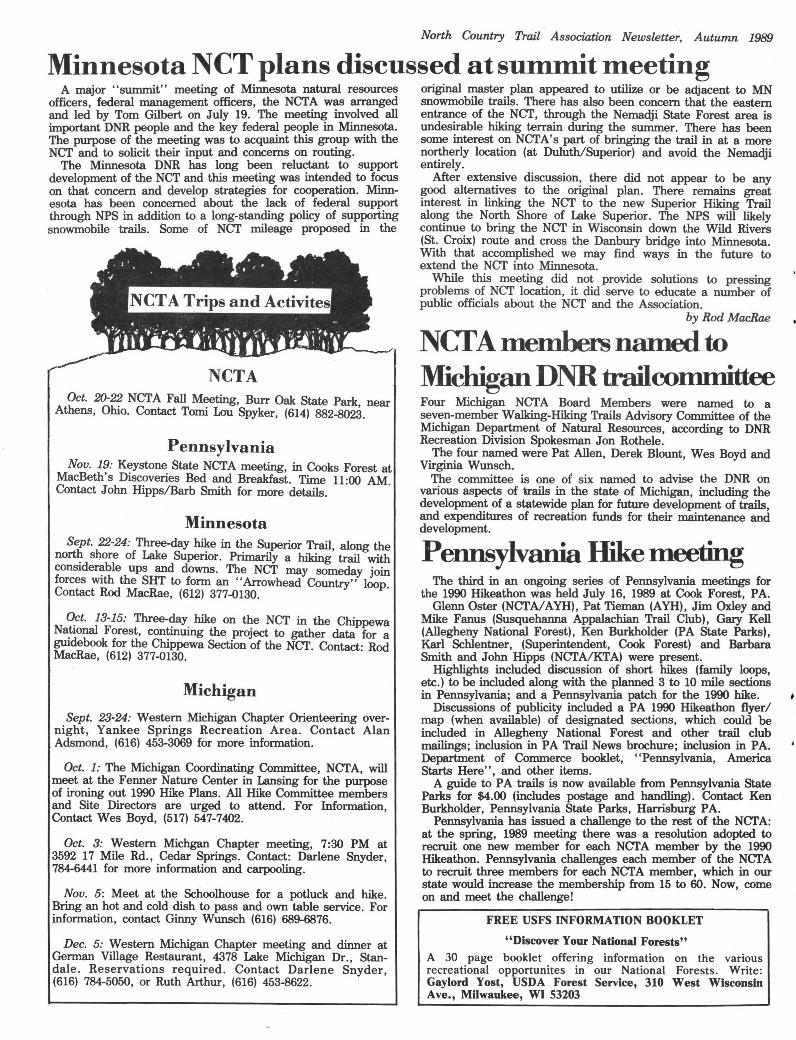
Michigan
()_ct. 13-15: Three-c;Iay_ hike on the NCT in the Chippewa Na?onal Forest, con~mwng the project to gather data for a guidebook for the Chippewa Section of the NCT. Contact: Rod MacRae, (612) 377-0130.
Sept. 22-24: Three-day hike in the Superior Trail, along the nort~ . shore of Lake Superior. Primarily a hiking trail with considerable ups and downs. The NCT may someday join forces with the SHT to form an "Arrowhead Country" loop. Contact Rod MacRae, (612) 377-0130.
Minnesota
Pennsylvania Nov. 19: Keystone State NCTA meeting, in Cooks Forest at
MacBeth's Discoveries Bed and Breakfast. Time 11:00 AM. Contact John Hipps/Barb Smith for more details.
Oct. 20-22 NCTA Fall Meeting, Burr Oak State Park near Athens, Ohio. Contact Tomi Lou Spyker, (614) 882-8023.
NCTA
A major "summit" meeting of Minnesota natural resources officers, federal management officers, the NCTA was arranged and led by Tom Gilbert on July 19. The meeting involved all important DNR people and the key federal people in Minnesota. The purpose of the meeting was to acquaint this group with the NCT and to solicit their input and concerns on routing.
The Minnesota DNR has long been reluctant to support development of the NCT and this meeting was intended to focus on that concern and develop strategies for cooperation. Minn esota has been concerned about the lack of federal support through NPS in addition to a long-standing policy of supporting snowmobile trails. Some of NCT mileage proposed in the
Minnesota NCT plans discussed at summit meeting original master plan appeared to utilize or be adjacent to MN snowmobile trails. There has also been concern that the eastern entrance of the NCT, through the Nemadji State Forest area is undesirable hiking terrain during the summer. There has been some interest on NCTA's part of bringing the trail in at a more northerly location (at Duluth/Superior) and avoid the Nemadji entirely.
After extensive discussion, there did not appear to be any good alternatives to the original plan. There remains great interest in linking the NCT to the new Superior Hiking Trail along the North Shore of Lake Superior. The NPS will likely continue to bring the NCT in Wisconsin down the Wild Rivers (St. Croix) route and cross the Danbury bridge into Minnesota. With that accomplished we may find ways in the future to extend the NCT into Minnesota.
While this meeting did not provide solutions to pressing problems of NCT location, it did serve to educate a number of public officials about the NCT and the Association.
by Rod Ma.cRae
NCTA members named to Michigan DNR trailcommittee Four Michigan NCTA Board Members were named to a seven-member Walking-Hiking Trails Advisory Committee of the Michigan Department of Natural Resources, according to DNR Recreation Division Spokesman Jon Rothele.
The four named were Pat Allen, Derek Blount, Wes Boyd and Virginia Wunsch.
The committee is one of six named to advise the DNR on various aspects of trails in the state of Michigan, including the development of a statewide plan for future development of trails, and expenditures of recreation funds for their maintenance and development.
Pennsylvania Hike meeting

As reported elsewhere, a new 7.5 mile segment of the Finger Lakes Trail . has been completed near Portageville, NY. This segment fills in a long gap, making continuous usable trail from Cook Forest State Park in Pennsylvania to Bath, NY. Ted Anderson, Tom Dziekonski and Bob Emerson are to be especially commended for their efforts. There are two other gaps on the portion of the FLT the NCT is to share, and FLTC members are working to fill them in.
The cover of the October "Backpack er'' Magazine may talk about Great Basin National Park and ultralight hiking boots, but in the "New Trails" section on Page 64 is a full page article on the NCT written by NCTA president Tom Reimers. Word is getting out!
Looking for end-to-end partner Dear Editor,
I am one of those rumoured to be of those going end to end. I was tenta- planning a thru-hike of the NCT. I spoke tively planning to travel East to West briefly to Tom Reimers at the A.T.C. in starting as early as weather permits, but Pennsylvania in June and was just about would like to get more hiker feed-back as to write to this Newsletter. and Derek mentioned. If no partners materialize I Blout (again!) looking for a partner for a will still go; although if someone ab- '90 thru-hike as part of the anniversary solutely positively wanted to go in '91, I celebration. Then this week I received could wait that one more year. the summer newsletter and was quite The Newsletter does not have a "Part- interested to see both a mention of such ners Wanted" column yet - perhaps it in the editor's corner and a full page of will in the future. For now could a note the first info of any kind I've been able be run saying I am seeking a partner and to obtain so far about thru-hiking NCT. info, please? This article was a very helpful planning Female partner wanted to thru-hike start. Living in south central PA. where NCT in '90. the weather is mild - including the Starting as early as possible. winters - I did not realize states so close Information on thru-hiking, trail condi- to me (New York, Ohio) had such ex- tions early and late in the season at both treme weather conditions i.e. deep mud ends also sought. Please contact: Diana and such late snow. In fact I would like Ludwig, P.O.Box 30, Rehrersburg, PA to hear more from others about trail 19550, [717] 933-5709. conditions in March, April, May and Thank you for your time and help. Sept. Nov. in both North Dakota and Diana Ludwig New York state, so I may compare · advantages of direction of travel. Editor's Note:
I plan to hike as part of the '90 OK, Diana - it would be redundant this anniversary celebration when, hopefully, time - but hereafter, we'll run "Partners there will be a few "extra" hikers along Wanted" as necessary. Please keep the trail and, even more hopefully, some under 50 words or so. - WB
Sincerely yours Don Beattie
The Appalachian Trail Conference has. sued the Park Service over an agreement the NPS signed with a Vermont Ski Resort. The ATC is upset, at least partly because the government-funded reserved trail corridor in the area will be necked down to 700 feet from the standard 1000 feet. The ATC has also requested $23 million per year for the next two. years for further land acquisition, a funding level twice anything they've had in the past decade.
After 15 years, Lois Fogelsanger has given up being editor of .the Cayuga Trails Club newsletter. The new editor is Barbara Morse, assisted by Doris Abbott. Best wishes to all concerned.
and M123 -- one bulldozing the trail, the other a forest service employee. They were woring through a swampy area eventually to be filled with sand. The worker said I was the third hiker he'd seen this summer. One section I completed on the recent trip (H42 to M123) was flooded with several inches of water near Clear and Silver Creeks when
·I left it in 1982. I could have walked highways then, but it was nicer walking a forest trail through the area last week.
It's encouraging seeing the trail progressing. I even got to walk across the "Little Mac" bridge {Autumn 1988 and Winter 1989 newsletters) over the Naomikong River on this trip. It's getting there!
Dear Wes: Last week I spent 4 days (my only
summer vacation as it turns out) hiking the NCT. I completed 3 segments in the eastern Michigan upper peninsula that filled in gaps from my 1980-82 hikes. I've now completed from Mackinac City to Sand Point in the Pictured Rocks National Lakeshore.
One sad observation: the National Forest "North Country Trail" sign at NF 3104 trailhead which was new when I hiked the forest section in 1982 was totally demolished along with its 2 4x4 mounting posts -- all debris laying in the ditch at the side of the road.
In hiking the section from Grand Marais to St. Ignace, I have not met a single hiker. Last week I did meet 2 persons on the trail between East Lake
Trail in eastern U .P. gets light use *** According to Pathways Across America, the number of rails-to-trails conversions in the US has climbed to 203, and Americans used these trails an estimated 27 million times in 1988. Total rail-trail mileage climbed to 2, 701.
***
The Buckeye Trail Association Trail blazer reports that the Delphos Canal Commission has been created for the purpose of restoring and displaying the remains of the canal boat "Marguerite," which sank in the 1920s. The old Miami and Erie Canal Boat will be another attraction along this western Ohio seg ment of the NCT.
Those who have attended the spring and fall NCT A meetings the last couple years know that NCT A president Tom Reimers is big on Roberts Rules of Order. Formerly president of the Cayuga Trails Club, Tom has now been named president of the Finger Lakes Trail Con ference, ascertaining that he will still be banging a gavel. Congratulations, Tom!
There are but few Adirondack Shelters along the entire route of the NCT; FLTC Trails Chairman Howard Beye reports that one was destroyed by fire on April 21, in the Kanakadea County Park of Steuben County, NY. According to Beye, a group of unsupervised local youths 'were apparently there at the time, and a campfire apparently got out of control. Beye reports that since another lean-to is .. ---------------------------------, nearby, the destroyed one probably won't be replaced. Letters to the Editor j
NCT:FYI North Country Trail Association Newsletter, Autumn 1989

NORTH COUNTRY NATIONAL SCENIC TRAIL: Status by segments, August, 1989 Gerti- Connect- Other+
North Dakota lied ingt Baw Beese Trail 5.0* Fort Ransom State Park 1.0 Lake Hudson State Rec. Area 4.2* Sheyenne State Forest 1.0 Anticipated: 872; Usable: 578.3 [66%] 396.5 16.6 165.2 Sheyenne National Grassland 25.0* Anticipated: 435.0; Usable, 27.0 [6%] 2.0 25.0 Ohio
Buckeye Trail 258.8 345.0 Minnesota . Wayne NF (not common with Buckeye) 20.0 Maplewood State Park 4.0 Beaver Creek State Park 6.2 Tamarac Wildlife Refuge 17.0 Anticipated: 708; Usable: 629.2 [86%] 284.2 345.0 Itasca State Park 8.0 Paul Bunyan State Forest 6.0* Pennsylvania Chippewa National Forest 68.0 McConnels Mill State Park 1.4 Savanna State Forest 12.0 McConnels-Glacier connection 2.0* Jay Cooke State Park 4.0 Glacier Ridge Trail 13.0 Minnesota-Wisconsin Border Trail 23.0 Cook Forest State Park 8.0 Anticipated: 373.0; Usable 142.0 [36%) 68.0 68.0 6.0 Baker Trail 4.5
Allegheny National Forest 92.0 Wisconsin Anticipated: 198; Usable: 120.9 [61%) 114.4 4.5 2.0 Brule River State Forest 13.5 Chequamegon National Forest 60.0 New York Copper Falls State Park 7.8 Finger Lakes Trail 26.8 308.7 Anticipated: 155; Usable 81.3 (52%) 60.o 21.3 Cortland-Canastota Rail-Trail 11.0*
Old Erie Canal Recreation Trail 17.5 Michigan Rome Bikeway 3.0 Ottawa National Forest (2 units) 76.0 29.0 Anticipated: 518; Usable: 367 (71%) 26.8 329.2 11.0
' Porcupine Mountian State Park 15.5 Tibbets Falls Trail 5.8 Craig Lake State Park 4.5 SUMMARY AND TOTALS (unnamed) Marquette County 6.0 Marquette Bikeway 6.0 Hiawatha National Forest (3 units) 93.0 State Antici % of Certi- All Total State Pictured Rocks National Lakeshore 42.8 12ated NCT fied Other State % Lake Superior State Forest (2 units) 46.5 Muskallonge Lake State Park 1.5 ND 435 13.3 2.0 25.0 27.0 6.2 Taquamenon Falls State Park 22.2 MN 373 11.4 68.0 74.0 142.0 36.5 Mackinac-Conway Trail 23.0** WI 155 4.8 60.0 21.3 81.3 52.5 Wilderness State Park 9.4 MI 872 26.8 396.5 181.8 578.3 66.3 Spring Brook Pathway 2.5 OH 708 21.7 284.2 345.0 629.2 86.2 Warner Creek & Jordan River Pathways 11. 7 PA 198 5.9 115.5 6.5 120.9 61.0 Mackinac State Forest 11.0* NY 518 15.5 26.8 340.2 367.0 70.8 Shore-to-Shore Riding-Hiking Trail 39.5 14.2 3259 951.9 993.8 1945.7 59.7 Manistee NF (several units) 52.6 23.0 Manistee NF Croton Dam segment 7.0* t Listed as eligible for certification in Comprehensive Plan. Rogue River State Game Area 7.0 Yankee Spring State Rec. Area 7.2 t Marked trail not recognized by NPS as connecting section. Battle Creek Linear Parkway 11.0 * Planned for completion in 1989? M-99 Bikeway 3.0 ** 3 miles under NCT development; rest is temporary route
summer. It includes some projects under way (and the compiler is not necessarily aware of all of them), and includes recently identified steppingstones along the general route of the trail. One major project, tlie 128-mile former Adirondack Railway rail-trail project in New York has not been included, since it is not yet clear if the NCT will follow this route.
The official projected length of the North Country Trail of 3,259 miles is probably much too short, but it is a convenient figure to base analysis on from year to year. It would not be surprising if the final length of the NCT turned out to be 3, 700 or 3,800 miles.
The longest continuously usuable segment of the NCT -- 610 miles - is the portion of the Buckeye Trail in Ohio shared with the NCT (see elsewhere in this issue). However, much of this is on-road. Completion of a 6-mile segment of the Finger Lakes Trail in New York strung together a 295 mile segment, mostly off-road, from the Baker Trail in Pennsylvania to Bath, New York, bumping Michigan's 206-mile Munising to St. Ignace section to second place in the running for the longest segments located largely off-road.
At least 66 miles of trail are currently under construction or firmly planned, and other projects are under way. The number and size of these is a little fuzzy, as some projects known to be under way are indefinite about dates or status.
This is a working list, and totals should only be regarded as approximate, based on current information. Segments and totals have not been reviewed or verified by the National Park Service, and should not be regarded as official.
Some comments and observations: The National Park Service only recognizes the "certified" and
"connecting" segments, and the latter is misnamed: the segments heretofore listed as "connecting" are actually "elig ible for certification in the 1982 Comprehensive Plan''. No new connecting segments have ever beeri designated. Since new certifications have largely come from these (85 miles Aug. 88 - Aug. 89) their number is dwindling; only New York and Minnesota still have significant amounts, and the total is down to 439.6.
The NPS categories do not tell the whole story of usable trail. They do not, for example, reflect new trail awaiting certification, marked on-road segments, and the like, so the category "other" has been included; it almost could have been called, "eligible to be connecting sections."
Obviously, "other" is pretty arbitrary. It does not, for example, include cycle/ ATV /ORV routes - but does include on-road mileage on trails such as the Buckeye, where off-road mileage is certified. It does include some segments open to snowmobiles in the winter, but closed to motorized use in the
It's time once again for the annual survey of the North Country Trail, and progress has been heartening. Since the last survey, 76 miles of trail have been certified in Michigan, 21 miles in New York, and 10 miles in Ohio, putting new certifications over the long-time goal of 100 miles per year for the first time since 1982, and leaving the door open to reach 1,000 certified miles in 1990.
What's done so far: 1989 Trail Status Survey North Country Trail Association Newsletter, Autumn 1989 PageB

-- by Wes Boyd
There are, of course, many problems. Routing the trail this way may not work, and alternatives may have to be sought. There is not a lot of local support, as population density is low -. Maintaining hiking/horse trail across hundreds of miles of prairie is a problem that waits to be solved. Probably the North Dakota segment of the NCT ought to be included in the High Plains Trail, because the problems and solutions are more similar than they are. to the largely forested NCT.
But the rewards are greater than just the uniqueness of a real coast-to-coast trail: the big dome of blue sky overhead as the grasslands roll off to the horizion (they don't call Montana the Big Sky Country for nothing), the largely-unvisit ed and rugged Missouri Breaks, the splendor of the Judith Basin, that Charley Russell made famous, the clouds of waterfowl in the many nesting areas along the route.
It could be done, and at least should be considered. If it ever comes about, remember, you heard it here first.
ental Divide and the North Country NSTs needs a name to make it easier to work with, so, let's just call it the "High Plains National Scenic Trail.''
Across America, the trail is essentially completed, and is seeking National Scenic Trail status.
The second leg is already certified National Scenic Trail, following the Continental Divide Trail south from Glacier to about the latitude of Great Falls, Montana.
From there, things get a little fuzzy, but amazingly enough, there's a lot of public land in eastem Montana and western North Dakota, though a good chunk of it more or less parallels the Lewis and Clark NHT. There's a good amount of public land in the Lewis and Clark National Forest, to about a hundred miles east of Great Falls. From there, it's not far to the Missouri Breaks Wild and Scenic River, which connects directly with the Charles M. Russell National Wildlife Refuge around Ft. Peck Lake. There's kind of a blank in public lands 'the 100 miles or so to the North Dakota border, but immediately on getting into North Dakota, you get to the Little Missouri National Grassland and the north unit of the Theodore Roosevelt National Park. By then, you're not far from Corps of Engineers land around Lake Sakakawea and the NCT trailhead.
The above route is kind of an over view, but it would seem as if the concept could stand a little more formal study. The idea of a trail connecting the Cont.in-
It's in all the literature; the North Country Trail connects with the Lewis and Clark National Historic Trail, making the two the components of a coast-to coast hiking trail.
For the purposes of this essay, we'll ignore the fact that the east end of the NCT does not go all the way to the Atlantic, nor is it planned to connect at the end with a trail system that does. That's basically politics.
On the west end, mere politics does not overlook the fact that the Lewis and
\ Clark NHT is a water route for most of its distance west -- save for a few hundred miles crossing the continental divide, and a lot of that is road route.
I've recently been corresponding with a man who plans a multi-year coast-to coast trip, using the NCT part of the way. We've both come to the same conclusion: the Lewis and Clark NHT, fine concept though it is, is not very usable as a hiking trail, and can't be made one without destroying the concept.
The idea of a coast-to-coast hiking trail is too good to let die; in fact, it's probably closer to complete than we might think.
The first leg, from the west coast, is on the Pacific Northwest Trail, which runs from Puget Sound to Glacier National Park. According to Pathways
Is it time for a "High Plains Trail"? A Montana - North Dakota route
Breakfast in meeting room 1990 meeting; presentation of Ohio plan, discussion of other items
Meeting ends
Sunday, October 22 8:00 AM 9:00AM 11:30-12:00
Doughnuts at BTA Cabin NCTA Board of Directors meets at meeting room in lodge
Lunch on your own Special BTA General Meeting at BTA Cabin (BTA Members only)
Short and long hikes; routes to be announced Evening banquet at Whipoorwill Room at lodge
Ohio Canal Society talk, ''Canals of Ohio", by Jim Sprague
12 noon 12:30 PM 1:30 PM 6:30 PM 8:00 PM
Saturday, October 21 Breakfast on your own 7:00 - 8:00 AM 8:30AM
Registration opens at Buckeye Trail Association Cabin Welcome party at BTA Cabin (Wine tasting, snacks available)
1989 NCTA FALL MEETING SCHEDULE Friday, October 20 6:00 PM 7:30
QUIRED FOR THIS MEETING. Indi viduals requiring more information than is available on the pre-registration form may call Tomi Spyker at (614) 882-8023 in the evenings, or Emily Gregor (216) 884-0281.
want to come early or stay after the meeting in order to hike the 20-mile backpack trail that circles Burr Oak Lake.
Due to meeting and room reservation deposits required by the lodge, PRE REGISTRATION AND PAYMENT IS RE-
On October 20-22 the Buckeye Trail Association will host the fall meeting of the NCTA at Burr Oak State Park Lodge. The lodge is located in the rolling hills of southeastern Ohio. The fall color is expected to be at its best during the weekend.
Several events will highlight the meeting. On Friday, a dedication cere mony and short hike will occurr on the new 10-mile section of the North Country Trail through the Athens Ranger District of the Wayne National Forest. (There will be hikes during the meeting on the section of North Country Trail that passes through the state park.) There will be a Hospitality Night at the Buck eye Trail Cabin on Friday evening, with an Ohio Wine Tasting for interested individuals. Saturday will feature good fellowship and an evening banquet. The Saturday evening program will be a talk and slide show by the Canal Society of Ohio on the Ohio Canal System. Sunday will offer a breakfast get-together before starting the days events.
Individuals who wish to combine some serious hiking with the meeting may
BT A to host fall Illeeting at Burr Oak
Page 11 North Country Trail Association Newsletter, Autumn 1989
North Country: Trail Association Fall-lVee-ting October 20-22

The Hikers Paradise
783 V Cliffside Dr. AKRON, OH 44313
ALPINE ADVENTURE TRAILS TOURS, lac.
swissair/1
Moderate optional length DAY hiking along skyline tralla. 7-2 week tours baaing at 15 mountain 3-4 star hotels. All hikes guided by NCT member Cecil Dobbins. For e free color brochure call 1216> 867.-3771, or write to:
GRINDELWALD SAAS-FEE
GSTAAD FLUELEN
ENGELBERG LEUKERBAD
KANDERSTEG ZERMATT MURR EN LENK WENGEN BETTMERALP RIG 1-K ALT &AD
SWISS ALPS
The deadline for the winter issue of the NCTA- Newsletter is Novermber 30, 1989. For future reference, the deadline for the spring issue will be February 28, 1990.
Working on building a trail from behind a keyboard is all right to a point, but every now and then it helps to take tools in hand and cut brush to bring things into perspective. Thus it was that I spent a couple days (all I could get free from work) with a Sierra Club-sponsored trail crew, led by NCTA Board Member Vince Smith, working on hacking out new trail connecting Michigan's Jordan River Pathway and the Shore-to-Shore Riding-Hiking Trail.
In the up and down weather we've had this summer, it was wonderful to catch a couple nice days to be out in the woods, fire rake in hand. I'd never seen one of these particular weapons before, and for the benefit of those not familiar with the tool, it's kind of like a regular rake, except it has only four sharp triangular teeth, about three inches on a side. It took me about thirty seconds to become impressed with the utility of this tool for clearing treadway, knocking down small branches and grubbing out saplings. This rake, along with a host of other tools, were among those provided by the National Park Service earlier this year for trail work.
The area we were working in had patches of near-jungle second growth saplings and. brush, but with nine great people in the crew, ranging from 13 to somewhere possibly on the far side of 70, we hacked along at a satisfying rate. (see Cover Photo.)
Over the two-week· period of the workbee, Vince had people from Michigan, Ohio, Illinois, Wisconsin and West Virginia chipping away at the 16-mile segment. Vince wasn't sure he could get the whole stretch in in the two weeks, and, as yet, I haven't heard if he did.
One thing Vince did accomplish was a lot of real good local publicity for the North Country Trail, and one item that got well beyond local, when a story on Vince and the second-week trail crew got plastered over the front of a section of the Sunday Detroit News, the largest circulation newspaper in Michigan.
Vince deserves extra credit, as he spent nearly a month in the area last spring working out route details with the local DNR officials, flagging the route, and making arrangements for and fixing up a camp site on a small lake. After Vince made a visit to.Isle Royale after this work party, he.-Don and Gene Elzinga, and Doug Welker led another two-week work party in the central upper peninsula. I haven't heard how that came out, either.
I've got to admit that the deer flies were a pain, but the good people more than made up for the flies. Put me down for next year, Vince.
~00 •·lllIIIIIIIIIl~ i1111'1111111\
Keyboard Trails
.by the Editor
'illH ~
North Country Trail Association Newsletter, Autumn l!J89
Special offer! Any new commercial memberships to the NCTA -- which cost $500 - will receive a premium of four free
full-page ads in the NCTA newsletter. This is a $200 savings to commercial members.
Four Issues $40.00 $80.00 $120.00 $200
Page size 1/8 1/4 1/2 1
NEWSLETIER ADVERTISING FEE SCHEDULE
Single Issue $15.00 $25.00 $40.00 $70.00
Please report any errors or ornlssions to the editor.
New York: Finger Lakes Trail Council; Tom Reimers Barbara Smith, John G. Hipps
Buckeye Trail Association: Emily Gregor Michigan NCTA Coordinating Committee: _Wes Boyd
Bob Dries Minn_ NCTA Coordinating Committee: Rod MacRae, Ed Solstad
Linda Vargeason
Pennsylvania: Ohio: Michigan: Wisconsin: Minnesota: North Dakota:
(402) 221-3481
(701 I 232-8513
(612) 377-0130 (216) 375-4461 (612) 822-0569
(715) 635-8193 (414) 354-8987
(616) 452-4487 (517) 547-7402 (313) 548-1737 (616) 891-1366 (616 I 784-6641 (313) 280-2921 (616 I 363-5966 (313) 231-1257 (616) 454-0545 (616 I 689-6876
(216) 884-0281 (216) 867-3371 (216) 884-4757 (614 I 882-8023
REGIONAL CHAPTERS/COORDINATORS/AFFILIATES
NATIONAL PARK SERVICE ADMINISTRATOR Tom Gilbert, National Park Service 1709 Jackson si-. Omaha NE 68102-2571
North Dakota Linda (Vargason), 1536 Second Ave. S, Fargo ND 58103
Minnesota Rod MacRae, 1210 W. 22nd St., Minneapolis MN 55405 Jim Richards, Rt. 1, Callaway MN 56521 Ed Solstad, 3701 Pillsbury Ave. S., Minnespolis MN 44509
Wisconsin Robert E. Dreis , 1632 Smith St., Spooner WI 54801 Gaylord Yost, 2925 W. Bradley Rd., River Hills WI 53209
Michigan Pat Allen, 2215 Sylvan Dr. SE, Grand Rapids Ml 49506 Wes Boyd, 14845 Rome Rd., Manitou Beach, Ml 49253 Derek Blount, 906 N. Alexander, Royal Oak Ml 48067 Ken Gackler, 413 W. Johnson sr., Caledonia Ml 49316 Art Holland, 492 Four Mile Rd., Comstock Park, Ml 49321 Martha K. Jones. 1857 Torquay Ave., Royal Oak Ml 48073 Ruth Sack, 2317 Foster NE, Grand Rapids Ml 49505 Vince Smith, Box 76, Whitmore Lake Ml 48189 Jim Warmels, 696 Plymouth NE, Grand Rapids Ml 49506 Virgina Wunsch, Rt. 1, Mundy Ave., White Cloud Ml 49349
Ohio Emily Gregor, 6502 Olde York Rd., Parma Hts., OH 44130 Cecil Dobbins, 783 Cliffside Dr., Akron OH 44313 Jim Sprague, 4406 Maplecrest, Parma CH Tomi Lou Spyker, 7040 Africa Rd., Rt. 1. Galena OH 43201
(814) 435-2371 (814) 435-2371 (412) 364-2864
Ave., Pittsburg PA 15222
(607) 272-5119 (716) 288-7191 (607) 564-3548 (607) 272-8679
Pennsylvania Barbara A. Smith, 11 W. Main St., Galeton PA 16922 John G. Hipps, 11 W. Main St., Galeton PA 16922 Glenn Oster, 784 Olive sr., Pittsburg, PA 15237 Paulette Johnson, West. PA Conservancy, 316 4th
New York Doris and Clifford Abbott, Rt. 1, Box 259, Spencer NY 14883 Howard S. seve. 202 Colbourne Rd., Rochester NY 14609 Laura McGuire, 1 Boylan Rd., Newfi8'1d NY 14867 Thomas J. Reimers, 3C Wildflower Or., Ithaca NY 14850
BOARD OF DIRECTORS
OFFICERS President: Thomas Reimers, 3C Wildflower Dr. Ithaca NY 14850 (607) 272-8679 Vice-President: Ruth Sack, 2317 Foster NE, Grand Rapids Ml 49505 (616) 363-5966 Secretary: Tomi Lou Spyker, 7044 Africa Rd., Galena OH 43201 (614) 882-8023 Treasurer: Kenneth Gackler, 413 W. Johnson, Caledonia Ml 49316 (616) 891-1366 Hq. Manager: Virginia Wunsch, Rt. 4, White Cloud Ml 49349 (616) 689-6876 Membership Chairperson: Martha Jones 1990 Hike Coordinator: Derek Blount Founding President: Lance Field
Editor: Wes Boyd, 14845 Rome Road, Manitou Beach, Ml 49253
NEWSLETTER of the
NORTH COUNTRY TRAIL ASSOCIATION PO Box 311, White Cloud, Ml, 49349
Page2

Phone--------------
Name
Address
I wish to join the North Country Trail Association.
Enclosed is $ for a
membership.
Adult $ 10.00 Family (includes children under 18) $ 15.00 Student $ 5.00 Organization $ 25.00 Supporting $ 50.00 Donor $ 250.00 Life : $ 300.00 Patron $ 5000.00 Commercial $ 500.00
D Yes, I would like to further support the North Country Trail Association with my tax free contribution of $ .........
. enclosed.
Annual Dues: membership year runs from July 1 through June 30. Dues paid from April 1 on are valid through June 30 of the following year.
APPLICATION FOR MEMBERSHIP
North Country Trail Association PO Box 311 White Cloud, Ml 49349
You can help with making the dream a reality by joining the
North Country Trail Association.
, ~uilding the North Country National Scenic Trail will be a big job. Much has been completed, but there's still a. lot to do.
THAT'S BEi NG REALIZED
North Country National Scenic Trail
A DREAM