njdep - njgs - bulletin 66, mapping digest for new jersey ... · mapping digest for new jersey ......
TRANSCRIPT
MAPPING DIGESTFOR
NEW JERSEY
BULLETIN 66
NEW JERSEY GEOLOGICALSURVEYDEPARTMENTOF CONSERVATIONAND ECONOMICDEVELOPMENTNEW JERSEY GEOLOGICAL SURVEY

Due to a reorganization (1965)withinthe Department of Con_nerce_ all referencesin this booklet to '_nited States Coast and
Geodetic Survey _ should read "Environmental
Science Services A_m_nistration, Coast and
Geodetic Survey". City and street addresses
areunchanged.
NEW JERSEY GEOLOGICAL SURVEY
BULLETIN 66
MAPPING DIGEST
FOR
NEW JERSEY
by
HAROLD J. BARKER, JR.
Topographic Engineer
STATE OF NEW JERSEY
RICHARD J. HUGHES, Governor
Department of Conservation and Economic Development
ROaEI',T A. RoE, Commissioner
Division of Resource Development
KENNETH n. CREVELING, Director
Bureau of Geology and Topography
KEMBLEWIDMER, State Geologist
Trenton, New Jersey
1965
NEW JERSEY GEOLOGICAL SURVEY
STATE OF NEW JEHSEY
DEPARTMENT OF CONSEI_VATION
AND ECONOMIC DEVEI_p_4ENT
OFFICE OF THE COHMISSIONER
TRENTON
February 1965
As part of our State's expanded service
to New Jersey citizens and municipalities, this
publication has been prepared by the Bureau of
Geology and Topography of the Department of
Conservation and Economic Development. Prepared
with material provided by federal, State and
private agencies, Mappin_ Di_est for New Jersey
fills a long standing need for a reference volume
containing basic mapping data.
Your comments and suggestions are
earnestly solicited and we appreciate the oppor-
tunity to be of service.
Sincerely yours,
Robert A. Roe
Commissioner
NEW JERSEY GEOLOGICAL SURVEY

CONTENTS
Introduction ........................................................................................ vii
A Brief History of Some New Jersey Maps, 1654-1964 .............. 1
Plane Coordinate Systems ................................................................ 5
State of New Jersey, Chapter 116, Laws of 1935 ............................ 9
Surveylng-The Past and the Future ................................................ 10
Magnetlc Data .................................................................................. 12Horizontal Control Datums ............................................................ 15
Vertical Control Datums .................................................................. 17
The Relationship Between Vertical Control Datumsand Mean Sea Level .................................................................. 19
Federal Agency Aerial Photographic Reproductions ...................... 21
Commercial Aerial Photography in New Jersey .............................. 22
Bibliography of Selected References .................................................. 24
Su/'vey Using State Plane Coordinates .......................................... 26
New Jersey Geodetic Control Survey Monumentsand Bench Marks ...................................................................... 31
Policy Statement of the Bureau of Geology and Topography ...... 32Destruction of Geodetic Control Stations .......................................... 33
Explanation of New Jersey Geodetic Control SurveyStation Designations .................................................................. 33
Abbreviations Used by the New Jersey Geodetic Control Survey .... 34
U.S. Coast and Geodetic Survey Control Data,User-Charge System .................................................................... 35
Price List-U.S. Coast and Geodetic Survey TriangulationStation and Level Line Data ...................................................... 37
U.S. Coast and Geodetic Survey Tidal Bench MarkData for New Jersey .................................................................. 40
Chart Scales and Equivalents .............................................................. 44List of New Jersey Maps ................................................................ 49
Index to Map List ............................................................................ 65Rear Pocket
Geodetic Control Map Index
List of Air Survey Firms
List of Official New Jersey, New York City and PhiladelphiaSales Agents for U.S. Coast and Geodetic Survey Chartsof Coastal Waters
Magnetic Declinations Map, 1960 Epoch
V
NEW JERSEY GEOLOGICAL SURVEY

INTRODUCTION
For several years this Bureau produced an eleven-page publicationtitled Sources o[ ln[ormation /or New Jersey Engineers and Land Sur-veyors, compiled by Robert G. Blanchard, who retired from the positionof Topographic Engineer in t956. This booklet is an expansion of Mr.Blanchard's work. A considerable amount of additional information has
been inserted, price schedules have been updated, and the original datahas been rewritten and rearranged. The material contained herein cannotbe found in any single publication, since general references by their verynature do not dwell upon data related to a single state.
Examination of reference lists at the end of each article should ade-quately indicate the high degree of indebtedness to the United StatesCoast and Geodetic Survey. A total of fifty-two personal communica-tions and publications from this organization have been cited or recom-mended. Personnel of the United States Geological Survey Map Infor-mation Office kindly furnished many details concerning Federal maps,and their time spent in research must be gratefully acknowledged. Sev-eral additional Federal agencies have contributed to a lesser extent, buttheir unfailing cooperation cannot go unmentioned. Specific acknowledge-ment of each fact in the text has not been inserted except in the caseof direct quotations, or where a particular article has been judged to beabove average in significance.
An expression of appreciation must also be tendered to members ofthe staff of the Bureau of Geology and Topography for their assistancein the preparation of this publication. Individual recognition must be
given to Miss Elaine Ferko, Senior Stenographer, who patiently typedand retyped most of the drafts and final copy.
Since many sources are listed in this publication, it will be to theadvantage of both the reader and the agencies involved if careful atten-tion is paid to directions for obtaining materials listed. Time losses inacquiring the desired information can be held to a minimum when theproper originating agency is contacted. In all cases where a specificcharge is indicated, requests for material should be accompanied by acheck or money order in the proper amount to avoid delay. Prices asshown on succeeding pages are subject to change.
Readers are invited to suggest additional material for inclusion in fu-ture reprints of this publication.
HAROLD BARKER, JR.
Topographic Engineer
vii
NEW JERSEY GEOLOGICAL SURVEY

SECTION I
NEW JERSEY GEOLOGICAL SURVEY
A BRIEF HISTORY OF SOME NEW JERSEY MAPS,
1654 - 1964
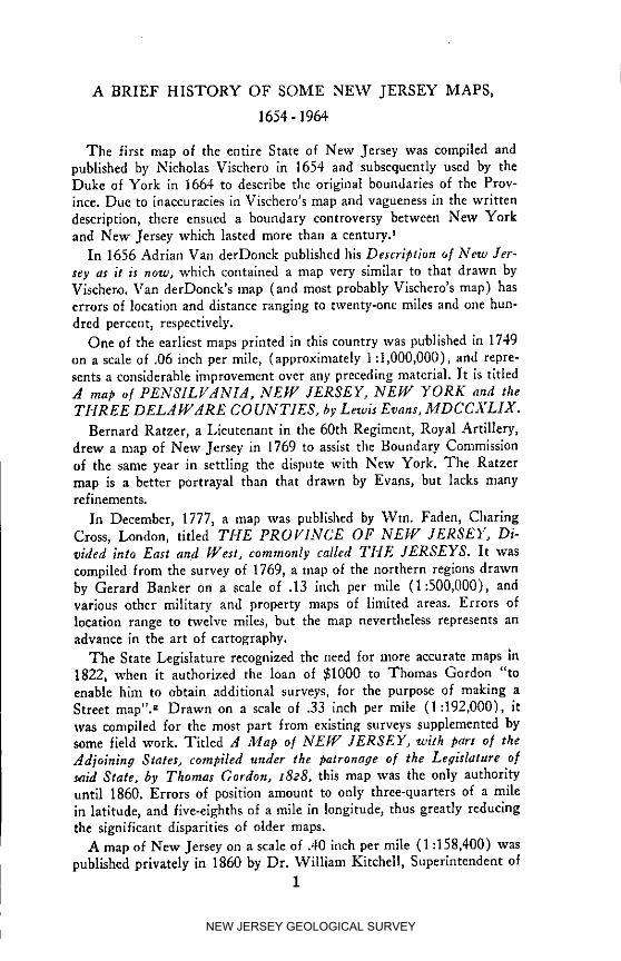
The first map of the entire State of New Jersey was compiled andpublished by Nicholas Vischero in 1654 and subsequently used by theDuke of York in 1664 to describe the original boundaries of the Prov-ince. Due to inaccuracies in Vischero's map and vagueness in the writtendescription, there ensued a boundary controversy between New Yorkand New Jersey which lasted more than a century.J
In 1656 Adrian Vail derDonck published his Description of New Jer-sey as it is now, which contained a map very similar to that drawn byVischero. Van derDonck's map (and most probably Vischero's map) haserrors of location and distance ranging to twenty-one miles and one hun-dred percent, respectively.
One of the earliest maps printed in this country was published in 1749on a scale of .06 inch per mile, (approximately 1:1,000,000), and repre-sents a considerable improvement over any preceding material. It is titledA map o[ PENSILVANIA, NEW JERSEY, NEW YORK and theTHREE DELAWARE CO UNT1ES, by Lewis Evans, MDCCXLIX.
Bernard Ratzer, a Lieutenant in the 60th Regiment, Royal Artillery,drew a map of New Jersey in 1769 to assist the Boundary Commissionof the same year in settling the dispute with New York. The Ratzermap is a better portrayal than that drawn by Evans, but lacks manyrefinements.
In December, 1777, a map was published by Win. Faden, CharlngCross, London, titled THE PROI/1NCE OF NEW JERSEY, Di-vided into East and West, commonly called 7"HE JERSEYS. It wascompiled from the survey of 1769, a map of the northern regions drawnby Gerard Banker on a scale of .13 inch per mile (1:500,000), andvarious other military and property maps of limited areas. Errors oflocation range to twelve miles, but the map nevertheless represents anadvance in the art of cartography.
The State Legislature recognized the need for more accurate maps in1822, when it authorized the loan of $1000 to Thomas Gordon "toenable him to obtain additional surveys, for the purpose of making aStreet map". z Drawn on a scale of .33 inch per mile (1:192,000), itwas compiled for the most part from existing surveys supplemented bysome field work. Titled A Map o[ NEW JERSEY, with part o[ the
Adjoining States, compiled under the patronage o[ the Legislature o[said State, by Thomas Gordon, t8e8, this map was the only authorityuntil 1860. Errors of position amount to only three-quarters of a milein latitude, and five-elghths of a mile in longitude, thus greatly reducingthe significant disparities of older maps.
A map of New Jersey on a scale of .40 inch per mile ( 1:158,400) waspublished privately in 1860 by Dr. William Kitchell, Superintendent of
1
NEW JERSEY GEOLOGICAL SURVEY
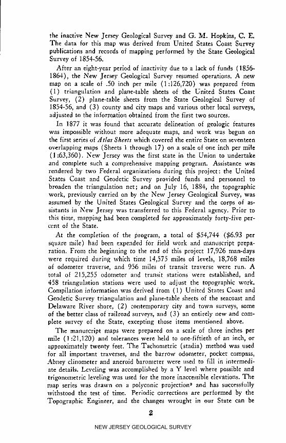
the inactive New Jersey Geological Survey and G. M. Hopkins, C. E.The data for this map was derived from United States Coast Surveypublications and records of mapping performed by the State GeologicalSurvey of 1854-56.
After an eight-year period of inactivity due to a lack of funds (1856-1864), the New Jersey Geoiogical Survey resumed operations. A newmap on a scale of .50 inch per mile (1:126,720) was prepared from(1) triangulation and plane-table sheets of the United States CoastSurvey, (2) plane-table sheets from the State Geological Survey of1854-56, and (3) county and city maps and various other local surveys,adjusted to the information obtained from the first two sources.
In 1877 it was found that accurate delineation of geologic featureswas impossible without more adequate maps, and work was begun onthe first series of Atlas Sheets which covered the entire State on seventeen
overlapping maps (Sheets t through 17) on a scale of one inch per mile(1:63,360). New Jersey was the first state in the Union to undertakeand complete such a comprehensive mapping program. Assistance wasrendered by two Federal organizations during this project: the UnitedStates Coast and Geodetic Survey provided funds and personnel tobroaden the triangulation net; and on July 16, 1884, the topographicwork, previously carried on by the New Jersey Geological Survey, wasassumed by the United States Geological Survey and the corps of as-sistants in New Jersey was transferred to this Federal agency. Prior tothis time, mapping had been completed for approximately forty-five per-cent of the State.
At the compleHon of the program, a total of $54,744 ($6.93 persquare mile) had been expended /or field work and manuscript prepa-ration. From the beginning to the end of this proiect 17,926 man-dayswere required during which time 14,575 miles of levels, 18,768 milesof odometer traverse, and 956 miles of transit traverse were run. Atotal of 215,255 odometer and transit stations were established, and458 triangulation stations were used to adjust the topographic work.Compilation information was derived from (1) United States Coast andGeodetic Survey triangulation and plane-table sheets of the seacoast andDelaware River shore, (2) contemporary city and town surveys, someof the better class of railroad surveys, and (3) an entirely new and com-plete survey of the State, excepting those items mentioned above.
The manuscript maps were prepared on a scale of three inches permile (1:21,120) and tolerances were held to one-fiftieth of an inch, orapproximately twenty feet. The Tachometrlc (stadia) method was usedfor all important traverses, and the barrow odometer, pocket compass,Abney clinometer and aneroid barometer were used to fill in intermedi-ate details. Leveling was accomplished by a Y level where possible andtrigonometric leveling was used for the more inaccessible elevations. Themap series was drawn on a polyconic projection 3 and has successfullywithstood the test of time. Periodic corrections are performed by theTopographic Engineer, and the changes wrought in our State can be
2
NEW JERSEY GEOLOGICAL SURVEY
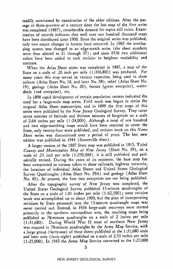
readily ascertained by examination of the older editions. After the pas-sage of three-quarters of a century since the last map of the first serieswas completed (1887), considerable demand for copies still exists. Exam-ination of records indicates that well over one hundred thousand mapshave been distributed since 1900. Since the original series was published,only two major changes in format have occurred. In 1903 the overlap-ping system was changed to an edge-match series (the sheet numberswere then altered to 21 through 37); and since 1956 two additionalcolors have been added to each revision to heighten readability andcontrast.
When the Atlas Sheet series was completed in 1887, a map of theState on a scale of .20 inch per mile (1:316,800) was produced. Formany years this map served in various capacities, being used to showculture (Atlas Sheet No. 18, and later No. 38), relief (Atlas Sheet No.19), geology (Atlas Sheet No. 20), forests (green overprint), water-sheds (red overprint), etc.
In 1898 rapid development of certain population centers indicated theneed for a large-scale map series. Field work was begun to revise theoriginal Atlas Sheet manuscripts, and in 1899 the first maps of thisseries were published by the New Jersey Geological Survey. They coverseven minutes of .latitude and thirteen minutes of longitude on a scaleof 2.64 inches per mile (1:24,000). Although a total of one hundredand two edge-matching maps would have been required to cover theState, only twenty-four were published, and revision work on this NameSheet series was discontinued over a period of years. The last newedition was published in 1944 (Somerville sheet).
A larger version of the 1887 State map was published in 1915. TitledCounty and Municipality Map o/ New Jersey (Sheet No. 39), on ascale of .25 inch per mile (1:250,000), it is still published and peri-odically revised. During the years of its existence, the base map hasbeen overprinted in various colors to show railroads, highway networks,the locations of individual Atlas Sheets and United States GeologicalSurvey Quadrangles (Atlas Sheet No. 39A) and geology (Atlas SheetNo. 40). At present, the first two overprints are not being published.
After the topographic survey of New Jersey was completed, theUnited States Geological Survey .published 15-minute quadrangles ofthe State on a scale of 1.01 inches per mile (1:62,500); some revisionwork was accomplished up to about 1909, but the plan of incorporatingrevisions by State personnel into the 15-minute quadrangle maps wasnever carried out. Instead, in 1934 large-scale resurveys were startedprlmarily in the northern metropolitan area, the resulting maps beingpublished as 7_-minute quadrangles on a scale of 2 inches per mile(1:31,680). During World War II most of northern New Jerseywas mapped in 7_-minute quadrangles by the Army Map Service, witha large group (forty-one) of these sheets published at the 1:31,680 scaleand later ones (torrj.-eight) published on a scale of 2.53 inches per mile(1:25,000). In 1943 the Army Map Service converted to the 1:25,000
3
NEW JERSEY GEOLOGICAL SURVEY

scale for 7_-minute maps; the Geological Survey changed from 1:31,680to a 1:24,000 scale in 1944. Following World War II 7_-minute quad-rangle map coverage for the entire State wns completed by the UnitedStates Geological Survey by one of the following methods: new mapping(including publication of coastal and Delaware River area maps com-piled by the Coast and Geodetic Survey), revision of older 7_-mlnutequadrangle maps of both the Geological Survey and the Army MapService (with conversion to 1:24,000), and by civil conversion of re-vised Army Map Service maps for the Fort Dix area. 4
Plastic relief maps of New Jersey have been available for a numberof years. The Army Map Service publishes a set of maps of the State(scale 1:250,000) several of which are plastic raised relief sheets. Twowill not be produced by this method since they show southern New Jer-sey and parts of Delaware and Maryland areas which are practicallydevoid of relief sufficient to show at the vertical scale used. Private
nrganizations are also publishing many different maps of New Jerseyiz:cludlng raised relief sheets. It is doubtful that anyone today cannotfind a map suitable for their purposes, except for highly detailed, large-scale engineering requirements.
REFERENCES CITED
1. Cook, George H., Topography, l]lagnetism, Climate, Vol. I ofReport of the State Geologist (Trenton: John L. Murphy PublishingCompany, 1888) pp. 40-73.
2. Cook, George H., Annual Report o[ the State Geologist [or theYear r885 (Trenton: John L. Murphy Publishing Company) p. 187.
3. Ibid., pp. 186-203.
4. Data concerning Federal maps furnished in personal communica-tions from the United States Geological Survey Map Information Office.
SELECTED REFERENCES
1. Heusser, Albert H., The For#otten General, Robert Erskine,F.R.S. 0735-r78o) (Paterson, N. J.: The Benjamin Franklin Press,1928).
2. Princeton University Library, New Jersey Road Maps o[ the 18thCentury (Meriden, Conn.: Mcriden Gravure Company, 1964).
'4 " "
NEW JERSEY GEOLOGICAL SURVEY

PLANE COORDINATE SYSTEMS
The United States Coast and Geodetic Survey control network wasbegun in 1816 by Professor Ferdinand Hassler, the first Coast SurveySuperintendent, under enabling legislation passed by Congress on Feb-ruary 10, 1807. Because of its central position along the eastern coastof the United States, New Jersey was chosen for the location of thefirst base llne for the coastal triangulation arcs.
In 1864 when the need for accurate maps of New Jersey becameapparent, Professor Edward Bowser, Assistant in the United StatesCoast Survey, began additional triangulation which eventually formedthe basis for the New Jersey Atlas Sheet series. The costs for this workwere borne entirely by the Federal Government, and upon completion in1887 a total of 458 geographic positions had been established. Since alltriangulation points which had been determined prior to 1880 were com-puted on the Bessel spheroid, the adoption of the 1866 Clarke spheroidin the former year made it necessary to recompute the positions of manystations, because the equatorial and polar axes were approximately in-creased by 1:8,000 and 1:13,000, respectively.
Although the value of these stations and their associated geographicpositions and azimuths has long been recognized, inherent difficultiesprevented use of the information for local cadastral and topographicsurveys in more than a limited way prior to 1933. The computationalprocedures and instrument methods required for the use of geographicpositions produced unwieldy and expensive surveys. In addition, fewengineers and surveyors were experienced or trained in this type of work,the accurate instruments necessary were rarely available, and tables offunctions, factors, etc. to the required refinement were not in commonuse or nonexistent.
In some areas plane coordinate systems of very limited extent wereestablished, but the projections were based upon a plane tangent to theearth at a point. Accuracy diminished rapidly with increasing distancefrom central meridians and large areas could not be covered by a singleprojection. When surveys were made in regions where projections over-lapped, cumbersome transformation equations were necessary, and thosewho undertook such work found expenses mounting. Regions which usedthe tangent plane projections were of necessity composed of mazes ofinterlocking systems with different datums.
In 1933 the North Carolina Highway Commission requested theUnited States Coast and Geodetic Survey to investigate the possibilitiesof establishing plane coordinate projection systems which would coverlarge areas_t,eithout great sacrifice of accuracy. Dr. O. S. Adams, SeniorMathematician in the Division of Geodesy, developed the necessary for-mulas for a Lambert Conformal Conic Projection which covered theentire State of North Carolina with a single central meridian and scaledeparture slightly more than 1:10,000. Since North Carolina with itspredominant east-west dimension was especially suited to the properties
5
NEW JERSEY GEOLOGICAL SURVEY
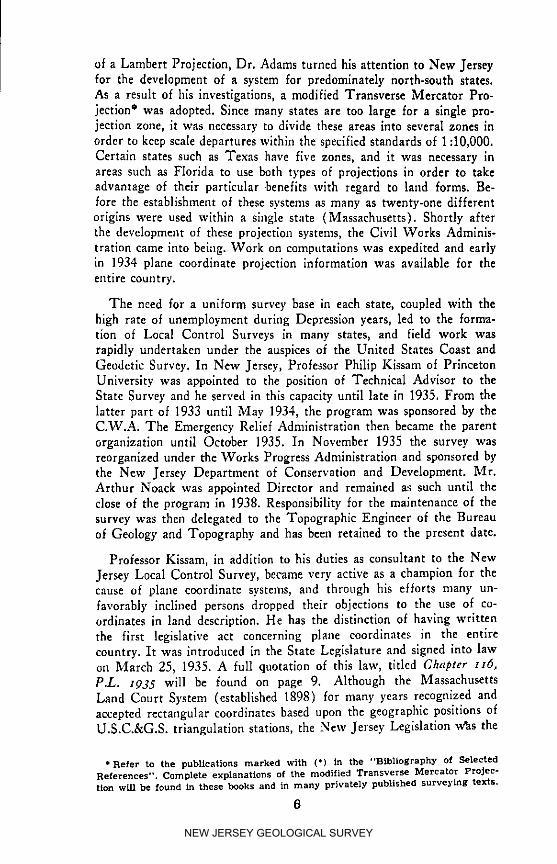
of a Lambert Projection, Dr. Adams turned his attention to New Jerseyfor the development of a system for predomlnately north-south states.As a result of his investigations, a modified Transverse Mercator Pro-jection ° was adopted. Since many states are too large for a single pro-jection zone, it was necessary to divide these areas into several zones inorder to keep scale departures within the specified standards of 1:10,000.Certain states such as Texas have five zones, and it was necessary inareas such as Florida to use both types of projections in order to takeadvantage of their particular .benefits with regard to land forms. Be-fore the establishment of these systems as many as twenty-one differentorigins were used within a sillgle state (Massachusetts). Shortly afterthe development of these projection systents, the Civil Works Adminis-tration came into being. Work on compotatlons was expedited and earlyin 1934 plane coordinate projection information was available for theentire country.
The need for a uniform survey base in each state, coupled with thehigh rate of unemployment during Depression years, led to the forma-tion of Local Control Surveys in many states, and field work wasrapidly undertaken under the auspices of the United States Coast andGeodetic Survey. In New Jersey, Professor Philip Kissam of PrincetonUniversity was appointed to the position of Technical Advisor to theState Survey and he served in this capacity until late in 1935. From thelatter part of 1933 until May 1934, the program was sponsored by theC.W.A. The Emergency Relief Administration then became the parentorganization until October 1935. In November 193.5 the survey wasreorganized under the Works Progress Administration and sponsored bythe New Jersey Department of Conservation and Development. Mr.Arthur Noack was appointed Director and remained as such until theclose of the program in 1938. Responsibility for the maintenance of thesurvey was then delegated to the Topographic Engineer of the Bureauof Geology and Topography and has beeo retained to the present date.
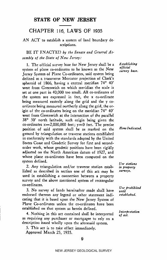
Professor Kissam, in addition to his duties as consultant to the NewJersey Local Control Survey, became very active as a champion for thecause of plane coordinate systems, and through his efforts many un-favorably inclined persons dropped their objections to the use of co-ordinates in land description. He has the distinction of having writtenthe first legislative act concerning plane coordinates in the entirecountry. It was introduced in the State Legislature and signed into lawon March 2.5, 1935. A full quotation of this law, titled Chapter H6,P.L. 1935 will be found on page 9. Although the MassachusettsLand Court System (established 1898) for many years recognized andaccepted rectangular coordinates based upon the geographic positions ofU.S.C.&G.S. triangulation stations, the New Jersey Legislation was the
*Refer to the publications marked with (*) in the "Bibliography of SelectedReferences". Complete explanations of the modinefl Transverse Mercator Projec-tion will be found in these books and in many privately published surveying texts.
6
NEW JERSEY GEOLOGICAL SURVEY
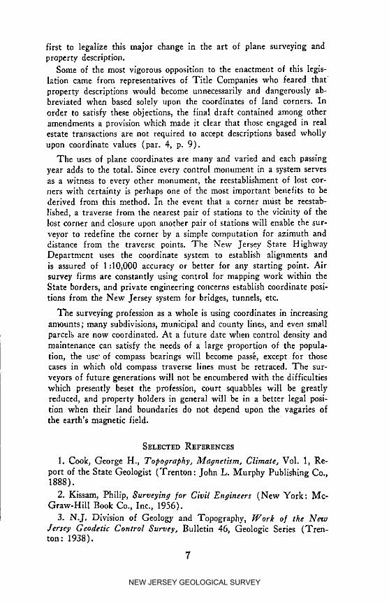
first to legalize this major change in the art of plane surveying andproperty description.
Some of the most vigorous opposition to the enactment of this legis-lation came from representatives of Title Companies who feared thatproperty descriptions would become unnecessarily and dangerously ab-breviated when based solely upon the coordinates of land corners. Inorder to satisfy these objections, the final draft contained among otheramendments a provision which made it clear that those engaged in realestate transactions are not required to accept descriptions based whollyupon coordinate values (par. 4, p. 9).
The uses of plane coordinates are many and varied and each passingyear adds to the total. Since every control monument in a system servesas a witness to every other monument, the reestablishment of lost cor-ners with certainty is perhaps one of the most important benefits to bederived from this method. In the event that a corner must be reestab-
lished, a traverse from the nearest pair of stations to the vicinity of thelost corner and closure upon another pair of stations will enable the sur-veyor to redefine the corner by a simple computation for azimuth anddistance from the traverse points. The New Jersey State HighwayDepartment uses the coordinate system to establish alignments andis assured of 1:10,000 accuracy or better for any starting point. Airsurvey firms are constantly using control for mapping work within theState borders, and private engineering concerns establish coordinate posi-tions from the New Jersey system for bridges, tunnels, etc.
The surveying profession as a whole is using coordinates in increasingamounts; many subdivisions, municipal and county lines, and even smallparcelg are now coordinated. At a future date when control density andmaintenance can satisfy the needs of a large 9roportion of the popula-tion, the use" of compass bearings will become pass6, except for thosecases in which old compass traverse lines must be retraced. The sur-veyors of future generations will not be encumbered with the difficultieswhich presently beset the profession, court squabbles will be greatlyreduced, and property holders in general will be in a better legal posi-tion when their land boundaries do not depend upon the vagaries ofthe earth's magnetic field.
SELECTED REFEREI_CES
1. Cook, George H., Topo#raphy, Magnetism, Climate, Vol. 1, Re-
port of the State Geologist (Trenton: John L. Murphy Publishing Co.,1888).
2. Kissam, Phillp, Surveying [or Civil Engineers (New York: Mc-Graw-Hill Book Co., Inc., 1956).
3. N.J. Division of Geology and Topography, Work o/ the NewJersey Geodetic Control Survey, Bulletin 46, Geologic Series (Tren-ton: 1938).
7
NEW JERSEY GEOLOGICAL SURVEY

4. U.S. Department of Commerce, Formulas and Tables for the Com-putation of Geodetic Positions, Special Publication No. 8 (Washington:Government Printing Office, 1933).
5. U.S. Department of Commerce, Geodetic Letter, No. 5, Vol. 2(Washington: Division of Geodesy, U.S. Coast and Geodetic Survey,May 1935).
6. U.S. Department of Commerce, Geodetic Letter, No. 7, Vol. 2(Washington: Division of Geodesy, U.S. Coast and Geodetic Survey,July-August 1935).
7. U.S. Department of Commerce, Geodetic Operations in the UnitedStates z933-I935, Special Publication No. 207 (Washington: Govern-ment Printing Office, 1936).
8. U.S. Department of Commerce, Geodetic Letter, No. 1, Vol. 4(Washington: Division of Geodesy, U. S. Coast and Geodetic Survey,January 1937).
9. U. S. Department of Commerce, Cartoeraphy, Special PublicationNo. 205 (Washington: Government Printing Office, 1943).
10. U.S. Department of Commerce, Elements o/ Map Projection,Special Publication No. 68 (Washington: Government Printing Of-fice, 1945).
8
NEW JERSEY GEOLOGICAL SURVEY
STATE OF NEW JERSEY
CHAPTER 116, LAWS OF 1935
AN ACT to establish a system of land boundary de-
scriptlons.
BE IT ENACTED by the Senate and General As-
sembly of the State of New Jersey:
1. The official survey base for New Jersey shall be a EaabliJhlna
system of plane co-ordinates to be known as the New oHiclalsur_ey base.Jersey System of Plane Co-ordinates, said system beingdefined as a transverse Mercator projection of Clark's
spheroid of 1866, having a central meridian 74 ° 40'west from Greenwich on which meridian the scale is
set at one part in 40,000 too small. All co-ordinates of
the system are expressed in feet, the x co-ordinatebeing measured easterly along the grid and the y co-
ordlnate being measured northerly along the grid, the or-igin of the co-ordinates being on the meridian 74 ° 40'
west from Greenwich at the intersection of the parallel
38 ° 50' north latitude, such origin being given theco-ordinates x_2,000,000 feet; y=0 feet. The precise
position of said system shall be as marked on the Ho*alndlcated.ground by triangulation or traverse stations establlshed
in conformity with the standards adopted by the UnitedStates Coast and Geodetic Survey for first and second-
order work, whose geodetic positions have been rigidly
adjusted on the North American datum of 1927, andwhose plane co-ordinates have been cmnputed on the
system defined. Ute stations2. Any triangulation and/or traverse station estab- in #ro#erty
lished as described in section one of this act may be sur_eys.
used in establishing a connection between a propertysurvey and the above mentioned system of rectangularco-ordlnates.
Use #rohiblted3. No survey of lands hereinafter made shall have until
endorsed thereon any legend or other statement indl- ettabhshd.
catlng that it is based upon the New Jersey System ofPlane Co-ordlnates unless the co-ordlnates have been
established on that system as herein defined.lnter2bretation
4. Nothing in this act contained shall be interpreted o.f act.as requfring any purchaser or mortgagee to rely on adescription based wholly upon the aforesaid system.
5. This act is to take effect immediately.Approved March 25, 1935.
9
NEW JERSEY GEOLOGICAL SURVEY
SURVEYING -- THE PAST AND THE FUTURE
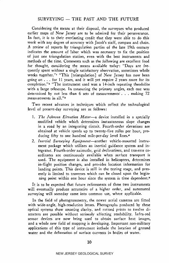
Considering the means at their disposal, the surveyors who producedearlier maps of New Jersey are to be admired for their perseverance.In fact, it is to their everlasting credit that they were able to do thiswork with any degree of accuracy with Jacob's staff, compass and chain.A review of reports by triangulation parties of the late 19th centuryindicates the amount of labor which was necessary to fix the positionof just one triangulation station, even with the best instruments andmethods of the time. Comments such as the following are excellent foodfor thought, considering the means available today: "Days are fre-quently spent without a single satisfactory observation, sometimes wholeweeks together.'" "This [triangulation] of New Jersey has now beengoing on . . . for 11 years, and it will yet require 2 years more for itscompletion. TM "The instrument used was a 14-inch repeating theodolitewith a large telescope. In measuring the primary angles, each one wasdetermined by not less than 6 sets of measurements-.., making 72measurements in all. ''_
Two recent advances in techniques which reflect the technologicallevel of present-day surveying are as follows:
1. The Jqhnson Elevation Meter--a device installed in a speciallymodified vehicle which determines instantaneous slope changesin a road by an integrating circuit. Fourth-order elevations areobtained at vehicle speeds up to twenty-flve miles per hour, pro-ducing fifty to one hundred mile-per-day level lines:
2. Inertial Surveying Equipment--another vehlcle-mounted instru-ment package which utilizes an inertial guidance system and in-tegrator. Fourth-order azimuths, grid declinations, and traverse co-ordinates are continuously available when surface transport isused. The equipment is also installed in helicopters, determinesin-flight position changes, and provides location information forlanding points. This device is still in the testing stage, and .pres-ently is limited to traverses which can be closed upon the begin-ning point within one hour since the system is time dependent, s
It is to be expected that future refinements of these two instrumentswill eventually produce accuracies of a higher order, and automatedsurveying will someday come into common use, where applicable.
In the field of photogrammetry, the newer aerial cameras are fittedwith wide-angle, high-resolution lenses. Photographs produced by theseoptical systems show amazing clarity, and ratioed prints to twelve di-ameters are possible without seriously affecting readability. Infra-redsensor devices are now being used to obtain surface heat images,and a whole new field of mapping is developing. Important non-militaryapplications of this type of instrument include the location of groundwater and the delineation of surface currents in bodies of water.
10
NEW JERSEY GEOLOGICAL SURVEY
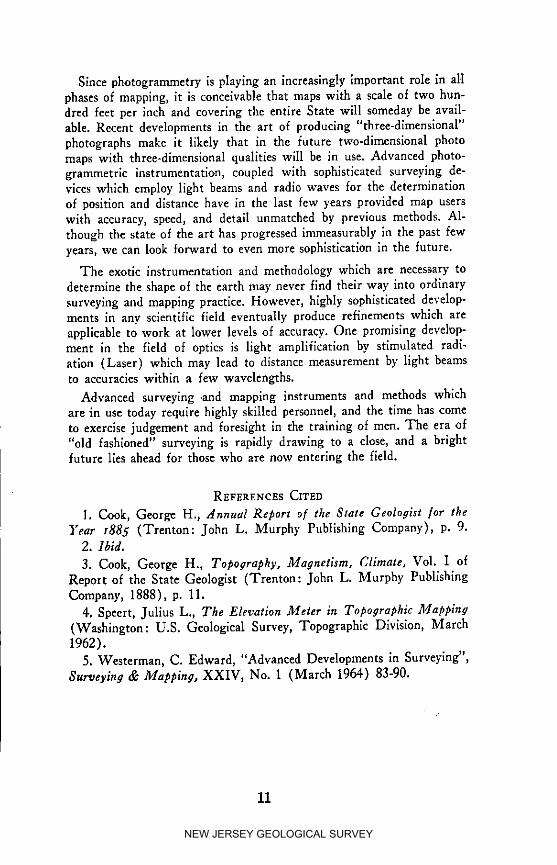
Since photogrammetry is playing an increasingly important role in allphases of mapping, it is conceivable that maps with a scale of two hun-dred feet per inch and covering the entire State will someday be avail-able. Recent developments in the art of producing "three-dimenslonal"photographs make it likely that in the future two-dimenslonal photomaps with three-dimensional qualities will be in use. Advanced photo-grammetric instrumentation, coupled with sophisticated surveying de-vices which employ light beams and radio waves for the determinationof position and distance have in the last few years provided map userswith accuracy, speed, and detail unmatched by previous methods. Al-though the state of the art has progressed immeasurably in the past fewyears, we can look forward to even more sophistication in the future.
The exot/c instrumentation and methodology which are necessary todetermine the shape of the earth may never find their way into ordinarysurveying and mapping practice. However, highly sophisticated develop-ments in any scientific field eventually produce refinements which areapplicable to work at lower levels of accuracy. One promising develop-ment in the field of optics is light amplification by stimulated radi-ation (Laser) which may lead to distance measurement by light beamsto accuracies within a tew wavelengths.
Advanced surveying .and mapping instruments and methods whichare in use today require highly skilled personnel) and the time has cometo exercise judgement and foresight in the training of men. The era of"old fashioned" surveying is rapidly drawing to a close, and a brightfuture lles ahead for those who are now entering the field.
REFERENCES CITED
I. Cook, George H., Annual Report o[ the State Geologist [or the]'ear x885 (Trenton: John L. Murphy Publishing Company), p. 9.
2. Ibld.
3. Cook, George H., Topography, Magnetism, Climate, Vol. I ofReport of the State Geologist (Trenton: John L. Murphy PublishingCompany, 1888), p. 11.
4. Speert, Julius L., The Elevation Meter in Topographic l],lapping(Washington: U.S. Geological Survey, Topographic Division, March1962).
5. Westerman, C. Edward, "Advanced Developments in Surveying",Surveying & Mapping, XXIV, No. 1 (March 1964) 83-90.
11
NEW JERSEY GEOLOGICAL SURVEY

MAGNETIC DATA
"The original magnetic survey of New Jersey was made in 1887 bythe New Jersey Geological Survey. Although confined to declinationonly, this work served to bring out clearly the widespread irregularitiesthat affect the magnetic lines in the northern part of the State. (Suchfeatures are by no means confined to this region but are found in manyother States as well.) The Coast and Geodetic Survey made completeobservations at some eighty stations throughout the State, mostly duringthe years 1904-14. More recently, declination observations at severalstations were obtained by the New Jersey Geodetic Control Survey(1934-38). Most of the Coast and Geodetic Survey stations were per-manently marked for the convenience of local engineers. Anyone desir-ing to occupy one of these stations for the purpose of testing a compassor transferring an azimuth may obtain a description of the station anda statement of the observed values by making application to the Direc-tor, U. S. Coast and Geodetic Survey.
Information on the gradual change in direction of the compass needle,essential in working with old surveys, has been delved from manysources including the reports of observations made in very early times inNew Jersey and adjacent regions. Tables of this secular change areavailable, together with explanations of their use) This change cannothe predicted, nor can it be reduced to any simple mathematical law orformula . . .
Because of the local irregularities already mentioned, it is not possibleto give an accurate value of the declination at a specific point unless ithas been actually measured at that point. Lacking actual observations,the best estimate may be obtained from the latest isogonic chart of theUnited States. A value so obtained may be regarded as a kind of normalor mean value for a fair-sized region around the point in question. Theactual declination at any particular point is ordinarily more or less thanthe normal value, but in any region free from magnetite the "probableerror" of a value scaled from a good isogonic chart 2 is perhaps one-halfdegree or less; that is, there is perhaps an even chance that the chartvalue will be within one-half degree of the actual value. The value isintended as a mean for several days, eliminating diurnal and irregularfluctuations. The [1960] chart shows values ranging from less than 9°West near Delaware Bay to 12° West near the northeast corner ofBergen County.
The daily variation of declination in New Jersey is characterizedby an easterly motion of the north end of the needle in the morning,with an easterly extreme about 8 or 9 a.m., local time; then a westerlymotion, with a westerly extreme about 1 or 2 p.m.; and then an easterlymotion for hours. From dusk to the early morning there is little change.The average amplitude of the swing from morning to afternoon is usu-ally between five and ten minutes of arc, being greater in summer than
12
NEW JERSEY GEOLOGICAL SURVEY

in winter, and greater at the eleven-year peak of sunspot activity thanat its trough. Both the amplitude and the times of the extremes are alsosubject to some fluctuation from day to day.
Aside from this systematic daily variation, the direction of the needleoccasionally undergoes erratic fluctuations which, if sufficiently severe,constitute a magnetic storm. The surveyor should be on the lookout forsuch an occurrence. Any unusual activity of the compass needle mayhave this explanation. Surveys made during the progress of a magneticstorm could be seriously in error, since the declination is then usuallychanging rapidly, and departures from normal of as much as half a de-gree may easily occur in the latitude of New Jersey. During the greatmagnetic storm of September 18 and 19, 1941, the maximum range ofthe fluctuations amounted in this region to more than four degrees ofare. A magnetic storm may last many hours (sometimes several days)and the more severe ones are known to extend from pole to pole over the
entire globe. They are usually associated with the appearance of auroraand with other phenomena of the ionosphere. They have no apparentrelation with the weather. "a
Quoted below is an excerpt from a publication of the New JerseyGeological Survey dated 1888. The discussion could be included in anysurveying journal which is presently published without seeming out ofplace.
"An examlnatlon of several instruments, made as a preliminary tothe magnetic survey of New Jersey, showed in one case an error of 1_,_in a needle . . . In another case a . . . needle . . . showed an error of25'. Another slx-inch needle showed an error of t0'. These are rather ex-
ceptional cases, but as they are instruments of different makers, in goodorder, and carefully compared, they point out the danger of error fromthis source . . . While the compass must still be used in retracing old
lines, the teaching of the irregularities of magnetic declinations....thenotes on magnetic disturbances, and those on instrumental defects, isclearly that no new surveys should be recorded by re[erence to the mag-netic needle alone, The time has come when its use [or this purposeshould be discontinued throughout the greater part o[ the State."4(Italics are mine, H.J.B., Jr.)
As a special service to engineers and land surveyors who need toretrace old boundary lines, magnetic declinations/or any section o[ NewJersey will be [urnished upon request by:
Bureau of Geology and TopographyP.O. Box 1889Trenton, New Jersey 08625Afl'ention Topographic EngineerTelephone: Area Code 609, 292-2576
13
NEW JERSEY GEOLOGICAL SURVEY

REFERENCES CITED
l. U. S. Department of Commerce, United States Magnetic Tables/or z96o, Publication 40-2, (Washington: Government Printing Of-flee, 1962).
2. Refer .to Magnetic Declinations Map o[ New Jersey in rear pocketof this booklet. This map is republished approximately fourteen monthsafter the end of each five-year magnetic epoch. Requests for futureprintings should refer to Bulletin No. 66 and include $0.25 to coverthe cost of printing and handling. Address order to: Bureau of Geologyand Topography, P.O. Box 1889, Trenton, New Jersey 08625.
3. Magnetic information excerpted, with a m_nor date correction fromHandbook o/ Technical Services by the Coast and Geodetic Survey forthe State o/New Jersey (Including New York City & Vicinity.), Pro-visional Edition (Washington: March 1948), pp. 38-40.
4. Cook, George H., Topography, Magnetism, Climate, Vol. I of Re-port of the State Geologist (Trenton: John L. Murphy Publishing Co.,1888), p. 324.
14
NEW JERSEY GEOLOGICAL SURVEY

HORIZONTAL CONTROL DATUMS
The nationwide net of triangulation arcs was established by the UnitedStates Coast and Geodetic Survey in order to determine precisely thelocations of points on the e_rth's surface by spherical coordinates. Thework was begun in the early part of the nineteenth century, and formany years individual arcs remained unconnected. About 1900, exten-sions and connections of the arcs made it possible to compute the entire
net as a single unit. Instead of embarking upon a major adjustmentwhich would have involved recomputing the position of every controlstation, it was decided to adopt the datum which had been used through-out New England and along the Atlantic Coast. A considerable amountof recomputatlon was avoided, yet the datum chosen proved nearly idealfor the entire country. Designated the United States Standard Datum,it was based upon Clarke's spheroid of 1866 and originated at stationMeades Ranch in Kansas (Latitude 39° 13' 26".686, Longitude 98 °32" 30".506). Inherent errors in the positions of stations throughoutthe triangulation net balanced out when the latitude and longitude ofMeades Ranch was used as a starting point for computations.
In 1913 Canada and Mexico adopted this datum, and in recognitionof the continental significance, the name was changed to North Ameri-can Datum. By 1927 the national triangulation network was completedto a sufficient degree to allow a major adjustment. Many of the arcsestablished between 1900 and 1927 had been made to fit the existingnetwork, and error distribution was not ideal. In order to correct thissituation the western half of the national net, then the eastern half, werereadjusted. Since station positions were altered up to 1 second in latitudeand 1.4 seconds in longitude, it was necessary to change the name ofthe datum to prevent confusion of new and old positions. The nameNorth American Datum o[ I927 was adopted and represents changes inposition only, since the geographic position of base station Meades Ranchremained unchanged, and Clarke's 1866 spheroid was retained, thusfundamental properties of the net were not altered.
Although the positions developed were considered to be final, andthe Atlantic Coast Arc adjustments were completed by 1933, some minorreadjustments have been found to be necessary. During the progress ofthe New Jersey Geodetic Control Survey discrepancies were discoveredbetween two parallel triangulation arcs. In 1937 a first-order baselinefrom Elizabeth to Port Reading was measured, and first-order triangu-lation checks were made between Princeton and Netcong by the UnitedStates Coast and Geodetic Survey. The results of this work slightly
changed geographic positions north of a line from Seaside Park to Mt.Holly to Newton to Phillipsburg. Local Control Survey traverses inthe area were then recomputed and in every case closure ratios wereimproved.
15
NEW JERSEY GEOLOGICAL SURVEY

SELECTED REFERENCES
1. McDonald, Frederick H., and others, Mapping for National Plan-ning (New York: American Society of Civil Engineers, 1935).
2. U.S. Department of Commerce, Geodetic Operations in the UnitedStates, z933"I935, Special Publication No. 207 (Washington: Govern-ment Printing Office, 1936).
3. N.J. Division of Geology and Topography, Work o? the NewJersey Geodetic Control Survey, Bulletin No. 46 (Trenton: 1938).
4. U.S. Department of Commerce, ftorizontal Control Data, SpecialPublieatlon No. 227 (Washington: Government Printing Office, 1941 ).
5. Whitmore, George D., ffdvanced Surveying and l]_Iapping (Scran-ton, Pa.: International Textbook Co., 1952).
16
NEW JERSEY GEOLOGICAL SURVEY
VERTICAL CONTROL DATUMS
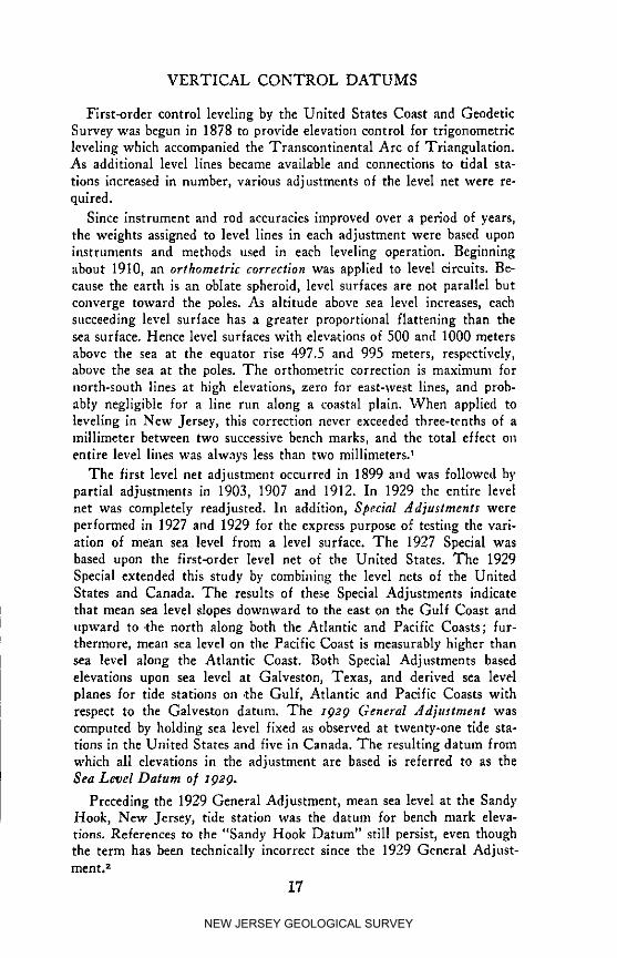
First-order control leveling by the United States Coast and GeodeticSurvey was begun in 1878 to provide elevation control for trigonometricleveling which accompanied the Transcontinental Arc of Triangulation.As additional level lines became available and connections to tidal sta-
tions increased in number, various adjustments of the level net were re-quired.
Since instrument and rod accuracies improved over a period of years,the weights assigned to level lines in each adjustment were based uponinstruments and methods used in each leveling operation. Beginningabout 1910, an orthometric correction was applied to level circuits. Be-cause the earth is an oblate spheroid, level surfaces are not parallel butconverge toward the poles. As altitude above sea level increases, eachsucceeding level surface has a greater proportlonal flattening than thesea surface. Hence level surfaces with elevations of 500 and 1000 metersabove the sea at the equator rise 497.5 and 995 meters, respectively,above the sea at the poles. The orthometrie correction is maximum for
north-south lines at high elevations, zero for east-west lines, and prob-ably negligible for a line run along a coastal plain. When applied toleveling in New Jersey, this correction never exceeded three-tenths of amillimeter between two successive bench marks, and the total effect onentire level lines was always less than two millimeters?
The first level net adjustment occurred in 1899 and was followed bypartial adjustments in 1903, 1907 and 1912. In 1929 the entire levelnet was completely readjusted. In addition, Special Adjustments wereperformed in 1927 and 1929 for the express purpose of testing the vari-ation of mean sea level from a level surface. The 1927 Special wasbased upon the first-order level net of the United States. The 1929Special extended this study by combining the level nets of the UnitedStates and Canada. The results of these Special Adjustments indicatethat mean sea level slopes downward to the east on the Gulf Coast andupward to .the north along both the Atlantic and Pacific Coasts; fur-thermore, mean sea level on the Pacific Coast is measurably higher thansea level along the Atlantic Coast. Both Special Adjustments basedelevations upon sea level at Galveston, Texas, and derived sea levelplanes for tide stations on .the Gulf, Atlantic and Pacific Coasts withrespect to the Galveston datum. The 1929 General Adjustment wascomputed by holding sea level fixed as observed at twenty-one tide sta-tions in the United States and five in Canada. The resulting datum fromwhich all elevations in the adjustment are based is referred to as theSea Level Datum of z929.
Preceding the 1929 General Adjustment, mean sea level at the Sand),Hook, New Jersey, tide station was the datum for bench mark eleva-tions. References to the "Sandy Hook Datum" still persist, even thoughthe term has been technically incorrect since the 1929 General Adjust-merit, z
17
NEW JERSEY GEOLOGICAL SURVEY

REFERENCES CITED
1. U. S. Department of Commerce, First-Order Leveling in New
Jersey, Special Publication No. 172 (Washington: Government PrintingOffice, 1931), p. 4.
2. Personal communication, United States Coast and Geodetic Sur-vey, Geodesy Division.
SELECTED REFERENCES
1. U. S. Department of Commerce, Fourth General Adjustment of
the Precise Level Net in the United States and the Resulting StandardElevations, Special Publication No. 18 (Washington: GovernmentPrinting Office, 1914).
2. U. S. Department of Commerce, Geodetic Operations in the UnitedStates January I, I927 to December 3I, I929, Special Publication No.166 (Washington: Government Printing Office, 1930).
3. U.S. Department of Commerce, Control Leveling, Special Publi-cation No. 266 (Washington: Government Printing Office, 1941).
4. U.S. Department of Commerce, J_anual of Leveling Computation_md Adjustment, Special Publication No. 240 (Washington: Govern-ment Printing Office, 1949).
18
NEW JERSEY GEOLOGICAL SURVEY

THE RELATIONSHIP BETWEEN VERTICAL CONTROL
DATUMS AND MEAN SEA LEVEL
It is well known that wind and barometric pressure exert a consider-
able influence upon the level of the sea. These forces produce variationsilom day to day and year to year. Therefore, a determination of a meansea level datum must not only take into account the periodic gravitationaleffects of the sun and moon, but also the nonperiodlc variations due towind and pressure. By means of mathematical procedures (harmonicanalysis) recorded tidal fluctuations (marlgrams) are analyzed to de-termine the amplitudes and phases of each constituent member of thetide generating forces. The meteorologlcal effects then remain as a non-periodic residue, and a mean sea level datum can be established usingonly those forces which are constant and predictable.
Due to complex phase relationships between the many periodicclfanges in relative positions of the earth, moon and sun, an accuratedetermination of mean sea level requires a long series of tidal observa-tions at a primary tidal sratlon. In order to obtain data for a completecycle of each of these position changes, an observation period extendingover 19 years is necessary) This 19-year period is referred to as themetonic cycle; it is the requisite amount of time for new and full moonto recur on the same day of the year. 2 A slow change in the declinationof the moon produces the longest individual cycle within a 19-year se-ries; this long-period tidal constituent (node cycle) requires 18.6 yearsfor completlon. 3.4
It is an accepted fact that the mean level of the sea is subject to aprogressive rise. Hence, a mean sea level surface derived from one 19-yearseries (or epoch) of tidal observations will not coincide with a surfacederived from another such series. For example, tidal observations beganat New York in 1893 and at Baltimore in 1903. Analysis of these rec-ords indicates that sea level rose at a rate of less than 0.01 foot per
year prior to 1930; after this date the rate increased to approximately0.02 foot per year. 5 To be specific, at Sandy Hook the average annualrate of change since 1930 is 0.018 foot. a
In the 1929 General Adjustment of the level net, mean sea level asobserved at each primary tidal station was held at zero. For the stationat Sandy Hook this datum was based upon tidal observations of t876-18817 due to the fact that a large amount of leveling in New Yorkand northeastern New Jersey was based upon data of this period. Atthe time, a change to a more modern tidal series would not have causedan appreciable modification of elevations. Since 1930, however, the an-nual rate of change of mean sea level has produced more significant cumu-lative effects.
The latest published elevations of New Jersey tidal bench marks arebased upon the 1941-1959 epoch. Referred to this period of observation,Tidal Bench Mark No. 2 at Sandy Itook is 6.69 feet above mean sea
i19
NEW JERSEY GEOLOGICAL SURVEY
level. However, the elevation of this bench from the geodetic level not(based upon the 1876-1881 epoch) is 7.27 feet above mean sea level.In the time interval of 78 years from 1881 to 1959, the relationshipbetween the sea a_d the land at Sandy Hook has changed hy 0.58 foot. 8Considering the evidence given above, it must be concluded without qual-ification that any references to local mean high water, local mean lowwater, half tide level, etc. and/or mean sea level must specify the epochused to determine the datum(s).
REFERENCES CITED
I. U.S. Department of Commerce, Tidal Datum Planes, Special Pub-lication No. 135, Revised (1951) Edition (Washington: Govern-inent Printing Office, 1951), chap. v, p. 63.
2. U.S. Department of Commerce, Tide and Current Glossary, Spe-cial Publication No. 228 (Washington: Government Printing Office,1941), p. 24.
3. U.S. Department of Commerce, h.lanual o] Harmonic Analysisand Prediction o/Tides, Special Publication No. 98 (Washington: Gov-ernment Printing Office, 1958), p. 17.
4. U. S. Department of Commerce, Shore and Sea Boundaries,Publication 10-1, Vol. 1 (Washington: Government Printing Office,1962), Appendix A, p. 304.
5. U.S. Department of Commerce, Tidal Datum Planes, chap. v, p. 58.
6. Personal communication, United States Coast and Geodetic Sur-vey, Geodesy Division.
7. Ibid.
8. Ibid.
SELECTED REFERENCE
1. Defant, Al,bert, Ebb and Flow, The Tides of Earth, Air and Water,(Ann Arbor, Michigan: The University of Michigan Press, 1958).
2O
NEW JERSEY GEOLOGICAL SURVEY

FEDERAL AGENCY AERIAL [PHOTOGRAPHIC REPRODUCTIONS
Various Federal agencies periodically obtain air photo coverage ofportions of New Jersey. Summarized below is information relative tosources and types of photography. Since scale, material, and quantityconsiderations determine prices, highly detailed instructions and pricelists are not warranted in this publication. Therefore, only a brief sum-mary of representative costs (which are standard in the Federal Gov-ernment) will be listed. Correspondence with the proper agency willenable prospective buyers to obtain complete, up-to-date information byreturn mail. In general, one month should be allowed for deliveryafter an order for photographs is initiated.
The Map Information Office of the United States Geological Surveymaintains records of aerial photographic coverage of the United Statesand outlying areas, based upon reports from Federal and State agenciesand commercial companies. From these records the Map Information Of-fice furnishes data to prospective purchasers on available photographyand the agency holding the aerial film.
There is no central sales office from which reproductions of aerial
photographs may be obtained; they must be purchased from the agencyholding the film.
Requests for data on aerial photography should be addressed to:
United States Geological SurveyMap Information OfficeWashington, D. C. 20025
As an adjunct to serving in .the capacity of a clearing house for airphotography data, the Map Information Office periodically producesstatus maps showing areas for which aerial mosaics or photo maps andunmounted aerial photographs are available. Individuals with a contin-uing interest in air photo coverage should obtain the latest editions ofthese status maps for their files:
1. Status o[ Aerial Mosaics (United States), Catalog No. I 19.5/3:Ae 8/2, scale 1:5,000,000, 150 m._-l.9 in., 27x41 in......... N/C
2. Status o[ Aerial Photography (United States), Catalog No. I19.5/3: Ae 8/961, scale 1:5,000,000, 150 m.= 1.9 in.,27x41 in.............................................................................. N/C
Due to diversified requirements, photography obtained by Federalagencies will generally range in scale from 1:10,000 to 1:30,000. Aerialcamera lens focal length specifications vary from four inches to twelveinches. The special nine-lens camera used by the United States Coastand Geodetic Survey produces prints which look like and can be usedas photographs taken with a single lens of 831 inch focal length and130 degree field of view.
Since stereoscopic coverage (60g end lap) requires about twice asmany prints as pictorial photography, the prospective purchaser should
21
NEW JERSEY GEOLOGICAL SURVEY
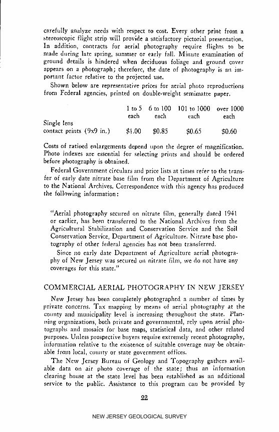
carefully analyze needs with respect to cost. Every other print from a
stereoscopic flight strip will provide a satisfactory pictorial presentation.In addition, contracts for aerial photography require flights to bemade during late spring, summer or early fall. Minute examination of
ground details is hindered when deciduous foliage and ground coverappears on a photograph; therefore, the date of photography is an im-portant factor relative to the projected use.
Shown below are representative prices for aerial photo reproductions
from Federal agencies, printed on double-welght semimatte paper.
1 to 5 6 to 100 101 to 1000 over 1000each each each each
Single lens
contact prints (9x9 in.) $1.00 $0.85 $0.65 $0.60
Costs of ratloed enlargements depend upon the degree of magnification.Photo indexes are essential for selecting prints and should be orderedbefore photography is obtained.
Federal Government circulars and price lists at times refer to the trans-
fer of early date nitrate base fihn from the Department of Agriculture
to the National Archives. Correspondence with this agency has producedthe following information:
"Aerial photography secured on nitrate f_lm, generally dated 1941or earlier, has been transferred to the National Archives from the
Agricultural Stabilization and Conservation Service aild the Soil
Conservation Service, Department of Agriculture. Nitrate base pho-tography of other federal agencies has not been transferred.
Since no early date Department of Agriculture aerial photogra-
phy of New Jersey was secured no nitrate film, we do not have anycoverages for this state."
COMMERCIAL AERIAL PHOTOGRAPHY IN NEW JERSEY
New Jersey has been completely photographed a number of times byprivate concerns. Tax mapping by means of aerial photography at the
county and municipality level is increasing throughout the state. Plan-ning organizations, both private and governmental, rely upon aerial pho-tographs ant| mosaics for base maps, statistical data, and other related
purposes. Unless prospective buyers require extremely recent photography,information relative to the existence of suitable coverage may ,be obtain-
able from local, county or state government offices.
The New Jersey Bureau of Geology and Topography gathers avail-able data on air photo coverage of the state; thus an informationclearing house at the state level has been established as an additional
service to the public. Assistance to this program can be provided by
22
NEW JERSEY GEOLOGICAL SURVEY

forwarding essential details on existing aerial photography to the addressgiven below :
Bureau of Geology and TopographyP. O. Box 1889Trenton, New Jersey 08625Attention Topographic Engineer
A presentation of the detailed information which should accompanya listing of air photo coverage for New Jersey areas is beyond the scopeof this publication. Data concerning specific areas will be supplied uponrequest. The Bureau of Geology and Topography presently has file in-formation for state-wide coverage since 1930. In addition, a recent can-vass produced data on post-1960 aerial photography which is availableat some county engineering or planning offices.
In the rear pocket will be found a list of aerial survey firms whichare known .to have produced photography of all or parts of New Jersey.The information is printed as a separate so that revisions and/or addi-tions can be made conveniently. It is not to be construed as an endorse-ment of any firm by the State of New Jersey or its representatives.
2,3
NEW JERSEY GEOLOGICAL SURVEY
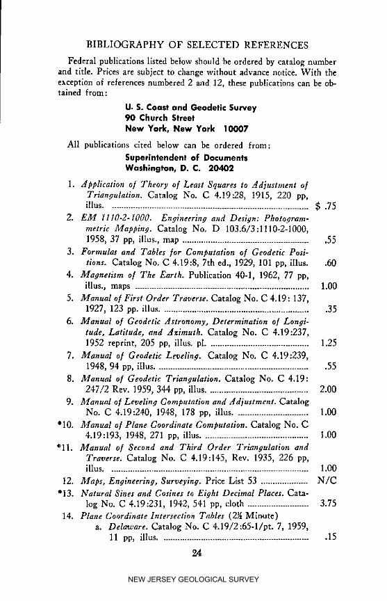
BIBLIOGRAPHY OF SELECTED REFERENCES
Federal publications listed below should be ordered by catalog numberand title. Prices are subject to change without advance notice. With theexception of references numbered 2 and 12, these publications can be ob-tained from :
U. S. Coast and Geodetic Survey90 Church StreetNew York, New York 10007
All publications cited below can be ordered from:
Superintendent of DocumentsWashington, D. C. 20402
1. Application o/ Theory o[ Least Squares to .4diustment o/Triangulation. Catalog No. C 4.19:28, 1915, 220 pp,illus ..................................................................................... $ .75
2. EM 1110-2-1000. Engineering and Design: Photo._ram-metric Mapping. Catalog No. D 103.6/3:1110-2-1000,1958, 37 pp, illus., map ....................................................... 55
3. Formulas and Tables [or Computation o[ Geodetic Posi-tions. Catalog No. C 4.19:8, 7th ed., 1929, 101 pp, illus. .60
4. Magnetism o/ The Earth. Publication 40-1, 1962, 77 pp,illus., maps .......................................................................... 1.00
5. Manual o/Fh'st Order Traverse. Catalog No. C 4.19: 137,1927, 123 pp. illus ................................................................ 35
6. Manual o[ Geodetic Astronomy, Determination o[ Longi-tude, Latitude, and Azimuth. Catalog No. C 4.19:237,1952 reprint, 205 pp, illus, pl ........................................... 1.25
7. Manual o[ Geodetic Levelia#. Catalog No. C 4.19:239,1948, 94 pp, illus .................................................................. 55
8. Manual o[ Geodetic Triangulation. Catalog No. C 4.19:247/2 Rev. 1959, 344 pp, illus ........................................... 2.00
9. Manual o[ Leveling Computation and Adjustment. CatalogNo. C 4.19:240, 1948, 178 pp, illus ............................... 1.00
*10. Manual o/Plane Coordinate Computation. Catalog No. C4.19:193, 1948, 271 pp, illus ............................................. 1.00
_'11. Manual o/ Second and Third Order Triangulation andTraverse. Catalog No. C 4.19:145, Rev. 1935, 226 pp,illus ..................................................................................... 1.00
12. 2]laps, Engineering, Surveying. Price List 53 .................... N/C
"13. Natural Sines and Cosines to Eight Decimal Places. Cata-log No. C 4.19:231, 1942, 541 pp, cloth .......................... 3.75
14. Plane Coordinate Intersection Tables (2_ Minute)a. Delaware. Catalog No. C 4.19/2:65-1/pt. 7, 1959,
11 pp, illus ................................................................ 15
24
NEW JERSEY GEOLOGICAL SURVEY
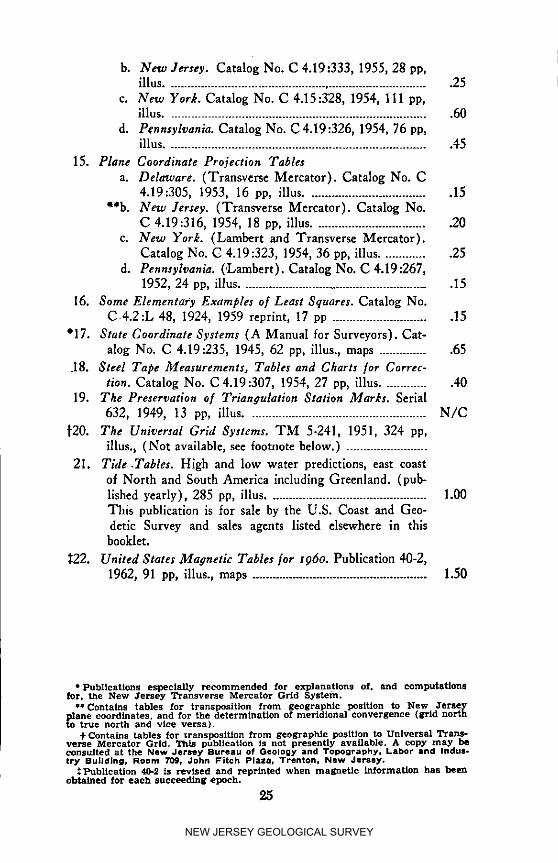
b. New Jersey. Catalog No. C 4.19:333, 1955, 28 pp,illus .............................................................................. 25
c. New York. Catalog No. C 4.15:328, 1954, 111 pp,illus .............................................................................. 60
d. Pennsylvania. Catalog No. C4.19:326, 1954, 76 pp,illus .............................................................................. 45
15. Plane Coordinate Projection Tablesa. Delaware. (Transverse Mercator). Catalog No. C
4.19:305, 1953, 16 pp, illus .................................... 15**b. New Jersey. (Transverse Mercator). Catalog No.
C 4.19:316, 1954, 18 pp, illus .................................. 20c. New York. (Lambert and Transverse Mercator).
Catalog No. C 4.19:323, 1954, 36 pp, illus .............. 25d. Pennsylvania. ('Lambert). C_,talog No. C 4.19:267,
1952, 24 pp, illus ....................................................... 15
16. Some Elementary Examples o/Least Squares. Catalog No.C.4.2:L 48, 1924, 1959 reprint, 17 pp ............................. 15
"17. State Coordinate Systems (A Manual for Surveyors). Cat-alog No. C 4.19:235, 1945, 62 pp, illus., maps ............... 65
.18. Steel Tape Measurements, Tables and Charts for Correc-tion. Catalog No. C 4.19:307, 1954, 27 pp, illus .............. 40
19. The Preservation o[ Triangulation Station Marks. Serial632, 1949, 13 pp, illus ..................................................... N/C
_'20. The Universal Grid Systems. TM 5-241, 1951, 324 pp,illus., (Not available, see footnote below.) ........................
21. Tide .Tables. High and low water predictions, east coastof North and South America including Greenland. (pub-lished yearly), 285 pp, illus ............................................... 1.00This publication is for sale by the U.S. Coast and Geo-detic Survey and sales agents listed elsewhere in thisbooklet.
_22. United 8totes Magnetic Tables/or x96o. Publication 40-2,1962, 91 pp, illus., maps .................................................... 1.50
* Publications especially recommended for explannttens of. and computationsfor, the New Jersey Transverse Mercator Grld System.
** Contains tables for transposition from geographic position to New .Terse Yplane coordinates, and for the determination of merldional convergence (grid northto true north and vice versa).
+ Contains tables for xranspositten from geographic position to Universal Trans-verse Mercator Grid. _ITtis pubncatlon is not presently available. A copy may beconsulted at the New Jer_y Bureau of Geology and Topography, Labor and Indul-try Building, Room 709, John Fitch Plaza, Trenton, New Jersey.
tPublteanon 40-2 is revised and reprinted when magnetic information has beenobtained for each succeeding epoch.
25
NEW JERSEY GEOLOGICAL SURVEY
SURVEY USING STATE PLANE COORDINATES
On the following four pages will be found a sample plat, description,
and computations for a survey based upon the New Jersey State Plane
Coordinate System. The material as shown originally appeared in Bul-
letin No. 46, Work o[ the New Jersey Geodetic Control 8ttrvey, alld
has been changed iu two respects: (1) redraftlug to provide a better
presentation, and (2) recomputation of coordinates and inlnor revision
of figures. Shortly after Bulletin No. 46 was published, an adjustment
of triangulation in northern New Jersey shifted traverse monument
positions slightly (see article titled "Horizontal Control Datums",
page 15). The improved positions have been used in the present com-
putations. It will be uoted that the measured lengths have not been
reduced to sea level or adjusted for grid scale factor. If first-order
points of origin, field methods and closures are required, these correctionsshould be included.
NEW JERSEY GEOLOGICAL SURVEY

,re _,_
,jc
©30
O(._C..._0 e_
m t_
_i _
Z
:" ioz_
i I - oo0cEOwt_Z_O
U" Z ¢/1
G. OCg_WWZ__. J
_ u "(IU .1.01 -I "1":1
27
NEW JERSEY GEOLOGICAL SURVEY

Description of Lots 328 and 329, Block 6, at the southeast intersection
of Harrlot ,&venue and Lynn Street in Harrington Park, Bergen
County, New Jersey, July, 1964.
Beginning at a point formed by the intersection of the westerly llne
of Lynn Street with the northerly line of Harriot Avenue (x :2,188.-
845.13) (y : 784,782.95) and running:
1. Thence N 11° 24' 22.3"W along the said westerly line of Lynn
Street a distance of 101.00 feet to a point (x:2,188,825.16)
(y : 784,881.96) ;
2. Thence S 78° 35' 37.7"W a distance of J0.00 feet to a point
(x :2,188,776.15) (y : 784,872.07) ;
3° Thence Sll ° 24' 22.3"E a distance of 108.60 feet to a point
(x :2,188,797.64) (y :784,765.61) ;
4. Thence N 69° 56' 28.9" E along the said northerly line of Harriot
Avenue a distance ot 50.60 feet to the westerly line of Lynn Street,
the point and place of beginning.
The coordinates referred to in the above description are for the New
Jersey Transverse Mercator Coordinate System (1938 positions) as
established by the New Jersey Geodetic Control Survey. All bearings
refer to grid north. The Central Meridian for this coordinate system
is Longitude 74° 40' 00"W.
28
NEW JERSEY GEOLOGICAL SURVEY

I I
0 I_1_ lt3"_L I I_1"I1_ li_l_i_ _ii'_l I_ _, _ I_ _1
•- a_ _ _ m _" _ _ _'_ q_0, '_r' 'J '- -_ -
_.- g__._ ,_ _ _ _ _ . .... _-_-• _ 0 _ 0 O0_ +u. _.. _ _o _o _- _- _ 0 "--'
._ ._ ¢ _ _" ,l _ o.,
.q.e, <_ >".£
_o_ .:-:_ _+_+<_'<_ o, _; _ _:<_o._o _, " _,rJ
0 i_. i_. rO
Z : m m_ _m m -= - a_ _8 _- o _ o o _ &o 0_ g _ ,_ ® o
0 _ 8 _ _ _. _ _ _0o _. o o _ _,_
0'_o, _i _ _ _ 0"8
--.I _ _ 0 __ _0 _ _ 0 0 :_"_'= '_ _ ,, _. _ oo _
.__,_ .g_ 8 _ _ _ o?_ -- . _ ,..0 z : z ----m _ _.,ll: m -" m _o . .. e,• o.o._
_ o 8 _ _ _ o_o_- 0 _ '_ 0-- -- ii II
,_ _ _ = o 8 _ _o_ _ 0 m ao _
<_ .. . _>_>_o -I-_ _ 8 >-x_o
g9
NEW JERSEY GEOLOGICAL SURVEY

oll0 _ -- >-0 _-,. +
X _ a
O__z "_ z z
o°°_.a+ 8 =_ .__
N!I - .o0
UC
= 2
ul, .-_g >_
g x W ®
i _ g -o -o ®_ _ ,7,Z Z I-.-
_o __ _ 7oNEW JERSEY GEOLOGICAL SURVEY

NEW JERSEY GEODETIC CONTROL SURVEYMONUMENTS AND BENCH MARKS
The axes of the New Jersey Plane Coordinate System are coincidentwith the 38 _' 50' North parallel and the 74° 40' West meridian. Atthe intersection of these lines X is assigned a value of 2,000,000 feetand Y is assigned a value of 0 feet.
All elevations are based upon the United States Coast and GeodeticSurvey meaia sea level datum of 1929.
Plane co_Jrdinate data is available for approximately" six thousand of
the eight tl_ousand control monuments established by the New JerseyGeodetii: Control Survey. The information is furnished on 8¥' x 11"prints. Each sheet provides location sketches of a pair of control monu-ments, brief descriptions, coordinate positions, distance and grid bearingbetween the monuments, and their elevations. The prints are furnishedat $0.25 each.
Descriptions and elevations of more than twelve thousand benchmarks are _ilso available on 8_"x 11" prints. Each sheet contains in-formation fdr four to seven benches and the cost per sheet is $0.25.
Index maps of each county showing the identification numbers ,andgeneral locations of all control stations are available at a cost of $1.00per map. I_ergen, Burlington and Ocean Counties require two mapseach.
A new sei'ies of elghty-five Geodetic Control Index maps is now beingproduced. These maps also cost $t.00 apiece. They have a scale ratioof 1:24,000 and each sheet covers the area of two United States Geo-logical Sur')ey 7t-mlnute quadrangles. The older index maps will beretired from service as the new control index map series coverage ex-tends over entire counties.
New booklets are being published under the title Geodetic ControlInlormation, and they contain all of the New Jersey Geodetic ControlSurvey dat_ for the area encompassed by a new series control indexmap. With the exception of areas with less than twenty control stations,each new series map will eventually have a corresponding booklet. Bind-ing is accomplished by means of screw fasteners and a pressboardcover to fac!lltate revision of information; a pocket provided on the rearcover contains the appropriate index map. Since the new control indexmaps are identified by number (1 through 85), corresponding GeodeticControl Information booklets are also labeled with the same numberseries. Orders for these publications should therefore specify title andnumber. Prices are adjusted to a quantity discount schedule and areavailable UlSOnrequest. Please refer to the Geodetic Control Map Index
in the rear_ pocket of this publication for maps and/or booklets whichare presently available. It is to the advantage of users of geodetic con-trol to contact the Topographic Engineer at least semiannually in orderto determine the availability of new series control index maps and/orbooklets co_,ering areas of interest. Production schedules necessarily varywith Bureau activities.
31
NEW JERSEY GEOLOGICAL SURVEY

POLICY STATEMENT OF THE BUREAU OF GEOLOGY
AND TOPOGRAPHY
Meetings have been held with officials of the United States Coast
and Geodetic Survey in an effort to resolve certain problems whichthis office has experienced in the distribution of Federal triangulationstation and bench mark information. The folIowing points were dis-cussed :
1. Reproduction of United States Government material for resale.
2. Establishment of the New Jersey Bureau of Geology and Topog-raphy as an official sales agency of the United States Coast andGeodetic Survey.
Reproducing Federal material for resale has not been recommended.
In view of various problems and the availability of printed data inWashington, this practice therefore has been discontinued.
The establishmen.t of this office as an official United States Coastand Geodetic Survey geodetic information sales agency is not possibleat this time due to the necessity of obtaining filing cabinets, personnel,office space, etc. for separate maintenance of Federal information.
The United States Coast and Geodetic Survey has initiated a user-
charge system for geodetic information, and instructions for obtainingdata will be found on succeeding pages. The policy change as statedshould not detrimentally affect consumers since orders are quicklyprocessed.
The office of the New Jersey Geodetic Control Survey will continueto provide geodetic information by telephone as follows:
1. Two N.J.G.C.S. or U.S.C.&G.S. bench mark descriptions andelevations, or
2. Two N.J.G.C.S. control monument descriptions, coordinates, andelevations, or
3. Two U.S.C.&G.S. triangulation station descriptions and coordi-nates.
Dissemination of geodetic data _y telephone suffers from a numberof disadvantages, the two following being the most important:
1. The possibility of providing improper values.
2. Disruption of office routine by prolonged telephone conversations.
Those who so desire are welcome to visit this office at any time tohand-copy Federal eor_trol information. It must be emphasized that theabove statements do not apply to the sale o/New Jersey Geodetic Con-trol Survey data which is distributed according to the policies outlinedin the previous article.
32
NEW JERSEY GEOLOGICAL SURVEY
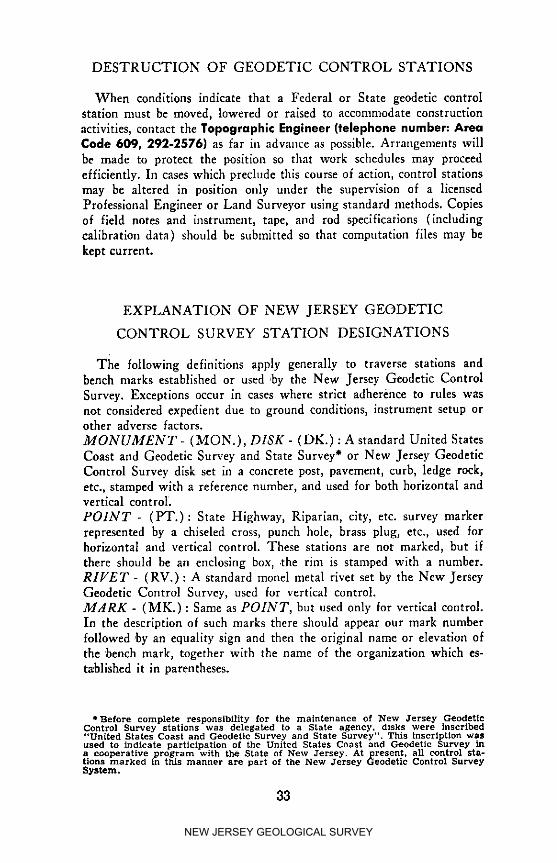
DESTRUCTION OF GEODETIC CONTROL STATIONS
When conditions indicate that a Federal or State geodetic controlstation nmst be moved, lowered or raised to accommodate constructionactivities, contact the Topographic Engineer (telephone number: AreaCode 609, 292-2576) as far ill advance as possible. Arrangements willbe made to protect tile position so that work schedules may proceedefficiently. In cases which preclude this course of action, control stationsmay be altered in position only under the supervision of a licensedProfessional Engineer or Land Surveyor uslng standard methods. Copiesof field notes and instrument, tape, and rod specifications (includingcalibration data) should be submitted so that computation files may bekept current.
EXPLANATION OF NEW JERSEY GEODETIC
CONTROL SURVEY STATION DESIGNATIONS
The following definitions apply generally to traverse stations andbench marks established or used ,by the New Jersey Geodetic ControlSurvey. Exceptions occur in cases where strict adherence to rules wasnot considered expedient due to ground conditions, instrument setup orother adverse factors.
MONUMENT - (MON.), DISK - (DK.) : A standard United StatesCoast and Geodetic Survey and State Survey ° or New Jersey GeodeticControl Survey disk set in a concrete post, pavement, curb, ledge rock,etc., stamped with a reference number, and used for both horizontal andvertical control
POINT - (PT.): State Highway, Riparian, city, etc. survey markerrepresented by a chiseled cross, punch hole, brass plug, etc., used forhorizontal and vertical control. These stations are not marked, but ifthere should be an enclosing box, .the rim is stamped with a number.RIFET - (RV.) : A standard monel metal rivet set by the New JerseyGeodetic Control Survey, used for vertical control.MARK - (MK.) : Same as POINT, hut used only for vertical control.In the description of such marks there should appear our mark numberfollowed ,by an equality sign and then the original name or elevation ofthe bench mark, together with the name of the organization which es-ta'blished it in parentheses.
SBefore complete responsibility for the maintenance of New ,lersey GeodeticControl Survey stations was delegated to a State agency, disks were inscribed"United States Coast and Geodetic Survey and State Survey". This inscription wasused to indtcate partinlpation of the United States Coast and Cceodetin Survey ina cooperative program with the State of New Jersey. At present, all control sta-tions marked in this manner are part of the New Jersey Geodetic Control SurveySystem.
33
NEW JERSEY GEOLOGICAL SURVEY

ABBREVIATIONS USED BY THE NEW JERSEY
GEODETIC CONTROL SURVEY
DEPARTMENT OF CONSERVATION ANDDEVELOPMENT-STATE OF NEW JERSEY ............ D.C.D.
HUDSON COUNTY ENGINEERINGDEPARTMENT ................................................................ H.C.E.
NORTH JERSEY DISTRICT WATER SUPPLYCOMMISSION ...................................................... N.J.D.W.S.C.
NEW JERSEY GEODETIC CONTROLSURVEY ............................................................ N.J.D.C.D.-G.C.S.
NEW JERSEY GEODETIC CONTROLSURVEY ........................................................................ N.J.G.C.S.
NEW JERSEY GEODETIC CONTROLSURVEY .............................................................. U.S.C.&G.S.&S.S.
NEW JERSEY GEOLOGICAL SURVEY ...................... N.J.G.S.
NEW JERSEY STATE HIGHWAY DEPARTMENT ...... N.J.
RIPARIAN STREAMS & WATERWAYSSURVEY .................................................................... "RIPARIAN"
UNITED STATES ARMYENGINEERS ........................................ MAP CONTROL STA.
UNITED STATES ARMYENGINEERS .................................................................... U.S.C.E.
UNITED STATES COAST & GEODETICSURVEY ............................................................ RV# (D.L.&W.R.R.)
UNITED STATES COAST & GEODETICSURVEY .................................................................... RV#(E.R.R.)
UNITED STATES COAST & GEODETICSURVEY .................................................... RV# (N.Y.S.&W.R.R.)
UNITED STATES COAST & GEODETICSURVEY ...................................................................... U.S.C.&G.S.
UNITED STATES ENGINEERINGDEPARTMENT .............................................................. H.L.R.M.
UNITED STATES ENGINEERINGDEPARTMENT .................................................................. U.S.E.
UNITED STATES ENGINEERINGDEPARTMENT .............................................................. U.S.E.D.
UNITED STATES GEOLOGICAl, SURVEY ............ U.S.G.S.
UNITED STATES WEATHER BUREAU .......................... W.B.
34
NEW JERSEY GEOLOGICAL SURVEY

U.S. DEPARTMENT OF COMMERCE
COAST AND GEODETIC SURVEY
GEODETIC CONTROL DATA
USER-CHARGE SYSTEM 1
The Coast and Geodetic Survey instituted a user-charge system forGeodetic Control Data on August l, 1961. The following price listand these instructions are effective as of this date, but are subject to
change without notice. The Bureau is in the process of republishing alldata to a new format. This will cause the prices and methods of furnish-
ing data to vary as the republication progresses from state to state.The following organizations will not be charged for dataSndicated:l. Local Governments - Limited quantities of all data within their
jurisdiction.2. Libraries and educational institutions- Limited (usually one copy)
to all data within their area or state.
Requests for free data must be made on an official letterhead or pur-chase order. Occasionally it may be advantageous to this Office to sup-ply data for areas larger than those specified above, but no charge willbe made for such extended coverage.
GENERAL INFORMATIONA minimum charge of $1.00 has been established for all orders other
than those mailings made under the automatic mailing service. Pre-payment for orders under $5.00 may be made at the option of theBureau. Prepayment is not required for mailings made under the auto-matic mailing service. Bills will be rendered on C&GS Form 325A,Geodetic Data Charge Statement. The top portion of the form mustbe returned with the remittance to assure proper credit.
Data may not be returned unless the Bureau made an error in com-piling the order.
When a statement is rendered for prepayment and the requestordeletes any items, the complete copy of Form 325A must be returnedwith the remittance.
C&GS Form 325B will be sent with all non-charge orders. This isan accounting and inventory document, and not a bill.
AUTOMATIC MAILING SERVICE
This service is designed to furnish data for large areas to users whointend to maintain active files and wish to receive the data as soon as
they become available. The minimum order for this service is the com-plete horizontal or vertical data for a State; or, in areas republishedby quadrangles, complete horizontal o1"vertical data for a 1° by 2 ° area.Orders must be in complete units, i.e., complete States or quadrangles.Initial orders to start a file or to enlarge a file need not be complete
35
NEW JERSEY GEOLOGICAL SURVEY

units. The requestor may order any area he desires; however, the auto-matic mailings to maintain the file will be on the basis of complete units.
All persons requesting the automatic mailing service, other thanthose receiving free copies, will be required to execute C&GS Form IIAGeodetic Control Data Automatic Mailing List Agreement, and returnit in triplicate to tbe Director, Coast and Geodetic Survey, U. S. De-partment of Commerce, Rockville, Md. 20852, Attention (L)6111. One copy will be returned to the applicant indicating the actiontaken by the Government.
A bill, Form 325A, or accounting statement, Form 325B, will ac-company each mailing. Prices will be the same as for individual ordersexcept that the $1.00 minimum charge will not apply. A $0.25 servicecharge per mailing will be added. No advance deposit or prepaymentwill be required; however, it is important that the top portion of Form325A be returned with the remittance so that proper credit can be given.
HORIZONTAL DATA - INDIVIDUAl., ORDERS
In areas where quadrangles have been published 2, a complete quad-rangle should normally be ordered. Most quadrangles will be 30' oflatitude by 30' of longitude. Individual sheets can be furnished butwhen a large portion of a quadrangle is requested the Bureau reservesthe right to send the entire quadrangle.
In areas where quadrangles have not been published, data should nor-mally be ordered on a county or State basis. Complete data for a Statemay be ordered at a substantial savings compared to the sheet price.Individual sheets and description books can be furnished at $0.06 perloose leaf sheet or $0.35 per description book. If more than a fewhorizontal stations in a county are requested and the requestor is unableto furnish the page numbers, the Bureau will generally send data forthe entire county. It is recommended that frequent users of the Bureau'sgeodetic control data use the Bureau's free indexes which are availablefor most areas upon request.
In areas where the horizontal data are partially republished as quad-rangles or are in the process of being republished, the data may hefurnished in either or both forms with some duplication. As portions ofStates are republished, the prices for complete States will be reducedaccordingly and the cost of the quadrangles added accordingly. In someStates republication of old data has not begun, but some quadrangle unitscontaining recently observed or adjusted data have been pnblished. Thecost of these quadrangles is not included in the price for complete Statesand an extra charge will be made.
VERTICAL DATA - INDIVIDUAL ORDERS
For areas where quadrangles have been published z, partially repub-lished, or are in process of being republished, the procedures for order-ing and filling orders described above for horizontal data apply to vertl-cal data too.
NEW JERSEY GEOLOGICAL SURVEY

In areas where quadrangles have not been published, data should beordered by the level line or by complete States. Except in instances wherevery little data are available in a State, substantial savings can be re-alized by ordi_ring by complete States rather than individual lines.
DIAGRAMS
A new series of geodetic control diagrams 2 is now being produced incooperation with the Geological Survey. These diagrams will replacethe old triangulation and level diagrams issued by States. An expIana-tion of this net series is included in a leaflet which is available on request.A charge of $0.50 will be made for all diagrams of both new and oldseries.
The Bureau assumes, unless otherwise specified by tbe requestor, thata person requesting a sizable quantity of data will require diagrams, andthey will I;e furnished although not specifically requested. The cost ofdiagrams is not included in the price of quadrangles or complete States.This will be a separate item.
TELEGRAMS
All telegraphic replies to requests for information will be sent "Col-lect". A confirmation copy of the telegram will be sent by regular mailin all cases of transmission of numerical data.
A copy of the published data from which the telegram was composedwill be enclosed with the confirmation copy of the telegram if requested,or if in the judgment of the Bureau the need is indicated. These pub-lished data will he accompanied by a bill, Form 325A ($1.00 minimumcharge).
SPECIAL HANDLING
The cost of sending data by First Class Mail or Parcel Post is in-cluded in the established price. The cost of special mailing or shippingwill he added to individual bills wben this service is requested.
PRICE LIST - U.S.C.&G.S. TRIANGULATIONSTATION AND LEVEL LINE DATA
DIAGRAMS. (Horizontal, Vertical, or Combined series,regardless of size or area covered) each $0.50
DATA SHEETS each .08
Geographic position sheetsPlane coordinate sheetsQuadrangle format 2 by sheets (furnished only in unassembled sheets
when request is for a few stations by name or station number orwhen sent, as supplements, to subscribers to automatic mailingservice).
37
NEW JERSEY GEOLOGICAL SURVEY
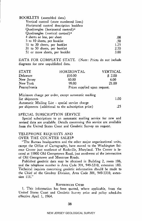
BOOKLETS (assembled data)i Vertical control (state numbered lines)
Horizontal control description bookletsQuadrangles (horizontal control) zQuadrangles (vertical control) 24 sheets or less, per sheet .085 to 10 sheets, per booklet .5011 to 30 sheets, per booklet 1.2531 to 50 sheets, per booklet 2.5051 or more sheets, per booklet 3.00
DATA FOR COMPLETE STATE. (Note: Prices do not includediagrams for new unpublished data.
STATE HORIZONTAL VERTICAL
Delaware $10.00 $ 2.00New Jersey 60.00 6.00New York 99.00 21.00
Pennsylvania Prices supplied upon request.
Minimum charge per order, except automatic mailinglist shipments 1.00Automatic Mailing List - special service chargeper shipments (additional to the subscription price) .25
SPECIAL SUBSCRIPTION SERVICE
Special subscriptions to an automatic mailing service for new andrevised data are available. Details concerning this service are availablefrom the United States Coast and Geodetic Survey on request.
TELEPHONE REQUESTS ANDOVER THE COUNTER SALES 3
"The Bureau headquarters and the other major organizational units,except the Office of Cartography, have moved to the Washington Sci-ence Center just southeast of Rockville, Maryland. The Center is lo-cated at 11800 Old Georgetown Road, just southwest of the intersectionof Old Georgetown and Montrose Roads.
Published geodetic data may be obtained in Building 2, room 106,and the telephone number is Area Code 301, 949-5310, extension 183.Technical inquires concerning geodetic information should be made tothe Chief of the Geodesy Division, Area Code 301, 949-5310, exten-sion 111."
REFERENCESCITED
1. This information has been quoted, where applicable, from theUnited States Coast and Geodetic Survey price and policy scheduleseffective April 1, 1964.
38
NEW JERSEY GEOLOGICAL SURVEY
2. A recent communication (December 1964) from the United StatesCoast and Geodetic Survey indicates that the new horizontal and verti-cal control format and the companion 1:250,000 geodetic control dia-grams for New Jersey will not be completed for about two years.
3. Information excerpted from a personal communication (December1964) from the United States Coast and Geodetic Survey.
89
NEW JERSEY GEOLOGICAL SURVEY

UNITED STATES COAST AND GEODETIC SURVEY
TIDAL BENCH MARK DATA FOR NEW JERSEY t
Elevations are derived by determining the mean value of a numberof high and low water readings in the vicinity of each bench to establisha mean low water datum. Connecting levels are then run to thebenches and the elevation as recorded is the number of feet above mean
low water. Recent connections to geodetic bench marks have resultedin the publication of figures for some tidal benches which will producean elevation referable to the 1929 sea-level datum which is the presentbasis for all geodetic calculations.
The difference between sea-level datum of 1929 (SLD) and meanlow water (MLW) for each location where the tidal bench marks andthe geodetic bench marks of the precise level net have been connectedby spirit levels is given below.
Bench mark elevations above sea-level datum of 1929 may be ob-tained by applying the tabular difference to the published elevationsabove mean low water; subtracting the difference when positive andadding the difference when negative.
There is no charge for tidal bench mark data published by the U.S.Coast & Geodetic Survey. Tidal bench mark data are issued on loose-leafsheets for individual station locations that are subject to revision when-ever new information becomes available. Therefore it is to the interest
of users to limit their request to the immediate area in which they areinterested. Address orders to either of the offices listed below, specifyinglocality and page number:
U.S. Coast and Geodetic Survey U.S. Coast and Geodetic Survey90 Church Street Rockville, Md. 20852New York, New York 10007
Page SLD-MLWNumber Locality Feet
I Alpine, Hudson River 1.602 Edgewater, Hudson River 2.063 Bayonne, Upper Bay 2.064 Constable Hook (Standard Oil Co., of
N.J. Plant), Upper Bay 1.905 Bergen Point, Kill Van KuI1 2.116 Secaucus, Hackensack River 2.216A Little Ferry, Hackensack River 2.376B Tea Neck (New Bridge), Hackensack River 2.137 Kearney Point, Hackensack River 2.068 Port Newark, Newark Bay 2.129 Elizabethport, Arthur Kill 2.15
10 Carteret, Arthur Kill 2.24
40
NEW JERSEY GEOLOGICAL SURVEY

Page SLD-MLWNumber Locality Feet
11 Destroyed12 South Amboy, Raritan River 2.1813 Crossman Dock, Raritan River14 Junction of Washington Canal and
Rarltan River
15 Sayreville, South River Highway Bridge16 New Brunswick (Delaware and Raritan
Canal Entrance), Raritan River17 Keyport, Raritan Bay 2.2918 Keansburg (Belvidere Beach), Raritan Bay 2.2019 Sandy Hook (Fort Hancock) 1.7320 Highlands Bridge, Shrewsbury River 1.4121 Normandie, Shrewsbury River 1.4222 Oceanic, Navesink River23 Red Bank, Navesink River24 Seabrlght, Shrewsbury River 0.4825 Destroyed26 Gooseneck Bridge, Shrewsbury River 0.0627 North Long Branch (Shorelands
Subdivision), Shrewsbury River28 Long Branch 1.9629 Shark River Inlet (Entrance) 1.9230 Shark River Inlet (North Channel) 1.2931 Manasquan Inlet 1.9632 Brielle (Railroad Bridge)
Manasquan River 1.4933 Upper Highway Bridge, Manasquan River34 Bayhead, Metedeconk River Entrance35 Upper Metedeconk Boys Camp,
Metedeconk River
36 Mantoloklng, Barnegat Bay --0.2737 Coates Point (Highway Bridge),
Toms River Entrance, Barnegat Bay --0.4038 Toms River, Toms River ---0.2539 Beachwood, Toms River ---0.3140 Barnegat Pier, Barnegat Bay --0.3441 Waretown, Barnegat Bay --0.1942 Oyster Creek Channel (East End),
Barnegat Bay ---0.1543 Sunset Shoal, Barnegat Bay 0.06
44 Barnegat City, Barnegat Inlet:East of Lighthouse at Inlet 1.21At Lighthouse at Inlet 0.97
45 West of Barnegat City (_ mile S.W. ofBarnegat Lighthouse) 0.40
41
NEW JERSEY GEOLOGICAL SURVEY

Page SLD-MLWNumber Locality Feet
46 High Bar Island (t; mile S.W. ofBarnegat Lighthouse) 0.18
47 Long Beach, Barnegat Bay --0.1048 Manahawkin Drawbridge,
Cedar Bonnet Island, Barnegat Bay 0.2749 Ship Bottom (Ocean) 1.9150 Beach Haven, Little Egg Harbor 0.6851 Long Point, Little Egg Harbor52 Tuckerton, Little Egg Harbor53 Big Sheepshead Creek Entrance,
Shooting Thorofare54 Tucker Island, Little Egg Inlet55 Crab Island, Seven Islands, Great Bay56 Mullica River Bridge (U.S. Highway No. 9)57 Mzin Marsh Thorofare, Great Bay
58 Brigantine Channel59 Grassy Bay (Entrance to Meadow Cut)60 Middle Thorofare, Broad Creek61 Absecon Creek Entrance, Absecon Bay62 Gardner Basin (Municipal Docks),
Atlantic City63 Atlantic City 1.6464 Chelsea (Inside Thorofare)65 Beach Thorofare (opposite Shelter Island)66 Dock Thorofare (Bridge)
67 Longport (Ventnor Avenue Highway Bridge)68 Longport (N ugents Wharf ), Risley Channel69 Longport-Ocean City Highway Bridge
(South End), Great Egg Harbor Inlet70 Ocean City (Foot of 9th Street),
Back Thorofare 1.78
71 Great Egg Harbor Highway Bridge 1.7272 Scull Landing, Great Egg Harbor River73 Mays Landing, Great Egg Harbor River74 Destroyed75 Devils Island, Crook Horn Creek76 Corson Inlet77 Ben Hands Thorofare (Inland Waterway)78 Sea Isle City:
City Pier, Outer Coast 2.14Bridge, Ludlam Thorofare 1.81
79 Long Reach (North End)80 Great Sound (Entrance to
Cresse Thorofare)81 Stone Harbor, Great Channel
42
NEW JERSEY GEOLOGICAL SURVEY

Page SLD-MLWNumber Locality Feet
82 Grassy Sound Channel Highway Bridge83 North Wildwood, Hereford Inlet84 Grassy Sound (Pennsylvania-Readlng
Seashore Lines Railroad Bridge)85 Swain Channel
86 Cape May Harbor 2.2487 Cape May (Municipal Pier) 2.2788 Cape May Canal (West End) 2.2089 East Point Light,
Maurice River Entrance
90 Fortescue, Delaware Bay91 Millville, Maurice River92 Bay Side, Delaware Bay93 Trenton, Delaware River 1.60
REFERENCESCITED
I. Descriptive material and sea level datum to mean low water con-version figures have been derived from United States Coast and Geo-detic Survey tidal bench mark data and personal communications.
SELECTED REFERENCE
1. Some construction activities require elevations based upon localtidal intervals. The relative accuracy of a tidal bench mark and, there-fore, the accuracy of any level llne run from it, is directly related tothe period of observation used to establish the datum. For a discussionof the principles involved in the determination of tidal datum planesand the accuracy attainable, the following reference is indispensable:
U.S. Department of Commerce, Tidal Datum Planes, Special Pub-lication No. 135 (Washington: Government Printing Office, 1951),price $0.70.
43
NEW JERSEY GEOLOGICAL SURVEY
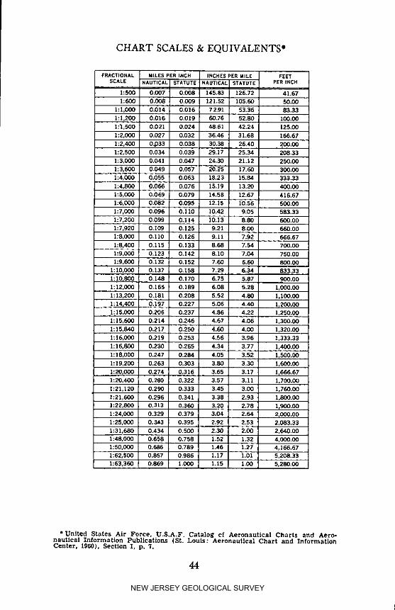
CHART SCALES & EQUIVALENTS*
FRACTIONAL MILESPERiNCH INCHESPERMILE FEETSCALE NAUTICAL STATUTE NAUTICAL STATUTE pER INCH
1:500 0,007 0.008 145,83 126.72 41.671:600 0,008 0,009 121.52 105.60 50.00
1:1,000 0.014 0.016 72.91 53.36 83,33
1:1,200 0.016 0.019 60,76 52.80 100,00
1:I,500 0,021 0.024 48.61 42.24 125,00
1:2,000 0.027 0.032 36.46 31.68 166.67
1:2.400 03333 0.038 30.38 26.40 200.00
1:2,500 0,034 0,039 29.17 25.34 208,33
1:3,000 0,041 0.047 24,30 21,12 250.00
1:3,600 0.049 0.057 20.25 17.60 300.00
1:4,000 0.055 0.063 18.23 15,84 333.33
1:4,800 0.066 0.076 15.19 13.20 400.00
1:5,000 0.069 0.079 14.58 12.67 416.67
1:6,000 0.082 0.095 12.15 10,56 500.00
1:7,000 0.096 0.110 10.42 9.05 683.331:7,200 0.099 0.114 10.13 8.80 600.00
1:7,920 0.109 0.126 9.21 8.00 660.00
1;8,000 0.110 0.126 9.11 7.92 666.67
1:8,400 0.115 0,133 8.68 7,54 700.00
1:9,000 0,123 0.]42 8.10 "7.04 750.00
1:9,600 0,132 0.152 7.60 6.60 800.00
1:10,000 0.137 0.158 7.29 6.34 833.33
1:10r800 0,148 0,170 6,75 5.87 900,001:12,000 0,165 0.189 6.08 5.28 1,000.C0
1:13,200 0.181 01208 5.52 4.80 1,100.00
1:14,400 0,197 0.227 5.06 4,40 lr200.001:15,000 0.206 0,237 4.86 4.22 1,250.00
1:15,600 0.214 0.246 4.67 4.06 1,300.00
1:15,840 0,217 0.250 4.60 4.00 1,320.00
1:16,0C0 0.219 0.253 4.56 3,96 1,333.33
I:16,800 0.230 0.265 4.34 3.77 1,400.00
1:18,000 0.247 0.284 4*05 3.52 L500.O0
1:19,200 0.263 0.303 3.80 3,30 1,600.00
1:20,000 0.274 0.316 3.65 3.17 1_666.671:20,400 ! 0,280 0.322 3.57 3.11 1,700.00
1:21,120 0,290 0.333 3.45 3.00 1,760,00
1:21,600 0.296 0.341 3.38 2.93 1,800.00
1:22,800 0,313 0.360 3.20 2,78 11900.00
1:24.000 0.329 0.379 3.04 2.64 2_000,001:25,000 0,343 0,395 2.92 2.53 2,083.33
1:31,680 0,434 0,500 2,30 2.00 2,640,00
1:48,C00 0.658 0.758 1.52 1.32 4,000,001:50,000 0.686 0.789 1.46 ].27 4,166.67
1:62,500 0.857 0,986 1.17 l.O1 5,208.33
1:63_360 i 0.869 1,000 1.15 1,00 5,280,00
• United States Air Force, U.S.A.F. Cata]og cf Aeronautical Charts and Aero-nautical Information Publications (St. Louis: Aeronautical Chart and InformationCenter, 1960), Section I. p. 7.
44
NEW JERSEY GEOLOGICAL SURVEY

CHART SCALES & EQUIVALENTS*
FRACTIONAL MILES PERiNCH INCHESPERMllrE, FEETSCALE NAUTICAL STATUTE NAUTICAL STATUTE PER ]_JCH
1:75.000 1.029 1.18,4 0.97 0.85 6.250.CO
1:96,000 1.317 1.515 0,76 0.66 8,000.00
1:100.000 1.371 1.578 0.73 0.63 8.333.33
1:125,0Q0 1.714 1.973 0.50 0.51 10,416.67
1:126,720 1.738 2.000 0.53 0.50 10.560.00
1:200,0C0 2.743 3.157 0.35 0.32 10,666.67
1:250,000 3.429 3.946 0,29 0.25 20,833.33
1:253,440 3.476 4.0QO 0.29 0.25 21,120.001:400.000 5.486 6.313 0.18 0.16 33,333.33
1:500,000 6.857 7.891 0.15 0.23 4].655.67
1:506,880 6.952 8.(X_ 0.14 0.13 42,240.00
1_750.0Q0 10.286 10.337 0,10 0.03 62,500.001:1,000,000 13.715 15.783 0.07 0.06 83,333.33
1:1,013,700 13.904 16.000 0.07 0.06 84,480.00
l: 1,500,C<X) 20.572 23.674 0.05 0.84 125,000.00
1:1,680,0C0 23.04! 26.515 0.04 0.04 140,000.00
1:2,C_0,000 27.430 31.555 0.04 0.03 166,656.57
1:2,500,0(X) 34.28- 39.457 0.03 0,03 208,333.331:3,00_,000 41.145 47.348 0,02 0.02 250.000.00
1:3,500.000 48,C02 55.240 0,02 0.02 291,666.67
1:4,000,000 54.860 63.131 0.02 0.02 333,333.331:4,500,000 61.717 71.023 0.01 0,01 375,000.00
1:5.000,000 68.575 78.914 0.01 0,01 410,666.67
1:6.GO0,O00 82.290 94.637 0.01 0.01 500,000.00
1:7,000,0(X) 96,005 110.479 0.01 0.01 583,333.33
1:8,000,000 109.719 126.262 0.01 0,01 666.666.67
1:9,000,0Q0 123.434 142.045 0.01 0.01 750,000.00
1:10,000,000 137.149 157.828 0.01 0.01 833,333.33
1: ] I,O00.CO0 150.864 173.611 0.01 0.01 916,666.67
1:12,000,0C0 164.579 189.393 0.01 0.01 1,000,000.00
1;13,000.000 178.294 205.176 1.083.333.33
1:14,000.000 ]92.009 220.959 1,116,666.67
1:15,000,000 205.724 236.742 1.250,C00.00
. 2:16,000,000 219.439 252.525 1,333,333.33]: ] 7,0C0,0C0 233.154 268.308 1,416,666.67
1:15,000,000 246 J_69 284.090 1,500,000.00
1:19.000,000 260.584 299.873 L583,333.33
1:20.000,0(X) 274.299 315.636 1,666.666.67
1:2L(X:O,O00 288.014 331.439 lr75QrO00.O01:22,CC0,000 301323 347.222 1,833,333.33
1:23.0G0,0_) 315A.43 363.0G5 1,916,566.671:24.000,000 329.158 378,787 2,000,000.00
1:25.(XX),000 342.873 394.570 2,083,333.33
SCALE SCALE 72913.24 63.360 S_:A!,_FORMULAS 7Z913.;_4 63.360 _ SCALE /2
* United States Air Force, U,S.A.F. Catalog Of Aeronautical Charts and Aero-nautical Information Publications (St, Louis: Aeronautical Chart and InFormationCenter, 1960), Section Z, p. 7.
45
NEW JERSEY GEOLOGICAL SURVEY
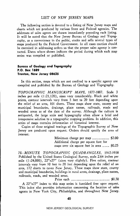
LIST OF NEW JERSEY MAPS
The following section is devoted to a listing of New Jersey maps andcharts which are produced by various State and Federal agencies. Theaddresses of sales agents are shown immediately preceding each listing.It will be noted that the New Jersey Bureau of Geology and Topog-raphy, as a convenience to tile public, stocks and sells several types ofmaps produced by the Federal Government. In all cases caution shouldhe exercised in addressing orders so that the proper sales agency is con-tacted. Dates where shown indicate the period during which each mapseries was compiled or published.
Bureau of Geology and TopegrophyP.O. Box 1889
Trenton, New Jersey 08625
In this section, maps which are not credited to a specific agency arecompiled and published by the Bureau of Geology and Topography.
TOPOGRAPHIC MANUSCRIPT _IAPS, 1877-1887. Scale 3
inches per mile (1:21,120), sizes vary considerably. Black and whiteprints, contour intervals vary from 5 feet to 20 feet depending uponthe relief of an area, 101 sheets. These maps show state, county andmunicipal boundaries, drainage, place names, railroads, roads andwooded areas as of the date of the survey. Although the culture isantiquated, the large scale and hypsography often allow a brief andinexpensive solution to a topographic mapping problem. In addition, thisseries of maps contains information of historical interest.
Copies of these original tracings of the Topographic Survey of NewJersey are produced upon request. Orders should specify the area ofinterest.
Minimum charge per map .................... $2.00Additional charge per square foot formaps over six square feet in area ........ $0.25
71_- MINUTE TOPOGRAPHIC QUADRANGLES, 1942-1958Published by the United States Geological Survey, scale 2.64 inches permile (1:24,000), 22"x27" (sizes vary slightly). Five colors, contourintervals vary from I0 feet to 20 feet depending upon the relief of anarea, 172 sheets to cover New Jersey. These maps show state, countyand municipal boundaries, buildings in rural areas, drainage, place names,railroads, roads, and wooded areas.
Price each .............................................. $0.50
A 22"x27" index to this map series is furnished free upon request.This index also provides information concerning the location of sales
agents in New York City, Philadelphia, and throughout New Jersey.
49
NEW JERSEY GEOLOGICAL SURVEY

Most of the agents carry only those maps for their immediate area; theBureau of Geology stocks maps which cover the entire state.
TOPOGRdPH1C NdME SHEETS. Scale 2.64 inches per mile(1:24,000), 26"x34". Three colors, contour intervals vary from 10 to20 feet depending upon the relief of an area. These maps show sta.te,county and municipal boundaries, drainage, place names, railroads androads as of the date of the survey.
Original plans for this map series called for 102 sheets covering theentire state; only 24 were produced before the program was discontinuedand approximately 100 each of the following maps remain in stock:
Amboy (1940) Hackensack (1943) New York Bay (1942)Atlantic City (1902) Jersey City (1928) Paterson (1929)Boonton (1932) Long Branch (1931) Pluckemin (1944)Camden (1900) Mount Holly (1900) Somerville (1944)(_hester (1930) Navesink (1932) Taunton (1900)Dover-Stanhope Newark (1937) Trenton East (1902)
(1932) New Brunswick Woodbury (1900)Elizabeth (1930) (1939)
Since older editions of maps are occasionally required for historical ref-erence purposes and the present stock of originals cannot be replaced,orders for these maps will be limited to single copies of each sheet.
Price each .............................................. $0.50
TOPOGRdPHIC dTLdS SHEETS, 1946-1963. Scale 1 inch permile (I:63,360), 27"x37". Three colors on editions printed prior to1956, and five colors on all editions printed after this date; contourintervals 5 feet to 20 feet depending upon the relief of an area, seventeensheets. These maps show state, county and municipal boundaries, drain-age, place names, railroads, roads, and wooded areas.
Price each .............................................. $2.00
An 8_"xll" Atlas Sheet index and descriptive price list is fur-nished free upon request.
8PECI,IL H.dCKENS,ICK MEADOWS SERIES. Due to a largevolume of requests for old maps of the Hackensack Meadows, a specialset has been prepared for use in litigation concerning Riparian Lands.These maps are dlazo copies of the unaltered originals and are sold insets of six sheets:
Scale 2.64 inches per mile (1:24,000), 26"x34".Elizabeth (1900 edition)Hackensack (1899 edition)Jersey City (1899 edition)Newark (1908 edition)
5O
NEW JERSEY GEOLOGICAL SURVEY

Scale 2 inches per mile (1:31,680), 28"x4ff'.Hackensack Meadows (1896 edition)
Scale 1 inch per mile (1:63,360), 27"x37".Atlas Sheet No. 7 (1884 edition)
Price per set ............................................ $12.00
SPECIAL 8ERI:ICES. Copies of each edition of the TopographicAtlas Sheets and the Topographic Name Sheets are on file. Originalprintings of nearly all of the older maps (dating to 1884) are nowunavailable. However, exact copies in black and white will be producedupon request. Among other uses, the historical information containedon old maps is of great value in court proceedings. In order to reproducethese maps, camera negatives and direct positive mylar films are re-quired; the Bureau of Geology and Topography will in all cases retainthe reproduction media, forwarding only the copies of maps to buyers.
Diazo reproduction of any Atlas Sheet :First copy cost ........................................ $19.00Each additional copy ............................ $ 2.00Diazo reproduction of any Name Sheet :First copy cost ........................................ $22.00Each additional copy ............................ $ 2.00Atlas Sheets and Name Sheets for which
reproduction media are already avail-able :
Price each .............................................. $ 2.00
STREAM MAPS, 19.55-1956. Scale 1 inch per mile (1:63,360), sizesvary. Black and white prints showing state and county boundaries,rivers, streams, lakes and ponds, and the names of these water features.
Each county is shown on a single sheet with the exception of Burling-ton which requires two maps (upper and lower) for full coverage, andEssex, Hudson and Union Counties which appear together on thesame sheet.
Price each ................................................ $0.50
ATLAS SHEET NO. 39, COUNTY AND MUNICIPALITYMAP OF NEI4: JERSEY, 1956. Scale 0.25 inch per mile (1:250,000),27"x48". Five colors, planimetric. This map shows state, county andmunicipal boundaries in color, drainage, locations and names of all cities,towns and most of the smaller settlements, railroads and roads.
Price each ................................................ $1.50
ATLAS SHEET NO. 39A, INDEX TO ATLAS SHEETS ANDUNITED STATES GEOLOGICAL SURVEY 7_A-MINUTE
QUADRANGLES, 1963. Scale 0.25 inch per mile (1:250,000),27"x48". This map is a special overprint of Atlas Sheet No. 39 de-scribed above. A sixth color has been added showing the locations and
51
NEW JERSEY GEOLOGICAL SURVEY

I
I
designations of Atlas Sheets and 7_-minute quadrangles. In addi-tion, changes in municipality names from I956 to January 1963 havebeen listed.
Price each ............................................... $2.00
UNITED STATES SERIES OF TOPOGRAPHIC MAPS, 1953-1964. This series is compiled by the Army Map Service and publishedand distributed for civilian use by the United States Geological Survey.Scale 0.25 inch per mile (1:250,000), sizes vary from 22"x32" to24"x34". Six colors, contour interval 100 feet with supplementary con-tours at 50-foot intervals in areas of low relief, six sheets to cover NewJersey. These maps show state and county boundaries, drainage, placenames, railroads, main roads and wooded areas.
Price each ............................................... $0.75
An index to this map series is furnished free upon request. Certainsheet_ in this series are available as raised plastic relief maps. Pleaserefer to the Army Map Service listing below for a description and priceinformation.
MAGNETIC DECLINATIONS MAP FOR NEW JERSEY, 1960EPOCH. Scale 0.13 inch per mile (1:500,000), 2Y'x28". This mapis a large-scale version of the Magnetic Declinations Map in the rearpocket of this booklet. Isogonic and isoporic values can be interpolatedwith ease and accuracy. The magnetic information is revised approxi-mately fourteen months after the end of each five-year magnetic epoch.
Price each ................................................ $2.00
NEW JERSEY (STATE), 1948. Published by the United StatesGeological Survey. Scale 0.13 inch per mile (1:500,000), 2Y'x28".Two colors, planlmetric. This map shows state and county boundaries,drainage, locations and names of all cities, towns, and most of thesmaller settlements, roads and railroads.
Price each ................................................ $0.75
NEW JERSEY (TOPOGRAPHIC), 1958. Published ,by the UnitedStates Geological Survey. Scale 0.13 inch per mile (1:500,000),2Y'x28". Four colors, contour interval 200 feet. '1'his map is an over-print of the map described directly above showing, in addition, roadsand contours. The physical features are further brought out by shaded-relief in colors on the conventional plan of assumed diagonal illumina-tion from the northwest.
Price each ................................................ $1.50
NEW JERSEY (RELIEF), 1958. Published by the United StatesGeological Survey. Scale 0.13 inch per mile (1:500,000), 23"x28".Two colors, planlmetric. This map shows shaded-relief, as on the mapdescribed directly above, but is overprinted on a modified map whichshows only county boundaries, drainage and the large cities.
Price each ................................................ $1.50
52
NEW JERSEY GEOLOGICAL SURVEY

SOIL SURVEYS. In cooperation with the United States Bureau ofSoils, a soil survey of New Jersey was undertaken and completed priorto 1930. Reports on various soil types and accompanying maps wereavailable for many years. Although soil boundaries are somewhat gen-eralized and soil classifications are not in accord with present correlationsor boundaries, the information contained in the reports is still valuablein many respects. At present, the following five reports are all that re-main in stock. Map scale 1 inch per mile (1:63,360), 26"x35".
Soil Survey o/ the Millville Area, New Jersey, Bulletin No.22, 1921, Reports of the Department of Conservation andDevelopment.
Soil Survey o/ the Bernardsville Area, New Jersey, BulletinNo. 24, 1923, idem.
*Soil Survey of the Chatsworth Area, New Jersey, BulletinNo. 25, 1924, idem.
*Soil Survey o/the Trenton Area, New Jersey, Bulletin No. 28,1926, idem.Soil Survey of the Camden Area, New Jersey, No. 28, Series1926, United States Department of Agriculture, Bureau ofChemistry and Soils.
Price each ........................................ $0.25
*At the present writing, twenty-two copies each of these two reportsremain in stock and it is expected that by June 1966 the inventory will
be depleted.
Rutgers, The State UniversityBureau of Engineering ResearchCollege of EngineeringNew Brunswick, New Jersey 08903
ENGINEERING SOIL SURVEY OF NEW JERSEY, 1951-1955.
Rutgers University Press, New Brunswick, New Jersey. A series of re-ports on soil conditions in each county of New Jersey from an engi-neering standpoint, for use by highway engineers in locating and re-locating road alignments and in finding material suitable for fills. Ofvalue also to consulting engineers, planning boards, housing authoritiesand real estate interests. Accompanied by maps for each county, scale1 inch per mile (1:63,360). Large maps, scale 2 inches per mile(1:31,680), are available separately at prices listed below. Report No.22 in this series contains 14 four-color photographs, 31 black-and-whiteillustrations and 8 tables, and is bound in hard covers.
53
NEW JERSEY GEOLOGICAL SURVEY

Large Scale Maps
Bull Report} Bull. No. EachI
No. No. Title Price Sheets Sheet Set
15 1 Soil Environment and Methods
of Research (revised edition) $2.013 ..................16 2 Essex County 1.00 2 _1.00 $2.0017 3 Passaic County 1.00 3 1.25 3.7518 4 Bergen and Hudson Counties 1.00 5 1.00 5.0019 5 Union County 1.00 2 1.00 2.0020 6 Hunterdon County 1.00 5 1.00 5.0021 7 Somerset County 1.00 4 1.00 4.0022 8 Ocean County 1.50 9 1.00 4.5023 9 Morris County 1.50 6 1.00 3.0024 10 Middlesex County 1.50 3 1.00 3.00*25 11 Sussex County 1.50 6 1.00 3.0026 12 Mercer County 1.50 4 1.00 2.0027 13 Warren County 1.50 4 1.00 2.0028 14 Salem County 1.50 6 1.00 3.0029 15 Cape May County 1.50 4 1.00 2.0030 16 Gloucester County 1.50 5 1.00 2.5031 17 Camden County 1.50 3 1.00 2.0032 18 Atlantic County 1.50 7 1.00 3.5033 19 Monmouth County 1.50 6 1.00 3.0034 20 Burlington County 2.00 10 1.00 5.0035 21 Cumberland County 1.50 7 1.00 3.5036 22 Practical Applications of
Engineering Soil Maps 3.00 .................Price of Complete Set $32.50 i.$63.76
Listed below are New Jersey Soil Surveys produced by the UnitedStates Department of Agriculture, Soil Conservation Service. Whenavailable, the material is distributed without charge 'by the Soil Con-servation Agent in each county. This series consists of half-tone photomaps overprinted in five colors. In addition to a legend specifying thetype of soil shown by each color, the following data is printed on thereverse side of each sheet: slope information, descriptions of soil types,classes of erosion and an index to adjoining sheets.
Soil Conservation ServiceU.S. Department of Agriculture28 Court Street
Freehold, New Jersey 07728
FREEHOLD SOIL CONSERFATION DISTRICT, MON-MOUTH COUNTY, PHYSICAL LAND CONDITIONS, 1948.Scale 4 inches per mile (I :15,840), 18"x22", 33 maps.
54
NEW JERSEY GEOLOGICAL SURVEY

Soil Conservation ServiceU.S. Department of AgricultureCounty Court House413 Second StreetBelvldere, New Jersey 07823
WARREN COUNTY SOIL CONSERVATION DISTRICTPHYSICAL LAND CONDITIONS, 1953. Scale 4 inches per mile
(1:15,840), 18"x22", 28 maps.
Soil Conservation ServiceU.S. Department of AgricultureCounty BuildingDelsea DriveClayton, New Jersey 08312
A new format for soil surveys is now in use by the U.S.D.A., SoilConservation Service. At present (1964), the only report available forNew Jersey covers Gloucester County. Work is continuing in othercounties of the state and additional surveys will be published as areas
are completed.
SOIL SURVEY, GLOUCESTER COUNTY, NEW JERSEY,1962. Bound report (9"xll") containing 84 pages of illustrated text,40 maps, scale 4 inches per mile (1:15,840), ll"x21". The half-tonephoto maps are overprinted in two colors to show soil and politicalsubdivision boundaries.
When the Gloucester County Soll Conservation Agent is unable tofurnish this report, copies may be obtained from:
Superintendent of DocumentsWashington, D.C. 20402
Price each ................................................ $2.25
Bureau of NavigationP.O. Box 1889Trenton, New Jersey 08625
RIPARIAN ATLAS SHEETS. Scales vary from 105.6 inches permile (1:600) to 10.5 inches per mile (1:6,000), 36"x42". Riparianlands and conveyances are sketched on tracings of tax maps and re-
produced on black and white prims. This series of maps covers themain tidal waterways of the state.
Price each ................................................ $2.00
Division of State and Regional Planning['.O. Box 1978Trenton, New Jersey 08625
55
NEW JERSEY GEOLOGICAL SURVEY

.All of the selected maps listed below are reproduced in black andwhite. Since the titles are more or less self-explanatory, no descriptivestatements are necessary.
NEW JERSEY STATE OWNED LANDS UNDER JURISDIC-TION OF DEPARTJ4ENT OF CONSERVATION AND ECO-
NOMIC DEVELOPMENT: B2A-25, B4A-37, B10A-13.
NEW JERSEY STATE OWNED LANDS UNDER JURISDIC-TION OF MAJOR STATE LAND HOLDING AGENCIES:B2.A-26, B4.A-38, B10A-14.
OCCUPIED AND POTENTIAL INDUSTRIAL LANDS OF
NEW JERSEY -- 195z and "957: B2.A-28, B4.A-40, B10A-16.
FEDERAL OWNED LANDS WITHIN THE STATE OF NEW
JERSEY dS OF I964: B2A-30, B4.A-36.
COUNTY OWNED LANDS 1N THE STATE OF NEW JER-
SEY AS OF 196o: B2.A-31, B4.A-42.
AIAJOR AND SECONDARY DRAINAGE BASINS OF NEIV
JERSEY: B4A-33, B10A-18.
A4AJOR AND SECONDARY DRAINAGE BASINS OF NEWJERSEY SHOWING MAJOR STREAM BEDS: B3A-34.
PUBLIC AND PRIVATELY OWNED POTABLE _VATER-SHED PROPERTIES IN NEW JERSEY AS OF z962: B10.A-12.
N.J. MUNICIPAL1T1E8 THAT HAVE AN APPROVED TAXJI_AP AS OF JANUARY I963: BI0.A-9
NOTE: .All number designations listed above concern prices and mapscales as follows; those maps for which one or two number designationsare shown are avail_ble only at the scale listed.
B2A series: 0.5 inch per mile (1:126,720), 54"x96". (These maps areprinted only on special order at cost of reproduction).
B4A series: 0.25 inch per mile (1:250,000), 27"x47".Price each .................................................................. $1.00
BIOA series: 0.10 inch per mile (1:601,920), 12"x20".Price each ................................................................ $0.10
Division of Water Policy and SupplyBureau of Water ControlP.O. Box 1390Trenton, New Jersey 08625
RIPARIAN AND STREAM SURVEY MAPS. Scales vary, 24"x36".These maps show the configuration of many of the larger streams andrivers in New Jersey. Since the project was abandoned be/ore comple-tion (t940), all waterways within the state are not completely mapped.
56
NEW JERSEY GEOLOGICAL SURVEY

Among the details shown, the most important are: plan and profilesof both banks and channel centerli/les, cross sections, structures, andlocations of control traverses as of the date of the survey. Many of thesurveys are based upon the New Jersey Plane Coordinate System. Thevertical datum is, in all cases, mean sea level. Tracings of intra-countystreams of Essex and Union Counties are filed at the offices of the
County Engineers.
Orders for black and white prints from the Bureau of Water Controlare processed by a private contracting company and costs are based uponpaper area.
Price per square foot ................................ $0.08(Postage additional when required.)
State Highway DepartmentBureau of Planning and Traffic31 Scotch RoadTrenton, New Jersey 08625
COUNTY BASE MAPS, dates vary*. Scale 2 inches per mile(1:31,680), 18 inches wide, variable length. Blue line prints, plani-metric, 122 sheets to cover New Jersey. The number of sheets per countyvaries. These maps show state, county and municipal boundaries, drain-age, place names, railroads, roads, some road names, mileage along stateroutes and rural buildings.
Price per sheet ........................................ $ 0.50Complete set ......................................... $50.00
A key map showing the sheet numbering system is supplied free uponrequest.
* Most principal and secondary routes and route numbers are revisedto 1960.
COUNTY MAPS SHOI4/1NG ADT I/OLUMES ON STATEI-[IGH_ITAYS, 1962. These maps are the same as those described above,with the exception that Average Daily Traffic figures are shown atlocations where traffic counts have been made.
Price each sheet ...................................... $0.50
A key map showing the sheet numbering system is supplied free uponrequest.
COUNTY hIAPS, GENERAL HIGHI4/AY SERIES, 1955-1962.Scale 2 inches per mile (I :31,680), 19"x42". Black and white, plani-metric. These maps are revised editions of the County l]ase Maps (listedabove), and show essentially the same information. The following coun-ties* are now available:
IIunterdon (1960) -- 5 sheetsMercer (I962) -- 4 sheetsi_Iiddlesex (1956) -- 3 sheetsMonmouth (1955) -- 6 sheets
57
NEW JERSEY GEOLOGICAL SURVEY
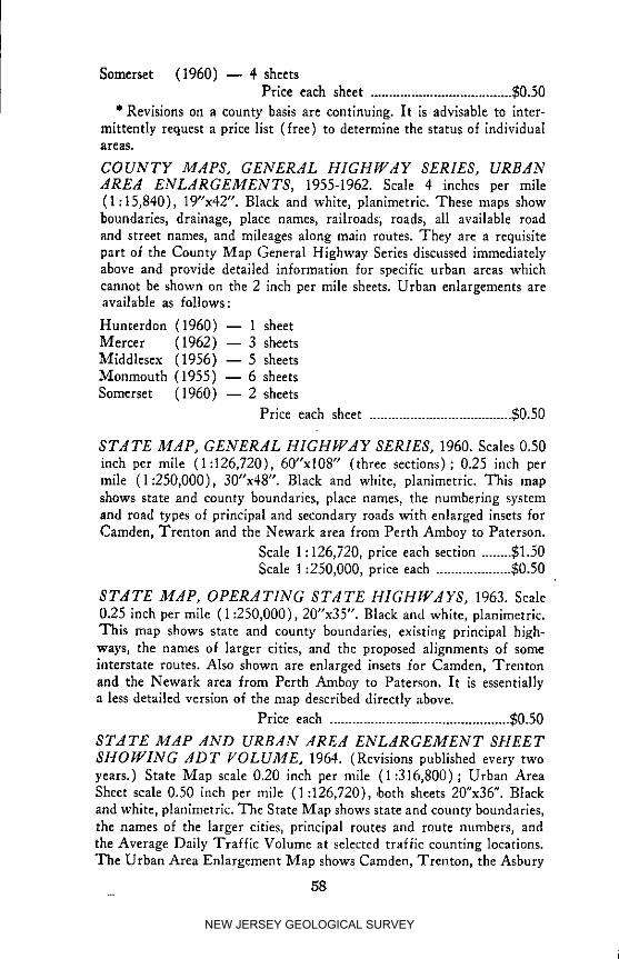
Somerset (1960) -- 4 sheetsPrice each sheet ...................................... $0.50
" Revisions on a county basis are continuing. It is advisable to inter-mittently request a price list (free) to determine the status of individualareas.
COUNTY MAPS, GENERAL HIGHWAY SERIES, URBANAREA ENLARGEMENTS, 1955-1962. Scale 4 inches per mile(1:15,840), 19"x42". Black and white, planlmetric. These maps showboundaries, drainage, pIace names, railroads; roads, all available roadand street names, and mileages along main routes. They are a requisitepart of the County Map General Highway Series discussed immediatelyabove and provide detailed information for specific urban areas whichcannot be shown on the 2 inch per mile sheets. Urban enlargements areavailable as follows:
Hunterdon (1960) -- 1 sheetMercer (1962) -- 3 sheetsMiddlesex (1956) -- 5 sheetsMonmouth (1955) -- 6 sheetsSomerset (1960) -- 2 sheets
Price each sheet ...................................... $0.50
STATE MAP, GENERAL HIGHWAY SERIES, 1960. Scales 0.50inch per mile (1:126,720), 60"x108" (three sections); 0.25 inch permile (1:250,000), 30"x48". Black and white, planimetric. This mapshows state and county boundaries, place names, the numbering systemand road types of principal and secondary roads with enlarged insets forCamden, Trenton and the Newark area from Perth Amboy to Paterson.
Scale 1 : 126,720, price each section ........ $I.50Scale 1:250,000, price each .................... $0.50
STATE MAP, OPERATING STATE HIGHWAYS, 1963. Scale0.25 inch per mile (1:250,000), 20"x35". Black and white, planimetrlc.This map shows state and county boundaries, existing principal high-ways, the names of larger cities, and the proposed alignments of someinterstate routes. Also shown are enlarged insets for Camden, Trentonand the Newark area from Perth Amboy to Paterson. It is essentiallya less detailed version of the map described directly above.
Price each ................................................ $0.50
STATE MAP AND URBAN AREA ENLARGEMENT SHEET
SHOWING ADT VOLUME. 1964. (Revisions published every twoyears.) State Map scale 0.20 inch per mile (1:316,800); Urban AreaSheet scale 0.50 inch per mile (I :126,720), ,both sheets 20"x36". Blackand white, planlmetric. The State Map shows state and county boundaries,the names of the larger cities, principal routes and route numbers, andthe Average Daily Traffic Volume at selected traffic counting locations.The Urban Area Enlargement Map shows Camden, Trenton, the Asbury
58
NEW JERSEY GEOLOGICAL SURVEY

Park area, and the Newark area from Perth Amboy to Trenton withADT volumes at selected points.
Price each set .......................................... $0.50
STATE AIAP, COUNTY LINES AND COUNTY SEATS. Scale0.20 inch per mile (1:316,800), 20"x36". Black and white. This mapshows an outline of the state and county boundaries, and the names ofcounties and county seats.
Price each ................................................ $0.25
Army Map ServiceSan Antonio Field Office2100 N. New Braunfels AvenueSan Antonio, Texas 78208
Many requests have been received for information concerning theavailability of Army Map Service Quadrangles with photo maps printedon the reverse side of each sheet, scale 2.53 inches per mile (1:25,000).Correspondence with the above agency has produced the followingstatement :
"This installation is not presently authorized to produce or stockphoto maps covering the State of New Jersey. The Army Map Servicedoes not produce large scale military maps of the United States for directcivilian purchase. Exceptions to this policy are made when civil editionsare not available at the United States Geological Survey."
The Army Map Service does, however, publish a series of plasticrelief maps for civilian purchase. Most of the northern half of NewJersey is covered by this series; relief maps of southern New Jersey willnot he produced due to the low relief.
PLASTIC RELIEF MAPS OF EASTERN-WESTERN U.S.A.,1953-1961. Horizontal scale .25 inch per mile (1:250,000), vertical
scale 1:83,333 (vertical exaggeration 3:1) 20.5"x29.5", six colors, con-tour interval 100 feet. These maps show state and county boundaries,
drainage, place names, railroads, roads and wooded areas.Price each ................................................ $4.00
For information concerning tile availability of these maps, requestindex series No. VS01P & V502P from the above address.
U.S. Geological SurveyMap Information OfficeWashington, D.C. 20025LARGE-SCALE TOPOGRAPHIC AND PLANIIlCETRIC MAPS.
Scale 8.8 inches per mile (1:7200), 6.34 inches per mile (1:10,000)and 5.28 inches per mile (1:12,000), sizes vary.
Quoted below are excerpts from correspondence with the UnitedStates Geological Survey relative to the existence of large-scale maps:
"... in New Jersey, such mamtscripts with contours exist for onlythree quadrangles and without contours for another 27 quadrangles.
59
NEW JERSEY GEOLOGICAL SURVEY

For these 27 maps, the contouring was by plane-table at 1:24,000 scale.
The cost of reproducing any of these manuscripts varies greatly, de-pending, of course, on the manuscript scale, but primarily on the typeof reproductions made: stable film, less expensive film, or paper prints.Specific price quotations can be provided for any quadrangle oil re-quest."
Manuscripts of a large portion of New Jersey mapped by the ArmyMap Service have been destroyed. Therefore, the only large-scale sheetscovering portions of this state which are presently available are thoselisted immediately below and under the heading "United States Coastand Geodetic Survey, LdRGE-SCdLE ACdPS (T-SHEETS)." Thenames used in the following lists are 7_-minute topographic quad-rangle map titles.
TOPOGRAPHIC MANUSCRIPTS
Scale 8.8 inches per mile (1:7200):Alloway (19.55)Bushkill (1944)Woodstown (1955)
PLANIMETRIC BASES
Scale 5.28 inches per mile (1:12,000) :Atsion (1953) Elmer (1953) Mount Holiy (1953)Bridgeton (1953) Five Points (1956) Newfield (1953)Buena (1953) Green Bank (1956) NewtonvilIe (1953)Cedarville (1956) Hammonton (1953) Oswego Lake (1955)Clementon (1953) Jenkins (1956) Pitman East (1953)Dividing Creek (1956) Mays Landing (1955) Pitman West (1953)Dorothy (1956) Medford Lakes (I953) Port Elizabeth (1956)Egg Harbor City Millville (1953) Runnemede (1952)
(1956) Moorestown (1953) Tuekahoe (1956)Williamstown (1953)
U.S. Coast and Geodetic SurveyRockville, Md. 20852
LdRGE-SCdLE MdPS (T-SHEETS). Scales 6.34 inches per mile(1:10,000), 3.17 inches per mile (1:20,000), and in the vicinity ofNew York 12.67 inches per mile (1:5,000), average size 26"x44".
Among many duties, the Coast and Geodetic Survey is responsiblefor mapping 7J6-minute series topographic quadrangles which coversea coasts and navigable waterways. The completed sheets are thenedited and published by the United States Geological Survey on a scaleof 2.64 inches per mile (1:24,000).
The large-scale manuscripts are compiled from aerial photographs andsupplemental planetable surveys based upon triangulation or traversecontrol. Permanent survey marks of Federal and State agencies are
60
NEW JERSEY GEOLOGICAL SURVEY
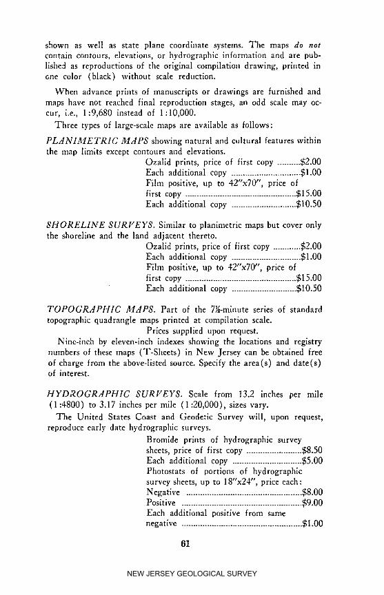
shown as well as state plane coordinate systems. Tbe maps do notcontain contours, elevations, or hydrographic information and are pub-
lished as reproductions of the original compilation drawing, printed inone color (black) without scale reduction.
When advance prints of manuscripts or drawings are furnished and
maps have not reached final reproduction stages, an odd scale may oc-cur, i.e., 1:9,680 instead of 1:10,000.
Three types of large-scale maps are available as follows:
PLAN1AfETRIC MAPS showing natural and cultural features withinthe map limits except contours and elevations.
Ozalid prints, price of first copy .......... $2.00Each additional copy .............................. $1.00
Film positive, up to 42"x70", price of
first copy ................................................ $15.00Each additional copy ............................ $10.50
SHORELINE SURVEYS. Similar to planimetric maps but cover only
the shoreline and the land adjacent thereto.
Ozalid prints, price of first copy ............ $2.00Each additional copy .............................. $1.00
Film positive, up to 42"x70", price offirst copy ................................................ $15.00
Each additional copy ............................ $10._50
TOPOGRAPHIC MAPS. Part of the 7_-mlnute series of standard
topographic quadrangle maps printed at compilation scale.
Prices supplied upon request.
Nine-lnch by eleven-inch indexes showing the locations and registry
numbers of these maps (T-Sheets) in New Jersey can be obtained freeof charge from the above-listed source. Specify the area(s) and date(s)of interest.
HYDROGRAPHIC SURFEYS. Scale from t3.2 inches per mile
(1:4800) to 3.17 inches per mile (1:20,000), sizes vary.
The United States Coast and Geodetic Survey will, upon request,
reproduce early date hydrographic surveys.
Bromide prints of hydrographic survey
sheets, price of first copy ........................ $8.50Each additional copy .............................. $5.00
Photostats of portions of hydrographicsurvey sheets, up to 18"x24"', price each:Negative .................................................. $8.00
Positive .................................................... $9.00Each additional positive from samenegative .................................................... $1.00
61
NEW JERSEY GEOLOGICAL SURVEY
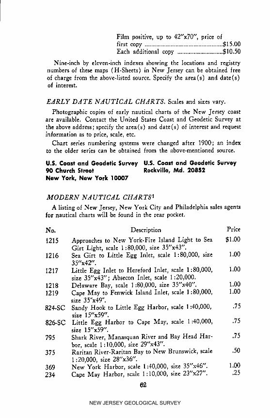
Film positive, up to 42"x70", price offirst copy ................................................ $15.00Each additional copy ............................ $10.50
Nine-lnch by eleven-inch indexes showing the locations and registrynumbers of these maps (H-Sheets) in New Jersey can be obtained freeof charge from the above-llsted source. Specify the area(s) and date(s)of interest.
EARLY DATE NAUTICAL CHARTS. Scales and sizes vary.
Photographic copies of early nautical charts of the New Jersey coastare available. Contact the United States Coast and Geodetic Survey atthe above address; specify the area(s) and date(s) of interest and requestinformation as to price, scale, etc.
Chart series numbering systems were changed after 1900; an indexto the older series can be obtained from the _rbove-mentloned source.
U.S. Coast and Geodetic Survey U.S. Coast and Geodetic Survey90 Church Street Rockville, Md. 20852New York, New York 10007
MODERN NAUTICAL CHAR T$1
A listing of New Jersey, New York City and Philadelphia sales agentsfor nautical charts will ,be found in the rear pocket.
No. Description Prlce
1215 Approaches to New York-Fire Island Light to Sea $1.00Girt Light, scale 1:80,000, size 35"x4Y'.
1216 Sea Girt to Little Egg Inlet, scale 1:80,000, size 1.003Y'x42".
1217 Little Egg Inlet to Hereford Inlet, scale 1:80,000, 1.00size 3Y'x4Y'; Absecon Inlet, scale 1:20,000.
1218 Delaware Bay, scale 1:80,000, size 3Y'x40". 1.001219 Cape May to Fenwlck Island Inlet, scale 1:80,000, 1.00
size 3 Y'x49".
824-SC Sandy Hook to Little Egg Harbor, scale 1:40,000, .75size 15"x59".
826-SC Little Egg Harbor to Cape May, scale 1:40,000, .75size 15"x59".
795 Shark River, Manasquan River and Bay Head Har- .75bor, scale 1:10,000, size 29"x43".
375 Rarltan River-Raritan Bay to New Brunswick, scale .501:20,000, size 28"x36".
369 New York Harbor, scale 1:40,000, size 35"x46". 1.00234 Cape May Harbor, scale 1:10,000, size 2Y'x27". .25
62
NEW JERSEY GEOLOGICAL SURVEY

280 Philadelphia and Camden Waterfronts, scale 1:15,000, 1.00size 36"x4Y'.
294 Delaware River-Smyrna River to XVilmington, scale 1.001:40,000, size 31"x47".
295 Delaware River-Wilmington River to Philadelphia, 1.00scale 1:40,000, size 34"x44".
296 Delaware River-Philadelphia to Trenton, scale .751:30,000, size 27"x46".
Coast Pilot #3: Atlantic Coast, Sandy Hook toCape Henry 1961 2.50
Tide Tables, East Coast North and South America 1.00Tidal Current Tables,Atlantic Coast of North America 1.00
R_F_RENCE CITED
1. All data concerning coastal charts and sales agents has been pro-vided by the United States Coast and Geodetic Survey. For additionalinformation contact either address shown above.
EARLY D.4TE MAPS OF NEW JERSEY
Listed below are major agencies which have valuable map collectionstiled for research purposes. Since material is most readily accessiblethrough an index card system, it is advisable to contact these agenciesdirectly for data concerning a particular area. All inquiries should beaccompanied by a statement which outlines the nature of the ;nformationrequired.
Division of State Library New Jersey Historical SocietyState House Annex 230 BroadwayTrenton, New Jersey 08625 Newark, New Jersey 07104
Special Collections Department Prlnceten University LibraryRutgers University Library Maps DivlslonNew Brunswick, Princeton, New Jersey 08540
New Jersey 08903 Library of CongressMap Division
Morristown National Historical Washington, D. C. 20540Park
P.O. Box 759 National Archives andMorristown, New Jersey 07960 Records Service
Cartographic BranchNew York Historical Society General Services170 Central Park West AdministrationNew York City, New York 10024 Washington, D. C. 20408
63
NEW JERSEY GEOLOGICAL SURVEY
The following publication lists most of the local historical societies inNew Jersey.
Directory, Historical Societies and dgencies in the United States andCanada.
Price each ................................................ $2.00
Copies are obtainable from:
American Associatien for State and Local History151 East Gorham StreetMadison, Wisconsin 53703
Many of the larger New Jersey libraries have extensive map collec-tions for reference purposes. Anyone with a professional interest in mapsshould not fail to investigate these sources.
THE EAST AND WEST JERSEY PROPRIETORSHIPS
Mr. h Snewden Haines, Clerk Mr. George J. Miller, RegistrarCouncil of Proprietors General Board of ProprietorsWestern Division of New Jersey Eastern Division of New Jersey230 High Street 1 Kilmer DriveBurlington, New Jersey 08016 Short Hills, New Jersey 07078
Fuli-tlme custodians are not maintained in the Eastern or Western
Division offices, Appointments for examination of the archives may beobtained by writing to the Eastern Division Registrar or the WesternDivision Clerk (see above). An office admission fee of $5.00 is chargedby both organizations.
Original maps, surveys, property descriptions, grants, etc. are available_or the use of surveyors, title searchers, historians, and other profession-ally interested persons. Photostats of records can be ordered. Contactthe respective Divisional representative in order to ascertain reproduc-tion charges.
Surveys which sever titles from the Eastern and Western Divisionsmay be found in the archives. Beyond the severance, no subsequent con-veyance in the chain of title is recorded. Conveyances which follow arerecorded either in the office of the Secretary of State or in the countywhere the land in question is situated.
64
lNEW JERSEY GEOLOGICAL SURVEY

INDEX
List of New Jersey Maps by Types
County Lines and County Seats, 59
County Owned Lands, 56
Drainage Basins, 56
Early Date, 49, 50, 51, 61, 63, 64
Federal Owned Lands, 56
Hackensaek Meadows, 50, 51
Hydrographic Surveys, 61, 62
Industrial Lands, 56
Magnetic Declinations, 52
Municipalities with Approved Tax Maps, 56
Nautical, Early Date, 62
Nautical, Modern, 62, 63
Planimetric (Less than 1:21,120), 51, 52, 57, 58
Planimetric (1:21,120 and Greater), 58, 59, 60, 61
Relief (Three Dimensional), 59
Relief (Two Dimensional), 52
Riparian, 55, 56, 57
Shoreline Surveys, 61
Soil Surveys, 53, 54, 55
State Owned Lands, 56
Stream, 51
Stream Surveys, 56, 57
Topographic (Less than 1:21,120), 49, 50, 52
Topographic (1:21,120 and Greater), 49, 59, 60, 61
Traffic Volumes, 57, 58, 59
Watershed Properties, 56
65
NEW JERSEY GEOLOGICAL SURVEY
NOTES
NEW JERSEY GEOLOGICAL SURVEY

NOTES
NEW JERSEY GEOLOGICAL SURVEY

NEW JERSEY GEOLOGICAL SURVEY

NEW JERSEY GEOLOGICAL SURVEY