newfoundland island 2014 - bafrenz.com island 2014...norse route from greenland to newfoundland day...
TRANSCRIPT

Newfoundland Island 2014 © Bert & Shari Frenz, 2014 All rights reserved.
Day 1 – June 25 – St. Anthony, Newfoundland
Day 2 – June 26 – Pistolet Bay
Day 3 – June 27 – Norstead
Day 4 – June 28 – Port au Choix
Day 5 – June 29 – Pointe Riche and Western Brook Pond
Day 6 – June 30 – Gros Morne
Day 7 – July 1 – Rocky Harbour
Day 8 – July 2 – Gros Morne to Twillingate
Day 9 – July 3 – Twillingate
Day 10 – July 4 – Twillingate
Day 11 – July 5 – Terra Nova National Park
Day 12 – July 6 – Terra Nova National Park
Day 13 – July 7 – Cape St. Mary’s Ecological Reserve
Day 14 – July 8 – Cape St. Mary’s Ecological Reserve
Day 15 – July 9 – St. John’s
Day 16 – July 10 – Witless Bay Ecological Reserve
Day 17 – July 11 – St. John’s
Day 18 – July 12 – St. John’s
Day 19 – July 13 – Bonavista Peninsula
Day 20 – July 14 – Bonavista Peninsula
Day 21 – July 15 – Bonavista Peninsula
Day 22 – July 16 – Bonavista to Gander
Day 23 – July 17 – Gander
Day 24 – July 18 – Deer Lake
Day 25 – July 19 – Codroy Valley
Day 26 – July 20 – Port aux Basques to Rose Blanche
Day 27 – July 21 – Port aux Basques
Day 28 – July 22 – Deer Lake to Twillingate
Day 29 – July 23 – Twillingate
Day 30 – July 24 – Twillingate
Day 31 – July 25 – Twillingate
Day 32 – July 26 – New World Island to Change Island
Day 33 – July 27 – Fogo Island
Day 34 – July 28 – Fogo Island
Day 35 – July 29 – Fogo Island to Lewisporte
Day 36 – July 30 – Lewisporte to Bishop Falls
Day 37 – July 31 – Grand Falls-Windsor
Day 38 – August 1 – Millertown to Brighton
Day 39 – August 2 – King’s Point and Springdale
Day 40 – August 3 – La Scie
Day 41 – August 4 – Baie Verte Peninsula
Day 42 – August 5 – Burlington to Corner Brook
Day 43 – August 6 – Bay of Islands
Day 44 – August 7 – French Ancestors Route, Port au Port loop
Day 45 – August 8 – Stephenville Crossing to Highlands
Day 46 – August 9 – Codroy Valley
Day 47 – August 10 – Cape Ray
Day 48 – August 11 – Newfoundland Ferry
Day 1. June 25 – St. Anthony, Newfoundland
(Bert) The first bird I see on Newfoundland island is a European Starling, not a propitious start
for my expectation of better birding. I watch it in the rain while I refuel at St. Barbe and then
carefully circumscribe huge rain puddles in the parking lot to check on Mike and Kay, Curt and
Chris, and Woody and Joey to explain our driving plans.
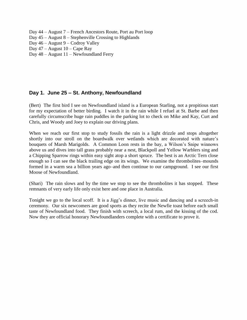
When we reach our first stop to study fossils the rain is a light drizzle and stops altogether
shortly into our stroll on the boardwalk over wetlands which are decorated with nature’s
bouquets of Marsh Marigolds. A Common Loon rests in the bay, a Wilson’s Snipe winnows
above us and dives into tall grass probably near a nest, Blackpoll and Yellow Warblers sing and
a Chipping Sparrow rings within easy sight atop a short spruce. The best is an Arctic Tern close
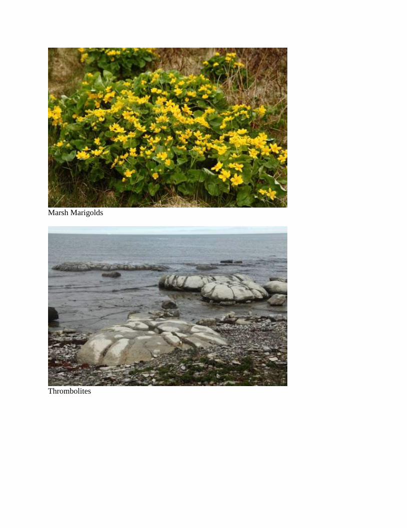
enough so I can see the black trailing edge on its wings. We examine the thrombolites–mounds
formed in a warm sea a billion years ago–and then continue to our campground. I see our first
Moose of Newfoundland.
(Shari) The rain slows and by the time we stop to see the thrombolites it has stopped. These
remnants of very early life only exist here and one place in Australia.
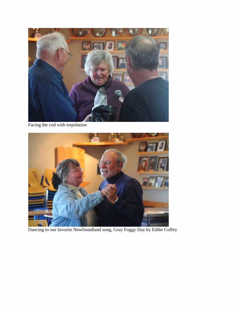
Tonight we go to the local scoff. It is a Jigg’s dinner, live music and dancing and a screech-in
ceremony. Our six newcomers are good sports as they recite the Newfie toast before each small
taste of Newfoundland food. They finish with screech, a local rum, and the kissing of the cod.
Now they are official honorary Newfoundlanders complete with a certificate to prove it.
Marsh Marigolds
Thrombolites
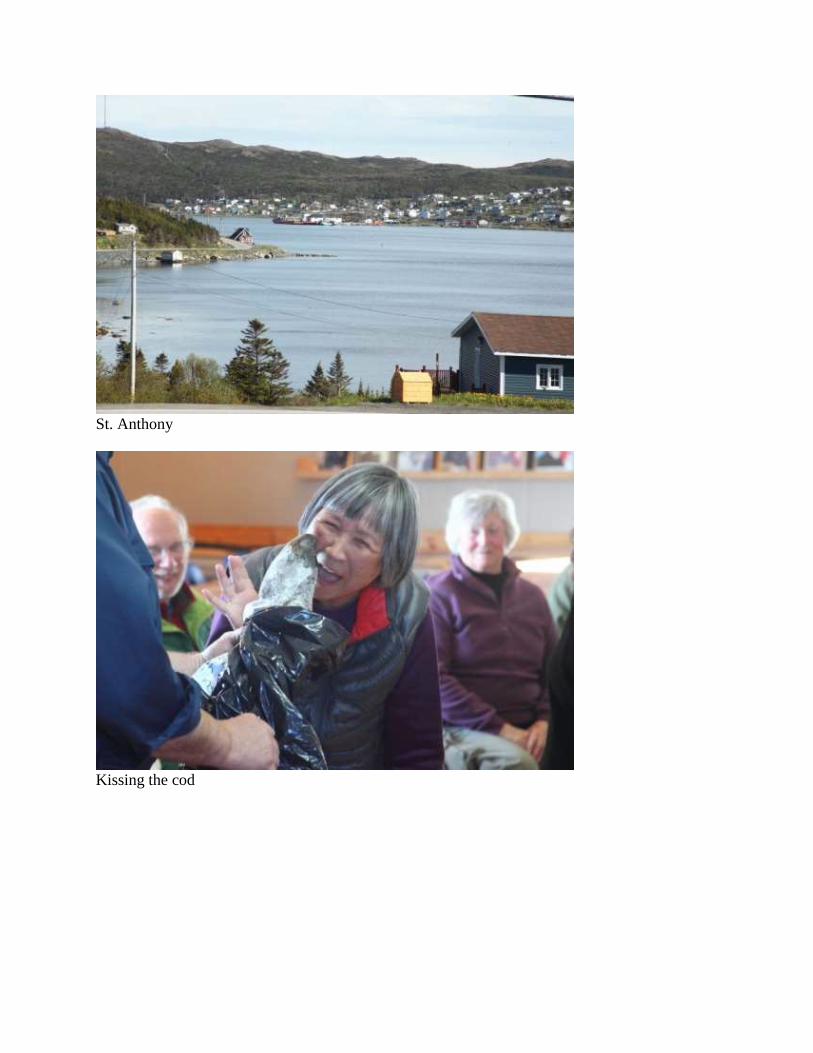
St. Anthony
Kissing the cod
Facing the cod with trepidation
Dancing to our favorite Newfoundland song, Gray Foggy Day by Eddie Coffey
Day 2. June 26 – Pistolet Bay
(Bert) Probably our best day yet for birding on a mild summer day, our first stop is a park on a
tranquil lake with a roped off section for swimming although I am sure the water temperature is
far too cold for my Texas blood. The best bird is Pine Grosbeak. On a list given to me by the
park attendant, I mark down the ones we find and she is impressed. She is even more surprised
when we tell her we found a morel mushroom only a hundred feet from her booth. We also see a
few mammals today: Snowshoe Hare, Harbor Seal, and a Moose close enough to photograph.
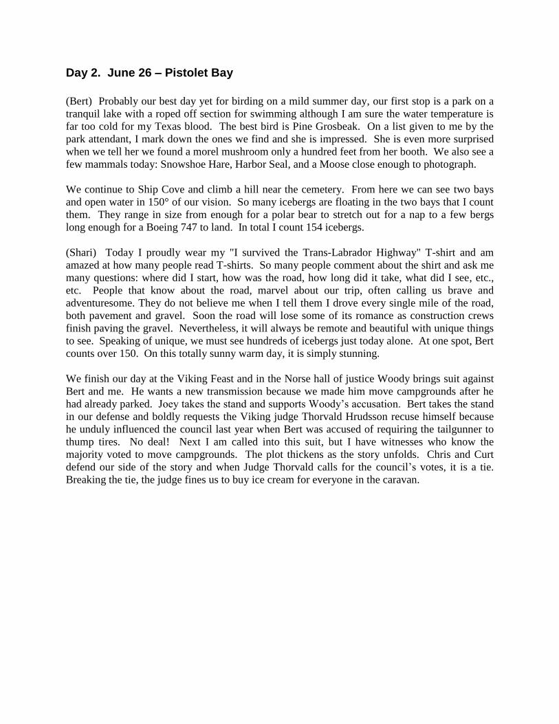
We continue to Ship Cove and climb a hill near the cemetery. From here we can see two bays
and open water in 150° of our vision. So many icebergs are floating in the two bays that I count
them. They range in size from enough for a polar bear to stretch out for a nap to a few bergs
long enough for a Boeing 747 to land. In total I count 154 icebergs.
(Shari) Today I proudly wear my "I survived the Trans-Labrador Highway" T-shirt and am
amazed at how many people read T-shirts. So many people comment about the shirt and ask me
many questions: where did I start, how was the road, how long did it take, what did I see, etc.,
etc. People that know about the road, marvel about our trip, often calling us brave and
adventuresome. They do not believe me when I tell them I drove every single mile of the road,
both pavement and gravel. Soon the road will lose some of its romance as construction crews
finish paving the gravel. Nevertheless, it will always be remote and beautiful with unique things
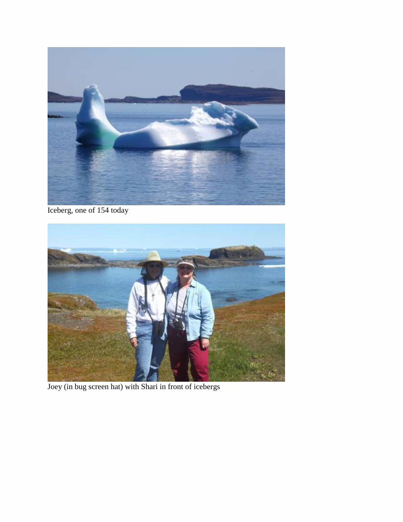
to see. Speaking of unique, we must see hundreds of icebergs just today alone. At one spot, Bert
counts over 150. On this totally sunny warm day, it is simply stunning.
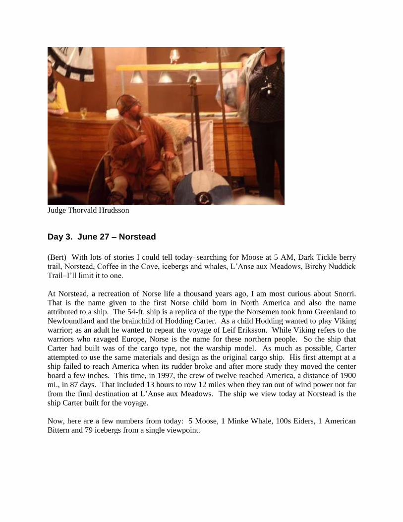
We finish our day at the Viking Feast and in the Norse hall of justice Woody brings suit against
Bert and me. He wants a new transmission because we made him move campgrounds after he
had already parked. Joey takes the stand and supports Woody’s accusation. Bert takes the stand
in our defense and boldly requests the Viking judge Thorvald Hrudsson recuse himself because
he unduly influenced the council last year when Bert was accused of requiring the tailgunner to
thump tires. No deal! Next I am called into this suit, but I have witnesses who know the
majority voted to move campgrounds. The plot thickens as the story unfolds. Chris and Curt
defend our side of the story and when Judge Thorvald calls for the council’s votes, it is a tie.
Breaking the tie, the judge fines us to buy ice cream for everyone in the caravan.

Nice weather, but too cold for swimming.
Snowshoe Hare
Iceberg, one of 154 today
Joey (in bug screen hat) with Shari in front of icebergs

Moss campion has a tap root up to 9 feet deep
Moose on side of road
Judge Thorvald Hrudsson
Day 3. June 27 – Norstead
(Bert) With lots of stories I could tell today–searching for Moose at 5 AM, Dark Tickle berry
trail, Norstead, Coffee in the Cove, icebergs and whales, L’Anse aux Meadows, Birchy Nuddick
Trail–I’ll limit it to one.
At Norstead, a recreation of Norse life a thousand years ago, I am most curious about Snorri.
That is the name given to the first Norse child born in North America and also the name
attributed to a ship. The 54-ft. ship is a replica of the type the Norsemen took from Greenland to
Newfoundland and the brainchild of Hodding Carter. As a child Hodding wanted to play Viking
warrior; as an adult he wanted to repeat the voyage of Leif Eriksson. While Viking refers to the
warriors who ravaged Europe, Norse is the name for these northern people. So the ship that
Carter had built was of the cargo type, not the warship model. As much as possible, Carter
attempted to use the same materials and design as the original cargo ship. His first attempt at a
ship failed to reach America when its rudder broke and after more study they moved the center
board a few inches. This time, in 1997, the crew of twelve reached America, a distance of 1900
mi., in 87 days. That included 13 hours to row 12 miles when they ran out of wind power not far
from the final destination at L’Anse aux Meadows. The ship we view today at Norstead is the
ship Carter built for the voyage.
Now, here are a few numbers from today: 5 Moose, 1 Minke Whale, 100s Eiders, 1 American
Bittern and 79 icebergs from a single viewpoint.

Deck of the Snorri
Bow of the Snorri

Norse route from Greenland to Newfoundland
Day 4. June 28 – Port au Choix
(Bert) When in Cartwright, Pete and George suggested an alternate route south from St.
Anthony. Not having driven that road before, we decide to try it today. Instead of following the
north shore we turn inland and climb in elevation to a thousand feet and drive along the Long
Range of the Great Northern Peninsula. This range is actually the northeastern end of the
Appalachian Mountains. Once we reach the top of the mountain, the paved highway is
surprisingly flat and straight as we pass through forests of short trees. Near the village of Main
Brook we start seeing gardens built on the side of the highway. At one time gardens were built
at remote hilltops because the soil was more fertile and not the rocky ground surrounding seaside
homes, but with the addition of roads and the fill left at the roadsides, local people took
advantage of the easy access. With no restrictions on usage, people put the gardens anywhere
convenient. So now we see a string of gardens that randomly stretches for miles, most with
crude log fences to keep out hungry Moose.
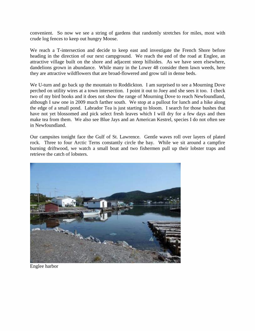
We reach a T-intersection and decide to keep east and investigate the French Shore before
heading in the direction of our next campground. We reach the end of the road at Englee, an
attractive village built on the shore and adjacent steep hillsides. As we have seen elsewhere,
dandelions grown in abundance. While many in the Lower 48 consider them lawn weeds, here
they are attractive wildflowers that are broad-flowered and grow tall in dense beds.
We U-turn and go back up the mountain to Roddickton. I am surprised to see a Mourning Dove
perched on utility wires at a town intersection. I point it out to Joey and she sees it too. I check
two of my bird books and it does not show the range of Mourning Dove to reach Newfoundland,
although I saw one in 2009 much farther south. We stop at a pullout for lunch and a hike along
the edge of a small pond. Labrador Tea is just starting to bloom. I search for those bushes that
have not yet blossomed and pick select fresh leaves which I will dry for a few days and then
make tea from them. We also see Blue Jays and an American Kestrel, species I do not often see
in Newfoundland.
Our campsites tonight face the Gulf of St. Lawrence. Gentle waves roll over layers of plated
rock. Three to four Arctic Terns constantly circle the bay. While we sit around a campfire
burning driftwood, we watch a small boat and two fishermen pull up their lobster traps and
retrieve the catch of lobsters.
Englee harbor
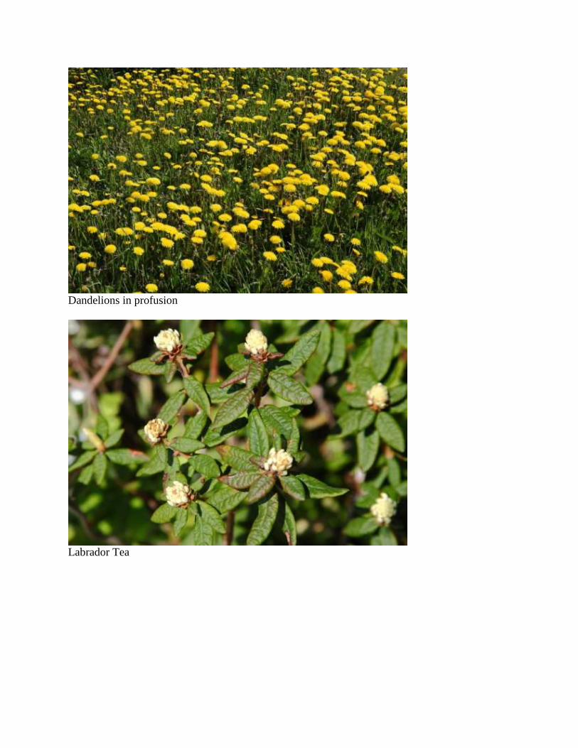
Dandelions in profusion
Labrador Tea
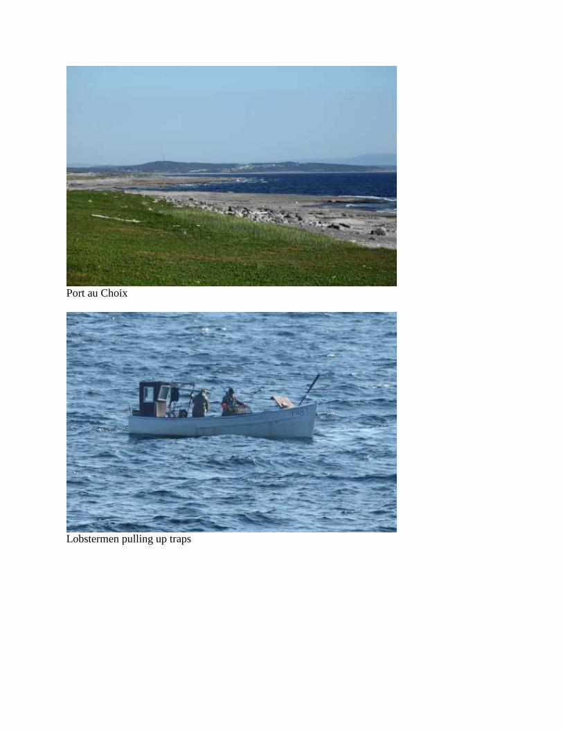
Port au Choix
Lobstermen pulling up traps
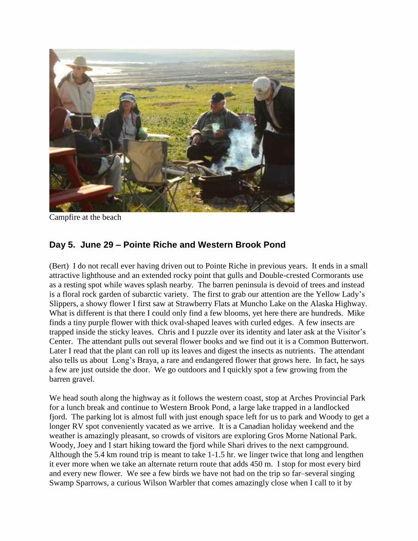
Campfire at the beach
Day 5. June 29 – Pointe Riche and Western Brook Pond
(Bert) I do not recall ever having driven out to Pointe Riche in previous years. It ends in a small
attractive lighthouse and an extended rocky point that gulls and Double-crested Cormorants use
as a resting spot while waves splash nearby. The barren peninsula is devoid of trees and instead
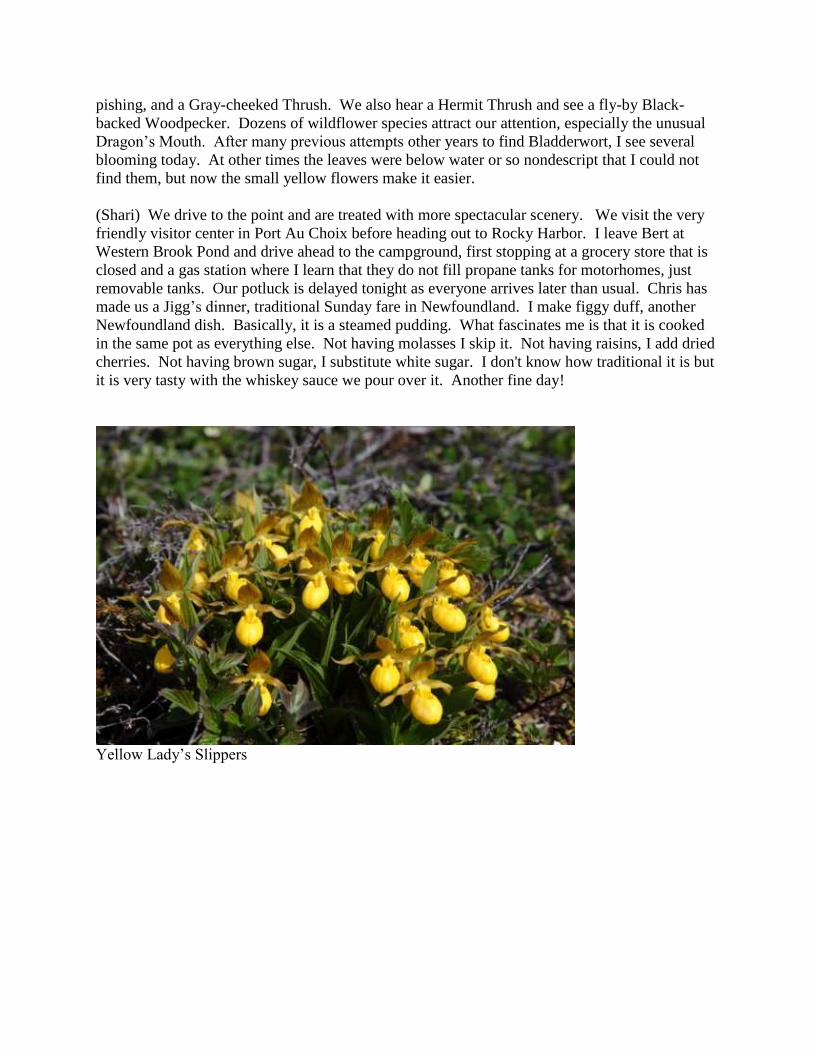
is a floral rock garden of subarctic variety. The first to grab our attention are the Yellow Lady’s
Slippers, a showy flower I first saw at Strawberry Flats at Muncho Lake on the Alaska Highway.
What is different is that there I could only find a few blooms, yet here there are hundreds. Mike
finds a tiny purple flower with thick oval-shaped leaves with curled edges. A few insects are
trapped inside the sticky leaves. Chris and I puzzle over its identity and later ask at the Visitor’s
Center. The attendant pulls out several flower books and we find out it is a Common Butterwort.
Later I read that the plant can roll up its leaves and digest the insects as nutrients. The attendant
also tells us about Long’s Braya, a rare and endangered flower that grows here. In fact, he says
a few are just outside the door. We go outdoors and I quickly spot a few growing from the
barren gravel.
We head south along the highway as it follows the western coast, stop at Arches Provincial Park
for a lunch break and continue to Western Brook Pond, a large lake trapped in a landlocked
fjord. The parking lot is almost full with just enough space left for us to park and Woody to get a
longer RV spot conveniently vacated as we arrive. It is a Canadian holiday weekend and the
weather is amazingly pleasant, so crowds of visitors are exploring Gros Morne National Park.
Woody, Joey and I start hiking toward the fjord while Shari drives to the next campground.
Although the 5.4 km round trip is meant to take 1-1.5 hr. we linger twice that long and lengthen
it ever more when we take an alternate return route that adds 450 m. I stop for most every bird
and every new flower. We see a few birds we have not had on the trip so far–several singing
Swamp Sparrows, a curious Wilson Warbler that comes amazingly close when I call to it by
pishing, and a Gray-cheeked Thrush. We also hear a Hermit Thrush and see a fly-by Black-
backed Woodpecker. Dozens of wildflower species attract our attention, especially the unusual
Dragon’s Mouth. After many previous attempts other years to find Bladderwort, I see several
blooming today. At other times the leaves were below water or so nondescript that I could not
find them, but now the small yellow flowers make it easier.
(Shari) We drive to the point and are treated with more spectacular scenery. We visit the very
friendly visitor center in Port Au Choix before heading out to Rocky Harbor. I leave Bert at
Western Brook Pond and drive ahead to the campground, first stopping at a grocery store that is
closed and a gas station where I learn that they do not fill propane tanks for motorhomes, just
removable tanks. Our potluck is delayed tonight as everyone arrives later than usual. Chris has
made us a Jigg’s dinner, traditional Sunday fare in Newfoundland. I make figgy duff, another
Newfoundland dish. Basically, it is a steamed pudding. What fascinates me is that it is cooked
in the same pot as everything else. Not having molasses I skip it. Not having raisins, I add dried
cherries. Not having brown sugar, I substitute white sugar. I don't know how traditional it is but
it is very tasty with the whiskey sauce we pour over it. Another fine day!
Yellow Lady’s Slippers

Common Butterwort with trapped insects
Endangered Long’s Braya

Arches Provincial Park
Bladderwort

Western Brook Pond
Jigg’s Dinner

Day 6. June 30 – Gros Morne
(Bert) Today we explore Gros Morne, or at least a small portion of this enormous national park.
At the Discovery Centre many excellent exhibits explain the geology and natural history of this
unique World Heritage Park. I find a loose leaf binder on the counter that contains photographs
of local wildflowers, searching for an anemone I just saw outside. An attendant notices my
interest and as I flip through the pages he tells me where each flower grows in the park and
peculiar identification features to look for on the flowers. I ask him about Canadian Burnet,
saying I have not been able to find it yet this year. Bruce says it isn’t blooming yet but can show
me the leaves just outside the building. He does, and Chris joins us. Bruce goes on to show us
flower after flower, so fast I can barely keep up with notes and photos so that I can remember
this rapid fire presentation. To my surprise I find out that Bruce is the maintenance man for the
park and is not the support naturalist I thought he was. He learned his plants out of personal
interest while laying out the park trails. After a half hour of his time we thank him and comment
that we hope his boss doesn’t mind the time he has spent. He tells us he hasn’t seen his boss here
for two years.
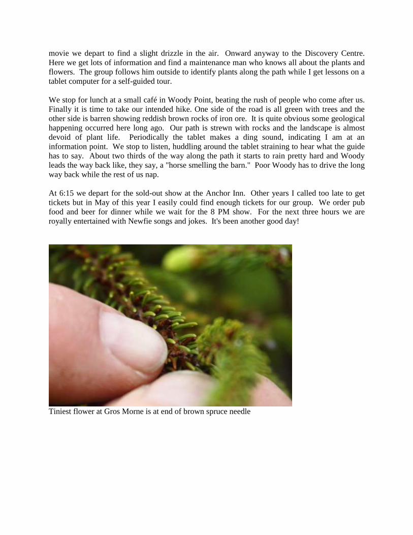
One of the flowers he shows us is tiny, the smallest in the national park. On some spruce trees
that look half dead, Bruce points out the tiny brown stubs of spruce needles that are tipped in
purple. It would take a magnifying glass to see the bloom of the parasitic flower.
Woody is driving, so he drives to Woody Point for lunch. For dessert I pay for ice cream for
everyone, thereby settling the court order laid down by Judge Thorvald Hrudsson at the Viking
Feast.
We head in the direction of the Tablelands, a geologic marvel. The earth’s crust of 4-5 million
years ago pushed up here. On one side of the deep canyon lies barren rock with soil too poor to
support more than a few widely scattered pioneer plants and on the opposite side is a lush tall
forest that completely blankets the Appalachian Mountains beneath.
We meet a park attendant who explains some tests he is performing. He dips an eye dropper into
the vase-shaped bowl of a Pitcher Plant and extracts insects floating in water. Midges and other
flying insects are food for the insectivorous plant after they are broken down by enzymes
secreted by the plant. He tells us that midges lay eggs on the plant and when they emerge the
plant nectar acts as food. The arrival of the midges used to be in June, but now through their
testing they have found out that the midges come out already in April as a result of global
warming.
Another discovery that fascinates me is Serpentinite, which we find scattered throughout our
walk. It is rock from the Earth’s mantle that has undergone hydration and metamorphic
transformation. What happens is water seeps through the rock, picks up minerals found within
the rock and crystalizes out as calcite and other mineral deposits in a snakeskin-like pattern.
(Shari) The weather is gorgeous when Bert and I drive to pick up tickets for the show tonight. It
will be a beautiful day for a hike on the Tablelands. Carpooling, we have our first stop at the
visitor center of this beautiful park of Gros Morne. After seeing the exhibits and watching a
movie we depart to find a slight drizzle in the air. Onward anyway to the Discovery Centre.
Here we get lots of information and find a maintenance man who knows all about the plants and
flowers. The group follows him outside to identify plants along the path while I get lessons on a
tablet computer for a self-guided tour.
We stop for lunch at a small café in Woody Point, beating the rush of people who come after us.
Finally it is time to take our intended hike. One side of the road is all green with trees and the
other side is barren showing reddish brown rocks of iron ore. It is quite obvious some geological
happening occurred here long ago. Our path is strewn with rocks and the landscape is almost
devoid of plant life. Periodically the tablet makes a ding sound, indicating I am at an
information point. We stop to listen, huddling around the tablet straining to hear what the guide
has to say. About two thirds of the way along the path it starts to rain pretty hard and Woody
leads the way back like, they say, a "horse smelling the barn." Poor Woody has to drive the long
way back while the rest of us nap.
At 6:15 we depart for the sold-out show at the Anchor Inn. Other years I called too late to get
tickets but in May of this year I easily could find enough tickets for our group. We order pub
food and beer for dinner while we wait for the 8 PM show. For the next three hours we are
royally entertained with Newfie songs and jokes. It's been another good day!
Tiniest flower at Gros Morne is at end of brown spruce needle
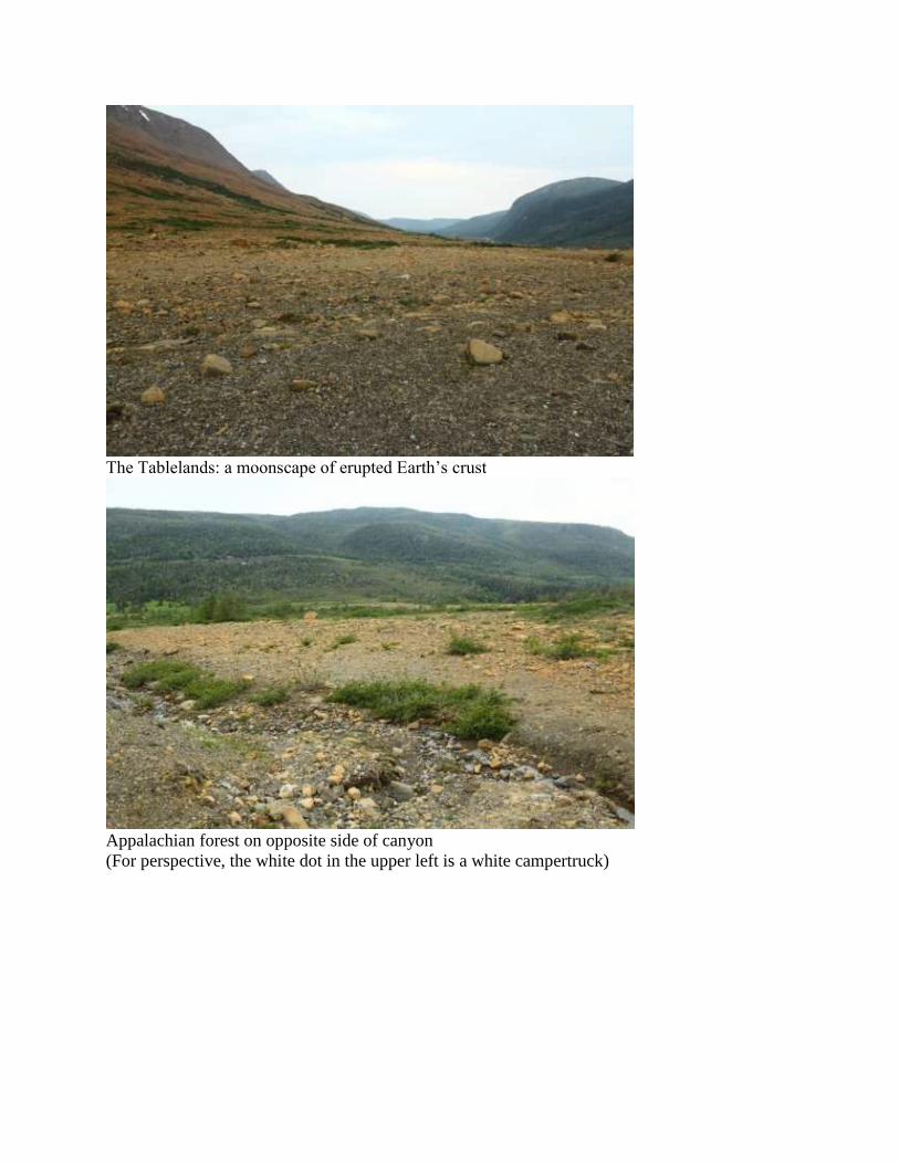
The Tablelands: a moonscape of erupted Earth’s crust
Appalachian forest on opposite side of canyon
(For perspective, the white dot in the upper left is a white campertruck)
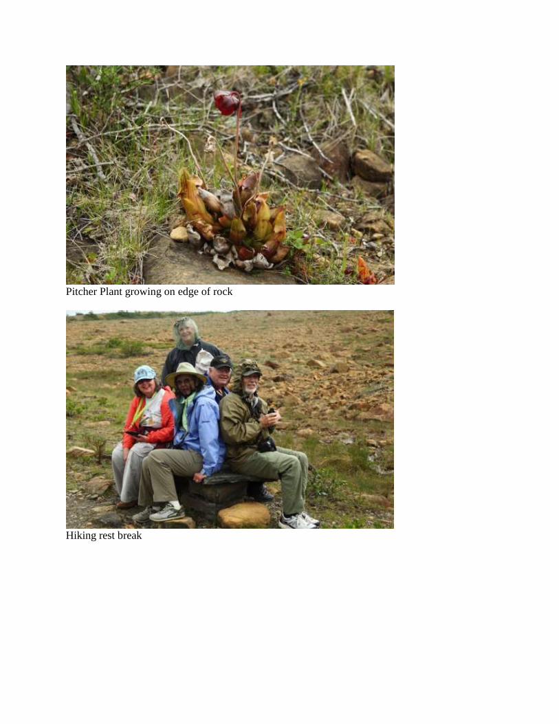
Pitcher Plant growing on edge of rock
Hiking rest break

Serpentinite (the white lines are calcite)
Nighttime entertainment at Anchor Inn
Day 7. July 1 – Rocky Harbour
(Shari) Today is catch up day. Bert and I finish the paperwork for the previous trip and package
it to be mailed as soon as possible. Others take a boat trip, ride bikes or just relax. It really is a
shame to be stuck indoors today. I have been here a total of eleven days and today is the best
weather of all eleven. At 5 PM Bert and I drive to the fish store to pick up lobsters for the group.
Later, we sit outside with the others oohing and aahing about how good it tastes.
(Bert) It is a shame to waste a day of good weather, but paperwork from our last tour must be
finished and I’d also like to catch up on journal writing. Since I haven’t got much to say about
my day, I’ll talk about the memorial day. Nationwide, July 1 is Canada Day and everyone
celebrates much like we Americans celebrate the Fourth of July. However, in Newfoundland it
is a dual holiday. Newfoundlanders call it Remembrance Day, commemorating July 1, 1916.
Newfoundlanders considered themselves England’s oldest colony and when World War I broke
out they readily volunteered to serve. Strangely, though, the commission in urban elite St.
John’s failed to recognize that 75% of the likely volunteers were seamen in the fisheries, so
instead of sending sailors, they sent soldiers. On the fateful day of July 1 some 800
Newfoundlanders charged German machine guns at Beaumont Hammond and within minutes
over 200 were dead and over 400 were wounded. For a small country as Newfoundland, almost
everyone had relatives or neighbors that died or were wounded that day. [Later I hear that
Eleanor of the Split Peas lost her grandfather in that battle]. Of the 12,000 volunteers over the
course of the war one-quarter died and another third were wounded.
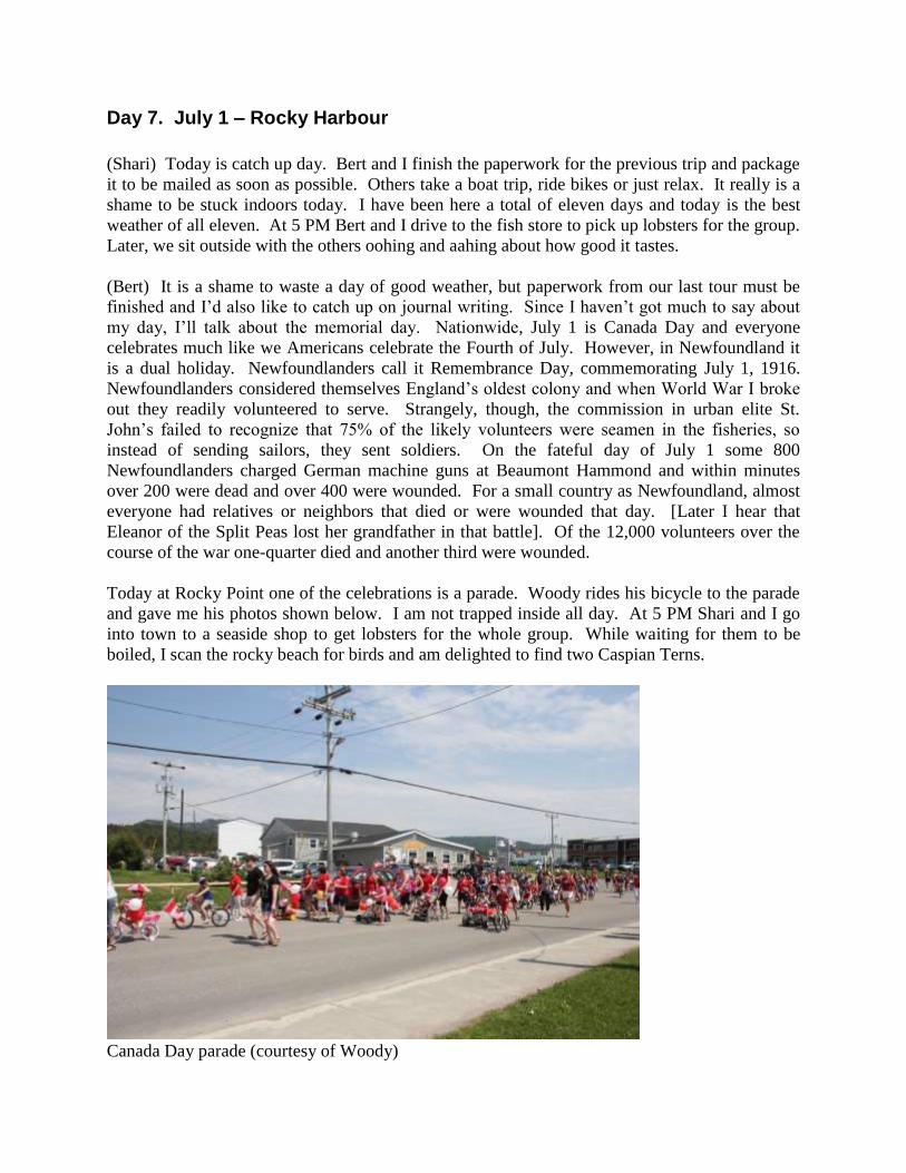
Today at Rocky Point one of the celebrations is a parade. Woody rides his bicycle to the parade
and gave me his photos shown below. I am not trapped inside all day. At 5 PM Shari and I go
into town to a seaside shop to get lobsters for the whole group. While waiting for them to be
boiled, I scan the rocky beach for birds and am delighted to find two Caspian Terns.
Canada Day parade (courtesy of Woody)
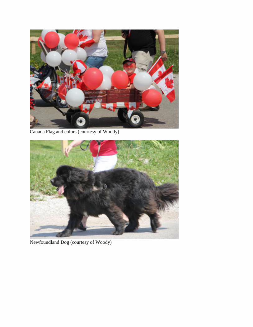
Canada Flag and colors (courtesy of Woody)
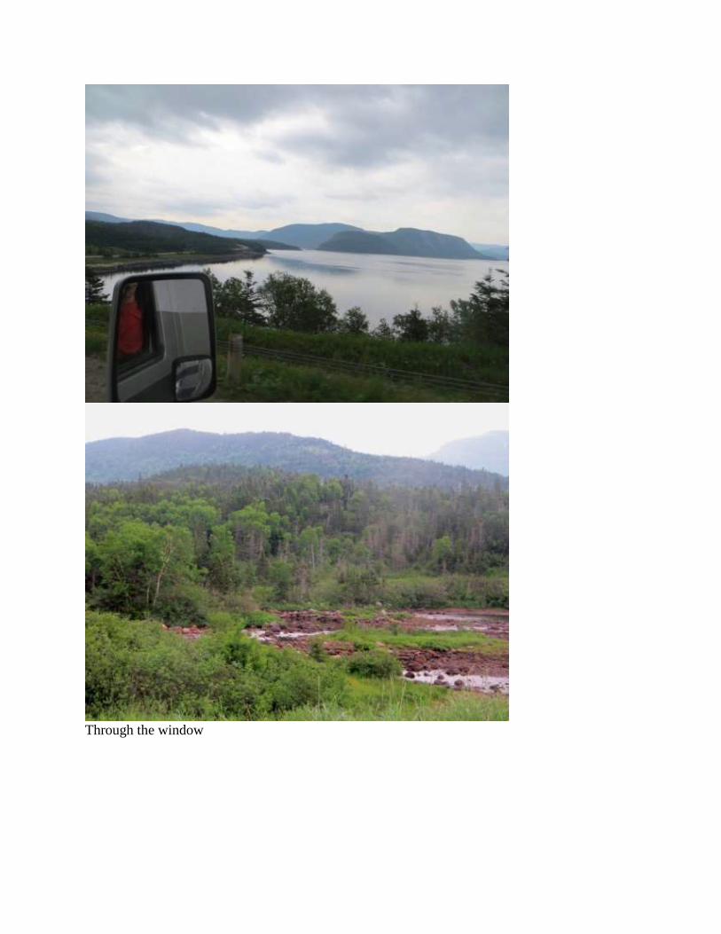
Newfoundland Dog (courtesy of Woody)

Flags and lighthouse (courtesy of Woody)

Rocky Harbour with distant Caspian Tern on center rock
Day 8. July 2 – Gros Morne to Twillingate
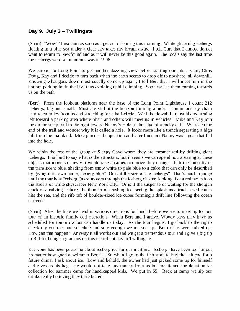
(Bert) Today is our longest travel day: 266 mi. Fortunately, much of it is on excellent highway,
TCH1, the Trans-Canada Highway. Pretty scenery, an Osprey near South Brook, a moose
roadside on TCH1, … not much else to say.
Except for the weather! We woke up to 47° inside our RV near Fermont; I have been bundled in
seven layers of clothes at Battle Harbour; we had our social gathering outside at 37° in
Cartwright during strong winds and we have seen thousands of icebergs floating in the Labrador
and Newfoundland bays. So it seems almost inconceivable that today the thermometer registers
in the 80s all day and tops out at 90° Fahrenheit at 1:30 PM.
Through the window
Day 9. July 3 – Twillingate
(Shari) “Wow!” I exclaim as soon as I get out of our rig this morning. White glistening icebergs
floating in a blue sea under a clear sky takes my breath away. I tell Curt that I almost do not
want to return to Newfoundland as it will never be this good again. The locals say the last time
the icebergs were so numerous was in 1998.
We carpool to Long Point to get another dazzling view before starting our hike. Curt, Chris
Doug, Kay and I decide to turn back when the earth seems to drop off to nowhere, all downhill.
Knowing what goes down must usually come up again, I tell Bert that I will meet him in the
bottom parking lot in the RV, thus avoiding uphill climbing. Soon we see them coming towards
us on the path.
(Bert) From the lookout platform near the base of the Long Point Lighthouse I count 212
icebergs, big and small. Most are still at the horizon forming almost a continuous icy chain
nearly ten miles from us and stretching for a half-circle. We hike downhill, most hikers turning
left toward a parking area where Shari and others will meet us in vehicles. Mike and Kay join
me on the steep trail to the right toward Nanny’s Hole at the edge of a rocky cliff. We reach the
end of the trail and wonder why it is called a hole. It looks more like a trench separating a high
hill from the mainland. Mike pursues the question and later finds out Nanny was a goat that fell
into the hole.
We rejoin the rest of the group at Sleepy Cove where they are mesmerized by drifting giant
icebergs. It is hard to say what is the attractant, but it seems we can spend hours staring at these
objects that move so slowly it would take a camera to prove they change. Is it the intensity of
the translucent blue, shading from snow white to pale blue to a color that can only be described
by giving it its own name, iceberg blue? Or is it the size of the icebergs? That’s hard to judge
until the tour boat Iceberg Quest motors through the iceberg cluster, looking like a red taxicab on
the streets of white skyscraper New York City. Or is it the suspense of waiting for the shotgun
crack of a calving iceberg, the thunder of crushing ice, seeing the splash as a truck-sized chunk
hits the sea, and the rift-raft of boulder-sized ice cubes forming a drift line following the ocean
current?
(Shari) After the hike we head in various directions for lunch before we are to meet up for our
tour of an historic family cod operation. When Bert and I arrive, Woody says they have us
scheduled for tomorrow but can handle us today. As the tour begins, I go back to the rig to
check my contract and schedule and sure enough we messed up. Both of us were mixed up.
How can that happen? Anyway it all works out and we get a tremendous tour and I give a big tip
to Bill for being so gracious on this record hot day in Twillingate.
Everyone has been pestering about iceberg ice for our martinis. Icebergs have been too far out
no matter how good a swimmer Bert is. So when I go to the fish store to buy the salt cod for a
future dinner I ask about ice. Low and behold, the owner had just picked some up for himself
and gives us his bag. He would not take any money from us but mentioned the donation jar
collection for summer camp for handicapped kids. We put in $5. Back at camp we sip our
drinks really believing they taste better.
(Bert) “Where did they get their salt from?” I ask. Bill retorts, “As my grandfather always said,
“Don’t get ahead of my story.” In early afternoon we learn more about cod fishing than we ever
did before. Bill, a former fifth-grade school teacher, is an excellent instructor, but he doesn’t
want me to interrupt his story. He has already explained the old method of jigging for cod–
snagging cod bloated on capelin–and dabbing–catching with bait–that was practiced up until the
1960s. These were followed by more efficient methods: the Newfoundland cod trap, up to 500
ft. long and seafloor to surface, and the drag nets used at sea by the Russians, English and
Americans. Although the decline of cod was already noted in the early 1800s, it was the
unrestricted use of more efficient methods that finally brought on the 1992 moratorium that put
an end to commercial cod fishing here in Newfoundland.
Bill has demonstrated how cod are cleaned and is discussing the salting process, when my salt
question comes up. Salt preserves the cod and kills maggots deposited by flies. Daily the cod
were stretched out on flakes to dry in the sun, brought inside into the “fish store” at night, then
moved outside again until they were dry as stiff boards and hard as leather in a week. Graded by
quality, stacked into barrels, merchants shipped off the best to Catholic countries Italy, France,
Portugal and Boston, and the worst to the slaves in the West Indies. So, now, I get the answer to
my question. The merchants traded cod to Portugal in exchange for salt and cork. Also, they
traded cod to the West Indies for barrels–called puncheons, hence the phrase “big as a puncheon”
–of molasses. The famous Newfoundland screech was made from the black mass at the bottom
of the puncheons, a crude bottom-of-the-barrel rum that induced a screech at first sip.
I must tell you about the saga of Doug and Kay who have joined us today. We last saw them the
day we left Churchill Falls when they had problems with the starter on their Ford F550. But
replacing the starter didn’t solve the problem and the truck was transported to Labrador City on a
flatbed truck which had a major tire blowout en route. After nearly a week in the remote city, it
was determined that a sheared pin on the head was the problem and it was replaced. Had the
problem been worse, the cab of the molded-body RV would have needed to be removed and
since that had been custom installed in Colorado, it might not have been possible to remove it in
the field. However, the truck now worked so Doug and Kay continued east on the Trans-
Labrador Highway. En route to Goose Bay they had a blow-out, perhaps from a rock that hit the
sidewall. These tires reach nearly chest high on a grown man, so are no simple task to change.
Fortunately, two other travelers passed by and offered to help Doug and in short order they had
the tire replaced. In Goose Bay Doug tried to buy a new tire. In that city the only tire available
of that size was an off-road Caterpillar tire. So that is now mounted on the back of the
Earthroamer when Doug and Kay arrive in Twillingate. Everyone, particularly Shari, is
delighted to see their return to the caravan. With lifted spirits, we all celebrate tonight at the
performance of the Split Peas.
(Shari) Soon it is time to go to the live performance of the Split Peas, a group of singing ladies
we heard and enjoyed last year. Their show again is good and all say they enjoyed it. Woody
may have gotten more enjoyment than others as he got to dance with the best looking lady of the
bunch, although you might not believe that when you see the mask she is wearing.
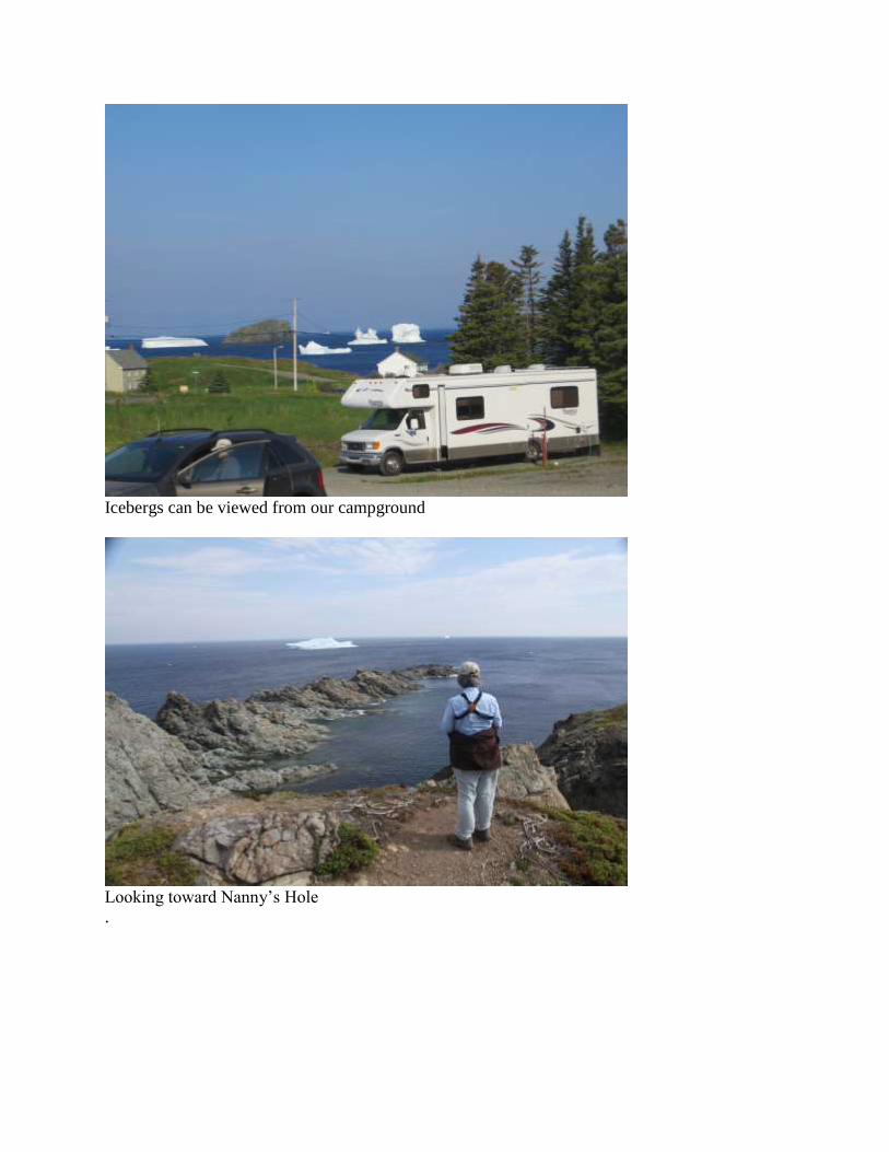
Icebergs can be viewed from our campground
Looking toward Nanny’s Hole
.
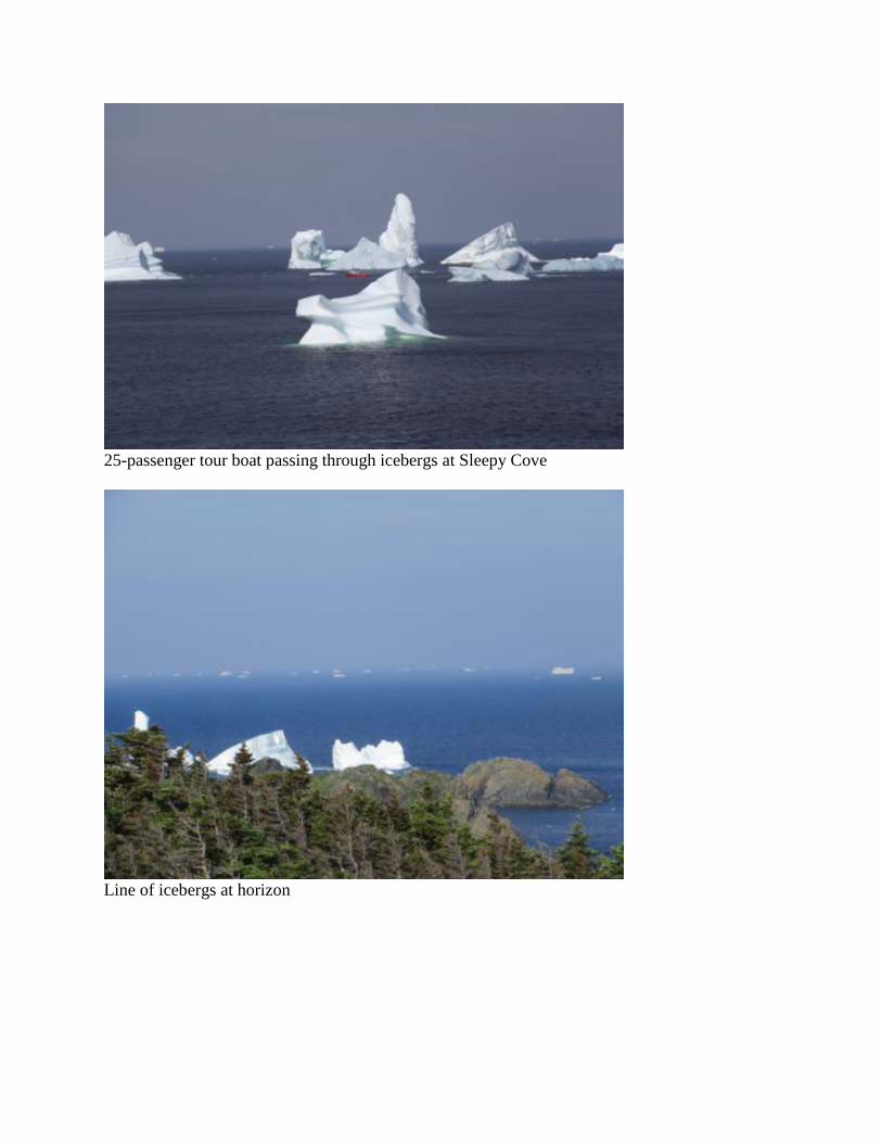
25-passenger tour boat passing through icebergs at Sleepy Cove
Line of icebergs at horizon
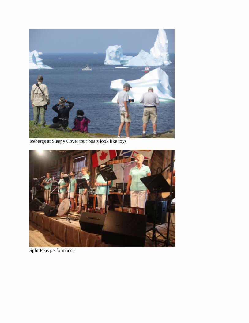
Icebergs at Sleepy Cove; tour boats look like toys
Split Peas performance

Woody dancing with the prettiest of the Split Peas
Day 10. July 4 – Twillingate
(Bert) We start with a hike in Peyton Woods, finding a good selection of birds that includes our
first Cedar Waxwings in Newfoundland. However, the gunshot cracking of icebergs is too much
to resist, so we come out of the woods to get a view of the sea. One of the closest icebergs is
starting to break up. We hike to the bay for a better view and once we are there the allure of
icebergs has again captivated us. We walk to Battrick’s Island and climb a steep hill that
overlooks the bay, the campground, the town and, of course, the panorama of icebergs. Perhaps,
you are tiring of my talk of icebergs, but we are not yet satiated. One of the icebergs has a
swimming pool visible when we climb the hill and are above the iceberg. We look down at the
iceberg-blue pool surrounded by a snow-white ice shore, all suspended 50 ft. above the sea.
We reach the top of Battrick’s Island where the winds are blowing at gale force. We try to find
the American Pipits that Mike found earlier, but I suspect the presence of our larger group deters
them from landing on the small apex. Later, alone, Mike finds them again and photographs one.
A teenager staying with his grandparents in a truck camper wades into the icy sea and pushes
large chunks of iceberg debris up onto shore. He has taken as much as he wants, so we pick up
what is left and carry it back to camp. Tonight we will have martinis with 10,000-year-old ice.
If you have ever done that, you know the ice crackles in a special magical way.
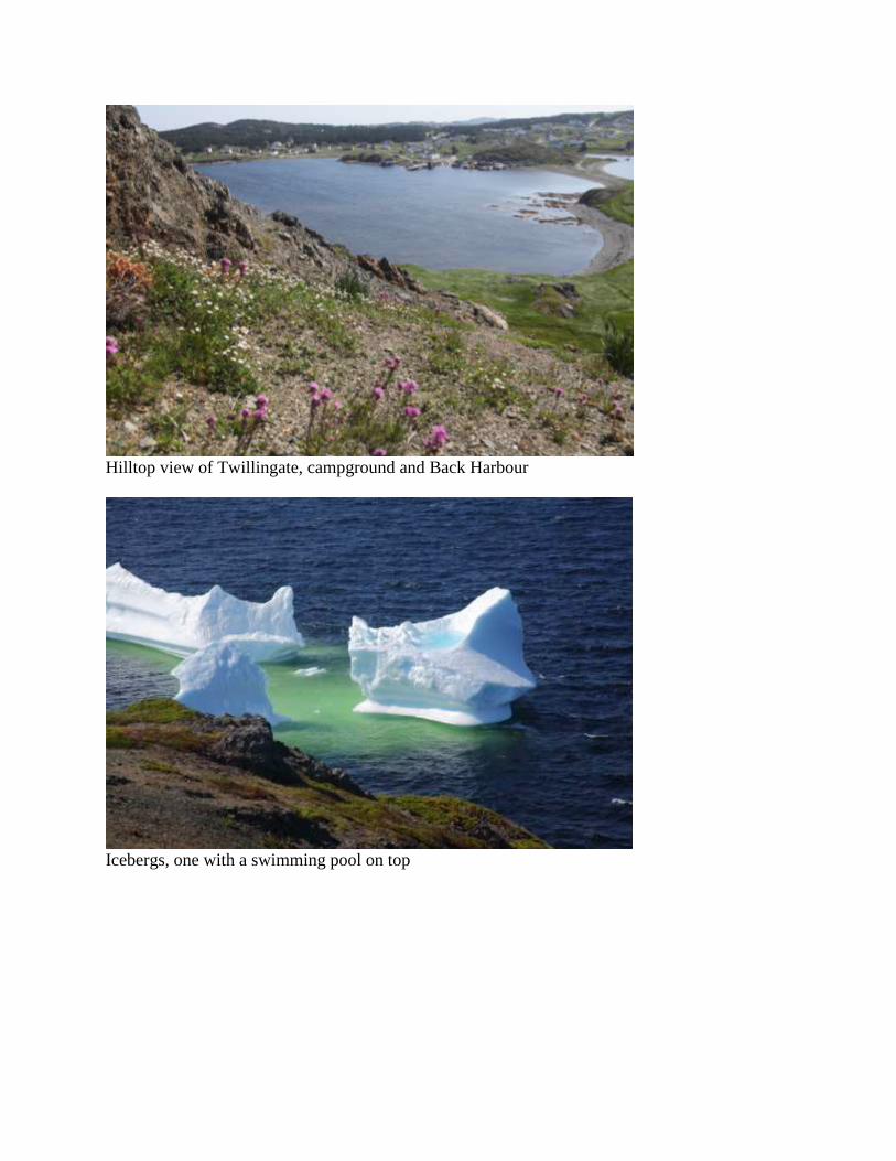
Hilltop view of Twillingate, campground and Back Harbour
Icebergs, one with a swimming pool on top

Rhodora blowing in the strong winds atop Battrick’s Island
Teenager in icy water, pushing iceberg chunks to shore
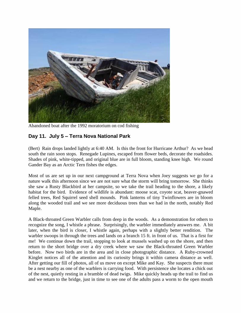
Abandoned boat after the 1992 moratorium on cod fishing
Day 11. July 5 – Terra Nova National Park
(Bert) Rain drops landed lightly at 6:40 AM. Is this the front for Hurricane Arthur? As we head
south the rain soon stops. Renegade Lupines, escaped from flower beds, decorate the roadsides.
Shades of pink, white-tipped, and original blue are in full bloom, standing knee high. We round
Gander Bay as an Arctic Tern fishes the edges.
Most of us are set up in our next campground at Terra Nova when Joey suggests we go for a
nature walk this afternoon since we are not sure what the storm will bring tomorrow. She thinks
she saw a Rusty Blackbird at her campsite, so we take the trail heading to the shore, a likely
habitat for the bird. Evidence of wildlife is abundant: moose scat, coyote scat, beaver-gnawed
felled trees, Red Squirrel seed shell mounds. Pink lanterns of tiny Twinflowers are in bloom
along the wooded trail and we see more deciduous trees than we had in the north, notably Red
Maple.
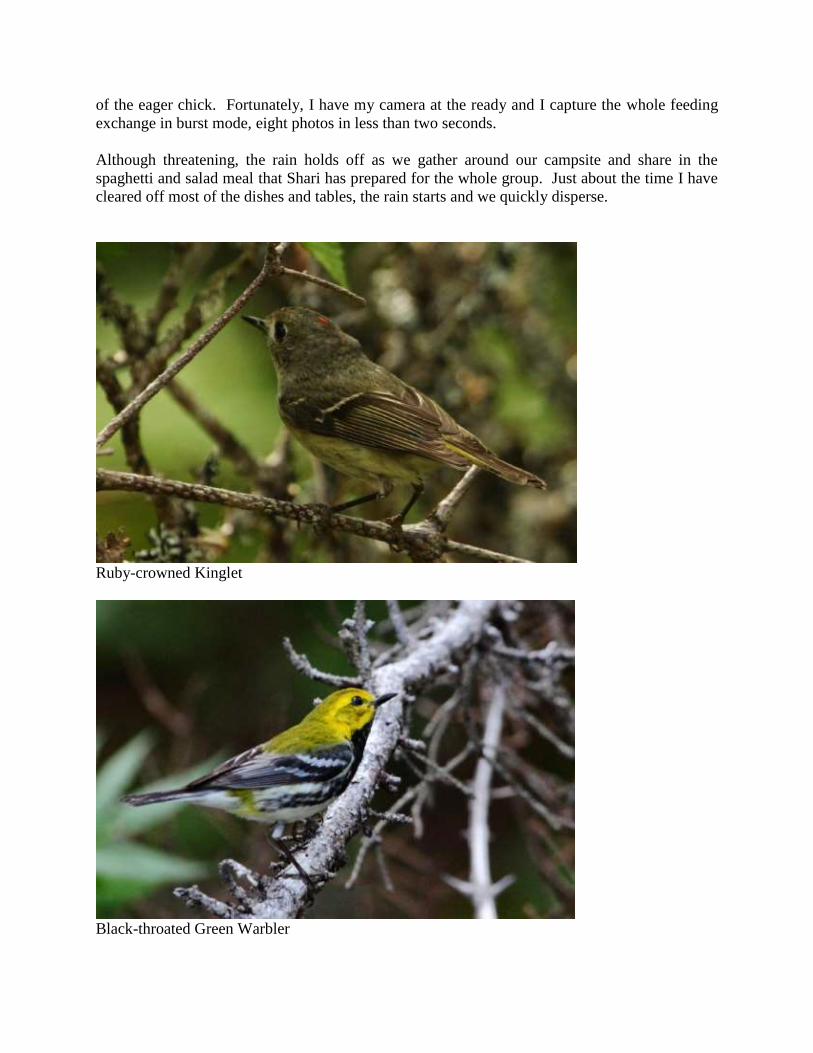
A Black-throated Green Warbler calls from deep in the woods. As a demonstration for others to
recognize the song, I whistle a phrase. Surprisingly, the warbler immediately answers me. A bit
later, when the bird is closer, I whistle again, perhaps with a slightly better rendition. The
warbler swoops in through the trees and lands on a branch 15 ft. in front of us. That is a first for
me! We continue down the trail, stopping to look at mussels washed up on the shore, and then
return to the short bridge over a dry creek where we saw the Black-throated Green Warbler
before. Now two birds are in the area and in close photographic distance. A Ruby-crowned
Kinglet notices all of the attention and its curiosity brings it within camera distance as well.
After getting our fill of photos, all of us move on except Mike and Kay. She suspects there must
be a nest nearby as one of the warblers is carrying food. With persistence she locates a chick out
of the nest, quietly resting in a bramble of dead twigs. Mike quickly heads up the trail to find us
and we return to the bridge, just in time to see one of the adults pass a worm to the open mouth
of the eager chick. Fortunately, I have my camera at the ready and I capture the whole feeding
exchange in burst mode, eight photos in less than two seconds.
Although threatening, the rain holds off as we gather around our campsite and share in the
spaghetti and salad meal that Shari has prepared for the whole group. Just about the time I have
cleared off most of the dishes and tables, the rain starts and we quickly disperse.
Ruby-crowned Kinglet
Black-throated Green Warbler
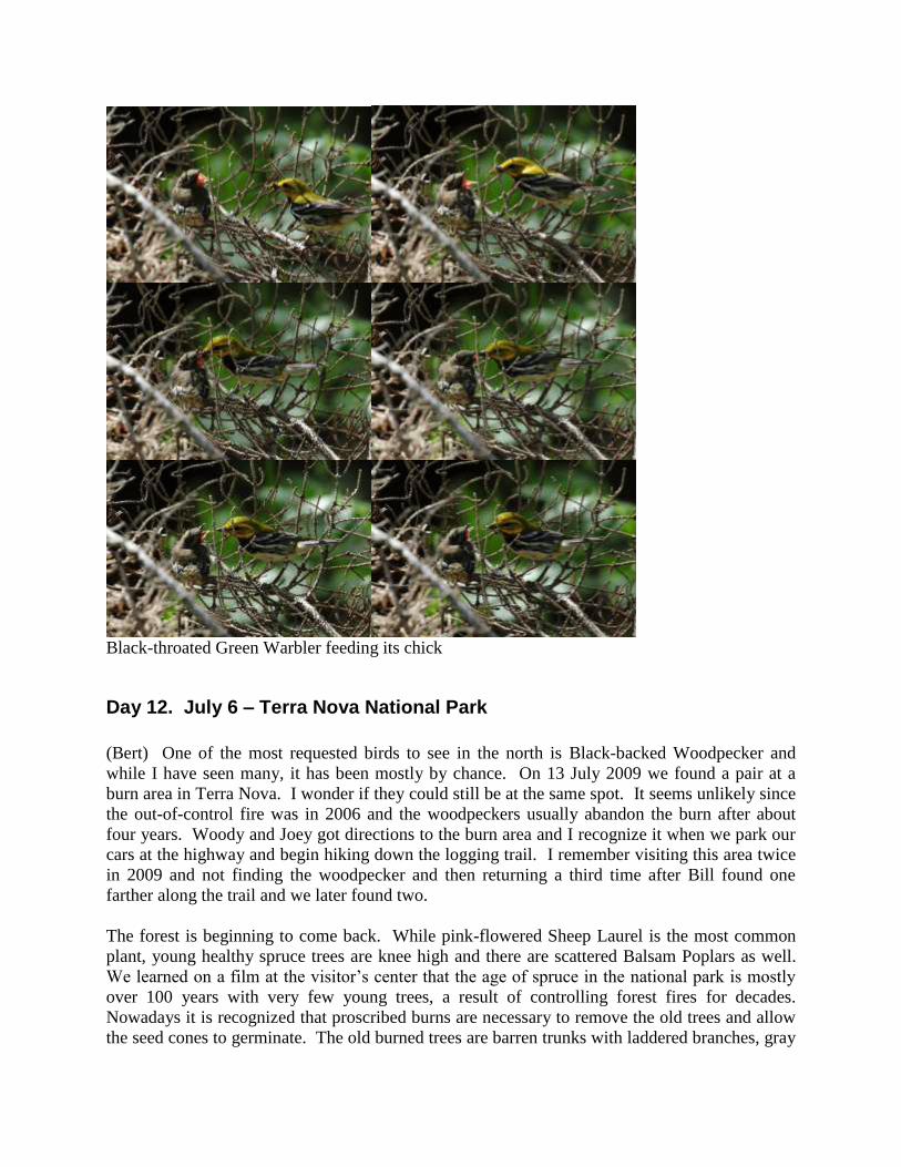
Black-throated Green Warbler feeding its chick
Day 12. July 6 – Terra Nova National Park
(Bert) One of the most requested birds to see in the north is Black-backed Woodpecker and
while I have seen many, it has been mostly by chance. On 13 July 2009 we found a pair at a
burn area in Terra Nova. I wonder if they could still be at the same spot. It seems unlikely since
the out-of-control fire was in 2006 and the woodpeckers usually abandon the burn after about
four years. Woody and Joey got directions to the burn area and I recognize it when we park our
cars at the highway and begin hiking down the logging trail. I remember visiting this area twice
in 2009 and not finding the woodpecker and then returning a third time after Bill found one
farther along the trail and we later found two.
The forest is beginning to come back. While pink-flowered Sheep Laurel is the most common
plant, young healthy spruce trees are knee high and there are scattered Balsam Poplars as well.
We learned on a film at the visitor’s center that the age of spruce in the national park is mostly
over 100 years with very few young trees, a result of controlling forest fires for decades.
Nowadays it is recognized that proscribed burns are necessary to remove the old trees and allow
the seed cones to germinate. The old burned trees are barren trunks with laddered branches, gray

wood stripped of bark, polished by wind and rain. They seem unlikely to harbor insects that
attract woodpeckers.
When a flying bird catches my attention and lands on a tree trunk I think I’ve got it, but it turns
into a Hermit Thrush. We reach the specific area where we saw the Black-backeds in 2009.
Now none can be found. We continue hiking until the dead wood ends and fresh tall spruce
begins. We turn around but I stop when I see a woodpecker flying near the top of a hill. I see
another, but they both are Yellow-shafted Flickers. We continue on, though Mike and Kay
linger longer. The group starts to separate, so when Mike and Kay catch up with me only Curt
and Chris are there. Kay describes a bird she saw near the top of the hill but couldn’t identify.
Her description is so good we decide to head back to the site. We scan the hillside for ten
minutes and I begin to ascend the slope, pausing periodically to rest and to look for birds. The
first part of the slope is easier, but then the bushes, broken tree branches and lichens are dense
and it is much harder to climb. Sometimes I walk over soft cushions of Star-tipped Reindeer
Lichen up to two feet deep and twice as wide, as spongy as a foam pillow. I am nearly to the top
of the hill when a woodpecker flies in front of me and lands 20 ft. away, just a little above eye
level. Its back is black and a patch of yellow feathers on a black head marks it as a male. I
watch it for at least 15 min. as it stays on the same branch oblivious to my presence. It uses its
stout black bill to flip away the bark in a sideways action and scrapes at the core below. I even
see it flick out its sticky pink tongue to extract an insect. I am not carrying my camera for what
would have been my closest photo ever. From below, though, the four others look up to the
woodpecker and Curt takes a distant photo. Too bad the others are so far down the return path to
see we have our target bird.
In the afternoon we leave camp again to hike a trail around a small lake. When we get there the
dark skies look threatening and a few drops of rain fall. It looks like Hurricane Arthur has
arrived. I am not carrying a rain shield for my camera so I consider going back and Chris is of
the same mind. Others continue around the lake, finding a copulating pair of Greater Yellowlegs
which seems odd so late in the breeding season. We talk to a park ranger who just started this
season. Previously he spent three years in Nunavut studying Peregrine Falcons. I’ve always
wanted to go to Nunavut for the birds and because it is the only territory or province of Canada I
have not visited. His wife is from Perth, Australia. What a contrast from +40°C to -60°C!
At about 4 PM we are inside the RV when a strange atmospheric condition occurs. Everywhere
around us the sky is gray-green pea soup, but directly above us is clear sky with bright sun rays
piercing down. I’ve often heard about the eye of the hurricane but did not think that applies
when it is downgraded to a tropical storm. We meet for a 5 PM social that is interrupted with
rain so we regroup under Curt and Chris’s awning. For dinner we have a special meal that Shari
has been working on, beginning three days ago when she started soaking the salt cod in water to
remove most of the preservative salt. For the salt cod boil Shari added potatoes, carrots,
rutabaga, parsnips and onions. Delicious!

Hiking on the logging trail through fire burn area
Curt’s photo of the Black-backed Woodpecker
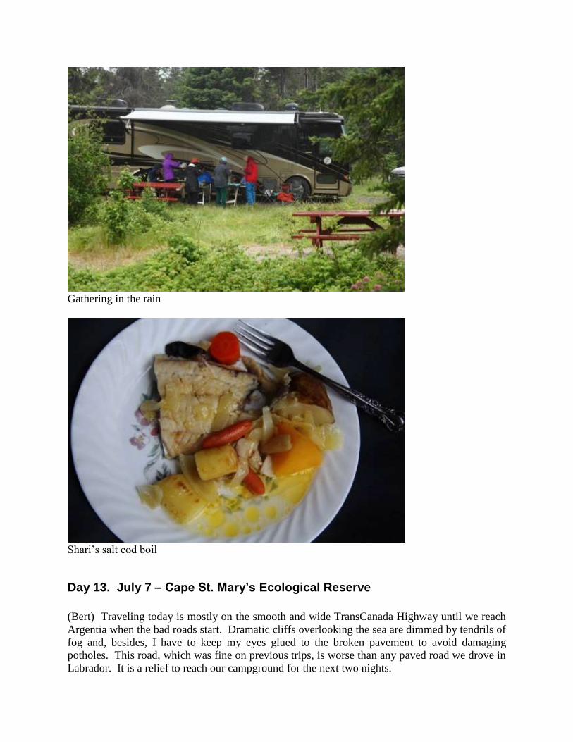
Gathering in the rain
Shari’s salt cod boil
Day 13. July 7 – Cape St. Mary’s Ecological Reserve
(Bert) Traveling today is mostly on the smooth and wide TransCanada Highway until we reach
Argentia when the bad roads start. Dramatic cliffs overlooking the sea are dimmed by tendrils of
fog and, besides, I have to keep my eyes glued to the broken pavement to avoid damaging
potholes. This road, which was fine on previous trips, is worse than any paved road we drove in
Labrador. It is a relief to reach our campground for the next two nights.
After others arrive and are settled in, we drive the short distance to Cape St. Mary's Ecological
Reserve. From the parking lot we already smell the gannet colony and when we walk toward the
edge of the cliff we can see the large patch of white dots on black rock about a half-mile away by
eyesight or a mile by hiking the trail following the cliffs. The white dots are a portion of the
15,000 breeding pairs of Northern Gannets resting on nest sites built on black rock. When we
hike to the site, the roost is just below us and we are enthralled by the constant churning of life as
gannets fly in and out, briefly hovering like helicopters so they can land exactly at the nest of
their mate who is sitting over chicks the size of softballs. In other directions the horizontal
ledges on vertical cliffs are covered with lines of nesting Black-legged Kittiwakes and
segregated Common Murres. And the noise is a constant roar of squawks and calls. Some 80
000 birds nest at the reserve and the majority are within earshot of where we stand at the edge of
a cliff. For now, we head back to camp and I am anxious to return tomorrow for a closer look.
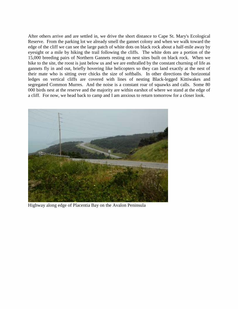
Highway along edge of Placentia Bay on the Avalon Peninsula
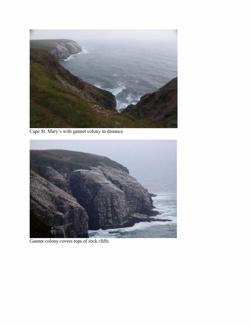
Cape St. Mary’s with gannet colony in distance
Gannet colony covers tops of rock cliffs

A portion of the Northern Gannet rookery
Close-up of gannets on nests
Day 14. July 8 – Cape St. Mary’s Ecological Reserve
(Bert) I head first to a spot from which I can view vertical cliffs where a few Thick-billed
Murres nest among thousands of Common Murres. Cape St. Mary’s is the southernmost nesting
site for Thick-billeds, so they are somewhat of a rarity here. I crouch very low to the ground and
creep toward the edge. The grassy cliff extends steeply downward for another dozen feet but if I
lost my balance here I would roll over the edge for a 350 ft. drop to the sea. A few large rocks
among the lush grass serve as seats and between them I set up my scope without the tripod legs
extended. Scanning the cliffs I locate a pair of Thick-billed Murres almost identical to the
Common Murres except for the white line extending at the cutting edge of the upper mandible. I
can also see the white point extending up the breast into the dark shoulder area, but that field
mark is less useful since I also see it on some Common Murres. Another field mark noticeable
in my photos, less so in the spotting scope, is the white flanks of the Thick-billed Murres
compared to the streaked flanks of adjacent Common Murres.
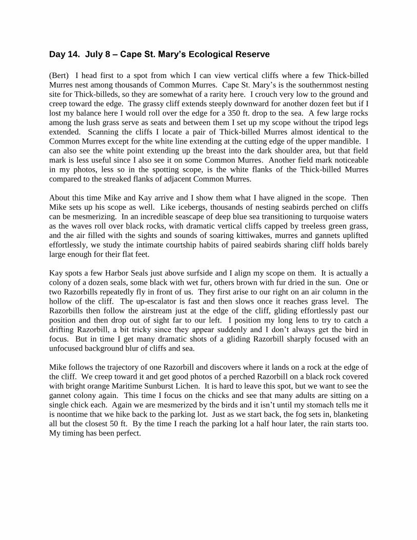
About this time Mike and Kay arrive and I show them what I have aligned in the scope. Then
Mike sets up his scope as well. Like icebergs, thousands of nesting seabirds perched on cliffs
can be mesmerizing. In an incredible seascape of deep blue sea transitioning to turquoise waters
as the waves roll over black rocks, with dramatic vertical cliffs capped by treeless green grass,
and the air filled with the sights and sounds of soaring kittiwakes, murres and gannets uplifted
effortlessly, we study the intimate courtship habits of paired seabirds sharing cliff holds barely
large enough for their flat feet.
Kay spots a few Harbor Seals just above surfside and I align my scope on them. It is actually a
colony of a dozen seals, some black with wet fur, others brown with fur dried in the sun. One or
two Razorbills repeatedly fly in front of us. They first arise to our right on an air column in the
hollow of the cliff. The up-escalator is fast and then slows once it reaches grass level. The
Razorbills then follow the airstream just at the edge of the cliff, gliding effortlessly past our
position and then drop out of sight far to our left. I position my long lens to try to catch a
drifting Razorbill, a bit tricky since they appear suddenly and I don’t always get the bird in
focus. But in time I get many dramatic shots of a gliding Razorbill sharply focused with an
unfocused background blur of cliffs and sea.
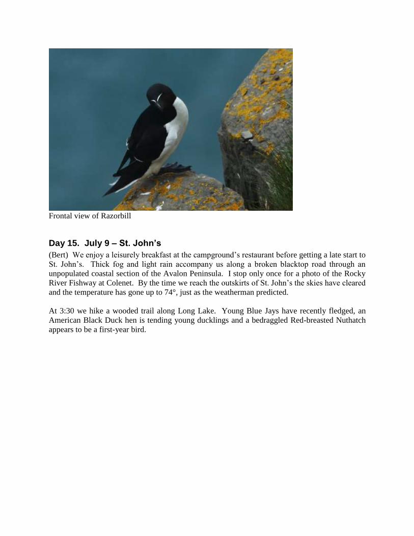
Mike follows the trajectory of one Razorbill and discovers where it lands on a rock at the edge of
the cliff. We creep toward it and get good photos of a perched Razorbill on a black rock covered
with bright orange Maritime Sunburst Lichen. It is hard to leave this spot, but we want to see the
gannet colony again. This time I focus on the chicks and see that many adults are sitting on a
single chick each. Again we are mesmerized by the birds and it isn’t until my stomach tells me it
is noontime that we hike back to the parking lot. Just as we start back, the fog sets in, blanketing
all but the closest 50 ft. By the time I reach the parking lot a half hour later, the rain starts too.
My timing has been perfect.
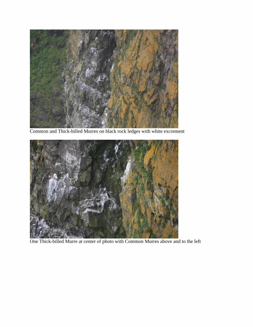
Common and Thick-billed Murres on black rock ledges with white excrement
One Thick-billed Murre at center of photo with Common Murres above and to the left
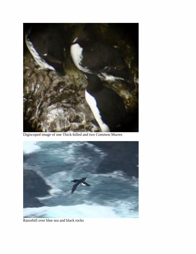
Digiscoped image of one Thick-billed and two Common Murres
Razorbill over blue sea and black rocks
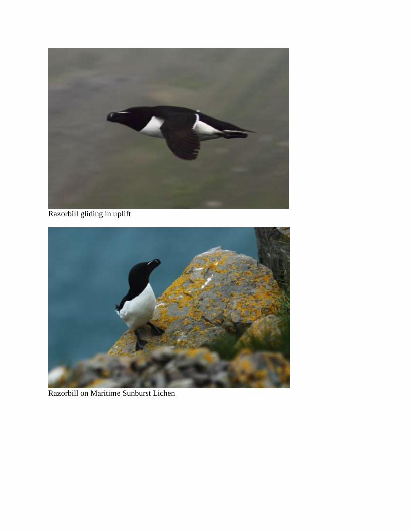
Razorbill gliding in uplift
Razorbill on Maritime Sunburst Lichen
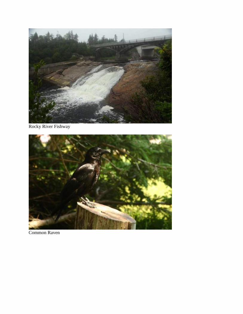
Frontal view of Razorbill
Day 15. July 9 – St. John’s
(Bert) We enjoy a leisurely breakfast at the campground’s restaurant before getting a late start to
St. John’s. Thick fog and light rain accompany us along a broken blacktop road through an
unpopulated coastal section of the Avalon Peninsula. I stop only once for a photo of the Rocky
River Fishway at Colenet. By the time we reach the outskirts of St. John’s the skies have cleared
and the temperature has gone up to 74°, just as the weatherman predicted.
At 3:30 we hike a wooded trail along Long Lake. Young Blue Jays have recently fledged, an
American Black Duck hen is tending young ducklings and a bedraggled Red-breasted Nuthatch
appears to be a first-year bird.
Rocky River Fishway
Common Raven

American Black Duck
Blue Jay fledgling
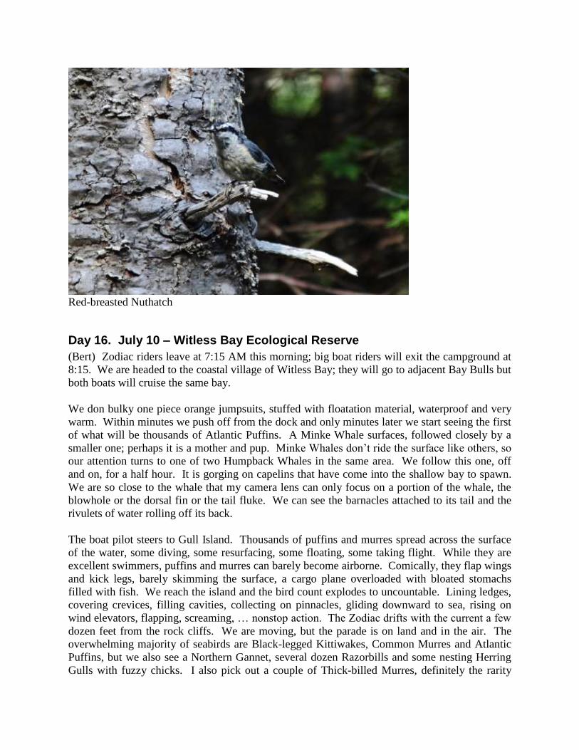
Red-breasted Nuthatch
Day 16. July 10 – Witless Bay Ecological Reserve
(Bert) Zodiac riders leave at 7:15 AM this morning; big boat riders will exit the campground at
8:15. We are headed to the coastal village of Witless Bay; they will go to adjacent Bay Bulls but
both boats will cruise the same bay.
We don bulky one piece orange jumpsuits, stuffed with floatation material, waterproof and very
warm. Within minutes we push off from the dock and only minutes later we start seeing the first
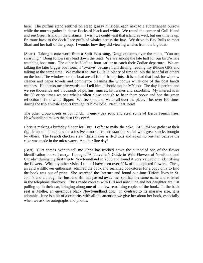
of what will be thousands of Atlantic Puffins. A Minke Whale surfaces, followed closely by a
smaller one; perhaps it is a mother and pup. Minke Whales don’t ride the surface like others, so
our attention turns to one of two Humpback Whales in the same area. We follow this one, off
and on, for a half hour. It is gorging on capelins that have come into the shallow bay to spawn.
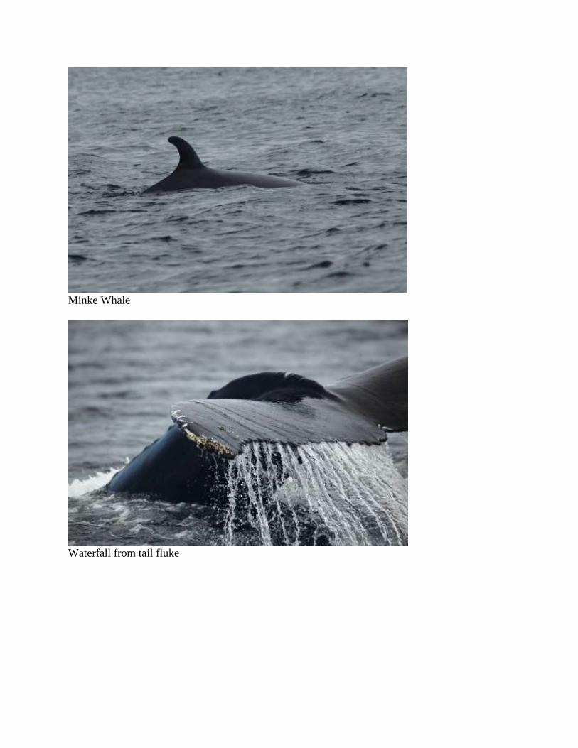
We are so close to the whale that my camera lens can only focus on a portion of the whale, the
blowhole or the dorsal fin or the tail fluke. We can see the barnacles attached to its tail and the
rivulets of water rolling off its back.
The boat pilot steers to Gull Island. Thousands of puffins and murres spread across the surface
of the water, some diving, some resurfacing, some floating, some taking flight. While they are
excellent swimmers, puffins and murres can barely become airborne. Comically, they flap wings
and kick legs, barely skimming the surface, a cargo plane overloaded with bloated stomachs
filled with fish. We reach the island and the bird count explodes to uncountable. Lining ledges,
covering crevices, filling cavities, collecting on pinnacles, gliding downward to sea, rising on
wind elevators, flapping, screaming, … nonstop action. The Zodiac drifts with the current a few
dozen feet from the rock cliffs. We are moving, but the parade is on land and in the air. The
overwhelming majority of seabirds are Black-legged Kittiwakes, Common Murres and Atlantic
Puffins, but we also see a Northern Gannet, several dozen Razorbills and some nesting Herring
Gulls with fuzzy chicks. I also pick out a couple of Thick-billed Murres, definitely the rarity
here. The puffins stand sentinel on steep grassy hillsides, each next to a subterranean burrow
while the murres gather in dense flocks of black and white. We round the corner of Gull Island
and see Green Island in the distance. I wish we could visit that island as well, but our time is up.
En route back to the dock I see puffs of whales across the bay. We drive to Bay Bulls to meet
Shari and her half of the group. I wonder how they did viewing whales from the big boat.
(Shari) Taking a cute word from a Split Peas song, Doug exclaims over the radio, “You are
swarving." Doug follows my lead down the road. We are among the late half for our bird/whale
watching boat tour. The other half left an hour earlier to catch their Zodiac departure. We are
talking the later bigger boat tour. I "swarve" because I am driving, reading my iPhone GPS and
talking at the same time. We make it to Bay Bulls in plenty of time to join the handful of others
on the boat. The windows on the boat are all full of handprints. It is so bad that I ask for window
cleaner and paper towels and commence cleaning the windows while one of the boat hands
watches. He thanks me afterwards but I tell him it should not be MY job. The day is perfect and
we see thousands and thousands of puffins, murres, kittiwakes and razorbills. My interest is in
the 30 or so times we see whales often close enough to hear them spout and see the green
reflection off the white flipper. We see spouts of water all over the place, I bet over 100 times
during the trip a whale spouts through its blow hole. Neat, neat, neat!
The other group meets us for lunch. I enjoy pea soup and steal some of Bert's French fries.
Newfoundland makes the best fries ever!
Chris is making a birthday dinner for Curt. I offer to make the cake. At 5 PM we gather at their
rig, tie up some balloons for a festive atmosphere and start our social with great snacks brought
by others. The French chicken stew Chris makes is delicious and again no one can believe the
cake was made in the microwave. Another fine day!
(Bert) Curt comes over to tell me Chris has tracked down the author of one of the flower
identification books I carry. I bought “A Traveller’s Guide to Wild Flowers of Newfoundland
Canada” during my first trip to Newfoundland in 2000 and found it very valuable in identifying
the flowers. With my other visits, I think I have seen over 90% of the depicted flowers. Chris,
an avid wildflower enthusiast, admired the book and searched bookstores for a copy only to find
the book was out of print. She searched the Internet and found out June Titford lives in St.
John’s and although her husband Bill has passed away, her son has the same name and is listed
in the telephone directory. Chris made contact with Bill and now June and her daughter are just
pulling up in their car, bringing along one of the few remaining copies of the book. In the back
seat is Mollie, an enormous black Newfoundland dog. In contrast to its massive size, it is
adorable. June is a bit of a celebrity with all the attention we give her about her book, especially
when we ask for autographs and photos.
Minke Whale
Waterfall from tail fluke
Tail fluke of Humpback Whale; note barnacles on fluke
Atlantic Common Murre in foreground, presumed Thick-billed Murre in background
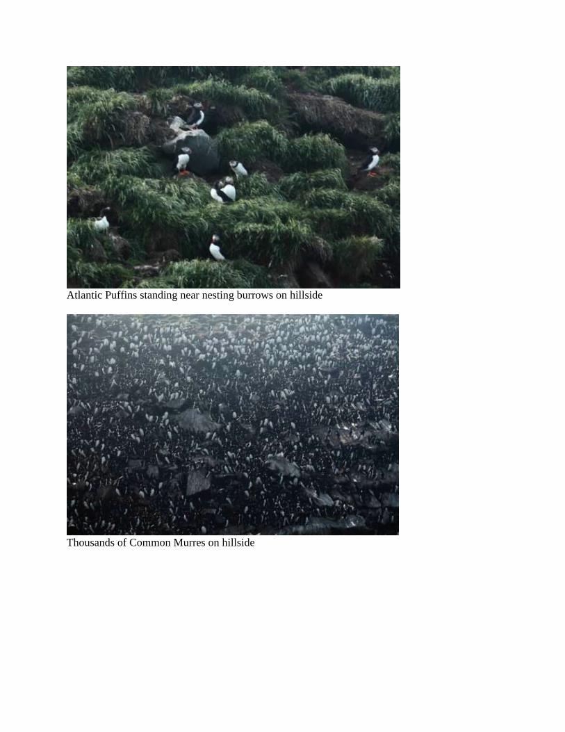
Atlantic Puffins standing near nesting burrows on hillside
Thousands of Common Murres on hillside
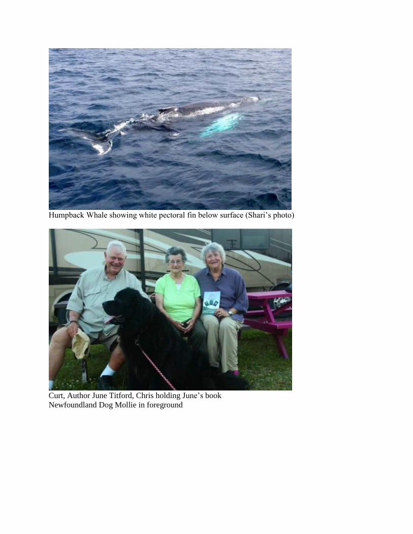
Humpback Whale showing white pectoral fin below surface (Shari’s photo)
Curt, Author June Titford, Chris holding June’s book
Newfoundland Dog Mollie in foreground
Day 17. July 11 – St. John’s
(Bert) It is to the laundry where we head first, filling four machines with an accumulation of
almost all of our washable clothes. Fortunately the laundry is across the street from a grocery so
we get two errands done at the same time. Then it is off to downtown St. John’s.
You can tell St. John’s is an old city by the way the streets are laid out. It is as if pavement was
laid where haphazard walking trails once went up and down the steep hills, crisscrossing left and
right with no regard for parallel and perpendicular. Somehow our direction has street names
changing a dozen times as Shari uses the GPS for directions and I avoid wrong way one-way
streets and the steepest inclines.
We reach our destination: the Johnson Geo Centre. We missed seeing this on previous trips to
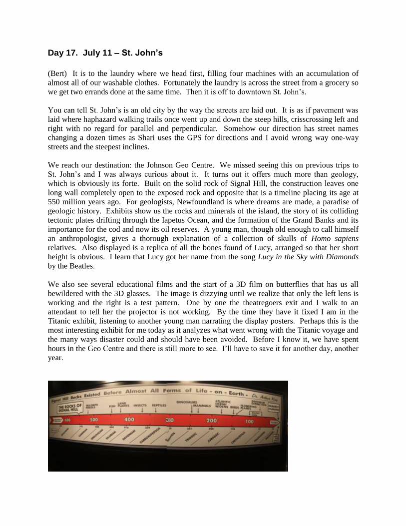
St. John’s and I was always curious about it. It turns out it offers much more than geology,
which is obviously its forte. Built on the solid rock of Signal Hill, the construction leaves one
long wall completely open to the exposed rock and opposite that is a timeline placing its age at
550 million years ago. For geologists, Newfoundland is where dreams are made, a paradise of
geologic history. Exhibits show us the rocks and minerals of the island, the story of its colliding
tectonic plates drifting through the Iapetus Ocean, and the formation of the Grand Banks and its
importance for the cod and now its oil reserves. A young man, though old enough to call himself
an anthropologist, gives a thorough explanation of a collection of skulls of Homo sapiens
relatives. Also displayed is a replica of all the bones found of Lucy, arranged so that her short
height is obvious. I learn that Lucy got her name from the song Lucy in the Sky with Diamonds
by the Beatles.
We also see several educational films and the start of a 3D film on butterflies that has us all
bewildered with the 3D glasses. The image is dizzying until we realize that only the left lens is
working and the right is a test pattern. One by one the theatregoers exit and I walk to an
attendant to tell her the projector is not working. By the time they have it fixed I am in the
Titanic exhibit, listening to another young man narrating the display posters. Perhaps this is the
most interesting exhibit for me today as it analyzes what went wrong with the Titanic voyage and
the many ways disaster could and should have been avoided. Before I know it, we have spent
hours in the Geo Centre and there is still more to see. I’ll have to save it for another day, another
year.
Day 18. July 12 – St. John’s
(Shari) Doug and I affectionately call her "Twinkle Toes." When the bus for our St. John's city
tour arrives 15 min. early this morning, she is the first one in line. This is an amazing occurrence
because she notoriously is on the late side. She says she has changed and is turning over a new
leaf. It does not last long as she often is the last to board at our various stops. She enjoys the
moment and gets wrapped up in taking pictures, studying birds or peering at flowers.
She is not the only one who does that either. We spend so much time at Petty Harbor and Cape
Spear that I get together with our guide Dave and work out a schedule for the afternoon so as not
to miss anything. He wants to finish by 3 or 3:30. I tell him we want to see the Tattoo and the
next performance is at 3, so even 3:30 won't happen. After watching the movie at Signal Hill, he
drops us off close to the pedestrian George Street. Curt wants to hear live music during lunch
and I am told O'Reilly’s Newfoundland Irish Pub is the place to go. I tell the help there that we
only have 60 min. and she says "No problem." We eat our fish and chips and down our beer and
finish paying in 65 min. The Veiled Virgin is next and Dave assures me it is open from 2 to 4
PM. At 2:30 we arrive and I tell the group we only have 15 min. here if we want to make the 3
o'clock Tattoo. I did not have to worry as the Veiled Virgin only has weekday showings. I am
visibly disappointed and Dave knows it. This year’s Military Tattoo is much expanded from
other years and includes high school students wearing uniforms, carrying guns and marching in
formations reminiscent of wars from 1812 to WWI. After this performance Dave takes us to
Cabot Tower where Marconi sent his first telegraph. It has been a full day and many take naps
before joining me in a social time.
(Bert) Dave is our bus driver and guide, a jolly old fellow with a belly laugh, and his wife Sofie
is along for the ride. Dave drives out of the city to a scenic fishing village at Petty Harbour. No
one is out fishing so the boats are tied to the dock and the crab pots are stacked high. A big net
hangs against a wall and I wonder if it has been used since the cod moratorium. Colorful houses
surround the harbor, more are stacked on steep green hillsides and, yet higher, Herring Gulls soar
along the rocky edges of the cliffs. We stop at the hill at the edge of the harbor entrance where a
flock of Rock Pigeons rests on the rock cliffs, a throwback to their habitat before cities with tall
buildings.
Next stop is Cape Spear where we walk to the easternmost point in North America. From our
vantage point we can see a Minke Whale not far from shore and a couple Humpback Whales
frolicking near the surface, gorging on capelin. Two icebergs are floating near the horizon, the
farthest south I have ever seen icebergs.
For lunch we eat at O’Reilly’s Irish Pub, dining on outside tables along famous George Street.
Always looking for something unusual to eat, I order Newfoundland Wild Rabbit potpie, as does
Curt. Newfoundland does not have rabbits, but it does have Snowshoe Hares and the waitress
assures me that that is what I am eating. As I used raise rabbits, I have eaten domestic rabbit
countless times, but this is the first time I’ve eaten hare. The meat is dark with a bit of a wild
taste somewhat obscured by the stewed vegetables and the tasty phyllo crust of the pie.
We arrive at Signal Hill just in time for the Tattoo, a military exercise that in this case spans
three wars in military uniforms and traditions. As the demonstration continues, Doug asks if I
have seen this before and we agree that they have significantly enhanced the performance with
much more history, music, gunfire and military maneuvers. All of the uniformed actors are
young people of high school and college age. It must have taken them a lot of practice sessions
to learn the marching commands and playing the drum and flute musical scores.
We finish our tour at the highest point in St. John’s, where the historic Cabot Tower stands.
From here we have a broad view of the ocean, including the same icebergs we saw from Cape
Spear, and a view of the narrow channel that protects the harbor and the city spread below us.
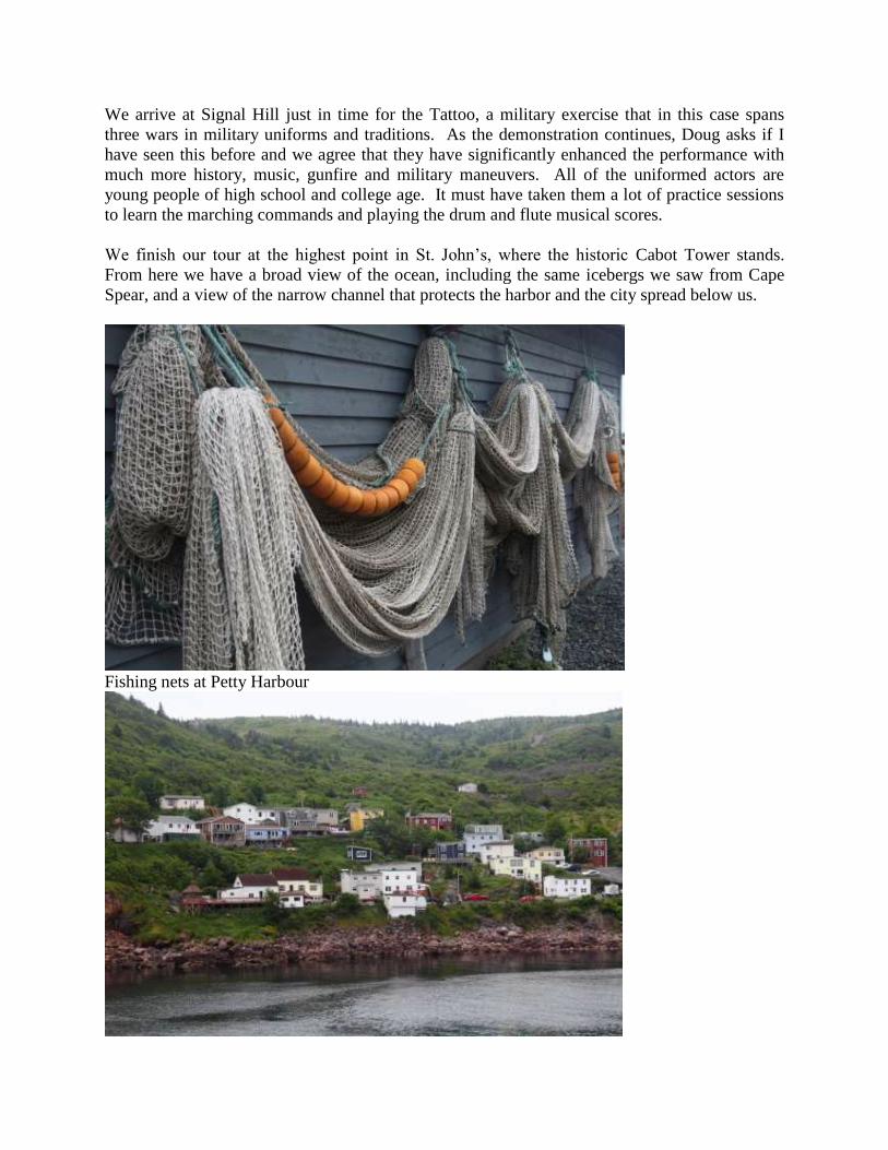
Fishing nets at Petty Harbour
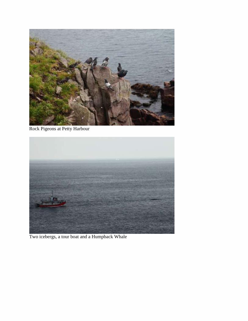
Rock Pigeons at Petty Harbour
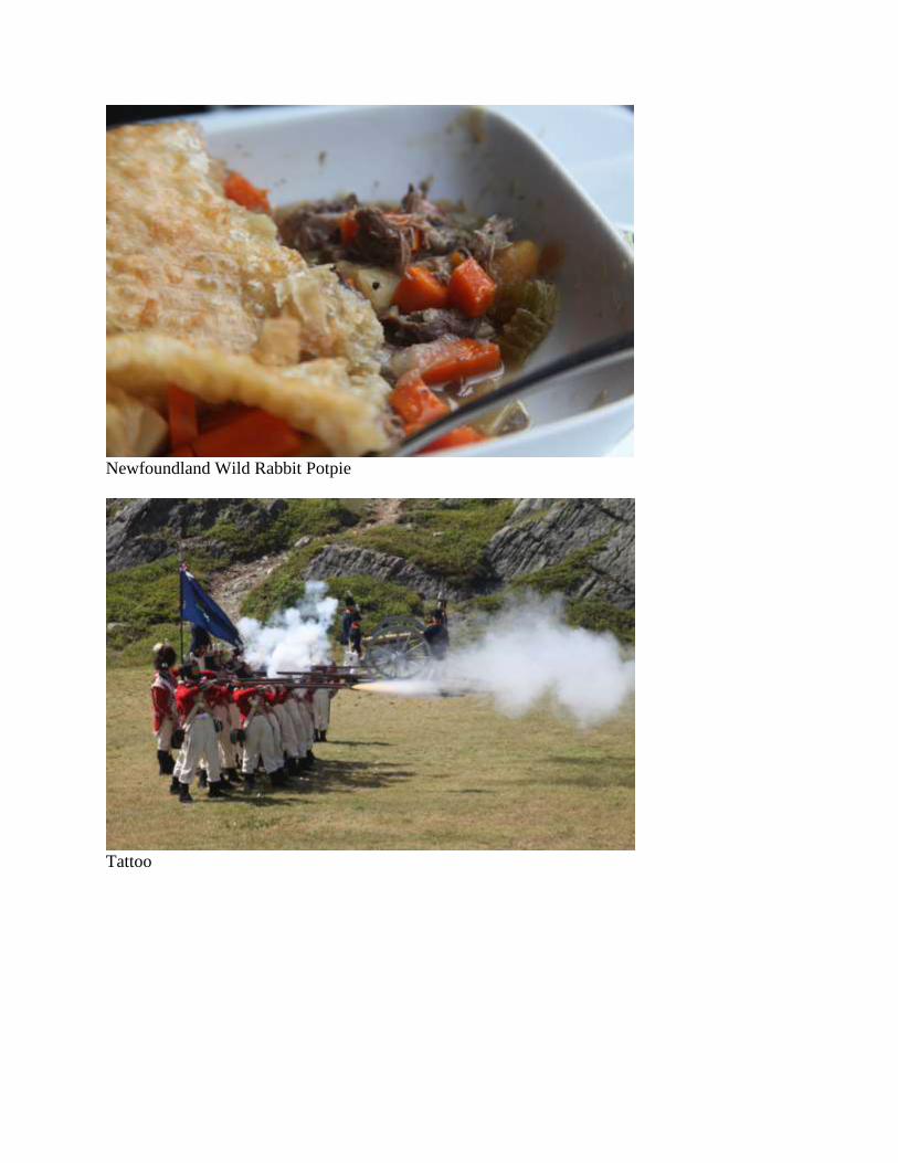
Two icebergs, a tour boat and a Humpback Whale
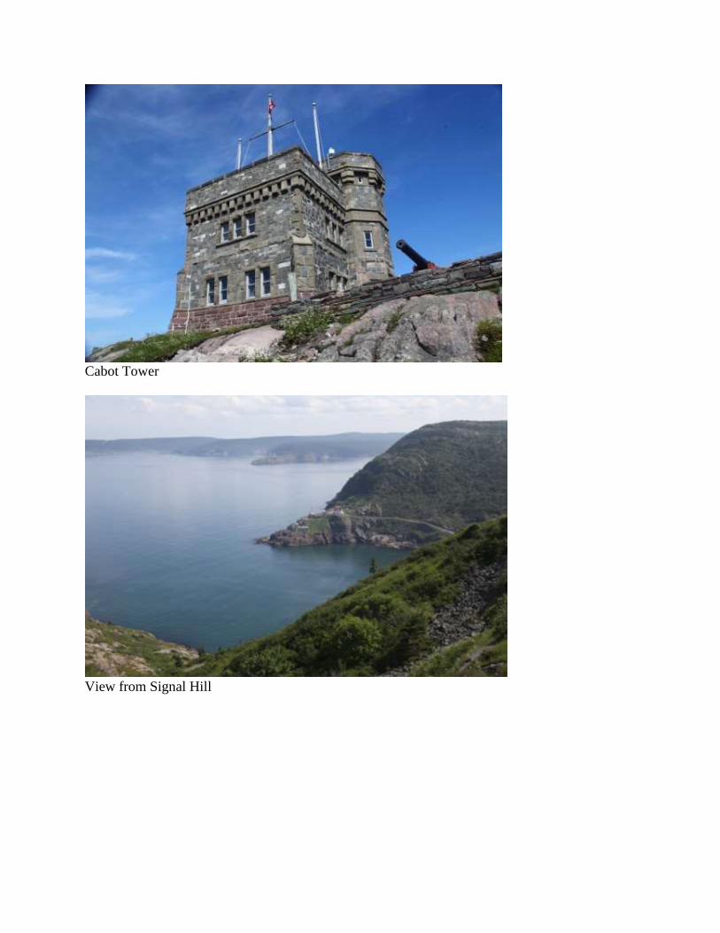
Newfoundland Wild Rabbit Potpie
Tattoo
Cabot Tower
View from Signal Hill

Day 19. July 13 – Bonavista Peninsula
(Bert) Colors are brighter; edges are sharper. Absent of dust particles and light reflecting
suspended water, the vibrancy of scenery is sharply in focus and crystal clear. We are driving
north again, leaving Avalon Peninsula and entering Bonavista Peninsula. We drive non-stop
except for refueling at Whitbourne and a brief break at the Canada Goose Sanctuary, a tall
lookout over Northwest Arm. A speedboat cuts a white wake across calm blue water. We reach
our campground near the tip of the peninsula and soon after we settle into a site we meet the new
owner of the RV park. In the three weeks he has owned the park we already see the
improvements Shawn has made, although faltering electricity is still a major problem. His plans
are ambitious and in time he may convert this place from one of the worst campgrounds to one of
the best.
Northwest Arm
Day 20. July 14 – Bonavista Peninsula
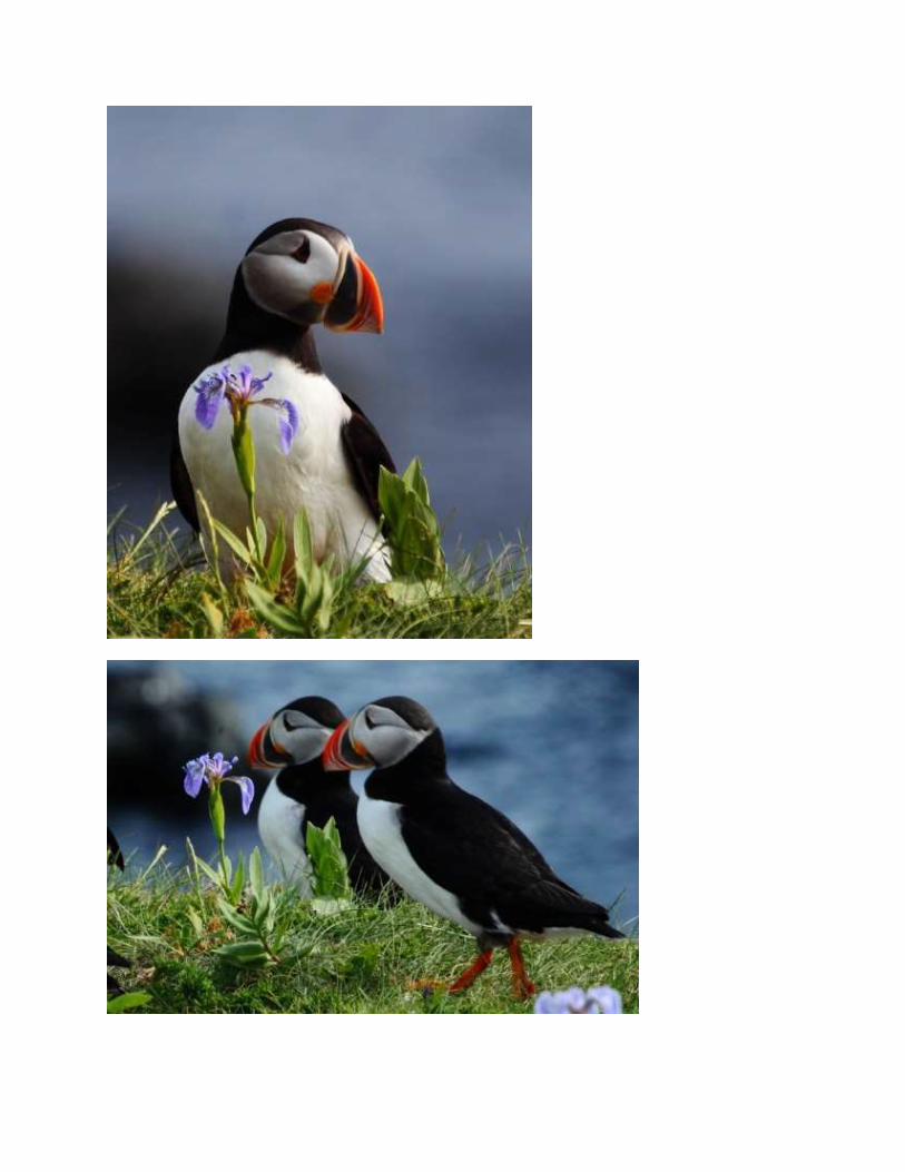
(Bert) As soon as Shari sees the puffins at the edge of the cliff, she quietly sits down on the
grass. The rest of us follow her lead. We are curious of the Atlantic Puffins and they seem to be
equally curious of us, but only at a distance. Too close and they gracefully jump off the cliff,
make a smooth arc upward and either go out to sea or glide left toward the close island to join
hundreds of others at nest holes. Quietly we watch the puffin antics, another one of those
mesmerizing scenes like watching icebergs and gannets. The outlandish bill and the tiny head
feathers give the illusion that they are painted porcelain. I am reclining so close to the ground
that I am eye to eye with the puffins as they walk among the Blue Flag irises and I try to photo
capture the black, white and orange of the puffin alongside the blue and green of the iris.

We move on, stopping briefly to examine the root cellars at Elliston, which proudly calls itself
the Root Cellar Capital of the World. With 130 extant root cellars, most more than a century old,
some still in use, no other community has challenged their claim to fame. Since our visit last
year the town has erected a bronze statue and a memorial wall listing the 132 sealers abandoned
on ice for 52 hours 31 March 1914. The sealers were transported by the S. S. Newfoundland for
a seal hunt; 78 needlessly died on the ice.
On a small island very close to shore we find a tern colony. At first I think they are Arctic Terns
again, but when I examine my photographs I see the colony is Common Terns, at least a hundred
nesting pairs. A few of the fist-sized chicks are visible beneath adults on nests. A Great Black-
backed Gull also has chicks, much larger and venturing a few feet from the adult. The large
adult is under attack by a dozen small terns which dive bomb like military jets, abruptly
swooping up just in time to avoid the open mandibles of the defending gull.
After lunch at Nanny’s Kitchen in Orange Hall, a dinner that takes far too long to prepare for a
group of ten, we drive to Bonavista and visit Ryan Premises. During our tours we have learned a
lot about the cod fishery, each time adding to the puzzle of where the cod have gone and the
question will they come back. In a CBC film we hear from all sides of the argument and in the
end one is left with the conclusion that many parties were responsible for the plummeting decline
of the cod, leading up to the moratorium on fishing. I see a strong parallel between the cod
history and our current disagreement over climate change. Anecdotal evidence and scientific
studies predicted the cod disaster, but politicians chose not to believe the scientists or the inshore
fishermen and preferred to believe that big industry could continue to take high quotas without
effecting the environment. As the lawyer for the inshore fishermen remarked, “The government
had their hand in the ecological till.” The politicians were proved wrong and everyone lost.
Now, more than a decade since commercial cod fishing was banned, there is hope that the cod
are coming back. Will there be enough to resume commercial fishing and, if so, who will be
allowed to do it?

Underground root cellar in Elliston
Common Terns and Great Black-backed Gulls
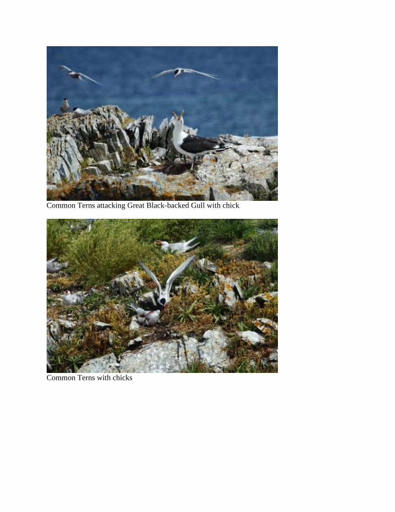
Common Terns attacking Great Black-backed Gull with chick
Common Terns with chicks
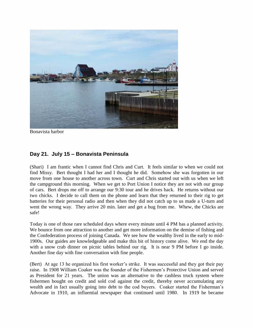
Bonavista harbor
Day 21. July 15 – Bonavista Peninsula
(Shari) I am frantic when I cannot find Chris and Curt. It feels similar to when we could not
find Missy. Bert thought I had her and I thought he did. Somehow she was forgotten in our
move from one house to another across town. Curt and Chris started out with us when we left
the campground this morning. When we get to Port Union I notice they are not with our group
of cars. Bert drops me off to arrange our 9:30 tour and he drives back. He returns without our
two chicks. I decide to call them on the phone and learn that they returned to their rig to get
batteries for their personal radio and then when they did not catch up to us made a U-turn and
went the wrong way. They arrive 20 min. later and get a hug from me. Whew, the Chicks are
safe!
Today is one of those rare scheduled days where every minute until 4 PM has a planned activity.
We bounce from one attraction to another and get more information on the demise of fishing and
the Confederation process of joining Canada. We see how the wealthy lived in the early to mid-
1900s. Our guides are knowledgeable and make this bit of history come alive. We end the day
with a snow crab dinner on picnic tables behind our rig. It is near 9 PM before I go inside.
Another fine day with fine conversation with fine people.
(Bert) At age 13 he organized his first worker’s strike. It was successful and they got their pay
raise. In 1908 William Coaker was the founder of the Fishermen’s Protective Union and served
as President for 21 years. The union was an alternative to the cashless truck system where
fishermen bought on credit and sold cod against the credit, thereby never accumulating any
wealth and in fact usually going into debt to the cod buyers. Coaker started the Fisherman’s
Advocate in 1910, an influential newspaper that continued until 1980. In 1919 he became
Minister of Marine and Fisheries. Coaker was knighted by King George V and could have been
Newfoundland’s premier had he accepted the persuasion of his political friends. Today we view
The Factory where the old newspaper printing presses have been preserved along with the
woodworking machinery that built the company town of Port Union. Then we get a guided tour
of his beautiful home, amazing because it houses virtually all of his original furniture, gifted
sculptures, photographs and period pieces.
We have lots more on the agenda, including a visit to the replica of the Mathew Legacy, the ship
that John Cabot sailed to Newfoundland in 1497, only 92 ft. long with a crew of 20, and steered
by a tiller. This is followed by a tour of the Mockbeggar Plantation where I instigate an almost
heated debate with the tour guide. As a preamble, let me point out that this is my fourth tour of
Newfoundland in which I have viewed historical sites and on this trip alone I have read three
history books on Newfoundland and am half way through a fourth and three chapters through a
fifth. Probably I am not the average U.S. tourist to Newfoundland. We are visiting the home of
Bradley, one the chief proponents of confederation with Canada in the mid-1940s, so the topic
steers to Confederation. Answering a question from our very inquisitive group, Margaret
mentions the referendum on joining Newfoundland with Canada. While I do not dispute her
52% vote for Confederation, I correct her on what the voting was for and that it was the second
referendum, not the first. Margaret states that the first vote was for joining the United States and
only 2% voted for that option. In my usual argumentative state, a condition to which Shari has
been accustomed, I disagree perhaps more forcefully than necessary. Margaret takes a step
backward and defends her position, but without reference. I state my reference and she says my
source is a comedian that cannot be trusted. Later, one on one, we have a more amiable
discussion and she takes interest in the books I’ve read and says she will read the book by Greg
Malone entitled "Don’t Tell the Newfoundlanders.” She compliments me on being such a well-
informed tour leader, but I am not sure her comment was not tongue in cheek.
Our next stop is Bonavista Lighthouse for which it is difficult to get a good photo since
scaffolding obscures the structure. I am amazed at the absence of puffins on the adjacent island.
In eleven visits to puffin nesting colonies, this is the first time I have seen a site vacant in the
breeding season. Through much searching I find one puffin on the island, plus a dozen or so
floating at sea. Do all puffins vacate a nesting site in mid-afternoon for a fishing expedition?
We follow the Bonavista coastline to the Dungeon where we still continue to see distant whales
and icebergs. Close to shore I find two sandpipers which I suspect are Semipalmated
Sandpipers, but they are gone by the time I return to the cliff with a spotting scope. Instead, we
watch a circling tern fishing in the bay. I believe it is a Common Tern, later substantiated when I
examine my photos on the computer.
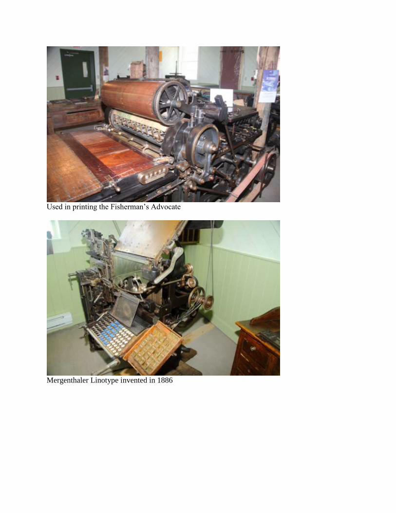
Used in printing the Fisherman’s Advocate
Mergenthaler Linotype invented in 1886
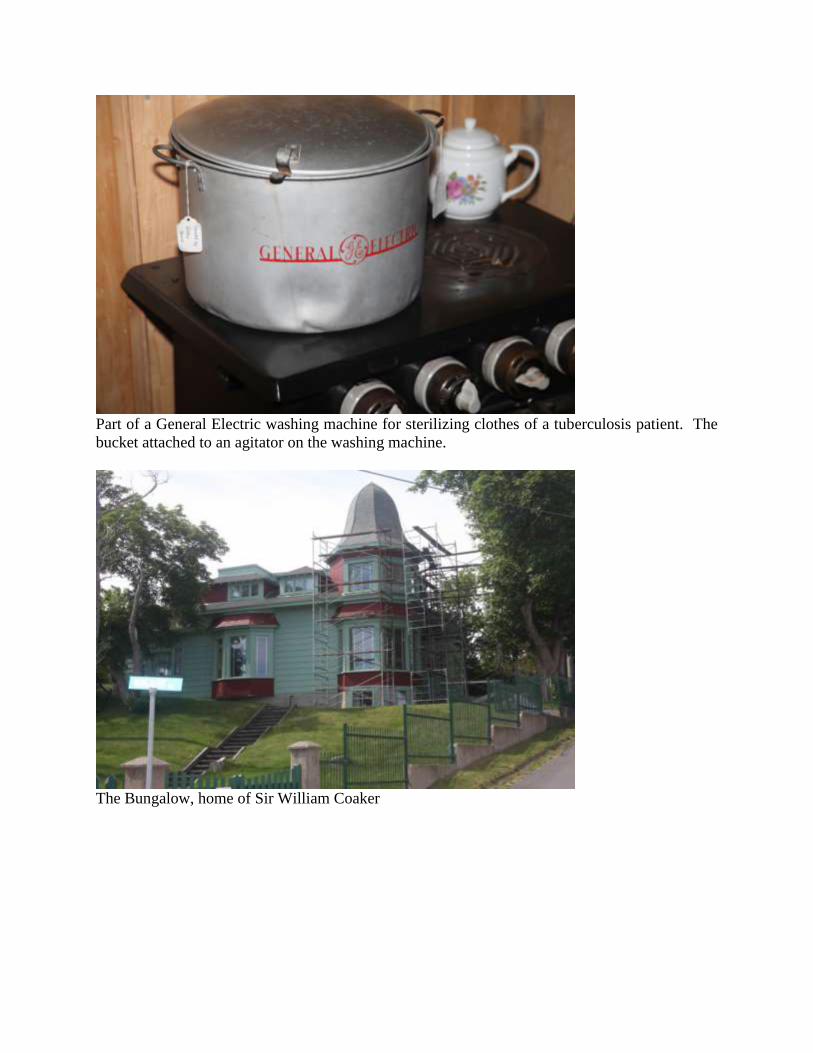
Part of a General Electric washing machine for sterilizing clothes of a tuberculosis patient. The
bucket attached to an agitator on the washing machine.
The Bungalow, home of Sir William Coaker
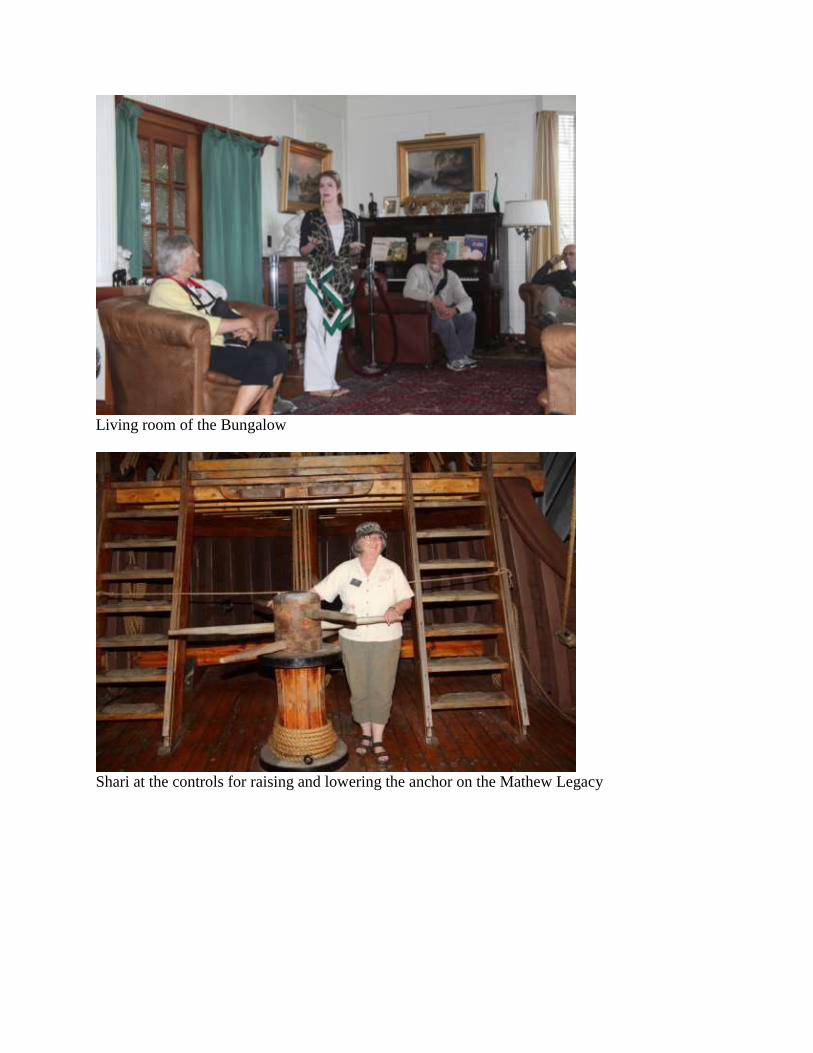
Living room of the Bungalow
Shari at the controls for raising and lowering the anchor on the Mathew Legacy

Room at Mockbeggar Plantation where Gordon Bradley and Joey Smallwood discussed
Newfoundland joining Confederation with Canada
Lone Atlantic Puffin at nesting colony at island off Bonavista Lighthouse
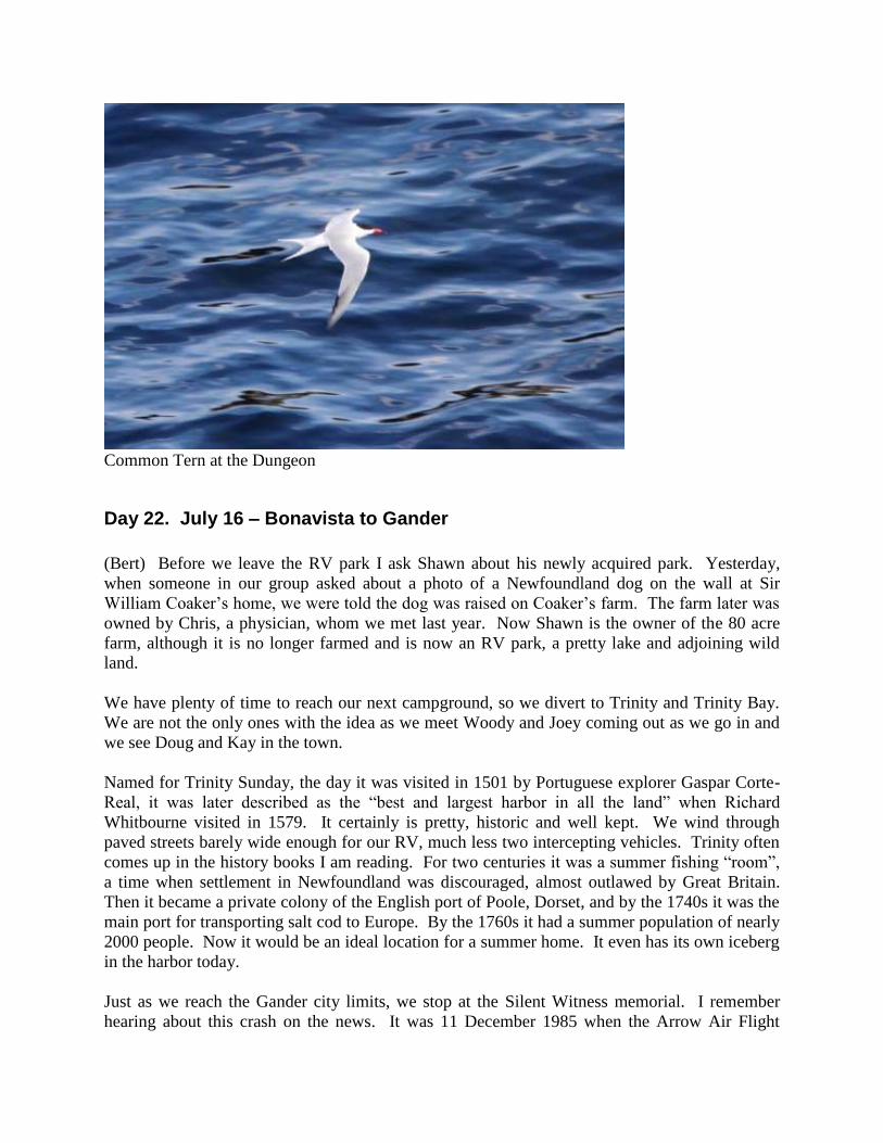
Common Tern at the Dungeon
Day 22. July 16 – Bonavista to Gander
(Bert) Before we leave the RV park I ask Shawn about his newly acquired park. Yesterday,
when someone in our group asked about a photo of a Newfoundland dog on the wall at Sir
William Coaker’s home, we were told the dog was raised on Coaker’s farm. The farm later was
owned by Chris, a physician, whom we met last year. Now Shawn is the owner of the 80 acre
farm, although it is no longer farmed and is now an RV park, a pretty lake and adjoining wild
land.
We have plenty of time to reach our next campground, so we divert to Trinity and Trinity Bay.
We are not the only ones with the idea as we meet Woody and Joey coming out as we go in and
we see Doug and Kay in the town.
Named for Trinity Sunday, the day it was visited in 1501 by Portuguese explorer Gaspar Corte-
Real, it was later described as the “best and largest harbor in all the land” when Richard
Whitbourne visited in 1579. It certainly is pretty, historic and well kept. We wind through
paved streets barely wide enough for our RV, much less two intercepting vehicles. Trinity often
comes up in the history books I am reading. For two centuries it was a summer fishing “room”,
a time when settlement in Newfoundland was discouraged, almost outlawed by Great Britain.
Then it became a private colony of the English port of Poole, Dorset, and by the 1740s it was the
main port for transporting salt cod to Europe. By the 1760s it had a summer population of nearly
2000 people. Now it would be an ideal location for a summer home. It even has its own iceberg
in the harbor today.
Just as we reach the Gander city limits, we stop at the Silent Witness memorial. I remember
hearing about this crash on the news. It was 11 December 1985 when the Arrow Air Flight

crashed on take-off from the Gander airport, killing all 256 occupants. The passengers were all
soldiers headed to Fort Campbell, TN, from Cairo, Egypt. It was the worst air disaster ever on
Canadian soil. A bronze statue at the memorial shows a soldier facing toward Tennessee,
holding the hands of two children. The children hold branches, perhaps olive branches,
signifying peace. The memorial interpretative signs make no mention of the cause of the crash,
but a Google search tells me that at first it was thought to have been an attack by the Islamic
Jihad, but later an examination of the wreckage concluded it was owing to ice on the wings.
Trinity and Trinity Bay
Silent Witness memorial
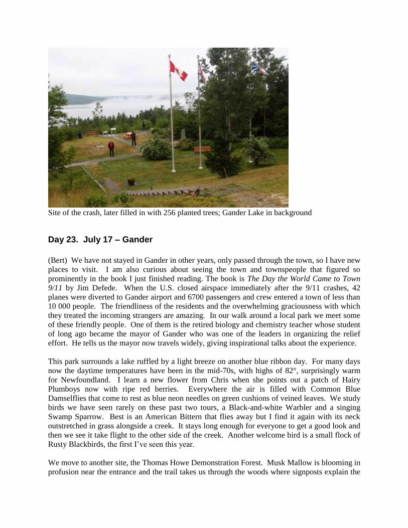
Site of the crash, later filled in with 256 planted trees; Gander Lake in background
Day 23. July 17 – Gander
(Bert) We have not stayed in Gander in other years, only passed through the town, so I have new
places to visit. I am also curious about seeing the town and townspeople that figured so
prominently in the book I just finished reading. The book is The Day the World Came to Town
9/11 by Jim Defede. When the U.S. closed airspace immediately after the 9/11 crashes, 42
planes were diverted to Gander airport and 6700 passengers and crew entered a town of less than
10 000 people. The friendliness of the residents and the overwhelming graciousness with which
they treated the incoming strangers are amazing. In our walk around a local park we meet some
of these friendly people. One of them is the retired biology and chemistry teacher whose student
of long ago became the mayor of Gander who was one of the leaders in organizing the relief
effort. He tells us the mayor now travels widely, giving inspirational talks about the experience.
This park surrounds a lake ruffled by a light breeze on another blue ribbon day. For many days
now the daytime temperatures have been in the mid-70s, with highs of 82°, surprisingly warm
for Newfoundland. I learn a new flower from Chris when she points out a patch of Hairy
Plumboys now with ripe red berries. Everywhere the air is filled with Common Blue
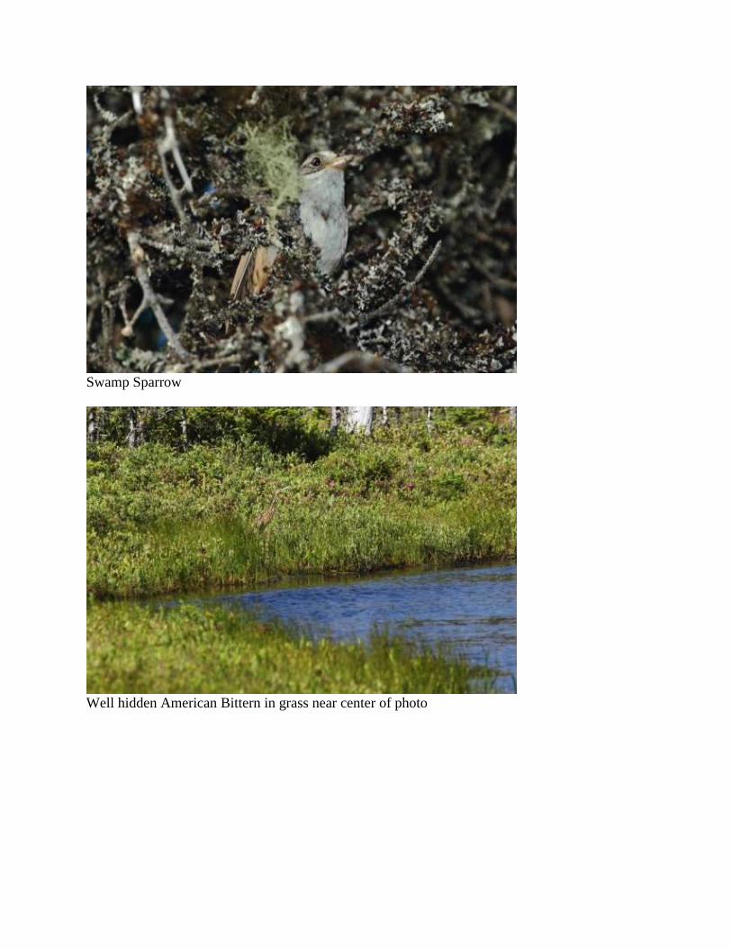
Damselflies that come to rest as blue neon needles on green cushions of veined leaves. We study
birds we have seen rarely on these past two tours, a Black-and-white Warbler and a singing
Swamp Sparrow. Best is an American Bittern that flies away but I find it again with its neck
outstretched in grass alongside a creek. It stays long enough for everyone to get a good look and
then we see it take flight to the other side of the creek. Another welcome bird is a small flock of
Rusty Blackbirds, the first I’ve seen this year.
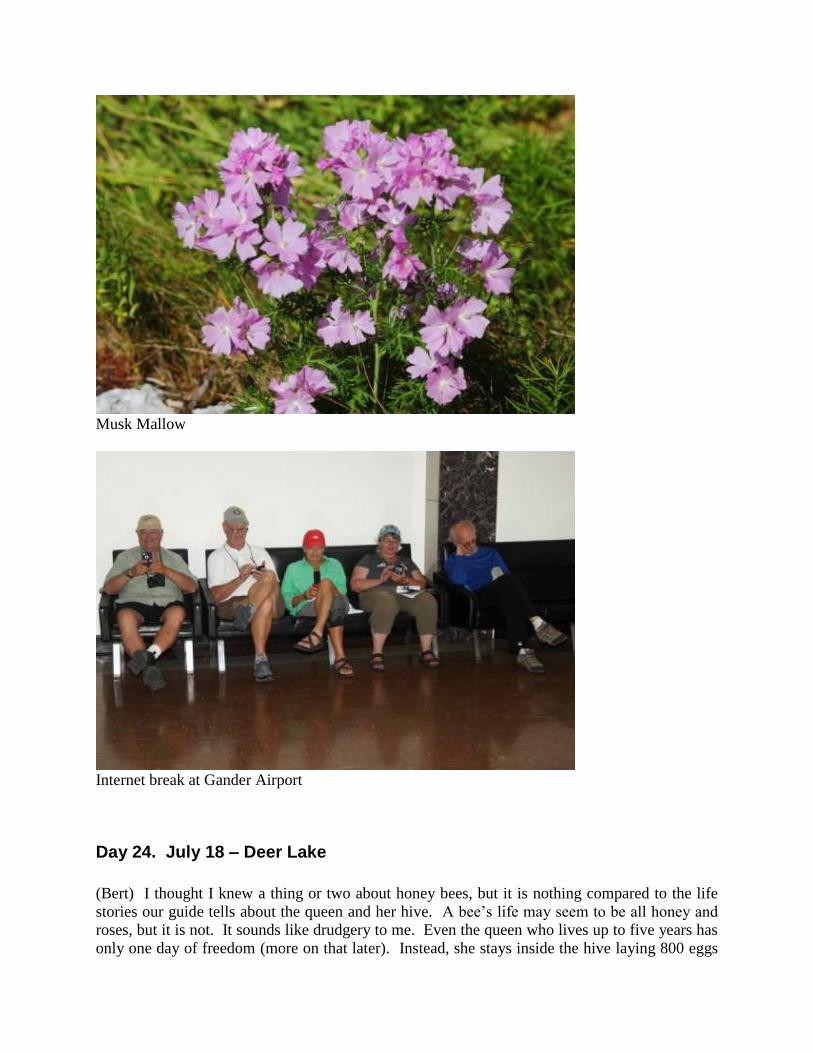
We move to another site, the Thomas Howe Demonstration Forest. Musk Mallow is blooming in
profusion near the entrance and the trail takes us through the woods where signposts explain the

forestry industry. We find a mixed flock of birds but I leave too early to see the Ermine that
Joey and Chris find. After lunch we visit the airport on a tip from the mayor. We thought we
would find a piece of the 9/11 Twin Towers wreckage there, but we must have gotten the
message wrong. Later we find the wreckage at the North Atlantic Aviation Museum. I am
particularly interested in the 9/11 exhibit and the replay of a Diane Sawyer broadcast about the
kind people of Gander.
In the evening we gather in Chris and Curt’s spacious RV, watch a movie and have popcorn.
Appropriately the movie is RV with Robin Williams, a comedy that is even funnier for us
RV’ers as some of the mishaps border on our own experiences.
Book about how Gander helped stranded passengers after 9/11

Hairy Plumboy
Common Blue Damselfly
Swamp Sparrow
Well hidden American Bittern in grass near center of photo
Musk Mallow
Internet break at Gander Airport
Day 24. July 18 – Deer Lake
(Bert) I thought I knew a thing or two about honey bees, but it is nothing compared to the life
stories our guide tells about the queen and her hive. A bee’s life may seem to be all honey and
roses, but it is not. It sounds like drudgery to me. Even the queen who lives up to five years has
only one day of freedom (more on that later). Instead, she stays inside the hive laying 800 eggs
per day into wax cells. She cannot eat by herself and instead is fed by her female attendants who
cluster tightly around her on all sides. They even carry out her bodily waste.
Almost all the bees in the hive are females, the worker bees. Each has an assigned duty, but
what I didn’t know is that their job changes depending on age and experience. A worker bee
starts life as a janitor, cleaning debris out of cells. After three days she is promoted to an
undertaker and is charged with removing dead bees and brood. By the end of a week she may be
responsible for feeding and caring for larvae. By the time she is a teenager she could be one of
the attendants to the Queen Bee, feeding her and carrying out waste. After that her task is to fan
the hive and to produce wax to build the hive. By three weeks she is on guard duty at the hive
entrance. Here she checks the ID of any bees entering the hive, the ID being whether the entrant
smells like others in the hive. Finally she lives out her life of 42 days visiting flowers to collect
nectar. Actually, she collects pollen, nectar, propolis and water, then swishes the sugar water in
her mouth and keeps spitting out the water, thereby concentrating the nectar. Then she passes
the mixture over to another worker bee, who continues the concentration process. The
concentrated sugar water passes through the mouths of ten bees before it becomes honey. Think
about that next time you eat honey!
While the life of the female workers seems like drudgery, the male drones have a carefree life, if
a bit boring. The male visits the hive to be fed by a female–nothing new here–and then leaves to
hang out with the other drones at the club, a hideout somewhere other than the hive. Here he
idles time away until hungry again. His one and only function in life is to mate with the queen,
i.e., he and all the other drones at the club. Imagine the buzz around the club about when they
will get their chance. Unfortunately, most of the drones live out their whole lives without a
chance to mate, since their lifespan is short and the wait time is 3-5 years.
Did you hear? The scuttlebutt is that the Queen Bee is weak and limping. She may be on her
last leg. Then it happens. The worker bees kick the Queen Bee out of the hive. If she cannot lay
eggs she is useless. Now the worker bees busy themselves with producing a new Queen. They
create a mansion wax cell, spacious to fit the Queen’s large size. Then they deposit a super
nectar for the queen larvae to eat. Maybe ten such mansions are built and when the first Queen
Bee hatches she goes about killing the other eggs. If another has already hatched, the two fight
to the death until one is victorious.
Meanwhile, back at the club the drones must be ecstatic. Their time has come. The new Queen
Bee leaves the hive and the drones pursue her. But the Queen Bee is selective, although
promiscuous. She allows eight or nine matings. Most of the drones miss their one and only
chance. However, all is not fun and games for the winners, as the Queen Bees kills her mates.
Then it is back to the hive for 3-5 years. She has stored enough sperm that she can hatch 800
eggs per day for the rest of her life. So, which bee would you rather be: worker bee, drone or
queen?
I learn about the bees at the Newfoundland Insectarium & Butterfly Garden. We also view a
large room full of fluttering butterflies and some of my photos are shown below. I know we
have a few butterfly enthusiasts on this e-group and maybe they can identify them. It will be a
challenge however, since most come from Costa Rica or the Philippines.
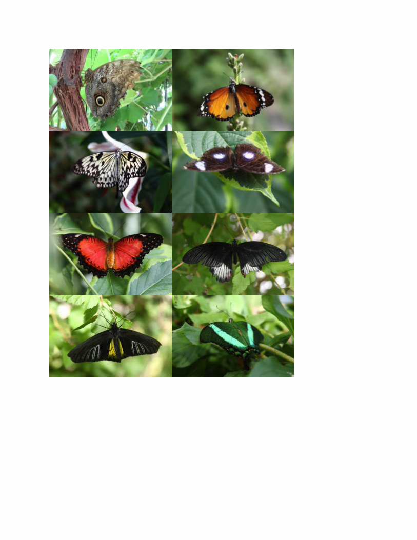
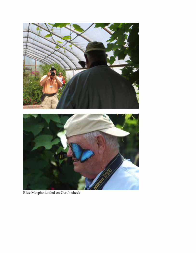
Blue Morpho landed on Curt’s cheek

Kay examines the mounted insect collection
Active beehive with the queen bee marked with a dab of paint
Answers to butterfly identification: #1=Yellow-fronted Owl-Butterfly, #2=Plain Tiger, #3=Rice
Paper Butterfly, #4=Common Eggfly, #5=?, #6=?, #7=Golden Birdwing, #8=Emerald
Swallowtail. The Owl-Butterfly is from Costa Rica; the rest are from the Philippines.
Day 25. July 19 – Codroy Valley
(Bert) Our spotting scopes are in position. We scan the swallow water, the islands of sea grass
and gravelly mudflats inland from the dilapidated metal bridge at Stephenville. Chris tells us she
saw one fly overhead just as they parked the RV. Through my scope I see one far in the
distance. The gull’s black head is obvious, especially the way the white rides up the nape to
make the black hat look like a beret tilted forward. It lifts from the grass and spreads its black
and white wings. I’ve got it! A Black-headed Gull.
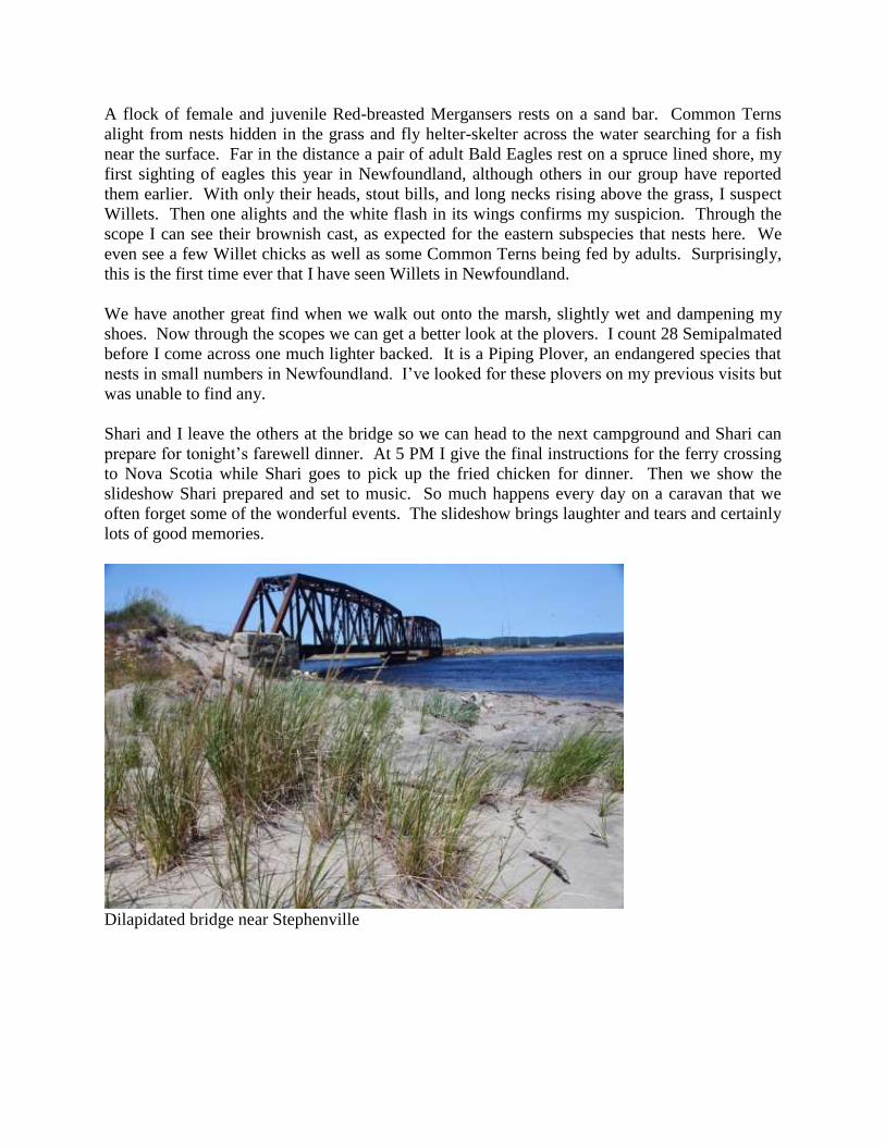
A flock of female and juvenile Red-breasted Mergansers rests on a sand bar. Common Terns
alight from nests hidden in the grass and fly helter-skelter across the water searching for a fish
near the surface. Far in the distance a pair of adult Bald Eagles rest on a spruce lined shore, my
first sighting of eagles this year in Newfoundland, although others in our group have reported
them earlier. With only their heads, stout bills, and long necks rising above the grass, I suspect
Willets. Then one alights and the white flash in its wings confirms my suspicion. Through the
scope I can see their brownish cast, as expected for the eastern subspecies that nests here. We
even see a few Willet chicks as well as some Common Terns being fed by adults. Surprisingly,
this is the first time ever that I have seen Willets in Newfoundland.
We have another great find when we walk out onto the marsh, slightly wet and dampening my
shoes. Now through the scopes we can get a better look at the plovers. I count 28 Semipalmated
before I come across one much lighter backed. It is a Piping Plover, an endangered species that
nests in small numbers in Newfoundland. I’ve looked for these plovers on my previous visits but
was unable to find any.
Shari and I leave the others at the bridge so we can head to the next campground and Shari can
prepare for tonight’s farewell dinner. At 5 PM I give the final instructions for the ferry crossing
to Nova Scotia while Shari goes to pick up the fried chicken for dinner. Then we show the
slideshow Shari prepared and set to music. So much happens every day on a caravan that we
often forget some of the wonderful events. The slideshow brings laughter and tears and certainly
lots of good memories.
Dilapidated bridge near Stephenville

Tidal estuary; Harebells in foreground
Harebells
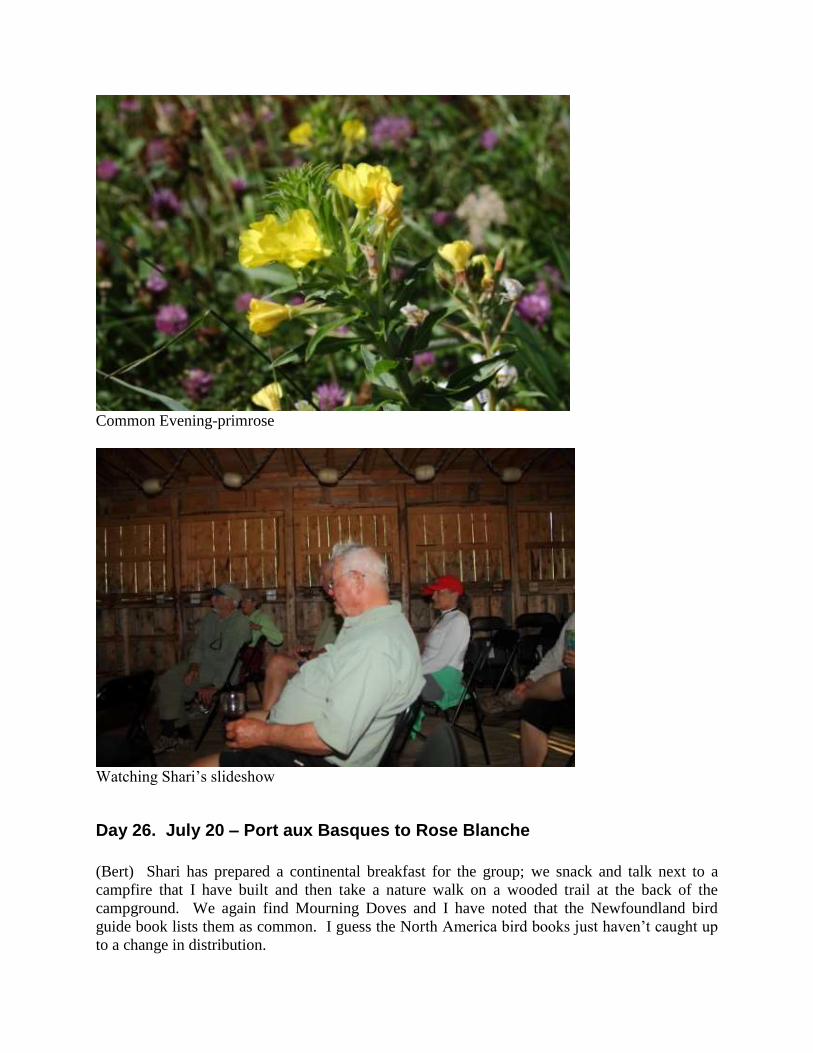
Common Evening-primrose
Watching Shari’s slideshow
Day 26. July 20 – Port aux Basques to Rose Blanche
(Bert) Shari has prepared a continental breakfast for the group; we snack and talk next to a
campfire that I have built and then take a nature walk on a wooded trail at the back of the
campground. We again find Mourning Doves and I have noted that the Newfoundland bird
guide book lists them as common. I guess the North America bird books just haven’t caught up
to a change in distribution.
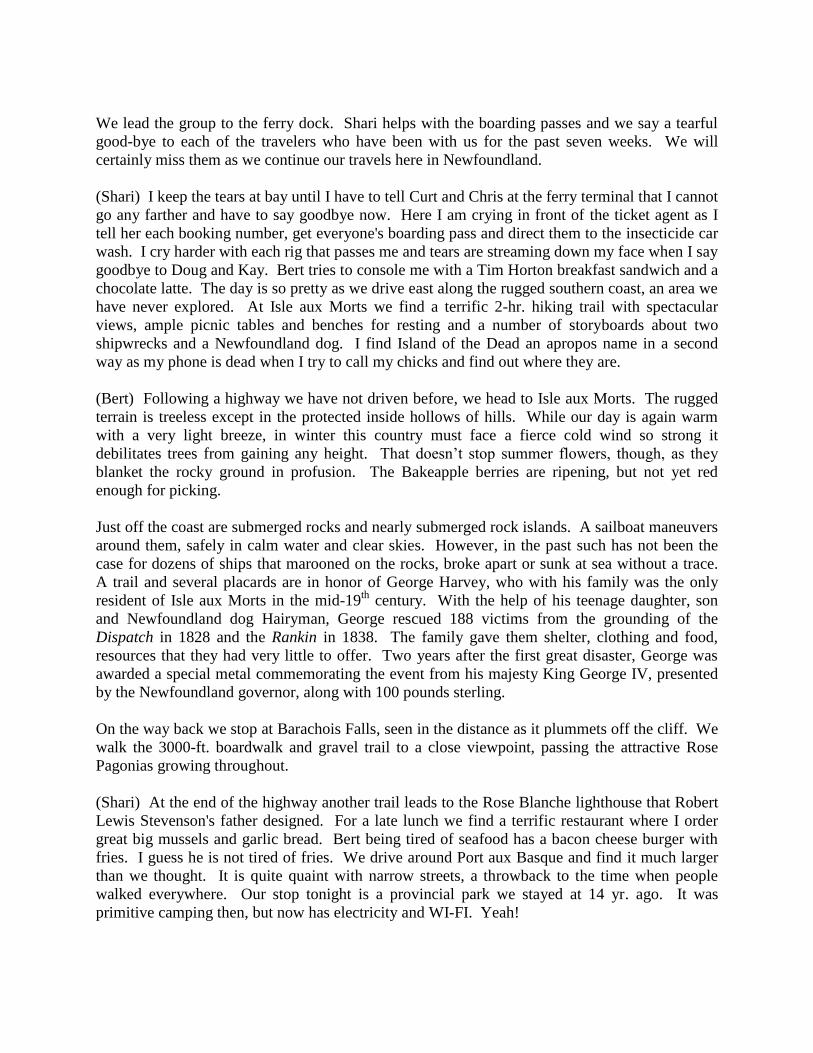
We lead the group to the ferry dock. Shari helps with the boarding passes and we say a tearful
good-bye to each of the travelers who have been with us for the past seven weeks. We will
certainly miss them as we continue our travels here in Newfoundland.
(Shari) I keep the tears at bay until I have to tell Curt and Chris at the ferry terminal that I cannot
go any farther and have to say goodbye now. Here I am crying in front of the ticket agent as I
tell her each booking number, get everyone's boarding pass and direct them to the insecticide car
wash. I cry harder with each rig that passes me and tears are streaming down my face when I say
goodbye to Doug and Kay. Bert tries to console me with a Tim Horton breakfast sandwich and a
chocolate latte. The day is so pretty as we drive east along the rugged southern coast, an area we
have never explored. At Isle aux Morts we find a terrific 2-hr. hiking trail with spectacular
views, ample picnic tables and benches for resting and a number of storyboards about two
shipwrecks and a Newfoundland dog. I find Island of the Dead an apropos name in a second
way as my phone is dead when I try to call my chicks and find out where they are.
(Bert) Following a highway we have not driven before, we head to Isle aux Morts. The rugged
terrain is treeless except in the protected inside hollows of hills. While our day is again warm
with a very light breeze, in winter this country must face a fierce cold wind so strong it
debilitates trees from gaining any height. That doesn’t stop summer flowers, though, as they
blanket the rocky ground in profusion. The Bakeapple berries are ripening, but not yet red
enough for picking.
Just off the coast are submerged rocks and nearly submerged rock islands. A sailboat maneuvers
around them, safely in calm water and clear skies. However, in the past such has not been the
case for dozens of ships that marooned on the rocks, broke apart or sunk at sea without a trace.
A trail and several placards are in honor of George Harvey, who with his family was the only
resident of Isle aux Morts in the mid-19th
century. With the help of his teenage daughter, son
and Newfoundland dog Hairyman, George rescued 188 victims from the grounding of the
Dispatch in 1828 and the Rankin in 1838. The family gave them shelter, clothing and food,
resources that they had very little to offer. Two years after the first great disaster, George was
awarded a special metal commemorating the event from his majesty King George IV, presented
by the Newfoundland governor, along with 100 pounds sterling.
On the way back we stop at Barachois Falls, seen in the distance as it plummets off the cliff. We
walk the 3000-ft. boardwalk and gravel trail to a close viewpoint, passing the attractive Rose
Pagonias growing throughout.
(Shari) At the end of the highway another trail leads to the Rose Blanche lighthouse that Robert
Lewis Stevenson's father designed. For a late lunch we find a terrific restaurant where I order
great big mussels and garlic bread. Bert being tired of seafood has a bacon cheese burger with
fries. I guess he is not tired of fries. We drive around Port aux Basque and find it much larger
than we thought. It is quite quaint with narrow streets, a throwback to the time when people
walked everywhere. Our stop tonight is a provincial park we stayed at 14 yr. ago. It was
primitive camping then, but now has electricity and WI-FI. Yeah!

Farewell continental breakfast
Waiting for departure of S.S. Highlanders to Nova Scotia
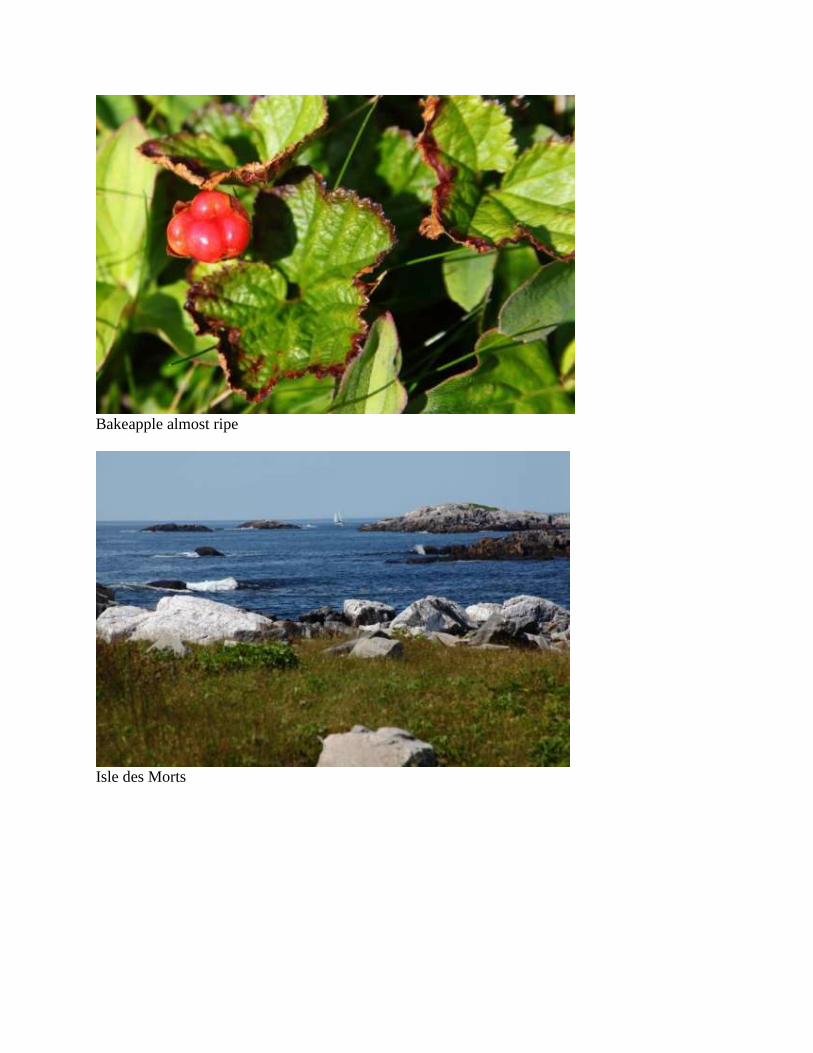
Bakeapple almost ripe
Isle des Morts

George Harvey
Rose Blanche lighthouse designed by Robert Lewis Stevenson's father
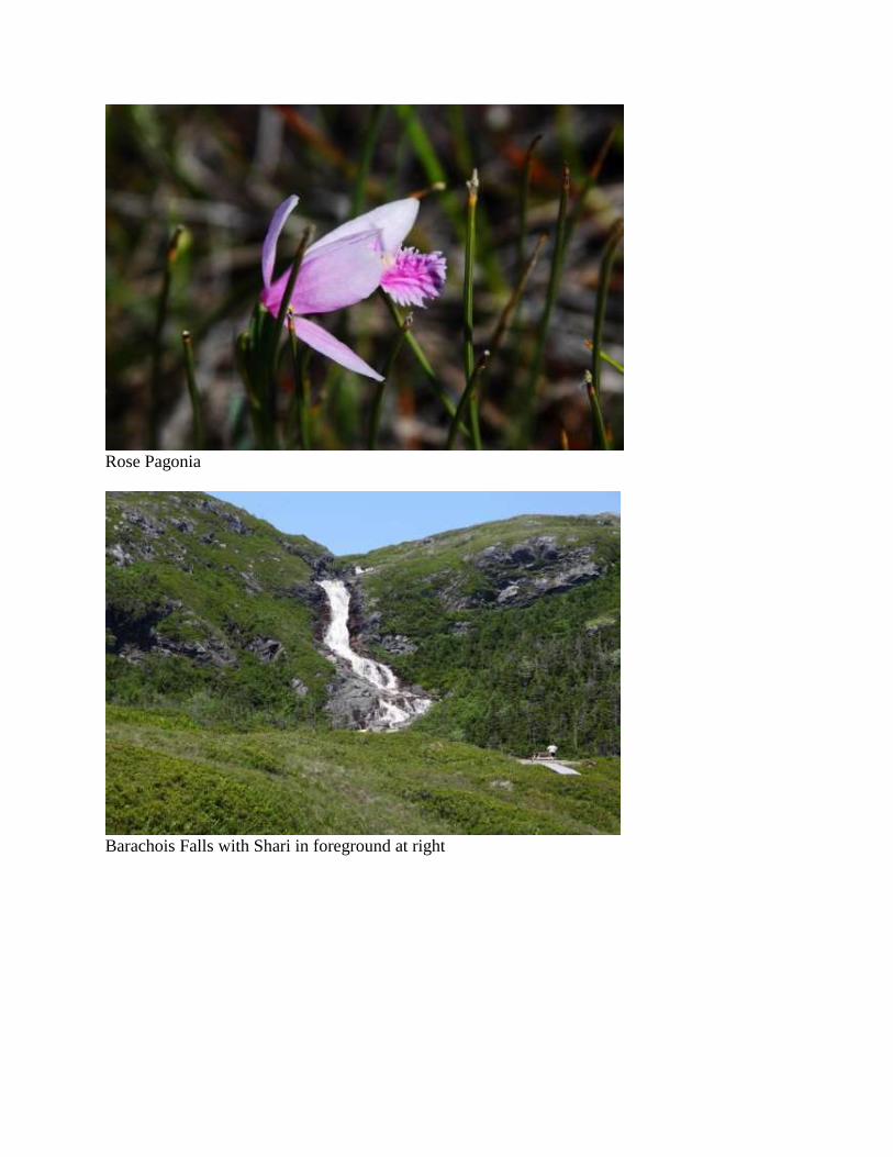
Rose Pagonia
Barachois Falls with Shari in foreground at right
Day 27. July 21 – Port aux Basques
(Bert) Shari is still sleeping when I start my hike from the provincial park through the hills to
the seashore. Piping Plovers nest at the beach, although I have not found them there previously.
First I find a pair of cooperative terns and get several good photos that highlight why these are
Common Terns and not Arctic Terns. In the photos the red-orange legs and bill–as opposed to
red–and the wide black trailing edge to the primaries with the outer primary showing black along
its length are well depicted. Also, the legs are medium length, not short.
Not much farther along the sandy beach I find two Piping Plovers. One has only been born this
summer and I can see the somewhat bedraggled feathers and many juvenal feathers that look like
stick pins. The Piping Plover is endangered so it is a rare treat to see a newly hatched bird. The
chick is able to run within a day of hatching and its pale color blends perfectly with the dry sand.
I’ve studied Piping Plovers for many hours in winter on Mustang Island beaches in Texas and, in
spite of their rarity, I’ve searched and found them in winter in Florida and seven Texas locations,
and in summer in Michigan, New Brunswick and Madeleine Islands. The Texas birds I have
found were born in Saskatchewan, as identified by color-coded bands placed on young birds.
The Newfoundland Piping Plovers are so rare they are not even mentioned in the Birds of
Canada field guide as a nesting area.
While searching the beach for shells, I find a washed up starfish, a razor clam shell and the egg
casing of a skate. More interesting is a pottery fragment, the patterned blue edge of a dinner
plate. It looks very old. Could it date to the time of the Treaty of Paris of 1783 when cod fishing
on the French Shore extended to Port aux Basques, or could it be when the Britain agreed to the
construction of a railway terminus at Port aux Basques, completed in 1897, or when the ferry
started running to Nova Scotia?
We leave the campground and I join Shari on a boardwalk hike along the beach at Port aux
Basques. I really wanted to see the rocks in this area ever since I read about them in my
Newfoundland geology book. The rock formations are in upheaved layers normally associated
with sedimentary rock tilted in mountain building. However, this is not sedimentary. Instead, it
is schist formed deep in the Earth at high temperatures, i.e., 650° C and 25 km below the surface.
The high pressure and temperature caused the growth of metamorphic minerals such as red
garnet and light blue kyanite. Veins of white quartz have forced through the layers of black
hornblende and there are thin fragile mirrors of shiny mica. The rock formations came to the
surface during continental plate collision after the Iapetus Ocean closed.
We leave the Port aux Basques area and head north, passing Corner Brook and Deer Lake and
begin looking for a boondocking site for the evening. I thought we might find one along a
country road that meets the old railway bed, but the connection through Deer Lake is blocked, so
we continue northward. From TCH1 I spot the numbered road and turn inland to Sandy Lake
where we find a delightful spot right up against the lake. As we dine on snow crab, we hear a
distant Common Loon on the lake.

Common Tern: note color of bill and legs
Common Tern: note black trailing edge on primaries

Juvenile Piping Plover
Plate fragment washed up on Port aux Basques beach

Tilted layers of Garnet-Kyanite schist
Garnet-Kyanite schist with quartz outcrop
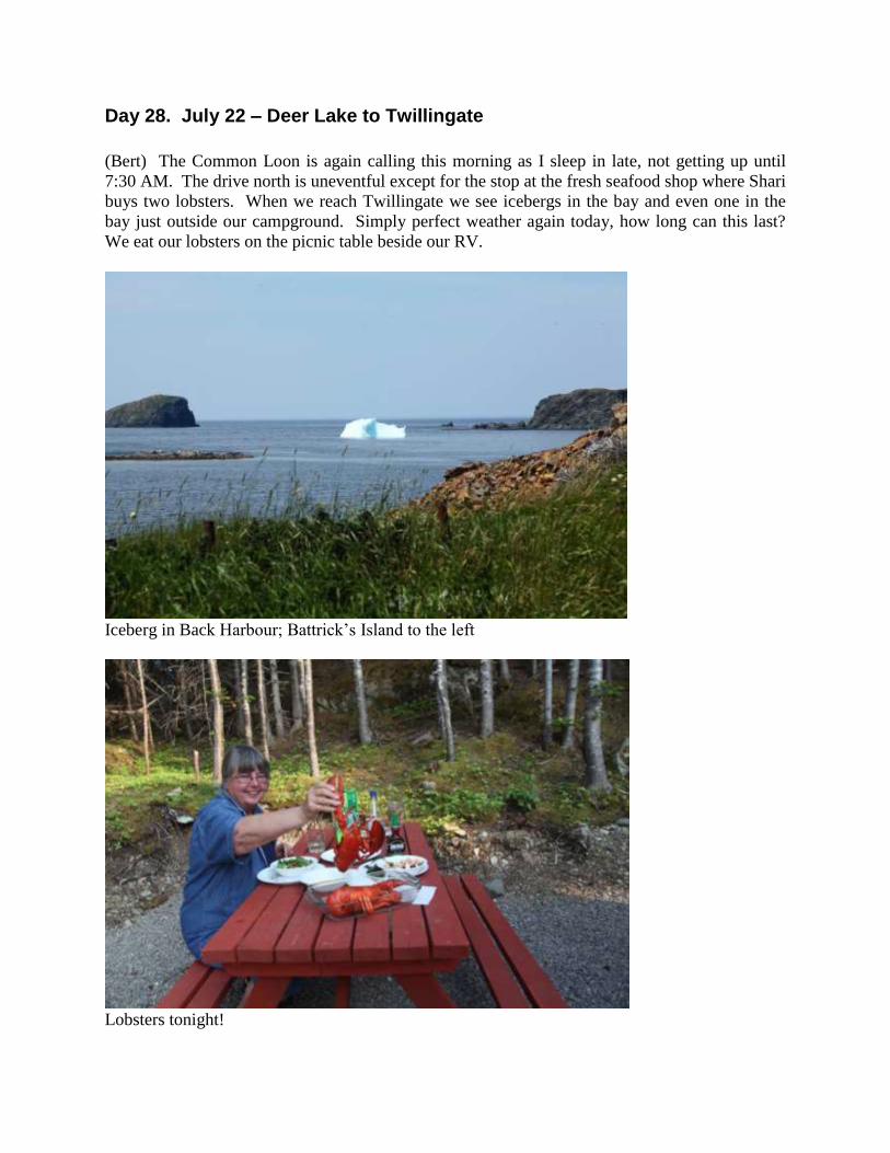
Day 28. July 22 – Deer Lake to Twillingate
(Bert) The Common Loon is again calling this morning as I sleep in late, not getting up until
7:30 AM. The drive north is uneventful except for the stop at the fresh seafood shop where Shari
buys two lobsters. When we reach Twillingate we see icebergs in the bay and even one in the
bay just outside our campground. Simply perfect weather again today, how long can this last?
We eat our lobsters on the picnic table beside our RV.
Iceberg in Back Harbour; Battrick’s Island to the left
Lobsters tonight!

Day 29. July 23 – Twillingate
(Bert) Shari wants to check out a back road near Twillingate. When we stop for her to get the
GPS coordinates of a potential boondocking site I notice a half dozen Milbert's Tortoiseshells
feeding on Canada Thistle. The population density makes me think the chrysalises just opened.
These very colorful butterflies are only found in the north and I distinctly remember when I first
identified them in Alaska in 1996.
We are in Twillingate for their 34th
annual Fish Fun & Folk Festival and today’s entertainment is
an Old Fashion Kitchen Party with Karen Churchill performing at the Twillingate Lions Club.
Karen is a very talented singer and 12-string guitar player. I am particularly impressed with her
large and varied repertoire which today includes traditional Newfoundland songs combined with
an Eddy Arnold western song, a one-time-popular Tom Jones ballad, Twillingate Isle which she
wrote, and finishing with an Australian song, Home among the gum trees, complete with body
movements performed by the audience. Amazingly, Karen apparently knows the lyrics and
cords to all the songs without referring to a songbook.
Milbert's Tortoiseshells feeding on Canada Thistle

Karen Churchill
Costumed Mummers join the Old Fashion Kitchen Party
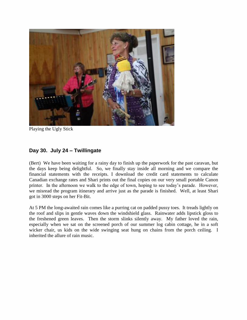
Playing the Ugly Stick
Day 30. July 24 – Twillingate
(Bert) We have been waiting for a rainy day to finish up the paperwork for the past caravan, but
the days keep being delightful. So, we finally stay inside all morning and we compare the
financial statements with the receipts. I download the credit card statements to calculate
Canadian exchange rates and Shari prints out the final copies on our very small portable Canon
printer. In the afternoon we walk to the edge of town, hoping to see today’s parade. However,
we misread the program itinerary and arrive just as the parade is finished. Well, at least Shari
got in 3000 steps on her Fit-Bit.
At 5 PM the long-awaited rain comes like a purring cat on padded pussy toes. It treads lightly on
the roof and slips in gentle waves down the windshield glass. Rainwater adds lipstick gloss to
the freshened green leaves. Then the storm slinks silently away. My father loved the rain,
especially when we sat on the screened porch of our summer log cabin cottage, he in a soft
wicker chair, us kids on the wide swinging seat hung on chains from the porch ceiling. I
inherited the allure of rain music.
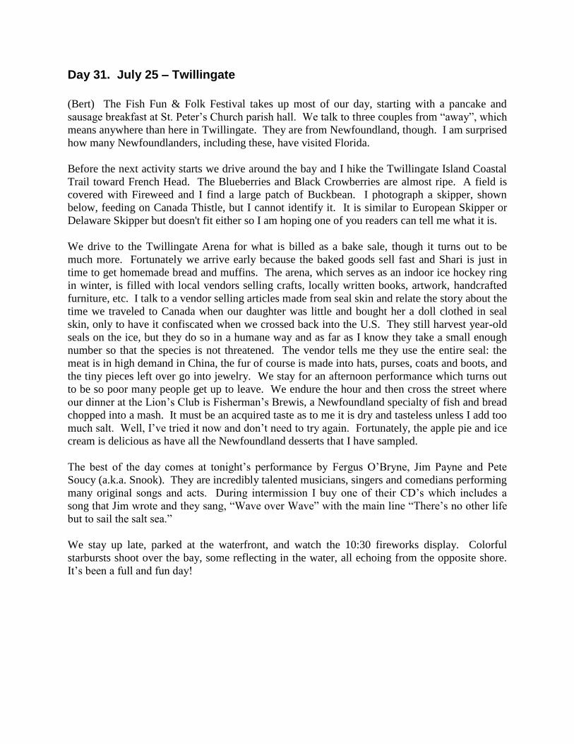
Day 31. July 25 – Twillingate
(Bert) The Fish Fun & Folk Festival takes up most of our day, starting with a pancake and
sausage breakfast at St. Peter’s Church parish hall. We talk to three couples from “away”, which
means anywhere than here in Twillingate. They are from Newfoundland, though. I am surprised
how many Newfoundlanders, including these, have visited Florida.
Before the next activity starts we drive around the bay and I hike the Twillingate Island Coastal
Trail toward French Head. The Blueberries and Black Crowberries are almost ripe. A field is
covered with Fireweed and I find a large patch of Buckbean. I photograph a skipper, shown
below, feeding on Canada Thistle, but I cannot identify it. It is similar to European Skipper or
Delaware Skipper but doesn't fit either so I am hoping one of you readers can tell me what it is.
We drive to the Twillingate Arena for what is billed as a bake sale, though it turns out to be
much more. Fortunately we arrive early because the baked goods sell fast and Shari is just in
time to get homemade bread and muffins. The arena, which serves as an indoor ice hockey ring
in winter, is filled with local vendors selling crafts, locally written books, artwork, handcrafted
furniture, etc. I talk to a vendor selling articles made from seal skin and relate the story about the
time we traveled to Canada when our daughter was little and bought her a doll clothed in seal
skin, only to have it confiscated when we crossed back into the U.S. They still harvest year-old
seals on the ice, but they do so in a humane way and as far as I know they take a small enough
number so that the species is not threatened. The vendor tells me they use the entire seal: the
meat is in high demand in China, the fur of course is made into hats, purses, coats and boots, and
the tiny pieces left over go into jewelry. We stay for an afternoon performance which turns out
to be so poor many people get up to leave. We endure the hour and then cross the street where
our dinner at the Lion’s Club is Fisherman’s Brewis, a Newfoundland specialty of fish and bread
chopped into a mash. It must be an acquired taste as to me it is dry and tasteless unless I add too
much salt. Well, I’ve tried it now and don’t need to try again. Fortunately, the apple pie and ice
cream is delicious as have all the Newfoundland desserts that I have sampled.
The best of the day comes at tonight’s performance by Fergus O’Bryne, Jim Payne and Pete
Soucy (a.k.a. Snook). They are incredibly talented musicians, singers and comedians performing
many original songs and acts. During intermission I buy one of their CD’s which includes a
song that Jim wrote and they sang, “Wave over Wave” with the main line “There’s no other life
but to sail the salt sea.”
We stay up late, parked at the waterfront, and watch the 10:30 fireworks display. Colorful
starbursts shoot over the bay, some reflecting in the water, all echoing from the opposite shore.
It’s been a full and fun day!
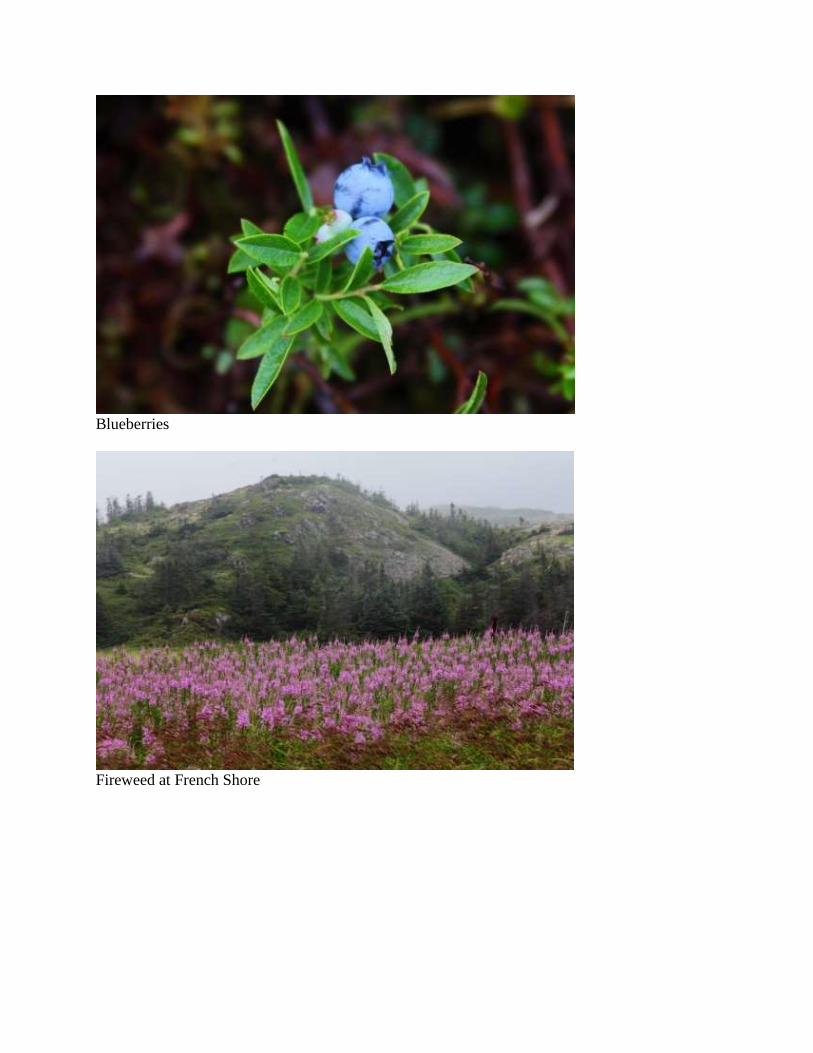
Blueberries
Fireweed at French Shore
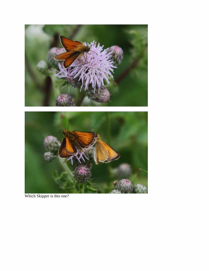
Which Skipper is this one?
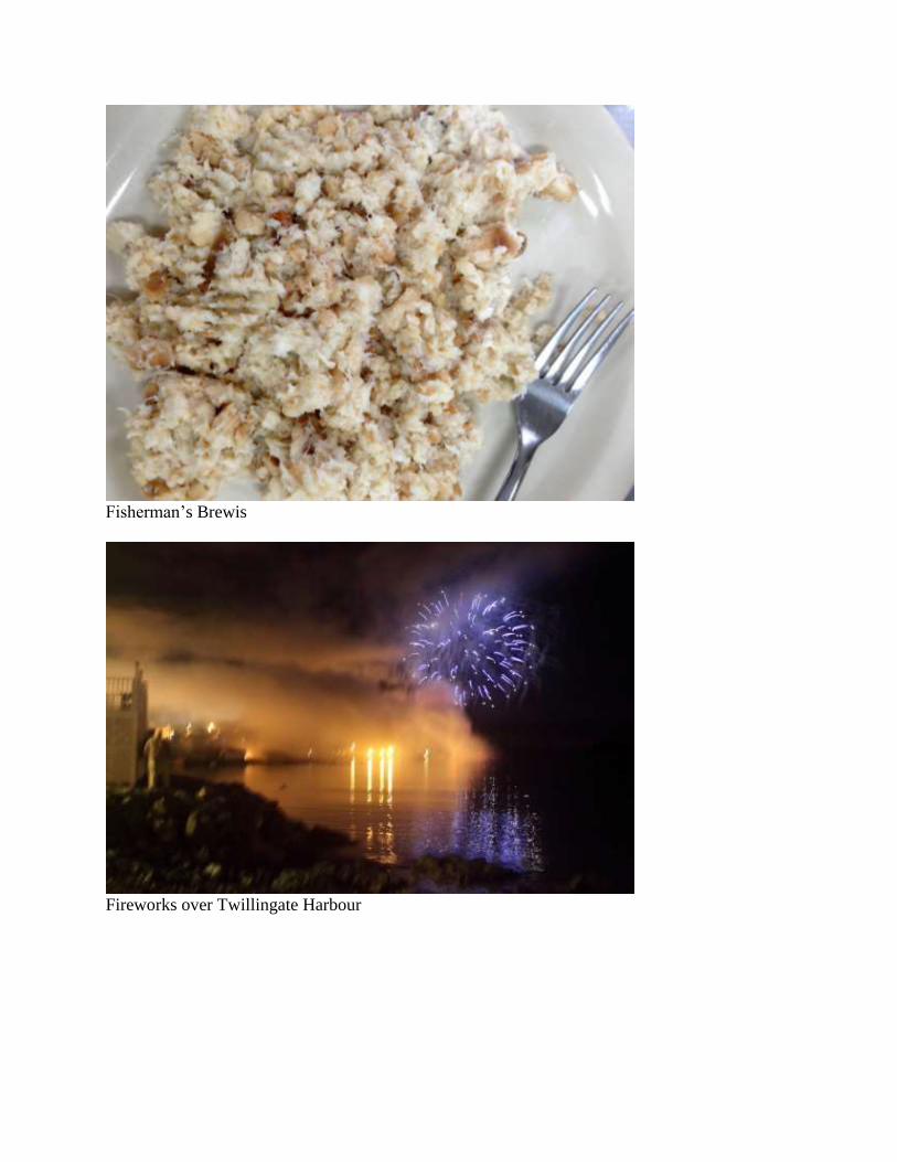
Fisherman’s Brewis
Fireworks over Twillingate Harbour
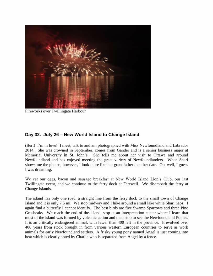
Fireworks over Twillingate Harbour
Day 32. July 26 – New World Island to Change Island
(Bert) I’m in love! I meet, talk to and am photographed with Miss Newfoundland and Labrador
2014. She was crowned in September, comes from Gander and is a senior business major at
Memorial University in St. John’s. She tells me about her visit to Ottawa and around
Newfoundland and has enjoyed meeting the great variety of Newfoundlanders. When Shari
shows me the photos, however, I look more like her grandfather than her date. Oh, well, I guess
I was dreaming.
We eat our eggs, bacon and sausage breakfast at New World Island Lion’s Club, our last
Twillingate event, and we continue to the ferry dock at Farewell. We disembark the ferry at
Change Islands.
The island has only one road, a straight line from the ferry dock to the small town of Change
Island and it is only 7.5 mi. We stop midway and I hike around a small lake while Shari naps. I
again find a butterfly I cannot identify. The best birds are five Swamp Sparrows and three Pine
Grosbeaks. We reach the end of the island, stop at an interpretation center where I learn that
most of the island was formed by volcanic action and then stop to see the Newfoundland Ponies.
It is an critically endangered animal, with fewer than 400 left in the province. It evolved over
400 years from stock brought in from various western European countries to serve as work
animals for early Newfoundland settlers. A frisky young pony named Angel is just coming into
heat which is clearly noted by Charlie who is separated from Angel by a fence.

We return to the ferry dock in time to catch a ride to Fogo Island and it being late in the day, we
boondock at the end of a road with a view of the Stag Harbour on the left and the open sea on the
right. The silence is broken by gentle waves lapping on the rocks from the incoming tide. A
motorboat starts up and kids in the boat pull another on an inner tube attached by rope. Then
silence again.
Miss Newfoundland and Labrador
Change Islands and Fogo Island

Unidentified White
Change Island near Red Rock Cove
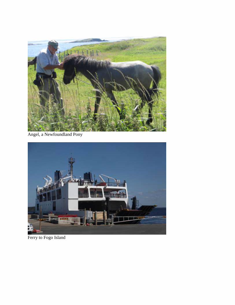
Angel, a Newfoundland Pony
Ferry to Fogo Island

Day 33. July 27 – Fogo Island
(Bert) A Great Auk quietly rests on a rock in Stag Harbour. Except for its oversized bill, it
looks and stands just like a black and white penguin. In fact, the French used to call this bird a
penguin and although it is anatomically quite similar, it is taxonomically far removed. In height,
the Great Auk is about the size of an eight-year-old boy, but heavier set. Not far from Fogo
Island is Funk Island, where world’s largest colony of Great Auks resided. A flightless bird in
the alcid family, related to murres, razorbills, auklets and puffins, it gathered on the island by the
tens of thousands, maybe even 100 000 pairs, first reported in 1534 and 1535 by Jacques Cartier
who landed there to replenish fresh meat.
The most infamous record of Great Auks comes from Whitbourne (1622) when he stated the
auks “multiply … infinitely” on Funk Island and that they were driven “hundreds at a time”
down gangplanks into waiting boats. He wrote “… God had made the innocency of so poor a
creature, to become such an admirable instrument for the sustenation of man.”
Through the 18th
century the Great Auks were relentlessly collected for feathers, meat, and bait,
and they were boiled in large caldrons for their fat. Fishing crews of English, French,
Portuguese and Spanish regularly killed Great Auks for meat. In 1785 Cartwright warned of the
precarious status of the Great Auk and a ban was instated against egg collecting during the
breeding season. Violators were sometimes punished by public flogging. But it was too late, as
the Great Auk was extirpated from Funk Island by the early 1800s. The last recorded living pair
was killed in 1844 in Eldey Island, Iceland.
However, in 1888 two fishermen captured a large bird floating in slob ice along the shoreline of
Fogo Island. They cooked and ate the bird, making three meals. An official examination of the
remnant head, feet and wings left “no doubt” that the bird was a Great Auk. If you believe that,
then maybe the bird I photographed this morning is another survivor of extinction.
Great Auk in Stag Harbour

Day 34. July 28 – Fogo Island
(Bert) Don’t ask me why, but Brimstone Head on Fogo Island is one of the four corners of the
flat earth. Apparently there is a society of flat-earthers that believe it is a hoax that the earth is
round. Just at the edge of our campground is the trail leading up Brimstone Head and that is
where I hike early this morning under yet another day of clear skies and warm weather. I take
my time climbing steps and slopes, stopping to photograph flowers, icebergs and panoramic
scenery and watching a flock of 13 Whimbrels glide and circle in airlifts below me. When I
reach the pinnacle a billboard sign maps the four corners: Fogo Island, Hydra in the
Mediterranean, Bermuda Triangle and Papua New Guinea.
More realistically, my top-of-the-world view includes twelve large icebergs and six cod boats.
Cod fishing season, for private use, opened a couple of days ago and the boats with two to three
fishermen each are floating among the icebergs. Our day is filled with visiting more of the
historical sites of Fogo Island and ends with a spectacular sunset viewed from our campsite.
Sun’s golden globe descends on a pyramidal iceberg that has drifted slowly across the bay
throughout the day. One can almost hear the sizzle when fire meets ice.
Brimstone Head, Fogo Island
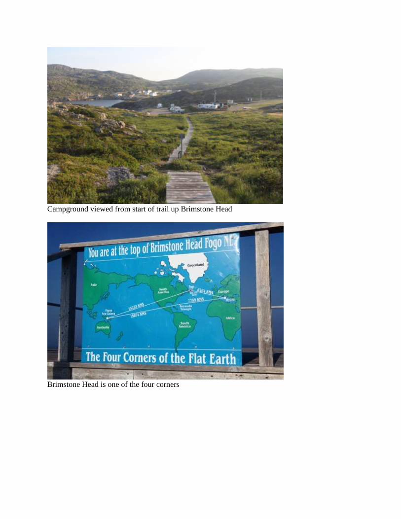
Campground viewed from start of trail up Brimstone Head
Brimstone Head is one of the four corners

Two cod boats and an iceberg
View of Fogo and Brimstone Head from Marconi site

Fire and Ice
Day 35. July 29 – Fogo Island to Lewisporte
(Bert) The tanks are large enough that they could substitute for those on tanker trucks that
deliver to your local fuel station. Yet these three are inside on the second story of the restored
building of the Fisherman’s Union Trading Company located in Seldom, Fogo Island. In their
day they did not hold gasoline, but rather were used for rendered cod liver oil. Just the thought
of it conjures up a bad taste in my mouth. Earlier this summer, we had a demonstration of how
cod were headed, gutted and split in preparation for salting and drying. All the guts were
dumped in the sea, down a hole in the stage–the name for a seaside building used to clean cod–
except the livers, which were thrown into a 45-gal. barrel where the livers soon dissolved into
oil. From there they were transported to the cod liver oil factory. The crude oil was poured into
a large tank which separated cod liver oil from water and dreg that settled to the bottom and was
extracted. Then it was pumped into a boiler where it was boiled for 4 hr. until it was pure cod
liver oil. It was then strained and pumped into holding tanks until delivery.
On the first floor of another building is the supply store. Our guide says her fisherman father
will not step into the store because of all the bad memories it brings back. The store was
operated on the truck system, a cashless exchange of cod for goods that consistently left the
fishermen in debt to the store. On long tables are dozens of thick binders filled with thousands
of letters and correspondence that quite amazingly has been preserved. Many are sad hand-
written letters from fishermen or their wives, asking for an extension of credit or promises to pay
and neatly typed letters on Fishermen's Union Trading Co., Ltd. stationery. In a corner of the
building a stairs leads up to a second story room, the manager’s office, deliberately “a step up”
signifying his superiority. Rows of book shelves are filled with manager’s ledgers each with a
year on the spine of the bound book, dated from 1918 through 1970.

We take the M/V Capt. Earl W. Windsor ferry back to the mainland and drive to a campground
in Lewisporte. After dinner–whole crab again–we walk to a performance by Terry Penney. I am
always amazed at the musical talent in Newfoundland everywhere we go. Terry plays guitar and
sings, mostly songs he has written. For each he tells a story of where he was and what his
thoughts were when he wrote the song. An admirer of songs of the 50s and 60s, he wrote Buddy
Holly Tribute. While sitting in his flooded hotel room in Texas he wrote West Texas Moon.
While reminiscing of a rowdy Lewisporte bike “club” whose leader disappeared while out
fishing, he wrote Ballard of the Baymen Riders. In another, he wrote a tribute to World War I
veterans, which included many in his family, and it is a play on the word “shell.” As a kid, it is
sea shells on the beach, as a soldier it is bullet shells over a bunker, as a returning veteran it is
shell shock. Before we exit the performance, I buy two of his CDs.
Cod liver oil holding tanks

Fishermen's Union Trading Co. store
Fishermen's Union Trading Co., Ltd. archived letters
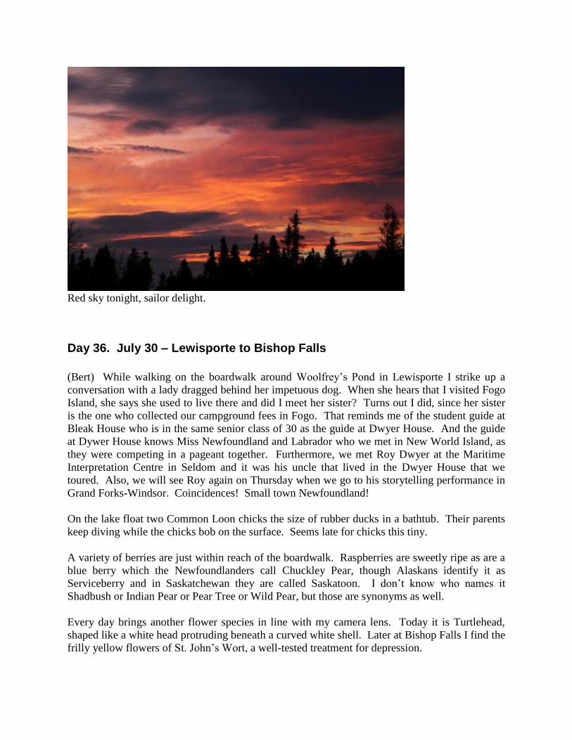
Red sky tonight, sailor delight.
Day 36. July 30 – Lewisporte to Bishop Falls
(Bert) While walking on the boardwalk around Woolfrey’s Pond in Lewisporte I strike up a
conversation with a lady dragged behind her impetuous dog. When she hears that I visited Fogo
Island, she says she used to live there and did I meet her sister? Turns out I did, since her sister
is the one who collected our campground fees in Fogo. That reminds me of the student guide at
Bleak House who is in the same senior class of 30 as the guide at Dwyer House. And the guide
at Dywer House knows Miss Newfoundland and Labrador who we met in New World Island, as
they were competing in a pageant together. Furthermore, we met Roy Dwyer at the Maritime
Interpretation Centre in Seldom and it was his uncle that lived in the Dwyer House that we
toured. Also, we will see Roy again on Thursday when we go to his storytelling performance in
Grand Forks-Windsor. Coincidences! Small town Newfoundland!
On the lake float two Common Loon chicks the size of rubber ducks in a bathtub. Their parents
keep diving while the chicks bob on the surface. Seems late for chicks this tiny.
A variety of berries are just within reach of the boardwalk. Raspberries are sweetly ripe as are a
blue berry which the Newfoundlanders call Chuckley Pear, though Alaskans identify it as
Serviceberry and in Saskatchewan they are called Saskatoon. I don’t know who names it
Shadbush or Indian Pear or Pear Tree or Wild Pear, but those are synonyms as well.
Every day brings another flower species in line with my camera lens. Today it is Turtlehead,
shaped like a white head protruding beneath a curved white shell. Later at Bishop Falls I find the
frilly yellow flowers of St. John’s Wort, a well-tested treatment for depression.
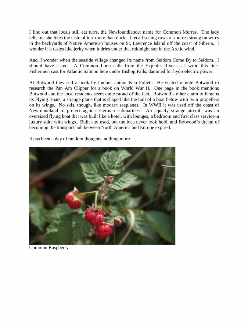
I find out that locals still eat turrs, the Newfoundlander name for Common Murres. The lady
tells me she likes the taste of turr more than duck. I recall seeing rows of murres strung on wires
in the backyards of Native American houses on St. Lawrence Island off the coast of Siberia. I
wonder if it tastes like jerky when it dries under that midnight sun in the Arctic wind.
And, I wonder when the seaside village changed its name from Seldom Come By to Seldom. I
should have asked. A Common Loon calls from the Exploits River as I write this line.
Fishermen cast for Atlantic Salmon here under Bishop Falls, dammed for hydroelectric power.
At Botwood they sell a book by famous author Ken Follett. He visited remote Botwood to
research the Pan Am Clipper for a book on World War II. One page in the book mentions
Botwood and the local residents seem quite proud of the fact. Botwood’s other claim to fame is
its Flying Boats, a strange plane that is shaped like the hull of a boat below with twin propellers
on its wings. No skis, though, like modern seaplanes. In WWII it was used off the coast of
Newfoundland to protect against German submarines. An equally strange aircraft was an
oversized flying boat that was built like a hotel, with lounges, a bedroom and first class service–a
luxury suite with wings. Built and used, but the idea never took hold, and Botwood’s dream of
becoming the transport hub between North America and Europe expired.
It has been a day of random thoughts, nothing more …
Common Raspberry

Chuckley Pear
Turtlehead

St. John’s-wort
Flying Boat

Bishop's Falls Dam
Day 37. July 31 – Grand Falls-Windsor
(Bert) “Have you seen the river yet?” she asks.
“Do you mean the Exploits?” I counter question.
“Yes,” she responds with a tone that implies there is no other.
Perhaps not, at least not in size. The Exploits, 246 mi. long, is Newfoundland's longest river. It
once thrived with Atlantic Salmon swimming upstream from the Bay of Exploits. The dam at
Bishop’s Falls, another at Grand Falls and more upstream put an end to salmon migration except
near the ocean, reducing the returning population to only 1200 in 1978. I remember our
Newfoundland and Labrador visit in 2000 and only hearing sad stories of the demise of salmon.
So, it is refreshing now to hear a success story at the Salmonid Interpretation Centre. But, first,
more on the demise side of the story, a tale of politics, greed, low wages and environmental
damage. For centuries, Newfoundland’s economy was dominated by the cod fishery, shifting up
and down with supply and demand. Political parties disagreed on how to fix bad economic
times. Should improvements be made in the fisheries or should alternative revenue sources be
found?
Late in the 19th
century, when the alternative-source political party was in power, a much
criticized contract was granted for the building of a railroad to cross into the virtually unknown
interior of the island. It was thought, somewhat naively, that abundant pine forests and mineral
deposits in the island’s center would bring wealth to Newfoundland. They say the deal was a
give-away and it included the grant of 5000 acres of land per mile of railroad bed as well as a
bribe to the man negotiating the contract for the government. The railway was completed in

1898 and, of course, that company was a beneficiary when logging operations began. On the
plus side, it did provide off-season employment for fishermen and a new export commodity for
Newfoundland. On the negative side, the labor was hard work and the men were paid so poorly
they could not make ends meet. Nonetheless, the White Pine forests were clear cut to the point
that only remote inaccessible stands still exist in Newfoundland. Thus ended the supply of
lumber. So they turned to Black Spruce and Balsam Fir, good for paper and pulp. There was
much demand for newsprint in those days. The logs were floated down the Exploits to mills at
Grand Falls and other sites. Nowadays, demand for newsprint has plummeted–owing to the
Internet–and many mills have shut down. The ghost of one at Grand Falls still stands.
Environmental improvements are best spurred when they can be tied to monetary gain. So it was
the desire for Atlantic Salmon that cleaned up the river pollutants and the logjams and debris
along the Exploits. By adding fish ladders around the dams, it is now possible for the salmon to
swim upstream beyond Bishop’s Falls and Grand Falls. Eggs were gathered and hatched,
salmonids were flown by helicopter upstream, and larger numbers of salmon began returning
from the sea. By 2013 the number had increased to 45 000 and the river has the potential of
supporting 300 000, so now they no longer collect and hatch eggs and the salmon population is
self-supporting. Yet, when I ask the guide whether we are eating locally caught Atlantic Salmon
when we order it at a restaurant, I am told no, it is farm-raised. Commercial fishing is still
banned and only a very limited catch–six salmon per season per fisherman–is allowed.
Grand Falls on the Exploit

Late 19
th century locomotive on narrow gauge track
Log driving, circa 1909

Dam and obsolete pulp mill at Grand Falls
Atlantic Salmon swimming upstream, past viewing window at Grand Falls
Day 38. August 1 – Millertown to Brighton
(Bert) The heat wave continues. Yesterday it was 87° by 2 PM, reaching to 92° by 4:35. Today
the high was 79° and we still saw icebergs at Brighton.
I received several replies to my query about the skipper (Day 31, July 25) and white butterflies.
Four respondents favored European Skipper, one thought it was Delaware Skipper and another
person suggested Small Skipper. Personally, I think it is Delaware Skipper and you can compare

my photos with those of a lightly-marked male Delaware Skipper on
http://www.carolinanature.com/butterflies/delawareskipper.html versus the European Skipper on
http://en.wikipedia.org/wiki/Essex_Skipper. I continued to see these skippers at Twillingate and
then more at Fogo Island. In all, I suspect I saw 150+ skippers (and about as many Milbert’s
Tortoiseshells). The photo below was one I took at La Scie on the Baie Verte peninsula. This
photo shows the white fringes again (not orange) and the black bar on the forewing which was
not obvious on my previous photos.
Here’s another challenge. What species is this caterpillar?
Delaware Skipper
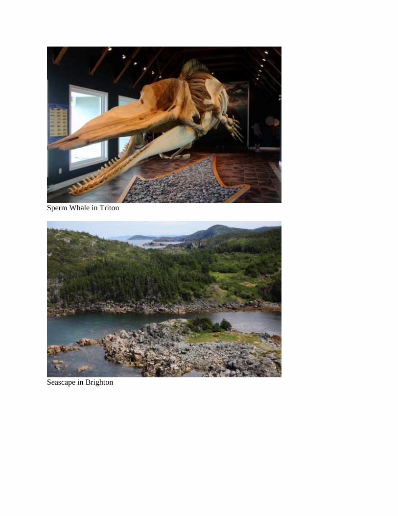
Sperm Whale in Triton
Seascape in Brighton
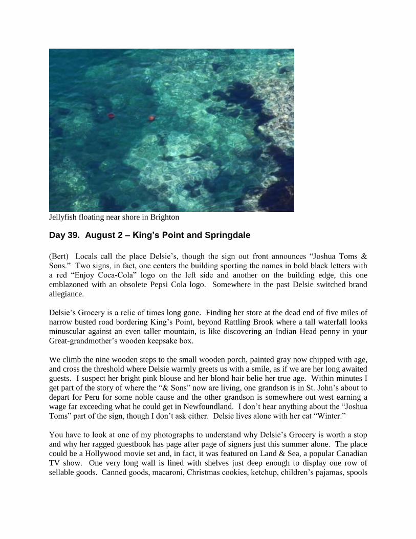
Jellyfish floating near shore in Brighton
Day 39. August 2 – King’s Point and Springdale
(Bert) Locals call the place Delsie’s, though the sign out front announces “Joshua Toms &
Sons.” Two signs, in fact, one centers the building sporting the names in bold black letters with
a red “Enjoy Coca-Cola” logo on the left side and another on the building edge, this one
emblazoned with an obsolete Pepsi Cola logo. Somewhere in the past Delsie switched brand
allegiance.
Delsie’s Grocery is a relic of times long gone. Finding her store at the dead end of five miles of
narrow busted road bordering King’s Point, beyond Rattling Brook where a tall waterfall looks
minuscular against an even taller mountain, is like discovering an Indian Head penny in your
Great-grandmother’s wooden keepsake box.
We climb the nine wooden steps to the small wooden porch, painted gray now chipped with age,
and cross the threshold where Delsie warmly greets us with a smile, as if we are her long awaited
guests. I suspect her bright pink blouse and her blond hair belie her true age. Within minutes I
get part of the story of where the “& Sons” now are living, one grandson is in St. John’s about to
depart for Peru for some noble cause and the other grandson is somewhere out west earning a
wage far exceeding what he could get in Newfoundland. I don’t hear anything about the “Joshua
Toms” part of the sign, though I don’t ask either. Delsie lives alone with her cat “Winter.”
You have to look at one of my photographs to understand why Delsie’s Grocery is worth a stop
and why her ragged guestbook has page after page of signers just this summer alone. The place
could be a Hollywood movie set and, in fact, it was featured on Land & Sea, a popular Canadian
TV show. One very long wall is lined with shelves just deep enough to display one row of
sellable goods. Canned goods, macaroni, Christmas cookies, ketchup, children’s pajamas, spools
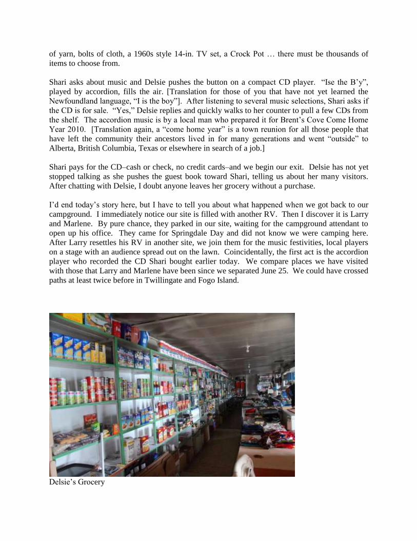
of yarn, bolts of cloth, a 1960s style 14-in. TV set, a Crock Pot … there must be thousands of
items to choose from.
Shari asks about music and Delsie pushes the button on a compact CD player. “Ise the B’y”,
played by accordion, fills the air. [Translation for those of you that have not yet learned the
Newfoundland language, “I is the boy”]. After listening to several music selections, Shari asks if
the CD is for sale. “Yes,” Delsie replies and quickly walks to her counter to pull a few CDs from
the shelf. The accordion music is by a local man who prepared it for Brent’s Cove Come Home
Year 2010. [Translation again, a “come home year” is a town reunion for all those people that
have left the community their ancestors lived in for many generations and went “outside” to
Alberta, British Columbia, Texas or elsewhere in search of a job.]
Shari pays for the CD–cash or check, no credit cards–and we begin our exit. Delsie has not yet
stopped talking as she pushes the guest book toward Shari, telling us about her many visitors.
After chatting with Delsie, I doubt anyone leaves her grocery without a purchase.
I’d end today’s story here, but I have to tell you about what happened when we got back to our
campground. I immediately notice our site is filled with another RV. Then I discover it is Larry
and Marlene. By pure chance, they parked in our site, waiting for the campground attendant to
open up his office. They came for Springdale Day and did not know we were camping here.
After Larry resettles his RV in another site, we join them for the music festivities, local players
on a stage with an audience spread out on the lawn. Coincidentally, the first act is the accordion
player who recorded the CD Shari bought earlier today. We compare places we have visited
with those that Larry and Marlene have been since we separated June 25. We could have crossed
paths at least twice before in Twillingate and Fogo Island.
Delsie’s Grocery
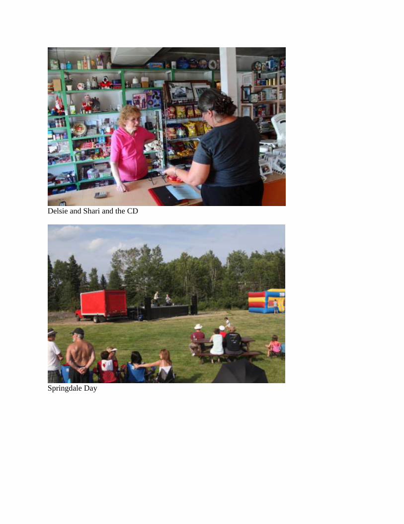
Delsie and Shari and the CD
Springdale Day
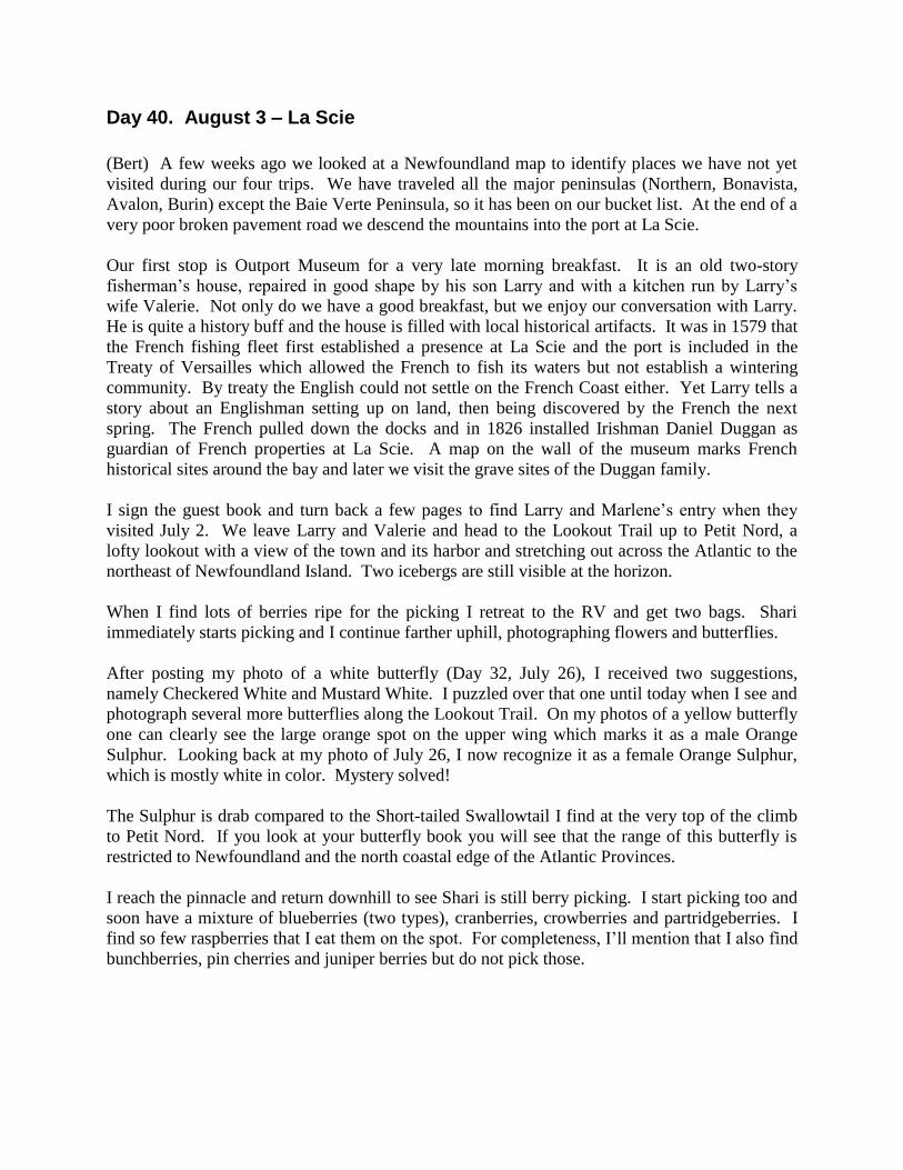
Day 40. August 3 – La Scie
(Bert) A few weeks ago we looked at a Newfoundland map to identify places we have not yet
visited during our four trips. We have traveled all the major peninsulas (Northern, Bonavista,
Avalon, Burin) except the Baie Verte Peninsula, so it has been on our bucket list. At the end of a
very poor broken pavement road we descend the mountains into the port at La Scie.
Our first stop is Outport Museum for a very late morning breakfast. It is an old two-story
fisherman’s house, repaired in good shape by his son Larry and with a kitchen run by Larry’s
wife Valerie. Not only do we have a good breakfast, but we enjoy our conversation with Larry.
He is quite a history buff and the house is filled with local historical artifacts. It was in 1579 that
the French fishing fleet first established a presence at La Scie and the port is included in the
Treaty of Versailles which allowed the French to fish its waters but not establish a wintering
community. By treaty the English could not settle on the French Coast either. Yet Larry tells a
story about an Englishman setting up on land, then being discovered by the French the next
spring. The French pulled down the docks and in 1826 installed Irishman Daniel Duggan as
guardian of French properties at La Scie. A map on the wall of the museum marks French
historical sites around the bay and later we visit the grave sites of the Duggan family.
I sign the guest book and turn back a few pages to find Larry and Marlene’s entry when they
visited July 2. We leave Larry and Valerie and head to the Lookout Trail up to Petit Nord, a
lofty lookout with a view of the town and its harbor and stretching out across the Atlantic to the
northeast of Newfoundland Island. Two icebergs are still visible at the horizon.
When I find lots of berries ripe for the picking I retreat to the RV and get two bags. Shari
immediately starts picking and I continue farther uphill, photographing flowers and butterflies.
After posting my photo of a white butterfly (Day 32, July 26), I received two suggestions,
namely Checkered White and Mustard White. I puzzled over that one until today when I see and
photograph several more butterflies along the Lookout Trail. On my photos of a yellow butterfly
one can clearly see the large orange spot on the upper wing which marks it as a male Orange
Sulphur. Looking back at my photo of July 26, I now recognize it as a female Orange Sulphur,
which is mostly white in color. Mystery solved!
The Sulphur is drab compared to the Short-tailed Swallowtail I find at the very top of the climb
to Petit Nord. If you look at your butterfly book you will see that the range of this butterfly is
restricted to Newfoundland and the north coastal edge of the Atlantic Provinces.
I reach the pinnacle and return downhill to see Shari is still berry picking. I start picking too and
soon have a mixture of blueberries (two types), cranberries, crowberries and partridgeberries. I
find so few raspberries that I eat them on the spot. For completeness, I’ll mention that I also find
bunchberries, pin cherries and juniper berries but do not pick those.

Coming down the mountain into La Scie
Map of French historical sites displayed at Outport Museum
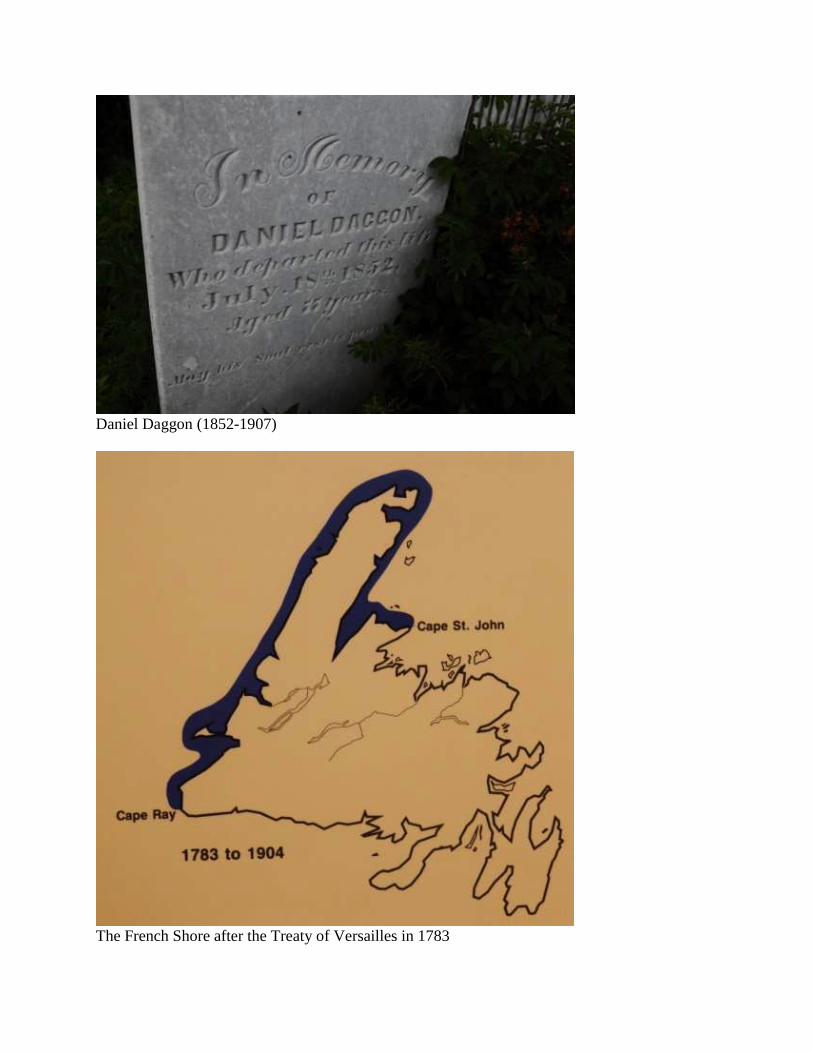
Daniel Daggon (1852-1907)
The French Shore after the Treaty of Versailles in 1783
Orange Sulphur
Short-tailed Swallowtail
A quart of berries
Day 41. August 4 – Baie Verte Peninsula
(Bert) One of our readers visited Newfoundland a long time ago and remembered how they were
often joined by locals when they ate at restaurants. Invited or not to the table, the
Newfoundlander entertained them non-stop throughout the meal with stories. In an e-mail to me,
she asks, “Is this still the case?”
Well, yes, it does happen to us also. So, that is what makes Cecil the exception.
Cecil walks up to where we have parked the RV, facing the sea. We already had a full day of
touring. We had our “five adventures” as Russell was prone to say. Although I was ready to
stop for the night more than an hour ago, Shari kept driving. We are in search of a friendly
Beluga Whale and Shari drove down mountain to the quaint outport of Burlington where it had
been seen a few days ago. She has been looking for a boondocking site. Shari asks a man at the
beach if we can camp here.
Rising a few feet above the rocky beach is a newly built wooden platform with picnic tables and
a circle of inverted wooden boxes surrounding an unlit campfire ring. Our view is of a protected
bay that could be a tranquil lake except for its brief opening to the sea a few miles across the
water. The sun is low on the horizon at our backs and the chill of early evening is accentuated
by a persistent breeze off the water. I retreat to the RV to get a jacket and when I come back
outside Cecil is still standing there.
Most Newfoundlanders are so talkative it is hard to get a word in edgewise. If I do get a chance
to ask a question, it is usually answered with another story that may or may not have anything to
do with the question. Perhaps our outsider’s accent is as hard for Newfoundlanders to
understand as we theirs. Or, maybe, we should not interrupt a story until it is all told.
Whatever the case, it does not apply to Cecil. I sit down on one of the wooden boxes and Cecil
does the same. Shari joins us. The awkwardness of prolonged silence prompts Shari and me to
ask questions. Cecil obliges with short answers. Yes, he lives in the house next to where we are
parked. Yes, he went fishing today and got his limit of cod. No, he wasn’t born here. His
birthplace was in the next harbor, Middle Arm, and he and his wife have lived here in adjacent
Burlington all their lives.
Cecil and I watch, mostly silently, as a man contemplates a lighthouse at the corner of his
property on the hill. His ladder is extended as high as the second story had the lighthouse been
an ordinary house. He stares up to the top of the ladder to the end of the horizontal boards of the
replacement siding. And, he holds another board in his hand. It is a long way up the flimsy
aluminum ladder, especially when one of your legs is stiff and cannot bend, a fact offered by
Cecil. After much staring upward, he climbs the ladder with the board and positions it in the
next available slot. Then he climbs back down to retrieve another board and again stares up the
ladder, perhaps to build up enough courage to repeat the process. Cecil and I watch silently.
The man puts up three boards and quits for the day. At this rate he will have the job down by
Christmas.
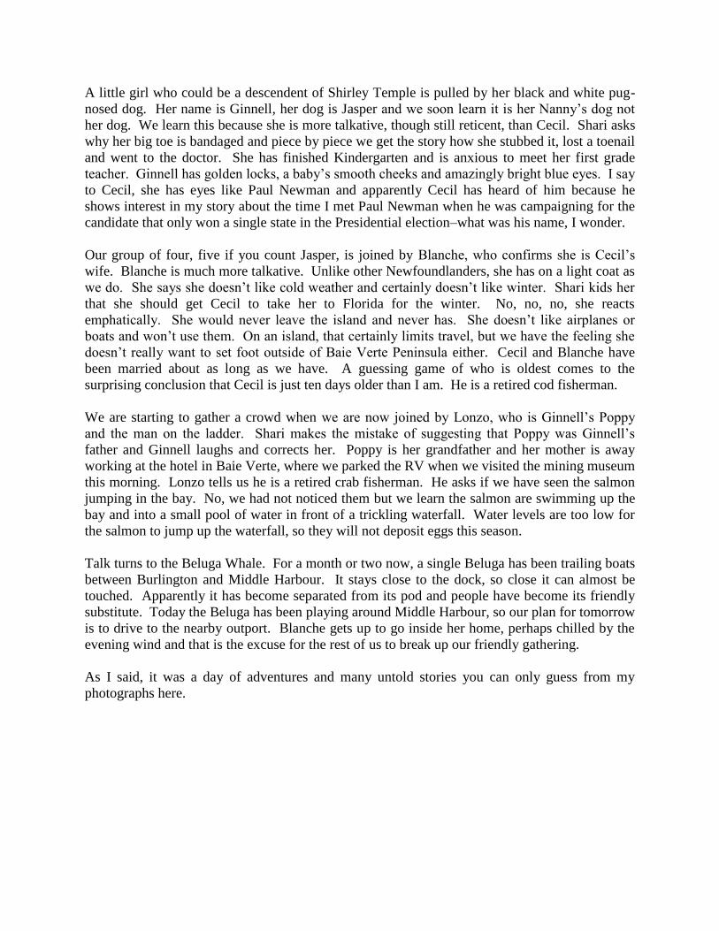
A little girl who could be a descendent of Shirley Temple is pulled by her black and white pug-
nosed dog. Her name is Ginnell, her dog is Jasper and we soon learn it is her Nanny’s dog not
her dog. We learn this because she is more talkative, though still reticent, than Cecil. Shari asks
why her big toe is bandaged and piece by piece we get the story how she stubbed it, lost a toenail
and went to the doctor. She has finished Kindergarten and is anxious to meet her first grade
teacher. Ginnell has golden locks, a baby’s smooth cheeks and amazingly bright blue eyes. I say
to Cecil, she has eyes like Paul Newman and apparently Cecil has heard of him because he
shows interest in my story about the time I met Paul Newman when he was campaigning for the
candidate that only won a single state in the Presidential election–what was his name, I wonder.
Our group of four, five if you count Jasper, is joined by Blanche, who confirms she is Cecil’s
wife. Blanche is much more talkative. Unlike other Newfoundlanders, she has on a light coat as
we do. She says she doesn’t like cold weather and certainly doesn’t like winter. Shari kids her
that she should get Cecil to take her to Florida for the winter. No, no, no, she reacts
emphatically. She would never leave the island and never has. She doesn’t like airplanes or
boats and won’t use them. On an island, that certainly limits travel, but we have the feeling she
doesn’t really want to set foot outside of Baie Verte Peninsula either. Cecil and Blanche have
been married about as long as we have. A guessing game of who is oldest comes to the
surprising conclusion that Cecil is just ten days older than I am. He is a retired cod fisherman.
We are starting to gather a crowd when we are now joined by Lonzo, who is Ginnell’s Poppy
and the man on the ladder. Shari makes the mistake of suggesting that Poppy was Ginnell’s
father and Ginnell laughs and corrects her. Poppy is her grandfather and her mother is away
working at the hotel in Baie Verte, where we parked the RV when we visited the mining museum
this morning. Lonzo tells us he is a retired crab fisherman. He asks if we have seen the salmon
jumping in the bay. No, we had not noticed them but we learn the salmon are swimming up the
bay and into a small pool of water in front of a trickling waterfall. Water levels are too low for
the salmon to jump up the waterfall, so they will not deposit eggs this season.
Talk turns to the Beluga Whale. For a month or two now, a single Beluga has been trailing boats
between Burlington and Middle Harbour. It stays close to the dock, so close it can almost be
touched. Apparently it has become separated from its pod and people have become its friendly
substitute. Today the Beluga has been playing around Middle Harbour, so our plan for tomorrow
is to drive to the nearby outport. Blanche gets up to go inside her home, perhaps chilled by the
evening wind and that is the excuse for the rest of us to break up our friendly gathering.
As I said, it was a day of adventures and many untold stories you can only guess from my
photographs here.
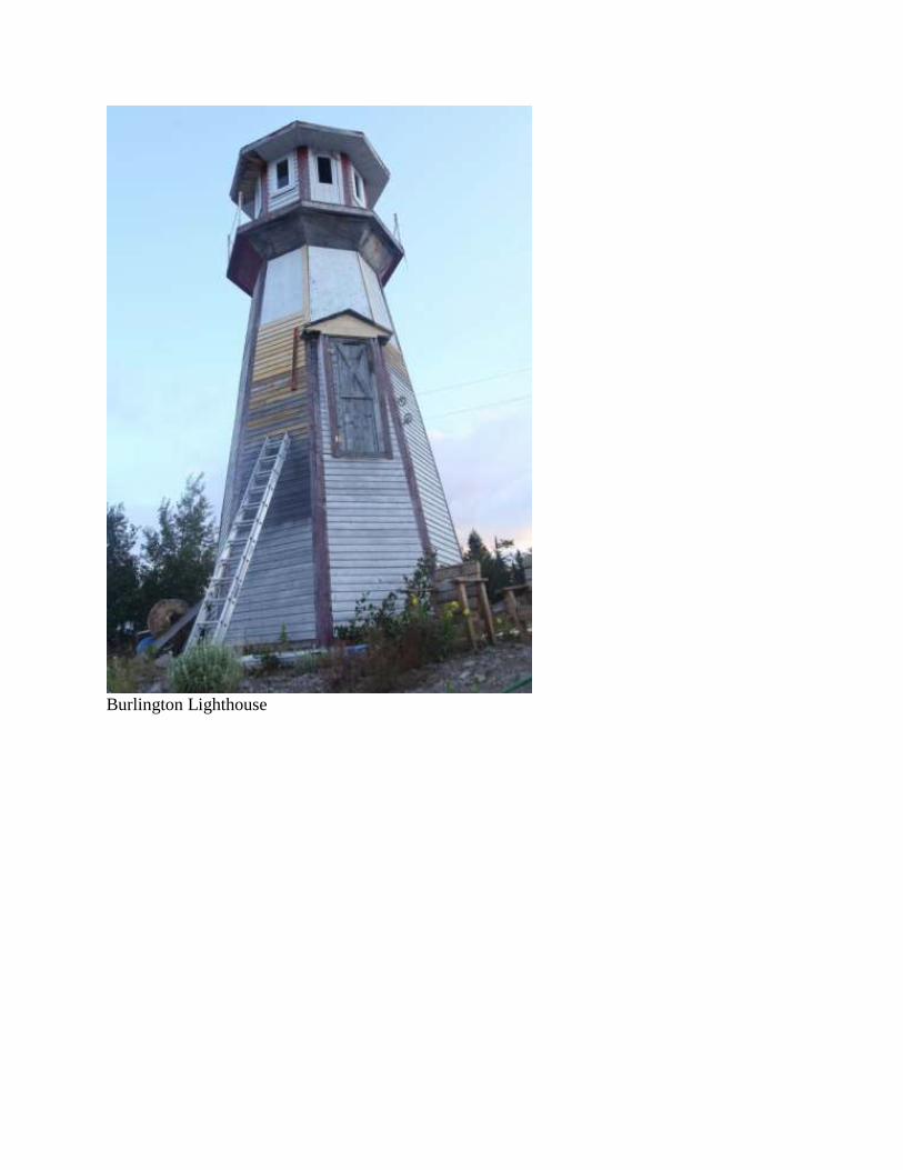
Burlington Lighthouse
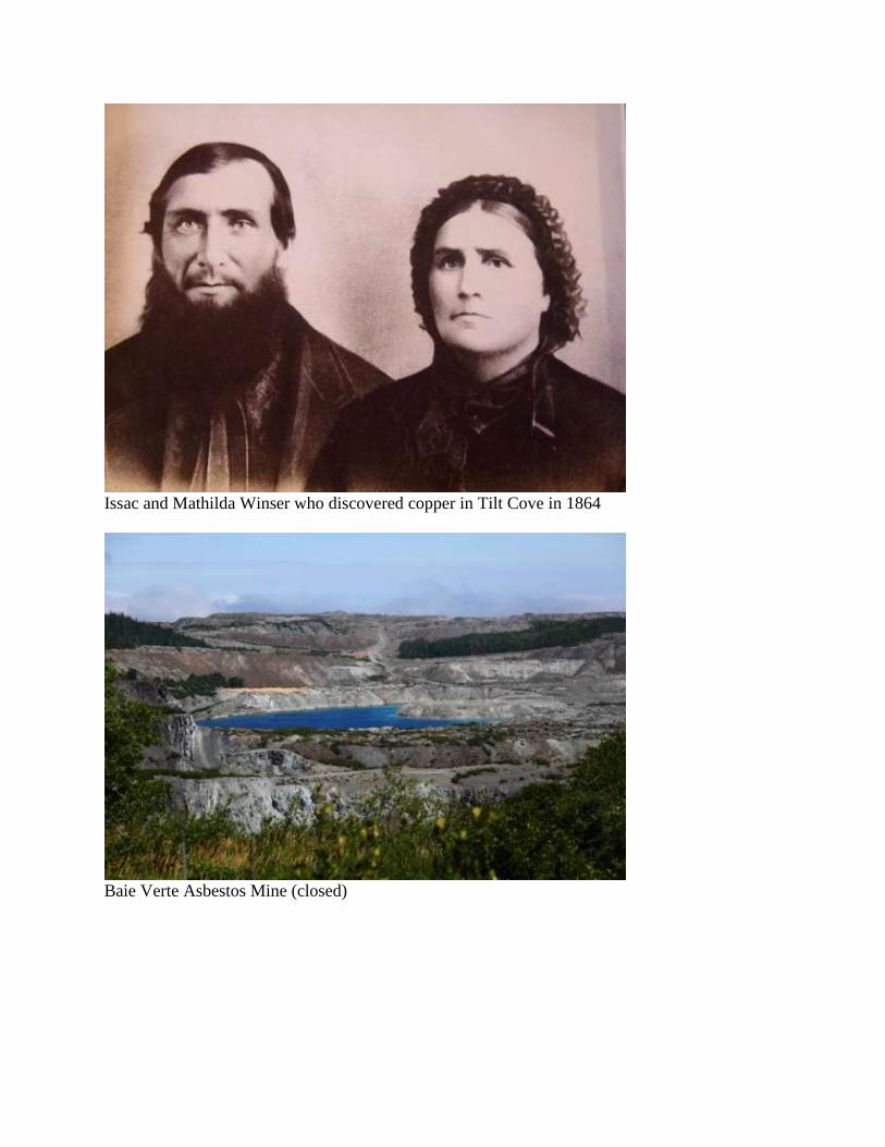
Issac and Mathilda Winser who discovered copper in Tilt Cove in 1864
Baie Verte Asbestos Mine (closed)
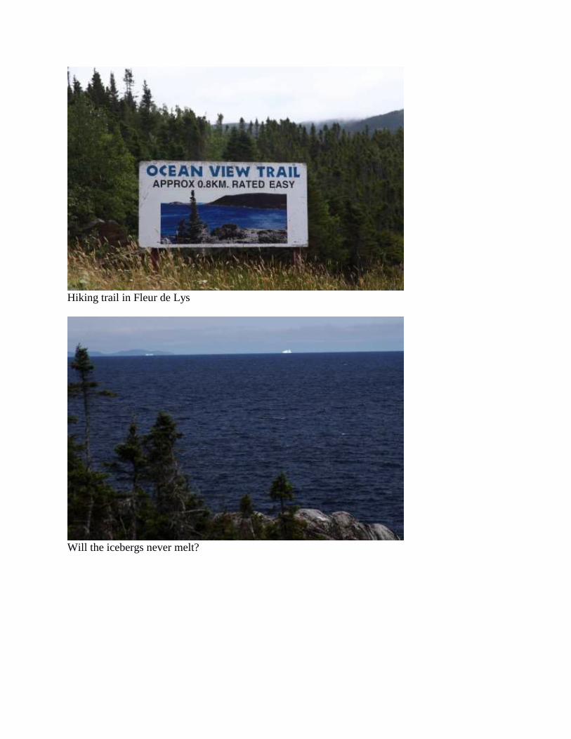
Hiking trail in Fleur de Lys
Will the icebergs never melt?
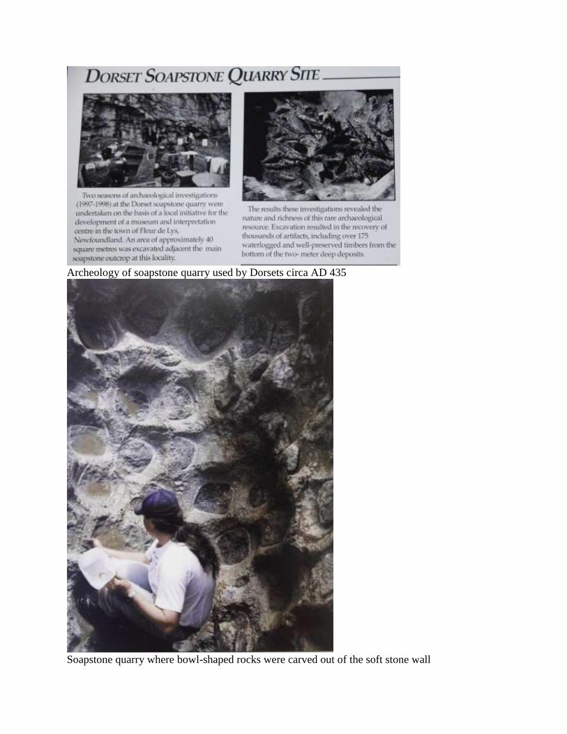
Archeology of soapstone quarry used by Dorsets circa AD 435
Soapstone quarry where bowl-shaped rocks were carved out of the soft stone wall
Day 42. August 5 – Burlington to Corner Brook
(Bert) We are late in rising this morning and I am sitting on an overturned box, same spot as last
night, when Cecil comes up and sits beside me, silent as usual. Another man walks up about the
same time that Shari exits the RV. He tells us his name, but I forgot and wish I could remember
it. I’ll call him Billy to keep the names straight for this story. Billy has two fresh cod fillets for
us, nicely cleaned and caught by him last night. Billy lives in the house overlooking the small
pool where the waterfalls cannot be jumped by the salmon and he takes us there to see his
backyard, picturesque enough for a magazine cover photo. The salmon are jumping, fully
clearing the surface, but not the falls. Billy is caretaker for some cabins and he offers to take us
to see one of Shaun’s luxury cabins. I don’t know Shaun and I don’t know what cabins he is
talking about, but I am game anyway. So after visiting with Billy’s wife, who comes from
England but has adopted a Newfoundlander’s accent, we head out in his car.
A hundred feet down the gravel street he asks, “Have you seen the museum?”
“No”, I say, not knowing we were camped next to a museum. Turns out it is not what most
people would call a museum, but Lonzo’s made-over garage. Inside we see artifacts from four
generations of Newfoundlanders and in unbelievable quantities. Not only does he have one
wood plane used for trimming boats during construction, but he has dozens. This is definitely
Lonzo’s man-cave and he must spend hours poring over his amazing collection of “stuff.”
On the bumpy gravel streets of Burlington again, we soon come to a wooded patch where we
will find Shaun. I ask the last name of Shaun and am told Majumder and that he is a well-known
comedian. That still does not ring a bell for Shari or me. Down a recently hacked trail through
dense spruce and fir we soon reach the coast and a chalet under construction. Shaun gracefully
greets us and excitedly shows us the accommodations he is building. Downstairs is a sitting area
and bath; upstairs in the loft is the bedroom. The front will be glassed with a view of the bay. It
will be delightful when it is finished–very private with a beautiful view.
Shari asks Shaun if he has been in any U.S. shows and Shaun offers Unhitched, The Firm and
Detroit 1-8-7. Not being avid TV watchers or moviegoers, we still draw a blank. Shari says,
“Sorry.” Shaun replies, “No problem,” and continues with the tour. Before we leave he
suggests we look up the project on http://www.omesweetome.com/. Later I find out that website
works as does Googling “Shaun Majumder” and you will get lots of hits. He is famous in
Canada, though we did not know it at the time.
Overlooking Green Bay from Burlington, where we camped for the night
Lonzo’s Museum
Shawn pointing to the loft in his ‘ome-lux accommodations
Shaun Majumder
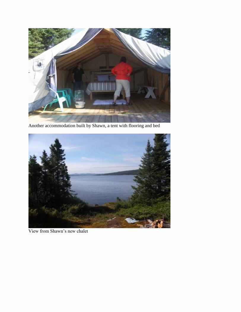
Another accommodation built by Shawn, a tent with flooring and bed
View from Shawn’s new chalet
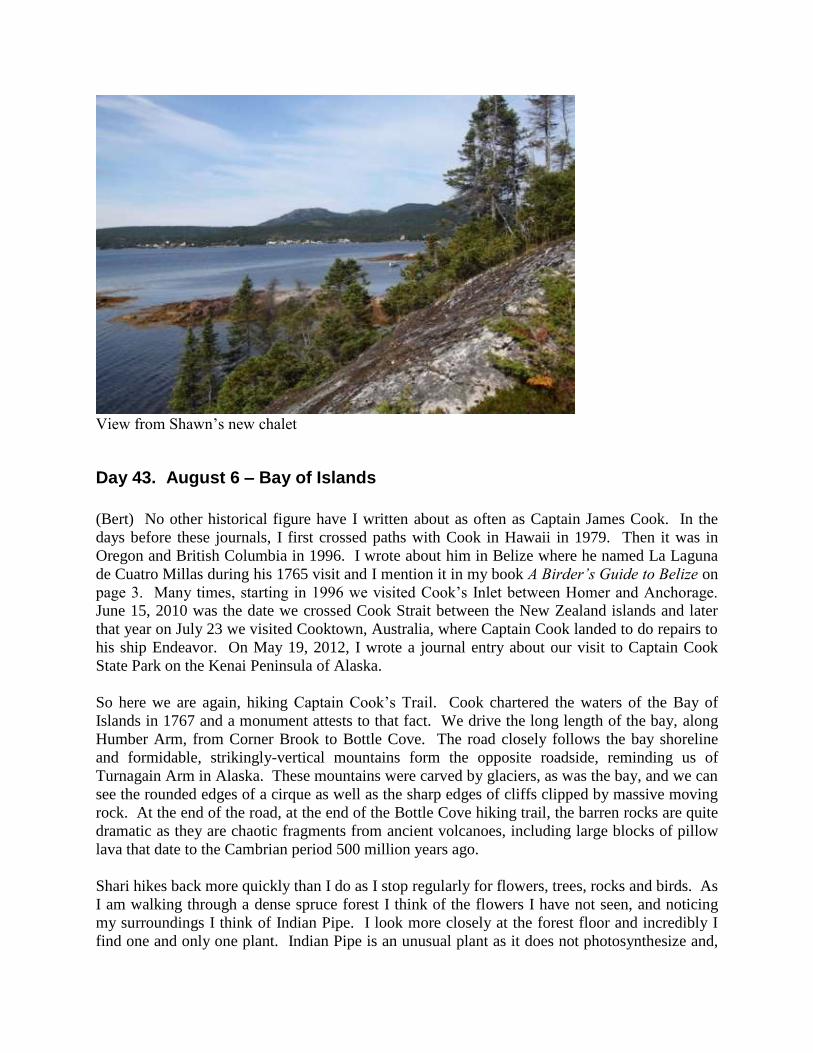
View from Shawn’s new chalet
Day 43. August 6 – Bay of Islands
(Bert) No other historical figure have I written about as often as Captain James Cook. In the
days before these journals, I first crossed paths with Cook in Hawaii in 1979. Then it was in
Oregon and British Columbia in 1996. I wrote about him in Belize where he named La Laguna
de Cuatro Millas during his 1765 visit and I mention it in my book A Birder’s Guide to Belize on
page 3. Many times, starting in 1996 we visited Cook’s Inlet between Homer and Anchorage.
June 15, 2010 was the date we crossed Cook Strait between the New Zealand islands and later
that year on July 23 we visited Cooktown, Australia, where Captain Cook landed to do repairs to
his ship Endeavor. On May 19, 2012, I wrote a journal entry about our visit to Captain Cook
State Park on the Kenai Peninsula of Alaska.
So here we are again, hiking Captain Cook’s Trail. Cook chartered the waters of the Bay of
Islands in 1767 and a monument attests to that fact. We drive the long length of the bay, along
Humber Arm, from Corner Brook to Bottle Cove. The road closely follows the bay shoreline
and formidable, strikingly-vertical mountains form the opposite roadside, reminding us of
Turnagain Arm in Alaska. These mountains were carved by glaciers, as was the bay, and we can
see the rounded edges of a cirque as well as the sharp edges of cliffs clipped by massive moving
rock. At the end of the road, at the end of the Bottle Cove hiking trail, the barren rocks are quite
dramatic as they are chaotic fragments from ancient volcanoes, including large blocks of pillow
lava that date to the Cambrian period 500 million years ago.
Shari hikes back more quickly than I do as I stop regularly for flowers, trees, rocks and birds. As
I am walking through a dense spruce forest I think of the flowers I have not seen, and noticing
my surroundings I think of Indian Pipe. I look more closely at the forest floor and incredibly I
find one and only one plant. Indian Pipe is an unusual plant as it does not photosynthesize and,
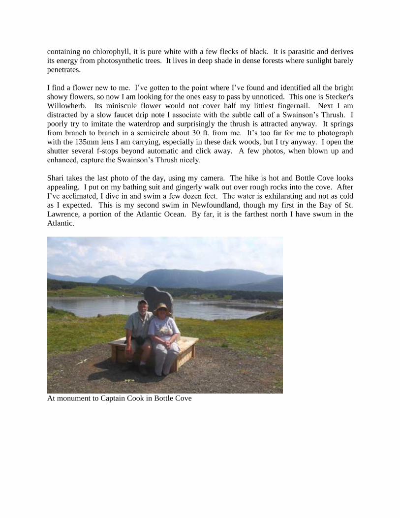
containing no chlorophyll, it is pure white with a few flecks of black. It is parasitic and derives
its energy from photosynthetic trees. It lives in deep shade in dense forests where sunlight barely
penetrates.
I find a flower new to me. I’ve gotten to the point where I’ve found and identified all the bright
showy flowers, so now I am looking for the ones easy to pass by unnoticed. This one is Stecker's
Willowherb. Its miniscule flower would not cover half my littlest fingernail. Next I am
distracted by a slow faucet drip note I associate with the subtle call of a Swainson’s Thrush. I
poorly try to imitate the waterdrop and surprisingly the thrush is attracted anyway. It springs
from branch to branch in a semicircle about 30 ft. from me. It’s too far for me to photograph
with the 135mm lens I am carrying, especially in these dark woods, but I try anyway. I open the
shutter several f-stops beyond automatic and click away. A few photos, when blown up and
enhanced, capture the Swainson’s Thrush nicely.
Shari takes the last photo of the day, using my camera. The hike is hot and Bottle Cove looks
appealing. I put on my bathing suit and gingerly walk out over rough rocks into the cove. After
I’ve acclimated, I dive in and swim a few dozen feet. The water is exhilarating and not as cold
as I expected. This is my second swim in Newfoundland, though my first in the Bay of St.
Lawrence, a portion of the Atlantic Ocean. By far, it is the farthest north I have swum in the
Atlantic.
At monument to Captain Cook in Bottle Cove
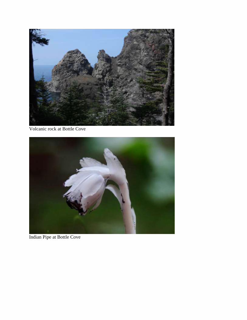
Volcanic rock at Bottle Cove
Indian Pipe at Bottle Cove
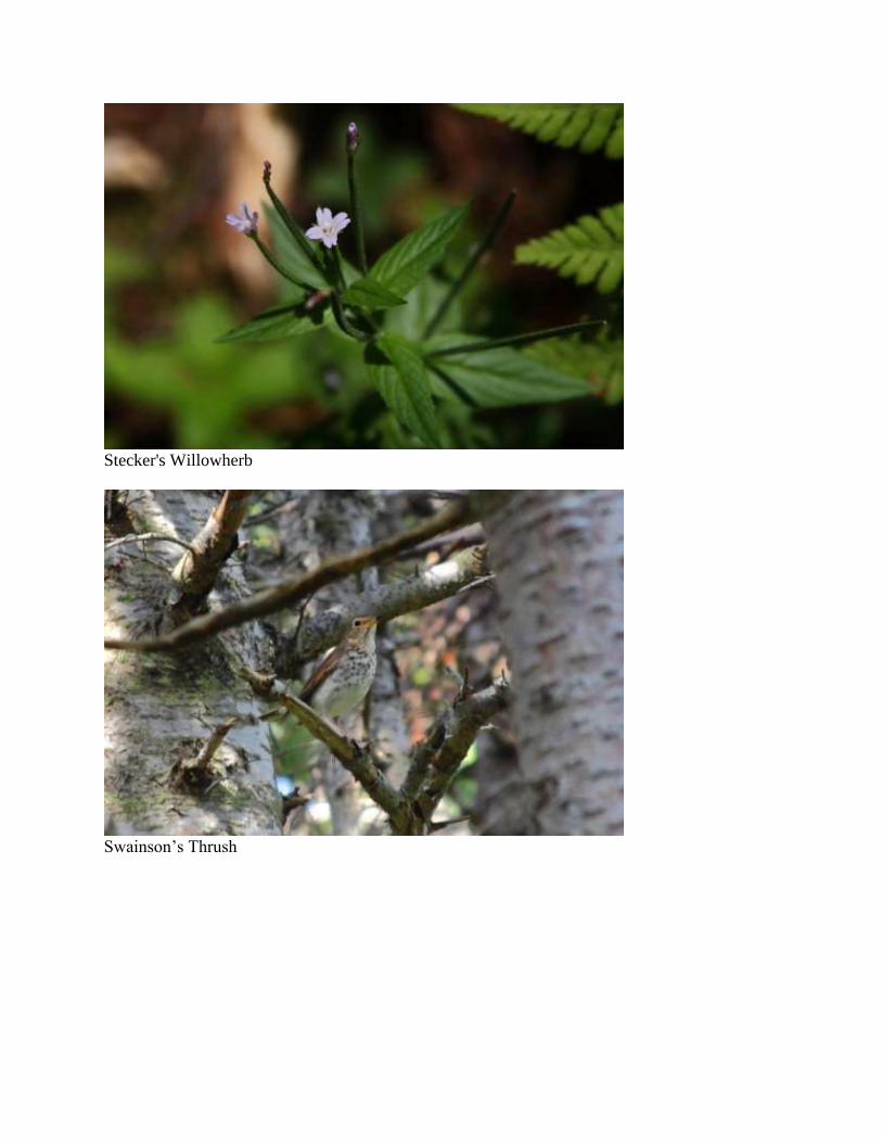
Stecker's Willowherb
Swainson’s Thrush
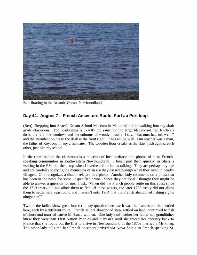
Bert floating in the Atlantic Ocean, Newfoundland
Day 44. August 7 – French Ancestors Route, Port au Port loop
(Bert) Stepping into Sister's Dream School Museum in Mainland is like walking into my sixth
grade classroom. The positioning is exactly the same for the large blackboard, the teacher’s
desk, the left side windows and the columns of wooden desks. I say, “But ours had ink wells”
and the attendant points to the desk at the front right. It has an ink well. Our teacher was a man,
the father of Roy, one of my classmates. The wooden floor creaks as the slats push against each
other, just like my school.
In the room behind the classroom is a museum of local artifacts and photos of these French-
speaking communities in southwestern Newfoundland. I brush past them quickly, as Shari is
waiting in the RV, but then stop when I overhear four ladies talking. They are perhaps my age
and are carefully studying the mementos of an era they passed through when they lived in nearby
villages. One recognizes a distant relative in a photo. Another lady comments on a priest that
has been in the news for some unspecified crime. Since they are local I thought they might be
able to answer a question for me. I ask, “When did the French people settle on this coast since
the 1713 treaty did not allow them to fish off these waters, the later 1783 treaty did not allow
them to settle here year round and it wasn’t until 1904 that the French abandoned fishing rights
altogether?”
Two of the ladies show great interest in my question because it was their ancestors that settled
here, each by a different route. French sailors abandoned ship, settled on land, continued to fish
offshore and married native Mi’kmaq women. One lady said neither her father nor grandfather
knew they were part First Nation Peoples and it wasn’t until she traced her ancestry back to
France that she found out the first to arrive in Newfoundland in the 1870s married a Mi’kmaq.
The other lady tells me her French ancestors arrived via Nova Scotia to French-speaking St.
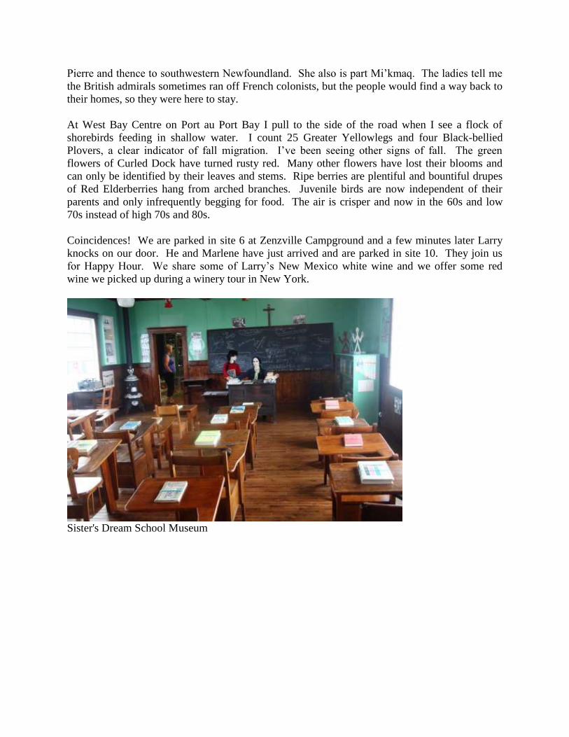
Pierre and thence to southwestern Newfoundland. She also is part Mi’kmaq. The ladies tell me
the British admirals sometimes ran off French colonists, but the people would find a way back to
their homes, so they were here to stay.
At West Bay Centre on Port au Port Bay I pull to the side of the road when I see a flock of
shorebirds feeding in shallow water. I count 25 Greater Yellowlegs and four Black-bellied
Plovers, a clear indicator of fall migration. I’ve been seeing other signs of fall. The green
flowers of Curled Dock have turned rusty red. Many other flowers have lost their blooms and
can only be identified by their leaves and stems. Ripe berries are plentiful and bountiful drupes
of Red Elderberries hang from arched branches. Juvenile birds are now independent of their
parents and only infrequently begging for food. The air is crisper and now in the 60s and low
70s instead of high 70s and 80s.
Coincidences! We are parked in site 6 at Zenzville Campground and a few minutes later Larry
knocks on our door. He and Marlene have just arrived and are parked in site 10. They join us
for Happy Hour. We share some of Larry’s New Mexico white wine and we offer some red
wine we picked up during a winery tour in New York.
Sister's Dream School Museum

Shorebirds at Port au Port Bay
Curled Dock
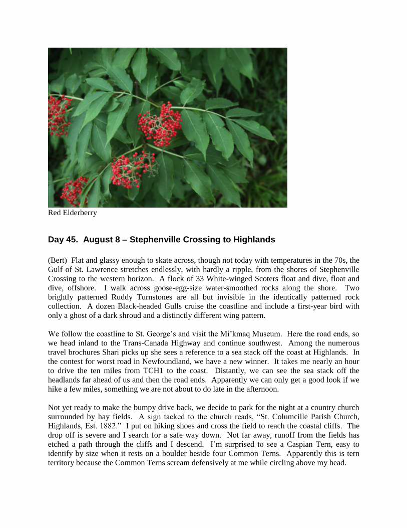
Red Elderberry
Day 45. August 8 – Stephenville Crossing to Highlands
(Bert) Flat and glassy enough to skate across, though not today with temperatures in the 70s, the
Gulf of St. Lawrence stretches endlessly, with hardly a ripple, from the shores of Stephenville
Crossing to the western horizon. A flock of 33 White-winged Scoters float and dive, float and
dive, offshore. I walk across goose-egg-size water-smoothed rocks along the shore. Two
brightly patterned Ruddy Turnstones are all but invisible in the identically patterned rock
collection. A dozen Black-headed Gulls cruise the coastline and include a first-year bird with
only a ghost of a dark shroud and a distinctly different wing pattern.
We follow the coastline to St. George’s and visit the Mi’kmaq Museum. Here the road ends, so
we head inland to the Trans-Canada Highway and continue southwest. Among the numerous
travel brochures Shari picks up she sees a reference to a sea stack off the coast at Highlands. In
the contest for worst road in Newfoundland, we have a new winner. It takes me nearly an hour
to drive the ten miles from TCH1 to the coast. Distantly, we can see the sea stack off the
headlands far ahead of us and then the road ends. Apparently we can only get a good look if we
hike a few miles, something we are not about to do late in the afternoon.
Not yet ready to make the bumpy drive back, we decide to park for the night at a country church
surrounded by hay fields. A sign tacked to the church reads, “St. Columcille Parish Church,
Highlands, Est. 1882.” I put on hiking shoes and cross the field to reach the coastal cliffs. The
drop off is severe and I search for a safe way down. Not far away, runoff from the fields has
etched a path through the cliffs and I descend. I’m surprised to see a Caspian Tern, easy to
identify by size when it rests on a boulder beside four Common Terns. Apparently this is tern
territory because the Common Terns scream defensively at me while circling above my head.

On the way back I pass through the church cemetery. Gravestones can be a fascinating history,
though often telling only a fragment of a story that leaves the reader wanting for details. In the
remote corner closest to the sea is a simple white tabular stone engraved on three sides. On the
first is etched, “In loving memory of John, beloved son of Elizabeth Quilty, died April 7th 1916,
aged 22 years 8 months.” So young to have died, but then again I’ve seen countless other
tombstones in Newfoundland of people dying under the age of 30. Tuberculosis was rampant
and many others died from boating disasters.
I turn to the front side of the tombstone. It is in memory of 49-year-old William, husband of
Elizabeth who died the next year in June. The story worsens when I turn to the third side:
“William, beloved son of Elizabeth Quilty, who was killed at Port-au-Port Nov 6th 1917, aged
20 years 8 months.” The story is suspended with a dozen questions: Why killed? How? Less
than 5 mo. after the death of his namesake father! What happened to Elizabeth? I search the
other gravestones for clues. Elizabeth is not among them.
Black-headed Gull
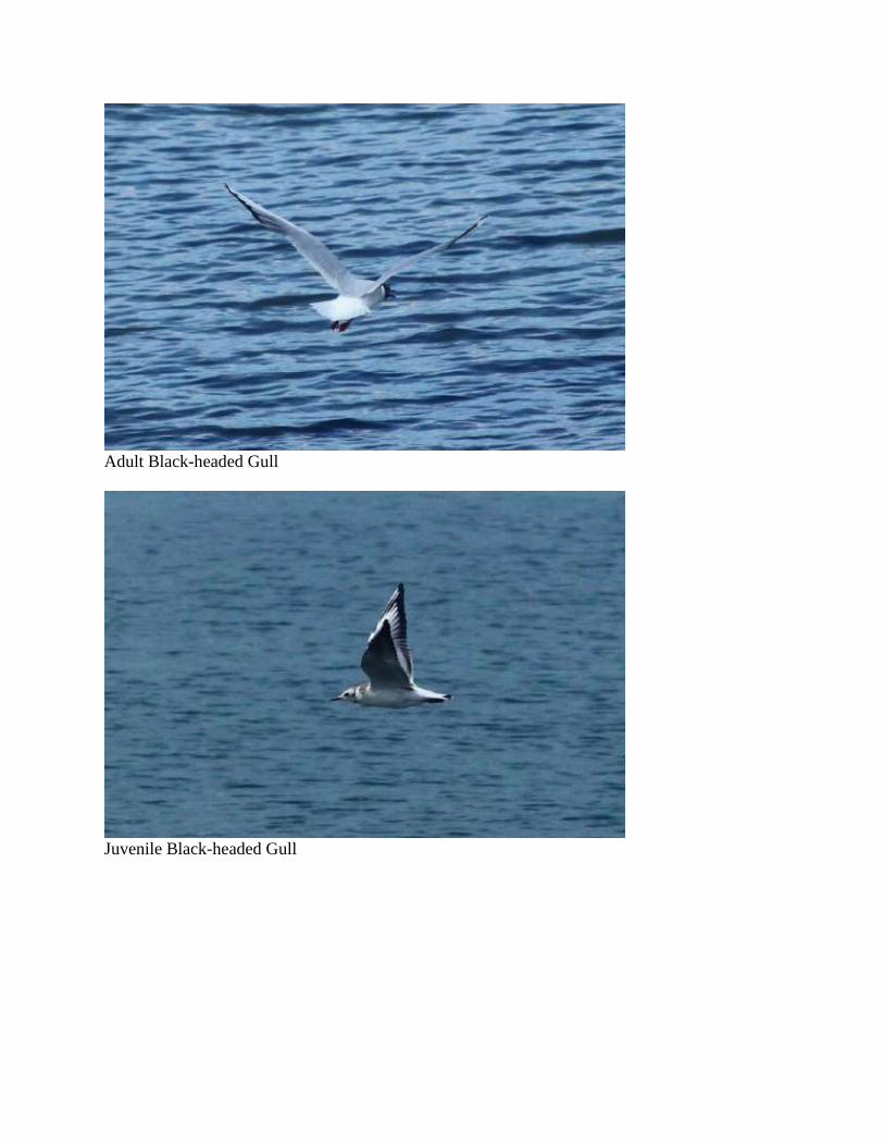
Adult Black-headed Gull
Juvenile Black-headed Gull
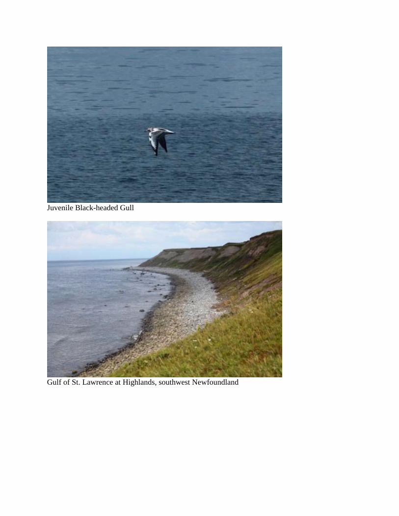
Juvenile Black-headed Gull
Gulf of St. Lawrence at Highlands, southwest Newfoundland

What happened to Elizabeth?
Day 46. August 9 – Codroy Valley
(Bert) Codroy Valley has the greatest concentration of bird diversity in Newfoundland. Its
sundry habitats of seacoast, lakes, wetlands, agricultural fields and woodlands, combined with
long mild summers must be part of the reason. It is also the closest point between the island and
Nova Scotia. Shari’s interest is in finding museum-type sightseeing spots, fresh lobster for sale
and a restaurant for lunch. I am more interested in finding new birding sites and revisiting ones
I’ve liked before. I score high with 36 species, a good half-day total for Newfoundland. This
includes a Common Grackle, not an exciting bird, but one not often seen in Newfoundland and
only my fourth in four years. Also noteworthy is the increased numbers of migrant shorebirds:
30+ Greater Yellowlegs, 17 Black-bellied Plovers, and 32 Semipalmated Plovers.
Shari finds two museums, one of little interest and one worth taking a caravan group. Lobster
catching season is over, so she buys frozen lobster pieces at the dock warehouse. The restaurant
is closed for a wedding dinner. Maybe we will try it tomorrow.
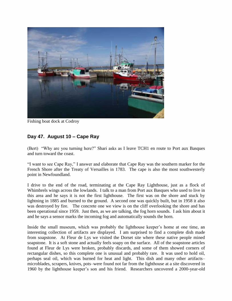
Fishing boat dock at Codroy
Day 47. August 10 – Cape Ray
(Bert) “Why are you turning here?” Shari asks as I leave TCH1 en route to Port aux Basques
and turn toward the coast.
“I want to see Cape Ray,” I answer and elaborate that Cape Ray was the southern marker for the
French Shore after the Treaty of Versailles in 1783. The cape is also the most southwesterly
point in Newfoundland.
I drive to the end of the road, terminating at the Cape Ray Lighthouse, just as a flock of
Whimbrels wings across the lowlands. I talk to a man from Port aux Basques who used to live in
this area and he says it is not the first lighthouse. The first was on the shore and stuck by
lightning in 1885 and burned to the ground. A second one was quickly built, but in 1958 it also
was destroyed by fire. The concrete one we view is on the cliff overlooking the shore and has
been operational since 1959. Just then, as we are talking, the fog horn sounds. I ask him about it
and he says a sensor marks the incoming fog and automatically sounds the horn.
Inside the small museum, which was probably the lighthouse keeper’s home at one time, an
interesting collection of artifacts are displayed. I am surprised to find a complete dish made
from soapstone. At Fleur de Lys we visited the Dorset site where these native people mined
soapstone. It is a soft stone and actually feels soapy on the surface. All of the soapstone articles
found at Fleur de Lys were broken, probably discards, and some of them showed corners of
rectangular dishes, so this complete one is unusual and probably rare. It was used to hold oil,
perhaps seal oil, which was burned for heat and light. This dish and many other artifacts–
microblades, scrapers, knives, pots–were found not far from the lighthouse at a site discovered in
1960 by the lighthouse keeper’s son and his friend. Researchers uncovered a 2000-year-old

Dorset village. It was a seasonal camp, a few months each spring, set up to coincide with Harp
Seal migration from Greenland into the Gulf of St. Lawrence. Sometime about 500 years ago,
all subsequent evidence of Dorset people disappeared, the last residing in northern Labrador.
Like earlier tribes of Paleoeskimos, archeologists do not know what caused their disappearance.
In the case of the Dorsets, their disappearance from Cape Ray coincides with climatic change
1200 years ago. At the peak of global warming, the poor ice conditions around Cape Ray
probably prohibited capture of seals and the Dorsets, being dependent on the sea for food, moved
northward.
Cape Ray Lighthouse

Dorset dish used to hold oil
Day 48. August 11 – Gulf of St. Lawrence
(Bert) The Port aux Basques ferry leaves at noon under gray skies and on a gray sea of
corrugated ripples without a whitecap in sight. Patches of blue paint the horizon to the west,
luring us in that direction. Smooth sailing you might say, except we aren’t moving by sails as
did the Vikings and other Europeans, but rather by huge diesel engines on a modern ferry loaded
with a hundred vehicles on three decks and hundreds of people meandering the sixth to tenth
levels, topped by a helicopter pad open to the salt air above. I few gulls and gannets are our send
off and then it is only an endless horizon spanning the Gulf of St. Lawrence. I retreat to where
Shari is sitting at the bow of the ship behind a large, freshly cleaned, glass window with a clear
view of the sea. A pod of White-sided Dolphins plays in front of the ship at a distance that one
would expect risky, but their agility converts danger to fun.
Aboard ship I am reading Keneva Kunz’s translation of The Vinland Sagas and the stories
transport me back in time. Earlier in this journal I mentioned the Norsemen–the Vikings–that set
up camp in L’Anse aux Meadows. Newfoundland road signs promote it as Vinland. But was it
really Leif Erickson’s Vinland? As our ferry carries us across the Gulf of St. Lawrence, so also
the ocean-going knorrs of the Vikings carried them much beyond L’Anse aux Meadows. The
Saga of the Greenlanders and Eirik the Red’s Saga were written early in the 14th
century, based
on texts written early in the 13th
century, which in turn were based on oral stories passed down
for more than two centuries. Once thought of as unreliable fantasies, the sagas now are
understood to contain factual material about the voyages, discoveries and settlements of
Norsemen a thousand years ago.
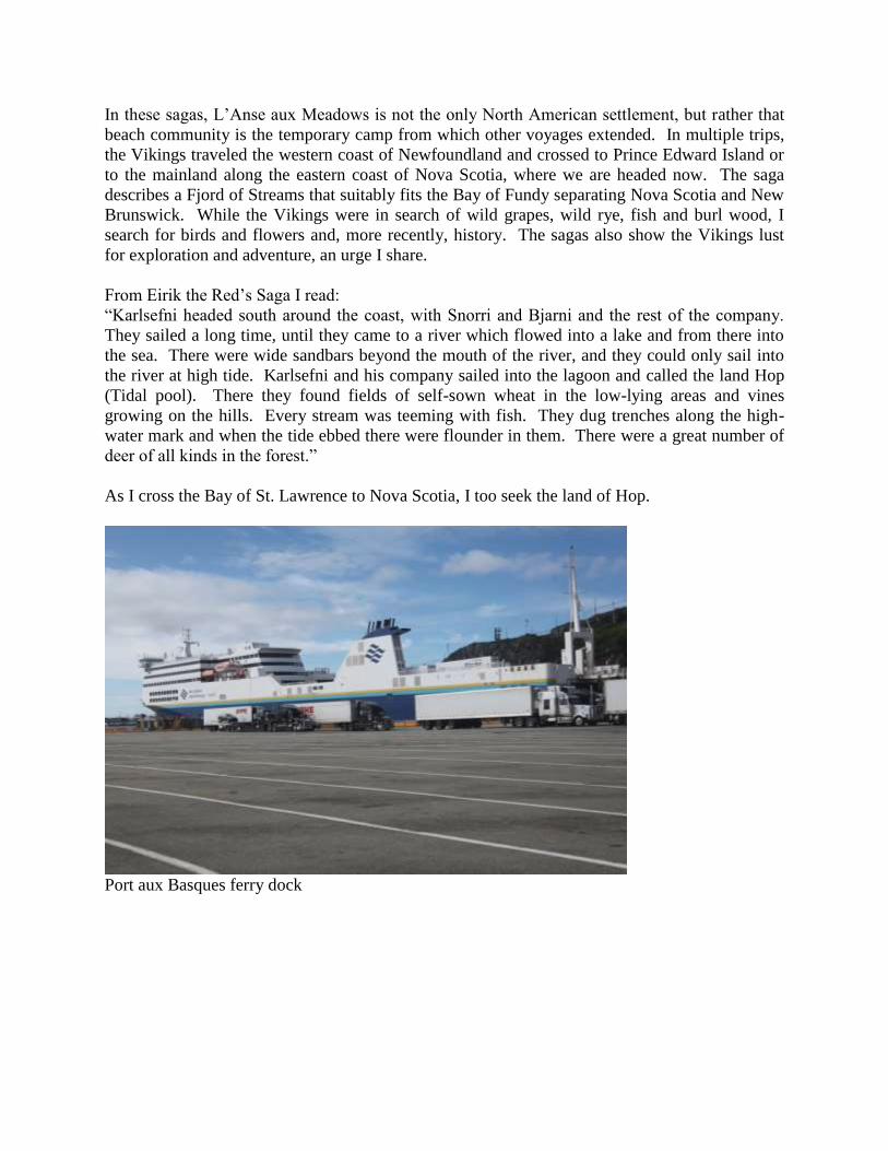
In these sagas, L’Anse aux Meadows is not the only North American settlement, but rather that
beach community is the temporary camp from which other voyages extended. In multiple trips,
the Vikings traveled the western coast of Newfoundland and crossed to Prince Edward Island or
to the mainland along the eastern coast of Nova Scotia, where we are headed now. The saga
describes a Fjord of Streams that suitably fits the Bay of Fundy separating Nova Scotia and New
Brunswick. While the Vikings were in search of wild grapes, wild rye, fish and burl wood, I
search for birds and flowers and, more recently, history. The sagas also show the Vikings lust
for exploration and adventure, an urge I share.
From Eirik the Red’s Saga I read:
“Karlsefni headed south around the coast, with Snorri and Bjarni and the rest of the company.
They sailed a long time, until they came to a river which flowed into a lake and from there into
the sea. There were wide sandbars beyond the mouth of the river, and they could only sail into
the river at high tide. Karlsefni and his company sailed into the lagoon and called the land Hop
(Tidal pool). There they found fields of self-sown wheat in the low-lying areas and vines
growing on the hills. Every stream was teeming with fish. They dug trenches along the high-
water mark and when the tide ebbed there were flounder in them. There were a great number of
deer of all kinds in the forest.”
As I cross the Bay of St. Lawrence to Nova Scotia, I too seek the land of Hop.
Port aux Basques ferry dock
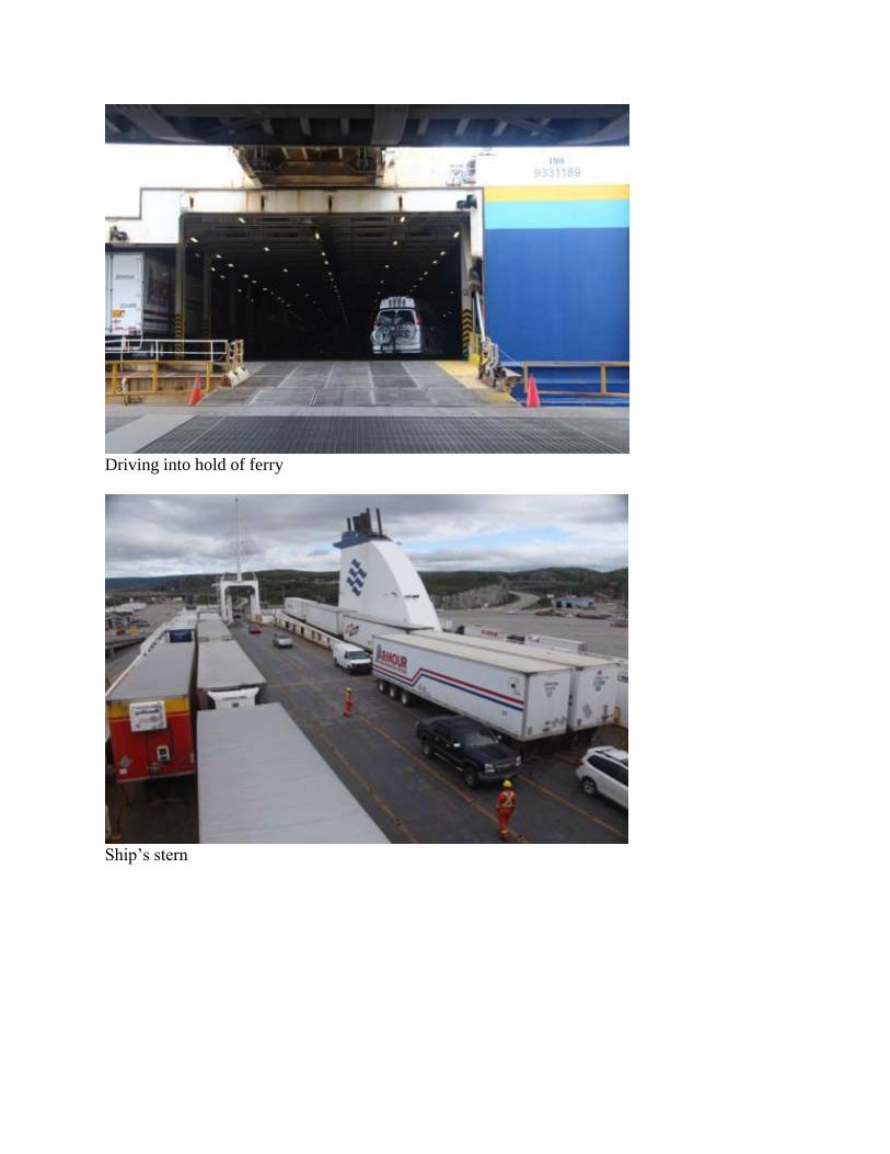
Driving into hold of ferry
Ship’s stern
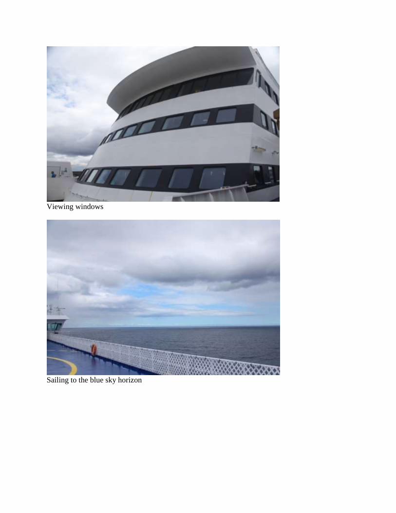
Viewing windows
Sailing to the blue sky horizon
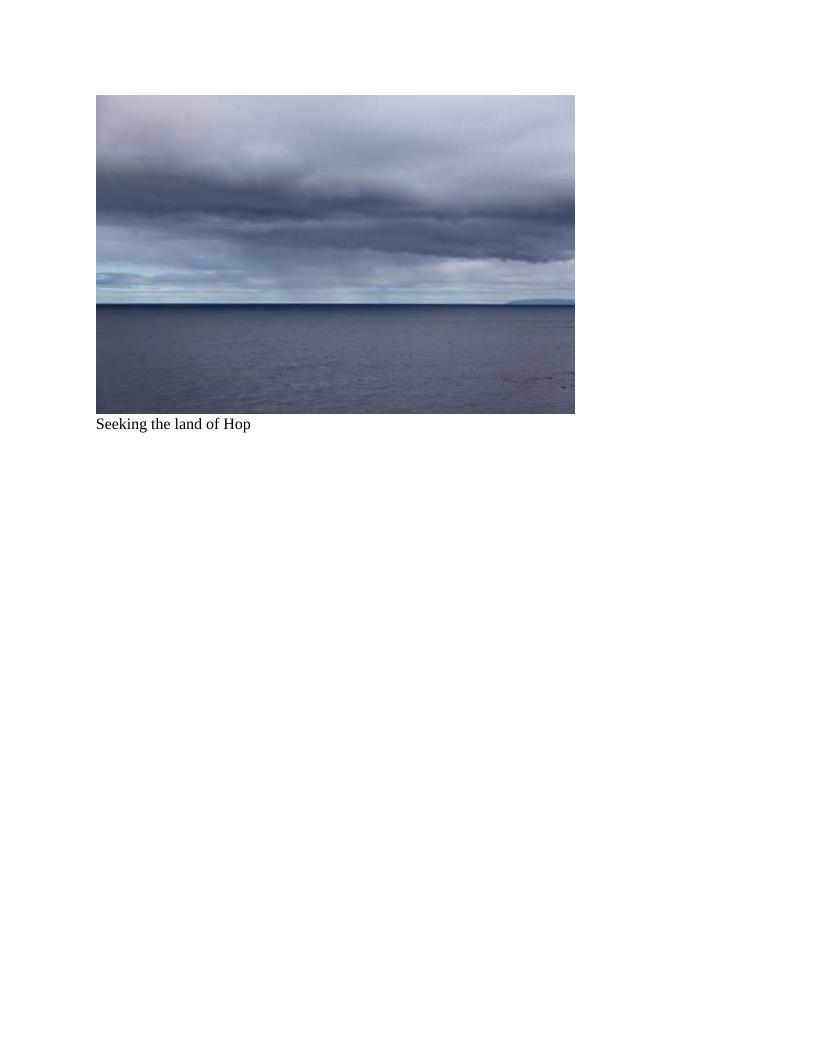
Seeking the land of Hop