new jersey department of environmental protection hpo … · the building is present again 1891 (e....
TRANSCRIPT

New Jersey Department of Environmental Protection Hurricane Sandy
Community Development Block Grant Form – 2 : Assessment of Effects (Version 1.0)
HPO USE ONLY
Architecture Reviewer Andrea Burk Archaeology Reviewer Brock Giordano Date Reviewed March 13, 2014
Required Documentation: Historic Properties Map Soils Map USGS Quad Property Photos V1.0 9/26/13 Page 1 of 2
NEP0233 NEP0233 Applicant Name: 127 Valley Road Condominium Development Street Address: 127 Valley Road Municipality: Township of Montclair County: Essex PAMS PIN: 0713_1509_40 Latitude: 40.821586 Longitude: -74.219142 Undertaking: Rehabilitation: Interior Exterior Both Elevation Reconstruction: Within Existing Footprint, plus 2 feet Outside Existing Footprint Property Description:
The property contains a one-story building that is occupied by multiple retail businesses. A paved parking area and two one-story garage/storage buildings are located behind the building. The building has a brick façade with stucco and half-timbering details. It has a side-gabled roof with front-gabled pediments, clad with asphalt shingles. Brick parapets correspond to the division of retail space within the building. No construction date was provided by the applicant however, according to the county tax board website, the building was constructed in 1925. The area immediately surrounding the building is primarily residential, developed with late 19th to early 20th century dwellings.
Current Property Status National Historic Landmark? Yes No National Register of Historic Places Listed? Yes No
Within a National Register of Historic Places Historic District? Yes No Contributing Non-Contributing Does the property have a SHPO Opinion or COE? Yes No Within a Known Archaeological Site? Yes No Within an Area of High Archaeological Sensitivity? Area of Previous Historic Occupation
Property Located within HPO’s Archaeological Site Sensitivity Grid Area Located on Well-Drained Soils located within 500 feet of waterways, wetland complexes, or relict glacial features.
Preliminary Property Evaluation
Further Survey Necessary: Archaeological Historic Architecture No Further Survey Necessary Recommend Eligible: Individual Contributing to:
Criteria: [Check All That Apply] A B C D Reasoning: The property currently contains a one-story building with vacant land in the rear of the property. Proposed plans indicate the
rear vacant lot will be subdivided and redeveloped into three residential duplexes resulting in substantial ground disturbance. Review of the historic maps indicates a dwelling was located in the current location of the retail building as early as 1880 (E. Robinson 1880). The building is present again 1891 (E. Robinson) and 1907 (Sanborn 1907). In 1891 an auxiliary building appears in the rear portion of the lot adjacent to Day Street. Similarly, by 1891 a dwelling (still present) is located fronting Talbot Street adjacent to the present day subject property. As a result of the documented historic occupation surrounding the area, archaeological sensitivity for historic-period archeological resources is considered moderate to high. Since proposed ground disturbance will impact these areas, archaeological testing is recommended to determine the presence and/or absence of such archaeological resources to exist. Additional consultation with NJHPO is recommended. Regarding historic architecture, the building does not appear to be individually eligible.
Recommend Ineligible: Lacks Integrity of Materials/Design Not 48 Years of Age
Not Within / In View of a National Register of Historic Places Listed / Eligible Historic District
Not a Building (per FEMA Definition) Other – Lacks Distinctive Characteristics That Make It Individually Eligible for Listing on NRHP

New Jersey Department of Environmental Protection Hurricane Sandy
Community Development Block Grant Form – 2 : Assessment of Effects (Version 1.0)
HPO USE ONLY
Architecture Reviewer Andrea Burk Archaeology Reviewer Brock Giordano Date Reviewed March 13, 2014
Required Documentation: Historic Properties Map Soils Map USGS Quad Property Photos V1.0 9/26/13 Page 2 of 2
Applicant ID # NEP0233 Property Address: 127 Valley Road, Township of Montclair Assessment of Effects No Historic Properties Adversely Affected No Historic Properties Adversely Affected, provided the following conditions are met:
Adverse Effect See discussion under “Treatment Measure” below. National Historic Landmark Consultation Process [If Applicable] Undertaking Located Within NHL : National Park Service Applying Allowances As Defined in Programmatic Agreement: National Park Service State Historic Preservation Office Tier I:
Tier II: Adverse Effect: National Park Service State Historic Preservation Office Advisory Council on Historic Preservation Resolution of Adverse Effects Abbreviated Consultation Process Treatment Measure: Additional consultation with
NJHPO is required; however, following NJDEP’s recommended standard mitigation treatment, the property may be treated as an eligible resource, with an assumed adverse effect and a monetary award would be set aside in a mitigation account. Additional written consultation would be required to document this finding.
Memorandum of Agreement Programmatic Agreement
Public Consultation Federally Recognized Tribes, Certified Local Governments, Historic Preservation Commissions, etc:
HISTORIC PRESERVATION OFFICE USE ONLY
I concur with this finding,
I do not concur with this finding for the following reason(s):
Daniel D. Saunders Deputy State Historic Preservation Officer
Date

New Jersey Department of Environmental Protection Hurricane Sandy
Community Development Block Grant Form – 3 (Version 1.0)
V1.0 9/26/13
Applicant ID # NEP0233 Property Address: 127 Valley Road, Township of Montclair
Historic Properties Map
Project Site
New Jersey Department of Environmental Protection Hurricane Sandy
Community Development Block Grant Form – 4 (Version 1.0)
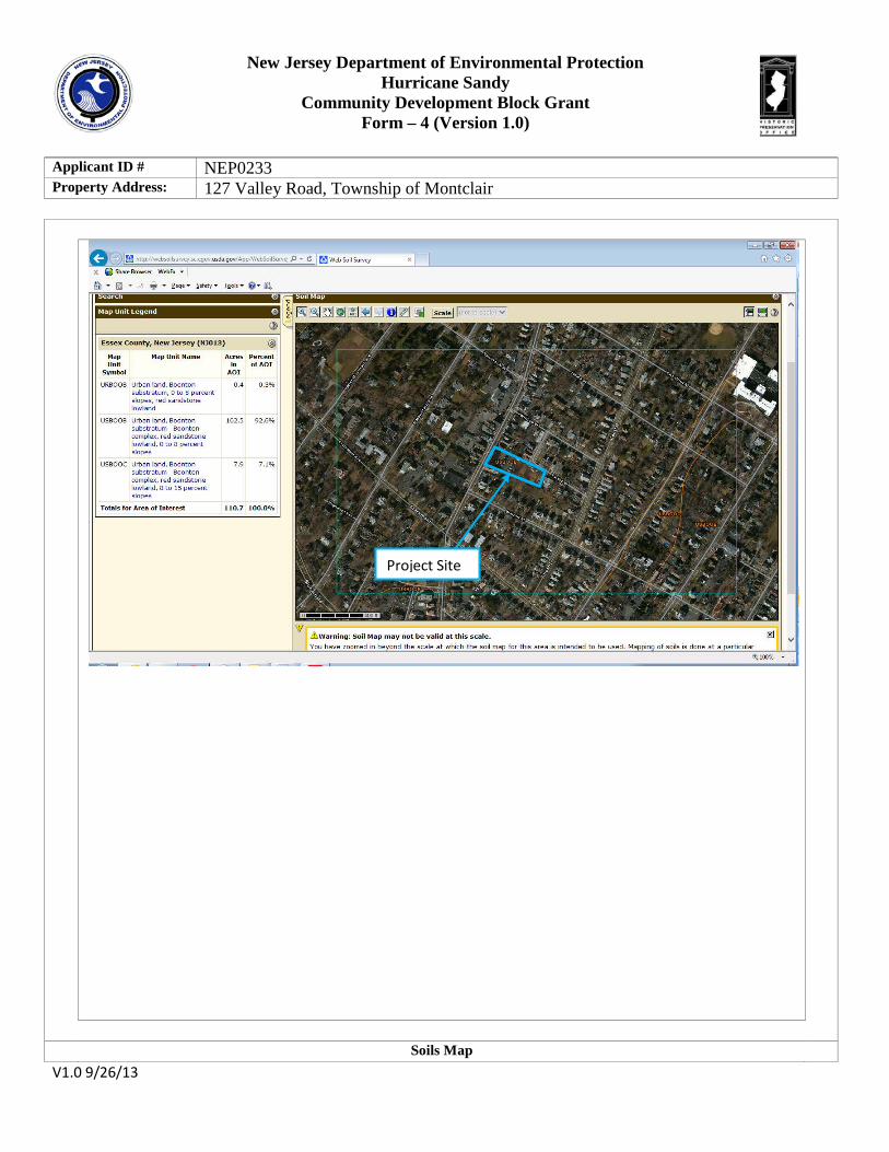
Applicant ID # NEP0233 Property Address: 127 Valley Road, Township of Montclair
Soils Map V1.0 9/26/13
Project Site

New Jersey Department of Environmental Protection Hurricane Sandy
Community Development Block Grant Form – 5 (Version 1.0)
Applicant ID # NEP0233 Property Address: 127 Valley Road, Township of Montclair
USGS Quadrangle : V1.0 9/26/13
Project Site

New Jersey Department of Environmental Protection Hurricane Sandy
Community Development Block Grant Form – 6 (Version 1.0)
V1.0 9/26/13
Applicant ID # NEP0233 Property Address: 127 Valley Road, Township of Montclair Date: 2/24/2014
Direction: East Description: Front of the property facing east.
Date: 2/24/2014
Direction: East Description: Front of the property (background) and adjacent property (foreground) facing east.

New Jersey Department of Environmental Protection Hurricane Sandy
Community Development Block Grant Form – 6 (Version 1.0)
V1.0 9/26/13
Date: 2/24/2014
Direction: North Description: View north along Valley Road, from the sidewalk in front of the property.
Date: 2/24/2014
Direction: South Description: View south along Valley Road, from front of the property.

New Jersey Department of Environmental Protection Hurricane Sandy
Community Development Block Grant Form – 6 (Version 1.0)
V1.0 9/26/13
Date: 2/24/2014
Direction: South Description: View of the rear of the building (right), garage/storage buildings and the building parking lot.
Date: 2/24/2014
Direction: West Description: View of the undeveloped portion of the property.

New Jersey Department of Environmental Protection Hurricane Sandy
Community Development Block Grant Form – 6 (Version 1.0)
V1.0 9/26/13
Date: 2/24/2014
Direction: South Description: View facing south along Dey Street, towards the intersection of Dey Street and Talbot Street, and the proposed entrance to the project (center).

1.
2.
3.
4.
5.
6.
NJDEP Environmental and Historic Review Application for EDA and DCA/NEP
D. CA_·_ Agency Name: _ . _
Date of Application Submittal to DEP: _-!::;D~e.--~C--2.-.....J,l~J~~:=::e:<~o=_f-::3::· = i /1g /L~@) CDBG-DR Program: _ ___,_f\j---"-1 _:_b-_:_p _ ________________ _
Applicant lD N urn ber: __,N_\_E__._p---"'~--_::.0_;_/--"Lj ______________ _
National Objective Description/Number: Ll./\ :r=. Grant Number: B~ /3 - D.S' -3 L/ - 0 D {) /
7. Applicant Name: 127 Vallev Road Condominium Development
8. Project Location: --'-1 =27-'---'V..:C:a"--II-=-ev;__:_;:R=oa=d=---___ ( Street Address) ---'0'-'-7-=-0-'-'4 2=--------
(Zip) 13/ocK 1509 Lc f '-{ 0
Montclair (Municipality) ~_55-e. x (A separateform with a unique Application ID number is requiredfor each locaiion)
P~S PjN 9.
o+t3_\s-o9-lfo-Detailed Project Description
-Please See Attached-
10. Change in Use Will the project result in a change in use for the land or structure?
The project will result in a change in use from vacant non-residential (commercial) to residential. The subject parcel . is now a part of a large lot which is currently in commercial/retail use. The rear of this large lot will be legally subdivided to create the development parcel.
11. Change in Size or capacity Will the project result in a change in size or capacity of any kind? If YES, describe the percentage
increase in size, footprint, number or capacity. Include any increase to main building(s), ancillary
struc£Ure(s}, parking areas, landscaping, paving, discharges such as sewage (wastewater), solid waste
(trash), or process discharges, etc.
The project proposes to construct 3 residential structures on what is now vacant land. Thus it
will result I an increase in the number of structures, parking areas, landscaping, paving,
discharges such as sewage (wastewater) and solid waste (trash).
HOMECorp NJDEP DCA -- NEP Environmental & Historic Review Application Page 1 of4

12. Market Value (for multi-family rehabilitation projects only) Jflhat is the estimated cost olfhe rehabilitation as a percentage oft he estimated post rehab value of the building? Attach documenwtion such as comparable housing prices.
-NA-
13. Right of Entry Form signed by property Owner - Please See An ached -
Initial Determination of Level of Review __ L=,·=-_,(J _ _:.\ ____ __ SCM Initials _U_._tAK_' __ _
Reason for Initial Determination N f!._M.) GJ ~sSvv-c.h OVl - ~ J..NcD l.e-I)<&S This section for DEP use. ~~.e._ (~ U:;>·e.. • r
HOMECorp NJDEP DCA - NEP Environmellfal & Historic Review Application Page 2 of'4

KEY and ZONINC MAP MAP llfi.NJI::.::APf--'LLl ~'\\AREA (~ 2CA.LE , HS
F,A,~"\I'JC SICiN TV:JF R7-R: AllJMI~lJM
SCALE NTS
SET CLEAN GR.A.NITE BLOC-\5 II~
FRFS-1 C. ASS 'R' --~.'lOO PSI :":ONC:RFTF
ctr""
PREMCLCED ,IOI~T FILLER
SET :::LE/\N GRt,NITE BLOCKS N FR:::SH CLASS 'B' 35·:0 PSI CDr~C:;;:ETE
/// ELOCK FLUSH W/PAVEMEI>. T
X
I
" T
n
,. ) SIGN, ~VCU~H TO 2"WICE X \y) 10 F- LONG GAL'v'_ STEEL \:y' ~-t--1 P:JST EMBC:DDED I~ 12" /1' - D A. :ONCREE FOO-ING,
(tf'~~ I:JJI. m ~0011r--1·:; S ·::·" ( /}0,\ MIN. BC:LJ'oV Fir~. GRAD:: m \ \\ MOU 'H TO W,II,LL ~~/~"'
J SABLED
PERSOI'S WITH VALID
lJ 0\JLY 1/2" THI:::K BITJiviiNOUS-
1.!~~!~!~~~-: CONCRETE SURFACE COURSE-=-ABC MIX 1-5
J' I HI(.;K ::JI UI-..11NOU::i f+----j CUNC~I:_ ll ~ lf>..t::lULUJ
ClA:::il ,:_;uu~::;c_ H\ClC b
/ L EITUMI=A\lEivENT AS DET.II.ILED
----,- ~.------+\\ .$--~-
" A L \ A. ~~ '~
=-11 FR FARRit ROTH Sin-S & TOP
J/4" CLt.AN CRJL~HU.": ::i,IUNC (40/o VUIU;) ~~~~y ~ITI
MIX I L oc 4' IHIC-<: W/ NO AGG-!lGA ll t3ASI:_
0 N 0
N
I :>;1;"""l~£'2'§~~. ; 4 I TH I C:K l F~JSF :iR Ar!Fil ll ~,:j 'I MiCiRFCi.II.TF RASF X JOINTS BETWEEN GRA\WE BLJCKS
~:; SHALL B:: 1/4" \'v'IJE FlLLED WITH
J6" UIA CORRUGAIU.:. _jU~-ORA ICU _jCLY
I
PROVIDE AT VAN ACCESSIBLE PARKir~G s-.b..LLS L_ __ ~~ML------~~1
.::;, MORTAR AND RECESSED C:TH YLENE P PE, -1-20S16 LCADir~c
' I COI\IIPJI.CTED SUB:::RADE TO 95% DE~JSITY
JCINTS BETWEEN CR.AJ~ITE BLOC.<::S SHAL_ EE 1/4' WOE FILLED WI-MORTAR ANC =<:EC::SSED
I 10'- •C" - I
rc x 50'-0" ~ < L" >I
Bll UnNOUS :.=J.AVEMEN I SC::ALE NOT TO SCALE
;-(.-::2_"\-J=C==. ==R==A==' 1\===1 I==E=====C==U==R==B=====o==· =====.A===L == ;-(--=3-~-J=J==R==U==P==P==E==D===G==R==,~·==N 1==1 ==E==B==_==c==·1 C==~ K===C==U==R B== (~~ '\ 5 T 0 R M
\_yP~) Sl::AL=- : \J::-JT TO Sr.: ALE ~p~ Sr:ALE : NOT 0 -~--ALE \~--~-/ SC.A.LE NU I \_:P~/ ~C--.:A.LE I U SCAL=
Pi'-,RKING SIGN DE I AIL 1\0T TCJ Sr:ALE
~
~ ~
> ~ ~
r ~
SLOPE 1: '18 TC- CLRB
2f ~ ~' COI\ICRETE SIDC:W1\LK J 1' COIYPACTED SUBG~ADE__j GEI\IERA.L ~jOTES
?0'-0''
o' c I·
BLINJ CJI~TRACTION JOINT 1/2" DEEP
1/L" IHI·:__:K, NUN CXIRULJACJLI:., fi::JRUUS, BITUM EXP/\NSIO~ "IOINT (=<EPEi\TS EVERY 16' OR 2J' OR _A,S INDICATED)
SLCI-'C ·: 24 ~
.L··~I ~\ CURB------~
CUMI-'ACICU CrlUSH=-U STO~JE SLBBI,SE __j
1. ALL CUN·:..:r-<tlt SH.Il,LL :..:CNf--CNM IU 1!JI::U NJUUI :::IANLJARU '::ii--'CC. rur< RO/\D &: BRIDCE COI'IST. SC:C. 911 Cl.'\SS '8' I1IR E~HR/\II~ED. fiLL cm,c. WJRK SH/I_L BC: FIN SHED EEFORE lr-.ITIAL SET USI~JG A S-EEL TROv'IC:L OR B!'\RN BROGrJ. ALL JOir-. TS & EDGES S--iA.LL EE TOOLED & ROJI~DEC.
2. SUB3ASE & FORMWOR-<: Sf-ALL BE FIRM & APPROVED Bl THE ENGir~EER
OR HIS RPRESEr-.ITATIVE :JRIOR TO POURING. ' .II.LL 2CNSTRUCTCN METHODS & ~v'A-ERIALS SHALL CONFORM -J '983
r~JDOT STA \J CARJ SPECIF CATION 5. 4 'vl/f---Er-.J SIDEWALK ABUTS AND TI--ER S-RLICTIJRC:, A 1/2' TH CK, NON
FXTRUJARI F; FIR"r.liS. R TliiJ FXPAr-.SI~I\1 .101~ T IS RFf.;liiRFIJ " lOR S:::CRII\G PA-TIRr~. SlliWA K SIIAII n1 liVrJir; INTO/ I Or-.GITU~JAI
scc-lmJs. 5. I~ NIT I'RIC[S Gl::• Sl ALL INCLUD[, GUT A l[ NOT LIMIT[] TO, ALL LAG OR,
[QUIPMCNT, lvi.II,TCRIALS & TOOLS -o CONSTRUCT Til[ SIDCWALK AS Sl OWN & SI'CCI-1[0 lr~ II, WO\KMAr--1 LIK[ MANr-.CR.
CONCRI= Tl= SIDI=WAH:. ~::..~ J SCAL=: , l\0- TO SCALE
Cl= TAIL
5'-0"
1/4"R ----1/~?~"R~~~- /' 1 - / , FI~IS-1 GR.II.DE. TCP CF
,\, _<n_.[._-'L::.·-- t:IIUM. :cuR-ACt. :.:cuR:;t_
I" '--t------CONCF<ETE SI]EWII_K
\<o------ CO~JCRCIC CUil::i
r----COMPACrrJ sun:As-
GCNCRAL \JDTCS
1. ALL CUNCKt.lt. SHALL CDN~DRM 10 1SijJ NLlJOI SIA\lJAR..: Sl't.C. r Crl rlOAJ & Clrl UCC ccms I rlUC IICm SlC I lUI\ V 14 C_AS::O 'Cl' fl.lrl EN-'<:,\11'-IED.
2. :CXPI\1\ISICN JOr~-S SH1\LL BE AT 10FT. r~-ERV/ILS & FL_E=' WITH A HA_F INCH THICK, NON-EXTRUDABLE, FIEROUS, EITUM. lviAERIAL
3. ALL CGrKRE-E \1'/0RK SHALL HA\IE A 'NOOD FLOAT & -::;M~SVERSE
BKOOM FINISf---_ 3ROOVI NG SHALL BE JCr~E B:OF:JRE I~JITIP.L SET USING A STEEL CR BAR~ B'<:COM.
4. SUBB.I'\SE S-L<'•.L_ EE FIRM & AP:JROVED Bv ---iE E~JGINEER CR f--IS REPRESC:NT.<'>.T \IE PRIOR T:J P:JI .. RI~G
~- All CCH~STRlJC":TICH~ vF---i\.IJS c'!.-- lvi.<'>.FRIAI S S-Ail rmJFOR\1 TO
6. -OR'vlv'IJRK SIIALL [3[ AFPROVCC DY Til[ Cr-.GI\J[[--; Ol II S P.CmCS::NTH 'J[ I'P-101( T:J I'OI~RI~G.
I. IHt. 6' x 8" :< 20' CRO':;S St.211CN :C:HALL l:lt. U':)UJ fDR tl.LL UCI-'KCS:::itll cu-.;CJ, 1b" AI U~ :::lit WGrlK
t) _ _jKUVIUI:. "/L ' I H CK, r~UN- :.X I KUU-'I.CJLI:., ~ ICJKUJS, CJII UM. ~J /\I =-KI A,L WHERE CJRB IJEETS S DEv'/.1\L-<:.
9. Jr-.IT P'<:IC:O BID SH/\_L I~CLI~DE BUT S I~OT LIMITD TC t,LL L/180=<: ECUI:::~/ENT, 1</P.-:::RI.II,LS & TOOLS TC ccr~STRU:::T THE :::URB AS Sf-OWN & SPE:::IFIEJ, N A WORK~ANJ LKE MA~I\JER.
'-.,_~_./SCALE : NOT TO SCAL=
CAIVPBELL No. 12036 or Al'l' !D\/IIJ I CUAI FRA~~E & COV:::R
' . [(l _·._ ' '. ' ' .. ' 4gs.co
TOP OF II\ TER OR r-+-'+- W.l\LL/ SPI LL\1/A Y
Ill VA m-.J I . / ~-
I: I \ ' "' 1b" :-;o ... _. I I
.
SIIRJl SIIAII ll AR SAiviRELi\T 01\ -:::J FI\J. GRADE 1\S IT BORE TO FREV OUS G'<:ADE
4" MULCH, 5--PEDDEJ CEOi\R BARK
PRJNE BRII.NCHC:S OF DC:CICUOUS nEES II.I~D SH~UBS (rWT ALL
r--~ FNI. TIP~; RY 1/1, 'iFTAI~ING r~Gr.lviAI PI ANT SIIAPI, rJO NOT CUT _[I'>,O[fi
RU3BE'i H:JSE
r~o. 12 CAL V NIZED l'vi~E
r~OICH SIAK=- f-OR Wlrlt.
8 ~I. _Or--IC L"xL" OA-< S IA-<lS, f;:--- 5 FT. C:XPCSED, (3) M 120
DEGREES. DRIVE ,II,T A~JGLE
Mm PJLL VERTI:AL
--;o=f---- WK/1.J IRUNK W/CJUK_/\.J 0-! ' .r KRI\FT CRE:JE P1\PC:R -~
E +" vii~L:II-SII"iCDCD c::DA"i ~---8A-iK
II,~HT R111 AR": AC::, SrHFnlJI Fn TA\PFRFROOF FASTHJF~S. INSTALL I~ ACCOIDANC[ W/ MANUr. WRIII:.N r~SIRU·~I mjS
(3) 3_/8" ::IA\ETER x 8" LO~G M~C-WR BOLTS
~1\IS--ii:.Ll CK-'I.lJC
4"- 6" SOIL SAU2ER (W'1~~§\i~~~~~~ 4"-fi" SOli SAliCTR
~ ~r ~_.·~_71 L_
CONCRETE FJCTr'-IG VI'/ (2) #3 \/E~T. REBAR & #3 HO=<:IZ. TIES AT 12" ON CENTER MAXI~Wivl l/2 TOPSOIL, 1/Z PEAT MOSS
I:)ACK=-ILL \11X
'----------- "'- 1,/2 TQ:JSO L. '/2 PE.<'>.T ~AOSS j RAC":KFII I IV IX
~
Fl FCTRir:AI CD~IJlJIT AS PFR ~::on-
1-c-::--);..~~cH~;,L~~~U~. ~~o~T~~~~~~~5~~~~~T~EI~)'j~(~~~D~E~T~/~·\ ~~ L~@ ~~;L~ E,o;T~~:~:;~ IN G DE T /\IL "'QT TO 5C/\LE
AcljaccnL PropcrLic;.; Ccncral S1Lc 1\oLcs 12 De~ Street Bloc< 1509 Lot 2 Borel lnvestnent c_...roJp, L_C PO Box ~0:."'\ Po~pton Pla>nc, NJ OH44
2l Talbot 5 treet Bloc< 1509 Lot 4 Necrra • Sandeep JBrn 2l Talbot Street Mo'ltclar~, NJ 0 1042
25 Talbot Street Bloc< 1509 Lot 5 John H. Davrc 141 Lerch Drrve M llo·d. Pa. l8:3:3l
I. OLLrer: Norman Forrest ~ Va'er-:..1na Fcr"est 1:21 Vall~!.. Rooc Montc.orr.-\l.eLL ,_,e~,;;;l:- Ol0"'\2
2. Appl cant: Homes of Mortcla r Ecume'llcal Corp. C'le .Jocdl;md Ave'lue Montc.:.Oir, \l.i::'LL vl::''"5:::'~ Ol0"'\2
3. Lo'le. R-2 Tuo-Fam ly Zone
-"1. S1L~: Cc8 Street ~ -albot Street Gieck. 150[1 Let ""10 .01 (lnclJdrng Lot 13) Montc.arr. =.ss~x Cour-:..~. NeJJ Jerse~
5. =.x1st1ng l..,:;t:> of S -:.t:>:
+ I
;,
0 I
;,
J::::T /1.IL
b I
Cn I:
N )
\ /
lhJLET I II J
P PE LADD:::R RUf'JGS A-12 'oc ---1'--+---+-'+-_/ 218 Walm.t 5tree:
Bloc< 1509 Lot 33
The:: srl~ r,:; c.:urri!:nl·f,J parl o·' Lo~ LO Lhal rs de:ve:lope:d .u1Lh a ore ;;tor8 ccrrrrc"cra· ::>uri::J1ng, accessory bu1ld1n~s and an off .:;treet .;-cved f;Jark:ing area. Lot ""10.01 Is f;Jro~o;:;ed tc be ,:;u::div1ded from Let -"10 and UJ II rnc.:orporate Lot 13. The ar~a of Lot 10.01 rs Jndev:::'loJ:ed
'-. / -Co
' ' < ·-,· ' "' I ,_ : <. ,, . ~~ i '.
5" OLIO UU IL I I;II'C +- B
F LI\I'J
\.__~./ 5CALE NOT 0 5CA.LE
·-' l ~ '
il /....--- '-....'--.
·/ '\\ /\ 'I
\' ,c!; +494.75 ::.::::.(};::::'.
-c;" SOLID OUTLET PI:JE
. ~CRCCACT L>JOO CCI CCNCRETE, A5H~ C478
SECTICN /1 SECTICN B
5 TRLICTU:;;:= DeTAIL
'---' Lemuood Ros;o t M1chl e Pc:~5tell~ 218 Walm.t Stret:-:.. Mootcla1·. NJ Ol042
220 Walnut Street Bloc< 1509 Lot :34 Scbrr'lc Hodgson, Inc.: 4 C.ub Wad Cedar ~rove, N" OlOC'1
222 Wulrut Street Bloc< 1509 Lol 35 Robert ~ Pamela Geed 222 Walrut Street Mo1tcla1·. NJ Ol042
12l Valle~ Road Bloc< 1509 Lot 40 Nornan t Valent na Forrest 5b-'i ::::.odJJr ,.6., venue M-cl;md Pnrk.. N.J Ol"'\32
b. Pro cc.:: Oe;oc.:r p:1on: _et ~ 40.01 Is pro~osed to be subc1V1ded ·rto three ots. Eac~ ot will b~ deVe opec With a two farrili,j dwel11ng and roJr orr .:;treet ::>crkr'lg ::paces Wl.l be vov ded for each :JUri::J1ng . .A.-::-::ess tc -:.he lots will be frcm -:.he cor'le" of De~ Street <Jnd Tnlbo-:.. Street. An ac::;;s,; easenent Wl.l be requl~ed on Lot 40.02 to :;rov1de access to _ot.:; LQ.OI and +:J.03.
l. ~lood 1-czarc: The srte s 1n flcod hazard Zo'le X, non hazard.
8 Surve8 The: e:'XIStlng !iiltC:: lnro··matlor· 15 r··om a 51JI'V~!d pr·e:par~cJ b!d Rlc.:hanJ J. Hrngos Ire .. Pro:-ess1onal Land 5Jrve~ors, I Bellevue Plazc 0 0 Box L3l;2, Upper Montclarr, NJ. 5·~red b~ R1charc ,_, hngos, J~., NJ L cerse No. 43231. Dated: ~overrbe" lb. :2012.
9 Storm Dra1nage· The ex1st1ng sto~m era-rage ~attern ;:;hal :Je modrrred to accoTimodate the propo;;ec Sit;:> la!dcut.
10. Co 'lo: seal:::- d
ZONE R2 ISSUE
PRTNClPAl, lJO'F:
ACCESSORY U:::E
ACCESSORY USE
lOT SJZJ<:
lOT WJDTJJ
1 OT Ji'RDNTAC~
lOT DJ<:PTH
NLMUJ-;H m· DWJ-;LLJNG~
ON LOT
STREET FRO'ITAGE
Prine l Buildin
F:XTSTTNC
N/A
N/A
19:17 s.r.
lOU. 09 Fr.
I 0~.43 FT.
180. G4 f"T.
N/A
25 FT.
IIJUJLDJNG HJ<:JGH'l' N/A
~'HONT YAJW o;J<:TBACK 1'1/A
ONE SIDE YARD SETBACK N/A
OTHER SIDE YARD N/ A SETBACK
BUILDING WIDTH N/A
RF:AR YARD SF:TFlACK N/~
BUILDING COVCRAGE N/A
Accessory Uses
NUMBER ol PARKING STALLS
1'1/A
SIZE OF PARKI'IG STALLS N/A
DRIVEWAY WIDTH N/ A
PAHKING ANJ<:A SICTJJACK 1'1/A
DRIVEWAY SllTDACK N/A
PARKING AREA N/A lOCA'l'JON
P Al!KJN G LOT AJSLJ-: N/A WTDTR
REQUIRED /PERMITTED
Two ?umily Dwclli:1g (317~17B)
Gnrnges r:pp11rt.Pnnnt. t.o a rcsidcnLal usc (317~,1911)
OH-Stree~ Parlking for not more thnn Five Vehicles (317~19B)
No Requ:rement (3L 7-50)
60 FT. (~4? 50/~47 I R8/\1ep)
No Rcqu~rcmcnt
Keep wi-::.b estabL:shed pattern (347-50/347-18E(1))
One Principal JBuilc.ing per Lot (347-20)
Lot stall front on Public Street (347-20)
35 FT. (24 7-51/34 7~45A(1)) 2 1/2 Story (317-51/317-,15A(2))
~b l•'L (047-b1/047-4cU(l)) (or avg. 4 adjacen-::. ~n zone)
6 FT. (347-51/347-45C(1))
10 FT (347-51/347-45C(1))
65% of Lc~ Frontage (34 7~51/34 7- 45C( 4 ))
25 FT. or 30% Lot Dcpch (34 7~51/34 7- 45D)
25% of Lc~ Area (34 7~51/347-45E)
2 Bedroom: 1. 5 Stalls :l Bedroom: 2.0 ~talls (347~~01/RSIS T4 4)
9 FT. x 19FT. (34 7~'023)
18 FT (~tn- ;JJ)
4 11 ''l'. (347~~04)
I FT. (347~'04)
No pc..rkir_g area shall be located between the main buik ing fl.nd the front. street. curb (347-52/34 7-46C/ 3,17-1 OB/317- 31 B)
12 FT 45 degree Sta~1.dard 18 FT 60 dcercc Sc.an~ard 2~ 1FT. 90 clegree Standard 21 FT 90 dtogn::!e s~uall (~tn-;JD(1 & cc))
APPROVAL SIGNATURES
TOWNSHIP BOARD CHAIRMAN
TOWNSHIP BOARD SECRETARY
TOWNSHIP ENGINEER
RE UIREMENTS PROPOSED Lot 40.03
Two F'nmily Dwelling
'IJ/.t:..
Four Vehicles (Common)
6.043 55 S.l'.
63.84 FT.
61.55 FT.
94.57 FT.
One
'lo
<30 "T 2 1/2 S Lory
25 P'T. to P'ront Lot ~ine
6 fT.
lU 1:"_'.
40 --=i'T ( 40.0 FT. max.)
25.22 FT. (28.37 FT. min.)
I ,471 S F /24 :1% (1,G10. 75 S.F mo.x.)
4 (:1.5 min.)
(4)9 FT. x 18 FT.
'1/A
4.0 FT.
~/A
'1/A
~/A
PROPOSED Lot 40.02 i.nc:l udlng lo L 13
T·v·m Fnmily Dwelning
N/A
four Vehicles (Common)
6,698 27 S. F.
62.79 JIT.
63.00 FT. (25 FT.) 18.91 FT. parallel to street
100.18 FT.
One
25 FT.
<30 FT. 2 1/2 S Lory
48.5 ITT. to Front Lot Line
8.5 FT.
11 r"T.
40 F'T (40.95 FT. max.)
. ' 15.0 FT. (30.05 FT. HlliL)
1,2?~ S.F./1~ 0% (1,674 62 S.F. max.)
4 (:1.0 min.)
(3)9 FT. x 18 (1)0 r'l'. x IU 8 FT AISLE
18-20 FT.
4.0 r"J'.
2. 7 FT.
FT. .b''l'. +
Between the main bu1lding a[ld the If ron t street r.mrh
24 FT
and DATES
PROPOSED Lot 40.01
Tl'm Fnm]ly Dwelling
N/A
Pour Vehicles (Common)
6,375. 37 S.l'.
60.00 JIT
62.28 FT 0 FT. parallel to street
105.67 PT.
One
No
<30 FT. 2 1/2 SLory
48.5 FT. to Front Lot Line
7 FT
1o.s r'T.
40 F'T ( 40.48 fT. max.)
15.0 FT. (31.70 FT. nin)
1,4~::1 ~ F'./22.Fl% (1,Ci93.87 S.F. IlldX.)
4 (C!.o min )
( 4)9 FT. x 18 FT.
N/A
4.0 Jl<"L
N/A
Between the m_ain building and the front streF.t curh
24 FT.
DATE
DATE
DATE
CDNfO:lM
Yes
Yes
:."r/A
Yes
'1/A
Yes
Yes
·1 0. 03: No ·10.02: Yes 40.03.- No
Jio
Yes
Yes
40.03: No ~0.02.- No 40.01: No
Yes
'lo
Yes
YES
Yes
40.03: 40.02> 4U. Ul:
Yes
N/A No No
till <])
J w > w 0'
tJl <])
J Jl '> Jl [}'
UJ z 0 UJ
[jj 0:::
"' "' "' UJ ' !::;: ' ~
' ~
' m
N
' r ' Cl " () 0 0
N
3BRA
7-1 RA
025 R.LA.
N.J. 6 P.P.
SPI
0 z

HS DRAWING OR C·OCIJME~H ."J\0 INFORIAJl.liON SET FO~ll- HER~IN ARE lHE P'lOPERT'r' CF SICNAS /IRCHTECTU~E, PC AND S~ALL NOT EE US~) OR DSCLOS~D EXCEPT IN .~CCORJJ!NCE "'ITH WRITTE~ PERIAISSON
SECTION Q= t:.XIST'G CHA'l\ LINK PENCE TO BE RELOCATED TO FROP:=RTY LINE or TO BE REP-AC:=C W/b' HIGH BLACK VIN"L r-----------~ COAT~C CHAIN LINK FENCE AT PROPERTY LINf, TY""'ICAL A- SOUT--1 ""'ROPFRT" LIN.F
PROPOSED 3.5' )< 3.5' CONCRETE PP..:J, I
TYPICAL AT RP.S:= OF ALL PROFOSED S I OOFS/S I EFS
SECTION o= EXIST'G CHA' LINK "~ -o;'--------------_/~' RCM.,IN, TYPICAL AT CAST FRO~LdY I ·
EXIS-'G
\ \
OPEN SIORr-lx C ANLOLE ::
SECTION o= EXIST'G CHA'l\ LINK FENCE TO BE REMOVEC·, IN.ST A_L PROPOSED ..::· HIC".1H WOOD BOARD Ol\ BOARD FC.NCC. APROPERTY LINE, TYPICAL AT E.AST SECTION o= NORTH PROPERTY LIN=.
Rll" - 491.13 INV = 49 .43
No.25 T AL30T ST.
I// I I
I
, I
I AD~OINE!<:'E EXIS-'G PAV::::.D P.Ll.!<:K'l\G 1
ARFA
GRANITE BLOCK CUI'::B At; UET AILE::J
REMOVE EXIST G CUR3 ~ SIDEWALK SECTIONS, CONSTRU::T GRANITE BLOCK CROP CJ'"?.B, CONC. APRON t CONC. SDEWALK AS DET.4.1-ED
EX ST'G GRANITE BLOCK C·ROP CURB, CONC. APRON f CONC SIDEWAL< TO REMAIN
TALBOT s-REET 50' ROU.
I
I
l I
0
-------
N S0 a cO'
N S0o00'
--- -
l:J
'l!
---------------- ;;;XIST'G SANITARY '1AI\--ICLE I I ~1'1 - 4"li.BO I I
181,.82'
;;,0 ,00'
0 wv
/
__ --------------------- r;]'i- __ .hV_ ~ ~~·3..?u
EXIST;G Ia·~ sTORM SEwER- -- EXIsTiG- ~:_,;---- - - ---, ~= ~ = = _---STORM \ \ I I - --MANHOLE \ \
======================================iJiRI(11M = 491.55 \ , I I ~~~.:::::: 492 OS \\ I I
T zf<eOL _Jo Q_,L.
(~)t1 :~~~ -~LAN \~ ~
IU
------
0 10
~\\ 111111
\\\ \ \\ \ \
'\\\ \ II ):) \\CB Q
1- YO UV
\\
\\
\\
\\
I I lli I I 2S I I 0 u: " rn D II
"'"-< (p ' '
l> I I 2 -=i I I
""' ill --; I I <P I I rn I I E f7l I I
AJ I I I I
(Jl
--l 70 rn l11
11--1 I I
I I '" 0
I I 70 I I 'i!
co
/
9
Cb
/
\\
\\
\\
\\
\\
\\
\\
\ I
) I
'\ I~EC-10\\ OF EXIST'G CI-AIN LINK FENCE r----r-~------------jTO BE RE'1CVED, TYPICAL NEAR I \\505 IPROPOSCD WCST FROP=RTY LINC
I I
/ ~~~~-_ALL PROPOSED 4· HIGH WOOD BOARD r-----f--------------i1;:o;;N, BCARD FENCE AT PROPERTY LINE
I I I PICA_ AT .lJFST PROPFRTY _INF
,/ I
I
(fl
4C
b'' UIAMETER 5CHE::JULE -10 F-'VC UNDERG'"?.OUND PIPE FROM BUILDING ROOF LEADER TO STORr DETENTION FIELD, PROV'DE CLEAN Ol T AT EACH CHANGE OF D'RCCTION, TYPICAL
DWELLING
'--------------------------------------ADJOINER'S EXIST'G _.Ll.NDSC:APE TIE CURB
I ADJCINER'S EX IS I 'G ~AVED FAR lNG r-*-------------------------------------------------------~ I AREA _ - ---~
------
----ou () O C.O.
'd
0 wv "' ws
0 GV.,. GS
__ , ---
--X---
0
---------------No.8 DEY ST.
TYPE '"B" 1\LET
INLFT. TYP=
~ ANLOLE
CL:::Al\ OUT
IIYC~ANT
C.1AS VAL VC. OR SC.RV C:C.
51G'I
SEWER FIFES i AEEI =.c:,
UNOI;;.RGROJ'ID CONDJIT ILA~I;;.L±:.:J)
LLA -ER LINE
GAS LINE
FEl\CE ILA3ELEO)
U.E_L ILABELEDl
UTILITY POL"
U I ILl I Y POL::. ILl LIGI I
o -----11!------
y
---- 2/t:. -----
2"---
+ 21t.
TP
TC
L GHT POL±:.
WALL MOJ\lTED LIG--1-
CVER-fEAD WIRES
JUNCTIOl\ BOX
TREE ~DECIDUOJSJ
TREE ~CONIFEROUS)
INDIVIDUAL SHRUBS ! BUSHES
HEDGES OR BJSHES
C.DC.lC. OF WOODS
EX ST'NG CONTOUR L 1\E
EXST'NG SPOT ElEVATION
PROPOSJ;;.D CO'ITOL.R LIN±:.
PROPOSED S=='OT EL::::.V.4TION
TO~ OF PAVE'1ENT
TO~ OP CURB
REVISION OUGC3LE LI~E
RAIL ~OAO T~ACKS
GUDE RAIL
HEA::JWAL
CO\IC. SI:JEWA.LK
• ~ • ;.
z ::; IL
~ lJ)
w "' _, " >= ru >- >~ lL w "' '" '" 0 ::J ::J Q!: II Ill
<( > > 0 lL ill
ru ~>' ""
(/) z 0 (/)
(ij 0::
<') w ~ ~ ~ ~ I ~ I 0
[),) . " 0 0 0
0 r"' N - Z
• r/J.
' w 8 ~ a
SHEET NO.
SP2 2 OF 6

IS DRI\WIN DOCUMCW A~C INICHM~TION ~[T IORT I IICRCIN ARC Tl [ r'R:Jr'CRTY •
C {(
·--~-----. ..... -·~ --.. ·-~----o-(ln.) Percent Sl·)pt o-f Roadway
Oto2%
2to5%
Length (If Stone Required Coarse Gralned Soils fine Grained Soils
50 f1: 100ft 100ft 200ft
E.utir~surfac: 5tabiliz..oad. witt: rABC base oounz
CONST. ACCESS
j c:qu~ rnc:nu for Silt Fence:
I.
3.
F~nce post! shall be spaced! reet OEnt~r,m-o:en.er or closer. They shall extend at least 2 f~et in1o tile ground and C:t. iend a least:<. fee t above grouud (Fig. 2S-2). Po_~t; shall be ~onsrrucr!d o! ll.:lrdwood i\ith a l'linimum dianeter thi.~knesi or l 'lz inches .
A mcta! fence w ith 6 im:h or smal ler openings .tnd u 1eas:t 2 :'eet high may be utilized. fu.s :ene.:l ta the t·~,.::~ pmts, to prllvidc re info~ernem and ;upport to the gar..tuti l~ fahri<:: wher~ S j:UCC for otiler ~~ices is lin.ited and hnvy sediment loading is C:\p!:Cied.
A geotextile fabri ~. r~Qmmentied il r ~ uclt iJSC b~ t~e manuf&eturer, shall be b~ried o.1 ~ ~~t 6 indies -deep in -:he grounC. The f.1 bri~: 5hal\ e11 tenC at l~ a.st :! fe:c i!bove the: Ji;rOIJrtd. The fabr;c must be ~ure l_y fa.:stcr,ed tl) che posts using l system consis1ing o f metal tilnr::r.en -:u il:1 or sttp lu ) a~d ~ 11iah .strcn ~ th rein io rcemo:nt -11ato:rial (n)·lon welbi ng. ¥rO,i\ m~t$ . Wtl:§he n etc. I pi~:JCed betwl"en the l'o!stc.1er an.i th~ sectcHi~ fabric. The fastc r. il1 j: system shall resist ·:e.:rin g :nva!' from thll!! post. Th e fa l:lric sfla. \1 i ncD r p.l~lt a dr:r..\st ring in th ~ lOp par1i -::m o :'the fen ·; ~ tbt ack e-d strength .
RP.,RRIER 'OT TO 5C.AI E
,-- F•RCMI)E 3' • 2~ OPEHING TO P,t.SS FRa.. 2 'fEAR SlOi'.IA OR tflE:A TEA
,.
I Bfo.CI(Fill.. AFl£R ----r t :o.S.TALL~TlON OF l li'LO Fll TER )
-........., I _.,.. ".J..-"
SECURE F1L T£R FABRIC TO FR-'t.l£ AND GRATE
t. COOTRACTOR \S TO CLEAN INLET f l l..T(Fi: AFl[Fi: EVERY STORM
2. IF BOnOM OF ROADWAY SOX IS BEI.CW TOP Of GR!ITE, CONS TFI UCT OPENINGS IN INLET 1'1-"Ll TO ALLOW 'II.AITR TO FLOW \N, COVER OPEttlt~CS VIITH wtLOED WIRE SUPPORT MID FILTER F-'BRIC INSPECTION SH,t.LL 8E FREOOENT. MAINTENANCE, R[PAIR AND i'.EPl~CEt.IHIT
J . SHAU. 6£ MADE PROMPTlY. AS HEEDED. THE BARRiER SHALL ~ R~MOII[O W:--1['-1 THE ARE-' ORAINIHG TOWARDS THE INLET HAS BEEN STAB!Ul£0
~ 1 1/2" CLEAN STONE Plt..£0 2• HIGH TO COUPLETEl..'l' SlJRPOUNO INLET
\__ INLET FIL T~R INST .loll A. l iON f:IR T'fPE A AND Tl"PE E INL.ETS
NOTE: TWO TR io,FflC CONES TO BE PLAC£0 ON E,t.CH SIDE Cf INLET
]\II'LET PROTECTION ~/ ~C;\LE l\OT TO SC/\LE
:, r'C AND S 1~.LL NDf J[ USCD OR DISCLOSD DC[r'T ~I A:CORD~~C[ ~II '"!<ITT:~ r'[RI-ISSION
I I
\}l
491~'-0
..)>. uo
E
..lll
. I _j
lJ1
49
I I
LO
I \
I I
I I
'I \
LA.W' .~RE.A 1-0 BE 5,E:JECJ/ TYPICAL
I _I_
~~.82' 4
l
::::ROPOSE::J 3LLDING A =f -:;01.4:2
'
/ /
~1.55'
TALBOT STREET 50' ROW
/ /
I
I
/ ,....-
I I
/
I I
50°53'
/
-
+ / ~llt<R
/
E
()
-/
/
w w
\80.82
(c0.00
'------~
I
------FRO:::l'OS C BUILDIING B FF +502 33
/ /
/ I
I I
0 /
5° 5 E
0
G0 I I
=:::::::: ::::::::::::::::::::::::::::::::::::::::::::::::-------:::: ::::::::::::q):: .:::: = I I ----U
1-1--
I I I \ \ I
==================================================================================================c~~ \ \ -----<:::-~.._, \ I
~I' ~ ,, ~I\
\~1 \ \'\ ,,
)8 \\
\\
\\
I I I I
I I I I I I
I I I I I I
0 111 -<
I I I I I I
I I I I I I
I I I I I I
I I I I I I
(fl -I 70 \11 rn -I ~
0
ill
" E
SF DW1F ~n C~ONTROL. LAI~DSC~A::Jh= I
Y:Jnd
----~~
\
25\00' \
\\
\\
\\
\\
\\
\\
\ \
)
c. ..)>. Ul
\
(
\
I I
I
/
I
/ /
/
r---LAWN AREA ITO B::. SEEDEDl. TYPICAL
I
THE PROPERTY LINE IS -I-E LIMI- CF :JIS-URGANC:E LINE, TYPICAL
I I I
/ I
- ----+ ------~--·
I I ___ ,--
P~OPOS~O BWILDING \c
I
~+-1
I \ ' '
I
I
I I
(fl
c.
0
I I
I
I '
:SOIL ERO:SION and SEDIMENT CONTROL NOTE
2.
3.
4.
All soil erosion and sediment contra~ prc.cbces are -to be Im;Ltt.lleJ. prlur Lu ttuy mi::l.jur ::;u_il dl::;.urh::uH.:t', ur· in Lln:'ir Pn.Jper selj_ueuc:e, cu1U ruaiulo.iuer.l uulil per1uo.ueul prulel'Liuu Is e s La blis he d.
Any dlslurbed areas lhal will be lefl exposed rrwc·e Lhhn Thirty (30) days, and not subject to const:cuction trafLc, Will immediately receive a temporary seed~::--_g. If the season Prevents the establishment of a terL::Jorary cover, the disturbed Areas will be mulched v,.ith straw. or equiva~ent material, at a Rate of two tons per acre, according to state standards.
Permanent vegetation is to be seeded or sodded on all Exposed areas within -ten (10) days after final grading. Mulch to be used as necessary for protection until sccC.ir_g Is c sta blis he d.
All work to be done in nccordancc with the standards foe :::>oil erosion nnd sediment control of New Jersey.
b. A subbase course will be applied immec.iately following Hough grading and installation of irr_:::;rovemec .. s tc stabilize ~t.reet.;-, roadB, drivewayB and park'-,E area;-. In nrem; where no UtilibeB are present., t.he SlJbbi1se shall be installed wit.hir Pift.rcf:n (1fi) <'ii'ly~ of the preliminnry ~r~i'lrling.
G TmmerliFJtely following init.i11l rli~d.lF'hA.nr:e or rongh gr11r:mg, All critical areas subject to erosicn (i e steep slopes and Roadway embankments) will receive a tem:?orary seEding in CuJublno.L.iuu Vl'llh :::;Ln:tw 1uukh ur a sull1:1.blt' el..j_uiv1:1.leul, ::t. ::t ral£:' Of Lwu (2) Luus per· ctl're. ct{.'l'un.liu~ Lu slale slctw.lo.nh.
7. Any :.leep :.lope:. receiving pipellne lH:.Lalld_io:: w ~~ be backfilled and ~Lablli:,:ed dally, as Lhe lnslallallon conllnues (Le. slopes grea-ter than 3: 1).
8. The standard for dabHized construction entrance requjres The installation of a 50' x 30' x 6" pad of 1 1/2" to 2" stcne, 1\.-t all construction driveways, immed~ately after iniLal site djsturbance.
9. ln sccorde.nce with the standard for perme.ne::-:.t vegeta-:.ive Cover for soil stabilization, any soil ha-.,ing a p_'"l of 4 DC less Or contninine iron ;-ulfideB shall be covered -wit_h n minirr.~11 of Twelve (12) inche:-; of soil havine; a ph of 5 or more prior to fleerlhf:d prepnration. - \ ff +504.92
I I I
'
' '' "
\ I I I
\ \
\
\ \
\ \
\
FCNC:. AS
I
I
\ I
1
5TABUZED CONSTRU:::TION ACCE55 ::>AD AS DETAILED
\ \
' '
\
I
l::.XIST'G TRl::.=-. TYPICAL-----"
----
\
X \
\ \
\
\
I
I I
' FOCT~fA\IDLE ILLL..MIN.A.TION.
\ \
~~-"-4\~---LAWN AREA no BE 5:::EDEDl. TYPICA_
I 1\ \ I
I
' \ \
I
I ·+
I I I
IB~LLA"'(~ LIGIIT. L51 S=.RIES. OW CMH. or LE:J, HOUSE SHIEL:J, TYPIC.A.L L
I I
-+ '
--
I
' L.,IGIITING IIYf-'fo( >\:-HYP3 SERIES. AS C·E T ..A.ILED,
505.31.
--
3~W
PLANT SCHEDL~E
1D The H11rl~on 'R~~ex nnrl P11s~Rir ~oil r.onserv11tion rli~t.-~kt.
Shall be notified seven-ty-two (72) ho-_Ts in advance of any _and Disturbing activity
11. AL Lhe liu1t:' Lhe :;ile JH'l:'_I.JCLI'aliuu fur penuaueul vt>gt:'Lalive :.Labili:.talion i::; going Lo be i:iccornpli:.hed, a11y soil Lhal will Nol provide i:i :.uilable envlronrnenL Lo suppe!rL adequale vegelallvco Ground cove1· shall be renwved or lc·elLed ln ::;uch a way LhaL will Permanen-tly adjust the soil condi-:.io::--_s and render _-:, suitable For vegetative ground cover. If -the rerr_ove.J or treatment of the Soil will not pro-.,ide suitable conditions, non-vegetative rr_eans Of permanent ground stabilization will ::--_ave to be e::=ployed.
12. In that 1\.J.S.A. ,1:2,1-39 et.seq Requires that no Certificates of occupancy be issued before L'le provisions of the Certified plan for erosion con-trol have been co::nplied with for Permanen-t measures, all site work around ~::1dividua~ lots in Subdivisions will have to be completed prior to -:.he district Issuing a report of compliance for the issuance of a ccrtificc.tc Of occupancy by the municipality.
l::l. Condmt outlet protection must be i::--_stalled at all required outfslls prior to the drainage system becoming operational
14. Any chnne;es t.o the cert.ified soil erosion n-d sediment Cont..rol plan:-; will req1Jire t.he submission of revised soil e~osion
,'lnd sF.dimF.nt. r:rmt.rol pli'ms t.o t-.he d st.rir:t. for rF.cF.ri.'fir.nt.ion. ThF. reviserl plnns mwd. mF.Ft. nll r.nrrent s~.ntF. soil F.rosion nnd Se<'liment. rontrol stfl.ndA.rd~
15 l~nfil-tered dewa-tering is not perm:-:.ted Take all necessary Prer.:aullu11:; Uuriug all tlt'wd.Lt'riug up!:'ralluus Lu ---~HluJ.i:..-;l:' sec..:.l111!:'11l Tra11:;fer·.
16. Should Lhe conlrol of duo:L aL Lhe :.lle be neces;,;ary, Lhe slle will be ~prinkled unlll Lhe surface is weL, Lernporary vegelalive Cover shall be es-tablished or mulch shall be a-pplied i::--_ accordance with state standards for erosion controL
17. All soil washed, dropped, spilled. or tracked outside U_e Limit of disturbance or onto pubLc rights-of-way will be :cemoved immediately.
18. The property ovmer shall be respo::1sible for any erosion or Sedimentation that may occur below stormwatcr outfalls or of::si-tc as a result of construction of the projec-t.
10. Stockpile and staging locutions determined ir_ the field shall l::Jc plo.ccd within the limit of disturbance a::::cording to the Certified plan. ::itagmg and stockpiles not lccated within the Limit of disturbance will require certification of a revised soil _L~;rosion and sediment con-trol plar__ The distric-:. reserves the righ-t To determine when certificntion o= n new nnd sepnr:-..t.e soil erosion rlan will be reqLJired for these act.ivi-ties
20 All soil st.or:kpiles nne to he t.emp:!rflrily stnhilizf:Cl in !kcor<'IAnce with soil eroo;ion Anrl :;;;erlimf:·-t. r:ont.rol note no.?.
Hudson, Essex and Passaie Soil ConservaLon District 1G EluurufidU AVI:'uue Nurlh Cc!.ld•r;ell, Nt'"' Jt'rsev 07006 ( 973) 364-0786 phone ·
TEMPORARY STABILIZATION
Soils exposed for periods of two to tweleve months shall be stabilized with temporary vegetative cover or o-ther :;.pproved methods as follows:
1. Streets, driveways and parking a::--co.s not schcd·..:.~cd for paving within the o.lottcd time fmmc sha~- be :ltabilizcd using the pavement subbase course 'l'his subbusc ::::oursc shall be installed 11'ithin lb days at preliminary grading.
2. All areas not scheduled for paving shall rece~ve a temporary c;eedine immediat.ely followine roueh eradin~.
:1. Apply limf:st.one nnd fert.ilizer nt. i'l rfl.t.F of snr: pounrls pFr fl.r.rrc or 11 ponn<'ls pf"r 100 sqnfl.rF. fF.F.t of 1f:-21l-10 r.r f: qni vi 1 Pill t.
4 Work limes-lone and fertilizer into the so:_ to a de-:1th of 4 iuc:he:; uuill uuilurru.
5. Ternporary seeding will be a mix o[ "-.nrLal ryegr-a::;s or perennial ryegrass al a r-ale of 40 pounC.s per ac:re or 1 pound per 1000 square feeL
6. Seeded area to be mulched usinc; straw ::-=uleh or a suitable equivilant at a rate of two tons -pe::-- acre ~n ac::::orC.ance with state standards.
PERMANENT STABILIZATION
1. All areas not scheduled for construction or
2.
landscaping to be stabilized using a mixture of seed consisting of Ken-tucky Bluegrass, Perennial Ryegrass and Spreading Fescue in equal quan:-:.ies. Seed to be applied at a rate of 30 pounds ~er acre.
Apply limestone and fertllizer at a ratE of 50C pounds per acre or ll pounds per square foot of 10-2C-l0 or equivilan-t.
Work limestone and fertilizer into the soil to a depth of 4 inches until uniform.
I :
~================================================~! P.emove all surface debris and stCJ::-:.es two inches or
lsrger.
KEY QNT
AR
PK
4
5
BOT AN CAL NAI"E
ACER RUBRUM 'OCTOBER GLORY
P;;cUNU5 SE;;cRULATA KWANZAN
COMMON NA.ME
OCTOBER GLORv ~ED MAPLE
<WA~ZA~ Cl :ORRY
SIZE
2 112"-3" CAL
2 112"-3" CAL
COMMENTS 5. Inspect seed bed just before seeding if traffic has left t.he soil compnct.ed, the arne m·.~s-t be ret_illed and firmed as fl.bove.
SEQUENCE OF CONSTRUCTION
f---+----1----------------------------+--------------------+-------+---------jll. lnste.ll sediment filter fence, inlet filters anc_ anL tracking pads. PT 25 PACHY5At'D"A TERMI~ALI2 ~ACH'(5,0..NOR,O. b"oo
3. Con:-;t.nJct. st.orm sewer. sa.nit.ary sewer, water and ot.her ut'-it.ies.
5 Construct. curbs, sidewalks and -::mse course of pc.veme:::-_-:. prior [---+----j----------------------------t--------------------+-------+---------11 to the construction of buildings
6. F_i_ual gnH.liug and :; Labllizaliuu
fw '" -' < ff)_
"' =>
'" n
"' < 0
"' "'
' " ' '" 0
fw '" 3 Ill
> w 0'
r 0
fw '" 3 Ill
> w 0'
"' ' r
' ~
0
en z 0 en iiJ [1::
c:i 0> N Z
SHEET NO.
8 s
SP3 3 OF 6

TliiS DRIIIWIIIIG OR DOCUMENT AIIID llllrD~ATION SET FCJllH HEREIN ARE lHE PROFERTY OF SIQNAS ARCHITECli.JRE. PC AND SHALL NOT BE USED DR DISCLOSED EXCEPT IN ACCORD.o.NCE WlH WRITT£N PERMISSION.
0 ' " "'
' 0 ' "
"'10'-0"
20'-0" 20'-0"
DN
SF/FLOOR ( UNIT 1, 120
LIVING/DINING _j [;'l- , -j I r-- · J: -·-i-·--' I •
¢o • • KITCHEN \DINING
9" (ADAPTABL.El [ I ADAPT ABLE BEDROOI1J
' -- --- l ___ ------
= ------
----------~-., ------ Do ~ _j o: · - -----·- I I ! • I I
' !k KITCHEN . .BATH -~ABLE> dO /ADAPTABLE! ----
fl" _,.... r- -- <!-fa LX LIVING I ue --
~--+---- WID ----
X ·" STUDY ,IT 2, 5bl.5 SF/FLOOR /ADAPTABLE BEDRODMJ SAT~~· -· - -
IADAPTAB • - UP •C
~ oo ~ • '• VI '
~
DN ~
8'-11 1/"1" I 20'-8 1/2" I 10'-4 1/4"
l
ON
•
I
ALTERNATE FIRST FLOOR SCALE , 1/8" ~ 1'-0'
COMeOSTION ROOFINC. SHINC.LES, TYPICAL---------------._
CLAD WOOD or COMPOSITE T!O!:IM, TYPICAL------------._
BOARD a BATTEN SIDINC!. TYPICAL---------,
ALUMINUM C:.UTTER, TYI"IC.~L-----------._
CEILINC.
VINYL or COMPOSITE SHUTTER, TYPICAL
HORIZONTAL SIDINC., TYPICAL
SECOND FLOOR
COMPOST/ON ROOFIN~ SHINC.LES, TYPICAL
CLAD WOOD or VINYL WINDOW, TYPICAL
FIRST FLOOR
CONCRETE or MASONRY FOUNDATION. TYF'IC•>L-----"""'
BASEMENT
.: . ·· .. '.
' ' ' ' ' I '
~-----------------------------------------L ______________ L ________________________ ]
CEILINC.
SECOND FLOO!<:':
FIRST FLOOR
BASEMENT
NORTH (FRONT) ELEVATION SCALE , 1/8• = 1'-0"
' ' ' ' ' ' ' ' ' ' ' . ·'
' ' '---------------------------------------"-----------------------------------------'
SOUTH ELEVATION SCALE , 1/8" = 1'-0"
~~
~ I
" ~ ~
" I
"' N
~ ~
0 I ,_
~~
PLAN
TOP OF ROOF
AVERAGE: GRApE ___ _
0 I ;-N
' 0 I
"
I
"'10'-0"
20'-0" 20'-0"
DN
SF/FLOOR ( UNIT I, 120
LIVING/DINING r-J[;"JL,! d: -~-~ do i i do -)-; l UNIT bH.rs SF/FLOOR
------------------
-----
~~ -----.... EiT --1 --~
I •• • 1 1
,--_j • : :! I '
lllc r- ·- 81 LIVING/DINING WSo I
I UP ------
L ______ j
L lw;ol ~CJ
-· .. _
~ STUDY
~("'...I o -
ON ~
8'-11 1/"1" I 20'-8 1/2" ! 10'-1 1/1"
FIRST FLOOR PLAN SCALE , 118" ~ 1'-0"
. •·.• :·. . . ~- l ·. . '
l
ON v
~>-
~ I
" ~ ~
" I
"' N
~ ~
0 I ,_
~>-
' ' ' I
' ' ' ' ' '
" L" [ __________________________________________________________ l ____________ J
WEST ELEVATION 5CALE : 1/8" = 1'-0"
,, ' '-------------------------------------------------------------------------'
EAST ELEVATION SCALE , 1/8" ~ 1'-0"
"'10'-0"
20'-0"
BEDROOM
BEDROOM
' ' ' ' I I I
' ' '
DN
.. _,_,L _____ _
BEDROOM
20'-0"
SECOND SCALE , 1/8" ~ 1'-0"
20'-0"
' ' ' ' ' ' ' ' ' ' ' '
8'-5"
FLOOR
BEDROOM
BEDROOM
11'-1"
PLAN
1-ill
"' --' <( 1-!:: >= Jll
"' "' 0 Ill <( 0 Jll
"' I .-T " 0
"'
• ~ • ;.
\Jl z 0
m!;;: Z>
<(~~ 000 zzz ---DDD _j_j_j ---::::l::::l:::J 11ll1ll1l SHEET NO.
(f)
z 0 [jj
> w 1- 1-
0::
ill Ill
"' "' 3 3 !lJ !lJ > > Ill Ill IJl IJl
"' "' w I I f-"' N r <( I T 0 r ..
0 0
0 N - z
~ E ..... ..d • uOO ""'-<M
~ ~
'
~ 8 ' ~ 0
ci z 1-
" ~ Ill 0 ~
0 ~
'
"' ~
a. ~
AI 4 OF 6

TliiS DRIIIWIIIIG OR DOCUMENT AIIID llllrD~ATION SET FCJllH HEREIN ARE lHE PROFERTY OF SIQNAS ARCHITECli.JRE. PC AND SHALL NOT BE USED DR DISCLOSED EXCEPT IN ACCORD.o.NCE WlH WRITT£N PERMISSION.
CEILINC.
SECOND FLOOR
FIRST FLOOR
BASEMENT
CEILINC.
FIRST FLOOR
BASEMENT
' N
. ~
' ,_ N
c ' "
"'10'-0"
20'-0" 20'-0"
• DN
DN ~ JEl ' ~--.J L__,_i ____
I liD' ' ---·--:-·--': B L--~ 4 '• ' ' KITCHEN \DINING • ' ' ' 9" (ADAPTABLEl [ I ADAPT ABLE • ;:;I:J
DINING / KITCHEN op BEDROOI1l
I ADAPT ABLE J I ADAPT ABLEl ~ I BEDROOMl '
L---
! = ___ _j Do ~ F @] oo _ _BATH
-~ABLEl
BA.MJ-:- ---(ADAPT ..:_ l!h'af [X LIVING
LIVING X 1":~~ ----
~~
[.',._ \i'f "f, 550 SF/FLOOR
UNIT 3, 550 SF/FLCfO -= UF r- --
UF f- v -.......;
CN DN ~
n
11'-1~ 11'-10" 11'-1"
~
' ,_ N
c ' "'
ALTERNATE FIRST FLOOR PLAN SCALE , 1/8" ~ 1'-0'
~-----------------------------------------L---------------------------------------1
NORTH (FRONT) ELEVATION SCALE , 1/8• = 1'-0"
' ' ' ' ' ' ' ' ' ' ' '· . ' ' '-----------------------------------------L---------------------------------------'
SOUTH ELEVATION SCALE , 1/8' ~ 1'-0"
TOP OF ROOF .
AVERAC.:.E GRApE __ _
c ' ;,-
N
' N
. ~
' ,_ N
"'10'-0"
20'-0" 20'-0"
• [eN DN ~ ~--IEr'---
__ jEll __ ! !
I '
~II ' UNIT ~) ;s, ) SF/FLOOR
UNIT 3, 550 "' nnr<>
()~ 7::0 I LIVINC./DININC.
LIVING/DINING
i
I
-·- -·-
~ f-
If'...
DN DN ~
n
11'-1" 11'-10' 11'-1"
FIRST FLOOR PLAN SCALE , 118" ~ 1'-0"
?'~~~
~ ~ ~ Ei'!:f~
~ ~ ::::
:::: ~ :::: :::: ~ :::: ~
. ' ... . ' . .·:· ... · ..
-[ ________________________________________________________ J
WEST ELEVATION 5CALE : 1/8" = 1'-0"
- . ' ' L--------------------------------------------------------'
EAST ELEVATION SCALE , 1/8" ~ 1'-0"
c ' "'
. ~
' ,_ N
"'10'-0"
20'-0"
BEDROOM
BEDROOM
20'-0"
' ' ' ' ' ' ' ' ' ' ' '
DN
SECOND SCALE , 1/8" ~ 1'-0'
' ' ' ' ' ' ' ' ' ' ' '
20'-0"
BEDROOM
BEDROOM
8'-5" 11'-1"
FLOOR PLAN
~
' ,_ N
1-ill
"' --' <( 1-!:: >= Jll
"' "' 0 Ill <( 0 Jll
"' ' .-T " 0
"'
• ~ • ;.
\ll z 0
m!;;: Z>
10~~ 000 zzz ---DDD _j_j_j ---::::l::::l:::J 101010 SHEET NO.
(f)
z 0 [jj
> w 1- 1-
0::
ill ill
"' "' 3 3 !lJ !lJ > > ill ill IJl IJl
"' "' w ' ' f-"' N r <(
' T 0 r .-
0 0
0 N - z
~ E ..... ..d • uOO ""'-<M
~ ~
'
~ 8 ' ~ 0
ci z 1-
" ~ ill 0 ~
0 ~
'
"' ~
a. ~
A2 5 OF 6

TliiS DRIIIWIIIIG OR DOCUMENT AIIID llllrD~ATION SET FCJllH HEREIN ARE lHE PROFERTY OF SIQNAS ARCHITECli.JRE. PC AND SHALL NOT BE USED DR DISCLOSED EXCEPT IN ACCORD.o.NCE WlH WRITT£N PERMISSION.
CEILINC.
SECOND FLOOR
FIRST FLOOR
BASEMENT
CEILINC.
SECOND i=LOOR
FIRST FLOOR
BASEMENT
" ' r
"
0 ' ~
"'10'-0"
20'-0" 20'-0"
DN 1--
UNIT "' 120 SF/FLOOR DN
If- ' _ji[";J L_ -----:--- ·:L Q -l '
LIVING/DINING • '
' ' ~ '
DINING/ KITCHEN CADAPTA5LE J I ADAPT Aal!) oO
E!EDROOMJ I ' '
~---J ----
? ------------
®1 oo ------ 1,---T""""""""" --- ' D L I I ---~
I I 6 ! '
BAJ!t:- KITCHEN~ IADAPT ..:_ I ADAPT ABLE) Ob
LIVING [X liE~~ -· - - - !"r UP El r----f--1 -- ---
1!., X UNIT 5, 550 SF/FLOO STUDY f- -- !ADAPTABLE
~f'TH BEDROOI1J UP r-- TAE!LEI --, ...
Do ~ • -..........;
,• '
v DN DN
10'-B 3/-1" ! 1'1'-11 1/2" ! 9'-3 3/"1' I
ALTERNATE FIRST FLOOR SCALE , 1/8" ~ 1'-0'
' ' ' ' ' .J L,
'-------·---------------------------------1- ________________________________________ j
NORTH (FRONT) ELEVATION SCALE , 1/8• = 1'-0"
SOUTH ELEVATION SCALE , 1/8" ~ 1'-0"
0 ' " ""
. 0
' '-'
PLAN
TOP OF ROOF
AVERAC.E C.RADE ___ _
0 ' "' N
" ' r
"
0 ' "'
I
"'10'-0"
20'-0" 20'-0"
DN +
UNIT 1,, 120 SF/FLOOR DN
! , __ j o '---, LIVING/DINING i-~- cb ! i ob f-t- ob !j c:::p
UNIT 5, 550 S~/FLOOR _l_ ------------------
7::~ --------------
~- Ttf-1 1 •••• I
: : o L-·-1
' ' LIVING/DININC, I:F;;I
0. I ---- -· ··- 0 ------ UP I
El ~ J-------J
~ f- ·- c::J[l!ij r--
0 \_('-,J STUDY
DN DN
10'-B 3/"1' ! 19'-11 1/2" I 9'-3 3/"f"
FIRST FLOOR PLAN SCALE , 118" ~ 1'-0"
_, ·.
WEST ELEVATION 5CALE : 1/8" = 1'-0"
EAST ELEVATION SCALE , 1/8" ~ 1'-0"
. 0 ' "
. . ~'· ... ,,. ',.
" ' ~ N
"'10'-0"
20'-0" 20'-0"
u .
0. BEDROOM
T 0 ~ /\C /\ir=" ·~ BEDROOM :8 DN
~ -= f'....i=~ ~
DN BEDROOM
~< IV ~ ' ' ' ' ' ' -------'--'-'
BEDROOM ' ' BEDROOM
' ' ' ' ' ' \ ' ' ' '
Jr
20'-0" 20'-0"
SECOND FLOOR PLAN SCALE , 1/8" ~ 1'-0'
0 ' " ""
1-ill
"' -' <( 1-!:: >= Jll
"' "' 0 Ill <( 0 Jll
"' ' .. T " 0
"'
• ~ • ;.
C.Jl z 0
c.n!;;: Z>
u~~ 000 zzz ---DDD _j_j_j ---::::l::::l:::J 11ll1ll1l SHEET NO.
(f)
z 0 [jj
> w 1- 1-
0::
ill Ill
"' "' 3 3 !lJ !lJ > > Ill Ill IJl IJl
"' "' w ' ' f-"' N r <(
' T 0 r ..
0 0
0 N - z
~ E ..... ..d • uOO ""'-<M
~ ~
'
~ 8 ' ~ 0
ci z 1-
" ~ Ill 0 ~
0 ~
'
"' ~
a. ~
A3 6 OF 6