new gis-enabled technologies and applications
TRANSCRIPT

New GIS-enabled Technologies and Applications
Gary Zhang MRF Geosystems Corporation
1
2
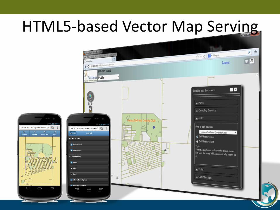
HTML5-based Vector Map Serving

Why Choose HTML5?
• Use one server to send vector maps to multiple browsers for desktops and smartphones – Internet Explorer, Firefox – Safari for iOS (iPhone and iPad) – Chrome for Android
• Performance – 2 Second Response Time – Vector map - Better map quality
• Technical Trend – HTML5 is the future – No plug-in required
3

HTML5-based Road Video Serving
4

Work Alone Safety Solution
• Use the SPOT Satellite GPS Messenger to support your work alone safety procedures – The supervisor can view all the employees’
locations on a map – The supervisor can dispatch the nearest employee
or resident to respond to an emergency – $150 hardware one time fee – $150 per year for tracking services – This solution can also be used by farmers
5
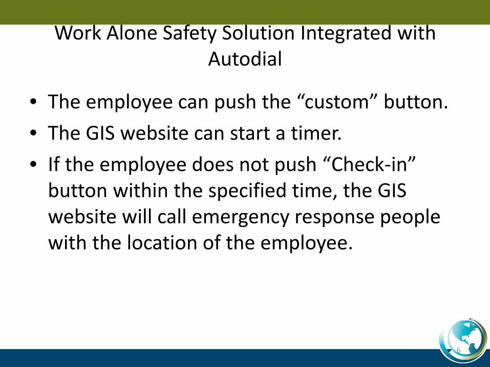
Work Alone Safety Solution Integrated with Autodial
• The employee can push the “custom” button. • The GIS website can start a timer. • If the employee does not push “Check-in”
button within the specified time, the GIS website will call emergency response people with the location of the employee.
6
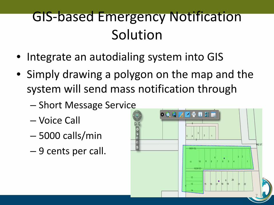
GIS-based Emergency Notification Solution
• Integrate an autodialing system into GIS • Simply drawing a polygon on the map and the
system will send mass notification through – Short Message Service – Voice Call – 5000 calls/min – 9 cents per call.
7
GIS-based Emergency Notification Solution
• Compared with alternatives: – Mail
• 63 cents for each mail • Takes days to arrive
– Door knocking • No fun when it is -30 degrees
– Manual calling • Time consuming
8

Integrating AVL with GIS
• Which road has been snow-cleared? • Which road has been graveled? • What area has been sprayed with what kind of
pesticides? • What was the weather condition when the
spraying was done?
9
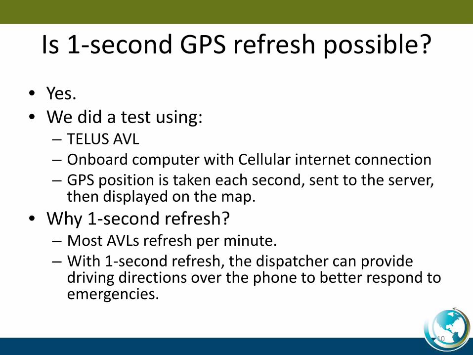
Is 1-second GPS refresh possible?
• Yes. • We did a test using:
– TELUS AVL – Onboard computer with Cellular internet connection – GPS position is taken each second, sent to the server,
then displayed on the map. • Why 1-second refresh?
– Most AVLs refresh per minute. – With 1-second refresh, the dispatcher can provide
driving directions over the phone to better respond to emergencies.
10
AVL and GIS Integration When There is no Cell Phone Signal
• Many counties in Alberta have cell phone blind spots.
• We have tested Global Star Satellite Phones • Sending or receiving simple email notifications
could take 20 to 50 seconds.
11
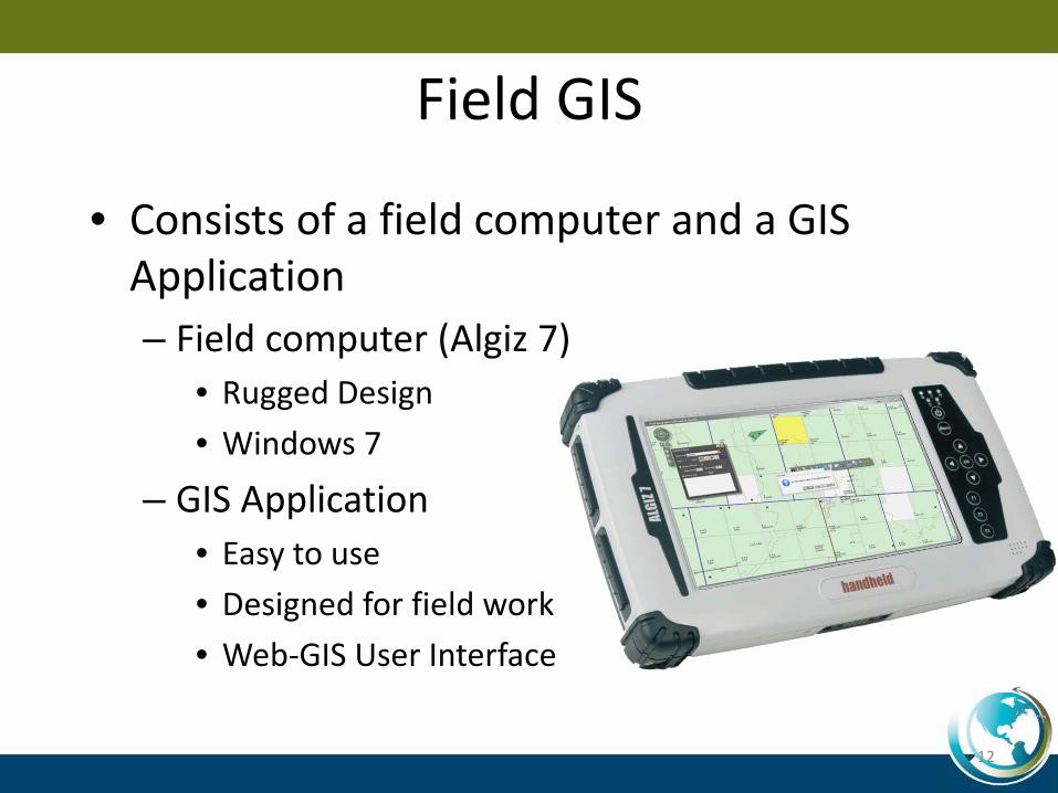
Field GIS
• Consists of a field computer and a GIS Application – Field computer (Algiz 7)
• Rugged Design • Windows 7
– GIS Application • Easy to use • Designed for field work • Web-GIS User Interface
12
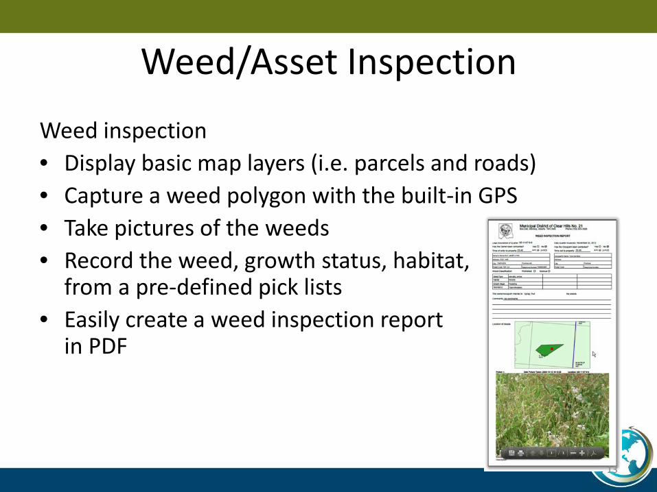
Weed/Asset Inspection
Weed inspection • Display basic map layers (i.e. parcels and roads) • Capture a weed polygon with the built-in GPS • Take pictures of the weeds • Record the weed, growth status, habitat,
from a pre-defined pick lists • Easily create a weed inspection report
in PDF
13
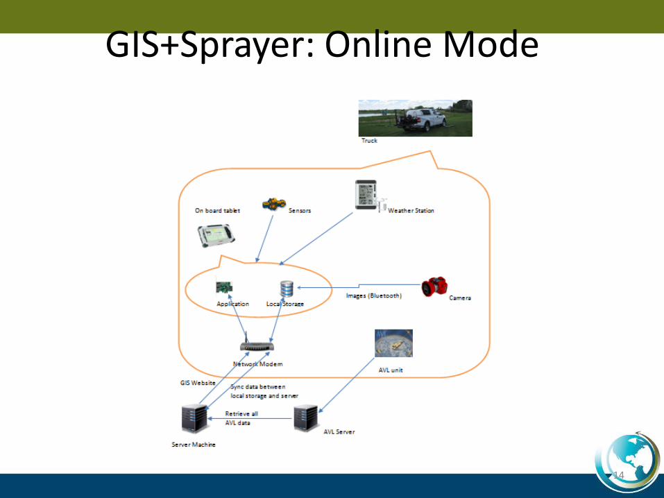
14
GIS+Sprayer: Online Mode
15
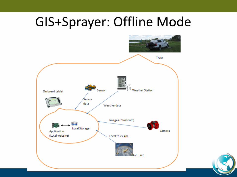
GIS+Sprayer: Offline Mode
Cloud-based GIS?
• Pros: – Offers flexibility (computing power, bandwidth,
storage, etc.) – Pay only for the usage (You could make your
website available between 8am and 5pm to save cost)
• Cons: – Cost is similar to dedicated server hosting – US Patriot Act
16
Acknowledgement
• MRF’s GIS technologies were developed with the financial support from TECTERRA Inc. and TRTech.
17