national gazetteer in the age of big …geosmartasia.org/2014/pdf/ajiputra.pdf · national...
TRANSCRIPT

CLICKHERETOKNOWMORE

P P R T - B I G P u s a t P e m e t a a n R u p a b u m i d a n T o p o n i mB a d a n I n f o r m a s i G e o s p a s i a l
N A T I O N A L G A Z E T T E E R
I N T H E A G E O F B I G ( T O P O N Y M ) D A T A
Aji Putra Perdana
INDONESIA
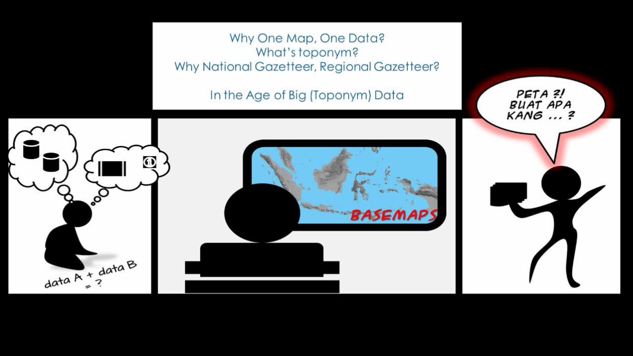
One Data & One Map

P P R T - B I G P u s a t P e m e t a a n R u p a b u m i d a n T o p o n i mB a d a n I n f o r m a s i G e o s p a s i a l
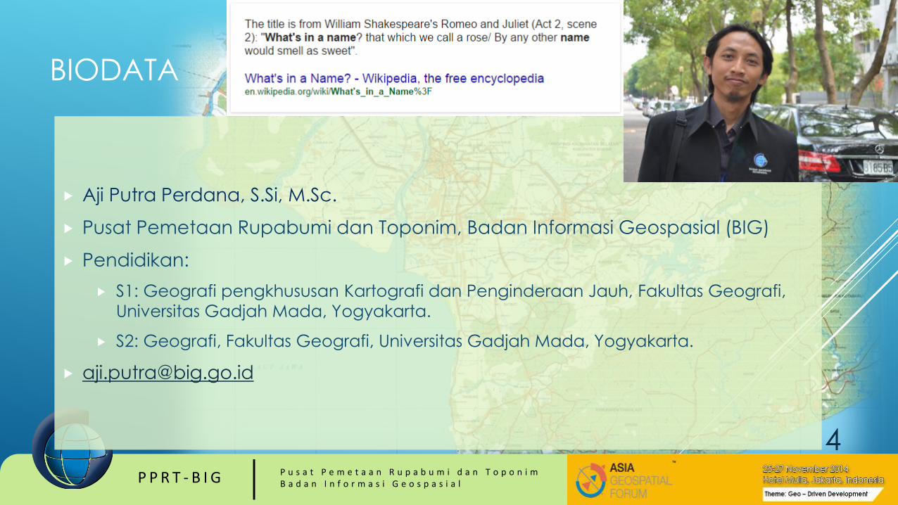
BIODATA
Aji Putra Perdana, S.Si, M.Sc.
Pusat Pemetaan Rupabumi dan Toponim, Badan Informasi Geospasial (BIG)
Pendidikan:
S1: Geografi pengkhususan Kartografi dan Penginderaan Jauh, Fakultas Geografi,
Universitas Gadjah Mada, Yogyakarta.
S2: Geografi, Fakultas Geografi, Universitas Gadjah Mada, Yogyakarta.
4

P P R T - B I G P u s a t P e m e t a a n R u p a b u m i d a n T o p o n i mB a d a n I n f o r m a s i G e o s p a s i a l
P P R T - B I G P u s a t P e m e t a a n R u p a b u m i d a n T o p o n i mB a d a n I n f o r m a s i G e o s p a s i a l

P P R T - B I G P u s a t P e m e t a a n R u p a b u m i d a n T o p o n i mB a d a n I n f o r m a s i G e o s p a s i a l
One Data & One Map
P P R T - B I G P u s a t P e m e t a a n R u p a b u m i d a n T o p o n i mB a d a n I n f o r m a s i G e o s p a s i a l
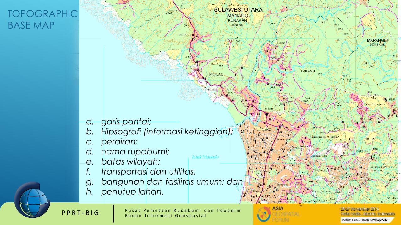
a. garis pantai;
b. Hipsografi (informasi ketinggian);
c. perairan;
d. nama rupabumi;
e. batas wilayah;
f. transportasi dan utilitas;
g. bangunan dan fasilitas umum; dan
h. penutup lahan.
TOPOGRAPHIC
BASE MAP
P P R T - B I G P u s a t P e m e t a a n R u p a b u m i d a n T o p o n i mB a d a n I n f o r m a s i G e o s p a s i a l
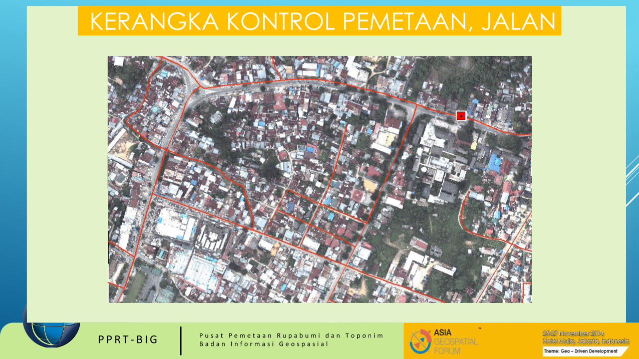
KERANGKA KONTROL PEMETAAN, JALAN
P P R T - B I G P u s a t P e m e t a a n R u p a b u m i d a n T o p o n i mB a d a n I n f o r m a s i G e o s p a s i a l
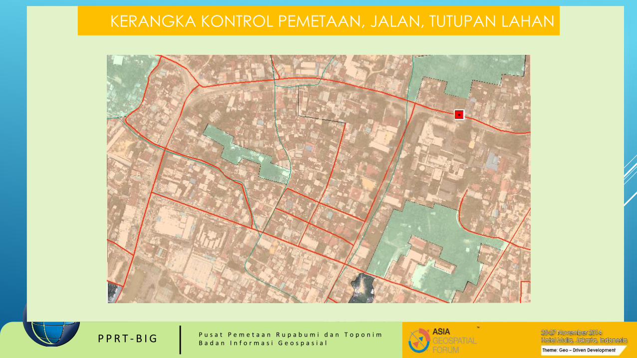
KERANGKA KONTROL PEMETAAN, JALAN, TUTUPAN LAHAN

P P R T - B I G P u s a t P e m e t a a n R u p a b u m i d a n T o p o n i mB a d a n I n f o r m a s i G e o s p a s i a l
KERANGKA KONTROL PEMETAAN, JALAN, PENUTUP LAHAN,
FASUM

P P R T - B I G P u s a t P e m e t a a n R u p a b u m i d a n T o p o n i mB a d a n I n f o r m a s i G e o s p a s i a l
KERANGKA KONTROL PEMETAAN, JALAN, PENUTUP LAHAN,
FASUM, TOPONIM
P P R T - B I G P u s a t P e m e t a a n R u p a b u m i d a n T o p o n i mB a d a n I n f o r m a s i G e o s p a s i a l
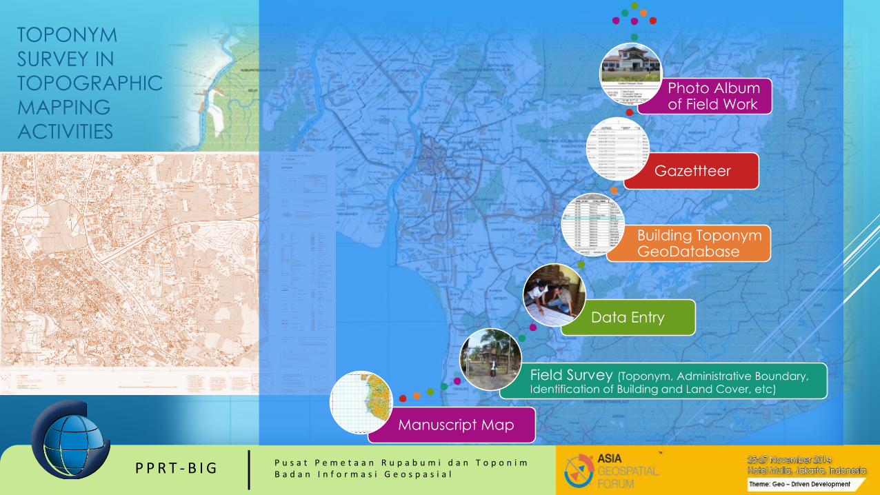
Manuscript Map
Field Survey (Toponym, Administrative Boundary, Identification of Building and Land Cover, etc)
Data Entry
Building Toponym GeoDatabase
Gazettteer
Photo Album of Field Work
TOPONYM
SURVEY IN
TOPOGRAPHIC
MAPPING
ACTIVITIES

P P R T - B I G P u s a t P e m e t a a n R u p a b u m i d a n T o p o n i mB a d a n I n f o r m a s i G e o s p a s i a l
T O P O N Y M S ?
“place”

P P R T - B I G P u s a t P e m e t a a n R u p a b u m i d a n T o p o n i mB a d a n I n f o r m a s i G e o s p a s i a l
TOPONYMS: DEFINITION
Toponyms (place names) often directly reflect spatial patterns of languages, dialects, and ethnicity, and may offer insights into the history, habitat, spatial andenvironmental perceptions of a certain culture (Jett1997).
Geographers and others have long used toponyms to provide clues as to the historical and cultural heritage of particular places and even large regions (e.g., McDavid 1958; Rickard 1968; Gelling1988; Kashif 2001),
because place names may survive long after a culture has vanished, therebypreserving traces of the past. The naming of places is also an integral aspect of the relationship between place and the politics of identity and power, as toponyms are often used by the authorities to promote their own ideological and political objectives (e.g.,Cohen and Kliot 1992; Myers 1996; Horsman 2006;
Dr. Andri Hernandi & Dr. Rizqi Abdulharis, 2014

P P R T - B I G P u s a t P e m e t a a n R u p a b u m i d a n T o p o n i mB a d a n I n f o r m a s i G e o s p a s i a l
P P R T - B I G P u s a t P e m e t a a n R u p a b u m i d a n T o p o n i mB a d a n I n f o r m a s i G e o s p a s i a l
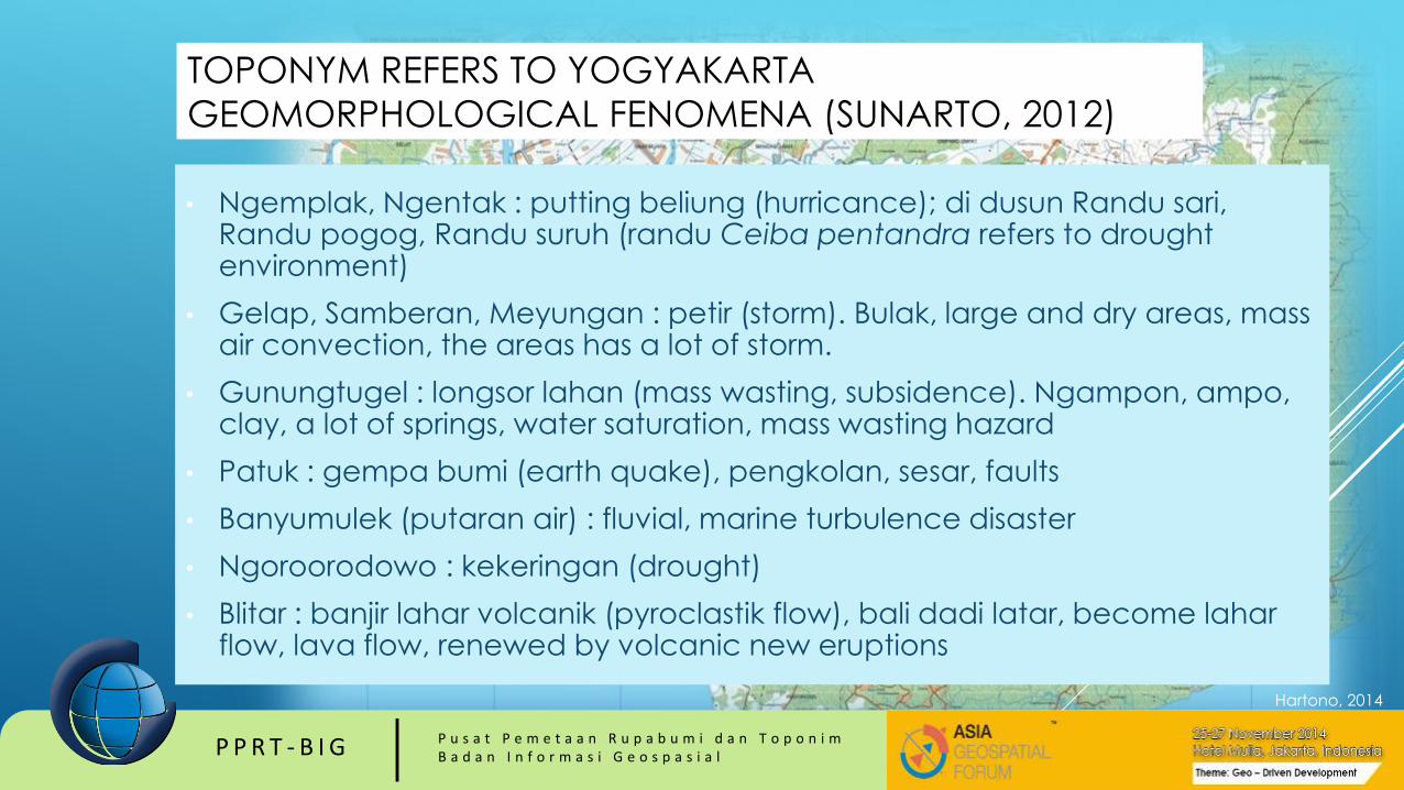
TOPONYM REFERS TO YOGYAKARTA
GEOMORPHOLOGICAL FENOMENA (SUNARTO, 2012)
• Ngemplak, Ngentak : putting beliung (hurricance); di dusun Randu sari, Randu pogog, Randu suruh (randu Ceiba pentandra refers to drought environment)
• Gelap, Samberan, Meyungan : petir (storm). Bulak, large and dry areas, mass air convection, the areas has a lot of storm.
• Gunungtugel : longsor lahan (mass wasting, subsidence). Ngampon, ampo, clay, a lot of springs, water saturation, mass wasting hazard
• Patuk : gempa bumi (earth quake), pengkolan, sesar, faults
• Banyumulek (putaran air) : fluvial, marine turbulence disaster
• Ngoroorodowo : kekeringan (drought)
• Blitar : banjir lahar volcanik (pyroclastik flow), bali dadi latar, become laharflow, lava flow, renewed by volcanic new eruptions
Hartono, 2014

P P R T - B I G P u s a t P e m e t a a n R u p a b u m i d a n T o p o n i mB a d a n I n f o r m a s i G e o s p a s i a l
Why Gazetteers?
• - 80% of data contains geospatial information
• - geospatial data utilises spatial identifiers to distinguish between real world features
described by the data
• - gazetteers are indexes of spatial identifiers
As a consequence, it is proposed that gazetteers can be used to achieve interoperability
between disparate systems.
UNSDI Gazetteer for Social
Protection in Indonesia

P P R T - B I G P u s a t P e m e t a a n R u p a b u m i d a n T o p o n i mB a d a n I n f o r m a s i G e o s p a s i a l

P P R T - B I G P u s a t P e m e t a a n R u p a b u m i d a n T o p o n i mB a d a n I n f o r m a s i G e o s p a s i a l
VERIFIKASI/
VALIDASI
KONSULTASI PAKAR
OFFICE TREATMENT
(pengolahan data hasil survei)
Tim Surveyor dan
Tim Teknis
Tim Teknis dan
Tim Pakar
Tim Nasional dan
Pemangku
Kepentingan
Daerah
Akurasi Koordinat
dan
Daftar Usulan
Nama
Akurasi Koordinat dan
Daftar Sementara Nama
Usulan Gasetir
TOPONYM VERIFICATION AND VALIDATION BY TIMNAS AND PPNR
PROVINCE, COUNTY/CITY

P P R T - B I G P u s a t P e m e t a a n R u p a b u m i d a n T o p o n i mB a d a n I n f o r m a s i G e o s p a s i a l
IND
ON
ESIA
N G
AZETT
EER
TIMNAS Toponym
Data (Island Names and
Administrative Names)
BIG Toponym Database
(GeoNamesfrom
Topographic Map scale 1:25.000 or 1:50.000)
Toponym Data on
Topo Map (scale
1:10.000, 1:25.000,
1:50.000 and 1:250.000)
GEOGRAPHICAL NAMES
Peta RBI-Fundamental Dataset- IGD
BIG Toponymic
Geodatabase
Verified Toponymic
Data
Validated Toponymic
Data
NATIONAL GAZETTEER
BIG GAZETTEER TO SUPPORT
NATIONAL GAZETTEER
P P R T - B I G P u s a t P e m e t a a n R u p a b u m i d a n T o p o n i mB a d a n I n f o r m a s i G e o s p a s i a l
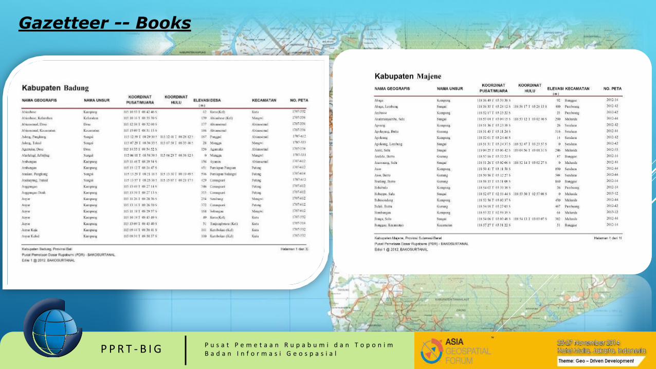
Gazetteer -- Books

P P R T - B I G P u s a t P e m e t a a n R u p a b u m i d a n T o p o n i mB a d a n I n f o r m a s i G e o s p a s i a l
REGIONAL MAP AND GAZETTEER UNGEGN ASEPSW
P P R T - B I G P u s a t P e m e t a a n R u p a b u m i d a n T o p o n i mB a d a n I n f o r m a s i G e o s p a s i a l
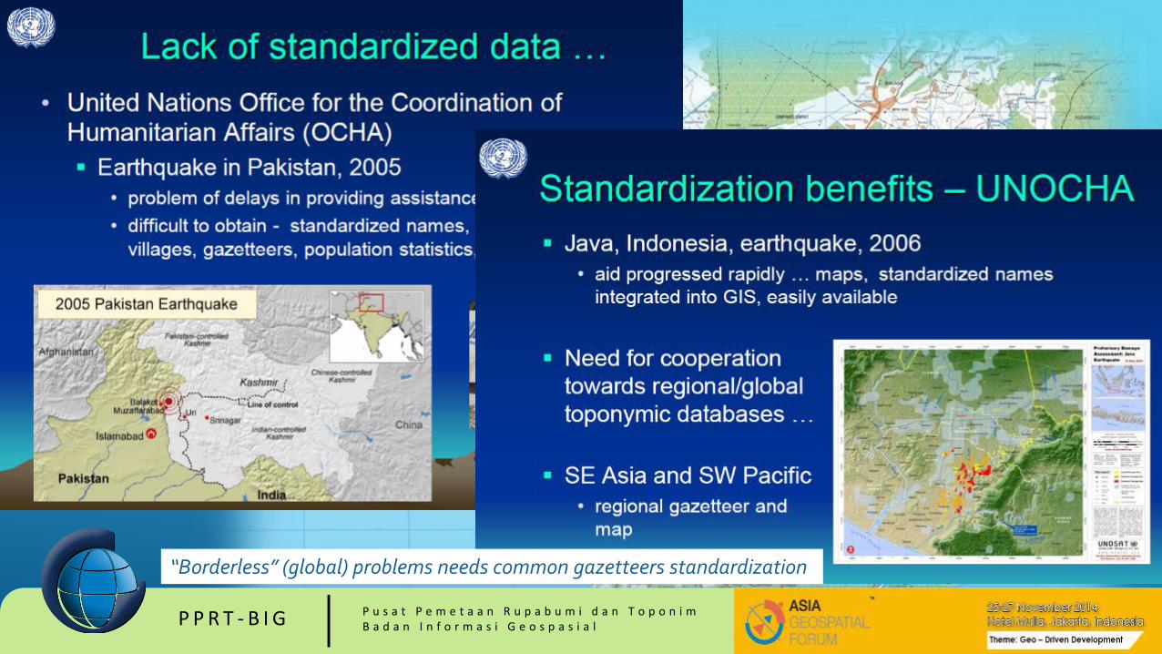
“Borderless” (global) problems needs common gazetteers standardization

P P R T - B I G P u s a t P e m e t a a n R u p a b u m i d a n T o p o n i mB a d a n I n f o r m a s i G e o s p a s i a l
NATIONAL GAZETTEER
Every country should construct a gazetteer of geographical names.
The National Gazetteer is an officially approved and standardized set of information
about geographical names which is the sole authority for all official documents.
It provides the correct name and its spelling for all parties, government, the public,
the mass media, school book publishers and map makers.
(Multamia RMT Lauder and Allan F Lauder, 2014)
P P R T - B I G P u s a t P e m e t a a n R u p a b u m i d a n T o p o n i mB a d a n I n f o r m a s i G e o s p a s i a l
P P R T - B I G P u s a t P e m e t a a n R u p a b u m i d a n T o p o n i mB a d a n I n f o r m a s i G e o s p a s i a l
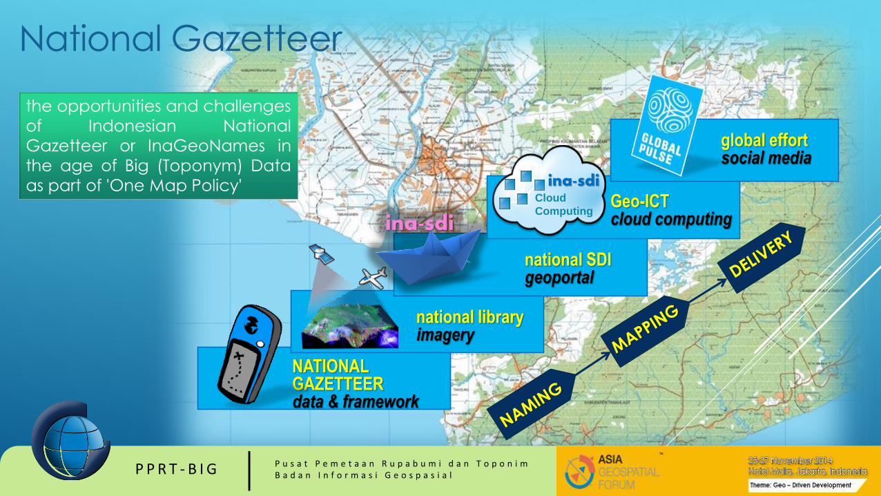
NATIONAL GAZETTEERdata & framework
national libraryimagery
ina-sdi
national SDIgeoportal
Geo-ICTcloud computing
Cloud
Computing
ina-sdi
global effortsocial media
National Gazetteer
the opportunities and challenges
of Indonesian National
Gazetteer or InaGeoNames in
the age of Big (Toponym) Data
as part of 'One Map Policy'
P P R T - B I G P u s a t P e m e t a a n R u p a b u m i d a n T o p o n i mB a d a n I n f o r m a s i G e o s p a s i a l
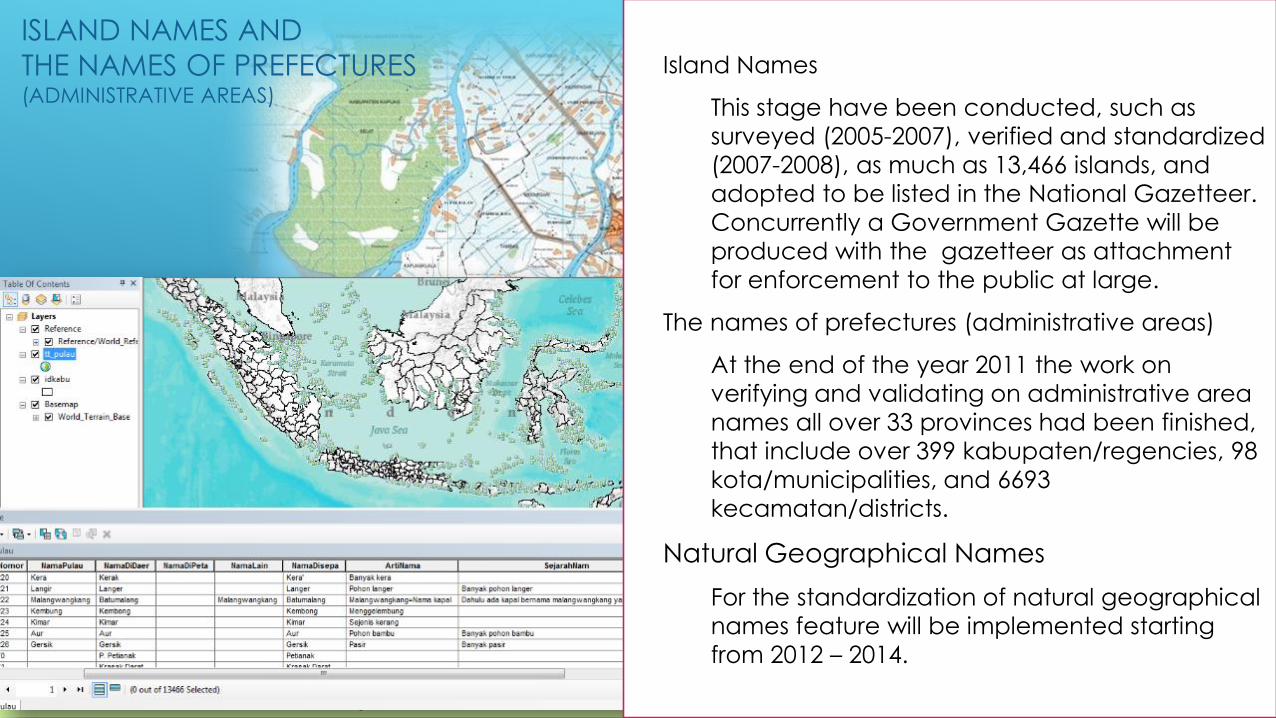
ISLAND NAMES AND
THE NAMES OF PREFECTURES(ADMINISTRATIVE AREAS)
Island Names
This stage have been conducted, such as
surveyed (2005-2007), verified and standardized
(2007-2008), as much as 13,466 islands, and
adopted to be listed in the National Gazetteer.
Concurrently a Government Gazette will be
produced with the gazetteer as attachment
for enforcement to the public at large.
The names of prefectures (administrative areas)
At the end of the year 2011 the work on
verifying and validating on administrative area
names all over 33 provinces had been finished,
that include over 399 kabupaten/regencies, 98
kota/municipalities, and 6693
kecamatan/districts.
Natural Geographical Names
For the standardization of natural geographical
names feature will be implemented starting
from 2012 – 2014.
P P R T - B I G P u s a t P e m e t a a n R u p a b u m i d a n T o p o n i mB a d a n I n f o r m a s i G e o s p a s i a l
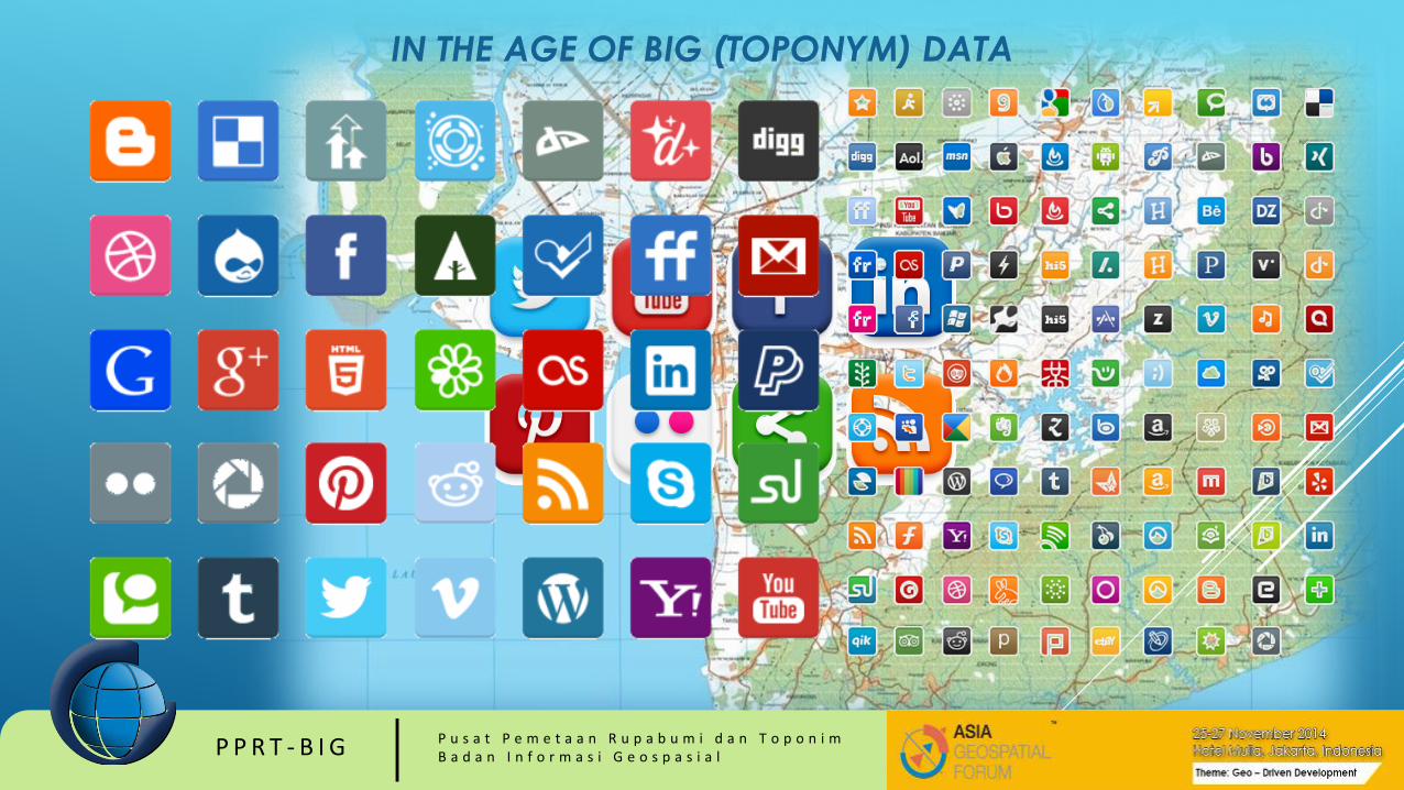
IN THE AGE OF BIG (TOPONYM) DATA

IPHONE VS HP ANDROID BERDASARKAN GEOTAGGED TWEETSWashington, DC:
Merah: pengguna Iphone
Hijau: pengguna Android
developed by Gnip, MapBox

PENGGUNA BLACKBERRYNew York City:
Merah: pengguna Iphone
Hijau: pengguna Android
Ungu: pengguna Blackberry
developed by Gnip, MapBox

BLACKBERRY DI JAKARTAJakarta:
Merah: pengguna Iphone
Hijau: pengguna Android
Ungu: pengguna Blackberry
developed by Gnip, MapBox

P P R T - B I G P u s a t P e m e t a a n R u p a b u m i d a n T o p o n i mB a d a n I n f o r m a s i G e o s p a s i a l

P P R T - B I G P u s a t P e m e t a a n R u p a b u m i d a n T o p o n i mB a d a n I n f o r m a s i G e o s p a s i a l
GAZETTEER FRAMEWORK – SPATIAL IDENTIFIER REFERENCE FRAMEWORK
BIG, INDONESIA – CSIRO, AUSTRALIA
to build an indexed gazetteer classified toponym into
verified, official, unofficial, not yet gazette, or to be verified.

P P R T - B I G P u s a t P e m e t a a n R u p a b u m i d a n T o p o n i mB a d a n I n f o r m a s i G e o s p a s i a l
SOP
Updating
Toponym
data
from
unofficial
data
P P R T - B I G P u s a t P e m e t a a n R u p a b u m i d a n T o p o n i mB a d a n I n f o r m a s i G e o s p a s i a l
CONCLUDING REMARKS
In the age of Big (Toponym) Data there is a big need to use a
single 'official gazetteer' as reference for 'georeferencing'
volunteered Big Geo-Data, user generated content or
unstructured textual words and phrases.
On the other hand, to accelerate the toponym data collection
should be analyze the possibility of the use Volunteered
Geospatial Information or any Big (Toponym) Data as
crowdsource gazetteer some novel approaches have to be
done.
P P R T - B I G P u s a t P e m e t a a n R u p a b u m i d a n T o p o n i mB a d a n I n f o r m a s i G e o s p a s i a l
T e r i m a K a s i h