mr. o’donnell’s class geography dbq
TRANSCRIPT

Mr. O’Donnell’s Class Geography DBQ
Name: ____________________________________ Period: _______ Number: __OD-___
Document 1: A physical map of New York State.
1) Name the two Mountain Ranges in New York state?
2) If you were going to plan the roads in New York State, how would this map be helpful?
Historical Context: Maps are cool. They can communicate all kinds of information about
places. Physical maps tell you about land forms and political maps tell you about the bound-
aries between governments. There are maps that communicate what people eat or what they
do for a living. There is almost no limit to the types of maps you can create.
Writing Task: Using the documents and your own knowledge of American history write a
D.B.Q. essay explaining:
At least four different types of information that can be shown on a map

Document 2: A map created by Shannon Glazer to illustrate regional food favorites in
New York State.
3) What is the favorite food of people living in Watertown?
4) Which thee cities in New York State refer to carbonated beverages as “pop”?
5) Compare the Document 1 and Document 2 and then explain why the maps creator thinks
the “favorite” food label for The Adirondack Mountains is funny?

Document 3: A map of the products of New York State and where those products are
made.
6) How many areas of manufacturing are their in New York State?
7) What product is produced the most north (above) the black line?
8) Would it be fair to say New York State ‘s products are mostly manufactured? Why or why
not?

Document 4: A map of New York State with Longitude and Latitude labeled.
9) Which city is the capital of New York State?
10) What city is located by 42 degrees North and 76 degrees West?
11) How many cities in New York State are west of Buffalo?

Document 5: A map of the British plan for taking New York State in 1777.
12) What city was General St. Leger army suppose to start from?
13) What city was the three British Army’s suppose to meet each other at?

Document 6: A map of the Major canals New York State in 1850.
14) The westward end of the Erie Canal is Lake Erie. What river is the eastern end of the
canal?
15) Using the Erie Canal and the river mentioned above, you could sail from Buffalo to what
major city?
16) Why are most of the cities in New York State are located on the Erie Canal?
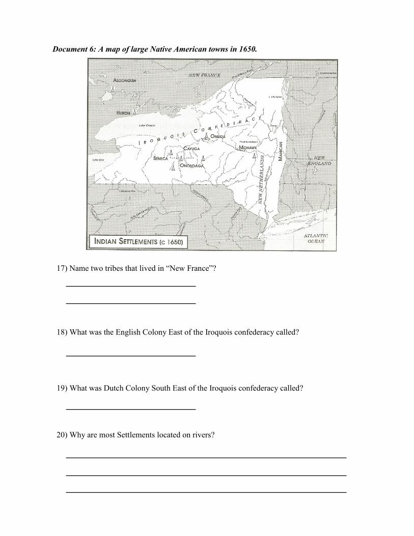
Document 6: A map of large Native American towns in 1650.
17) Name two tribes that lived in “New France”?
18) What was the English Colony East of the Iroquois confederacy called?
19) What was Dutch Colony South East of the Iroquois confederacy called?
20) Why are most Settlements located on rivers?

Historical Context: Maps are cool. They can communicate all kinds of information about
places. Physical maps tell you about land forms and political maps tell you about the bound-
aries between governments. There are maps that communicate what people eat or what they
do for a living. There is almost no limit to the types of maps you can create.
Writing Task: Using the documents and your own knowledge of American history write a
D.B.Q. essay explaining:
At least four different types of information that can be shown on a map