mourne outdoor recreation action plan
TRANSCRIPT
Mourne Outdoor Recreation Action
Plan
Prepared by Outdoor Recreation NI on behalf of
Sport NI and in partnership with the Mourne
Outdoor Recreation Forum
October 2014

Page 2 of 93
CONTENTS
TABLE OF FIGURES ........................................................................................................................................................ 5
FOREWORD ..................................................................................................................................................................... 6
1. INTRODUCTION .................................................................................................................................................. 7
1.1. The Need for this Plan .................................................................................................................................. 7
1.2. Purpose of Plan ............................................................................................................................................... 7
1.4. Scope ................................................................................................................................................................. 8
1.5. Activities Covered ......................................................................................................................................... 9
2. METHODOLOGY ................................................................................................................................................ 11
3. INTRODUCTION ................................................................................................................................................ 13
3.1. National Context – NI wide ...................................................................................................................... 13
3.2. Local Context – The Mournes Destination ........................................................................................... 14
3.3. Other Factors to Consider ........................................................................................................................ 15
4. NATURAL AND BUILT HERITAGE ................................................................................................................ 17
4.1. Natural Heritage ........................................................................................................................................... 17
4.2. Built Heritage................................................................................................................................................. 17
5. ACCESS ................................................................................................................................................................... 20
6. LAND OWNERSHIP ............................................................................................................................................ 23
7. CURRENT PROVISION ...................................................................................................................................... 25
7.1. Land-Based Activities......................................................................................................................................... 25
7.1.1. Adventure Racing ....................................................................................................................................... 25
7.1.2. Archery ......................................................................................................................................................... 25
7.1.3. Blokarting ..................................................................................................................................................... 25
7.1.4. Boot Camps ................................................................................................................................................. 25
7.1.5. Bushcraft ....................................................................................................................................................... 25
7.1.6. Clay Pigeon Shooting ................................................................................................................................. 26
7.1.7. Cycling (On and Off Road Cycling) ........................................................................................................ 26
7.1.8. Fell running ................................................................................................................................................... 27
7.1.9. High Ropes /Ziplines .................................................................................................................................. 27
7.1.10. Hill Walking ............................................................................................................................................... 27
7.1.11. Horse Riding .............................................................................................................................................. 27
7.1.12. Kite Buggying ............................................................................................................................................. 28
7.1.13. Mountain Biking ........................................................................................................................................ 28
7.1.14. Mountain Boarding ................................................................................................................................... 29
7.1.15. Orienteering .............................................................................................................................................. 29

Page 3 of 93
7.1.16. Paintballing ................................................................................................................................................. 29
7.1.17. Rock Climbing ........................................................................................................................................... 29
7.1.18. Segway ........................................................................................................................................................ 30
7.1.19. Walking ....................................................................................................................................................... 31
7.1.20. Zorbing ....................................................................................................................................................... 33
7.2. Water-based Activities ..................................................................................................................................... 33
7.2.1. Angling ........................................................................................................................................................... 33
7.2.2. Boat Cruising ............................................................................................................................................... 34
7.2.3. Bouldering .................................................................................................................................................... 34
7.2.4. Canoeing/Kayaking/Slalom ........................................................................................................................ 34
7.2.5. Caving ............................................................................................................................................................ 35
7.2.6. Coasteering .................................................................................................................................................. 35
7.2.7. Diving............................................................................................................................................................. 35
7.2.8. Hovercrafting ............................................................................................................................................... 35
7.2.9. Rowing .......................................................................................................................................................... 35
7.2.10. Sailing ........................................................................................................................................................... 35
7.2.11. Stand-Up Paddleboarding ....................................................................................................................... 35
7.2.12. Surfing ......................................................................................................................................................... 35
7.2.13. Waterskiing/Wakeboarding ................................................................................................................... 35
7.2.14. Windsurfing ............................................................................................................................................... 36
7.3. Air-based Activities ............................................................................................................................................ 36
7.3.1. Aero-modelling ........................................................................................................................................... 36
7.3.2. Gliding ........................................................................................................................................................... 36
7.3.3. Hang Gliding/Paragliding ........................................................................................................................... 36
7.3.4. Micro-light Flying ........................................................................................................................................ 36
7.3.5. Sky Diving/ Parachuting ............................................................................................................................. 36
7.4. Outdoor Education Centres ........................................................................................................................... 37
7.5. Activity Providers ............................................................................................................................................... 37
7.6. Events .................................................................................................................................................................... 39
7.7. Summary ............................................................................................................................................................... 42
8. CONSULTATION RESULTS .................................................................................................................................. 44
9. SWOT ANALYSIS ................................................................................................................................................. 45
10. ISSUES AND BARRIERS .................................................................................................................................. 47
11. FUTURE DEVELOPMENT .............................................................................................................................. 48
11.1. The ‘BIG’ Issues ............................................................................................................................................ 48

Page 4 of 93
11.2. The ‘Bottom Up’ Approach ....................................................................................................................... 48
11.2.1. High Mournes Development ............................................................................................................ 48
11.2.2. Low Mournes Development ............................................................................................................. 50
12. ACTION PLAN ................................................................................................................................................. 57
13. CONCLUSIONS ............................................................................................................................................... 64
14. OUTDOOR RECREATION MAPS .............................................................................................................. 65
15. BIBLIOGRAPHY ................................................................................................................................................ 76
16. APPENDIX ......................................................................................................................................................... 77
16.1. Terms of Reference ..................................................................................................................................... 77
16.2. Consultation Questionnaire ...................................................................................................................... 78
16.3. Consultation Poster ..................................................................................................................................... 81
16.4. Project Consultees ....................................................................................................................................... 82
16.5. Public Consultation Event Attendees ...................................................................................................... 83
16.6. Natural and Built Heritage ......................................................................................................................... 84
16.7. PRoW and Permissive Paths ...................................................................................................................... 88
ACRONYMS .................................................................................................................................................................... 91
DEFINITION OF TERMS.............................................................................................................................................. 92

Page 5 of 93
TABLE OF FIGURES
Fig. 1 Project Scope ........................................................................................................................................................ 10
Fig. 2 Natural Heritage .................................................................................................................................................. 18
Fig. 3 Built Heritage ........................................................................................................................................................ 19
Fig. 4 Public Rights of Way and Permissive Paths ................................................................................................... 21
Fig. 5 Access Points ........................................................................................................................................................ 22
Fig. 6 Land Ownership ................................................................................................................................................... 24
Fig. 7 Mourne Outdoor Recreation Action Plan ..................................................................................................... 63
Fig. 8 Activity Providers ................................................................................................................................................ 66
Fig. 9 Current Provision - Angling .............................................................................................................................. 67
Fig. 10 Current Provision - Canoeing ........................................................................................................................ 68
Fig. 11 Current Provision - Climbing ......................................................................................................................... 69
Fig. 12 Current Provision - Cycling ............................................................................................................................ 70
Fig. 13 Current Provision - Mountain Biking ............................................................................................................ 71
Fig. 14 Current Provision - Orienteering ................................................................................................................. 72
Fig. 15 Current Provision - All Air Activities ........................................................................................................... 73
Fig. 16 Future Development - Site Based.................................................................................................................. 74
Fig. 17 Future Development - Activity Based .......................................................................................................... 75
Table 1 Outdoor Recreation Activities Covered ..................................................................................................... 9
Table 2 Consultee Categories and Consultation Methods Employed ............................................................... 11
Table 3 Mountain Bike Trails - Usage ........................................................................................................................ 28
Table 4 Formal Walking Sites ...................................................................................................................................... 32
Table 5 Informal Walking Sites .................................................................................................................................... 33
Table 6 Walking Sites - Usage (Source: Mourne Heritage Trust) ...................................................................... 33
Table 7 2013 Events Calendar (Source: Mourne Heritage Trust) ...................................................................... 42
Table 8 SWOT Analysis ................................................................................................................................................ 46

Page 6 of 93
FOREWORD
Please note that this report is not an exhaustive list of all current outdoor recreation within the
Mourne and Slieve Croob AONB region. The results recorded are based on data gathered through
existing studies and information collected through desk research and consultation.
Although every endeavour has been taken to ensure accuracy in mapping, some trails, sites, public land
and activities may appear under-represented due to a lack of feedback or limited response.

Page 7 of 93
1. INTRODUCTION
1.1. The Need for this Plan
Over the last 30 years a number of recreation and access-related strategies have been produced for the
Mournes including:
- Greer & Murray (1988) Recreation Strategy for the Mourne AONB
- Countryside Consultancy (2002-2006) Mourne Countryside Recreation Strategy
- Outdoor Recreation NI (2007) Mourne AONB Access Study
- Dafydd Davis (2012) The Mournes and Slieve Croob Strategic Path Review
In the last 10 years the provision and management of outdoor recreation in the Mournes area has
significantly changed rendering some of these plans out-of-date. Despite this the Mournes area has seen
a notable investment in activity products which are marketable for tourism, the prime examples being
the ‘Mourne Mountain Bike Trails’; several sites have been developed under the auspices of the ‘Mourne
Mountains’ destination branding scheme and the Mourne Forests are set to become key tourist
attractions in the future.
Recognising this gap, the ‘Outdoor Recreation Action Plan for Northern Ireland – Our Great Outdoors’
(2014) includes the recommendation;
“to map current hubs for outdoor recreation and identify geographical gaps in provision...and to develop
a framework for creating recreational ‘master plans’ for these hubs to ensure appropriate infrastructure
and management’1.
1.2. Purpose of Plan
Despite advancement in the Mournes tourism status; it is one of NITB’s nine signature, world class
destinations; there is no one document which provides an up-to date picture of current recreation
provision or outlines what the priorities for future development might be.
The intended purpose of this Plan is to address this gap and produce an ‘Action Plan’ which sets out a
framework for the development of outdoor recreation across the Mournes area. The Plan will
specifically highlight priorities for future development and suggest recommendations for projects which
are recreation related.
Providing opportunities for increased participation is one of Sport NI’s key priorities2. This study is
intended to make proposals for future development which contribute to increasing the provision and
opportunities for local people and visitors to engage in physical recreation. However this should not be
at the expense of the natural environmental. Protection of the natural environment remains paramount
thus any recommendations will take account of the total impact on the Mournes ecosystem and the
services’ it provides.
The Plan will act as a guide and as a platform for advocating future development to be used by Mourne
Outdoor Recreation Forum, Sport NI and other stakeholders with a mutual interest in outdoor
recreation in the Mournes. Identifying the need for projects through this Plan may also help to secure
financial support in the future.
1 Action E1 2 Sport NI, ‘Sport Matters: The Strategy for Sport and Physical Recreation 2009-19’

Page 8 of 93
1.3. Aim & Objectives
The aim of this Plan is:
‘To prepare a framework for the sustainable development, management and promotion of future
outdoor recreation facilities and opportunities within the Mournes and Slieve Croob AONB region,
accommodating both the needs of the local community and those visiting the area’
The broad objectives of this Plan Strategy are to3:
detail and GIS map the nature and extent of current outdoor recreation provision in the Mournes
identify the future opportunities for outdoor recreation in the Mournes
produce a 5-10 year Action Plan outlining delivery partners
1.4. Scope
The study area is defined as the Mourne and Slieve Croob AONB area which measures approximately
57,965 hectares4.
The study area incorporates not just the Mourne Mountains but also the south east coastline from
Dundrum to Warrenpoint incorporating Carlingford Lough, numerous rivers including the Bann, Shimna
and Lagan, several inland lakes and reservoirs including Spelga and Silent Valley, forests and forest parks
including Castlewellan, Tollymore, Donard, Rostrevor and Slieve Gullion and towns such as Hilltown,
Warrenpoint, Newry, Kilkeel, Annalong, Dundrum, Newcastle, Forkhill, Jonesborough and Finnis.
The project area falls within three local council areas – Newry and Mourne District Council (c. 70%)
Down District Council (c.20%) and Banbridge District Council (c.10%). Under the Review of Public
Administration (RPA) in 2015 Newry and Mourne and Down District Council will combine to form one
administrative body, i.e. Newry, Mourne and Down Council with the inclusion of Slieve Croob which
currently falls within Banbridge District Council area.
3 The full Terms of Reference for this Project are available in Appendix 16.1 4 Source: NIEA Natural Designations – GIS database

Page 9 of 93
1.5. Activities Covered
39 outdoor recreation activities5 are covered by this study, as shown in Table 1. These activities are all
dependant on sustainable access to the natural environment. Golf, hunting and motorised sports are
not included.
ACTIVITIES COVERED
LAND WATER AIR
Adventure Racing Angling Aero-Modelling
Archery Boat Cruising Gliding
Blokarting Bouldering Hang Gliding/Paragliding
Boot Camps Canoeing (including
Kayaking and Slalom) Micro-Light Flying
Bush Craft Caving Sky Diving/Parachuting
Clay Pigeon Shooting Coasteering
Cycling (On- and Off- Road) Diving
Fell Running Hovercrafting
High Ropes/Ziplines Rowing
Hill Walking Sailing
Horse Riding Stand Up Paddleboarding
(SUP)
Kite Buggying Surfing
Mountain Biking Waterskiing/Wakeboarding
Mountain Boarding Windsurfing
Orienteering
Paintballing
Rock Climbing
Segway
Walking
Zorbing
Table 1 Outdoor Recreation Activities Covered
5 These activities were chosen because they are covered under Outdoor Recreation NI’s remit and are listed on
OutdoorNI.com

Fig. 1 Project Scope

2. METHODOLOGY
Data used to produce this Plan was collected, analysed and presented using a three-tiered approach:
1. Use of Existing Information and Data
Existing information and data gathered through previous reports such as the 2007 Mourne Access
Strategy and 2012 Strategic Path Review was collated. Information about current provision and land
ownership was derived in-house records and from the following sources:
Existing databases - WalkNI.com, CycleNI.com, Ulster Way, CanoeNI.com, MountainBikeNI.com
Research projects - Public Land Mapping Phase 1 and 2, Mourne Forest Scoping Studies
2. Consultation
Table 2 shows how consultees were grouped and the consultation method employed for each.
Consultee Category Consultation Method
Local Council Officers Face-to-face meeting
Invited to public consultations
Governing Bodies Questionnaire (via email)
Telephone or email interviews (depending on convenience)
Public/Statutory Agencies Questionnaire (via email)
Face-to-face meeting (where relevant)
Follow-up phone call to discuss (where relevant)
Outdoor Education Centres Face-to-face meeting
Activity Providers Questionnaire (via email)
Follow-up phone call to discuss (where relevant)
General public, community
groups, local clubs and MORF
Public Consultation
Table 2 Consultee Categories and Consultation Methods Employed
Three public consultation events were organised and widely promoted through the following channels:
- Direct emails to all of the above groups (database compiled by Outdoor Recreation NI)
- Editorials in local newspapers including Newry Reporter

Page 12 of 93
- Websites including Outdoor Recreation NI.com, Outdoor NI.com, WalkNI.com and
CommunityNI.com
- Direct email to members via County Down Rural Community Network
- Direct emails via Council’s mailing lists
- Direct emails to governing bodies for disseminations amongst member organisations
- Wide circulation of a poster which advertised the dates, venues and purpose of the events (see
Appendix).
The event dates and venues were:
- Monday 9th December at Tollymore National Outdoor Centre
- Tuesday 10th December at Hillyard House, Castlewellan
- Wednesday 11th December Warrenpoint Town Hall
The consultation events involved a short presentation given by Outdoor Recreation NI followed by
workshop style discussions on 2 main topics (i) current outdoor recreation provision and associated
issues, and (ii) future opportunities for development.
47 different organisations and groups were represented through the consultation events, the results of
which are summarised in Chapter 10.6
3. Use of GIS
The spatial mapping tool ArcGIS was used to analyse and present the spatial data collected through this
study. The following information was mapped:
- current provision of all land, air and water-based activities (sites and trails)
- land ownership (public and private)
- Public Rights of Way (PRoW) and permissive path agreements
- environmental designations
- future development opportunities
Please note that where the extent of the landownership was known, this was shown in polygon format,
where the extent of land ownership was not known, this was shown in point format.
6 See Appendix 17.3 for a full list of project and public event consultees

Page 13 of 93
3. INTRODUCTION
This chapter outlines the context of this Outdoor Recreation Plan and how it fits with other relevant
plans and strategies written at a national and local level.
3.1. National Context – NI wide
A Draft Tourism Strategy for Northern Ireland to 2020
The first national Strategy to name ‘The Mournes’ as a ‘signature project’ was NITB’s ‘Strategic
Framework for Action 2004-2007’. As a result of this Strategy a total of £3,647, 626.74 has been
invested in the Mournes through infrastructure development, access, signage, site enhancement,
interpretation and public art projects. Specifically the Mournes is benefitting from the creation of the
Mourne Coastal Route, exclusive Mourne Destination branding and the Mourne Mountain Bike Trails.
The Draft 2020 Tourism Strategy represents how the approach to tourism development has evolved
and ‘the Mournes’ is now referred to as a ‘signature destination’ rather than a ‘signature project.
The Strategy still represents a ‘top down’ approach to tourism development outlining the over-arching
goals of economic growth and sustainability. More importantly it outlines how this should be done, for
example through ‘visitor inspired experiences’, competitiveness, cross-border partnerships and product
differentiation. 3 themes are indentified: 1. People, 2. Product & Places, and 3. Promotion symbolising a
3-pronged approach to tourism development.
Under ‘Product & Places’ and from 2014 onwards the Action Plan contained in this Strategy focuses on
the ‘completion of the signature projects’ and fine-tuning the tourism products on offer through
investing in existing product, developing year-round events, improving access especially to the public
forest estate and preserving the natural environment, etc. (pp. 21-22)
How does the Mournes Outdoor Recreation Plan fit with the above?
The Mournes continues to be a key priority for DETI and NITB. The ‘Destination’ is seen as one of the
key delivery agents in achieving national tourism targets. But whereas the Draft Tourism Strategy
represents a ‘top-down’ approach this Outdoor Recreation Plan represents a bottom-up approach to
enhancing outdoor recreation for visitors and residents alike. None the less this Plan endeavours to
make recommendations which are complementary to the goals set out in this National Strategy, and the
more area-specific targets that are set out in the Destination Tourism Plan discussed below.
‘Our Great Outdoors’ - The Outdoor Recreation Action Plan for Northern Ireland, 2013-
2020
This 7-year plan sets out the aspirations for creating and the actions for achieving “a culture of dynamic,
sustainable outdoor recreation in Northern Ireland” (2013, pp.4). It is intended that this plan will act as
the ‘driver’ for “Government, businesses and voluntary organisations to work together to achieve
greater accessibility to the outdoors in a sustainable and responsible manner” (pp.5). Actions over the
next 7 years are categorised according to 6 themes: 1. Structures & Partnerships, 2. Legislation, Policy
and Responsibilities, 3. Making the Outdoors More Accessible, 4. Investment of Time, Energy and
Resources, 5. Communication, Marketing and Promotion, and 6. Research & Monitoring.
How does the Mournes Outdoor Recreation Plan fit with the above?

Page 14 of 93
The rationale for this Mournes Plan comes from the national Outdoor Recreation Action Plan. Under
the aspirations of Theme 3 it is recommended that current outdoor recreation hubs are audited,
geographical gaps in provision identified and recommendations made for developing access and
opportunities for participation. These are very much intended to be locally based plans with the more
strategic, national issues being addressed by the proposed National Outdoor Recreation Forum which
will be created as part of this national Plan.
3.2. Local Context – The Mournes Destination
Destination Mourne Mountains Tourism Management Plan 2013-18
This Destination Action Plan was published by the Destination Forum Group made up of public and
private stakeholders including Down District Council, Newry and Mourne District Council and
Banbridge District Council. It outlines a collective vision and set of actions to grow tourism at a local
level within the signature destination and also fulfil national targets set out in the draft 2020 Tourism
Strategy.
The Mournes tourism profile is made up of mostly day visitors and visitors within Northern Ireland.
61% of visitors are families while 21% are couples and 30% of all those visiting participate in
hiking/walking (pp. 3).
The Tourism Plan identifies that the Mourne Mountains’ strengths are: 1. Walking and Climbing, 2.
Scenery, beautiful landscape and views, 3. Mountain biking and cycling, 4. Seaside, beaches and
Newcastle, 5. The Mournes and other mountains, 6. Silent Valley and 7. Outdoor recreation and
activities (all) (pp. 4).
Playing on these strengths, the vision for the Mournes is “The Outdoor Playground for the North of
Ireland” and the objective is to “maximise the Mournes potential to attract and encourage visitors to
stay longer and spend more”.
To achieve this vision, key actions are listed under 4 strategic themes: 1. Investment & Infrastructure, 2.
Marketing & Promotion, 3. Distinct Visitor Experiences and 4. Building Business Engagement &
Sustainability. Under Theme 3, the core signature activities are golf, mountain biking, walking and
climbing (pp. 9).
How does the Mournes Outdoor Recreation Plan fit with the above?
Although this Outdoor Recreation Plan is not a tourism plan it is intended that the recommendations
contribute to achieving tourism objectives via a bottom-up approach. This Outdoor Recreation Plan
includes proposals for the development of activities, sites and trails at a local level which will enhance
the product offering and increase the appeal of the Mourne Mountains destination for day visitors, local
communities, families and couples. This Plan fits with the Tourism Plan because it takes into account
the priorities and makes recommendations for the development/improvement of core activities of
walking and mountain biking as well as other land and water based activities.
The Mournes & Slieve Croob Strategic Path Review 2012
Completed by Dafydd Davis in 2012 on behalf of the Mourne Heritage Trust the Strategic Path Review
sets out recommendations for the sustainable maintenance, management and development of the
recreational path network in the Mournes and Slieve Croob area. It outlines the profile of user groups,
patterns of use and the current impact of recreation on other ecosystem services. It categorises the

Page 15 of 93
“Eastern Mournes as of major national significance, the Western Mournes as regional significance and
Slieve Croob as local significance as a recreation, tourism and landscape resource” (pp. 9)
How does the Mournes Outdoor Recreation Plan fit with the above?
Many if not all of the recommendations put forward in Dafydd’s Review will be adopted by this
Outdoor Recreation Plan, as advocated by consultees of this study. This Plan is not a duplication of the
Review but an amalgamation of the findings of both contemporary studies.
Mourne AONB Access Audit 2007
This audit was completed by the Countryside Access & Activities Network (CAAN) now known as
Outdoor Recreation NI. Although now 7 years old it gives an encompassing overview of national access
legislation, local access arrangements and land ownership, the provision of public rights of way and the
wide-ranging issues associated with access in the Mournes including economic, institutional, legal,
management, practical, recreational and social. But despite being 7 years old, the nature of this
information means that the findings are still applicable and current today.
How does the Mournes Outdoor Recreation Plan fit with the above?
Much of the findings about access, land ownership and issues associated with access can be used to
inform the Outdoor Recreation Plan and will be used as a basis for consultation. This information will
not be duplicated but will be referred to and used as a platform for more in-depth discussion to see if
and how the access situation has changed. Where private landowners may be reluctant to engage in
consultation this Audit will act as an insight into the type of discussion that might have been had.
3.3. Other Factors to Consider
National Park Status
In October 2012 the Environment Minister Alex Attwood announced that the proposal for a Mourne
National Park was being withdrawn and would not be imposed due to a lack of support from within the
local community.
How does the Mournes Outdoor Recreation Plan fit with the above?
This Plan is in no way related to the agenda for a National Park in the Mourne Mountains. Although a
National Park remains a target within DETI’s 2020 Draft Tourism Strategy for the benefit of economic
growth, it has no bearing on this Plan which would still be produced with the same recommendations.
Access to Public Forest Estate
It is known that Forest Service NI intends to transfer the responsibility for the provision and
management of recreation within its forests and forest parks to consenting local councils. This is
already the case in Castlewellan Forest Park between Forest Service NI and Down District Council and
in Rostrevor Forest between Forest Service NI and Newry and Mourne District Council.
Currently there are plans to extend this agreement to all of the forests in the Down Council area,
including Tollymore Forest Park, Donard Forest, Bunkers Hill and Tipperary Wood. Outdoor
Recreation NI is also working on behalf of Down District Council on the re-development of several of
these forests which include plans for the recreational trail network, buildings and associated visitor
services.

Page 16 of 93
How does the Mournes Outdoor Recreation Plan fit with the above?
In addition to the above there is a host of exciting recreational development projects currently ongoing
in the Mournes region which are not included in any one holistic document. This Plan will address this
gap and provide a framework for development that both incorporates the current development taking
place and the future opportunities identified through consultation.

Page 17 of 93
4. NATURAL AND BUILT HERITAGE The Mourne and Slieve Croob area is rich in both natural and built heritage which is protected under a
number of statutory designations. These designations in turn govern the management and development
of this area to ensure the natural landscape and built features remain protected.
4.1. Natural Heritage
The Mournes AONB was first designated in 1965 then re-designated in 1986 to its current boundary
today.
Within the study area - the Mourne and Slieve Croob AONB, there are 7 different types of statutory
environmental designations (See Fig. 2). This incorporates:
- 8x Landscape Character Areas (LCA)
- 1x Area of Outstanding Natural Beauty (AONB)
- 9x Areas of Special Scientific Interest (ASSI)
- 2x Special Areas of Conservation (SAC)
- 1x Special Protection Area (SPA)
- 2x National Nature Reserves (NNR); and
- 1x Ramsar site
A full list of natural heritage designations can be found in the Appendix.
4.2. Built Heritage
Noted not only for the beauty of its natural landscape the Mournes area is rich in built heritage and
archaeological features (See Fig. 3). Within and around the Mourne and Slieve Croob AONB study area
there are:
- 12x Historic Parks, Gardens and Demesnes
- 663x Listed Buildings
- 480x features listed on NIEA’s Scheduled Monuments Record7
o 2x ‘listed’ protection status
o 71x ‘scheduled’ protection status
o 6x ‘state care’ protection status
o 2x ‘state care and scheduled’ protection status; and
- 69x Scheduled Areas
A full list of built heritage sites can be found in the Appendix.
7 NIEA’s SMR can be found at: http://www.doeni.gov.uk/niea/built-home/protection/scheduled_monuments-2.htm

Fig. 2 Natural Heritage

Page 19 of 93
Fig. 3 Built Heritage

5. ACCESS
This Plan found that access within the Mournes as outlined in 2007 Access Audit remains much the
same and can be used as a contemporary guide for information. For the purpose of this Plan, the
following is borrowed from the 2007 Audit to provide a synopsis8.
Access within the Mournes is predominantly on a ‘de-facto’ basis meaning access is largely informal
via a mix of single track pathways, sheep tracks and small roads used for farm access. This means that
access is ‘tolerated’ by private landowners and recreational users do not always have a ‘right’ to be
there.
Formal access however is provided via a number of established or prescribed routes, such as Public
Rights of Way and a smaller number of permissive paths9. This study identified 67 public rights of way
(PRoW), 20 of which are bridleways and 4 permissive paths totalling a distance of 57km or 35 miles
approximately – see Fig. 4 and the Appendix for a list of routes. Other formal routes, where
permission has been granted, include the Ulster Way and Mourne Way which form long distance routes
through the Mournes.
In terms of access to the Mournes the Strategic Path Review identified 32 different access points; 21
in the Mournes and 11 in the Slieve Croob area; categorised into primary and secondary nodes (See Fig.
5). Primary nodes are those with formal car parking, visitor information/interpretation, access to the
wider trail network and links to strategically important paths. Secondary nodes are limited in provision
of the above. These nodes have been used extensively for years and form significant linear access
routes linking the low-level Mournes with the higher, more exposed and unenclosed Mournes.
The type of node also varies from a small lay-by and stile to a major car park and large access track with
visitor services such as signage and toilets. Depending on their ‘hierarchy of use’10 and ability to absorb
high visitor pressure the following issues have become prevalent in the Mournes – erosion, litter, traffic
congestion, lack of parking and wild camping.
Overall the Mournes is a relatively small area and the abundance of access points means access is
relatively easy for visitors and a very permeable boundary exists between the lower and upper
mountain regions.
8 The full 2007 Access Audit Report can be found at:
www.mournelive.com/_literature_116855/Mournes_Access_Study_2007. 9 Information Source: NIEA 10 Taken from the 2012 Strategic Path Review

Fig. 4 Public Rights of Way and Permissive Paths

Fig. 5 Access Points

6. LAND OWNERSHIP
Fig. 6 shows the extent and distribution of land owned within the study area11. The majority of land in
the Mournes is owned/managed by private landowners, predominantly made up of “‘small’ private land
holders comprising around an average of 15 hectares” (2007 Access Audit; Section 8).
The larger landowners are the Mourne Trustees (private) – not mapped, Forest Service NI, NI Water
and National Trust – all public bodies.
The Access Audit (2007) identified 13 trustee groups with grazing rights – ‘Slievenabrock, Clanawillan,
Portadown and Banbridge, Downshire Estate Stang, Batts Estate, Mournes Middle, Mourne Mountains
West, Killowen, Crossan, Slievenagarragh/Ballagh, Spences Mountain, Browne Knowe, Forks and Slieve
Binnian – plus Greencastle to Annalong’ (2007; Section 8).
In total 8 public landowners have been identified through this study:
- Forest Service NI (FSNI)
- NI Water
- Northern Ireland Environment Agency (NIEA)
- Department of Culture, Arts and Leisure (DCAL)
- National Trust
- Down District Council
- Newry & Mourne District Council
- Banbridge District Council12
There is also a significant amount of land classified as ‘common’ land, that is, land owned by more than
one person. This is typically confined to the central uplands, as shown in Fig. 6.
In some case land mapped by land ownership does not necessarily mean it is also managed by that
organisation, for example Silent Valley is owned by NI Water but managed by Forest Service NI.
In terms of access, Fig. 6 highlights the extent of public land in the Mournes and therefore the potential
opportunity to avail of this and create formal access to these site for recreation, where appropriate, and
where it does not impact on any other ecosystem service, such as clean water supply.
Of the public land owners/managers, both Forest Service NI and NI Water have recreation13 and access
strategies14, respectively. These documents set out the departments’ approach to permitting access and
developing recreation.
11 Where the extent of the ownership was known, this was shown as an area, for example for FSNI-owned land.
Where the extent of land ownership was not known, this was shown in point format. 12 No land ownership data supplied 13 Forest Service NI (2009) A Strategy to Develop the Recreational and Social Use of Our Forests 14 NI Water (2013) Recreation and Access Policy

Fig. 6 Land Ownership

Page 25 of 93
7. CURRENT PROVISION
This chapter provides a brief synopsis of the current provision for all 30 recreation activities, the
current issues face by users and the areas for development. It is not an exhaustive list of every site,
trail and facility and often provides only the detail identified through consultation.
7.1. Land-Based Activities
7.1.1. Adventure Racing
Typically this activity is a combination of 2 or more endurance activities such as cross-country
running, cycling, canoeing and swimming and involves the use of navigational skills. Due to its nature
it is an activity which is formally organised and managed by local clubs and private event-based
companies. It can take place in any natural setting with a variety of terrains and land and water
based resources. This study identified the following sites where adventure races have been held:
- Castlewellan Forest Park
- Rostrevor Forest
7.1.2. Archery
This study identified the following sites where archery takes place:
- Castlewellan Forest Park
- Tollymore Forest Park
- Narrow Water Forest
- Mourne Park
The nature of this activity also means that archery is typically organised by activity providers, takes
place in forests via an activity permit from the landowner, usually Forest Service NI, and under the
management of the organising club or activity provider. East Coast Adventure (private activity
provider) also operates a dedicated archery and zip line centre in Mourne Park.
7.1.3. Blokarting
The following sites where blokarting takes place were identified through this study:
- Murlough Beach
- Tyrella Beach
7.1.4. Boot Camps
‘Boot camps’ refer to the use of the outdoors for the improvement of physical fitness and is usually a
programme of sessions organised by private sector operators.
7.1.5. Bushcraft
This involves the learning and application of ‘survival’ type skills in the outdoors such as lighting fires,
eating wild food and making a water tight shelter, aka ‘bivvy’ from natural materials, etc.

Page 26 of 93
There were no sites identified through this study where bush craft is taught however it is known
that courses are delivered through activity providers and outdoor education centres at various
locations including the open mountain and forest parks.
7.1.6. Clay Pigeon Shooting
Castlewellan Forest Park was the only site identified through this study where clay pigeon shooting
takes place. As with other inherently dangerous activities, clay pigeon shooting takes place on
private land at the permission of the landowner and under the strict management of the organising
club, activity provider or outdoor centre.
7.1.7. Cycling (On and Off Road Cycling)
For this study cycling is split into ‘off-road family cycling’ trails and ‘on-road’ routes. The following
sites have been identified were off-road family cycling takes place formally:
- Castlewellan Forest Park
Informally:
- Ben Crom
- Donard Park
- Island Park
- Mourne Esplanade
- Silent Valley
There is also a network of on-road cycling routes15 that are promoted through ‘CycleNI’:
- Cranfield – Greencastle Route
- Dundrum Coastal Path
- Head Road
- Kilkeel/Knockchree
- Legananny
- Mournes Food Cycle
- Newcastle/Lough Island Reavy
- Poets Trail O’Neill
- Rostrevor Cycle Route
- Slieve Croob Cycle Route
There are also a number of high profile road-cycling events, races and sportives taking place in the
Mournes on an annual basis with participation amongst cycling clubs. This includes:
- Etape Mourne
- Mourne Sportive (Dromara CC)
15 This does not include the intricate network of local cycle paths (DRD Roads Service), only promoted routes
on CycleNI.com.

Page 27 of 93
‘Trail quests’ which are off-road cycling orienteering events working individually or as a team are
also growing in prominence particularly in the Mournes where the landscape and trails lend
themselves well to. In recent years Dromara Cycling Club has organised events in Shimna Valley,
Seaforde and Dollys Brae, etc.
7.1.8. Fell running
Due to the nature of mountainous terrain fell running commonly takes place across the whole
Mournes region using a mixture of small roads, pathways and tracks. Through this study the
following sites were specifically identified as being used by fell-runners:
- Castlewellan Forest Park
- Crotlieve
- Donard Forest
- Rostrevor Forest
- Slieve Croob
- Tollymore Forest Park
The NI Mountain Running Association also organises and manages a series of races throughout the
year including the popular ‘Hill and Dale’ series. The popularity of these events often means that
issues of parking and congestion are exacerbated at main access points to the mountains on days
when races are being held.
7.1.9. High Ropes /Ziplines
The largest permanent high ropes facility in the Mournes is located at Tollymore National Outdoor
Centre. East Coast Adventure (private operator) also operates an archery and zip line centre in
Mourne Park. In the Mournes, this activity tends to be used for training, team building and personal
development by activity providers and outdoor education centres as opposed to a tourist attraction
or commercial venture.
7.1.10. Hill Walking
For the purpose of this study ‘hill walking’ is dealt with separately from ‘walking’. Hill walking is
defined as walking generally above 300 metres and undertaken by persons who are appropriately
equipped with the knowledge and kit to deal with/survive in the outdoors and the risks that
changeable weather can pose. A full outline of the trail systems in the mid- to high- level Mournes
used by hill walkers can be found in the Mourne Strategic Path Review. Some of the long and
medium distance quality walks, as outlined in Section 7.1.19 are also used by hill walkers.
7.1.11. Horse Riding
This activity is primarily provided through local clubs and equestrian centres that can use both
private land and facilities and the public forest estate as well as the network of bridle ways. In
Northern Ireland, Down District Council has the densest network of bridleways.
Equestrian centres include The Gamekeepers Lodge, Mourne Trail Riding Centre and Mount
Pleasant Riding Centre.
Bridleways include Darby’s Loanin and Glen Loanin16.
16 For a full list of bridle ways see Appendix ??

Page 28 of 93
Forests/forest parks include Castlewellan Forest Park, Rostrevor Forest and Tollymore Forest Park
formally and Kilbroney Forest informally. Again where horse riding occurs in FSNI sites this
requires permission via an activity permit.
Murlough Beach (owned by National Trust) is a popular venue for horse-riding.
7.1.12. Kite Buggying
There were no sites where kite buggying takes place identified through this study.
7.1.13. Mountain Biking
The Mournes is home to the first wave of mountain biking development in Northern Ireland. For
years the Mournes have been a haven for mountain bikers informally. Now national trail centres,
launched in May 2013, exist at the following locations:
- Castlewellan Forest Park (28 km includes red with black options, blue and green trails and a
pump track)
- Rostrevor Forest (26 kms includes red, black and 2 downhill trails)
Tollymore National Outdoor Centre provides a local mountain biking facility; a skills course with
1.5km of single track and a range of technical features.
Informally Tollymore Forest Park and Donard Forest are popular venues for mountain biking,
particularly downhill trails and jumps in the latter; alluding to a demand for ‘natural’ trail riding.
Other informal sites include Narrow Water Forest, Tipperary Wood, Moneyscalp Wood, the Ulster
Way and a network of un-prescribed trails across the open mountain linking various sites.
With the creation of these trail centres the Mournes now has the infrastructure to host mountain
biking events, from a local to international scale. To date the Single Speed European Championships
2014 have been held in Castlewellan Forest Park and the International Downhill Mountain Bike
Series and the Ulster Cross Country Series in Rostrevor Forest Park in March 2014.
It was identified through consultation that the majority of issues voiced by mountain bikers relate to
the ‘evolution’ of the mountain biking product and ‘refinement’ issues in terms of technical features
and the location of facilities and services. In terms of development the focus tends to be on
connecting existing trail centres, creating ‘journeys’ and extending/improving the trail product in
existing centres.
Usage
The following table gives the usage figures for the mountain bikes trails in the Mournes.
SITE USAGE (for period June 2013-March 2014)
Castlewellan – Cross Country Trail 21,973
Castlewellan – Pump Track 3,209 (Jan-Mar 2014 only)
Rostrevor – Cross Country Trail 13,371
Rostrevor – Downhill 1 ‘Mega Mission’ 17,502
Table 3 Mountain Bike Trails - Usage

Page 29 of 93
7.1.14. Mountain Boarding
Currently there are no designated centres for mountain boarding in the Mournes.
7.1.15. Orienteering
A permanent orienteering course exists at Castlewellan Forest Park. In addition the following
forests/areas have been mapped for orienteering by NI Orienteering:
- Croob/Garron/Cratlieve/Drumkeeragh
- Donard Forest
- Drumkeeragh Forest
- Meelmore Lodge/Lukes Mountain
- Murlough Bay
- Newcastle Town/Tipperary Wood
- Rostrevor Forest
- Silent Valley
- Slievemartin/Rostrevor Forest/ Kilbroney Park
- Slievenagore/Silent Valley
- Tollymore Forest Park
An ecotrail course exists at Kilbroney Park.17
The development of this activity is primarily the remit of the governing body, NI Orienteering but
currently the main issue faced by orienteers is the impact caused by developing mountain bike trails
and how this reduces the complexity of orienteering maps and in some cases renders them useful.
7.1.16. Paintballing
There are currently no designated paintballing sites in the Mournes study area.
7.1.17. Rock Climbing
The Mournes Massif is one of best areas for outdoor climbing in Northern Ireland; Fairhead and a
few sites in Fermanagh are amongst others. In the Mournes climbers tend to use mountains’ crags
and outcrops18, in particular;
- Little Binnian
- Binnian Tors
- Douglas Crag
- Blue Lough Buttress
- Buzzards Roost
- Percy Bysshe
- Lamagan
- Lower Cove
17 See www.ecotrailsni.com 18 Information sourced from ‘MCI Guide Mournes’ booklet

Page 30 of 93
- Upper Cove
- Slieve Beg
- Slieve Commedagh
- Annalong Buttress
- Hare’s Castle
- Chimney Rock
- Eagle Rocks
- Spellack
- Slievenaglogh Buttress
- Meelmore Buttress
- Bearnagh Slabs
- Bearnagh Tors
- Ben Crom
- Doan
- Pigeon
- Slievenaglogh Bluffs
- Eagle Mountain
- Hen Mountain
Altnadue Quarry near Castlewellan is also used extensively by outdoor education centres, activity
providers, clubs and individuals with groups and as a training venue. It is leased from a local farmer
by Sport NI and is managed by Tollymore National Outdoor Centre. A feasibility study19 was
conducted in 2013 to outline the options, costs and viability of developing this site as a regional
climbing facility. As of March 2014, no planning applications have been lodged.
Climbers are typically split into groups and individuals – groups tend to use Altnadue Quarry, Hen
Mountain and Pigeon Rock mostly due to ease of access and proximity to road.
At Hen Mountain in particular there is the problem of car/bus parking at top of track instead of using
car park on the main road which is an issue for private landowner.
Another issue affecting access for climbers is nesting birds. This means that in certain seasons
climbing is not possible, e.g. Kestrels in Altnadue Quarry.
In terms of development maintaining and securing access to sites for climbers is key, in addition to
solving the lesser issue of parking congestion.
7.1.18. Segway
There are currently no activity providers offering segway activities in the Mournes study area.
19 Funded by Sport NI and conducted by Consarc Design Group, Feb 2013

Page 31 of 93
7.1.19. Walking
The Mourne AONB Access Audit states that walking is the most popular activity in the Mournes.
The following is a list of trails and sites where walking occurs, formally and informally. For a full
breakdown of the recreational trail network in the Mournes see the ‘Strategic Path Review’ (2012).
Formal Trails and Sites
3x long distance ‘Quality Walks’:
- Lecale Way
- Mourne Way
- Mourne Wall Challenge
7x medium distance ‘Quality Walks’:
- Castlewellan Forest Park – Slievenaslaat Trail
- Glen River
- Lough Shannagh
- Slieve Binnian
- Slieve Donard from Bloody Bridge
- Slieve Donard via Glen River
- Tollymore Forest Park – Mountain & Drinn Trail
16x short distance Quality Walks:
- Bloody Bridge
- Dundrum Castle Woods Trail
- Dundrum Coastal Path
- Fairy Glen
- Granite Trail
- Hares Gap
- Mourne Coastal Path
- Murlough NNR
- Rocky Mountain
- Rostreor to Cloughmore Stone
- Slieve Croob Transmitter Walk
- Slievemartin
- Castlewellan Forest Park - Cypress Pond Trail
- Castlewellan Forest Park - Lake Path
- Tollymore Forest Park – Arboretum Path
- Tollymore Forest Park – River Trail

Page 32 of 93
Formal Sites
The following sites have been identified where there is formal provision for walking.
No. SITE LANDOWNER
1 Silent Valley NI Water
2 Rostrevor Wood NNR NIEA
3 Dundrum Castle SCM NIEA
4 Silent Valley NI Water
5 Ben Crom NI Water
6 Fofanny NI Water
7 Castle Park Council
8 Island Park Council
9 Donard Park Council
10 Castlewellan Forest Park Forest Service
11 Donard Forest Forest Service
12 Rostrevor Forest Forest Service
13 Tollymore Forest Park Forest Service
14 Fairy Glen Council
15 Carrick Little Amenity Area Council
16 Mourne Esplanade Council
17 Kilbroney Park Council
18 Dundrum Coastal Path National Trust
19 Mourne Coastal Path National Trust
20 Murlough Nature Reserve National Trust
21 Slieve Donard National Trust
Table 4 Formal Walking Sites
Informal Sites
The following sites have been identified where there is no formal provision for walking.
No. SITE LANDOWNER
1 Spelga NI Water
2 Twelve Arches Recreation Area Council
3 Annalong Forest Forest Service NI
4 Drumkeeragh Forest Forest Service NI
5 Mourne Forest Forest Service NI

Page 33 of 93
6 Narrow Water Forest Forest Service NI
7 Cranfield Amenity Area Council
8 Warrenpoint Foreshore Newry & Mourne District Council
9 Annalong Marine Park Newry & Mourne District Council
10 Donaghaguy Reservoir Newry & Mourne District Council
11 Milltown Newry & Mourne District Council
12 Clonallon Park Newry & Mourne District Council
13 Bryansford National Trust
Table 5 Informal Walking Sites
Usage
Overall there is a lack of monitoring data relating to the usage of trails and sites for walking. Of that
which was available, the following was collated.
SITE USAGE (for period May 2013-Oct 2014)
Fofanny Glen 11,103
Trassey Track 12,235
Ott Track 10,853
Carrick Little 11,318
Table 6 Walking Sites - Usage (Source: Mourne Heritage Trust)
7.1.20. Zorbing
There are currently no activity providers offering zorbing activities in the Mournes study area.
7.2. Water-based Activities
7.2.1. Angling
This study identified the following sites where angling takes place:
- Ballylough Lake
- Bloody Bridge
- Carlingford Lough (Loughs Agency)
- Castle Park
- Castlewellan Lake (DCAL)
- Donaghaguy Reservoir
- Lough Island Reavy
- Moneycarragh River

Page 34 of 93
- Newry Canal
- River Bann
- Shimna River (DCAL)
- Spelga Reservoir (DCAL)
- Whitewater River (Loughs Agency)
Depending on location angling permits and licences are provided through the Loughs Agency, DCAL,
local clubs with fishing rights or arranged through a private activity provider. Generally angling in the
Mournes is a local-based activity meaning there is a gap in angling-based tourism, as identified
through ‘A Strategic Review of Angling in Northern Ireland’ (July 2013). This study found that at a
local level infrastructure and facilities are under-developed and in terms of tourism access to
facilities, information and advice not least about permits and licences are barriers to the growth of
the activity (2013, pp. 12-13).
7.2.2. Boat Cruising
This study identified the following sites where boat cruising is provided:
- Annalong Marine Park
- Cranfield amenity area
This activity is predominantly offered through private operators and businesses.
7.2.3. Bouldering
Bouldering, otherwise known as gorge walking, takes place at the following sites:
- Bloody Bridge
- Amy’s Biver
- Tullybrannigan River
- Spinkwee River
In particular there is very extensive use made of the section between the sea at Bloody Bridge and
the jumps downstream of the Glenfofanny river junction. Sport NI in partnership with the National
Trust has developed a charter for bouldering usage at this site.
While the number of users have had no significant impact on the river bed and granite boulders at
Bloody Bridge concerns have been raised about erosion on the banks especially at access and egress
points. Concerns have also been raised about speed of traffic and numbers of users crossing the
road at Bloody Bridge. Closure of the Ballagh River for bouldering due to concerns about liability is
also an issue for users.
7.2.4. Canoeing/Kayaking/Slalom
There is one coastal canoe trail promoted to the tourism market – the South East Canoe Trail20.
This sea kayaking trail stretches more than 50 nautical miles from Strangford Lough to Carlingford
Lough and has several formal egress points.
Formally, paddlers also access the coast at Cranfield amenity area and Annalong Marine Park.
It was identified that white water canoeing can take place at:
20 See www.canoeni.com

Page 35 of 93
- Whitewater River
- Shimna River
- Upper Bann
Flat water canoeing is confined to inland lakes and reservoirs, for example:
- Castlewellan Lake (formal)
- Lough Island Reavy (informal)
Through this study it was identified that canoeing is under-developed on inland lakes and reservoirs.
Going forward the development of this activity should focus on increasing access to these publically
owned sites where it does not negatively impact on other ecosystem services being provided by that
resource, e.g. clean water supply.
7.2.5. Caving
Through this study no sites were identified where caving takes place.
7.2.6. Coasteering
This activity takes place at various places along the coast between Newcastle and Bloody Bridge.
7.2.7. Diving
Through this study no sites were identified where diving takes place.
7.2.8. Hovercrafting
No sites were identified through this study where hovercrafting takes place.
7.2.9. Rowing
An annual regatta takes place at Castlewellan Lake through Queens University Rowing Club.
7.2.10. Sailing
The following sites were identified as locations where sailing takes place:
- Annalong Marine Park
- Dundrum Inner Bay (c/o Dundrum Sailing Club)
- Newcastle Harbour (c/o Newcastle Yacht Club)
This study identified that there are opportunities to develop this activity further primarily through
the development of sailing clubs.
7.2.11. Stand-Up Paddleboarding
Within the study area it was identified that this activity is provided through Cloghmor Extreme.
7.2.12. Surfing
Through this study no sites were identified where surfing takes place.
7.2.13. Waterskiing/Wakeboarding
Through this study it was identified that these activities occur informally at Cranfied.

Page 36 of 93
7.2.14. Windsurfing
Through this study no sites were identified where windsurfing takes place.
7.3. Air-based Activities
7.3.1. Aero-modelling
Through this study no sites were identified where model flying takes place.
7.3.2. Gliding
Through this study no sites were identified where gliding takes place.
7.3.3. Hang Gliding/Paragliding
Through this study it was found that in the last 2-3 years hang gliding and paragliding is increasing in
the Mournes. Depending on weather conditions, hang gliding and paragliding take place from the
following sites;
- Ballyvally Mountain
- Cloghgarran
- Cock Mountain
- Mayobridge (Edentrumly)/Carmeen (periphery site); suitable for cross country flights
- Slieveban, Rostrevor
- Slieve Binnian
- Slieve Commedagh
- Slieve Donard
- Slieve Gullion (periphery site); suitable for cross country flights
- Slieve Meelmore
- Slieve Muck
- Spelga Mountain
- Spences Mountain
The development of this activity relies primarily on the governing body, the Ulster Hang Gliding and
Paragliding Club (UHGPC), but current issues faced by gliders concern the ambiguity over land
ownership (who to ask for permission for new access) and co-ordination with emergency services.
7.3.4. Micro-light Flying
Northern Irelands’ only flying club – The Ulster Flying Club – is located in Newtownards.
Depending on weather conditions flights do take place across the study area but not originating
within the study area.
7.3.5. Sky Diving/ Parachuting
There are no sky diving centres located within the Mournes study area.

Page 37 of 93
7.4. Outdoor Education Centres
There are 4 outdoor centres in the study area providing opportunities for instructor training and
participation in recreational activities. These are:
- Tollymore National Outdoor Centre (funded and managed by Sport NI)
- Ardnabannon OEC (SEELB)
- Killowen OEC (SELB)
- Shannagh-more OEC (SEELB)
Tollymore National Outdoor Centre
This is the National Centre for mountaineering and canoeing but also provides courses in mountain
biking, high ropes, coasteering, slack lining and orienteering. It provides training facilities for outdoor
instructors and leaders and also outdoor activities for groups of adults and young people.
Shannagh-more, Ardnabannon and Killowen OEC’s
These centres are all funded and managed by Education and Library Boards (Southern and South
Eastern). Their purpose is to deliver outdoor education programmes through day visits or
‘residentials’. Programmes are specifically designed for young people and their leaders/instructors
and encourage personal and social development through outdoor activities such as canoeing, hill
walking, bouldering, sailing, orienteering and mulit-activity skills such as bushcraft, etc. An integral
part of the instructor’s work is to encourage independence in the outdoors, personal responsibility
and responsibility for the natural environment through stewardship principles.
Through this study there was a consensus identified that increasing the level of access to the high
Mournes may have a detrimental impact on the landscape and increase the risk to recreational users,
in particular those whom are less experienced in remote areas and lack skills of navigation and basic
survival. As such developing recreation in the Mournes should incorporate the values of skills
development, personal safety and responsibility, leadership and respect for the natural environment.
Greenhill YMCA National Outdoor Centre
Greenhill Centre is an outdoor education and residential centre located on the edge of Donard
Forest. The programmes and activities specifically target youth organisations with the aim of
providing personal development with a Christian ethos.
7.5. Activity Providers
In total 22 activity providers were identified as being located or operating within the Mournes study
area; 17 private operators, 1 national outdoor centre, 3 outdoor education centres and 1 YMCA
organisation.
1. Anarky Paintball
Activities - paintballing
2. Ardnabannon OEC

Page 38 of 93
Activities – hillwalking, orienteering, bouldering, canoeing, fieldwork, archery, high ropes
course, zipline
3. Castle Cruises (Carlingford Lough)
Activities – boat cruises
4. Cloughmore Extreme
Activities – bouldering, hill walking, mountain biking, orienteering, horse riding, stand up paddle
boarding, slack lining an team building
5. Cnocnafeola Centre (community business)
Activities – walking, hiking, climbing, mountain biking, climbing, fishing, golf, horse riding
6. East Coast Adventure
Activities – mountain biking, archery, ziplines, team building, bushcraft, canoeing, kayaking, jet
skiing, bouldering, rock climbing, rope traversing, orienteering, hillwalking, gorge walking, etc.
7. First Tracks MTB
Activities – mountain biking
8. Greenhill YMCA
Activities – archery, bouldering, canoeing, climbing, team building, orienteering, bushcraft, ropes
traverse, zipline and walking
9. Killowen OEC
Activities – sailing, canoeing, bouldering, orienteering, mountaineering, ropes traverse
10. LIFE Adventure (Annalong)
Activities - canoeing, mountain biking, bushcraft, team building, orienteering, archery, bouldering,
coasteering, sea kayaking, canoeing, canyoning, hillwalking, rock climbing.
11. LIFE (Castlewellan)
Activities – as above.
12. Mourne Bikes
Activities – bike hire
13. Mourne Spirit
Activities – hillwalking.
14. Mountain Sojourns
Activities – hillwalking.
15. Outdoor Ireland North
Activities – hillwalking and cycling.
16. Ride the Mournes
Activities – mountain biking.
17. Rock and Ride Outdoors
Activities – mountaineering, rock climbing and mountain biking.
18. Rostrevor Holidays

Page 39 of 93
Activities – walking, cycling, mountain biking, fishing, horse riding
19. Shannagh-More OEC
Activities – abseiling, archery, walking, canoeing, bouldering, rock climbing, horse riding, orienteering,
climbing wall, ropes course, Duke of Edinburgh, John Muir award, personal development, rescue
emergency care and first aid training.
20. Tollymore National Outdoor Centre
Activities – mountain biking, canoeing, mountaineering, slack lining, ropes course, orienteering,
kayaking, coasteering and team building.
21. Walks in the Mournes
Activities – hillwalking.
22. 26 Extreme
Activities – event organisation: running, cycling, adventure, multi sport (e.g. duathlons) and charity
7.6. Events
The nature of the terrain, its mix of challenge and environment, its iconic status and relative ease of
accessibility means that the Mournes is a desirable destination for holding events. Events of all types
and scale are held in the Mournes, for example;
Walking - Mourne International Walking Festival; Down District Walking Festival; Wee Binnian
Walking Festival
Running - Hill & Dale Series; Mourne Mountain Marathon; Donard Race
Mountain Biking - International Downhill Mountain Biking Series (IDMS); Ulster Cross Country
Series; Winter League Mountain Biking event
Cycling (on-road) - Mourne Etape
Adventure races and large scale charity events are also growing in prominence which brings
additional pressure on the already susceptible natural environment and exacerbate the issue of
parking congestion at key access points.
The table below shows the 2013 event calendar and is representative of the types of events that are
becoming increasingly common and the routes used, e.g. Donard Park to Slieve Donard summit.
No. Event/
Organisation Month Participants Route
Annual
Event
(Y/N)
1 St Patrick’s Trail Walk
Northern Walking
March - Not specified N
2 Mountain Ventures April 50 Glen River – up and down Slieve
Donard N

Page 40 of 93
No. Event/
Organisation Month Participants Route
Annual
Event
(Y/N)
3 Kilcoo Gaelic Club April 250-350 Start – Donard Car Park
Finish – Tollymore Forest Park
Route – Glen River, Donard,
Brandy Pad, Hares Gap,
Meelmore, Happy Valley,
Tollymore
N
4 Mourne Mountain
Adventure (MMA)
April 252 Tollymore-Trassey-Brandy Pad-
Donard-Glen River-Newcastle
Beach on boats to Ballykinler
Y
5 Chest, Heart & Stroke
event
May 50-200 Glen River – up and down Slieve
Donard N
6 NI Hospice Event May - Donard Horseshoe N
7 Coast to Coast
26 Extreme
May - Not specified. N
8 Concern event May - Donard and Glen River N
9 St John’s GAC event June - Donard, Commedagh Challenge
and road run N
10 Mourne Trek
Marie Curie
June - Slieve Donard Hotel to Slieve
Donard summit via beach N
11 Mourne Way Marathon
26 Extreme
June 780 5 events – 5km, 10km, 13 miles,
26 miles and 52 miles on Mourne
Way
Start – Kilbroney Park, Donard
Park, Slievemann Road, Leitrim
Lodge
Finish – Kilbroney Park
Y
12 Focus Ireland 4 Peaks
Challenge
June 244 Slieve Donard Y
13 Slieve Donard Moonlit
Trek
Cancer focus NI event
June - Slieve Donard
14 Oxfam Trailtrekker June 600 100km Mourne Way to
Carlingford Y

Page 41 of 93
No. Event/
Organisation Month Participants Route
Annual
Event
(Y/N)
15 Donard Dozen Challenge
Cancer Focus NI
June - Small group to Donard 12 times
in 36 hours
Donard Park to Slieve Donard
summit via Glen River
N
16 PLOD Mountain Endurance
Walk
Action Medical Research
June 124 Not specified
N
17 Mourne International
Walking Festival
June - Not specified N
18 UK 4 Peaks Challenge
Walk
June - Slieve Donard N
19 Celtic Traverse
26 Extreme
June 60 Mourne Way/Brandy Pad N
20 Mourne Walk Challenge June - 22 miles, Mourne Way N
21 Slieve Donard Pilgrimage
Life/Trocaire
July - Newcastle to Slieve Donard loop
– from Bloody Bridge
Finish – Donard Park
N
22 Women’s Mini Marathon
26 Extreme
July - Road race N
23 Mourne Mountain Race
World Police & Fire Games
Aug 250 Check points – Donard Park,
Slieve Donard, Commedagh N
24 Mourne Seven 7’s
Challenge Walk
Spartan Red Socks
Aug - Slieve Donard plus 6 other peaks
over 700m Y
25 MS Society event Aug - Slieve Donard N
26 4:48 Challenge
Christian Aid
Aug 20 Donard plus 3 other peaks in
Ireland N
27 Annalong Valley Trek
Ulster Cancer Foundation
Aug 40 Carrick Little car park – Slieve
Binnian – Cove Mountain – Slieve
Beg – Slieve Commedagh – Slieve
Donard – Rock Mountain
returning Annalong Valley
N
28 Cancer Fund for Children
event
Aug - Donard Car Park to Slieve
Donard via Glen River N

Page 42 of 93
No. Event/
Organisation Month Participants Route
Annual
Event
(Y/N)
29 Trek the Magical Mournes
Ten Foundations Org
Aug - 4 day adventure route N
30 Mourne Wall Walk
Life
Sept - Mourne Wall N
31 Friends of Cancer Centre
event
Sept - Slieve Donard N
32 Wee Binnian Walking
Festival
Sept - Not specificied Y
33 Friends Cancer Support
event
Sept - Slieve Donard N
34 Mourne Mountain Hack
NSPCC
Sept 250-300 20 miles
Donard car park-Glen River-
Donard Saddle-Brandy Pad-
Hares Gap-Pollaphuca-
Meelmore-Loughshannagh-
Fofanny-Mourne Way-
Tollymore-Donard Park
Y
35 Mourne Mountain
Marathon
Spartan Red Socks
Sept - Not specified
Y
36 Simon Community event Sept - Slieve Donard N
37 Cedar Foundation event Sept - Slieve Donard via Glen River N
38 Slieve Donard Challenge
CLIC Sargent
Sept 100 Slieve Donard via Glen River N
39 The Wall Adventure
Duathlon
26 Extreme
Oct - Carrick Little, Ben Crom and
Binnian Y
Table 7 2013 Events Calendar (Source: Mourne Heritage Trust)
7.7. Summary
The Mourne AONB Access Study (2007) stated that “walking, cycling (including mountain biking)
and horse riding are the three most popular activities”.
The 2007 study also found that:
- Activities are not undertaken on a geographically uniform basis; and

Page 43 of 93
- The area favours experienced users over the casual day-visitor
This study has found that the above is still accurate in 2013. In addition the findings from this study
indicate that fell running, orienteering, climbing, angling and more in recent years - hang gliding and
paragliding – are popular activities. These activities together with water-based activities, canoeing,
kayaking and sailing, represent the main areas for growth for both the local community and tourists.
The abundance of activity providers in the study area is also representative of the strength of the
outdoor activity market in the Mournes and the benefit this has to the growing economy. Activity
providers have the ability to offer ‘packages’ and unique products such as high ropes courses to the
visitor market. Going forward this group together with outdoor centres should continue to be
supported as assets to the outdoor recreation and activity tourism sector.

Page 44 of 93
8. CONSULTATION RESULTS
Consultation was carried out through 3 public events and direct and telephone interviews with
stakeholders and questionnaires. A full list of event attendees can be found in the Appendix.
The following is a summary of the main findings which were raised throughout the study process.
At a strategic level, development should be about;
- Collaborative working and decision-making across the range of government departments which
have a responsibility for access and recreation
- Addressing the ‘bigger’, strategic issues such as access legislation, liability and adopting a ‘total
ecosystems’ approach to development and management of recreation in the Mournes
- Protecting the natural resource; a balance needs to be sought between economic development
and environmental protection; development should not be at the expense of the environment
- Preserving the ‘remoteness’ of the Mournes, and controlling access
- Development within a strategic framework; not piecemeal, individual projects; development of
facilities, products and access should contribute to achieving/delivering more strategic projects
- Path maintenance and management and less about path creation in the high Mournes
- Education and promoting personal safety and responsible use of the Mournes
- Building positive relationships with private landowners
- Removing the negative reputation associated with ‘recreationalists’ in the Mournes
- Managing events to have minimal impact on the Mournes
- Planning for the long term and for particular target user groups, i.e. delivering recreation
products which are economically viable and environmentally sustainable
- Addressing the existing issues instead of exacerbating them or creating new issues through
unplanned development
At a local level, development should be about;
- Addressing the existing issues associated with high impact visitor pressure such as car parking
- Increasing participation without necessarily creating more product
- Development at the lower mountain levels and management in the upper mountain levels
- Focus on publically owned land
- Focus on water-based sites, the coastline and forests; sites at a low level which have the ability
or ‘carrying capacity’ to absorb the impact of high visitors numbers
- Creating linkages and connections between existing trails and sites; extending the trail network
and enhancing recreation product without creating a host of new trails and sites
- Developing disabled access where appropriate; not all of the Mournes needs to be fully
accessible or indeed ‘pedestrianised’
- Providing signage, and direction where appropriate
- Maintaining and supporting the creation of Public Rights of Way and Permissive Paths
- Considering the impact of product development on surrounding businesses and activities, e.g.
displacement vs. additionality

Page 45 of 93
9. SWOT ANALYSIS
This SWOT analysis outlines the strengths, weaknesses, opportunities and threats associated with
the development of outdoor recreation development in the Mournes, at a local level.
STRENGTHS WEAKNESSES
- NITB signature destination
- Natural landscape – famous ‘Mountains of
Mourne’
- Geographical proximity to Strangford Lough –
another NITB signature destination
- Reputation as an ‘adventure playground’ in NI
- Proximity to centres of population, e.g. Newry,
Newcastle and Castlewellan
- The variety of environments which support a
variety of outdoor activities - coastline,
mountains, forests, rivers, loughs, etc
- Existing network of recreational trails, i.e.
walking
- Mournes mountain bike trails
- Existence of Mourne Heritage Trust; umbrella
organisation working with private landowners
through to central government departments
- Existence of Mourne ORF – umbrella group
bringing together all stakeholders interested in
recreation
- Recent path erosion works, especially at
Binnian and Donard
- Existing waymarked ways such as Mourne
Way/Ulster Way
- Upcoming Review of Public Adminstration
- Network of activity providers and outdoor
centres in Mournes
- Associated impact of high participation,
e.g. path erosion, parking congestion,
litter, camping, anti-social behaviour, etc.
- Historical issues of car parking, wild
camping, congestion, poor public
transport still ongoing today – lack of
solutions to these
- Impact of large-scale, unplanned events
on Mournes’ paths and natural
environment
- Not fully utilising existing assets and
current product to full potential, e.g.
walking and mountain biking
- Lack of low level walking trails
- Lack of coastline development
- Lack of water based activities
- Lack of facilities for children and families
- Public transport
- Provision of parking
- Lack of ‘total ecosystems’ approach to
development and management
- Management of current access points to
the hills, e.g. Carrick Little, Bloody Bridge
- Ambiguity over legal status of access and
permission to private land
- Connectivity between sites
- Absence of leisure centre in Newcastle

Page 46 of 93
OPPORTUNITIES THREATS
- Planning for the long term and for particular
target user groups, i.e. delivering recreation
products which are economically viable and
environmentally sustainable
- Addressing the existing issues associated with
high impact visitor pressure such as lack of car
parking and inadequate camping provision
- Focus on publically owned land – public forest
estate and NI Water owned reservoirs
- Deliver recommended actions of Mourne
Strategic Path Review
- Development of recreation facilities and services
within public forest estate
- Better education and awareness of personal
safety and responsible use of Mournes for
recreation
- Continue to develop positive relationships with
landowners – protect access arrangements
made to date
- Promotion of activity ‘hubs’, e.g. Tollymore,
Rostrevor, Castlewellan, Silent Valley and
Donard Park
- Coastline development; Newcastle Harbour and
Dundrum Bay, Annalong, Murlough, etc
- Water-based activities; canoeing and sailing
along coastlines, on inland lakes and reservoirs
and rivers
- Creating linkages/connections between existing
sites and trails to enhance product offering
- Disused, abandoned railways represent new trail
corridors
- Create walk/cycle way along Silent Valley
pipeline
- Development of low level trails
- Lack of strategic planning for recreation
in the Mournes; what is the need for
development projects and what is the
strategic value, i.e. what will it add and is
it sustainable?
- Lack of partnership working and joined
up thinking at central government level
- Lack of secure access to coast, public
land sites and uplands
- Risk of litigation from private landowners
- Lack of ‘total ecosystems’ approach to
development and management
- Weakening relationships with private
landowners
- Funding; availability and amount
- Relative ease of access into the high
Mournes, yet
- Increased risk to those ‘inexperienced’
users
- Lack of responsible use of the Mournes
- Downgrading the importance of wildness
and remoteness of Mournes
- Increased access and increased
participation may exacerbate existing
problems - parking, camping, anti-social
behaviour, litigation, damage to fencing,
gates and livestock, etc.
- Increase in large scale, unplanned events
may damage natural environment
Table 8 SWOT Analysis

Page 47 of 93
10. ISSUES AND BARRIERS
The Mourne AONB Access Audit (2007) gives a comprehensive review of all the issues affecting the
Mournes related to access, legal, economic, institutional, management and practical. This study
found that all of these issues still apply and have not changed since the Access Audit was carried out.
For summary purposes this section outlines the current issues associated with recreational use of
the Mournes and potential barriers to development.
Issues
There are a number of key ‘historical’ issues in the Mournes which need to be addressed above all
others. These were repeatedly identified through consultation and are:
- The need for secure, permanent access across the whole of Mournes; introduction of ‘public
access to the open country’
- The need for a shared approach across central government departments and agencies to access
and recreation development; there is a need for development to contribute to a ‘strategic plan’
- Review of NI access legislation; and in particular clarity over private landowner liability
These issues are above and beyond the remit of the Plan however that is not to say that they are
not important. These are critical issues which are determining the nature of access and recreation
development. Lobbying and seeking solutions to the above issues will fall under the remit of the
National Outdoor Recreation Forum which will be formed as an outcome of the NI Outdoor
Recreation Plan (Action 1B, pp.16).
At a local level the following issues have been identified which affect outdoor recreation. Again
these are ‘historical’ issues which have been prevalent in the Mournes for many years. They are:
- Car parking – lack of secure and adequate parking facilities, in particular at key access ‘nodes’ or
gateways such as Carrick Little, Trassey Track, Bloody Bridge, Happy Valley, etc (See Strategic
Path Review 2012)
- Traffic congestion - exacerbated by poor public transport network
- Provision of basic facilities, e.g. toilets and bins, especially at key access nodes or gateway sites
- Wild camping and associated issues, e.g. litter and sanitary waste – and the negative impact this
can have on relationships with private landowners
- Path erosion; increase in access is likely to increase erosion
- Damage to property, fences, gates and livestock
- Anti-social behaviour, e.g. noise, lighting fires, vandalism
The above were recognised by all consultees as issues which need addressed when considering
recreation development. However it is also recognised that there are no ‘quick-fix’ solutions
although some may be easier to address than others. For example already additional parking
facilities have been provided on private land. Regardless, the above should be considered when
planning any development, i.e. does that development enhance the issue or go some way to alleviate
it?

Page 48 of 93
11. FUTURE DEVELOPMENT
11.1. The ‘BIG’ Issues
In terms of future development the most important issues to be addressed have been named in the
previous chapter, e.g. better access legislation and the creation of one vision/strategic approach to
outdoor recreation in the Mournes across government departments.
The Mournes has a reputation for being one of Northern Ireland’s greatest ‘outdoor adventure
playgrounds’ and as such experiences high levels of use both in the lower and upper levels. In order
for this to continue sustainably the ‘big’ issues need to be addressed however they are outside the
remit of this Plan. The responsibility of tackling these issues will lie with the ‘Strategic Outdoor
Recreation Group’ as outlined in Action 1A of the NI Outdoor Recreation Plan.
At the same time it is important that recreation development – where it is appropriate, needed and
strategically valuable - continues at the local level via a bottom-up approach.
11.2. The ‘Bottom Up’ Approach
This Plan adopts the ethos of the Strategic Path Review in terms of development, “the priority must
be to prevent recreational use from having any further impact upon the landscape, habitats, land use
and the integrity of recreational experiences...it is important to prevent impacts from spreading to
areas that are not currently under excessive pressure and this requires a strategic approach to
recreation planning and provision” (pp.41).
For this reason development at a local level has been split into two zones; high Mournes and low
Mournes, because the type of development should differ in both.
The High Mournes is perceived to have reached an acceptable level of product provision, in other
words no more new development is needed. This is advocated by the Strategic Path Review and the
majority of project consultees. Therefore the way forward for the uplands is focused on
management rather than development.
Any new development should focus on the low Mournes and in particular the coastline, the public
forest estate and other public land sites, both land and water based.
In summary this Plan identified two types of development; (i) management/enhancement of the
existing access and provision and (ii) creation of new access and provision. Both should be
SUSTAINABLE and STRATEGIC.
11.2.1. High Mournes Development
This Plan identifies the following as priority areas for recreation development in the high Mournes:
1. Deliver the recommendations of Strategic Path Review - 21
(a) Mitigate and manage the current impacts
(b) Maintain the status quo of access
21 List of recommendations is a summary – for full list and explanation see full report, pages 42-27

Page 49 of 93
(c) Maintain and manage the existing low level path network
(d) Focus on mid to low level development especially more formalised provision at key
‘management and access nodes’
(e) Enhance and develop new low level routes to mitigate current and future pressure on the
more remote and summit areas
(f) Sustain mid-elevation thorough fares; develop new links between access points which
reinforce mid-elevation use
(g) Establish link between Bloody Bridge path and Donard Forest and Donard Forest to
Tollymore Forest Park (creating circular loop linking Donard Park, Trassey Track, Hares
Gap, and Brandy Pad)
(h) Develop more formal low level recreational opportunities at key access nodes, e.g.
Rostrevor Forest, Silent Valley, Donard Forest, Tollymore Forest Park and Castlewellan
Forest Park
a. Develop prescribed trails, provide ‘Mournes experience’, provide information,
incorporate management resources, e,g, ranger, install basic visitor facilities and link
to public transport
(i) Further develop Castlewellan and Tollymore Forest Parks
(j) Review and upgrade where necessary the Mourne Way; improve sustainability of key parts
to accommodate events and lower elevation use
(k) Maintain and manage the existing upland path network, carrying out path works at 15
different tracks identified
(l) Introduce better management mechanisms for the existing path network particularly for
establishing access agreements with private landowners, clarifying the status of a routes,
providing site information, best practice ethics and local weather updates
(m) Implement an appropriately resourced programme of on-site management and maintenance
with an enhanced ranger capacity and erosion control/path repair team to enable a more
stitch in time approach to be taken
(n) Establish a programme of education, information and training for users/leaders of the
outdoor environment
(o) Seek funding based on projects delivering strategic value and not one-off capital projects
2. Address issue of wild camping in high Mournes, perhaps through providing ‘necklace’ of
formal campsites with basic facilities (tap and compost toilet), at Fofanny, Banns Road, Happy
Valley, Annalong, Shannagh-more, Meelmore Lodge and other appropriate sites which do not
displace current similar facilities
3. Address car parking issue; investigate options of purchasing additional adjacent land at
Carrick Little and Trassey Track, review public transport links and Rambler service

Page 50 of 93
11.2.2. Low Mournes Development
This Plan identifies the following as priority areas for recreation development in the low Mournes:
1. Education, Awareness & Training
Education, raising awareness and training about ensuring the protection of the natural environment
upon which all outdoor recreation activities depends, remains a key priority in this Action Plan.
How the Mournes are used will directly impact on the quality of the environment. The following
recommendations have been identified:
(a) Consider the introduction of a Pay Back Scheme for the Mournes (financial or time)
(b) Promote the principles and implement training for ‘Leave No Trace’
(c) Continue to include environmental awareness as a priority in training programmes
(d) Continue to promote message about responsible use of the outdoors for recreation
(e) Ensure ‘raising public awareness about the fragility of the natural environment’ remains a key
agenda item for MORF
2. Forest Parks
The public forest estate in Down and Newry and Mourne Council regions has already undergone
several improvements to the recreational infrastructure for mountain biking, e.g. Castlewellan and
Rostrevor Forest. Plans are already underway to extend this development and include other sites
such as Donard Forest, Tollymore, Moneyscalp, Bunkers Hill and Tipperary Wood. As such they
have the potential to become key visitor attractions boosting the local economy but also potentially
serve the purpose of mitigating increased pressure in the high Mournes whilst still providing an
authentic ‘Mournes experience’.
The recommendations for these sites are -
(a) Castlewellan Forest Park – renovate and re-purpose buildings, trails, lake and maze, caravan
and camping and natural/adventure play facilities for families
(b) Tollymore Forest Park – renovate and re-purpose buildings, develop trails, improve caravan
and camping and develop natural/adventure play facilities for families
(c) Rostrevor Forest/Kilbroney Park – develop trails and implement recommendations of
scoping study22
(d) Donard Forest – develop trails, visitor services and Gondola facility (depending on results of
feasibility and impacts study)23
(e) Bunkers Hill Forest – develop walking and cycling trail and natural play facilities for the local
community
(f) Tipperary Wood – develop walking trails and BMX/pump track facility for local community
(g) Moneyscalp, Drumkeeragh and Others – consider potential future developments
22 Outdoor Recreation NI is currently undertaking a scoping study for Rostrevor/Kilbroney Forest investigating
the opportunities for future recreation and tourism development 23 Down District Council is currently undertaking a feasibility study looking at the economic and environmental
viability of a Gondola in Donard Forest – the recommendations in this study are dependent on the results of
this feasibility study.

Page 51 of 93
Many of the above sites should be developed as ‘activity hubs’.
3. Activity Hubs
This Plan identified the demand for the development of ‘activity hubs’ throughout the Mournes
specifically at key access nodes:
(a) Kilbroney/Rostrevor Forest
(b) Castlewellan Forest Park
(c) Tollymore Forest Park
(d) Donard Forest
(e) Silent Valley
(f) Tollymore National Outdoor Centre
These sites should be developed holistically with enhancements made to recreational trails and
visitor services to cater for a wide range of interests, a wide range of user and a wide range of
abilities. These hubs represent a method of alleviating the pressure from the uplands yet still
providing an authentic ‘Mournes experience in a managed setting.
4. Mourne Coastline
The Mourne coastline represents a major untapped resource for walking and water-based activities.
Although it is one of the study area’s greatest strengths and attractions there is a gap in provision of
things to do. As such the coastline should be a focus for future development, not least because it
represents another opportunity to draw pressure away from the uplands yet still offer a unique
‘Mournes experience’. Opportunities for development are –
(a) Assess the feasibility and develop a long distance coastal walking trail from Portavogie to
Kilkeel
(b) Develop lower level coastal walks linking seaside towns to coastal zone
(c) Develop/enhance facilities at Newcastle Harbour
(d) Investigate opportunities to develop/enhance facilities at:
i. Dundrum Bay
ii. Mill Bay
iii. Newcastle Beach
iv. Kilkeel Beach
v. Annalong amenity area
vi. Bloody Bridge to Newcastle Harbour
5. Water-based activities; sailing, canoeing and kayaking, etc.
The study area has an abundance of water based resources including the coastline, loughs, inland
lakes and reservoirs and rivers, most of which could be developed/further developed for recreation.
This Plan identified a gap in provision in water based activities – from sailing, canoeing and kayaking
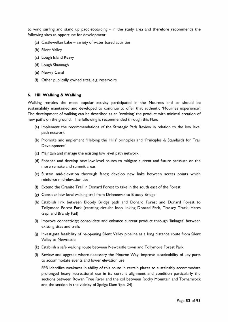
Page 52 of 93
to wind surfing and stand up paddleboarding - in the study area and therefore recommends the
following sites as opportune for development:
(a) Castlewellan Lake – variety of water based activities
(b) Silent Valley
(c) Lough Island Reavy
(d) Lough Shannagh
(e) Newry Canal
(f) Other publically owned sites, e.g. reservoirs
6. Hill Walking & Walking
Walking remains the most popular activity participated in the Mournes and so should be
sustainability maintained and developed to continue to offer that authentic ‘Mournes experience’.
The development of walking can be described as an ‘evolving’ the product with minimal creation of
new paths on the ground. The following is recommended through this Plan:
(a) Implement the recommendations of the Strategic Path Review in relation to the low level
path network
(b) Promote and implement ‘Helping the Hills’ principles and ‘Principles & Standards for Trail
Development’
(c) Maintain and manage the existing low level path network
(d) Enhance and develop new low level routes to mitigate current and future pressure on the
more remote and summit areas
(e) Sustain mid-elevation thorough fares; develop new links between access points which
reinforce mid-elevation use
(f) Extend the Granite Trail in Donard Forest to take in the south east of the Forest
(g) Consider low level walking trail from Drinneevar to Bloody Bridge
(h) Establish link between Bloody Bridge path and Donard Forest and Donard Forest to
Tollymore Forest Park (creating circular loop linking Donard Park, Trassey Track, Hares
Gap, and Brandy Pad)
(i) Improve connectivity; consolidate and enhance current product through ‘linkages’ between
existing sites and trails
(j) Investigate feasibility of re-opening Silent Valley pipeline as a long distance route from Silent
Valley to Newcastle
(k) Establish a safe walking route between Newcastle town and Tollymore Forest Park
(l) Review and upgrade where necessary the Mourne Way; improve sustainability of key parts
to accommodate events and lower elevation use
SPR identifies weakness in ability of this route in certain places to sustainably accommodate
prolonged heavy recreational use in its current alignment and condition particularly the
sections between Rowan Tree River and the col between Rocky Mountain and Tornamrock
and the section in the vicinity of Spelga Dam 9pp. 24)

Page 53 of 93
(m) Review signage in Mournes especially along key access/gateway points in eastern Mournes,
e.g. Trassey Track
(n) Assess feasibility and develop coastal walking trail from Portavogie to Kilkeel
(o) Undertake a feasibility study to develop a walking trail from Finnis to the summit of Slieve
Croob along the River Lagan
(p) Improve the walking trail from Bloody Bridge to Newcastle to walk on the sea side
(q) Investigate opportunities to utilise disused, abandoned railways for new
walking/cycling/equestrian routes
(r) Investigate and develop where appropriate a link between Castlewellan Forest Park and
Slieve Croob utilising a currently derelict railway line (SPR, pp. 39)
(s) Better promote the existing Waymarked Ways
(t) Maintain existing rights of way
(u) Support the assertion of new rights of way and permissive paths
7. Cycling
Mountain Biking
The Mournes has recently become the premier mountain biking destination in Northern Ireland,
courtesy of significant investment from public sector and partnership working between local councils
and Forest Service NI. Regarding development of this activity discussion tended to focus more on
‘perfecting’ the existing infrastructure, extending the trails and improving the visitor services with
some debate over the creation of new trail centres. The following opportunities are recommended
through this Plan:
(a) Extend trails at Castlewellan Forest
(b) Extend trails at Rostrevor - downhill, cross country and introduce family trails into the
network
(c) Rostrevor – investigate potential to develop a world class free ride park
(d) Develop Tipperary Wood as a local facility – pump/BMX track and/or dirt jumps areas
(e) Investigate the potential and where feasible/appropriate create ‘journeys’ or long distance
rides throughout Mournes which links existing trail centres
i. Link Tollymore and Castlewellan Forest Parks via Mourne Way
ii. Link Leitrim Lodge into Rostrevor
iii. Connect Castlewellan to Ballyward and on to Banbridge
iv. Utilise old pipeline to create route from Slieve Donard to Bloody Bridge
v. Utilise old railway track from Murlough to Newcastle as a link route
(f) Investigate the potential for the Mourne way to become a ‘rideable’ route
(g) Continue to promote the Mournes as a destination for mountain biking events/races
(h) Investigate potential for Donard Forest, Tollymore Forest Park, Big Wood and Mourne
Wood as mountain bike trail centres and/or facilities
Page 54 of 93
Off-Road (Family) Cycling
(a) Investigate development of family cycling trail(s) at Silent Valley
8. Canoeing
The following opportunities for developing canoeing are recommended through this Plan:
(a) Castlewellan Lake
i. Enhanced changing, toilet and training facilities
ii. Installation of polo and sprint facilities
(b) Dundrum Bay – Keel Point road
i. Construct play wave under arches to work in both directions of tide
ii. Construct a turning circle, parking area for vans and trailers
iii. Construct a canoe step
(c) Newcastle Harbour
i. Improve canoe access as part of future harbour improvement plans
(d) Upper Bann
i. Develop campsite potentially between Ballyroney-Katesbridge or Katesbridge-Corbett
ii. Construct additional canoe steps – with potential at Hilltown, Ballynagapogge and
Ballyroney
(e) Annalong Harbour
i. Improve canoe access
(f) Newry Canal
i. Construct canoe steps at Victoria Locks
ii. Install canoe access signage
(g) South East Coastal Canoe Trail
i. Develop campsite; potentially at Green Harbour
(h) Carlingford Lough
i. Develop canoe trail – taking in Greencastle to Greenore to Carlingford, Killowen,
Warrenpoint and finishing in Newry
ii. Potential campsite development at Tain Holiday Village, Omeath
9. Bouldering
The following opportunities have been identified:
(a) Develop erosion control measures at key access points at Bloody Bridge
(b) Lobby Transport NI on reducing the speed limit on the road at Bloody Bridge
(c) Continue to promote the Bloody Bridge Usage Charter to activity providers using the site

Page 55 of 93
(d) Undertake negotiations with the landowner(s) at Ballagh Bridge with a view to re-opening
access for primary school level bouldering
10. Horse Riding
The following opportunities have been identified for the development of horse riding:
(a) Connect up existing bridle ways, e.g. Drumkeeragh, Slieve Croob, Cratlieve and Slieve
Garragh to extend off-road provision
(b) Develop trails in Castlewellan Forest Park
11. Orienteering
The following opportunities have been identified for the development of orienteering in the study
area:
(a) Consider the impact of trail development on existing orienteering course and build
orienteering re-mapping into trail development costs
(b) Re-map Castlewellan Forest Park and Rostrevor Forest
(c) Update the map for Slieve Gullion with digital file
(d) Consider the potential of Slieve Roosley for mapping
12. Rock Climbing
The following opportunities have been identified for climbing:
(a) Develop Altnadue Quarry
13. Angling
The following opportunities have been identified for angling:
(a) Construct disabled access at Castlewellan Lake
(b) Support the creation of access for anglers to ‘derelict waters’
(c) Support the development of tourism based angling
(d) Support the development of angling infrastructure and services where appropriate
14. Running
The following opportunities have been identified for fell-running:
(a) Consider potential solutions to car parking and public transport issues especially on
race/event days
The following opportunities have also been identified on a site-by-site basis through this Plan:
15. Slieve Croob

Page 56 of 93
(a) Investigate and implement opportunities for the development of walking, cycling (on-road)
and horse riding in Slieve Croob region
16. Silent Valley
(a) Investigate and develop further opportunities for cycling and adventure/natural play
17. Lough Island Reavy
(a) Consider potential development of water-based activities, e.g. sailing, rowing, windsurfing
18. Leitrim Road Car Park
(a) Extend car parking
19. Dree Hill Car Park
(a) Consider development of path and signage leading from Dree Hill Car Park
20. Cratlieve Mountain
(a) Investigate development of new access with links to Legananny Dolmen and existing access
at Windy Gap Pad
11.3. The Over-Arching Principles
Prior to any development taking place, it is recommended that the following be taken into
consideration so that the issues which are already a concern in the Mournes are not made worse:
(a) Impact on other ecosystem services
(b) Impact on natural environment
(c) Impact on other recreational activities, e.g. displacement or additionality?
(d) Need for project/development; how does it fit with bigger, long term picture?
(e) Is it sustainable?

Page 57 of 93
12. ACTION PLAN
Recommendation
No. Activity Recommendation Site/Area Actions
Delivery
Partners Priority Status
1
Education,
awareness and
training
Support the development of education and awareness
initiatives/programmes/projects which encourage safe
and responsible use of the Mournes for recreation
A. Consider the introduction of a Pay Back Scheme for the Mournes
(financial or time) MHT and Others Low
B. Promote the principles and implement training for ‘Leave No
Trace’
TNOC, Scouts,
DofE, MI, ELB’s,
Activity Providers
High
C. Continue to include environmental awareness as a priority in
training programmes
TNOC, ELB’s, MI
and Others High
D. Continue to promote message about responsible use of the
outdoors for recreation
Sport NI, MHT,
NIEA, ELB’s,
Activity Providers,
Clubs
High
E. Ensure ‘raising public awareness about the fragility of the natural
environment’ remains a key agenda item for MORF MORF High
2 Forest Parks
Develop the forest parks as key visitor attractions
offering a package of activities and experiences with
quality trails, activities and services
A. Castlewellan Forest Park – renovate and re-purpose buildings,
trails, lake and maze, caravan and camping and natural/adventure
play facilities for families
Local Council(s),
FSNI, ORNI,
private sector
High
B. Tollymore Forest Park – renovate and re-purpose buildings,
develop trails, improve caravan and camping and develop
natural/adventure play facilities for families
C. Rostrevor Forest/Kilbroney Park – develop trails and implement
recommendations of scoping study
D. Donard Forest – develop trails, visitor services and Gondola
facility (depending on results of feasibility and impacts study)
E. Bunkers Hill Forest – develop walking and cycling trail and natural
play facilities for the local community
F. Tipperary Wood – develop walking trails and BMX/pump track
facility for local community
G. Moneyscalp, Drumkeeragh and Others – consider potential future
developments

Page 58 of 93
Recommendation
No. Activity Recommendation Site/Area Actions
Delivery
Partners Priority Status
3 Activity Hubs
Develop and promote key, low-level access nodes as
activity and information hubs; develop activities,
infrastructure, attractions and visitor services
A. Kilbroney/Rostrevor Forest
Local Council(s),
FSNI, NI Water,
Sport NI, ORNI,
private sector
Medium
B. Castlewellan Forest Park
C. Tollymore Forest Park
D. Donard Forest
E. Silent Valley
F. Tollymore National Outdoor Centre
4 Mourne Coastline
Develop the Mourne coastline to offer a range of land
and water based activities with supporting services
including signage
A. Assess the feasibility and develop a long distance coastal walking
trail from Portavogie to Kilkeel
Medium
B. Develop lower level coastal walks linking seaside towns to coastal
zone
C. Develop/enhance facilities at Newcastle Harbour
D. Investigate opportunities to develop/enhance facilities at Dundrum
Bay, Mill Bay, Newcastle Beach, Kilkeel Beach, Annalong amenity
area and/or Bloody Bridge to Newcastle Harbour
5
Water based;
sailing, canoeing,
kayaking, wind
surfing, etc.
Where appropriate develop water-based recreation
particularly on publicly owned sites through the
development of infrastructure and investment in clubs
A. Castlewellan Lake (variety of water based activities) Local Council(s),
NI Water, DCAL,
Loughs Agency,
Private and public
landowner(s),
CANI, RYA, local
clubs, community
groups
Low
B. Silent Valley
C. Lough Island Reavy
D. Lough Shannagh
E. Newry Canal
F. Other publically owned sites, e.g. surplus reservoir assets
6 Hill Walking &
Walking
Maintain, manage, extend and enhance the high-
elevation trail network
A. Implement the recommendations of the Strategic Path Review in
relation to the low level path network MHT and Others High
B. Promote and implement ‘Helping the Hills’ principles and
‘Principles and Standards for Sustainable Trail Development’ MHT and Others
Maintain, manage, extend and enhance the low- and
mid-elevation trail network
C. Maintain and manage the existing low level path network
Local Council(s),
MHT, ORNI and
Others
High
D. Enhance and develop new low level routes to mitigate current and
future pressure on the more remote and summit areas
E. Sustain mid-elevation thorough fares; develop new links between
access points which reinforce mid-elevation use

Page 59 of 93
Recommendation
No. Activity Recommendation Site/Area Actions
Delivery
Partners Priority Status
F. Extend the Granite Trail in Donard Forest to the south east
G. Consider low level trail from Drinneevar to Bloody Bridge
Develop link/connecting routes between existing sites
and trails
H. Establish link between Bloody Bridge path and Donard Forest and
Donard Forest to Tollymore Forest Park (creating circular loop
linking Donard Park, Trassey Track, Hares Gap, and Brandy Pad) Local Council(s),
MHT, FSNI, Public
and Private
Landowners, ORNI
and Others
identified
Low
I. Improve connectivity; consolidate and enhance current product
through ‘linkages’ between existing sites and trails
J. Investigate feasibility of re-opening Silent Valley pipeline as a long
distance route from Silent Valley to Newcastle
K. Establish a safe walking route between Newcastle town and
Tollymore Forest Park
Conduct a review of the Mourne Way L. Review and upgrade where necessary the Mourne Way; improve
sustainability of key parts for events
Local Council(s)’
NIEA, ORNI High
Review signage and where appropriate develop new
signage at key access points
M. Review signage in Mournes especially along key access/gateway
points in eastern Mournes, e.g. Trassey Track MHT, ORNI Low
Develop coastal and riverside walks
N. Assess feasibility of a walking trail from Portavogie to Kilkeel
Various Medium
O. Undertake a feasibility study to develop a walking trail from Finnis
to the summit of Slieve Croob along the River Lagan
P. Improve walking trail from Bloody Bridge to Newcastle to walk on
the sea side
Investigate the feasibility of and where appropriate
develop disused railways as new route corridors (not
limited to walking)
Q. Investigate opportunities to utilise disused, abandoned railways for
new walking/cycling/equestrian routes Local Council(s),
MHT, ORNI,
Public and Private
landowners,
community groups
Medium
R. Investigate and develop where appropriate a link between
Castlewellan Forest Park and Slieve Croob utilising a currently
derelict railway line
Continue to promote the existing waymarked ways
and quality walks
S. Better promote the existing Waymarked Ways Local Council(s),
ORNI Low
Protect, maintain and increase rights of way, permissive
paths and other access agreements
T. Maintain existing rights of way Local Council(s),
MHT High
U. Support the assertion of new rights of way and permissive paths

Page 60 of 93
Recommendation
No. Activity Recommendation Site/Area Actions
Delivery
Partners Priority Status
7 Mountain Biking
Develop, enhance and/or extend the trails and/or
facilities at existing trail centres
A. Extend trails at Castlewellan Forest
Local Council(s),
FSNI, ORNI,
private sector
Medium
B. Extend trails at Rostrevor - downhill, cross country and introduce
family trails into the network
C. Rostrevor – investigate feasibility for world class free ride park
Develop new trail centres and/or facilities where
appropriate
D. Develop Tipperary Wood as a local facility – pump track, BMX
track, dirt jumps Local Council(s),
FSNI, ORNI,
community groups,
local clubs
Medium
E. H. Investigate potential of Donard Forest, Tollymore Forest Park,
Big Wood and Mourne Wood
Investigate the potential and where feasible and
appropriate create ‘journeys’ or long distance riding
routes with links to trail centres
F. Investigate the potential and where feasible/appropriate create
‘journeys’ or long distance rides throughout Mournes which links
existing trail centres
i. Link Tollymore and Castlewellan Forests via Mourne Way
ii. Link Leitrim Lodge into Rostrevor
iii. Connect Castlewellan to Ballyward and on to Banbridge
iv. Create route from Slieve Donard to Bloody Bridge
v. Utilise old railway to link Murlough and Newcastle
Local Council(s),
ORNI, FSNI, Public
and Private
landowners
Low
G. Investigate potential of Mourne way as a ‘rideable’ route
Continue to promote the Mournes destination for
mountain biking events/races
H. Continue to promote the Mournes as a destination for mountain
biking events/races from local to world class level
Local Council(s),
NITB, ORNI,
Cycling Ulster,
Cycling Ireland,
private sector,
local clubs
High
8 Canoeing
Enhance/improve user facilities at existing canoe access
points
A. Castlewellan Lake – develop enhanced changing, toilet and training
facilities
Local Council(s),
Private and Public
landowners, CANI
Medium
B. Newcastle Harbour – improve canoe access as part of future
harbour improvement plans
C. Dundrum Bay/Keel Point Road – construct a turning circle and
parking area for vans and trailers
D. Annalong Harbour – improve canoe access
Develop new canoe access facilities
E. Dundrum Bay/Keel Point Road – construct a canoe step
Local Council(s),
Private and Public
landowners, CANI
Low
F. Upper Bann – construct additional canoe steps with potential at
Hilltown, Ballynagapogge and Ballyroney
G. Newry Canal – construct canoe steps at Victoria Lock and install
canoe access signage

Page 61 of 93
Recommendation
No. Activity Recommendation Site/Area Actions
Delivery
Partners Priority Status
Develop canoe campsite(s)
H. Upper Bann – develop a campsite potentially between Ballyroney
and Katesbridge or Katesbridge and Corbett
Local Council(s),
Private and Public
landowners, CANI
Low
I. SE Coast Canoe Trail – develop a campsite potentially at Green
Harbour
J. Carlingford Lough – develop campsite potentially at Tain Holiday
Village along new canoe trail
Develop new canoe trail
K. Carlingford Lough – develop new canoe trail taking in Greencastle,
Greenore, Carlingford, Killowen, Warrenpoint and Newry
Local Council(s),
Private and Public
landowners,
Loughs Agency,
CANI
Low
Construct training facilities such as polo and sprint
course and play wave
L. Castlewellan Lake – install polo and sprint facilities Local Council(s),
Private and Public
landowners,
DCAL, National
Trust, CANI
Low
M. Dundrum Bay/Keel Point Road – construct a play wave under
arches to work in both directions of tide
9 Bouldering
Manage the Bloody Bridge site
A. Develop erosion control measures at key access points at Bloody
Bridge
National Trust,
Sport NI, Activity
Providers
Medium
B. Lobby Transport NI to reduce the speed limit of road at Bloody
Bridge Medium
C. Continue to promote the Bloody Bridge Usage Charter to activity
providers using the site High
Re-open access at Ballagh Bridge D. Undertake negotiations with landowner(s) at Ballagh Bridge with a
view to re-opening access for primary school level bouldering
Landowners, Sport
NI Medium
10 Horse Riding
Develop new and existing equestrian trails A. Connect up existing bridle ways, e.g. Drumkeeragh, Slieve Croob,
Cratlieve and Slieve Garragh to extend off-road provision
Local Council(s),
FSNI, BHS Low
Connect up and extend existing bridleways to extend
off-road riding provision
B. Develop trails in Castlewellan Forest Park Local Council(s),
BHS, MHT,
Landowners
Low

Page 62 of 93
Recommendation
No. Activity Recommendation Site/Area Actions
Delivery
Partners Priority Status
11 Orienteering Re-map existing sites
A. Consider the impact of trail development on existing orienteering
courses and add re-mapping into trail development costs
NIO, FSNI High
B. Re-map Castlewellan Forest Park and Rostrevor Forest
C. Update the map for Slieve Gullion with digital file
Create maps for new sites D. Consider the potential of Slieve Roosley for mapping NIO, Landowners Medium
12 Rock Climbing Develop climbing facilities A. Develop climbing facilities at Altnadue Quarry Sport NI Low
13 Angling
Construct disabled angling access facilities A. Construct disabled access at Castlewellan Lake DCAL Medium
Support the development of ‘derelict waters’ B. Support the creation of access for anglers to ‘derelict waters’ Various Medium
Support the development of tourism based angling C. Support the development of tourism based angling Various Low
Support the development of angling infrastructure and
services where appropriate
D. Support the development of angling infrastructure and services
where appropriate Various Low
14 Fell running Consider and pilot solutions to car parking and public
transport issues identified
A. Consider potential solutions to car parking and public transport
issues especially on race/event days
MHT, NIFRA,
Translink,
Landowners
High
15-19 Site-based
Investigate and where appropriate develop
opportunities for access and recreation development,
including walking, cycling and equestrian trails, signage,
play and water based activities
15. Slieve Croob - investigate opportunities for the development of
walking, cycling (on-road) and horse riding in Slieve Croob region
Local Council(s),
FSNI, Private and
Public Landowners,
ORNI, governing
bodies, local clubs,
private sector,
community groups
Low
16. Silent Valley - Investigate and develop further opportunities for
cycling and adventure/natural play
17. Lough Island Reavy - Consider potential development of water-
based activities, e.g. sailing, rowing, windsurfing
18. Leitrim Road Car Park – extend car parking
19. Dree Hill Car Park – consider path development and signage
20. Cratlieve Mountain – investigate access development with links to
Legananny Dolmen and existing access at Windy Gap Pad

Page 63 of 93
Recommendation
No. Activity Recommendation Site/Area Actions
Delivery
Partners Priority Status
General
Value of
Recreation Undertake a feasibility study to identify the social and economic value of outdoor recreation in the Mournes
Sport NI, MHT,
NIEA and Others Medium
Camping Investigate the potential to develop a ‘necklace’ of formal campsites with basic facilities in the Mournes, where appropriate, i.e.
minimal impact on environment and existing businesses
MHT, Private and
Public landowners,
Duke of Edinburgh,
private sector
High
Car Parking Investigate options for additional parking and where appropriate support the development of enhancing parking capacity at key
access nodes, e.g. Trassey Track and Carrick Little
MHT, Private and
Public landowners High
Management and
Maintenance Continue to support the work of Mourne Heritage Trust and invest in recreation management programmes All High
Planning
Development Undertake and promote a ‘total ecosystems’ approach to the planning of recreation development in the Mournes All High
Fig. 7 Mourne Outdoor Recreation Action Plan

Page 64 of 93
13. CONCLUSIONS
This report gives a broad summary of the current provision and management of outdoor recreation
within the Mournes and Slieve Croob area. It identifies the geographical gaps in provision, outlines
the most popular activities and highlights the priorities for development over the next 5-10 years.
With regard to future priority this report found that the management of existing provision is equally
weighted against the development of new product and that new development should be restricted
to the lower levels. To reflect this distinction has been made between the ‘upper’ and ‘lower’
Mournes.
In summary, future development in the Mournes should:
1. Adopt a ‘no development’ approach to the upland areas – focus on maintenance and
management of the existing recreational trail network as per the 2012 Strategic Path Review
2. Focus on new access and trails in low to mid level elevations particularly
3. Create ‘activity hubs’ at key access nodes to concentrate visitor pressure within a defined area
where prescribed management can be implemented yet visitors still achieve the ‘Mournes
experience’
4. Concentrate new development along coastline, inland lakes and reservoirs, public forest estate
and other public land sites
5. Prioritise the creation of ‘links’ which connect existing sites and trails, e.g. abandoned railways
and pipelines, Donard Forest and Tollymore Forest Park
However prior to any development taking place the following over-arching principles should be
taken into account to ensure that current issues are not exacerbated or displaced by development:
(a) The impact on other ecosystem services
(b) The impact on natural environment
(c) The impact on other recreational activities, e.g. displacement or additionality?
(d) The need for project/development; how does it fit with bigger, long term picture?
(e) Is it sustainable?

Page 65 of 93
14. OUTDOOR RECREATION MAPS

Page 66 of 93
Fig. 8 Activity Providers

Page 67 of 93
Fig. 9 Current Provision - Angling

Page 68 of 93
Fig. 10 Current Provision - Canoeing

Page 69 of 93
Fig. 11 Current Provision - Climbing

Page 70 of 93
Fig. 12 Current Provision - Cycling

Page 71 of 93
Fig. 13 Current Provision - Mountain Biking

Page 72 of 93
Fig. 14 Current Provision - Orienteering

Page 73 of 93
Fig. 15 Current Provision - All Air Activities

Page 74 of 93
Fig. 16 Future Development - Site Based

Page 75 of 93
Fig. 17 Future Development - Activity Based

Page 76 of 93
15. BIBLIOGRAPHY
Reports & Strategies
- CAAN (2007) Mourne Area of Outstanding Natural Beauty Access Study.
- Dafydd Davis (2012) The Mournes & Slieve Croob Strategic Path Review.
- DCAL, Sport NI, NIEA and NITB (2013) Our Great Outdoors – The Outdoor Recreation
Action Plan for Northern Ireland
- DCAL, Sport NI, NITB & Loughs Agency (2014) A Strategic Review of Angling in Northern
Ireland.
- Department of Enterprise, Trade & Investment (2010) A Draft Tourism Strategy for Northern
Ireland to 2020.
- FSNI (2009) A Strategy to Develop the Recreational and Social Use of Our Forests.
- KPMG (2012) Assessment of the Existing and Potential Tourism Development Opportunities
Available from Northern Ireland Forests.
- NITB (2013) Creating Experiences: A Toolkit for the NI Tourism Industry
- NITB (2012) Northern Ireland Tourism Priorities for Growth
- NI Water (2012) Access and Recreation Policy
Websites
- www.walkni.com
- www.cycleni.com
- www.canoeni.com
- www.mountainbikeni,com
- www.loughs-agency.org/

Page 77 of 93
16. APPENDIX
16.1. Terms of Reference
This Plan sets out to:
detail and GIS map the nature and extent of current outdoor recreation provision in the
Mournes AONB region including;
o all land, air and water-based activities
o whether these take place on public and private land
o both area and site-specific facilities
o PRoW and access agreements
detail and GIS map the current land management bodies involved in outdoor recreation
provision in the area - private, public, community, FSNI, Water Service, charitable trusts, etc.
detail and GIS map all environmental designations across the region
collate all available and relevant monitoring information about current outdoor recreation
use/participation in the region
outline the relevant context of outdoor recreation within the area, against what is happening at
a regional and national level, detailing the current situation and any future development plans
conduct consultation with all relevant stakeholders including as a minimum the MORF, Mourne
Heritage Trust and local Council officers and others where appropriate including the local
community, tourism and business sector, public bodies, statutory organisations, national
governing bodies, user groups and private sector to discuss their aspirations for future
development of the Mournes
where appropriate, use the results of any other relevant consultation exercises which have been
undertaken
identify the principle management issues (challenges/barriers) (local, regional and national)
affecting the development and/or management of outdoor recreation in the Mournes
complete a SWOT analysis for the Mournes AONB region
identify the future opportunities for outdoor recreation in the Mournes, both regional and site-
specific including any natural ‘activity hubs’
prioritise areas for the growth and/or management of outdoor recreation regional and site
specific
produce a 5-10 year Action Plan outlining delivery partners
The Plan will also take account of the following:
1. the advanced nature of recreation in the Mournes and issues linked to high visitor pressure
2. the specific nature of certain sites and any proposed activities and (where practicable) seek
to deliver improved accessibility for people with disabilities, and
3. the consideration of the value of ecosystem services

Page 78 of 93
16.2. Consultation Questionnaire
MOURNE OUTDOOR RECREATION PLAN
ACTIVITY PROVIDER QUESTIONNAIRE
Activity Provider: __________________________________ Date: __________________
IMPORTANT: To select a box, right click on the box, select ‘Properties’ and choose
‘Checked’
1. What outdoor recreation activities do you provide?
Land-Based Water-Based Air-Based
Archery Angling - Coarse Model Flying
Adventure Racing Angling – Game Gliding
Boot camps Boat cruises Hang Gliding
Bushcraft Canoeing Paragliding
Clay pigeon shooting Kayaking Micro light
Climbing Slalom Sky diving
Fell-running SUP Parachuting
Cycling – On road Rowing
Cycling – Mountain biking Sailing
High Ropes/Ziplines Water skiing/Wakeboarding
Horse riding Hovercrafting
Mountain Boarding
Mountaineering
Orienteering
Segway Other Please specify: ___________________
Walking/Rambling Zorbing

Page 79 of 93
2. Are your activities:
Site Based – Go to Q4 Mobile – Go to Q 3 Both – Go to Q 3
3. What areas/sites do you use? And for what activities?
Site/Area: _E.g. Davagh Forest______________________________________________ ___
Activity(s):_Mountain Biking____________________________________________________
Permit/License/Permission required: Yes No
Site/Area:___________________________________________________________________
Activity(s):__________________________________________________________________
Permit/License/Permission required: Yes No
Site/Area:___________________________________________________________________
Activity(s):__________________________________________________________________
Permit/License/Permission required: Yes No
Site/Area:
______________________________________________________________________ ___
Activity(s):__________________________________________________________________
Permit/License/Permission required: Yes No
Site/Area: ______________________________________________________________ ___
Activity(s):_________________________________________________________________
Permit/License/Permission required: Yes No
Site/Area: _______________________________________________________________ ___
Activity(s):__________________________________________________________________
Permit/License/Permission required: Yes No

Page 80 of 93
4. In your opinion, what are the opportunities for development? Please give details of
specific activities and or specific areas/sites you think have potential to enhance the
activity offering in the Sperrins.
______________________________________________________________________________
______________________________________________________________________________
______________________________________________________________________________
______________________________________________________________________________
______________________________________________________________________________
5. In your opinion, what are the barriers or issues which may affect the growth of
outdoor recreation or the activities mentioned above?
______________________________________________________________________________
______________________________________________________________________________
______________________________________________________________________________
______________________________________________________________________________
______________________________________________________________________________
6. Can we contact you to discuss this questionnaire further? Yes No
If Yes, please provide: Contact Name:
___________________________________________
Telephone No:
___________________________________________
Email:
__________________________________________________
THANK YOU FOR TAKING THE TIME TO COMPLETE THIS
SURVEY
OutdoorNI.com │WalkNI.com │ MountainbikeNI.com │CycleNI.com │CanoeNI.com │ BeachNI.com

Page 81 of 93
16.3. Consultation Poster

Page 82 of 93
16.4. Project Consultees
Consultee Organisation
Trevor Quinn Ardnabannon & Shannagh-More OEC
Trevor Fisher Tollymore NOC
Peter Wells Killowen OEC
Kenny Baxter Greenhill YMCA
Sean McGrade DARD
Vincent McAlinden Killowen OEC
Ian Rea Killowen OEC
Various Members Mourne Outdoor Recreation Forum
Special Economic Development
Committee
Newry & Mourne District Council
Catherine Murphy (Rights of Way
Officer)
Newry & Mourne District Council
Michelle Boyle (Tourism Officer) Newry & Mourne District Council
Heather Wilson Down District Council
Nuala Hamilton Banbridge District Council
Matthew Bushby, Martin & John Mourne Heritage Trust
Helen Lawless Mountaineering Ireland
Conor Fadian NI Orienteering Association
Ashley Hunter Canoe Association NI
Kate Thompson Duke of Edinburgh Sheme
David Thompson National Trust
Alan Moore NI Water
Kathleen Conlon DCAL
Rory Mellon NIEA
James McEvoy NIEA
Darren Rice Ring of Gullion AONB Officer
Sean Fitzpatrick NIAPA
Peter Lynch DCAL Inland Fisheries

Page 83 of 93
16.5. Public Consultation Event Attendees
No. Attendee Organisation/Interest Group
Tollymore National Outdoor Centre – Mon 9th December 2013
1 Charles McRobert MHT
2 Cathryn Cochrane MHT
3 Steve Hill UHGPC
4 Ian Cross UHGPC
5 Rick McKee NIMBA
6 Peter Magowen Dimss
7 Peter Wells SEELB
8 Gary Parr Disc Golf NI
9 Ian Bailey Rock + Ride Outdoors
10 Andy Cardon M.N.W.
11 Mike Barton NIMRA
12 Paul McWhirt Forest Service NI
13 Alwyune Shannon MMLP (MHT)
14 Pamela McClelland Newcastle Harbour & Rock Pool
15 Leo Paul N.H.R.A.
16 Trevor Fioher Tollymore NOC
17 David Creighton NIMBA
18 Mike McClure Sport NI
19 Greg McCann Lagan Valley Orienteers
20 Matthew Bushby MHT
Hillyard House, Castlewellan – Tues 10th December 2013
1 William Byrne Cloughmor Extreme
2 Eoin McCartan Mourne Bikes
3 Donnall McCornish Mourne Ramblers
4 Frank Harpor Mourne Camping
5 Laurence McBride Far and Wild
6 Paul Giben Banbridge D.C.
7 Niall McAleenan NIEA
8 Brian McBuiney Shannagh-More OEC
9 Stephen Gilmore Dromara CC
10 Martin Carey Mourne Heritage Trust
11 Philip Savage Mourne Heritage Trust
12 Stephen Davidson Plush MTB
13 Steven Graham Plush MTB
14 Colin Finley Plush MTB
Warrenpoint Town Hall – Weds 11th December 2013
1 Jim Brennan Camping Pods
2 Mike McClure SportNI
3 Ian Cummings East Coast Adventures
4 Ray McCann Mountain Biking
5 Thomas McCoy Mountain Biking
6 Steven Turnbull Green Bikes
7 Jonathan McComiskey Mountain Biking
8 Esoghe Sheehan Angling
9 Liz McLaughlin ‘Not The Sunday Run’ Club
10 Hewey McLaughlin ‘Not The Sunday Run’ Club

Page 84 of 93
16.6. Natural and Built Heritage
Natural Heritage Designations
NO. DESIGNATION AREA (hectares)
Area of Outstanding Natural Beauty (AONB)
1 Mourne & Slieve Croob 57,965
Landscape Character Area (LCA)
1 Newry Basin N/A
2 Slieve Roosley N/A
3 Kilkeel Coast N/A
4 The Kingdom of Mourne N/A
5 Mourne Mountains N/A
6 Ballyroney Basin N/A
7 Mourne Foothills N/A
8 Newcastle Valleys N/A
9 Slieve Croob Summits N/A
Area of Special Scientific Interest (ASSI)
1 Ballybannan ASSI 1
2 Murlough ASSI 1,481
3 Eastern Mournes ASSI 7,507
4 Rostrevor Wood ASSI 17
5 Carlingford Lough ASSI 1,099
6 Castlewellan Lake ASSI 47
7 Shimna River ASSI 39
8 Kilbroney River ASSI 0
9 Gruggandoo ASSI 5
Special Area of Conservation (SAC)
1 Murlough 11,902
2 Eastern Mournes 7,507
Special Protection area (SPA)
1 Carlingford Lough 830
National Nature Reserve (NNR)
1 Rostrevor Forest 17
2 Murlough 280
Ramsar Site
1 Carlingford Lough 830

Page 85 of 93
Built Heritage Features
No. X Y SMR No Type Protection
1 324730 311840 DOW057:003 GREENCASTLE. CASTLE & WELL: GREENCASTLE State Care with
Proposed Scheduled
Area
2 337220 334110 DOW043:085 MAGHERA CHURCH. MULTIPERIOD CHURCH, GRAVEYARD AND ROUND
TOWER: MAGHERA
State Care and Scheduled
3 328850 315030 DOW055:030 GIANT'S GRAVE. COURT TOMB: GIANT'S GRAVE State Care and Scheduled
4 328870 343390 DOW035:037 LEGANANNY DOLMEN. PORTAL TOMB: LEGANANNY DOLMEN State Care
5 331130 334030 DOW043:063 WALSH'S FORT. CASHEL with SOUTERRAIN & HOUSE SITES: WALSH'S FORT State Care
6 340480 337000 DOW044:006 DUNNADROMA, DUNDRUM CASTLE. DUNDRUM CASTLE State Care
7 324367 331024 DOW048:011 GOWARD DOLMEN, CLOGHMORE CROMLECH, PAT KEARNEY'S BIG
STONE, FINN'S FINGERSTONES. PORTAL TOMB: GOWARD DOLMEN;
CLOGHMORE CROMLECH
State Care
8 312560 319390 DOW051:044 NARROW WATER CASTLE. TOWER-HOUSE AND BAWN: NARROW
WATER CASTLE
State Care
9 323220 315350 DOW055:018 KILFEAGHAN DOLMEN. PORTAL TOMB: KILFEAGHAN DOLMEN State Care
10 327400 344180 DOW035:006 SOUTERRAIN Scheduled
11 324500 342600 DOW035:007 CASHEL Scheduled
12 325880 341600 DOW035:009 RATH Scheduled
13 325850 341380 DOW035:010 PLATFORM RATH Scheduled
14 327180 341430 DOW035:013 MOAT HILL, THE COVE. CAIRN & LONG CIST: THE COVE Scheduled
15 327210 339770 DOW035:019 DERRYNEILL MOUND. RAISED RATH: DERRYNEILL MOUND Scheduled
16 330330 342740 DOW036:001 GRAVEYARD WITH CROSS-INSCRIBED PILLAR STONE Scheduled
17 335930 343730 DOW036:007 RATH Scheduled
18 335180 341540 DOW036:025 BALLYWILLWILL RATH. COUNTERSCARP RATH & SOUTERRAIN:
BALLYWILLWILL RATH
Scheduled
19 334410 341150 DOW036:026 SLIEVEHANNY. CASHEL & SOUTERRAIN: SLIEVEHANNY Scheduled
20 334270 339530 DOW036:028 CLONVARAGHAN WOOD. CASHEL & SOUTERRAIN with possible House
Platform: CLONVARAGHAN WOOD
Scheduled
21 328050 334050 DOW042:035 COUNTERSCARP RATH Scheduled
22 328190 333750 DOW042:036 KILCHOW, KILCOO, KILCUDUA, KILUA. CHURCH & GRAVEYARD: KILCOO Scheduled
23 329650 338000 DOW042:064 BIG FORT. RATH & SOUTERRAIN: BIG FORT Scheduled

Page 86 of 93
24 330330 338650 DOW043:002 COEN'S FORT. RATH: COEN'S FORT Scheduled
25 331040 338710 DOW043:004 PLATFORM RATH & SOUTERRAIN Scheduled
26 330980 337780 DOW043:013 CASHEL & SOUTERRAIN Scheduled
27 334000 338280 DOW043:014 CASHEL & SOUTERRAIN Scheduled
28 334210 336730 DOW043:036 D-SHAPED ENCLOSURE - possibly CEMETERY Scheduled
29 339360 334400 DOW043:061 SLIDDERYFORD DOLMEN. PORTAL TOMB: SLIDDERYFORD DOLMEN Scheduled
30 330890 333720 DOW043:065 CASHEL Scheduled
31 331410 334380 DOW043:067 CASHEL Scheduled
32 316480 326050 DOW047:093 BALLYVALLY RATH. COUNTERSCARP RATH: BALLYVALLY RATH Scheduled
33 319280 327220 DOW047:096 MURPHY'S FORT. BRONZE AGE RING BARROW with cremation burials & 5
STANDING STONES: MURPHY'S FORT
Scheduled
34 319290 327220 DOW047:097 MURPHY'S FORT. RING BARROW: MURPHY'S FORT Scheduled
35 322230 328880 DOW048:021 BALLYMAGHERY MOTTE. MOTTE? or RAISED RATH?: BALLYMAGHERY
MOTTE
Scheduled
36 320650 328240 DOW048:022 ENCLOSURE, possibly HORIZONTAL MILL Scheduled
37 323740 329640 DOW048:030 STONE CIRCLE. COURT TOMB & IRON AGE OCCUPATION SITE Scheduled
38 336800 331950 DOW049:007 ST. CILLAN'S FORT. RATH: ST. CILLAN'S FORT Scheduled
39 338840 326740 DOW049:012 BLOODY BRIDGE, BALLACHANERY, BALLAGH-A-NEIR, ST MARY'S CHURCH,
KILLNAHATTIN. CHURCH (in ruins), GRAVEYARD & ENCLOSURE:
ST.MARY'S, BALLACHANERY, BLOODY BRIDGE
Scheduled
40 337640 330380 DOW049:022 WWII PILLBOX - DHP no.3 Scheduled
41 316490 325250 DOW051:019 LARGE ENCLOSURE Scheduled
42 315140 322720 DOW051:032 CASHEL & SOUTERRAIN Scheduled
43 314680 321700 DOW051:035 LARGE HILLTOP ENCLOSURE Scheduled
44 316150 319900 DOW051:050 STONE FACED RATH - one of a pair with 051:051 Scheduled
45 316090 319800 DOW051:051 STONE FACED RATH - one of a pair with 051:050 Scheduled
46 318750 319540 DOW051:058 KILBRONEY, GLENTEGY'S, NISTER, ST. BRIDGET'S WELL. CROSSES (2),
MULTIPERIOD CHURCH, GRAVEYARDS & HOLY WELL: KILBRONEY &
ST.BRIDGET'S WELL
Scheduled
47 312900 319230 DOW054:001 MOTTE Scheduled
48 315470 318930 DOW054:004 RATHTURRET. TRIVALLATE RATH & possible SOUTERRAIN: RATHTURRET Scheduled
49 325560 309690 DOW057:010 ARTILLERY FORT Scheduled
50 317480 318600 DOW054:026 GROTTO Scheduled
51 328180 315990 DOW055:022 GIANT'S GRAVE. COURT TOMB: GIANT'S GRAVE Scheduled

Page 87 of 93
52 324470 314610 DOW055:038 TAMLAGHT. RATH, reused as CHURCH SITE & GRAVEYARD: TAMLAGHT Scheduled
53 322470 315020 DOW055:050 COURT TOMB Scheduled
54 328780 319580 DOW055:052 RUSH'S CAVE. COURT TOMB: RUSH'S CAVE Scheduled
55 335390 319910 DOW056:005 LONGSTONE, THE LONGSTONE. STANDING STONE: THE LONG STONE Scheduled
56 334430 318280 DOW056:014 KILMELOGE. CHURCH SITE & ENCLOSURE: KILMELOGE Scheduled
57 330700 314560 DOW056:026 KILKEEL, ST. COLMAN DEL MOURNE. RATH, reused as MEDIEVAL CHURCH
& GRAVEYARD: KILKEEL or ST.COLMAN del MOURNE
Scheduled
58 324290 311830 DOW057:001 MOTTE Scheduled
59 328500 312930 DOW057:006 DUNNAVAL. COUNTERSCARP RATH: DUNNAVAL Scheduled
60 327170 310440 DOW057:008 MOUND Scheduled
61 337790 330600 MRD255:004 LADY ANNESLEY'S FISH TRAP. FISH TRAP: LADY ANNESLEY'S FISH TRAP Scheduled
62 339071.6 334214.8 DOW043:060 STANDING STONES (2) (REMAINS OF MEGALITHIC TOMB) Scheduled
63 330603.7 333600.2 DOW043:064 CARNBANE. ROUND CAIRN WITH CIST Scheduled
64 341630 339138.5 DOW044:002 MOTTE Scheduled
65 333045.9 331765.8 DOW049:003 WHITE FORT. CASHEL: WHITE FORT Scheduled
66 316264.6 325239.3 DOW051:018 STANDING STONE Scheduled
67 315408.1 324453.9 DOW051:059 CLOGHADDA. STANDING STONE & ENCLOSURE: CLOGHADDA Scheduled
68 314176.9 319717.4 DOW051:065 STANDING STONE Scheduled
69 318709.3 319385.8 DOW054:018 STANDING STONE NO 1. STANDING STONE (NO.1) Scheduled
70 318646.2 319138.1 DOW054:019 STANDING STONE NO 2. STANDING STONE (NO.2) Scheduled
71 314281.7 318226 DOW054:500 WINDMILL - IHR 03599 Scheduled
72 330754.8 314874.8 DOW056:025 THE CRAWTREE STONE. PORTAL TOMB: THE CRAWTREE STONE Scheduled
73 324524.7 311809.9 DOW057:002 CHURCH Scheduled
74 338069.6 329706.5 MRD255:001 NEWCASTLE HARBOUR. HARBOUR: NEWCASTLE HARBOUR Scheduled
75 337818.5 330203 MRD255:003 LADY ANNESLEY'S FISH TRAP. FISH TRAP: LADY ANNESLEY'S FISH TRAP Scheduled
76 329841 338416 DOW042:088 STANDING STONE Scheduled
77 328875 337910 DOW042:089 STANDING STONE Scheduled
78 330883 338206 DOW043:110 STANDING STONE Scheduled
79 334089 338355 DOW043:015 STANDING STONE Scheduled
80 325796 340751 DOW035:500 FLAX MILL CHIMNEY - IHR 03320 Scheduled
81 315140 319590 DOW051:061 CLONDALAN. MULTIPERIOD CHURCH & GRAVEYARD: CLONDALAN Listed
82 335224.6 337314.8 DOW043:500 LINEN FACTORY CHIMNEY - IHR 03446 Listed

Page 88 of 93
16.7. PRoW and Permissive Paths
Public Rights of Way
REF. STATUS LOCATION LENGTH
(M)
Newry & Mourne Council Area
1 FOOTPATH MOYGANNON ROAD TO DOBBIN POINT,
WARRENPOINT
193
2 FOOTPATH KILLOWEN ROAD TO BALLYEDMOND FORESHORE,
ROSTREVOR
662
3 FOOTPATH NEWTOWN ROAD TO FORESTBROOK ROAD,
ROSTREVOR
559
4 FOOTPATH ROONEY ROAD TO HARBOUR ROAD, KILKEEL 129
5 FOOTPATH CLOUGHMORE STONE TO SHORE ROAD,
ROSTREVOR
1,552
6 BRIDLE PATH BALLINRAN ROAD TO AUGHNAHOORY ROAD,
KILKEEL
1,423
7 FOOTPATH ORCHARD HILL TO SUMEMRHILL, WARRENPOINT 37
8 FOOTPATH HANNA'S CLOSE, KILKEEL 789
9 FOOTPATH KILKEEL ROAD TO FORESHORE MONEYDARRAGH
BEG
71
10 FOOTPATH NEWTOWN ROAD TO FORESTBROOK ROAD,
ROSTREVOR
144
11 FOOTPATH GREENPARK ROAD TO DRUMSESK ROAD,
ROSTREVOR
515
12 FOOTPATH DRUMSESK ROAD TO MOYGANNON ROAD,
WARRENPOINT
1,427
13 FOOTPATH KILLOWEN ROAD TO BALLINRAN FORESHORE,
ROSTREVOR
68
14 FOOTPATH GLEN LOANAN, BALLYMARTIN 259
15 FOOTPATH AMERACAM LANE TO FAIR ROAD, CRANFIELD 1,347
16 CARRIAGEWAY WARRENPOINT RD TO ROSSES QUAY FORESHORE,
ROSTREVOR
112
17 FOOTPATH ULSTER AVENUE TO THE HARBOUR, ANNALONG 312
18 FOOTPATH 100M SOUTH OF NO.80, SHORE ROAD, ROSTREVOR 30
19 FOOTPATH KILLOWEN RD TO FORESHORE ADJACENT NO.9
KILLOWEN RD
85
20 FOOTPATH KILLOWEN ROAD TO KILLOWEN OLD ROAD,
BALLYEDMOND
162
21 FOOTPATH KILLOWEN RD TO FORESHORE, KILLOWEN OEC,
ROSTREVOR
106
22 FOOTPATH KILLOWEN ROAD TO THE FORESHORE, ROSTREVOR 214
23 FOOTPATH WINDSOR AVENUE TO UPPER DAMOLLY ROAD,
NEWRY
413
24 FOOTPATH SHANNAGH PLAYING FILEDS TO COASTAL PATH,
ANNALONG
86
Down District Council Area
1 FOOTPATH BRYANSFORD ROAD TO TULLYREE ROAD 1,508
2 FOOTPATH DRUMEE PROW TO NEWCASTLE ROAD 136
3 BRIDLE PATH DUNDRINNE ROAD TO BALLYBANNON ROAD 1,860
4 FOOTPATH MACLEANS CLOSE TO BRYANSFORD ROAD, 616

Page 89 of 93
TULLYREE
5 FOOTPATH GREEN LANE, BURRENREAGH, CASTLEWELLAN 512
6 BRIDLE PATH DUNDRINNE ROAD TO BROOK COTTAGE 476
7 BRIDLE PATH DUNDRINNE ROAD TO DUNDRINNE ROAD UPPER 748
8 BRIDLE PATH BALLYBANNON ROAD TO WATERESK ROAD 1,284
9 BRIDLE PATH WATERESK ROAD TO KILMEGAN ROAD 1,221
10 BRIDLE PATH KILMEGAN ROAD TO PRIESTS ROAD 805
11 BRIDLE PATH TULLYBRANNIGAN ROAD TO TULLYBRANNIGAN
ROAD LOOP
1,091
12 BRIDLE PATH CAMACAVILLE ROAD TO CHURCH HILL ROAD 513
13 FOOTPATH LOWER BURREN ROAD TO NEWCASTLE ROAD 477
14 BRIDLE PATH DRUMREE CEMETARY TO DRUMEE CARNACAVILLE
ROAD
438
15 BRIDLE PATH DRUMEE ROAD TO CARNACAVILLE ROAD
LANEWAY
2,033
16 BRIDLE PATH DRUMEE CEMETARY 1,319
17 PROW MANSE LANE, DUDNRUM 189
18 BRIDLE PATH MCSHERRY'S LANE, CASTLEWELLAN 1,764
19 FOOTPATH TIPPERARY LANE, NEWCASTLE 1,194
20 PROW DARN WALK, DUNDRUM 782
21 PROW BACK LANE, DUNDRUM 654
22 PROW CASTLE LANE, DUNDRUM 640
23 PROW CASKELL LANE, CASTLEWELLAN 678
24 PROW COW LANE, CASTLEWELLAN 680
25 PROW ROCK LANE, CASTLEWELLAN 1,017
26 PROW MAGEE'S WALK, CASTLEWELLAN 110
27 PROW KILCOO GRAVEYARD 297
28 PROW TRASSEY TRACK 5,703
29 PROW GLEN RIVER, NEWCASTLE 2,330
30 PROW BATH LANE, NEWCASTLE 53
31 BRIDLE PATH CLONVARAGHAM ROAD TO SLIEVEHANNY ROAD,
C'WELLAN
1,488
32 BRIDLE PATH BALLYWILLWILL ROAD TO CLONVARAGH ROAD 962
33 BRIDLE PATH TOLLYMORE ROAD TO WILD FOREST CLOSE,
NEWCASTLE
1,443
34 BRIDLE PATH BETWEEN BALLYLOUGH AND ANNSBOROUGH
(CUDGEL ROW)
598
35 FOOTPATH BETWEEN MAIN STREET AND VALENTIAL PLACE,
NEWCASLTE
44
36 CARRIAGEWAY MAIN STREET TO BEACH AVENUE, NEWCASTLE 59
37 FOOTPATH KING STREET TO SOUTH PREOMENADE,
NEWCASTLE
45
38 BRIDLE PATH TOLLYMORE ROAD TO WILD FOREST LANE 543
Banbridge District Council
1 CARRIAGEWAY FLUSH ROAD TO EELWIRE ROAD, BALLYWARD 944
2 BRIDLE PATH MONEYNABANE ROAD TO CASTLEWELLAN ROAD,
DROMARA
1,024
3 BRIDLE PATH MONEYNABANE ROAD TO DRUMBOY ROAD,
DROMARA
1,655
4 FOOTPATH Unknown 4,197
5 FOOTPATH SLIEVENABOLEY ROAD TO LEGANANNY ROAD,
BALLYWARD
2,419

Page 90 of 93
Permissive Paths
REF STATUS LOCATION LENGTH
(M)
1 FOOTPATH CAR PARK TO TRANSMITTER MAST, SLIEVE CROOB 2,203
2 FOOTPATH PASS LOANING, DRINN ROAD, FINNIS 3,001
3 FOOTPATH ACCESS TO FINNIS SOUTERRAIN FROM CARRIGAGH ROAD 127
4 FOOTPATH KILKEEL ROAD HILLTOWN TO SANDBANK RD AMENITY
AREA
1,163

Page 91 of 93
ACRONYMS
AONB Area of Outstanding Natural Beauty
ASSI Area of Special Scientific Interest
BHS British Horse Society
CANI Canoe Association Northern Ireland
DARD Department of Agriculture and Rural Development
DCAL Department of Culture, Arts and Leisure
DoE Duke of Edinburgh
DRD Department of Regional Development
FSNI Forest Service NI
GIS Geographic Information System
ILDRA Irish Long Distance Riding Association
LCA Landscape Character Area
MORF Mourne Outdoor Recreation Forum
MTB Mountain Bike
NGB National Governing Body
NIEA Northern Ireland Environment Agency
NIMBA Northern Ireland Mountain Biking Alliance
NIOA Northern Ireland Orienteering Association
NITB Northern Ireland Tourist Board
NNR National Nature Reserve
OEC Outdoor Education Centre
ORS Outdoor Recreation Strategy
ORNI Outdoor Recreation NI
PRoW Public Right of Way
POC Permanent Orienteering Course
QW Quality Walk
RDP Rural Development Programme
RPA Review of Public Administration
SAC Special Area of Conservation
SFP Single Farm Payment
TIC Tourist Information Centre
UAF Ulster Angling Federation
UFRC Ulster Federation of Rambling Clubs
UHGPC Ulster Hang Gliding and Paragliding School
URRA Ulster Rural Riders’ Association
USP Unique Selling Point
UWT Ulster Wildlife Trust
WT Woodland Trust

Page 92 of 93
DEFINITION OF TERMS
Access The right or permission to enter and make use of the natural
environment for outdoor recreation, can be on public and private
land, and on a formal or informal basis. Access is typically
categorised as Public Right of Way (PRoW), permissive or ‘de facto’
basis.
Activity Hub Refers to the clustering of activities and supporting visitor services
within a confined area providing the local/visitor ample opportunities
to spend a single or multi-day trip. There is no specified area for a
‘hub’ but it will typically have a multitude of outdoor recreation
activities with good connectivity between all resources.
Common Land Land owned collectively by a group of landowners with mutual
rights.
Development Refers to both the enhancement/improvement of existing recreation
provision and/or the creation of new access/provision.
‘De Facto’ Access Access established through a long-standing history of use. No legal
right of way exists and no explicit permission granted but consent of
the landowner is implied. Typical in upland areas of ‘common’ land.
Ecosystem Services The benefits provided by ecosystems that contribute to making
human life both possible and worth living, classified into four groups,
‘Provisioning’, ‘Regulating’, ‘Cultural’ and ‘Supporting’24.
Formal Where the landowner permits/encourages activity and designated
signage, facilities and/or infrastructure is in place to facilitate access.
Informal The landowner does not permit/encourage activity and there is no
designated signage, facilities or infrastructure in place to facilitate
access.
Outdoor Recreation Non-motorised recognised sports and other recreational activities
that require sustainable access to the natural environment for their
respective activities, events and programmes. This does not include
golf, hunting or motorised activities.
Permissive Path Paths/tracks which the landowner has given consent to access.
Public Right of Way Roads, paths or tracks which the public have a legal right to access.
24 Definition taken from UK National Ecosystem Assessment: NI Summary, 2011, pg. 5

Page 93 of 93
INSPIRING OUTDOOR RECREATION
Outdoor Recreation NI is supported by the Northern Ireland Environment Agency, the
Northern Ireland Tourist Board, Sport NI, Inland Waterways of the Department of Culture,
Arts and Leisure and the Department of Social Development