mountains, sinks and deserts: the physical …alliance.la.asu.edu/aasgi/warren mountains/mountains...
TRANSCRIPT
Mountains, Sinks and Deserts: The Physical Geography of the California Trail
Author Carol Warren Grade Level 5 Duration 2 class periods
National Geography Standards
Arizona Geography Concepts
Other Arizona Standards
Physical Systems #7: The Physical Processes that Shape the Patterns of Earth’s Surface.
Concept 1: The World in Spatial Terms Grade 5 PO 6: Construct maps, charts, and graphs to display geographic information. Concept 6: Geographic Applications Grade 5 PO 1: Describe how geographic features influenced events in the past in the Original Thirteen Colonies, the Great Plains, the Pacific Northwest and the West.
Math Grade 5 Strand 2. Concept 1 PO 2: Construct a double-bar graph, line plot, frequency table, or three-set Venn diagram with appropriate label and title from organized data. Social Studies: Strand 1: American History Grade 5 Concept 1: Research Skills for History PO 4. Locate information using both primary and secondary sources. Concept 5 PO 1. Describe the following events of 19th century presidencies of:
e. James Polk – Mexican-American War; discovery of gold in California
PO 3. Identify major westward migration routes of the 19th Century.
Overview The physical geography of modern-day Nevada and California greatly impacted travelers to California in the 1800s. In this lesson, students will learn about the physical geography of the trail to California in order to better understand the experiences of the travelers. Purpose In this lesson, students will learn abut the physical geography of the California Trail and how it impacted travelers. Materials
o “Map of the California and Oregon Trails,” one per student and teacher overhead, if desired
o Colored pencils, crayons, or markers o Student worksheet #1, “The Physical
Geography of the California Trail,” one per student
o Student worksheet #2, “Map Activities,” one per student
o Student worksheet #3 “Elevation Along the California Trail,” one per student
o Assessment sheet, one per student o Graph paper o Transparencies of the attached photos
of locations along the California Trail o Atlases or physical wall map of the
United States (optional) Objectives The student will be able to:
Mountains, Sinks and Deserts: The Physical Geography of the California Trail
o Describe physical features of the California Trail
o Compare primary and secondary sources
o Graph elevations along the California Trail
Procedures Prerequisite skills: Student should have knowledge of the Oregon Trail route from Independence and graphing skills. Session One
1. Review what students know about the discovery of gold in California and the rush of individuals to that state in the latter half of the 1800s. Discuss other reasons for travel to California in the 1800s (e.g., new land).
2. Hand out the map of “The Oregon and California Trails” and have students locate the route from Independence to where it left the Oregon Trail and then to Sacramento, California.
3. Hand out the student worksheet, “The Physical Geography of the California Trail.” Have students read aloud the information and primary sources on the worksheet describing the different sections of the trail. Inform students that the primary sources writings have not been corrected for grammar or spelling. (Teacher may want to read these sections aloud if students have difficulty understanding the writing.)
4. As each section is described, (Great Basin, Humboldt River, Humboldt Sink, 40-Mile Desert, Truckee River, Sierra Nevada Mountains/Donner Pass) show the pictures on the transparencies.
5. Compare the photos to the journal comments of the overland travelers. Explain that the photos were taken in the 1900s, after the event, and are secondary sources. The journal entries were written as the event occurred and are primary sources. Have students note any differences.
6. Have students complete the map activities on Worksheet #2. They may need to use a map or atlas for assistance.
Session Two 1. Review what students learned about the
physical geography of the California Trail in session one.
2. Hand out Worksheet #3, “Elevations Along the California Trail” and graph paper.
3. Have students complete the worksheet. 4. After worksheets have been completed,
review by discussing the route in terms of difficulty due to physical features.
5. Have students complete the assessment for the lesson.
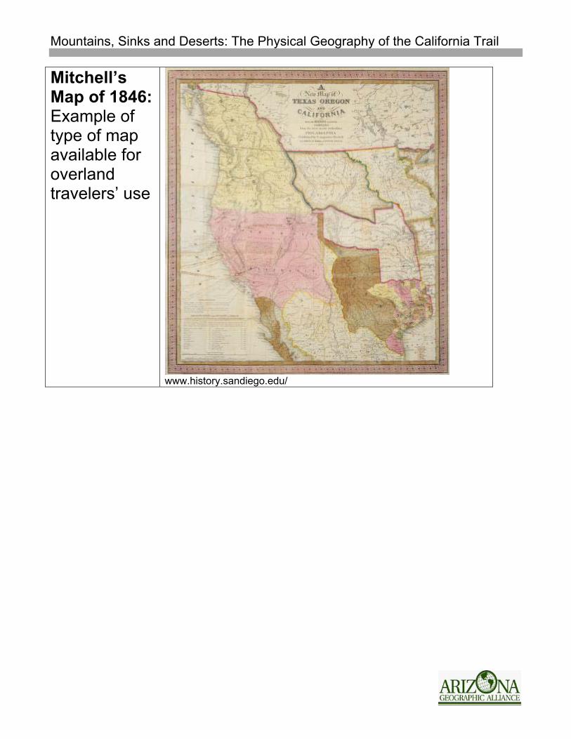
Assessment Students will write one fact about the physical geography of the different portions of the California Trail for a total of six facts. Mastery will be 80%, or 5 correct facts. Map activities (Worksheet #2) may also be used for assessment purposes. 8 points are possible. Extensions Compare the Truckee Route to other routes of the California Trail (e.g., Carson Route, Lassen Route). Show the transparency of Mitchell’s Map of 1846 used by some travelers. Discuss the accuracy of the map and its usefulness to the emigrants. Have students pretend to be a traveler on the trail and write about their experiences. Sources Churchill, Stillman. Diary, 1849 (2 volumes). The Library of Congress, American Memory Website.
Mountains, Sinks and Deserts: The Physical Geography of the California Trail
Cobbey, John Furmes. Journal, 1850. Overland Trails Diaries, Utah Academic library Consortium. Online Collections at BYU. Cone, Gordon C. Diary, 1849-1850. Overland Trails Diaries, Utah Academic library Consortium. Online Collections at BYU. Jackson, Edward. Diary, 1849. The Library of Congress, American Memory Website. Kimball, Violet T. Stories of Young Pioneers: In Their Own Words. Missoula, MT. Mountain Press Publishing Co. 2000. Stewart, George R. The California Trail. New York. McGraw Hill Co. 1962. Trails West. The National Geographic Society. Washington D.C. 1979.
Mountains, Sinks and Deserts: The Physical Geography of the California Trail
Sinks, Deserts, and Mountains: TRANSPARENCIES
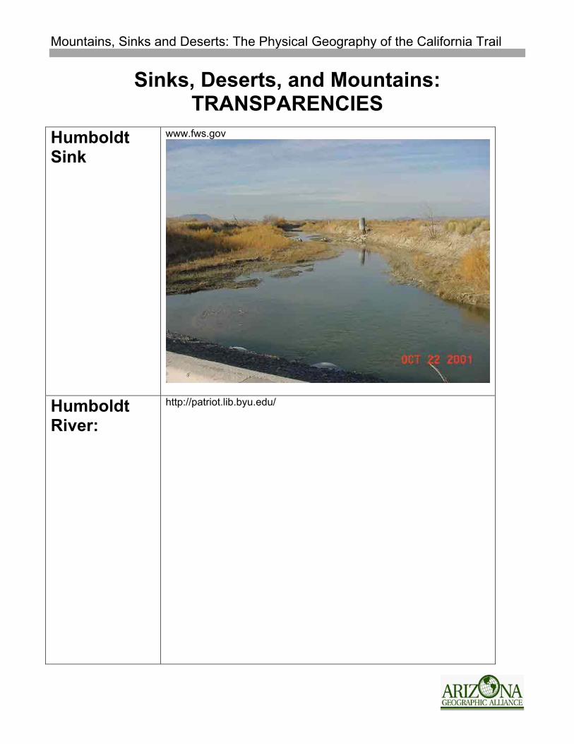
Humboldt Sink
www.fws.gov
Humboldt River:
http://patriot.lib.byu.edu/

Mountains, Sinks and Deserts: The Physical Geography of the California Trail
Great Basin Desert
greatbasin.nbii.gov/
Mountains, Sinks and Deserts: The Physical Geography of the California Trail
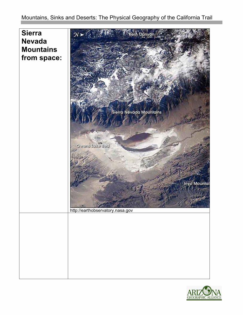
Sierra Nevada Mountains from space:
http://earthobservatory.nasa.gov
Mountains, Sinks and Deserts: The Physical Geography of the California Trail
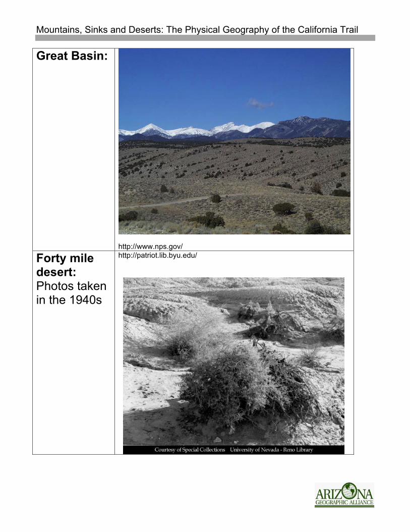
Great Basin:
http://www.nps.gov/
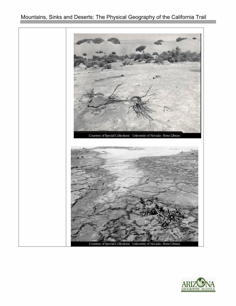
Forty mile desert: Photos taken in the 1940s
http://patriot.lib.byu.edu/
Mountains, Sinks and Deserts: The Physical Geography of the California Trail
Mountains, Sinks and Deserts: The Physical Geography of the California Trail
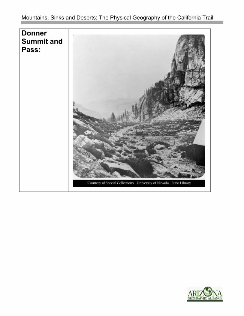
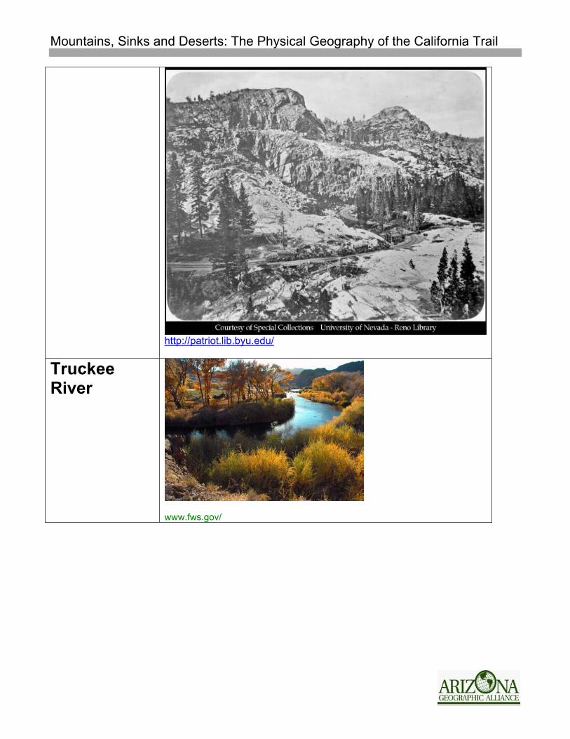
Donner Summit and Pass:
Mountains, Sinks and Deserts: The Physical Geography of the California Trail
http://patriot.lib.byu.edu/
Truckee River
www.fws.gov/
Mountains, Sinks and Deserts: The Physical Geography of the California Trail
Mitchell’s Map of 1846: Example of type of map available for overland travelers’ use
www.history.sandiego.edu/
Mountains, Sinks and Deserts: The Physical Geography of the California Trail
Student Worksheet #1 The Physical Geography of the California Trail
Emigrants traveling to California on the Oregon-California Trail faced many challenges, some of which were due to the physical geography of the route. Following the Oregon Trail from “jumping-off places” along the Missouri River, those heading for California left that trail about 150 days later near Fort Hall on the Snake River. California travelers faced the most difficult terrain in the West. Not only had they crossed the Rocky Mountains at South Pass, but ahead of them lay deserts and the Sierra Nevada Mountains. There were various routes to California, but they all contained the same physical barriers. This lesson will follow the Truckee River Route, also known as the Donner Pass Route, through the writings of some of its travelers. Great Basin After crossing the Rocky Mountains and leaving the Oregon Trail, travelers entered the Great Basin Desert. This desert lies between the Rocky Mountains to the east and the Sierra Nevada and Cascade Mountains to the west. It consists of alternating basins (valleys with interior drainage) and mountain ranges. In other words, all of its waterways (rivers and streams) drain into desert flats, not into the sea. It is mostly a desert and semi-desert area of sagebrush and greasewood plants.
Saturday August 18th The appearance of the country is again changed. The vallies are lar--ger, and in many instances form quite large plains-- are destitute of grass, and all kind of vegitation, except the eternal Artimecia;-- [sagebrush] this shrub grows from one, to six feet high; it has a few small leaves that resemble sage leaves, and are about the same size--it grows very scraggy, and gives the country where it is the only thing of the vegetable kin--gdom that is seen (and there is much of it) a som--bry, and grayish appearance that is not at all pleasant. The mountains begin to show more rock, and barrenness.
Gordon C. Cone, Diary, 1849-1850
July 4th The country through which we pass to day rather barren and dry of a porious soil and easily broke; hence the road very dusty The season has become quite warm and the meredian sun makes us pant for the shady Grove & cooling brooks our fancy would gladly emagine . . .
Mountains, Sinks and Deserts: The Physical Geography of the California Trail
July 15th we now continued to cross the sterrl plain prolific for nothing but its deep dust. Thise ise a very level plains or table lands at the foot of lofty bluffs
John Furmes Cobbey, Journal, 1850. Humboldt River After traveling about 160 miles from the turnoff on the Oregon Trail, emigrants reached the Humboldt River, the longest river in the Great Basin. The Humboldt begins in northeastern modern-day Nevada and flows to the southwest. Travelers found grass and water along the river, but soon tired of constantly having to cross its meandering path and traveling along its swampy lowlands. The river eventually drains into the Humboldt Sink.
July 6th Continued down the valley 5 miles crossed a low plain 1 mile to the Middle forke of Humbolt river. This stream is about 40 feet wide at this time 4 feet deep crossed safely we now have tow [two] slougs to cross the mud or /mire almost bottomeless Horses, mules, and Oxen foundered some mules only saved from the dominion of the mud; by fasning ropes to them; & using violent force, make the mire yeald its bony prey.
John Furmes Cobbey, Journal, 1850. Humboldt Sink Travelers said goodbye to the Humboldt River as it disappeared into the Humboldt Sink. The sink is an intermittent dry lakebed. The body of water occasionally in the sink is called the Humboldt Lake. The sink has no outlet. It is a remnant of a large prehistoric lake (Lake Lahontan) that existed about 13,000 years ago, at the end of the last ice age.
September 22, 1849 We have passed the "sink" or termination of Hum--boldt river; and after haveing travelled along its Ban--ks four hundred miles, and enjoyed so many refr-eshing draughs from its limped stream, it is not without some little emotion that we see it in its final resting place, in the midst of a Desart. It is a singular fact that so large a stream of water as "Humboldt" river, should after flowing on over a firm bed, and within high banks for four hundred miles loose itself in a bottomless than ten miles in length.
Gordon C. Cone, Diary, 1849-1850
Mountains, Sinks and Deserts: The Physical Geography of the California Trail
July 19th Started early this morning. Came 2 miles and come the last Slough of the sink (as we supposed) we now camped untill the heat of the day should pass water very poor in this slougth. At 5 o'k P.M. We continued our journey asscended a low sand ridege, and found the sloughs of the sunk sink still extended farther In 4 miles we crossed the meagre sloughs, the remains of Humbolt ; that, had escaped the devouring sands.
John Furmes Cobbey, Journal, 1850. 40-Mile Desert The travelers left the poor water and grass of the Humboldt Sink and entered the 40-mile Desert. The 40-Mile Desert is an alkaline wasteland, the remnants of part of an ancient, inland sea. Travelers faced deep sand, dust, and intense heat for the entire 40 miles. There was no grass for the animals and the only drinkable water was at Boiling Springs, a mineral-filled bubbling geyser. Many emigrants lost animals and belongings on this stretch of the trail, and while it was difficult and uncomfortable for the travelers, very few lost their lives. Most emigrants survived to reach the Truckee River.
July 19th We found this part of the desert a level plain for 12 miles and looked like it might have been covered with watr in in (sic) times past. It is a complete arid waste. these 12 miles the road is good the plains then becomes more rolling with some heavey sand Dead Horses are frequent on either hand, haveing performed only a small portion a cross this desert.
John Furmes Cobbey, Journal, 1850.
September 22, 1849 The country is indeed a desart , not a single plant of any description Is to be seen along the rout as we pass-- not even the wild sage, or greecewood, that is almost every where, is to be found here; all is one dry, and barren waste, and with the exception of here and there a sand hill, the country is entirely level . . Gordon C. Cone, Diary, 1849-1850
Disappointment intensified our burning thirst and my good mother gave [us] moistened peppermint and later put a flattened bullet in each child’s mouth to engage its attention and help keep the salivary glands in action. Eliza Donner, Overland in 1846 in Kimball, Stories of Young Pioneers: In Their Own Words, p. 139.
Mountains, Sinks and Deserts: The Physical Geography of the California Trail
Truckee River The weary travelers and their surviving animals found plentiful water and grass upon reaching the Truckee River. This river begins high in the Sierra Nevada Mountains and sinks into the 40-Mile Desert. Travelers followed the river on an uphill grade, crossing the river several times, into the forested country of the Sierra Nevada Mountains.
Sep. 1st Tuck's river [Truckee River] which flows thro this valley is a fine little stream which flows from the " Sierra Nevada ", clear as crystal. It is well appreciated by the thirsty traveller, after a journey of 45 miles over a desert.
Sep. 3d. We started from our nooning - went about 5 miles and came to a very extensive plain, 5 by 10 miles, covered by a luxuriant growth of grass, thro which Truck's river [Truckee River] passes; and walled in on all sides by the lofty Sierra Nevada .
Jackson, Edward. Diary, 1849 Sierra Nevada Mountains (Through Donner/Stephens Pass) The final obstacle on the road to California now lay before the emigrants – the Sierra Nevada Mountains. The Sierra Nevada stretch 400 miles from north to south with peaks ranging from a height of 5000 feet to over 14,000 feet. This mountain range began approximately 150 million years ago rising as a result of the collision of landmasses. By 65 million years ago, they had been worn down to a range of low, rolling mountains only a few thousand feet high. Uplifting of the mountains began about 25 million years ago and continues today. As a result of the uplifting, rivers cut deep canyons on both sides of the range. U-shaped canyons were also carved out of the mountains by glaciers during later ice ages. All of this physical activity resulted in beautiful, but rugged mountains; very difficult for emigrants and wagons to traverse both up to Donner Pass (also known as Stephens Pass) as well as down into California’s Central Valley and Sutter’s Fort (Sacramento).
Mountains, Sinks and Deserts: The Physical Geography of the California Trail
September 9, 1849 it is 2 miles from base to summit nearly all up hill parts of it considerable steep covered with pines the last hill or pitch is 30 yds long sandy + very steep + very difficult of ascent our mules got so tired or jaded we were obliged to call on an emigrant wagon to assist us up the last ascent which was granted when our wagon was safely landed on the summit
Churchill, Stillman. Diary, 1849
September 6, 1849 We started this morning, for our last tremendous summit, at 9 oclock. For the first 2 miles the ascent was very gradual and our path lay among pines; but the next three miles was more rugged and steep and many fir and spruce trees bordered our way. Some of the rocks are granite of a very white color. After climbing one very sharp pitch, we came on a level bit of table land, an acre broad, which seemed placed on purpose for all hands to stop and recruit for the next tremendous effort, which is the top of the Sierra Nevada , 9358 feet above the level of the sea.
September 7, 1849 We still have monstrous mountains to ascend and descend. You have nothing at home that will compare with them. Sometimes, to get the waggons down, we cut a tree and tie it to the back part of a waggon & ease it down, sometimes, we tie a rope to the back and give it a turn or two around a tree then all take hold and ease it down as slowly as possible.
Jackson, Edward. Diary, 1849
Mountains, Sinks and Deserts: The Physical Geography of the California Trail
Student Worksheet #2 Map Activities
Name ___________________________________
Use the map, “The Oregon and California Trails,” for the following activities.
1. Label the Sierra Nevada Mountains and the Great Basin Desert. 2. Shade the area known as the 40-Mile Desert yellow. (Hint: remember
where travelers entered it and left it.)
3. Highlight the following items on the map by tracing them in different colors. In the space below, make a legend for the map indicating the colors you used.
o Marshall Route (to Independence, Missouri) o The Oregon Trail (from its starting point in Independence, Missouri to
the California Trail cutoff) o The California Trail o Humboldt River o Truckee River
Mountains, Sinks and Deserts: The Physical Geography of the California Trail
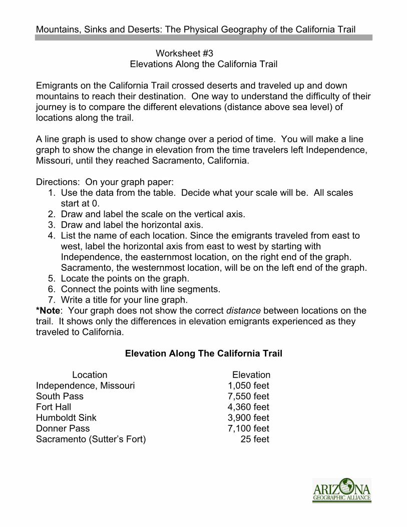
Worksheet #3 Elevations Along the California Trail
Emigrants on the California Trail crossed deserts and traveled up and down mountains to reach their destination. One way to understand the difficulty of their journey is to compare the different elevations (distance above sea level) of locations along the trail. A line graph is used to show change over a period of time. You will make a line graph to show the change in elevation from the time travelers left Independence, Missouri, until they reached Sacramento, California. Directions: On your graph paper:
1. Use the data from the table. Decide what your scale will be. All scales start at 0.
2. Draw and label the scale on the vertical axis. 3. Draw and label the horizontal axis. 4. List the name of each location. Since the emigrants traveled from east to
west, label the horizontal axis from east to west by starting with Independence, the easternmost location, on the right end of the graph. Sacramento, the westernmost location, will be on the left end of the graph.
5. Locate the points on the graph. 6. Connect the points with line segments. 7. Write a title for your line graph.
*Note: Your graph does not show the correct distance between locations on the trail. It shows only the differences in elevation emigrants experienced as they traveled to California.
Elevation Along The California Trail Location Elevation Independence, Missouri 1,050 feet South Pass 7,550 feet Fort Hall 4,360 feet Humboldt Sink 3,900 feet Donner Pass 7,100 feet Sacramento (Sutter’s Fort) 25 feet
Mountains, Sinks and Deserts: The Physical Geography of the California Trail
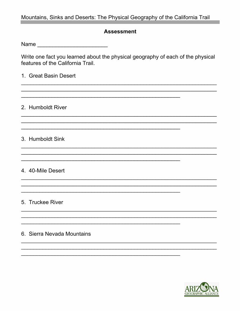
Assessment
Name _______________________ Write one fact you learned about the physical geography of each of the physical features of the California Trail. 1. Great Basin Desert ____________________________________________________________________________________________________________________________________________________________________________________ 2. Humboldt River ____________________________________________________________________________________________________________________________________________________________________________________ 3. Humboldt Sink ____________________________________________________________________________________________________________________________________________________________________________________ 4. 40-Mile Desert ____________________________________________________________________________________________________________________________________________________________________________________ 5. Truckee River ____________________________________________________________________________________________________________________________________________________________________________________ 6. Sierra Nevada Mountains ____________________________________________________________________________________________________________________________________________________________________________________
Mountains, Sinks and Deserts: The Physical Geography of the California Trail
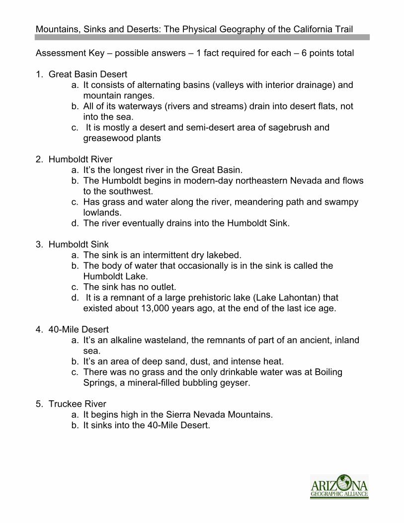
Assessment Key – possible answers – 1 fact required for each – 6 points total 1. Great Basin Desert
a. It consists of alternating basins (valleys with interior drainage) and mountain ranges.
b. All of its waterways (rivers and streams) drain into desert flats, not into the sea.
c. It is mostly a desert and semi-desert area of sagebrush and greasewood plants
2. Humboldt River
a. It’s the longest river in the Great Basin. b. The Humboldt begins in modern-day northeastern Nevada and flows
to the southwest. c. Has grass and water along the river, meandering path and swampy
lowlands. d. The river eventually drains into the Humboldt Sink.
3. Humboldt Sink a. The sink is an intermittent dry lakebed. b. The body of water that occasionally is in the sink is called the
Humboldt Lake. c. The sink has no outlet. d. It is a remnant of a large prehistoric lake (Lake Lahontan) that
existed about 13,000 years ago, at the end of the last ice age. 4. 40-Mile Desert
a. It’s an alkaline wasteland, the remnants of part of an ancient, inland sea.
b. It’s an area of deep sand, dust, and intense heat. c. There was no grass and the only drinkable water was at Boiling
Springs, a mineral-filled bubbling geyser. 5. Truckee River
a. It begins high in the Sierra Nevada Mountains. b. It sinks into the 40-Mile Desert.
Mountains, Sinks and Deserts: The Physical Geography of the California Trail
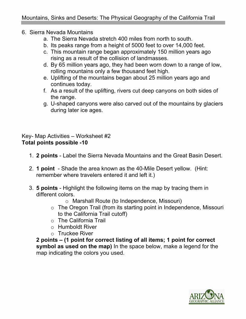
6. Sierra Nevada Mountains a. The Sierra Nevada stretch 400 miles from north to south. b. Its peaks range from a height of 5000 feet to over 14,000 feet. c. This mountain range began approximately 150 million years ago
rising as a result of the collision of landmasses. d. By 65 million years ago, they had been worn down to a range of low,
rolling mountains only a few thousand feet high. e. Uplifting of the mountains began about 25 million years ago and
continues today. f. As a result of the uplifting, rivers cut deep canyons on both sides of
the range. g. U-shaped canyons were also carved out of the mountains by glaciers
during later ice ages. Key- Map Activities – Worksheet #2 Total points possible -10
1. 2 points - Label the Sierra Nevada Mountains and the Great Basin Desert. 2. 1 point - Shade the area known as the 40-Mile Desert yellow. (Hint:
remember where travelers entered it and left it.)
3. 5 points - Highlight the following items on the map by tracing them in different colors.
o Marshall Route (to Independence, Missouri) o The Oregon Trail (from its starting point in Independence, Missouri
to the California Trail cutoff) o The California Trail o Humboldt River o Truckee River
2 points – (1 point for correct listing of all items; 1 point for correct symbol as used on the map) In the space below, make a legend for the map indicating the colors you used.