mn dnr forestry - mnics.orgmnics.org/wpress/.../04/2018-airspace-deconfliction... · of airspace....
TRANSCRIPT

1
MN DNR FORESTRY
AIRSPACE COORDINATION DE-CONFLICTION
ACTION PLAN
AND PROCEDURES GUIDE
Recommend Annual Update Prior to March 1st
Revised by: _Linda Bruss _ Date: _03/28/2018_
Supervisory Aircraft Dispatcher
Approved by: _Darren Neuman_ Date: _04/29/2018_
Aviation Safety Advisor

2
TABLE OF CONTENTS
PURPOSE /OBJECTIVE/REVIEW
INTRODUCTION
BACKGROUND
CHAPTER I: INCIDENT AIRSPACE COORDINATION PROCEDURES
SEE AND AVOID
CHAPTER II: INCIDENT COMMUNICATIONS PROCEDURES
INITIAL RESPONSE
TRANSITION / EXTENDED PHASE
PROCEDURE FOR VHF-AM FREQUENCY CHANGE
“ALL RISK” COMMUNICATION EFFORTS
FIRE MUTUAL AID – RURAL FIRE DEPTS.
CHAPTER III: TEMPORARY FLIGHT RESTRICTIONS (TFR’s)
AUTHORITY
PROCEDURES
ENFORCEMENT
TYPE OF TFR’s
AUTHORITY TO FLY INSIDE A TFR
CHAPTER IV: INFORMATION & EDUCATION
AIRPORT MAILINGS
DOT NOTICES
PILOT SCHOOL EDUCATION
NEWS RELEASES
AIRPORT NOTIFICATIONS
FAA SAFETY PERSONNEL
CHAPTER V: SPECIAL USE AIR SPACE
DECONFLICTION PROCEDURES
PROHIBITED AREAS
RESTRICTED AREAS
MILITARY OPERATIONS AREAS
CHAPTER VI: MILITARY TRAINING ROUTES
DECONFLICTION PROCEDURES
MTR’s

3
CHAPTER VII: FIRE SUPPRESSION AIRCRAFT AND AIR TRAFFIC CONTROL
WITHOUT AIR ATTACK
WITH AIR ATTACK
USE OF THE AM FREQUENCIES
ANNOUNCING “IN THE BLIND”
ROUTE DISCIPLINE
TRAINING PILOTS & OBSERVERS
CRM – SPLITTING THE WORKLOAD
INCREASED AREA FORESTRY COORDINATION
ESTABLISHING, TRAINING BOUNDARY PROCEDURES
CHAPTER VIII: AERIAL DETECTION DECONFLICTION
INCREASED UTILIZATION OF THE AM RADIO
FOLLOW THE MNICS AVIATION ALL RISK PLAN
DETECTION ROUTE DISCIPLINE
TRAINING OF DETECTION PILOTS AND OBSERVERS
COCKPIT RESOURCE MANAGEMENT PROCEDURES
PROVIDE DAILY BRIEFINGS
INCREASED ADJACENT AREA COORDINATION
CHAPTER IX: TEMPORARY AIR TRAFFIC SERVICES
CHAPTER X: UTILITY / RIGHT OF WAY DECONFLICTION PROCEDURES
OWNERSHIP OF LAND
CONTACTING APPROPRIATE UTILITY COMPANIES
ITEMS TO CONSIDER
COMPANY PHONE NUMBERS
CHAPTER XI: UNMANNED AIRCRAFT SYSYTEMS (UAS) and MODEL AIRCRAFT
OPERATIONS
UAS
MODEL AIRCRAFT OPERATIONS
APPENDIX A DEFNITIONS / ACRONYMS
APPENDIX B INTRUSION SAFECOM’s
APPENDIX C INFORMATION / EDUCATION
APPENDIX D TFR ENFORCEMENT EXAMPLE
APPENDIX E FLIGHT TRAFFIC AREA PROCEDURES
APPENDIX F AIR TACTICAL GROUP SUPERVISOR
(ATGS) ROLES AND RESPONSIBILITIES
APPENDIX G IRON RANGE MINING FACILITIES

4
PURPOSE AND OBJECTIVE
The purpose of this plan/guide is to promote aviation safety by documenting and
utilizing air space coordination procedures and air space de-confliction procedures.
The guide will serve as a reference to the procedures and tactics available to the
Division. It is essential that all personnel involved in flight planning and operations
read, understand and implement the procedures and tactics contained in this guide.
REVIEW
This guide will normally be revised and maintained annually (prior to March 1) by
the MNCC Assistant Center Manager - Aviation and reviewed annually by the
Division’s Aviation Safety Advisor.

5
INTRODUCTION
The Division of Forestry employs a variety of tactics to help de-conflict incident airspace.
Tactics to include:
A. Education of Incident Personnel Including:
1) Agency Personnel
2) Cooperating Agencies
3) MNICS Aviation Partners
4) Others
B. Education of General Aviators via:
1) Airport mailings
2) Posters
3) Airport directory
4) Notification to towers & airports adjacent to incidents
5) Other
C. Training of Division Personnel in the Areas of:
1) Temporary Flight Restrictions (TFRs)
2) Special Use Areas (SUAs)
3) Military Training Routes (MTRs)
4) Incident Aviation Management
5) Fire Traffic Areas (FTAs)
6) Radio Communication
7) Border Crossing Issues
8) Other
D. Establishing Division Procedures for:
1) Temporary Flight Restrictions (TFRs)
2) Military Training Routes (MTRs)
3) Military Operating Areas (MOAs)
4) Operating in Incident Airspace
5) Radio Communications
6) Border Crossings
7) Other
E. Improve Aerial Detection - Deconfliction via:
1) Increased use of VHF-AM radios
2) Improved coordination between Forestry Area Offices
3) Establishing detection route procedures
4) Aircraft/Altitude separation near borders
5) Pilot/observer training
6) Cockpit resource management

6
F. Collaboration With:
1) MNICS partners, such as
a. National Guard
b. State Patrol
c. Emergency Medical Services
d. Media
e. Civil Air Patrol
f. Coast Guard
g. Border Patrol
h. DNR Enforcement
i. Others
2) Federal Aviation Administration (FAA)
a. Flight Standard District Office (FSDO)
b. Flight Service Station (FSS)
c. Air Route Traffic Control Center (ARTCC)
3) Border Patrol, Grand Forks, Sector Headquarters
4) Other Military
5) Others
G. Enforcement of:
1) Temporary Flight Restrictions (TFRs)
2) Safety Procedures
3) Other
H. Analysis, Advisories and Modifications via:
1) Reporting (SAFECOMs)
2) Briefings
3) Alerts
4) Review of Policy/Procedures Guide
5) Guide Revisions
6) Other

7
BACKGROUND
Congress has charged the Federal Aviation Administration (FAA)
with administering and managing the airspace, in the public
interest, to insure the safety of aircraft and the efficient utilization
of airspace. Airspace is a limited natural resource with numerous
potential conflicting demands. The primary focus in airspace
coordination is mid-air collision avoidance. In the past several
years, we have seen a marked increase in incident airspace
conflicts; near mid-air collisions, intrusions into temporary flight
restriction areas, etc. (See appendix B for documentation).
Airspace coordination is a shared responsibility of pilots,
dispatchers, Air Tactical Group Supervisors, aviation personnel
and management. It is the pilot’s responsibility to be familiar
with the airspace of the intended flight and to comply with all
rules and regulations for flight through each type of airspace.
Thorough understanding of the procedures in this guide can aid
in the reduction of airspace conflict and can improve aviation
safety within the National Airspace System (NAS).

8
CHAPTER I: SEE AND AVOID –
INCIDENT PERSONNEL SHOULD FOLLOW “SEE AND
AVOID TECHNIQUES.”
Pilots, aviation managers, aircraft chiefs of party and flight
crewmembers must understand that even with the implementation
of procedures (TFRs, NOTAMs, etc.) in this guide, the ultimate
assurance of collision avoidance rests with the pilot in command
(PIC) maintaining the vigilance necessary to spot other aircraft and
take necessary action. Flight crewmembers should remember they
are not merely passengers, but observers as well, and should keep a
constant watch for other aircraft whenever in flight. They should
never assume the pilot sees another aircraft or aerial hazard.

9
CHAPTER II: COMMUNICATION PROCEDURES
INCIDENT PERSONNEL SHOULD KNOW, UNDERSTAND AND FOLLOW
INCIDENT AIRSPACE COMMUNICATION PROCEDURES.
INITIAL RESPONSE TO AN INCIDENT-
While enroute, all fixed wing and federal aircraft will flight follow with the
MNCC Aviation dispatch. MN DNR helicopters will flight follow with assigned
tanker base until contact is made with the incident or other local dispatch center.
All aircraft, when within 12 miles of each fire incident should announce “in the
blind”: aircraft identification, current altitude, location, and direction of travel on
VHF-AM (Victor) 122.925. All aircraft should monitor 122.925 while in the
vicinity of the fire – (unless in controlled airspace or another frequency has been
assigned) whether in bound to that particular fire or not. 122.925 is the primary
AM frequency being utilized in the State of Minnesota for wildfire. Detection
planes or “Air Attack” may or may not be over a fire before suppression aircraft
arrive. Do not assume you are the first or only aircraft in the vicinity of the fire.
Aircraft responding to a non-fire, “all-risk” type emergency should announce “in
the blind” on 123.025 and monitor 123.025.
Detection planes should respond on the AM frequency; however, another option
would be to attempt contact on the appropriate agency FM frequency.
If an Air Tactical Group Supervisor (ATGS) is over the fire or other incident,
they have the responsibility and authority to manage the airspace for participating
aircraft, assign appropriate radio frequencies and activate an alternate
communication plan when necessary. Airspace management is facilitated by all
aircraft maintaining radio discipline.
If an Air Tactical Group Supervisor (ATGS) is on the incident: Prior to entering
incident airspace (12 miles out), contact ATGS and identify your type of aircraft,
call sign, general location from the incident and E.T.A. Request status of other
aircraft on the incident and adhere to the Flight Traffic Area Rules (FTA), see
Appendix E.
NOTE: *DO NOT ENTER* incident airspace without prior approval from the
ATGS. If contact cannot be established on 122.925 or an agency FM frequency,
try the “Air Guard Frequency” 168.625, Tone Tx 110.9. Air Tactical Group
Supervisor (ATGS) are commonly referred to as “Air Attack”. Their call sign on
an incident is often “Air Attack” followed by a number, i.e., Air Attack 1 or Air
Attack 2, etc.

10
When departing the incident, all aircraft should announce to Air Attack or other
aircraft their intended flight path.
TRANSITION PHASE OR EXTENDED RESPONSE –
In this phase an Air Tactical Group Supervisor is usually in place providing
airspace coordination between aircraft over an incident. In addition, an Air
Operations Branch within the Incident Command System (ICS) may be utilized as
part of an incident management team, facilitating aviation operations, assigning
radio frequencies and determining the need for a TFR.
PROCEDURE FOR VHF-AM FREQUENCY CHANGE ON WILDFIRES –
The VHF-AM frequency will be assigned by the MNCC Aviation Dispatch at the
time of the initial request for aircraft.
If the Air Tactical Group Supervisor (Air Attack) recognizes the need for an AM
(Victor) frequency change or addition, the procedure is as follows:
1. Air Attack recognizes the need for an alternate VHF-AM frequency and
contacts the MNCC Aviation Dispatch who will assign a new frequency
and relay it to the Air Attack.
2. Air Attack notifies all aircraft on scene of the frequency change or addition
and confirms change by commo check with all aircraft. Air Attack
monitors both the new frequency and the former AM frequency (122.925
most likely) if possible.
3.
4. MNCC Aviation Dispatch contacts all tanker bases and the applicable
helibases and informs them of the fire name, location, and AM frequency
assignment.
5. MNCC Aviation Dispatch contacts/informs local area/agency of frequency
change; local area/agency notifies their detection or observer aircraft.
6. When it is determined by Air Attack that the frequency plan is no longer
required, MNCC Aviation Dispatch will be directed to close out the plan.
They will contact tanker bases, helibases and local area/agency of
frequency closure/change.

11
“ALL RISK COMMUNICATION EFFORTS”
The “All Risk” Aviation Operation Plan is designed to provide guidance for
coordinating aviation assets from various agencies (law enforcement, DNR, EMS,
Forest Service, Army National Guard, CAP, contractors, media, etc.) responding to any
emergent situation. These guidelines are recommended for use when two or more
aircraft are functioning at an incident and are extremely important to initiate
immediately upon response to any emergent incident. The “Plan” addresses three
phases of an incident: initial response, transition, and extended response.
INITIAL RESPONSE PHASE
The “Plan” encourages the use of the Air Tactical Group Supervisor position (Air
Attack) generally filled by the first aircraft on the scene until formally handing off the
responsibility.
The initial VHF AM frequency for “All Risk” incidents is 123.025 (122.925 wild land
fire). Any aircraft arriving on the scene should adhere to the following standards:
Monitor VHF AM
Announce “in the blind” 5 minutes from incident:
Tail number
Altitude
Direction of entry
First aircraft assumes air traffic control providing for coordination, separation and
safety. If other aircraft are on the scene, do not enter incident airspace until contact has
been made with the Air Tactical Group Supervisor or the controlling aircraft. Any
aircraft departing the incident should announce their intended flight path from the
incident.
TRANSITION PHASE
The transition phase has the incident going beyond “normal” or “usual” response. Some
of the indicators that you are in the transition phase may include:
Activity is escalating at the incident
Multiple agencies are responding
Media involvement
Airborne air traffic control is more difficult

12
It is critical that the Air Tactical Group Supervisor is identified and functioning
smoothly. Also, at this time, the aviation assets should begin to be organized and
managed under the ICS system.
EXTENDED RESPONSE PHASE
Some of the indicators of the extended response phase:
The incident has grown in complexity
The incident is beyond the first operational period
Air Tactical Group Supervisor is assigned
Incident management team assigned or on order
All risk MNICS aviation activities include both “civil” and “public” operations. All
aircraft operations are expected to comply with applicable sections of 14CFR (control of
air traffic, use of air space, and aircraft registration) as well as owner agency’s policy.
A ground based Air Operations Branch Director (AOBD) will often coordinate the
aviation aspects of an extended aviation operation. Aircraft entering or departing the
incident will normally contact the Air Tactical Group Supervisor for an incident briefing
or check-in / check-out. The Air Tactical Group Supervisor should inform the incoming
aircraft of: other aircraft, whether or not a TFR is in effect, the current altimeter setting
and the frequencies to monitor at all times while operating within 5 minutes of the
incident.
UNSAFE CONDITIONS:
All personnel have the responsibility to initiate action to stop any unsafe aviation
operation. Anyone may refuse or curtail a flight or operation when an unsafe condition
exists. Federal employees and Division of Forestry employees will normally utilize a
“SAFECOM” to document any deviations of normal operation or safety concerns.
“SAFECOMs” should be forwarded through each agency’s channels.
Aircraft and Pilots: Agency personnel may only use aircraft and pilots that are approved
for use by their agency. For Federal fire agency employees, only those aircraft with
current aircraft data cards or letters of authorization may be used. Pilots are required to
have a current pilot qualification card or letter of authorization before taking Federal fire
agency employees as passengers. For non-Federal employees, each agency is
responsible for determining approval of aircraft and pilots.
For additional information on “All Risk” coordination, refer to the Minnesota Incident Command
System “All Risk” Aviation Operation Plan.

13
FIRE MUTUAL AID
FM RADIO: Fire Mutual Aid – (VFIRE23) 154.295 Tone Tx156.7 narrow band is the primary frequency
used for coordination between fire departments and other agency responding ground forces.
ARMER RADIO:
Some counties in Minnesota are utilizing the Armer (800 MHz) radio system. Initial contact
with the county dispatcher and the incident commander should be made on the assigned 800
MHz talk group or on the Primary IC Zone Talkgroup.
DNR ground personnel will normally coordinate priorities and assignments with the incident
commander, either face to face, on Fire Mutual Aid or by using 800 MHz radio
communications.
Air-ground communication for tactical operations with DNR aircraft will normally be
communicated on a DNR VHF-FM air-ground frequency. Tactical aircraft managers are
encouraged to use the MN DNR Forestry designated air-ground frequency “DNR A/G 1”
151.340 Tone 110.9 (Tx / Rx narrow band) when coordinating air operations if the primary
frequency is congested.
If initial contact cannot be made with aircraft, try utilizing the Air Guard frequency, 168.625,
Tone 110.9 (Tx only narrow band). Return to an air-to-ground or a tactical frequency as soon as
possible to “free-up” the Air Guard frequency.
This plan was developed and its use encouraged so that radio traffic for the tactical fire fighting
pilots is reduced. This should allow them an increased ability to concentrate on their mission
and will assist the ultimate goal of a safe operation.
AM FREQUENCIES
123.025 MNICS – AIR-AIR – ALL RISK FREQUENCY (call in 10 minutes out)
122.925 AIR-AIR & AIR-GROUND designated natural resources frequency
AIR-AIR – Initial Attack (as assigned)
135.925 AIR-AIR - SUF/CPF Primary – Initial Attack
119.775 AIR-AIR – CPF Secondary – Initial Attack
120.825 AIR-AIR – SUF Secondary – Initial Attack
120.125 AIR-GROUND – Air Tanker Base Operations Within 10 Miles of Base
126.200 AIR-GROUND – CAMP RIPLEY – Miller Field
121.500 EMERGENCY LOCATOR TRANSMITTER (ELT)
FM FREQUENCIES
155.340
Tone
Tx 156.7
VMED28 (EMS)
155.475
Tone
Tx 156.7
VLAW31 (MINSEF)
151.340
Tone
(Rx/Tx)110.9
DNR AIR/GROUND 1

14
159.300 Tone
(Rx/Tx) 110.9
DNR AIR/GROUND 2
167.950 AIR/GROUND 70
166.6125 AIR/GROUND 3
168.1250 AIR/GROUND 19
154.295 Tone
Tx 156.7
VFIRE23 (FIRE MUTUAL AID)
159.2400 Tone
(Rx/Tx) 100.0
MN Tanker Base Ramp Frequency
CHAPTER III: TEMPORARY FLIGHT RESTRICTIONS
(TFRs)
WHEN REQUESTED AND WHERE POSSIBLE AND APPROPRIATE, TFR’s
SHOULD BE IMPLEMENTED OVER INCIDENT AIRSPACE. THE MOST
COMMON METHOD OF ESTABLISHING TFR’s WILL NORMALLY BE
THROUGH MNCC AVIATION DISPATCH.
AUTHORITY
The FAA is the only authority that can implement a TFR. The authority for
agency personnel to request a TFR is found in 91.137 (a) (2).
PROCEDURE
1. Determine the need for a TFR and/or deconfliction. This determination
would likely originate with an Incident Commander, the ATGS, an aviation
manager, or a dispatcher. The criteria for establishing the need may
include:
Lengthy air operation is anticipated: from several hours to several days.
Operations are in congested areas or near an airport.
There is a high potential for sightseer and/or media aircraft.
Military training route is involved.
Special use airspace is involved.
Other considerations
15
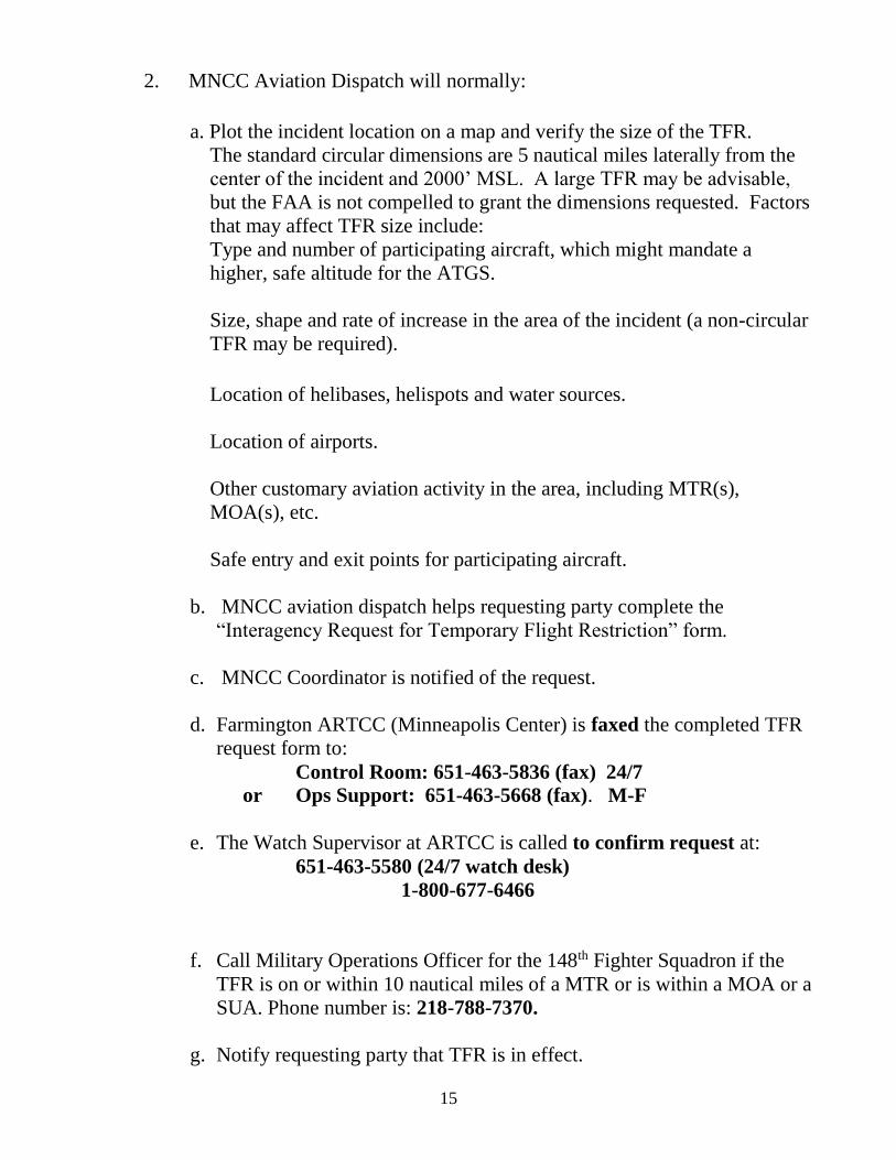
2. MNCC Aviation Dispatch will normally:
a. Plot the incident location on a map and verify the size of the TFR.
The standard circular dimensions are 5 nautical miles laterally from the
center of the incident and 2000’ MSL. A large TFR may be advisable,
but the FAA is not compelled to grant the dimensions requested. Factors
that may affect TFR size include:
Type and number of participating aircraft, which might mandate a
higher, safe altitude for the ATGS.
Size, shape and rate of increase in the area of the incident (a non-circular
TFR may be required).
Location of helibases, helispots and water sources.
Location of airports.
Other customary aviation activity in the area, including MTR(s),
MOA(s), etc.
Safe entry and exit points for participating aircraft.
b. MNCC aviation dispatch helps requesting party complete the
“Interagency Request for Temporary Flight Restriction” form.
c. MNCC Coordinator is notified of the request.
d. Farmington ARTCC (Minneapolis Center) is faxed the completed TFR
request form to:
Control Room: 651-463-5836 (fax) 24/7
or Ops Support: 651-463-5668 (fax). M-F
e. The Watch Supervisor at ARTCC is called to confirm request at:
651-463-5580 (24/7 watch desk)
1-800-677-6466
f. Call Military Operations Officer for the 148th Fighter Squadron if the
TFR is on or within 10 nautical miles of a MTR or is within a MOA or a
SUA. Phone number is: 218-788-7370.
g. Notify requesting party that TFR is in effect.

16
h. Close the TFR as soon as it is no longer needed.
3. MNCC Aviation Dispatch also notifies of other TFR’s in the area through
the Aircraft Status Report.
TFR ENFORCEMENT
To enforce a TFR violation, MNCC should gather the appropriate information
(utilizing available personnel – local DNR, Enforcement Pilots, etc.) and shall
report the violations to the local Flight Standards District Office (FSDO).
FAA: FSDO = (612) 253-4400 Minneapolis Flight Standards District
M-F (0730-1600) Minneapolis MN 55450
Fax #: 612-253-4401
Alternate #: = (612) 253-4494 Mr. Darryl Anderson
M-TH (0600-1630)
Penalties for violating TFR(s):
1. Certificate Suspension – 30 – 180 days and/or remedial training thru the
program safety manager at the Flight Standards District Office (FSDO).
Training may be ground school or flight instruction at pilot’s expense. If
pilot does not complete training, suspension will take place.
2. Certificate Revocation – Normally due to record falsification (ultra-lights
have no certificates).
3. Fines – Up to $1,000.00 per violation.
(See Appendix D for TFR Enforcement Documentation Example)
TYPES OF TFR(s) –
A TFR (also known as a FDC NOTAM) is an area delineated for flight
restrictions by the FAA for use by the requesting agency. Intrusions into a
TFR may carry a penalty such as suspension of license. There are three kinds of
TFR’s that fall under FAR 91.137.

17
1. 14 CFR Section 91.137 (a) (1)
Restrictions issued under this FAR prohibit all flight in the designated area
except those participating in hazard relief activities. This is the most
restrictive of the TFR(s) and is rarely issued for wild land fire incidents. It
is more commonly used for the following:
Toxic Gas Leaks
Volcano Eruptions
Nuclear Accident or Incident
Hijacking Incidents
Aircraft Accident Sites at the discretion of the FAA
2. 14 CFR Section 91.137 (a) (2) – To provide a safe environment for the
operation of disaster relief aircraft. This is the most common of the TFR(s)
being utilized by land management agencies that deal with wild land fires.
Our TFR(s) over our fires will more than likely be issued under this
paragraph. Some of the common uses of this TFR are:
Wild land fires utilizing air resources
Earthquakes, floods, tornadoes, hurricanes, etc.
Aircraft accident sites
3. 14 CFR Section 91.137 (a) (3) – Issued to prevent unsafe congestion of
sight seeing aircraft above an incident or event which may generate a high
degree of public interest. This TFR is rarely used, except for some sporting
events or accident sites. Agencies have attempted to get this type of TFR
for prescribed burning and other management activities, but are rarely, if
ever, issued by the FAA.

18
AUTHORITY TO FLY INSIDE A TFR –
Regulations on who can fly within a TFR vary by the TFR(s). The following
standards apply:
1. 91.137 (a) (1) – is the most restrictive of the 91.137 series of TFR(s). No
aircraft can operate within the TFR unless they are participating in hazard
relief activities and are under the direction of the official in charge.
91.137 (a) (2) – most commonly used TFR for wild land fire. Certain
aircraft are allowed to fly within the TFR. They are:
Participating aircraft – aircraft under the direction of the official in charge.
Law Enforcement – may show up without prior notification. We continue
to share frequency information and procedures to law enforcement with
aviation assets.
Media aircraft carrying properly accredited news representatives. They
must file a flight plan with the appropriate FAA or ATC facility specified
in the TFR NOTAM. They must stay above the altitude used by the
disaster relief aircraft, unless authorized by the Air Tactical Group
Supervisor. We continue to share frequency information and procedures to
the media as well.
Airport Traffic – TFR(s) do not close airports. VFR traffic is allowed
inside the TFR if the flight is conducted directly to or from an airport.
TFR(s) in or near airports are a red flag, requiring a heightened sense of
alertness.
IFR Traffic – ATC approved IFR flight plans could be routed through a
TFR.
3. 91.137 (a) (3) - Under this type of TFR, entry for non-participating aircraft
are very similar to 91.137 (a) (2) - media, law enforcement, airport traffic,
etc.
19
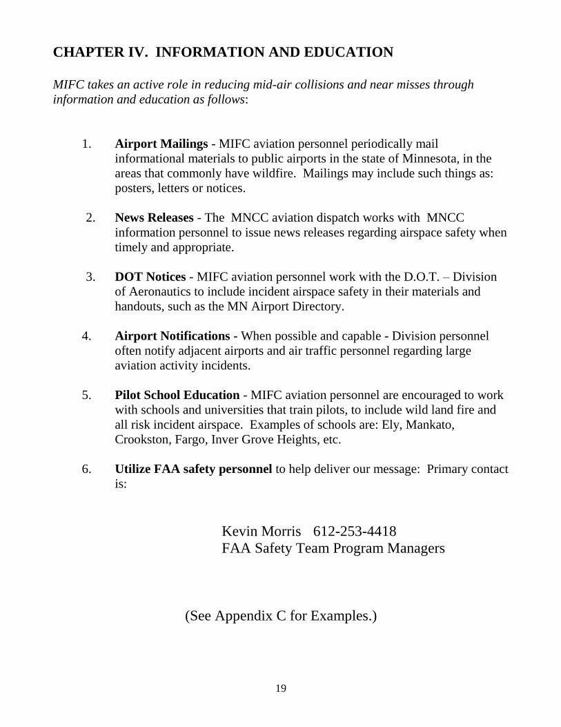
CHAPTER IV. INFORMATION AND EDUCATION
MIFC takes an active role in reducing mid-air collisions and near misses through
information and education as follows:
1. Airport Mailings - MIFC aviation personnel periodically mail
informational materials to public airports in the state of Minnesota, in the
areas that commonly have wildfire. Mailings may include such things as:
posters, letters or notices.
2. News Releases - The MNCC aviation dispatch works with MNCC
information personnel to issue news releases regarding airspace safety when
timely and appropriate.
3. DOT Notices - MIFC aviation personnel work with the D.O.T. – Division
of Aeronautics to include incident airspace safety in their materials and
handouts, such as the MN Airport Directory.
4. Airport Notifications - When possible and capable - Division personnel
often notify adjacent airports and air traffic personnel regarding large
aviation activity incidents.
5. Pilot School Education - MIFC aviation personnel are encouraged to work
with schools and universities that train pilots, to include wild land fire and
all risk incident airspace. Examples of schools are: Ely, Mankato,
Crookston, Fargo, Inver Grove Heights, etc.
6. Utilize FAA safety personnel to help deliver our message: Primary contact
is:
Kevin Morris 612-253-4418
FAA Safety Team Program Managers
(See Appendix C for Examples.)

20
CHAPTER V. SPECIAL USE AIRSPACE (SUA)
The MNCC aviation dispatch should continue to be pro-active in de-conflicting
airspace in “Special Use Airspace.”
1. MIFC aviation generally conducts an annual meeting with local military
contacts for coordination purposes.
2. MNCC aviation dispatch, during fire season receives MTR and MOA
activity for the day, via e-mail from Duluth ANG or by reviewing the
NOTAMs on the FAA website
3. DNR forestry flight crews are normally advised of MTR and MOA activity
via the daily Aircraft Status Report.
If an incident impacts an MTR or MOA, the MIFC aviation desk contacts
the military directly (or via ARTCC) to advise the military of the situation
and requests an appropriate modification of military activity in the area –
(perhaps a continuation of military flights at a higher altitude as opposed to
a cessation/ceasing of all activity.)
It’s important to note that military aircraft operate in full compliance with the
FAR(s) whenever possible, and generally utilize SUA(s) when mission needs
dictate deviation from civil flight rules. Contact the designated coordinating
authority, listed in AP/1B, to de-conflict incident operations in or near SUA(s).
Special use airspace is established by the FAA – usually at the request of civilian
agencies or military branch. It’s a special designation alerting users to military
activity, hazards, national security needs, and to segregate that activity from other
airspace users to enhance safety. There are six different categories of SUA(s).
They are:
a. Prohibited Areas (PA)
b. Military Operations Areas (MOA)
c. Restricted Areas (RA)
d. Alert Areas (AA)
e. Warning Areas (WA)
f. Controlled Firing Areas (CFA)

21
Within Minnesota we have three categories of SUA(s) –
Prohibited Areas (PA) – The Boundary Waters Canoe Area Wilderness
(BWCAW) falls into this category. The controlling agency is the U.S.
Forest Service and their contact is Superior Dispatch at 218-327-4175. The
use of the airspace below 4,000’ MSL is restricted to aircraft that do not
fall under one of the conditions that are outlined in the Executive Order
(E.O. 10092, Dec. 17, 1949; 3 CFR 1949 Supp.)
(b) Emergency landing and rescue operations. The pilot of any aircraft landing within any of said areas for reasons of emergency or for conducting rescue operations, shall inform the Forest Supervisor within seven days after the termination of the emergency or the completion of the rescue operation as to the date, place, and duration of landing, and the type and registration number of the aircraft. (c) Low flights. Any person making a flight within said airspace reservation for reasons of safety or for conducting rescue operations shall inform the Forest Supervisor within seven days after the completion of the flight or the rescue operation as to the date, place, and duration of flight, and the type and registration number of the aircraft. (d) Official flights. The provisions of §§ 294.2(b) and 294.2(c) do not apply to flights made for conducting or assisting in the conduct of official business of the United States, of the State of Minnesota or of Cook, St. Louis, or Lake Counties, Minnesota.
For example, you’re a Helicopter Manager working in support of a large
fire. There is a request for a search and rescue mission by the Cook County
Sheriff to use your helicopter in the BWCAW. You are authorized for this
and all other missions that fall under (d) Official flights - when “conducting
official business of the government”.
Contact must be made with the MNCC Aviation Dispatch to inform them
of your mission, including aircraft type, Make and Model, N#, flight path,
destination and nature of the flight so they can coordinate any airspace
issues. MNCC Aviation Dispatch will inform MNCC Operations Dispatch.
Prohibited areas are charted on sectionals. They are identified by the letter
P, followed by a number. Three PA(s) identify the BWCAW:
P204 - east of the Echo Trail and west of the Gunflint Trail
P205 - west of the Echo Trail P206 - east of the Gunflint Trail
Restricted Areas (RA) - We have one restricted area within the State of
Minnesota. Camp Ripley, which is located in Central Minnesota. The
controlling agency is the U.S. Army. Contact is Miller Operations at
Miller Field: 320-616-2780; direct line 320-616-2779 (Airfield). No
specific ceiling restrictions – depends on current firing range activity.
Pilots and/or aircraft managers can contact Miller Field on 126.200. For
traversing the camp, aircraft may be vectored higher or sent around,

22
depending on type of ordnance in use. In a critical situation (structures in
imminent danger of wildfire), the quickest way for our resources to arrive
is to traverse the camp. If an incident is within the camp itself, contact
Miller Field on 126.200 for clearance into the airspace.
Restricted areas are charted on sectionals. They are identified by the letter
R, followed by a number. Camp Ripley is R- 4301.
Military Operations Areas (MOAs) - were established to contain certain
military activities within geographic boundaries. In Minnesota, we have 3
MOA(s) – Beaver, Snoopy and Snoopy East (over Lake Superior).
Civilian VFR and IFR flights are allowed within a MOA, even when the
area is in use by the military. Clearance is not required; however, pilots
need to recognize when they are flying an active MOA and should take
appropriate action. MOA(s) have a defined floor and ceiling, which can
range up to the floor of Class A airspace (18,000’).
MOA(s) are charted on the sectionals and identified by their respective
name. Military pilots are exempt from the FAR(s) when conducting
training within an active MOA. Speeds can be in excess of 250 knots
below 10,000 MSL (i.e., Beaver MOA can be below 400 feet AGL).
CHAPTER VI. MILITARY TRAINING ROUTES (MTR)
The MNCC aviation dispatch will receive communications for deconflicting airspace as
it relates to military training routes via e-mail from Duluth ANG or by reviewing the
NOTAMs on the FAA website. These communications will be revised every morning by
0800. MNCC aviation dispatch will enter them on the “Aircraft Status Report”
The daily Aircraft Status Report will normally advise Agency personnel of military
training route activity. The Aircraft Status Report will normally be distributed daily
when tactical aircraft are available for fire suppression.
These routes are provided for military training at speeds of more than 250 knots and at
altitudes that range from the surface to 18,000’. Most operations are conducted well
below 10,000’ MSL. MTR(s) are depicted on sectionals with a solid gray line with a
letter/number identifier. The solid gray line on the chart depicts the center line of the
MTR. This can be misleading since the width of the route may not be uniform in
reference to the line. Department of Defense publishes the handbook AP/1B, which
provides a complete description of the MTR’s, including hours of operation,
geographical points of each segment, altitude limitations for each segment, route width,

23
flight service stations within 100 nautical miles and more. The routes are most often
designed for low level terrain following training missions.
Minnesota Military Training Routes (MTRs)
IR 605 – East flights from Beaver MOA to Snoopy MOA
IR 606 – West Flights from Snoopy MOA to Beaver MOA
VR 604 – East flights from near Lutsen – Swan River/Palisade – Malmo -
Bruno – Holyoke and into Wisconsin
VR 607 – West flights from Wisconsin – Holyoke – Bruno – Malmo –
Palisade – Swan River - Lutsen
CHAPTER VII. FIRE SUPPRESSION AIRCRAFT
AND AIR TRAFFIC CONTROL
If a wildfire occurs within or adjacent to class B, C, or D airspace, and aerial
firefighting resources are being utilized to suppress the fire, the following radio
frequency management plan should be followed. All operations within Class B,
C, and D airspace must be in accordance with FAR(s) 91.129 and 91.131.
AM (VICTOR) RADIO:
WITHOUT AIR ATTACK -
All tactical aircraft must maintain communications with either Approach Control
or Tower as directed by Approach at all times while in class B, C, or D airspace
(FAR 91.131).
WITH AIR ATTACK –
If requested by Air Attack and approved by the ATC, FAR 91.129 (b) allows for
a deviation, which could allow the following scenario:
1. Air Attack would monitor and maintain communications with either
Approach or Tower as directed by ATC. Air Attack Pilot would
communicate/coordinate with ATC and tactical firefighting aircraft.

24
2. Tactical firefighting aircraft would communicate/coordinate with Air
Attack on 122.925 or other approved frequency.
3. If above deviation from FAR(s) 91.129 and 91.131 are not requested and
approved, all aircraft operating in class B, C and D airspace must maintain
direct communications with ATC at all times.
MSP – ATCT 612-713-4010 (8-4:30 M-F)
612-713-4050 (24/7)
Air Traffic Control Tower Mpls. Center
651-463-5580 (24/7)
Airspace Definitions
Class G - (uncontrolled airspace) That airspace not designated as Class A, B, C, D, or E. Controlled Airspace – An airspace of defined dimensions within which air traffic control service is provided to IFR flights and to VFR flights in accordance with the airspace classification. Controlled airspace is a generic term that covers Class A, Class B, Class C, Class D, and Class E airspace. Controlled airspace in the United States is designated as follows: Class A - Generally, that airspace from 18,000 feet MSL up to and including FL600, including the airspace overlying the waters within 12 nautical miles of the coast of the 48 contiguous States and Alaska. Unless otherwise authorized, all persons must operate their aircraft under IFR. Class B - Generally, that airspace from the surface to 10,000 feet MSL surrounding the nation's busiest airports in terms of IFR operations or passenger enplanements. The configuration of each Class B airspace area is individually tailored and consists of a surface area and two or more layers (some Class B airspace areas resemble upside-down wedding cakes), and is designed to contain all published instrument procedures once an aircraft enters the airspace. An ATC clearance is required for all aircraft to operate in the area, and all aircraft that are so cleared receive separation services within the airspace. The cloud clearance requirement for VFR operations is "clear of clouds." Class C - Generally that airspace from the surface to 4,000 feet above the airport elevation (charted in MSQ surrounding those airports that have an operational control tower, are serviced by a radar approach control, and that have a certain number of IFR operations or passenger enplanements. Although the configuration of each Class C airspace area is individually tailored, the airspace usually consists of a surface area with a 5NM radius, and an outer circle with a 1 ONM radius that extends from 1,200 feet to 4,000 feet above the airport elevation. Each person must establish two-way radio communications with the ATC facility providing air traffic services prior to entering the airspace and thereafter maintain those communications while within the airspace. VFR aircraft are only separated from IFR aircraft within the airspace. Class D - Generally, that airspace from the surface to 2,500 feet above the airport elevation (charted in MSQ surrounding those airports that have an operational control tower. The configuration of each Class D airspace area is individually tailored and when instrument procedures are published, the airspace will normally be designed to contain the procedures. Arrival extensions for instrument approach procedures may be Class D or Class E airspace. Unless otherwise authorized, each person must establish two-way radio communications with the ATC facility providing air traffic services prior to entering the airspace and thereafter maintain those communications while in the airspace. No

25
separation services are provided to VFR aircraft. Class E - Generally, if the airspace is not Class A, Class B, Class C, or Class D, and it is controlled airspace, it is Class E airspace. Class E airspace extends upward from either the surface or a designated altitude to the overlying or adjacent controlled airspace. When designated as a surface area, the airspace will be configured to contain all instrument procedures. Also in this class are Federal airways, airspace beginning at either 700 or 1,200 feet AGIL used to transition to/from the terminal or enroute environment, enroute domestic, and offshore airspace areas designated below 18,000 feet MSL. Unless designated at a lower altitude, Class E airspace begins at 14,500 MSL over the United States, including that airspace overlying the waters within 12 nautical miles of the coast of the 48 contiguous States and Alaska. Class E airspace does not include the airspace 18,000 MSL or above.
CHAPTER VIII. AERIAL DETECTION DECONFLICTION
Airspace conflicts develop when smokes are detected near or adjacent to DNR Area
forestry or adjacent agency boundaries.
Detection aircraft from two or more Areas or agencies may respond to a common smoke
while monitoring and transmitting on separate FM radio frequencies.
Aircraft responding to a common smoke while monitoring separate FM frequencies are
a serious threat for mid-air collisions.
DNR Area, Federal agency and MNCC dispatchers play a significant role in reducing
airspace conflicts between detection and other suppression aircraft. Fire Program Team
leaders, dispatchers, pilots, aerial observers, ATGS(s) and MIFC aviation staff also play
a role.
Division personnel can reduce the threat of mid-air collisions by utilizing the following
techniques:
1. Increased utilization of the AM radio required in detection contracts. Too
often the AM radio is an underutilized tool in reducing airspace conflicts. The
aircraft AM radio can be used to increase communication between aircraft. Too
often the AM radio of detection aircraft are tuned to an airport Unicom or other
frequency.
Unless another frequency is being utilized, 122.925 is the common designated AM
frequency for natural resources. Under most circumstances, detection aircraft
while flying their route should monitor 122.925.
NOTE: Exceptions may exist when at or near airports or large incident activity.

26
2. Follow FTA (Fire Traffic Area) procedures and have detection aircraft announce
“In the Blind” 12 miles or 7 minutes out when approaching a wildfire on VHF AM
122.925. Detection aircraft should announce location, call sign, altitude and
direction of travel. Departures from the airspace should also be announced.
3. Detection Route Discipline: DNR Areas and Federal agencies should train, brief
and re-brief detection pilots and aerial observers about the importance of detection
route procedures.
DNR Areas and Federal agencies should set high standards for detection
procedures. Detection aircraft should remain on their route until given permission
to check out a smoke.
4. Training of Detection Pilots and Observers: Initial training and subsequent
briefings need to include boundary fire detection procedures. Dispatchers, pilots,
observers, Team Leaders and aviation personnel need to remain vigilant in training
all detection personnel of the potential hazards and deconfliction procedures
relating to fires near an adjacent area boundary.
5. Cockpit Resource Management procedures and training can improve
communications and see and avoid procedures. Knowing, understanding and
establishing pilot and observer duties can improve cockpit efficiency and safety.
When observers are used, splitting of the workload can improve the pilot’s ability
to communicate air to air and also get their eyes out of the cockpit and into the air
space ahead.
6. Provide Daily Briefings. Brief, re-brief and de-brief are all procedures which are
important to re-enforce the policy, procedures and expectations of aerial detection
personnel.
7. Increased Adjacent Area and Adjacent Agency Coordination needs to occur
when a smoke has been detected near an Area or Agency boundary.
A. Telephone or radio call to adjacent Area/Agency
1. Determine who has aircraft responding
2. Identify aircraft and call signs
3. Agree on a common frequency
4. Notify pilots of frequency change
5. Notify pilots of other aircraft en route
6. Advise pilots and observers to maintain vigilance
B. Consider monitoring adjacent Area and Agency aerial detection activity.

27
C. Consider altitude separation for each detection aircraft responding.
D. Establish boundary procedures, train boundary procedures and brief all
detection personnel on boundary procedures. Proper briefings and clear
standard operating procedures can significantly reduce the risk.
CHAPTER IX. TEMPORARY AIR TRAFFIC SERVICES
If the need for temporary FAA flight control is needed; i.e., at a large incident with
significant air traffic, a temporary tower or other temporary air traffic services may be
requested via MNCC aviation dispatch. MNCC aviation dispatchers and MIFC aviation
staff should use the agreement in Chapter IX as reference (see pages 28-39). There is
no current agreement with the State of MN or FAA currently in place for
temporary towers.

28

29
30

31

32

33

34

35
36

37

38

39

40
41

42

43

44

45
CHAPTER X. UTILITY / RIGHT OF WAY DECONFLICTION PROCEDURES
Gas and oil transmission lines, other utility ‘right of way’ lines all routinely do aerial
surveillance of their respective lines.
Aerial recons consist of both rotor and fixed wing traffic as well as unmanned aerial
systems. They operate at low level, do orbits over suspect areas, and can travel in any
direction. Use due diligence in keeping a watchful eye while operating within these
utility ‘right of ways’. Contact appropriate utility companies for any information they
may have in regards to flight activity, etc. Phone numbers are often times posted on mile
markers within the ‘right of ways’.
When conducting operations within Utility companies ‘right of way’ lines, the
following procedures should be adhered to:
When establishing a landing area or a base for operation, ownership of land
should be determined and permission acquired prior to use of the property.
The land could be USFS, State of Minnesota, County land, Industrial land
or privately held.
Appropriate utility companies should then be contacted for any flight
information they may have on utility recons.
Items to consider:
- Where aircraft is based or flying out of.
- Any appropriate frequency information.
- Appropriate Unicom frequency.
On any visuals of aircraft, contact should be attempted utilizing the above
information.
Enbridge Energy Company: 1-800-858-5253 (24/7 Emergency Line)
TransCanada / Great Lakes Gas Transmission Company: 1-800-447-8066 (24/7)
Superior WI office number: 715-394-1400 (Glenda)

46
CHAPTER XI. UNMANNED AIRCRAFT SYSTEMS (UAS)
and
MODEL AIRCRAFT OPERATIONS
UAS
The official FAA designation for unmanned aircraft is Unmanned Aircraft Systems (UAS). UAS
refers to the 3 elements that make up the operational system; the vehicle or aircraft, the payload
(camera, sensor, etc.) and the ground control system (controller). In the past designations such as
Remotely Operated Aircraft (ROA), Unmanned Aerial Vehicles (UAV), Remotely Piloted Aircraft
(RPA), drones, etc. were used, now collectively these designations are classified as UAS. The actual
flying aircraft may still be called UAV, ROA RPA, drone, etc. by the general public, operators and
users.
UAS have several functions in Civilian Airspace throughout the Nation, some of the functions are: law
enforcement, homeland security, firefighting, weather prediction, tracking missions, agriculture
information gathering, insect/disease detection and observation. Commercial companies are exploring
and implementing a wide variety of applications that were unimagined just a decade ago.
Public entities operating UAS in civilian airspace are required to have a Certificate of Authorization
(COA) issued by the FAA. The COA requires the operator to detail through an operational plan
including how they will de-conflict with civil aircraft. The primary method for public entities of de-
confliction is the requesting and granting of a Notice to Airman (Notam).
Not all Law Enforcement or Military UAS operations are required to file a Notam and should de-
conflict airspace with the following methods:
1. Altitude Separation
2. Notice via TFR
3. Chase Aircraft
4. Ground Control with on board forward
cameras
5. Automated TCAS
6. Or other
UAS in Minnesota
Border Patrol
The primary UAS operating in the state originates in Grand Forks, ND from the Air Force Base and is
operated by the US Customs and Border Protection Agencies. The function of this UAS is to patrol the
U.S. border with Canada. The operating altitude for this aircraft is between 19,000 and 28,000 feet.
The operational effectiveness of this UAS is lost below 19,000 feet. So the only time that the UAS
would be in our common altitude operating areas is upon takeoff and landing.
Contact Information:
US Customs and Border Protection Agencies
Christopher T. Bacon
701-747-8116 (primary number to use)
(701)330-9027 cell
47
(701)747-8114 office
Border Patrol Director
AJ Venson
701-330-9858 cell
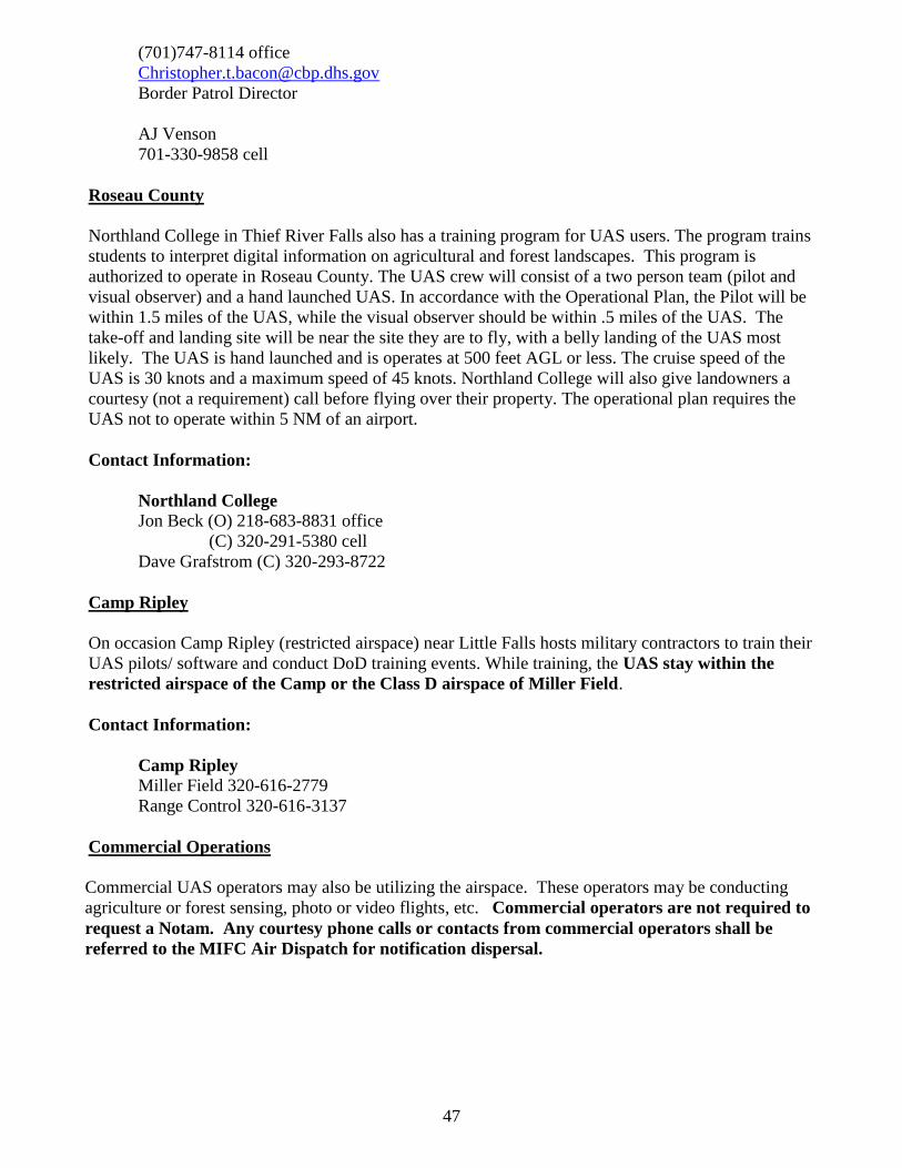
Roseau County
Northland College in Thief River Falls also has a training program for UAS users. The program trains
students to interpret digital information on agricultural and forest landscapes. This program is
authorized to operate in Roseau County. The UAS crew will consist of a two person team (pilot and
visual observer) and a hand launched UAS. In accordance with the Operational Plan, the Pilot will be
within 1.5 miles of the UAS, while the visual observer should be within .5 miles of the UAS. The
take-off and landing site will be near the site they are to fly, with a belly landing of the UAS most
likely. The UAS is hand launched and is operates at 500 feet AGL or less. The cruise speed of the
UAS is 30 knots and a maximum speed of 45 knots. Northland College will also give landowners a
courtesy (not a requirement) call before flying over their property. The operational plan requires the
UAS not to operate within 5 NM of an airport.
Contact Information:
Northland College
Jon Beck (O) 218-683-8831 office
(C) 320-291-5380 cell
Dave Grafstrom (C) 320-293-8722
Camp Ripley
On occasion Camp Ripley (restricted airspace) near Little Falls hosts military contractors to train their
UAS pilots/ software and conduct DoD training events. While training, the UAS stay within the
restricted airspace of the Camp or the Class D airspace of Miller Field.
Contact Information:
Camp Ripley Miller Field 320-616-2779
Range Control 320-616-3137
Commercial Operations
Commercial UAS operators may also be utilizing the airspace. These operators may be conducting
agriculture or forest sensing, photo or video flights, etc. Commercial operators are not required to
request a Notam. Any courtesy phone calls or contacts from commercial operators shall be
referred to the MIFC Air Dispatch for notification dispersal.

48
What to do if UAS are encountered on a Wildfire
If a UAS is encountered or reported to be working within the Fire Traffic Area, all tactical firefighting
aircraft that are operating below 1,500’ AGL are to disengage from their firefighting activities. If a
pilot observes a UAS, they should notify all aircraft on the fire by announcing on the Guard frequency
“There is a UAS operating within the FTA, disengage immediately.” The Incident Commander will be
notified of the conflicted airspace and the IC will relay the information to the Area Dispatcher.
If there is an ATGS on the fire, they should transition to an operational altitude of 2,000’ AGL to
direct aircraft to a holding area with adequate separation. The ATGS will contact the Fire Center for
further instructions for disengagement and whether to remain airborne while the situation is mitigated
or to return to the nearest base or helispot to hold on the ground.
If there is no ATGS on the fire, pilots will communicate and coordinate their flight paths with one
another for disengagement from the incident area.
Aircraft can re-engage with firefighting missions after the airspace is confirmed to be free of UAS.
Before re-engaging the ATGS or Helicopter Manager will contact the Fire Center to advise that the
FTA is confirmed safe and the intention is to re-engage.
Continue operations only if airspace within the FTA is confirmed safe
Report to the Air Dispatch prior to re-engagement
The Area Dispatcher will contact local law enforcement
The Air Dispatch will contact the FAA Hotline – 1-866-835-5322
A SAFECOM will be completed as soon as possible after the incident by the
ATGS.
o If no ATGS, the SAFECOM will be completed by the helicopter or fixed
wing manager or pilot.

49
April 6, 2015
Fire Marshal West, Some recent events have brought an issue to the forefront related to Unmanned Aircraft Systems (UAS/drones). As these aircraft become more prevalent in the airspace we need to point out some hazards associated with their use on wildfire operations. UAS can provide fire managers with important information, but they can also pose a hazard to wildfire aircraft operating over a fire. Our DNR wildfire aviation resources often operate in the same environment and airspace where UAS operators are functioning (under 500 feet). Our helicopters and airtankers spend most of their operating time over a fire in this same section of airspace. We cannot operate in this environment if drones are present. Current DNR wildfire aviation policy is, if a drone is seen or suspected over a fire our aircraft will disengage and leave the scene until it can be confirmed the UAS/drone is no longer present. We have alerted our Incident Commanders and firefighters to be on the lookout for UAS aircraft and to pass the information on to aviation resources over the fire and to their dispatchers. Also, if a Fire Chief or Fire Department Firefighter sees or suspects a drone may be on scene over a wildfire, we request that they alert DNR resources so that we can take necessary precautions for our firefighting aircraft. Again, if UAS aircraft are seen or suspected on a wildfire DNR aviation resources will disengage or wait to respond until the UAS is confirmed to no longer be on scene. I’d appreciate it if you would use your network to get this message out to those on your broadcast email list. It is important to get this information out to as many Fire Chiefs and fire department personnel as possible. Thanks for your help on this Bruce, and please pass on a big thank you to all our local fire department partners who have been responding to wildfires thus far this year. The help provided is invaluable, and often may be the only or primary response on wildfires in some parts of the state. This looks to be an active year for wildfires and I am sure DNR and local fire departments will be working together closely for the next several weeks. If there are any questions about any of the above they may be directed to me. Thanks again for your help…Ron Ron Stoffel MN DNR Wildfire Suppression Supervisor MIFC 402 11th ST SE Grand Rapids, MN 55744 218-322-2682 – Office 218-244-1091 – Cell

50
Model Aircraft Operations
Private Citizens may fly model aircraft. According to the FAA model aircraft may be used if (1) the
aircraft is flown strictly for hobby or recreational use; (2) the aircraft is operated in accordance with a
community-based set of safety guidelines and within the programming of a nationwide community-
based organization; (3) the aircraft is limited to not more than 55 pounds unless otherwise certified
through a design, construction, inspection, flight test, and operational safety program administered by a
community-based organization; (4) the aircraft is operated in a manner that does not interfere with and
gives way to any manned aircraft; (5) when flown within 5 miles of an airport, the operator of the
aircraft provides the airport operator and the airport air traffic control tower with prior notice of the
operation; and (6) the aircraft is flown within visual line sight of the operator.
Airspace issues may occur with (4) above as an operator may engage in flight profiles considered
flying in a reckless manner or reckless endangerment of other aircraft. Unsafe Model Aircraft
Operations should be reported to local Law Enforcement or the FAA hotline at 1-866-835-5322.
Model aircraft operations do not require a Notam.

51
APPENDIX A: DEFINITIONS/ACRONYMS
Definitions Acronyms Alert Areas AA
Above Ground Level AGL
Air Operations Branch Director AOBD
Air Route Traffic Control Center ARTCC
Air Tactical Group Supervisor ATGS
Bureau of Indian Affairs BIA
Bureau of Land Management BLM
Civil Air Patrol CAP
Controlled Firing Areas CFA
Chippewa National Forest CPF
Department of Natural Resources DNR
Eastern Area Coordination Center EACC
Emergency Medical Services EMS
Estimated Time of Arrival ETA
Estimated Time Enroute ETE
Federal Aviation Administration FAA
Flight Standard District Office FSDO
Flight Traffic Areas FTA
Geographical Area Coordination Center GACC
Incident Command System ICS
Minnesota Interagency Coordination Center MNCC
Military Operations Areas MOA
Mean Sea Level MSL
Military Training Routes MTR
National Interagency Coordination Center NICC
Notice to Airmen NOTAM
Prohibited Areas PA
Pilot in Command PIC
Restricted Areas RA
Special Use Areas SUA
Superior National Forest SUF
Temporary Flight Restrictions TFR
United States Forest Service USFS
United States Fish & Wildlife USFW

52
APPENDIX B: INTRUSION SAFECOMS
SAFECOM
AVIATION SAFETY
COMMUNIQUE
Reported By (Optional)
Name Dan Hertle Phone _218-246-8343_____
Organization _DNR Forestry Date 04-29-03 _
EVENT
Date 04__27__2003 Local Time 1700_____ Injuries? Y N Damage Y N Mo Day Year 24 Hour Clock
Location Snowshoe Lake Fire, Sec. 20 T58N R25W State MN Airport, City, Lat.../Long, or Fire Name
MISSIO
N
Type ___Fire Detection Procurement Contract_ Pax, Cargo, Recon, Sling, Long line, Rappel, etc. Contract, CWN, Rental, Fleet, Cooperator, etc.
Number of Persons On board _2_ Special Use? Y N Hazardous Materials Onboard?
Y N Circle
Circle
Departure Point GPZ Destination Deer River Detection Route_ __________
AIRCRA
FT
N # _N6418D Manufacturer __Cessna__________ Model _172_________
Owner/Operator Airways Aviation_ Pilot ______________
NARRATIVE: Please provide a brief explanation of the event.
Alpha-22 reported a smoke within the Federal Protection Area. Grand Rapids Dispatch notified Chippewa Dispatch of the
fire. Chippewa Dispatch requested Alpha-22 to stay over the fire until Engine 631 arrived. While scanning the Chippewa
frequency, Alpha-22 realized that Fire Bird had also been dispatched to the fire. Alpha-22 contacted Fire Bird to let them
know their position and altitude. Shortly there after Fire Bird was turned around and North Patrol was sent to the fire.
Again Alpha-22 made contact with the incoming aircraft and notified them of their position and altitude. Because of the
presence of North Patrol, Alpha-22 returned to its detection route without being released from the fire.
The directing of two additional aircraft into the same airspace was done without notifying the reporting aircraft. All three
aircraft were operating at the same altitude at the same time. Although neither aircraft got closer than six to ten miles, an
incident could have occurred if the observer hadn’t been alert.
The observer is also a commercial pilot and is very experienced at doing detection. A less experienced observer may not
of recognized the situation that was developing.
To minimize aerial detection confliction, dispatchers need to keep the aircraft over their incident informed of other
responding aircraft.
CHIEF PILOT NOTES:
Chippewa Dispatch was trying to contact Alpha 22 and the Blackduck/Effie detection planes on the Chippewa frequency.
I feel because the handheld radios in the airplanes are in the scan mode, all of the Chippewa dispatch transitions were not
heard by the detection planes.
Experienced pilots and observers along with a scannable, multi-channel radio were able to receive and transmit
information faster than the Chippewa dispatch.
Scannable radios are good – but some vital information can be missed.
SAFETY ADVISOR NOTES: Scanning needs to be held to a minimum.
This form is used to report any condition, observance, act, maintenance problem, or circumstance which has potential to
cause an aviation-related mishap.

53
SAFECOM
AVIATION SAFETY
COMMUNIQUE
Reported By (Optional)
Name Terry Novak Phone _218-732-3309__
Organization __DNR Forestry Date 4/28/03________
EVENT
Date 04 27 03 Local Time __1545 Injuries? Y N Damage Y N Mo Day Year 24 Hour Clock Circle
Location Red Lake Fire 540 State MN Airport, City, Lat.../Long, or Fire Name
MISSIO
N
Type Retardant Dropping_ Procurement Contract - BIA____ Pax, Cargo, Recon, Sling, Long line, Rappel, etc. Contract, CWN, Rental, Fleet, Cooperator, etc.
Number of Persons On board 1_ Special Use? Y N Hazardous Materials Onboard?
Y N Circle
Circle
Departure Point Bemidji Airport Destination ___Fire 540 ___________________
AIRCRA
FT
N # T-444 Manufacturer Snow________________ Model __AT-
802_________
Owner/Operator Queen Bee_________ Pilot
Larson______________
NARRATIVE: Please provide a brief explanation of the event.
Tanker 444 was returning to the fire with a load of retardant. Before he was on scene, T-263 (a CL-
215) started dropping water on the fire. T-444 reported in 10 miles out and was told to over fly the fire
at 2,500’ MSL (approx. 1300’ AGL). Air attack was at 3,000’ – T-263 low level.
T-444 over flew the fire but dropped down to T-263’s altitude without notifying anyone. As T-263
was on final, T-444 flew parallel to and passed T-263 at the same altitude. T-263 told him to pull up
and there was no reply. T-263 dropped his load and announced he was breaking right. He asked for
better altitude management.
In debriefing, T-444’s pilot stated that he had T-263 in sight and was no factor. Myself and T-263’s
pilots were quite concerned as we didn’t know T-444’s intentions.
This form is used to report any condition, observance, act, maintenance problem, or circumstance which has potential to
cause an aviation-related mishap.

54
SAFECOM
AVIATION SAFETY
COMMUNIQUE
Reported By (Optional)
Name Terry Novak Phone 218-828-2575______
Organization _MN DNR______ Date 4/10/03______
EVENT
Date 4/10/03______ Local Time 1505 ________ Injuries? ___Y _X N
Damage __Y _X_ N Mo Day Year 24 Hour Clock
Location 5 Miles NE. of the Brainerd Airport _____________ State MN Airport, City, Lat.../Long, or Fire Name
MISSIO
N
Type Retardant Dropping _________________ Procurement CWN______________
Pax, Cargo, Recon, Sling, Long line, Rappel, etc. Contract, CWN, Rental, Fleet, Cooperator, etc.
Number of Persons On board _2_ Special Use? __Y _ X N Hazardous Materials Onboard?
__ Y _X_ N
Departure Point _Brainerd Air Tanker Base____ Destination Wildfire 5 miles NE. of base_______
AIRCRA
FT
N # 26AU_____ Manufacturer Lockheed _________________ Model P3A_____
Owner/Operator Aero Union Corporation _________ Pilot _Hock / Lesley_____________
NARRATIVE: Please provide a brief explanation of the event.
As T-26 was dropping the last ½ of its load another aircraft flew over the fire. It was parallel
to and slightly in front of T-26. Separation was approximately 200 yards horizontal and was
LOWER than T-26. It did not activate T-26’s TCAS nor respond to calls on Unicom. Type of
aircraft is unknown – white, small low wing airplane. Tanker 26 never saw the plane.
Safety Advisor Notes: Excellent reminder to be “HEAD’S UP” for other aircraft. A news
release will be sent out by MIFC reminding pilots to avoid fires and be alert for firefighting
aircraft.
This form is used to report any condition, observance, act, maintenance problem, or circumstance which has potential to
cause an aviation-related mishap.

55
SAFECOM
AVIATION SAFETY
COMMUNIQUE
Reported By (Optional)
Name Jon Coil Phone __218-647-8268 _
Organization __MN-DNR Date 4/27/04________
EVENT
Date _4___27___2004 Local Time ___1405_ Injuries? Y N Damage Y
N Mo Day Year 24 Hour Clock Circle
Circle
Location Blackduck Detection Route State MN Airport, City, Lat.../Long, or Fire Name
MISSIO
N
Type __Detection___ Procurement Contract_____________
Pax, Cargo, Recon, Sling, Long line, Rappel, etc. Contract, CWN, Rental, Fleet, Cooperator, etc.
Number of Persons On board __2 Special Use? Y N Hazardous Materials
Onboard? Y N Circle
Circle
Departure Point _Big Fork____ Destination ___Detection
Route_____________________
AIRCRA
FT
N # N739 XK Manufacturer Cessna____________ Model ___172______
Owner/Operator Airway Aviation Pilot Roland Heaton____
NARRATIVE: Please provide a brief explanation of the event.
On routine detection flight for the Blackduck Area between checkpoints 1 and 2, we looked at a previous day
fire in Sec 30-151-32. We were continuing to checkpoint 2 and were just off the SE corner of Lower Red Lake
when pilot Heaton noticed a plane in front of us. The plane passed directly over us about 200 feet above us.
Pilot Heaton recognized the tail # as 7NR and called 7NR on 122.925. Pilot Ettl answered and said he was on
the SE corner of Lower Red Lake but hadn’t seen us.
Safety Advisor Note: Near Mid Air Collisions (NMAC’s) are extremely serious situations which need to be reported. NMAC’s
generally include the element of surprise. Methods to avoid Mid Air collisions include:
1) Vertical separation – MIFC Logistical support flight are generally flown at 3,000 feet MSL, due to
most detection routes being flown at 2500 MSL or less.
2) Horizontal separation – knowing the general Area’s or routes flown by other aircraft and staying clear
of smoke and other activity that have other aircraft assigned.
3) Communications on Area and common VHF – AM radio frequencies to determine other aircraft
locations.
4) Practicing good cockpit resource management, staying alert, keeping your eyes outside the cockpit,
and adhering to see and avoid techniques.
This form is used to report any condition, observance, act, maintenance problem, or circumstance which has potential to
cause an aviation-related mishap.

56
SAFECOM
AVIATION SAFETY
COMMUNIQUE
Reported By (Optional)
Name Steve Newbloom Phone 218-879-0823
Organization DNR Forestry Date 05/06/2004
EVENT
Date _05_ 06 2004 Local Time 1535_ ___ Injuries? N Damage
N Mo Day Year 24 Hour Clock
Location 46 33.133 92 53.414 State MN Airport, City, Lat.../Long, or Fire Name
MISSIO
N
Type Detection ________ Procurement Contract__ ____
Pax, Cargo, Recon, Sling, Long line, Rappel, etc. Contract, CWN, Rental, Fleet, Cooperator, etc.
Number of Persons On board 2 Special Use? N Hazardous Materials Onboard? N
Departure Point TWN_____ Destination _____TWN_______________________
AIRCRA
FT
N # 9011T_____ Manufacturer Cessna _________________ Model _182__
Owner/Operator Anderson Aero _Pilot Mark Lande ______________
NARRATIVE: Please provide a brief explanation of the event.
An incident occurred in the Cloquet detection area. Our detection plane spotted a smoke in the Sandstone area.
The detection observer radioed that they would check it out. The dispatcher informed St. Louis 1 to “Standby”
while a call was made to the Sandstone dispatch.
Upon calling Sandstone, Cloquet dispatch was informed that they had their detection plane heading towards
the reported smoke. Cloquet dispatch called St. Louis 1 to inform them that they could resume their route.
Detection then informed dispatch that they were over the fire.
Cloquet dispatch immediately informed St. Louis to go back to the Cloquet area and resume their route.
Dispatch and the observer discussed the incident. The observer was reminded of the protocol used for flying
into another Area’s air space.
FORESTRY CHIEF PILOT’S NOTES: We have procedures for crossing area boundaries; they are reviewed at Fire Team Leader meetings, Dispatcher
Meetings and at pre-season detection start up meetings. The observer is the person in charge of the flight. The
pilot takes direction from the observer. The person managing the individual detection contract should review
the procedures for crossing Area boundaries with their observers and pilots. Make people accountable for their
actions. This is not the only Area having this problem.
SAFETY ADVISOR’S NOTES: We have established good procedures to help avoid mid air collision or near mid air collisions in these types of
situations. Now we need to identify why we continue to have these types of incidents despite our procedures:
Supervision failure? Training failure? Communication failure? Inadequate briefings? Other?
This form is used to report any condition, observance, act, maintenance problem, or circumstance which has potential to
cause an aviation-related mishap.

57
SAFECOM
AVIATION SAFETY
COMMUNIQUE
Reported By (Optional)
Name Jody Leidholm Phone 218-278-6651
Organization DNR Forestry - ATGS Date 10-26-00
EVENT
Date 10 19 00 Local Time 1530 Injuries? Y N Damage Y N Mo Day Year 24 Hour Clock Circle
Circle
Location Carlos Avery Fire State MN Airport, City, Lat.../Long, or Fire Name
MISSIO
N
Type Media Helicopters -Bell 206 Procurement N/A - Media / TV
Pax, Cargo, Recon, Sling, Long line, Rappel, etc. Contract, CWN, Rental, Fleet, Cooperator, etc.
Number of Persons On board Special Use? Y N Hazardous Materials Onboard?
Y N Circle
Circle
Departure Point Mpls / St. Paul Destination Carlos Edge Fire
AIRCRA
FT
N # 111AR Manufacturer Bell (Blue - w/Red A9" Model 206?
Owner/Operator KMSP Channel 9 Pilot
NARRATIVE: Please provide a brief explanation of the event.
While working 2 Type III helicopters, 1 SEAT, and 1 CL 215 Air Tanker on initial attack, I sighted a Blue
Helicopter that appeared to be a Jet Ranger flying at or below the same altitude as the Air Attack Platform -
2500 MSL. It had a large number 9 painted on the side that looked exactly like the KMSP Channel 9 logo form
Mpls/St. Paul. I tried to contact him on 122.92 as well as various UNICOM Frequencies.
Since I was busy watching him and the other aircraft, which I had notified of the traffic, I asked my pilot, Jack
Huhta to see if he could get the helicopter up on frequency. He contacted MSP approach and found out that the
(ch9) was up on approach freq. So approach contacted the Ch. 9 Media ship and instructed him to contact us on
122.925. He contacted us and we talked. Channel 9 media ship was nearly done filming by this time but we
gave him an altitude clear of other traffic for his time remaining. He then contacted us for departure and we
cleared him southbound at days end, I informed dispatch of this situation and was assured follow-up phone
calls would be made to avoid further situations like this.
This form is used to report any condition, observance, act, maintenance problem, or circumstance which has potential to
cause an aviation-related mishap.

58
SAFECOM
AVIATION SAFETY
COMMUNIQUE
Reported By (Optional)
Name Mark A. Anderson Phone 320-532-3137
Organization DNR Forestry Date 4-02-00
EVENT
Date 4 02 00 Local Time Injuries? Y N Damage Y N Mo Day Year 24 Hour Clock Circle
Circle
Location Wyanett Twnshp Camb Area Fire 16-36-25
State Airport, City, Lat.../Long, or Fire Name
MISSION
Type Initial Attack - Isanti County Procurement Contract
Pax, Cargo, Recon, Sling, Long line, Rappel, etc. Contract, CWN, Rental, Fleet, Cooperator, etc.
Number of Persons On board Special Use? Y N Hazardous Materials
Onboard? Y N Circle
Circle
Departure Point PNM / Princeton Airport Destination Fire IA / Camb Area 16-36-25
AIRCRAFT
N # 39102 Manufacturer Bell Helicopter Model BIII Jet Ranger
Owner/Operator Hillcrest Aircraft Co Pilot Michael Wilton
NARRATIVE: Please provide a brief explanation of the event.
SUBJECT: DETECTION AIRCRAFT:
At morning briefing between helitack and tanker personnel, the subject was brought up that detection
plane for St. Cloud area was flying too low (500' agl and below. Hillcrest helicopter 102 had the
detection plane in his air space when he was doing bucket work the previous week in Benton County.
Air Attack (Terry Novak) said he’d check into it and St. Cloud dispatch was notified to inform
detection to stay higher.
At 1:20 p.m. we were dispatched to a fire in Isanti County (16-36-25). Approximately 2 to 1 mile out
we noted Charlie 1 directly on our heading in a right hand turn 1/4 to 2 mile out at our elevation 500'
AGL Michael Wilton, 102's pilot asked me to have detection climb to a higher orbit. I relayed the
message to detection. Detection did not acknowledge immediately. At this point, Cambridge
dispatcher repeated my message and detection acknowledged and began climbing.
*At no point during this time were we in any immediate danger, but it should be noted that if the area
was real smokey or if there were more aircraft in the vicinity, the outcome could be drastically
different.
FWOS NOTE: Please remind detection pilots to maintain an altitude well above 500' above
ground level and monitor VHF-AM 122.925.
This form is used to report any condition, observance, act, maintenance problem, or circumstance which has potential to
cause an aviation-related mishap.

59
SAFECOM
AVIATION SAFETY COMMUNIQUE
Reported By (Optional)
Name Greg Johnson Phone
Organization DNR Forestry Date 4-9-00
EVENT
Date 4 09 2000 Local Time 1500 Injuries? Y N Damage Y N Mo Day Year 24 Hour Clock Circle Circle
Location Forest Lake Fire #51 (Taconite) State MN Airport, City, Lat.../Long, or Fire Name
MISSION
Type Bucket Work Procurement CWN
Pax, Cargo, Recon, Sling, Long line, Rappel, etc. Contract, CWN, Rental, Fleet, Cooperator, etc.
4 during recon
Number of Persons On board 0 for bucket work Special Use? Y N Hazardous Materials Onboard? Y N
Circle Circle
Departure Point Forest Lake Helibase Destination Ham Lake Fire
AIRCRAFT
N # 56P Manufacturer Bell Model 206BIII
Owner/Operator Ideal Helicopters Pilot Jeff McDermott
NARRATIVE: Please provide a brief explanation of the event.
While en route to a dispatched fire, we contacted the detection plane. We were in bound at 1500' for size-up
and 360 when another helicopter (Dark R22) was encountered at same altitude. He broke off to his left and
we continued on recon. When we set down to hook up bucket, he was still orbiting. We tried to make
contact but were unable and not sure if detection plane had contact either. One other helicopter also made
one loop around fire and left - also no contact. Finished fire and returned to Forest Lake helibase. We have
people working on finding where these helicopters are coming from.
HOS NOTE: Thanks Greg for a good SAFECOM. This is one example of the activity in Metro Region. I
have received several similar reports. In order to improve the situation, we are:
1.) Meeting with Robinson 22 flight instructors at Crystal Airport.
2.) Doing our annual airport mailing with our message to stay away from fire.
3.) Putting out a news release on giving firefighting pilots their space.
4). Putting out a news release on TFR’s.
5.) Asking all aviation folks to look up, look around and look out.
*Do good briefings * Be an active Apart of the flight crew.
Thank you for your efforts. Sheldon Mack
This form is used to report any condition, observance, act, maintenance problem, or circumstance which has potential to cause an aviation-
related mishap.

SAFECOM
AVIATION SAFETY COMMUNIQUE
Reported By (Optional)
Name Mike Eilers Phone
Organization DNR Forestry Date 4-26-00
EVENT
Date 4 25 00 Local Time 1505 Injuries? Y N Damage Y N Mo Day Year 24 Hour Clock Circle Circle
Location Forest Lake Fire #66 State MN Airport, City, Lat.../Long, or Fire Name
MISSION
Type Bucket / I.A. Procurement CWN
Pax, Cargo, Recon, Sling, Long line, Rappel, etc. Contract, CWN, Rental, Fleet, Cooperator, etc.
Number of Persons On board 0 Special Use? Y N Hazardous Materials Onboard? Y N
Circle Circle
Departure Point Forest Lake Base Destination Holly Fire
AIRCRAFT
N # 2756P Manufacturer Bell Model 206 BIII
Owner/Operator Ideal Helicopters Pilot Jeff McDermott
NARRATIVE: Please provide a brief explanation of the event.
While working a fire for approximately 20 - 25 minutes, 56P pilot Jeff McDermott noticed a shadow of
another aircraft directly overhead. Shortly after that, 56P was advised by I.C. Tom Lynch to be aware of a
helicopter flying over the fire. Later questioning pilot and I.C. determined that 56P was at 100' agl with a
bucket of water when the Robinson 22 helicopter overflew 56P at a agl of 300' - 400' and never returned. A
tail # was observed by I.C. Lynch. This same helicopter has been seen repeatedly on other fires flying in
unexpectedly/unannounced at an agl of less than 500' for a short overflight and then leaving again. Action
will be taken to try to keep this helicopter/pilot from showing up unannounced and causing a possible
aviation incident or accident.
This form is used to report any condition, observance, act, maintenance problem, or circumstance which has potential to cause an aviation-
related mishap.
53

SAFECOM
AVIATION SAFETY COMMUNIQUE
Reported By (Optional)
Name Doug Lloyd Phone 218-327-4529
Organization DNR Forestry Date 5-04-00
EVENT
Date 5 04 00 Local Time 1030 Injuries? Y N Damage Y N Mo Day Year 24 Hour Clock Circle Circle
Location Elbow Lake Fire 48 0.85' 92 33.617' State MN Airport, City, Lat.../Long, or Fire Name
MISSION
Type Buckets Procurement Cloquet Contract Pax, Cargo, Recon, Sling, Long line, Rappel, etc. Contract, CWN, Rental, Fleet, Cooperator, etc.
Number of Persons On board 1 Special Use? Y N Hazardous Materials Onboard? Y N
Circle Circle
Departure Point Elbow Lake Helibase Destination Elbow Lake Fire
AIRCRAFT
N # 589 Manufacturer Bell Model 206 BIII
Owner/Operator Cascade Helicopter Pilot Bill Lovitt
NARRATIVE: Please provide a brief explanation of the event.
Pilot Lovitt reported a helicopter that flew through our airspace over the Elbow Lake Fire. A TFR was in
place at the time. Helibase tried to contact unidentified helicopter on our Victor AM freq with no response.
Ship flew through fire area and then departed. Was not a threat to our operations. Lovitt thought a camera
was on board. Possibly a media ship.
HOS Note: Thanks Doug. Good Safecom. The attached safety alert was posted on our web site and sent to
the media. The 122.925 Victor is our normal I.A. frequency. Incident AM frequencies can change. We will
continue to work hard at minimizing unannounced aircraft on fires. Good example that TFR=s are not a fix-
all. Keep alert and fly safe!
Sheldon
May 5, 2000 Safety Alert:
We received notification that what was assumed to be a media helicopter was flying over the Elbow Lake
Fire on May 4. They did not respond to contact from the aircraft working on the fire. A temporary flight
restriction was in place.
PLEASE REMIND YOUR PILOTS FOR THE SAFETY OF EVERYONE INVOLVED, IT IS OF
UTMOST IMPORTANCE WE COMMUNICATE ON VICTOR 122.925. THERE WERE 10 AIRCRAFT
WORKING ON THE FIRE. WE WILL MAKE EVERY EFFORT TO ACCOMODATE YOU, BUT WE
MUST MAINTAIN A SAFE OPERATION.
Thank you for your cooperation!
MN Interagency Fire Center
This form is used to report any condition, observance, act, maintenance problem, or circumstance which has potential to cause an aviation-
related mishap. 54

SAFECOM
AVIATION SAFETY COMMUNIQUE
Reported By (Optional)
Name Phone
Organization Date
EVENT
Date 10 21 00 Local Time 1530 Injuries? Y N Damage Y N Mo Day Year 24 Hour Clock Circle Circle
Location Carlos Avery Fire State MN Airport, City, Lat.../Long, or Fire Name
MISSION
Type Air Attack Procurement CWN
Pax, Cargo, Recon, Sling, Long line, Rappel, etc. Contract, CWN, Rental, Fleet, Cooperator, etc.
Number of Persons On board 2 Special Use? Y N Hazardous Materials Onboard? Y N
Circle Circle
Departure Point ANE Destination
AIRCRAFT
N # 111AR Manufacturer Beechcraft Model 65
Owner/Operator Bemidji Aviation Pilot Breuer
NARRATIVE: Please provide a brief explanation of the event.
While flying air attack over the Carlos Avery Fire on Sunday, October 22, our TFR airspace was violated by intruders
on numerous occasions, most of the violations occurred from 1400 local time to the time we left (because we felt safety
was compromised) about 1535.
Listed below is the approximate chronological order of events:
1400 - 1420 Several intruders a fair distance away from us
1424 - 1450 White float plane enters airspace and flies all over in the airspace, we follow him to landing on lake,
called in ground personnel to talk to him
1450 - 1515 One or two more intruders a fair distance away
1518 Yellow Piper Cub enters airspace south to north 1,800' msl, tail #NC21478
1530 White Cessna 172 or 182 flies right over the top of us 200' - 300' higher than us (at this time we decided
to cease air operations)
We feel it would keep TFR airspace violations down if the TFR was better disseminated, possible actions follow:
1) Fax TFR to all airports within 100 NM with instructions to post
2) Involve news media in TFR dissemination
FWOS notes: Good call shutting down operations! This is another reminder that a TFR does not ensure clear airspace.
SEE AND AVOID!! Follow up is underway with the F.A.A.
This form is used to report any condition, observance, act, maintenance problem, or circumstance which has potential to cause an aviation-
related mishap.
55
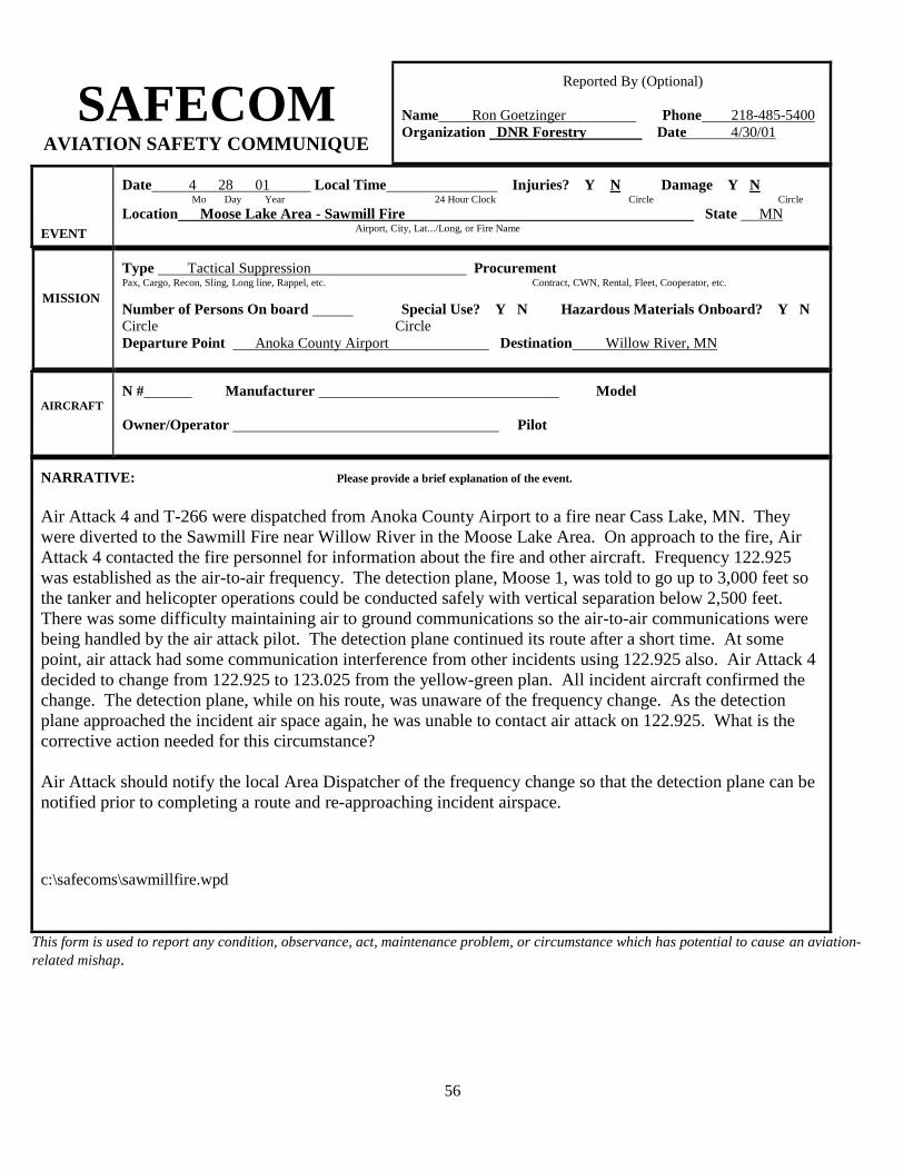
SAFECOM
AVIATION SAFETY COMMUNIQUE
Reported By (Optional)
Name Ron Goetzinger Phone 218-485-5400
Organization DNR Forestry Date 4/30/01
EVENT
Date 4 28 01 Local Time Injuries? Y N Damage Y N Mo Day Year 24 Hour Clock Circle Circle
Location Moose Lake Area - Sawmill Fire State MN Airport, City, Lat.../Long, or Fire Name
MISSION
Type Tactical Suppression Procurement Pax, Cargo, Recon, Sling, Long line, Rappel, etc. Contract, CWN, Rental, Fleet, Cooperator, etc.
Number of Persons On board Special Use? Y N Hazardous Materials Onboard? Y N Circle Circle
Departure Point Anoka County Airport Destination Willow River, MN
AIRCRAFT
N # Manufacturer Model
Owner/Operator Pilot
NARRATIVE: Please provide a brief explanation of the event.
Air Attack 4 and T-266 were dispatched from Anoka County Airport to a fire near Cass Lake, MN. They
were diverted to the Sawmill Fire near Willow River in the Moose Lake Area. On approach to the fire, Air
Attack 4 contacted the fire personnel for information about the fire and other aircraft. Frequency 122.925
was established as the air-to-air frequency. The detection plane, Moose 1, was told to go up to 3,000 feet so
the tanker and helicopter operations could be conducted safely with vertical separation below 2,500 feet.
There was some difficulty maintaining air to ground communications so the air-to-air communications were
being handled by the air attack pilot. The detection plane continued its route after a short time. At some
point, air attack had some communication interference from other incidents using 122.925 also. Air Attack 4
decided to change from 122.925 to 123.025 from the yellow-green plan. All incident aircraft confirmed the
change. The detection plane, while on his route, was unaware of the frequency change. As the detection
plane approached the incident air space again, he was unable to contact air attack on 122.925. What is the
corrective action needed for this circumstance?
Air Attack should notify the local Area Dispatcher of the frequency change so that the detection plane can be
notified prior to completing a route and re-approaching incident airspace.
c:\safecoms\sawmillfire.wpd
This form is used to report any condition, observance, act, maintenance problem, or circumstance which has potential to cause an aviation-
related mishap.
56

SAFECOM
AVIATION SAFETY COMMUNIQUE
Reported By (Optional)
Name Larry Zajanc Phone 208-523-1412
Organization USFS Date 10-20-00
EVENT
Date 10 20 00 Local Time 0830 Injuries? Y N Damage Y N Mo Day Year 24 Hour Clock Circle Circle
Location Carlos Avery Fire State MN Airport, City, Lat.../Long, or Fire Name
MISSION
Type Air Attack Procurement Fleet Pax, Cargo, Recon, Sling, Long line, Rappel, etc. Contract, CWN, Rental, Fleet, Cooperator, etc.
Number of Persons On board 2 Special Use? Y N Hazardous Materials Onboard? Y N
Circle Circle
Departure Point Princeton Destination Carlos Avery Fire
AIRCRAFT
N # 37250 Manufacturer Cessna Model 310
Owner/Operator Division of Enforcement Pilot Jack Huhtaa
NARRATIVE: Please provide a brief explanation of the event.
On Friday, October 21, 00, while flying air attack over the Carlos Avery Fire, numerous aircraft had intruded
into restricted airspace.
A 180, 182, 206 (Amphib Floats) and a Citabria were observed within the TFR.
The 206 (Amphib) had passed within 500' of our flight path. Attempts to contact the intruding aircraft were
unsuccessful.
I contacted air support and informed him of the situation.
Upon landing at Anoka County, the tower was notified and reminded of the TFR, for announcement to
departing aircraft.
FWOS notes: Another reminder that a TFR does not ensure clear airspace. SEE AND AVOID1
This form is used to report any condition, observance, act, maintenance problem, or circumstance which has potential to cause an aviation-
related mishap.
57

2
SAFECOM
AVIATION SAFETY COMMUNIQUE
Reported By (Optional)
Name Michael Eilers Phone 218-278-6651
Organization DNR Date 04/11/10
EVENT
Date 04 / 11 / 2010 Local Time 1600 Injuries? Y N Damage Y N Mo Day Year 24 Hour Clock Circle Circle
Location Carver Cty. Fire / Waconia Fire Dept.>>> Legal: NWSE 116-24-20 State MN Airport, City, Lat.../Long, or Fire Name
MISSION
Type IA & Recon./ GPS________________ Procurement ___CWN_ Pax, Cargo, Recon, Sling, Long line, Rappel, etc. Contract, CWN, Rental, Fleet, Cooperator, etc.
Number of Persons On board _3_ Special Use? Y N Hazardous Materials Onboard? Y
N Circle
Circle
Departure Point Anoka Airport_____ Destination Carver Cty. Fire__________
AIRCRAFT
N # 39101___ Manufacturer ___Bell______________ Model ___206B3______
Owner/Operator Scotts Helicopters _________ Pilot Mike Balch ____
NARRATIVE: Please provide a brief explanation of the event.
After we completed initial attack operations on the fire a request was made by the Waconia Fire Dept. for
a recon. / GPS flight. While performing this mission we were alerted by the crew members on the ground
of a helicopter in the area of the fire. After circling the fire perimeter, we noticed that there now were two
helicopters in the vicinity, but still outside of the parameters of any immediate danger of our flight path.
At that point, the pilot of 101 attempted and successfully made contact with both media helicopters. At
no point was vertical separation jeopardized. The two media helicopters did not initiate radio contact with
us as they approached the fire.
HELICOPTER OPERATIONS SPECIALIST’S NOTES:
In debriefing with the pilot of 101, he did talk directly with the Channel 11media helicopter on 122.925. The
helicopter did not try to contact 101 before entering the fire area, but they were on the correct frequency
when 101 called them.
The media pilots for Channel 11 and Channel 5 were communicating with one another while on scene. We
will continue to meet with the media pilots to encourage them to “call in the blind” on 122.925 when within 12
miles and approaching wildfires.
AVIATION SAFETY ADVISOR’S NOTES:
This form is used to report any condition, observance, act, maintenance problem, or circumstance which has potential to cause an
aviation-related mishap.

3

4
SAFECOM
Reported By (Optional)
Name Ron Goetzinger Phone ___________
Organization DNR Date 4/5/12

5
AVIATION SAFETY COMMUNIQUE
EVENT
Date 03 04 2012 Local Time 11:45 Injuries? Y N Damage Y N Mo Day Year 24 Hour Clock
Location Boone Fire in Brooklyn Park State MN
Airport, City, Lat.../Long, or Fire Name
MISSION
Type Fire Suppression Procurement Contact & Cooperator Pax, Cargo, Recon, Sling, Long line, Rappel, etc. Contract, CWN, Rental, Fleet, Cooperator, etc.
Number of Persons On board Special Use? Y N Hazardous Materials Onboard? Y N Departure Point Anoka County A.P. Destination Brooklyn Park
AIRCRAFT
N # 111AR Manufacturer Beechcraft Model Queen Air
Owner/Operator Bemidji Pilot Head
Please provide a brief explanation of the event.
NARRATIVE: Air Attack 5 and T-890 were dispatched to the Boone Fire at Brooklyn Park. When commo was
established with fire personnel on the ground, Air Attack 5 was informed that the helicopters Trooper 9 and 2TC
were using the Victor (am) frequency of 123.025 for air to air communication. The DNR fire standard is 122.925.
This situation creates the opportunity for incoming aircraft (broadcasting in the blind) to assume there are no
other aircraft within the fire area.
Note: Apparently Trooper 9 suggested the frequency to 2TC when 2TC came on scene. All operators and partners
should be aware of the standard.
FIXED WING SPECIALIST COMMENTS: Will follow up making sure that appropriate contacts are made,
incident information is shared and that proper procedures are communicated and recommended to responding
resources.
HOS COMMENTS: The firefighting mission is new for the State Patrol. We implemented State Patrol pilot
training and awareness of our standard procedures the day after this fire. Coordination of the airspace within the
FTA, safety and tactics were our primary focus for this training. Mixing rotor wing and fixed wing aircraft on
tactical missions in a smoke-filled environment requires that we are all working as a team. A DNR Forestry / MN
State Patrol Helicopter Firefighting Operations Plan has been drafted and reviewed. In the future if the State
Patrol is requested to respond to a wildfire they will have a helicopter manager assigned or will be coordinating
with an ATGS before they enter the FTA.
Helicopter Managers must ensure that when on wildfires all Air-Air AM radio communications are on 122.925
unless a frequency change is implemented by the ATGS. The All-Risk frequency (all missions except wildfire) is
123.025.
SAFETY ADVISOR’S NOTES: This is an example of how a chain of events begins and continues until
someone breaks the chain. Ron did a good job of breaking the chain by getting folks back on track by returning
folks to our standard operating procedures. A good job by Bill insuring a quick After action review was
performed that identified the risk and assessed the risk. Risk mitigation steps are continuing including the “DNR
Forestry / MN State Patrol Helicopter Firefighting Operations Plan”. Supervision of the risk mitigation steps
will continue as we move forward.
APPENDIX C: INFORMATION

6
APPENDIX C-1

7
APPENDIX C-2
DNR FIREFIGHTERS ASK PILOTS FOR THEIR HELP
Cooperation from all pilots is being requested to ensure a safe environment for aerial firefighting aircraft and crews. In Minnesota during periods when weather and fuel conditions cause our forests and wetlands to be in the moderate to high fire danger range, the DNR uses helicopters and airplanes as part of their firefighting arsenal. During these periods, 40 - 50 aircraft may be working or on stand-by every day for aerial delivery of water, retardant, firefighters, cargo and for fire detection. Aircraft and crews are strategically located around the State to quickly respond to wildfires. One or more aircraft may be dispatched to any fire in the State within minutes after it starts, depending on what is burning and the values that are threatened by the fire. According to Bill Schuster of the Minnesota Interagency Fire Center in Grand Rapids, sometimes conflicts arise between private aircraft and firefighting aircraft when they find themselves in the same airspace. Bill is a Helicopter Operations Coordinator for the DNR and has been involved with aerial firefighting since 1982. He says that some private pilots seem to be naturally attracted to smoke and will change their course or even take a quick flight just to see what’s burning. He and his colleagues have seen this type of behavior occur all over the nation which sometimes causes air operations to be suspended until the airspace can be cleared. Given the extensive use of aerial firefighting resources, We need to change the culture of pilots. Our goal is to obtain an area free of non-emergency aircraft within a 5 mile radius below 5,000' MSL from all fires. In Minnesota, the average elevation above Mean Sea Level (MSL) is 1500' and the DNRs request will give the firefighters 3,500' to work in and provide separation between their airplanes and helicopters. Often, a large fire takes firefighters several days to control, similar to the Andover fire in 1999 and the Carlos Edge fire of this past October, or the fires that occurred this past summer in the Western United States. A Temporary Flight Restriction (TFR) is requested by the firefighting agency and is placed over the area by the FAA. Any pilot of a non-emergency relief aircraft who flies into this restricted airspace without permission is subject to penalties that are assessed by the FAA. These penalties may include remedial training, Pilot Certificate suspension or revocation, and/or fines of up to $1,000 per occurrence. These TFRs seem to work on a large fire that burns for several days where the general public is aware of the situation and if pilots obtain a briefing before their flight to check current Notices to Airmen (NOTAMs). Over 99% of the wildfires that occur in Minnesota are smaller, quick moving, wind driven type fires that do most of their damage within the first few hours after they start. With the ever increasing urban interface (areas where people are building in forests and near wetlands) Minnesota firefighters are forced to be more aggressive with their assault on wildfires. This aggressive assault includes the extensive use of aircraft. On most of the fires in Minnesota, there simply is no time to request, place and notify pilots of a flight restriction. "Voluntary cooperation by all pilots in the State will be much more effective", says Schuster. "We are asking for the professional courtesy of all pilots to stay 5 miles and 5,000' MSL from fires so we can do our job safely, efficiently and effectively."

8
APPENDIX D: TFR ENFORCEMENT EXAMPLE U.S. Forest Service MN Department of Natural Resources Bureau of Indian Affairs U.S. Fish and Wildlife Service National Park Service MN Department of Public Safety Emergency Management
“Minnesota’s Emergency Response Agencies”
For Immediate Release Contact: Fire Aviation Dispatch, (218) 327-4573 or Fire Information, (218) 327-4564
General Aviation Pilots Pose Threat to Firefighters, Public
Friday, October 27, 2000, Grand Rapids, Minn. – Minnesota Interagency Fire Center (MIFC) officials say they will pursue violations of temporary restrictions of flight space over wild land fires. Sheldon Mack, Helicopter Specialist at MIFC, said, “We are disturbed by the number of general aviation pilots that ignore temporary flight restrictions and want them to know they pose a threat to lives and property of citizens, as well as the firefighters.” This type of restriction is regularly placed over wild land fires because air support is often critical to extinguishing the fire. During a year when fire blazed across the state, temporary flight restrictions were set in place many times. A Temporary Flight Restriction (TFR) is granted in accordance with FAA regulations. The TFR allows for law enforcement and media aircraft if they operate at an altitude above suppression efforts. Other aircraft need clearance from the controlling office. Violation of the TFR is turned over to the FAA for investigation and enforcement. Pilots found in violation may be subject to pilot certification suspension or revocation, or fines. MIFC officials offer this advice to general aviation pilots: Make yourself aware of any temporary flight restrictions in effect before departing. If you see smoke or hear of a fire, avoid it. Resist the urge to go “have a look”. You will be endangering the lives of firefighters and the public. Recently, air operations were suspended on an 8,500-acre fire near Wyoming, Minnesota that burned four homes and threatened hundreds more, forcing evacuation and road closures. This case has been turned over to the FAA. Numerous other instances have occurred in which aerial operations were almost curtailed due to close calls with sightseers making over flights of a fire. Mack said, “Suppressing wild land fires is like any other emergency when the public is required to give ample space for emergency equipment. In the case of fires, aircraft are part of the suppression efforts, including EMS helicopters or law enforcement aircraft”. Even during the best weather conditions, aerial firefighting operations can be complicated. The complexity is compounded because firefighters must hit targets while flying in congested airspace, often near power lines and radio towers with adverse weather and smoke conditions.

9
APPENDIX E: FIRE TRAFFIC AREA PROCEDURES
3 C’S COMMUNICATIONS CLEARANCE
COMPLY
DO NOT PENETRATE THE FTA IF YOU CANNOT COMPLY
WITH A CLEARANCE
NOCOM IF COMMUNICATIONS
ARE NOT ESTABLISHED, HOLD AT THE 7NM RING
UNTIL THEY ARE ESTABLISHED!!!

10
APPENDIX F: AIR TACTICAL GROUP SUPERVISORS (ATGS) – ROLES AND RESPONSIBILITIES
ATGS ROLES & RESPONSIBILITIES The Air Tactical Group Supervisor works for the Incident Commander. Air Tactical Group Supervisor (ATGS): An ATGS is an airborne air traffic controller. Duties include:
Provide airspace supervision, including holding patterns and altitudes
Coordinate flights of all aircraft
Develop, recommend and implement air-to-air communication plans
Develop, recommend and implement air-to-ground communication plans
Make tactical recommendations
Triage structures
Assign aircraft specific tasks
Brief pilots on strategy and tactics
Provide safe separation of all aircraft
Assess situation, aircraft hazards and potential problems
Establish flight patterns – approve any changes
Clears ground resources
Establish geographical operating separation
Determine air safety requirements and procedures
Takes appropriate action on aircraft incidents and accidents
Determines and recommends aircraft needs over incidents
Recommends temporary flight restrictions
Coordinates with media, Enforcement and other agencies over the fire
Enforces safety & operating procedures
Determine aircraft capabilities and limitations
Inform Incident Commander of overall incident conditions
Requests subsequent drops
Requests additional aircraft as necessary
Return aircraft to base when not needed
Brief ground resources on potential safety concerns and fire behavior
Conduct daily de-briefings with all incident aircraft
Recommend other resources needed (besides aircraft Aerial supervision will normally be dispatched, when available, for initial attack and extended attack to enhance aviation efficiency and safety.

11
APPENDIX F-1
The ATGS also may advise, regarding: 1. Fire Behavior 2. Safety a. Spread relative to congested areas and fire resources b. Adverse fire behavior, which may endanger workers c. Location of escape routes and safety zones d. Safety of ground personnel and equipment
e. Air operations safety
3. Fire Tactics and Use of Resources a. Direction and rate of spread b. Access c. Anchor points d. Water source e. Effectiveness of attack f. Location of spot fires 4. Number and type of aircraft needed 5. Appropriate use of all aviation resources The ATGS role in coordinating ground and aviation resources is critical. An ATGS’s primary responsibility is the coordination of aircraft operations operating on an incident. ATGS’s Initial Attack Responsibilities with no IC: The ATGS’s role and responsibilities may vary somewhat between initial attack and project incidents. The presence of an IC on the initial attack incident, and the experience level of the Initial Attack IC should determine the ATGS role. The ATGS, when making an initial attack with no IC, should: 1. Make an initial assessment of incident and/or fire behavior. 2. Recommend dispatch of specific resources based on access, tactical capability, known
availability, response time, fire behavior and expected spread. 3. Give periodic status reports to dispatch/unit. 4. Develop tactical plan and assigns arriving resources based on the strategy. 5. Until a qualified IC arrives on-scene, the responsible agency may temporarily rely on the ATGS
for tactical assignments. Upon arrival of an IC, the ATGS should assume the “normal ATGS role”.
6. Brief ground resources on potential safety concerns and fire behavior.

12
APPENDIX F-2
ATGS Roles in Multiple Fire Situations: Some fire management units activate the ATGS position when multiple fires start. The ATGS can provide the following services and intelligence information: 1. Provide fire detection and location. Accurate locations using “legal description”, latitude and
longitude, VOR and radial. 2. Prioritize incidents based on: a. Threat to life and property, congested areas b. Land use management designation c. Fire behavior – current and expected d. Expected fire spread/size e. Environmental sensitivity f. Political considerations g. Potential resource loss 3. Assess access to the incident. Distance and time requirements. 4. Recommend the best resource(s) to commit to the incident, based on resource capability,
mode of access, probably availability and response time. 5. Develop an initial attack strategy and tactical plan based on fire behavior elements and
types/numbers of air and/or ground resources responding within specific time frames. 6. Direct fire resources as per strategy/tactical plan until a qualified IC arrives on-site. 7. Collect and report intelligence information for dispatch and the IC. 8. Re-assign resources to higher priorities if they develop. ATGS and Ground Resources Issues that need improvement: *ATGS “In-the-Know”: The ATGS works for the IC; however, IC’s Division Supervisors, Helicopter Managers or others should not re-position aircraft without coordinating thru the ATGS.
*ATGS Overload: The ATGS workload is extensive. They should help in any way they can; however, the ATGS should not be relied upon to perform duties commonly assigned to ground personnel. *Radio Discipline: While most of us listen to 1 radio, the ATGS has to listen to two (2) or more. Please keep radio messages short, concise and to the point. *Radio Frequency: There are several options available to reduce or “breakdown” the radio traffic. Breakdown radio traffic when appropriate; i.e., area/tactical/divisions/air-to-ground, etc.

13
APPENDIX G: IRON RANGE MINING FACILITIES