m'~i/i.-ls~-k. gee (o3'·cq,( sv.xv-ly
TRANSCRIPT

M'~I/I.-LS~-k. Gee (o3'·cq,( Sv.xV-LY Ope.v. F It~.. 'R~po r t q I - tf
DESCRIPTION OF MAP SHEETS FOR TIlE CENTRAL DULUTII COMPLEX SHALLOW DRILLING PROJECT
BY VAL W. CHANDLER AND JAMES D. MILLER, Jr.
6/28/91
In fulfilling the requirements of the Central Duluth Complex Shallow Drilling Project, two 1: 1 00,000 scale map sheets have been produced, along with some explanatory materials. Sheet 1 shows the locations of outcrops and drill holes in the study area, and those drill holes that were completed as a part of this study are described on an accompanying table. Updated petrographic descriptions of some of the latest drilled holes, along with the geochemical analysis of core and outcrop samples from the study area will be provided later.
Sheet 2 shows a preliminary geologic interpretation of the area, based on the new drill holes and interpretation of the MGS-LCMR aeromagnetic data. Previous work has indicated that a strong remanent magnetization dominates this part of the complex, which skews the anomalies relative to their sources. In order to compensate for this effect, the aeromagnetic data was reduced tothe-pole assuming a total magnetic polarization directed along an average declination/inclination of 2900 /40 0 . To enhance the effects of near-surface geology, the reduced to the pole data was subjected to a first vertical derivative filter. A color image of the filtered aeromagnetic data is included.
To produce the geologic map of Sheet 2 all available outcrop and drill hole data were considered, and contacts were inferred between areas having distinctly different magnetic signature. The position and structural attitude of contacts and sheet sources were estimated by Werner deconvolution analysis (Ferderer, 1988) along both rows and columns of the gridded data, and selected solutions are plotted on Sheet 2. In comparison to the previous interpretation by Chandler (1990) Sheet 2 map shows considerably more detail and includes a few major changes; an inferred mass of anorthositic rocks is actually composed of troctolitic rocks ( unit tr2 on sheet 2), and an adjacent gabbro mass ( unit g2 on Sheet 2) now includes a large mass of anorthositic rocks. Furthermore, granophyre is interpreted to be considerably more abundant in the central part of the area than previously interpreted.

It must be cautioned that the geologic map in Sheet 2 is preliminary and may be subject to considerable revision with further work. Geophysical contacts and geologic contacts may not always correspond, and excepting the areas of abundant outcrop in the in the extreme southeastern and northwestern corners of the study area. all contacts and most structural attitudes are wholly based on geophysics. Even assuming geophysical and geologic contacts correspond, various sources of error probably do not allow for a positional accuracy of better than 100-200 meters over most of the map. In spite of these short comings, the map shown on Sheet 2 is a considerable improvement over previous interpretations and can serve as suitable base for further work.
REFERENCES CfIED (Note: Includes references cited on explanation sheet)
Bonnichsen, B. , 1970 Geologic Map of the Babbitt SE Quadrangle, Minnesota Geological Survey Open File Map, scale 1 :24,000.
Bonnichsen, B. Outcrop map of the southern Duluth Complex and associated Keweenawan rocks, St. Louis and Lake Counties Minnesota: Minnesota Geological Survey Miscellaneous Map Series M-11, scale 1: 125,000.
Chandler, V. W., 1990, Geologic interpretation of gravity and magnetic data over the central part of the Duluth Complex, northeastern Minnesota: Economic Geology v. 85, p. 816-829.
Ferderer, R. J., 1988, Werner deconvolution and its application to the Penokean orogen, east-central Minnesota, Ph.D. dissertation, University of Minnesota, 284 p.
Miller, J. D., Jr., and Chandler, V. W., 1991, Geologic map of the Doyle Lake quadrangle, Lake County, Minnesota: Minnesota Geological Survey Miscelaneous map M-73, scale1 :24,000.
Ruhanen R. W., and Jiran, J. R., eds., 1989, Drill Core Library Index: Minnesota Dept. of Natural Resources, Division of Minerals, miscellaneous publication, 126 p.
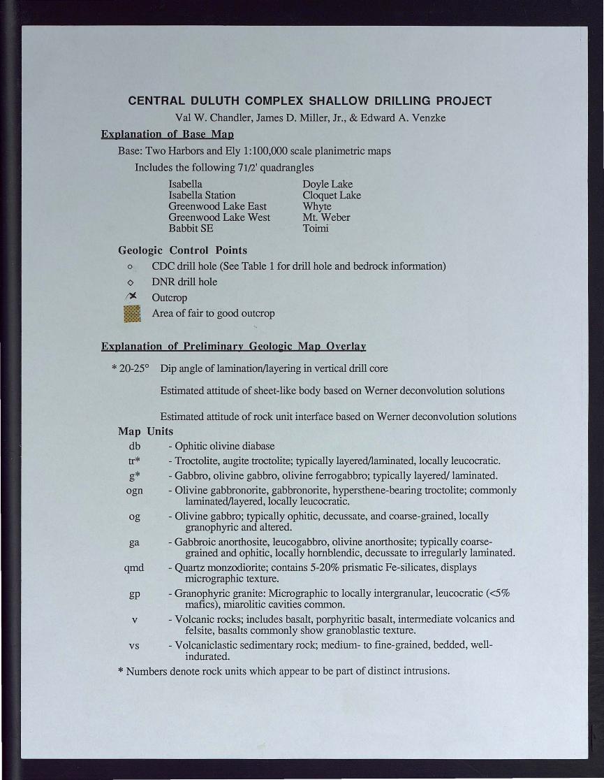
CENTRAL DULUTH COMPLEX SHALLOW DRILLING PROJECT Val W. Chandler, James D. Miller, Jr., & Edward A. Venzke
Explanation of Base Map
Base: Two Harbors and Ely 1: 100,000 scale planimetric maps
Includes the following 71(2' quadrangles
Isabella Doyle Lake Isabella Station Cloquet Lake Greenwood Lake East Whyte Greenwood Lake West Mt. Weber Babbit SE Toimi
Geologic Control Points o CDC drill hole (See Table 1 for drill hole and bedrock information)
<> DNR drill hole
;')( Outcrop
::~t~ Area of fair to good outcrop
Explanation of Preliminary Geolol:ic Map Oyerlay
* 20-25° Dip angle of lamination/layering in vertical drill core
Estimated attitude of sheet-like body based on Werner deconvolution solutions
Estimated attitude of rock unit interface based on Werner deconvolution solutions Map Units
db - Ophitic olivine diabase tr* - Troctolite, augite troctolite; typically layered!1aminated, locally leucocratic. g* - Gabbro, olivine gabbro, olivine ferrogabbro; typically layered/laminated.
ogn - Olivine gabbronorite, gabbronorite, hypersthene-bearing troctolite; commonly laminated!1ayered, locally leucocratic.
og - Olivine gabbro; typically ophitic, decussate, and coarse-grained, locally granophyric and altered.
ga - Gabbroic anorthosite, leucogabbro, olivine anorthosite; typically coarse-grained and ophitic, locally hornblendic, decussate to irregularly laminated.
qmd - Quartz monzodiorite; contains 5-20% prismatic Fe-silicates, displays micrographic texture.
gp - Granophyric granite: Micrographic to locally intergranular, leucocratic «5% mafics), miarolitic cavities common.
v - Volcanic rocks; includes basalt, porphyritic basalt, intermediate volcanics and felsite, basalts commonly show granoblastic texture.
vs - Volcaniclastic sedimentary rock; medium- to fine-grained, bedded, well-indurated.
* Numbers denote rock units which appear to be part of distinct intrusions.

MI~~.e...s~-k. Gao lo::/c,q,( StJ..-n/.e...y Op~ rlt~_ Re..pori q{ - tf
DESCRIPTION OF MAP SHEETS FOR THE CENTRAL DULUTII COMPLEX SHALLOW DRILLING PROJECT
BY VAL W. CHANDLER AND JAMES D. MlLLER, Jr.
6/28/91
In fulfilling the requirements of the Central Duluth Complex Shallow Drilling Project, two 1: 1 00,000 scale map sheets have been produced, along with some explanatory materials. Sheet 1 shows the locations of outcrops and drill holes in the study area, and those drill holes that were completed as a part of this study are described on an accompanying table. Updated petrographic descriptions of some of the latest drilled holes, along with the geochemical analysis of core and outcrop samples from the study area will be provided later.
Sheet 2 shows a preliminary geologic interpretation of the area, based on the new drill holes and interpretation of the MGS-LCMR aeromagnetic data. Previous work has indicated that a strong remanent magnetization dominates this part of the complex, which skews the anomalies relative to their sources. In order to compensate for this effect, the aeromagnetic data was reduced tothe-pole assuming a total magnetic polarization directed along an average declination/inclination of 2900 /40 0 . To enhance the effects of near-surface geology, the reduced to the pole data was subjected to a first vertical derivative filter. A color image of the filtered aeromagnetic data is included.
To produce the geologic map of Sheet 2 all available outcrop and drill hole data were considered, and contacts were inferred between areas having distinctly different magnetic signature. The position and structural attitude of contacts and sheet sources were estimated by Werner deconvolution analysis (Ferderer, 1988) along both rows and columns of the gridded data, and selected solutions are plotted on Sheet 2. In comparison to the previous interpretation by Chandler (1990) Sheet 2 map shows considerably more detail and includes a few major changes; an inferred mass of anorthositic° rocks is actually composed of troctolitic rocks ( unit tr2 on sheet 2), and an adjacent gabbro mass ( unit g2 on Sheet 2) now includes a large mass of anorthositic rocks. Furthermore, granophyre is interpreted to be considerably more abundant in the central part of the area than previously interpreted.

It must be cautioned that the geologic map in Sheet 2 is preliminary and may be subject to considerable revision with further work. Geophysical contacts and geologic contacts may not always correspond, and excepting the areas of abundant outcrop in the in the extreme southeastern and northwestern corners of the study area, all contacts and most structural attitudes are wholly based on geophysics. Even assuming geophysical and geologic contacts correspond, various sources of error probably do not allow for a positional accuracy of better than 100-200 meters over most of the map. In spite of these short comings, the map shown on Sheet 2 is a considerable improvement over previous interpretations and can serve as suitable base for further work.
REFERENCES CrrED (Note: Includes references cited on explanation sheet)
Bonnichsen, B. , 1970 Geologic Map of the Babbitt SE Quadrangle, Minnesota Geological Survey Open File Map, scale 1 :24,000.
Bonnichsen, B. Outcrop map of the southern Duluth Complex and associated Keweenawan rocks, St. Louis and Lake Counties Minnesota: Minnesota Geological Survey Miscellaneous Map Series M-ll, scale 1: 125,000.
Chandler, V. W., 1990, Geologic interpretation of gravity and magnetic data over the central part of the Duluth Complex, northeastern Minnesota: Economic Geology v. 85, p. 816-829.
Ferderer, R. J., 1988, Werner deconvolution and its application to the Penokean orogen, east-central · Minnesota, Ph.D. dissertation, University of Minnesota, 284 p.
Miller, J. D., Jr., and Chandler, V. W., 1991, Geologic map of the Doyle Lake quadrangle, Lake County, Minnesota: Minnesota Geological Survey Miscelaneous map M-73, scale1 :24,000.
Ruhanen R. W., and Jiran, J. R., eds., 1989, Drill Core Library Index: Minnesota Dept. of Natural Resources, Division of Minerals, miscellaneous publication, 126 p.

Minnesota Geological Survey Open-File Report: CENTRAL DULUTH COMPLEX SHALLOW DRILLING PROJECT
Depth to Sound rock Total Hole T!N) R!W) Sec Quarters Quad' Dates drilled Elevation bedrock drilled del!th Descrll!tlon of Bedrock CDC1 58 8 35 CDA DL 9/28-10/5/90 1690 117 9'4" 129.3 Med, well-laminated, apatitic olivine ferrogabbro CDC4 58 8 14 CCCBDA I 9/25-9/27/90 1843 205 10' 221 Med, moderately laminated ferrogabbro CDC5 58 8 10 DBBCAC I 10/2-10/5/90 1878 215 10' 228.3 Crs, decussate, ophitic, olivine gabbronorite CDC9 59 8 2 CCOCO I 3/1-3/5/91 1965 118 10' 133 Med fine, ophitic olivine-Fe oxide diabase
CDC11 59 8 8 BAAB IS 2/27-3/4/91 1995 167 10' 183 Salmon pink, med, leucocratic, granophyric granite CDC12 59 8 27 BBBBC I 10/6-10/10/91 2019 184 10' 199 Fine, subprismatic ferrodiorite - intermediate volc? CDC13 58 8 9 BBCCA I 9/10-9/24/90 1970 184 8' 194 Pink, feldspar/quartz-phyric rhyolite cut by irregular diabase dikelet
CDC14A 58 8 6 BOOBCB IS 10/10 -1 0/13/90 2005 246?? 0 261 No core recovered?? CDC14B 58 8 6 BOOBCB IS 6/24-7/1/91 2005 277 3' 305 Intensely weathered, pink leucocratic granophyric granite CDC16 58 9 13 BADACC IS 11128/90-2/24/91 1961 357 10' 400 Crs, ophitic, olivine leucogabbro to troctolitic anorthosite; locally altered CDC18 58 9 33 DABDB CL 2/20-2/22/91 1961 133 10 148 Pink, med, leucocratic equigranular granite CDC19 57 9 9 DDBAA CL 12/9 -2/21/91 1935 100 10 128 Pink, med, leucocratic granophyric granite CDC23 59 9 8 AAAA IS 3/5-3/5/91 1828 93# 10 105 Crs, poorly lam., ophitic gabbroic anorthosite (locally hornblendic) CDC25 59 9 14 ACBBA IS 3/6 -3/6/91 1945 33 6 39 Fine, subprismatic quartz ferrodiorite - intermediate volcanic CDC26 59 9 28 OODCA IS 2/14-2/17/91 1875 136 8.3 147 Crs, decussate, subophitic, apatitic, hornblendic gabbroic anorthosite CDC28 58 9 31 ACDOO W 12/10/90-2/23/91 1950 68 10 87 Med crs, mod. laminated, intergranular oxide gabbronorite wi poikilltic hypo CDC31 57 10 2 a:JC() W 12/13/90-2/27/91 1904 123 10 145 Med crs, decussate, intergranular olivine gabbronorite wi poikilitic hypo CDC33 57 10 21 CAACB W 3/10-3/14/91 1830 210# 10 220 Crs, well laminated, serpentinized, ophitic augite troctolite CDC35 56 9 4 ACCDAB SBsw 6/19-6-20/91 1735 45 9 60 Med fine, mottled, very sausseritized, PI porph. intermediate volc .? CDC36 57 10 19 AABDA MN 6/12-6/18/91 1850 102 10 228 Med, decussate to poorly laminated, equigran., melanocratic apatite fe-gabbro CDC37 57 10 32 DOC MN 12/21/90 - 3/8/91 1750 127 10 141 Crs, altered , ophitic, qtz-bearing, hornblendic, leucocratic oxide gabbro CDC38 57 11 11 ocro MN 317 - 3/9/91 1810 99 4.5 109.5 Fine, granoblastic basalt CDC40 57 11 9 CCCCC MN 3/9-3 /1 0/91 1802 52# 13 65.5 Med, moderately laminated, olivine ferrogabbro CDC41 58 9 19 ABDCDC W 12/11/90 -2/ 23/91 1900 185 0.5 194 V crs, decussate, ophitic olivine gabbronorite CDC48 59 11 24 ADADBB G....W 6/20 - 6/24191 1703 102 10 117.5 Med to v.crs, poor to mod. laminated, suboph. to ophitic ol-ox gabbro CDC50 59 10 7 AB G....W 6/24-6/26/91 1712 55 10 70 Med crs, mod. laminated ophitic augite troctolite CDC52 57 12 2 BAD T 6/5-6/11191 1709 194 9.5 209.5 Med, altered, well laminated ophitic augite troctolite CDC54 57 12 26 DAADA T 6/11 - 6/12/91 1698 64 9.4 79.4 Med, well laminated apatitic olivine ferrogabbro
SLI-1 58 8 35 a:JC() DL 3/13 -3/1 8 / 91 1660 110 765 875 110-240: Prismatic granophyre; 240-875 laminated apatite 01 fe-gabbro.
All drill holes are vertical except SlI-1 which trends 3250 at a 650 angle . • auadrangles: I-Isabella, IS-Isabella Station, GLE-Greenwood Lake East, GLW - Greenwood Lake West, DL-Doyle Lake,
CL-Cloquet Lake, W-Whyte, MW-Ml Weber, T-Toimi, SBsw-Silver Bay Southwest; All holes Lake Co. except 52 & 54. # Continuous cores of glacial till were obtained by sonic drilling at these sites

EXPLANATION
Sheet 1: Database Map
Base: Two Harbors and Ely 1: 100,DOO scale planimetric maps
Study area includes the following 71(2' quadrangles
Isabella Doyle Lake Isabella Station Cloquet Lake Greenwood Lake East Whyte Greenwood Lake West Mt Weber Babbit SE Toirni
Geologic Control Points
o CDC drill hole (See Table 1 for drill hole and bedrock information)
<> DNR or other drill hole (MDNR, 1989)
x Outcrop (this study and Bonnichsen, 1971)
::(}f?: Area of fair to good outcrop (see Bonnichsen, 1970; Miller & Chandler, in press) -:-:::.:::.,
Sheet 2: Preliminary Geolo2ic Interpretation
* 20-25° Dip angle of larnination/layering in vertical drill core
<f? Estimated attitude of sheet-like body based on Werner deconvolution solutions
/ Estimated attitude of rock unit interface based on Werner deconvolution solutions
Map Units
db - Ophitic olivine diabase
tr* - Troctolite, augite troctolite; typically layered/larninated, locally leucocratic.
g* - Gabbro, olivine gabbro, olivine ferrogabbro; typically layered! laminated.
ogn - Olivine gabbronorite, gabbronorite, hypersthene-bearing troctolite; commonly larninated/layered, locally leucocratic.
og - Olivine gabbro; typically ophitic, decussate, and coarse-grained, locally granophyric and altered.
ga - Gabbroic anorthosite, leucogabbro, olivine anorthosite; typically coarse-grained and ophitic, locally hornblendic, decussate to irregularly laminated.
qmd - Quartz monzodiorite; contains 5-20% prismatic Fe-silicates, displays micrographic texture.
gp - Granophyric granite: Micrographic to locally intergranular, leucocratic (<5% mafics), miarolitic cavities common.
v - Volcanic rocks; includes basalt, porphyritic basalt, intermediate volcanics and felsite, basalts commonly show granoblastic texture.
vs - Volcaniclastic sedimentary rock; mediurn- to fine-grained, bedded, well-indurated.
* Numbers denote rock units which appear to be part of distinct intrusions.