mi open book project geography - wexford …textbooks.wmisd.org/downloads/6th/6thchapter1.pdf ·...
TRANSCRIPT

World Geography
Brian Dufort, Sally Erickson, Matt Hamilton, David Soderquist, Steve Zigray
MI OPEN BOOK PROJECT

World Geography
This is version 1.4 of this resource, released in July of 2016.
Information on the latest version and updates are available on the project homepage: http://textbooks.wmisd.org/dashboard.html
The text of this book is licensed under a Creative Commons NonCommercial-ShareAlike (CC-BY-NC-SA) license as part of Michigan’s participation in the national #GoOpen movement.
Attribution-NonCommercial-ShareAlike CC BY-NC-SA ii
About the Authors - 6th Grade World Geography The Michigan Open Book Project
Project Manager: Dave Johnson, Wexford-Missaukee Intermediate School District
6th Grade Team Editor: Amy Salani, Wexford-Missaukee Intermediate School District
6th Grade Content Editor: Carol Egbo
6th Grade World Geography Authors
Brian Dufort, Shepherd Public Schools
Sally Erickson, Livonia Public Schools
Matt Hamilton, East Jordan Public Schools
David Soderquist, Three Rivers Schools
Steve Zigray, Concord Public Schools
Brian Dufort Shepherd Public Schools
Odyssey MS/HS Brian is originally from Midland, MI and is a graduate of Northern Michigan University. He has spent his entire teaching career at Odyssey Middle/High School, an alternative education program in the Shepherd Public School system. In 2001, his environmental studies class was one of seven programs from the United States and Canada to be chosen as a winner of the Sea World/Busch Gardens Environmental Excellence Award. Brian is also the Northern Conference director of the Michigan Alternative Ath-
Sally Erickson Livonia Public Schools
Cooper Upper Elementary Sally has taught grades 3-6, as well as special education. She has served as a district literacy leader for many years and participated in the Galileo Lead-ership Academy in 2001-03. She is proud to be a teacher.
Matt Hamilton East Jordan Public Schools
East Jordan Middle School Matt grew up in Cadillac, MI. He holds a bachelor and masters degree from Michigan State University. He currently teaches middle school History and Geography. Matt started and advises a club at his school called the Shoe Club to inspire his students to Dream Big. His wife and two daughters enjoy traveling and spending time in the out-doors.

David Soderquist Three Rivers Public Schools Three Rivers Middle School For the Past 11 years David has taught 6-8 grade Social Studies for Three Rivers Middle School. He serves as Department Head, School Improvement Member and Social Studies Rep for his area. Over the past few years he has completed his Mas-ters Degree in Curriculum and Instruction and become a state recognized Instruc-tional Coach.
Steve Zigray Concord Community Schools Concord Middle School Steve Zigray is a 6th grade teacher. He holds a Bachelor’s Degree from Central Michi-gan University and a Masters Degree in K-12 Administration from Eastern Michigan University. Honors Steve has been awarded are the 2001 Junior Achievement Educa-tor of the Year and he was nominated for Jackson Magazine’s, Educator of the year in 2014. He has also coached high school and middle school sports, worked on various school improvement committees, wrote the 6th grade Common Assessment tests for Jackson County ISD and is an active member in the community as well as the PTO. He lives in southeast Jackson County with his beautiful wife and three fantastic daugh-ters.
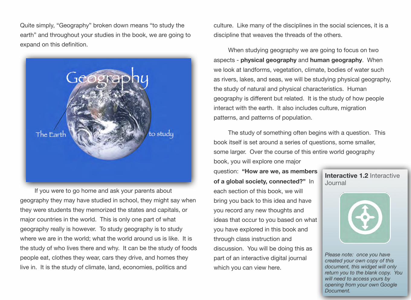
Chapter 1
StudyingGeography QUESTIONS TO GUIDE INQUIRY
1. What is geography?
2. Why do we study geography?
3. What tools do geographers use?
4. What is geographic inquiry?
5. Why do we need to think globally?
Image source: http://upload.wikimedia.org/wikipedia/commons/0/05/Land_ocean_ice_cloud_1024.jpg

Section 1
What is Geography Anyway?
QUESTIONS TO GUIDE INQUIRY
1. What is geography?
2. Why do we study geography?
3. What tools do geographers use?
4. What is geographic inquiry?
5. Why do we need to think globally?
This year you will be studying the geography of the world in which we live. Right off the bat, think about what you already know about geography - it could be things you have learned in other classes at other grade levels, things you’ve heard from your parents, or things you’ve heard from teachers. What comes to mind? Is it maps? Latitude and longitude? What else?
Interactive 1.1 What is Geography?
What is Geography?
Take a moment to view this brief video online and then answer the question in the blue box to thebest of your ability
6
“How are we, as members
ideas that occur to you based on what
7
Quite simply, “Geography” broken down means “to study the earth” and throughout your studies in the book, we are going to expand on this definition.
If you were to go home and ask your parents about geography they may have studied in school, they might say when they were students they memorized the states and capitals, or major countries in the world. This is only one part of what geography really is however. To study geography is to study where we are in the world; what the world around us is like. It is the study of who lives there and why. It can be the study of foods people eat, clothes they wear, cars they drive, and homes they live in. It is the study of climate, land, economies, politics and
culture. Like many of the disciplines in the social sciences, it is a discipline that weaves the threads of the others.
When studying geography we are going to focus on two aspects - physical geography and human geography. When we look at landforms, vegetation, climate, bodies of water such as rivers, lakes, and seas, we will be studying physical geography, the study of natural and physical characteristics. Human geography is different but related. It is the study of how people interact with the earth. It also includes culture, migration patterns, and patterns of population.
The study of something often begins with a question. This book itself is set around a series of questions, some smaller, some larger. Over the course of this entire world geography book, you will explore one major question: Interactive 1.2 Interactive of a global society, connected?” In Journal each section of this book, we will bring you back to this idea and have you record any new thoughts and
you have explored in this book and through class instruction and discussion. You will be doing this as part of an interactive digital journal which you can view here.
Please note: once you havecreated your own copy of this document, this widget will onlyreturn you to the blank copy. You will need to access yours byopening from your own Google Document.

While the teachers who have put this book together have provided some questions to focus your study, you will be asked and encouraged to come up with your own questions as well. The process you will be guided through is known as inquiry - the act of seeking out information.
Image source: http://upload.wikimedia.org/wikipedia/commons/8/8c/ Inupiat_Family_from_Noatak,_Alaska,_1929,_Edward_S._Curtis_(restored).jpg
How are the people in the picture above dressed? Why might people in this place wear clothing like this? If you notice the fur hoods surrounding their faces you might think it is cold where they live. If you investigated further, you would learn that this is a historical photo of an Inupiat family from Alaska. It might lead you to ask more questions - are there times of the year when they
would wear lighter clothing? What is the average temperature during winter? What is the average temperature during the summer months? One question about why people dress the way they do could lead to a series of new inquiries in the desire to learn more.
Image source: https://farm4.staticflickr.com/3302/3570407917_585dd5a1e8_o.jpg
Gallery 1.1 Image Gallery
View the image gallery above -practice asking geographic questions based on the images shown.
8
As you continue to study “the basics,” this chapter serves not just as an introduction to your studies this year, but also as a “how to use this book” in case this is your first time using a digital textbook to explore Social Studies. You will have an opportunity to practice most of the things you will be asked to do in this book during this introductory chapter. The last thing you will be asked to do is to once again revisit the question we posed at the start of this section. This time, you are going to write a brief response.
What is Geography, anyway?
9

Section 2
Why Do We Study Geography?
QUESTIONS TO GUIDE INQUIRY
1. What is geography?
2. Why do we studygeography?
3. What tools do geographers use?
4. What is geographic inquiry?
5. Why do we need to think globally?
Image source: http://upload.wikimedia.org/wikipedia/commons/3/32/JohannesVermeer-
You might now have a better idea about what geography is, but why do we study it? There are many reasons. Take a moment to view the video clip here about how some people use geography in their chosen professions.
Interactive 1.3 What can you do with geography?
Learn more about what geographers do with this YouTube clip (requires internet connection)
TheAstronomer(1668).jpg 10

Why we study geography is a question many have asked. While to some geography is viewed only as maps, in reality it has links to science, mathematics, literacy, literature, and the other social sciences.
Studying geography can provide you with an overview of the planet upon which we live. People who study it are better equipped to understand topics such as why people live where they do, what causes people to move between places, how we use our natural resources, why countries and locations are broken up into geographic regions...the list goes on and on!
In addition to knowing about our planet and the people who live there, people study geography because it helps you learn to
think critically. It provides opportunity to inquire about the world around you and research to find answers.
Geographers study the “why of where” which can be simplified to “why there?” or “why here?” You may have studied the early history of the United States in other social studies classes. Where did early settlements like Jamestown tend to spring up and plant roots? It was generally around water sources. A geographer would then ask and seek to explain “why there?”
The image on this page is not an all inclusive list of why we study geography, but it does include many of the major reasons we will outline as you go through this book.
11
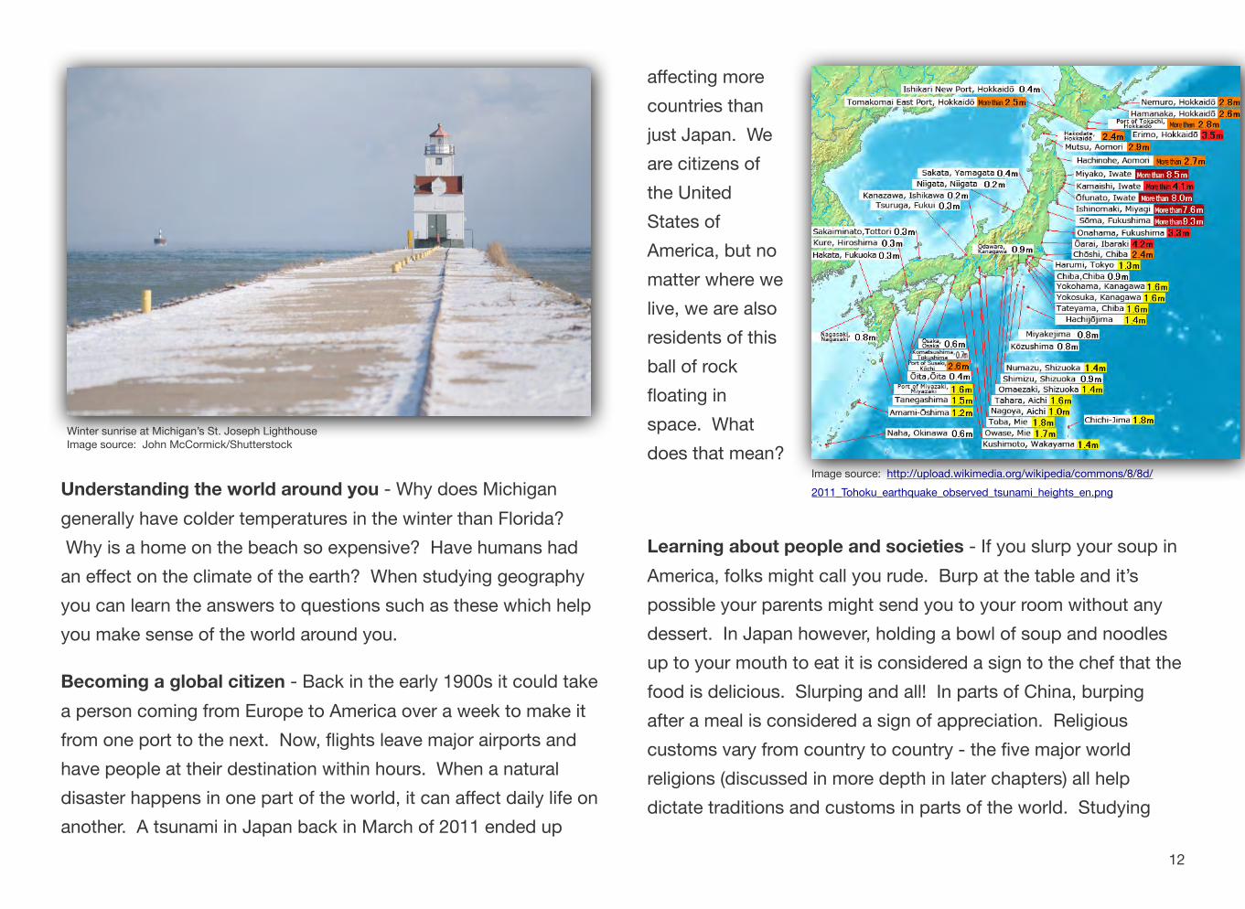
Winter sunrise at Michigan’s St. Joseph LighthouseImage source: John McCormick/Shutterstock
Understanding the world around you - Why does Michigan generally have colder temperatures in the winter than Florida? Why is a home on the beach so expensive? Have humans had an effect on the climate of the earth? When studying geography you can learn the answers to questions such as these which help you make sense of the world around you.
Becoming a global citizen - Back in the early 1900s it could take a person coming from Europe to America over a week to make it from one port to the next. Now, flights leave major airports and have people at their destination within hours. When a natural disaster happens in one part of the world, it can affect daily life on another. A tsunami in Japan back in March of 2011 ended up
affecting more countries than just Japan. We are citizens of the United States of America, but no matter where we live, we are also residents of this ball of rock floating in space. What does that mean?
Learning about people and societies - If you slurp your soup in America, folks might call you rude. Burp at the table and it’s possible your parents might send you to your room without any dessert. In Japan however, holding a bowl of soup and noodles up to your mouth to eat it is considered a sign to the chef that the food is delicious. Slurping and all! In parts of China, burping after a meal is considered a sign of appreciation. Religious customs vary from country to country - the five major world religions (discussed in more depth in later chapters) all help dictate traditions and customs in parts of the world. Studying
Image source: http://upload.wikimedia.org/wikipedia/commons/8/8d/ 2011_Tohoku_earthquake_observed_tsunami_heights_en.png
12

geography allows you to learn more than just where a country is located on a map, but what the people and society are like as well.
http://upload.wikimedia.org/wikipedia/commons/2/23/JapaneseBosozoku.jpg
Connections -
All of these things together help us explore the idea of how the world around us affects every day life, as well as the connections between how we relate to all of that.
For that reason, the inquiry question we will keep coming back to throughout the course of this book is:
“How are we, as members of a global society, connected?”
This question is not studied because there is a world government that unifies the planet, but more to help you realize that whatever country you are from is one of many, and that
actions in one place can have effects on other places.
Take a moment to record your thoughts to that question. In the next section we will begin to look at some of the tools that geographers use.
Learning about locations - This may be the piece of geography that sticks in almost everyone’s mind, but geography is the study of locations. We do this by studying maps, pictures, Geographic Information Systems data, visiting and exploring these places, among others.
Image source: http://upload.wikimedia.org/wikipedia/commons/1/12/ World_map_2004_CIA_large_1.7m_whitespace_removed.jpg
13
Section 3
What Tools Do Geographers Use to Study the Earth?
QUESTIONS TO GUIDE INQUIRY
1. What is geography?
2. Why do we studygeography?
3. What tools do geographers use?
4. What is geographic inquiry?
5. Why do we need to think globally?
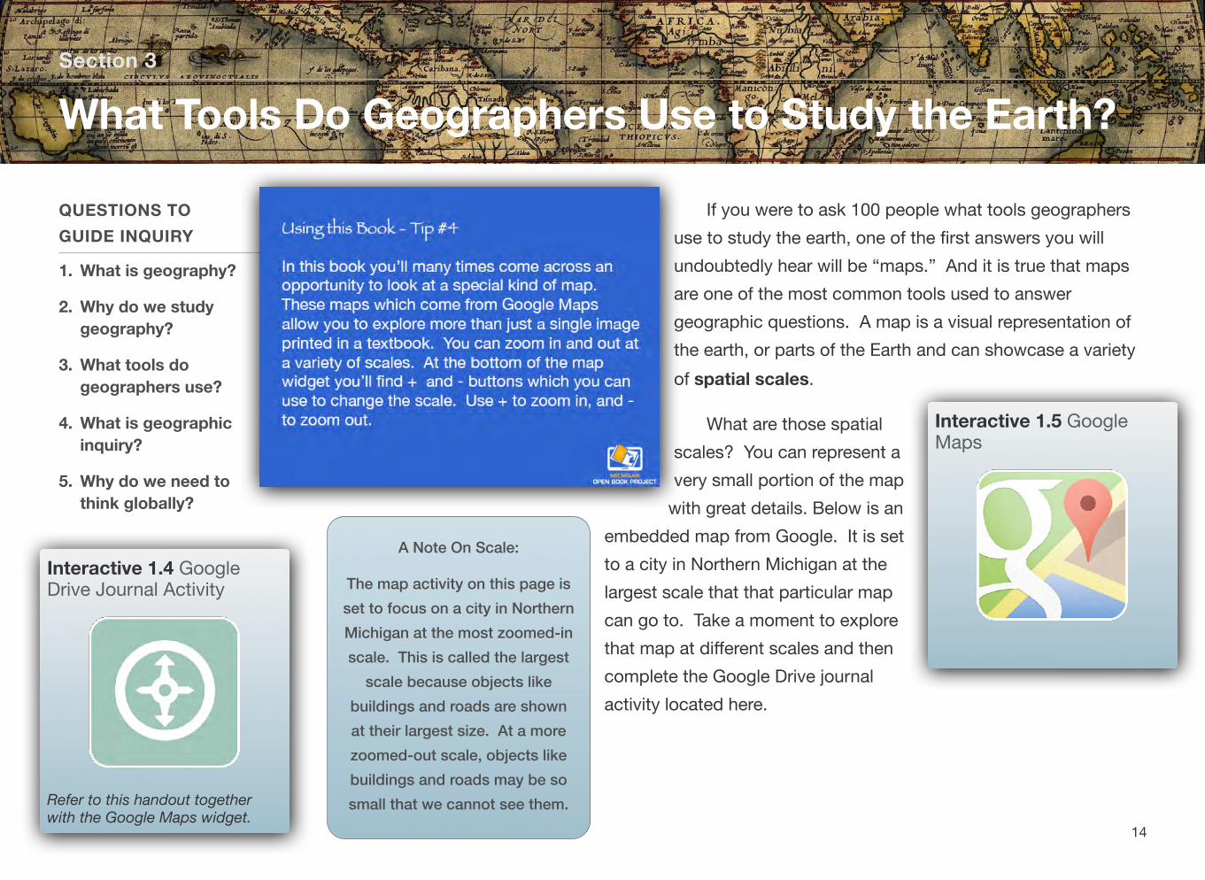
If you were to ask 100 people what tools geographers use to study the earth, one of the first answers you will undoubtedly hear will be “maps.” And it is true that maps are one of the most common tools used to answer geographic questions. A map is a visual representation of the earth, or parts of the Earth and can showcase a variety of spatial scales.
What are those spatial scales? You can represent a very small portion of the map
with great details. Below is an embedded map from Google. It is set to a city in Northern Michigan at the largest scale that that particular map can go to. Take a moment to explore that map at different scales and then complete the Google Drive journal
Interactive 1.5 GoogleMaps
activity located here.
Interactive 1.4 GoogleDrive Journal Activity
Refer to this handout togetherwith the Google Maps widget.
A Note On Scale:
The map activity on this page is set to focus on a city in Northern Michigan at the most zoomed-in scale. This is called the largest
scale because objects like buildings and roads are shown at their largest size. At a more zoomed-out scale, objects like buildings and roads may be so small that we cannot see them.
14

Maps
Maps are able to show information about geographic areas. Every map has at least one purpose. They can represent a place such as a neighborhood, a town, a country, or the world overall. Sometimes they can show human features. In the very first map you looked at in the Google Maps link above, what human characteristics such as roads, buildings, etc. were you able to see? When you zoomed all the way out, were you still able to see any human characteristics?
When your parents were younger, they probably went on a trip with their families which involved using a map of a state or region to get to their final destination. Modern technology such as smart phones have GPS built in which has made these two dimensional maps obsolete for that purpose. A road trip is not the only use for a map of a city or a state, however. Maps can represent a variety of different features about a place. There is a small problem with maps however…
Interactive 1.6 The Orange
If you were to take a balloon and inflate it, then draw a map of the world on it, you could, if you were careful, get a very close approximation of what the world overall looks like. If you were extremely careful you could represent the continents of the earth drawn to a precise scaled size. This is because a balloon is a round, three-dimensional object. A map, however, is a two-dimensional
Interactive 1.7 MapProjections Video
Learn more about map projections with this video. (Requires internet connection)
object. If you were to pop that balloon (much like peeling the orange in the video above) what you are left with is a much less useful representation of the earth.
In an attempt to represent a three dimensional object in two dimensions, mapmakers, known as cartographers, have created different ways to represent the earth. These are known as map projections. There are hundreds of different types of projections and each has plusses and minuses in its usage.
15
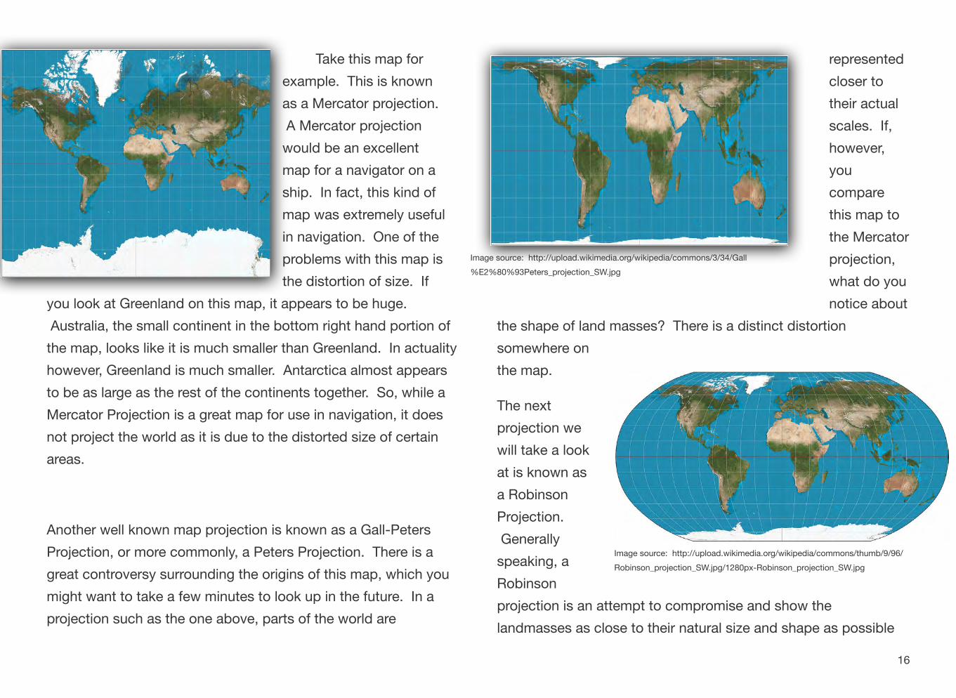
A Mercator projection would be an excellent map for a navigator on a ship. In fact, this kind of map was extremely useful in navigation. One of the problems with this map is the distortion of size. If
you look at Greenland on this map, it appears to be huge. Australia, the small continent in the bottom right hand portion of the map, looks like it is much smaller than Greenland. In actuality however, Greenland is much smaller. Antarctica almost appears to be as large as the rest of the continents together. So, while a Mercator Projection is a great map for use in navigation, it does not project the world as it is due to the distorted size of certain areas.
Take this map for
as a Mercator projection. example. This is known
Another well known map projection is known as a Gall-Peters Projection, or more commonly, a Peters Projection. There is a great controversy surrounding the origins of this map, which you might want to take a few minutes to look up in the future. In a projection such as the one above, parts of the world are
Image source: http://upload.wikimedia.org/wikipedia/commons/3/34/Gall %E2%80%93Peters_projection_SW.jpg
represented closer to their actual scales. If, however, you compare this map to the Mercator projection, what do you notice about
the shape of land masses? There is a distinct distortion somewhere on the map.
The next projection we will take a look at is known as a Robinson Projection. Generally speaking, a Robinson
Image source: http://upload.wikimedia.org/wikipedia/commons/thumb/9/96/ Robinson_projection_SW.jpg/1280px-Robinson_projection_SW.jpg
projection is an attempt to compromise and show the landmasses as close to their natural size and shape as possible
16
on a two dimensional representation. It too, however, suffers from distortion. In this case, much of the world is shown as close to scale as possible, but as you move toward the top and bottom of the map, what do you notice happening?
Now, think back to the video you watched at the beginning about the orange. Another projection is known as the Goode Homolosine Projection, more commonly known as an Interrupted Projection. In this projection type, there is very little distortion in terms of size of continents, however it is very difficult to calculate distances on a map such as this. If you were taking a plane ride from New York to London, it would be difficult to figure out the exact distance if this were the only map available to you.
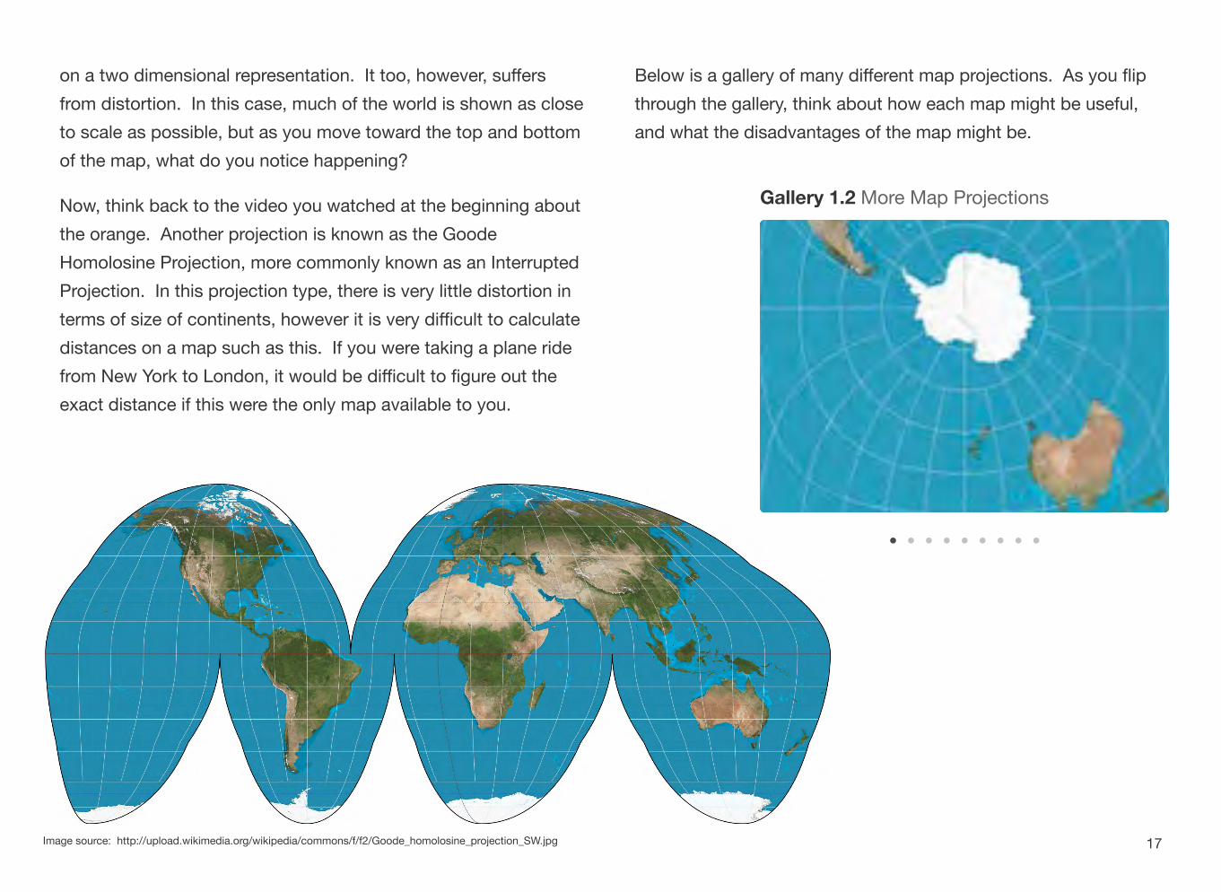
Below is a gallery of many different map projections. As you flip through the gallery, think about how each map might be useful, and what the disadvantages of the map might be.
Gallery 1.2 More Map Projections
Image source: http://upload.wikimedia.org/wikipedia/commons/f/f2/Goode_homolosine_projection_SW.jpg 17
one portion of the United States seems to have a lot of these lights, while large portions of the Western half of the United States are much spottier. A “why” question a geographer might ask about this would be: “Why are there
Image source: http://pixabay.com/p-92367/?no_redirect
Image source: http://upload.wikimedia.org/wikipedia/commons/d/da/Washington,_D.C._-_2007_aerial_view.jpg
So, yes...maps are one of the many tools that geographers use to study the earth. But what are some of the others?
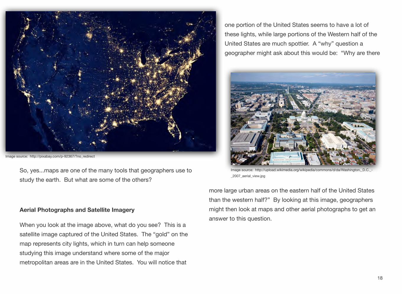
Aerial Photographs and Satellite Imagery
When you look at the image above, what do you see? This is a satellite image captured of the United States. The “gold” on the map represents city lights, which in turn can help someone studying this image understand where some of the major metropolitan areas are in the United States. You will notice that
more large urban areas on the eastern half of the United States than the western half?” By looking at this image, geographers might then look at maps and other aerial photographs to get an answer to this question.
18

A satellite image has many purposes and can be helpful at a variety of spatial scales from large to small. An aerial photograph is similar to this, but is generally speaking at a larger. The aerial photograph that shows Washington, DC, shows a zoomed-in view of a city at a larger scale in which we can see individual buildings and streets. A picture like this one might help someone study patterns of development for neighborhood planning. It could be useful in surveying an area for a potential building project. Other aerial photographs could be useful in determining location of farmland, where irrigation systems could be created, among many other things. Both of these tools are useful for geographers in answering their “why” and “where” questions.
GPS (Global Positioning Systems)
Do your parents have a smartphone they sometimes use to get directions to places they have never been? What about you? Global Positioning Systems (commonly referred to as GPS) make use of satellites in orbit to collect information about where the user is on the earth. Your GPS device, be it a phone or a commercially available
GPS_Receivers_2007.jpg
stand-alone unit, sends information up into the sky where it connects with a satellite, which then determines your position on the planet. This information is then relayed back to the user and displayed on a map. Aside from just locating yourself on a map, how might GPS be a useful tool for geographers?
GIS (Geographic Information System)
A geographic information system, commonly referred to as GIS utilizes software and hardware to collect and display data. It can help you display forms of information useful for geographers to explore. It is a combination of map making (cartography), data
Image source: http://upload.wikimedia.org/wikipedia/commons/5/59/
Image source: http://upload.wikimedia.org/wikipedia/commons/3/33/GvSIG_-_GIS.jpg
19

about places, and computer technology to create a representation of places. Someone who uses a GIS is then able to create a representation of places by layering information on top of the map and allowing the people using them to manipulate information in an attempt to better understand a place.
Other tools
You may not initially think of things like stories, people, charts, tables and graphs as being things a geographer might use, however, even with a wealth of other tools such as maps, satellite imagery, and GPS and GIS available, more information is needed in pursuit of the answer to the questions of “why” and “where.” In this case, geographers use some of the same tools as everyone else to explore and learn more, such as data in tables, and charts and graphs which can help with numerical data about a place. If a geographer is trying to understand why people settled in a given area, they might look back at historical data about when people came to a region in an attempt to understand why. They might also look at primary source documents - first hand accounts from people who lived during the time to get a sense of why people came there. If movement to this region was recent, they might even interview living people to get clues.
What has been outlined in this section is by no means a full list that shows you every tool a geographer can use. It focused on some of the most common ones, and you’ll et practice with these and many more throughout the book.
Return once more to the “What Tools Do Geographers Use to Study the Earth” note guide. There is one final question for you to explore before moving into the next section.
Interactive 1.8 GoogleDrive Digital Journal Activity
20

Section 4
What is Geographic Inquiry?
QUESTIONS TO GUIDE INQUIRY
1. What is geography?
2. Why do we study geography?
3. What tools do geographers use?
4. What is geographic inquiry?
5. Why do we need to think globally?
So far you have learned about what geography is, why you are going study it, and what tools geographers use. One of the most important things to remember is that just like people in every field, geographers ask questions. Geographers go through an inquiry process every time they ask themselves a question on something that interests us, whether we are aware of it or not. The first step is asking the right question. From there, you go out and find the right information.
You evaluate, sometimes without knowing it, whether the information is “good” or not, before finally coming up with your conclusion. These are all steps in a good inquiry process.
Geographic inquiry is no different. For the purposes of this book the following process will be used:
21

Ask a geographic question
To begin any inquiry, you need to have a question in mind. If you are having a hard time beating a boss in a video game, you might ask “How do I get past the level 12 boss?” This is certainly a question you can research, but it probably is not a question a geographer would use. Geographers are going to ask questions about where things happen, what happened, and why it happened. Two geographers headed to a rock concert (music, not stones) might wonder why it costs $15 an hour to park their car in the lot right next to the venue, the place where the concert happens. This is one of those times where economics also comes into play. If they drove several streets over, there might be cheaper parking lots. In this case, they may think the answer to this question is “convenience.” The closer you are to your destination, the more expensive it is to park there. To be certain however, they are going to have to do a few more things.
Acquire Geographic Information
The second step once you have your question is to go out and gather some information. In the rock concert example above, a geographer probably would not look at a world map to figure out where to park, but if you think back to the geographic tools we discussed in the previous section, you might look at aerial photographs to see where available parking might be. You might
also use a map that is more zoomed in so you can see more specifically how streets connect a parking lot to the concert site. All of this information helps you as you begin the next stage of geographic inquiry.
Organize Geographic Information
The date of the concert is approaching and the geographers’ excitement grows. They do not want to pay too much, however, so now that the question has been asked and they have an opportunity to collect some resources, it’s time to explore and organize that data. As they look through aerial photographs of the area to determine the number of parking lots in walking
22
distance of the concert venue, they also might have received information from the city website on how much the parking costs at various locations. At this point they may create their own special map which showcases prices. Once this is done, they are ready for the next step.
Analyze Geographic Information
Once their map has been assembled with the most up-to-date data they have available, it is easy to see the available public parking lots that are the furthest away from location A (the concert venue) are cheaper than the ones located right near the venue. While our example has been relatively simple, sometimes it takes a long time to analyze the geographic information that has been collected and organized in response to a geographic question. And sometimes, as you get further into the inquiry process, you might need to return to earlier steps. Perhaps it is asking a different question. Maybe you need more information to reach your conclusion. Inquiry can be messy, but once you have the right question and the right data, you can move to the final step.
Answer Geographic Questions
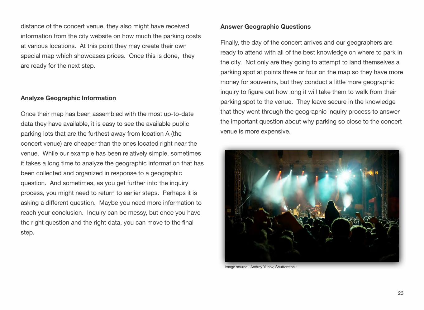
Finally, the day of the concert arrives and our geographers are ready to attend with all of the best knowledge on where to park in the city. Not only are they going to attempt to land themselves a parking spot at points three or four on the map so they have more money for souvenirs, but they conduct a little more geographic inquiry to figure out how long it will take them to walk from their parking spot to the venue. They leave secure in the knowledge that they went through the geographic inquiry process to answer the important question about why parking so close to the concert venue is more expensive.
Image source: Andrey Yurlov, Shutterstock
23