mesquite tree infestation on gash spate irrigation system: impacts and remedial measures presented...
TRANSCRIPT

MESQUITE TREE INFESTATION ON GASH SPATE IRRIGATION SYSTEM: Impacts and Remedial Measures
Presented by: Hamisi Said Nzumira UNESCO IHE-Institute for Water
Education, Delft, Netherlands
Acknowledgement Prof Charlotte de Fraiture-UNESCO IHE Dr. Frank van Steenbergen - MetaMeta Dr. Abraham Mehari Haile-UNESCO-IHE Dr. Yasir Abbas Mohamed-UNESCO-IHE
Regional Conference on Invasive Species in ASAL-Managing Prosopis Juliflora (Mesquite) for
better(agro-) pastoral livelihoods in the Horn of Africa @Desalegn Hotel, Addis Ababa, Ethiopia
@1440-1500hrs, May 1st, 2014

Outlines
1. Introduction2. Problem statement3. Research objectives4. Research Questions and Methodology5. Results and Major findings6. Conclusions and Recommendations

INTRODUCTION
Sudan, Kassala state and Gash Delta maps

INTRODUCTION cont…
Agriculture is the main activity in Sudan -contribute about 38% of GDP -80 % of the population dependent on
agriculture -provides about 80 % of the country’s export - Main crops are Sorghum, Cotton,
GroundnutsGash Agricultural Scheme (GAS) -pilot projects , that serves the local
population(approx. 1.5million people) around Kassala state
Gash River -originates from the Eritrea/Ethiopian Plateau
and ends up in Gash deltaThe Kassala state is heavily impacted by
desertificationThe scheme has been invaded by Mesquite trees

Mesquite Tree Mesquite (Prosopis
spp.) - exotic plant , invasive having ecological, economic and social impacts, (Osmond et al.,2003)
Mesquite tree was introduced in 1917 in northern and eastern parts of Sudan for the purposes of dune stabilization
(Broun &Makey,1929)

PROBLEM STATEMENT
Over 100,000 ha of irrigable land is estimated to be infested
Mesquite blocks irrigation canals and reduces water capacity
Invades the agriculture areas hence diminishing the cultivated land
Absence of permanent land leads to lack of user right
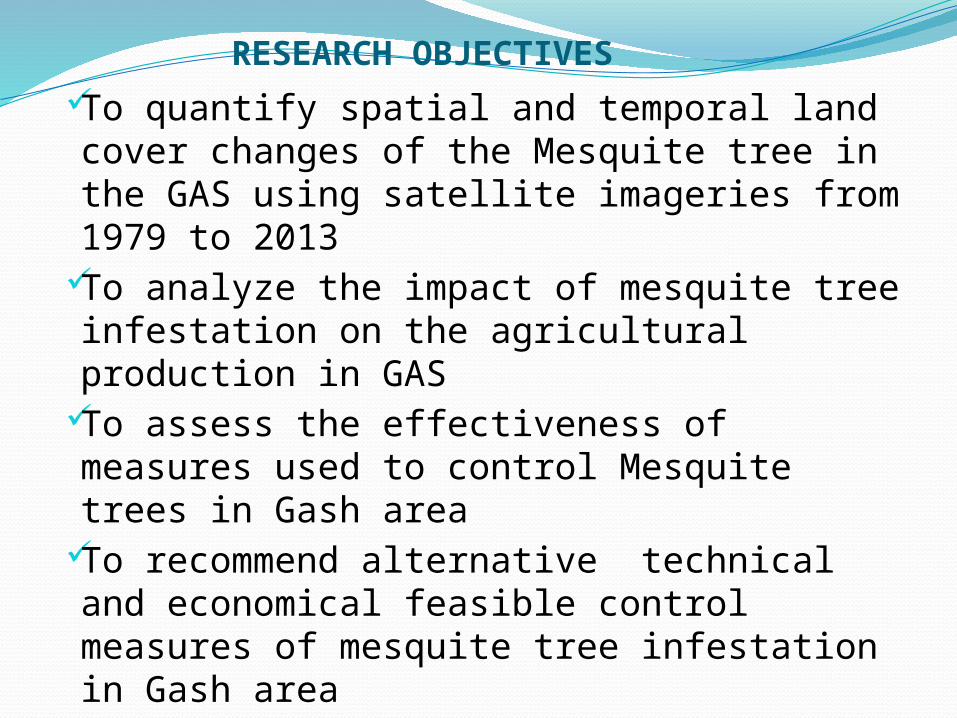
RESEARCH OBJECTIVESTo quantify spatial and temporal land
cover changes of the Mesquite tree in the GAS using satellite imageries from 1979 to 2013
To analyze the impact of mesquite tree infestation on the agricultural production in GAS
To assess the effectiveness of measures used to control Mesquite trees in Gash area
To recommend alternative technical and economical feasible control measures of mesquite tree infestation in Gash area

Research question Methodology
How the Mesquite tree infestation has changed over the years
Review of relevant literature (journals, books, publications, conference papers, previous thesis) analysis of Remote Sensing land cover maps of mesquite infestation trendsChanging detection analysis-calculation on the arcgis 9.3.1
What are the factors that have contributed to those changes
Review of relevant literaturesInterview with stakeholders (local farmers, research institutes)- Questionnaires
What are the impacts of Mesquite trees infestation on agriculture production in GAS
Literature reviewAnalysis of the remote sensing imageries of the Gash delta (1979– 2013)Canal Capacity measurement, water use calculationsAqua-crop modeling
How effective are the existing measures to reduce or eradicate the infestation of mesquite trees has been done
What alternative measures if any, could be recommended
Literature reviewsReferences from articles &consultants consultation, Researcher ‘s results on the measure to improveInterviews with stakeholdersField observation & satellite based analysis
Interviews with stakeholders (local farmers, research institutes)Research resulted validated in the stakeholder consultants
RESEARCH QUESTIONS & METHODOLOGY

Methodology
Landsat( 1 - 3
MSS)
Landsat(4-5
TM)
Landsat(4-5
TM)
Landsat 8
OLI
Date acquired 13/05/1979 13/05/1985 13/05/1998 26/04/2013
Path184 171 171 171
Row49 49 49 49
Spatial resolution (m)
60 30 30 30
Temporal resolution (days)
18 16 16 16
Number of bands 4 7 7 11
Spectral-Band combination used (RGB)
6-5-4 (NIR-R-G)
7-4-2(SWIR-NIR-G) 7-4-2(SWIR-NIR-G) 6-5-4 (NIR-R-G)
Image size (swath-km2)
180 x180 185 x185 185X185 185x185
Cloud cover (%) 0 0 0
SWIR band (1.55 – 1.75 μm)
Overall Accuracy assessment from confusion matrix is 76%

Ground TruthingField Work91 GCPs covered in
Gash DeltaChanging detection
from imageries of Landsat 1-3(MSS)-1979,Landsat 4-5(TM) 1985,1998 and Landsat 8(OLI) 2013
Data analysis from interviews- questionnaires, consultations, agriculture, irrigation, hydrology and livestock stakeholders

Area(ha)
% Area(ha) % Area(ha) % Area(ha) %
1979 1985 1998 2013
Mesquite trees 89,428 24
104,483 28 117,076 32 141,942 38
Agricultural areas 32,125 9
11,777 3 11,326 3 23,538 6
Other vegetations 62,652 17
80,445 22 48,971 13 27,210 7
Bared Land 107,443 28.9 79,455 21 82,914 22 58,572 16
Urban areas 80,217 21.6 95,710 26 111,583 30 120,608 32
RESULTSMajor finding 1-How the Mesquite Tree infestation has changed
over the years

Change detectedChange detected, gained & disappeared areas by mesquite trees
Areas (Ha)
Mesquite trees Disappeared
Mesquite trees Gain
Net gain
Change Detection 1998 vs 1985
7,290 58,583 51,293
Change Detection 2013 vs 1998
18,841 56,975 38,134
Change Detection 2013 vs 1985
10,708 100,135 89,427

Land Cover Change on GAS, Kassala state in Sudan (1979-2013)
Mesquite trees Agricultural areas Other vegetations Bare Land Urban areas/stabilized sand0.0
5.0
10.0
15.0
20.0
25.0
30.0
35.0
40.0
1979
1985
1998
2013
Land Classification
%

Major finding 2- what are the factors that contribute to the trends-Livestock cause•Livestock dung characterized by high
water retention capacity ensure germination•No damage through the digestive tract of the animals•Seeds characterized by coat imposed dormancy•High sugar(16%),protein(12%)-(Mohamed,2001)

Poor Water Management
•Pods are float easily transported•Flood water transport the seeds, poor irr facility cause poor proper water flow Lack of natural enemiesCan grow in any type of soil Wide range of dry tolerance, able to find water using its tap root during drought

Major Finding 3- What are the impacts of mesquite trees infestation on the agriculture production of GASCase 1-25% Canal capacity
reductions. Assumptions-maintain the current
water application of 987mmConsequences-irrigable land will
reduces for 37,500 haYield/ton-remain the same 5
ton/ha(aquacrop simulations)Case 2-50% canal capacity
reduction-worst scenarios in the same canal
Assumptions-maintained the same water application of 987mm
Consequences; irrigable land will reduced to 25,000 ha
Yield/ton; 2.5ton/ha

Mesquite water consumptions
Consumption per Tree (liters/day)
Number of tree per ha
Total consumption per ha/day
Total annual water consumption per ha
Irrigated area infested per ha
Total water consumed per total area
Total annual water consumption per total area
Gross consumption 18 952
17,143 6,257,143 42,600
730,285,714
266,554,285,714
Evapotransipiration
11,429 4,171,429
486,857,143
177,702,857,143 Net water consumption(l/day)
5,714 2,085,714
243,428,571
88,851,428,571
Net water consumption(m3/yr)
88,851,428.57 Net water consumption(Mm3/yr
88.85
Mean Annual rainfall (mm/year)=180Gash river annual flood flow(Mm3) as per 2010 data = 560

Major finding 4-How effective are the existing measures to reduce or eradicate/control the infestation has been done Cutting the mesquite trees on the stem Hand puling, hoeing, tilling up to 10
weeks use diesel and 2-4 D chemicals to
eradicate and control the mesquite Planting Sorub/Kormot trees to
overcome Mesquite Allowing bees to produces honey from
mesquite

Major finding 5-What alternative measures could be recommended
Biological ,Physical and Chemical control (New Halfa scheme)
Controlled management for productive use• Charcoal productions (Afar scheme Ethiopia)• Honey produces (India & Yemen)• Increase agricultural areas(mesquite area for
agriculture activities• Bio fuel• Biomass to generate power (Nema electricity power
plant, Kenya)

Mesquite Cost Benefit analysis
Area considered is irrigable area (42,600 ha)Only Sorghum crop considered for analysisOnly Charcoal productions considered The rate of 1USD=5.67SDG was used
No.
Item Cost (USD) Benefit(USD)
per ha
per 42,600ha
per haper 42,600ha
1 Mechanical Removal
196 8,367,851
2 Charcoal 2,082 88,699,286
2,946 125,517,857
3 Sorghum 875 37,286,964
1,719 73,218,750
4 Total 3,153 134,304,101
4,665 198,736,607
5 Total Net Profit 1,513 64,432,506

CONCLUSIONS
Mesquite infestation has increased from 89,000 ha in 1979 to 142,000 ha in 2013- a 14% total increment
Landsat MSS,TM and OLI have been reliable (mesquite invaded much on the canal, river banks and farm road sides )
Existing measure have been ineffective•Lack of land ownership (land tenure)
•Lack of institutional backing from central and local governments(Control has been disappointed due to luck of commitment and follow up from the state government
•Non connectivity between eradication/control program and benefit generated
Mesquite has several uses to its credit
Salinity control, Land reclamation, Charcoal, Wood chips, Fodder, Bio fuel, Biomass to generate power, Honey and gum, Pods for animal food, Medicinal purposes , Timber, Fencing, bread productions

RecommendationsEradication and Control to maximize the income to
citizens Cost benefit analysis -effective and is an essential
component of a noxious mesquite management strategyPrevent Land rotation and promote long term
permanent land user rightHigh resolution satellites (ALOS, RapidEye, Meteosat,
GeoEye, DigitalGlobe, ERDAS, ASTER ‘s) could be used to find and effecting the monitoring expansion of mesquite
Coordinate national management programme that select the appropriate management procedures
Regular monitoring and annual evaluations determine adequacy of the plan(a case study of New Halfa scheme)

