maryland; rainscaping in the sligo watershed - friends of sligo creek
TRANSCRIPT
8/3/2019 Maryland; Rainscaping in the Sligo Watershed - Friends of Sligo Creek
http://slidepdf.com/reader/full/maryland-rainscaping-in-the-sligo-watershed-friends-of-sligo-creek 1/13
Rainscaping in the SligoWatershed:
A Tour Book
§
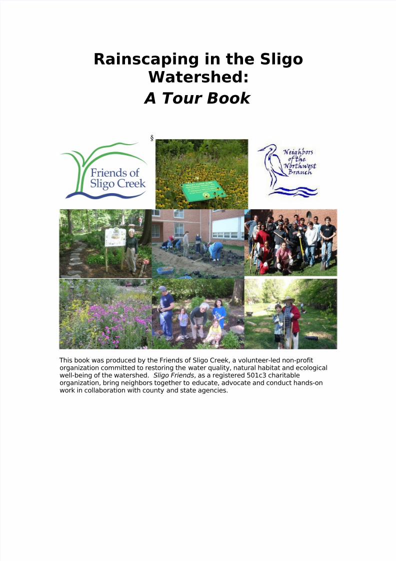
This book was produced by the Friends of Sligo Creek, a volunteer-led non-profitorganization committed to restoring the water quality, natural habitat and ecologicalwell-being of the watershed. Sligo Friends, as a registered 501c3 charitableorganization, bring neighbors together to educate, advocate and conduct hands-on
work in collaboration with county and state agencies.

8/3/2019 Maryland; Rainscaping in the Sligo Watershed - Friends of Sligo Creek
http://slidepdf.com/reader/full/maryland-rainscaping-in-the-sligo-watershed-friends-of-sligo-creek 2/13
Welcome
Outlined on the following pages, you will find descriptions of raingardens and
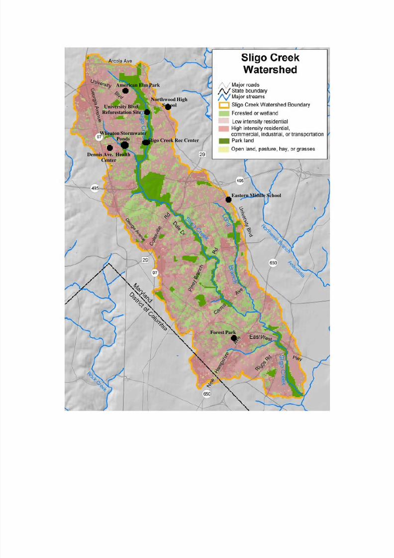
rainscaping projects which have been installed within the Sligo Creek watershed of Maryland. Sligo Creek is a tributary of the Anacostia and the Potomac Rivers whichruns through lower Montgomery and northeastern Prince George’s Counties. The areais one of intense urbanization, where apartment buildings, commercial development,school buildings, single family homes and houses of worship have been built very closeto the creek bed.
Despite its proximity to urban development, or perhaps because of it, the Creek isbeloved by many and forms a giant, green backbone of open space in an area wherepeople are hungry for opportunities to experience nature. A paved hiker/biker pathruns parallel to the creek and a tree-lined two lane road runs the complete distance of the park. Playgrounds, ball fields and picnic areas sit at many of the park’s busiestintersections. Pathways connect the park to nearby suburban subdivisions. For theseand other reasons, the Sligo is always filled with people who visit the creek either by
car, bike or foot.
The park is pretty and the park is a great place to play, but the stream inside of it playsan important role in the cityscape, too. Many kinds of wildlife depend upon its waterand the trees which line much of its banks. Unfortunately, much of the stormwater inthe area is channeled or piped to its banks, and as urbanization in our watershed hasincreased, stressors on the Creek have increased, too. Each time a new slab of concrete is laid in the watershed, more rainwater heads to creek at a faster rate. Fastwater picks up more pollution and carries it farther. Fast moving water also cannotsupport as much wildlife as slow water, and fast water is more likely to jump the banksunexpectedly. As the variety of wildlife diminishes, water quality begins to suffer. Thestream is not able to function as well as it could or should.
No one wants to live near a polluted stream which floods dangerously each time it
rains and constantly emits strange smells or is full of disease-causing bacteria. Wemust act now. By implementing low impact design practices, known as LIDs, residentsand building owners near the creek can make a huge difference in the overall healthand well-being of the entire urban area. If we can help the creek recover from some of the damage done by more than a century of intense development and amelioratesome of urbanization’s negative environmental impacts, we will provide habitat forwildlife, places for families to play and a higher quality of life for all citizens in our area.
By supporting, promoting and publicizing the efforts of those who are using LIDpractices in the area, we hope to encourage more property owners to try thesepractices on their own. Towards that goal we hope that these projects will inspire anddemystify the process of helping the creek through the use of LIDs.

8/3/2019 Maryland; Rainscaping in the Sligo Watershed - Friends of Sligo Creek
http://slidepdf.com/reader/full/maryland-rainscaping-in-the-sligo-watershed-friends-of-sligo-creek 3/13
But what is LID?
Scientists have long marveled at the ability of forests to slow down, filter and even
absorb water. Healthy, strong trees and rich soils have the amazing power to clean outpollutants that pass through their root zones. Streams and rivers which aresurrounded by such forests often team with life and rarely flood, because the foreststhemselves act as flood buffers.
In areas where forests have been destroyed or disturbed, water in nearby streamsoften becomes quickly polluted. In addition, fast moving water can cause erosionproblems and flooding begins to occur more frequently.
Low Impact Design (LID) is an innovative stormwater management approach with asimple basic principle at heart: to manage rainfall by mimicking nature instead of fighting against it. One of LID practices is called Rainscapes. Rainscape techniques asdescribed by the Montgomery County Department of Environment seeks to recreatenatural ecosystems to help soil capture and filter rain water, which prevents pollutionrunoff and erosion, while also recharging groundwater supplies. From simple rainbarrels to elaborate raingardens, Rainscapes are a wonderful mix of innovativeapproaches which help conserve our natural resources while creating habitat areas fullof beauty and life.
With the exception of the Wheaton Branch Stormwater Management Ponds, all thestormwater management practices within this tour incorporate LID principals. TheWheaton Branch Stormwater Management Ponds were included as an example of acentralized or more traditional development practice to compare with the LIDpractices. Although the acronym is new, the concepts of LID are based on processesas old as the forests themselves.

8/3/2019 Maryland; Rainscaping in the Sligo Watershed - Friends of Sligo Creek
http://slidepdf.com/reader/full/maryland-rainscaping-in-the-sligo-watershed-friends-of-sligo-creek 4/13
A Quick Glossary
Rain gardens/Bio-retention systems: Rain gardens and bio retention systems arespecially designed depressions which are filled with plants and designed to collect andstore rain water. The vegetation helps cleanse the pollulated runoff. Underneath
these gardens, layers of rock, soil and sand can act as natural filters. Retainingstormwater allows it either to slowly soak into the soil or get soaked up by plants. Forlarger gardens like bio-retention systems, a drainage system is installed under thegarden. Raingardens and bio-retention systems are frequently referred to as “bio-filters” or “sponges” that soak up and filter out pollutants such as sediment, fertilizers,heavy metals and petroleum products.
Permeable Paving: According to the online resource Wikipedia, “permeable paving,also called pervious paving or porous pavement , is a term used to describe pavingmethods for roads, parking lots and walkways that allow the movement of water andair through the paving material. Alothough some porous paving materials appearnearly indistinguishable from nonporous materials, their environmental effects arequalitatively different. Their effects are important because pavements are two-thirds
of the potentially impervious surface cover in urban areas.”Green Roofs: Green roofs are rooftops planted with vegetation. Intensive green roofshave thick layers of soil (6 to 12 inches, or more) that can support a broad variety of plant or even tree species. Extensive green roofs are simpler green roofs with a soillayer of 6 inches or less to support turf, grass, or other ground cover. Not only dogreen roofs help manage stormwater runoff, but they also provide thermal insulationand habitat for birds and insects. The roofs also last longer due to less sun exposure.
Trees & Riparian Buffers: The word riparian refers to anything connected with orimmediately adjacent to the banks of a stream or other body of water. Streamsideforests are riparian forests. Riparian areas, which encompass the flood-plain and aportion of the adjacent upslope area, are complex ecosystems, connecting a streamsystem and a people-based system such as agriculture, housing, or industry. Theability of these areas to function naturally is crucial to the protection of the streams
and rivers. A buffer is an area managed to reduce the impact of adjacent land use. Ariparian forest buffer, therefore, encompasses the area from the streambank in thefloodplain to, and including, an area of trees, shrubs, and herbaceous vegetationlocated upslope from the body of water. (Taken from the University of MarylandCooperative Extension Fact Sheet An Introduction to Forest and Riparian Bufferswww.riparianbuffers.umd.edu/fact/FS724.html) In order to be effective in stormwatermanagement, tree groves and riparian buffers must be fully integrated into thestormwater drainage design, including use of proper grading, and level spreadingdevices, so that runoff disperses and soaks into the ground.
Stormwater Management Ponds: Stormwater management ponds are a centralizedtemporary storage of runoff that is designed to address flooding by reducing peakflows. Unlike the LID practices, stormwater management ponds are not intended to
reduce the volume of runoff and do little to improve the water quality. Stormwatermanagement ponds are an “end-of-pipe” stormwater practice that uses gutters, curbsand pipes to collect and convey runoff from residential and commercial properties asquickly as possible. While LID practices addresses runoff close to the source, the pondsare intended to address the symptoms excessive runoff.
8/3/2019 Maryland; Rainscaping in the Sligo Watershed - Friends of Sligo Creek
http://slidepdf.com/reader/full/maryland-rainscaping-in-the-sligo-watershed-friends-of-sligo-creek 5/13
Forest Park
American Elm Park
Northwood HighSchoolUniversity Blvd.
Reforestation Site
Wheaton StormwaterPonds Sligo Creek Rec Center
Dennis Ave. HealthCenter
Eastern Middle School
8/3/2019 Maryland; Rainscaping in the Sligo Watershed - Friends of Sligo Creek
http://slidepdf.com/reader/full/maryland-rainscaping-in-the-sligo-watershed-friends-of-sligo-creek 6/13
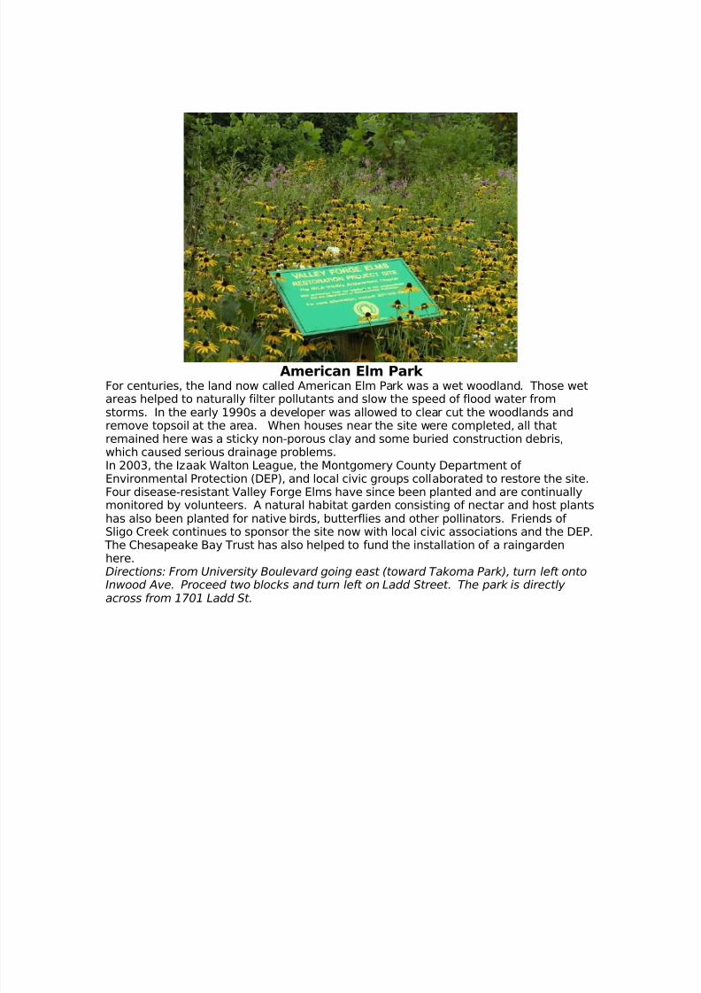
American Elm Park For centuries, the land now called American Elm Park was a wet woodland. Those wetareas helped to naturally filter pollutants and slow the speed of flood water fromstorms. In the early 1990s a developer was allowed to clear cut the woodlands andremove topsoil at the area. When houses near the site were completed, all thatremained here was a sticky non-porous clay and some buried construction debris,which caused serious drainage problems.In 2003, the Izaak Walton League, the Montgomery County Department of Environmental Protection (DEP), and local civic groups collaborated to restore the site.Four disease-resistant Valley Forge Elms have since been planted and are continuallymonitored by volunteers. A natural habitat garden consisting of nectar and host plants
has also been planted for native birds, butterflies and other pollinators. Friends of Sligo Creek continues to sponsor the site now with local civic associations and the DEP. The Chesapeake Bay Trust has also helped to fund the installation of a raingardenhere.Directions: From University Boulevard going east (toward Takoma Park), turn left ontoInwood Ave. Proceed two blocks and turn left on Ladd Street. The park is directly across from 1701 Ladd St.

8/3/2019 Maryland; Rainscaping in the Sligo Watershed - Friends of Sligo Creek
http://slidepdf.com/reader/full/maryland-rainscaping-in-the-sligo-watershed-friends-of-sligo-creek 7/13
Northwood High School
The Northwood High School site uses various LID techniques to manage stormwater. Agreen roof for the Courtyard and a pervious pavement parking lot were both installedas “pilot projects” at the school. Students, the Department of EnvironmentalProtection, and volunteers from Friends of Sligo Creek and the Neighbors of NorthwestBranch joined forces to build raingardens on the schoolyard. In 2006 the firstraingarden built on the east side of the school. A second raingarden was built soonafterwards in the Courtyard. The schoolyard site is located on the ridge that divides the
Northwest Branch watershed from the Sligo watershed. Please note, for securityreasons the Courtyard is not accessible to the general public.
Directions: Northwood High School is located at 919 University Blvd (close to thecorner of Arcola Ave.)
8/3/2019 Maryland; Rainscaping in the Sligo Watershed - Friends of Sligo Creek
http://slidepdf.com/reader/full/maryland-rainscaping-in-the-sligo-watershed-friends-of-sligo-creek 8/13
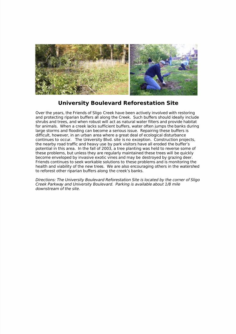
University Boulevard Reforestation Site
Over the years, the Friends of Sligo Creek have been actively involved with restoring
and protecting riparian buffers all along the Creek. Such buffers should ideally includeshrubs and trees, and when robust will act as natural water filters and provide habitatfor animals. When a creek lacks sufficient buffers, water often jumps the banks duringlarge storms and flooding can become a serious issue. Repairing these buffers isdifficult, however, in an urban area where a great deal of ecological disturbancecontinues to occur. The University Blvd. site is no exception. Construction projects,the nearby road traffic and heavy use by park visitors have all eroded the buffer’spotential in this area. In the fall of 2003, a tree planting was held to reverse some of these problems, but unless they are regularly maintained these trees will be quicklybecome enveloped by invasive exotic vines and may be destroyed by grazing deer.Friends continues to seek workable solutions to these problems and is monitoring thehealth and viability of the new trees. We are also encouraging others in the watershedto reforest other riparian buffers along the creek’s banks.
Directions: The University Boulevard Reforestation Site is located by the corner of SligoCreek Parkway and University Boulevard. Parking is available about 1/8 miledownstream of the site.
8/3/2019 Maryland; Rainscaping in the Sligo Watershed - Friends of Sligo Creek
http://slidepdf.com/reader/full/maryland-rainscaping-in-the-sligo-watershed-friends-of-sligo-creek 9/13
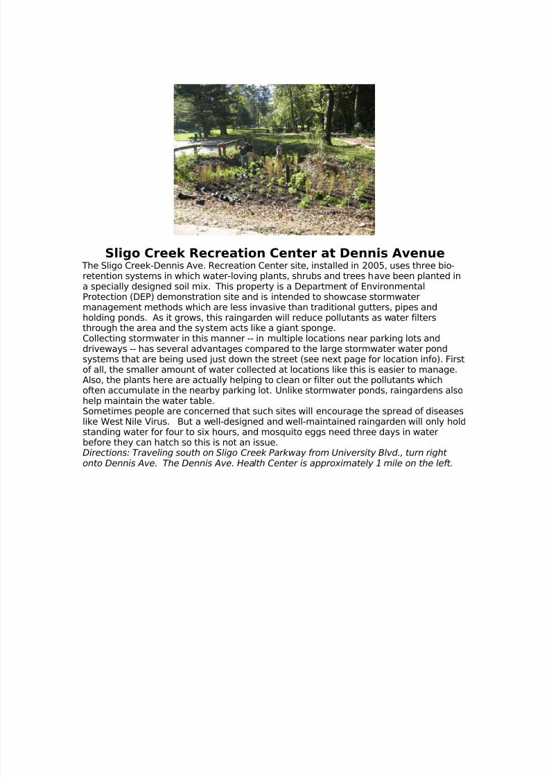
Sligo Creek Recreation Center at Dennis Avenue The Sligo Creek-Dennis Ave. Recreation Center site, installed in 2005, uses three bio-retention systems in which water-loving plants, shrubs and trees have been planted ina specially designed soil mix. This property is a Department of EnvironmentalProtection (DEP) demonstration site and is intended to showcase stormwatermanagement methods which are less invasive than traditional gutters, pipes andholding ponds. As it grows, this raingarden will reduce pollutants as water filtersthrough the area and the system acts like a giant sponge.Collecting stormwater in this manner -- in multiple locations near parking lots anddriveways -- has several advantages compared to the large stormwater water pondsystems that are being used just down the street (see next page for location info). Firstof all, the smaller amount of water collected at locations like this is easier to manage.Also, the plants here are actually helping to clean or filter out the pollutants whichoften accumulate in the nearby parking lot. Unlike stormwater ponds, raingardens alsohelp maintain the water table.
Sometimes people are concerned that such sites will encourage the spread of diseaseslike West Nile Virus. But a well-designed and well-maintained raingarden will only holdstanding water for four to six hours, and mosquito eggs need three days in waterbefore they can hatch so this is not an issue.Directions: Traveling south on Sligo Creek Parkway from University Blvd., turn right onto Dennis Ave. The Dennis Ave. Health Center is approximately 1 mile on the left.
8/3/2019 Maryland; Rainscaping in the Sligo Watershed - Friends of Sligo Creek
http://slidepdf.com/reader/full/maryland-rainscaping-in-the-sligo-watershed-friends-of-sligo-creek 10/13
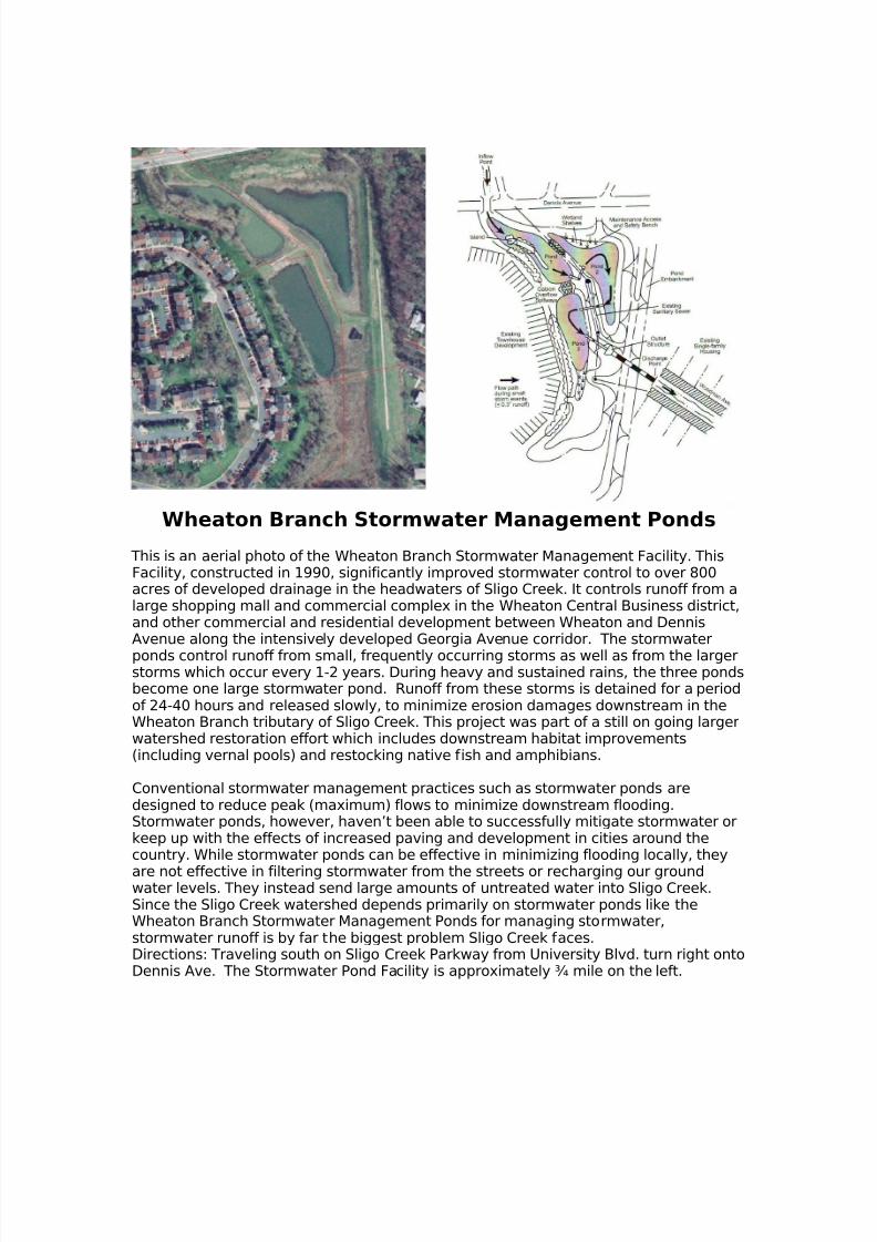
Wheaton Branch Stormwater Management Ponds
This is an aerial photo of the Wheaton Branch Stormwater Management Facility. ThisFacility, constructed in 1990, significantly improved stormwater control to over 800acres of developed drainage in the headwaters of Sligo Creek. It controls runoff from alarge shopping mall and commercial complex in the Wheaton Central Business district,and other commercial and residential development between Wheaton and DennisAvenue along the intensively developed Georgia Avenue corridor. The stormwater
ponds control runoff from small, frequently occurring storms as well as from the largerstorms which occur every 1-2 years. During heavy and sustained rains, the three pondsbecome one large stormwater pond. Runoff from these storms is detained for a periodof 24-40 hours and released slowly, to minimize erosion damages downstream in theWheaton Branch tributary of Sligo Creek. This project was part of a still on going largerwatershed restoration effort which includes downstream habitat improvements(including vernal pools) and restocking native fish and amphibians.
Conventional stormwater management practices such as stormwater ponds aredesigned to reduce peak (maximum) flows to minimize downstream flooding.Stormwater ponds, however, haven’t been able to successfully mitigate stormwater orkeep up with the effects of increased paving and development in cities around thecountry. While stormwater ponds can be effective in minimizing flooding locally, they
are not effective in filtering stormwater from the streets or recharging our groundwater levels. They instead send large amounts of untreated water into Sligo Creek.Since the Sligo Creek watershed depends primarily on stormwater ponds like theWheaton Branch Stormwater Management Ponds for managing stormwater,stormwater runoff is by far the biggest problem Sligo Creek faces.Directions: Traveling south on Sligo Creek Parkway from University Blvd. turn right ontoDennis Ave. The Stormwater Pond Facility is approximately ¾ mile on the left.
8/3/2019 Maryland; Rainscaping in the Sligo Watershed - Friends of Sligo Creek
http://slidepdf.com/reader/full/maryland-rainscaping-in-the-sligo-watershed-friends-of-sligo-creek 11/13
Dennis Ave Health Center
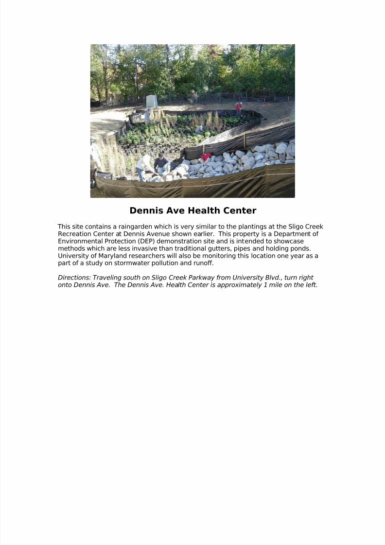
This site contains a raingarden which is very similar to the plantings at the Sligo CreekRecreation Center at Dennis Avenue shown earlier. This property is a Department of Environmental Protection (DEP) demonstration site and is intended to showcasemethods which are less invasive than traditional gutters, pipes and holding ponds.University of Maryland researchers will also be monitoring this location one year as apart of a study on stormwater pollution and runoff.
Directions: Traveling south on Sligo Creek Parkway from University Blvd., turn right
onto Dennis Ave. The Dennis Ave. Health Center is approximately 1 mile on the left.

8/3/2019 Maryland; Rainscaping in the Sligo Watershed - Friends of Sligo Creek
http://slidepdf.com/reader/full/maryland-rainscaping-in-the-sligo-watershed-friends-of-sligo-creek 12/13
Sustainable Landscaping at Eastern Middle SchoolNot too long ago, the schoolyard of Eastern Middle School was comprised almostentirely of grass. Now the location boasts a showcase of sustainable landscapingtechniques, including some lovely gardens. The plantings are helping to addressstormwater problems, but have also improved the overall appearance of the school.Native flowers, shrubs, and trees, have been planted where once there was only lawn.As the trees grow they will also help to keep the school building and schoolyard cool,improve air quality, and provide habitat for wildlife. Ideally, such areas could also beused by teachers for outdoor education in subjects such as science, art and history.
To obtain support for sustainable landscaping in public institutions like Eastern MiddleSchool, Friends of Sligo Creek piloted a Green Landscaping Partnership between thelocal watershed groups, the Eastern Middle School PTSA, and the Montgomery CountyPublic School's Green Schools Program. The Goals of the Green LandscapingPartnership include:
A. To reduce the negative environmental impacts of unchecked stormwater run-off
and to boost the environmental contributions that can be made throughsustainable landscaping.
B. To educate students, parents, and the community at large about the problemsof stormwater runoff and about the benefits of Sustainable Landscaping (i.e.Bayscaping, Rainscaping) and other LID practices for both public and privatefacilities and back yards.
C. To enhance the appearance and interest of the schoolyard through high quality
landscaping at the site. To show the community that LID and use of native plantscan be a beautiful solution to stormwater runoff.
D. To use this partnership and its resultant landscaping as a model for other
schools and other private and public institutions in the region.
Directions: Eastern Middle School is located at 300 University Boulevard (about ½mile East of Four Corners).
8/3/2019 Maryland; Rainscaping in the Sligo Watershed - Friends of Sligo Creek
http://slidepdf.com/reader/full/maryland-rainscaping-in-the-sligo-watershed-friends-of-sligo-creek 13/13
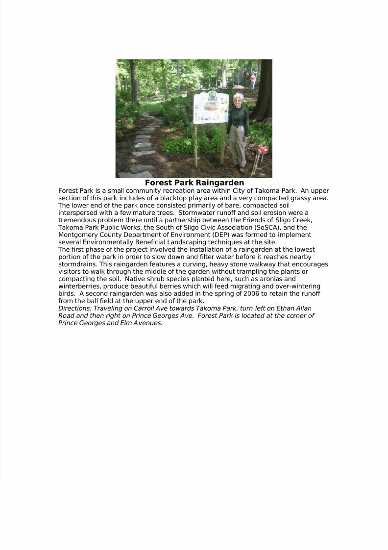
Forest Park Raingarden
Forest Park is a small community recreation area within City of Takoma Park. An uppersection of this park includes of a blacktop play area and a very compacted grassy area. The lower end of the park once consisted primarily of bare, compacted soilinterspersed with a few mature trees. Stormwater runoff and soil erosion were atremendous problem there until a partnership between the Friends of Sligo Creek,
Takoma Park Public Works, the South of Sligo Civic Association (SoSCA), and theMontgomery County Department of Environment (DEP) was formed to implementseveral Environmentally Beneficial Landscaping techniques at the site.
The first phase of the project involved the installation of a raingarden at the lowestportion of the park in order to slow down and filter water before it reaches nearbystormdrains. This raingarden features a curving, heavy stone walkway that encouragesvisitors to walk through the middle of the garden without trampling the plants orcompacting the soil. Native shrub species planted here, such as aronias and
winterberries, produce beautiful berries which will feed migrating and over-winteringbirds. A second raingarden was also added in the spring of 2006 to retain the runoff from the ball field at the upper end of the park.Directions: Traveling on Carroll Ave towards Takoma Park, turn left on Ethan AllanRoad and then right on Prince Georges Ave. Forest Park is located at the corner of Prince Georges and Elm Avenues.