maps trb jan 2013 - me.umn.educliao/pdf/maps_trb_2013.pdf · avanish rayankula, sowmya ramesh,...
TRANSCRIPT
2/11/2013
1
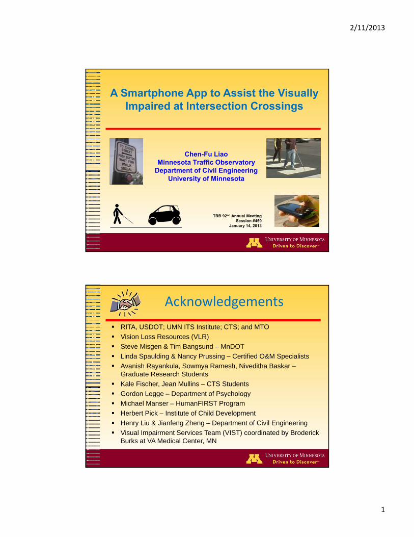
A Smartphone App to Assist the Visually Impaired at Intersection Crossings
Chen-Fu LiaoMinnesota Traffic Observatory
Department of Civil EngineeringUniversity of Minnesota
TRB 92nd Annual MeetingSession #459
January 14, 2013
Acknowledgements
RITA, USDOT; UMN ITS Institute; CTS; and MTO
Vision Loss Resources (VLR)
Steve Misgen & Tim Bangsund – MnDOT
Linda Spaulding & Nancy Prussing – Certified O&M Specialists
Avanish Rayankula, Sowmya Ramesh, Niveditha Baskar –Graduate Research Students
Kale Fischer, Jean Mullins – CTS Students
Gordon Legge – Department of Psychology
Michael Manser – HumanFIRST Program
Herbert Pick – Institute of Child Development
Henry Liu & Jianfeng Zheng – Department of Civil Engineering
Visual Impairment Services Team (VIST) coordinated by Broderick Burks at VA Medical Center, MN

2/11/2013
2
Outline
Background Accessible Pedestrian Signals (APS)Motivation Our Approach Recommendations from UI Survey Field Experiment and Results Lesson Learned Concluding Remarks
Low Vision Statistics
Every 7 minutes someone in U.S. becomes blind or visually impaired
More than 3.4 million (3%) Americans 40 years and older are legally blind or visually impaired
By 2030, the number of blind and visually impaired people is predicted to double
Alliance for Aging Research. (2010). The Silver Book: Vision Loss. http://www.silverbook.org/VisionLossSilverbook.pdfImproving the Nation’s Vision Health. http://minorityhealth.hhs.gov/Assets/pdf/Checked/FINAL_Improving_the_Nations_Vision_Health.pdf
2/11/2013
3
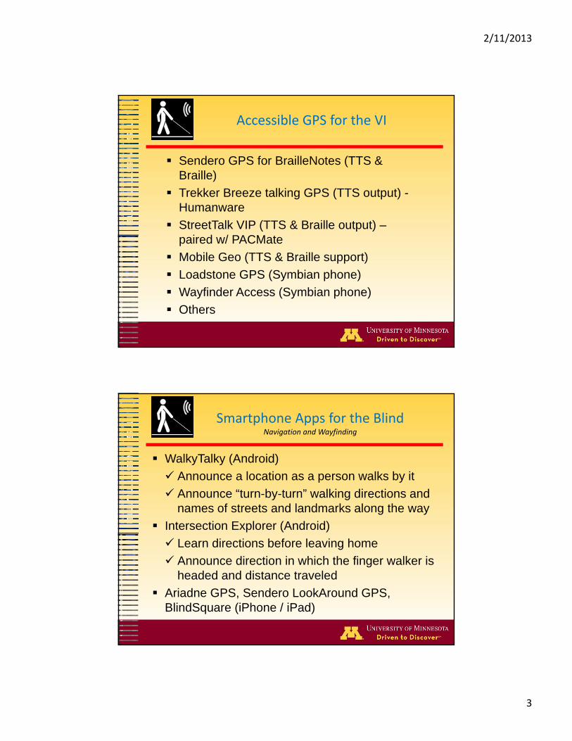
Accessible GPS for the VI
Sendero GPS for BrailleNotes (TTS & Braille)
Trekker Breeze talking GPS (TTS output) -Humanware
StreetTalk VIP (TTS & Braille output) –paired w/ PACMate
Mobile Geo (TTS & Braille support)
Loadstone GPS (Symbian phone)
Wayfinder Access (Symbian phone)
Others
Smartphone Apps for the BlindNavigation and Wayfinding
WalkyTalky (Android)
Announce a location as a person walks by it
Announce “turn-by-turn” walking directions and names of streets and landmarks along the way
Intersection Explorer (Android)
Learn directions before leaving home
Announce direction in which the finger walker is headed and distance traveled
Ariadne GPS, Sendero LookAround GPS, BlindSquare (iPhone / iPad)

2/11/2013
4
Potential Challenges at Crossings
No intersection geometry information
Locate the edge of street
Locate crosswalk
Interpret signal & traffic patterns
Align toward crosswalk
Locate pushbutton, if exists
Determine when to cross
Maintain alignment
while crossing
Intersection Crossing
48.6% of crossings started during walk interval and 26.9% of all crossings (w/o assistance) ended after the onset of the perpendicular traffic w/o APS – Barlow et al. (2005)
72% started with appropriate alignment, 42% ended outside the crosswalk w/o APS – Barlow et al. (2005)
With APS installation, 13% of crossings ended after perpendicular traffic began and APS reduced starting delay time by nearly 2 sec. – Scott et al. (2008)
Train pedestrians to use new cues or enhance their judgments with technology may be a more effective method of reducing crash events – Guth et al. (2005)

2/11/2013
5
Accessible Pedestrian Signals (APS)Brief History
Audible pedestrian signals starting in 1920 in U.S.
Not included in U.S. standards and regulations until MUTCD 2000
Cuckoo/cheep signals mounted on the pedestrian signal heads (pedhead-mounted APS) – mid 70’s
Integrated APS in pushbutton – mid 90’s
Latest Generation of APS
Audible and/or vibrotactile WALK signal indications
Pushbutton locator tone - repeats constantly at 1Hz to provide information about the presence and location of a pushbutton
Tactile arrow that points in the direction of travel on the crosswalk
Automatic volume adjustment
Walk time count down

2/11/2013
6
APS Installation
Costs - $6,000 per intersection plus labor
Noisy. Add 5 decibels of noise within 6 to 12 feet of pushbutton
Require additional stub, pushbutton station poles
Pushbutton pole location
Braille verification
Maintenance
APS at SE University & Berry St.LRT Westgate Station

2/11/2013
7
Motivation
Controversy between ACB and NFB
Provide personal pedestrian signal information with properly design user interface
Intersection geometry information
Blind pedestrian needs to locate and push the walk button by listening to separate audible cue
Audible messages are often confused with noises in the vicinity and heavy rush hour traffic
Recommendations from the VISummary of survey results
Present additional information about an intersection Use short auditory phrases Auditory and tactile information should not interfere
with the pedestrian’s ability to use their cane or listen to traffic cues
Use tactile cues for dangerous warnings A method to repeat warnings / output is necessary Allow for automatic activation of walk signal request
at an intersection; or Allow the user to activate a walk signal request
though a mobile APS device

2/11/2013
8
User Interface for a Mobile Device
User Feedback
Auditory or verbal (Text to speech, TTS)
Vibration
Tactile
User Input
Tactile (Tap on mobile phone or press a button)
Speech to text (STT, or voice input)
Braille overlay on smartphone screen
DrawBraille, a smartphone braille
SPaT Data Acquisition
TS2 Traffic Signal Controller Cabinet
Synchronous Data Link Control (SDLC)
MAPS DB Server
USB I/O
Wires toPushbutton
Smartphone
3G orWi-Fi
MnDOT Network
System Diagram of MAPS Data Communications
Firewall
3G orWi-Fi
UMN VPN

2/11/2013
9
Mobile APS User InterfaceGeometry Information
Single tap for orientation and geometry information
Text-to-Speech message
Heading North to
Washington Ave 4‐Lane
Heading West to
Oak Street 4‐Lane
Mobile APS User InterfaceSignal Information
Double tap to confirm crossing
Send walk phase request to traffic signal controller
Obtain signal timing information
Harvard. Walk sign is on to cross Harvard, 20 sec to cross
Wait for walk signal

2/11/2013
10
Field Experiment – Test Sites
Golden Valley, MN Winnetka Ave and
Golden Valley Rd, Crossing Winnetka 5
lanes Cross from NW corner to
NE corner Crossing time Approx 22
seconds APS equipped
APS Golden Valley, MN Minnesota Highway 55 &
Rhode Island Ave N, Crossing Rhode Island
Ave. 5 lanes, 111 ft Crossing from NE corner
to NW corner Crossing time 23 sec. Walk – 7 sec Don’t Walk – 16 sec
No APS installed
Non‐APS
Experiment Tasks
Crossing
Walk 100~200 ft toward
intersection
Destination
Origin

2/11/2013
11
System Evaluations
Subjective Measures
Sufficient info needed to cross intersection Sufficient time to cross Feel safe during crossing Usefulness & satisfaction
(Van der Laan et al, 1997) Trust (Lee & Moray, 1992)
Objective Measures
Walk speed at sidewalk Walk speed at crosswalk Initial alignment Time to step into
crosswalk Veering and # of veering # of assistance needed
from O&M specialist
Visually Impaired Participants
11 Male, 7 FemaleAge – average 44.2 years (SD 15.2 years) 12 cane users 5 guide dog usersCane users – average 14.2 years (SD 14.1,
Max 49)Guide dog users – average 7.1 years (SD
5.7, Max 15)

2/11/2013
12
Crossing Freq. & Phone Ownership
9
5
2 20
5
10
More than 4intersections a day
1 to 2 intersections aday
1 to 4 intersections aweek
Less than 1intersection a week
Intersection Crossing Frequency
1
98
0
5
10
No phone Smartphone Non‐smartphone
Mobile Phone Ownership
Self‐Assessment Navigation & Wayfinding
0
2
4
6
8
10
12
Cane Guide dog Askingothers
No outsideasstance
Other
Preferred Method of Navigation Assistance
0
2
4
6
8
10
12
Well below Below Average Above Well above
Travel Skills ‐ General Sense of Direction
0
2
4
6
8
10
Well below Below Average Above Well above
Travel Skills ‐ Independent Travel
0
2
4
6
8
10
Well below Below Average Above Well above
Travel Skills ‐ Signalized Street Crossing

2/11/2013
13
Intersection #1 (APS)
Intersection #1 Responses No Yes Don't Know
Use GPS Navigation Previously 16 2 0
Have Prior APS Experience 2 16 0
Prefer Pushbutton (PB) over No PB 1 17 0
Have Difficulty in Locating PB 14 3 1
APS Provides Sufficient Info 2 16 0
Have Sufficient Time to Cross 7 11 0
Feel Aligned to Crosswalk 2 14 2
Intersection #2 (Non‐APS)
Intersection #2 Responses No Yes Note
Prefer Pushbutton (PB) over MAPS 11 41 ‐ Both
1 ‐ Neither
Have Difficulty in Locating PB* 9 8 0
Have Sufficient Time to Cross 2 15 0
Feel Aligned to Crosswalk 2 15 0
MAPS Provides Sufficient Info 6 11 0
MAPS Provides Helpful Geometry Info 3 14 0
MAPS Provides Helpful Signal Timing Info 6 10 1 ‐ Unknown

2/11/2013
14
Objective Measures
Intersection ID 1 2
Intersection Type APS Non APS
Crosswalk Length, meter (ft) 28.7 (94) 33.8 (111)
Crossing Task # 1 2 3
Sample Size (N) 18 17 17
Ped Call APS PB Regular PB MAPS
Crosswalk Speed, Average (mph) 2.9 3.4 3.3
Crosswalk Speed, SD (mph) 0.4 0.8 0.6
Sidewalk Speed, Average (mph) 2.5 3.1 3.3
Sidewalk Speed, SD (mph) 0.4 0.5 0.6
Sidewalk vs. Crosswalk Speed (p‐value) 0.01 0.06 0.77
Pushbutton Search Time, Average (sec) 7.8 26.6 NA
Pushbutton Search Time, SD (sec) 6.1 56.5 NA
In‐Position Time, Average (sec) 14.5 34.8 9.8
In‐Position Time, SD (sec) 7.5 57.2 6.7
Time to Step Into Crosswalk, Average (sec) 3.1 7.1 5.5
Time to Step Into Crosswalk, SD (sec) 1.5 4.7 3.2
Number of Veers Outside Crosswalk 4 2 4
Usefulness & Satisfaction
UsefulPleasantGoodNiceEffectiveLikeableAssistingDesirableRaising Alertness
UselessUnpleasant
BadAnnoying
SuperfluousIrritating
WorthlessUndesirable
Sleep-inducing
Cronbach's α = 0.96
Van der Laan et al. (1997)
‐2
‐1
0
1
2
‐2 ‐1 0 1 2
Satisfaction
Usefulness
Usefulness & Satisfaction
17 Participants Mean
2/11/2013
15
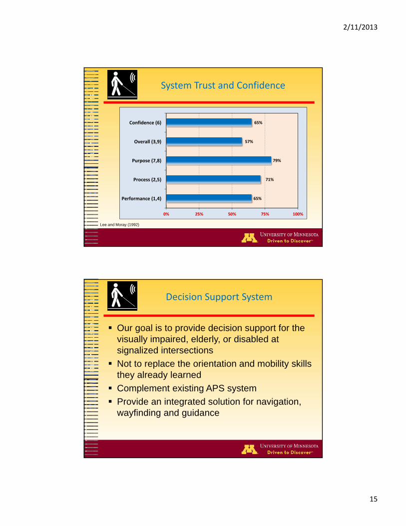
System Trust and Confidence
65%
71%
79%
57%
65%
0% 25% 50% 75% 100%
Performance (1,4)
Process (2,5)
Purpose (7,8)
Overall (3,9)
Confidence (6)
Lee and Moray (1992)
Decision Support System
Our goal is to provide decision support for the visually impaired, elderly, or disabled at signalized intersections
Not to replace the orientation and mobility skills they already learned
Complement existing APS system
Provide an integrated solution for navigation, wayfinding and guidance

2/11/2013
16
Lesson Learned
Privilege of observing 18 VI people, cross the same intersection all day
Every VI person is a different traveler- advocate for one on one mobility instruction
Guide dogs are very distracted by COMS following even 10-30 feet away
Teaching the blind technology requires a lot of training time. Build in additional time for GPS training and mobility lessons
Lesson Learned (Continued)
VI individuals need their O&M skills, MAPS App shall be used as an assistant only, never walk across the street just listen to the phone
Urban canyon and other factors will make GPS unreliable
Great blind traveler could get lost in unfamiliar environments – have client travel on their own –home work assignments, travel days after completion to keep skills up

2/11/2013
17
Future Directions & Opportunities
Work zone bypass and routing
Orientation and direction support at bus stops (transfers, route # and arrival time)
Veering warning
Wayfinding and navigation
Indoor (e.g. Minneapolis skyway)
Outdoor
Route planning and guidance
Application for elderly or disabled
Intelligent Mobility Applications
Inform driver when blind pedestrian is waiting at an intersection
Warn blind pedestrian not to enter crosswalk where there is potential red light runner
Extend pedestrian phase for registered blind, elderly, or disabled people
Connected Vehicles Initiative (V2I, V2P, P2I)

2/11/2013
18
Thank You !
Chen-Fu LiaoMinnesota Traffic Observatory
Department of Civil EngineeringUniversity of Minnesota
(612) [email protected]