madera county blueprint report · madera county blueprint report chapter 1 choosing our own future...
TRANSCRIPT

Madera County Blueprint Report
August 2008 VERSION 3
Prepared for:
2001 Howard Road, Suite 201 Madera, CA 93637
Prepared by:
4630 W. Jennifer, Ste. 105 Fresno, CA 93722

Madera County Blueprint Report
Our Valley - OUR HOME!
Table of Contents
Chapter 1 Choosing Our Own Future 2
Chapter 2 Blueprint Planning Process 3
Chapter 3 Imagine the Possibilities for Madera County 11
Chapter 4 Looking Back: History of Madera County 12
Chapter 5 Key Challenges 14
Chapter 6 If We Don’t Act…Previous Trends Continue to 2050 15
Chapter 7 If We DO Act…A Positive Outlook for 2050 16
Chapter 8 How We Get There: Action Plan & Implementation Strategy 18
Chapter 9 Working Together: Staying Focused on a Common Goal 23
1

Madera County Blueprint Report
Chapter 1 Choosing Our Own Future Ideal future vision for the Valley and Madera County
Valley-wide: Preserve what’s great about the Valley 25 nearby national/state parks, forests, wildlife refuges 150 years of proud agricultural heritage 6 of the top 10 agricultural counties in CA are in the Valley $15.8 billion or half of the state’s total agricultural production comes from the Valley 50% lower housing costs than Bay Area
Madera County Future Vision: Provide a healthy, sustainable environment Create new, vibrant, healthy communities; with housing options, cultural richness and a positive image Preserve open land Improve mobility/transportation options Promote Public Safety World Class Education
2

Madera County Blueprint Report
Chapter 2 Blueprint Planning Process
Background What is the Valley Blueprint? The San Joaquin Valley Blueprint Planning Process is a chance to plan for the future of transportation and land use in the San Joaquin Valley to the Year 2050. The Blueprint is a “goals oriented” mechanism for regional integrated land use and transportation planning that is not “one size fits all.” It is explicitly understood by all jurisdictions and regional planning agencies within Madera County that Madera, Chowchilla and Madera County would maintain authority over local planning and zoning. It is further understood that local agencies can customize the implementation of the Blueprint considering the values, socioeconomic conditions, and desires of the local area. Why the Blueprint is Important? The San Joaquin Valley Blueprint provides a proactive plan to help guide the Valley down a cooperative path as a region and addresses regional issues such as land use and transportation that can’t be adequately addressed on a county-by-county basis. We have choices about how, where, and in what form our region will grow. We can continue our current pattern of development, which will cause us to consume land at a rapid pace, encroach on critical environmental resources, lose the distinctiveness of our communities, and paralyze our residents and businesses in traffic. Or, we can boldly choose a different approach where we conserve our environment, strengthen our urban centers, and provide a variety of choices for how we live, work, travel, raise our families, and enjoy our free time. What will the Blueprint Planning Process do? Planning issues do not exist in a vacuum. Transportation and land use are intertwined; these issues also affect housing, employment centers, and air quality. The San Joaquin Valley Blueprint Planning Process will enable the region to better understand that what we do locally affects the entire region. This growth vision and the accompanying action plan offer strategic direction for our Valley’s future. We acknowledge that this growth vision is a community-generated guide for the Valley’s future development. We agree to enhance existing and/or develop new practices to continue cooperation and consensus-building at the regional level in support of the Valley’s growth vision. These practices may include:
Establishing a Valley-wide forum for continued cooperation among regional elected officials
Work with our county legislative delegation to establish regional legislative delegation meetings and priorities Work with the legislature to advance regional priorities consistent with this vision
3

Madera County Blueprint Report
The eight Councils of Governments (COGs) in the San Joaquin Valley have come together in an unprecedented effort to develop a coordinated valley vision – the San Joaquin Valley Regional Blueprint. This eight county venture is being conducted in each county, and will ultimately be integrated to form a preferred vision for future development throughout the Valley to the year 2050. Technical activities will lead to the development of alternative growth scenarios that will be modeled to illustrate the various potential footprints and the consequences of each alternative. Ultimately, the goal is to select a preferred growth alternative that will help the State, counties, cities and special districts with their planning activities and capital facilities construction considering their individual values, needs and issues. Why should we plan for the Future? The San Joaquin Valley is a special place. It has a rich, diverse population; communities that blend rural calm with urban amenities; and an unrivaled agricultural economy. These qualities also mean the region will grow. In the next 45 years, the Valley will more than double in population from 3.3 million to more than 7 million. With this growth comes many challenges. Where should we grow? How will we grow? The San Joaquin Valley Blueprint Planning Process provides an opportunity to work together to answer these questions. We recognize that the decisions we make today about future growth will determine the competitiveness of our economy, the sustainability of our environment, and the quality of life for future generations. The decisions about development made by individual communities can have impacts far beyond their boundaries. That’s why a regional, collaborative approach is imperative. We applaud the work of numerous public, private, and civic organizations, as well as the many Madera County residents who have helped to answer the question of “How Shall We Grow?” We believe that this vision reflects what matters most as we raise our families, grow our businesses and build our communities. What were the Technical Steps Taken To Show How Madera County Should Grow? A number of technical steps were taken to identify and evaluate how Madera County should grow over the next 42 years. The modeling effort required collecting Geographic Information System (GIS) based data from various County agencies and cities in the county; standardizing it, and converting it to inputs for the UPLAN Land use modeling software. Each of the steps is detailed below. Specific details regarding standardization of the General Plan land use categories and the selection criteria for existing developable and non-developable parcels are provided in Appendix A.
Data Collection
Numerous sets of data; Assessor’s Parcel Data, General Plans, geographical & environmental data, and others were collected. The data sets were analyzed and standardized to create the different inputs for the model. The Assessor’s data was critical to this process.
General Plans The General plans were standardized to fifteen (15) land use categories utilized by the UPLAN software (reference Figure 1). The UPLAN software allocates jobs and housing based on the standardized General Plan map derived from the collected general plans. The gross densities utilized in the software included the specific use (type of residential or type of employment) and the access required for those uses e.g.: neighborhood or streets and roads or "local" streets and roads within a subdivision, utilities, trails, and pedestrian connections. For example, gross low density does not include neighborhood commercial or any other type of employment, parks, schools, or major streets and roads (collectors, arterials, expressways, or freeways) since these uses are already mapped or designated in each of the General Plans GIS files. If such uses were not in the General Plans, then they were considered as the gross densities were established.
4

Madera County Blueprint Report
FIGURE 1
Assessor’s Data
Assessor’s parcel data was utilized to identify vacant, developable and re-developable parcels for the different scenarios. A set of 11 criteria were utilized to identify parcels that had the potential for new development or re-development. The selection criteria were modified for the Moderate and Major scenarios to include more existing developments as having potential for re-development.
Selection Criteria for Existing Developable/Non-developable Parcels Appendix A describes the criteria applied to select developable and non-developable parcels for use in UPLAN modeling.
Geographical & Environmental Data Geographical and environmental data such as slopes, rivers and wetlands were obtained from UC Davis and the State’s GIS data banks accessible on the internet (CASil & Ceres). The Consultant Team also obtained the State’s data on quality agricultural land and merged it with the Assessor’s parcel data on agricultural land under the Williamson Act. Furthermore, infrastructure and political datasets were obtained such as Sphere’s of Influence and roads and highways from the County and the two cities. All of these datasets were primarily used as attractors or discouragers to development in the UPLAN software model.
Modeling Allocation Assumptions The data collected from the State about prime agricultural land was combined with the assessor’s data identifying preserved agricultural land to create a layer of high quality farmland on which new growth was severely discouraged. In addition, the urbanized areas of different cities and communities (Spheres of Influence) were utilized as attractors to growth. The priority of attraction was varied to simulate the different levels of attractiveness and real world trends. Further details regarding these two important allocation assumptions are provided in Appendix A.
5

Madera County Blueprint Report
Modeling Process Assumptions
The Blueprint process objective was to give communities an opportunity to envision alternative futures of their region based upon development choices made in the present. For the Madera Blueprint process the goal was to envision four alternative scenarios including the Status Quo (prevailing trends), Low Change 15-20% reduction in lot size with enhanced transit), Moderate Change (higher densities that would support Bus Rapid Transit or BRT and Light Rail Transit or LRT systems), and Major Change (doubles the share for multiple-family housing with additional BRT routes and LRT expansion). Details regarding each of the alternative scenarios are provided in Appendix B.
What is Madera County’s Regional Blueprint Vision? Madera County will be composed of unique cities, communities and a diverse population that is supported by a vibrant economy, a healthy and sustainable environment and public safety, accomplished through a land use and transportation system that supports livable communities and interregional coordination and connectivity, while preserving agricultural and natural resources. This growth vision and the accompanying action plan offer strategic direction for our future. We acknowledge that this growth vision is a community-generated guide for our future development. It is time to enhance existing and/or develop new practices to continue cooperation and consensus-building at the regional level in support of this growth vision. These practices may include:
Establishing a forum for continued cooperation among regional elected officials Work with our county legislative delegation to establish regional legislative delegation meetings and priorities Work with the legislature to advance regional priorities consistent with this vision
It is also time to consider the following six regional growth principles when making future public, private, and civic investment decisions:
Preserve open space, recreational areas, farmland, water resources, and regionally significant natural areas Provide a variety of transportation choices Foster distinct, attractive and safe places to live Encourage a diverse, globally competitive economy Create a range of obtainable housing opportunities and choices Build communities with educational, health care and cultural amenities
Coordinating regional action in these six areas by enhancing existing or developing new regional partnerships is important to the future of Madera County and the Valley. We acknowledge that comprehensive plans and other regional and locals plans are the critical tools for translating this vision into action. We agree to:
Develop or update strategic regional policy plans, community visions, local government comprehensive plans, transportation plans, resource agency plans, and economic development plans to develop more specific goals, policies, and programs to manage long range growth and guide infrastructure investments consistent with this Vision Consider this Vision and the six regional growth principles in future updates of these plans
6

Madera County Blueprint Report
Coordinate local and regional plans with those of neighboring and overlapping government entities, as well as key statewide plans
Working toward additional intergovernmental agreements when necessary provides opportunities for joint action or to resolve inconsistencies amount statewide, regional and local policies and plans. What are Madera County’s Values As It Grows to the Year 2050?
1. Environmental Health and Sustainability Rational stewardship of environmental resources to provide the highest quality of life. Protection from and prevention of potential environmental health threats
2. Vibrant Economy A healthy, independent, and sustainable economy that benefits all citizens
3. Public Safety Provision of effective and sustainable public services and community design
4. World Class Education Provision of a breadth and depth of educational opportunities that challenge each student and trains the leaders of tomorrow
5. Transportation Options A variety of options available to all income, age and cultural groups
6. Housing Choices A variety of options available to all income, age and cultural groups
7. All People Have Worth Respect for all people that truly reflects equal opportunity
8. Aesthetic Quality Well-designed buildings with character
9. Cultural Richness Activities, structures, and districts that enrich religious, cultural, social and economic development
10. Positive Image Promoting and experiencing creative, innovative, and viable communities and region
7

Madera County Blueprint Report
What Did You Tell Us During the Blueprint Planning Process? In January 2007 and March/April 2008, the Madera County Transportation Commission (MCTC) hosted public participation workshops regarding the “vision” and “values” for future growth and development within Madera County and the proposed Madera County Blueprint Land Use and Transportation Scenarios. Workshops were held in Madera, Chowchilla and in the foothill areas of Madera County. The final exercise of each workshop was an interactive polling, or “clicker”, exercise. Each workshop participant was given a “clicker” for the purpose of voting on questions prepared by the Madera County Blueprint Team.
Responses in the Foothill areas of the County differed from responses provided by those residing on the Valley floor areas of the County. For the most part, the vision and values are generally consistent with those described above. Regarding the alternative scenarios, participants from the Valley floor communities and the foothill areas of Madera County favored the “Moderate Growth Scenario”. It is understood however, that clicker results are not statistically accurate since workshop participants did not represent a true cross-section of the Madera County community, but only those who attended voluntarily given their particular interest in the future of the County.
8
Madera County Blueprint Report
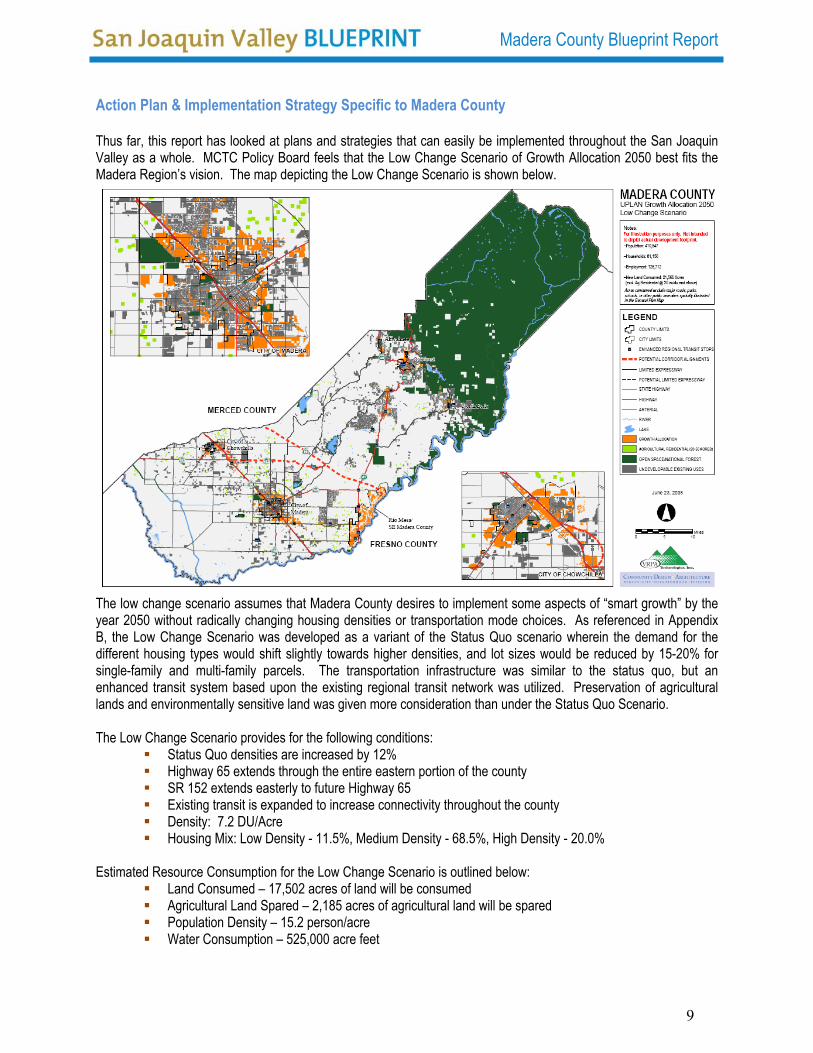
Action Plan & Implementation Strategy Specific to Madera County Thus far, this report has looked at plans and strategies that can easily be implemented throughout the San Joaquin Valley as a whole. MCTC Policy Board feels that the Low Change Scenario of Growth Allocation 2050 best fits the Madera Region’s vision. The map depicting the Low Change Scenario is shown below.
The low change scenario assumes that Madera County desires to implement some aspects of “smart growth” by the year 2050 without radically changing housing densities or transportation mode choices. As referenced in Appendix B, the Low Change Scenario was developed as a variant of the Status Quo scenario wherein the demand for the different housing types would shift slightly towards higher densities, and lot sizes would be reduced by 15-20% for single-family and multi-family parcels. The transportation infrastructure was similar to the status quo, but an enhanced transit system based upon the existing regional transit network was utilized. Preservation of agricultural lands and environmentally sensitive land was given more consideration than under the Status Quo Scenario. The Low Change Scenario provides for the following conditions:
Status Quo densities are increased by 12%
Highway 65 extends through the entire eastern portion of the county SR 152 extends easterly to future Highway 65 Existing transit is expanded to increase connectivity throughout the county Density: 7.2 DU/Acre Housing Mix: Low Density - 11.5%, Medium Density - 68.5%, High Density - 20.0%
Estimated Resource Consumption for the Low Change Scenario is outlined below:
Land Consumed – 17,502 acres of land will be consumed Agricultural Land Spared – 2,185 acres of agricultural land will be spared Population Density – 15.2 person/acre Water Consumption – 525,000 acre feet
9

Madera County Blueprint Report
CO2 Emission – 419.48 thousand tons Megawatt Hours Consumed – 954,438
Balancing demand for single family homes with a good mix of housing types in the medium and high density range is important in planning for the most efficient use of both urban land and existing infrastructure. Balancing this demand creates compact neighborhoods, provides cost effective transit services and allows for a choice of residential types for a broader range of the population. One option for housing choices will be to maintain the availability and increase the variety of housing, while emphasizing an overall increase in housing density over time. This increase in housing density can include multi-family homes, single-family attached homes, mixed land use on the same parcels, cluster housing, as well as infill. Development projects that incorporate good urban design will further our transportation and mobility options ensuring that our future growth is walkable and bicycle-friendly and supports public transportation. Land use development and transportation projects must incorporate strategies that will reduce our dependency on automobiles, as well as use energy efficient and environmentally friendly design. Poor air quality in Madera County and in the surrounding region lends itself to making future choices that will improve overall health. Increasing the
walkability of our communities will lead to increased opportunities for healthy mobility lifestyles, as well as improve air quality. Incorporating “greener” strategies into our future development will further improve our air quality while providing the opportunity decrease our energy consumption and CO2 emissions consistent with AB 32. With Madera County’s agriculture production valued at $1 billion annually, we must ensure that our farming/agricultural industry remains viable. We must respect the private property rights of the land owner to farm, or not to farm, while providing incentives to discourage farm land conversion for development. Farmer’s markets, roadside fruit stands, wine industry promotion, and other ancillary agricultural tourism uses such as bed & breakfast, restaurants and education need
to be encouraged to further add value to Madera County. Discouraging incompatible development both residential and non-residential within agriculturally zoned areas is essential to future growth in Madera County. Minimizing conflicts between residents and the farming industry can be accomplished by strengthening support for physical separators or buffer zones at agricultural/urban interfaces. Madera County’s Regional Blueprint Vision includes building communities with educational, health care and cultural amenities. In order to create a thriving economy in Madera County, it will be necessary to increase the quality and diversity of job opportunities that are available to our residents. Supporting the expansion of education and training opportunities and increasing their accessibility to all area residents will foster shared economic prosperity. Madera County is comprised of unique communities that have individual identities that are rich in cultural history. It is imperative that we recognize the importance of these identities and seek to integrate them into our future growth. Art and culture should play an important role in the future planning and architectural design of our communities.
10

Madera County Blueprint Report
Chapter 3 Imagine the Possibilities for Madera County
The Implementation and Action Strategy recommended in Chapter 2, provides us with the opportunity to imagine a place where natural resources are treasured: the air is sweet and clean, lakes and rivers are crystal clear. Unique wildlife, vegetation and ecosystems thrive. Open space is protected and abundant. Water and land are used responsibly, so that they are preserved for future generations. Residential, commercial and public buildings and infrastructure enhance the region’s environment, respecting the private property rights, value of wildlife habitats, critical waters and other natural treasures. Just imagine a place where original farms and villages exist alongside 21st century cities. Traditional rural communities maintain their character and heritage. Rural development in the Valley floor area is compact, has clear boundaries, and respects the important role of agriculture in the regions economy. Parts of the region still feel untouched by the rapid growth of the last 100 years. As a result, the focus of Blueprint principles should primarily address growth within the Valley floor areas of Madera County. The mountain and foothill areas of Eastern Madera County will continue to grow as they have in the past, providing vital services for recreational activities and a quiet rural atmosphere for its residents.
Welcome to one of the world’s most inviting regions. Welcome to Madera County, Year 2050
Now we can imagine a place where people can live close to their jobs, schools, stores, restaurants and recreational areas. Schools, hospitals, public transportation systems, parks, museums, and other cultural amenities are easy to reach and reflect the character of the communities that they serve. Street-level retail shops and restaurants form a welcoming space. Neighborhoods have charm and character. People see family, friends and co-workers on a regular basis, creating a community. We can also imagine a place where travel within and between communities is efficient and dependable. Residents and visitors have choices for how they move within the region and to other locations. These choices save travel time, allowing people to spend more time with family and friends. Businesses can easily access national and global markets with their products and services. They are able to expand their reach worldwide. The Valley and Madera County must compete globally, now we can imagine the possibilities.
11

Madera County Blueprint Report
12
Chapter 4 Looking Back: History of Madera County as Part of the San Joaquin Valley
The SJV Region at a Glance — 2000 Counties: Fresno, Kern, Kings, Madera, Merced, San Joaquin, Stanislaus, and Tulare Total area: 27,280 square miles; 17% of the land area of California Total population: 3.3 million; 10% of California’s population Ethnic composition: 53% white, 34% Hispanic, 8% Asian/Pacific Islander, 4% African American, and 1% Native American Age distribution: 0-9 years old, 18%; 10-19 years old, 16%; 20-44 years old, 36%; 45-64 years old, 19%; 65+ 10% Adult educational attainment: 66% are high school graduates; 14% have Bachelor’s degree Source: Great Valley Center. The Economic Future of the SJV: Growing a Prosperous Economy that Benefits People and Place. 2000
The 27,280 square mile San Joaquin Valley, part of California’s Central Valley, is home to 5 of the 10 most agriculturally productive counties in the United States, as measured by value of total annual sales. Since the middle of the 20th century, the San Joaquin Valley has transitioned from an area of small towns and agricultural fields to a bustling metropolitan region. The region’s growth has been a product of several factors: its climate, land, and other natural resources; its lower cost of living and business-friendly environment; and strategic investments in education, transportations, technology and other infrastructure. Madera County was formed in 1893 and is located in the exact center of
California. As such, it is the heart of California and the “Passage Way to the Sierras.” It is considered by many to be the perfect location. Madera County residents have easy access to Yosemite, Kings Canyon and Sequoia National Parks as well as access to the Pacific Coast, Bay Area and Southern California. Madera County encompasses 2,153 square miles. Of this total area, 2, 136 square miles is land and the remaining 17 square miles is water.
Madera County shared in the beginnings of the San Joaquin Valley life. Land that is now Madera County was traversed by fur trader, explorer and gold seeker. Growth of the territory progressed in waves. The first small wave included explorers, soldiers, trappers and Spanish speaking settlers with Mexican land grants. Immigrants composed the second wave of growth which followed the discovery of gold in the area.

Madera County Blueprint Report
Madera history, before and after the formation of the county in 1893, has been determined by its three different physical areas and its consequent resources; First, the belt of foothill region in which gold was discovered and the first village established for the accommodation of homesteaders on the only available water supply; secondly, the plains area, with but scant water supply under natural conditions, which could furnish only pasture until such time as electric power warranted pumping or highly capitalized water storage furnished gravity water to the farmer; and thirdly, the higher Sierras, with their timber and mineral and opportunities for recreation and the accommodation of tourists. “Madera" is the Spanish word for "lumber", the first industry in the County. From 1899 to 1931, the Madera Sugar Pine Lumber
Company operated miles of narrow gauge railroad track. During that time, nearly one and a half billion board feet of lumber were harvested from the forests. Five wood burning Shay locomotives hauled massive log trains to the mill over the extensive rail network. Part of the historic Sugar Pine Railroad remains as a tourist attraction and draws 50,000 visitors each year.
Agriculture holds the highest importance in Madera County today. As an industry, Madera County agriculture has a production value of $1 billion annually. That works out to be $3 million per day.
Of the 250 crops grown in this agriculturally productive region of the San Joaquin Valley, 80 crops are grown in the boundaries of Madera County. As remarkable as the productivity is the diversity of the product. The county’s top ten products show this diversity. Ranked by dollar value, Madera County’s top ten agricultural products are: almonds, grapes, milk, replacement heifers, pistachios, alfalfa, cattle & calves, poultry, cotton and nursery stock.
The commodities of the county are exported to destinations around the world. We are ranked first in the production of figs, second in the production of raisins and grapes and third in the production of pistachios.
13

Madera County Blueprint Report
Chapter 5 Key Challenges Why it’s important to act now
alley residents report they or a
h problems
affic delays in
average Valley unemployment
Previous Trends – Madera County ral
sing health problems due to
ngestion
Previous Trends – San Joaquin Valley 74% of the 115,000 acres of land urbanized in the Valley from 1990-2004 was agricultural land 70%+ of all urban development occurred on prime, unique, or statewide important farmland in 5 Central Valley counties 57% of Vfamily member have asthma $3 billion/year spent on healtcaused by air pollution 118% increase in trFresno and Kern counties from 1999-2002 7.9% rate is higher than the state average and among the highest in the U.S.
Loss of high-quality agricultu
land Increapoor air quality Increased traffic co
14

Madera County Blueprint Report
Chapter 6 If We Don’t Act…Previous Trends Continue to 2050 Population growth
The San Joaquin Valley faces major challenges. One concerns how to handle future growth. Population in the Valley is expected to nearly triple by 2050, from 3.6 million to 9.4 million people, the equivalent of adding 11 new towns the size of Fresno to the area.
As of January 1, 2007, Madera County had a population of 148,721. This was a 2.4% increase since January 1, 2006. The following table shows the projected population for Madera County thru the year 2050.
Year 2000 2010 2020 2030 2040 2050 Madera County 124,696 162,114 212,874 273,456 344,455 413,569
This population growth will place increasing pressure on our County’s unique and fragile environment along with our transportation system. Development on agricultural land Productive agricultural land is a finite and irreplaceable natural resource. Along with the food and fiber products that Madera County’s agricultural land provides, it also supplies products which have little market value but substantial cultural and ecological importance. These values can be both immediate and long-term. The immediate values are social heritage, scenic views, open space and community character. The long-term environmental benefits include wildlife habitat, clean air and water, flood control, ground-water recharge and carbon sequestration. By 2040, it is projected that 34% of high-quality farmland will be developed in Madera County that will equate to roughly 40,000 acres of lost farmland.
Traffic congestion Traffic congestion, a condition of traffic delay, occurs when the number of vehicles using a roadway exceeds the design capacity. Rapid growth in urban areas contributes to traffic congestion as the area grows faster then the overall capacity of the transportation system. The resulting slow-downs negatively impact the residents and the businesses through impacts on air quality, quality of life and business activities. To date, 69% of our increase in traffic can be attributed to factors associated with sprawl. Road-building attempts to ease congestion have only been temporarily effective. Transportation costs, for the average American, outweigh health care, education and food costs.
15

Madera County Blueprint Report
Chapter 7 If We DO Act…A Positive Outlook for 2050 Positioning Madera County as an economically viable and vibrant county through a multifaceted and diversified economic base is our goal. We want to ensure that Madera County is business friendly, and the right choice for quality of life. In using our Blueprint planning process in Madera County, we have learned that our community does not want to continue on its current path of development, but wants to see our future growth preserve our precious environmental and agricultural lands, focus development in urban centers and connect these centers with transportation corridors that provide choices. Through workshops and live-interactive surveys, the residents, business leaders and elected officials of Madera County worked together to envision a future that is overwhelmingly different from where we are today. A future where Madera County is recognized as a great place to live, learn, work and play. A future where people with diverse backgrounds and talents come together to enhance an economy that rivals the greatest cities. A future where the natural beauty and other amenities that are unique to our region are enjoyed by all. A future where we consume less land, preserve more precious environmental resources, create more distinctive places to live and provide more travel choices. A future that reflects four key themes: Conservation, Countryside, Centers and Corridors. Conservation Enjoying Madera County’s most precious resources – land, water, air and wildlife Madera County’s natural settings are precious to all of us. Within a relatively short drive, we can enjoy the beauty of several national parks, hike or bike the numerous trails available, or walk along the Pacific Coast beaches.
e will significantly expand the amount of land preserved for
As a community, we seek to ensure that our natural resources are available for our children and grandchildren. We want them to be able to access and enjoy our beaches, parks, trails and recreation areas. We want them to see how irreplaceable wildlife, plants and ecosystems can thrive along side a dynamic economy. We never want them to worry whether they will have clean air to breathe and clean water to drink. Wposterity, including our critical lands and water. These additional conservation lands will create many new spaces for recreation, wildlife and groundwater recharge. Conservation lands will be connected in a necklace of “green” corridors
throughout the region that preserve natural ecosystems and provide better mobility for wildlife and recreational travelers. Growth in water consumption and greenhouse gas emissions will be reduced so that even as we add new residents to our mix, our overall “footprint” on the environment will be limited.
16
Madera County Blueprint Report
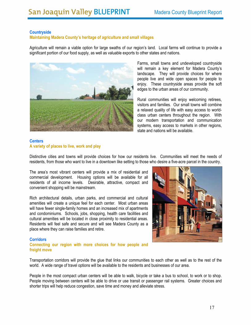
Countryside Maintaining Madera County’s heritage of agriculture and small villages Agriculture will remain a viable option for large swaths of our region’s land. Local farms will continue to provide a significant portion of our food supply, as well as valuable exports to other states and nations.
Farms, small towns and undeveloped countryside will remain a key element for Madera County’s landscape. They will provide choices for where people live and wide open spaces for people to enjoy. These countryside areas provide the soft edges to the urban areas of our community. Rural communities will enjoy welcoming retirees, visitors and families. Our small towns will combine a relaxed quality of life with easy access to world-class urban centers throughout the region. With our modern transportation and communication systems, easy access to markets in other regions, state and nations will be available.
Centers A variety of places to live, work and play Distinctive cities and towns will provide choices for how our residents live. Communities will meet the needs of residents, from those who want to live in a downtown like setting to those who desire a five-acre parcel in the country. The area’s most vibrant centers will provide a mix of residential and commercial development. Housing options will be available for all residents of all income levels. Desirable, attractive, compact and convenient shopping will be mainstream. Rich architectural details, urban parks, and commercial and cultural amenities will create a unique feel for each center. Most urban areas will have fewer single-family homes and an increased mix of apartments and condominiums. Schools, jobs, shopping, health care facilities and cultural amenities will be located in close proximity to residential areas. Residents will feel safe and secure and will see Madera County as a place where they can raise families and retire. Corridors Connecting our region with more choices for how people and freight move Transportation corridors will provide the glue that links our communities to each other as well as to the rest of the world. A wide range of travel options will be available to the residents and businesses of our area. People in the most compact urban centers will be able to walk, bicycle or take a bus to school, to work or to shop. People moving between centers will be able to drive or use transit or passenger rail systems. Greater choices and shorter trips will help reduce congestion, save time and money and alleviate stress.
17

Madera County Blueprint Report
Chapter 8 How We Get There: Action Plan & Implementation Strategy Action Plan & Implementation Strategy Through our Blueprint planning process, we have identified six principles that will guide future growth decisions for Madera County, as well as the actions necessary to implement each principle:
PRESERVE open space, recreational areas, farmland, water resources and regionally significant natural areas.
PROVIDE a variety of transportation choices.
FOSTER distinct, attractive and safe places to live.
ENCOURAGE a diverse, globally competitive economy.
CREATE a range of obtainable housing opportunities and choices.
BUILD communities with educational, health care and cultural amenities.
Preserve open space, recreational areas, farmland, water resources and regionally significant natural areas Preserving and enjoying our natural resources is what matters most to our citizens. This is the foundation of our shared regional vision – the principle that above all we must follow if our region is to become the place where our children and grandchildren would want to live in 2050. 1. Identify the “must save” lands.
The centerpiece of the regional vision is a “greenprint,” which is a plan for an inter-connected network of conservation lands, open space, and recreational areas.
2. Invest in preserving these critical lands. Dedicated public funding will be one way to purchase lands for this “greenprint.” However, conservation also
can occur through private investment. Incentives can encourage landowners to conserve greenprint lands and other open space, and to set aside lands for preservation as part of major development projects. 3. Ensure that residents can easily access recreational areas. It is not enough to conserve lands; we also must make sure we can access and enjoy nature. Communities will be designed so that the vast majority of our residents are within a short walk or bike ride from a green space. Appropriate transportation access also will be needed to recreational areas located outside of the urban areas.
18

Madera County Blueprint Report
4. Develop in a sensitive manner. The environment will be a critical factor in future decisions about public and private investment in our region. Development should focus in existing centers and other areas that do not pose significant risk to environmental resources and that reduce the overall land required to support future growth. Transportation corridors should impact sensitive lands only when absolutely necessary to connect centers, and then only when access to these corridors can be restricted to avoid drawing even more growth into the area. The design of buildings and infrastructure also should help reduce the region’s water consumption, greenhouse gas emissions, and other “footprints” on the environment.
5. Encourage sustainable agriculture. Agriculture should remain a viable option for our land to provide part of our food supply and to serve export markets. Local governments, land owners, and farmers should work together to promote the importance of agriculture, to retain suitable lands in agriculture, and to ensure that farming remains economically and environmentally viable.
6. Plan for future water needs. The region also should develop strategies for providing sufficient water and ensuring that water supply is in place to support new development. A regional water resources plan should include strategies for reducing consumption, sharing available water sources, and developing alternative water sources.
Provide a variety of transportation choices Transportation is the key factor that will shape urban and rural development around the greenprint. The region’s transportation investments will support the shared regional vision by providing: 1. Connectivity between centers and to other regions.
Existing or new corridors will connect the city centers within the region. Where possible, the preference should be to enhance existing corridors, but new corridors may be needed where there are “gaps” in this system. It also will be important to work with the state to enhance the corridors that connect Madera County
to other parts of California, other states, and other nations, using a mix of road, rail, water, and air. 2. Congestion relief. Madera County’s residents desire to spend less time traveling, and our businesses are looking for ways to reduce the cost and improve the reliability of moving goods. Our regional transportation strategy will include ways to reduce traffic delays, such as eliminating bottlenecks and creating more travel options.
19

Madera County Blueprint Report
3. Choices for moving people and goods. Residents of Madera County envision a regional transit system that connects existing and future urban centers in all parts of the region. They also envision local light rail, street car, or bus rapid transit systems that connect neighborhoods with the regional transit service. They seek to expand the use of freight rail, and high-speed passenger rail, to move people and freight between Madera County and other regions. They also desire a system of greenways and trails for walking or bicycling. A regional transportation plan should identify where these choices are most feasible, and set priorities to implement these investments.
4. Concurrency with new development. Local governments should work with developers to implement needed roads and transit systems in parallel with anticipated growth. This balancing of growth and infrastructure should occur at both local and regional levels to better address impacts of growth that spill over city or county lines. Regional standards can help ensure that development in one county or municipality does not adversely impact other counties or municipalities.
Foster distinctive, attractive and safe places to live Centers ranging from villages to towns to cities will be the region’s focal point for future development. Our region already offers many choices for where and how we live. How can we expand these options and create new ones in the future? 1. Enhance existing communities.
Each community should develop according to the size and character envisioned by its residents, consistent with the shared regional vision. Some communities may choose to create compact developments that can accommodate more residents; others may redevelop and redesign downtowns and central business districts to be more inviting; still others may remain much the same as they are today, whether they are rural communities or urban centers.
2. Create new centers. A small number of new centers may be created at locations that are suitable for compact development. These locations should reflect market demand, avoid critical environmental lands, and be connected to existing or planned transportation corridors.
3. Encourage creativity. The development of our cities, towns, and other centers should reflect the diversity of our people and our economy. Incentives could be provided for creative design practices; developing mixed land uses, creating more compact centers located close to regional transit stations and expressway interchanges; and implementing “green” community designs that support a reduced urban and environmental footprint.
4. Meet the unique needs of key population groups. The region should develop centers that appeal to people of all ages and walks of life. Some centers may be family friendly with good schools and child care; others may appeal to active retiree populations by providing accessible health care and recreational and cultural amenities.
20
Madera County Blueprint Report
5. Provide peace of mind. 5. Provide peace of mind. From the smallest neighborhood to the largest city, residents of each community seek to feel safe and secure. The public and private sectors will consider public safety, public health, and emergency evacuation needs in community design decisions.
From the smallest neighborhood to the largest city, residents of each community seek to feel safe and secure. The public and private sectors will consider public safety, public health, and emergency evacuation needs in community design decisions.
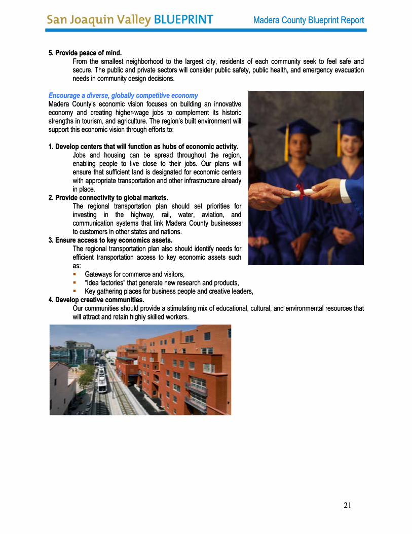
Encourage a diverse, globally competitive economy Encourage a diverse, globally competitive economy Madera County’s economic vision focuses on building an innovative economy and creating higher-wage jobs to complement its historic strengths in tourism, and agriculture. The region’s built environment will support this economic vision through efforts to:
Madera County’s economic vision focuses on building an innovative economy and creating higher-wage jobs to complement its historic strengths in tourism, and agriculture. The region’s built environment will support this economic vision through efforts to: 1. Develop centers that will function as hubs of economic activity. 1. Develop centers that will function as hubs of economic activity.
Jobs and housing can be spread throughout the region, enabling people to live close to their jobs. Our plans will ensure that sufficient land is designated for economic centers with appropriate transportation and other infrastructure already in place.
Jobs and housing can be spread throughout the region, enabling people to live close to their jobs. Our plans will ensure that sufficient land is designated for economic centers with appropriate transportation and other infrastructure already in place.
2. Provide connectivity to global markets. 2. Provide connectivity to global markets. The regional transportation plan should set priorities for investing in the highway, rail, water, aviation, and communication systems that link Madera County businesses to customers in other states and nations.
The regional transportation plan should set priorities for investing in the highway, rail, water, aviation, and communication systems that link Madera County businesses to customers in other states and nations.
3. Ensure access to key economics assets. 3. Ensure access to key economics assets. The regional transportation plan also should identify needs for efficient transportation access to key economic assets such as:
The regional transportation plan also should identify needs for efficient transportation access to key economic assets such as:
Gateways for commerce and visitors, Gateways for commerce and visitors, “Idea factories” that generate new research and products, “Idea factories” that generate new research and products, Key gathering places for business people and creative leaders, Key gathering places for business people and creative leaders,
4. Develop creative communities. 4. Develop creative communities. Our communities should provide a stimulating mix of educational, cultural, and environmental resources that will attract and retain highly skilled workers. Our communities should provide a stimulating mix of educational, cultural, and environmental resources that will attract and retain highly skilled workers.
Madera County Blueprint Report
21
21
Madera County Blueprint Report
Create a range of obtainable housing opportunities and choices The region’s housing stock is becoming less affordable due to rapid price increases and limited wage gains. Housing is increasingly out of reach not just for the working poor, but also for the teachers, nurses, police, firefighters, and other public servants who are so essential to our communities. Obtainable housing for residents from every walk of life is integral to our future. We will work together to:
1. Set regional goals How to make housing more obtainable in the region for both owners and renters and how to maintain this affordability over time. 2. Educate citizens about obtainable housing. Better understanding about affordable housing will help debunk myths, relieve fears, and otherwise reduce opposition to placing more obtainable housing in communities. 3. Balance the geographic distribution of obtainable housing. All types of communities, not just urban centers, should provide an appropriate share of the region’s obtainable housing. Where possible, the design of
obtainable housing should be integrated with market rate housing in the communities in which it is located. Without a diverse array of suitable housing locations, workers will be forced to live further from their jobs.
4. Provide incentives for obtainable housing. Dedicated public funding will continue to be one source of investment in obtainable housing. Creative solutions can help leverage public funding, such as community land trusts, developer incentives, and co-location of housing for essential service workers on school properties and other public lands.
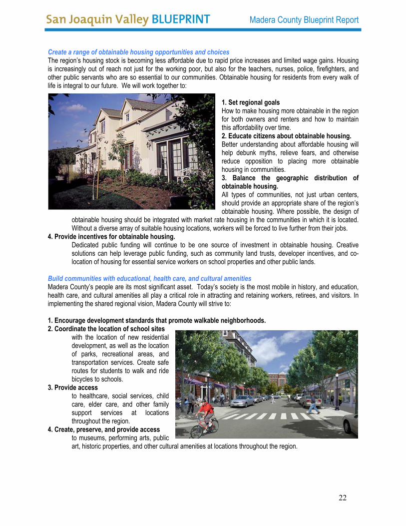
Build communities with educational, health care, and cultural amenities Madera County’s people are its most significant asset. Today’s society is the most mobile in history, and education, health care, and cultural amenities all play a critical role in attracting and retaining workers, retirees, and visitors. In implementing the shared regional vision, Madera County will strive to: 1. Encourage development standards that promote walkable neighborhoods. 2. Coordinate the location of school sites
with the location of new residential development, as well as the location of parks, recreational areas, and transportation services. Create safe routes for students to walk and ride bicycles to schools.
3. Provide access to healthcare, social services, child care, elder care, and other family support services at locations throughout the region.
4. Create, preserve, and provide access to museums, performing arts, public art, historic properties, and other cultural amenities at locations throughout the region.
22

Madera County Blueprint Report
Chapter 9 Working Together: Staying Focused on a Common Goal What must we do next? 5 Regional Actions The decisions that we make today about growth will shape Madera County’s future over the next 50 years. The public and private organizations who have participated in this planning process commit to the following five actions to initiate implementation of the shared regional growth vision.
KEEP WORKING TOGETHER
We will continue to meet as regional leaders to review progress toward the regional vision, and begin the hard work of carrying out key actions. The San Joaquin Regional Blueprint Planning Committee will continue to meet on a regular basis to discuss the growth issues and policies. We will also establish a forum for public, private and civic organizations representing all disciplines – environment, transportation, land use, economic development, housing, education, health, safety and others to meet on a continuing basis. DEVELOP A REGIONAL “GREENPRINT” In painting the canvas of our region for the next 50 years, the first colors we will use are green and blue, for our critical lands and waters. We will develop a strategy to effectively weave together Madera County’s environmental and urban systems to sustain, protect, and provide access to our exceptional natural resources. State and local governments, landowners, and environmental interests will define the “greenprint” of critical lands and waters, and use public funding and private incentives to set aside these lands, waters, other open space, and recreational areas. In doing so, we will preserve the best of our region for our children and grandchildren. DEVELOP REGIONAL TRANSPORTATION CORRIDORS We next will paint our region gray, as we develop the transportation and other infrastructure that connect our city centers to each other and to other regions, states, and nations. Our transportation corridors will link our centers into a region, and, together with the greenprint, will establish the broad framework for where future growth will occur. We will develop a comprehensive, long-range regional transportation plan that will enhance connectivity, relieve congestion, and expand travel choices. We will give particular emphasis to developing regional transit corridors that can serve as the future backbone for travel, much like the major highways do today. To do so, we will expand planning activities across all jurisdictions and across all modes—highway, rail, water, air, and space.
UNLEASH CREATIVITY We then will use the complete palette of colors to paint our region with distinctive neighborhoods, villages, towns, and cities. Through market forces and incentives, we will encourage our local governments and developers to imagine and then implement creative solutions for reducing sprawl, promoting compact development, designing distinctive places, making housing more affordable, and growing economic centers of excellence. We will begin the detailed process of revising regional and local plans, regulations, and processes to convert these dreams into reality.
MEASURE, INSPECT AND IMPROVE Finally, we will regularly monitor the progress of the region toward implementing the shared regional vision, determine where we are falling short, and make the midcourse corrections necessary to keep us on track. We will work with other partners to develop an annual regional progress report, and periodically convene regional leaders to make adjustments to the vision and related plans.
23

Madera County Blueprint Report
Appendix A Modeling the Alternative Scenarios Using UPLAN The following section provides additional detail and specifics regarding development of the UPLAN modeling process applied to analyze the four land use and transportation scenarios as referenced in Chapter 2. Land Use Categories The various land use categories in the General Plans for each of the cities and the County were compared to the 15 category definitions referenced in Table A1 in an effort to best match their definitions to the definitions listed in the table.
Table A1 - UPLAN Land Use Definitions Residential Uses General Plan Residential Land Use Designations
Density Range (units/acre)
Lots Size Range Gross (Sq.Ft.)
Average Lot Size Gross (Sq.Ft.) *
Very Low Density <2 > 22,000 75,000 Low Density 2.01-6.5 6,700-22,000 10,750 Medium Density 6.51-12.00 2,900-6,700 5,500 High Density >12.00 2,000 -2,900 2,400 Mixed Use >12.00 2,000-2,900 2,400 Employment Uses
General Plan Residential Land Use Designations F.A.R.*
Density Range (jobs/acre)+
Square Feet (building) per Employee*
High Density Commercial 0.4 36.00-48.00 400 Low Density Commercial 0.2 15.00-35.99 500 Industrial 0.2 10.65 825 Mixed Use 0.4 36.00-48.00 400 Other Uses Agriculture Urban Reserve Public Lands and Open Space Government Jobs Water Bodies Education + Density Ranges are based on SJVGRS project assumptions * Columns in Orange are UPLAN inputs
The allocation categories were matched to the different General Plan categories. In UPLAN 2.1, the allocation priority is fixed with the first allocation being Industrial growth and the last being Very low Density Residential. The sequence primarily allocates higher intensity uses first, then moves down to lower intensity uses. In the Madera County Blueprint Process, the Consultant Team limited the allocation to the respective General Plan categories. However, it did allow for higher intensity commercial growth allocated to lower intensity uses and vice versa. This was done with the knowledge that high intensity growth will be allocated first and if there was extra growth still to be allocated and available are under that category; low intensity commercial could fill that in order to avoid gaps in development. A similar approach was used in allocating low and medium density residential growth as well. Only the Urban Reserve category was allowed to accept residential and employment uses. Table A2 identifies the allocation uses that were assigned to the different General Plan categories.
24

Madera County Blueprint Report
Table A2 - UPLAN Land Use Allocation UPLAN LAND USES TYPE
Valu
e General Plan Value Definition
Indu
stria
l
Com
Hig
h
Res
Hig
h
Com
Low
Res
Med
Res
Low
Res
V L
ow
1 Agriculture X
2 Industrial x
3 High Density Commercial x x
4 Low Density Commercial x
5 High Density Residential x
6 Medium Density Residential x x
7 Low Density Residential x x
8 Public Lands & Open Space
9 Water Bodies
10 Urban Reserve x x x x x
11 Planned Development x x x x
12 Mixed Uses x x
13 Very Low Density Residential x
14 Government Jobs
15 Schools
Selection Criteria for Existing Developable/Non-developable Parcels
Developable Land Criteria (1): Rural Residential Land In the County area, the parcels considered Rural Residential that are larger than 5 acres were allowed to be subdivided while those smaller than 5 acres are considered ‘not-developable’. This rule applied outside of any city's sphere of influence areas. If the Rural Residential falls inside of the sphere of influence, it will be considered as re-developable if the General Plan land use designation was different than Rural Residential.
Criteria (2): Non-residential Urban Lands I STATUS QUO & LOW CHANGE SCENARIOS: For non-residential uses in urban areas, parcels were selected where the non-residential density was 50 percent or less than the permitted General Plan Floor Area Ratio (FAR) and if the building’s age was available and was older than 25 years. If the existing use fit into this criterion, it was reviewed considering the classification parameters of Criteria 3 below. MODERATE CHANGE SCENARIO: For non-residential uses in urban areas, parcels were selected where the non-residential density was 70 percent or less than the permitted General Plan FAR and if the building age was available and was older than 10 years. If the existing use fit into this criterion, it was reviewed considering the classification parameters of Criteria 3 below.
25

Madera County Blueprint Report
MAJOR CHANGE SCENARIO: For non-residential uses in urban areas, parcels were selected where the non-residential density was 80 percent or less than the permitted General Plan FAR and if the building age was available and was older than 1.25 years. If the existing use fit into this criterion, it was reviewed considering the classification parameters of Criteria 3 below. Note: All parcels that were classified as Criteria 2 but did not meet Criteria 3 were marked as 'Not Developable'.
Criteria (3): Non-residential Urban lands II (Infill) Parcels meeting Criteria (2) and having an improvement value that is equal to, or less than, the land value as recorded by Assessor’s parcel data were identified as developable land. Criteria (4): Re-developable Residential Parcels (Infill) STATUS QUO & LOW CHANGE SCENARIOS: Parcels identified with an improvement value that was less than 50 percent of land value (likely an unused building) and were greater than 1 acre in land area in urban areas were identified as residential uses that can redevelop. MODERATE CHANGE SCENARIO: Parcels identified with improvement value is less than 70 percent of land value, and were greater than 0.75 acre in land area in urban areas were identified as residential uses that can redevelop. MAJOR CHANGE SCENARIO: Parcels identified with improvement value is less than 80 percent of land value, and WERE greater than .50 acre in land area in urban areas were identified as residential uses that can redevelop. Criteria (5): Vacant Land All parcels that were identified as Vacant. Criteria (6): Developable Agricultural Land All Agricultural Land within City Spheres of Influence. Non Developable Land Criteria (7): Non Developable Residential Parcels All Residential uses in Urban Areas that did not meet Criteria (4) or Criteria (1) Criteria (8): Public Uses All Public Uses, Parks, Schools, Institutions, Roads and ROW easements. Criteria (9) Non Developable Commercial Parcels All employment uses (Commercial/Office/Industrial) that do not match Criteria (2) and (3). Criteria (10) Proposed Developments All proposed developments collected from local jurisdictions and available in Assessor’s parcel data. Criteria (11): Preserved Lands All agriculture land, open space, and water bodies that are classified as agriculture land, open space, conserved lands and water bodies in the General Plans.
26

Madera County Blueprint Report
Appendix B Analyzing the Alternative Scenarios This appendix provides details regarding each of the alternative scenarios analyzed using UPLAN software, as well as specifics regarding consideration of urban area attraction priorities, prime farm lands, a review of alternative parameters applied to each scenario during the modeling process, and results of the evaluation parameters comparing the benefits of each of the four scenarios. Urban Area Attractors The UPLAN model allocates housing and employment based upon ratings assigned to specific attractors and discouragers. The urbanized areas of different cities and communities (Spheres of Influence) were utilized as attractors to growth. However, the priority of attraction was varied to simulate the different levels of attractiveness and real world trends. Eight areas were utilized: 1) Rio Mesa Area 4) Madera Community College Area 7) North Fork 2) City of Madera 5) Fairmead 8) Ahwahnee 3) City of Chowchilla 6) Oakhurst The prioritization of these areas was accomplished in consultation with the Blueprint Roundtable and was modified across the different scenarios (reference Table B1). Primarily the most attractive areas were Rio Mesa and the City of Madera, whereas North Fork and Ahwahnee were the least attractive. Prime Agricultural Land Discouragement The data collected from the State about prime agricultural land was combined with the assessor’s data identifying preserved agricultural land to create a layer of high quality farmland on which new growth was severely discouraged. Figure B1 provides a view of agricultural lands within Madera County based upon the sources identified above. Furthermore, local inputs about prime farmland west of highway 99 lead to restricting new growth close to highway 99 and in pocket of areas with poor agricultural land west of the highway. FIGURE B1 - Prime Agricultural Lands
27

Madera County Blueprint Report
Table B1 - Madera County Blueprint Alternative Parameters
28

Madera County Blueprint Report
Alternative Scenarios Status Quo
This scenario (reference Figure B2) was to evaluate the impacts of growth as it has happened in the past and would continue without a shift in direction. The densities of residential uses and the intensity of employment uses were kept at prevailing trends. The distribution of jobs and household types were also kept to the prevailing present trend. The transportation infrastructure was limited to new freeway off-ramps and the existing regional transit network. Preservation of agricultural lands and environmentally sensitive land was given some consideration.
FIGURE B2 – Status Quo Scenario
Low Change This scenario (reference Figure B3) was developed as a variant of the Status Quo scenario wherein the demand for the different housing types would shift slightly towards higher densities, and the lot sizes would reduce by 15-20% for single-family and multi-family parcels. The transportation infrastructure was similar to the status quo, but an enhanced transit system based upon the existing regional transit network was utilized. Preservation of agricultural lands and environmentally sensitive land was given more consideration than under the Status Quo Scenario.
FIGURE B3 – Low Change Scenario
29

Madera County Blueprint Report
Moderate Change
This scenario (reference Figure B4) shifts further the demand for housing towards higher densities. In addition to the housing shift, it also assumes a change in the distribution of employment from retail to more service and industrial oriented jobs. The transportation infrastructure builds on top of the previous scenarios with the addition of Bus Rapid Transit (BRT) routes connecting the city centers of Madera and Chowchilla to the Rio Mesa/Southeast Madera County area where a Light Rail Transit (LRT) line along the SR41 corridor connecting with Fresno. Preservation of agricultural lands and environmentally sensitive land was given similar consideration than the Low Change Scenario.
FIGURE B4 – Moderate Change Scenario Major Change This scenario (reference Figure B5) assumes a large shift in the demographics of the County, wherein there would be a stronger demand for urban living and service oriented jobs within the urban centers. This scenario would double the share of housing to 30 percent for high density residential, while significantly reducing rural residential and agricultural residential uses in the County. The transportation infrastructure improvements include further enhancement of the BRT routes within the cities of Madera and Chowchilla and adds an additional LRT stop further north into Southeast Madera County. Preservation of agricultural lands and environmentally sensitive land was given the highest consideration of all of the Scenarios.
FIGURE B5 – Major Change Scenario
30

Madera County Blueprint Report
31
Scenario Evaluation and Comparison of Benefits The model results were evaluated utilizing parameters developed by Kern County. It predictably showed that the Major Change Scenario showed the lowest land consumption as well as resource consumption. The charts comparing the performance of all the indicators are shown below.
Megawatt Hours Consumed
860,000
880,000
900,000
920,000
940,000
960,000
980,000
Stat
us Q
uo
Low
Chan
ge
Mod
erat
e Ch
ange
Majo
r Cha
nge
CO2 Emmision (tons)
423.40419.48
408.75
393.66
375380385390395400405410415420425430
Stat
us Q
uo
Low
Chan
ge
Mod
erat
e Ch
ange
Maj
or C
hang
e
1000
Ton
s
Household per Acre % Increase
143% 142%
112%
100%
0%
20%
40%
60%
80%
100%
120%
140%
160%
Major Change Moderate Change Low Change Status Quo
Population Density (person/acre)
13.515.2
19.2 19.3
0.0
5.0
10.0
15.0
20.0
25.0
Status Q
uo
Low C
hange
Moderat
e Cha
nge
Major C
hang
e
Water Consumption(Acre/ft)
500
509
525
537
480
490
500
510
520
530
540
Stat
us Q
uo
Low
Chan
ge
Mod
erat
e Ch
ange
Maj
or C
hang
e
Acr
efee
t(M
illio
ns)