logan city council - logan.qld.gov.au · 1. introduction 1.1. purpose the purpose of this report is...
TRANSCRIPT

Logan City Council Phone: 3412 5269
PO Box 3226 Logan Central QLD 4114 Email: [email protected]
Document Reference: #8813686 Web: logan.qld.gov.au
Logan City Council
Planning Assessment Program
Standard Development Approval Conditions
3 July 2017
Version 12
1. INTRODUCTION
1.1. Purpose
The purpose of this report is to provide a suite of standard conditions to be included in development permits issued by the Logan City Council. The report provides a discussion on the basis of the standard conditions and guidance on the preparation of conditions.
1.2. Background and Key Matters
Conditions are a key element of development approvals. Along with approved plans and reports, conditions are a key mechanism for on the ground realisation of the development and land use aspirations of the City as expressed in the Planning Scheme. From this perspective it is important that conditions convey the broader desired planning outcomes and objectives for the City at a site by site, development by development level.
Furthermore, it is important that Council promotes consistency in condition writing. Standard conditions can be applied across a variety of circumstances, whereas unique conditions will still be required where specific circumstances require. In order to improve efficiency, consistency and ease of understanding a standard suite of conditions is required that is also complemented by a consistent philosophy to preparing conditions.
While the conditions are not a legal opinion, they have been prepared with legal peer review. In any case, where possible legal issues are identified, relevant legal advice should be sought.
1.3. Approach
The following approach was adopted for the project: • Stage 2 – Inception/Stakeholder Consultation • Stage 3 – Formulation of Draft Conditions Package • Stage 4 – Refinement • Stage 5 – Peer Review • Stage 6 – Final Set of DA Conditions

2. BASIS FOR DRAFTING AND APPLYING CONDITIONS
2.1. Outline
The following section forms the basis for which the standard conditions have been drafted. This guidance was formulated on the basis of discussions with Council regarding the expectations of the standard conditions suite, legal peer review and past experience in dealing with development conditions.
The following refers to requirements of both the repealed Sustainable Planning Act 2009 (SPA) (to the extent that SPA may still be relevant to approvals granted under this act) and to the Planning Act 2016 (PA), however the intention is not to provide a detailed legal interpretation of condition drafting. This information is not a legal opinion and where possible legal issues are identified, relevant legal advice should be sought.
2.2. Statutory Powers for Conditions
Council’s power to impose conditions to development permits and preliminary approvals is a statutory power prescribed under section 324 of the SPA and section 60 of the PA.
The limitations to imposing conditions are stipulated in sections 344 to 349 of the SPA (i.e. Division 6 of Part 5 of Chapter 6) and sections 65 to 67 of the PA generally. For conditions relating to development infrastructure, the limitations are stipulated in the following sections —
Condition type SPA (Ch 8, Pt2)
PA (Ch4, Pt 2)
Necessary infrastructure condition - LGIP identified infrastructure
645, 646, 648
127,128
Necessary infrastructure condition - for other infrastructure 645, 647, 648
127, 128
Condition for additional trunk infrastructure costs / extra trunk infrastructure costs
650 - 653 130 - 133
Non-trunk infrastructure 665 145
For each condition about development infrastructure imposed under these sections, the decision notice must state the provision under which the condition was imposed
2.3. Common Law Tests
In interpreting and applying the above statutory requirements the courts have developed a number of tests to assist. It should be noted that the SPA and the PA are the sole instruments that gives the power for Councils to impose conditions and limit the application of conditions. Common law principles have developed in courts merely to assist with the interpretation of provisions of these acts. The following provides an outline of the test:
1. Reasonable and Relevant (s345 SPA/s65 PA)
Neither the SPA or the PA define the terms ‘reasonable’ and ‘relevant’. As such a common law test was developed in Newbury District Council v Secretary of State for the Environment [1981] AC 578 as follows:
• Conditions must be for a planning purpose – what constitutes a planning purpose has been further explored and may be determined by reference to the purposes for which the decision maker was entrusted with the particular discretion.
• Conditions must fairly and reasonably relate to the application– in considering this it is necessary to determine the changes that are likely to emerge from the development and whether the conditions are related to those changes.

• Conditions must not be so unreasonable that no reasonable planning authority could have imposed them– this principle has been further developed in a number of cases. Conditions which are not considered reasonable include:
• Conditions that are manifestly arbitrary, unjust or exhibit partiality; • Conditions that are uncertain (refer Principle 2 below) (Shilling v Cairns City Council
[1988] QPLR 243); • Conditions that require constant supervision by the assessment manager (Merv
McKeown Carpets Pty ltd v Brisbane City Council [1977] QPLR 200.
The principle of reasonable and relevance has been litigated on several occasions. An example of its application was in Neilson v Gold Coast City Council and Anor [2004] QPEC 089 (reviewed by Wright, 2007), where a shopping centre would bring forward the upgrading of a state controlled roundabout from 2013 to 2010. Expert studies showed that the development would create between 9-12% of the demand necessitating the upgrade. A condition of the development permit was that the applicant pay 100% of the costs of the upgrade. The Court held that the condition was relevant to the development, but that amount of the contribution was an unreasonable imposition on the development pursuant to s3.5.30(1) of the Integrated Planning Act 1997 (IPA).
The court found that it was unreasonable for a minor user to be made to pay for the whole of the works. The Court struck out the condition and substituted the contribution with a ‘bring forward’ amount (11.3% of total upgrade cost) that represented the extra costs of performing the upgrade 3 years ahead of schedule.
It is evident from the above that even where the condition may be relevant to the development, it may not be reasonable and therefore cannot be imposed.
2. Finite and Certain
In addition to the reasonable and relevance common law test, the court also applies the test of finite and certain. In order for conditions to achieve this, the following should be applied:
• Certainty – for a condition to have certainty it must not prejudice the completeness of the approval and must lawfully identify the applicant’s rights and responsibilities; and
• Finality – for a condition to have finality it must be definitive or irrevocable so that undertaking the development does not depend on the making of further discretionary decisions.
The key issue is the compliance and enforcement of the condition. Where the condition lacks specificity, it is difficult for enforcement and compliance matters to be established. The criteria for setting a charge or standard should be clear and any matter of importance should be finally determined rather than left to a subsequent discretionary judgement.
2.4. Approaches to Drafting & Applying Conditions
Further to the above, there are also a several recommended drafting approaches and considerations of how conditions will be applied which should be considered:
Approaches to Drafting
• Conditions will be the exceptions and will not state the obvious. By this, it is meant that the conditions will not simply state matters such as “the stormwater management system shall comply with standard” or “the system shall function properly”. In this instance, the application should not be approved if the system is assessed to not work properly or has been designed not in accordance with a relevant standard. Likewise, if a subsequent approval (operational works) is required, then that assessment will apply the relevant standards in that process.
• Conditions will be the “enabler” of achieving the intent of the Planning Scheme and other Council policies. Applying this approach provides conditions for meeting the outcomes of the planning scheme. An example is the inclusion of a condition to require privacy screening to be constructed and then maintained in order to meet the scheme’s requirement for amenity.
• Conditions should not change the nature of the application. An assessment manager cannot impose conditions which abrogate the basic characteristics of the application.

• Advice that is included in a permit/approval will be minimal or not included at all. Advice relating to standard conditions may be addressed by a stand alone Council policy document that provides advice regarding why certain conditions are applied. It is observed that the inclusion of advice has led to unnecessary requests for negotiated decisions and appeals where it has been sought to amend the advice included with permits.
• Conditions will typically start with a verb. This approach provides the intent for conditions to require action of some sort rather than being a statement.
Considerations for Applying Conditions
• The approved plans, drawings and documents should stand on their own and are the principle point of reference in the permit. In addition, it is recognised that conditions are necessary in circumstances where specific requirements need emphasis and where particular details are not shown on plans.
• Timing will be “prior to commencement of use” or “prior to plan sealing” or “prior to commencement of works” and at no cost to Council unless otherwise stated. All conditions packages will contain a condition to this effect and will avoid repeating this timing statement in conditions.
• Conditions should only be applied where the submitted material does not identify that aspect of development (e.g. a fence condition should not be applied where the approved plan already shows it); or to provide the “link” to further works or those things approved plans need to operate (such as the generally in accordance condition).
• Conditions should not be used as the stop-gap to make up for significant shortfalls in the application – where such occurs, other options should be considered including refusal and preliminary approvals (particularly where a number of attempts have been made to gain the desired information).
• A condition should not be impossible or difficult to enforce. This should particularly be considered in reference to restricting hours of operation or levels of noise.
• Standard conditions will only provide the common elements of a conditions package and unique conditions will still be required where the specific circumstances require.
2.5. Drafting Conditions – Do’s and Don’ts
The following list provides practical guidance on aspects of drafting conditions. While a general guide is provided here, the nature of conditions is specific to a development so modification of standard conditions may occur to suit the according development needs and the desired outcome.
DO Start conditions with a verb such as: “provide”, “construct”, “maintain”, “rehabilitate”, “manage”, “establish”, “implement”, “demonstrate”, “submit”
DO Use plain English and avoid long multiple stepped conditions
DO Refer to specific reports, plans or other supporting application material where these provide and/or fulfil the desired outcome
DO Remember that the condition you write has to be interpreted by others such as private building certifiers, plan sealing and compliance officers – who may not understand the technical basis for complex and/or esoteric conditions
DO Require that when a condition requires a further submission of material, the condition described the criteria for that condition being fulfilled (i.e. typically an approval via a Condition Certificate) – the action loop must be closed
DO Always ask “how will we enforce this condition?” as a test of the condition drafting
DO Modify standard conditions to be more specific as the development requires
DO Staging in a sequence & specific to each condition
DON’T Attribute action/conditions to the applicant, developer or other individual/entity as the conditions run with the land, not persons and apply to whoever ends up undertaking the conditions – this is particularly relevant where conditions require an ongoing responsibility such as monitoring, regular

reporting and management
DON’T Use “what if” conditions as these are not specific/relevant to the development and where they do not apply, they should not be included (they are not relevant and therefore not reasonable)
DON’T
Apply conditions that are superfluous and not relevant such as “building is not to exceed 8.5 metres” where the approved plans show the height to be less – where the approved plans and/or reports are part of the approval and referred to, there is no need to add further conditions regarding those matters
DON’T Use discretionary terms such as “should”, “could” or “may” as these are not finite and imply that there is an alternative course of action/inaction that can apply
DON’T Re-state the content of standards, criteria, solutions or codes that are in a planning scheme or other relevant legislation, policies or codes
DON’T Use terms such as “to the satisfaction of…” as this is not finite, a finite approach is to require “in accordance with standard AS***” or “in accordance with Planning Scheme Policy ***”
DON’T Use town planning jargon (such as terms like “create visual interest”), adjectives and legal sounding terms (such as henceforth, herewith and forthwith)
3. GUIDE TO THE STANDARD CONDITIONS SUITE
3.1. Overview
The following provides guidance for the interpretation and use of the standard conditions suite’s general structure and development permits, the use of conditions and subsequent approvals/consents as required.
3.2. Conditions Suite Structure
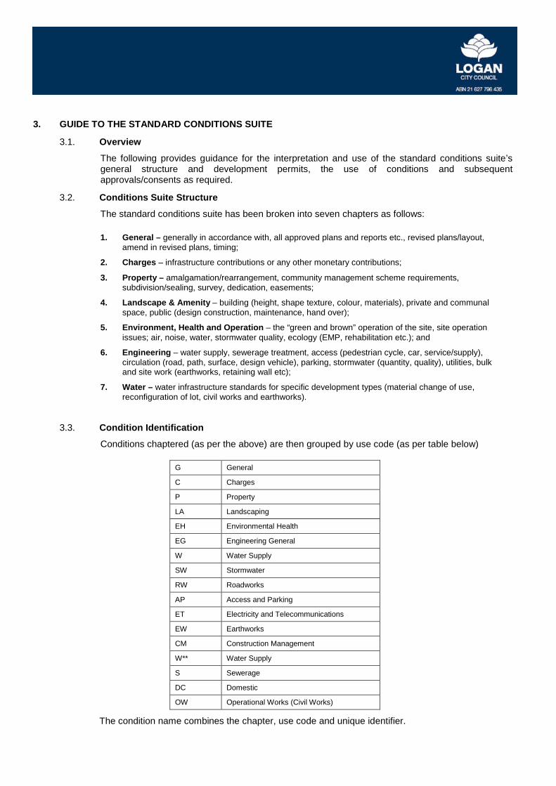
The standard conditions suite has been broken into seven chapters as follows:
1. General – generally in accordance with, all approved plans and reports etc., revised plans/layout, amend in revised plans, timing;
2. Charges – infrastructure contributions or any other monetary contributions;
3. Property – amalgamation/rearrangement, community management scheme requirements, subdivision/sealing, survey, dedication, easements;
4. Landscape & Amenity – building (height, shape texture, colour, materials), private and communal space, public (design construction, maintenance, hand over);
5. Environment, Health and Operation – the “green and brown” operation of the site, site operation issues; air, noise, water, stormwater quality, ecology (EMP, rehabilitation etc.); and
6. Engineering – water supply, sewerage treatment, access (pedestrian cycle, car, service/supply), circulation (road, path, surface, design vehicle), parking, stormwater (quantity, quality), utilities, bulk and site work (earthworks, retaining wall etc);
7. Water – water infrastructure standards for specific development types (material change of use, reconfiguration of lot, civil works and earthworks).
3.3. Condition Identification
Conditions chaptered (as per the above) are then grouped by use code (as per table below)
G General
C Charges
P Property
LA Landscaping
EH Environmental Health
EG Engineering General
W Water Supply
SW Stormwater
RW Roadworks
AP Access and Parking
ET Electricity and Telecommunications
EW Earthworks
CM Construction Management
W** Water Supply
S Sewerage
DC Domestic
OW Operational Works (Civil Works)
The condition name combines the chapter, use code and unique identifier.

3.4. Condition Format
The condition name combines the chapter, use code and unique identifier. An explanation of the table structure is provided below:
Condition Name: P4 - Easement(s)
Explanation:
Condition Name sets out the use code (i.e. Property 4) and the actual name of the condition. It will be Council’s discretion whether the use codes are included for easy reference.
Conditions:
# Lodge for registration at the office of the Land Registry the following easement(s):
#.1 an access and services easement having a minimum width [INPUT – of # metres / as shown on the approved plan(s) of development] burdening proposed Lot [INPUT – # ] to the benefit of proposed Lot [INPUT – # ].
#.2 an access and services easement having a minimum width [INPUT – of # metres / as shown on the approved plan(s) of development] burdening proposed Lot [INPUT – # ] to the benefit of proposed Lots [INPUT – # and #] that then reduces in width with a 450 taper [INPUT – to # metres / as shown on the approved plan(s) of development] burdening proposed Lot [INPUT – # ] to the benefit of proposed Lot [INPUT – # ] from the point where there is one less lot benefited by the easement.
Explanation:
Where an [INPUT] is included Conditions will require further information to be inputted. This may include references to standards or other guidelines or to development specific parameters (e.g. dimensions). Ensure that where no further information is required, the [INPUT] text is deleted and that the remaining text is understandable. Furthermore, if information is inputted ensure that the sentence makes sense and the appropriate measurement or reference is included (e.g. metre or metres).
Further Advice to Applicant:
Documentation in relation to any easement proposed to be registered to the benefit of Council is required to be prepared and carried out by Council's solicitors at the applicant's expense.
Explanation:
In some cases, some further advice to the applicant may be required to support the condition. The advice will not form part of the condition but will rather appear in a separate location within the decision notice. The fact that this is not part of the conditions package should be made clear to the applicant and officers should ensure that matters are advisory only.
Explanatory Note (Council Use):
This condition can be amended to include/remove easements that form part of the approval.
Explanation
The explanatory note is for Council use only and is intended to provide advice to Council officers only. This note can be added to by Council officers over time to further assist others using the Condition and to develop the condition further. The explanatory note is not to be included in the decision notice.

3.5. Development Permit Structure
The following provides a breakdown of a recommended development permit based on discussions with senior Council Development Assessment Branch officers and recent practices.
1. Approved Plans
Setting out the approved plans from the outset in the development permit will ensure that all further conditions will extend from the plans. The plans will be easily identified at the beginning of the permit and may be referred to in any further conditions.
2. Parameters of Approval
The parameters of the approval section of the development permit may set out matters such as staging, infrastructure agreements, infrastructure contributions etc.
3. Conditions
Conditions may be broken into categories according to the relevant disciplines (i.e. Stormwater). This will assist in the navigation of the permit for applicants.
4. Further Advice to Applicant
Information necessary to support any of the conditions should be included as advice only. It should be noted that this information does not form part of the condition package and should be included as separate annexure.
3.6. Conditions for Subsequent Approvals
A common feature of development permits is the requirement for an applicant to submit further plans, designs or other material for a subsequent approval by Council. This may take the form of a subsequent development application (such as operational works) or to the extent of a simple letter to Council informing of the desired subject. Most parts of Council that contribute conditions to a development permit have subsequent approval requirements. This standard suite of conditions provides a consistent means of requiring such matters. The approach adopts the principles already discussed as the starting point, therefore the subsequent approval requirements do not seek to repeat aspects of Planning Scheme or PSPs. The approach is a simple three step approach:
1. If there is an approved plan and/or report forming part of the permit, then it is not required to repeat the need to undertake development in accordance with that approved plan and/or report;
2. If there is a subsequent approval requirement, it should be in the form of a Condition Certificate as described on Council’s website;
3. Where a more rigorous approach is considered necessary, then the subsequent approval may be required as a development application in accordance with the Planning Scheme Table of Assessment.
Requiring a development application would typically be relevant for larger and more complex development. A typical acoustic report would not require a subsequent development application and a Condition Certificate would suffice. The Condition Certificate process is also broad enough to capture such matters as traffic management plans, EMPS and the like that would otherwise not be regarded as fitting the definition for operational works.
3.7. Infrastructure Agreement Requirements
For some applications it is necessary for Council to enter into an infrastructure agreement with the applicant for delivery of certain infrastructure vital to the performance of the development. It is Council’s preference to have any infrastructure agreements executed prior to the development permits being issued. This reduces the risk from Council’s perspective and ensures these issues are resolved from the outset. A resolution is included within section 4 dealing with the approach to be adopted and can be adapted as necessary.

3.8. Resolutions
To ensure that there is consistency in the recommendations made to Council, as well as aligning with the corporate governance requirements of the Council that resolutions be self explanatory and stand alone, different resolutions for different outcomes are included in section 4. While there may be need to adjust the recommended resolutions on a case by case basis, this is to be avoided to ensure the corporate requirements are maintained and changes should be confirmed with the governance branch.

4. RESOLUTIONS
4.1. Intent
While the majority of resolutions made by the Council in deciding a development application will be standard, there exist some instances where a unique resolution of Council is required due to circumstances associated with the development application. Those circumstances, often due to the scale or type of application, will determine the use or application of these alternative resolutions instead of the normal standard decision and they are accordingly expected to be used infrequently.
4.2. Resolutions of Council
4.2.1. Standard Decision
Resolution Name: R1A - Decision to approve a Development Application
That the Development Application [INPUT – Application Number] be approved and a Development Permit for a [INPUT – Application Description] at [INPUT – Application Address] more accurately described as [INPUT – Real Property Descriptions] be granted, subject to the following conditions;
Resolution Name: R1B - Decision to refuse a Development Application
That the Development Application [INPUT – Application Number] for a [INPUT – Application Description] at [INPUT – Application Address] more accurately described as [INPUT – Real Property Descriptions] be refused for the following reasons;
(a) [INPUT – Reason for refusal]; and
(b) [INPUT – Reason for refusal].
Resolution Name: R1C - Decision to approve in part and refuse balance a Development Application
That the Development Application [INPUT – Application Number] be approved in part and a Development Permit for a [INPUT – Application Description] be granted only and the balance of the Development Application at [INPUT – Application Address] more accurately described as [INPUT – Real Property Descriptions] be refused, subject to the following conditions and for the following reasons of refusal respectively;
Resolution Name: R1D - Decision to approve a Preliminary Approval instead of a Development Permit
That Development Application [INPUT – Application Number] be approved and a Preliminary Approval for a [INPUT – Application Description] be granted instead of a Development Permit at [INPUT – Application Address] more accurately described as [INPUT – Real Property Descriptions], subject to the following conditions;
Resolution Name: R1E - Decision to approve a Preliminary Approval/Variation Request (s242 of the SPA/s61 of the PA)
That, in respect to Development Application [INPUT – Application Number], [INPUT – all of the variations sought / only some of the variations sought / different variations from those sought] are approved and a Preliminary/Variation Approval for a [INPUT – Application Description] at [INPUT – Application Address] more accurately described as

[INPUT – Real Property Descriptions] is to be granted. The approved variations to the [INPUT – Name of Local Planning Instrument] are as follows;
(a) [INPUT – Variation to the local planning instrument]; and
(b) [INPUT – Variation to the local planning instrument].
4.2.2. Planning and Environment Court Appeals
Resolution Name: R2A - Defend Appeal to the Court
That the appeal in relation to Development Application [INPUT – Application Number] to the Planning and Environment Court, Number [INPUT – Appeal Number] be defended.
That 'Without Prejudice' discussions be entered into in an effort to try and resolve Appeal Number [INPUT – Appeal Number].
That upon finalisation of Appeal Number [INPUT – Appeal Number], the Governance Manager be requested to place the confidential report of the Development Assessment Manager dated [INPUT – Date of Report] (Id: [INPUT – The Confidential Report's DM Reference Number]) and associated confidential background papers into the public records.
Resolution Name: R2B - Resolve Appeal to the Court
That the Development Assessment Manager be delegated authority to resolve the appeal to the Planning and Environment Court, Number [INPUT – Appeal Number] in relation to Development Application [INPUT – Development Application Number] based on the conditions attached to the report of the Development Assessment Manager dated [INPUT – Date of Report] (Id: [INPUT – The Confidential Report's DM Reference Number]).
That upon finalisation of the Appeal, the Governance Manager be requested to place the confidential report of the Development Assessment Manager dated [INPUT – Date of Report] (Id: [INPUT – The Confidential Report's DM Reference Number]) and associated confidential background papers into the public records.
4.2.3. Infrastructure Agreement
Resolution Name: R3 - Infrastructure Agreement Prior to Development Permit
PART A That, subject to the execution of an Infrastructure Agreement between Council and [INPUT – owner] for the purposes of: [INPUT – Infrastructure Agreement requirements] then, Part B of this resolution will take effect.
PART B That, subject to execution of the Infrastructure Agreement detailed in Part A above, Council approve the development application for a [INPUT – Application Description] on land at [INPUT – Address of land] more accurately described as [INPUT – Real Property Descriptions] subject to the following conditions:
Explanatory Note (Council Use):
The intent of this condition is to require the execution of an Infrastructure Agreement prior to the issue of an approval for the application. It is Council’s preference for these matters to be sorted prior to any development occurring and to be addressed at the applicants expense. Examples of the Infrastructure Agreement requirements would be; (a) A covered pedestrian connection to the southern boundary of the site at a future date; and/or (b) Public art on the site.

4.2.4. Sufficient Grounds (not applicable to the PA)
Resolution Name: R4 - Reasons for decision in conflict with a relevant instrument
The following information is to be included on the Decision Notice:
Statement of sufficient grounds to justify decision:
Pursuant to section 335(1)(n) of the Sustainable Planning Act 2009, the decision conflicts with the following provisions of Logan Planning Scheme 2015.
(a) [INPUT – Insert relevant parts of planning scheme]; and
(b) [INPUT – Insert relevant parts of planning scheme]
Discussion:
The decision conflicts with [INPUT – Insert relevant parts of the planning scheme]. Despite these conflicts, there are sufficient grounds to justify the decision. The sufficient grounds are as follows:
(a) [INPUT – Insert a sufficient ground], and
(b) [INPUT – Insert a sufficient ground].
Explanatory Note (Council Use):
The intent of this resolution is to state sufficient grounds to warrant a decision (presumably to approve) a development that is in conflict with the relevant instrument (presumably the planning scheme). Section 335(1)(n) of the SPA requires it to be included in a decision. Examples of the sufficient grounds would be; (a) The development is ideally located to be an iconic development that has demonstrated that there is a need for the development and it will generate employment and service shopping needs to persons within the area; and/or (b) The development will provide a range of services (including convenience grocery shopping in a full line supermarket), a diversity of shopping pursuits within speciality shops and commercial floor space; etc.

5. GENERAL
Intent General conditions are typically those included at the beginning of the development permit. The intent of these conditions is to set out the parameters of the approval including the approved plans, reports, staging and other general matters.
Conditions
Parameters of the Approval
Condition Name: E) G1 - Approved Documents
5.1. Undertake development generally in accordance with the following approved plan(s) of development and/or document(s); except as altered by other conditions of this development approval including any amendments wherever made in red on the approved plan(s) and/or document(s):
Title Plan Number Rev/Amd’t Date Prepared by Title Document Number Rev/Amd’t Date Prepared by
Condition Name: E) G2 - Approved Documents
5.2. Undertake development generally in accordance with the approved plan(s) of development and/or document(s); that are to be based on the following:
Title Plan Number Rev/Amd’t Date Prepared by Title Document Number Rev/Amd’t Date Prepared by
except as altered by other conditions of this development approval, amendments in red on the approved plan(s) and/or document(s) and as follows:
• <insert change>
• <insert change>
5.3. Submit to, and have approved by the Development Assessment Branch of Council, prior to [INPUT - any Condition Certificate / any approval of Operational Works / any approval of Building Works / the commencement of the use / the Council’s endorsement of any Subdivision Plan (e.g. a Plan of Survey) / the Council's endorsement of any Community Management Statement] in respect to this development approval, an amended plan with the changes required in this development approval. Once approved, the amended plan will become the approved plan of development.
Condition Name: E) G3 - Approved Documents
5.4. Undertake development generally in accordance with the following approved plan(s) of development and/or document(s); except as altered by other conditions of this development approval including any amendments wherever made in red on the approved plan(s) and/or document(s):
Title Job No. Sheet/Document No. Date Prepared by

Condition Name: E) G4 - Approved Documents - Implement Recommendations
5.5. Implement the recommendations of the following approved reports, referred to in the previous condition, submitted to Council in support of the development application:
5.5.1. Acoustic Assessment Report, and more specifically the following;
5.5.1.1. [INPUT – specific recommendations of report if necessary];
5.5.2. Air Quality Assessment Report, and more specifically the following;
5.5.2.1. [INPUT – specific recommendations of report if necessary];
5.5.3. Water Quality Assessment Report, and more specifically the following;
5.5.3.1. [INPUT – specific recommendations of report if necessary];
5.5.4. Waste Management Plan, and more specifically the following;
5.5.4.1. [INPUT – specific recommendations of report if necessary];
5.5.5. Construction Management Plan, and more specifically the following;
5.5.5.1. [INPUT – specific recommendations of report if necessary];
5.5.6. Geotechnical Report, and more specifically the following;
5.5.6.1. [INPUT – specific recommendations of report if necessary];
5.5.7. Water Supply Network Analysis – Submit a Water Supply Network Analysis reflecting the amended plan of development and proposed staging, for the approval of the Water Infrastructure Branch prior to the submission of any Operational Works Application;
5.5.7.1. [INPUT – specific recommendations of report if necessary];
5.5.8. Sewer System Network Analysis – Submit a Water Supply Network Analysis reflecting the amended plan of development and proposed staging, for the approval of the Water Infrastructure Branch prior to the submission of any Operational Works application;
5.5.8.1. [INPUT – specific recommendations of report if necessary].
Condition Name: E) G5 - Compliance Timing
5.6. Comply with all conditions of this development approval at no cost to Council and prior to [INPUT any approval of Operational Works / the Final Inspection Certificate by a Building Certifier / the Final Inspection Certificate by a Building Certifier or commencement of the use, whichever comes first / the Council’s endorsement of any Subdivision Plan (eg. a Plan of Survey) / the Council's endorsement of any Community Management Statement] unless otherwise stated in a specific condition.
Condition Name: E) G6 - Development in Stages (Stage No.)
5.7. Develop the site in accordance with the stages identified on the approved plan of development with the stages to be developed in the consecutive numeric or alphabetic order of each stage as identified on the plan. The applicant must comply with each condition of this development approval as it relates to each stage, unless otherwise specifically stated in the condition.
5.8. These conditions only apply insofar as they relate to Stage [INPUT - stage number] as shown on the approved plan(s) of development.
Condition Name: E) G7 - Development in Stages (Actions)
5.9. Develop the site in accordance with the stages identified on the approved plan of development with the stages to be developed in the consecutive numeric or alphabetic order of each stage as identified on the plan. The applicant must comply with each condition of this development approval as it relates to each stage, unless otherwise specifically stated in the condition.

5.10. These conditions only apply insofar as they relate to Stage [INPUT - stage number] as shown on the approved plan(s) of development.
5.11. Undertake and provide the following as part of the specified stage(s) of the development:
5.11.1. Stage [INPUT – stage number];
5.11.1.1. [INPUT – staging actions].
Condition Name: E) G8 - Progressive Development
5.12. These conditions only apply insofar as they relate to Stage [INPUT - stage number] as shown on the approved plan(s) of development.
5.13. Develop the site in accordance with the following stage(s) unless otherwise stated in a specific condition:
5.13.1. Prior to the development of [INPUT – Threshold being number of lots/units, gross floor area, other unit of measure];
5.13.1.1. [INPUT – staging actions].
Condition Name: S) G9 - Terms
5.14. Interpret words and terms used in this development approval as having the meaning ascribed to them in the planning scheme under which this development approval has been given unless otherwise stated in a specific condition.
Condition Name: E) G10 - Further assessment of document or work – Condition Certificate required
5.15. Submit to [INPUT – the Council / name of nominated entity of the Council] for assessment and obtain a Condition Certificate for, the following:
5.15.1. [INPUT - name of document/description of type of work] prior to [INPUT - any approval of Operational Works / any approval of Building Works / the commencement of the use / the Council’s endorsement of any Subdivision Plan (eg. a Plan of Survey) / the Council's endorsement of any Community Management Statement / issuing a certificate of classification under the Building Act 1975] to be assessed against the following matters or things;
5.15.1.1. [INPUT – relevant matters or things];
5.15.2. [INPUT - name of document/description of type of work] prior to [INPUT - any approval of Operational Works / any approval of Building Works / the commencement of the use / the Council’s endorsement of any Subdivision Plan (eg. a Plan of Survey) / the Council's endorsement of any Community Management Statement / issuing a certificate of classification under the Building Act 1975] to be assessed against the following matters or things;
5.15.2.1. [INPUT – relevant matters or things];
5.15.3. [INPUT - name of document/description of type of work] prior to [INPUT - any approval of Operational Works / any approval of Building Works / the commencement of the use / the Council’s endorsement of any Subdivision Plan (eg. a Plan of Survey) / the Council's endorsement of any Community Management Statement / issuing a certificate of classification under the Building Act 1975] to be assessed against the following matters or things;
5.15.3.1. [INPUT – relevant matters or things].

6. CHARGES & CONTRIBUTIONS
Intent
The charges and contributions conditions set out the payments required. These may include infrastructure contribution charges or other necessary land or monetary payments such as infrastructure agreements.
Conditions
Infrastructure Charges
Condition Name: E) C1 - Infrastructure Charges
6.1. Infrastructure charges for the water supply, sewerage, stormwater, movement and park and land for community facilities networks are no longer levied as a condition of development within the development approval. Infrastructure charges for these networks are now levied pursuant to a charges resolution by way of an Infrastructure Charges Notice (ICN), which accompanies this development approval (unless incorporated into an agreed Infrastructure Agreement). Condition
Name: E) C2 - Payment of extra trunk infrastructure cost
6.2. As The development, the subject of this development approval, is deemed to be inconsistent with section [INPUT - ICU to nominate section] of Council's Local Government Infrastructure Plan (LGIP) as follows: [INPUT: ICU to select relevant point below in accordance with advice from DA]
6.2.1. {The development is inconsistent with the assumptions about the type, scale, location or timing of future development stated in the LGIP.} [OR]
6.2.2. {The premises completely or partly outside the priority infrastructure area}.
6.3. The LGIP provides that inconsistent development incurs additional costs to supply trunk infrastructure. In accordance with the LGIP, the total cost to supply trunk infrastructure includes:
6.3.1. a charge levied by the Infrastructure Charges Notice; and
6.3.2. a payment of extra trunk infrastructure costs required by an extra payment condition.
6.4. The extra trunk infrastructure costs payable for this development are: [to be used if the extra payment condition complies with either section 132 (Restriction if development completely in PIA) or section 133 (Extra payment conditions for development outside PIA) of the Planning Act 2016].
Network Catchment The trunk infrastructure
for which the payment is required
Extra trunk infrastructure cost
Water Supply
[INPUT: Identify the catchment. If not this network, delete row]
[INPUT: Provide details of the trunk infrastructure for which the payment is required. The details should be sufficient to identify ‘any requirements for providing the trunk infrastructure’. The details should be similar to the requirements that would be identified if the infrastructure was required by a condition, including specifications of the infrastructure (size/location etc) or as referenced in another document (ie DSS)]
[INPUT: $Identify the amount of the payment to be made for the trunk infrastructure for which the payment is required]

Sewerage [INPUT: Identify the catchment. If not this network, delete row]
[INPUT: Provide details of the trunk infrastructure for which the payment is required. The details should be sufficient to identify ‘any requirements for providing the trunk infrastructure’. The details should be similar to the requirements that would be identified if the infrastructure was required by a condition, including specifications of the infrastructure (size/location etc) or as referenced in another document (ie DSS)]
[INPUT: $Identify the amount of the payment to be made for the trunk infrastructure for which the payment is required]
Movement [INPUT: Identify the catchment. If not this network, delete row]
[INPUT: Provide details of the trunk infrastructure for which the payment is required. The details should be sufficient to identify ‘any requirements for providing the trunk infrastructure’. The details should be similar to the requirements that would be identified if the infrastructure was required by a condition, including specifications of the infrastructure (size/location etc) or as referenced in another document (ie DSS)]
[INPUT: $Identify the amount of the payment to be made for the trunk infrastructure for which the payment is required]
Park and Land for Community Facilities
[INPUT: Identify the catchment. If not this network, delete row]
[INPUT: Provide details of the trunk infrastructure for which the payment is required. The details should be sufficient to identify ‘any requirements for providing the trunk infrastructure’. The details should be similar to the requirements that would be identified if the infrastructure was required by a condition, including specifications of the infrastructure (size/location etc) or as referenced in another document (ie DSS)]
[INPUT: $Identify the amount of the payment to be made for the trunk infrastructure for which the payment is required]
Stormwater [INPUT: Identify the catchment. If not this network, delete row]
[INPUT: Provide details of the trunk infrastructure for which the payment is required. The details should be sufficient to identify ‘any requirements for providing the trunk infrastructure’. The details should be similar to the requirements that would be identified if
[INPUT: $Identify the amount of the payment to be made for the trunk infrastructure for which the payment is required]

the infrastructure was required by a condition, including specifications of the infrastructure (size/location etc) or as referenced in another document (ie DSS)]
Total [INPUT: $total extra trunk infrastructure cost]
This condition is imposed under section 130 of the Planning Act 2016.
6.5. The extra payment condition is being imposed because the development will generate infrastructure demand of more than that required to service the type or scale of future development that the LGIP assumes and the development would impose extra trunk infrastructure costs on Council after taking into account either or both of the following:
6.5.1. levied charges for the development;
6.5.2. trunk infrastructure provided, or to be provided, by the applicant
[Use if relying on section 130(1(a)(i) for the imposition of the extra payment condition]
6.6. The extra payment condition is being imposed because the development will require new trunk infrastructure earlier than when identified in the LGIP and the development would impose extra trunk infrastructure costs on Council after taking into account either or both of the following:
6.6.1. levied charges for the development;
6.6.2. trunk infrastructure provided, or to be provided, by the applicant.
[Use if relying on section 130(1(a)(ii) for the imposition of the extra payment condition]
6.7. The extra payment condition is being imposed because the development is for premises completely or partly outside the PIA and the development would impose extra trunk infrastructure costs on Logan City Council after taking into account either or both of the following:
6.7.1. levied charges for the development;
6.7.2. trunk infrastructure provided, or to be provided, by the applicant.
[Use if relying on section 130(1(a)(iii) for the imposition of the extra payment condition]
6.8. The applicant is to pay to Logan City Council, an additional trunk infrastructure charge prior to [INPUT
• the day the development or works associated with the development starts (use if the infrastructure is necessary to service the premises); or
• Council approving a plan for the reconfiguration that, under the Land Title Act 1994, is required to be given to Logan City Council for approval (use if the trunk infrastructure is not necessary to service the premises and the extra payment condition applies for ROL); or
• the final inspection certificate for the building work or the certificate of classification for the building, being given under the Building Act 1975 (use if the trunk infrastructure is not necessary to service the premises and the extra payment condition applies for building work); or
• the material change of use happening, or a compliance certificate being given under the Plumbing and Drainage Act 2002, or a certificate of classification for the building being given under the Building Act 1975, whichever occurs first (use if the trunk infrastructure is not necessary to service the premises and the extra payment condition applies for material change of use).

6.9. The applicant may elect to supply all or part of the trunk infrastructure instead of making payment for the infrastructure to be supplied. Where the applicant elects to supply trunk infrastructure instead of making a payment:
6.9.1. an infrastructure agreement between the applicant and the Council for the provision of trunk infrastructure must be executed prior to issue of any development permit for operational work for the subject trunk infrastructure works; and
6.9.2. the trunk infrastructure must be provided [INPUT: ICU to select time].

7. PROPERTY
Intent Property conditions set out matters such as the amalgamation of allotments, Development envelope areas and easements. Where details on the process of implementing these conditions are necessary, this can be included as a further advice note to the applicant.
Conditions
On-Site Manager
Condition Name: E) P1 - On-site Manager
7.1. Ensure unit [INPUT – nominated unit number] as indicated on the approved plans of development is available for an on-site manager.
7.1.1. Prior to the commencement of the use or Council's endorsement of any Community Management Statement, whichever occurs first, submit a plan nominating a unit for an on-site manager and obtain a Condition Certificate from Council.
Amalgamation
Condition Name: E) P2A - Amalgamation of Lots
7.2. Amalgamate [INPUT – lot/plan numbers] into one allotment. The Subdivision Plan providing for the amalgamation must be registered prior to [INPUT - any approval of Operational Works / any approval of Building Works / the commencement of the use / the Council's endorsement of any Community Management Statement].
Condition Name: E) P2B - Statutory Covenant
7.3. Register an instrument of covenant under Section 97A(3)(c)(i) of the Land Title Act 1994 that does not allow the transfer of proposed [INPUT – Lots __ and __] separately. The instrument of covenant must be registered concurrently with any Subdivision Plan creating proposed [INPUT – Lots __ and __].
Community Titles Scheme
Condition Name: S) P3A - Community Management Statement
7.4. Ensure that any Community Management Statement submitted to the Council for endorsement is consistent with any lawful requirement of, or development approval granted by, Council. Without limiting the content of the Community Management Statement it must:
7.4.1. include any obligations, responsibilities or controls imposed on the Body Corporate in a condition of any relevant development approval;
7.4.2. include equal access to all visitor car parking spaces, communal recreation areas, access driveways and the like intended to be available to all lots in the Community Titles Scheme.
Condition Name: S) P3B - Not allow Community Titles Scheme
7.5. Do not submit to the Council for its endorsement any Community Management Statement that would allow the development to be separately titled into a Community Titles Scheme.
Further Advice:
A Property Record Notation will be imposed on [INPUT – real property description] once the use has commenced advising that separate titling of the land by way of a Community Titles Scheme is not permitted to occur. The Property Record notation is to read as follows:

“Subdividing the land by way of a Community Titles Scheme is not permitted to occur and has been prevented by way of a condition of development approval. A copy of the conditions of the development approval is available from Council. Landowners or purchasers are strongly advised to seek further details by contacting Council’s Development Assessment Branch.”
Development envelope area
Condition Name: E) P4A - Development envelope area
7.6. [INPUT – Plan details] is the approved Development envelope area plan. Condition Name: E) P4B - Development envelope area
7.7. Do not carry out development outside of the approved Development envelope area unless another condition of this development approval specifically states otherwise.
Condition Name: E) P4B - Development envelope area (Cond. Cert.)
7.8. A Development envelope area plan for the development is to be submitted that:
7.8.1. is prepared by a cadastral surveyor;
7.8.2. identifies by metes and bounds the approved Development envelope area for each lot identified on the approved plan of development as having a Development envelope area;
7.8.3. dimensions each envelope to a point on the lot boundary with a maximum area of [INPUT – maximum area of Development envelope area in m2] unless otherwise identified on the approved plan of development;
7.8.4. incorporates any required changes shown in red on the approved plan of development; and
7.8.5. is submitted to Council either as part of an Operational Works application for Earthworks, Stormwater Management, Vegetation Clearing, Civil Works (where relevant and whichever occurs first) or for a Condition Certificate; and
7.8.6. approved by Council.
Once approved, the Development envelope area can only be amended by Council approval obtained in writing.
Further Advice: In accordance with the definition of a Development envelope area in the Logan Planning Scheme 2015, the Development envelope area is an area of a lot defined by metes and bounds within which all development including but not limited to a building, structure, private open space, accessway, car parking area, storage, on-site wastewater treatment and associated clearing of vegetation is confined other than a boundary fence. The term does not include an accessway from a road to the Development envelope area.
A Property Record Notation will be imposed on [INPUT – Real Property description / proposed Lot(s) ___] advising that a Development envelope area encumbers the property. The Property Record notation is to read as follows:
“Development envelope area restrictions apply in respect to the use and development of this property. A copy of the Development envelope area plan is available from Council. Landowners or purchasers are strongly advised to seek further details by contacting Council’s Development Assessment Branch.
Condition Name: E) P4C - Development envelope area pegging
7.9. Place by survey on each lot controlled by a Development envelope area, survey pegs on each corner or change in direction of the Development envelope area after all operational works on the lot have been completed.
7.10. Submit certification from a cadastral surveyor that the previous condition with respect to the placement of survey pegs in respect to Development envelope area(s) has been complied with.

Condition Name: S) P4E - Effluent Disposal in respect to Development envelope area
7.11. An effluent disposal area for above ground irrigation is permitted outside the Development envelope area where no vegetation clearing is required for the installation or maintenance of the effluent disposal system and the system is located in accordance with a Plumbing and Drainage Works approval.
Further Advice:
A Property Record Notation will be imposed on [INPUT – Real Property description / proposed Lot(s) ___] advising that a Development envelope area encumbers the property. The Property Record notation is to read as follows:
“Development envelope area restrictions apply in respect to the use and development of this property. A copy of the Development envelope area plan is available from Council. Landowners or purchasers are strongly advised to seek further details by contacting Council’s Development Assessment Branch.”
Easements
Condition Name: E) P5 - Easement(s)
7.12. Lodge for registration at the office of the Land Registry the following easement(s):
7.12.1. an access and services easement having a minimum width [INPUT – of # metres / as shown on the approved plan(s) of development] burdening proposed Lot [INPUT – # ] to the benefit of proposed Lot [INPUT – # ];
7.12.2. an access and services easement having a minimum width [INPUT – of # metres / as shown on the approved plan(s) of development] burdening proposed Lot [INPUT – # ] to the benefit of proposed Lots [INPUT – # and #] that then reduces in width with a 45° taper [INPUT – to # metres / as shown on the approved plan(s) of development] burdening proposed Lot [INPUT – # ] to the benefit of proposed Lot [INPUT – #] from the point where there is one less lot benefited by the easement;
7.12.3. a reciprocal access and services easement having a minimum width [INPUT – of # metres in total / as shown on the approved plan(s) of development] burdening proposed Lot [INPUT – # ] to the benefit of proposed Lot [INPUT – # ] and vice versa. The total width of the easement must be evenly divided between the proposed Lots;
7.12.4. a stormwater drainage easement having a minimum width [INPUT – of # metres / as shown on the approved plan(s) of development] or as determined in any approval for operational works, whichever is the greater, to the benefit of Council that includes;
7.12.4.1. all stormwater overland flow paths traversing the land;
7.12.4.2. any stormwater main existing or proposed to traverse the land centrally located within the easement; and
7.12.4.3. all stormwater overland flow paths downstream of the land to an agreed lawful point of discharge;
7.12.5. a stormwater drainage easement over the proposed stormwater detention basin and associated treatment facilities as shown on the approved plan(s) of development or as determined in any approval for operational works to the benefit of Council;
7.12.6. a sewerage easement having a minimum width [INPUT – of # metres / as shown on the approved plan(s) of development] or as determined in any approval for operational works to the benefit of Council that includes any sewerage main existing or proposed traversing the land to be centrally located within the easement;
7.12.7. a water supply easement having a minimum width [INPUT – of # metres / as shown on the approved plan(s) of development] or as determined in any approval for operational works

to the benefit of Council that includes any water main existing or proposed traversing the land to be centrally located within the easement; and
7.12.8. a temporary access easement to accommodate the turn around movements of a refuse vehicle or as otherwise determined in any approval for operational works, to the benefit of Council and its agents in the following locations;
7.12.8.1. [INPUT – as shown on the approved plan(s) of development / at the end of any proposed road that does not end with a permanent turn around provided].
Further Advice:
Documentation in relation to any easement proposed to be registered to the benefit of Council is required to:
• Include Council’s standard terms for easements (as amended from time to time), relevant at the time the request for approval of plan of subdivision is made. At time of writing, the Titles Registry Dealing Numbers for Council’s standard terms documents are 716215253 for easements over freehold land and 716055287 for easements over trust and reserves; or
• be prepared and carried out by Council's solicitors at the owner's expense if Council’s standard terms are not used, or not permitted by a condition of approval.
Land Dedications and Transfers
Condition Name: E) P6A - Land dedication generally
7.13. Dedicate land shown [INPUT – on the approved plan of development identified as _____ / as proposed Lot # ] as follows:
7.13.1. land identified as [INPUT – public open space / park / proposed Lot #] must be dedicated as park;
7.13.2. land identified as road must be dedicated to the state as road reserve; and
7.13.3. land identified as drainage must be dedicated as drainage;
7.13.4. Land identified as environmental reserve must be dedicated as reserve.
7.14. The land is to be dedicated at no cost to Council [use if a non-trunk infrastructure condition].
[Determine whether the condition is imposed under section 128 of the Planning Act 2016 (necessary infrastructure condition) or section 145 of the Planning Act 2016 (non-trunk infrastructure condition). If this condition requires land to be dedicated for different networks, determine each land dedication separately and if not all are necessary infrastructure or non-trunk, then insert a separate statement under each specific land dedication identifying the section under which the sub-condition is imposed.]
This condition is imposed under section 128 of the Planning Act 2016. [Use if a necessary infrastructure condition] This condition is imposed under section 145 of the Planning Act 2016. [Use if a non-trunk infrastructure condition]
Further Advice:
Documentation in relation to any land required to be registered to the benefit of Council is required to be prepared and carried out by Council's solicitors at the owner's expense.
Condition Name: E) P6B - Land dedication specifically as road reserve
7.15. Dedicate to the state the following land as road reserve:
7.15.1. a [INPUT – # ] metre wide strip of land along the full frontage of the site to [INPUT – street name] or as shown on the approved plan of development, whichever is the greater;
7.15.2. a [INPUT – 6.0 / 10.0 ] metre radius, 3 chord truncation on the corner of [INPUT – insert 2 street names ] or as shown on the approved plan of development, whichever is the greater;
7.15.3. the part of Lot [INPUT – Real Property description of the ARS] (otherwise described as an Access Restriction Strip) along the [INPUT – street name ] frontage of the site; and
7.15.4. a minimum 10.0 metre wide pathway connection extending from the end of each proposed cul de sac through to the most proximate alternative constructed road.
7.16. The land is to be dedicated at no cost to Council [use if a non-trunk infrastructure condition]. [Determine whether the condition is imposed under section 128 of the Planning Act 2016 (necessary infrastructure condition) or section 145 of the Planning Act 2016 (non-trunk infrastructure condition).]
This condition is imposed under section 128 of the Planning Act 2016. [Use if a necessary infrastructure condition] This condition is imposed under section 145 of the Planning Act 2016. [Use if a non-trunk infrastructure condition]
Further Advice:
Documentation in relation to any land required to be registered to the benefit of Council is required to be prepared and carried out by Council's solicitors at the applicant's expense.
In accordance with the Council's policy titled 'Process for the Release of Access Restriction Strips', at the date of this approval the purchase/transfer cost for that part of the Access Restriction Strip is calculated to be $[INPUT – payment amount]. This amount will increase over time with indexation and will be a payment to Council as the owner of the land.
Condition Name: E) P6C - Land transfer to Council in fee simple
7.17. Transfer land shown [INPUT – on the approved plan of development identified as _____ / as proposed Lot #] to the Council in fee simple and as trustee for a park, at no cost to Council [use if a non-trunk infrastructure condition] [Determine whether the condition is imposed under section 128 of the Planning Act 2016 (necessary infrastructure condition) or section 145 of the Planning Act 2016 (non-trunk infrastructure condition).]
This condition is imposed under section 128 of the Planning Act 2016. [Use if a necessary infrastructure condition] This condition is imposed under section 145 of the Planning Act 2016. [Use if a non-trunk infrastructure condition]
Further Advice:
Documentation in relation to any land required to be transferred to the Council is required to be prepared and carried out by Council's solicitors at the owner's expense.
Survey
Condition Name: E) P8 - Permanent Survey Mark(s)
7.18. Where Permanent Survey Marks are required to be shown on new survey plans the Surveyor will provide the Department of Natural Resources and Mines an Australian Height Datum height for all new and unlevelled existing Permanent Survey Marks.
7.19. Ensure that at least 50% of any new Permanent Survey Marks placed as a result of the subdivision are to be a standard brass plaque in concrete.
7.20. Level all Permanent Survey Marks shown on the Subdivision Plan (ie. the Plan of Survey) submitted to the Council for approval with information about the level to be submitted to both Council and the Department of Natural Resources and Mines, unless Council confirms in writing that this is not required due to the location of the land and its survey constraints.
7.21. Submit certification from a cadastral surveyor that the previous conditions with respect to Permanent Survey Marks have been complied with.

Building and Certification
Condition Name: E) P10A - Demolish Building(s) and/or Structure(s) – all on site
7.22. Demolish or relocate off site all existing buildings and/or structures on site and disconnect and where required cap all associated services in accordance with [INPUT - a Plumbing and Drainage application/ the Water Infrastructure Branch guidelines] prior to demolition commencing.
Condition Name: E) P10B - Demolish Building(s) and/or Structure(s) – notated on plan
7.23. Demolish or relocate off site all existing buildings and/or structures on site in accordance with the notations made on the approved plan of development and disconnect and where required cap all associated services [INPUT - a Plumbing and Drainage application/ the Water Infrastructure Branch guidelines] prior to demolition commencing.
Condition Name: S) P10C - Demolish Building(s) and/or Structure(s) – by way of condition
7.24. Demolish or relocate off site any existing buildings and/or structures on the site that are located:
7.24.1. over any proposed lot boundary;
7.24.2. on land proposed to be dedicated to Council as trustee or transferred to Council in fee simple; and
7.24.3. within any easement required to be registered across any part of the site.
Condition Name: S) P13 - New Street Address
7.25. Submit to and have approved by Council a request for street addresses for each proposed lot.
7.26. Submit the approval for street addresses for each proposed lot to the Council with a request to Council for approval of a Subdivision Plan (ie. Survey Plan).
Condition Name: S) P14 - Street Names
7.27. Submit to and have approved by Council a request for naming any proposed new road prior to or concurrently with any application to Council for operational works for constructing the proposed new road with a copy of the approval submitted with a request to Council for approval of a Subdivision Plan (ie. Survey Plan). The request must include:
7.27.1. a minimum of 3 proposed names for each new road;
7.27.2. the reasons for selection of the proposed names;
7.27.3. proposed names that;
7.27.3.1. are not offensive, profane or racist;
7.27.3.2. are not the name of another road in the local government area;
7.27.3.3. are not difficult to spell;
7.27.3.4. allow for logical and unambiguous street numbering in accordance with road/street hierarchy;
7.27.3.5. are single names rather than double or hyphenated names; and
7.27.3.6. enable Emergency Services to readily locate properties.
Condition Name: S) P15 - Display Street Number - Res/Com/Ind
7.28. Provide property identification numbers with a minimum height of 300mm on the front façade of the building or on any advertising sign in a location and in a manner able to be clearly identifiable from the primary road frontage.

Covenant
Condition Name: E) P16 - Dev Exclusion Area future road infrastructure
7.29. Submit to Council for execution, a properly executed Form 31 Covenant (and duplicate) pursuant to Section 97A(3)(a)(i) of the Land Title Act 1994 to the satisfaction of Council's delegate that prevents the construction of a building or structure within the parts of Lot(s) [INPUT – Real Property description] that are within [INPUT – insert distance from property boundary] metres of [INPUT – insert name of road / street / etc].
7.30. Arrange lodgement for registration at the office of the Land Registry the executed Form 31 Covenant concurrently with the survey plan either:
7.30.1. by Council's solicitors at the applicants expense; or
7.30.2. by the applicant's solicitor at the applicant's expense, with the executed Covenant and endorsed survey plan only released to the applicant (or its agent) if the applicant’s solicitor has given the Council a written undertaking to lodge the executed Covenant with the endorsed survey plan, concurrently with the office of the Land Registry.
7.31. Ensure that the parts of Lot(s) [INPUT – Real Property description] that are within [INPUT – insert distance from property boundary] metres of [INPUT – insert name of road / street / etc], are not used for a purpose which would compromise the future use of the land for road transport infrastructure.

8. LANDSCAPE & AMENITY
Intent The landscaping and amenity conditions set out conditions relating to general landscaping matters as well as supplementary matters such as fencing and colour schemes which ultimately impact the amenity of the development and surrounding area. In addition to any of the following standard conditions, it is envisaged that there may be specific conditions required for certain development or sites.
Conditions
Landscape Drawings/Works on private land (no further approval required)
Condition Name: E) LA1A - Landscaping Works
8.1. Ensure landscaping works on site are undertaken in accordance with Planning Scheme Policy 5 – Infrastructure consistent with [INPUT - the landscaping plan located within] the approved plan(s) of development and modified as follows:
8.1.1. provide a minimum [INPUT - # ] metre wide garden bed being primarily the planting of plants along the whole of the [INPUT – name of road / name of park / compass point (eg. north-western)] frontage of the site except where varied by other conditions of this development approval;
8.1.2. Construct, at no cost to Council, a metal fence along the shared boundary of all lots which adjoin park. The fence must not exceed 1.8 metres in height from natural ground level, and is to be no less than 50% transparent.
8.1.2.1. [INPUT - insert requirement or change]; and
8.1.2.2. [INPUT - insert requirement or change].
8.1.3. Provide street trees, species selection and locations with required clearance, spacings and setbacks in accordance with the Planning Scheme Policy 5 – Infrastructure.
8.2. The landscaping works are to be provided [at no cost to Council] [use if a non-trunk infrastructure condition] [Determine whether the condition is imposed under section 128 of the Planning Act 2016 (necessary infrastructure condition) or section 145 of the Planning Act 2016 (non-trunk infrastructure condition).]
This condition is imposed under section 128 of the Planning Act 2016. [Use if a necessary infrastructure condition] This condition is imposed under section 145 of the Planning Act 2016. [Use if a non-trunk infrastructure condition]
Condition Name: S) LA1B - Landscape Drawings/Works on private land (no further approval required)
8.3. Ensure landscaping works are carried out on site in accordance with Planning Scheme Policy 5 – Infrastructure, [at no cost to Council]. [use if a non-trunk infrastructure condition] [Determine whether the condition is imposed under section 128 of the Planning Act 2016 (necessary infrastructure condition) or section 145 of the Planning Act 2016 (non-trunk infrastructure condition).]
This condition is imposed under section 128 of the Planning Act 2016. [Use if a necessary infrastructure condition] This condition is imposed under section 145 of the Planning Act 2016. [Use if a non-trunk infrastructure condition]
Landscape works in future land dedicated (as part of another Operational Works application)
Condition Name: E) LA2A - Park Landscape Drawings / Works - future land dedicated (as part of another Operational Works application)

8.4. Submit for Council approval, detailed Park landscape drawings and documentation for the area identified as Park on the approved plan(s) of development. Prepare Park landscape drawings and documentation, in accordance with Planning Scheme Policy 5 – Infrastructure, as part of an Operational Works application for Earthworks, Stormwater Management, Vegetation Clearing, Civil Works (where relevant and whichever occurs first), including, but not limited to:
8.4.1. Install a restricted access hose cock for maintenance purposes at [INPUT - state general location in the park];
8.4.2. Construct a minimum 2.0 metre wide concrete footpath [INPUT - state general location in the park];
8.4.3. Provide a play area in the park [INPUT - state general location in the park] that:
8.4.3.1. is in close proximity to any shelter, picnic area, pathway and amenities; and
8.4.3.2. is visible from a road and a footpath; and
8.4.3.3. is no closer than 25 metres from—
8.4.3.3.1 premises used for a residential use; or
8.4.3.3.2 a road, bushland, a waterway and any other area that represents a risk to the personal health and safety of children; and
8.4.3.4. uses either, or combined together; plants, earthen mounding, boulders and other natural and manmade features adjacent to play equipment to—
8.4.3.4.1 provide protection from sun, wind and air pollutants; and
8.4.3.4.2 control stormwater; and
8.4.3.4.3 provide innovative play options; and
8.4.3.5. provides seating and a shelter for a supervisor to clearly view users at play in the playing area.
8.4.4. [INPUT - other specific requirements]
8.5. The work referred to in the Park landscape drawings and documentation is to be provided at no cost to Council. [use if a non-trunk infrastructure condition] [Determine whether the condition is imposed under section 128 of the Planning Act 2016 (necessary infrastructure condition) or section 145 of the Planning Act 2016 (non-trunk infrastructure condition).]
This condition is imposed under section 128 of the Planning Act 2016. [Use if a necessary infrastructure condition] This condition is imposed under section 145 of the Planning Act 2016. [Use if a non-trunk infrastructure condition]
Condition Name: E) LA2B - Parks Landscape Drawings & Documents (as part of another Operational Works application)
8.6. Submit for Council approval, detailed Park landscape drawings and documentation for the area identified as Park on the approved plan(s) of development. Prepare Park landscape drawings and documentation, in accordance with Planning Scheme Policy 5 – Infrastructure as part of an Operational Works application for Earthworks, Stormwater Management, Vegetation Clearing, Civil Works (where relevant and whichever occurs first), including, but not limited to:
8.6.1. the location and detail of all works proposed within the Park and areas which are publically accessible;
8.6.2. the location of any existing and proposed services within the park indicating the extent of disturbance and subsequent rehabilitation;
8.6.3. show existing and proposed contours;

8.6.4. identify Q10 and Q100 flood line;
8.6.5. surveyed location of existing mass vegetation and any free standing trees in open areas, identifying any trees proposed to be removed and areas of rehabilitation;
8.6.6. location of any water bodies, waterway and drainage corridors within Park;
8.6.7. location and detailed design of any proposed embellishments within the Park;
8.6.8. location and design of proposed fencing and bollards;
8.6.9. location of proposed concrete bikeways / pathways;
8.6.10. show the location of safety lighting to all bikeways/pathways;
8.6.11. show existing and/or proposed grassed areas to be maintained by regular mowing;
8.6.12. show the location, layout and details of proposed planting and garden beds, including plant species and quantities;
8.6.13. provide detailed information of landscaping for any areas greater than 1 in 5 grade;
8.6.14. location, size and landscape treatments of any proposed stormwater infrastructure within Park;
8.6.15. location and design of vehicle access to the Park and to all proposed bioretention / detention systems for maintenance and management;
8.6.16. show the location of any off street parking; and
8.6.17. [INPUT - other specific requirements].
8.7. The work referred to in the Park landscape drawings and documentation is to be provided at no cost to Council. [use if a non-trunk infrastructure condition] [Determine whether the condition is imposed under section 128 of the Planning Act 2016 (necessary infrastructure condition) or section 145 of the Planning Act 2016 (non-trunk infrastructure condition).]
This condition is imposed under section 128 of the Planning Act 2016. [Use if a necessary infrastructure condition] This condition is imposed under section 145 of the Planning Act 2016. [Use if a non-trunk infrastructure condition] Condition Name: E) LA2C - Open Space Management Plan
8.8. Submit for Council approval, an Open Space Management Plan for the area identified on the approved plan(s) of development. Prepare Landscape drawings and documentation, in accordance with Planning Scheme Policy 5 – Infrastructure, as part of an Operational Works application for Earthworks, Stormwater Management, Vegetation Clearing, Civil Works (where relevant and whichever occurs first), including, but not limited to:
8.8.1. [INPUT - other specific requirements]; and
8.8.2. [INPUT - other specific requirements].
8.9. The work referred to in the Open Space Management Plan, landscape drawings and documentation is to be provided at no cost to Council [use if a non-trunk infrastructure condition] [Determine whether the condition is imposed under section 128 of the Planning Act 2016 (necessary infrastructure condition) or section 145 of the Planning Act 2016 (non-trunk infrastructure condition).]
This condition is imposed under section 128 of the Planning Act 2016. [Use if a necessary infrastructure condition] This condition is imposed under section 145 of the Planning Act 2016. [Use if a non-trunk infrastructure condition]
Condition Name: S) LA2D - General Park Landscape Conditions
8.10. Install bollards, in accordance with Council's Standard Drawing - Single Bollard Detail - Drawing No: 8 00247, along the boundary of the park dedication area, where the park adjoins road reserve.
8.11. Install an entry locking post and rail, in accordance with Council's Standard Drawing - Locking Post and Rail Detail - Standard Drawing No: LCC 8-00256, to all proposed maintenance access points to the park dedication area.
8.12. Construct, at no cost to Council, a metal fence along the shared boundary of any lots which adjoin park. The fence must not exceed 1.8 metres in height from natural ground level, and is to be no less than 50% transparent, unless an adjoining land owner for the respective part of the property boundary advises the applicant in writing that the existing fence is to be maintained.
8.13. Erect protective chain wire mesh fence of 1800mm high, or approved similar, in accordance with AS 4970 - 2009 Protection of Trees on Development Sites around the drip line of all existing vegetation and / or individual trees within existing or proposed Park areas which adjoin the development site, for the duration of all works.
8.14. Comply with AS 4970 - 2009 Protection of trees on development sites at all times.
8.15. Provide and maintain temporary pedestrian safety fencing to the boundaries of all existing Park which adjoins the subject site, where tree protection fencing is not required.
8.16. Ensure that any proposed stormwater drainage through the existing or proposed Park must be via underground drainage pipes.
8.17. Remove all noxious and environmental weeds from Park dedication area.
8.18. Ensure that there is 80% grass cover prior to being accepted off maintenance with an even cross fall free of hollows.
8.19. Repair any trenching in parkland. Trenches must be compacted to 95% modified compaction and the surface returfed.
8.20. The requirements in conditions [INPUT – insert condition numbers of LA3C - General Park Landscape Conditions] are to be provided at no cost to Council [use if a non-trunk infrastructure condition] [Determine whether the condition is imposed under section 128 of the Planning Act 2016 (necessary infrastructure condition) or section 145 of the Planning Act 2016 (non-trunk infrastructure condition).]
This condition is imposed under section 128 of the Planning Act 2016. [Use if a necessary infrastructure condition] This condition is imposed under section 145 of the Planning Act 2016. [Use if a non-trunk infrastructure condition]
Crime Prevention Through Environmental Design
Condition Name: E) LA4A - Casual Surveillance (pedestrian paths)
8.21. Design and construct pedestrian paths with clear end to end sightlines without truncations or sudden changes in grade.
Condition Name: E) LA4B - Casual Surveillance (landscaping)
8.22. Ensure landscaping does not reduce casual surveillance or create entrapment of any public or communal open space. This can be achieved by ensuring that:
8.22.1. the canopy of a mature tree does not hang below two metres;
8.22.2. landscaping incorporated into or adjacent to public or communal open space is of a species that does not grow above a maximum height of 600mm;
8.22.3. vegetation is not planted within three metres either side of a pedestrian path
Condition Name: E) LA4C - Casual Surveillance (fencing)
8.23. Ensure fencing, other than acoustic fencing, adjacent to a road, public or communal open space has a maximum height of:
8.23.1. 1.2 metres if the fence is not transparent; or
8.23.2. 1.8 metres if the fence has a minimum transparency of 50%.
Condition Name: E) LA4D - Mechanical Surveillance
8.24. Install and maintain [INPUT] CCTV cameras on the external perimeter of building. [INPUT] would include the number of CCTV cameras to be installed.
Further Advice:
To satisfy Logan Planning Scheme Policy 1 - Crime Prevention through Environmental Design, mechanical surveillance to be provided where opportunities for casual surveillance do not exist.
Condition Name: E) LA4E - Access Control
8.25. Ensure access control mechanisms are incorporated into design to reduce unintended use. Incorporate physical barrier/s [INPUT] into design at [INPUT] location/s. [INPUT] would include:
8.25.1. lockable gate for pedestrian access;
8.25.2. boom gate for car parks;
8.25.3. bollard/s for mixed use spaces;
8.25.4. natural barrier made of landscaping.
Condition Name: E) LA4F - Way-finding
8.26. Ensure commercial premises and residential developments with on-site car park/s incorporate way finding measures including:
8.26.1. directional signage to building entrance is identifiable from outside the building;
8.26.2. pedestrian access provided from a car park into building is direct and directional signage is incorporated into design.
Condition Name: E) LA4G - Lighting
8.27. Lighting in public or communal open space must be designed such that it provides:
8.27.1. consistent levels of lighting along the entirety of a pedestrian pathway through public or communal open space;
8.27.2. high-mounted, vandal resistant fittings that deflects light downwards.
Condition Name: E) LA4H - Limit opportunities for graffiti
8.28. Limit opportunities for graffiti or vandalism by avoiding large blank vertical surfaces, including fencing, fronting a road, public or communal open space. Where large vertical surfaces cannot be avoided, [INPUT] must be applied. [INPUT] would include:
8.28.1. use of a variety of materials including transparent or textured surfaces;
8.28.2. application of graffiti resistant coatings to a minimum vertical height of three metres;
8.28.3. screen planting in front of walls and fences.

Graffiti resistant paint
Condition Name: E) LA5 - Graffiti resistant paint on wall to boundary of public spaces
8.29. Provide external graffiti resistant paint to the proposed wall on the [INPUT - compass location of boundary (eg. south-eastern boundary) adjacent to the park/car park/public access way]. The graffiti resistant paint on the wall must be to a minimum vertical height of three metres above ground level.
Advertising Devices
Condition Name: S) LA6A - Advertising generally
8.30. Do not install any advertising device on site unless the advertising device is:
8.30.1. Accepted development under the applicable planning scheme and the advertising device complies with all of the stated requirements of the planning scheme; or
8.30.2. Explicitly allowed for in this development approval or any other development approval applicable to the site that has not lapsed where approval for advertising was specifically sought and was not an artistic note, reference or sketch on the approved plan(s) of development.
Condition Name: S) LA6B - Advertising maintenance
8.31. Maintain all advertising in a clean and tidy state. Any damaged signs must be replaced or repaired to the same state as when originally installed within 20 business days of the damage having occurred.
Condition Name: S) LA6C - Advertising - bunting
8.32. Do not install bunting on the premises at any time.
Condition Name: S) LA6D - Advertising on plan of development
8.33. Ensure that advertising on the façade of the building is located and of a size generally consistent with what is shown on the approved plan(s) of development subject to compliance with all applicable outcomes in the Advertising Device Code of the planning scheme.
Condition Name: S) LA6E - Advertising - connections
8.34. Ensure that any electricity or other similar service connections to the advertising device is concealed from public view.
Condition Name: E) LA6F - Advertising - height and face area
8.35. The advertising device must have a maximum:
8.35.1. height of [INPUT - #] metres; and
8.35.2. face area of [INPUT - #] metres2 .
Condition Name: S) LA6G - Advertising - appearance
8.36. The advertising device is to:
8.36.1. be static; and
8.36.2. not involve flashing lights or audible noises.

Privacy
Condition Name: S) LA13 - Privacy screening
8.37. Ensure that where a building is located within two metres at ground level or nine metres above ground level of a habitable room, window or private open space, habitable rooms have:
8.37.1. an offset from a habitable room or private open space to limit overlooking as shown in Diagram A below; or
8.37.2. sill heights of a minimum 1500mm above floor levels; or
8.37.3. fixed obscure glazing in any part of the window below 1500mm above floor level; or
8.37.4. fixed external screens; or
8.37.5. in the case of screening for ground floor, fencing to a minimum of 1.8 metres above ground level that is:
8.37.5.1. permanent and fixed into place;
8.37.5.2. constructed of durable materials; and
8.37.5.3. designed and painted or coloured to blend in with the development.
8.38. Ensure that development provides solid walls or fixed screening to balconies that are:
8.38.1. limited to the side directly adjoining another balcony or private open space within the same building;
8.38.2. limited to a minimum 20 percent or one metre of one external face whichever is the lesser to screen utilities or private clothes lines; and
8.38.3. the full extent of a secondary balcony on a side elevation where for utilities or services.
8.39. In reference to the two previous conditions, Diagram A is as follows:
Design Condition Name: S) LA14A - Security
8.40. Install an intercom system outside each of the gates, connected to each of the units that allows the unit occupant to automatically open the gates via the intercom system.
Condition Name: S) LA14B - Boundary Fence
8.41. Install a 1.8 metre high fence at the applicant's expense:
8.41.1. on all shared property boundaries to private land unless an adjoining land owner for the respective part of the property boundary advises the applicant in writing that the existing fence is to be maintained;
8.41.2. using quality materials and that if constructed using soft wood, the timber is CCA treated and 3 rails are used;
8.41.3. that if there is any existing fence on the property boundary, replaces that fence and is not constructed as a second fence abutting the existing fence with a narrow gap between; and
8.41.4. that unless required otherwise by other conditions of this approval or works on site, has a gap between the bottom of the fence and the finished ground level of no more than 100mm.

9. ENVIRONMENT, HEALTH AND OPERATION
Intent Environment, health and operation conditions set out requirements relating to potential environmental health impacts such as dust, noise, waste etc. Conditions set out control mechanisms such as acoustic fencing and hours of operation, whilst it is also possible to condition the recommendations made in technical reports such as an acoustic assessment report.
Conditions
Amenity - General Impact
Condition Name: E) EH1 - Amenity - General
9.1. Undertake the use so that there is no environmental nuisance or detrimental effect on any surrounding land uses and activities by reason of the emission of noise, vibration, smell, fumes, smoke, vapour, steam, soot, ash, waste water, waste products, grit, oil or otherwise.
Amenity - Hours of Operation
Condition Name: E) EH2A - Hours of Operation - Construction
9.2. Undertake activities associated with the construction only between the hours of [INPUT – (time) am and (time) pm on (name days or bracket) days].
Condition Name: E) EH2B - Hours of Operation - Operation
9.3. Undertake activities associated with the operation of the use only between the hours of [INPUT – (time) am and (time) pm on (name days or bracket) days] unless stated otherwise in another condition of this approval.
Condition Name: E) EH2C - Hours of Operation - Servicing
9.4. Ensure loading, unloading and delivery activities associated with the operation of the use only occur between the hours of [INPUT – (time) am and (time) pm on (name days or bracket) days].
9.5. Ensure waste collection activities associated with the operation of the use only occur between the hours of [INPUT – (time) am and (time) pm on (name days or bracket) days].
Amenity – Lighting
Condition Name: E) EH5 - Lighting Emissions
9.6. Provide certification to Council from a suitably qualified person that all on site lighting (particularly outdoor lighting) complies with AS4282:1997 (Control of Obtrusive Effects of Outdoor Lighting) and any requirements of the planning scheme.
Amenity – Refuse
Condition Name: E) EH6 - Refuse Storage Area
9.7. Provide a refuse storage area located [INPUT - as shown on the approved plan(s) of development / state a location on the site] for the storage of a minimum of [INPUT - # wheelie / # ______ litre bulk] bins. This storage area must be:
9.7.1. impervious, drained and provided with a hose cock;
9.7.2. enclosed so the area is able to be secured after hours;

9.7.3. located in accordance with crime prevention through environmental design principles so as not to create a natural ladder;
9.7.4. illuminated for night time use; and
9.7.5. screened from view from public land with a maximum transparency of 20%.
Environment - Vegetation Management
Condition Name: E) EH7A - Vegetation - Clearing
9.8. Undertake vegetation clearing only within the development footprint of approved buildings and structures and their associated parking and access areas as identified on the approved plan(s) of development. No additional clearing is permitted beyond the development footprint other than in accordance with Table 8.2.2.1.1 to Table 8.2.2.1.5 of the Biodiversity areas overlay code of the planning scheme.
9.9. Undertake vegetation clearing in accordance with the approved plan(s) of development only. No additional clearing is permitted other than in accordance with Table 8.2.2.1.1 to Table 8.2.2.1.5 of the Biodiversity areas overlay code of the planning scheme.
9.10. Ensure all vegetation cleared as a result of this development approval and requiring disposal is disposed of:
9.10.1. on the premises for landscaping and sediment and erosion control purposes (for example as mulch); and/or
9.10.2. at a waste disposal facility operated by Council provided that the waste is delivered to the waste disposal facility in a manner and form which allows it to be mulched at the facility; and/or
9.10.3. in such other environmentally responsible manner as meets with the written approval of the Council; and
9.10.4. ensure any vegetation cleared as a result of this development approval is not burnt or incinerated except for the purpose of domestic heating inside a dwelling on the subject site.
9.11. Ensure compliance with AS 4970 - 2009 Protection of trees on development sites, including but not limited to the implementation of a 'Tree Protection Zone' where trees are to be retained onsite and undertake the following:
9.11.1. install protective fencing to prevent any damage to areas not in the approved vegetation clearing area in general accordance with Section 4.3 of AS 4970 - 2009;
9.11.2. provide signs identifying the 'Tree Protection Zone' on exclusion fencing that are clearly visible from all areas within the development site within 20 metres of the exclusion fencing; and
9.11.3. ensure all trees to be retained within allotments are protected from harm during works on site. Ensure activities such as traffic, stockpiling and compaction are excluded from areas of retained vegetation particularly within the tree protection zones of retained trees.
9.12. Develop a Vegetation Clearing and Management Plan (VMP) that addresses all activities associated with construction of the development (including Building Works, Operational Works and Plumbing and Drainage Works) as they relate to existing vegetation on site. The VMP must comply with all other conditions of this approval and must include, but is not limited to, the following items:
9.12.1. a clear indication of all trees to be removed and retained;
9.12.2. details of all operational works likely to impact on existing vegetation;
9.12.3. temporary and permanent exclusion and protection fencing;
9.12.4. roles and responsibilities for site contractors, the proponent, and the consultant group;

9.12.5. stockpiling and reuse of cleared vegetation;
9.12.6. a clearing sequencing plan showing the commencement of clearing and the direction of removal (this should be in conjunction with the Fauna Management Plan to allow the appropriate flushing of fauna to surrounding safe haven areas);
9.12.7. ongoing weed management;
9.12.8. a detailed ongoing rehabilitation and maintenance plan including the restoration and enhancement of disturbed areas in the post construction phase and processes to maximise survival opportunities for areas of retained vegetation and newly rehabilitated areas; and
9.12.9. specific details on the removal of potential habitat trees.
9.13. The VMP must be:
9.13.1. prepared and signed by a suitably qualified environmental consultant (or an alternative person determined by Council as being suitably qualified to prepare such a plan) as being in accordance with the planning scheme and this development approval; and
9.13.2. submitted to Council either as part of an Operational Works application for Earthworks, Stormwater Management, Vegetation Clearing, Civil Works (where relevant and whichever occurs first) or for a Condition Certificate; and
9.13.3. approved by Council.
9.14. Implement any approved Vegetation Clearing and Management Plan at all times during construction of the development.
9.15. Ensure a legible copy of the approved Vegetation Clearing and Management Plan and approval conditions are available on site at all times during construction and earthworks
Condition Name: E) EH7B - Vegetation - Replanting & Rehabilitation (small applications)
9.16. Plant [INPUT - #] trees that are native to the area and to be selected from the approved revegetation species list attached as appendix A unless otherwise approved in writing by Council. At least [INPUT - #] of these trees must be large or medium trees (as identified in the approved revegetation species list), taken from the approved revegetation species list unless otherwise approved in writing by Council.
9.17. Ensure that the trees are planted in a manner and in locations on the site that will ensure their long-term survival. In considering the precise planting locations, consideration must be given to matters such as the potential height of the trees on maturity, the locations of actual and future structures, works and the usage areas.
9.18. Plant the trees within 3 months of the clearing occurring, or such other time as is agreed to by Council in writing.
9.19. Maintain the completed revegetation including by the removal of weeds, mowing and slashing, replacement of dead or damaged trees which have been planted, as well as ongoing sediment and erosion control methods for a period of at least 5 years after planting.
9.20. Trees are to be kept in perpetuity and replaced in the event of death.
Further Advice to Applicant: Revegetation must occur in locations which will enhance biodiversity outcomes, existing areas of native vegetation or fauna habitat and link or enhance wildlife corridors. Revegetation must be located outside of any Development envelope areas, firebreaks and fence lines.
Condition Name: S) EH7C - Vegetation - Replanting & Rehabilitation (approved SRP)
9.21. Implement the approved Site Based Rehabilitation Plan at all times during construction of the development and for any maintenance period identified in the Site Based Rehabilitation Plan except where altered by the conditions of this approval.

9.22. Ensure a legible copy of the approved Site Based Rehabilitation Plan and approval conditions are available on site at all times during construction and earthworks.
Condition Name: S) EH7D - Vegetation – Restoration offset
9.23. Submit to Council a restoration offset report in accordance with section 2.2.3 of Planning scheme Policy 3 – Environmental management. The restoration offset report is to detail how native vegetation to be cleared will be offset onsite (e.g. insert within the waterway corridor).
9.24. The restoration offset report must be submitted to Council either as part of an Operational Works application for Earthworks, Stormwater Management, Vegetation Clearing, Civil Works (where relevant and whichever occurs first) or for a Condition Certificate and approved by Council.
9.25. Implement the approved restoration offset report at all times in accordance with Planning scheme Policy 3 – Environmental management.
Condition Name: E) EH7E - Vegetation - Replanting & Rehabilitation (SRP required)
9.26. Develop a Site Based Rehabilitation Plan (SRP) that provides a strategy for the rehabilitation and maintenance of the site in accordance with Council planning scheme policy(s). The SRP must comply with all other conditions of this approval and must include, but is not limited to, the following items:
9.26.1. site characteristics;
9.26.2. revegetation locations;
9.26.3. species selection;
9.26.4. planting densities;
9.26.5. planting methodology;
9.26.6. maintenance schedules; and
9.26.7. satisfaction of the following objectives;
9.26.7.1. revegetation must occur in strategic locations which will enhance biodiversity outcomes, existing areas of native vegetation or fauna habitat and link or enhance wildlife corridors;
9.26.7.2. provide for the direct restoration of the bed and/or banks of the waterway/wetland, and the associated vegetation;
9.26.7.3. species selection will be based on the regional ecosystems which naturally occur on the subject site (including canopy species);
9.26.7.4. plants used are to be made up of locally derived seed stock;
9.26.7.5. ensure that trees planted as part of the rehabilitation of the site are planted in a manner and in locations, which will ensure their long-term survival. In considering the precise planting locations, consider matters such as the potential height of the trees on maturity, the locations of actual and future structures, works and the usage areas;
9.26.7.6. maintenance of the completed revegetation must be undertaken that will include the removal of weeds, mowing and slashing, replacement of dead or damaged trees which have been planted, as well as ongoing sediment and erosion control methods for a period of at least 5 years after planting.
9.26.7.7. Trees are to be kept in perpetuity and replaced in the event of death.
9.27. Ensure the SRP is:

9.27.1. prepared and signed by a suitably qualified environmental consultant (or an alternative person determined by Council as being suitably qualified to prepare such a plan) as being in accordance with the planning scheme and this development approval;
9.27.2. submitted to Council either as part of an Operational Works application for Earthworks, Stormwater Management, Vegetation Clearing, Civil Works (where relevant and whichever occurs first) or for a Condition Certificate; and
9.27.3. approved by Council.
9.28. Implement any approved Site Based Rehabilitation Plan at all times during construction of the development and for any maintenance period identified in the Site Based Rehabilitation Plan.
9.29. Ensure any revegetation required in any approved Site Based Rehabilitation Plan is completed.
9.30. Ensure a legible copy of the approved Site Based Rehabilitation Plan and approval conditions are available on site at all times during construction and earthworks.
Condition Name: E) EH7F - Vegetation Offset
9.31. Comply with the executed infrastructure agreement titled, ‘TITLE’
Environment - Fauna Management
Condition Name: E) EH11A - Fauna Management – Relocation of Animals (small scale clearing)
9.32. Ensure all potential habitat trees that are to be removed are checked for wildlife prior to removal. Where native vertebrate animals are found, clearing must cease and a Wildlife Spotter (Department of Environment and Heritage Protection approved) contacted. All native vertebrate animals located within, on and amongst plants or areas of plants proposed to be harmed in accordance with this approval are only to be managed under the guidance of a Wildlife Spotter (Department of Environment and Heritage Protection) approved.
Condition Name: S) EH11B - Fauna Management - Plan (Approved FMP)
9.33. Undertake fauna management in accordance with the approved Fauna Management Plan.
9.33.1. Ensure that a fauna spotter is present to check all potential habitat prior to removal. Where native vertebrate animal are found, clearing must only continue in coordination with a fauna spotter (department of Environment and Heritage Protection approved). All native vertebrate animals located within, on and amongst vegetation or areas of vegetation proposed to be harmed in accordance with this approval are only to be managed under the guidance of a wildlife spotter (Department of Environment and Heritage Protection approved).
9.34. Ensure the wildlife spotter, who must hold a current licence and rehabilitation permit to carry out the following operations, does the following:
9.34.1. undertakes a wildlife load reduction measures through the pre-clearing trapping and relocation of wildlife 1-3 days prior to the approved clearing being conducted. Sequential clearing cannot be used as a primary fauna management measure as the remaining vegetation is insufficient to sustain the displaced fauna;
9.34.2. at sites that support potential koala habitat (fodder/habitat trees) conducts a site inspection the night before and the morning that the clearing will commence to identify fauna species and fauna habitat, using binoculars or a spotting scope when observing trees larger than 4.0 metres tall;
9.34.3. clearly marks (flag) vegetation found to contain fauna or fauna habitat (such as tree hollows, arboreal termite mounds, stick nests or possum drays with flagging tape), and

visually and verbally communicate this information to the tree feller to ensure flagged trees are not felled until authorised by the fauna manager;
9.34.4. manages fauna habitat identified during the site inspection using the protocols discussed in the approved pre clearing fauna habitat report / Fauna Management Plan; and
9.34.5. works in conjunction with a professional tree feller in the removal of any vegetation identified for removal.
9.35. Schedule vegetation clearing to ensure that in order of preference:
9.35.1. impacts on nesting and hatching avifauna and herpetofauna designated as ENVT are avoided;
9.35.2. impacts on nesting and hatching avifauna and herpetofauna of Least Concern species are minimised;
9.35.3. the likelihood of detection and capture of herpetofauna is maximised; and
9.35.4. wildlife load reduction measures are most productive.
9.36. Ensure vegetation and rubble piles are not left to serve as a refuge for displaced or roaming wildlife through the implementation of the following measures:
9.36.1. immediately (within 12 hours) remove or destroy such materials; or
9.36.2. ensure old (>12 hours) piles of felled vegetation are treated as potential wildlife habitat and inspected by a wildlife spotter catcher prior to removal or destruction.
9.37. Ensure the type of equipment used is matched to the specific clearing task to minimise the risk of death or injury to fauna. The use of bulldozers must be limited to low or regrowth vegetation that has been thoroughly inspected by a wildlife spotter and is found to contain no fauna or potential habitat. Bulldozers are not to be used on any tree that may contain fauna or potential fauna habitat.
9.38. Habitat or hollow bearing trees are to be felled last and cleared using special plant and equipment.
9.39. Limit the felling of habitat and hollow bearing trees to the following methods:
9.39.1. segmental removal of the tree, with hollow-bearing limbs being checked by the wildlife spotter and cleared of fauna using a cherry picker;
9.39.2. segmental removal of the tree, with hollow-bearing limbs plugged and lowered to the ground for inspection by the wildlife spotter;
9.39.3. use of an excavator with vertical grab to lower the main trunk; or
9.39.4. a combination of the above methods.
9.40. Preserve valuable habitat features such as large fallen logs, log piles, rock piles or outcrops wherever practicable through the translocation and re-establishment in coordination with the wildlife spotter. Ensure the replacement of natural tree hollows occurs through the replacement with artificial hollows at a rate of a species dependent, per ha rate to be determined based upon the size of the retention area. Replacements should be erected prior to the commencement of clearing works and placed within suitable habitat. If additional tree hollows are discovered and removed during clearing works replacements should be erected within 24 hours of hollow loss.
9.41. Keep and maintain accurate records of all animal captures, incidents and disposals for the site and a report prepared for Council and other relevant authorities within one month of completion of the project.
9.42. Organise and have a pre-start meeting prior to vegetation clearing where Council environment officers sign-off on wildlife spotter qualifications, licences and references, and ensure the pre-clear survey and contractor pre-start meeting have been appropriately undertaken.
9.43. The applicant must provide a copy of this approval to the wildlife spotter, who is to acknowledge in writing, that they have read and understood the conditions of this approval. A copy of this

acknowledgement and the wildlife spotter's details are to be forwarded to Council's environment section prior to vegetation clearing.
Condition Name: S) EH11C - Fauna Management – Plan (FMP required)
9.44. Develop a Fauna Management Plan (FMP) that provides a strategy for the management of fauna and fauna habitat on the site. The FMP must comply with other conditions of this approval, link closely with any Vegetation Clearing and Management Plan developed for the site and include, but is not limited to, the following items:
9.44.1. a summary of species surveyed as using the site and which of these are likely to be impacted by works occurring in the development area;
9.44.2. a list of relevant State and Federal legalisation constraints and controls for the above listed fauna;
9.44.3. a plan showing existing habitat opportunities and locations;
9.44.4. details of the threats to existing fauna species;
9.44.5. a clearing sequencing plan from the Vegetation Clearing and Management Plan;
9.44.6. management and mitigation measures;
9.44.7. details of Spotter Catcher roles/responsibilities, contacts and certification;
9.44.8. specific fauna management procedures for potential or known habitat trees; and
9.44.9. clearing procedures in accordance with the Koala Plan guidelines and specifications.
9.45. The FMP must be:
9.45.1. prepared and signed by a suitably qualified environmental consultant (or an alternative person determined by Council as being suitably qualified to prepare such a plan) as being in accordance with the planning scheme and this development approval;
9.45.2. submitted to Council either as part of an Operational Works application for Earthworks, Stormwater Management, Vegetation Clearing, Civil Works (where relevant and whichever occurs first) or for a Condition Certificate; and
9.45.3. approved by Council.
9.46. Implement any approved Fauna Management Plan at all times during construction of the development.
9.47. Ensure a legible copy of the approved Fauna Management Plan and approval conditions are available on site at all times during construction and earthworks.
Condition Name: E) EH11D - Fauna Management - Fauna Friendly Fencing and Food Trees
9.48. Ensure any boundary fencing is fauna friendly fencing that must meet the following requirements to allow fauna movement and koalas to climb through or over the fence:
9.48.1. use appropriate materials such as timber post-and-rail or chain wire, that can easily be gripped and climbed;
9.48.2. the fence must have a gap of at least 300mm above ground level; and
9.48.3. rails or slats are not to have gaps more than 150mm wide;
9.48.4. except if there is an existing fence on the property boundary and it is not proposed to be replaced.
9.49. Modify any existing fence on the property boundary that does not meet the requirements of the previous condition to be fauna -friendly as follows:
9.49.1. install a timber post leaning against the fence at a 45 degree angle on each side; and
9.49.2. install panels or planks along the top of the fence to provide a walkway.
9.50. Install koala exclusion fencing within the approved Development envelope area to separate dogs or other domestic animals from koalas, where such animals are to be kept on the property. Koala exclusion fencing is fencing:
9.50.1. constructed using a material that cannot be easily gripped by koalas such as tin, steel or colour-bond panels; and
9.50.2. with a gap between the ground level and the fencing not greater than 100mm at all times; and
9.50.3. that has a minimum height of 1.5 metres.
Condition Name: E) EH11E - Koala Habitat Tree Offset
9.51. Submit and have approved by Council within 30 days of this permissible change to the development approval taking effect a Koala Offset that provides for the financial contribution in accordance with the "Offsets for Net Gain of Koala Habitat in South East Queensland Policy" being $920.00 per koala habitat tree cleared in the mapped Medium Value Rehabilitation Koala Habitat area (total of [INPUT - #], x $920.00 = $[INPUT - #].00) to Council.
Environment – Bushfire
Condition Name: E) EH15 - Bushfire - Bushfire Management Plan
9.52. Ensure construction of future dwelling houses and associated development works must be in accordance with the approved "Bushfire Management Plan”.
9.53. Ensure the details of construction requirements and associated recommendations of the Fire Management Plan relating to lots [INPUT - #] are to be included in all sales literature relating to the site.
9.54. Property Record Notation - Bushfire to be included as further advice:
Further Advice:
A Property Record Notation will be imposed on INPUT – real property description advising that an approved Bushfire Management Plan encumbers the property. The Property Record notation is to read as follows:
A Bushfire Management Plan is associated with the property to ensure protection from bushfire risk as far as practicable through mitigation and maintenance measures. A copy is available from Council. Landowners or purchasers are strongly advised to seek further details by contacting Council’s Development Assessment Branch.
9.55. Develop a Bushfire Management Plan (BMP) that ensures adequate measures are in place to manage any bushfire threat to the development or to neighbouring areas. The BMP must comply with all other conditions of this approval, link closely with any Vegetation Clearing and Management Plan developed for the site and include, but is not limited to, the following items:
9.55.1. an assessment done in accordance with Planning Scheme Policy 6 Management of Bushfire Hazard;
9.55.2. evidence of consultation with stakeholders (eg fire service, land managers);
9.55.3. evidence that the plan has addressed the whole of the site and local area;
9.55.4. identification of the location and severity of all bushfire risks, such as vegetation, landforms and bushfire history;
9.55.5. identification of the fire risk reduction features including identified fire maintenance trails and fire fighting facilities to be installed and their ongoing maintenance schedule;

9.55.6. identification of the ways the impact of risk reduction activities will be minimised to preserve the conservation values of the property; and
9.55.7. to scale maps of the property, proposed development and its surrounds.
9.56. The BMP must be:
9.56.1. prepared and signed by a suitably qualified environmental consultant (or an alternative person determined by Council as being suitably qualified to prepare such a plan) as being in accordance with the planning scheme and this development approval; and
9.56.2. submitted to Council either as part of an Operational Works application for Earthworks, Stormwater Management, Vegetation Clearing, Civil Works (where relevant and whichever occurs first) or for a Condition Certificate; and
9.56.3. approved by Council.
9.57. Implement any approved Bushfire Management Plan at all times during the construction and operational phases of the development.
9.58. Ensure a legible copy of the approved Bushfire Management Plan and approval conditions are available on site at all times during construction and earthworks.
9.59. Design and construct the development in accordance with section 3.7.4 of the Building Code of Australia and in accordance with Australian Standard AS3959:2009 - Construction of Buildings in Bushfire Prone Areas as assessed by an authorised Building Certifier.
9.60. Construct and maintain the driveway to the house to provide continuous access for fire-fighting and other emergency vehicles prior to completion of the building construction. The fire maintenance trail must meet the following requirements:
9.60.1. has a minimum cleared width of 6 metres;
9.60.2. has a minimum formed width of 4 metres;
9.60.3. has a vertical clearance of a minimum of 4 metres;
9.60.4. has a maximum gradient of 1 in 4;
9.60.5. is constructed and maintained to prevent erosion and provide continuous access for fire fighting and other emergency vehicles; and
9.60.6. provides a turning bay to allow for the turning of fire fighting and other emergency vehicles.
9.61. Ensure development has permanent access to an adequate water supply for bushfire fighting purposes prior to completion of the building construction. The permanent water supply must be:
9.61.1. connected to a reticulated water supply;
9.61.1.1. with sufficient flow and pressure for fire fighting purposes; and
9.61.1.2. designed and constructed in accordance with the SEQ Code for water supply such that there is an fire hydrant that is accessible by a fire appliance located within 90 metres of all parts of the Development envelope area.
Note:
A reticulated water supply designed and constructed in accordance with the SEQ Code for water supply is deemed to provide the required pressure and flow for fire-fighting.
Where a hydrant on the public reticulation system is not within 90 metres of all parts of the Development envelope area, a privately owned extension from the water main shall be designed and built in accordance with the SEQ Code for water supply. The extension will extend into the property sufficiently length to comply with the 90 metre requirement. [Or]

9.61.2. an on-site water storage, dedicated or retained for fire fighting purposes that is made of fire resistant materials and is:
9.61.2.1. a separate tank; or
9.61.2.2. a reserve section in the bottom part of a main water supply tank; and
9.61.2.3. has the following capacity:
Lot size / use type Water requirement
For each residential lot:
(i) less than 1000m2 5000 litres
(ii) between 1000m2 and less than 1 hectare 10,000 litres
(iii) greater than 1 hectare 20,000 litres
Multiple dwelling 5000 litres per dwelling up to a maximum of 20,000 litres
A use other than Multiple dwelling 5000 litres or the prevailing rural fire brigade standard
Further Advice:
Ensure the proposed dwelling achieves compliance with the relevant 'bushfire prone area' for the Building Code Of Australia (BCA) and the BCA codes for building in bushfire prone areas. Building Designers should refer to the document titled "Living in Bushfire-Prone Areas (HB 330-2009)" by Standards Australia as the document complements the requirements set out in the AS 3959:2009 and also the document entitled "Siting and Design of Residential Buildings in Bushfire-Prone Areas" by Queensland Department of Local Government and Planning and Queensland Fire Service - Rural Fire
Environment – Air
Condition Name: E) EH16 - Air - General
9.62. Undertake the activity in a manner that does not allow the unreasonable release of a contaminant to the air environment and achieves the air emission standards outlined in Table 3.2.2.1 of Planning Scheme Policy 3 - Environmental Management.
Environment – Land
Condition Name: E) EH17 - Land Contamination (where not referred to DERM as a referral agency)
9.63. Submit a site investigation and soil analysis with any future Operational Works application confirming that the land and soil does not pose an environmental health risk to future users or owners of the land. If the analysis results exceed acceptable levels, a Site Rehabilitation Plan must be submitted with the site investigation and soil analysis and must contain the following:
9.63.1. a site plan accurately indicating the location of suspected contaminated land/soil;
9.63.2. details of the contamination and sampling results, and any issues associated with the contamination. This should also include details of any contaminated land/soil treatment, waste disposal, etc;
9.63.3. details of the proposed methodology for any decontamination, decommissioning and dismantling of contaminated land/structures, including run off control, dust suppression and waste removal; and
9.63.4. proposed methodology for clean up of the site including the removal of any contaminated material. This must address issues relating to potential nutrient and pathogen build up in

the soil on site and any required sediment control fencing. Details of the vehicles to be used for transporting waste from the site must be provided.
Environment - Electromagnetic Radiation
Condition Name: E) EH18A - Electro-magnetic Radiation – Construction of Telecommunications or Power-line Infrastructure
9.64. Install warning signs on the site in accordance with the Australian Communications Industry Forum (ACIF) Industry Code - Deployment of Radio-communications Infrastructure RF Warning Signs guidelines.
9.65. Restrict general public access to the radiofrequency hazard areas in accordance with the Australian Communications Industry Forum (ACIF) Industry Code.
9.66. Provide certification to Council of the actual maximum cumulative radiofrequency (RF) electromagnetic energy (EME) emitted from the site at ground level, once the proposed development is completed and the site is fully operational. This is to be conducted and prepared in accordance with the ACA regulations and Australian Radiation Protection and Nuclear Safety Agency (ARPANSA) guidelines for measuring cumulative radiofrequency electromagnetic energy. The RF EME levels are to be measured at the time where RF EME emissions are at their highest.
9.67. Ensure fauna exclusion fencing is located and installed in a manner that does not lead to the harm of fauna.
Note:
Refer to the exclusion fencing information provided in 'Koala Safety Fencing and Measures Guideline: A Guideline for the draft South East Queensland Koala Conservation State Planning Regulatory Provisions' (December 2009).
Condition Name: E) EH18B - Electro-magnetic Radiation
9.68. Ensure that the [INPUT - sensitive land use] complies with the setback distances outlined in the Regional infrastructure corridors and substations overlay code (Acceptable Outcome AO2) of the Logan Planning Scheme 2015;
[Or]
9.69. Provide certification or confirmation from the relevant power authority to Council of the actual maximum cumulative radiofrequency (RF) electromagnetic energy (EME) emitted onto Lots [INPUT - #] complies with the 'public exposure limit' of 100 microtesla for up to 24 hours a day at ground level. This is to be conducted and prepared in accordance with the ACA regulations and Australian Radiation Protection and Nuclear Safety Agency ARPANSA guidelines for measuring cumulative radiofrequency electromagnetic energy. The RF EME levels are to be measured at the time where RF EME emissions are at their highest.
Environment – Acoustics
Condition Name: E) EH20A - Acoustics - Fence
9.70. Construct acoustic fencing in accordance with the recommendations of the acoustic report listed in the approved documents.
Condition Name: E) EH20B - Acoustics - Fence (no acoustic report submitted or report lacks fence specifications)
9.71. Construct a [INPUT - # height] metre high acoustic fence as outlined in Figure [INPUT - Figure #]. The acoustic fence is to have the following basic specifications:
9.71.1. a minimum surface mass density of 12.5kg/m²;
9.71.2. be free from holes, gaps and rattle;

9.71.3. does not impede fauna movement; and
9.71.4. is generally in accordance with the design specifications outlined in Planning Scheme Policy 5 Table 3.4.13.
Condition Name: E) EH20C - Acoustics - General (MCU Commercial/Industrial development)
9.72. Ensure all forklifts and delivery vehicles associated with the use have broadband reverse beepers/alarms installed and operated.
9.73. Conduct the activity in a manner that achieves the noise emission standards outlined in the planning scheme and the acoustic quality objectives outlined in Schedule 1 of the Environmental Protection (Noise) Policy 2008, and does not allow the unreasonable emission of noise to the environment.
9.74. In the event of a noise complaint regarding the operation of the activity, conduct an appropriate investigation to determine whether the operation of the activity has exceeded the noise emission standards outlined in the planning scheme and the acoustic quality objectives outlined in Schedule 1 of the Environmental Protection (Noise) Policy 2008.
9.75. If the noise emission standards outlined in the planning scheme and the acoustic quality objectives outlined in Schedule 1 of the Environmental Protection (Noise) Policy 2008 have been exceeded, prepare, submit to Council and obtain a Condition Certificate for a Transitional Environmental Program (TEP) within one month of the noise complaint being received. The TEP must address all relevant sections of the Environmental Protection Act 1994, particularly sections 331, 334 and 335. The TEP must include, but is not restricted to:
9.75.1. objectives of the program;
9.75.2. measures to be implemented to achieve the objectives;
9.75.3. appropriate performance indicators at intervals of less than 6 months; and
9.75.4. provisions for monitoring and compliance recording.
9.76. The TEP must demonstrate how compliance with the noise emission criteria outlined above will be achieved, and include a timetabled implementation plan. Once approved, the use must operate in accordance with the approved TEP.
Condition Name: E) EH20D - Acoustics – Buildings in a Transport Noise Corridor
The construction of the external envelope of habitable rooms must comply with the applicable noise category from MP4.4- Buildings in a Transport Noise Corridor. Please note that if an acoustic report is prepared, then it must be prepared in accordance with Schedule 3 of MP4.4- Buildings in a Transport Noise Corridor.
A Transport Noise Corridor map for your property showing applicable noise categories can be obtained online from: http://spp.dsdip.esriaustraliaonline.com.au/geoviewer/map/da Condition Name: E) EH20E - Acoustics - General (RL residential in a noise affected area with Acoustic report)
9.77. Include in any sales literature to any future purchasers of proposed lots [INPUT – #] the information stated below. A copy of such sales literature must be submitted to Council for approval by the Development Assessment Manager prior to approval by Council of any sealing of the Subdivision Plan (ie. Survey Plan). The sales literature must include:
9.77.1. the construction of any future dwelling on Lot [INPUT - # ] must comply with the applicable noise category from MP4.4- Buildings in a Transport Noise Corridor. Please note that if an acoustic report is prepared, then it must be prepared in accordance with Schedule 3 of MP4.4- Buildings in a Transport Noise Corridor.
A Property Record Notation will be imposed on proposed Lot(s) [INPUT - #] identified on the approved plan(s) of development advising that acoustic restrictions encumber the property. The property Record notation is to be as follows:
Acoustic requirements: Restrictions apply in relation to construction on this property. Purchasers are advised to seek further details by contacting Council's Health, Environment and Waste Branch.
Environment - Acid Sulphate Soils
Condition Name: E) EH24A - Acid Sulfate Soil – Appropriate ASS investigation and management plan provided
9.78. Treat and manage all excavated soils in accordance with the approved Acid Sulfate Soils Management Plan located within the approved plan(s) of development.
9.79. Retain lime receipt/delivery dockets and verification testing results on-site for inspection by council officers to demonstrate liming has been carried out at the correct rates.
9.80. Provide to Council, prior to the commencement of earthworks on site, details of any soil to be removed off-site. Include:
9.80.1. the volume of soil to be removed, how it will be transported, where it will be transported to and proposed management measures to be utilised off-site; and
9.80.2. Copies of receipts from any receiving facility accepting contaminated soils on the day that the soil is transported are to be provided to council prior to the commencement of use.
Condition Name: E) EH24B - Acid Sulfate Soil - No ASS investigation and management plan provided
9.81. Provide to council an Acid Sulfate Soils Investigation report prior to the commencement of any works on site or prior to the submission to Council of any application for operational works, whichever occurs first. The Acid Sulfate Soils Investigation is to be consistent with the requirements of:
9.81.1. Guidelines for Sampling and Analysis of Lowland Acid Sulfate Soils in Queensland 1998 (Ahern CR, Ahern MR and Powell B, 1998).
9.82. Provide to Council an Acid Sulfate Soil Management Plan, as required by the results of the Acid Sulfate Soils Investigation Report, prior to the commencement of any works on site or prior to the submission to Council of any application for operational works, whichever occurs first. The Acid Sulfate Soil Management Plan is to be consistent with the requirements of the Queensland Acid Sulfate Soil Technical Manual, Soil Management Guidelines Version 3.7 (Dear SE et al.).
9.83. Implement the recommendation of any Acid Sulfate Soil Management Plan.
Environment - Service Stations
Condition Name: S) EH25A - Chemical Storage Installation
9.84. Prior to commencement of the use, submit to Council a copy of the as-constructed drawings of the UPSS. The as-constructed drawings must be in accordance with the requirements of Clause 6.4.3 of AS 4897: 2008.
9.85. Prior to commencement of the use, submit to Council certification from the installation contractor that the installation has been installed to Equipment Level 1 (AS 4897: 2008).
9.86. Prior to commencement of the use, submit to Council certification that the installation has been designed and installed in accordance with AS 1940:2004 The storage and handling of flammable and combustible liquids.
9.87. Retain and make available for inspection the above certification for the life of the UPSS.
Condition Name: S) EH25B - Management Systems
9.88. Develop an underground petroleum storage system (UPSS) management system that clearly defines requirements, processes and responsibilities for UPSS operation and management in order to minimise the risk of any adverse effects of a release of contaminant into the environment.

9.89. Ensure the management system contains the following:
9.89.1. A risk assessment identifying all risks;
9.89.2. Objectives and targets to ensure compliance with all relevant legislation;
9.89.3. Detailed information about site classification, UPSS design and installation details;
9.89.4. Measures for leak prevention including maintenance, corrosion protection, testing and record keeping;
9.89.5. Measures for leak detection and monitoring;
9.89.6. Contingency plans including procedures for spill and leak response and loss investigation;
9.89.7. Information on the ownership and occupation of both the site and the UPSS, including specific contractual/franchise arrangements, defined responsibilities and contact details.
9.90. The UPSS management system must be fully documented and made available on site for inspection and audit by Council's authorised officers.
9.91. Develop and submit the UPSS management system to Council within 6 months from the date of commencement of the use.
9.92. Retain all records associated with the UPSS management system for a minimum of seven years after the removal of the UPSS.
9.93. Transfer all records and certifications required under this permit to any new owner/operator if a change of owner/occupier occurs.
Condition Name: S) EH25C - Leak Detection and Monitoring
9.94. Take all practicable measures to prevent contamination of groundwater and land.
9.95. Install and operate leak detection/monitoring systems for the tanks and the piping. The system must be in conformance with AS 4897: 2008, Clause 4.5 and Clause 5.5 (for used oil).
9.96. Only leak detection/monitoring systems summarised in Table 1 of this condition are to be used to meet leak detection and monitoring requirements. Alternative leak detection/monitoring methods may be used if they can meet the performance standards of AS 4897: 2008 Clause 4.5.
9.97. Table 1 Summary of leak monitoring systems
1.1. Leak Monitoring System 1.2. Refer to AS 4897: 2008
1.3. Automatic Tank Gauging plus Line Leak Detection 1.4. Clause 4.5.3 and 4.5.6
1.5. Statistical Inventory Analysis 1.6. Clause 4.5.4
1.7. Interstitial Monitoring (as back-up only) 1.8. Clause 4.5.5
1.9. Line Leak Detection for pressure piping 1.10. Clause 4.5.6
9.98. Wherever pressure piping is present, a line leak detection system must be installed and operated in compliance with Clause 4.5.6 (AS 4897: 2008).
9.99. Interstitial monitoring must only be used as a back-up to a primary leak monitoring system and must comply with Clause 4.5.5 (AS 4897: 2008).
9.100. Tank pit observation wells must be installed in each individual tank excavation with a minimum of two tank pit observation wells for excavations with two or more tanks.
9.101. The tank pit observation wells must comply with the requirements of Clause 4.4.3 of AS 4897: 2008.

9.102. If water is present in the tank pit observation wells, the water must be checked every 6 months for the presence of petroleum product. If product is detected the water must be sampled and analysed.
9.103. If water is not present in the tank pit observation wells, the wells must be monitored every 6 months for the presence of vapour.
9.104. Notify Council immediately if petroleum product or vapour is detected in the tank pit observation wells or ground water monitoring wells.
9.105. Carry out additional sampling and analysis, in addition to that specified in the conditions above, if there is reason to suspect significant contamination, or as requested by the local authority, or as a component of any investigation into the cause or fate of the contamination, or to determine the effectiveness of corrective actions taken in response to the contamination.
9.106. Maintain records of all leak monitoring system checks, inspections and tests. The records must be retained for a period of 2 years and be made available for inspection by Council officers.
9.107. Conduct inventory control and reconciliation in accordance with Appendix D of AS 4897: 2008.
9.108. In the event of a discrepancy in the inventory control reconciliations, conduct a discrepancy or loss investigation procedure in accordance with Appendix E of AS 4897: 2008.
9.109. Records of the dip tests must be kept at the place at which the activities are carried out for a period of 2 years and be made available for examination or copying by an authorised Council officer.
9.110. In the event that evidence of a leak in the UPSS is identified, or product vapour is identified in the tank pit, or product identified in the tank pit or ground water, a transitional environmental program (TEP) must be prepared if requested by an authorised officer. The TEP must be submitted to Council for approval within 30 days of the request. The TEP must address sections 330, 331 and 332 of the Environmental Protection Act 1994. The TEP must include, but is not restricted to:
9.110.1. Objectives of the program;
9.110.2. Measures to be implemented to achieve the objectives;
9.110.3. Appropriate performance indicators at intervals of less than 6 months;
9.110.4. Provisions for monitoring and compliance recording.
9.111. Once the TEP has been approved by Council, the use must operate in accordance with the approved TEP.
Condition Name: S) EH25D - Equipment Integrity Testing
9.112. After completion of the installation of the tanks and product piping and all associated site works and prior to commissioning of the tanks and piping, an equipment integrity test (EIT) must be carried out of the entire UPSS in compliance with Clause 8.5 AS 4897: 2008.
9.113. Submit the results of the EIT to Council prior to commencing the use.
9.114. The EIT must be carried out by a qualified and competent person.
9.115. An EIT must be conducted immediately following any upgrade, repair or re-use of tank or piping in accordance with Clause 8.5 of AS 4897: 2008.
9.116. An EIT must be conducted as required or as directed by authorised Council officers to confirm or deny the presence of a leak form the UPSS.
9.117. Notify Council immediately in the event of any EIT failure.
9.118. Records of the EIT results must be made available to Council officers on request and must contain as a minimum the following information:
9.118.1. equipment identification;
9.118.2. location of test;

9.118.3. date of test;
9.118.4. test method; and
9.118.5. certification by the person conducting the test that the test method complies with AS 4897: 2008.
9.119. If the UPSS fails an EIT a transitional environmental program (TEP) must be prepared if requested by a Council authorised officer. The TEP must be submitted to Council for approval within 30 days of the request. The TEP must address sections 330, 331 and 332 of the Environmental Protection Act 1994. The TEP must include, but is not restricted to:
9.119.1. Objectives of the program;
9.119.2. Measures to be implemented to achieve the objectives;
9.119.3. Appropriate performance indicators at intervals of less than 6 months; and
9.119.4. Provisions for monitoring and compliance recording.
9.119.5. Once the TEP has been approved by Council, the use must operate in accordance with the approved TEP.
Condition Name: S) EH25E - Leak Response
9.120. The owner and/or occupier must, on confirmation of a leak, take the following actions:
9.120.1. Take all reasonable steps to prevent any further release of contaminant into the environment;
9.120.2. Take all reasonable steps to prevent migration of the contaminant;
9.120.3. Take all reasonable steps to recover or remove the leaked contaminant;
9.120.4. Remove or repair any leaking components of the UPSS in compliance with section 9 of AS 4897: 2008; and
9.120.5. Develop a transitional environmental program as directed by the local authority.
Condition Name: S) EH25F - Duty to Notify
9.121. Notify Council immediately of any event where serious or material environmental harm is caused or threatened such as a spill, leak or other unauthorised release of contaminants to the environment. The notification to Council must include the following information: the site address, site manager, telephone and other contact details, the nature of the unauthorised release, incident or emergency including the nature of the contaminants involved, the expected time to the event or since the event, the suspected cause, the possible effects on the environment and the actions taken to address the occurrence.
Condition Name: S) EH25G - Vapour Recovery Systems
9.122. Install and maintain Stage 1 vapour recovery system (VRS1) for all tanks used for the storage of petroleum product on the site. The VRS1 must be designed and installed in compliance with Clause 4.3.6 AS4897: 2008.
9.123. Install and maintain Stage 2 vapour recovery systems (VRS2) to all dispensers when required as per the NSW DECC Standards and Best Practice Guidelines for Vapour Recovery at Petrol Service Stations.
9.124. Ensure the transfer of petroleum products does not occur unless the installed vapour recovery systems are operated.
9.125. Locate fuel storage vents at the greatest distance possible from surrounding sensitive uses.
Condition Name: S) EH25H - Service Station Stormwater
9.126. Contaminants must not be released on premises where they could reasonably be expected to move or be washed into a roadside gutter, stormwater drain or waterway.
9.127. Stormwater must be diverted away from storage and contaminated work areas.
9.128. Ensure any fuel spillage anywhere on the forecourt area is not released or allowed to enter into stormwater infrastructure, roadside gutters or other waters outside of the property.
9.129. Conduct the activity in a manner that will prevent the contamination of surface stormwater runoff.
9.130. Ensure all ground surfaces within fuel dispensing areas and tank filling areas are made of impervious material such as concrete or equivalent and be free of gaps or cracks.
9.131. Grade and cover fuel dispensing areas and demarcate the dispensing area clearly from other areas such as air/water supply areas, uncovered forecourt, access roads. Fuelling facilities must be designed so that no vehicle may be refuelled outside designated fuel dispensing areas.
9.132. Grade the fuel dispensing areas to containment infrastructure which drains to a blind sump with a minimum capacity of 10,000 litres. The blind sump must be fitted with alarms and warning lights.
9.133. Install and maintain dispenser sumps to all dispensers.
9.134. Install and maintain overfill protection to the tank filling system to reduce the risk of overfilling the tanks while the product is being delivered into the tank by means of mechanical and/or electrical device that is installed in:
9.134.1. the tank fill piping; or
9.134.2. the vent piping and vapour recovery piping.
9.135. Discharging contaminants in the general forecourt (not under the canopy) to the stormwater system via a separator with a capacity of 10,000 litres.
9.136. Discharging contaminants from the underground storage tank remote fill point to an onsite holding tank; (has a spill activated cut-off valve installed.
9.137. Ensure contaminants are not released on the premises where they could reasonably be expected to move or be washed into a roadside gutter, stormwater drain or waterway.
Condition Name: S) EH25I - Waste Disposal
9.138. All regulated waste (including wastewater collected from the effluent holding tank draining the under-canopy dispensing area) must only be removed from the premises by a licensed waste transport contractor and disposed of at a licensed waste treatment facility. Receipts for the transport and disposal of the waste must be retained on site and made available to any authorised Council officer upon request.
9.139. Notify Council of any event where a regulated waste associated with the activity has been (or is to be) disposed of in a manner that is improper or unlawful.
Condition Name: S) EH25J - Repair and Reuse of Equipment
9.140. Undertake any repair and/or reuse of equipment for the UPSS in accordance with Section 9 of AS4897: 2008.
9.141. Certification of repairs and reuse of equipment must be obtained in accordance with Section 9 of AS4897: 2008 and retained for the life of the UPSS.
Condition Name: S) EH25K - Decommissioning
9.142. All UPS Systems no longer to be used for petroleum storage or no longer required must be managed in accordance with Section 5 of AS 4976: 2008. Written consent must be obtained from Council prior

to UPS Systems no longer to be used for petroleum storage or no longer required to be managed in-situ in accordance with AS 4976: 2008.
9.143. Council must be notified when tanks are permanently or temporarily decommissioned. Notification must be accompanied by certification as per Clauses 1.4.9 and 1.4.10 of AS 4897: 2008.
9.144. The removal, transport, storage, disposal, abandonment or temporary decommissioning of a UPSS must be performed in compliance with AS 4976: 2008 Australian Standard: The removal and disposal of underground petroleum storage tanks and AS1940 The storage and handling of flammable and combustible liquids and the following specific requirements:
9.144.1. All work must be performed by a company or person who is competent and experienced in the type of work. The person or company must hold all certificates, licences, accreditations, or other forms of approval that are appropriate for the type of work to be performed.
9.144.2. The company or person performing the work must certify in writing that the work has been performed in conformance with this section.
9.144.3. All UPS Systems no longer to be used for petroleum storage or no longer required must be managed in accordance with Section 5 of AS 4976: 2008. Written consent must be obtained from Council prior to UPS Systems no longer to be used for petroleum storage or no longer required to be managed in-situ in accordance with AS 4976: 2008.
9.145. Council must be notified when tanks are permanently or temporarily decommissioned. Notification must be accompanied by certification as per Clauses 1.4.9 and 1.4.10 of AS 4897: 2008.
9.146. The removal, transport, storage, disposal, abandonment or temporary decommissioning of a UPSS must be performed in compliance with AS 4976: 2008 Australian Standard: The removal and disposal of underground petroleum storage tanks and AS1940 The storage and handling of flammable and combustible liquids and the following specific requirements:
9.146.1. All work must be performed by a company or person who is competent and experienced in the type of work. The person or company must hold all certificates, licences, accreditations, or other forms of approval that are appropriate for the type of work to be performed.
9.146.2. The owner of the UPSS must certify in writing that the work has been performed in conformance with AS 4976:2008.
9.146.3. Such certificates as required by the above condition must be retained by the permit holder for a period of 7 years.
Environment - Air Quality
Condition Name: S) EH26A - Air Quality
9.147. Conduct the activity in a manner that does not allow the unreasonable release of a contaminant to the air environment.
9.148. Ensure the activity operates to achieve compliance with Schedule 1 (Air Quality Objectives) of the Environmental Protection (Air) Policy 2008.
9.149. Following the receipt of a request from Council, the owner and/or occupier must conduct air quality monitoring to determine compliance with the Air Quality Objectives. The monitoring must be carried out by a suitably qualified and competent person and be submitted to Council within 30 days of the request.
9.150. In the event that the air emission standards outlined above are not complied with, or in the event of any validated complaints, a transitional environmental program (TEP) must be prepared if requested by a Council authorised officer. The TEP must be submitted to Council for approval within 30 days of the request. The TEP must address sections 330, 331 and 332 of the Environmental Protection Act 1994. The TEP must include, but is not restricted to:

9.151. Objectives of the program;
9.151.1. Measures to be implemented to achieve the objectives;
9.151.2. Appropriate performance indicators at intervals of less than 6 months; and
9.151.3. Provisions for monitoring and compliance recording.
9.152. Once the TEP has been approved by Council, the use must operate in accordance with the approved TEP.
Environment - Waste Management
Condition Name: S) EH27A - Storage of Waste
9.153. Liquid contaminants (eg. oil, waste oil, paint tins, acid drums, batteries etc.) must be stored in a covered area on an impervious surface and contained in a manner capable of containing the liquids in case of accidental spillage.
9.154. Solid contaminants (e.g. oil drums, absorbent, etc) must be stored in a manner to prevent the mobilisation, or the potential for mobilisation, of the contaminant by wind or water.
9.155. Only solid inert waste is to be placed in industrial bins.
9.156. All waste is to be recycled where possible and any residual waste unsuitable for recycling must be removed to a licensed waste disposal facility.
Condition Name: S) EH27B - Contaminant Source Monitoring
9.157. Monitor and record the levels of any contaminants that may or will be released to the environment as directed by Council.
Condition Name: S) EH27C - Waste Records and Documentation
9.158. Keep records of all regulated waste removed from the premises and include the following details:
9.158.1. The data, quantity and type of waste removed;
9.158.2. The name of the waste transporter and/or disposal operator that removed the waste; and
9.158.3. The intended treatment/disposal destination of the waste.
9.159. Any record or document required to be kept by a condition of this approval must be retained for the life of the UPSS or as otherwise directed. The record or document must be made available to Council's officers on request.
Animal and Pest - Kennel and Cattery
Condition Name: E) EH28A - Enclosures
9.160. Ensure that construction of enclosures meets the minimum area requirements per animal (Refer to Table A below):
Table A: Enclosure Dimensions Dogs
Height of the dog at the shoulder of the dog
Minimum area
Minimum Width
Minimum Height
Increased floor area for each pup ages between 8 & 16 weeks
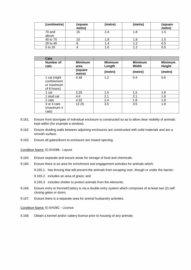
(centimetre) (square metre)
(metre) (metre) (square metre)
70 and above
15 2.4 1.8 1.5
40 to 70 10 1.8 1.8 1.0 20 to 40 6 1.4 1.2 0.5 5 to 20 4 1.0 1.2 0.5
Cats Number of cats
Minimum area
Minimum Length
Minimum Width
Minimum Height
(square metre) (metre) (metre) (metre)
1 cat (night confinement or maximum of 8 hours)
0.48 1.2 0.4 0.6
1 cat 2.25 1.5 1.5 1.8 1 stud cat 4.4 2.1 2.1 1.8 2 cats 4.32 2.4 1.8 1.8 3 or 4 cats (maximum 4 cats)
12.25 3.5 3.5 1.8
9.161. Ensure front door/gate of individual enclosure is constructed so as to allow clear visibility of animals kept within (for example a window).
9.162. Ensure dividing walls between adjoining enclosures are constructed with solid materials and are a smooth surface.
9.163. Ensure all gates/doors to enclosure are inward opening.
Condition Name: E) EH28B - Layout
9.164. Ensure separate and secure areas for storage of food and chemicals.
9.165. Ensure there is an area for enrichment and engagement activities for animals which:
9.165.1. has fencing that will prevent the animals from escaping over, though or under the barrier;
9.165.2. includes an area of grass; and
9.165.3. includes shelter to protect animals from the elements.
9.166. Ensure entry to Kennel/Cattery is via a double entry system which comprises of at least two (2) self closing gates or doors.
9.167. Ensure there is a separate area for animal husbandry activities.
Condition Name: E) EH28C - Licence
9.168. Obtain a kennel and/or cattery licence prior to housing of any animals.

10. ENGINEERING
Intent
Engineering conditions have been broken into the relevant categories including general, water supply, sewerage, stormwater, roadworks, access and parking, and utilities. This will allow the relevant officers in Council to distinguish the conditions necessary and to structure the decision notice accordingly.
There has been no separation into a separate list of Reconfiguring a Lot and Material Change of Use conditions. Where a condition is only applicable to one type, reference has been made in the Condition Name.
All design and construction works undertaken in relation to these conditions are to be carried out in accordance with the following Design and Construction Standards, except as required otherwise by the Logan Planning Scheme 2015, which are:
• Planning Scheme Policy 5 - Infrastructure • Logan City Council Standard Drawings • Queensland Urban Drainage Manual • Queensland Streets Manual • Manual of Uniform Traffic Controls Devices • Austroads Guide to Road Design (set) • Austroads Guide to Traffic Management (set) • Austroads Guide to Road Safety (set) • AS 3798 Guidelines on earthworks for commercial and residential developments • AS 4678 Earth-retaining structures • AS 2890 Parking facilities • AS 1158 Lighting for roads and public spaces • Water Supply Code of Australia • Sewerage Code of Australia
The versions of the above standards are to be the current versions at the time the conditions are written including any amendments to the relevant standard. Where there are any discrepancies between the Logan Planning Scheme 2015 and any of the Design Guidelines or Australian Standards, the Logan Planning Scheme is to take precedence unless otherwise determined by Council.
Conditions
General
Condition Name: E) EG1A - General - Engineering standard - Obtain Permit
10.1. Obtain an operational works permit for [INPUT – standard reference Roadworks (internal and/or external), stormwater quantity, access and parking, earthworks, erosion and sediment control, sewer and water, Vegetation Clearing, Stormwater Quality]. [TO BE USED IF OW IS REQUIRED]
10.2. An operational works permit is not required for [INPUT – standard reference Roadworks (internal and/or external), stormwater quantity, access and parking, earthworks, erosion and sediment control, electrical reticulation, sewer and water, Vegetation Clearing, Stormwater Quality]. [TO BE USED IF NO OW IS REQUIRED]
Note: The Planning Act 2016 does not allow OPW approval requirement to be switched off for OPW associated with an ROL only MCU.
Condition Name: S) EG1B - General - Engineering standard
10.3. Construct all works in accordance with the approved plan(s) of development and in accordance with the Council’s adopted standards.

10.4. The applicant is required to submit a final plumbing and drainage certificate, prior to or at the time of plan sealing, to verify the disconnection and reconnection of an existing dwelling [TO BE USED IF PROPOSING TO RETAIN AN EXISTING DWELLING]
10.5. The applicant is responsible for protecting nearby property owners from dust pollution arising from the construction and maintenance of the works required by this approval and must comply with any lawful instruction from the Council if in his opinion a dust nuisance exists. [TO BE USED IF NO OW IS REQUIRED]
10.6. Access to the site must be through [INPUT – street name] ([INPUT - describe route or streets permitted to be used]). Trucks and other heavy machinery used in construction must use only the above access/ routes as described above. [TO BE USED IF NO OW IS REQUIRED and where development works may require extensive construction works and it is likely that the adjoining residents might be affected by heavy traffic] Advisory Note: [TO BE USED IF NO OW IS REQUIRED] This approval does not include the sewer house drain/s for proposed lot/s/development. The applicant is required to obtain a plumbing and drainage permit prior to commencement of any works on internal sewer (house drains) and water reticulation. The movement of commercial soil, extracted or waste soil, mulch, grass clippings, branches, commercial and non-commercial pot plants, baled hay and straw, within a Fire Ant Restricted Area must be undertaken in accordance with movement controls for those materials. Movement controls for high-risk materials are documented on the Department of Agriculture, Fisheries and Forestry web site. For further advice about movement controls, identification and treatment of fire ants, refer to the DAFF web site (www.daff.qld.gov.au) or phone the DAFF Call Centre on 13 25 23. When water restrictions are in place within the City of Logan, use of reticulated water for construction purposes is not permitted except for landscaping in accordance with the South East Queensland water restrictions.
Condition Name: S) EG1C - General - RPEQ Certification
10.7. Submit to Council certification from a Registered Professional Engineer of Queensland (RPEQ-Civil) that all engineering works authorised by this development approval have been designed and constructed in accordance with the requirements of the development approval(s).
Condition Name: S) EG1D - General – Submission of As Constructed drawings
10.8. Submit to Council ‘As Constructed’ drawings in accordance with Part 5 of Planning Scheme Policy 5 - Infrastructure, including an asset register, checked by a Registered Professional Engineer Queensland (RPEQ-Civil), certifying that the works have been completed in accordance with the Council’s adopted standard(s). [TO BE USED IF OW IS REQUIRED]
10.9. Ensure that the asset register is in editable spreadsheet format comprising assets with design life, geographical, geometrical attributes consistent with the as-constructed drawings. [TO BE USED IF OW IS REQUIRED]
Condition Name: S) EG1E - Rectification
10.10. Be responsible for the full cost of any alteration necessary to electricity, telephone, water mains, sewer mains, stormwater drainage systems or easements and/or other public utility installations resulting from the development or from road and drainage works required in connection with the development.
Stormwater
Condition Name: S) SW1A - Stormwater Quantity - Connection
10.11. Connect the development to the existing stormwater [at no cost to Council]. [use if a non-trunk infrastructure condition]
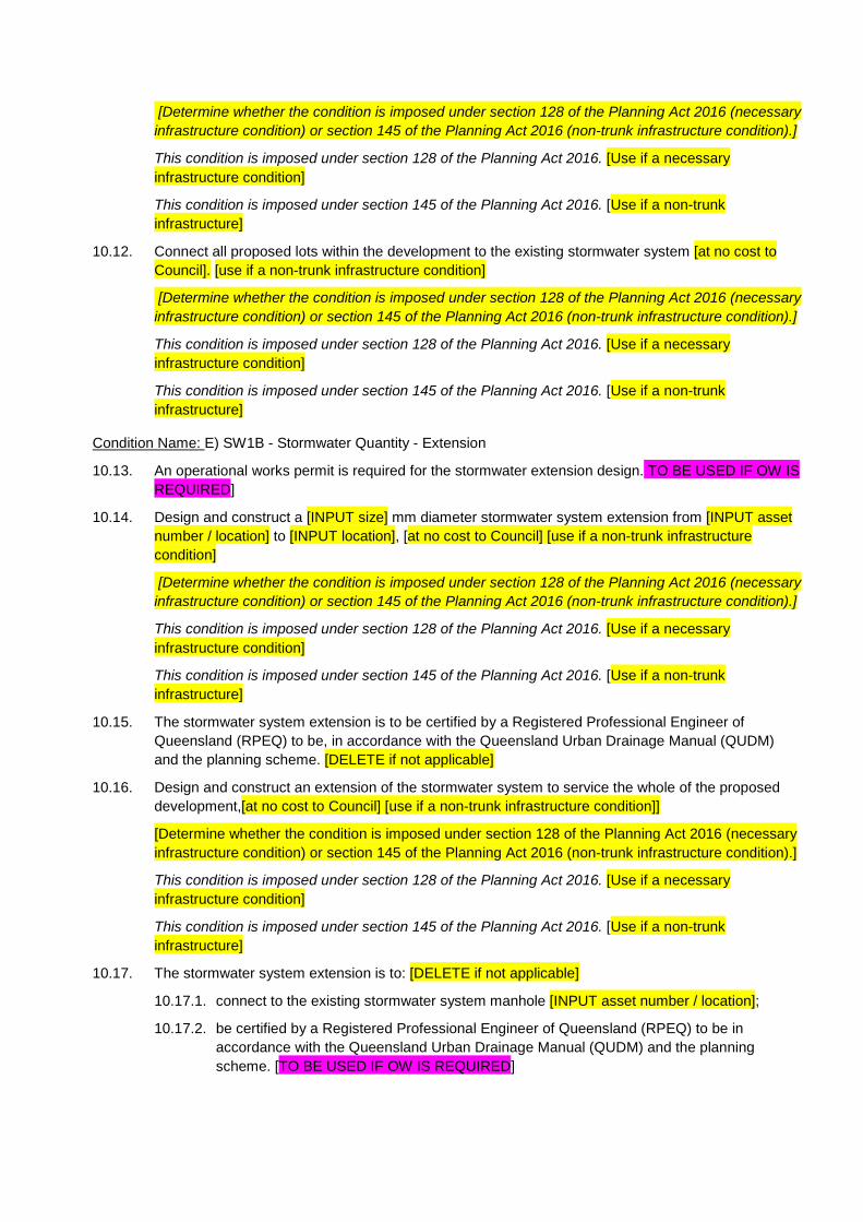
[Determine whether the condition is imposed under section 128 of the Planning Act 2016 (necessary infrastructure condition) or section 145 of the Planning Act 2016 (non-trunk infrastructure condition).]
This condition is imposed under section 128 of the Planning Act 2016. [Use if a necessary infrastructure condition]
This condition is imposed under section 145 of the Planning Act 2016. [Use if a non-trunk infrastructure]
10.12. Connect all proposed lots within the development to the existing stormwater system [at no cost to Council]. [use if a non-trunk infrastructure condition]
[Determine whether the condition is imposed under section 128 of the Planning Act 2016 (necessary infrastructure condition) or section 145 of the Planning Act 2016 (non-trunk infrastructure condition).]
This condition is imposed under section 128 of the Planning Act 2016. [Use if a necessary infrastructure condition]
This condition is imposed under section 145 of the Planning Act 2016. [Use if a non-trunk infrastructure]
Condition Name: E) SW1B - Stormwater Quantity - Extension
10.13. An operational works permit is required for the stormwater extension design. TO BE USED IF OW IS REQUIRED]
10.14. Design and construct a [INPUT size] mm diameter stormwater system extension from [INPUT asset number / location] to [INPUT location], [at no cost to Council] [use if a non-trunk infrastructure condition]
[Determine whether the condition is imposed under section 128 of the Planning Act 2016 (necessary infrastructure condition) or section 145 of the Planning Act 2016 (non-trunk infrastructure condition).]
This condition is imposed under section 128 of the Planning Act 2016. [Use if a necessary infrastructure condition]
This condition is imposed under section 145 of the Planning Act 2016. [Use if a non-trunk infrastructure]
10.15. The stormwater system extension is to be certified by a Registered Professional Engineer of Queensland (RPEQ) to be, in accordance with the Queensland Urban Drainage Manual (QUDM) and the planning scheme. [DELETE if not applicable]
10.16. Design and construct an extension of the stormwater system to service the whole of the proposed development,[at no cost to Council] [use if a non-trunk infrastructure condition]]
[Determine whether the condition is imposed under section 128 of the Planning Act 2016 (necessary infrastructure condition) or section 145 of the Planning Act 2016 (non-trunk infrastructure condition).]
This condition is imposed under section 128 of the Planning Act 2016. [Use if a necessary infrastructure condition]
This condition is imposed under section 145 of the Planning Act 2016. [Use if a non-trunk infrastructure]
10.17. The stormwater system extension is to: [DELETE if not applicable]
10.17.1. connect to the existing stormwater system manhole [INPUT asset number / location]; 10.17.2. be certified by a Registered Professional Engineer of Queensland (RPEQ) to be in
accordance with the Queensland Urban Drainage Manual (QUDM) and the planning scheme. [TO BE USED IF OW IS REQUIRED]
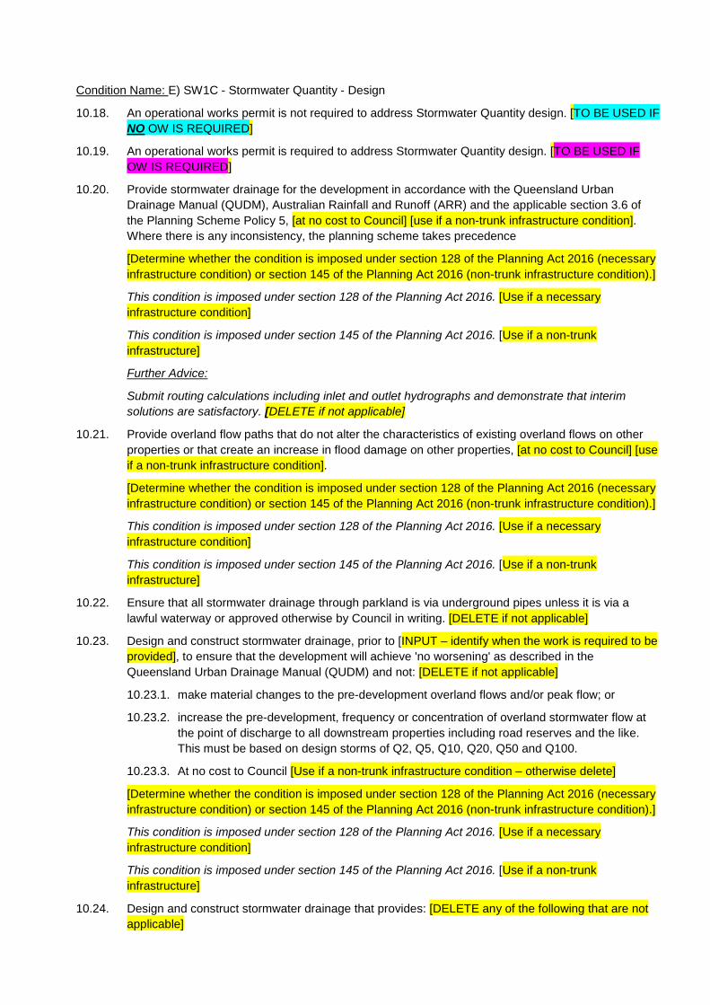
Condition Name: E) SW1C - Stormwater Quantity - Design
10.18. An operational works permit is not required to address Stormwater Quantity design. [TO BE USED IF NO OW IS REQUIRED]
10.19. An operational works permit is required to address Stormwater Quantity design. [TO BE USED IF OW IS REQUIRED]
10.20. Provide stormwater drainage for the development in accordance with the Queensland Urban Drainage Manual (QUDM), Australian Rainfall and Runoff (ARR) and the applicable section 3.6 of the Planning Scheme Policy 5, [at no cost to Council] [use if a non-trunk infrastructure condition]. Where there is any inconsistency, the planning scheme takes precedence
[Determine whether the condition is imposed under section 128 of the Planning Act 2016 (necessary infrastructure condition) or section 145 of the Planning Act 2016 (non-trunk infrastructure condition).]
This condition is imposed under section 128 of the Planning Act 2016. [Use if a necessary infrastructure condition]
This condition is imposed under section 145 of the Planning Act 2016. [Use if a non-trunk infrastructure]
Further Advice:
Submit routing calculations including inlet and outlet hydrographs and demonstrate that interim solutions are satisfactory. [DELETE if not applicable]
10.21. Provide overland flow paths that do not alter the characteristics of existing overland flows on other properties or that create an increase in flood damage on other properties, [at no cost to Council] [use if a non-trunk infrastructure condition].
[Determine whether the condition is imposed under section 128 of the Planning Act 2016 (necessary infrastructure condition) or section 145 of the Planning Act 2016 (non-trunk infrastructure condition).]
This condition is imposed under section 128 of the Planning Act 2016. [Use if a necessary infrastructure condition]
This condition is imposed under section 145 of the Planning Act 2016. [Use if a non-trunk infrastructure]
10.22. Ensure that all stormwater drainage through parkland is via underground pipes unless it is via a lawful waterway or approved otherwise by Council in writing. [DELETE if not applicable]
10.23. Design and construct stormwater drainage, prior to [INPUT – identify when the work is required to be provided], to ensure that the development will achieve 'no worsening' as described in the Queensland Urban Drainage Manual (QUDM) and not: [DELETE if not applicable]
10.23.1. make material changes to the pre-development overland flows and/or peak flow; or
10.23.2. increase the pre-development, frequency or concentration of overland stormwater flow at the point of discharge to all downstream properties including road reserves and the like. This must be based on design storms of Q2, Q5, Q10, Q20, Q50 and Q100.
10.23.3. At no cost to Council [Use if a non-trunk infrastructure condition – otherwise delete]
[Determine whether the condition is imposed under section 128 of the Planning Act 2016 (necessary infrastructure condition) or section 145 of the Planning Act 2016 (non-trunk infrastructure condition).]
This condition is imposed under section 128 of the Planning Act 2016. [Use if a necessary infrastructure condition]
This condition is imposed under section 145 of the Planning Act 2016. [Use if a non-trunk infrastructure]
10.24. Design and construct stormwater drainage that provides: [DELETE any of the following that are not applicable]

10.24.1. for stormwater infrastructure to be included in easements where the infrastructure is located in downstream properties;
10.24.2. a network that commands the whole of the site and provides for external upstream catchments in their fully developed state;
10.24.3. pipeline connections to the upstream catchment;
10.24.4. upgrades of the downstream stormwater infrastructure required to convey design flows to the lawful point of discharge;
10.24.5. inter-allotment drainage that complies with the Queensland Urban Drainage Manual (QUDM) Level II along [INPUT location];
10.24.6. inter-allotment drainage that complies with the Queensland Urban Drainage Manual (QUDM) Level III along [INPUT location];
10.24.7. one drainage outlet (approved metal kerb adaptor) in the kerb and channel for each lot draining towards the road along its frontage; and
10.24.8. for any existing or proposed Council drainage scheme for a catchment that the site is located within.
10.24.9. At no cost to Council [Use if a non-trunk infrastructure condition – otherwise delete]
[Determine whether the condition is imposed under section 128 of the Planning Act 2016 (necessary infrastructure condition) or section 145 of the Planning Act 2016 (non-trunk infrastructure condition).]
This condition is imposed under section 128 of the Planning Act 2016. [Use if a necessary infrastructure condition]
This condition is imposed under section 145 of the Planning Act 2016. [Use if a non-trunk infrastructure]
10.25. Submit to Council a stormwater design, checked and certified by a Registered Professional Engineer of Queensland (RPEQ) for a major storm recurrence interval of [INPUT 50 / 100] years. The design must have a minimum freeboard determined in accordance with the requirements of:
10.25.1. Table 9.03.1 of the Queensland Urban Drainage Manual (QUDM) for overland flow paths; and
10.25.2. Table 5.06.1 of the Queensland Urban Drainage Manual (QUDM) for detention basins and an underground drainage network designed to cater for the minor storm recurrence interval of [INPUT – 2 / 10] years. [TO BE USED IF OW IS REQUIRED]
10.26. Prior to [INPUT Council's endorsement of the survey plan / commencement of use], submit to Council, certification from a Registered Professional Engineer Queensland (RPEQ), certifying that the stormwater management design has been undertaken in accordance with the conditions of this and any other relevant approvals issued by Council. [TO BE USED IF NO OW IS REQUIRED]
Condition Name: E) SW1D - Stormwater Quantity - Lawful Point Discharge
10.27. Lawful point of discharge for the development is [INPUT location].
10.28. Submit to Council written consent for a lawful point of stormwater discharge from the owners of land affected by any stormwater discharge from the development. [DELETE if not applicable]
10.29. Discharge all minor storm flows that fall or pass onto the site to the lawful point of discharge in accordance with the Queensland Urban Drainage Manual (QUDM).

Condition Name: E) SW1E - Stormwater Quantity – Existing and new lot connections
10.30. Design and construct in accordance with the planning scheme, a minimum [INPUT - #mm] diameter private stormwater pipe along the full length of the access strip for any rear lot(s) [at no cost to Council] [use if a non-trunk infrastructure condition].
[Determine whether the condition is imposed under section 128 of the Planning Act 2016 (necessary infrastructure condition) or section 145 of the Planning Act 2016 (non-trunk infrastructure condition).]
This condition is imposed under section 128 of the Planning Act 2016. [Use if a necessary infrastructure condition]
This condition is imposed under section 145 of the Planning Act 2016. [Use if a non-trunk infrastructure]
10.31. Submit to Council, certification by a cadastral surveyor or engineer that certifies that:
10.31.1. a stormwater connection has been provided to the existing house on proposed [INPUT - lot # / lots # and #] that is wholly located within the lot(s) it serves;
10.31.2. a stormwater connection has been provided to the existing house on proposed [INPUT - lot # / lots # and #] that is wholly located within the lot(s) it serves and is connected to the new stormwater network after it was accepted "On Maintenance" by Council;
10.31.3. all redundant stormwater connections have been removed and the land reinstated; and 10.31.4. a private stormwater pipe has been installed along the full length of the access strip for any
rear lot(s) in accordance with the conditions of this and any other development approval issued by Council and the works have been completed.
Condition Name: S) SW1F - Stormwater Quantity - CCTV
10.32. Provide to Council before any operational or building works approval is granted, a closed circuit television survey of all existing stormwater pipes within the development site proposed to be retained and a defect report of the survey.
10.33. Provide to Council upon completion of all construction works, a closed circuit television survey of all pre - existing stormwater pipes and new stormwater pipes constructed within the development site, including a defect report of the survey to confirm that the stormwater pipes have not been adversely affected by the development. Submit to Council upon completion of all construction works for review and approval, an engineering restoration plan and schedule for any defect found that did not exist before works began. The applicant must repair all damaged stormwater pipes in accordance with the approved engineering restoration plan and schedule and any conditions of the Council attached to that approval.
Condition Name: E) SW1G -Stormwater Quantity – Stormwater Management On site (No Operational Works approval required)
10.34. An operational works permit is not required to address Stormwater Quantity Management.[TO BE USED IF NO OW IS REQUIRED]
10.35. Undertake stormwater management on site in accordance with the approved stormwater management plan, modified as follows:
10.35.1. [INPUT requirement or change]; and
10.35.2. [INPUT requirement or change].
10.36. Undertake the stormwater management on site in accordance with the Planning Scheme Policy 5 – Infrastructure of the Planning Scheme.

10.37. The stormwater management on site is to be provided at no cost to Council [use if a non-trunk infrastructure condition].
[Determine whether the condition is imposed under section 128 of the Planning Act 2016 (necessary infrastructure condition) or section 145 of the Planning Act 2016 (non-trunk infrastructure condition).]
This condition is imposed under section 128 of the Planning Act 2016. [Use if a necessary infrastructure condition]
This condition is imposed under section 145 of the Planning Act 2016. [Use if a non-trunk infrastructure]
10.38. Prior to [INPUT Council's endorsement of the survey plan / commencement of use], submit to Council, certification from a Registered Professional Engineer Queensland (RPEQ), certifying that the: [DELETE any of the following that are not applicable]
10.38.1. stormwater management has been undertaken on site in accordance with the conditions of this and any other relevant approval issued by Council;
10.38.2. detention/flood retardation systems are properly installed and functioning in accordance with the approved stormwater management plan and modified with conditions of this approval; and
10.38.3. proposed works will not result in an increase of peak flow rates from the site, no increase in flood levels external to the site that could cause loss or nuisance for all standard design storm events up to [INPUT 50/100] year ARI. [TO BE USED IF NO OW IS REQUIRED]
Condition Name: E) SW1H -Stormwater Quantity – Stormwater Management On site (Operational Works approval required)
10.39. An operational works permit is required for Stormwater Quantity Management. [TO BE USED IF OW IS REQUIRED]
10.40. Submit [INPUT an amended / a ] stormwater management plan, designed in accordance with QUDM and Council's planning scheme and policies and includes the following information:
10.40.1. [INPUT requirement or change];
10.40.2. [INPUT requirement or change]; and
10.40.3. [INPUT requirement or change]. [TO BE USED IF OW IS REQUIRED]
Condition Name: E) SW2A - Stormwater quality and management devices
10.41. Design and construct stormwater quality and/or management devices that achieve the stormwater management design objective(s) for stormwater quality [insert waterway stability, frequent flow if applicable]. Stormwater quality and management device design must be in accordance with Planning Scheme Policy 5 – Infrastructure.
10.42. The design and construction of stormwater quality and/or management devices is to be provided at no cost to Council [use if a non-trunk infrastructure condition].
[Determine whether the condition is imposed under section 128 of the Planning Act 2016 (necessary infrastructure condition) or section 145 of the Planning Act 2016 (non-trunk infrastructure condition).]
This condition is imposed under section 128 of the Planning Act 2016. [Use if a necessary infrastructure condition]
This condition is imposed under section 145 of the Planning Act 2016. [Use if a non-trunk infrastructure]
Condition Name: E) SW2B -Stormwater Quality: Sediment & Erosion Control
10.43. An operational works permit is required to address Erosion and Sediment Control TO BE USED IF OW IS REQUIRED

10.44. Provide to Council an Erosion and Sediment Control Plan designed in accordance with the International Erosion Control Association (Australasia) Best Practice Erosion and Sediment Control Guidelines (2008) prior to the commencement of any works on site or prior to the submission to Council of any application for operational works, whichever occurs first. Install, monitor and amend where necessary the erosion and sediment control measures during all phases of the development to ensure all reasonable and practicable measures are taken to prevent environmental harm. [TO BE USED IF OW IS REQUIRED]
Condition Name: S) SW2C - Sediment and Erosion Control for small scale low risk MCU
For lower risk sites (eg sites with area of disturbance less than 2500m2) [TO BE USED IF NO OW IS REQUIRED]
10.45. An operational works permit is not required for Sediment and Erosion Control.
10.46. Install, monitor and amend where necessary erosion and sediment control measures during all phases of the development to ensure all reasonable and practicable measures are taken to prevent environmental harm.
10.47. Prior to each rainfall event ensure:
10.47.1. concentrated stormwater flow paths are diverted around the site or conveyed through the site without causing erosion and without contaminating the flow and receiving waters;
10.47.2. erosion control measures are implemented which prevent or minimise erosion; and
10.47.3. sediment control measures are installed and implemented as necessary to maximise sediment capture.
10.48. Effectively stabilise all site surfaces using methods which achieve effective short term stabilisation and which will continue to achieve effective stabilisation in the long term. For the purpose of this condition, an effectively stabilised surface is defined as one that, as a result of rainfall and stormwater runoff, does not erode, does not cause sedimentation and does not cause water contamination.
For higher risk sites (eg larger than 2500m2 where controlled discharge of water eg sediment basin would be required) [TO BE USED IF NO OW IS REQUIRED]
10.49. An operational works permit is not required for Sediment and Erosion Control.
10.50. Install, monitor and amend where necessary erosion and sediment control measures during all phases of the development to ensure all reasonable and practicable measures are taken to prevent environmental harm.
10.51. Prior to each rainfall event ensure:
10.51.1. concentrated stormwater flow paths are diverted around the site or conveyed through the site without causing erosion and without contaminating the flow and receiving waters;
10.51.2. erosion control measures are implemented which prevent or minimise erosion; and
10.51.3. sediment control measures are installed and implemented as necessary to maximise sediment capture.
10.52. Prior to the controlled discharge of any water from the site during construction, the following water quality objectives must be achieved:
10.52.1. total suspended solids (maximum 50mg/L, TSS);
10.52.2. turbidity (measured in NTUs maximum of 60 NTU); and
10.52.3. water pH between 6.5 and 8.5 unless otherwise required by the Council.
10.53. All site monitoring data including rainfall records, dates of water quality testing, testing results and records of controlled water releases from the site, must be kept in an on-site register. The register is
to be maintained up to date for the duration of the approved works and be available on-site for inspection by Council officers on request.
10.54. Effectively stabilise all site surfaces using methods which achieve effective short term stabilisation and which will continue to achieve effective stabilisation in the long term. For the purpose of this condition, an effectively stabilised surface is defined as one that, as a result of rainfall and stormwater runoff, does not erode, does not cause sedimentation and does not cause water contamination.
Condition Name: E) SW2D- Stormwater Quality: Requirement (RL – SWMP accepted – Council to own asset)
10.55. Implement the recommendations of the approved Conceptual Site Based Stormwater Management Plan located within the approved plan(s) of development subject to detailed design and except as altered by the conditions of this development approval.
10.56. The implementation of the recommendations of the approved Conceptual Site Based Stormwater Management Plan is to be provided at no cost to Council [use if a non-trunk infrastructure condition].
[If the CSBMP requires works to be carried out for stormwater infrastructure, determine whether the condition is imposed under section 128 of the Planning Act 2016 (necessary infrastructure condition) or section 145 of the Planning Act 2016 (non-trunk infrastructure condition). If the CSBMP does not require any works to be carried out, then the condition is not a development infrastructure condition, in which case this further advice must not be inserted.]
This condition is imposed under section 128 of the Planning Act 2016. [Use if a necessary infrastructure condition]
This condition is imposed under section 145 of the Planning Act 2016. [Use if a non-trunk infrastructure]
10.57. Submit to Council for approval a final Detailed Stormwater Quality Management Plan (DSQMP) including all stormwater infrastructure, relevant landscaping and engineering designs as a part of any operational works application. The final detailed stormwater management plan and designs are to be in accordance with Planning Scheme Policy 5 – Infrastructure and must include:
10.57.1. detailed calculations for each treatment measure and completed copies of the applicable Design Calculation Summary checklists from the Water Sensitive Urban Design Technical Design Guidelines for South East Queensland (WSUD TDG);
10.57.2. a completed copy of the relevant design assessment checklist from the applicable Water by Design Technical Design Guidelines for each treatment measure certified by the stormwater quality system designer; and
10.57.3. details of how the bioretention basin will be protected during the construction and building phases of the development based on one of the four methods outlined in the Construction and Establishment Guidelines: Swales, Bioretention Systems and Wetlands (C&E guidelines. Identify which method will be adopted and include a copy of the relevant step-by-step sequence and sign-off forms as an appendix to the report; and;
10.57.4. an Operational Management and Maintenance Plan (OMMP) as a separable section of the DSQMP to provide an outline of the proposed long term operational management and maintenance requirements of the stormwater system on the site. The OMMP must include a plan showing the location of the individual components of the system.
10.57.5. [INPUT - insert requirement or change]
Condition Name: E) SW2E-Stormwater Quality: Requirement (RL – SWMP not accepted or not submitted – Council to own)
10.58. Submit to Council for approval a final Detailed Stormwater Quality Management Plan (DSQMP) including all stormwater infrastructure, relevant landscaping and engineering designs as a part of any operational works application. The final detailed stormwater management plan and designs are to be in accordance Planning Scheme Policy 5 – Infrastructure and must include:

10.58.1. a copy (on CD and also emailed to [email protected]) of MUSIC modelling, undertaken in accordance with the MUSIC User Manual and MUSIC Modelling Guidelines, that demonstrates that the proposed treatment train achieves Council's load based reduction water quality objectives;
10.58.2. detailed calculations for each treatment measure and completed copies of the applicable Design Calculation Summary checklists from the Water Sensitive Urban Design Technical Design Guidelines for South East Queensland (WSUD TDG);
10.58.3. a completed copy of the relevant design assessment checklist from the applicable Water by Design Technical Design Guidelines for each treatment measure certified by the stormwater quality system designer;
10.58.4. details of how the bioretention basin will be protected during the construction and building phases of the development based on one of the four methods outlined in the Construction and Establishment Guidelines: Swales, Bioretention Systems and Wetlands (C&E guidelines. Identify which method will be adopted and include a copy of the relevant step-by-step sequence and sign-off forms as an appendix to the report; and
10.58.5. an Operational Management and Maintenance Plan (OMMP) as a separable section of the DSQMP to provide an outline of the proposed long term operational management and maintenance requirements of the proposed stormwater system on the site. The OMMP must include a plan showing the location of the individual components of the system.
Condition Name: E) SW2F-Stormwater Quality: Requirement (MCU – SWMP accepted – Private to own)
10.59. Implement the recommendations of the Stormwater Quality Management Plan located within the approved plans of development subject to detailed design and except as altered by the conditions of this development approval [at no cost to Council] [use if a non-trunk infrastructure condition].
[If the SQMP requires works to be carried out for stormwater infrastructure, determine whether the condition is imposed under section 128 of the Planning Act 2016 (necessary infrastructure condition) or section 145 of the Planning Act 2016 (non-trunk infrastructure condition). If the SQMP does not require any works to be carried out, then the condition is not a development infrastructure condition, in which case this further advice must not be inserted.]
This condition is imposed under section 128 of the Planning Act 2016. [Use if a necessary infrastructure condition]
This condition is imposed under section 145 of the Planning Act 2016. [Use if a non-trunk infrastructure condition]
10.60. Submit to Council for approval a final Detailed Stormwater Quality Management Plan (DSQMP) including all stormwater infrastructure, relevant landscaping and engineering designs as a part of any operational works application. The final detailed stormwater management plan and designs are to be in accordance with Planning Scheme Policy 5 – Infrastructure and must include:
10.60.1. detailed calculations for each treatment measure and completed copies of the applicable Design Calculation Summary checklists from the Water Sensitive Urban Design Technical Design Guidelines for South East Queensland (WSUD TDG);
10.60.2. a completed copy of the relevant design assessment checklist from the applicable Water by Design Technical Design Guidelines for each treatment measure certified by the stormwater quality system designer; and
10.60.3. an Operational Management and Maintenance Plan (OMMP) as a separable section of the DSQMP to provide an outline of the proposed long term operational management and maintenance requirements of the stormwater system on the site. The OMMP must include a plan showing the location of the individual components of the system.
10.60.4. [INPUT - insert requirement or change]

10.61. Implement the approved Detailed Stormwater Quality Management Plan (DSWMP) and Operational Management and Maintenance Plan (OMMP) in perpetuity. Maintain:
10.61.1. copies of the most recent approved amendment of the DSWMP and OMMP on site; and
10.61.2. inspection records at the frequency recommended in Table 1 of Maintaining Vegetated Stormwater Assets (Version 1) Water by Design (2012) that are to be available to Council on written request.
[If the DSWMP and the OMMP require works to be carried out for stormwater infrastructure, determine whether the condition is imposed under section 128 of the Planning Act 2016 (necessary infrastructure condition) or section 145 of the Planning Act 2016 (non-trunk infrastructure condition). If the DSWMP and the OMMP does not require any works to be carried out, then the condition is not a development infrastructure condition, in which case this further advice must not be inserted.]
This condition is imposed under section 128 of the Planning Act 2016. [Use if a necessary infrastructure condition]
This condition is imposed under section 145 of the Planning Act 2016. [Use if a non-trunk infrastructure condition]
10.62. Make all necessary improvements immediately upon awareness of any deficiencies in the treatment measures detailed in the DSWMP and the OMMP.
Condition Name: E) SW2G-Stormwater Quality: Requirement (MCU – SWMP not accepted or not submitted – Private to own)
10.63. Be advised that the Stormwater Management Plan submitted as part of the application is not accepted in terms of stormwater quality.
10.64. Submit to Council for approval a final Detailed Stormwater Quality Management Plan (DSQMP) including all stormwater infrastructure, relevant landscaping and engineering designs as a part of any operational works application. The final detailed stormwater management plan and designs are to be in accordance with the Water Sensitive Urban Design Technical Design Guidelines for South East Queensland (WSUD TDG), the Construction and Establishment Guidelines: Swales, Bioretention Systems and Wetlands (C&E guidelines) and IPWEAQ Standard Drawings numbers WSUD-001 to WSUD-012 and must include:
10.64.1. a copy (on CD and also emailed to [email protected]) of MUSIC modelling, undertaken in accordance with the MUSIC User Manual and MUSIC Modelling Guidelines, that demonstrates the proposed treatment train achieves Council's load based reduction water quality objectives;
10.64.2. detailed calculations for each treatment measure and completed copies of the applicable Design Calculation Summary checklists from the WSUD TDG;
10.64.3. a completed copy of the relevant design assessment checklist from the WSUD TDG for each treatment measure certified by the stormwater quality system designer; and
10.64.4. an Operational Management and Maintenance Plan (OMMP) as a separable section of the DSQMP to provide an outline of the proposed long term operational management and maintenance requirements of the proposed stormwater system on the site. The OMMP must include a plan showing the location of the individual components of the system.
10.64.5. [INPUT - insert requirement or change]
10.65. Implement the approved Detailed Stormwater Quality Management Plan (DSWMP) and Operational Management and Maintenance Plan (OMMP) in perpetuity. Maintain:
10.65.1. copies of the most recent approved amendment of the DSWMP and OMMP on site; and
10.65.2. inspection records at the frequency recommended in Table 1 of Maintaining Vegetated Stormwater Assets (Version 1) Water by Design (2012) that are to be available to Council on written request.
[If the DSWMP and the OMMP require works to be carried out for stormwater infrastructure, determine whether the condition is imposed under section 128 of the Planning Act 2016 (necessary infrastructure condition) or section 145 of the Planning Act 2016 (non-trunk infrastructure condition). If the DSWMP and the OMMP does not require any works to be carried out, then the condition is not a development infrastructure condition, in which case this further advice must not be inserted.]
This condition is imposed under section 128 of the Planning Act 2016. [Use if a necessary infrastructure condition]
This condition is imposed under section 145 of the Planning Act 2016. [Use if a non-trunk infrastructure condition]
10.66. Make all necessary improvements immediately upon awareness of any deficiencies in the treatment measures detailed in the DSWMP and the OMMP.
Condition Name: E) SW2H - RL - Stormwater Quality offset
10.67. Submit to Council for approval, prior to submission of an Operational Works application, amended plan(s) of development which identify and show the location of stormwater infrastructure designed and sized sufficiently to demonstrate the development will achieve the Stormwater Quality Design Objective of Planning Scheme Policy 5 – Infrastructure (PSP 5). Submit a Conceptual Site Based Stormwater Management plan or deemed to comply solution in accordance with PSP 5 in support of the amended plan of development.
10.68. Submit to Council for approval a final Detailed Stormwater Quality Management Plan (DSQMP) including all stormwater infrastructure, relevant landscaping and engineering designs as a part of any operational works application. The final detailed stormwater management plan and designs are to be in accordance with Planning Scheme Policy 5 – Infrastructure and must include:
10.68.1. a copy (on CD and also emailed to [email protected]) of MUSIC modelling, undertaken in accordance with the MUSIC User Manual and MUSIC Modelling Guidelines, that demonstrates that the proposed treatment train achieves Council's load based reduction water quality objectives;
10.68.2. detailed calculations for each treatment measure and completed copies of the applicable Design Calculation Summary checklists from the Water Sensitive Urban Design Technical Design Guidelines for South East Queensland (WSUD TDG);
10.68.3. a completed copy of the relevant design assessment checklist from the applicable Water by Design Technical Design Guidelines for each treatment measure certified by the stormwater quality system designer; and
10.68.4. details of how the bioretention basin will be protected during the construction and building phases of the development based on one of the four methods outlined in the Construction and Establishment Guidelines: Swales, Bioretention Systems and Wetlands (C&E guidelines. Identify which method will be adopted and include a copy of the relevant step-by-step sequence and sign-off forms as an appendix to the report; and
10.68.5. an Operational Management and Maintenance Plan (OMMP) as a separable section of the DSQMP to provide an outline of the proposed long term operational management and maintenance requirements of the proposed stormwater system on the site. The OMMP must include a plan showing the location of the individual components of the system.
Further advice:
The Applicant may enter into an infrastructure agreement with Council that provides for a monetary contribution paid to Council in lieu of achieving the required stormwater quality obligations on the development site. This will allow Council to achieve the stormwater quality obligations elsewhere.

Compliance with the executed infrastructure agreement will prevail over the conditioned stormwater quality requirements under this approval.
Condition Name: E) SW2I - MCU - Stormwater Quality Offset
10.69. Submit to Council for approval, prior to submission of an Operational Works application, amended plan(s) of development which identify and show the location of stormwater infrastructure designed and sized sufficiently to demonstrate the development will achieve the Stormwater Quality Design Objective of Planning Scheme Policy 5 – Infrastructure (PSP 5). Submit a Conceptual Site Based Stormwater Management plan or deemed to comply solution in accordance with PSP 5 in support of the amended plan of development.
10.70. Submit to Council for approval a final Detailed Stormwater Quality Management Plan (DSQMP) including all stormwater infrastructure, relevant landscaping and engineering designs as a part of any operational works application. The final detailed stormwater management plan and designs are to be in accordance with Planning Scheme Policy 5 – Infrastructure (PSP 5) and must include:
10.70.1. a copy (on CD and also emailed to [email protected]) of MUSIC modelling, undertaken in accordance with the MUSIC User Manual and MUSIC Modelling Guidelines, that demonstrates the proposed treatment train achieves the Stormwater Quality design objective of PSP 5;
10.70.2. detailed calculations for each treatment measure and completed copies of the applicable Design Calculation Summary checklists from the Water Sensitive Urban Design Technical Design Guidelines for South East Queensland (WSUD TDG);
10.70.3. a completed copy of the relevant design assessment checklist from the applicable Water by Design Technical Design Guidelines for each treatment measure certified by the stormwater quality system designer; and
10.70.4. an Operational Management and Maintenance Plan (OMMP) as a separable section of the DSQMP to provide an outline of the proposed long term operational management and maintenance requirements of the proposed stormwater system on the site. The OMMP must include a plan showing the location of the individual components of the system.
10.70.5. [INPUT - insert requirement or change]
10.71. Implement the approved Detailed Stormwater Quality Management Plan (DSWMP) and Operational Management and Maintenance Plan (OMMP) in perpetuity. Maintain:
10.71.1. copies of the most recent approved amendment of the DSWMP and OMMP on site; and
10.71.2. inspection records at the frequency recommended in Table 1 of Maintaining Vegetated Stormwater Assets (Version 1) Water by Design (2012) that are to be available to Council on written request.
[If the DSWMP and the OMMP require works to be carried out for stormwater infrastructure, determine whether the condition is imposed under section 128 of the Planning Act 2016 (necessary infrastructure condition) or section 145 of the Planning Act 2016 (non-trunk infrastructure condition). If the DSWMP and the OMMP does not require any works to be carried out, then the condition is not a development infrastructure condition, in which case this further advice must not be inserted.]
This condition is imposed under section 128 of the Planning Act 2016. [Use if a necessary infrastructure condition]
This condition is imposed under section 145 of the Planning Act 2016. [Use if a non-trunk infrastructure condition
10.72. Make all necessary improvements immediately upon awareness of any deficiencies in the treatment measures detailed in the DSWMP and the OMMP.
Further advice:
The Applicant may enter into an infrastructure agreement with Council that provides for a monetary contribution paid to Council in lieu of achieving the required stormwater quality obligations on the development site. This will allow Council to achieve the stormwater quality obligations elsewhere. Compliance with the executed infrastructure agreement will prevail over the conditioned stormwater quality requirements under this approval.
Condition Name: E) SW10G - OW - Stormwater Quality
10.73. Provide stormwater quality treatment on site in accordance with the approved engineering drawings.
10.74. Submit to council for approval a copy of the bioretention basin filter media laboratory results demonstrating that the media complies with the criteria outlined in the most recent version (at the time of testing) of the Guidelines for Soil Filter Media In Bioretention Systems, (Facility for Advancing Water Biofiltration) or other more current standard used by Council at the time of filter media installation. This is to be complied with prior to the installation of the filter media.
Condition Name: E) SW10H - MCU - Stormwater Quality Proprietary device
10.75. Implement the recommendations of the Stormwater Quality Management Plan located within the approved plans of development subject to detailed design and except as altered by the conditions of this development approval.
10.76. The implementation of the recommendations of the approved Stormwater Quality Management Plan is to be provided at no cost to Council [use if a non-trunk infrastructure condition].
[If the SQMP requires works to be carried out for stormwater infrastructure, determine whether the condition is imposed under section 128 of the Planning Act 2016 (necessary infrastructure condition) or section 145 of the Planning Act 2016 (non-trunk infrastructure condition). If the SQMP does not require any works to be carried out, then the condition is not a development infrastructure condition, in which case this further advice must not be inserted.]
This condition is imposed under section 128 of the Planning Act 2016. [Use if a necessary infrastructure condition] This condition is imposed under section 145 of the Planning Act 2016. [Use if a non-trunk infrastructure condition]
10.77. Submit to Council for approval a final Detailed Stormwater Quality Management Plan (DSQMP) including all stormwater infrastructure, relevant landscaping and engineering designs as a part of any operational works application. The final detailed stormwater management plan and designs are to be in accordance with Planning Scheme Policy 5 – Infrastructure and must include:
10.77.1. an Operational Management and Maintenance Plan (OMMP) as a separable section of the DSQMP to provide an outline of the proposed long term operational management and maintenance requirements of the stormwater system on the site. The OMMP must include a plan showing the location of the individual components of the system.
10.77.2. [INPUT - insert requirement or change]
10.78. Implement the approved Detailed Stormwater Quality Management Plan (DSWMP) and Operational Management and Maintenance Plan (OMMP) in perpetuity. Maintain:
10.78.1. copies of the most recent approved amendment of the DSWMP and OMMP on site; and
10.78.2. inspection records at the frequency recommended in the manufacturer’s specifications or as otherwise determined by Council. Inspection records must be available to Council on written request.
[If the DSWMP and the OMMP require works to be carried out for stormwater infrastructure, determine whether the condition is imposed under section 128 of the Planning Act 2016 (necessary infrastructure condition) or section 145 of the Planning Act 2016 (non-trunk infrastructure condition). If the DSWMP and the OMMP does not require any works to be carried out, then the condition is not a development infrastructure condition, in which case this further advice must not be inserted.]

This condition is imposed under section 128 of the Planning Act 2016. [Use if a necessary infrastructure condition] This condition is imposed under section 145 of the Planning Act 2016. [Use if a non-trunk infrastructure condition]
10.79. Make all necessary improvements immediately upon awareness of any deficiencies in the treatment measures detailed in the DSWMP and the OMMP.
Condition Name: E) SW10I - Stormwater Offset IA
10.80. Comply with the executed infrastructure agreement titled, ‘TITLE’.
Condition Name: E) SW11 - Flooding - general
10.81. An operational works permit is required to address flooding.
10.82. Ensure that the minimum habitable floor levels of all proposed buildings are at least 500mm above the Defined Flood Level [INPUT level] metres Australian Height Datum (AHD).
10.83. Locate all buildings and structures within any Development envelope areas proposed in the approved flood study.
10.84. Undertake earthworks on site in accordance with the approved flood study report being [INPUT Drawing Number: 99999, dated XX/XX/XXXXX] located within the approved document(s) and its recommendations with the following amendments and clarifications.
10.85. [INPUT insert requirement or change].
10.86. Submit to Council certification issued by a cadastral surveyor prior to [INPUT Council's endorsement of the survey plan / commencement of use]:
10.86.1. that all earthworks on site have been confirmed by survey on [INPUT – date] as having been carried out in accordance with the conditions of this development approval in respect to the:
10.86.1.1. approved location of filling and excavation;
10.86.1.2. approved volumes of filling and excavation;
10.86.1.3. finished ground levels; and
10.86.1.4. a contour plan showing the finished ground levels and the Defined Flood Line on a site plan certified by a cadastral surveyor that the above has been based on.
10.87. The development must be designed and constructed as to result in:
10.87.1. No increase in peak flow rates at the discharge outlet of the site;
10.87.2. No increase in flood levels external to the subject site; and
10.87.3. No modification of the overland flow path on the site in a way that alters the characteristics of the existing overland flows or creates an increase in flood damage on other properties.
10.88. Construct all parts of the development below the Defined Flood Level using materials that are capable of being submerged under water for a period of at least 24 hours without requiring their replacement. The materials must be flood resistant such as cement, masonry, tile and steel.
Roadworks
Condition Name: E) RW1 - Roadworks – Frontage works
10.89. An operational works permit is required for the following [roadworks/Frontage works].
10.90. Design and construct the road along [INPUT all frontages / the <street name> frontages] of the site as [INPUT an urban access street / urban access road/ rural access / industrial access / main street or road / an urban collector single carriageway / Urban collector dual carriageway/ rural collector / industrial collector /Urban arterial single carriageway / Urban arterial dual carriageway / rural arterial single carriageway / rural arterial dual carriageway / a multi-modal] road and more specifically include:
10.90.1. concrete [INPUT barrier / semi mountable / mountable] kerb and channel on a [INPUT 4.0 / 4.5 / 5.0 / 6.0] metre alignment, subsequent to any road reserve widening required by this approval, from the road reserve boundary and associated stormwater;
10.90.2. a compacted gravel pavement and an Asphaltic Concrete (AC) wearing course up to a minimum of 1.0 metre beyond the road centreline unless:
10.90.2.1. an alternative alignment or construction material has been approved by Council in writing; or
10.90.2.2. it has been demonstrated to Council that an existing road pavement is satisfactory to cater for the ultimate traffic conditions for the nominated hierarchy of the road and that the existing pavement complies with Table 3.4.4.2.1 Road Design Standards, Table 3.4.1.4.1 Road network planning guidelines & Table 3.4.8.2.1 Pavement design standards for a road of Logan Planning Scheme Policy 5 – Infrastructure. In this instance and where road widening is a minimum of 1.2 metres wide along the frontage; it is instead only required 300mm beyond the edge of the existing pavement. Demonstration is to occur by way of submitting and having approved by Council, a pavement investigation report prepared by a suitably qualified Registered Professional Engineer of Queensland (RPEQ) that includes appropriate geotechnical test results;
10.90.3. tapers to existing road pavement;
10.90.4. line marking and signage should be in accordance with Manual of Uniform Traffic Control Devices (MUTCD);
10.90.5. design and construct street lighting that complies with Logan Planning Scheme Policy 5 – Infrastructure, Table 3.5.1.1.1 Lighting categories;
10.90.6. a minimum [INPUT 1.2 metre (where an Urban Access Road) / 1.5 metre wide] wide reinforced concrete pedestrian path within the road verge [OPTIONAL INPUT as shown on the approved plan(s) of development] that connects into any existing paths adjacent to the site;
10.90.7. a minimum 2.5/3.0 metre wide reinforced concrete shared path within the road verge [OPTIONAL INPUT as shown on the approved plan(s) of development] that connects into any existing paths adjacent to the site;
10.90.8. the installation of disabled compliant kerb ramps at the road corners in accordance with Council's Standard Drawings 8-00411, 8-00412 or 8-00413; and
10.90.9. design and construct all water supply conduits to service the development across [INPUT street or road name] using thrust boring. Thrust boring must be undertaken in accordance with Council's standards. [USE WHEN OW APPROVAL IS REQUIRED]
10.90.10. The road is to be provided at no cost to Council. [use if a non-trunk infrastructure condition].
10.91. The road is to be provided at no cost to Council. [use if a non-trunk infrastructure condition].
[Determine whether the condition is imposed under section 128 of the Planning Act 2016 (necessary infrastructure condition) or section 145 of the Planning Act 2016 (non-trunk infrastructure condition).]
This condition is imposed under section 128 of the Planning Act 2016. [Use if a necessary infrastructure condition]

This condition is imposed under section 145 of the Planning Act 2016. [Use if a non-trunk infrastructure]
Condition Name: E) RW2 - Roadworks – internal / new roads (Residential)
10.92. An operational works permit is required for the following [INPUT internal / new roads].
10.93. Design and construct the new roads on the approved plan(s) of development [OPTIONAL INPUT identified as road XXXXX (eg. Road A, B and C) / identified as <street name>] as [INPUT an urban / rural / main street or road / a urban collector single / dual carriageway / rural / an urban / rural arterial single / dual carriageway / a multi-modal] road and more specifically include the following:
10.93.1. a minimum road reserve width of [INPUT 15.5 / 17.0 / 20.0 / 21.0 / 23.0 / 27.0 / 29.0 / 34.0 / 36.0 / 40.0 / 53.0] metres;
10.93.2. concrete [INPUT barrier / semi mountable / mountable] kerb and channel on a [INPUT 4.0 / 6.0 / 8.0] metre alignment from the road reserve boundary;
10.93.3. a minimum carriageway width of [INPUT 7.5 / 8.0 / 9.0 / 11.0 / 13.0 / 15.0/ 20.0 / 22.0] metres constructed using a compacted gravel payment and an Asphaltic Concrete (AC) wearing course;
10.93.4. provision for stormwater drainage, line marking, tapers to existing road pavement, signage and street lighting associated with the required road works;
10.93.5. a minimum [INPUT 1.2 metre (where an Urban Access Road) / 1.5 metre wide] wide reinforced concrete pedestrian path within the road verge [INPUT coincident with the location of street lights wherever possible / as shown on the approved plan(s) of development] that connects into any existing paths adjacent to the site
10.93.6. a minimum [2.5 / 3.0] metre wide reinforced concrete shared path within the road verge [INPUT coincident with the location of street lights wherever possible / as shown on the approved plan(s) of development] that connects into any existing paths adjacent to the site;
10.93.7. disabled compliant kerb ramps at the road corners in accordance with Council's Standard Drawings 8-00411, 8-00412 or 8-00413;
10.93.8. entry statements, where approved, only when built into the construction of the road using materials or treatments that have been approved by Council;
10.93.9. speed restriction devices in accordance with [INPUT - MUTCD Part 13 by the Queensland Government – Department of Transport and Main Roads, with the necessary adjustments to the road reserve width to preserve minimum verge widths of 4.0 metres, generally as per the approved plan(s) of development];
10.93.10. carriageway and road reserve transitions between any existing road and a proposed road designed in accordance with the requirements of the planning scheme and the Council’s adopted standards including appropriate tapers designed for the road hierarchy and speed environment of the road;
10.93.11. cul de sac ends with a minimum 9.0 metre radius to the bulb end and minimum 20.0 metre approach radius, all measured to the invert of kerb and channel and designed in accordance with the requirements of the planning scheme and the Council’s adopted standards;
10.93.12. a minimum 4.0 metre wide verge along the road and around cul de sac ends; and
10.93.13. bollards that prevent vehicle access across any pathway connection extending from the end of each proposed cul de sac through to another road.
10.94. The road is to be provided at no cost to Council [use if a non-trunk infrastructure condition].
[Determine whether the condition is imposed under section 128 of the Planning Act 2016 (necessary infrastructure condition) or section 145 of the Planning Act 2016 (non-trunk infrastructure condition).]
This condition is imposed under section 128 of the Planning Act 2016. [Use if a necessary infrastructure condition]
This condition is imposed under section 145 of the Planning Act 2016. [Use if a non-trunk infrastructure]
10.95. Submit to Council for approval, an AutoTurn plot that demonstrates that the appropriate design vehicle can manoeuvre through the intersection. The minimum design vehicle to be used is a garbage truck; however roads including bus routes will require a larger design vehicle.
Condition Name: E) RW3 - Roadworks – internal / new roads (Industrial and Commercial)
10.96. An operational works permit is required for the following [INPUT internal/new roads].
10.97. Design and construct the new roads on the approved plan(s) of development [OPTIONAL INPUT identified as road XXXXX (eg. Road A, B and C) / identified as <street name>] as [INPUT – an industrial access / an industrial collector ] road and more specifically include the following:
10.97.1. a minimum road reserve width of [INPUT 20.0 / 24.0 ] metres;
10.97.2. concrete [INPUT barrier / semi mountable / mountable] kerb and channel on a 4.0 metre alignment from the road reserve boundary;
10.97.3. a minimum carriageway width of [INPUT 12.0 / 16.0] metres constructed using a compacted gravel payment and an Asphaltic Concrete (AC) wearing course;
10.97.4. provision for stormwater drainage, line marking, tapers to existing road pavement, signage and street lighting associated with the required road works;
10.97.5. a minimum [INPUT 1.2 metre (where an Urban Access Road) / 1.5 metre wide] wide reinforced concrete pedestrian path within the road verge [INPUT coincident with the location of street lights wherever possible / as shown on the approved plan(s) of development] that connects into any existing paths adjacent to the site;
10.97.6. a minimum [2.5/3.0] metre wide reinforced concrete shared path within the road verge [INPUT coincident with the location of street lights wherever possible / as shown on the approved plan(s) of development] that connects into any existing paths adjacent to the site;
10.97.7. disabled compliant kerb ramps at the road corners in accordance with Council's Standard Drawings 8-00411, 8-00412 or 8-00413;
10.97.8. 1.2 metre wide splitter islands in the give way leg of each Tee intersection;
10.97.9. entry statements, where approved, only when built into the construction of the road using materials or treatments that have been approved by Council;
10.97.10. carriageway and road reserve transitions between any existing road and a proposed road designed in accordance with the requirements of the planning scheme and the Council’s adopted standards including appropriate tapers designed for the road hierarchy and speed environment of the road;
10.97.11. cul de sac ends with a minimum 12.0 metre radius to the bulb end and minimum 30.0 metre approach radius, all measured to the invert of kerb and channel and designed in accordance with the requirements of the planning scheme and the Council’s adopted standards;
10.97.12. a minimum 4.0 metre wide verge along both sides of the carriageway and around cul de sac ends;
10.97.13. bollards that prevent vehicle access across any pathway connection extending from the end of each proposed cul de sac through to another road; and
10.97.14. a minimum 3.5 metre wide turning lane, generally located as [INPUT shown on the approved plan(s) of development / proposed in the approved Traffic report].

10.98. The road is to be provided at no cost to Council [use if a non-trunk infrastructure condition].
[Determine whether the condition is imposed under section 128 of the Planning Act 2016 (necessary infrastructure condition) or section 145 of the Planning Act 2016 (non-trunk infrastructure condition).]
This condition is imposed under section 128 of the Planning Act 2016. [Use if a necessary infrastructure condition]
This condition is imposed under section 145 of the Planning Act 2016. [Use if a non-trunk infrastructure]
10.99. Submit to Council for approval, an AutoTurn plot that demonstrates that the appropriate design vehicle can manoeuvre through the intersection. The minimum design vehicle to be used is a garbage truck; however roads including bus routes will require a larger design vehicle.
Condition Name: E) RW4 - Roadworks – roundabouts and traffic lights
10.100. An operational works permit is required for the following [INPUT roundabouts/traffic lights].
10.101. Design and construct a two lane roundabout at the intersection of [INPUT <road name> and <road name>] in accordance with AUSTROADS Guide to Road Design, Part 4B -Roundabouts. The roundabout must be designed for the turning movements of [INPUT an Articulated vehicle / a B Double vehicle] and be supported by an Auto-Turn plot that demonstrates that the appropriate design vehicle can manoeuvre through the intersection.
10.102. The roundabout is to be provided at no cost to Council [use if a non-trunk infrastructure condition].
[Determine whether the condition is imposed under section 128 of the Planning Act 2016 (necessary infrastructure condition) or section 145 of the Planning Act 2016 (non-trunk infrastructure condition).]
This condition is imposed under section 128 of the Planning Act 2016. [Use if a necessary infrastructure condition]
This condition is imposed under section 145 of the Planning Act 2016. [Use if a non-trunk infrastructure]
10.103. Design and construct a single lane roundabout at the intersection of [INPUT <road name> and <road name>] in accordance with [INPUT AUSTROADS Guide to Road Design, Part 4B - Roundabouts / Queensland Streets section 2.11 produced by the Institute of Municipal Engineering Australia Queensland Division]. The roundabout must be designed for the turning movements of a Heavy Rigid Vehicle and be supported by an Auto-Turn plot that demonstrates that the appropriate design vehicle can manoeuvre through the intersection.
10.104. The roundabout is to be provided at no cost to Council [use if a non-trunk infrastructure condition].
[Determine whether the condition is imposed under section 128 of the Planning Act 2016 (necessary infrastructure condition) or section 145 of the Planning Act 2016 (non-trunk infrastructure condition).]
This condition is imposed under section 128 of the Planning Act 2016. [Use if a necessary infrastructure condition]
This condition is imposed under section 145 of the Planning Act 2016. [Use if a non-trunk infrastructure]
10.105. Design and install traffic signals at the intersection of [INPUT <road name> and <road name>] including the design and construction of associated traffic islands, pavement works, line marking, signage and lighting in accordance with AUSTROADS Guide to Road Design, Part 4A – Un-signalised and Signalised Intersections.
10.106. The design and installation of traffic signals is to be provided at no cost to Council [use if a non-trunk infrastructure condition].
[Determine whether the condition is imposed under section 128 of the Planning Act 2016 (necessary infrastructure condition) or section 145 of the Planning Act 2016 (non-trunk infrastructure condition).]
This condition is imposed under section 128 of the Planning Act 2016. [Use if a necessary infrastructure condition]

This condition is imposed under section 145 of the Planning Act 2016. [Use if a non-trunk infrastructure]
10.107. Consult the adjoining property owners during the design and construction process where it is determined that existing situations will be altered, such as access or proposed truncations.
Condition Name: E) RW5- Roadworks – T-intersections and turning lanes
10.108. An operational works permit is required for the following [INPUT T-intersections and/or turning lanes].
10.109. Design and construct the intersection of [INPUT <road name> and <road name>] including turning lanes in accordance with AUSTROADS 2009 Guide to Road Design, Part 4A, Unsignalised and Signalised Intersections.
10.110. The intersection is to be provided at no cost to Council [use if a non-trunk infrastructure condition].
[Determine whether the condition is imposed under section 128 of the Planning Act 2016 (necessary infrastructure condition) or section 145 of the Planning Act 2016 (non-trunk infrastructure condition).]
This condition is imposed under section 128 of the Planning Act 2016. [Use if a necessary infrastructure condition]
This condition is imposed under section 145 of the Planning Act 2016. [Use if a non-trunk infrastructure]
10.111. Design and construct a right turn lane from [INPUT <road name>] into the site at the entrance location shown on the approved plan(s) of development in accordance with AUSTROADS Guide to Traffic Engineering Practice, Part 5, Figure 5.19.
10.112. The right turn lane is to be provided at no cost to Council [use if a non-trunk infrastructure condition].
[Determine whether the condition is imposed under section 128 of the Planning Act 2016 (necessary infrastructure condition) or section 145 of the Planning Act 2016 (non-trunk infrastructure condition).]
This condition is imposed under section 128 of the Planning Act 2016. [Use if a necessary infrastructure condition]
This condition is imposed under section 145 of the Planning Act 2016. [Use if a non-trunk infrastructure]
Condition Name: E) RW6 - Road – Sight distance
10.113. Ensure sight distances at the [INPUT - proposed intersection of <road name> and <road name> / entrance and exit to the site at the location shown on the approved plan(s) of development] comply with AUSTROADS Guide to Road Design, Part 4 - Intersections and Crossings General and Part 4A – Unsignalised and Signalised Intersections.
Access and Parking
Condition Name: E) AP1 - Vehicle Access – New Crossovers (Residential)
10.114. Design and construct all new crossovers in accordance with section 3.4.5 - Design standards for access and driveways of planning scheme policy 5 - Infrastructure.
10.115. The reinforced concrete driveway crossover/s between the kerb and channel and the property boundary must be inspected by Council’s Technical Officers prior to concrete pour. [TO BE USED FOR EVERY APPLICATION THAT HAS A NEW CROSSOVER]
Advisory Note
An inspection compliance fee is applicable and must be paid prior to the inspection by Council’s Technical Officers, as per Council’s Register of Cost-Recovery Fees current at the time of payment (Refer to council's website: https://www.logan.qld.gov.au/)
10.116. Construct a reinforced concrete residential crossover between the property boundary and the edge of the road pavement, having a minimum width of [INPUT 2.5 / 3.0 / 4.0 / 5.5] metres, in accordance with IPWEAQ Drawing No. RS-049 and RS-050.
10.117. Construct any new crossover in the location(s) shown on the approved plan(s) of development and in accordance with the following:
10.117.1. the edge of the crossover must be no closer than 0.5 metres to any built infrastructure including any stormwater gully pit, manhole, service infrastructure (eg. power pole, telecommunications pit) or road infrastructure (eg. street sign, bus stop, street tree, etc);
10.117.2. the edge of the crossover is not to be within 12 metres (measured from the cadastral boundary) of an intersection of roads.
10.118. Construct in any internal driveway crossing of a creek, gully, stream or other waterway within the site, a concrete culvert having a minimum capacity that will provide a Q2 storm immunity and be trafficable in a Q100 storm.
Condition Name: E) AP2 - Vehicle Access – New Crossovers (Commercial and Industrial)
10.119. Design and construct all new crossovers in accordance with section 3.4.5 - Design standards for access and driveways of planning scheme policy 5 - Infrastructure.
10.120. The reinforced concrete driveway crossover/s between the kerb and channel and the property boundary must be inspected by Council’s Technical Officers prior to concrete pour. [TO BE USED FOR EVERY APPLICATION THAT HAS A NEW CROSSOVER]
Advisory Note
An inspection compliance fee is applicable and must be paid prior to the inspection by Council’s Technical Officers, as per Council’s Register of Cost-Recovery Fees current at the time of payment (Refer to council's website: https://www.logan.qld.gov.au/)
10.121. Construct a reinforced concrete industrial crossover between the property boundary and the edge of the road pavement, having a minimum width of [INPUT 5.5 / 6.0 / 7.0 / 10.0] metres, in accordance with IPWEAQ Drawing No. RS-051
10.122. Construct any new crossover in the location(s) shown on the approved plan(s) and in accordance with the following:
10.122.1. the edge of the crossover must be no closer than 0.5 metres to any built infrastructure including any stormwater gully pit, manhole, service infrastructure (eg. power pole, telecommunications pit), road infrastructure (eg. street sign, bus stop, street tree, etc); and
10.122.2. the edge of the crossover is not to be within 12 metres (measured from the cadastral boundary) of an intersection of roads.
Condition Name: S) AP3 - Vehicle Access – Redundant Crossovers
10.123. Remove all redundant crossovers and reinstate the kerb and channel, road pavement, services, verge and any footpath to the same standard as existing (or proposed) immediately adjacent along the frontage.
Condition Name: E) AP4 - Vehicle Access – Access Restriction
10.124. Access the development at the locations shown on the approved plan(s) of development with no vehicle access permitted via [INPUT – street name].
Further Advice:

A Property Record Notation will be imposed on [INPUT – Real Property description / proposed Lot(s) _____] advising that direct access to [INPUT – insert name of road] is not permitted to occur. The Property Record notation is to read as follows:
Vehicular access to the site from [INPUT – insert name of road] is not permitted to occur at any time. Vehicular access has been prevented by way of a condition of development approval. A copy of the conditions of the development approval is available from Council. Landowners or purchasers are strongly advised to seek further details by contacting Council’s Development Assessment Branch.
Condition Name: E) AP5 - Vehicle Access – Temporary Turn around
10.125. Construct a temporary turnaround, consisting of a gravel pavement with asphalt wearing surface in accordance with the approved pavement design for the adjacent road or a reinforced concrete pavement, at the end of [INPUT – street name] able to accommodate the turning movements of a Council [INPUT - type of refuse collection vehicle].
Condition Name: E) AP6 - Vehicle Access – Rear Access Lot(s)
10.126. An operational works permit is not required for vehicle access. [TO BE USED IF NO OW IS REQUIRED]
10.127. An operational works permit is required for vehicle access. [TO BE USED IF OW IS REQUIRED]
10.128. Construct a reinforced concrete access drive:
10.128.1. along the full length of the access strip providing access to proposed lot [INPUT #];
10.128.2. having a minimum width of [INPUT 3.0 / 5.5 / 6.0] metres; and
10.128.3. in an access strip having a minimum width of [INPUT 4.0 / 6.0 / 8.0] metres.
10.129. Construct a reinforced concrete access drive:
10.129.1. along the full length of the access strip providing access to proposed lots [INPUT # and #];
10.129.2. having a minimum width of [INPUT 3.0 / 4.0 / 5.5] metres from the road frontage to the rear boundary of proposed lot [INPUT # (being the front lot)] that then tampers in width down to a minimum width of [INPUT 2.5 / 3.0 / 4.0] metres to the rear boundary of proposed lot [INPUT # (being the 2nd lot)]; and
10.129.3. in an access strip having a minimum width of [INPUT 4.5 / 5.5 / 7.0] metres from the road frontage to the rear boundary of proposed lot [INPUT # (being the front lot)] that then tapers in width down to a minimum width of [INPUT 4.0 / 4.5 / 5.5] metres to the rear boundary of proposed lot [INPUT –# (being the 2nd lot)].
10.130. Construct a reinforced concrete access drive:
10.130.1. along the full length of the access strip providing access to proposed lots [INPUT # and #];
10.130.2. having a minimum width as noted on the approved plan(s) of development; and
10.130.3. in an access strip having a minimum width as noted on the approved plan(s) of development.
10.131. Prior to [INPUT Council's endorsement of the survey plan / commencement of use], submit to Council, certification from a Registered Professional Engineer Queensland (RPEQ), certifying that the vehicle access drive has been located and constructed in accordance with the conditions of this and any other relevant approvals issued by Council. [ TO BE USED IF NO OW IS REQUIRED].
Condition Name: E) AP7 - Pedestrian Access – general
10.132. An operational works permit is not required for Pedestrian Access. [TO BE USED IF NO OW IS REQUIRED]

10.133. Construct a reinforced concrete pathway having a minimum width of [INPUT 1.2 metre (where an Urban Access Road) / 1.5 metre wide] [INPUT from the end of the proposed new cul de sac fronting proposed lot # / from the end of {road name} / adjacent to proposed lot # ] extending to [INPUT the proposed new road / {existing street name} / adjacent to proposed lot # / the end of the proposed new cul de sac fronting proposed lot # ], [at no cost to Council] [use if a non-trunk infrastructure condition].
[Determine whether the condition is imposed under section 128 of the Planning Act 2016 (necessary infrastructure condition) or section 145 of the Planning Act 2016 (non-trunk infrastructure condition).]
This condition is imposed under section 128 of the Planning Act 2016. [Use if a necessary infrastructure condition]
This condition is imposed under section 145 of the Planning Act 2016. [Use if a non-trunk infrastructure]
10.134. Construct a reinforced concrete pathway having a minimum width of [INPUT 1.2 /1.5 / 2.5 / 3.0] metres along the frontage of the site to [INPUT street name], [at no cost to Council] [use if a non-trunk infrastructure condition].
[Determine whether the condition is imposed under section 128 of the Planning Act 2016 (necessary infrastructure condition) or section 145 of the Planning Act 2016 (non-trunk infrastructure condition).]
This condition is imposed under section 128 of the Planning Act 2016. [Use if a necessary infrastructure condition]
This condition is imposed under section 145 of the Planning Act 2016. [Use if a non-trunk infrastructure]
10.135. Construct a reinforced concrete pathway having a minimum width of [INPUT 1.2 / 1.5 / 2.5 / 3.0] metres along one side of the following new roads
10.135.1. [INPUT <proposed Road 1> / the new road fronting proposed lots # to # ]
10.136. The design and construction of the reinforced concrete pathway is to be provided at no cost to Council [use if a non-trunk infrastructure condition].
[Determine whether the condition is imposed under section 128 of the Planning Act 2016 (necessary infrastructure condition) or section 145 of the Planning Act 2016 (non-trunk infrastructure condition).]
This condition is imposed under section 128 of the Planning Act 2016. [Use if a necessary infrastructure condition]
This condition is imposed under section 145 of the Planning Act 2016. [Use if a non-trunk infrastructure]
Condition Name: E) AP8 - Parking – No Parking signage
10.137. Install along the frontage of the site to [INPUT – street name], R5-40 'No Parking' signage as specified in AS 1742.11 Manual of Uniform Traffic Control Devices - Parking Controls.
Condition Name: E) AP9 - Parking – directional signage
10.138. An operational works permit is not required for line marking and signage. [TO BE USED IF NO OW IS REQUIRED]
10.139. An operational works permit is required for line marking and signage. [TO BE USED IF OW IS REQUIRED]
10.140. Line mark the car park aisles and driveways within the development with directional arrows on the pavement consistent with the directions shown on the approved plan(s) of development a minimum distance of every 20 metres and in accordance with AS 1742.11 Manual of Uniform Traffic Control Devices - Parking Controls.
10.141. Install at [INPUT location], R2-17A (450mm x 750mm) 'One Way' signage as specified in and in accordance with AS 1742.11 Manual of Uniform Traffic Control Devices – Parking Controls.

10.142. Install at [INPUT location], R2-11A (450mm x 750mm) 'Two Way' signage as specified in and in accordance with AS 1742.11 Manual of Uniform Traffic Control Devices – Parking Controls.
10.143. Install at the entrance into, and within, the development directional signage to the basement car park that is clearly visible. Install a height bar across the entrance to the basement car park identifying the minimum clearance required.
10.144. Install at the entrance into, and within, the development directional signage to the visitor car park that is clearly visible to visitors when arriving in their vehicle.
10.145. Prior to [INPUT Council's endorsement of the survey plan / commencement of use], submit to Council certification from a suitably qualified Registered Professional Engineer Queensland (RPEQ), confirming that the linemarking and signage for the development have been provided in accordance with the requirements of the Conditions of the development permit. [TO BE USED IF NO OW IS REQUIRED]
Condition Name: E) AP10 - Parking and Access - General
10.146. An operational works permit is not required for parking and access. [TO BE USED IF NO OW IS REQUIRED]
10.147. An operational works permit is required for parking and access. [TO BE USED IF OW IS REQUIRED]
10.148. Provide a minimum of [INPUT # ] car parking spaces.
10.149. Design all access driveways, circulation driveways, parking aisles and car parking spaces in accordance with Australian Standard 2890.1 - Parking Facilities - Off Street Car Parking except where stated otherwise in the planning scheme.
10.150. All car parking spaces must be laid out, paved, line marked, signposted, drained and maintained in accordance with the planning scheme and Australian Standard 2890.1 and Australian Standard 2890.2
10.151. Ensure access to car parking spaces, bicycle spaces, vehicle loading and manoeuvring areas and driveways remain unobstructed and available for their intended purpose during the hours of operation.
10.152. Prior to [INPUT Council's endorsement of the survey plan/commencement of use], submit to Council certification from a suitably qualified Registered Professional Engineer Queensland (RPEQ), confirming that the Parking and Access for the development have been designed and constructed in accordance with the requirements of the Conditions of the development permit. [TO BE USED IF NO OW IS REQUIRED]
Condition Name: E) AP11 - Parking and Access - Servicing
10.153. An operational works permit is not required for parking and access. [TO BE USED IF NO OW IS REQUIRED]
10.154. An operational works permit is required for parking and access. [TO BE USED IF OW IS REQUIRED]
10.155. Provide loading bay facilities for [INPUT a Small Rigid Vehicle / a Medium Rigid Vehicle / a Heavy Rigid Vehicle / an Articulated Vehicle ] in the location generally shown on the approved plan(s) of development that are designed in accordance with Australian Standard 2890.2 – Off-street commercial vehicle facilities except where stated otherwise in the planning scheme.
10.156. Design along the route to and from all loading bay facilities and the external road network, all access driveways, circulation driveways, parking aisles and the like with a layout that accommodates the turning movements of [INPUT a Small Rigid Vehicle / a Medium Rigid Vehicle / a Heavy Rigid

Vehicle / an Articulated Vehicle ] and ensure that these vehicles are able to enter and exit the site in a forward direction.
10.157. Demonstrate turning movements for [INPUT a Small Rigid Vehicle / a Medium Rigid Vehicle / a Heavy Rigid Vehicle / an Articulated Vehicle ] on any drawing(s) or plan(s) submitted to the Council as a part of an application for operational works.
10.158. Ensure loading and unloading operations are conducted wholly within the site and vehicles enter and exit the site in a forward direction.
10.159. Design along the route to and from the main entrance into the building and the external road network, all access driveways, circulation driveways, parking aisles and the like with a layout that accommodates the turning movements of a passenger bus and ensure that these vehicles are able to enter and exit the site in a forward direction.
10.160. Design all bus parking facilities in accordance with Australian Standard AS 2890.4 Parking facilities - Bus parking facilities.
10.161. Prior to [INPUT Council's endorsement of the survey plan / commencement of use], submit to Council certification from a suitably qualified Registered Professional Engineer Queensland (RPEQ), confirming that the Parking and Access for the development have been designed and constructed in accordance with the requirements of the Conditions of the development permit. [TO BE USED IF NO OW IS REQUIRED]
Condition Name: E) AP12 - Parking and Access - Bicycle
10.162. Provide a minimum of [INPUT - # ] bicycle parking spaces, including rail-type locking facilities for each parked bicycle, on site. The spaces are to be located a maximum of 25 metres from any pedestrian entrance into the development.
10.163. Design all bicycle parking spaces and rail-type locking facilities in accordance with Australian Standard AS 2890.3 – 1993 Bicycle parking facilities, except where stated otherwise in the planning scheme.
Electricity and Telecommunications
Conditions Name: E) ET1 - Electricity and Telecommunications
10.164. Design and provide underground electricity supply and telecommunications to [INPUT the development / all lots within the development] in accordance with the Planning Scheme Policy 5 - Infrastructure and the Energex - Underground Distribution Construction Manual. Ensure all conduits are located with the 0-750mm corridor measured from the road reserve boundaries.
10.165. Design and provide underground electrical and telecommunications connections to proposed [INPUT lot # / lots # and #] and underground or overhead connections to proposed [INPUT lot # / lots # and #].
10.166. Install conduits for underground electricity supply and telecommunications including draw wires within and for the entire length of the access strip for each rear lot.
10.167. Install an electrical and telecommunications connection to the existing house on proposed [INPUT lot # / lots # and #] that is wholly located within the lot(s) it serves and is connected to the electrical and telecommunications network after it was accepted by the service provider.
10.168. Remove all redundant electrical and telecommunications connections and reinstate the land.
10.169. Pay the cost of any alterations to electricity supply and telecommunications mains, services or installations required as a result of the development.
10.170. Prior to [INPUT Council's endorsement of the survey plan / commencement of use], submit to Council an Energex certificate of supply and written confirmation from an electricity provider that an
agreement has been made for the supply of electricity to the development and where staged, written confirmation is required for each stage of the development.
10.171. Prior to [INPUT Council's endorsement of the survey plan / commencement of use], submit to Council written confirmation from a telecommunications carrier that an agreement has been made for the supply of telecommunications to the development and where staged, written confirmation is required for each stage of the development.
10.172. Do not install any electrical transformers or telephone control pillars within existing or proposed park unless otherwise approved by Council in writing.
10.173. Do not install [INPUT property poles or flying fox overhead connections].
10.174. Install fixed optical fibre line connections to each [INPUT lot / dwelling] in the development in accordance with the requirements, and technical standards made under, the Telecommunications Act 1997 (Cth).
10.175. Install optical fibre ready facilities to each [INPUT lot / dwelling] in the development in accordance with the requirements, and technical standards made under, the Telecommunications Act 1997 (Cth).
10.176. If street lighting is required, design and install all required street, path or public lighting in accordance with AS/NZ 1158.The street, path or public lighting is to be at no cost to Council and is to be provided prior to [INPUT – identify when the work is required to be provided]
Further Advice:
This condition is imposed under section 145 of the Planning Act 2016.
10.177. Install a street and path light system on all roads within and bounding the site and on all footpaths/bikeways within park and road reserves associated with the development at no cost to Council. The street and path light system must be designed in accordance with the 'Crime Prevention through Environmental Design: Guidelines for Queensland' produced by the Queensland Government and unless otherwise approved by Council in writing, be powered using underground power.
10.178. The street and path light system is to be at no cost to Council [use if a non-trunk infrastructure condition].
[Determine whether the condition is imposed under section 128 of the Planning Act 2016 (necessary infrastructure condition) or section 145 of the Planning Act 2016 (non-trunk infrastructure condition).]
This condition is imposed under section 128 of the Planning Act 2016. [Use if a necessary infrastructure condition]
This condition is imposed under section 145 of the Planning Act 2016. [Use if a non-trunk infrastructure]
10.179. Install street lighting in all road reserves on the same side of the road that accommodates any footpath or bikeway.
10.180. The street lighting is to be provided at no cost to Council. [use if a non-trunk infrastructure condition]. [Determine whether the condition is imposed under section 128 of the Planning Act 2016 (necessary infrastructure condition) or section 145 of the Planning Act 2016 (non-trunk infrastructure condition).]
This condition is imposed under section 128 of the Planning Act 2016. [Use if a necessary infrastructure condition]
This condition is imposed under section 145 of the Planning Act 2016. [Use if a non-trunk infrastructure]
10.181. Submit the electrical reticulation and street lighting design plans to ENERGEX for approval prior to commencement of any electrical works.

Conditions Name: E) ET2 - Electricity and Telecommunications – Existing connections
10.182. Prior to [INPUT Council's endorsement of the survey plan / commencement of use], submit certification from a cadastral surveyor or engineer that certifies that:
10.182.1. conduits for underground electricity supply and telecommunications including draw wires within and for the entire length of the access strip for each rear lot have been installed;
10.182.2. an electrical and telecommunications connection has been provided to the existing house on proposed [INPUT lot # / lots # and # ] that is wholly located within the lot(s) it serves; and
10.182.3. all redundant electrical and telecommunications connections have been removed and the land reinstated.
Conditions Name: S) ET3 - Electricity and Telecommunications – Road Crossing
10.183. Construct electrical and telecommunications conduits where required under any existing road to service the development by thrust boring.
Conditions Name: S) ET4 - Electricity Certification
10.184. Prior to [INPUT – Council’s endorsement of the survey plan / commencement of use] submit to Council, certification from a Registered Professional Engineer Queensland RPEQ – Electrical, certifying that the electrical reticulation and street lighting design and construction has been undertaken in accordance with Planning Scheme Policy 5 – Infrastructure and Energex – Underground Distribution Construction manual and the conditions of this and any other relevant approvals issued by Council and Energex.
Earthworks
Condition Name: E) EW1- Earthworks – On site (Op Works approval required)
10.185. An operational works permit is required for earthworks. [TO BE USED IF OW IS REQUIRED]
10.186. Undertake earthworks on site in accordance with [OPTIONAL INPUT the earthworks plan located within] the approved plan(s) of development and modified as follows:
10.186.1. [INPUT insert requirement or change];
10.186.2. [INPUT insert requirement or change]; and
10.186.3. [INPUT insert requirement or change]. [TO BE USED WHEN OW APPROVAL IS REQUIRED]
Condition Name: E) EW2 - Earthworks – Carrying out Earthworks
10.187. An operational works permit is not required for earthworks. [TO BE USED IF NO OW IS REQUIRED]
10.188. An operational works permit is required for earthworks. [TO BE USED IF OW IS REQUIRED]
10.189. Carry out earthworks in accordance with AS3798-2007 – Guidelines on earthworks for commercial and residential developments.
10.190. Supervise bulk earthworks to Level 1 and have a frequency of field density testing done in accordance with Table 8.1 of AS 3798-2007.
10.191. Dewatering of any existing dams must be done in accordance with Planning Scheme Policy 5 – Infrastructure.
10.192. Do not place earth fill adjacent or in proximity to any site boundary unless:
10.192.1. the fill is retained on the boundary with approval from Council in accordance with the Planning Scheme; and
10.192.2. adjoining properties are not adversely affected with respect to a loss of privacy and safety (caused by the ability for example to look over boundary fences) and changes in the natural drainage pattern as a result of the works.
10.193. Ensure that each lot is self - draining and grassed.
10.194. Do not place earth fill on any existing adjoining parkland or land required by Council as parkland unless otherwise approved by Council in writing.
10.195. Prior to [INPUT Council's endorsement of the survey plan / commencement of use], submit to Council certification from a suitably qualified Registered Professional Engineer Queensland (RPEQ) confirming that all earthworks have been carried out and inspected in accordance with Council's Planning Scheme and Policies, AS 3798 - Guidelines on earthworks for commercial and residential developments, and comply with the requirements of the Conditions of the development permit. [TO BE USED IF NO OW IS REQUIRED]
Condition Name: S) EW3 - Earthworks – Retaining structures
10.196. An operational works permit is not required for retaining structures. [TO BE USED IF NO OW IS REQUIRED]
10.197. An operational works permit is required for retaining structures. [TO BE USED IF OW IS REQUIRED]
10.198. Design and construct all retaining walls and associated footings:
10.198.1. in accordance with Australian Standard 4678 - 2002 Earth Retaining Structures;
10.198.2. without encroachment onto adjoining properties or public land;
10.198.3. with the retaining wall wholly located within the allotment being retained;
10.198.4. to not cause any adverse effect on the stability and integrity of the neighbouring buildings, properties, utility services and infrastructures;
10.198.5. to achieve a long term factor of safety greater than 1.5; and
10.198.6. in accordance with Planning Scheme Policy 5 - Infrastructure.
10.199. Ensure the inspection of the retaining structure(s) by a Registered Professional Engineer Queensland (RPEQ) at the following stages:
10.199.1. Footing stage (including excavation and reinforcement); and
10.199.2. At the time of installing drainage behind the wall (including geo-fabric, backfill and perforated pipe).
10.200. Do not construct retaining walls between any:
10.200.1. existing or proposed parkland; and
10.200.2. existing or proposed road reserve;
unless otherwise approved by Council in writing.
10.201. Prior to [INPUT Council's endorsement of the survey plan / commencement of use], submit to Council certification from a suitably qualified Registered Professional Engineer Queensland (RPEQ) confirming that all retaining structures have been carried out and inspected in accordance with Council's Planning Scheme and Policies, AS 3798 - Guidelines on earthworks for commercial and residential developments, AS4678-2002 Earth Retaining Structures and comply with the requirements of the Conditions of the development permit. [TO BE USED IF NO OW IS REQUIRED]

Construction Management
Condition Name: E) CM1 - Construction Management
10.202. Construction vehicle access to the site must be through [INPUT – street name], [INPUT - describe route or streets permitted to be used]. Trucks and other heavy machinery used in construction must use only the above access/routes as described above. [This condition is to be used in development works that may require extensive construction works and it is likely that the adjoining residents might be affected by heavy traffic].
10.203. Carry out construction work only between the hours of [INPUT - 6.30 am and 6.30 pm /or other time nominated] Monday to Saturday, with no work to be undertaken on Sundays or public holidays. Noise levels from construction work must at all times comply with the requirements of the Environmental Protection Act 1994.
Condition Name: E) CM2 - Construction Management Major
10.204. Undertake development works including demolition, earthworks and construction in accordance with a Construction Management Plan endorsed by Council. The Construction Management Plan must be endorsed by Council prior to works commencing on site and shall include the following:
10.204.1. Details of site security;
10.204.2. Details of how pedestrian movement around the site will be managed including during works and outside normal working hours;
10.204.3. Location of street lights, fire hydrants, sewer and stormwater pipes and manholes, footpaths and any other street furniture around/across the perimeter of the site. Include details of any proposed service protection measures to be installed during the works;
10.204.4. Location of buildings and structures on adjacent properties;
10.204.5. Temporary vehicular access points and frequency of use;
10.204.6. Provision for loading and unloading materials including the location of any remote loading sites;
10.204.7. Location of materials, structures, plant and equipment to be stored or placed on the construction site;
10.204.8. How materials are to be loaded/unloaded and potential impacts on existing Council infrastructure (including but not limited to footpaths and street trees);
10.204.9. Location of any proposed gantries or overhead protective awnings over the road or footpath (with clearances to street furniture and other footpath assets);
10.204.10. Employee and visitor parking areas;
10.204.11. Anticipated staging and duration of works;
10.204.12. Provision for fire exit routes for other uses on the subject or adjoining sites;
10.204.13. Location and details of public information signs showing the Developers Name and address; a contact representative of the Developer and Principal Contractor and phone number;
10.204.14. Establishment of a communication protocol with the general public, adjoining owners, emergency services and local businesses to advise of agreed construction times, any changes in traffic flows during construction, impacts on services and other relevant issues;
10.204.15. identification of complaint management procedures including:
10.204.16. contact details for the on-site manager
10.204.17. dispute resolution procedures

10.204.18. Identify the haul route for the transport of imported or spoil material, gravel pavement material and building materials. Council approval will be required for all roads on the haul route below arterial standard;
10.204.19. Traffic management during all aspects of the construction phase including a Traffic Management Control Plan prepared in accordance with the Manual of Uniform Traffic Control Devices (MUTCD) detailing all temporary signage and traffic control measures required prior to construction. The plan is to be certified by a suitably qualified RPEQ or a suitably qualified Traffic Management Design professional.
10.204.20. Include details of any traffic controllers required to coordinate traffic flow around surrounding roads and any specific controls for concrete pours or mobile crane lifting movements during building and construction works;
10.204.21. Details for the management of stormwater run-off and the proposed sediment and erosion control measures including the location of any rubble grids or shakers;
10.204.22. Extent of earthworks proposed on the site at any time;
10.204.23. Details of air and dust management;
10.204.24. Details of noise and vibration controls;
10.204.25. Details of measures for the collection and control of rubbish.
10.205. A copy of the endorsed Construction Management Plan must be available on site at all times during construction.
Approval for footpath closures and/or temporary vehicle access will only be considered where it can be demonstrated that no other reasonable alternative can be provided due to site constraints and that safety, capacity and/or operation of public transport, vehicle and pedestrian traffic are not compromised.
Proposed arrangements utilising any part of the road reserve for construction related activities, for example, on-street work zones, overhead gantries, or pedestrian diversions are subject to a separate application and relevant fees.
The approval of the Department of Transport and Main Roads will be required where works are to occur on roads or footpaths which are under their control.
The endorsed Construction Management Plan will not allow the carrying out of specific work activities for any phase of construction outside of normal hours (6:30am to 6:30pm, Monday to Saturday).
Dewatering directly into Council’s stormwater system (pipes or overland flow) without appropriate water quality treatment/improvement is not acceptable.
Materials unloading and loading must occur on-site unless prior written approval is given by Council.
All construction office accommodation and associated temporary buildings are to be contained within the site or on a nearby site.
Condition Name: E) CM3 - Construction Management Minor
10.206. Undertake development works including demolition, earthworks and construction in accordance with a Construction Management Plan certified by a suitably qualified RPEQ. The Construction Management Plan must be certified prior to works commencing on site and must address the following issues, where applicable:
10.206.1. Details of site security;
10.206.2. Details of how pedestrian movement around the site will be managed including during works and outside normal working hours;

10.206.3. Location of street lights, fire hydrants, sewer and stormwater pipes and manholes, footpaths and any other street furniture around/across the perimeter of the site. Include details of any proposed service protection measures to be installed during the works;
10.206.4. Location of buildings and structures on adjacent properties;
10.206.5. Temporary vehicular access points and frequency of use;
10.206.6. Provision for loading and unloading materials including the location of any remote loading sites;
10.206.7. Location of materials, structures, plant and equipment to be stored or placed on the construction site;
10.206.8. How materials are to be loaded/unloaded and potential impacts on existing Council infrastructure (including but not limited to footpaths and street trees);
10.206.9. Location of any proposed gantries or overhead protective awnings over the road or footpath (with clearances to street furniture and other footpath assets);
10.206.10. Employee and visitor parking areas;
10.206.11. Anticipated staging and duration of works;
10.206.12. Provision for fire exit routes for other uses on the subject or adjoining sites;
10.206.13. Signage must be prominently located at the perimeter of the site entrance showing the Developers Name and address; a contact representative of the Developer and Principal Contractor and phone number. These people are to be responsible to provide 24 hr contact for complaints arising from the development;
10.206.14. Establishment of a communication protocol with the general public, adjoining owners, emergency services and local businesses to advise of any changes in traffic flows during construction, impacts on services and other relevant issues;
10.206.15. Identify the haul route for the transport of imported or spoil material, gravel pavement material and building materials. Council approval will be required for all roads on the haul route below arterial standard;
10.206.16. Details for the management of stormwater run-off and the proposed sediment and erosion control measures including the location of any rubble grids or shakers;
10.206.17. Details of air and dust management;
10.206.18. Details of noise and vibration controls;
10.206.19. Details of measures for the collection and control of rubbish.
10.206.20. Allowable works times are 6:30am to 6:30pm Monday to Saturday, with no work on Sundays or public holidays as set out by the Queensland Environmental Protection Act. Out of hours construction is not permitted without the appropriate approval.
10.207. A copy of the certified Construction Management Plan must be available on site at all times during construction.
Approval for footpath closures and/or temporary vehicle access are subject to a separate application and relevant fees and will only be considered where it can be demonstrated that no other reasonable alternative can be provided due to site constraints and that safety, capacity and/or operation of public transport, vehicle and pedestrian traffic are not compromised.
Proposed arrangements utilising any part of the road reserve for construction related activities, for example, on-street work zones, overhead gantries, or pedestrian diversions are subject to a separate application and relevant fees.
The approval of the Department of Transport and Main Roads will be required where works are to occur on roads or footpaths which are under their control.

Dewatering directly into Council’s stormwater system (pipes or overland flow) without appropriate water quality treatment/improvement is not acceptable.
Materials unloading and loading must occur on-site unless prior written approval is given by Council.
All construction office accommodation and associated temporary buildings are to be contained within the site or on a nearby site.
Condition Name: S) CM4 - Construction Management - General
10.208. Advise Council in writing of the name of the responsible contractor and that the contractor has received a notice of appointment of principal contractor under the provisions of the Workplace Health and Safety Act 2011.
10.209. Ensure that all works required by this approval are completed and the works accepted "On Maintenance".
10.210. Do not permit the use of reticulated water for construction purposes while Level 4 or higher water restrictions are in place within the city of Logan. Only recycled water obtained from Council's sewerage treatment plant at Loganholme or any similar approved source must be used for construction purposes while Level 4 or higher water restrictions are in place
Condition Name: E) CM5 - Park Management
10.211. Provide and maintain temporary fencing (a three strand wire fence with star pickets) to the boundaries of all proposed and existing park to protect the park from all development impacts associated with the works.
10.212. Provide and maintain temporary erosion and sedimentation control fencing in accordance with the Council’s adopted standards to protect the park from any potential impacts of sediment from the development site.
10.213. Remove and appropriately dispose of all rubbish and foreign matter from the park off site.
10.214. Clearing of the park area must not proceed until trees that are to remain are inspected, marked and protected from damage to the satisfaction of Council's Parks Branch.
10.215. Restore and/or rehabilitate to the state it was in prior to the disturbance, any area disturbed by construction associated with this development approval.
10.216. Restore and/or rehabilitate to the state it was in prior to the actions having occurred, any area caused to become unsightly or contaminated during construction works associated with this development approval as a result of placement, deposition or discarding of rubbish, refuse or waste matter or thing onto or into the park.
10.217. Ensure earthworks are to be kept to a minimum within the park area and in accordance with an approval from Council.
10.218. Excavation, including trenching, must not occur within less than one (1) metre of the drip line in accordance with the Protection of Trees on Development Sites AS4970-2009.
10.219. Ensure that no storage of mechanical plant or materials occurs within the park.
Water Supply
Condition Name: S) WS1 - Water Supply – Water Supply Connection
10.220. Connect the development to Council's water supply and sewerage system and augment the existing system as required to adequately service the development, [at no cost to Council] [use if a non-trunk infrastructure condition]. [Determine whether the condition is imposed under section 128 of the Planning Act 2016 (necessary infrastructure condition) or section 145 of the Planning Act 2016 (non-trunk infrastructure condition).]

This condition is imposed under section 128 of the Planning Act 2016. [Use if a necessary infrastructure condition]
This condition is imposed under section 145 of the Planning Act 2016. [Use if a non-trunk infrastructure]
10.221. Make an arrangement with the Water Operations Branch for the supply and installation of a master water meter at the point of supply to the site.
10.222. Install a separate water service connection to each dwelling within the development [at no cost to Council] [use if a non-trunk infrastructure condition]. [Determine whether the condition is imposed under section 128 of the Planning Act 2016 (necessary infrastructure condition) or section 145 of the Planning Act 2016 (non-trunk infrastructure condition).]
This condition is imposed under section 128 of the Planning Act 2016. [Use if a necessary infrastructure condition]
This condition is imposed under section 145 of the Planning Act 2016. [Use if a non-trunk infrastructure]
10.223. Connect all proposed lots within the development to the existing reticulated water supply [at no cost to Council] [use if a non-trunk infrastructure condition]. [Determine whether the condition is imposed under section 128 of the Planning Act 2016 (necessary infrastructure condition) or section 145 of the Planning Act 2016 (non-trunk infrastructure condition).]
This condition is imposed under section 128 of the Planning Act 2016. [Use if a necessary infrastructure condition]
This condition is imposed under section 145 of the Planning Act 2016. [Use if a non-trunk infrastructure]
Condition Name: E) WS2 - Water Supply – Water Supply Extension
10.224. Design and construct a [INPUT- 100 / 150 / size]mm diameter water main extension from [INPUT - location] to [INPUT – location]. The water main extension is to:
10.224.1. be certified by a Registered Professional Engineer of Queensland (RPEQ), in accordance with the Water Services Association of Australia (WSAA) guidelines, except as approved otherwise by the Water Infrastructure Branch;
10.224.2. be constructed in accordance with a development approval for operational works for the works; and
10.225. be provided at no cost to Council [use if a non-trunk infrastructure condition]. [Determine whether the condition is imposed under section 128 of the Planning Act 2016 (necessary infrastructure condition) or section 145 of the Planning Act 2016 (non-trunk infrastructure condition).]
This condition is imposed under section 128 of the Planning Act 2016. [Use if a necessary infrastructure condition]
This condition is imposed under section 145 of the Planning Act 2016. [Use if a non-trunk infrastructure]
10.226. Design and construct an extension of the water supply network to service the whole of the proposed development. The water supply network extension is to:
10.226.1. connect at [INPUT – location];
10.226.2. be certified by a Registered Professional Engineer of Queensland (RPEQ), in accordance with the Water Services Association of Australia (WSAA) guidelines, except as approved otherwise by the Water Infrastructure Branch;
10.226.3. be done in accordance with a development approval for operational works; and
10.227. be provided at no cost to Council [use if a non-trunk infrastructure condition]. [Determine whether the condition is imposed under section 128 of the Planning Act 2016 (necessary infrastructure condition) or section 145 of the Planning Act 2016 (non-trunk infrastructure condition).]
This condition is imposed under section 128 of the Planning Act 2016. [Use if a necessary infrastructure condition]

This condition is imposed under section 145 of the Planning Act 2016. [Use if a non-trunk infrastructure]
Condition Name: E) WS3 - Water Supply - Relocation of water main
10.228. Relocate the existing water main located [INPUT - location] to a new alignment in accordance with the [INPUT – attached plan {plan details} / approved plan(s) of development] and in accordance with the Water Services Association of Australia (WSAA) guidelines, except as approved otherwise by the Water Infrastructure Branch.
10.229. The relocation of the existing water main is to be provided at no cost to Council [use if a non-trunk infrastructure condition].
[Determine whether the condition is imposed under section 128 of the Planning Act 2016 (necessary infrastructure condition) or section 145 of the Planning Act 2016 (non-trunk infrastructure condition).]
This condition is imposed under section 128 of the Planning Act 2016. [Use if a necessary infrastructure condition]
This condition is imposed under section 145 of the Planning Act 2016. [Use if a non-trunk infrastructure]
Condition Name: S) WS4 - Water Services
10.230. Construct conduits along the proposed access driveway to enable the installation of water services by others to serve each rear access allotments, [at no cost to Council] [use if a non-trunk infrastructure condition]. [Determine whether the condition is imposed under section 128 of the Planning Act 2016 (necessary infrastructure condition) or section 145 of the Planning Act 2016 (non-trunk infrastructure condition).]
This condition is imposed under section 128 of the Planning Act 2016. [Use if a necessary infrastructure condition]
This condition is imposed under section 145 of the Planning Act 2016. [Use if a non-trunk infrastructure]
Sewerage
Condition Name: S) S1 - Sewerage - Sewerage Connection
10.231. Connect the development to the existing sewerage system at no cost to Council.
10.232. Connect all proposed lots within the development to the existing sewerage system [at no cost to Council] [use if a non-trunk infrastructure condition]. [Determine whether the condition is imposed under section 128 of the Planning Act 2016 (necessary infrastructure condition) or section 145 of the Planning Act 2016 (non-trunk infrastructure condition).]
This condition is imposed under section 128 of the Planning Act 2016. [Use if a necessary infrastructure condition]
This condition is imposed under section 145 of the Planning Act 2016. [Use if a non-trunk infrastructure]
Condition Name: E) S2 - Sewerage - Sewer Extension
10.233. Design and construct a [INPUT- 150 / size]mm diameter sewerage extension from [INPUT - asset number / location] to [INPUT – location] completed in accordance with the Council’s adopted standard(s). [INPUT – Standard References] or as agreed by the Water Infrastructure Branch. The sewerage extension is to:
10.233.1. provide house connections to each proposed lot;
10.233.2. have an alignment that provides a minimum 2.5 metre clear access to all sewerage infrastructure on the site post development;

10.233.3. have polyethylene lined manholes within 100 metres of any trunk sewer main or sewer rising main discharge manhole;
10.233.4. be certified by a Registered Professional Engineer of Queensland (RPEQ) to be in accordance with Council's standards;
10.233.5. be done in accordance with a development approval for operational works for the works; and
10.234. be provided at no cost to Council [use if a non-trunk infrastructure condition].
[Determine whether the condition is imposed under section 128 of the Planning Act 2016 (necessary infrastructure condition) or section 145 of the Planning Act 2016 (non-trunk infrastructure condition).]
This condition is imposed under section 128 of the Planning Act 2016. [Use if a necessary infrastructure condition]
This condition is imposed under section 145 of the Planning Act 2016. [Use if a non-trunk infrastructure]
10.235. Design and construct an extension of the sewerage network to service the whole of the proposed development in accordance with the Council’s adopted standard(s). [INPUT – Standard References] or as agreed by the Water Infrastructure Branch. The sewerage network extension is to:
10.235.1. connect to the existing sewer manhole [INPUT – asset number / location];
10.235.2. provide house connections to each proposed lot;
10.235.3. have an alignment that provides a minimum 2.5 metre clear access to all sewerage infrastructure on the site post development;
10.235.4. have polyethylene lined manholes within 100 metres of any trunk sewer main or sewer rising main discharge manhole;
10.235.5. be certified by a Registered Professional Engineer of Queensland (RPEQ) to be in accordance with Council's standards;
10.235.6. be done in accordance with a development approval for operational works; and
10.236. be provided at no cost to Council [use if a non-trunk infrastructure condition]. [Determine whether the condition is imposed under section 128 of the Planning Act 2016 (necessary infrastructure condition) or section 145 of the Planning Act 2016 (non-trunk infrastructure condition).]
This condition is imposed under section 128 of the Planning Act 2016. [Use if a necessary infrastructure condition] This condition is imposed under section 145 of the Planning Act 2016. [Use if a non-trunk infrastructure]
Condition Name: E) S3 - Sewerage - Relocate sewer main
10.237. Relocate the existing sewer main identified and located as [INPUT - asset number / location] to a new alignment in accordance with the [INPUT – attached plan {plan details} / approved plan(s) of development] and in accordance with the Council's standards.
10.238. The relocation of the existing sewer main is to be provided at no cost to Council [use if a non-trunk infrastructure condition]
[Determine whether the condition is imposed under section 128 of the Planning Act 2016 (necessary infrastructure condition) or section 145 of the Planning Act 2016 (non-trunk infrastructure condition).]
This condition is imposed under section 128 of the Planning Act 2016. [Use if a necessary infrastructure condition]
This condition is imposed under section 145 of the Planning Act 2016. [Use if a non-trunk infrastructure]
Condition Name: S) S4 - Sewerage - Building over or near Sewer - No
10.239. Do not build within 2.0 metres or within the zone of influence, whichever is the greater, (measured horizontally) of all sewer pipes unless otherwise approved in writing the Water Infrastructure Branch.
Condition Name: E) S5 - Sewerage - Building over or near Sewer - Yes
10.240. Develop the land as shown on the approved plan(s) of development over or in close proximity to the sewer main located [INPUT - location ] and identified as asset number [INPUT - Asset Number] unless amended by other conditions of this development approval.
10.241. Submit to Council a certification prepared by a Registered Professional Engineer of Queensland (RPEQ) that certifies that:
10.241.1. the development complies with the Councils requirements and standards [INPUT – Standard References], or as amended; and
10.241.2. the works have been carried out in accordance with any development approval related to the works.
Condition Name: E) S6 - Sewerage - CCTV
10.242. Submit to Council before any [INPUT - relevant approval] is granted, a closed circuit television survey of all existing sewer mains within the development site proposed to be retained and a defect report of the survey.
10.243. Submit to Council upon completion of all construction works, a closed circuit television survey of all pre - existing sewer mains and new sewer mains constructed within the development site including a defect report of the survey to confirm that the sewer mains have not been adversely affected by the development. Submit to Council upon completion of all construction works for review and approval, an engineering restoration plan and schedule for any defect found that did not exist before works began.
10.244. The CCTV survey and condition report must be completed in accordance with the WSAA Sewer Inspection Reporting Code of Australia and only be undertaken by suitably qualified persons trained in conduit condition assessment.
10.245. The applicant must repair all damaged sewer mains in accordance with the approved engineering restoration plan and schedule.

11. WATER INFRASTRUCTURE
Conditions
Reconfiguration of a Lot
Condition Name: S) WR1 - General Water for Reconfiguration of a Lot
11.1. Design and construct all water and sewerage infrastructure to be owned and operated by Council in accordance with the South East Queensland Water Supply and Sewerage Design and Construction Code (SEQ Design and Construction Code) [at no cost to Council] [use if a non-trunk infrastructure condition].
[Determine whether the condition is imposed under section 128 of the Planning Act 2016 (necessary infrastructure condition) or section 145 of the Planning Act 2016 (non-trunk infrastructure condition).]
This condition is imposed under section 128 of the Planning Act 2016. [Use if a necessary infrastructure condition]
This condition is imposed under section 145 of the Planning Act 2016. [Use if a non-trunk infrastructure]
11.2. Obtain a development permit for Operational Works for any water and/or sewerage infrastructure assets to be owned and/or operated by Council.
11.3. Ensure that each lot is serviced by Council’s [water supply and sewerage] infrastructure.
11.4. Ensure that any live works to Council’s water supply and/or sewerage infrastructure are performed by Council at the applicant’s cost unless otherwise approved by Council in writing.
Condition Name: E) WR2 – Sewerage for Reconfiguration of a Lot
11.5. Ensure that each lot is provided with a separate sewerage property connection to Council’s sewerage infrastructure at no cost to Council.
This condition is imposed under section 145 of the Planning Act 2016.
11.6. Provide a 150 mm diameter property service connection for any lot where future multi-unit development is proposed, unless otherwise approved by Logan City Council [at no cost to Council] [use if a non-trunk infrastructure condition].
[Determine whether the condition is imposed under section 128 of the Planning Act 2016 (necessary infrastructure condition) or section 145 of the Planning Act 2016 (non-trunk infrastructure condition).]
This condition is imposed under section 128 of the Planning Act 2016. [Use if a necessary infrastructure condition]
This condition is imposed under section 145 of the Planning Act 2016. [Use if a non-trunk infrastructure]
11.7. Obtain and lodge written consent from any property affected by any external works required to connect the proposed development to Council’s sewerage infrastructure network.
11.8. Ensure that the connection point for the proposed development to the Council’s sewerage infrastructure is [manhole/main description and location], unless otherwise approved by Council.
11.9. Ensure that any redundant sewerage property connections are removed by Council, at the applicant's cost.
Note to applicant:
The removal of any redundant sewerage property connection requires the lodgement of a “Disconnection of Services” Application with Council’s Water Operations Branch via [email protected]
11.10. Submit a sewerage analysis report to Council prior to the lodgement of any operational works application to ensure that the proposed internal sewerage infrastructure meets Council’s Desired

Standards of Service (DSS) and to demonstrate whether Council’s downstream sewerage network has sufficient capacity to accommodate the proposed development. The sewerage analysis report must include a sewer schematic plan detailing sizes of proposed sewerage reticulation.
Note to applicant:
Contact Council’s Water Development Services Program for further information regarding modelling requirements and the provision of hydraulic models and relevant information to undertake any analysis.
11.11. An operational works permit is required for the construction of sewerage infrastructure assets to be owned and/or operated by Council.
11.12. Extend Council’s existing sewerage infrastructure from [INPUT - existing network location description] to [INPUT - location description] subject to Operational Works approval [at no cost to Council] [use if a non-trunk infrastructure condition].
[Determine whether the condition is imposed under section 128 of the Planning Act 2016 (necessary infrastructure condition) or section 145 of the Planning Act 2016 (non-trunk infrastructure condition).]
This condition is imposed under section 128 of the Planning Act 2016. [Use if a necessary infrastructure condition]
This condition is imposed under section 145 of the Planning Act 2016. [Use if a non-trunk infrastructure]
11.13. Extend Council’s sewerage infrastructure generally in accordance with [INPUT - Plan/Drawing identification] subject to Operational Works approval [at no cost to Council] [use if a non-trunk infrastructure condition].
[Determine whether the condition is imposed under section 128 of the Planning Act 2016 (necessary infrastructure condition) or section 145 of the Planning Act 2016 (non-trunk infrastructure condition).]
This condition is imposed under section 128 of the Planning Act 2016. [Use if a necessary infrastructure condition]
This condition is imposed under section 145 of the Planning Act 2016. [Use if a non-trunk infrastructure]
11.14. Extend Council’s existing sewerage infrastructure to ensure each proposed allotment can be serviced in accordance with all requirements of the SEQ Design and Construction Code, subject to Operational Works approval [at no cost to Council] [use if a non-trunk infrastructure condition].
[Determine whether the condition is imposed under section 128 of the Planning Act 2016 (necessary infrastructure condition) or section 145 of the Planning Act 2016 (non-trunk infrastructure condition).]
This condition is imposed under section 128 of the Planning Act 2016. [Use if a necessary infrastructure condition]
This condition is imposed under section 145 of the Planning Act 2016. [Use if a non-trunk infrastructure]
11.15. Ensure the extension of Council’s sewerage infrastructure makes allowance for any adjacent property requiring future connection, subject to Operational Works approval [at no cost to Council] [use if a non-trunk infrastructure condition].
[Determine whether the condition is imposed under section 128 of the Planning Act 2016 (necessary infrastructure condition) or section 145 of the Planning Act 2016 (non-trunk infrastructure condition).]
This condition is imposed under section 128 of the Planning Act 2016. [Use if a necessary infrastructure condition]
This condition is imposed under section 145 of the Planning Act 2016. [Use if a non-trunk infrastructure]
11.16. Establish any external sewerage infrastructure required to connect the development to the Council’s sewerage network, prior to the endorsement of survey plans [at no cost to Council] [use if a non-trunk infrastructure condition].
[Determine whether the condition is imposed under section 128 of the Planning Act 2016 (necessary infrastructure condition) or section 145 of the Planning Act 2016 (non-trunk infrastructure condition).]

This condition is imposed under section 128 of the Planning Act 2016. [Use if a necessary infrastructure condition]
This condition is imposed under section 145 of the Planning Act 2016. [Use if a non-trunk infrastructure]
11.17. Decommission Council’s existing sewerage infrastructure from [existing network location description] to [existing network location description], in accordance with requirements set out in the SEQ Design and Construction Code [at no cost to Council] [use if a non-trunk infrastructure condition].
[Determine whether the condition is imposed under section 128 of the Planning Act 2016 (necessary infrastructure condition) or section 145 of the Planning Act 2016 (non-trunk infrastructure condition).]
This condition is imposed under section 128 of the Planning Act 2016. [Use if a necessary infrastructure condition]
This condition is imposed under section 145 of the Planning Act 2016. [Use if a non-trunk infrastructure]
11.18. Ensure that any sanitary house drainage is wholly contained within the lot being serviced.
11.19. Design and construct a temporary sewerage pump station in accordance with the South East Queensland Water Supply and Sewerage Design and Construction Code (SEQ WS&S D&C Code) -Sewage Pumping Station Code [at no cost to Council] [use if a non-trunk infrastructure condition].
[Determine whether the condition is imposed under section 128 of the Planning Act 2016 (necessary infrastructure condition) or section 145 of the Planning Act 2016 (non-trunk infrastructure condition).]
This condition is imposed under section 128 of the Planning Act 2016. [Use if a necessary infrastructure condition]
This condition is imposed under section 145 of the Planning Act 2016. [Use if a non-trunk infrastructure]
11.20. Provide adequate easements over the proposed temporary pump station for access, maintenance and associated services in favour of Council at no cost to Council.
11.21. The Applicant is to provide Council), prior to [INPUT – identify when the work is required to be provided] with cost estimates, prepared in accordance with the principles of Council’s Procurement Manual, for the following:
11.21.1. Annual operation and maintenance costs for the proposed temporary sewage pump station covering the first five years of operation; and
11.21.2. The decommissioning costs for the proposed temporary sewage pump station. The decommissioning costs must include the sewerage infrastructure works required to make connection to a future sewerage infrastructure main.
11.22. The Applicant must pay Council the cost of operating, maintaining and decommissioning the proposed temporary sewage pump station prior to the endorsement of survey plans. The operation and maintenance costs must be for first five years of operation.
Note: The Applicant may lodge the operation and maintenance costs for the first five years of operation in the form of an unconditional bank guarantee in favour of Council. Council will invoice the applicant annually for the operation and maintenance costs. Council will draw upon the unconditional bank guarantee where the Applicant fails to make payment within 20 business days of the invoice being issued. Upon decommissioning of the temporary sewage pump station, Council will issue a final invoice for payment calculated to represent the usage for the actual period in operation. Any outstanding balance of the unconditional bank guarantee will be returned upon the final payment being made by the Applicant. The Applicant may make requests to Council to consider a reduction in the unconditional bank guarantee. Council will give consideration to such requests. The costs of actioning such a request will be at the expense of the Applicant.

Condition Name: E) WR3 - Water Supply for Reconfiguration of a Lot
11.23. Ensure that each lot is provided with direct access to Council’s water infrastructure [at no cost to Council] [use if a non-trunk infrastructure condition].
[Determine whether the condition is imposed under section 128 of the Planning Act 2016 (necessary infrastructure condition) or section 145 of the Planning Act 2016 (non-trunk infrastructure condition).]
This condition is imposed under section 128 of the Planning Act 2016. [Use if a necessary infrastructure condition]
This condition is imposed under section 145 of the Planning Act 2016. [Use if a non-trunk infrastructure]
11.24. Ensure that the [INPUT - water main size description] diameter water main within [INPUT - location description] is used as the water supply connection point for the proposed development.
11.25. Ensure the required standard of service to Council’s water supply network is On Demand, unless otherwise specified in writing by Council.
11.26. Submit a water supply analysis report to Council for approval prior to the lodgement of any operational works application to ensure that the proposed internal water reticulation meets Council’s Desired Standards of Service (DSOS). The water analysis report must include a water reticulation schematic plan detailing sizes of proposed water mains.
Note:
Contact Council’s Water Development Services Program on 3412 4504 or [email protected] for further information regarding modelling requirements and the provision of hydraulic models and relevant information to undertake any analysis.
11.27. An operational works permit is required for the construction of water supply infrastructure assets to be owned and/or operated by Council.
11.28. Ensure that with the construction of any new Council water main, any required service connections are provided for with a suitably sized property service connection and conduits where necessary. Any connection to Council’s reticulation main is to be made with an approved tapping band.
The installation of property service connections and water meters for the development requires the lodgement of a “Water Meter Connection” application with Council’s Water Operations Branch via [email protected]
11.29. Provide a suitably sized service conduit for any allotment where the water main is in the opposite side of the road.
Note:
The installation of property service connections and water meters for the development requires the lodgement of a “Water Meter Connection” application with Council’s Water Operations Branch via [email protected].
11.30. Extend Council’s water supply infrastructure from [INPUT - existing network location description] to [INPUT - location description] subject to operational works approval [INPUT – identify when the work is required to be provided] [at no cost to Council] [use if a non-trunk infrastructure condition].
[Determine whether the condition is imposed under section 128 of the Planning Act 2016 (necessary infrastructure condition) or section 145 of the Planning Act 2016 (non-trunk infrastructure condition).]
This condition is imposed under section 128 of the Planning Act 2016. [Use if a necessary infrastructure condition]
This condition is imposed under section 145 of the Planning Act 2016. [Use if a non-trunk infrastructure]
11.31. Extend the Council’s water supply infrastructure generally in accordance with [INPUT - Plan/Drawing identification] subject to Operational Works approval [INPUT – identify when the work is required to be provided] [at no cost to Council] [use if a non-trunk infrastructure condition].

[Determine whether the condition is imposed under section 128 of the Planning Act 2016 (necessary infrastructure condition) or section 145 of the Planning Act 2016 (non-trunk infrastructure condition).]
This condition is imposed under section 128 of the Planning Act 2016. [Use if a necessary infrastructure condition]
This condition is imposed under section 145 of the Planning Act 2016. [Use if a non-trunk infrastructure]
11.32. Extend the Council’s water supply infrastructure to ensure each proposed allotment can be serviced in accordance with all requirements of the South East Queensland Water Supply and Sewerage design and Construction Code (SEQ Design and Construction Code), subject to Operational Works approval, prior to [INPUT – identify when the work is required to be provided] [at no cost to Council] [use if a non-trunk infrastructure condition].
[Determine whether the condition is imposed under section 128 of the Planning Act 2016 (necessary infrastructure condition) or section 145 of the Planning Act 2016 (non-trunk infrastructure condition).]
This condition is imposed under section 128 of the Planning Act 2016. [Use if a necessary infrastructure condition]
This condition is imposed under section 145 of the Planning Act 2016. [Use if a non-trunk infrastructure]
11.33. Ensure the extension of Council’s water supply infrastructure makes allowance for any adjacent property requiring future connection, subject to Operational Works approval [at no cost to Council] [use if a non-trunk infrastructure condition].
[Determine whether the condition is imposed under section 128 of the Planning Act 2016 (necessary infrastructure condition) or section 145 of the Planning Act 2016 (non-trunk infrastructure condition).]
This condition is imposed under section 128 of the Planning Act 2016. [Use if a necessary infrastructure condition]
This condition is imposed under section 145 of the Planning Act 2016. [Use if a non-trunk infrastructure]
11.34. Disused and/or redundant water meter connections must be removed by Logan City Council at the applicant’s cost.
Note:
The removal of property service connections and water meters for the development requires a lodgement of a “Water Meter Disconnection” application with Council Water Operations Branch via [email protected].
11.35. Ensure that all house plumbing is wholly contained within the lot being serviced or within a dedicated services easement.
11.36. Ensure that a new fire hydrant is installed on the water main within [INPUT - location description] by Council at no cost to Council, to ensure a hydrant is located within 40m of any property boundary in accordance with the South East Queensland Design and Construction Code (SEQ Design and Construction Code).
11.37. Ensure that all properties have a Council installed and owned fire hydrant within 40m of its property boundary in accordance with South East Queensland Design and Construction Code (SEQ Design and Construction Code) requirements and standards.
Condition Name: S) WR4 - Easements for Reconfiguration of a Lot
11.38. Lodge for registration at the office of the Land Registry the following easement(s):
11.38.1. Sewerage easements over any sewerage infrastructure within private property in accordance with the South East Queensland Design and Construction Code (SEQ Design and Construction Code) at no cost to Council.
Further Advice:
Documentation in relation to any easement proposed to be registered to the benefit of Council is required to:
1. Include Council’s standard terms for easements (as amended from time to time), relevant at the time the request for endorsement of any Subdivision Plan (eg a Plan of Survey) is made. At time of writing, the Titles Registry Dealing Numbers for Council’s standard terms documents are 716215253 for easements over freehold land and 716055287 for easements over trust and reserves; or
2. Be prepared and carried out by Council's solicitors at the owner's expense if Council’s standard terms are not used, or not permitted by a condition of approval.
11.39. Lodge for registration at the office of the Land Registry the following easement(s):
11.39.1. A 1m wide access easement along the side boundary for any allotment where a manhole is proposed at the rear of the lot at no cost to Council.
Further Advice:
Documentation in relation to any easement proposed to be registered to the benefit of Council is required to:
1. Include Council’s standard terms for easements (as amended from time to time), relevant at the time the request for endorsement of any Subdivision Plan (eg a Plan of Survey) is made. At time of writing, the Titles Registry Dealing Numbers for Council’s standard terms documents are 716215253 for easements over freehold land and 716055287 for easements over trust and reserves; or
2. Be prepared and carried out by Council's solicitors at the owner's expense if Council’s standard terms are not used, or not permitted by a condition of approval.
11.40. Lodge for registration at the office of the Land Registry the following easement(s):
11.40.1. A water supply easement over the full alignment of any water supply infrastructure within private property in accordance with the South East Queensland Water Supply and Sewerage Design and Construction Code (SEQ WS&S D&C Code).
Further Advice: Documentation in relation to any easement proposed to be registered to the benefit of Council is required to:
1. Include Council’s standard terms for easements (as amended from time to time), relevant at the time the request for endorsement of any Subdivision Plan (eg a Plan of Survey) is made. At time of writing, the Titles Registry Dealing Numbers for Council’s standard terms documents are 716215253 for easements over freehold land and 716055287 for easements over trust and reserves; or
2. Be prepared and carried out by Council's solicitors at the owner's expense if Council’s standard terms are not used, or not permitted by a condition of approval.
Material Change of Use
Condition Name: E) WM1 - General Water for Material Change of Use
11.41. Design and construct all water and sewerage infrastructure to be owned and operated by Council in accordance with the South East Queensland Water Supply and Sewerage Design and Construction Code (SEQ Design and Construction Code) [at no cost to Council] [use if a non-trunk infrastructure condition].
[Determine whether the condition is imposed under section 128 of the Planning Act 2016 (necessary infrastructure condition) or section 145 of the Planning Act 2016 (non-trunk infrastructure condition).]
This condition is imposed under section 128 of the Planning Act 2016. [Use if a necessary infrastructure condition]
This condition is imposed under section 145 of the Planning Act 2016. [Use if a non-trunk infrastructure]

11.42. Obtain a development permit for operational work for any water and/or sewerage infrastructure assets to be owned or operated by Council.
11.43. Ensure that any live works to Council’s water supply and/or sewerage infrastructure are performed by Council at no cost to Council, unless otherwise approved by Council in writing.
Condition Name: E) WM2 - Sewerage for Material Change of Use
11.44. Connect the development to Council's sewerage infrastructure network at no cost to Council.
This condition is imposed under section 145 of the Planning Act 2016.
11.45. Provide a 150 mm diameter property service connection unless otherwise approved by Logan City Council at no cost to Council.
This condition is imposed under section 145 of the Planning Act 2016.
11.46. Obtain and lodge written consent from any property affected by any external works required to connect the proposed development to Council’s sewerage infrastructure.
11.47. Ensure that the connection point for the proposed development to the Council’s sewerage infrastructure is [INPUT - manhole/main description and location], unless otherwise approved by Council.
11.48. Ensure that with the construction of any new Council wastewater main, any required service connections are provided for with a suitably sized property service connection. Any connection to Council’s reticulation main is to be made with an approved tapping band.
Note:
The water meter and meter box will be installed by Council upon lodgement of a Water Meter Application with Council’s Water Operations Branch via [email protected].
11.49. Ensure that any redundant sewerage property connections are removed by Council, at no cost to Council.
Note:
The removal of any redundant sewerage property connection requires the lodgement of a “Disconnection of Services” Application with Council’s Water Operations Branch via [email protected]
11.50. Submit a sewerage analysis report to Council prior to the lodgement of any operational works application to ensure that the proposed internal sewerage reticulation meets Council’s Desired Standards of Service (DSS) and to demonstrate whether Council’s downstream sewerage infrastructure has sufficient capacity to accommodate the proposed development. The sewerage analysis report must include a sewer schematic plan detailing sizes of proposed sewerage reticulation.
Note :
Contact Council’s Water Development Services Program for further information regarding modelling requirements and the provision of hydraulic models and relevant information to undertake any analysis.
11.51. Design and construct a temporary sewage pump station in accordance with South East Queensland Water Supply and Sewerage Design and Construction Code (SEQ WS&S D&C Code) - Sewage Pumping Station Code.
11.52. Provide adequate easements over the proposed temporary pump station for access, maintenance and associated services in favour of Council at no cost to Council.
11.53. The Applicant is to provide Council with cost estimates, prepared in accordance with the principles of Council’s Procurement Manual, for the following:

11.53.1. Annual operation and maintenance costs for the proposed temporary sewage pump station covering the first five years of operation; and
11.53.2. The decommissioning costs for the proposed temporary sewage pump station. The decommissioning costs shall include the sewerage infrastructure works required to make connection to a future sewerage infrastructure main planned to terminate on the eastern side of Menora Road.
11.54. The Applicant must pay Council the cost of operating, maintaining and decommissioning the proposed temporary sewage pump station prior to the endorsement of survey plans. The operation and maintenance costs shall be for first five years of operation.
Note:
The Applicant may lodge the operation and maintenance costs for the first five years of operation in the form of an unconditional bank guarantee in favour of Council. Council will invoice the applicant annually for the operation and maintenance costs. Council will draw upon the unconditional bank guarantee where the Applicant fails to make payment within 20 business days of the invoice being issued.
Upon decommissioning of the temporary sewage pump station, Council will issue a final invoice for payment calculated to represent the usage for the actual period in operation. The unconditional bank guarantee will be returned upon the final payment being made by the Applicant.
The Applicant may make requests to Council to consider a reduction in the unconditional bank guarantee. Council will give consideration to such requests. The costs of actioning such a request will be at the expense of the Applicant.
11.55. Extend Council’s existing sewerage infrastructure from [INPUT - existing network location description] to [INPUT - location description] subject to Operational Works approval, [at no cost to Council] [use if a non-trunk infrastructure condition].
[Determine whether the condition is imposed under section 128 of the Planning Act 2016 (necessary infrastructure condition) or section 145 of the Planning Act 2016 (non-trunk infrastructure condition).]
This condition is imposed under section 128 of the Planning Act 2016. [Use if a necessary infrastructure condition]
This condition is imposed under section 145 of the Planning Act 2016. [Use if a non-trunk infrastructure]
11.56. Extend Council’s sewerage infrastructure generally in accordance with [INPUT - Plan/Drawing identification] subject to Operational Works approval, [at no cost to Council] [use if a non-trunk infrastructure condition].
[Determine whether the condition is imposed under section 128 of the Planning Act 2016 (necessary infrastructure condition) or section 145 of the Planning Act 2016 (non-trunk infrastructure condition).]
This condition is imposed under section 128 of the Planning Act 2016. [Use if a necessary infrastructure condition]
This condition is imposed under section 145 of the Planning Act 2016. [Use if a non-trunk infrastructure]
11.57. Extend Council’s existing sewerage infrastructure to ensure each proposed allotment can be serviced in accordance with all requirements of the South East Queensland Water Supply and Sewerage Design and Construction Code (SEQ WS&S D&C Code), subject to Operational Works approval, [at no cost to Council] [use if a non-trunk infrastructure condition].
[Determine whether the condition is imposed under section 128 of the Planning Act 2016 (necessary infrastructure condition) or section 145 of the Planning Act 2016 (non-trunk infrastructure condition).]
This condition is imposed under section 128 of the Planning Act 2016. [Use if a necessary infrastructure condition]
This condition is imposed under section 145 of the Planning Act 2016. [Use if a non-trunk infrastructure]

11.58. Ensure the extension of Council’s sewerage infrastructure makes allowance for any adjacent property requiring future connection, subject to Operational Works approval, [at no cost to Council] [use if a non-trunk infrastructure condition].
[Determine whether the condition is imposed under section 128 of the Planning Act 2016 (necessary infrastructure condition) or section 145 of the Planning Act 2016 (non-trunk infrastructure condition).]
This condition is imposed under section 128 of the Planning Act 2016. [Use if a necessary infrastructure condition]
This condition is imposed under section 145 of the Planning Act 2016. [Use if a non-trunk infrastructure]
11.59. Establish any external sewerage infrastructure required to connect the development to the Council’s sewerage infrastructure, [at no cost to Council] [use if a non-trunk infrastructure condition].
[Determine whether the condition is imposed under section 128 of the Planning Act 2016 (necessary infrastructure condition) or section 145 of the Planning Act 2016 (non-trunk infrastructure condition).]
This condition is imposed under section 128 of the Planning Act 2016. [Use if a necessary infrastructure condition]
This condition is imposed under section 145 of the Planning Act 2016. [Use if a non-trunk infrastructure]
11.60. Decommission Council’s existing sewerage infrastructure from [INPUT - existing network location description] to [INPUT - existing network location description], in accordance with requirements set out in the SEQ Design and Construction Code, [at no cost to Council] [use if a non-trunk infrastructure condition].
[Determine whether the condition is imposed under section 128 of the Planning Act 2016 (necessary infrastructure condition) or section 145 of the Planning Act 2016 (non-trunk infrastructure condition).]
This condition is imposed under section 128 of the Planning Act 2016. [Use if a necessary infrastructure condition]
This condition is imposed under section 145 of the Planning Act 2016. [Use if a non-trunk infrastructure]
Note:
The removal of any redundant sewerage property connection requires the lodgement of a Disconnection of Services Application with Council’s Water Operations Branch via [email protected].
11.61. Ensure that any sanitary house drainage is wholly contained within the lot being serviced.
11.62. Ensure the protection of Council's sewerage infrastructure during the construction phase of the development. Measures must be put in place to physically protect and restrict access over any existing sewerage infrastructure to ensure protection from excessive crushing loads.
Note::
The applicant is responsible for any damage caused to Council sewerage infrastructure during development works. Any remedial or rectification works must be approved by Council prior to commencement of works and is to be undertaken at no cost to Council.
11.63. Ensure the provision of a safe working distance around Logan City Council sewerage maintenance holes (MH) and property connections. The cover of the MH must have a clear zone of 1.5 metres maintained around it in all directions from the centre of the MH cover and be open to the sky.
11.64. Ensure the provision of a safe working distance around sewerage property connections. Property connections shall have a minimum clear distance to any existing/proposed structure of 1 metre vertically and horizontally in all directions.
11.65. Ensure access to the sewerage maintenance structure located at the rear of the property is available at all times for maintenance purposes.
The access cover of any sewerage maintenance structure is not to be filled, covered, buried or obstructed.

11.66. Maintain a minimum [specify clearance] between the [main description] Council sewerage infrastructure and the footings of the [proposed structure].
11.67. Provide a post-construction closed circuit television (CCTV) survey and accompanying condition report prior to final Building Approval being granted. The CCTV survey and condition report must be completed in accordance with the South East Queensland Water Supply and Sewerage Design and Construction Code. All costs for repairs to the infrastructure must be borne by the owner where the post-construction CCTV shows that damage has occurred to Logan City Council infrastructure as a result of any building works. Logan City Council must be notified via the inbox [email protected] at least 48 hours prior to the commencement of the survey. The notification must include the proposed time and date of the survey and details of the sewer to be surveyed including the address, manhole reference number and the total length of sewer.
Condition Name: E) WM3 - Water Supply for Material Change of Use
11.68. Connect the development to Council's water supply network, [at no cost to Council] [use if a non-trunk infrastructure condition].
[Determine whether the condition is imposed under section 128 of the Planning Act 2016 (necessary infrastructure condition) or section 145 of the Planning Act 2016 (non-trunk infrastructure condition).]
This condition is imposed under section 128 of the Planning Act 2016. [Use if a necessary infrastructure condition]
This condition is imposed under section 145 of the Planning Act 2016. [Use if a non-trunk infrastructure]
11.69. Ensure that property service connections and water meters servicing the development are installed by Council at no cost to Council.
Note:
The installation of property service connections and water meters for the development requires the lodgement of a “Water Meter Connection” application with Council’s Water Operations Branch via [email protected].
11.70. Ensure that the [INPUT - water main size description] diameter water main within [INPUT - location description] is used as the water supply connection point for the proposed development, [at no cost to Council] [use if a non-trunk infrastructure condition].
[Determine whether the condition is imposed under section 128 of the Planning Act 2016 (necessary infrastructure condition) or section 145 of the Planning Act 2016 (non-trunk infrastructure condition).]
This condition is imposed under section 128 of the Planning Act 2016. [Use if a necessary infrastructure condition]
This condition is imposed under section 145 of the Planning Act 2016. [Use if a non-trunk infrastructure]
11.71. Ensure the required standard of service to Council’s water supply network is On Demand, unless otherwise specified in writing by Council.
11.72. Submit a water supply analysis report to Council for approval prior to the lodgement of any operational works application to ensure that the proposed internal water reticulation meets Council’s Desired Standards of Service (DSOS). The water analysis report must include a water reticulation schematic plan detailing sizes of proposed water mains. Once approved implement the recommendations of the approved water supply analysis report.
Note:
Contact Council’s Water Development Services Program for further information regarding modelling requirements and the provision of hydraulic models and relevant information to undertake any analysis.
11.73. An operational works permit is required for the construction of water supply infrastructure assets to be owned and/or operated by Council.

11.74. Ensure that with the construction of any new Council water main, any required service connections are provided for with a suitably sized property service connection and conduits where necessary. Any connection to Council’s reticulation main is to be made with an approved tapping band.
11.75. Extend the Council’s water supply infrastructure to ensure each proposed allotment can be serviced in accordance with all requirements of the South East Queensland Water Supply and Sewerage Design and Construction Code SEQ Design and Construction Code (SEQ Design and Construction Code), subject to Operational Works approval, [at no cost to Council] [use if a non-trunk infrastructure condition].
[Determine whether the condition is imposed under section 128 of the Planning Act 2016 (necessary infrastructure condition) or section 145 of the Planning Act 2016 (non-trunk infrastructure condition).]
This condition is imposed under section 128 of the Planning Act 2016. [Use if a necessary infrastructure condition]
This condition is imposed under section 145 of the Planning Act 2016. [Use if a non-trunk infrastructure]
11.76. Extend the Council’s water supply infrastructure generally in accordance with [INPUT - Plan/Drawing identification] subject to Operational Works approval, [at no cost to Council] [use if a non-trunk infrastructure condition].
[Determine whether the condition is imposed under section 128 of the Planning Act 2016 (necessary infrastructure condition) or section 145 of the Planning Act 2016 (non-trunk infrastructure condition).]
This condition is imposed under section 128 of the Planning Act 2016. [Use if a necessary infrastructure condition]
This condition is imposed under section 145 of the Planning Act 2016. [Use if a non-trunk infrastructure]
11.77. Extend the Council’s water supply infrastructure to ensure each proposed allotment can be serviced in accordance with all requirements of the SEQ Design and Construction Code, subject to Operational Works approval, [at no cost to Council] [use if a non-trunk infrastructure condition].
[Determine whether the condition is imposed under section 128 of the Planning Act 2016 (necessary infrastructure condition) or section 145 of the Planning Act 2016 (non-trunk infrastructure condition).]
This condition is imposed under section 128 of the Planning Act 2016. [Use if a necessary infrastructure condition]
This condition is imposed under section 145 of the Planning Act 2016. [Use if a non-trunk infrastructure]
11.78. Ensure the extension of Council’s water supply infrastructure makes allowance for any adjacent property requiring future connection, subject to Operational Works approval, [at no cost to Council] [use if a non-trunk infrastructure condition].
[Determine whether the condition is imposed under section 128 of the Planning Act 2016 (necessary infrastructure condition) or section 145 of the Planning Act 2016 (non-trunk infrastructure condition).]
This condition is imposed under section 128 of the Planning Act 2016. [Use if a necessary infrastructure condition]
This condition is imposed under section 145 of the Planning Act 2016. [Use if a non-trunk infrastructure]
11.79. Disused and/or redundant water meter connections must be removed by Logan City Council at the applicant’s cost.
Note:
The removal of property service connections and water meters for the development requires a lodgement of a “Water Meter Disconnection” application with Council Water Operations Branch via [email protected].
11.80. Provide individual sub-meters for each units within the complex including any common property. Full unhindered access to sub-meters must be maintained at all times for the purposes of meter reading and billing. Onsite fences, landscaping and other structures must not restrict access to any onsite sub-meters.

11.81. Ensure that a new fire hydrant is installed on the water main within [INPUT - location description] by Council at no cost to Council, and ensure the hydrant is located within 40m of the development property boundary in accordance with the South East Queensland Water Supply and Sewerage Design and Construction Code SEQ Design and Construction Code (SEQ Design and Construction Code).
11.82. Ensure that the development has a Council installed and owned fire hydrant within 40m of the property boundary in accordance with South East Queensland Water Supply and Sewerage Design and Construction Code SEQ Design and Construction Code (SEQ Design and Construction Code).
11.83. Ensure that a new fire hydrant is installed on the water main within [location description] by Council at no cost to Council, to ensure a hydrant is located within 40m of the development property boundary in accordance with the South East Queensland Water Supply and Sewerage Design and Construction Code SEQ Design and Construction Code (SEQ Design and Construction Code).
11.84. Ensure that the fire-fighting capacity provided by the Council's water network is limited to 15L/s. Additional fire-fighting capacity required for commercial or industrial uses by the development shall be provided by the applicant with an on-site private solution.
11.85. Install a removable slab designed by an RPEQ Engineer over the existing water main under the proposed driveway in accordance with Section 5.4.13 of the South East Queensland Water Supply and Sewerage Design and Construction Code (SEQ WS&S D&C Code, [at no cost to Council] [use if a non-trunk infrastructure condition].
[Determine whether the condition is imposed under section 128 of the Planning Act 2016 (necessary infrastructure condition) or section 145 of the Planning Act 2016 (non-trunk infrastructure condition).]
This condition is imposed under section 128 of the Planning Act 2016. [Use if a necessary infrastructure condition]
This condition is imposed under section 145 of the Planning Act 2016. [Use if a non-trunk infrastructure]
11.86. Replace the section of existing Asbestos Cement water main under the proposed commercial driveway/crossover with a hydraulically equivalent Ductile Iron Cement Lined water main, [at no cost to Council] [use if a non-trunk infrastructure condition].
[Determine whether the condition is imposed under section 128 of the Planning Act 2016 (necessary infrastructure condition) or section 145 of the Planning Act 2016 (non-trunk infrastructure condition).]
This condition is imposed under section 128 of the Planning Act 2016. [Use if a necessary infrastructure condition] This condition is imposed under section 145 of the Planning Act 2016. [Use if a non-trunk infrastructure]
Condition Name: S) WM4 - Easements for Material Change of Use
11.87. Lodge for registration at the office of the Land Registry the following easement(s):
11.87.1. Sewerage easements over any sewerage infrastructure within private property in accordance with the South East Queensland Design and Construction Code (SEQ Design and Construction Code) at no cost to Council.
Further Advice: Documentation in relation to any easement proposed to be registered to the benefit of Council is required to:
1. Include Council’s standard terms for easements (as amended from time to time), relevant at the time the request for endorsement of any Subdivision Plan (eg a Plan of Survey) is made. At time of writing, the Titles Registry Dealing Numbers for Council’s standard terms documents are 716215253 for easements over freehold land and 716055287 for easements over trust and reserves; or
2. Be prepared and carried out by Council's solicitors at the owner's expense if Council’s standard terms are not used, or not permitted by a condition of approval.

11.88. Lodge for registration at the office of the Land Registry the following easement(s):
11.88.1. A 1m wide access easement along the side boundary for any allotment where a manhole is proposed at the rear of the lot at no cost to Council.
Further Advice: Documentation in relation to any easement proposed to be registered to the benefit of Council is required to:
1. Include Council’s standard terms for easements (as amended from time to time), relevant at the time the request for endorsement of any Subdivision Plan (eg a Plan of Survey) is made. At time of writing, the Titles Registry Dealing Numbers for Council’s standard terms documents are 716215253 for easements over freehold land and 716055287 for easements over trust and reserves; or
2. Be prepared and carried out by Council's solicitors at the owner's expense if Council’s standard terms are not used, or not permitted by a condition of approval.
11.89. Lodge for registration at the office of the Land Registry the following easement(s):
11.89.1. A water supply easement over the full alignment of any water supply infrastructure within private property in accordance with the South East Queensland Water Supply and Sewerage Design and Construction Code (SEQ WS&S D&C Code).
Further Advice: Documentation in relation to any easement proposed to be registered to the benefit of Council is required to:
1. Include Council’s standard terms for easements (as amended from time to time), relevant at the time the request for endorsement of any Subdivision Plan (eg a Plan of Survey) is made. At time of writing, the Titles Registry Dealing Numbers for Council’s standard terms documents are 716215253 for easements over freehold land and 716055287 for easements over trust and reserves; or
2. Be prepared and carried out by Council's solicitors at the owner's expense if Council’s standard terms are not used, or not permitted by a condition of approval.
Operational Works (Civil Works)
Condition Name: S) WC1 - General Water for Operational Works (Civil Works)
11.90. Design and construct all water and sewerage infrastructure asset to be owned and operated by Council in accordance with the South East Queensland Water Supply and Sewerage Design and Construction Code (SEQ Design and Construction Code).
11.91. Submit to Council ‘As Constructed’ documentation in accordance with the South East Queensland Water Supply and Sewerage Design and Construction Code, certified by a Registered Professional Engineer Queensland (RPEQ-Civil), that the works have been completed in accordance with the approved drawings and Council’s adopted standard(s).
11.92. Ensure that all required minimum horizontal and/or vertical clearances between any existing or proposed water supply and sewerage infrastructure and any other existing or proposed infrastructure or services are achieved in accordance with the South East Queensland Water Supply and Sewerage Design and Construction Code (SEQ WS&S D&C Code).
11.93. Ensure the protection of Council's sewerage infrastructure during the construction phase of the development. Measures must be put in place to physically protect and restrict access over any existing sewerage infrastructure to ensure protection from excessive crushing loads.
Note:

The applicant is responsible for any damage caused to Council sewerage infrastructure during development works. Any remedial or rectification works must be approved by Council prior to commencement and is to be undertaken at no cost to Council.
11.94. Ensure that any live works to Council’s water supply and/or sewerage network are performed by Council at no cost to Council unless otherwise approved by Council in writing.
11.95. Design and construct a temporary sewage pump station in accordance with, the South East Queensland Water Supply and Sewerage Design and Construction Code (SEQ WS&S D&C Code) –Sewage Pumping Station Code.
Provide adequate easements over the proposed temporary pump station for access, maintenance and associated services in favour of Council at no cost to Council.
The Applicant is to provide Council with cost estimates, prepared in accordance with the principles of Council’s Procurement Manual, for the following:
Annual operation and maintenance costs for the proposed temporary sewage pump station covering the first five years of operation; and
The decommissioning costs for the proposed temporary sewage pump station. The decommissioning costs shall include the sewerage infrastructure works required to make connection to a future sewerage reticulation main planned to terminate on the eastern side of Menora Road.
The Applicant must pay Council the cost of operating, maintaining and decommissioning the proposed temporary sewage pump station prior to the endorsement of survey plans. The operation and maintenance costs shall be for first five years of operation.
The Applicant may lodge the operation and maintenance costs for the first five years of operation in the form of an unconditional bank guarantee in favour of Council. Council will invoice the applicant annually for the operation and maintenance costs. Council will draw upon the unconditional bank guarantee where the Applicant fails to make payment within 20 business days of the invoice being issued.
Upon decommissioning of the temporary sewage pump station, Council will issue a final invoice for payment calculated to represent the usage for the actual period in operation. The unconditional bank guarantee will be returned upon the final payment being made by the Applicant.
The Applicant may make requests to Council to consider a reduction in the unconditional bank guarantee. Council will give consideration to such requests. The costs of actioning such a request will be at the expense of the Applicant.
Condition Name: S) WC2 - Water Supply Connection to New Mains for Operational Works (Civil Works)
11.96. Install water service connections in compliance with the details shown on Logan City Council's standard drawings No.8-00322 and No.8-00324 and other relevant drawings in the SEQ Design and Construction Code including the meter box, [at no cost to Council] [use if a non-trunk infrastructure condition].
[Determine whether the condition is imposed under section 128 of the Planning Act 2016 (necessary infrastructure condition) or section 145 of the Planning Act 2016 (non-trunk infrastructure condition).]
This condition is imposed under section 128 of the Planning Act 2016. [Use if a necessary infrastructure condition]
This condition is imposed under section 145 of the Planning Act 2016. [Use if a non-trunk infrastructure]
11.97. Terminate the service main after installation of the ball valve.
Note:
Council will install the water meter at the time of building application at no cost to Council.
11.98. The polyethylene service line must comply with AS/NZS4130 series 1 DN20 PN16.

11.99. Tapping bands must be used when providing connection, unless otherwise approved by Council.
11.100. Property services within any footway shall be positioned at 90±5 degrees to the water main or kerb. Where required to cross the road carriageway, property services shall be located within the service ducts (conduits) positioned at 90±5 degrees to the road carriageway and extending behind each kerb in accordance with Clause 5.11.3 of the South East Queensland Water Supply and Sewerage Design and Construction Code (SEQ WS&S D&C Code). The conduit shall have a maximum length of 25m and extend 300mm beyond the back of the kerb or concrete/paved area (SEQ WS&S D&C Code Clause 5.11.6).
11.101. Where practicable, property service connection points shall be located 300mm from the residential property side boundary on the opposite side of the lot to the electrical service pillar-box. Services shall be located at least 1.0m from all electrical sources and clear of existing or future driveways. Property services laid parallel to the footpath and/or property boundary are not permitted (SEQ WS&S D&C Code Clause 5.11.5).
11.102. Provide a suitably sized service conduit for any allotment where the water main is in the opposite side of the road.
Note:
Disused and/or redundant water meter connections must be removed by Logan City Council at no cost to Council. The removal of property service connections and water meters for the development requires a lodgement of a “Water Meter Disconnection” application with Council Water Operations Branch via [email protected].
Condition Name: S) WC3 - Water Supply Connection to Existing Mains for Operational Works (Civil Works)
11.103. Provide a suitably sized service conduit for any allotment where any allotment will be service by an existing water main within the opposite road verge, unless otherwise approved by Council, [at no cost to Council] [use if a non-trunk infrastructure condition]
[Determine whether the condition is imposed under section 128 of the Planning Act 2016 (necessary infrastructure condition) or section 145 of the Planning Act 2016 (non-trunk infrastructure condition).]
This condition is imposed under section 128 of the Planning Act 2016. [Use if a necessary infrastructure condition]
This condition is imposed under section 145 of the Planning Act 2016. [Use if a non-trunk infrastructure]
Note:
The installation of property service connections and water meters for the development requires the lodgement of a “Water Meter Connection” application with Council’s Water Operations Branch via [email protected].
Note:
Disused and/or redundant water meter connections must be removed by Logan City Council at no cost to Council. The removal of property service connections and water meters for the development requires a lodgement of a “Water Meter Disconnection” application with Council Water Operations Branch via [email protected].

Condition Name: S) WC4 - Easements for Operational Works (Civil Works)
11.104. Lodge for registration at the office of the Land Registry the following easement(s):
11.104.1. Sewerage easements over any sewerage infrastructure within private property in accordance with the South East Queensland Design and Construction Code (SEQ Design and Construction Code) at no cost to Council.
Further Advice: Documentation in relation to any easement proposed to be registered to the benefit of Council is required to:
1. Include Council’s standard terms for easements (as amended from time to time), relevant at the time the request for endorsement of any Subdivision Plan (eg a Plan of Survey) is made. At time of writing, the Titles Registry Dealing Numbers for Council’s standard terms documents are 716215253 for easements over freehold land and 716055287 for easements over trust and reserves; or
2. Be prepared and carried out by Council's solicitors at the owner's expense if Council’s
standard terms are not used, or not permitted by a condition of approval.
11.105. Lodge for registration at the office of the Land Registry the following easement(s):
11.105.1. A 1m wide access easement along the side boundary for any allotment where a manhole is proposed at the rear of the lot at no cost to Council.
Further Advice: Documentation in relation to any easement proposed to be registered to the benefit of Council is required to:
1. Include Council’s standard terms for easements (as amended from time to time), relevant at the time the request for endorsement of any Subdivision Plan (eg a Plan of Survey) is made. At time of writing, the Titles Registry Dealing Numbers for Council’s standard terms documents are 716215253 for easements over freehold land and 716055287 for easements over trust and reserves; or
2. Be prepared and carried out by Council's solicitors at the owner's expense if Council’s standard terms are not used, or not permitted by a condition of approval.
11.106. Lodge for registration at the office of the Land Registry the following easement(s):
11.106.1. A water supply easement over the full alignment of any water supply infrastructure within private property in accordance with the South East Queensland Water Supply and Sewerage Design and Construction Code (SEQ WS&S D&C Code).
Further Advice: Documentation in relation to any easement proposed to be registered to the benefit of Council is required to:
1. Include Council’s standard terms for easements (as amended from time to time), relevant at the time the request for endorsement of any Subdivision Plan (eg a Plan of Survey) is made. At time of writing, the Titles Registry Dealing Numbers for Council’s standard terms documents are 716215253 for easements over freehold land and 716055287 for easements over trust and reserves; or
2. Be prepared and carried out by Council's solicitors at the owner's expense if Council’s standard terms are not used, or not permitted by a condition of approval.

Operational Works (Stormwater)
Condition Name: E) WST1 - General Operational Works (Stormwater)
11.107. Ensure that the minimum horizontal/vertical clearance of [INPUT - x mm] between [INPUT - the/any] [INPUT - existing/proposed] [INPUT - water supply/sewerage infrastructure] and any [INPUT - existing/proposed water supply/sewerage/stormwater/other services] are achieved in accordance with the South East Queensland Water Supply and Sewerage Design and Construction Code (SEQ WS&S D&C Code.
11.108. Ensure the protection of Council's sewerage infrastructure during the construction phase of the development. Measures must be put in place to physically protect and restrict access over any existing sewerage infrastructure to ensure protection from excessive crushing loads.
Note:
The applicant is responsible for any damage caused to Council sewerage infrastructure during development works. Any remedial or rectification works must be approved by Council prior to commencement and is to be undertaken at no cost to Council.
Operational Works (Landscape Works)
Condition Name: S) WL1 - Water and Sewerage for Operational Works (Landscape Works)
11.109. Ensure the protection of Council's sewerage infrastructure during the construction phase of the development. Measures must be put in place to physically protect and restrict access over any existing sewerage infrastructure to ensure protection from excessive crushing loads.
11.110. Ensure all planted tree species have non-invasive root systems. Plantings must not be located any closer than two (2) metres to the underground water supply or sewerage infrastructure.
11.111. Ensure the provision of a safe working distance around Logan City Council sewerage maintenance holes (MH) The cover of the MH shall have a clear zone of 1.5 metres maintained around it in all directions from the centre of the MH cover and be open to the sky.
11.112. Ensure the access cover/hatch of the sewer maintenance hole (MH) is not to be filled, covered, buried or obstructed. Incurred costs from Logan City Council raising or lowering the maintenance structure, if covered, will be the responsibility of the applicant.
11.113. Ensure the layout of any garden bed/landscaping around any maintenance structure is well drained and does not allow for local ponding that may become a source of sewer inflow/infiltration (I/I).
Operational Works (Earthworks)
Condition Name: S) WE1 - General Operational Works (Earthworks)
11.114. Ensure the protection of Council's sewerage infrastructure during the construction phase of the development. Measures must be put in place to physically protect and restrict access over any existing sewerage infrastructure to ensure protection from excessive crushing loads.
Note:
The applicant is responsible for any damage caused to Council sewerage infrastructure during development works. Any remedial or rectification works must be approved by Council prior to commencement and is to be undertaken at no cost to Council.
11.115. Ensure the provision of a safe working distance around Logan City Council sewerage maintenance holes (MH) The cover of the MH shall have a clear zone of 1.5 metres maintained around it in all directions from the centre of the MH cover and be open to the sky.
11.116. Ensure the access cover/hatch of the sewer maintenance hole (MH) is not to be filled, covered, buried or obstructed. Incurred costs from Logan City Council raising or lowering the maintenance structure, if covered, will be the responsibility of the applicant.

Building Work
Condition Name: S) WB1 - Sewerage Supply for Building Work
11.117. Ensure the protection of Council's sewerage infrastructure during the Connect the development to Council's sewerage infrastructure network at no cost to Council.
11.118. During the construction phase of the development measures must be put in place to physically protect and restrict access over any existing sewerage infrastructure to ensure protection from excessive crushing loads.
Note: The applicant is responsible for any damage caused to Council sewerage infrastructure during development works. Any remedial or rectification works must be approved by Council prior to commencement and is to be undertaken at no cost to Council.
11.119. Ensure the provision of a safe working distance around Logan City Council sewerage maintenance holes (MH) and property connections. The cover of the MH must have a clear zone of 1.5 metres maintained around it in all directions from the centre of the MH cover and be open to the sky.
11.120. Ensure the provision of a safe working distance around sewerage property connections. Property connections must have a minimum clear distance to any existing/proposed structure of 1 metre horizontally in all directions.
11.121. The access cover of any sewerage maintenance structure is must not, be filled, covered, buried or obstructed.
11.122. Ensure access to the sewerage maintenance structure located at the rear of the property is available at all times for maintenance purposes.
11.123. Maintain a minimum [specify clearance] between the [main description] Council sewerage infrastructure and the footings of the [proposed structure].
11.124. Provide a post-construction closed circuit television (CCTV) survey and accompanying condition report prior to final Building Approval being granted. The CCTV survey and condition report must be completed in accordance with the South East Queensland Water Supply and Sewerage Design and Construction Code. All costs for repairs to the infrastructure must be borne by the owner where the post-construction CCTV shows that damage has occurred to Logan City Council infrastructure as a result of any building works. Logan City Council must be notified via the inbox [email protected] at least 48 hours prior to the commencement of the survey. The notification must include the proposed time and date of the survey and details of the sewer to be surveyed including the address, manhole reference number and the total length of sewer.
Condition Name: S) WB2 - Water Supply for Building Work
11.125. Connect the development to Council's water supply network [at no cost to Council] [use if a non-trunk infrastructure condition].
[Determine whether the condition is imposed under section 128 of the Planning Act 2016 (necessary infrastructure condition) or section 145 of the Planning Act 2016 (non-trunk infrastructure condition).]
This condition is imposed under section 128 of the Planning Act 2016. [Use if a necessary infrastructure condition]
This condition is imposed under section 145 of the Planning Act 2016. [Use if a non-trunk infrastructure]
11.126. Ensure that property service connections and water meters servicing the development are installed by Council at the applicant's cost.
Note:
The installation of property service connections and water meters for the development requires the lodgement of a “Water Meter Connection” application with Council’s Water Operations Branch via [email protected].

12. ADVICE NOTES
Intent
Advice notes are for clarity in relation to plumbing and drainage. The use of specific conditions for plumbing and drainage is not reasonable and/or relevant as the issues covered by the conditions are covered by a separate head of power being the Plumbing and Drainage Act 2002.
Advice Notes – Plumbing and Drainage Act 2002
Under the Plumbing and Drainage Act 2002, regulated work requires a complete 'Compliance assessment application for plumbing, drainage and on-site sewerage work' Form 1, to be lodged and a compliance permit issued by Council's Plumbing Services section prior to commencement of any plumbing and drainage work.
• Regulated work can be defined as plumbing and drainage work that will not become a service providers asset. Examples are where:
• House drainage and/or water service is to be installed along an access driveway/easement to rear lots; and
• Existing dwellings require house drains and/or water services to be connected to new wastewater (sewer) and/or new water meters.
In the case of a Dual Occupancy, a separate wastewater (sewer) connection, roof water and water meter connection must be provided for each unit within their own designated area.
Advice Notes - Aboriginal Cultural Heritage Act 2003
You are also advised that it is the developer's responsibility to ensure that all development should proceed in accordance with the Duty of Care Guidelines under the Aboriginal Cultural Heritage Act 2003, Penalties apply where the duty of care is breached. For further information in regards to the provisions of the Aboriginal Cultural Heritage Act 2003, please contact the Cultural Heritage Coordination Unit, Department of Natural Resources and Water on (07)3238 3838.
Advice Notes - Environmental Protection Act 1994
It is the owner's and occupants responsibility under the Environmental Protection Act 1994 to advise the Chief Executive of the Environmental Protection Agency, of any Notifiable Activity conducted on the site or contamination or suspected contamination which may cause a hazard to human health or the environment within 30 days of becoming aware of the operation of a Notifiable Activity on the site or of any contamination or suspected contamination. The Chief Executive, pursuant to the Act, is empowered to require that the development complies with the provisions of the Act, including the preparation of site investigation reports and if necessary the remediation of the site at the owners expense.

13. EXPLANATORY NOTES
Please find below the list of approval conditions as grouped in the standard conditions package that were provided explanatory notes for Council use only. Not every condition had this requirement so please use this as a reference guide for applying the appropriate development conditions.
Condition Name: E) G1 - Approved Documents Explanatory Note (Council Use): The “generally in accordance” condition is typically the first condition in the permit. The above allows the recording of documents being amended and what the amendment is for. This condition is accurate and specific. If it is not clear on the plans, it will be necessary to specify exactly what is being approved if not clear on plans.
Condition Name: E) G2 - Approved Documents Explanatory Note (Council Use): This condition is typically the first condition in the approval. The above allows the recording of documents being amended and what the amendment is for. The condition is focused on approving a plan that once amended will become the approved plan of development. This condition is accurate and specific. If it is not clear on the plans, it will be necessary to specify exactly what is being approved if not clear on plans. Changes required to the plan are not to be stated elsewhere in other conditions of the development approval.
Condition Name: E) G3 - Approved Documents BWAP/MCU House Explanatory Note (Council Use): The “generally in accordance” condition is typically the first condition in the permit. The above allows the recording of documents being amended and what the amendment is for. This condition is accurate and specific. If it is not clear on the plans, it will be necessary to specify exactly what is being approved.
Condition Name: E) G4 - Approved Docs: Implement Recommendations Explanatory Note (Council Use): Condition #.6 Geotechnical Report: Assessment manager to choose relevant reports to include. It may also be useful to specify
recommendations of these reports if these require further clarification or need to be reiterated to the applicant to avoid confusion.
Condition #.7 Water Supply Network Analysis The analysis is required to demonstrate that the water supply system has adequate capacity to cater for the proposed development whilst meeting desired levels of service, and considering development staging. Any augmentations required as a result of the proposed demands are to be identified. Should development be proposed prior to the delivery of permanent infrastructure by the Water Infrastructure Branch, the analysis must determine the extent of temporary or bring forward infrastructure required.
Condition #.8 Sewer System Network Analysis: The analysis is required to demonstrate that the sewerage system has adequate capacity to cater for the proposed development whilst meeting desired levels of service, and considering development staging. Any augmentations required as a result of the proposed demands are to be identified. Should development be proposed prior to the delivery of permanent infrastructure by the Water Infrastructure Branch, the analysis must determine the extent of temporary or bring forward infrastructure required.
Condition Name: E) G5 - Compliance Timing Explanatory Note (Council Use): This condition allows the terms “prior to commencement of use” and prior to the approval of the survey plan” to be deleted from all conditions where such timing would apply and thereby reduce the overall wording of the conditions. This condition also allows the focus of consideration for timing to be in the other instances where alternative timings are necessary.
Condition Name: E) G6 - Development in Stages (Stage No.) Explanatory Note (Council Use): The intention of this condition is to be a general condition allowing staging of the development to occur.
Condition Name: E) G7 - Development in Stages (Actions) Explanatory Note (Council Use): The intention of this condition is to set out the initial requirements of the specific stages. An example would be; Condition #.1 Stage 1
Condition #.1.1 Construct the unmade part of Smith Road external to the development site in accordance with the conditions of this development approval; and
Condition #.1.2 Seal the whole of the existing car park including the vehicle entrance and exit onto Smith Road The conditions that follow this will then set out requirements applicable respectively to every stage (i.e stormwater, earthworks etc.).

Condition Name: E) G8 - Progressive Development Explanatory Note (Council Use): This approach adopts an allotment threshold rather than a specific stage number. This will require certain infrastructure to be constructed relevant to the number of allotments and removes the requirement for a staging plan which limits the potential to realign the development sequencing if necessary. An example would be; Condition #.1 Prior to the development of more than 100 Lots
Condition #.1.1 Construct the unmade part of Smith Road external to the development site in accordance with the conditions of this development approval; and
Condition #.1.2 Dedicate all land required in this development approval to be dedicated for Park purposes. The conditions that follow this will then set out requirements applicable respectively to every stage (i.e. stormwater, earthworks etc.).
Condition Name: S) G9 - Terms Explanatory Note (Council Use): The intention of this condition is to simply state that words and terms are to be interpreted in accordance with the planning scheme instead of a common dictionary interpretation. In addition, when drafting or amending any condition, regard needs to be given to using the words and terms defined in the planning scheme.
Condition Name: E) G10 - Further assessment of document or work Explanatory Note (Council Use): The intention of this condition is for certain works or documents to be submitted to the Council for assessment and to obtain a Condition Certificate. When including the names of documents and the matters and things it is to be assessed against, regard needs to be given to using the words and terms defined in the planning scheme or the Act. An example of this condition where a Material Change of Use requires as a condition of approval the dedication of land along the road frontage, submission of a Site-based Stormwater Management Plan and Certification from a cadastral surveyor that certain buildings/structures do not exceed a maximum building height, would be as follows: Condition # Submit to the Council for assessment and obtain a Condition Certificate for, the following:
Condition #.1 a Site-based Stormwater Management Plan prior to any approval of operational works or building works to be assessed against the following matters or things:
Condition #.2.1 Prepared in accordance with Logan Planning Scheme Policy No. 1, Part 4, Division 16; and
Condition #.2.2 Complying with Logan Planning Scheme Policy No. 5, Part 2, Division 9. Condition #.2 Certification prior to the Council's endorsement of any Community Management Statement or issuing a
certificate of classification under the Building Act 1975 to be assessed against the following matters or things: Condition #.3.1 Prepared by a cadastral surveyor; and Condition #.3.2 Complying with all conditions of this development approval requiring certain matters
or things to be done or confirmed by a cadastral surveyor.
Condition Name: E) P2A - Amalgamation of Lots Explanatory Note (Council Use): This condition is relevant where a proposed building would traverse the existing lots. Another example is where the building is located on one lot and the car parking is located on the other and amalgamation is needed to ensure the lot containing the car parking is not sold off (unless protected otherwise by an easement or covenant). A plan of survey is not required to be submitted to the Council for approval prior to the registration at the Titles Office.
Condition Name: E) P2B - Statutory Covenant Explanatory Note (Council Use): This condition is relevant where it is proposed to use a statutory covenant to prevent the sale of one lot without another. An example is where the building is located on one lot and the car parking is located on the other and avoids the need to amalgamate both lots and loose a title. Another example is where is might be intended as a short - medium term solution and allows the simple removal of the covenant rather than subdivision at the future date when no longer required.
Condition Name: S) P3A - Community Management Statement Explanatory Note (Council Use): This condition can be modified accordingly to add / remove requirements of the CMS.

Condition Name: S) P3B - Not allow Community Titles Scheme Explanatory Note (Council Use): Condition #.1 The use of this condition is for unique instances where community titling is not wanted due to the nature of the use. An
example might be to prevent tourist cabins from being separately titled and therefore more likely used for permanent accommodation. Another example is to not compromise long term outcomes sought - refer to Document Number 6533625 for one example.
Further Advice This condition itself does not prevent separate titling and therefore must be used in combination with a separate condition that does so. The use of this condition is for unique instances where community titling is not wanted due to the nature of the use. An example might be to prevent tourist cabins from being separately titled and therefore more likely used for permanent accommodation. Another example is to not compromise long term outcomes sought - refer to Document Number 6533625 for one example.
Condition Name: S) P4E - Development envelope area - Effluent Disposal Explanatory Note (Council Use): This condition requires the submission of the Development envelope area plan prior to the sealing of plans, which is specified in the timing condition. If necessary, the timing can be added to this condition to avoid confusion. The further advice note provides clarification on what is to occur in an envelope.
Condition Name: E) P5 - Easement(s) Explanatory Note (Council Use): The Standard Terms Documents for Easements should only be used for standard development situations. In the event that an easement in favour of Council is required for a purpose listed in the standard terms, but is for a novel or unusual development scenario, specific terms may be required within the easement document. In this case, the Standard Terms Documents for Easements should be reviewed to determine if the terms are appropriate (refer to DM#9257459 and DM#9254251). In the event that the terms are not appropriate, the standard conditions should be amended to include any particular terms and require the easement documentation to be prepared by Council’s solicitors.
Condition Name: E) P6A - Land dedication generally Explanatory Note (Council Use): The above condition requires the dedication of land as a reserve for different purposes where the Council would normally become a trustee for the reserve land. The types of purposes are listed in Schedule 1 of the Land Act 1994 An infrastructure agreement (prior to a decision about the application being made) may also be an appropriate alternative when; a contribution above what might be argued as reasonable and relevant has been negotiated, to ensure that the agreed outcome is not challenged in the court process; or the development involves a wider range of more complex outcomes (for example deferred dedication of land to the last stage for some reason, etc). Legal documents are not required for land to be dedicated in 'fee simple' for Council's ownership. Land identified as road dedicated as a road reserve, public open space or drainage reserve does not require legal documents to be prepared. Only land identified to be dedicated as park requires Council's solicitors to prepared documentation.
Condition Name: E) P6B - Land dedication specifically: Road Reserve Explanatory Note (Council Use): This condition allows for any specific land to be dedicated as road reserve. In respect to the Access Restriction Strip, the approach to be taken is that while it is a condition to have the land dedicated as road reserve to provide direct access to the road, the dealings with the Council as the owner of the land are separate to the development approval process. In managing, as a land owner, the sale or dedication of land as road reserve to an applicant, reference is to be made to Council's Policy titled 'Process for the Release of Access Restriction Strips' document number 4909162.
Condition Name: E) P6C - Land transfer to Council in fee simple Explanatory Note (Council Use): The above condition requires the transfer of land to Council in fee simple. This is increasingly becoming a request of the Parks Branch within the Council. Costs associated with the transfer such as stamp duty (that would not be payable on a land dedication) are to be borne by the applicant unless arrangements are otherwise made with the Parks Branch. Land is able to be transferred to Council in fee simple however note that the Land Title Practice Manual (Item 21-2160) and s116 of the Trusts Act 1973 states that any transfer in favour of a Local Government for a public, charitable, recreation or other leisure time purpose must be in trust (although it may be held in fee simple).

Condition Name: E) P8 - Permanent Survey Mark(s) Explanatory Note (Council Use): Condition #.1 The minimum requirement is for 2 PSMs however this number does increase with larger developments. Where the
development is proposed to be carried out in stages the condition does not need to be changed as it requires the number of PSMs for each Survey Plan submitted that normally aligns with each stage as it occurs. The requirement is 500 metres in all urban areas including rural residential areas (being where the minimum lot size intended for the area is 1 hectare or less) whereas 1000 metres is all that is required in Rural areas. The distinction is that the frequency of survey in an urban area with more lots is more frequent and common than in a rural area.
Condition #.2 Apply this condition only when the subdivision will result in the creation of an additional 10 lots. This was a threshold determined to be reasonable for the additional work and small cost that doing this creates. This will also ensure a high standard of PSMs as Surveyors are also able under the Surveying and Mapping Infrastructure Act to use lower standard mini marks (small bolts) placed in the kerb as PSMs.
Condition #.3 This is a Council requirement and understood not to be a requirement under the Surveying and Mapping Infrastructure Act but instead good practice. In some Rural areas, this would however be difficult to achieve and therefore the Council's Program Leader for Survey can authorise a relaxation from this requirement if representations are made by the applicant based on real and practical survey constraints more often associated with the remote location of the land and the absence of local survey data.
Condition #.4 If any of the previous conditions are included, this condition also needs to be included.
Condition Name: E) P4C - Development envelope area pegging Explanatory Note (Council Use): Condition #.1 This condition simply seeks to 'peg out' the Development envelope area to inform prospective purchasers of the land where
on the land the Development envelope area is located. Condition #.2 If the previous condition is included, this condition also needs to be included.
Condition Name: S) P14 - Street Names Explanatory Note (Council Use): Street naming policy Doc. #6333242
Condition Name: E) P16 - Dev Exclusion Area future road inf'struct Explanatory Note (Council Use): This condition is focused on where the Council has identified a future need for land. An example is road dedication however a dedication of land might be argued as an unreasonable condition on the development approval (such as in a boundary realignment). Alternatively, Council may not want the land dedicated at this time (perhaps if the alignment is not exactly known yet or is trunk infrastructure that must be paid for) and may simply want to ensure that the land if free of improvements that would otherwise increase the value of the land unnecessarily.
Condition Name: S) LA1B - Landscape Drawings/Works on private land Explanatory Note (Council Use): Use this condition for existing Commercial or Industrial sites where the existing landscaping areas could be improved but no landscaping plan or certification of works from Council is necessary.
Condition Name: S) LA13 - Privacy screening Explanatory Note (Council Use): As drafted, the above condition allows the applicant a number of options to choose from in how privacy between dwellings is to occur. In some instances, based on the design of the development, concerns from assessing officer or in respect to submissions received the Council may need to amend the condition to limit the options available or simply specify the outcome. While many plans of development indicatively show a screening device on windows, where there is specific concern with this issue it is recommended that this condition be included to ensure compliance occurs as relying on something shown indicatively on a plan is problematic to enforce to any specific standard.
Condition Name: E) EH2A - Hours of Operation - Construction Explanatory Note (Council Use): To be included where construction hours need to be restricted. Even activities that produce no significant noise can have negative environmental impacts such as lighting, generation of traffic, etc.
Condition Name: E) EH2B - Hours of Operation - Operation Explanatory Note (Council Use): To be included where operational hours need to be restricted.
Condition Name: E) EH2C - Hours of Operation - Servicing Explanatory Note (Council Use): A separate waste collection condition is required as waste collection is generally more stringent in the hours of access than general access for loading, etc associated with noise and the like.
Condition Name: E) EH7A - Vegetation - Clearing Explanatory Note (Council Use): Condition #.1 To be used for small applications (small sheds, garages, single dwellings etc) where no vegetation plan provided or
approved plan and Council aerial photos identify less than 10 trees will be removed. Condition #.5 To be used where a vegetation plan has been provided and approved and Council aerial photos identify vegetation on site. Condition #.8 To be used for large applications being an RL, commercial or industrial or for areas with high ecological value where a
vegetation management plan has not been provided
Condition Name: E) EH7B - Vegetation - Replant & Rehab (Small app) Explanatory Note (Council Use): To be used for small applications (small sheds, garages, single dwellings etc) where no vegetation plan provided or approved plan and Council aerial photos identify less than 25 trees to be removed. This is based on a 2 for 1 and up to 50 trees to be replanted.
Condition Name: S) EH7C - Vegetation - Replant & Rehab (App SRP) Explanatory Note (Council Use): To be used where a Site Based Rehabilitation Plan has been provided and approved and Council aerial photos identify vegetation on site.
Condition Name: E) EH7E - Vegetation - Replant & Rehab (SRP required) Explanatory Note (Council Use): To be used for larger applications and aerial photos identify more than 25 trees to be removed and no Site Based Rehabilitation Plan has been provided.
Condition Name: E) EH11A - Fauna Management – Relocation of Animals (small scale clearing) Explanatory Note (Council Use): To be used for small applications (small sheds, garages, single dwellings etc) where no fauna management plan has been provided or approved and Council aerial photos identify less than 10 trees to be removed.
Condition Name: S) EH11B - Fauna Management - (App FMP) Explanatory Note (Council Use): To be used where a fauna management plan has been provided and approved and Council aerial photos identify habitat/vegetation on site.
Condition Name: S) EH11C - Fauna Management - (FMP req'd) Explanatory Note (Council Use): Condition #.3 To be used for large applications being an RL, commercial, industrial or high ecological value area where a fauna
management plan has not been provided and approved and Council aerial photos identify habitat/vegetation on site. Condition #.17 To be used for medium sized applications where a fauna management plan has not been provided and is not required to be
submitted however, Council aerial photos identify some areas of habitat/vegetation on site.
Condition Name: E) EH11D - Fauna Management - Koala Friendly Explanatory Note (Council Use): Condition #.1 For areas mapped as wildlife corridors, Conservation Zone, Koala Assessable Development Areas or when Koalas or
significant native fauna have been identified on site. It is preferred that there is no fencing and therefore the wording is to not require fencing but require that where there is to be fencing that it is Koala friendly.
Condition #.2 For areas with existing fencing and mapped as wildlife corridors, Conservation Zone, Koala Assessable Development Areas or when Koalas or significant native fauna have been identified on site. It is preferred that there is no fencing and therefore the wording is to not require fencing but require that where there is to be fencing that it is Koala friendly.
Condition #.3 For use where a Development envelope area has been approved in areas mapped as wildlife corridors, Conservation Zone, Koala Assessable Development Areas or when Koalas or significant native fauna have been identified on site.

Condition Name: E) EH15 - Bushfire Management Plan Explanatory Note (Council Use): Condition #.2 To be used when a Bushfire Management Plan has been provided at the Reconfigure of Lot stage. A property notation must
be placed on the applicable properties. Condition #.3 To be used when a Bushfire Management Plan has NOT been provided and is required. Condition #.6 To be used when a Bushfire Management Plan has NOT been provided and is not required such as smaller scale MCUC
applications. Further conditions relating to bushfire may be applicable due to differing conditions and hazard levels. These conditions should not be taken as the only measures required to control bushfire hazard in all situations.
Condition Name: E) EH17 - Land Contamination (not referrable DERM) Explanatory Note (Council Use): This condition is to be used on rare occasions where the previous land use has a high risk of land contamination and is not required to be referred to DEHP as a referral agency with this jurisdiction. An example encountered has been a previous irrigation area for a sewerage treatment plant or a discontinued poultry farm. Where the application has been referred to DEHP as a referral agency, this issue is to be left with the referral agency for a determination and any conditions.
Condition Name: E) EH18B - Electro-magnetic Radiation Explanatory Note (Council Use): This condition is to be used only in respect to dwellings and child related uses near powerline infrastructure.
Condition Name: E) EH28A - Enclosures Explanatory Note (Council Use): Animal specific conditions set out requirements relating to potential risks and nuisance to people and property with regard to neighbourhood amenity and to ensure the safe keeping of cats and/or dogs. Conditions set out preventative mechanisms to avoid or minimise adverse impacts arising from noise, odour and risk to public health and safety.
Condition Name: E) EH25B - Layout Explanatory Note (Council Use): Animal specific conditions set out requirements relating to potential risks and nuisance to people and property with regard to neighbourhood amenity and to ensure the safe keeping of cats and/or dogs. Conditions set out preventative mechanisms to avoid or minimise adverse impacts arising from noise, odour and risk to public health and safety.
Condition Name: E) EH28C - Licence Explanatory Note (Council Use): Animal specific conditions set out requirements relating to potential risks and nuisance to people and property with regard to neighbourhood amenity and to ensure the safe keeping of cats and/or dogs. Conditions set out preventative mechanisms to avoid or minimise adverse impacts arising from noise, odour and risk to public health and safety.
Condition Name: S) EG1C - General - RPEQ Certification Explanatory Note (Council Use): In effect, this condition requires all works to be certified and can be quite broad and therefore needs to be carefully applied. This condition requires design certification and construction certification as required by the conditions of the approval. In most instances where works are not authorised by the Planning Program Approval (MCU / RL) the construction certification need to be required by the relevant Operational Works approval.
Condition Name: S) EG1D - General - Submit As Constructed drawings Explanatory Note (Council Use): In time, Council will adopt the need for an Asset Register to also be required as a condition of approval. However, such is not to be conditioned until the format of such a register has been agreed to with the asset management sections of Council.
Condition Name: S) WS1 - Water Supply - Connection Explanatory Note (Council Use): Connections of new water infrastructure to the existing system must be carried out by the Water Operations Branch at the applicant's expense. The applicant must apply to the Water Operations Branch for a connection fee estimate and pay the fee prior to such connection being made.

Condition Name: E) WS2 - Water Supply - Extension Explanatory Note (Council Use): This condition is to be used when extension to the existing infrastructure is required. The intent is to simply state the required infrastructure and the relevant extension necessary. The engineering plans submitted will provide the further details necessary for operational works approval.
Condition Name: E) WS3 - Water Supply - Relocation of water main Explanatory Note (Council Use): If no plan of the proposed water supply amendments have been provided it will be necessary to outline further details of the relocation.
Condition Name: S) S1 - Sewerage - Sewerage Connection Explanatory Note (Council Use): These conditions are to be used in the relevant circumstances and simply require development to be connected to Council’s sewerage system. A subsequent condition will be required should any upgrade or extension to the existing system be necessary.
Condition Name: E) S2 - Sewerage - Sewer Extension Explanatory Note (Council Use): This condition is to be used when extension to the existing infrastructure is required. The intent is to simply state the required infrastructure and the relevant extension necessary. The engineering plans submitted will provide the further details necessary for operational works approval.
Condition Name: E) S3 - Sewerage - Relocate sewer main Explanatory Note (Council Use): If no plan of the proposed sewerage amendments have been provided it will be necessary to outline further details of the relocation.
Condition Name: S) S4 - Sewerage: Building over or near Sewer- No Explanatory Note (Council Use): The reference to 2.0 metres is indicative and a general standard only. The minimum distance is based on the 'zone of influence' and therefore for deeper infrastructure, especially some trunk infrastructure, the distance may need to be greater proportional to the sewer's depth.
Condition Name: E) S5 - Sewerage: Building over or near Sewer- Yes Explanatory Note (Council Use): Reference is to be given to the adopted "Building Near Sewerage Infrastructure Technical Guideline August 2008" (last modified in February 2010). Refer to documents #4846804 and #6506882.
Condition Name: S) S6 - Sewerage - CCTV Explanatory Note (Council Use): Reference is to be given to the adopted "Building Near Sewerage Infrastructure Technical Guideline August 2008" (last modified in February 2010). Refer to documents #4846804 and #6506882.
Condition Name: S) SW1A - Stormwater Quantity - Connection Explanatory Note (Council Use): These conditions are to be used in the relevant circumstances and simply require development to be connected to Council’s stormwater system where it exists. A subsequent condition will be required should any upgrade or extension to the existing system be necessary.
Condition Name: E) SW1B - Stormwater Quantity - Extension Explanatory Note (Council Use): This condition is to be used when extension to the existing infrastructure is required. The intent is to simply state the required infrastructure and the relevant extension necessary. The engineering plans submitted will provide the further details necessary for operational works approval

Condition Name: E) SW1C - Stormwater Quantity - Design Explanatory Note (Council Use): Condition #.4 This condition is to be used when the stormwater quantity generated from the development is to be maintained at pre-
development levels. Condition #.5.1 The assessment officer is to nominate stormwater lines that require easements in other conditions under
the Easement heading. Condition #.5.3 This condition will only apply where the site has upstream catchments. Condition #.5.4 This condition will only apply when the development needs to convey stormwater flows through a
downstream property to the lawful point of discharge. Conditios #.5.5 This condition will only apply where lots fall to the back and the assessment officer is to determine the
appropriate condition based on the type of development. Condition #.5.6 This condition will only apply where lots fall to the back and the assessment officer is to determine the
appropriate condition based on the type of development. Condition #.5.7 This condition is only to be used where lots fall to the front. Condition #.5.8 This is only to be used where an existing or proposed drainage scheme is to be undertaken. Where a
drainage scheme is proposed additional conditions may be required for the developer to undertake works associated with part or all of the proposed drainage scheme.
Condition #.5.9 This is to include appropriate recurrence intervals for both minor and major storm events in accordance with QUDM and the Planning Scheme. Freeboard associated with open drains and detention basins are to be determined by consulting the relevant tables in QUDM - they will not always be 300.
Condition Name: E) SW1D - Stormwater Quantity - Lawful Point Discharge Explanatory Note (Council Use): This condition is to be used when the stormwater quality and/or quantity generated from the development does not require additional regulation. The second part of the condition is only needed where stormwater needs to pass through a downstream property to reach the lawful point of discharge.
Condition Name: E) SW1G - Stormwater Quantity - On site (No OW) Explanatory Note (Council Use): This condition relies on a stormwater management plan having been submitted in sufficient detail (based on the scale / type of development) that can be conditioned sufficiently and does not warrant the need to make a separate application to the Council for Operational Works (stormwater management). In this instance the level of risk relating to stormwater management will need to be determined and it will be Council’s discretion as to the preferred option. A decision is to be made in respect to which, based on the nature, type, circumstances of the development, of the last 2 conditions is to be selected as there is not to be both imposed.
Condition Name: E) SW1H - Stormwater Quantity - On site (OW req) Explanatory Note (Council Use): This condition relies on an application for operational works (stormwater management) being submitted to the Council for assessment. That assessment will determine compliance with the planning scheme and approve of any variations, etc. A decision is to be made in respect to which, based on the nature, type, circumstances of the development, of the last 2 conditions is to be selected as there is not to be both imposed.
Condition Name: E) SW2I – MCU Stormwater quality offset Explanatory Note (Council Use): Agreement on the dollar value needs to be reached by both Environment and Sustainability and the applicant. The applicant also needs to provide written agreement.
Condition Name: E) SW11 – Flooding - General Explanatory Note (Council Use): 1. Building Code of Australia 1996, Part A1.1 Definitions - Habitable room means a room used for normal domestic activities, and includes a
bedroom, living room, lounge room, music room, television room, kitchen, dining room, sewing room, study, playroom, family room and sunroom; but (b) excludes a bathroom, laundry, water closet, pantry, walk-in wardrobe, corridor, hallway, lobby, photographic darkroom, clothes-drying room, and other spaces of a specialised nature occupied neither frequently nor for extended periods.
Condition Name: E) RW1 - Roadworks - Frontage works Explanatory Note (Council Use): Condition #.6 Under SPA 2009, LCC cannot have a planning policy requiring monetary contributions for concrete footpaths from
developers. Under LCC resolution 4/10/2011 Minute No. 347/2011, the DA Manager was requested to include in all development approvals a condition for the provision of a concrete footpath in the following manner for streets with a road hierarchy of collector and greater, streets are to have concrete footpath constructed on both sides of the road; and for streets with a road hierarchy of minor collector and lower, streets are to have a concrete footpath constructed on one side of the road only. The footpath standard is provided in PSP5 Road Design Standards in PSP5 Table 3.4.4.2.1
Condition #.9 The assessment officer will need to consult with the Water Infrastructure Branch to determine the appropriate enveloper pipe size and grout specifications for thrust bored pipes under roads.
Condition Name: E) RW2 - Roadworks - Internal/new roads (Resident) Explanatory Note (Council Use): Bus routes must also be nominated in the approval conditions if applicable.
Condition Name: E) RW3 - Roadworks - Internal/new roads (Ind/Com) Explanatory Note (Council Use): Ensure that the approved traffic report is listed in the approved documents condition that lists the approved plans and documents.
Condition Name: E) RW4 - Roadworks - roundabouts & traffic lights Explanatory Note (Council Use): The assessment officer must nominate any required Bus routes in the approval conditions. Where bus routes are to be included as part of the development the assessment officer may need to nominate the appropriate bus as the design vehicle for intersection design.
Condition Name: E) RW5- Roadworks - T-intersections & turning lane Explanatory Note (Council Use): The assessment officer must nominate any required Bus routes in the approval conditions. Where bus routes are to be included as part of the development the assessment officer may need to nominate the appropriate bus as the design vehicle for intersection design.
Condition Name: E) AP1 - Vehicle Access - Crossovers Residential Explanatory Note (Council Use): This condition will apply to lots generally larger than 4000m2 in area.
Condition Name: E) AP9 - Parking - directional signage Explanatory Note (Council Use): Condition #.2 This condition will apply only to an MCU where 1 way internal traffic is proposed and the design necessitates such a sign to
ensure the correct movement of internal traffic or where an access point is not 2 way. Condition #.3 This condition will apply only to an MCU where 2 way internal traffic is proposed and the design necessitates such a sign. Condition #.4 This condition will apply only to an MCU involving a basement carpark.
Condition Name: E) AP10 - Parking & Access - General Explanatory Note (Council Use): This condition is only intended to apply to Shopping Centres. Refer to Council Minute No. 312/2005 (Doc No.3155645).
Condition Name: E) AP11 - Parking & Access - Servicing Explanatory Note (Council Use): This condition should only be used where a bus is required to enter the site and the type of bus to be used needs to be included in the conditions.
Condition Name: E) AP12 - Parking & Access - Bicycle Explanatory Note (Council Use): The number of bicycle parking spaces to be provided shall be determined in accordance with the Planning Scheme.

Condition Name: E) ET1 - Electricity & Telecom - General Explanatory Note (Council Use): Condition #.11 The installation of Optical Fibre requirements is reliant on the adoption of the proposed federal legislation that will via sub
ordinate legislation determine the exact nature and type of infrastructure to be installed. The timing of when this condition is to be applied is to be determined.
Condition #.12 The installation of Optical Fibre requirements is reliant on the adoption of the proposed federal legislation that will via sub ordinate legislation determine the exact nature and type of infrastructure to be installed. The timing of when this condition is to be applied is to be determined.
Condition Name: E) EW1 - Earthworks On site (OW approval req) Explanatory Note (Council Use): This condition relies on an application for Operational Works (earthworks) being submitted to the Council for assessment. That assessment will determine compliance with the planning scheme and approve of any variations, etc.

14. CONCLUSION
This report provides a suite of standard conditions to be implemented at Logan City Council. The intent of this suite is not to provide an exhaustive set of conditions, but rather provide those that can be used across various development approvals. Section 2 of this report should be used for guidance in preparing conditions necessitated for the development approval. This standard conditions suite is for general circulation and is for internal use only. The conditions are not a legal opinion and where possible legal issues are identified, relevant legal advice should be sought.

15. REFERENCES
Wright, I, 2007, Drafting IDAS Documents, Planning, Environment and Local Government Group, Corrs Chambers Westgarth
Logan City Council Phone: 3412 5269
PO Box 3226 Logan Central QLD 4114 Email: [email protected]
Document Reference: #8813686 Web: logan.qld.gov.au
Logan City Council
Development Assessment Branch
DA Standard Conditions Version 12 – July 2017
Attachment 1: Standard Compliance Assessment Conditions

Contents
1. GENERAL ........................................................................................................................................................... 125 2. CHARGES AND CONTRIBUTIONS ................................................................................................................... 126 3. PROPERTY ......................................................................................................................................................... 127 4. ENVIRONMENT, HEALTH AND OPERATION .................................................................................................. 129 5. ENGINEERING ................................................................................................................................................... 131 6. WATER INFRASTRUCTURE ............................................................................................................................. 139

1. GENERAL
Condition Name: E) CA1A - Approved Documents
1.1. Undertake development generally in accordance with the following approved plan(s) of development and/or document(s); except as altered by other conditions of this development approval including any amendments wherever made in red on the approved plan(s) and/or document(s):
Title Plan Number Rev/Amd’t Date Prepared by
Condition Name: E) CA1B - Compliance Timing
1.2. Comply with all conditions of this development approval at no cost to Council and prior to [INPUT any approval of Operational / the submission to the Council for compliance assessment of a Subdivision Plan (eg. a Plan of Survey) / the Council's endorsement of any Community Management Statement] unless otherwise stated in a specific condition.
Condition Name: S) CA1C - Terms
1.3. Interpret words and terms used in this development approval as having the meaning ascribed to them in the applicable planning scheme under which this development approval has been given unless otherwise stated in a specific condition.
Condition Name: E) CA1AB – Approved Documents (OW)
1.4. Construct all works pertaining to the development in accordance with Logan City Council’s Planning Scheme and Policies, Local Laws, Approved Drawings and relevant Council's Engineering Specifications and any other overriding planning approval(s).
1.5. Construct the approved works under the supervision of a Registered Professional Engineer Queensland- Civil (RPEQ).
Further Advice:
This approval does not include the sewer house drain/s for proposed INPUT - lot #]
The applicant is required to obtain a plumbing and drainage permit prior to commencement of any works on internal sewer (house drains) and water reticulation. This advice is valid only if an existing house is retained within a lot.

2. CHARGES AND CONTRIBUTIONS
Condition Name: S) CA2A - Infrastructure Charges
Infrastructure charges for the Transport, Parks, Stormwater, Water and Wastewater networks are no longer levied as a condition of development within the development approval. Infrastructure charges for these networks are now levied under the Sustainable Planning Act 2009 by way of an Infrastructure Charges Notice (ICN), which accompanies this development approval (unless incorporated into an agreed Infrastructure Agreement).

3. PROPERTY
Condition Name: E) CA3A - Easement(s)
3.1. Lodge for registration at the office of the Land Registry the following easement(s):
3.1.1. an access and services easement having a minimum width [INPUT – of # metres / as shown on the approved plan(s) of development] burdening proposed Lot [INPUT – # ] to the benefit of proposed Lot [INPUT – # ]; or
3.1.2. a reciprocal access and services easement having a minimum width [INPUT – of # metres in total / as shown on the approved plan(s) of development] burdening proposed Lot [INPUT – # ] to the benefit of proposed Lot [INPUT – # ] and vice versa. The total width of the easement must be evenly divided between the proposed Lots;
3.1.3. A stormwater drainage easement having a minimum width [INPUT – of # metres in total / as shown on the approved plan(s) of development] or as determined in any approval for operational works, whichever is the greater, to the benefit of Council that includes;
3.1.3.1. All stormwater overland flow paths traversing the land;
3.1.3.2. Any stormwater main existing or proposed to traverse the land centrally located within the easement; and
3.1.3.3. All stormwater overland flow paths downstream of the land to an agreed lawful point of discharge;
Further Advice:
Documentation in relation to any easement proposed to be registered to the benefit of Council is required to be prepared and carried out by Council's solicitors at the owner's expense.
Condition Name: E) CA3B - Permanent Survey Mark(s)
3.2. Connect, by survey, any Subdivision Plan (ie. the Plan of Survey) submitted to the Council for approval, to at least 2 existing or new Permanent Survey Marks that are each located no further than [INPUT – 500m in urban areas /1000m in rural areas] metres from the survey shown on the Subdivision Plan.
3.3. Ensure that at least 50% of any new Permanent Survey Marks placed as a result of the subdivision are to be a standard brass plaque in concrete.
3.4. Level all Permanent Survey Marks shown on the Subdivision Plan (ie. the Plan of Survey) submitted to the Council for approval to at least 4th order standards with information about the level to be submitted to both Council and the office of the Land Registry, unless Council confirms in writing that this is not required due to the location of the land and its survey constraints.
3.5. Submit certification from a cadastral surveyor that the previous conditions with respect to Permanent Survey Marks have been complied with.
Condition Name: E) CA3C - Land dedication generally
3.6. Dedicate, at no cost to Council, land shown [INPUT – on the approved plan of development identified as _____ / as proposed Lot # ] as follows:
3.6.1. land identified as [INPUT – public open space / park / proposed Lot #] must be dedicated as park;
3.6.2. land identified as road must be dedicated to the state as road reserve; and
3.6.3. land identified as drainage must be dedicated to the state as drainage reserve.

Further Advice:
Documentation in relation to any park land required to be registered to the benefit of Council is required to be prepared and carried out by Council's solicitors at the owner's expense.
Condition Name: E) CA3D - Demolish Building(s) and/or /Structure(s) - all on site
3.7. Demolish or relocate off site all existing buildings and/or structures on site and disconnect and where required cap all associated services in accordance with [INPUT - a Plumbing and Drainage application/ the Water Infrastructure Branch guidelines] prior to demolition commencing.
Condition Name: E) CA3E - Demolish Buildings(s) and/or Structure(s) - notated on plan
3.8. Demolish or relocate off site all existing buildings and/or structures on site in accordance with the notations made on the approved Plan of Development and disconnect and where required cap all associated services [INPUT - a Plumbing and Drainage application/ the Water Infrastructure Branch guidelines] prior to demolition commencing.
3.9. Demolish or relocate off site any existing buildings and/or structures on the site that are located:
3.9.1. over any proposed lot boundary;
3.9.2. on land proposed to be dedicated to Council as trustee or transferred to Council in fee simple; and
3.9.3. within any easement required to be registered across any part of the site.
Condition Name: S) CA3F - Survey Plan - As Constructed Bonding
3.10. The plan of survey will not be endorsed by Council until all operational works are completed and As Constructed drawings have been submitted and approved.
Condition Name: E) CA3G- As Constructed Drawings
3.11. The applicant must, prior to the on-maintenance approval, submit to Local Government the As Construction drawings, CD's and other documentation in accordance with Planning Scheme Policy 5 - Infrastructure, and with the ‘As Constructed’ Drawings Submission Checklist.
Further Advice:
A compliance checking fee will be charged after one initial submission for non-complying submissions, as per Council's Register of Fees and Charges current at the time of payment.
Refer to the Council’s website (https://www.logan.qld.gov.au/) for the ‘As Constructed’ Drawings Submission Checklist.
Condition Name: S) CA3H- Easement
3.12. Show easements created over services identified in the development approval on the As Constructed drawings.

4. ENVIRONMENT, HEALTH AND OPERATION
Condition Name: S) CA4A- Sediment and Erosion Control
4.1. Implement all relevant sediment and erosion control measures and temporary fencing as identified on the approved engineering drawings for this development. Initially, those measures which are applicable prior to the commencement of the proposed development works must be implemented. Council’s Technical Officer will assess the sediment and erosion control measures and temporary fencing implemented, and any alterations and/or supplementary works required must be incorporated during the construction process.
4.2. Regularly monitor all sediment control devices and sediment collection points, remove sediment as necessary and maintain devices responsibly during construction and maintenance period of the development works.
4.3. Prior to each rainfall event ensure:
4.3.1. concentrated stormwater flow paths are diverted around the site or conveyed through the site without causing erosion and without contaminating the flow and receiving waters;
4.3.2. erosion control measures are implemented which prevent or minimise erosion; and
4.3.3. sediment control measures are installed and implemented as necessary to maximise sediment capture.
4.4. Effectively stabilise all site surfaces using methods which achieve effective short term stabilisation and which will continue to achieve effective stabilisation in the long term. For the purpose of this condition, an effectively stabilised surface is defined as one that, as a result of rainfall and stormwater runoff, does not erode, does not cause sedimentation and does not cause water contamination.
4.5. Maintain the site in a clean and tidy state.
Further Advice:
The movement of commercial soil, extracted or waste soil, mulch, grass clippings, branches, commercial and non-commercial pot plants, baled hay and straw, within a Fire Ant Restricted Area must be undertaken in accordance with movement controls for those materials. Movement controls for high-risk materials are documented on the Department of Agriculture, Fisheries and Forestry web site. For further advice about movement controls, identification and treatment of fire ants, refer to the DAFF website (www.daff.qld.gov.au) or phone the DAFF Call Centre on 13 25 23.
When water restrictions are in place within the City of Logan, use of reticulated water for construction purposes is not permitted except for landscaping in accordance with the South East Queensland water restrictions.
Condition Name: S) CA4B - Vegetation Management
4.6. Where vegetation is removed, dispose the vegetation waste by:
4.6.1. Milling;
4.6.2. Chipping and / or mulching;
4.6.3. Disposal at an approved waste disposal facility; and
4.6.4. Incineration of vegetation or waste at the site is not permitted.
4.7. Dispose waste other than vegetation waste, generated as a result of the operational works to an approved disposal facility via an approved waste receptacle and/or collection service.

Condition Name: S) CA4C - Dust Protection
4.8. The applicant is responsible for protecting nearby property owners from dust pollution arising from the construction and maintenance of the works required by this approval and must comply with any lawful instruction from the Council if in its opinion a dust nuisance exists.
Condition Name: S) CA4D- Construction Hours
4.9. Carry out construction work only between the hours of 6.30 am and 6.30 pm Monday to Saturday, with no work to be undertaken on Sundays or public holidays. Noise levels from construction work must at all times comply with the requirements of the Environmental Protection Act 1994.

5. ENGINEERING
Condition Name: E) CA5A – General Engineering Standard - Obtain Permit
5.1. Obtain a Compliance Permit for the following:
Document or Works requiring compliance assessment
Matters or things against which the document or work must be assessed
Compliance assessor
When the request for compliance assessment must be made
Earthworks • Logan Planning Scheme 2015 Schedule 6 Planning Scheme Policy 5 – Infrastructure;
• Australian Standards AS3798-2007 and AS4678-2002; and
• Workplace Health and Safety Act.
Logan City Council Prior to site works commencing.
Sewer reticulation works
• Logan Planning Scheme 2015 Schedule 6 Planning Scheme Policy 5 – Infrastructure; and
• South East Queensland - Water Supply and Sewerage Design and Construction Code.
Logan City Council Either prior to the endorsement of the survey plan or prior to the commencement of works.
Water supply • Logan Planning Scheme 2015 Schedule 6 Planning
Logan City Council Either Prior to the endorsement of the survey plan or prior to the commencement of

Scheme Policy 5 – Infrastructure; and
• South East Queensland - Water Supply and Sewerage Design and Construction Code.
works.
Frontage works (where relevant) i.e Kerb and Channel, Pedestrian footpath
Logan Planning Scheme 2015 Schedule 6 Planning Scheme Policy 5 – Infrastructure.
Logan City Council Prior to the commencement of works.
Electrical works • Logan City Council Planning Scheme 2015 Schedule 6 Planning Scheme Policy 5 – Infrastructure; and
• Energex Underground Distribution Construction Manual.
Logan City Council Prior to the endorsement of the survey plan.
Condition Name: S) CA5B – General - RPEQ Certification
5.2. Submit to Council certification from a Registered Professional Engineer of Queensland (RPEQ-Civil) that all engineering works authorised by this development approval and any related approval issued by Council as defined in Section 341(7) of the Sustainable Planning Act 2009 have been designed and constructed in accordance with the requirements of the development approval(s).
Condition Name: S) CA5C – General – Submission of As Constructed drawings
5.3. Submit to Council ‘As Constructed’ drawings in accordance with Planning Scheme Policy 5 - Infrastructure including an asset register, checked by a Registered Professional Engineer Queensland (RPEQ-Civil), certifying that the works have been completed in accordance with the Council’s adopted standard(s).
Condition Name: S) CA5D - Rectification
5.4. Be responsible for the full cost of any alteration necessary to electricity, telephone, water mains, sewer mains, stormwater drainage systems or easements and/or other public utility installations resulting from the development or from road and drainage works required in connection with the development.
Condition Name: S) CA5E - Stormwater Quantity – Connection
5.5. Connect all proposed lots within the development to the existing stormwater system at no cost to Council.

Condition Name: E) CA5F - Stormwater Quantity – Design
5.6. Provide stormwater drainage for the development in accordance with the Queensland Urban Drainage Manual (QUDM) and the applicable planning scheme. Where there is any inconsistency, the applicable planning scheme takes precedence.
5.7. Provide overland flow paths that do not alter the characteristics of existing overland flows on other properties or that create an increase in flood damage on other properties.
5.8. Ensure that all stormwater drainage through parkland is via underground pipes unless it is via a lawful waterway or approved otherwise by Council in writing.
5.9. The applicant must ensure that the stormwater discharge from the development does not impact in any way on existing Council Infrastructure either upstream or downstream of the development, or on neighbouring properties. It is the responsibility of the applicant to demonstrate that the development has no impact, and upgrade any infrastructure to suit if there is an impact.
5.10. Design and construct stormwater drainage that provides:
5.10.1. for stormwater infrastructure to be included in easements where the infrastructure is located in downstream properties;
5.10.2. a network that commands the whole of the site and provides for external upstream catchments in their fully developed state;
5.10.3. pipeline connections to the upstream catchment;
5.10.4. upgrades of the downstream stormwater infrastructure required to convey design flows to the lawful point of discharge;
5.10.5. inter-allotment drainage that complies with the Queensland Urban Drainage Manual (QUDM) Level II along [INPUT – location];
5.10.6. inter-allotment drainage that complies with the Queensland Urban Drainage Manual (QUDM) Level III along [INPUT – location];
5.10.7. one drainage outlet (approved metal kerb adaptor) in the kerb and channel for each lot draining towards the road along its frontage;
5.10.8. for any existing or proposed Council drainage scheme for a catchment that the site is located within;
5.10.9. a stormwater design, checked and certified by a Registered Professional Engineer of Queensland (RPEQ) for a major storm recurrence interval of 100 years. The design must have a minimum freeboard determined in accordance with the requirements of:
5.10.9.1. Table 9.03.1 of the Queensland Urban Drainage Manual (QUDM) for overland flow paths; and
5.10.9.2. Table 5.06.1 of the Queensland Urban Drainage Manual (QUDM) for detention basins and an underground drainage network designed to cater for the minor storm recurrence interval of [INPUT – 2 / 10] years.
Condition Name: E) CA5G - Stormwater Quantity - Lawful Point of Discharge
5.11. Lawful point of discharge for the development is [INPUT - location].
5.12. Submit to Council written consent for a lawful point of stormwater discharge from the owners of land affected by any stormwater discharge from the development in accordance with Logan Planning Scheme Policy 5 - Infrastructure.
This condition is required for lots that are not discharging to the kerb and channel, and the natural slope of the land is to the rear of the lot. To maintain the drainage regime, it is necessary to obtain the written consent from downstream owners on lodgement.

5.13. Discharge all minor storm flows that fall or pass onto the site to the lawful point of discharge in accordance with the Queensland Urban Drainage Manual (QUDM).
Condition Name: E) CA5H – Stormwater Quantity - Existing and new lot connections
5.14. Design and construct in accordance with the applicable planning scheme, a minimum [INPUT - #mm] diameter private stormwater pipe along the full length of the access strip for any rear lot(s).
5.15. Obtain a Compliance Certificate from Council that stormwater management and connections has been undertaken on site in accordance with the conditions contained within this approval. The stormwater management and connections that have been undertaken must comply with the following:
5.15.1. a stormwater connection has been provided to the existing house on proposed [INPUT - lot # / lots # and #] that is wholly located within the lot(s) it serves;
5.15.2. all redundant stormwater connections have been removed and the land reinstated;
5.15.3. a private stormwater pipe has been installed along the full length of the access strip for any rear lot(s) in accordance with the conditions of this and any other development approval issued by Council and the works have been completed; and
5.15.4. pipeline works downstream have been constructed and the downstream land has been restored to its original condition, as per written agreement with downstream property owners.
Condition Name: E) CA5I - Stormwater Quality - Water quality devices
5.16. Design and construct stormwater quality, waterway stability and frequent flow infrastructure that achieves the stormwater management design objectives of the Logan Planning Scheme 2015 Schedule 6 Planning Scheme Policy 5 - Infrastructure.
5.17. Provide certification from a Registered Professional Engineer Queensland (RPEQ – Civil) that the stormwater infrastructure achieves the stormwater management design objectives of the Logan Planning Scheme 2015 Schedule 6 Planning Scheme Policy 5 - Infrastructure.
[Or]
5.18. Provide to Council an environmental offset for stormwater quality prior to sealing of the survey plan, an offset amount of [INPUT - dollar value], as agreed with the Manager Environment and Sustainability, in lieu of implementing a Council approved Detailed Stormwater Quality Management Plan (DSWMP). This environmental offset is considered to satisfy the stormwater management design objectives of the Logan Planning Scheme 2015 Schedule 6 Planning Scheme Policy 5 - Infrastructure.
These conditions are only required for industrial subdivisions where the subject site is greater than 2500m² and will require stormwater management design objectives to be met.
Condition Name: S) CA5J - Stormwater Quality - Sediment and Erosion Control
5.19. Install, monitor and amend where necessary erosion and sediment control measures during all phases of the development to minimise the export of silts, sediment, soils and associated pollutants from the site.
5.20. Effectively stabilise all site surfaces using methods which achieve effective short term stabilisation and which will continue to achieve effective stabilisation in the long term. For the purpose of this condition, an effectively stabilised surface is defined as one that, as a result of rainfall and stormwater runoff, does not erode, does not cause sedimentation and does not cause water contamination.
Condition Name: E) CA5K - Vehicle Access – New Crossovers (Residential)

5.21. Construct a reinforced concrete residential crossover between the property boundary and the edge of the road pavement, having a minimum width of [INPUT - 2.5 / 3.0 / 4.0 / 5.5] metres, in accordance with SEQ-IPWEAQ Drawing No. R-0050.
5.22. Construct any new crossover in the location(s) shown on the approved plan(s) of development and in accordance with the following:
5.22.1. the edge of the crossover must be no closer than 0.5 metres to any built infrastructure including any stormwater gully pit, manhole, service infrastructure (eg. power pole, telecommunications pit) or road infrastructure (eg. street sign, bus stop, street tree, etc);
5.22.2. the edge of the crossover is not to be within 12 metres (measured from the cadastral boundary) of an intersection of roads.
Condition Name: E) CA5L - Vehicle Access - Crossovers (Commercial and Industrial)
5.23. Construct a reinforced concrete industrial crossover between the property boundary and the edge of the road pavement, having a minimum width of [INPUT - 5.5 / 6.0 / 7.0 / 10.0] metres, in accordance with SEQ-IPWEAQ Drawing No. [INPUT - R-0051 FOR TYPE A CROSSINGS / R-0052 FOR TYPE B CROSSINGS].
5.24. Construct any new crossover in the location(s) shown on the approved plan(s) and in accordance with the following:
5.24.1. the edge of the crossover must be no closer than 0.5 metres to any built infrastructure including any stormwater gully pit, manhole, service infrastructure (eg. power pole, telecommunications pit), road infrastructure (eg. street sign, bus stop, street tree, etc); and
5.24.2. the edge of the crossover is not to be within 12 metres (measured from the cadastral boundary) of an intersection of roads.
Condition Name: S) CA5M - Vehicle Access - Redundant Crossovers
5.25. Remove all redundant crossovers and reinstate the kerb and channel, road pavement, services, verge and any footpath to the same standard as existing (or proposed) immediately adjacent along the frontage.
Condition Name: E) CA5N - Vehicle Access - Rear Access Lot(s)
5.26. Construct a reinforced concrete access driveway pavement:
5.26.1. along the full length of the access strip providing access to proposed lot [INPUT – #];
5.26.2. having a minimum width of 2.5 metres and extending to the kerb; and
5.26.3. in an access strip having a minimum width of 4.0 metres.
Condition Name: E) CA5O - Electricity and Telecommunications – General
5.27. Design and provide underground electricity supply and telecommunications to proposed Lot [INPUT – Lot No.] within the development in accordance with the Planning Scheme Policy 5 - Infrastructure and the Energex - Underground Distribution Construction Manual.
5.28. Install conduits for underground electricity supply and telecommunications including draw wires within and for the entire length of the access strip for each rear lot.
5.29. The existing dwelling on proposed [INPUT - lot # / lots # and #] must be connected to the new electrical supply and telecommunications reticulation system following Council’s acceptance of the constructed works.
5.30. The existing overhead power supply and telecommunications line on [INPUT - lot # / lots # and #] must be removed prior to the endorsement of the survey plan. Remove all redundant electrical and telecommunications connections and reinstate the land.

5.31. Pay the cost of any alterations to electricity supply and telecommunications mains, services or installations required as a result of the development.
5.32. Submit to Council written confirmation from an electricity provider that an agreement has been made for the supply of electricity to the development.
5.33. Submit to Council written confirmation from a telecommunications carrier that an agreement has been made for the supply of telecommunications to the development.
5.34. Do not install property poles or flying fox overhead connections.
Condition Name: E) CA5P - Electricity and Telecommunications - Existing Connections
5.35. Submit a Compliance Certificate from a cadastral surveyor or engineer that certifies that:
5.35.1. conduits for underground electricity supply and telecommunications including draw wires within and for the entire length of the access strip for each rear lot have been installed;
5.35.2. an electrical and telecommunications connection has been provided to the existing house on proposed [INPUT - lot # / lots # and # ] that is wholly located within the lot(s) it serves; and
5.35.3. all redundant electrical and telecommunications connections have been removed and the land reinstated.
Condition Name: S) CA5Q - Earthworks - Carrying out Earthworks
5.36. Carry out earthworks in accordance with AS3798-2007 - Guidelines on earthworks for commercial and residential developments.
5.37. Supervise bulk earthworks to Level 1 and have a frequency of field density testing done in accordance with Table 8.1 of AS 3798-2007.
5.38. Dewatering of any existing dams must be done in accordance with Planning Scheme Policy 5 - Infrastructure.
5.39. Do not place earth fill adjacent or in proximity to any site boundary unless:
5.39.1. the fill is retained on the boundary with approval from Council in accordance with the Logan Planning Scheme 2015; and
5.39.2. adjoining properties are not adversely affected with respect to a loss of privacy and safety (caused by the ability for example to look over boundary fences) and changes in the natural drainage pattern as a result of the works.
5.40. Ensure that each lot is self draining and grassed.
5.41. Do not place earth fill on any existing adjoining parkland or land required by Council as parkland unless otherwise approved by Council in writing.
Condition Name: S) CA5R - Earthworks - Retaining structures
5.42. Design and construct all retaining walls and associated footings:
5.42.1. in accordance with Australian Standard 4678 - 2002 Earth Retaining Structures;
5.42.2. without encroachment onto adjoining properties or public land; and
5.42.3. with the retaining wall wholly located within the allotment being retained.
5.43. Ensure the inspection of the retaining structure(s) by a Registered Professional Engineer Queensland (RPEQ) at the following stages:
5.43.1. Footing stage (including excavation and reinforcement); and
5.43.2. At the time of installing drainage behind the wall (including geo-fabric, backfill and perforated pipe).
5.44. Do not construct retaining walls between any:
5.44.1. existing or proposed parkland; and
5.44.2. existing or proposed road reserve
unless otherwise approved by Council in writing.
Condition Name: E) CA5S - Pedestrian Access – General
5.45. Construct a reinforced concrete pathway having a minimum width of [INPUT – 1.5 / 2.0] metres along the frontage of the site to [INPUT – street name]
Condition Name: S) CA5T – Pre - Start
5.46. Arrange a pre start meeting between the Consulting Engineer and Council Technical Officer prior to starting any works at the site. The applicant or the applicant’s agent must complete the following documents before the pre start meeting.
5.46.1. Pre Start Conference Agenda
5.46.2. Pre Commencement Notification
5.46.3. Appointment of Principal Contractor (in duplicate)
Further Advice:
To arrange a pre start meeting please contact Council on 07 3412 5269 and refer to the Council’s website (https://www.logan.qld.gov.au/) for the above documents.
Condition Name: S) CA5U - Inspection Compliance Fee
5.47. An inspection compliance fee must be paid to Council prior to a pre start meeting being held, as per Council's Register of Fees and Charges current at the time of payment.
Condition Name: S) CA5V - Traffic Management
5.48. Provide a Traffic Control Plan to Council certified by suitably qualified traffic engineer prior to pre start meeting for any works on Council road reserves.
Condition Name: S) CA5W - Maintenance Security/Security Deposit
5.49. Deposit with Council, a security deposit calculated at the following rates either by cash or by bank guarantee prior to endorsement of the survey plan or acceptance of work "On Maintenance" whichever occurs first.
5.49.1. (a) A maintenance security sum equivalent to 5% (five per cent) of the total value of the works or $2000 per lot whichever is the higher;
5.49.2. (b) $2000 deposit per each as constructed drawing, if not previously supplied and approved
5.50. Deposit (a) will be released on satisfactory “Off Maintenance” and deposit (b) will be released on submission and approval of as constructed drawings.
Condition Name: S) CA5X - Acceptance of Works
5.51. On completion of all site works as approved, satisfactory audit inspections, submission and acceptance of as constructed drawings and documentation, and submission of as constructed information on CD, Council will accept the works “On Maintenance”.
5.52. The development will not be connected to Council's water and sewerage services until acceptance of works “On Maintenance”.

5.53. Maintain all works for a period of 12 months (maintenance period) from the date of “On Maintenance” unless a different on-maintenance period is specified for a particular asset. Any defective works must be rectified within the maintenance period.
5.54. At the end of the maintenance period the works are inspected and if satisfactory, will be placed “Off Maintenance”. Bonds or other securities will be released after the works have been placed “Off Maintenance”.
Further Advice: To arrange an "On Maintenance" inspection after the completion of work and an "Off Maintenance" inspection after the completion of maintenance period between the Consulting Engineer and Council Technical Officer contact Council on 07 3412 5269.

6. WATER INFRASTRUCTURE
Condition Name: E) CA6A - General Water Infrastructure
6.1. Design and construct any water and sewerage infrastructure to be owned and operated by Council in accordance with the South East Queensland Water Supply and Sewerage Design and Construction Code (SEQ WS&S D&C Code).
6.2. Obtain a development permit for operational work (works for infrastructure) for any works where the water and/or sewerage infrastructure assets are to be owned or operated by Council.
6.3. Provide written authority at the time of submission of Operational Works plans to allow Council officers to enter the land at all reasonable times in order to carry out inspections in relation to this approval.
6.4. Ensure that each lot is serviced by Council’s [water supply and sewerage] reticulation system(s).
Condition Name: E) CA6B - Sewerage
6.5. Do not build within 2.0 metres or within the zone of influence, whichever is the greater, (measured horizontally) of all sewer pipes unless otherwise approved in writing the Water Infrastructure Branch.
6.6. Ensure that each lot has a separate sewerage property connection to Council’s reticulation system, prior to the endorsement of survey plans at the applicant’s cost.
6.7. Provide a 150 mm diameter property service connection for any lot where future multi-unit development is proposed, unless otherwise approved by Logan City Council.
6.8. Obtain written consent from any property affected by any external works required to connect the proposed development to Council’s existing sewerage reticulation system.
6.9. Design and construct any external sewerage infrastructure required to connect the development to the existing Council sewerage system, prior to the endorsement of survey plans and subject to Operational Works approval at the applicant’s cost.
6.10. Extend Council’s existing sewerage reticulation from [INPUT - manhole/location description] to [INPUT - location description, within easement etc./to the property boundary of the subject site/to provide connection for lot # / lots # and #] subject to Operational Works approval at the applicant’s cost.
6.11. Extend Council’s sewerage reticulation generally in accordance with [INPUT - Plan/Drawing #, Revision dated XX/XX/201X] subject to Operational Works approval at the applicant’s cost.
6.12. Ensure that the connection point for the proposed development to Council’s existing sewerage system is [INPUT - manhole/main description and location], unless otherwise approved by Council.
6.13. Ensure that any live works to Council’s existing sewerage reticulation main are performed by Council at the applicant's cost.
6.14. Ensure that any redundant sewerage property connections within the site or servicing the development is capped and sealed by Council at the applicant's cost.
6.15. Ensure that the sanitary house drainage pipework within each lot is wholly contained within the lot being serviced.
Condition Name: E) CA6C - Water Supply
6.16. Ensure that the existing [INPUT - main description] diameter water main within [INPUT - location description] is used as the water supply connection point for the proposed development.

6.17. Extend Council’s water supply reticulation from [INPUT - description] to [INPUT - description] to [INPUT - the property boundary of the subject site/to provide connection for lot # and #] subject to Operational Works approval at the applicant’s cost.
6.18. Extend the Council’s water supply reticulation generally in accordance with [INPUT - Plan/Drawing #, Revision dated XX/XX/201X] subject to Operational Works approval at the applicant’s cost.
6.19. Ensure that any live works to Council’s existing water reticulation system are performed by Council at the applicant’s cost.
6.20. Provide a suitably sized service conduit for any allotment where the water main is in the opposite side of the road.
Note to applicant: The complete Property Service connection that includes the meter installation and tapping of the main shall be installed by Council at the time of the building application at the cost of the applicant.
6.21. Ensure that a new fire hydrant is installed on the existing water main within [INPUT - location description] by Council at the applicant's cost, to meet the requirement of a hydrant being located within 40m of the property boundary in accordance with the SEQ WS&S D&C Code.
6.22. Submit a water analysis report to Council’s Water Development Services Program for approval prior to the lodgement of any operational works application to ensure that the proposed internal water reticulation meets Council’s desired standards of service. The water analysis report must include a water reticulation plan showing sizes of proposed water mains.
6.23. Ensure that all private potable service pipes are wholly contained within the lot being serviced.
Condition Name: E) CA6D - Easements
6.24. Provide easements over the full alignment of any sewerage infrastructure within [INPUT - private property/the subject site] in accordance with the SEQ WS&S D&C Code.
6.25. Provide a 1m wide easement along the side boundary to facilitate access for any allotment where a manhole is proposed at the rear of the lot in accordance with the SEQ WS&S D&C Code.
Condition Name: E) CA6E - Water and Sewerage Tests
6.26. Prior to the Council's acceptance of work on-maintenance, provide sewer main pressure test results / and / water reticulation main pressure test results, and water main water quality test results to Council for approval complying with the requirements of South East Queensland Water Supply & Sewer Design & Construction Code (SEQ WS & S D & C Code) and more specifically:
6.26.1. comply with sewer testing to Section 22 Acceptance Testing; SEQ Sewer Code; Part 3 Construction;
6.26.2. comply with water testing to Section 19 Acceptance Testing SEQ Water Supply Code; Part 2 Construction; and
6.26.3. provide water quality test results within 7 days of test sample was taken from site.
Condition Name: S) CA6F - Subsoil Drainage
6.27. Provide subsoil drainage lines around all sewer manholes to maintain drainage in sewer trenches, and where possible the subsoil drains are to be connected to roofwater or stormwater manholes.

Logan City Council Phone: 3412 5269
PO Box 3226 Logan Central QLD 4114 Email: [email protected]
Document Reference: #8813686 Web: logan.qld.gov.au
Logan City Council
Development Assessment Branch
DA Standard Conditions Version 12 – July 2017
Attachment 2: Standard Domestic Development Conditions

Contents 1. DEVELOPMENT SPECIFIC ............................................................................................................................... 143 2. LANDSCAPE AND AMENITY ............................................................................................................................ 143 3. ENGINEERING ................................................................................................................................................... 143 4. FURTHER ADVICE ............................................................................................................................................. 144

1. DEVELOPMENT SPECIFIC
Condition Name: E) DC1A - Approval Parameters
1.1. This development approval is for building works/a material change of use for a [INPUT - building/use type] only and does not authorise any other building works/land uses on the site or shown on the approved plan(s) of development.
Condition Name: S) DC1B - Open Structure (Carport)
1.2. Ensure the carport is not enclosed at any time unless further written approval from Council is obtained.
Condition Name: S) DC1C - Open Structure (Patio)
1.3. Ensure the patio is not enclosed at any time unless further written approval from Council is obtained.
2. LANDSCAPE AND AMENITY
Condition Name: E) DC2A - Landscape Screening
2.1. Provide landscape screening along the [INPUT - boundary description] boundary, with a minimum width of [INPUT minimum width] and a minimum height of [INPUT - minimum height]. The landscape screening must consist of native, drought-hardy trees and/or shrubs, which once fully established completely screen the [INPUT - structure] from the [INPUT - boundary description] boundary. The location of planting is shown in red on the approved Plan of Development.
3. ENGINEERING
Condition Name: S) DC3A - S/W Quality: Sediment and Erosion Control
3.1. Implement erosion and sediment control measures designed in accordance with the International Erosion Control Association (Australasia) Best Practice Erosion and Sediment Control Guidelines (2008) prior to the commencement of any works on site. Install, monitor and amend where necessary the erosion and sediment control measures during all phases of the development to minimise the export of silts, sediment, soils and associated pollutants from the site.
Condition Name: S) DC3B - Vehicle Access: New Crossover
3.2. Ensure that there is a maximum of one vehicle crossover with a maximum 5.0m width.
Condition Name: S) DC3C - Vehicle Access
3.3. Access to the development must be via the existing driveway. No additional driveway or informal vehicular crossing of the footpath is permitted at any time. If widening of the existing driveway/crossover is required, ensure the maximum width does not exceed 5.0 metres within the road reserve.

Condition Name: S) DC3D - Engineering
3.4. Prepare a site-specific slope stability report (geotechnical analysis) from a Registered Professional Engineer of Queensland (RPEQ), prior to any approval of Building Work that includes the following information:
3.4.1. Address the relevant requirements of the [INPUT - Applicable Planning Scheme]’s Landslide Hazard and Steep Slopes Area Overlay Code;
3.4.2. Classify the slope stability of the site and state clearly if the subject site and the proposed earthworks are suitable for a residential dwelling, ancillary buildings and residential access. Support this classification with a site slopes plan of the existing topography in clearly distinguishable colours.
Advice: The geotechnical report shall not be qualified as accepting no liability for damage or failure as a result of slope stability if the subject site is deemed suitable for a residential dwelling, ancillary buildings and residential access;
3.4.3. Undertake all site specific field investigations required and document recommendations of appropriate residential dwelling foundation types;
3.4.4. Specify the suitability and type of possible earth retaining structures (taking into account any surcharge loading) and identify any locations where these structures should be excluded (if any); and
3.4.5. The site specific slope stability report must be signed by a RPEQ suitably qualified in geotechnical engineering.
3.5. Undertake the development in accordance with the site specific slope stability report.
4. FURTHER ADVICE Ensure the shed is not used for habitable, commercial or industrial purposes unless further written approval is obtained from Council.

Logan City Council Phone: 3412 5269
PO Box 3226 Logan Central QLD 4114 Email: [email protected]
Document Reference: #8813686 Web: logan.qld.gov.au
Logan City Council
Development Assessment Branch
DA Standard Conditions Version 12 – July 2017
Attachment 3: Standard Operational Works (Civil Works) Conditions
Contents 1. APPROVED PLANS OF DEVELOPMENT ........................................................................................................ 147 2. GENERAL CONDITIONS ................................................................................................................................... 147 3. DEVELOPMENT WORKS .................................................................................................................................. 149 4. WORKS IN THE FLOOD PLAIN ........................................................................................................................ 149 5. CERTIFICATIONS .............................................................................................................................................. 150 6. EASEMENTS ...................................................................................................................................................... 150 7. EARTHWORKS .................................................................................................................................................. 151 8. RETAINING STRUCTURES ............................................................................................................................... 151 9. CONSTRUCTION MANAGEMENT PLAN ......................................................................................................... 151 10. AS CONSTRUCTED PLANS .............................................................................................................................. 152 11. WATER AND SEWER TESTS ............................................................................................................................ 152 12. MAINTENANCE SECURITY/SECURITY DEPOSIT .......................................................................................... 152 13. ACCEPTANCE OF WORKS ............................................................................................................................... 153

1. APPROVED PLANS OF DEVELOPMENT
1.1. The following design drawings for Operational Works (Civil Works/Bulk Earthwork / Retaining Walls) prepared by [INPUT – Consulting Engineer's name] are approved as amended / as amended and marked in Red / without amendments (delete which are not applicable).
Drawing Title Drawing
Number Revision Number
Date of Revision
1.1. (This condition to be used only if any amendments to the drawings are required as per Condition 1.1. Note that this condition will not be applicable to Risk Smart Applications) Drawing (DRAWING NUMBER) shall be amended as follows:
1.1.1. ……………………………. (add necessary amendments)
1.1.2. ……………………………. (add necessary amendments)
1.2. The following non-conforming designs have been approved:
1.2.1. Nil or [insert approved non-conforming matters]
1.3. Only non-conforming designs listed in this approval have been accepted. All other discrepancies with Council standards shall be redesigned and / or reconstructed as necessary to conform with Council standards at no cost to Council
1.4. Where errors or omissions occur in the design or works do not conform to or meet Council standards then these works shall be rectified to comply with Council standards at no cost to Council at all times during construction and prior to works being accepted Off Maintenance.
1.5. Construct all works pertaining to the development in accordance with Logan City / Gold Coast City / Beaudesert Shire Council’s Planning Scheme and policies, Local Laws, Gold Coast City Council Land Development Guidelines, Approved Drawings and relevant Council's Engineering Specifications and any other overriding planning approval(s).
Where drawings contain insufficient detail or do not contain details of works that are either necessary or associated with the development then these works shall be designed and constructed to Council standards at no cost to Council at all times during construction and prior to works being accepted Off Maintenance.
Note: Council reserves the right to amend the approved drawings or request further information should this become necessary.
2. GENERAL CONDITIONS
2.1. The plan of survey / and / or / Community Management Statement will not be endorsed by Council/work will not be accepted as "on maintenance" by Council until all operational works are completed and as-constructed drawings have been submitted and approved.
Advice only:
Alternatively, the value of outstanding works and the as-constructed drawings may be bonded in accordance with Council’s policy prior to the release of the plan of survey / Community Management Statement.
2.2. Bonding of uncompleted works will not be permitted until all essential services required to service the lots / development are constructed and are functional.

2.3. Show easements created over services identified in the development approval on the As Constructed drawings.
2.4. Arrange a pre-start meeting between the Consulting Engineer and Council Technical Officer (Phone. 07 3412 5269) prior to starting any works at the site. The applicant or the applicant’s agent must complete the following documents before the pre start meeting.
2.4.1. Pre Start Conference Agenda
2.4.2. Pre Commencement Notification
2.4.3. Appointment of Principal Contractor ( in duplicate)
Advice only:
The documents may be downloaded from Logan City Council website.
https://www.logan.qld.gov.au/planning-and-building/planning-and-development/fees-forms-and-fact-sheets
2.5. An inspection compliance fee must be paid to Council Prior to a Pre Start meeting being held, as per Council's Register of Cost-Recovery Fees current at the time of payment (Refer to council's website: https://www.logan.qld.gov.au/)
2.6. Works carried out in or affecting existing roads must be undertaken so that these roads are maintained in a safe and useable condition at all times. Provide a Traffic Management / Control Plan prepared in accordance with the Manual of Uniform Traffic Control Devices (MUTCD) for any works that will affect traffic movements or traffic safety in existing roads. The report is to be to certified by suitably qualified RPEQ or a suitably qualified Traffic Management Design professional and approved by Council prior to a pre-start meeting being held for any works on Council road reserves.
Advice only:
Where temporary road closures are required, separate approval is required from Council and the Queensland Police Service.
Applicant must obtain necessary permits/approvals from the Department of Transport and Main Roads prior to commencement of any works on state control roads.
2.7. Provide subsoil drainage lines around all sewer manholes to maintain drainage in sewer trenches, and where possible the subsoil drains are to be connected to roofwater or stormwater manholes.
2.8. Maintain the site in a clean and tidy state.
2.9. Replace existing Council infrastructure (including but not limited to street trees and footpaths) that is damaged as part of construction works, to a standard which is consistent with Council’s standards at all times during construction and prior to works being accepted Off Maintenance.
Advice only:
The movement of commercial soil, extracted or waste soil, mulch, grass clippings, branches, commercial and non-commercial pot plants, baled hay and straw, within a Fire Ant Restricted Area must be undertaken in accordance with movement controls for those materials. Movement controls for high-risk materials are documented on the Department of Agriculture, Fisheries and Forestry web site. For further advice about movement controls, identification and treatment of fire ants, refer to the DAFF web site (www.daff.qld.gov.au) or phone the DAFF Call Centre on 13 25 23.
When water restrictions are in place within the City of Logan, use of reticulated water for construction purposes is not permitted except for landscaping in accordance with the South East Queensland water restrictions.

3. DEVELOPMENT WORKS
3.1. All temporary sedimentation, erosion and runoff control measures must be installed in accordance with Council’s planning scheme requirements and Council’s design standards, the International Erosion Control Association (Australasia) Best Practice Erosion and Sediment Control Guidelines (2008), the State Government’s standards and other relevant legislative requirements (e.g. Environmental Protection (Water) Policy) prior to commencement of any clearing or earthworks on the site.
3.2. The temporary erosion and sediment control measures must be maintained and amended where necessary to ensure that all reasonable and practical measures are undertaken to prevent environmental harm.
Note: Council’s Technical Officer may require alterations and/or additional measures to control silt on the site.
3.3. Where vegetation is removed, dispose the vegetation waste by:
3.3.1. Milling;
3.3.2. Chipping and / or mulching;
3.3.3. Disposal at an approved waste disposal facility; and
3.3.4. Incineration of vegetation or waste at the site is not permitted.
3.4. Dispose waste other than vegetation waste, generated as a result of the operational works to an approved disposal facility via an approved waste receptacle and/or collection service.
3.5. The applicant is responsible for protecting nearby property owners from dust pollution arising from the construction and maintenance of the works required by this approval and must comply with any lawful instruction from the Council if in his opinion a dust nuisance exists.
3.6. Access to the site must be through [INPUT – street name] (describe route or streets permitted to be used). Trucks and other heavy machinery used in construction must use only the above access/ routes as described above. (This condition is to be used in development works that may require extensive construction works and it is likely that the adjoining residents might be affected by heavy traffic. REMOVE THIS CONDITIONS IF NOT APPLICABLE)
Advice only
Carry out construction work only between the hours of 6.30 am and 6.30 pm Monday to Saturday, with no work to be undertaken on Sundays or public holidays. Noise levels from construction work must at all times comply with the requirements of the Environmental Protection Act 1994.
4. WORKS IN THE FLOOD PLAIN
(These conditions are to be used only if filling in the flood plain is approved.)
4.1. Do not fill on any part of the land other than where shown on the approved plans.
4.2. Compact all fill to a minimum standard as per Logan City Council’s Planning Scheme 2015 and Planning Scheme Policy Number 5 Infrastructure) / Section 3.2 of the Land Development Guidelines; Gold Coast City Council / Part 3; Work Code; Beaudesert Shire Council.
4.3. Grass cover to the site area and batters must be achieved within one month of completion of filling.
4.4. All fill must be solid clean earth, does not contain any potentially acid sulphate material and free of organic and putrescible or refuse material and should comply with 'Standard specification No.1 (Earthworks) Part 8 Filling, Logan City Council Planning Scheme/Section 3.2 of the Land Development Guidelines, Gold Coast City Council/ Part 3; Work Code; Beaudesert Shire Council.

5. CERTIFICATIONS
(These conditions are to be used unless similar conditions are included in ROL/MCU permit relevant to the development OR no ROL/MCU permit for the proposed development. Eg: earthwork)
5.1. Prior to Council's endorsement of the survey plan/prior to the commencement of use/prior to the Council's endorsement of any Community Management Statement / if the work have been completed, submit to Council, a Compliance Certificate from a Registered Professional Engineer Queensland (RPEQ) specialised in Hydraulics, certifying that the;
5.1.1. stormwater management has been undertaken on site in accordance with the conditions of this and any other relevant approval issued by Council.
5.1.2. detention/flood retardation systems are properly installed and functioning in accordance with the approved stormwater management plan and modified with conditions of this approval.
5.1.3. proposed works will not result in an increase of peak flow rates from the site, no increase in flood levels external to the site that could cause loss or nuisance for all standard design storm events up to 50/100 year ARI.
5.2. Prior to the commencement of any construction on site / of cut / fill batters and / or retaining structures on site submit to Council certification from a suitably qualified Registered Professional Engineer Queensland (RPEQ) specialised in Geotechnical Engineering stating that all cut/fill batters and / or retaining structures will achieve a long term factor of safety greater than 1.5 and that that the proposed cut/fill batters and / or retaining structures will not cause any adverse effect on the stability and integrity of the neighbouring buildings, properties, utility services and infrastructures.
5.3. Prior to Council's endorsement of the survey plan / prior to the commencement of use / prior to the Council's endorsement of any Community Management Statement / prior to the Council's acceptance of work as "satisfactory completion complying with the conditions of this development permit, submit to Council certification from a suitably qualified Registered Professional Engineer Queensland (RPEQ) specialised in Geotechnical Engineering confirming that all earthworks/cut/fill batters/ and / or retaining structures have been carried out and inspected in accordance with Council's Planning Scheme and Policies, AS 3798 Guidelines on earthworks for commercial and residential developments, and comply with the requirements of the Conditions of the development permits and achieved the long term factor of safety greater than 1.5.
5.4. Prior to Council's endorsement of the survey plan / prior to the commencement of use / prior to the Council's endorsement of any Community Management Statement / prior to the Council's acceptance of work as "satisfactory completion complying with the conditions of this development permit, submit a certification from a Registered Professional Engineer Queensland (RPEQ) confirming that all earthworks have been carried out in accordance with the approved earthworks drawings resulting no loss of flood storage below the designated flood level. (This condition is to be used only if filling in the flood plain is approved).
6. EASEMENTS
6.1. Lodge for registration at the office of the Land Registry the following easements;
6.1.1. an access / and / services / and / stormwater easement having a minimum width [INPUT – of # metres / as shown on the approved plan(s) of development] burdening proposed Lot/s [INPUT – # ] to the benefit of proposed Lot/s [INPUT – #].
6.1.2. a stormwater drainage easement having a minimum width [INPUT – of # metres / as shown on the approved plan(s) of development/ burdening proposed Lot/s [INPUT – # ], to the benefit of Council.

6.1.3. a sewer / water easement having a minimum width [INPUT – of # metres / as shown on the approved plan(s) of development/ burdening proposed Lot/s [INPUT – # ], to the benefit of Council.
Advice only:
Documentation in relation to any private easements proposed to be registered is required to be prepared and carried out by owner's solicitors at the owner's expense.
Documentation in relation to any easement proposed to be registered to the benefit of Council is required to be prepared and carried out by Council's solicitors at the owner's expense.
7. EARTHWORKS
(These conditions are to be used unless similar conditions are included in ROL/MCU permit relevant to the development OR no ROL/MCU permit for the proposed development. Eg: earthwork)
7.1. Undertake earthworks on site in accordance with [the earthworks plan located within] the approved plan(s) of development.
7.2. Carry out earthworks in accordance with AS3798-2007 – Guidelines on earthworks for commercial and residential developments.
7.3. Supervise bulk earthworks to Level 1 and have a frequency of field density testing done in accordance with Table 8.1 of AS 3798-2007.
7.4. Ensure that each lot is self draining and grassed.
8. RETAINING STRUCTURES
(These conditions are to be used unless similar conditions are included in ROL/MCU permit relevant to the development OR no ROL/MCU permit for the proposed development. Eg: earthwork)
8.1. Design and construct all retaining walls and associated footings;
8.1.1. in accordance with Australian Standard 4678 - 2002 Earth Retaining Structures;
8.1.2. without encroachment onto adjoining properties or public land; and
8.1.3. with the retaining wall wholly located within the allotment being retained.
8.2. Do not construct retaining walls between any;
8.2.1. existing or proposed parkland; and
8.2.2. existing or proposed road reserve.
8.3. Ensure the inspection of the retaining structure(s) by a Registered Professional Engineer Queensland (RPEQ) at the following stages;
8.3.1. Footing stage (including excavation and reinforcement); and
8.3.2. At the time of installing drainage behind the wall (including geo-fabric, backfill and perforated pipe)
9. CONSTRUCTION MANAGEMENT PLAN
(These conditions are to be used depending on complexity of proposal unless similar conditions are included in ROL/MCU permit relevant to the development OR no ROL/MCU permit for the proposed development)
9.1. Develop a Construction Management Plan (CMP), that addresses all activities associated with construction of the development of (Operational Works), that complies with all other conditions of this approval and includes but is not limited to the following items;
9.1.1. Traffic management (including loading, unloading and cartage routes);

9.1.2. Parking of vehicles (including on site workers and delivery vehicles);
9.1.3. Maintenance of safe pedestrian movement across the site’s frontage(s) including people with disabilities;
9.2. The CMP must be submitted to Council prior to pre-start meeting on site for Council's approval.
9.3. Implement the approved Construction Management Plan at all times during construction of the development.
9.4. Ensure a legible copy of the approved Construction Management Plan and approval conditions are available on site at all times during construction and earthworks.
10. AS CONSTRUCTED PLANS
10.1. The applicant must, prior to the on-maintenance approval, submit to Local Government the As Construction drawings, CD's and other documentation in accordance with Section 5.4.1 & 5.6 of Planning Scheme Policy 5 – Infrastructure of the Logan Planning Scheme, and with the As Constructed Submission Checklist. These documents can be downloaded from Council's web site by searching for "submission of as constructed data"
10.2. Upon completion of the earthworks, submit to Council as-constructed details certified by a Registered Surveyor highlighting the defined flood line. (This condition to be added only if filling in the flood plain is approved)
Advice only:
A compliance checking fee will be charged after one initial submission for non complying submissions, as per Council's Register of Regulatory Fees, at the rate applicable at the time of payment. (This amount must be checked at the time of approval to include the current fee)
11. WATER AND SEWER TESTS
11.1. Prior to the Council's acceptance of work on-maintenance, provide sewer main pressure test results / and / water reticulation main pressure test results, and water main water quality test results to Council for approval complying with the requirements of South East Queensland Water Supply & Sewer Design & Construction Code (SEQ WS & S D & C Code) and more specifically;
11.1.1. comply with sewer testing to Section 22 Acceptance Testing; SEQ Sewer Code; Part 3 Construction.
11.1.2. comply with water testing to Section 19 Acceptance Testing SEQ Water Supply Code; Part 2 Construction.
11.1.3. provide water quality test results within 7 days of test sample was taken from site.
(These conditions are to be added if sewer and/or water mains are proposed to be constructed)
12. MAINTENANCE SECURITY/SECURITY DEPOSIT
(For applications not related to reconfiguration of a lot)
12.1. Deposit with Council, a security deposit calculated at the following rates either by cash or by bank guarantee prior to starting any work at the site.
12.1.1. (a) A maintenance security sum equivalent to 5% (five per cent) of the total value of the works or $2000 whichever is the higher
12.1.2. (b) $2000 deposit per each as constructed drawing.
12.2. Deposit (a) will be released on satisfactory “Off Maintenance” and deposit (b) will be released on submission and approval of as constructed drawings.

(For reconfiguration of a lot development)
12.3. Deposit with Council, a security deposit calculated at the following rates either by cash or by bank guarantee prior to endorsement of the survey plan or acceptance of work "on maintenance" whichever occurs first.
12.3.1. (a) A maintenance security sum equivalent to 5% (five per cent) of the total value of the works or $2000 per lot whichever is the higher
12.3.2. (b) $2000 deposit per each as constructed drawing, if not previously supplied and approved
12.4. Deposit (a) will be released on satisfactory “Off Maintenance” and deposit (b) will be released on submission and approval of as constructed drawings.
13. ACCEPTANCE OF WORKS
13.1. On completion of all site works as approved, satisfactory audit inspections, submission and acceptance of as constructed drawings and documentation, and submission of as constructed information on CD, Council will accept the works “On Maintenance” / as "satisfactory completion complying with the conditions of relevant development conditions".
13.2. The development will not be connected to Council's water and sewerage services until acceptance of works “On Maintenance” / "satisfactory completion complying with the conditions of relevant development conditions".
13.3. Maintain all works for a period of 12 months (maintenance period) from the date of “On Maintenance” unless a different on-maintenance period is specified for a particular asset. Any defective works must be rectified within the maintenance period.
13.4. At the end of the maintenance period the works are inspected and if satisfactory, will be placed “Off Maintenance”. Bonds or other securities will be released after the works have been placed “Off Maintenance”.
Advice only:
Arrange an "on maintenance" inspection after the completion of work and an "off maintenance" inspection after the completion of maintenance period between the Consulting Engineer and Council Technical Officer (Phone. 07 3412 5269).