lizardtech company...
TRANSCRIPT
Data Compression “From Sensor to Solution: Processing and Delivering
Massive UAS Geospatial Data”
Jeff Young, Business Development Genie Hays, Account Manager
Special Thanks to CompassData
Image Compression
Reduction of image data for efficient storage, transmission, viewing……and exploitation.
2

Today
• Thank you
• Advantageous use cases of compressed UAS datasets
• Practical compression ratios
• Data compression workflows
• Image compression examples
3
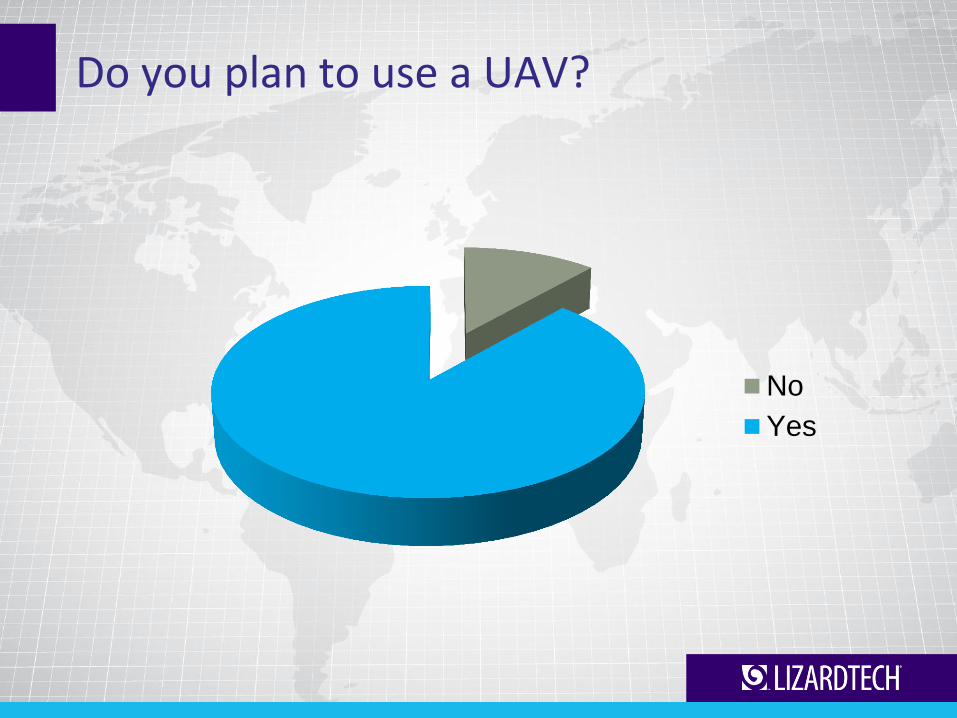
Do you plan to use a UAV?
No
Yes
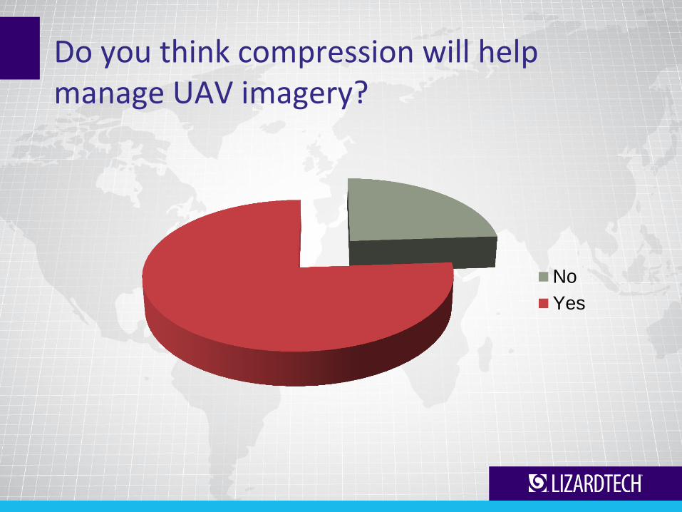
Do you think compression will help manage UAV imagery?
No
Yes
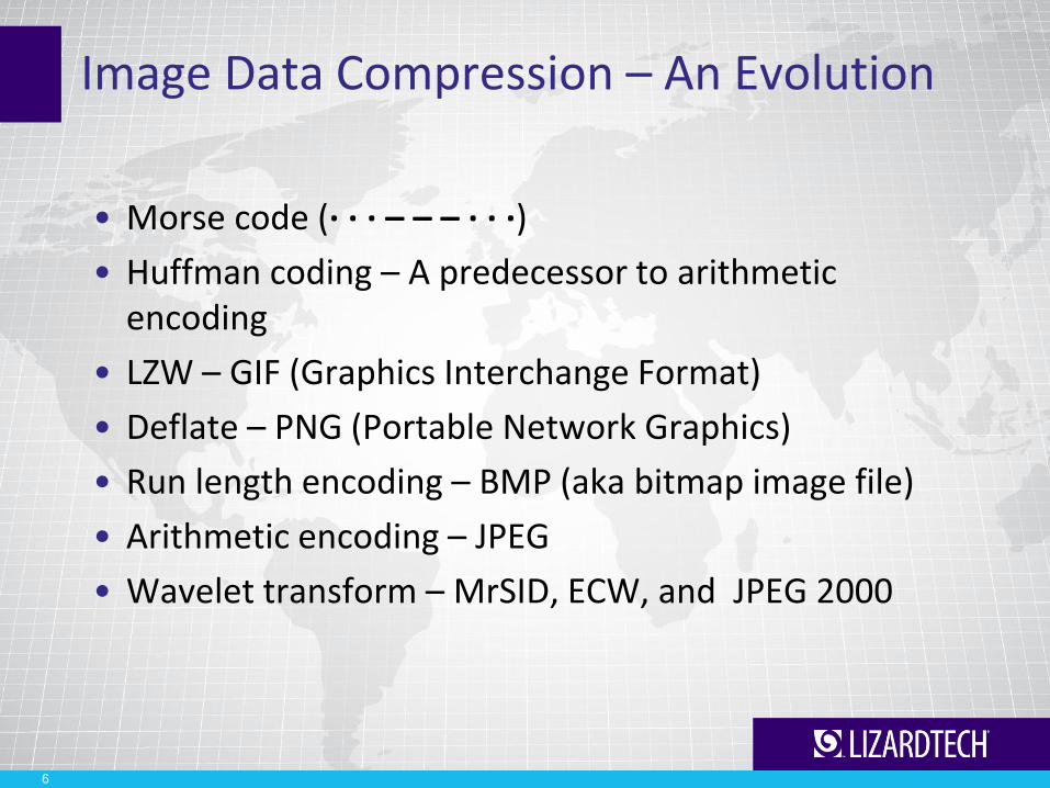
Image Data Compression – An Evolution
• Morse code (· · · – – – · · ·)
• Huffman coding – A predecessor to arithmetic encoding
• LZW – GIF (Graphics Interchange Format)
• Deflate – PNG (Portable Network Graphics)
• Run length encoding – BMP (aka bitmap image file)
• Arithmetic encoding – JPEG
• Wavelet transform – MrSID, ECW, and JPEG 2000
6
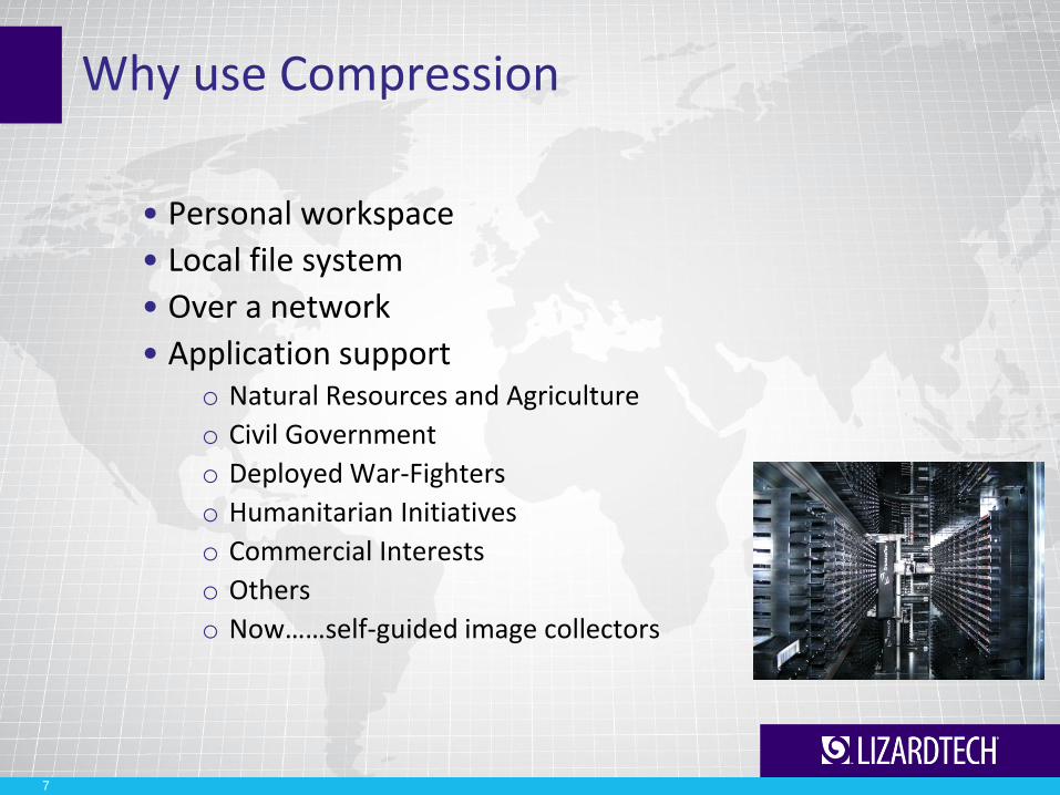
Why use Compression
• Personal workspace
• Local file system
• Over a network
• Application support o Natural Resources and Agriculture
o Civil Government
o Deployed War-Fighters
o Humanitarian Initiatives
o Commercial Interests
o Others
o Now……self-guided image collectors
7

Compression Impact Factors (it’s about time and space)
• File size
• Encoding time
• Decoding time
• Selective Decompression
• Area of interest compression
• Multispectral support – Now 255 Bands
• Streaming
8
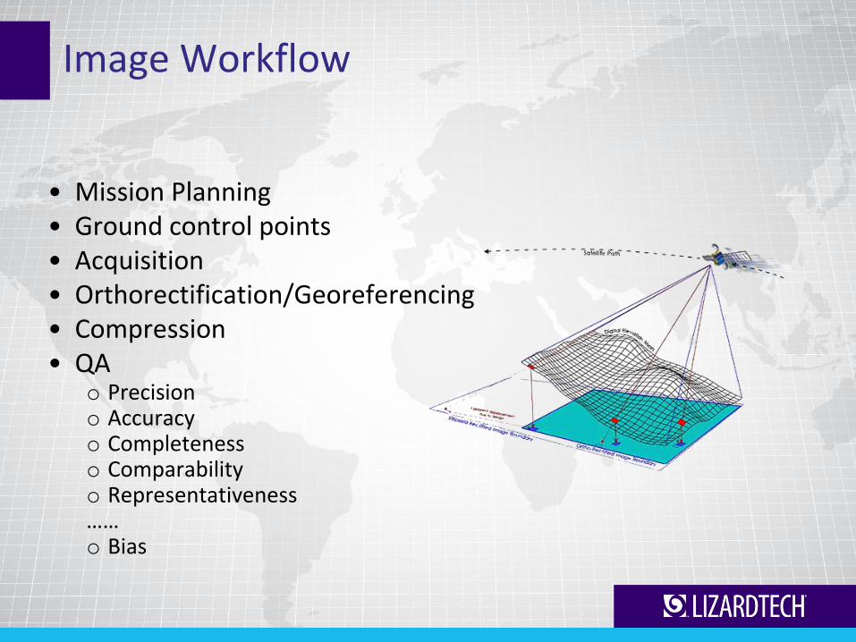
Image Workflow
• Mission Planning • Ground control points • Acquisition • Orthorectification/Georeferencing • Compression • QA
o Precision o Accuracy o Completeness o Comparability o Representativeness …… o Bias
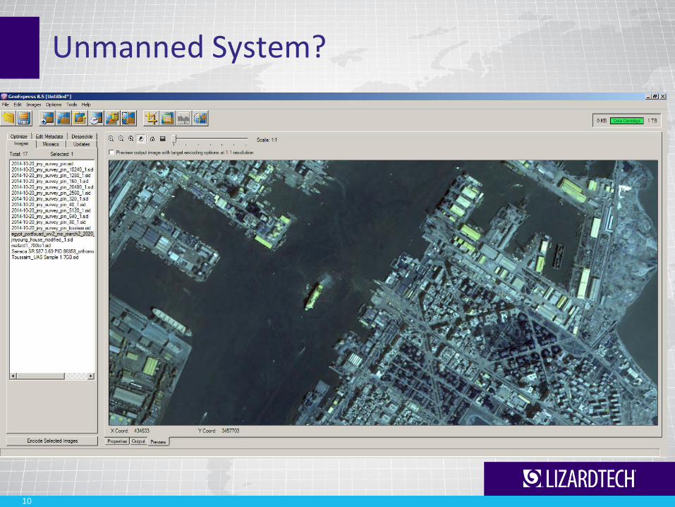
Unmanned System?
10

11
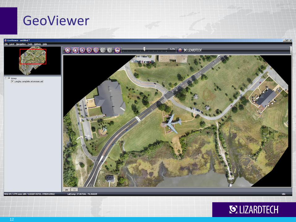
GeoViewer
12

Geo-Referenced
13
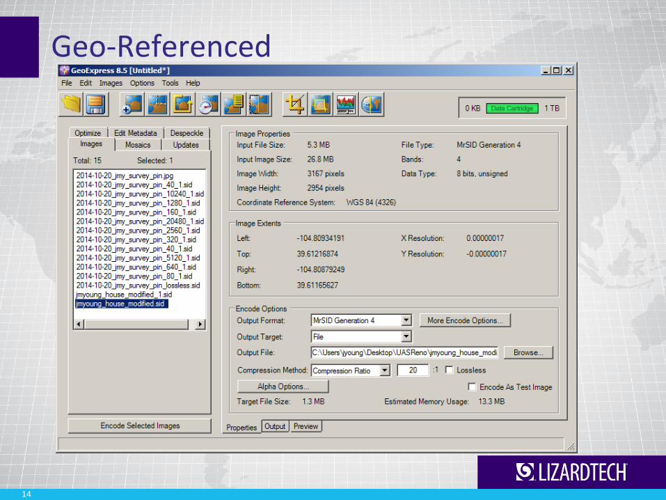
Geo-Referenced
14

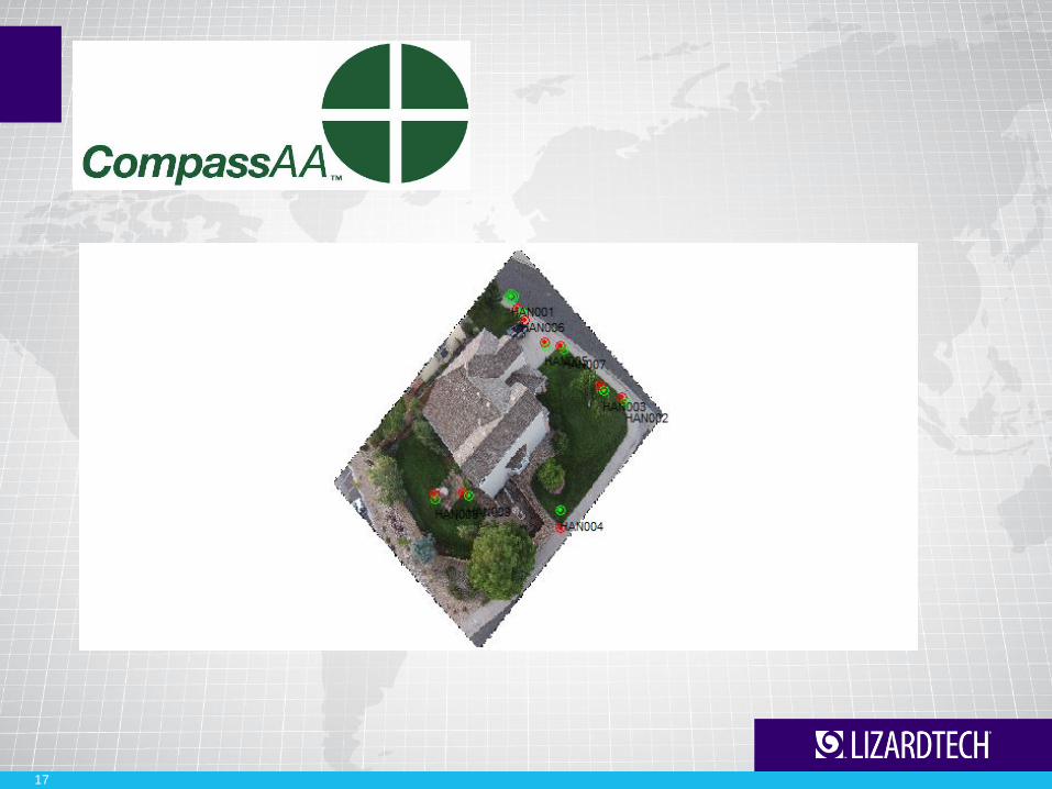
Field Survey
15
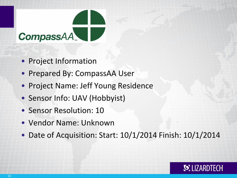
• Project Information
• Prepared By: CompassAA User
• Project Name: Jeff Young Residence
• Sensor Info: UAV (Hobbyist)
• Sensor Resolution: 10
• Vendor Name: Unknown
• Date of Acquisition: Start: 10/1/2014 Finish: 10/1/2014
16
17
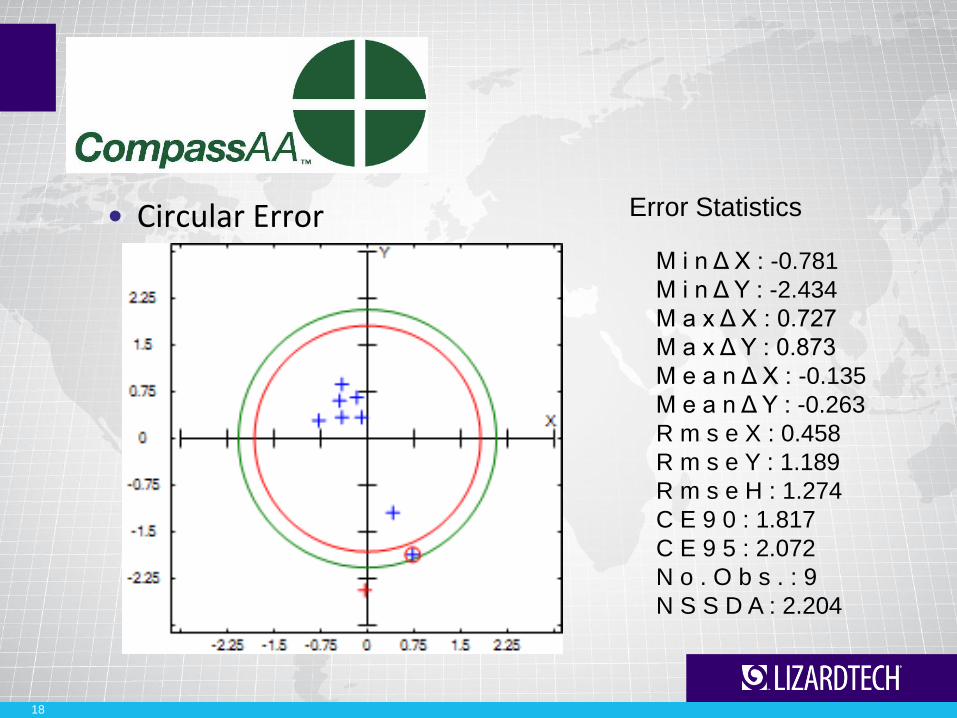
• Circular Error
18
M i n Δ X : -0.781
M i n Δ Y : -2.434
M a x Δ X : 0.727
M a x Δ Y : 0.873
M e a n Δ X : -0.135
M e a n Δ Y : -0.263
R m s e X : 0.458
R m s e Y : 1.189
R m s e H : 1.274
C E 9 0 : 1.817
C E 9 5 : 2.072
N o . O b s . : 9
N S S D A : 2.204
Error Statistics

Understanding Error
19

Understanding Error
20
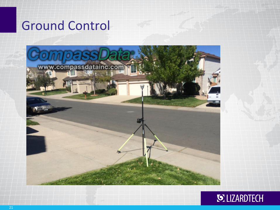
Ground Control
21
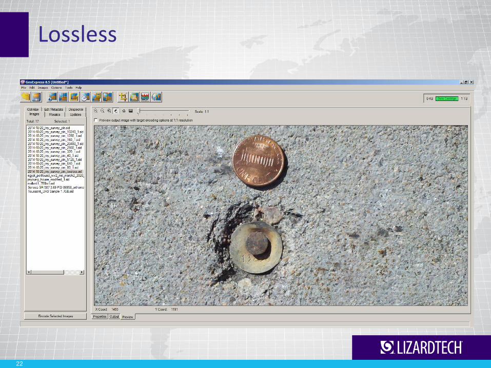
Lossless
22
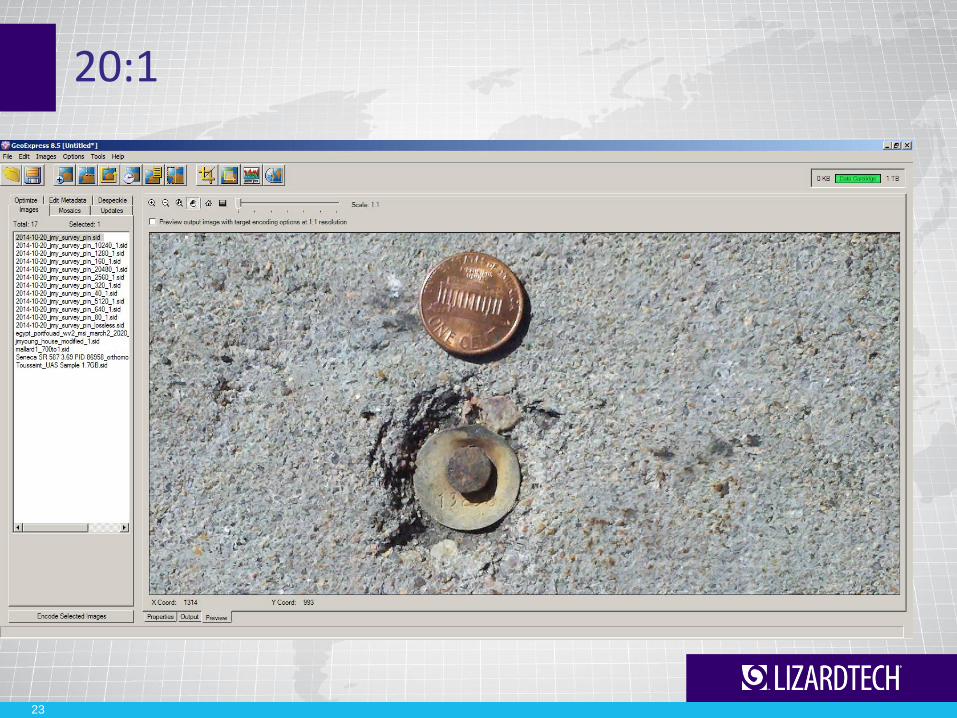
20:1
23

80:1
24
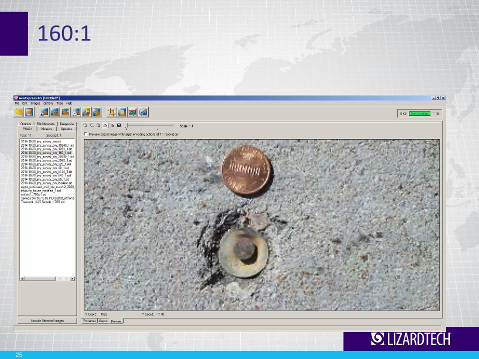
160:1
25

320:1
26

640:1
27
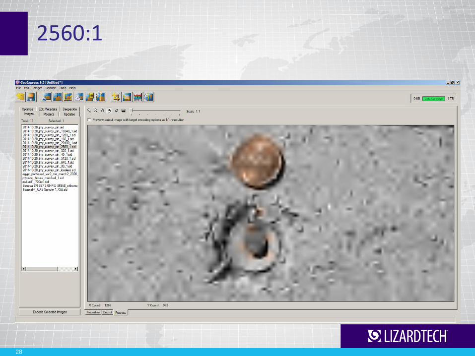
2560:1
28

10240:1
29

Image Compression
• Will I lose data?
• Will there be distortion?
• Will I have to decompress?

Compression ratios 3.04 GB TIFF
Lossless 2:1 451.8 MB
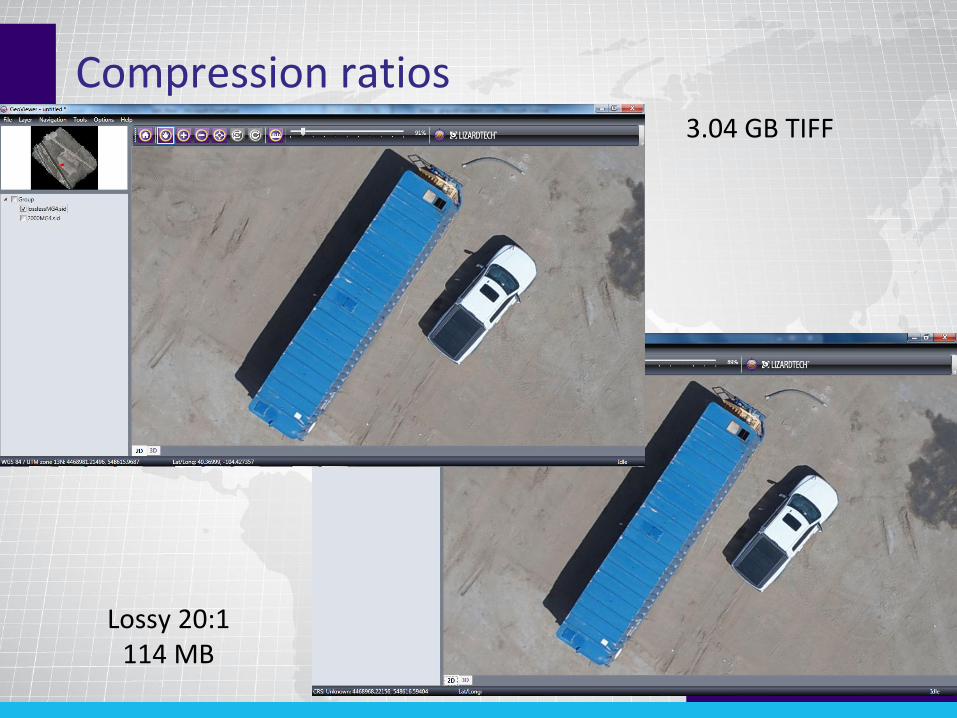
Compression ratios 3.04 GB TIFF
Lossy 20:1 114 MB
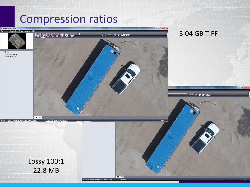
Compression ratios 3.04 GB TIFF
Lossy 100:1 22.8 MB

Compression ratios 3.04 GB TIFF
Lossy 500:1 4.6 MB

Compression ratios 3.04 GB TIFF
Lossy 1000:1 2.3 MB

Compression ratios
Lossy 2000:1 1.1 MB
3.04 GB TIFF

The Sand Box
37
Thank you
Jeff Young 303-815-2254
[email protected] www.lizardtech.com
Genie Hays 206-902-2811
[email protected] www.lizardtech.com