limnology - ningapi.ning.com/.../limnologyall50ppt.pdf · introduction to limnology the term...
TRANSCRIPT

Limnology
What is limnology?

Introduction to limnology
The term limnology was used by F.A
Forel (1892) during his scientific studies
on Lake Geneva.
It is combination of two Greek words, “Limne”
means lake and “logos” means study.

Introduction to limnology
• Limnology is the study of inland water.
• Study of the functional relationships and
productivity of freshwater communities, as
they are regulated by the dynamics of their
physical, chemical, and biotic environments.

Introduction to limnology
• Limnology includes standing water (lentic
habitats) as well as running water (lotic
habitats).
• This includes the study of lakes and ponds,
rivers, springs, streams and wetlands.

Introduction to limnology
Limnology covers the biological, chemical,
physical, geological and other attributes of all
inland waters (running and standing waters,
fresh and saline, natural or man-made).

Introduction to limnology
A more recent sub-discipline of limnology,
termed landscape limnology, studies, manages,
and conserves these aquatic ecosystems using
a landscape perspective.

Introduction to limnology
Limnology is closely related to aquatic
ecology and hydrobiology, which study aquatic
organisms in particular regard to their
hydrological environment.
Although limnology is sometimes equated
with freshwater science, this is erroneous since
limnology also comprises the study of inland
salt lakes.

Introduction to limnology
Significant progress in limnology was made in
20th century:
Phytoplankton succession and primary
forcing functions.
Transfer of energy (food network) Hydro-
geochemical and geochemical studies on
sediments.
Importance of limnology as a science

Importance of limnology as a science
The study of limnology is, like other sciences
basically a search of principles. Those
principles that are involved in certain
processes and operating mechanisms in the
field of limnology.

Importance of limnology as a science
For example, When comparing the
hydrodynamics of river, lakes and reservoirs,
certain basic functional aspects are immediately
understood that affect the life cycle and
distribution and biomass of aquatic organisms.

Importance of limnology as a science
In addition to scientific interest and basic
knowledge, limnology can provide some
important applications,
Planktonic successions
Study of evolution of lakes and reservoirs
Geomorphology

Importance of limnology as a science
Hydrodynamic and its effects.
The ration of allochthonous (externally
derived) to autochthonous (internally
derived) material.
Comparison between lakes and reservoirs.

Importance of
Water
Importance of Water
Water is medium of life. Without water life is
impossible.
About 71% of earth surface is covered with
water. 97% of this water is saltwater present in
oceans while only 3% is available as freshwater.

Importance of Water
The overall
distribution
of water on
the earth
surface is
depicted
by this diagram.
Importance of Water
Water importance
Photosynthesis
Irrigation
Domestic use
Industrial use for power generation
Recreational purpose

Importance of Water
Drinking
Transport of nutrients throughout body
Removal of waste from body
Lubricate body tissues
Maintains the temperature of body
Essential for proper functioning of body
Maintenance of pH
Physical properties
of water

Physical properties of water
Some physical properties of water are,
o Molecular shape
o Polarity
o Surface tension
o Specific heat capacity

Physical properties of water
o Density
o Viscosity
o Solubility
o Dissolved Oxygen
o Cohesion
o Adhesion
Physical properties of water
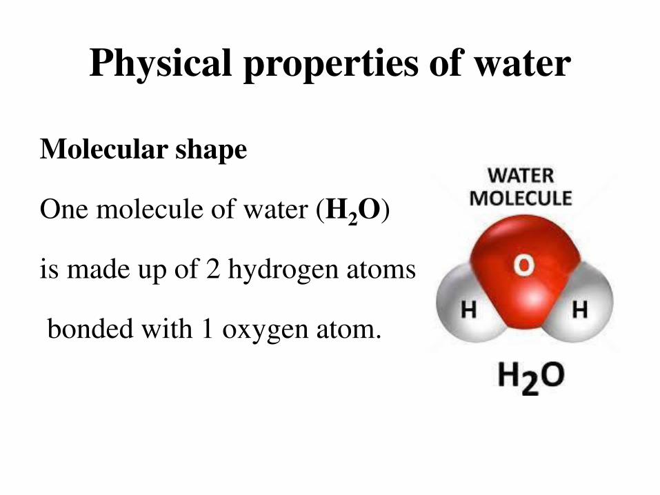
Molecular shape
One molecule of water (H2O)
is made up of 2 hydrogen atoms
bonded with 1 oxygen atom.

Physical properties of water
Polarity
Water is a polar molecule.
The positive hydrogen
ends of 1 molecule are
attracted to the negative
end of the oxygen of
another molecule.

Physical properties of water
Surface tension
The property of the surface of a liquid that
allows it to resist an external force. It enables
some objects (e.g. water striders) to float on
surface of water.

Physical properties of water
Specific heat capacity
Amount of energy needed to increase
temperature of one gram of water to one degree
Celsius.
Water has a specific heat of 4.18 J.

Physical properties of water
Density
Mass a substance per unit volume.
Liquid is more dense than ice, that’s why ice
floats on liquid water.
The density of liquid water is maximum at 4°C.

Physical properties of water
Viscosity
The quantity of internal resistance in the fluid or
simply the thickness of a fluid.
Honey is more viscous than water because it is
more thick and hence offer more resistance in
flow than water.

Physical properties of water
Solubility
Universal solvent
On earth, water exists in 3 physical states
Solid – ice
Liquid – water
Gas – vapor

Physical properties of water
Dissolved Oxygen
Oxygen saturation in water medium.
Dissolved oxygen range for healthy biological
system is, 5-12 mg/liter.

Physical properties of water
Cohesion
The force of attraction between water molecules.
Water molecules like to stick to each other.
Adhesion
The force of attraction between the molecules of
water and other substances.

Chemical properties
of water

Chemical properties of water
pH
Alkalinity
Salinity
Total dissolve solids
Hardness

Chemical properties of water
pH
Hydrogen ion concentration of a medium.
A measure of acidity or alkalinity of a medium.
The pH of pure water is 7.

Chemical properties of water
Alkalinity
Ability of water to absorb hydrogen ions when
acid is added to it.
Also called as acid neutralizing capacity (ANC).

Chemical properties of water
Salinity
A measure of total concentration of ions
dissolved in water.
Fresh water: 0-0.5 ppt
Brackish water: 0.5-25 ppt
Saltwater: 25-35 ppt

Chemical properties of water
Total dissolved solids
A measure of total amount of inorganic (calcium,
magnesium, potassium, sodium, bicarbonates,
chlorides, and sulfates) and organic salts (organic
matter) dissolved in water.

Chemical properties of water
Hardness
A measure of amount of dissolved calcium and
magnesium ions in the water.
Water with high concentration of dissolved calcium
and magnesium carbonates is regarded as hard water
while water with less concentration of dissolved
calcium and magnesium ions is called as soft water.
Freshwater
ecosystem

Freshwater ecosystem
Freshwater Division
Freshwater ecosystem includes
1. Lentic water bodies or systems
2. Lotic water bodies or systems

o Cover almost about 3% of the earth’s surface.
o They provide a number of important ecological
and economic services to humans.
o Possess diverse flora and fauna.
Freshwater ecosystem

Freshwater ecosystem

Lotic water bodies

Lotic water bodies
The study of freshwater is known as limnology.
Those water bodies that hold running water are
termed as lotic water bodies.
High dissolved oxygen due to continuous flow of
water

Lotic water bodies
Examples of lotic water bodies are
1. Rivers
2. Streams
3. Springs

Lotic water bodies
Lotic water bodies receive water supply from
• Precipitation
• Snow melt
• Springs

Lotic water bodies
Rivers
A deep fast flowing freshwater body with high dissolved oxygen content.

Lotic water bodies
Streams
A shallow fast flowing water body smaller than rivers.

Lotic water bodies
Springs
A freshwater body
in which water
flows out of the
ground.

Streams

Streams
A small, shallow and fast moving water body
that supports variety of aquatic flora and fauna.
A watershed, or drainage basin, is the land
area that delivers runoff, sediment, and dissolved
substances to a stream.
Streams
In many areas, streams begin in mountainous or
hilly areas that collect and release water falling
to the earth’s surface as rain or snow melts
during warm seasons.
Streams have low depth and narrow banks.

Streams
Streams receive nutrients from
Falling leaves
Animal feces
Insects
Biomass washed into streams during heavy rainstorms or by
melting snow.
Thus, the levels and types of nutrients in a stream depend on
what is happening in the stream’s watershed.

Streams
Streams receive their water from
o Precipitation
o Melting snow
o Groundwater
They lose water by
• Evaporation
• Sinking into the ground
• Discharge at their terminus or mouth.
Streams
The velocity of a stream depends on following
factors
i. Volume of water
ii. Stream channel width and depth
iii. Slope or gradient of stream

Streams
Streams habitat
A typical stream contains three major types of
habitats:
Riffle
Pool
Run

Streams
A riffle is an area of shallow and fast moving,
water.
A run is an area of smoothly moving water.
A pool is an area of deep and stagnant water.
Each habitat type supports different types of aquatic
life, so a stream with a greater diversity of habitat
types will generally support a greater diversity of
organisms.

Stream order
Stream order
The concept of stream order classifies streams in
relation to tributaries, drainage area, total length
and age of water. . It is actually a measure of
relative size of streams.

Stream order
A stream order assigns numerical designations
that indicate where in a watershed drainage
system a certain stream segment lies.
First order stream
Second order stream
Third order stream and so on……….

Stream order
Perennial streams without tributaries are
termed as first-order streams.
Two first-order streams combine to form a
second-order stream.
While two second-order streams combine to
form a third-order stream and so on.

Stream order
A comprehensive
model of stream
order depicting
various orders of
steams.

Stream order
The Mississippi River is a 10th-order stream
when it empties into the Gulf of Mexico.
The Amazon River in Brazil is the world’s
largest river because it carries more water into
the ocean than any other. It is a 12th-order
stream when it reaches the Atlantic Ocean.

Rivers

Rivers
Small streams join to form rivers, and rivers flow
downhill to the ocean. Rivers and streams are
powerful transporting agents as they roll and
push material on their bed down the channel. The
suspended matter give river water a muddy look.

Rivers
The downward flow of surface water and
groundwater from mountain to the sea typically
takes place in three zones characterized by different
environmental conditions:
Source zone
Transition zone
Floodplain zone

Rivers
Three zones in the downhill flow of water: – Source zone containing mountain (headwater) streams
– Transition zone containing wider, lower-elevation streams
– Floodplain zone containing rivers, which empty into the ocean

Drainage Basin

Drainage Basin
The area of landscape that contributes to the
water supply of river/ stream is called as
Drainage basin or catchment basin.
The area or boundary between two drainage
basins is known as a drainage divide or
watershed.

Drainage Basin
Drainage divide or watershed is the boundary
line that makes a differentiation between one
drainage basin to other.
Small drainage basins generally contribute to
streams, while the water from larger drainage
basins come together to form large rivers.

Drainage Basin
The drainage basin includes both the streams and
rivers that convey the water as well as the land
surfaces from which water drains into those
channels.
The drainage basin acts like a funnel, collecting
all the water within the area covered by the basin
and channeling it into a waterway.

Drainage Basin

Morphology and flow
in river ecosystems

Morphology and flow
in river ecosystems
The terms river morphology is used to describe
the shapes of river channels and how they
change in shape and direction over time.
The study of river morphology is accomplished
in the field of fluvial geomorphology, the
scientific term.

Morphology and flow
in river ecosystems
Fluvial geomorphology is the study of the form
and function of rivers/streams and the interaction
between rivers/streams and the landscape around
them.
The fluvial system of the river valley can be
divided into three main zones.

Morphology and flow
in river ecosystems
Fluvial geomorphology
An erosional zone
A transport zone
A depositional zone

Morphology and flow
in river ecosystems
Erosional zone
In the first or upper zone the erosional process
predominates and the stream and riverbeds are
generally degraded. The streams join together
and their slopes are generally steep. The bed
material is characteristically composed of
gravels.

Morphology and flow
in river ecosystems
Transport zone
The second (middle) zone is considered as near
equilibrium condition between the inflow and outflow
of water and sediment. The bed elevation in this
equilibrium zone is fairly constant and the river
generally flows in a single channel.
The sediment material generally composes gravels and
sands of various sizes.

Morphology and flow
in river ecosystems
Depositional zone
The lower zone is characterized by net
sedimentation and river bed aggradations. There
is branching of the river into channels and the
slope of these channels is rather flat. The bed
material generally composes of fine sand to silt
and clay.

Morphology and flow
in river ecosystems
The river's mouth is classified into two types:
1) Delta
2) Estuary
Delta:
Land formed by the material accumulated by the
river into contact with the sea.

Morphology and flow
in river ecosystems
Estuary:
The place where the river comes into contact
with the sea, where sea water enters into the
mouth of the river. The mix water is now called
estuarine water.

Channel morphology
Channel morphology
The basin or valley trough containing the
flowing water is the stream or river channel.
The channel is described physically in terms of
length, width, depth, cross-sectional area, slope
etc.
Channel morphology
The channel is usually bordered on one or both
sides by a flat area called the flood plain.
Much of the soil of the flood plain is connected
hydrologically to the water of the channel.

Channel morphology
The forms of river channels are,
o Straight
o Meandering
o Braided

Channel morphology
Straight channel
Straight stream channels are rare and are found
in the most tectonically incised/active areas.
Even in straight channel segments water flows in
a sinuous fashion.

Channel morphology
Meandering channel
A meandering channel is one that takes twists
and turns over its length.
Meanders are bends in
a river that form as a
river’s sinuosity increases.

Channel morphology
Sinuosity of a river
a measurement of how much a river varies from
a straight line.
Sinuosity = Channel Length / Displacement
A sinuosity of 1 means that the channel is
perfectly straight. A sinuosity greater than 1
means that the river meanders.

Channel morphology
Braided channel
Develops when a stream channel is divided into
several smaller ones by the accumulation of in-
channel deposits.
Sand or gravel bars
accumulate
subdividing the flow of water into many smaller
channels.

River continuum
concept

River continuum concept
The river continuum concept, first proposed by
Vannote and some others in 1980, provides a
model of changes that might take place as water
travels from headwater streams to larger rivers.

River continuum concept
The RCC proposes a progressive shift in
following parameters from headwaters to down
water,
Physical gradients and energy inputs
Trophic organization
Biological communities.

River continuum concept
An overview of RCC
Headstream water:
Headwater has steep gradient with riffles,
rapids and falls.
Limited photosynthesis because of limited
sunlight due to overhanging trees.

River continuum concept
Leaves and woody material falling into the stream
are a main source of energy.
Aquatic insects break down and digest the
terrestrial organic matter.
Water is cooled by springs and often supports
trout.
The fauna is dominated by detritivores and filter
feeders.

River continuum concept
Downstream water:
The river grows having less gradient with few
riffles and rapids.
Phytoplankton and zooplankton contribute to the
food base along with dissolved organic matter.
Supports a greater diversity of invertebrates and
fish.

River continuum concept
Photosynthesis increases due to increase in
light initially at start but later decreases along
the course of downstream due to increase of
sediments that ultimately make water turbid.
Colonization of algae and plants contribute
significant energy to the community.

Stream communities

Stream communities
Life in First-and second-order streams
o In the headwaters of a stream the water is
shallow, the stream bottom is often rocky, and
there are few aquatic plants. A lack of food
limits the number of animals that can live
there.

Stream communities
o Benthos, is a key part of the food web. These
include benthic macro-invertebrates, such as
mussels, aquatic insects, and other
invertebrates.
o Animals at the bottom of the food web depend
on the leaves, stems, and animals that may fall
into the stream from the land.

Stream communities
o Aquatic insects, such as stonefly nymphs,
chew and tear leaves and stems into tiny bits.
They are called shredders.
o Small pieces not eaten by shredders are eaten
by filtering and gathering collectors.

Stream communities
o Grazers (snails, for example) appear further
downstream as the channel widens and feed on
the algae.
o Most fish that live in headwater streams are
small predators such as darters or minnows
that feed on smaller animals, such as aquatic
insect nymphs and larvae.

Stream communities
Life in Third- through fifth-order streams
Rooted and floating aquatic plants and algae
Grazers such as snails and water pennies eat
the growing number of plants. Collectors
increase with the varied plant life.

Stream communities
Plant diversity increases, shredders begin to
decrease.
A large variety of fish species live in the
deeper and more varied mid-level streams.

Stream communities
Life in High-order streams
• Few rooted plants may grow because the water
is too deep and turbid (cloudy).
• More collectors than shredders. One major
group of collectors in big rivers is mussels
living in the river’s benthic zone.

Stream communities
• Fish and turtles and reptiles in large rivers are
also an important part of the food web.
Predators such as sunfish may specialize in
eating insects, while others such as the Catfish
and Spotted bass consume smaller fish.
Predators range in size from
tiny zooplankton to 300 pound alligator gar.

Stream communities
• Otters are small
carnivorous mammals
that are often the top
predators in streams
and feeds on mussels,
fish, turtles, frogs, etc.

Types of streams

Types of streams
Streams and rivers are primarily characterized by
flow. There are three main types of streams,
Perennial
Intermittent
Ephemeral

Types of streams
Perennial stream:
Perennial streams and rivers are those that flow
year-round.
These streams flow all year around because their
channels are in constant contact with the
groundwater table.

Types of streams
Most well developed streams in New England are
perennial.

Types of streams
Intermittent streams:
Intermittent streams and rivers are those that
become dry for a period of a week or longer each
year.
They flow continuously only during certain
seasons when the groundwater table is high.

Types of streams
These water bodies are generally associated with arid or
semiarid areas or areas of average rainfall that are
experiencing especially dry conditions.

Types of streams
Ephemeral stream
Intermittent streams that regularly exist for only a short
period of time are classified as ephemeral streams.
Types of streams
Ephemeral streams are best illustrated by the dry
stream beds called arroyos, that flow only
following rainfall and cease to flow soon after.

Types of flow

Types of flow
There are in usually three types of fluid flow
• Laminar flow
• Turbulent flow
• Transient flow
Types of flow
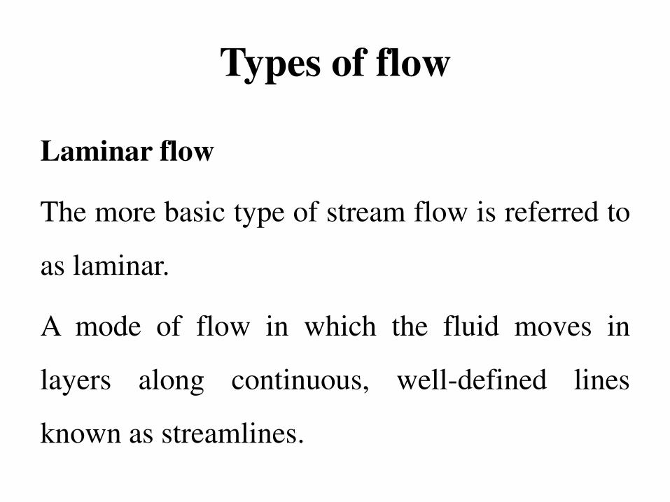
Laminar flow
The more basic type of stream flow is referred to
as laminar.
A mode of flow in which the fluid moves in
layers along continuous, well-defined lines
known as streamlines.

Types of flow
A flow with regular, predictable motion is
called laminar flow. Laminar flow is when water
is organized in parallel layers and moves in an
orderly manner.
It is possible because there are minimal rocks or
other physical barriers in these types of flows.

Types of flow
Turbulent flow
The more complex type of steam flow is referred
to as turbulent. A flow with irregular,
unpredictable motion is called turbulent flow.
Turbulent stream flow is when water does not
remain within parallel layers and does not move
in an orderly manner.
Types of flow
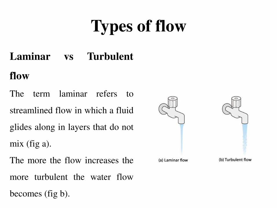
Laminar vs Turbulent
flow
The term laminar refers to
streamlined flow in which a fluid
glides along in layers that do not
mix (fig a).
The more the flow increases the
more turbulent the water flow
becomes (fig b).

Types of flow
Transient flow
Transitional flow is a mixture of laminar and
turbulent flow, with turbulence in the centre of
the channel, and laminar flow near the edges.
Transient flow is a condition where the velocity
and pressure of a fluid flow change over time
due to changes in system status.

Lentic water bodies

Lentic water bodies
Standing bodies of freshwater that supports
variety of life.
Wind action is very vital in these water bodies
because it increases the content of dissolve
oxygen that is necessary for the aquatic life in
these water bodies.

Lentic water bodies
Examples of such water systems are
Ponds
Lakes
Wetlands

Lentic water bodies
These still water bodies possess following zones,
–Littoral zone
–Limnetic zone
–Profundal zone
–Benthic zone

Lentic water bodies
Overturn
The mixing of water from the bottom of the lake
with the water close to the surface of lake.
This occurs during spring and fall. Lake overturn
enhances the dissolve oxygen content of lake
that is necessary for survival of life present in the
lake water.

Lakes

Lakes
Lakes are large natural bodies of standing
freshwater formed when precipitation, runoff, or
groundwater seepage fills depressions in the
earth’s surface.

Lakes
Lake formation
Factors that are vital in lake formation are
• Glaciation
• Crustal displacement
• Volcanic activity

Freshwater lakes vary tremendously in
• Size
• Depth
• Nutrient content
Lakes

Lakes
Deep lakes normally consist of four distinct
zones
1. Littoral
2. Limnetic
3. Profundal
4. Benthic

Lakes
Littoral zone:
A shallow water area near the shore where
maximum light can penetrate.
Littoral zone possess
• High biological diversity
• Ample sunlight
• Inputs of nutrients

Lakes
Limnetic zone:
Open water area away from shore where still
enough light can penetrate.
Main photosynthetic body
Produces food and oxygen for consumers
Most abundant organisms are microscopic
phytoplankton and zooplankton

Lakes
Profundal zone
A deep zone of standing body of water where
light can not penetrate.
No photosynthesis.
Oxygen levels are often low
Cool and dark water with fish species is found

Lakes
Benthic zone
The bottom of the lake Containing organisms
called benthos.
Decomposers
Detritus feeders
Invertebrates
Some fishes

Lakes

The origin of lakes

The origin of lakes
The formation and life history of lakes is an
important part of landscape ecology of lakes.
The study of geomorphology contributes
significantly to understanding the origin of lakes
and the dynamics of the formative processes of
lake ecosystems.

The origin of lakes
The influx of nutrients, stratification, thermal
de-stratification and retention time all depend
on the lake’s geomorphology.
The origin of lakes
Morphology, the study of lake shapes, is related
to the origins of each system.
Morphometry deals with the quantification of
these forms and elements. Lake morphology and
morphometry basically depend on the processes
from which lakes originated.

The origin of lakes
Lakes that were formed from specific
geomorphological events in certain geographical
areas have similar characteristics and are
therefore grouped into lake districts.

The origin of lakes
Although these characteristics are similar, there
are differences in the morphometry,
productivity and chemical composition of the
water. Comparative studies of lakes in the same
district and between different lake districts allow
for regional classification.

The origin of lakes
Lakes are formed by the action of following
process,
o Glaciation
o Tectonic activity
o Volcanic activity
o Biological activity

Lake formation by
Glaciation

Lake formation by Glaciation
Glaciation is a major geological process that
forms lakes.
Glaciers are formed by accumulation of snow
during cool climate conditions.
Accumulated snow compacts to form ice and the
mass slowly spreads out.

Lake formation by Glaciation
Glaciers create basins for lakes by dropping
sediments that dam rivers and valleys leaving
iceberg in sediments.
Continental glaciers have been occurring for
about last 1.5 million years.

Lake formation by Glaciation
Alpine Glaciation
Alpine glaciers often dig out basin at the base of
a steep cliff.
If the basin is filled with water it is called a
Tarn.

Lake formation by Glaciation
Glacial till or Glacial drift
Glacial sediments that dam valleys and rivers are
called as Glacial till or Glacial drift. These
include, clays, sand, gravel etc.
Piles of glacial till is known as Moraines.

Lake formation by Glaciation
Kettle pond
They are formed among moraines.
As the glaciers melted, they dumped
accumulated till mixed with large pieces of ice.
Blocks of ice melted, sometimes producing a
basin within the glacial till.
Lake formation by Glaciation
Alluvial Dam
When two rivers meet, the one that is flowing
faster will dump sediments into other slower
stream/river forming an alluvial dam.
Sediments carried by river/Stream currents are
known as Alluvium.

Lake formation by Glaciation
Plunge basin
A depression that is created by the action of
falling water from waterfalls.
As the glaciers melt they released water that falls
and creates a basin.

Lake formation by
Tectonic activity

Lake formation by Tectonic activity
The lake is formed by movements of the Earth’s
crust, such as faults that result in depressions.
They are often formed in rift valleys (Graben).
The basin created by broken earth crust is known
as Graben and it can host a lake.

Lake formation by Tectonic activity
Tectonic movements can occur through the
emergence or subsiding (lifting or sinking) of
areas with shifts in sea level. The formation of
lakes then begins with isolation from the ocean.
Some lakes, which were ancient fjords, formed
when their connection with the sea was closed.
Lake formation by Tectonic activity
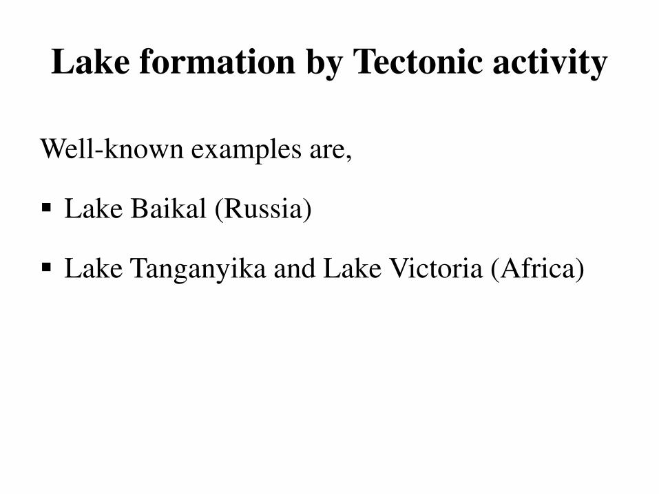
Well-known examples are,
Lake Baikal (Russia)
Lake Tanganyika and Lake Victoria (Africa)

Lake formation by Tectonic activity
Lake Baikal
Lake Baikal is the largest freshwater lake in the
world (by volume) and the world's deepest lake
found in Russia.
It is 1741-meter deep and a host to 2000 species
of plants and animals.

Lake formation by
Volcanic activity

Lake formation by Volcanic activity
During a volcanic explosion the top of the cone
may be blown off leaving behind a natural
hollow called a crater (A cup shaped depression).
This may be enlarged by subsidence into a
caldera (A large crater).

Lake formation by Volcanic activity
After the eruption of magma has ceased, the
crater frequently turns into a lake at a later time.
This lake is called a ‘caldera’.
Examples:
• Lonar lake in Maharashtra
• Krakatao lake in Indonesia

Lake formation by Volcanic activity
Volcanic Landforms
Volcanic landforms are divided into extrusive
and intrusive landforms based on weather
magma that cools within the crust or above the
crust.
Rocks formed by cooling of magma within the
crust are called ‘Plutonic rocks’.

Lake formation by Volcanic activity
• Rocks formed by cooling of lava above the
surface are called ‘Igneous rocks’.
• In general, the term ‘Igneous rocks’ is used to
refer all rocks of volcanic origin

Lake formation by Volcanic activity
Intrusive Volcanic Landforms
Intrusive landforms are formed when magma
cools within the crust (Plutonic rocks or intrusive
igneous rock).
The intrusive activity of volcanoes gives rise to
various forms.

Lake formation by Volcanic activity
Extrusive Volcanic Landforms
Extrusive landforms are formed from material
thrown out during volcanic activity.
The materials thrown out during volcanic activity
includes lava flows, pyroclastic debris, volcanic
bombs, ash and dust and gases such as nitrogen
compounds, sulphur compounds and minor
amounts of chlorine, hydrogen and argon.

Lake formation by
Biological activity

Lake formed by Biological activity
Several species of relatively large animals can
make lakes. Mainly following biological
activities are involved in the formation of water
reservoir.
1) Beaver ponds
2) Wallows
3) Human activity

Lake formed by Biological activity
Beaver ponds:
Beavers are water animals and exist on a diet
of bark, twigs and buds of trees. They are
excellent swimmers and wood cutters. They
use trees not only for food but also for building
lodges and dams.

Lake formed by Biological activity
Beavers are another good example of a foundation species. Acting as
“ecological engineers,” they build dams in streams to create ponds
and other wetlands used by other species.

Lake formed by Biological activity
Beaver ponds create important habitat for
many other species, including juvenile Coho
salmon. Some migratory birds also prefer
landing on beaver ponds instead of more open
bodies of water.
Lake formed by Biological activity
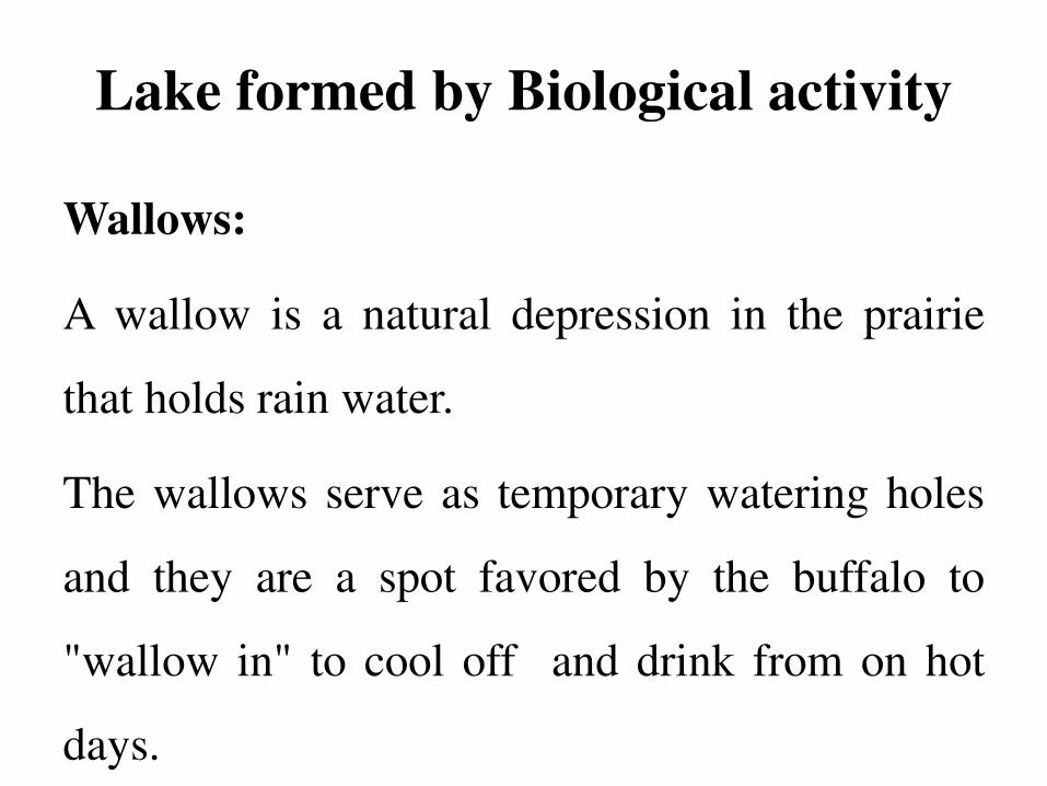
Wallows:
A wallow is a natural depression in the prairie
that holds rain water.
The wallows serve as temporary watering holes
and they are a spot favored by the buffalo to
"wallow in" to cool off and drink from on hot
days.

Lake formed by Biological activity
Human activity:
Besides the natural lakes, man has now created
artificial lakes by erecting a concrete dam across
a river valley so that the river water can be kept
back to form reservoirs. An example is Lake
Mead above the Hoover Dam on the Colorado
River, U.S.A.

General features of
lakes

General features of lakes
The chemical and biological characteristics of
the lake depend on the following:
• Lake formation
• Basin size and shape
• Topography and chemistry

General features of lakes
• Regional climate
• Biological community
• Anthropogenic activity

General features of lakes
Lakes are extremely variable in their physical,
chemical and biological characteristics.
Physically they vary in terms of
Level of light
Temperature
Water currents

General features of lakes
Chemically they vary in form of
Nutrients
Major ions and contaminants
Biologically in terms of
Biomass
Population numbers and growth

Zonation in lakes
Zonation in lakes
Deep lakes normally consist of four distinct
zones
Littoral zone
Limnetic zone
Profundal zone
Benthic zone

Zonation in lakes
Littoral zone:
A shallow water area near the shore where
maximum light can penetrate.
The aquatic weed and phytoplankton are the
basis of the aquatic food chain which supports
the most diverse life forms ranging from aquatic
plant life, zooplankton, crustacean and fish.

Zonation in lakes
Littoral zone possess
• Algae
• Aquatic macrophytes
• Animals may include tiny crustaceans,
flatworms, insect larvae, snails, frogs, fish, and
turtles.

Zonation in lakes
Limnetic zone:
Open water area away from shore where still
enough light can penetrate.
The part of the limnetic zone that gets sunlight is
called the Euphotic zone.

Zonation in lakes
Aphotic zone is just below the photic zone
where light cannot penetrate.
Limnetic zone possess
Main photosynthetic body
Produces food and oxygen for consumers
Most abundant organisms are microscopic
phytoplankton and zooplankton

Zonation in lakes
Profundal zone:
A deep zone of standing body of water where
light can not penetrate.
No photosynthesis
Oxygen levels are often low
Cool and dark water with fish species is found
Inhabited by fish adapted to cool dark waters

Zonation in lakes
Benthic zone:
The bottom of the lake containing organisms called
benthos.
o Decomposers
o Detritus feeders
o Invertebrates
o Some fishes

Zonation in lakes

Physical processes in
lakes, reservoirs and
rivers

Physical processes in lakes,
reservoirs and rivers
The principal mechanisms and functions of
physical force that affect the vertical and
horizontal structure of lakes and reservoirs
include the following:
1. External mechanisms
2. Internal mechanisms

Physical processes in lakes,
reservoirs and rivers
External mechanisms:
• Wind
• Barometric pressure
• Heat transfer
• Intrusion

Physical processes in lakes,
reservoirs and rivers
• Downstream flow
• Coriolis effect (from the rotation of the Earth)
• Discharges on the surface

Physical processes in lakes,
reservoirs and rivers
Internal mechanisms
• Stratification
• Vertical mixing
• Selective removal or selective loss
downstream
• Density currents

Physical processes in lakes,
reservoirs and rivers
Mixing and vertical stratification are dynamic
phenomenon for the structure and organization
of chemical and biological processes in lakes,
reservoirs, rivers and estuaries.

Physical processes in lakes,
reservoirs and rivers
Wind exerts an action of turbulence stress on
the water surface. As a consequence, the
following phenomena occur:
• Surface currents
• Accumulation of water on the surface, in the
direction of wind, and an oscillation in the
stratified interface.

Physical processes in lakes,
reservoirs and rivers
Wind-produced kinetic energy, therefore,
generates currents, waves, turbulence and
transient situations that promote mixing and
dissipation.

Penetration of solar
energy in water

Penetration of solar energy in water
The term Light is generally used to refer to the
portion of the electromagnetic spectrum to which
the human eye is sensitive (i.e., the region of the
spectrum considered visible – in the range of
390–740 nm).The aesthetic value of a body of
water is related to its color and hence to the
quality of the water.

Penetration of solar energy in water
Life essentially depends on the amount and
quality of solar energy that is available on the
surface and distributed in the water column. In
any medium, light is related to its color, and this
in turn, to water quality.

Penetration of solar energy in water
The solar radiation reaching the top of the
atmosphere (in unit area and unit time) is called
the solar constant. The intensity and quality of
solar radiation changes, and its quantity is
substantially reduced during its passage through
the atmosphere.

Penetration of solar energy in water
Light plays an important role in lake ecology and
determines the potential rate of photosynthesis,
which supplies dissolved oxygen and food in the
water. Nearly all energy that controls the
metabolism of lakes and streams is derived
directly from the solar energy utilized in
photosynthesis.

Penetration of solar energy in water
Light intensity varies with seasons and depth.
Deeper the light penetration, higher is the rate of
photosynthesis.
The rate at which the penetration of light
decreases with depth depends on the amount of
suspended particles in water.
Penetration of solar energy in water
When light passes down through a column of
water, the amount of light available at any
particular depth decreases exponentially, as most
of the light is absorbed in the surface waters. The
depth of light penetration depends very much on
the color and turbidity of the water.

Penetration of solar energy in water
A Secchi disk is an 8-
inch (20 cm) black and
white colored wooden
disk used for
measuring light
penetration in water.

Penetration of solar energy in water
It is lowered into the water of a lake until it can
no longer be seen by the observer. This depth of
disappearance, called the Secchi depth, is a
measure of the transparency of the water.

Density
Density
Water differs from other compounds as it is less
dense as solid than as liquid (most dense at 4°C
and less dense at both higher and lower
temperatures). When the surface water of the
lake warms up, heat takes a long time to
penetrate down through the water.

Density
During summer, temperature differences
between the upper and lower layers become
more distinct. Deep lakes generally become
stratified into three identifiable layers known as
Epilimnion
Metalimnion
Hypolimnion

Density
Change in density at the metalimnion acts as a
physical barrier preventing the mixing of
epilimnion and hypolimnion. Thermocline is
actually the plane or surface of maximum rate of
decrease of temperature with respect to depth.
Thus, thermocline is the point of maximum
temperature change within the metalimnion.

Density
Thermal stratification and heat exchange depend
on solar radiation and wind. In addition to
climate, the size and wind exposure of a lake and
water inflow are the major factors that determine
the type of circulation
Density
Circulation pattern in lakes:
• Amictic
• Meromictic
• Holomictic
• Monomictic
• Dimictic
• Polymictic

Density
Amictic:
Never mix as they are permanently frozen.
Meromictic:
mix only partially, the deeper layers never mix
either because of high water density caused by
dissolved substances or because the lake is
protected from wind effects.

Density
Holomictic:
Mix completely
Monomictic:
Mix only once each year, either in winter or
summer.
Dimictic:
Mix twice a year

Density
Polymictic:
Mixing frequently, they are shallow tropical
lakes with great wind exposure.

pH

pH
The pH is a measure of the acid-base balance of
a solution and is defined as the negative of the
logarithm to the base 10 of the hydrogen ion
concentration.
The pH scale runs from 0 to 14 (i.e., very acidic
to very alkaline) with pH 7 representing a neutral
solution

pH
At a given temperature pH indicates the acidic or
basic character of the solution and is controlled
by chemical and biochemical processes in the
solution.
Diurnal variations in pH can take place due to
photosynthesis and respiration cycles of algae in
eutrophic waters.

pH
Acid-base balance of a water body can be
influenced by
• Inflow of industrial effluents
• Domestic sewage
• Atmospheric deposition of acid-forming
substances

pH
Acidity of water is controlled by
o Strong mineral acids
o Weak acids such as carbonic, humic and fulvic
acids
o Hydrolysing salts of metals such as iron and
aluminium

pH
The three main processes that affect lake pH are,
Photosynthesis
Respiration
Nitrogen assimilation
Nutrients in lake
water

Nutrients in lake water
Nutrients are the basic requirements of plants for
their growth along with water and sunlight.
The two most important nutrients present in
sufficient concentrations in fresh waters to
maintain a healthy ecosystem are,
Nitrogen
phosphorous

Nutrients in lake water
Aquatic plants and algae respond to even small
changes in the amount of nutrients present in the
water. The identification of the watershed areas
and land use activities that contribute to these
nutrients in the lake water is essential.

Nutrients in lake water
Phosphorous and nitrogen enter the lake in the
form of,
• Inorganic ions
• Inorganic polymers
• Organic compounds,
• Living micro organisms
• Detritus

Nutrients in lake water
Only a few of these forms are readily available
for plant and algal growth. A nutrient-poor lake
may have only about 1mg/L of phosphorous or
50 mg/L of nitrogen, while the most fertile lake
may have up to a milligram of phosphorous or
20-30 mg/L of nitrogen.

Nitrogen compounds

Nitrogen compounds
Plants and microorganisms convert inorganic
nitrogen to organic nitrogen.
The inorganic compounds include
• Nitrite
• Nitrate
• Ammonium ions
• Molecular nitrogen

Nitrogen compounds
These undergo biological and non-biological
transformations in the environment.
The major non-biological transformations
include
o Sorption (absorption and adsorption)
o Volatilization
o Sedimentation

Nitrogen compounds
Biological transformations include:
Assimilation of inorganic ions (ammonia and
nitrate) by plants and microorganisms to form
organic nitrogen (amino acids).
Reduction of nitrogen gas to organic nitrogen
and ammonia by microorganisms.

Nitrogen compounds
Oxidation of ammonia to nitrite and nitrate
(Nitrification).
Conversion of organic compounds to ammonia
during the decomposition of organic matter.
Bacterial reduction of nitrate to nitrous oxide and
molecular nitrogen under anoxic conditions
(Denitrification).
Nitrogen compounds
In lakes where the concentration of nitrogen
compounds is extremely low, plants can take up
additional inorganic nitrogen immediately. The
discharge of sewage into the water body causes
large growth of algae.

Nitrogen compounds

Nitrogen compounds
Ammonia:
Ammonia occurs naturally in water due to
• The breakdown of nitrogenous organic and
inorganic matter in soil and water
• Excretion by biota

Nitrogen compounds
• Reduction of nitrogen gas in water by micro-
organisms
• Gas-exchange in the atmosphere.
At certain pH levels, high concentrations of
ammonia are toxic to aquatic life and are
detrimental to the ecological balance of water
bodies.

Nitrogen compounds
In aqueous solution, un-ionized ammonia exists
in equilibrium with ammonium ion. Total
ammonia is the sum of these two forms, also
forming complexes with several metal ions, and
may be adsorbed into colloidal particles, and
suspended and settled sediments.

Nitrogen compounds
The concentrations of un-ionized ammonia
depend on,
o pH
o Temperature
o Total ammonia concentration

Nitrogen compounds
Nitrate and nitrite:
Nitrate ions are commonly found in natural
waters. It may be reduced to nitrite by
denitrification process (usually under anaerobic
conditions).

Nitrogen compounds
The nitrite ions rapidly oxidize to nitrate, which
is an essential constituent of aquatic plants,
although seasonal fluctuations can occur due to
plant growth and decay.
Determination of nitrite and nitrate in surface
waters gives a general indication of the nutrient
status and level of organic pollution.

Nitrogen compounds
Organic nitrogen:
Organic nitrogen consists of protein substances
and the product of their transformations. It is
subject to seasonal fluctuations of the biological
community, formed in water by phytoplankton
and bacteria, and recycled within the food chain.

Phosphorous

Phosphorous
Phosphorous is an essential nutrient for living
organisms and exists in water bodies as
dissolved and particulate matter. In natural
waters, it occurs mostly as dissolved
orthophosphates and polyphosphates and
organically bound phosphates.

Phosphorous
Phosphorous is rarely found in high
concentrations in freshwaters and ranges from
0.005 to 0.020 mg/L. High concentrations of
phosphates can indicate the presence of pollution
and are responsible for eutrophic conditions.

Phosphorous
Phosphorous is much more readily lost from an
ecosystem than nitrogen and carbon as it reacts
with mud and chemicals in water in ways that
make it unavailable for plants. Plants can absorb
phosphorous only as dissolved inorganic
phosphorous, which is rapidly taken up by algae
and macrophytes.

Phosphorous
Bacteria in the sediments at the bottom of the
lake break down organic content of dead plants
and animals and phosphate is released into the
water in the spaces between the sediment
particles. This process is rapid in sediments
devoid of oxygen.

Phosphorous
Aquatic plants and algae absorb the released
phosphate in the water and their population’s
increase. This enhances the death and
decomposition of more phosphate containing
materials in the water, which in turn reduces the
oxygen levels and speeds up the release of more
phosphate.

Organic matter

Organic matter
Organic matter in freshwater arises from living
material and as a constituent of many waste
materials and effluents. The total organic matter
can be a useful indication of pollution. In surface
waters, concentration of total organic carbon is
less than 10 mg/L.

Organic matter
Chemical Oxygen Demand (COD):
Chemical oxygen demand is the amount of
oxygen that is required to oxidize the organic
matter present in water.
COD testing is used to determine the amount of
organic matter in a water sample as well as
amount of inorganic chemicals in a sample.

Organic matter
Biochemical Oxygen Demand (BOD):
Biochemical Oxygen Demand or Biological
Oxygen Demand, is a measurement of the
amount of dissolved oxygen (DO) that is
required by microorganisms to decompose
organic matter in water.
Organic matter
Chemical Oxygen Demand (COD) is similar to
Biochemical Oxygen Demand (BOD) in that
they are both used to calculate the oxygen
demand for oxidization of organic and inorganic
matter.

Organic matter
The difference between the two is that Chemical
Oxygen Demand (COD) measures amount of
oxygen that can oxidize both organic matter as
well as inorganic matter, whereas Biochemical
Oxygen Demand (BOD) only measures the
oxygen demanded by organisms to oxidize
organic matter in water.

Organic matter
Humic and Fulvic acids:
Organic matter from flora and fauna makes a
major contribution to the natural quality of
surface water, the composition of which is
extremely diverse. Natural organic matter is not
toxic but exerts major influence on biochemical
processes in the water body.

Organic matter
Humus is formed by biochemical and chemical
decomposition of vegetative residues and
microorganism activity. It enters directly from
the soil or is a result of biochemical
transformations within the lake. Humus is
divided into humic and fulvic acids.

Major ions in lake
water

Major ions in lake water
The chemical composition of a lake is a function
of its,
o Climate
o Hydrology
o Basin geology
Major ions in lake water
Each lake has three major anions and four major
cations which are in ionic balance.
Ion balance means the sum of negative ions
equals the sum of positive ions when expressed
in equivalents. These ions are expressed as mg/L
(ppm).

Major ions in lake water
Anions Percent Cations Percent
HCO3 73% Ca 2+ 63%
SO4 16% Mg2+ 17%
Cl 10% Na+ 15%
K+ 4%
Other <1% Other < 1%
Ion balance for fresh water

Major ions in lake water
Hard water lakes
Lakes with high concentrations of calcium and
magnesium are called hard water lakes.
Soft water lakes
Those lakes with low concentrations of these
ions are called soft water lakes.

Major ions in lake water
Importance of major ions in lake water:
Calcium is essential for all the cell processes
of plants and animals and serves as a structural
component for the shells of invertebrate
animals like molluscs.
Magnesium is important for photosynthesis.

Major ions in lake water
Iron is a major component of the red blood
pigment haemoglobin (found in all
invertebrates) and also for certain cell
processes.
Silica is essential for the growth of diatoms as
their outer cast (frustule) is entirely made up of
silica.

Reynolds Number

Reynolds Number
In 1883, a British scientist named Osborne
Reynolds (1842-1912) classified flows as either
laminar or turbulent from a series of experiments
known as the Reynolds’ experiment.

Reynolds Number
Flows were
visualized by
pouring a stream
of ink into a pipe
in which water
flows.

Reynolds Number
Laminar flow
The result showed that, when the water
velocity was low, the ink moved downstream in
a continuous straight line. In this case, the flow
was laminar.

Reynolds Number
Turbulent flow
However, when the water velocity was high, the
ink started in a straight line but began oscillating
and quickly dispersed throughout the pipe. This
flow was turbulent.

Reynolds Number
In the experiment, Reynolds discovered
a dimensionless number could be used to
classify flows as either laminar or turbulent. This
number is called the Reynolds number.

Reynolds Number
Reynolds number formula is given by:
ρ is the density of the fluid
V is the velocity of the fluid
μ is the viscosity of fluid
L is the length or diameter of the fluid.
It is dimensionless

Reynolds Number
Reynolds number formula is used to find the
followings of a fluid
Velocity (V),
Density (ρ),
Viscosity (μ)
Diameter (L)

Reynolds Number
The Kind of flow depends on value of Re
• If Re < 2000 the flow is Laminar
• If Re > 4000 the flow is turbulent
• If 2000 < Re < 4000 it is called transition flow.

Thermal stratification
Thermal stratification
The thermal stratification of lakes refers to a
change in the temperature at different depths in
the lake, and is due to the change in water's
density with temperature.
This profile changes from one season to the next
and creates a cyclical pattern that is repeated
from year to year.

Thermal stratification
Lake stratification is the
separation of lakes into three
layers:
Epilimnion - Top of the lake.
Metalimnion- Middle layer
that may change depth
throughout the day.
Hypolimnion - The bottom
layer.
Thermal stratification
Lake stratification in summer
As air temperatures rise in late spring, heat from
the sun begins to warm the lake.
As the amount of solar radiation absorbed
decreases with depth, the lake heats from the
surface down.

Thermal stratification
The warm water is less dense than the colder
water below resulting in a layer of warm water
that floats over the cold water. The layer of
warm water at the surface of the lake is called
the Epilimnion.

Thermal stratification
The cold layer below the epilimnion is called the
Hypolimnion.
These two layers are separated by a layer of
water which rapidly changes temperature with
depth. This is called the Metalimnion.

Thermal stratification
In the metalimnion, the region in which the
temperature drops at least 1°C per meter is called
the Thermocline.
The three distinct layers of water, each with a
different temperature or range of temperatures, is
an excellent example of thermal stratification
within a lake system

Thermal stratification
Lake stratification in winter
As the winter approaches, the lake gets colder
until the water attains a uniform temperature of
4°C at which it has maximal density. As the
surface cools below it becomes lighter.
Eventually the surface water may freeze at 0°C.

Thermal stratification
During the winter season, the ice cover forms on
the surface and in such ice-bound lakes there
exists an inverse stratification of water
temperature, with the coldest water (ice) at the
surface and the warmest water (4°C) on the
bottom.

Thermal stratification
and mixing

Thermal stratification and mixing
Thermal stratification depends on mainly two
factors
Water density
Water temperature
When water temperature and density become
same in a lake then mixing of lake water occurs.

Thermal stratification and mixing
In this topic we will discuss that how process of
thermal stratification and lake water mixing
occurs with respect to different season like
summer, fall, winter and spring depending upon
the lake water density and temperature.

Thermal stratification and mixing
Thermal stratification and mixing in Summer:
• In summer, the sun heats the top layer of a lake,
the epilimnion, which causes it to become less
dense.
• The bottom layer of the lake, the hypolimnion,
does not receive sunlight and therefore remains
cold.

Thermal stratification and mixing
• Since the epilimnion is less dense, it floats on top
of the hypolimnion and the two do not mix.
• The thermocline is the dividing area between the
top and bottom layers.
• As the epilimnion is the only part of the lake that
sunlight can penetrate, it is where plants and algae
grow.

Thermal stratification and mixing
• Around the shoreline of a lake, the area where
sunlight penetrates and vascular plants grow is
called the littoral zone.
• In the middle of the lake, the epilimnion is
home to algae and zooplankton.
Thermal stratification and mixing
• When algae and zooplankton die, they sink to
the bottom of the lake.
• Invertebrates and microbes living in the
benthos recycle and decompose this dead
material. This recycling process uses up
oxygen.

Thermal stratification and mixing
• Since the lake does not
mix during the summer,
the hypolimnion is
completely cut off from
the epilimnion and does
not receive a fresh
supply of oxygen.

Thermal stratification and mixing
Thermal stratification and mixing in Fall:
o In fall the sunlight is not as strong and the
nights become cooler.
o This change in season allows the epilimnion to
cool off.

Thermal stratification and mixing
o As the water in the epilimnion cools, the
density difference between the epilimnion and
hypolimnion becomes minimum.
o Wind can then mix the layers.
o In addition, when the epilimnion cools it
becomes more dense and sinks to the
hypolimnion, mixing the layers.

Thermal stratification and mixing
o This mixing called
fall overturn allows
oxygen and
nutrients to be
distributed across
the whole water
column.

Thermal stratification
and mixing

Thermal stratification and mixing
Thermal stratification and mixing in Winter:
In winter season, the lakes are covered with
ice. Under the ice, the water cannot mix because
it is not exposed to wind.
Most of the hypolimnion remains 4 degrees
Celsius. There is a thin layer of water under the
ice that is colder than 4C and therefore less dense.

Thermal stratification and mixing
This thin layer of water floats on top of the
hypolimnion throughout the winter.
This phenomenon is called inverse
stratification because cooler water is sitting on
top of warmer water.

Thermal stratification and mixing
When the hypolimnion becomes anoxic in the
winter it is called winter kill because fish and
other living organisms that need oxygen die.
when the bottom of the lake is anoxic,
chemical processes at the sediment/water
interface cause phosphorus to be released from
the sediments.

Thermal stratification and mixing
When the ice melts in
the spring and the lake
mixes again, this
increased phosphorus
fuels algae growth.

Thermal stratification and mixing
Thermal stratification and mixing in Spring:
In spring season, the ice melts off the lake and
temperature as well as density of both
epilimnion and hypolimnion becomes same.
Now the wind picks up and the lake mixes the
lake water throughout the lake. This is called
spring turnover.

Thermal stratification and mixing
Oxygen and nutrients get
distributed throughout
the water column as the
water mixes.

Thermal stratification and mixing
As the weather becomes warmer, the surface
water warms again and sets up summer
stratification.
Most lakes are considered Dimictic lakes, as
their water is mixed twice a year. Once in
spring and second time in fall season.

Factors affecting
thermal stratification

Factors affecting thermal
stratification
The process of thermal stratification depends on
following factors,
Weather pattern
Lake depth
Wind fetch
Topography
Solutes

Factors affecting thermal
stratification
Weather pattern:
Different patterns of annual and daily variations
in temperature, as are found in more tropical and
artic areas, have great effect on thermal
stratification.

Factors affecting thermal
stratification
Lake depth:
Shallow lakes tend to be easily stirred by wind,
so stratification is more easily destroyed by wind
storm.
On the other hand deep lakes are thermally well
stratified depending on temperature and weather.

Factors affecting thermal
stratification
Wind fetch:
The distance wind travels over water before
meeting an obstacle, like a shore line or reef, is
the fetch of the wind.
The longer the fetch the more likely a wind can
mix the lake.

Factors affecting thermal
stratification
Topography:
Topography means surface feature of a specific
area or site.
Lakes and reservoirs form in (sometimes deep)
depressions which naturally reduce the
interaction between surface and bottom water.

Factors affecting thermal
stratification
Hence, vertical stratification in lakes and
reservoirs becomes increasingly important as the
lake becomes more laminar, has longer residence
times and deeper bottom water.

Factors affecting thermal
stratification
Solutes:
Salts in lake water make the water denser.
Enough solutes will make the water more dense
and it will resist the water mixing in lakes.
Shallow saline lakes such as Great salt lake can
be mixed by strong wind.

Division of lakes on
water mixing

Division of lakes on water mixing
Lakes and reservoirs can be grouped into
categories related to their vertical thermal
pattern and their evolution during the seasonal
cycle of stratification and circulation.

Division of lakes on water mixing
Thus, the systems can be classified as:
o Monomictic lakes
o Dimictic lakes
o Amictic lakes
o Polymictic lakes
o Meromictic lakes

Division of lakes on water mixing
The definitions centered on circulation patterns,
as the roots of the names indicate, and refer to
lakes that are of sufficient depth to form a
hypolimnion.

Monomictic Lakes

Monomictic Lakes
Lakes that mix from top to bottom during one
mixing period each year.
Monomictic lakes may be subdivided into:
1. Cold monomictic lakes
2. Warm monomictic lakes

Monomictic Lakes
Cold monomictic lakes:
• Cold monomictic lakes are lakes that are
covered by ice throughout much of the year.
• Water temperatures never exceed 4°C, and
with only one period of circulation in summer
at or below 4°C.

Monomictic Lakes
• During their brief "summer", the surface
waters remain at, or below, 4 °C.
• The ice prevents these lakes from mixing in
winter.
• These lakes are typical of cold climate regions.

Monomictic Lakes
• During summer, these lakes lack significant
thermal stratification, and they mix thoroughly
from top to bottom.
• Lake Char on Cornawallis island is a good
example of cold monomictic lakes.
Monomictic Lakes
Warm monomictic lakes
Warm monomictic lakes are lakes that never
freeze, and are thermally stratified throughout
much of the year.
These lakes circulate freely once a year in the
winter at or above 4°C and are stably stratified
for the remainder of the year.

Monomictic Lakes
The density difference between the warm
surface waters (the epilimnion) and the colder
bottom waters (the hypolimnion) prevents
these lakes from mixing in summer.
These lakes are not covered with ice.

Monomictic Lakes
During winter, the surface waters cool to a
temperature equal to the bottom waters.
Lacking significant thermal stratification, these
lakes mix thoroughly each winter from top to
bottom.
Lake Oglethorp in Athens is a good example of
warm monomictic lakes.

Dimictic lakes

Dimictic lakes
Lakes are called Dimictic if they circulate freely
twice a year in the spring and fall.
They are directly stratified in summer and
inversely stratified under ice cover in winter.
Dimictic lakes mix from the surface to bottom
twice each year.
Dimictic lakes
Dimictic lakes represent the most common type
of thermal stratification observed in most lakes
of the cool temperate regions of the world.
Such lakes also are found commonly at high
elevations in subtropical latitudes.

Dimictic lakes
Spring Overturn
In the spring the ice melts off the lake. The
epilimnion becomes cool and the temperature
and density of both epilimnion and hypolimnion
becomes same. Now wind causes the mixing of
both layers called as spring overturn

Dimictic lakes
Oxygen and nutrients get distributed throughout
the water column as the water mixes. Then, as
the weather becomes warmer, the surface water
warms again and sets up summer stratification.

Dimictic lakes
Fall Overturn
In the fall months, cooler air temperatures
decrease the surface water temperature of a lake.
The densities of the upper and lower waters
become similar, and the wind mixes the layers of
water together.

Dimictic lakes
When the water temperature in the lake becomes
uniform, this is known as fall turnover.
Oxygen levels are replenished in the deep water
and nutrients are also mixed.
As winter approaches lake again stratified by the
ice cover that prevent mixing.

Dimictic lakes
Example of Dimictic lakes
Lake Mendota, Wisconsin is an good example of
Dimictic lakes in which two turn over; spring
and fall turnover occurs.

Polymictic lakes

Polymictic lakes
Polymictic lakes present many periods of
circulation annually.
Polymictic lakes are influenced by diel (24hour)
fluctuations in temperature, such as superficial
warming and nocturnal cooling.

Polymictic lakes
In general, shallow lakes that experience year-
round wind action present this type of
circulation.
Stratification can occur for a few hours or even
days, but then quickly disappears.

Polymictic lakes
Polymictic lakes are further divided into,
Cold Polymictic lakes
Warm Polymictic lakes

Polymictic lakes
Cold Polymictic lakes
• Cold Polymictic lakes that circulate
continually at temperatures near or slightly
above 4°C.
• Such lakes are found in equatorial regions of
high wind and low humidity where little
seasonal change in air temperatures occurs

Polymictic lakes
• At very high altitudes in equatorial regions,
cold Polymictic lakes gain a significant
amount of heat during the day, but nocturnal
losses are sufficient to permit complete mixing
during them night.

Polymictic lakes
Warm Polymictic lakes
o Warm Polymictic lakes are usually tropical
lakes that exhibit frequent periods of
circulation at temperatures above 4°C.
o Annual temperature variations are small in
equatorial tropics.

Polymictic lakes
o These variations result in repeated periods of
circulation between short intervals of heating
and weak stratification, followed by periods of
rapid cooling.
o Under these circumstances, convectional
circulation is sufficient, in combination with
wind, to disrupt stratification.

Polymictic lakes
Examples include Lake George (Uganda) and
Clear Lake (California).
The reservoir behind the Lobo dam , in the State
of Sao Paulo, is an example of a classic
Polymictic reservoir.

Meromictic lakes

Meromictic lakes
A number of lakes do not undergo complete
circulation, and the primary water mass does not
mix with a lower portion. Such lakes are termed
Meromictic lakes.
The term Meromictic was introduced by
Findenegg (1935).

Meromictic lakes
In Meromictic lakes, the deeper stratum of water
that is perennially isolated is called the
Monimolimnion.
This stratum underlies the upper Mixolimnion,
which periodically circulates.

Meromictic lakes
These two strata are separated by a steep salinity
gradient, the stratum of which is the
Chemolimnion, the plane of density change is
called the Chemocline.

These lakes have high concentrations of
dissolved substances in the lower layer. In such
lakes, added density is the principal stratifying
factor and not temperature.

Meromictic lakes
1. Ectogenic Meromixis
2. Biogenic or endogenic Meromixis
3. Crenogenic Meromixis
Meromictic lakes
Ectogenic Meromixis
The condition that results when some external
event brings salt water into a freshwater lake or
fresh water into a saline lake is called Ectogenic
Meromixis.

Meromictic lakes
• The result in either case is a superficial layer
of less dense, less saline water overlying a
Monimolimnion of saline, more dense water.
• Such situations are found often along marine
coastal regions where catastrophic intrusions
of salt water from storms associated with
unusual tidal activity are fairly common
events.

Meromictic lakes
Biogenic or endogenic Meromixis
Biogenic or endogenic Meromixis results from
an accumulation of salts in the Monimolimnion,
which are usually liberated by means of
decomposition in the sediments and from
sedimenting organic matter.

Meromictic lakes
Biogenic Meromixis is caused by the substantial
contributions of biological material from internal
or external (autochthonous or allochthonous)
sources – such as litter from forests surrounding
the lake.

Meromictic lakes
Crenogenic Meromixis
Crenogenic Meromixis results from submerged
saline springs that deliver dense water to deep
portions of lake basins. The saline water
displaces the water of the Mixolimnion.
Meromictic lakes
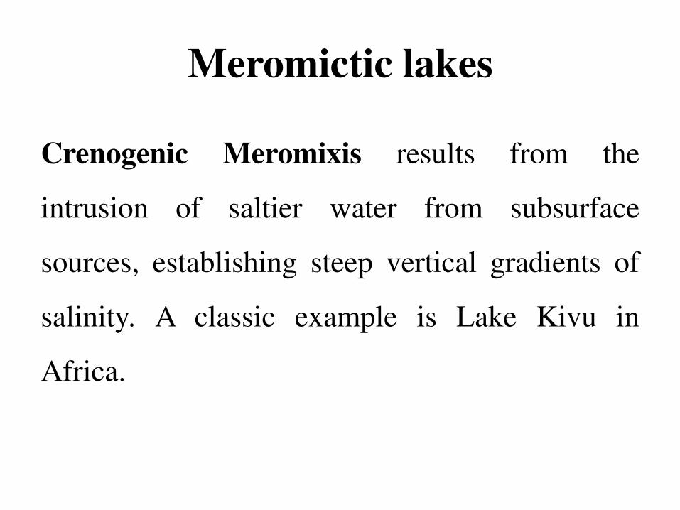
Crenogenic Meromixis results from the
intrusion of saltier water from subsurface
sources, establishing steep vertical gradients of
salinity. A classic example is Lake Kivu in
Africa.

Division of lakes on base
of primary productivity

Division of lakes on base of primary
productivity
Productivity is the rate of production for a given
group of organisms, essentially representing the
net growth rate of organisms. Lakes seldom
suffer from shortage of water but are often
unproductive due to lack of nutrients necessary
for plant growth and reproduction.

Division of lakes on base of
primary productivity
Plants comprise the basic food material, directly
or indirectly, for the whole lake ecosystem. Their
abundance can therefore indicate the lake’s
productivity.

Division of lakes on base of
primary productivity
Productivity is measured as the new carbon
collected from the air and fixed as organic
compounds by photosynthesis, so that it can be
added to the total food supply in the lake.

Division of lakes on base of
primary productivity
Lakes are classified based on productivity as
follows:
Oligotrophic lakes
Eutrophic lakes

Eutrophic lake

A lake with a large supply of nutrients needed by
producers is called a eutrophic lake.
They are also designated as well-nourished lakes
because they receive maximum nutrients.
Eutrophic lake

Eutrophic lake usually have
o Shallow depth
o Murky brown or green water
o High turbidity
o High net primary productivity.
Eutrophic lake

Eutrophic lake
Cultural eutrophication
Human inputs of nutrients from the atmosphere
and from nearby urban and agricultural areas can
enhance the biological activity of lakes by a
process called cultural eutrophication or
simply eutrophication.

Eutrophic lake
Hypertrophic lake
Lake having excessive amounts of dissolved
nutrients.
Mesotrophic lake
Alake having moderate amounts of dissolved
nutrients.

Eutrophic lake
A eutrophic lake having an excess of plant nutrients. Its surface is covered with
mats of algae and cyanobacteria.

Oligotrophic lakes

Oligotrophic lakes
Ecologists classify lakes according to their
1. Nutrient content
2. Primary productivity.

Oligotrophic lakes
Lakes that have a small supply of plant nutrients
are called oligotrophic lakes.
These have low primary productivity, and low
biomass associated with low concentrations of
nitrogen and phosphorous (nutrients).
Oligotrophic lakes are poorly nourished lakes.

Oligotrophic lakes
• Often deep
• Steep banks
• Glaciers and mountain streams supply water
• Little sediment or microscopic life
• Crystal-clear water
• Small populations of phytoplankton and fishes such as
smallmouth bass and trout
• Low net primary productivity.

Over time, sediment, organic material, and
inorganic nutrients wash into most oligotrophic
lakes, and plants grow and decompose to form
bottom sediments.
Oligotrophic lakes

Oligotrophic lakes
Crater Lake in the U.S. state of Oregon is an example of an oligotrophic lake that is
low in nutrients. Because of the low density of plankton, its water is quite clear.

Dissolved Oxygen

Dissolved Oxygen
Dissolved Oxygen (DO)
Oxygen saturation in water medium.
Dissolved oxygen range for healthy biological
system is, 5-12 mg/liter.

Dissolved Oxygen
Most aquatic organisms require oxygen for their
metabolic activities.
The supply of oxygen in water comes from,
The exchange with the atmosphere.
Photosynthesis in flora and cyanobacteria
(blue green algae).

Dissolved Oxygen
Photosynthesis produces organic matter and
releases oxygen, whereas aerobic respiration
consumes organic matter and uses oxygen.
Oxygen production (photosynthesis)
predominates in the light whereas oxygen
consumption takes place in the dark.

Dissolved Oxygen
Based on these processes lakes can be divided
into two zones,
o Trophogenic zone
o Tropholytic zone

Dissolved Oxygen
Trophogenic zone:
Trophogenic zone also called as lighted
trophogenic zone is a zone where maximum light
is available and organic matter is synthesised
along with production of oxygen.

Dissolved Oxygen
The trophogenic zone often corresponds to the
epilimnion. The organic matter produced during
photosynthesis sinks to the bottom but the
oxygen remains in the surface layers
(epilimnion). The entire water mass is
oxygenated only during periods of circulation
due to action of wind.
Dissolved Oxygen
Tropholytic zone:
Tropholytic zone is a zone where light cannot
penetrate and decomposition of organic matter
occurs that leads to lowering of oxygen level.

Dissolved Oxygen
During stagnation periods (absence of wind),
only the epilimnion is oxygenated. The oxygen
required for the decomposition of organic matter
that sinks to the bottom must therefore come
from the supply obtained during periods of
circulation. Thus the oxygen levels in the
hypolimnion are constantly depleted.