lidar mapping ltd · · 2012-03-19lidar scanning of 200km road area (point density 5p/m², ......
TRANSCRIPT
LIDAR MAPPING OÜ
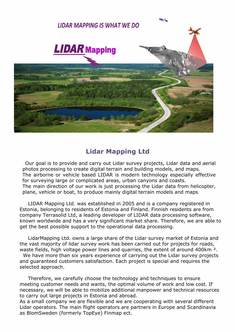
Lidar Mapping Ltd
Our goal is to provide and carry out Lidar survey projects, Lidar data and aerial photos processing to create digital terrain and building models, and maps. The airborne or vehicle based LIDAR is modern technology especially effective for surveying large or complicated areas, urban canyons and coasts. The main direction of our work is just processing the Lidar data from helicopter, plane, vehicle or boat, to produce mainly digital terrain models and maps.
LIDAR Mapping Ltd. was established in 2005 and is a company registered in Estonia, belonging to residents of Estonia and Finland. Finnish residents are from company Terrasolid Ltd, a leading developer of LIDAR data processing software, known worldwide and has a very significant market share. Therefore, we are able to get the best possible support to the operational data processing. LidarMapping Ltd. owns a large share of the Lidar survey market of Estonia and the vast majority of lidar survey work has been carried out for projects for roads, waste fields, high voltage power lines and quarries, the extent of around 400km ². We have more than six years experience of carrying out the Lidar survey projects and guaranteed customers satisfaction. Each project is special and requires the selected approach. Therefore, we carefully choose the technology and techniques to ensure meeting customer needs and wants, the optimal volume of work and low cost. If necessary, we will be able to mobilize additional manpower and technical resources to carry out large projects in Estonia and abroad. As a small company we are flexible and we are cooperating with several different Lidar operators. The main flight operators are partners in Europe and Scandinavia as BlomSweden (formerly TopEye) Finmap ect.
LIDAR MAPPING OÜ
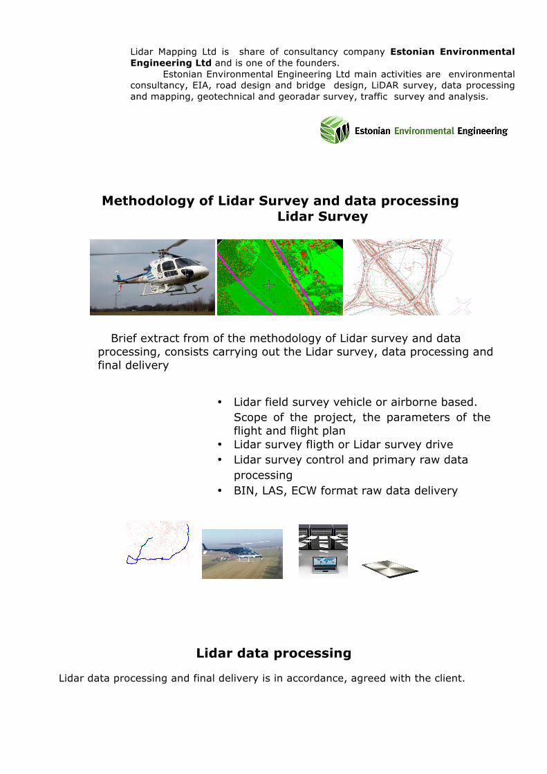
Lidar Mapping Ltd is share of consultancy company Estonian Environmental Engineering Ltd and is one of the founders. Estonian Environmental Engineering Ltd main activities are environmental consultancy, EIA, road design and bridge design, LiDAR survey, data processing and mapping, geotechnical and georadar survey, traffic survey and analysis.
Methodology of Lidar Survey and data processing Lidar Survey
Brief extract from of the methodology of Lidar survey and data processing, consists carrying out the Lidar survey, data processing and final delivery
• Lidar field survey vehicle or airborne based. • Scope of the project, the parameters of the
flight and flight plan • Lidar survey fligth or Lidar survey drive • Lidar survey control and primary raw data
processing • BIN, LAS, ECW format raw data delivery
Lidar data processing
Lidar data processing and final delivery is in accordance, agreed with the client.
LIDAR MAPPING OÜ
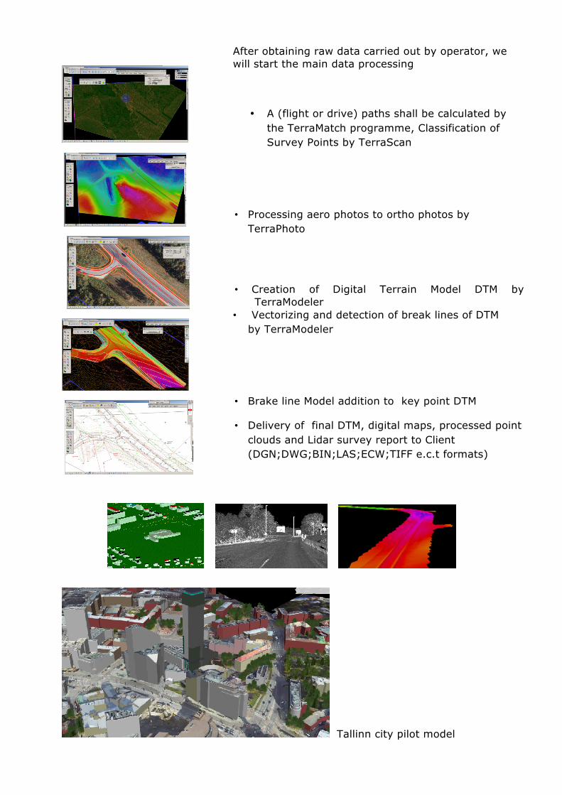
After obtaining raw data carried out by operator, we will start the main data processing
• A (flight or drive) paths shall be calculated by the TerraMatch programme, Classification of Survey Points by TerraScan
• Processing aero photos to ortho photos by TerraPhoto
• Creation of Digital Terrain Model DTM by TerraModeler
• Vectorizing and detection of break lines of DTM by TerraModeler
• Brake line Model addition to key point DTM
• Delivery of final DTM, digital maps, processed point clouds and Lidar survey report to Client (DGN;DWG;BIN;LAS;ECW;TIFF e.c.t formats)
Tallinn city pilot model
LIDAR MAPPING OÜ
Our strengths in Lidar projects include
• extensive experience all over Estonia from 2004. • flexibility in carrying out Lidar survey projects • possibility to increase the team, depending on project needs • creative and competent staff including specialists of Lidar and software
developers from Terrasolid; • we always have the possibility to consult with software developers up to
the creation of new tools; • experience in working with several Lidar survey operators; • flexibility in Lidar projects reflects flexibility in costs
Contact us:
Urmas Saar Project manager, mapping. GSM +372 5116911 e-mail: [email protected] Skype: urmizzaar
Kristel Jerlei
Processing of LIDAR data and orthophotos GSM +372 56642290 Email: [email protected] Skype: kristel.jerlei
References
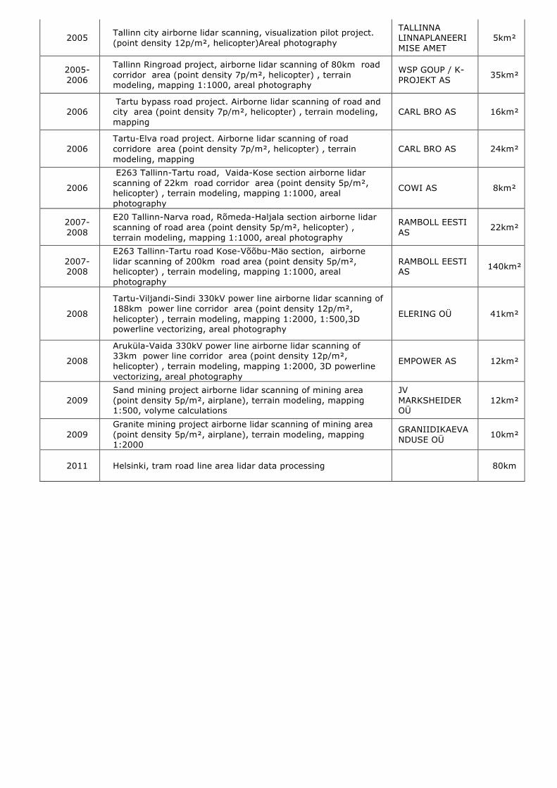
Year Project description Client Size
2004 Kukruse-Jõhvi road area, airborne lidar scanning project (point density 5p/m² , airplane), terrain modeling, mapping
GMBH DHALI & PARTNERS 10km²
2004 Landfill (oil shale hills) in Ida-Viru county, airborne lidar scanning project (point density 3p/m², airplane) , terrain modeling, mapping 1:2000
AS VIRU KEEMIAGRUPP 3km²
2005 Juuliku-Tabasalu road area, airborne lidar scanning project (point density 4p/m², airplane) , terrain modeling, areal photography, mapping 1:500
AS TEEDE TEHNOKESKUS 45km²
LIDAR MAPPING OÜ
2005 Tallinn city airborne lidar scanning, visualization pilot project. (point density 12p/m², helicopter)Areal photography
TALLINNA LINNAPLANEERIMISE AMET
5km²
2005-2006
Tallinn Ringroad project, airborne lidar scanning of 80km road corridor area (point density 7p/m², helicopter) , terrain modeling, mapping 1:1000, areal photography
WSP GOUP / K-PROJEKT AS 35km²
2006 Tartu bypass road project. Airborne lidar scanning of road and city area (point density 7p/m², helicopter) , terrain modeling, mapping
CARL BRO AS 16km²
2006 Tartu-Elva road project. Airborne lidar scanning of road corridore area (point density 7p/m², helicopter) , terrain modeling, mapping
CARL BRO AS 24km²
2006
E263 Tallinn-Tartu road, Vaida-Kose section airborne lidar scanning of 22km road corridor area (point density 5p/m², helicopter) , terrain modeling, mapping 1:1000, areal photography
COWI AS 8km²
2007-2008
E20 Tallinn-Narva road, Rõmeda-Haljala section airborne lidar scanning of road area (point density 5p/m², helicopter) , terrain modeling, mapping 1:1000, areal photography
RAMBOLL EESTI AS 22km²
2007-2008
E263 Tallinn-Tartu road Kose-Võõbu-Mäo section, airborne lidar scanning of 200km road area (point density 5p/m², helicopter) , terrain modeling, mapping 1:1000, areal photography
RAMBOLL EESTI AS 140km²
2008
Tartu-Viljandi-Sindi 330kV power line airborne lidar scanning of 188km power line corridor area (point density 12p/m², helicopter) , terrain modeling, mapping 1:2000, 1:500,3D powerline vectorizing, areal photography
ELERING OÜ 41km²
2008
Aruküla-Vaida 330kV power line airborne lidar scanning of 33km power line corridor area (point density 12p/m², helicopter) , terrain modeling, mapping 1:2000, 3D powerline vectorizing, areal photography
EMPOWER AS 12km²
2009 Sand mining project airborne lidar scanning of mining area (point density 5p/m², airplane), terrain modeling, mapping 1:500, volyme calculations
JV MARKSHEIDER OÜ
12km²
2009 Granite mining project airborne lidar scanning of mining area (point density 5p/m², airplane), terrain modeling, mapping 1:2000
GRANIIDIKAEVANDUSE OÜ 10km²
2011 Helsinki, tram road line area lidar data processing 80km