leveraging 3d mapping for planning and land...
TRANSCRIPT
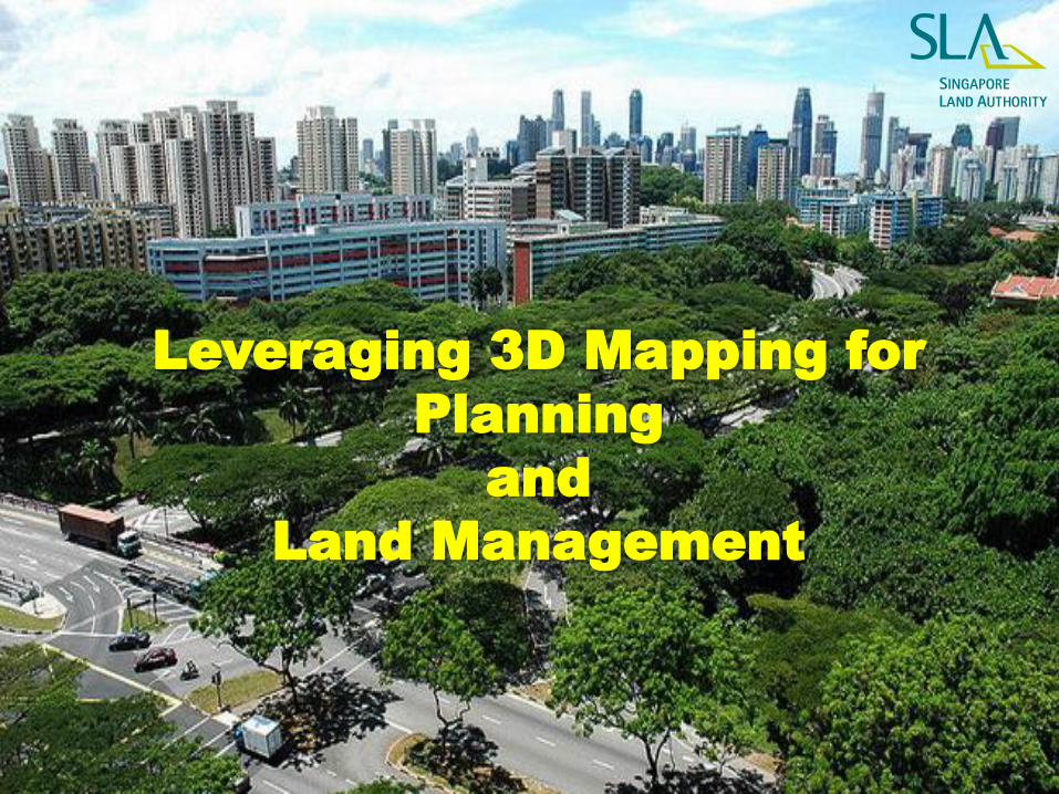
Leveraging 3D Mapping for
Planning
and
Land Management
©SLA 2015
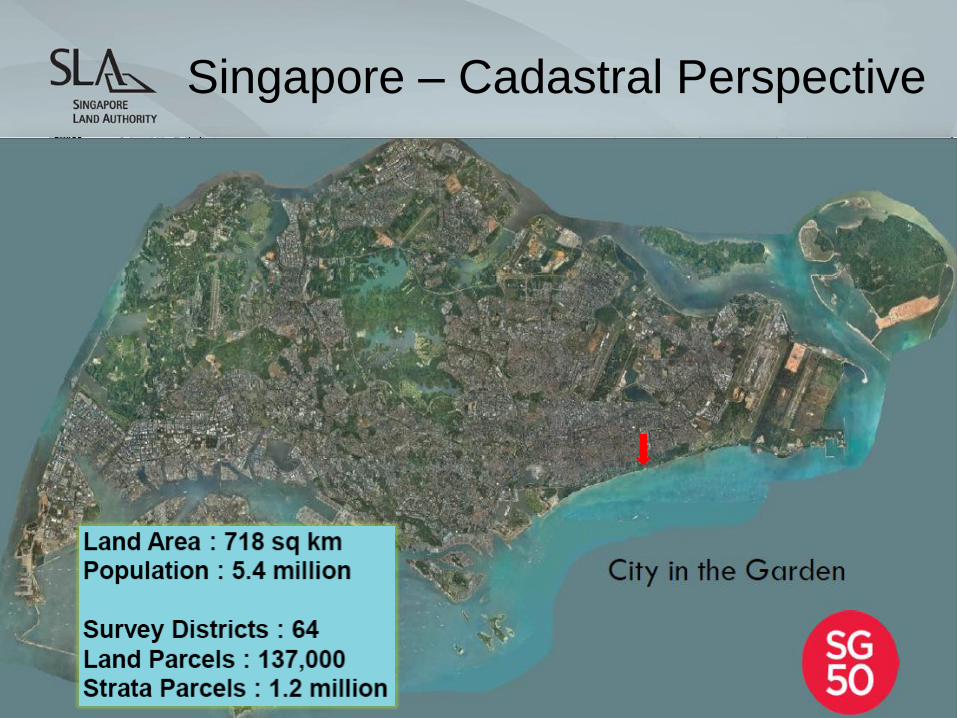
Singapore – Cadastral Perspective
©SLA 2015
Why Mapping?
©SLA 2015
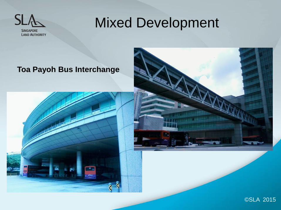
Mixed Development
Toa Payoh Bus Interchange

©SLA 2015
Inter-locking Development
The Interlace Condominium
©SLA 2015
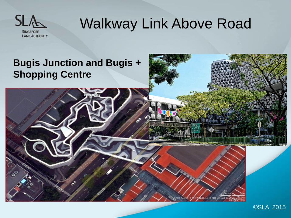
Walkway Link Above Road
Bugis Junction and Bugis +
Shopping Centre
©SLA 2015
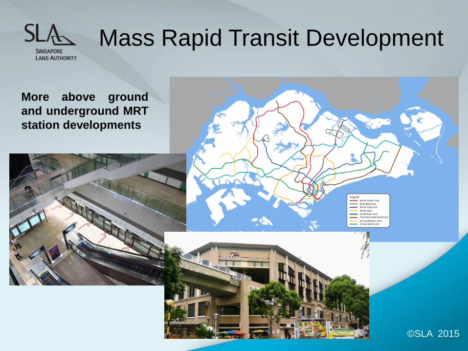
Mass Rapid Transit Development
More above ground
and underground MRT
station developments
©SLA 2015
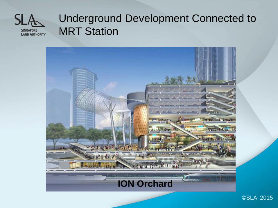
Underground Development Connected to
MRT Station
ION Orchard
©SLA 2015
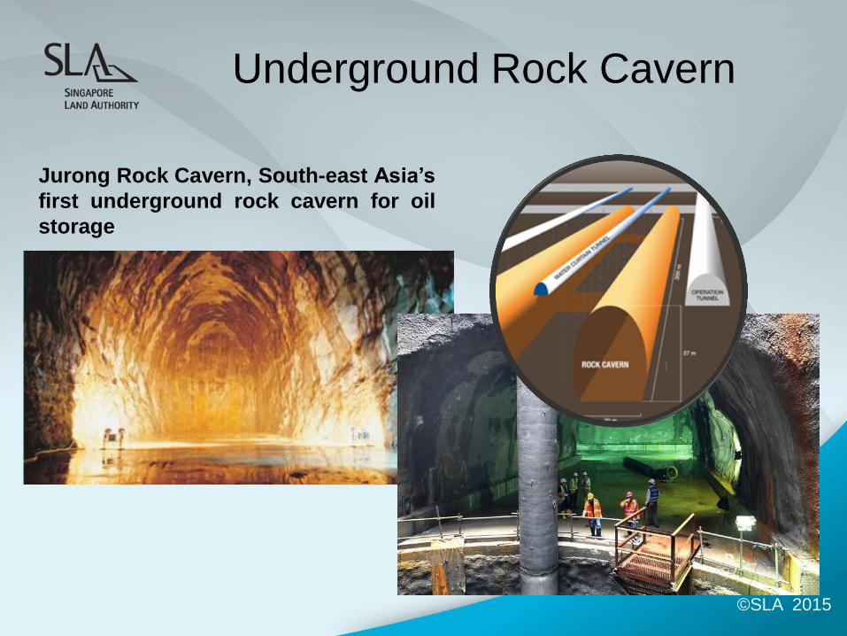
Underground Rock Cavern
Jurong Rock Cavern, South-east Asia’s
first underground rock cavern for oil
storage
©SLA 2015
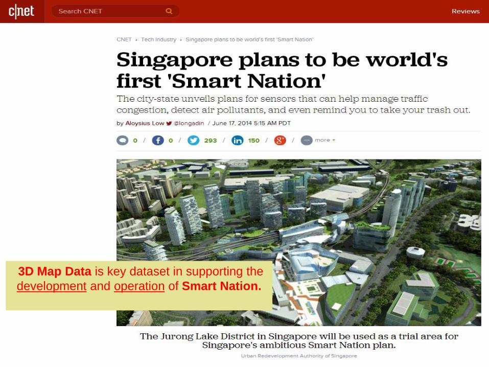
3D Map Data is key dataset in supporting the
development and operation of Smart Nation.
©SLA 2015
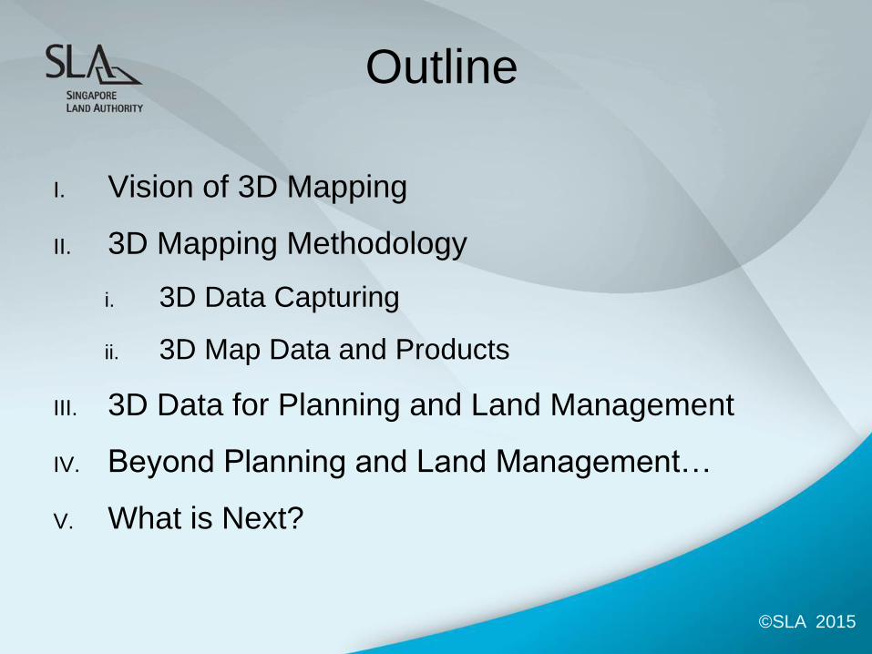
Outline
I. Vision of 3D Mapping
II. 3D Mapping Methodology
i. 3D Data Capturing
ii. 3D Map Data and Products
III. 3D Data for Planning and Land Management
IV. Beyond Planning and Land Management…
V. What is Next?
©SLA 2015
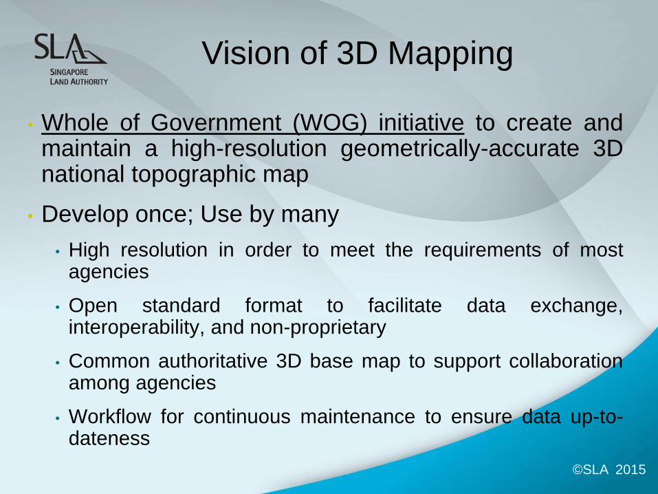
Vision of 3D Mapping
• Whole of Government (WOG) initiative to create and maintain a high-resolution geometrically-accurate 3D national topographic map
• Develop once; Use by many
• High resolution in order to meet the requirements of most agencies
• Open standard format to facilitate data exchange, interoperability, and non-proprietary
• Common authoritative 3D base map to support collaboration among agencies
• Workflow for continuous maintenance to ensure data up-to-dateness
©SLA 2015
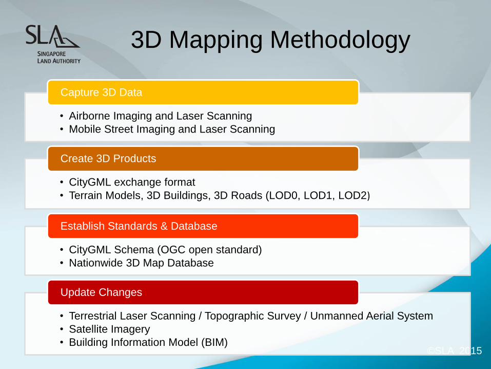
3D Mapping Methodology
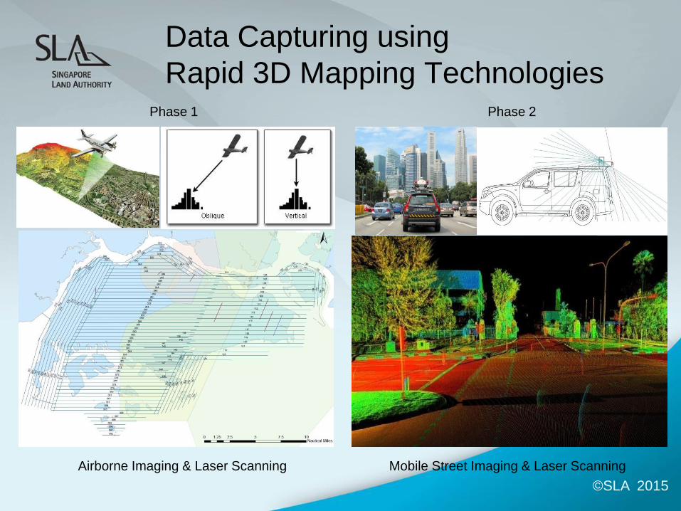
• Airborne Imaging and Laser Scanning
• Mobile Street Imaging and Laser Scanning
Capture 3D Data
• CityGML exchange format
• Terrain Models, 3D Buildings, 3D Roads (LOD0, LOD1, LOD2)
Create 3D Products
• CityGML Schema (OGC open standard)
• Nationwide 3D Map Database
Establish Standards & Database
• Terrestrial Laser Scanning / Topographic Survey / Unmanned Aerial System
• Satellite Imagery
• Building Information Model (BIM)
Update Changes
©SLA 2015
Data Capturing using
Rapid 3D Mapping Technologies
Airborne Imaging & Laser Scanning Mobile Street Imaging & Laser Scanning
Phase 1 Phase 2
©SLA 2015
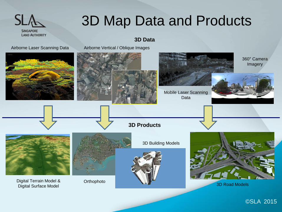
3D Map Data and Products 3D Data
3D Products
Airborne Laser Scanning Data
360° Camera
Imagery
Mobile Laser Scanning
Data
3D Road Models
Airborne Vertical / Oblique Images
Digital Terrain Model &
Digital Surface Model
3D Building Models
Orthophoto
©SLA 2015
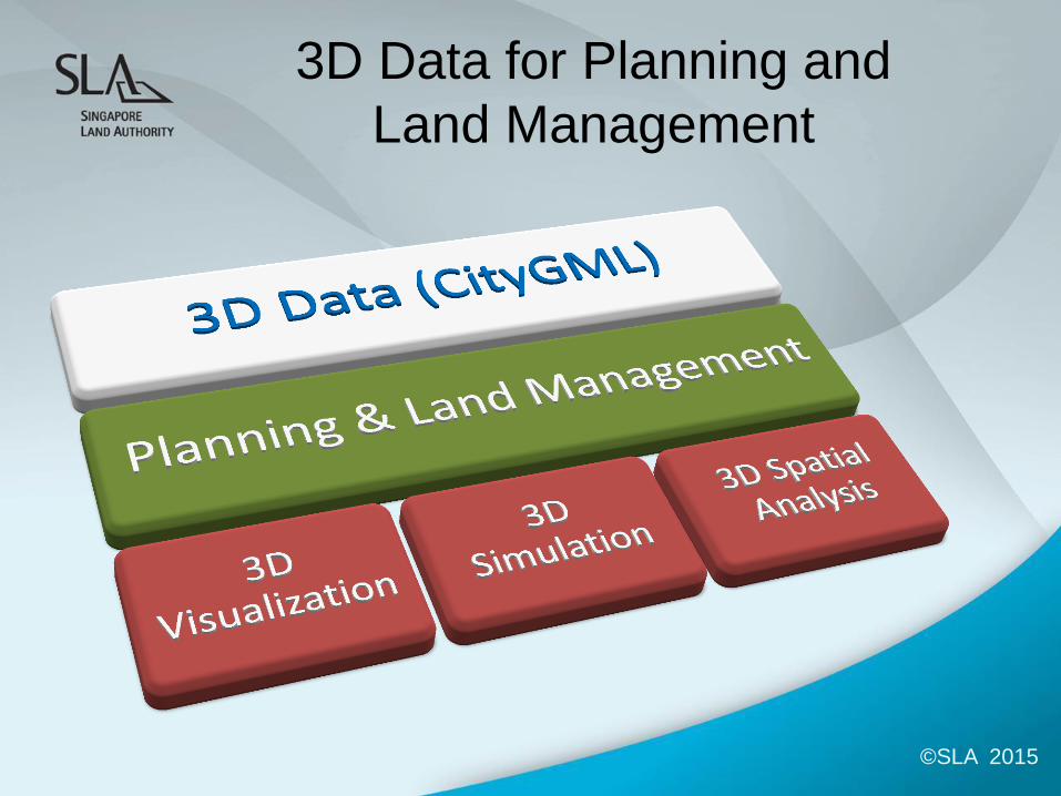
3D Data for Planning and
Land Management
3 ©SLA 2015
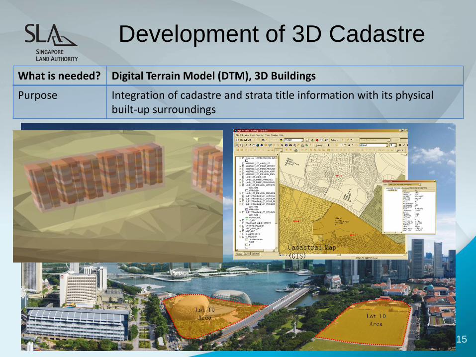
Development of 3D Cadastre
What is needed? Digital Terrain Model (DTM), 3D Buildings
Purpose Integration of cadastre and strata title information with its physical built-up surroundings
©SLA 2015 3
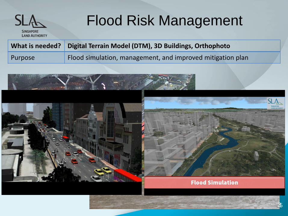
Flood Risk Management
What is needed? Digital Terrain Model (DTM), 3D Buildings, Orthophoto
Purpose Flood simulation, management, and improved mitigation plan
©SLA 2015
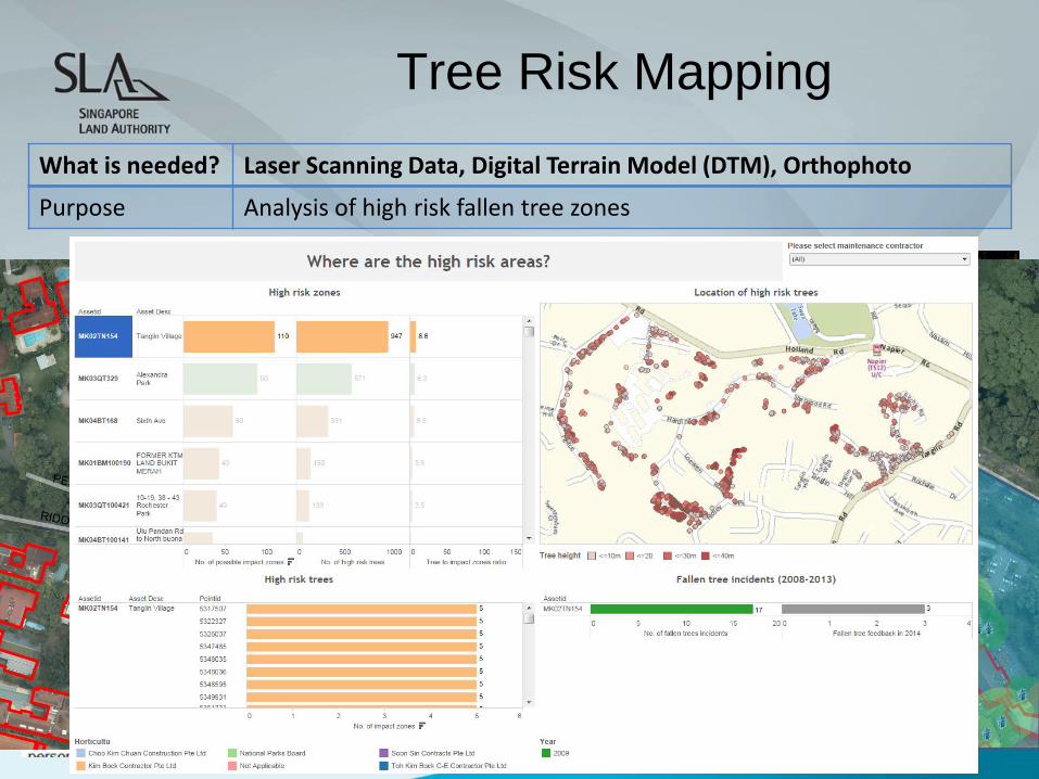
Tree Risk Mapping
What is needed? Laser Scanning Data, Digital Terrain Model (DTM), Orthophoto
Purpose Analysis of high risk fallen tree zones
Possible Impact on
Private Buildings
Possible Impact
on Roads
Possible Impact
on State Buildings
©SLA 2015
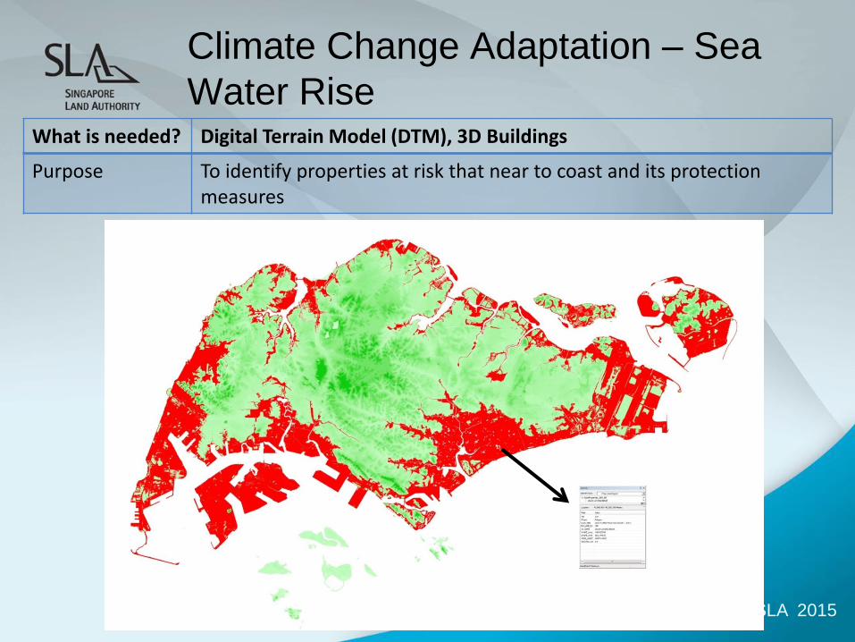
Climate Change Adaptation – Sea
Water Rise What is needed? Digital Terrain Model (DTM), 3D Buildings
Purpose To identify properties at risk that near to coast and its protection measures
3 ©SLA 2015 Presenter:
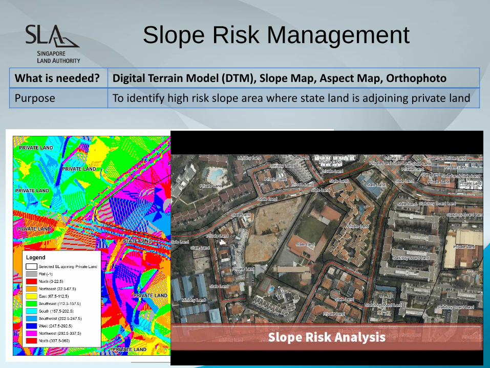
Slope Risk Management
What is needed? Digital Terrain Model (DTM), Slope Map, Aspect Map, Orthophoto
Purpose To identify high risk slope area where state land is adjoining private land
3 ©SLA 2015 Presenter:
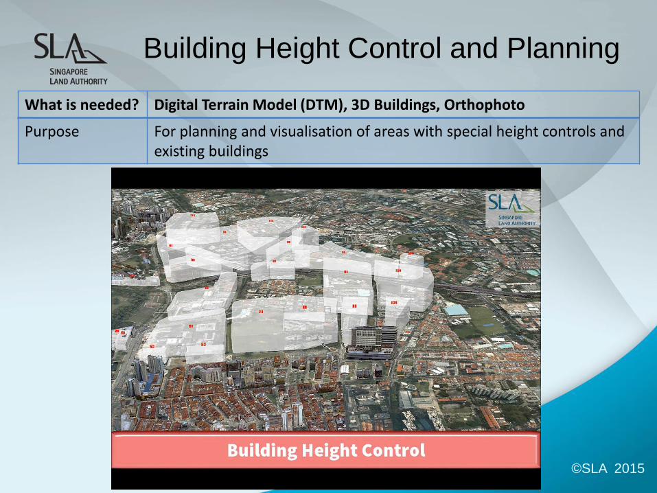
Building Height Control and Planning
What is needed? Digital Terrain Model (DTM), 3D Buildings, Orthophoto
Purpose For planning and visualisation of areas with special height controls and existing buildings
3 ©SLA 2015 Presenter:
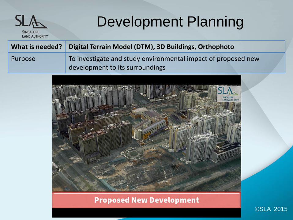
Development Planning
What is needed? Digital Terrain Model (DTM), 3D Buildings, Orthophoto
Purpose To investigate and study environmental impact of proposed new development to its surroundings
3 ©SLA 2015 Presenter:
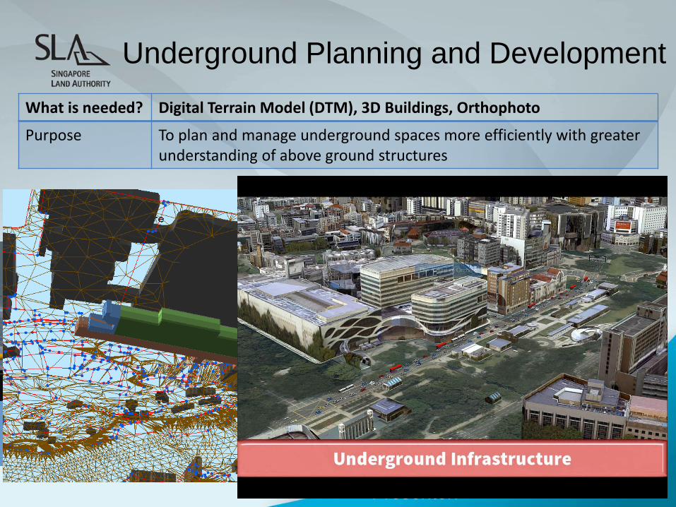
Underground Planning and Development
What is needed? Digital Terrain Model (DTM), 3D Buildings, Orthophoto
Purpose To plan and manage underground spaces more efficiently with greater understanding of above ground structures
©SLA 2015
Beyond Planning and
Land Management …
• Establish strong foundation for Whole-of-Goverment 3D mapping
capabilities
• 3D products with qualities that ensure widespread applications • accurate geometry
• open standard (CityGML)
• smart data model
• high resolution
• current and comprehensive
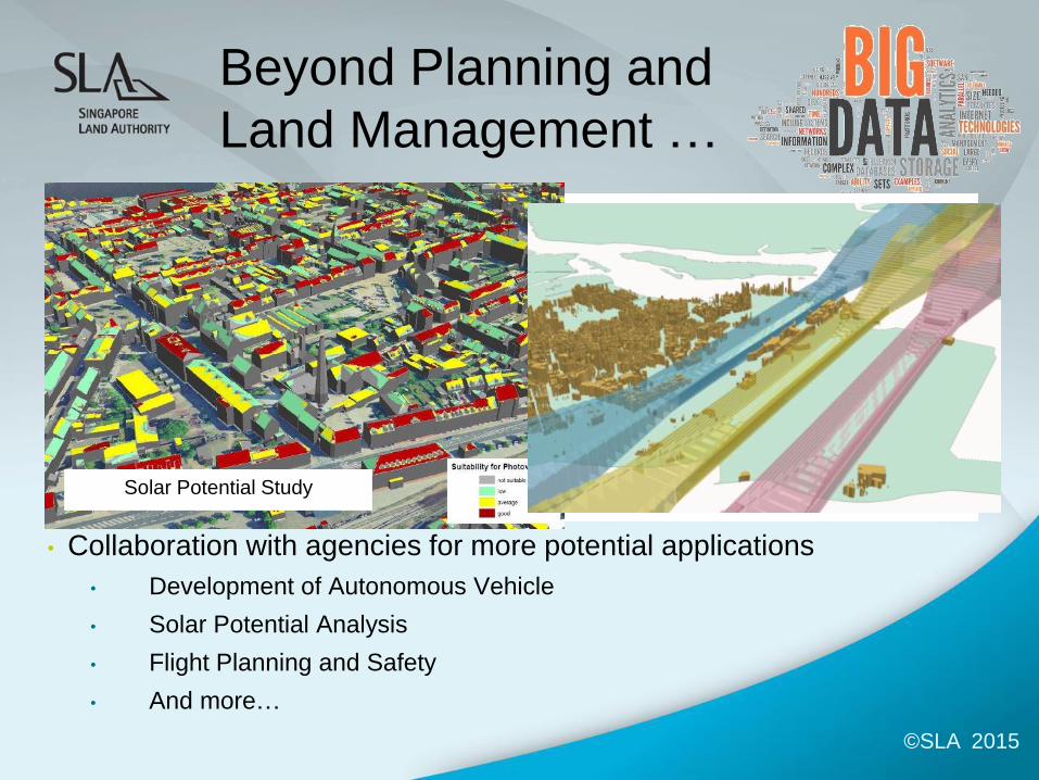
• Collaboration with agencies for more potential applications
• Development of Autonomous Vehicle
• Solar Potential Analysis
• Flight Planning and Safety
• And more…
Solar Potential Study
©SLA 2015
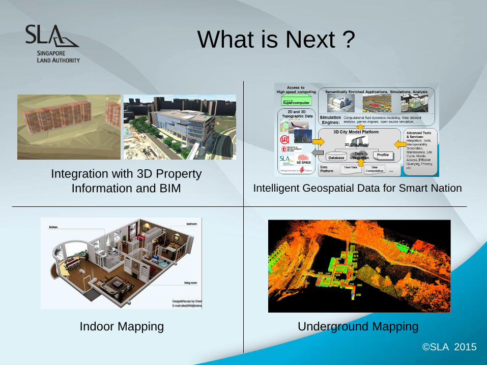
What is Next ?
Integration with 3D Property
Information and BIM
Indoor Mapping Underground Mapping
Intelligent Geospatial Data for Smart Nation
©SLA 2015