lecture 2 introduction to gis software and...
TRANSCRIPT

1
Lecture 2
Introduction to GIS Softwareand Resources
GIS in Water ResourcesSpring 2015
Introduction to GIS Software… there are others. Proprietary:

2
Introduction to GIS Software… and even more. OpenSource:
Introduction to GIS Software… and more notables. OpenSource:
3
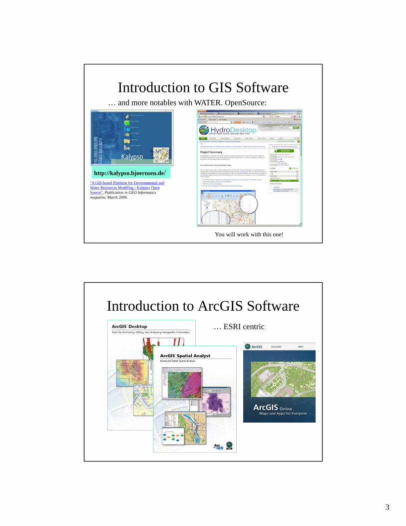
Introduction to GIS Software… and more notables with WATER. OpenSource:
http://kalypso.bjoernsen.de/"A GIS-based Platform for Environmental and Water Resources Modeling - Kalypso Open Source", Publication in GEO Informatics magazine, March 2009.
You will work with this one!
Introduction to ArcGIS Software… ESRI centric

4
ESRI Online Reference Materials• ArcGIS summary:
http://www.esri.com/library/brochures/pdfs/arcgis.pdf
• ArcGIS Desktop summary: http://www.esri.com/library/brochures/pdfs/arcgis-desktop.pdf
• Spatial Analyst summary: http://www.esri.com/library/brochures/pdfs/spatialanalystbro.pdf
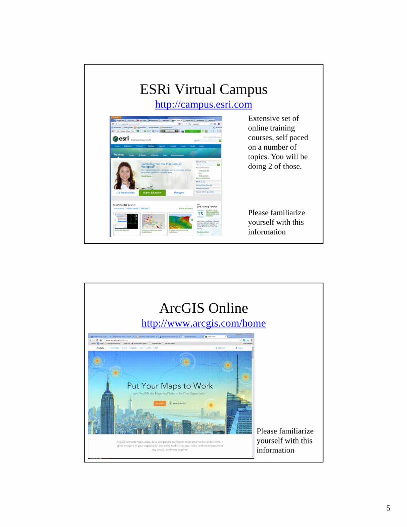
• ESRI Virtual Campus – provides online training http://campus.esri.com/
The first three items are readings for this class
ArcGIS Resource Centerhttp://resources.arcgis.com
Please familiarize yourself with this information.
Notice: we are usingV. 10.0 and not 10.1
5
ESRi Virtual Campushttp://campus.esri.com
Please familiarize yourself with this information
Extensive set of online training courses, self paced on a number of topics. You will be doing 2 of those.
ArcGIS Onlinehttp://www.arcgis.com/home
Please familiarize yourself with this information

6
ArcGIS Onlinehttp://www.arcgis.com/home
• Description: http://www.esri.com/software/arcgis/arcgisonline
Please familiarize yourself with this information
ArcGIS Online
Share Maps and Apps

7
ArcGIS MarketplaceShare Apps:
Use following SDKs:Android & iOS& JavaScript
Great ClassProject!
Need a developer account!
ArcGIS Online Explorerhttp://www.arcgis.com/explorer
Build your own:- import maps via WebMapService (WMS)- Modify and build your own layers- Export your own
Same general ESRI login credentials

8
ArcGIS Online Explorerhttp://www.arcgis.com/explorer
Add your own contentto BaseMap1) Load file2) Draw your own
3) Load from WMS
ArcGIS Online Explorerhttp://www.arcgis.com/explorer

9
Query for sites with Nitrogen data and at least 50 observed values
East Fork Watershed Sitesin ArcGIS Explorer Online (in a private group)

10
Query for sites with Nitrogen data and at least 50 observed values
You can only query onFeatures!! Hence youneed import a WebFeatureService(WFS)
Selected Sites Satisfying this Query
Non-selected site
Selected site Info on a selected site

11
WaterML Response for Time Series
Introduction to GIS Software
• How data are stored in ArcGIS
• Components of ArcGIS – ArcMap, ArcCatalog and ArcToolbox
• GIS on the Web – ArcGIS Server, ArcGIS Online, Google Earth.
• Extensions of ArcGIS – spatial analyst, geostatistical analyst and 3D analyst

12
ESRI GIS Development
Arc/Info (coverage model)
Versions 1-7 from 1980 – 1999
Arc Macro Language (AML)
ArcView (shapefile model)
Versions 1-3 from 1994 – 1999
Avenue scripting language
ArcGIS (geodatabase model)
Version 8.0, …, 10.0 from 2000 – Python scripting
160,000 licenses1,200,000 users as of 2009
Geographic Data Models
All geographic information systems are built using formal models that describe how things are located in space. A formal model is an abstract and well-defined system of concepts. A geographic data model defines the vocabulary for describing and reasoning about the things that are located on the earth. Geographic data models serve as the foundation on which all geographic information systems are built.
Scott Morehouse, Preface to “Modeling our World”
13
Data Models
• A geographic data model is a structure for organizing geospatial data so that it can be easily stored and retrieved.
Geographic coordinates
Tabular attributes
File-based Data Models
• Coverages– Developed for
workstation Arc/Info ~ 1980
– Complex structure, proprietary format
– Attributes in Infotables
• Shapefiles– Developed for
ArcView ~ 1993
– Simpler structure in public domain
– Attributes in dBase(.dbf) tables
Geographic coordinates and attributesare stored in separate but linked files
ArcInfo
14
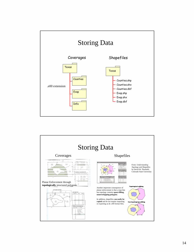
Storing Data
Coverages Shapefiles
Texas
Counties
Evap
Info
Texas
Counties.shpCounties.shxCounties.dbfEvap.shpEvap.shxEvap.dbf
.e00 extension
Storing DataCoverages Shapefiles
Planar Enforcement throughtopologically structured polygons
From: Understanding Topology and Shapefilesby David M. Theobald, Colorado State University
Another important consequence of planar enforcement is that a map that has topology contains space-filling, nonoverlapping polygons.
In addition, shapefiles can easily be copied and do not require importing or exporting as do .e00 format files.

15
Shapefiles
Texas
Counties.shpCounties.shxCounties.dbfEvap.shpEvap.shxEvap.dbf
3 Mandatory files :
• .shp — shape format; the feature geometry itself
• .shx — shape index format; a positional index of the feature geometry to allow seeking forwards and backwards quickly
• .dbf — attribute format; columnar attributes for each shape, in dBase IV format
8 Optional files :
• .prj — projection format; the coordinate system and projection information, a plain text file describing the projection using well-known text format
• .sbn and .sbx — a spatial index of the features• .fbn and .fbx — a spatial index of the features for shapefiles that are read-only• .ain and .aih — an attribute index of the active fields in a table or a theme's attribute
table• .ixs — a geocoding index for read-write shapefiles• .mxs — a geocoding index for read-write shapefiles (ODB format)• .atx — an attribute index for the .dbf file in the form of shapefile.columnname.atx
(ArcGIS 8 and later)• .shp.xml — geospatial metadata in XML format, such as ISO 19115 or other schemas• .cpg — used to specify the code page (only for .dbf) for identifying the character
encoding to be used
http://www.esri.com/library/whitepapers/pdfs/shapefile.pdf
Storing Data
• Coverages and Shapefiles– Coverages are stored partially in their own folder (ARC) and
partially in the common INFO folder. Shapefiles are stored in three to five files (with extensions .shp, .shx, .dbf, .sbx and .sbn).
– Coverages store common boundaries between polygons only once, to avoid redundancy. Shapefiles store all the geometry of each polygon regardless of redundancy.
– Coverage features are single lines or single polygons. Shapefilesallow features to have multiple, disconnected, intersecting and overlapping components.
– A primary advantage of shapefiles is that this simple file structure draws faster than a coverage does.
Storing Data

16
Geodatabase and Feature Dataset
• A geodatabase is a relational database that
stores geographic information.
• A feature dataset is a collection of feature
classes that share the same spatial reference frame.
Geodatabase model
• Stores geographic coordinates as one attribute (shape) in a relational database table
• Uses MS Access for “Personal Geodatabase” (single user)
• Uses Oracle, SQL/Server, dB2 or other commercial relational databases for “Enterprise Geodatabases” (many simultaneous users)
• Uses files in “File Geodatabase”
Shape

17
ArcGIS Geodatabase
Geodatabase
Feature Dataset
Feature Class
Geometric Network
Object Class
Relationship
Workspace
Object Class• An object class is a collection of
objects in tabular format that have the same behavior and the same attributes.
An object class is a table that has a unique identifier (ObjectID)for each record

18
Feature Class
• A feature classis a collection of geographic objects in tabular formatthat have the same behavior and the same attributes.
Feature Class = Object class + spatial coordinates
Relationship
• A relationship is an association or link between two objects in a database.
• A relationship can exist between spatial objects (features in feature classes), non-spatial objects (objects in object classes), or between spatial and non-spatial objects.

19
RelationshipRelationship between non-spatial objects
Water QualityData
Water Quality Parameters
RelationshipRelationship between spatial and non-spatial objects
Water quality data(non-spatial)
Measurement station(spatial)

20
Network
• A network is a set of edges (lines) and junctions (points) that are topologically connected to each other.
• Each edge knows which junctions are at its endpoints
• Each junction knows which edges it connects to
Introduction to GIS Software
• How data are stored in ArcGIS
• Components of ArcGIS – ArcMap, ArcCatalog and ArcToolbox
• GIS on the Web – ArcGIS Server, ArcGIS Online.
• Extensions of ArcGIS – spatial analyst, geostatistical analyst and 3D analyst
21
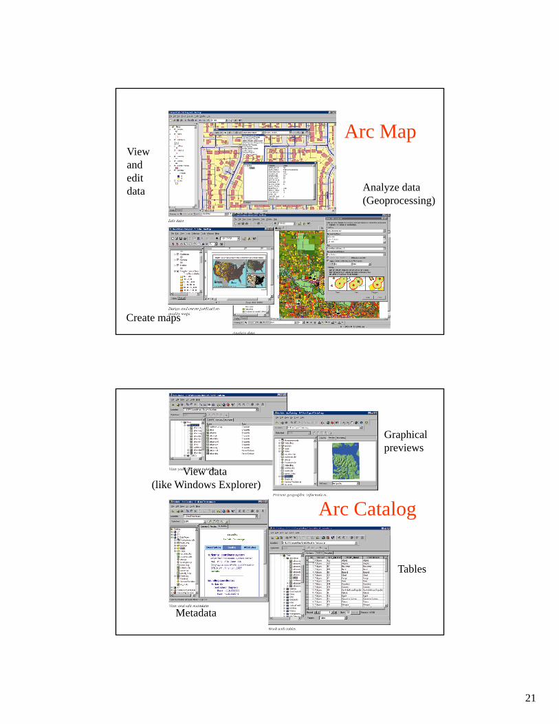
Arc Map
Create maps
Viewand edit data Analyze data
(Geoprocessing)
Arc Catalog
View data (like Windows Explorer)
Graphicalpreviews
Metadata
Tables
22
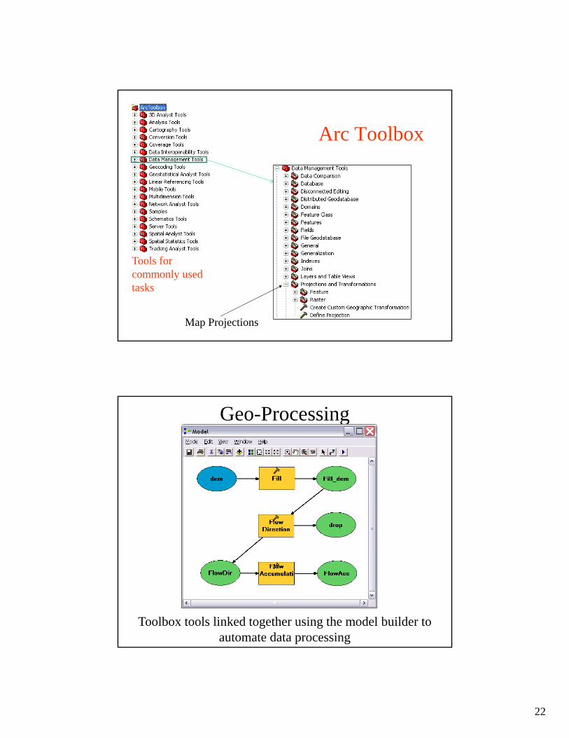
Arc Toolbox
Map Projections
Tools for commonly used tasks
Geo-Processing
Toolbox tools linked together using the model builder to automate data processing
23
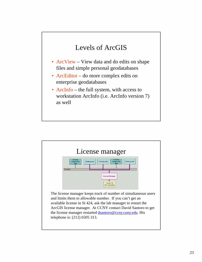
Levels of ArcGIS
• ArcView – View data and do edits on shape files and simple personal geodatabases
• ArcEditor – do more complex edits on enterprise geodatabases
• ArcInfo – the full system, with access to workstation ArcInfo (i.e. ArcInfo version 7) as well
License manager
The license manager keeps track of number of simultaneous users and limits them to allowable number. If you can’t get an available license in St 424, ask the lab manager to restart the ArcGIS license manager. At CCNY contact David Santoro to get the license manager restarted [email protected]. His telephone is: (212) 6505 313.
24
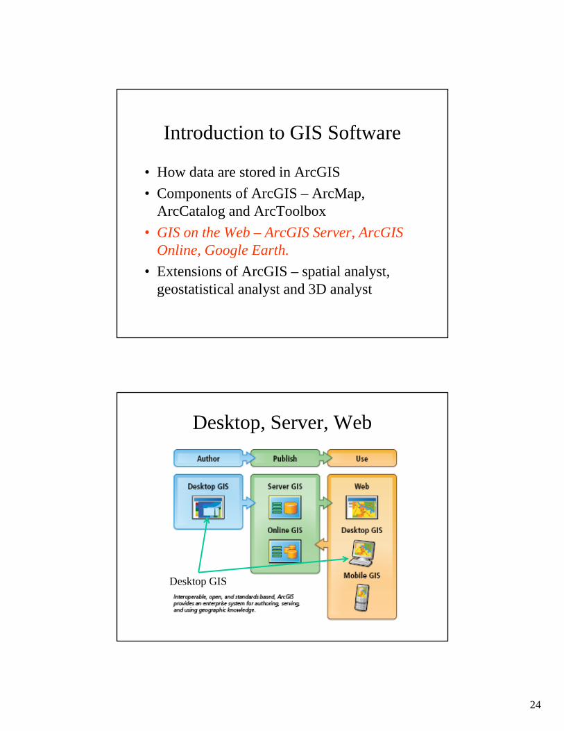
Introduction to GIS Software
• How data are stored in ArcGIS
• Components of ArcGIS – ArcMap, ArcCatalog and ArcToolbox
• GIS on the Web – ArcGIS Server, ArcGIS Online, Google Earth.
• Extensions of ArcGIS – spatial analyst, geostatistical analyst and 3D analyst
Desktop, Server, Web
Desktop GIS
25
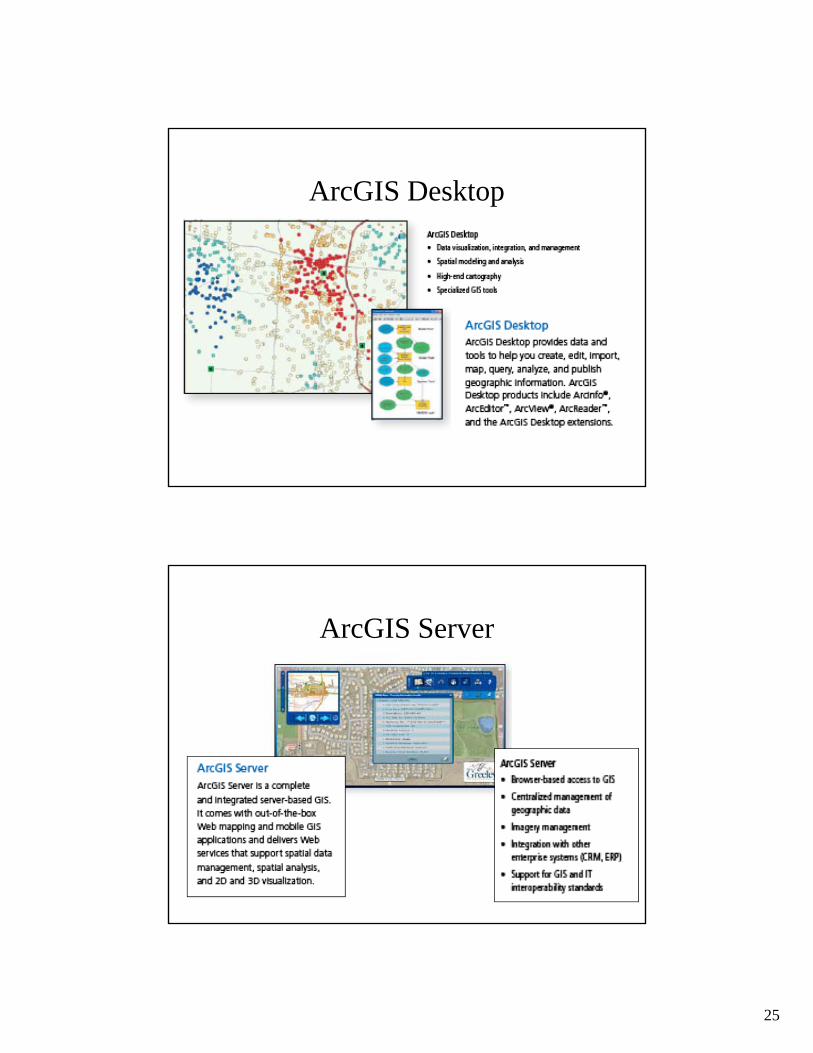
ArcGIS Desktop
ArcGIS Server
26
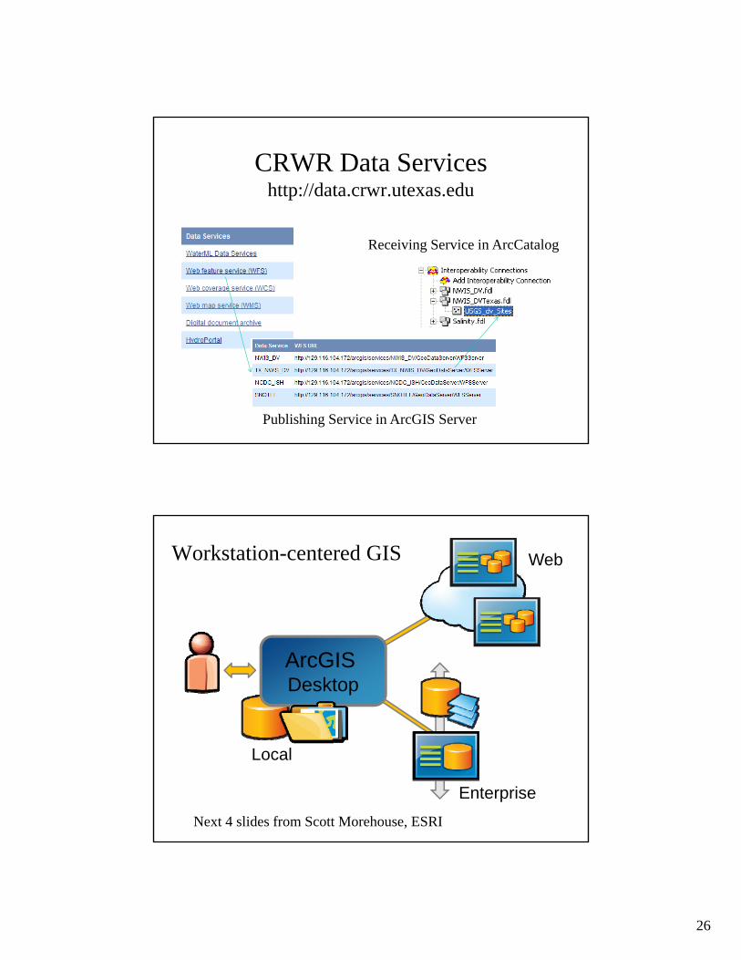
CRWR Data Serviceshttp://data.crwr.utexas.edu
Receiving Service in ArcCatalog
Publishing Service in ArcGIS Server
Workstation-centered GIS
ArcGIS Desktop
Local
Web
Enterprise
Next 4 slides from Scott Morehouse, ESRI
27
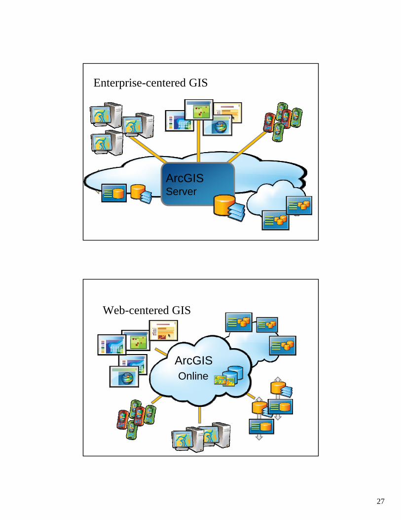
Enterprise-centered GIS
ArcGISServer
Web-centered GIS
ArcGISOnline

28
An Integrated Systems Approach
ArcGISOnline
ArcGISDesktop
ArcGISServer

29
Multiscale Tiled ImagesSmall Scale: Little detail, broad coverage
Large Scale: Great detail, narrow coverage
1:1,000
1:1,000,000
World Topographic Base Map
With content added by the City of Austin
Cartographic map built from GIS data
30
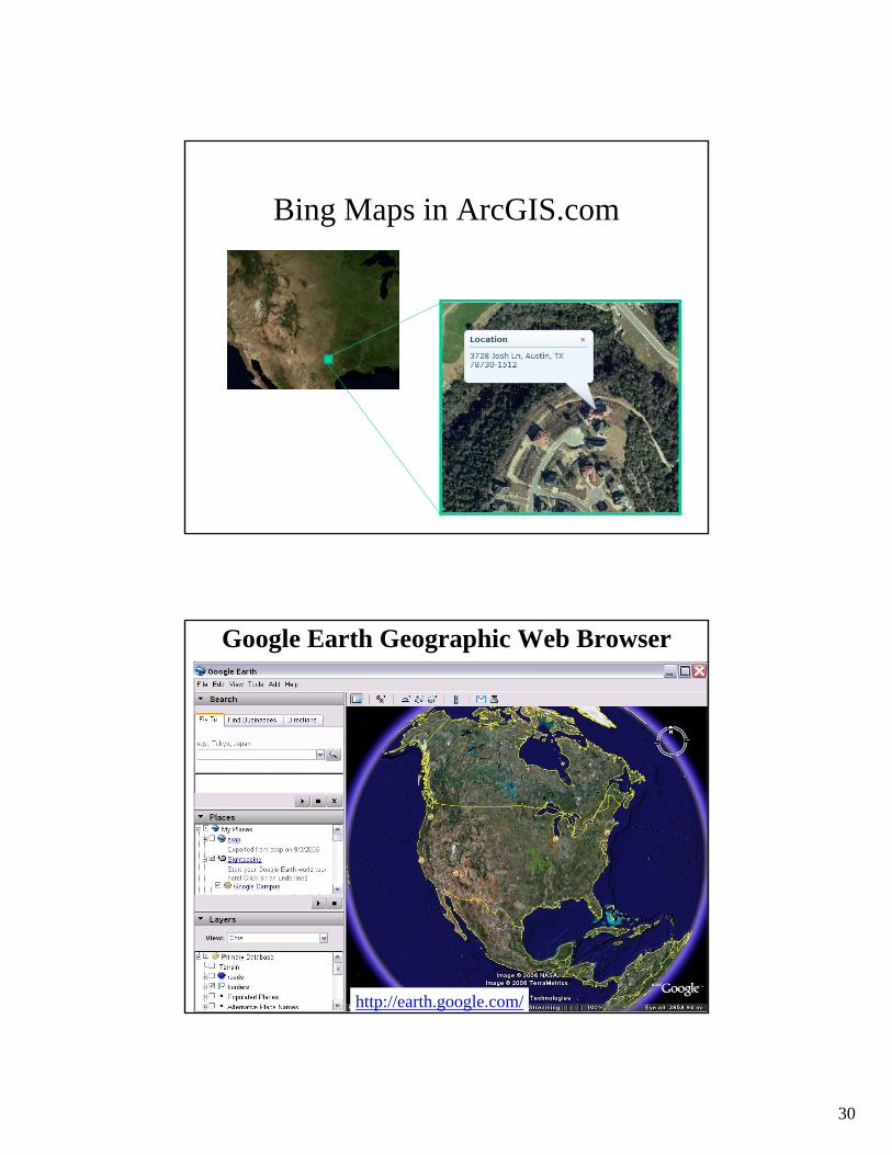
Bing Maps in ArcGIS.com
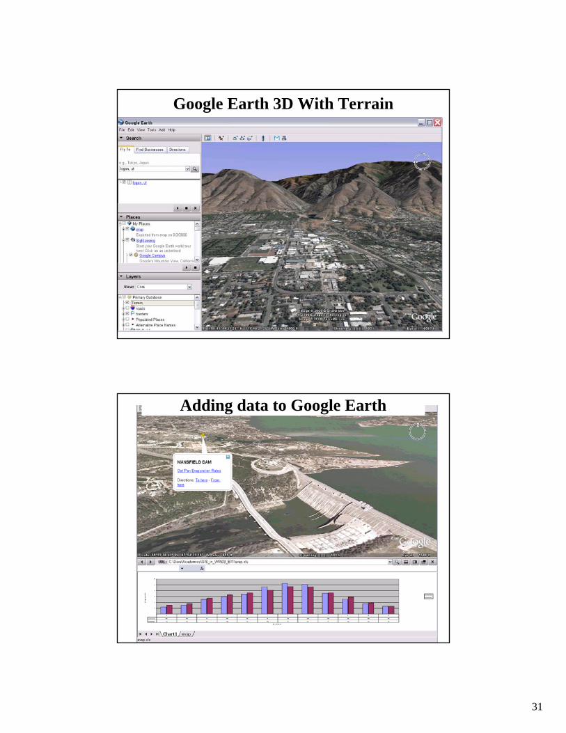
Google Earth Geographic Web Browser
http://earth.google.com/
31
Google Earth 3D With Terrain
Adding data to Google Earth

32
Observations Data and Google Earth
http://odm.usu.edu/odmmap/default.aspx?NetworkName=Little Bear River
Introduction to GIS Software
• How data are stored in ArcGIS
• Components of ArcGIS – ArcMap, ArcCatalog and ArcToolbox
• GIS on the Web – ArcGIS Server, ArcGIS Online, Google Earth.
• Extensions of ArcGIS – spatial analyst, geostatistical analyst and 3D analyst

33
ArcGIS Extensions
Spatial Analyst
• Analysis of land surface terrain as a grid
• Key means of defining drainage areas and connectivity to stream network

34
Grid Datasets• Cellular-based data structure composed
of square cells of equal size arranged in rows and columns.
• The grid cell size and extension (number of rows and columns), as well as the value at each cell have to be stored as part of the grid definition.
Number of columns
Num
ber
of r
ows
Cell size
Grid Datasets
• Grid datasets

35
Geostatistical Analyst
• Interpolation of points to a grid using statistical correlation
• Produces a standard error of estimate of each map location
AlaskaSiberia
Biomass in the Arctic Ocean
Image Datasets
• Image datasets
Digital Orthophotos and satellite imagery

36
Image Datasets• Supported image formats:
– ARC Digitized Raster Graphics (ADRG)– Windows bitmap images (BMP) [.bmp]– Multiband (BSQ, BIL and BIP) and single band images
[.bsq, .bil and .bip]– ERDAS [.lan and .gis]– ESRI Grid datasets– IMAGINE [.img]– IMPELL Bitmaps [.rlc]– Image catalogs– JPEG [.jpg]– MrSID [.sid]– National Image Transfer Format (NITF)– Sun rasterfiles [.rs, .ras and .sun]– Tag Image File Format (TIFF) [.tiff, .tif and .tff]– TIFF/LZW
3-D Analyst
• Analysis of land surface terrain as triangulated irregular network (TIN)
• Visualization in 3-D using Arc Scene
Stream channel of Pecan Bayou, TX

37
TIN Datasets
• TIN datasets
Points and breaklines from which a TIN is
constructed.
• Triangle sides are constructed by connecting adjacent points so that the minimum angle of each triangle is maximized. Triangle sides cannot cross breaklines.
• The TIN format is efficient to store data because the resolution adjusts to the parameter spatial variability.
TIN Datasets

38
Multipatch features
3D surfaces as collections of
triangles
Tracking Analyst
Produces animated maps and display files for space-time data

39
Summary (1)
• Three core data representations for vector data: coverage (ArcInfo), shapefile(ArcView) and geodatabase (ArcGIS). We will emphasize geodatabase in this class
• Relationships based on attributes (table fields) or on geometry (networks) are used to connect related geographic features
Summary (2)
• ArcGIS Components: ArcMap, ArcCatalog, ArcToolbox
• ArcGIS levels: ArcInfo, ArcEditor, ArcView
• Desktop, Server and Web-based sources of maps and data
• ArcGIS Online – image maps and shared data content

40
Summary (3)
• Google Earth – web-based GIS and KML addons
• ArcGIS Extensions: Spatial Analyst, 3D Analyst, Geostatistical Analyst, Tracking Analyst