land and soil degradation assessments in mediterranean europe · land and soil degradation...
TRANSCRIPT

Remote Sensing Department
2nd GMES Forum, 14-16 January 2003, ESA/ESTEC Nordwijk
JOACHIM HILL
Land and Soil Degradation Assessments in Mediterranean EuropeLand and Soil Degradation Assessments in Mediterranean Europe
Remote Sensing Department
2nd GMES Forum, 14-16 January 2003, ESA/ESTEC Nordwijk
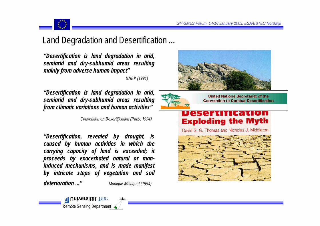
“Desertification is land degradation in arid, semiarid and dry-subhumid areas resultingmainly from adverse human impact”
UNEP (1991)
“Desertification is land degradation in arid, semiarid and dry-subhumid areas resultingfrom climatic variations and human activities”
Convention on Desertification (Paris, 1994)
“Desertification, revealed by drought, iscaused by human activities in which thecarrying capacity of land is exceeded; itproceeds by exacerbated natural or man-induced mechanisms, and is made manifest by intricate steps of vegetation and soildeterioration ...“ Monique Mainguet (1994)
Land Degradation and Desertification ...

Remote Sensing Department
2nd GMES Forum, 14-16 January 2003, ESA/ESTEC Nordwijk
Land Degradation involves Complex Interactions ...
DG Research: > 10 Years of dedicated research (FP 3, 4 & 5) MEDALUS, DeMon, EFEDA, Archeomedes, GeoRange ...
Climatic Factors
Drought
Aridity
Fires
Torrential Rainfall
Soil and VegetationLoss
Human Factors
Mismanagement and/orOverexploitation of Resources
Desertification
GeomorphologicalFactors
PopulationPressure
from Perez-Trejo, 1994
Human Population
RenewableNatural
Resources
DisturbanceClimateDemographyMarketTechnology
reversible?Y
DesertificationLand Degradation
N
overexplotation
Puigdefabregas & Mendizabal, in press
Currentvs.RelictProcesses
Currentvs.RelictProcesses

Remote Sensing Department
2nd GMES Forum, 14-16 January 2003, ESA/ESTEC Nordwijk
Soil and Vegetation Loss ...Soil and Vegetation Loss ...
Soil ErosionSoil Erosion
Modelling Soil Erosion = Modelling Degradation Processes …Modelling Soil Erosion = Modelling Degradation Processes …
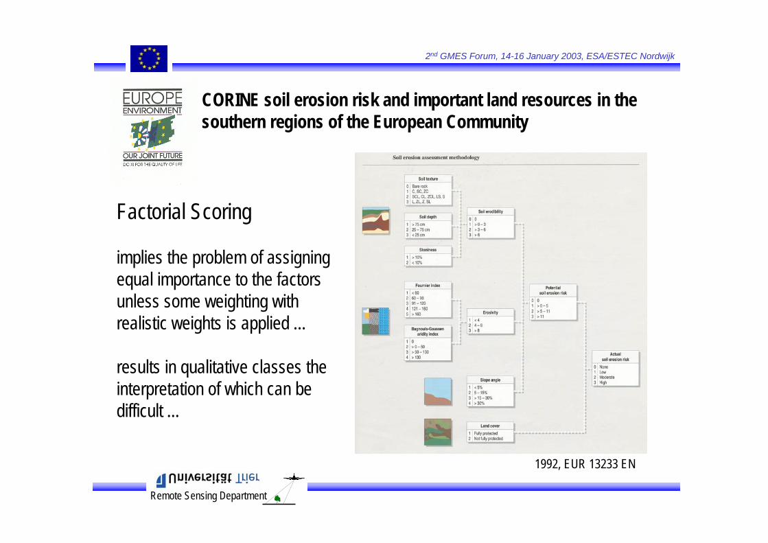
First attempts to produce regional assessments of soil erosion riskin Southern Eruope date back to the early nineties (CORINE)First attempts to produce regional assessments of soil erosion riskin Southern Eruope date back to the early nineties (CORINE)
which is a natural process ...but becomes a problem when the natural rate is significantly increasedwhich is a natural process ...but becomes a problem when the natural rate is significantly increased
Remote Sensing Department
2nd GMES Forum, 14-16 January 2003, ESA/ESTEC Nordwijk
CORINE soil erosion risk and important land resources in thesouthern regions of the European Community
1992, EUR 13233 EN
Factorial Scoring
implies the problem of assigningequal importance to the factorsunless some weighting withrealistic weights is applied ...
results in qualitative classes theinterpretation of which can bedifficult ...
Remote Sensing Department
2nd GMES Forum, 14-16 January 2003, ESA/ESTEC Nordwijk
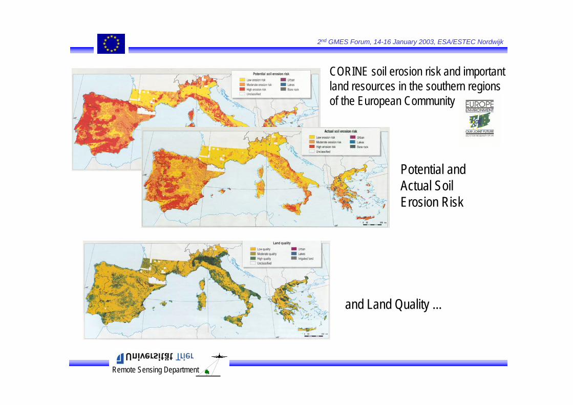
CORINE soil erosion risk and importantland resources in the southern regionsof the European Community
Potential and Actual SoilErosion Risk
and Land Quality ...
Remote Sensing Department
2nd GMES Forum, 14-16 January 2003, ESA/ESTEC Nordwijk
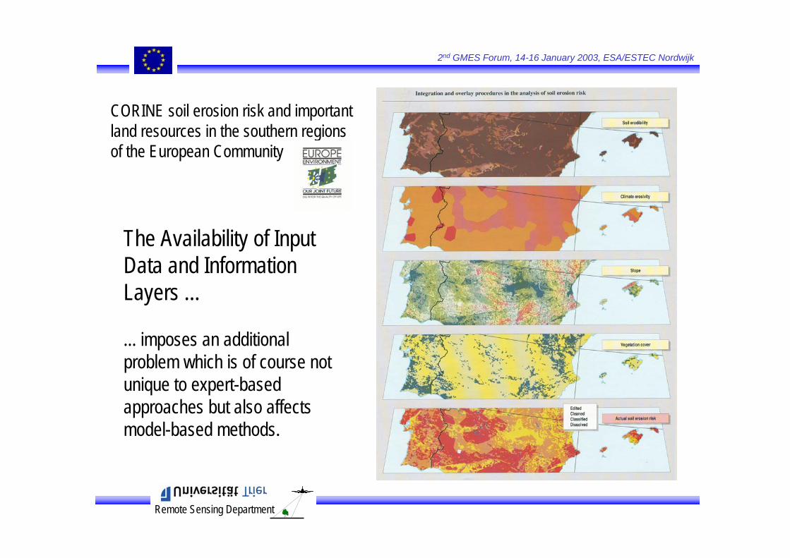
The Availability of Input Data and Information Layers ...
... imposes an additional problem which is of course notunique to expert-basedapproaches but also affectsmodel-based methods.
CORINE soil erosion risk and importantland resources in the southern regionsof the European Community
Remote Sensing Department
2nd GMES Forum, 14-16 January 2003, ESA/ESTEC Nordwijk
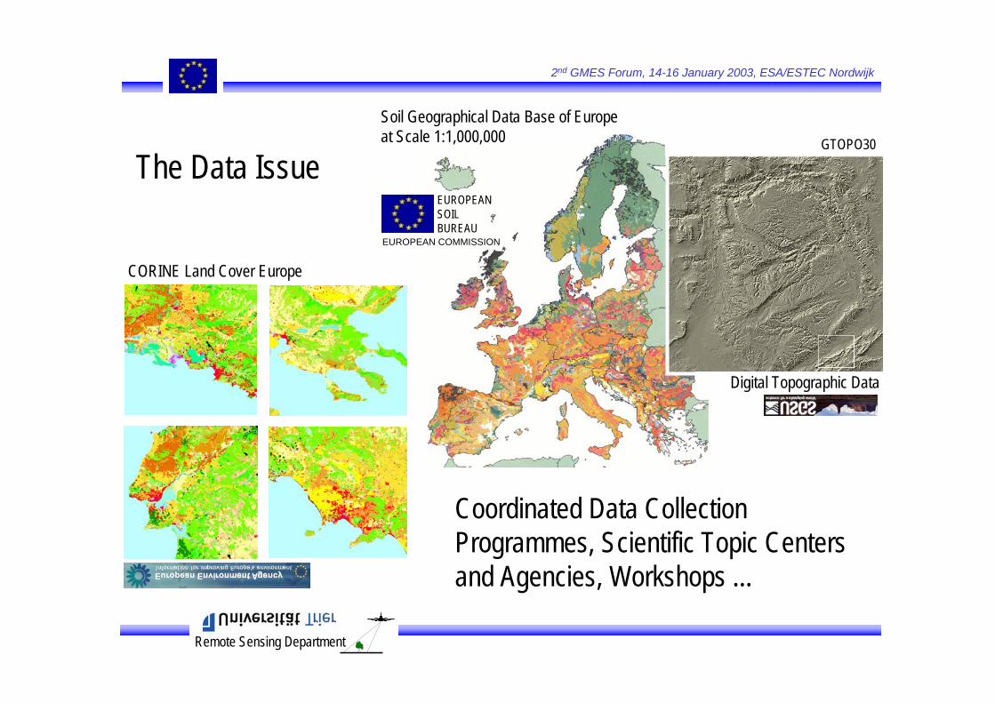
Coordinated Data CollectionProgrammes, Scientific Topic Centers and Agencies, Workshops ...
Soil Geographical Data Base of Europe at Scale 1:1,000,000
CORINE Land Cover Europe
EUROPEAN SOIL BUREAU
EUROPEAN COMMISSION
The Data Issue
Digital Topographic Data
GTOPO30

Remote Sensing Department
2nd GMES Forum, 14-16 January 2003, ESA/ESTEC Nordwijk
Actual and Potential SoilErosion Risk based on theUSLE
Grimm, Jones & Montanarella, 2001 (EUR 19939 EN)
PESERAPan-European SoilErosion RiskAssessment
Kirkby & King, 1998
Land Use & Vegetation Cover from RS Systems (NOAA-VHRR, VEGETATION)
Model-basedApproaches
http://pesera.jrc.it
Remote Sensing Department
2nd GMES Forum, 14-16 January 2003, ESA/ESTEC Nordwijk
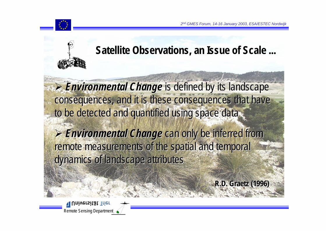
Environmental Change is defined by its landscapeconsequences, and it is these consequences that haveto be detected and quantified using space data
Environmental Change can only be inferred fromremote measurements of the spatial and temporal dynamics of landscape attributes
R.D. Graetz (1996)
Environmental Change is defined by its landscapeconsequences, and it is these consequences that haveto be detected and quantified using space data
Environmental Change can only be inferred fromremote measurements of the spatial and temporal dynamics of landscape attributes
R.D. Graetz (1996)
Satellite Observations, an Issue of Scale ...
Remote Sensing Department
2nd GMES Forum, 14-16 January 2003, ESA/ESTEC Nordwijk
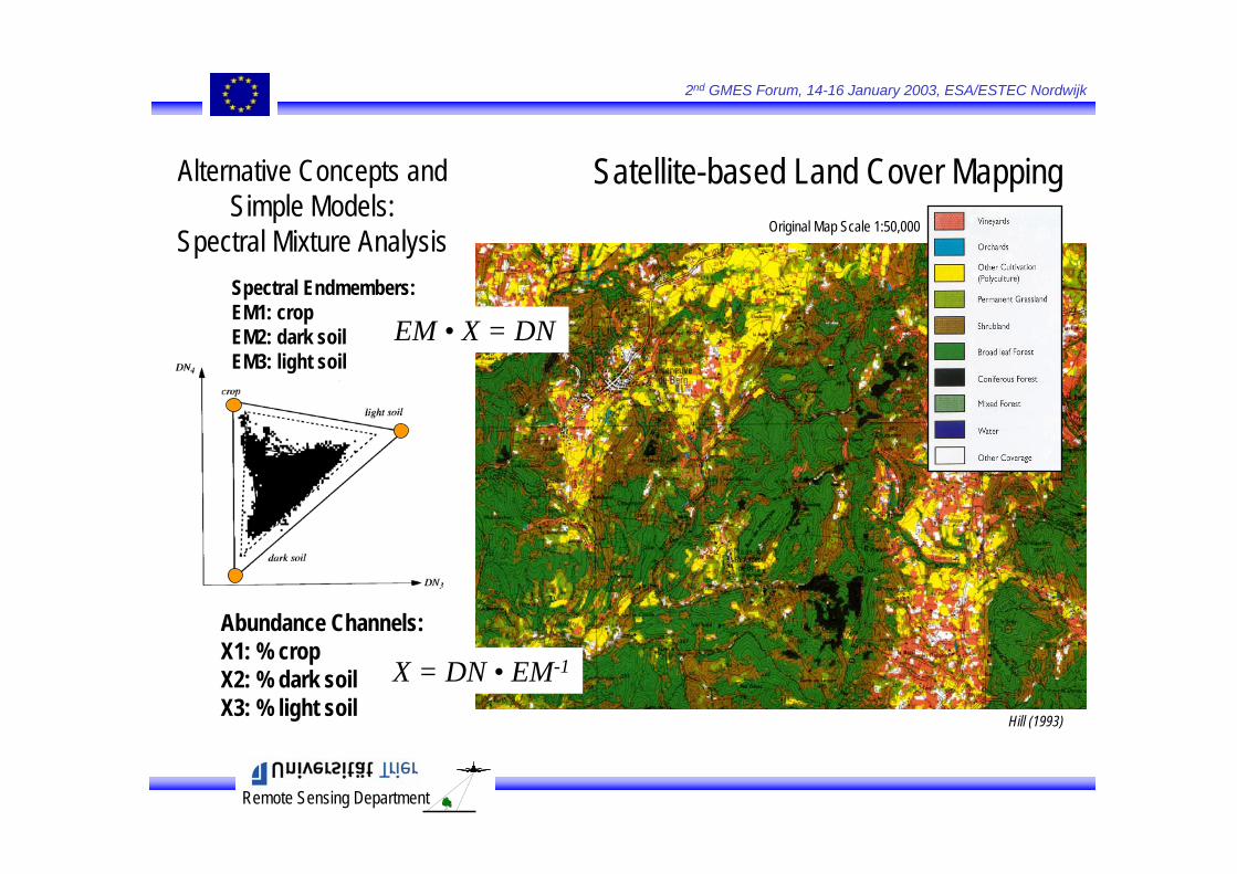
Satellite-based Land Cover MappingOriginal Map Scale 1:50,000
Hill (1993)
Extract TrainingPixels
Multi-SpectralImagery
Determine DiscriminantFunctions
Image Labeling
Alternative Concepts and Simple Models:
Spectral Mixture Analysis
EM • X = DN
X = DN • EM-1
Abundance Channels:X1: % cropX2: % dark soilX3: % light soil
Spectral Endmembers:EM1: cropEM2: dark soilEM3: light soil
Remote Sensing Department
2nd GMES Forum, 14-16 January 2003, ESA/ESTEC Nordwijk
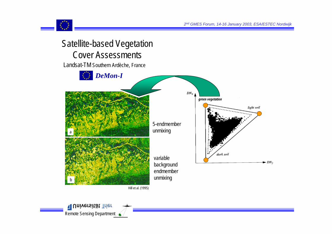
Satellite-based Vegetation Cover Assessments
Landsat-TM Southern Ardèche, France
DeMon-I
a
b
5-endmember unmixing
variable backgroundendmember unmixing
Hill et al. (1995)
green vegetation

Remote Sensing Department
2nd GMES Forum, 14-16 January 2003, ESA/ESTEC Nordwijk
Soils
Marls Limestone0 25 50 75 100
0
0
Ternary Diagramof
Mixing Proportions
GER-SIRIS measurements,sampled to Landsat-TM spectral bands
Soil ConditionsIIIIIIIVaIVb
100
25
50
75
100
75
50
25
Satellite-based Soil Degradation Mapping
Spectral MixtureAnalysis
Hill et al. (1995)
Landsat-TM Southern Ardèche, France
DeMon-I
Remote Sensing Department
2nd GMES Forum, 14-16 January 2003, ESA/ESTEC Nordwijk
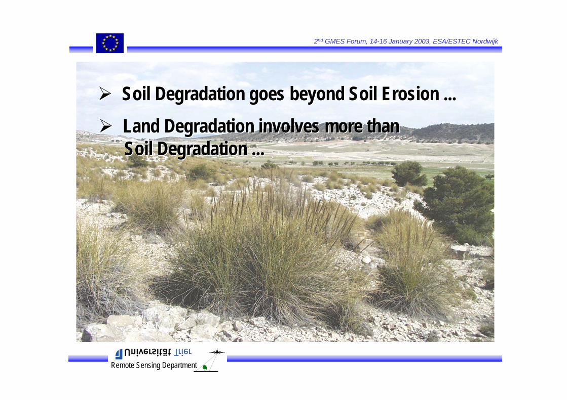
Soil Degradation goes beyond Soil Erosion ...Soil Degradation goes beyond Soil Erosion ...Land Degradation involves more thanSoil Degradation ...Land Degradation involves more thanSoil Degradation ...
Remote Sensing Department
2nd GMES Forum, 14-16 January 2003, ESA/ESTEC Nordwijk
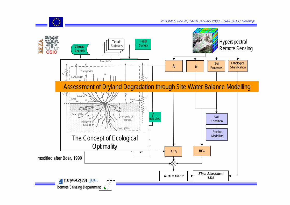
Terrain Attributes
Interpolate
P
Field Survey
E0
k
ksample sites
fsample sites
k – f0model
f0 f / f0 RC0
fg
Climate Records
Sample of undisturbed
sitesfs
LithologicalStratification
Erosion Modelling
Soil Condition
Soil Properties
HyperspectralRemote Sensing
RUE = Ea / PFinal Assessment
LDS
The Concept of EcologicalOptimality
Assessment of Dryland Degradation through Site Water Balance Modelling
modified after Boer, 1999
Remote Sensing Department
2nd GMES Forum, 14-16 January 2003, ESA/ESTEC Nordwijk
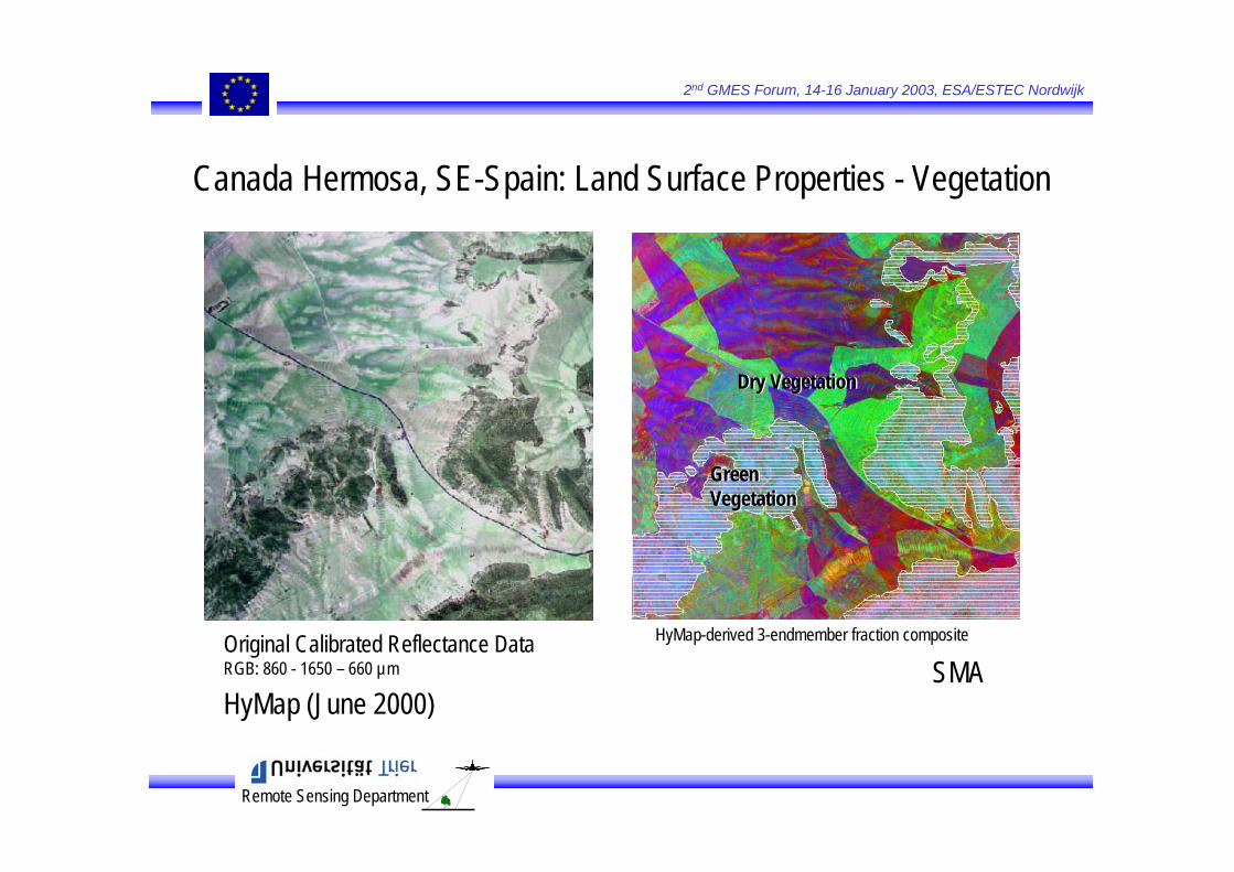
Canada Hermosa, SE-Spain: Land Surface Properties - Vegetation
HyMap (June 2000)
Original Calibrated Reflectance DataRGB: 860 - 1650 – 660 µm
HyMap-derived 3-endmember fraction composite
SMA
Green VegetationGreen Vegetation
Dry VegetationDry Vegetation
Remote Sensing Department
2nd GMES Forum, 14-16 January 2003, ESA/ESTEC Nordwijk
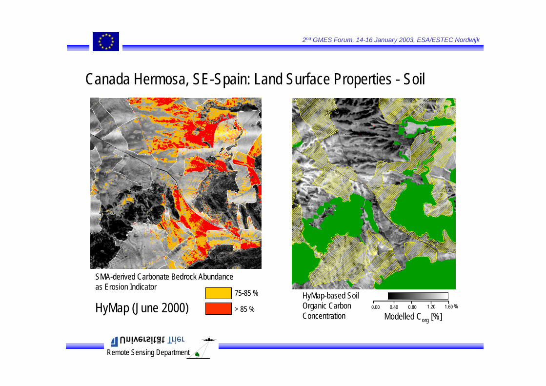
SMA-derived Carbonate Bedrock Abundanceas Erosion Indicator
75-85 %
> 85 % 0.00 0.40 0.80 1.20 1.60 %
Modelled Corg [%]
HyMap-based SoilOrganic CarbonConcentration
HyMap (June 2000)
Canada Hermosa, SE-Spain: Land Surface Properties - Soil
Remote Sensing Department
2nd GMES Forum, 14-16 January 2003, ESA/ESTEC Nordwijk
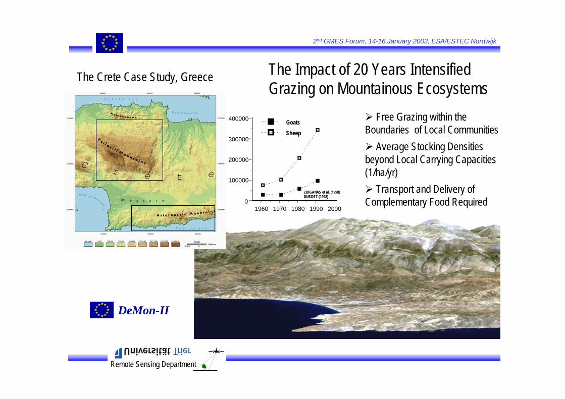
The Impact of 20 Years Intensified Grazing on Mountainous Ecosystems
The Crete Case Study, Greece
Free Grazing within theBoundaries of Local Communities
Average Stocking Densitiesbeyond Local Carrying Capacities(1/ha/yr)
Transport and Delivery of Complementary Food Required
1960 1970 1980 1990 20000
100000
200000
300000
400000 Goats
Sheep
ZIOGANAS et al. (1998)DUBOST (1998)
DeMon-II

Remote Sensing Department
2nd GMES Forum, 14-16 January 2003, ESA/ESTEC Nordwijk
1972
1989
1991
1993
1994
1997
Satellite-EstimatedVegetation Abundance
year
Veg.[%]
y = a + b*x
Spatio-temporal Indicators
Remote Sensing Department
2nd GMES Forum, 14-16 January 2003, ESA/ESTEC Nordwijk
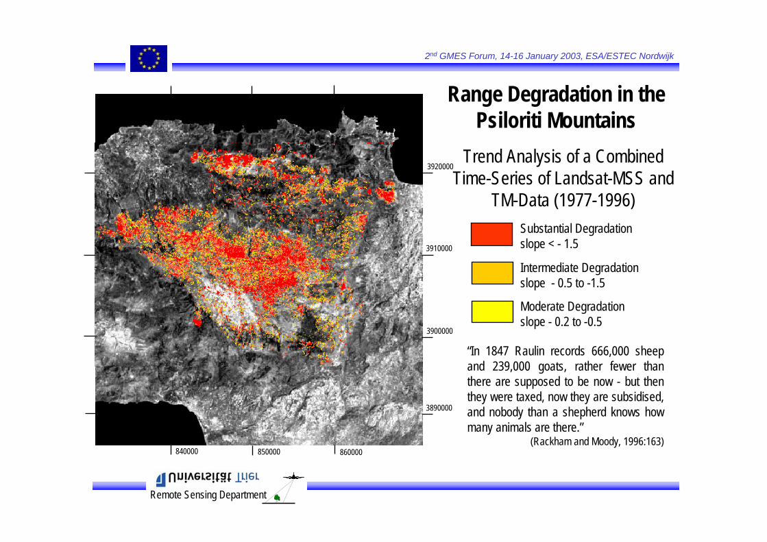
Range Degradation in the Psiloriti Mountains
Trend Analysis of a Combined Time-Series of Landsat-MSS and
TM-Data (1977-1996)Substantial Degradationslope < - 1.5
Intermediate Degradationslope - 0.5 to -1.5
Moderate Degradationslope - 0.2 to -0.5
3920000
3900000
3910000
3890000
860000850000840000
“In 1847 Raulin records 666,000 sheep and 239,000 goats, rather fewer than there are supposed to be now - but then they were taxed, now they are subsidised, and nobody than a shepherd knows how many animals are there.”
(Rackham and Moody, 1996:163)
Remote Sensing Department
2nd GMES Forum, 14-16 January 2003, ESA/ESTEC Nordwijk
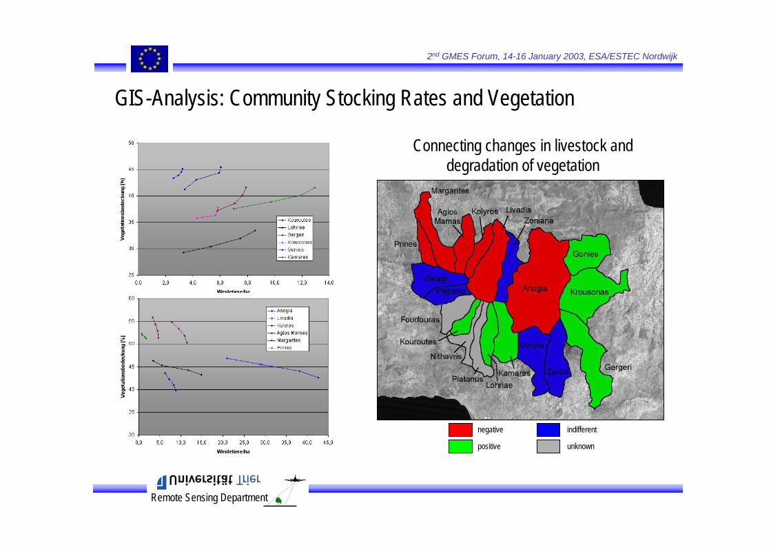
negative
positive
indifferent
unknown
GIS-Analysis: Community Stocking Rates and Vegetation
Connecting changes in livestock and degradation of vegetation

Remote Sensing Department
2nd GMES Forum, 14-16 January 2003, ESA/ESTEC Nordwijk
SPOT VEGETATION Landsat TM / ETM
Synergy of High Resolution Earth Observation Satellites and Global Monitoring Systems ...
Spectral Bandpasses
0.00 0.50 1.00 1.50 2.00 2.50Wavelength (µm)
0.00
500.00
1000.00
1500.00
2000.00
2500.00
W/m
^2/µ
m
0.00
0.20
0.40
0.60
0.80
1.00
Tran
smitta
nce
Spatial Resolution 1 km 30 m (TM 1-5, 7) Swath Width 2250 km 180 km NE ∆ ρ 0.005 – 0.024 ≤ 0.005 Quantization 12 bit (TOA) 8 bit Abs. Calibration 5 % ≈ 10 % Global Coverage 1 Day 16 Days
Remote Sensing Department
2nd GMES Forum, 14-16 January 2003, ESA/ESTEC Nordwijk
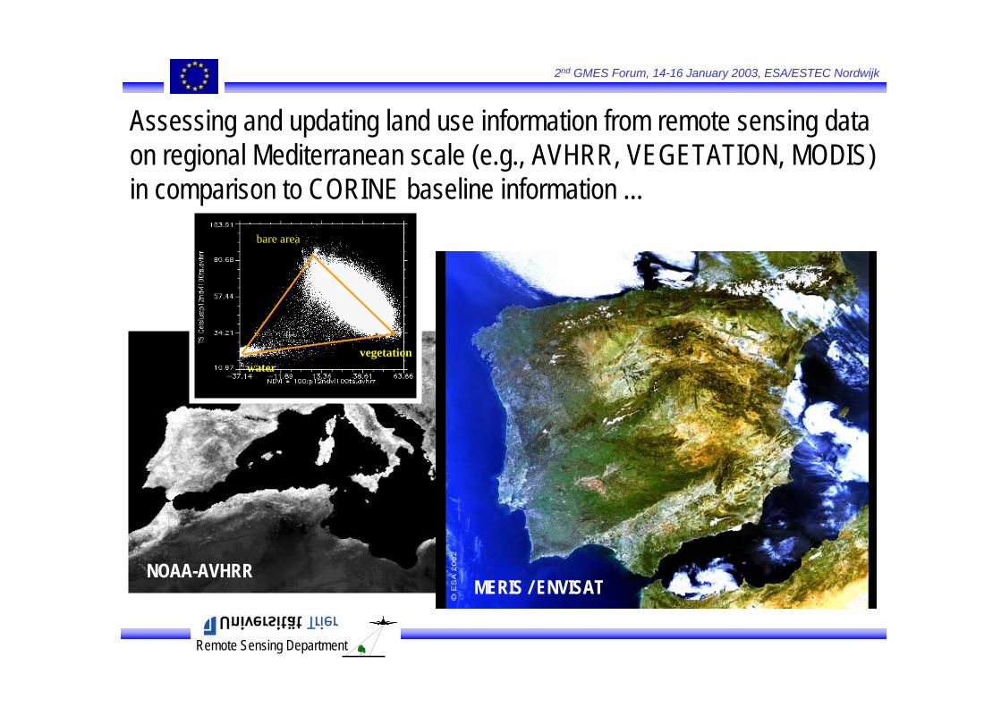
NOAA-AVHRR
Assessing and updating land use information from remote sensing dataon regional Mediterranean scale (e.g., AVHRR, VEGETATION, MODIS)in comparison to CORINE baseline information ...
vegetation
bare area
water
CORINE Land Cover Europe
MERIS / ENVISAT
Remote Sensing Department
2nd GMES Forum, 14-16 January 2003, ESA/ESTEC Nordwijk
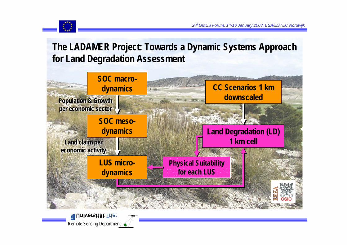
The LADAMER Project: Towards a Dynamic Systems Approach for Land Degradation Assessment
SOC macro-dynamics
SOC meso-dynamics
LUS micro-dynamics
Land Degradation (LD) 1 km cell
CC Scenarios 1 km downscaledPopulation & Growth
per economic sectorPopulation & Growth per economic sector
Land claim per economic activity
Land claim per economic activity
Physical Suitabilityfor each LUS
Physical Suitabilityfor each LUS
Remote Sensing Department
2nd GMES Forum, 14-16 January 2003, ESA/ESTEC Nordwijk
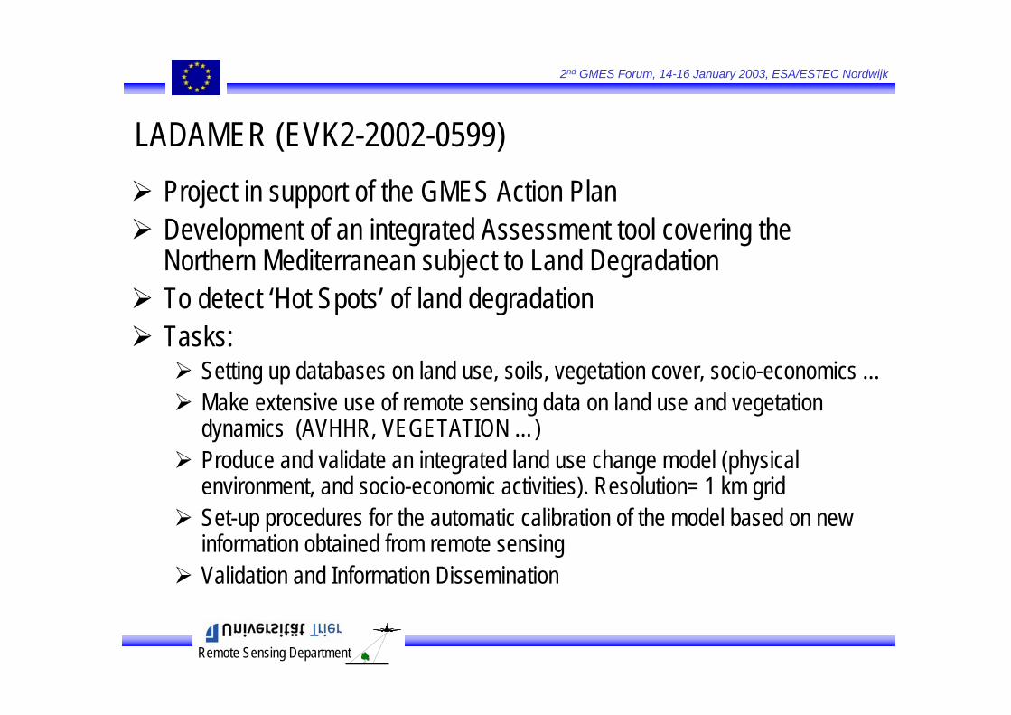
Project in support of the GMES Action PlanDevelopment of an integrated Assessment tool covering the Northern Mediterranean subject to Land DegradationTo detect ‘Hot Spots’ of land degradationTasks:
Setting up databases on land use, soils, vegetation cover, socio-economics …Make extensive use of remote sensing data on land use and vegetation dynamics (AVHHR, VEGETATION …)Produce and validate an integrated land use change model (physical environment, and socio-economic activities). Resolution= 1 km grid Set-up procedures for the automatic calibration of the model based on new information obtained from remote sensingValidation and Information Dissemination
LADAMER (EVK2-2002-0599)
Remote Sensing Department
2nd GMES Forum, 14-16 January 2003, ESA/ESTEC Nordwijk
Terrain Attributes
Interpolate
P
Field Survey
E0
k
ksample sites
fsample sites
k – f0model
f0 f / f0 RC0
f
Climate Records
Sample of undisturbed
sites
MultispectralRemote Sensing
RUE = Ea / PFinal Assessment
LDS
after Boer, 1999
Assessing land degradation status at 1 km resolution ...
Remote Sensing Department
2nd GMES Forum, 14-16 January 2003, ESA/ESTEC Nordwijk
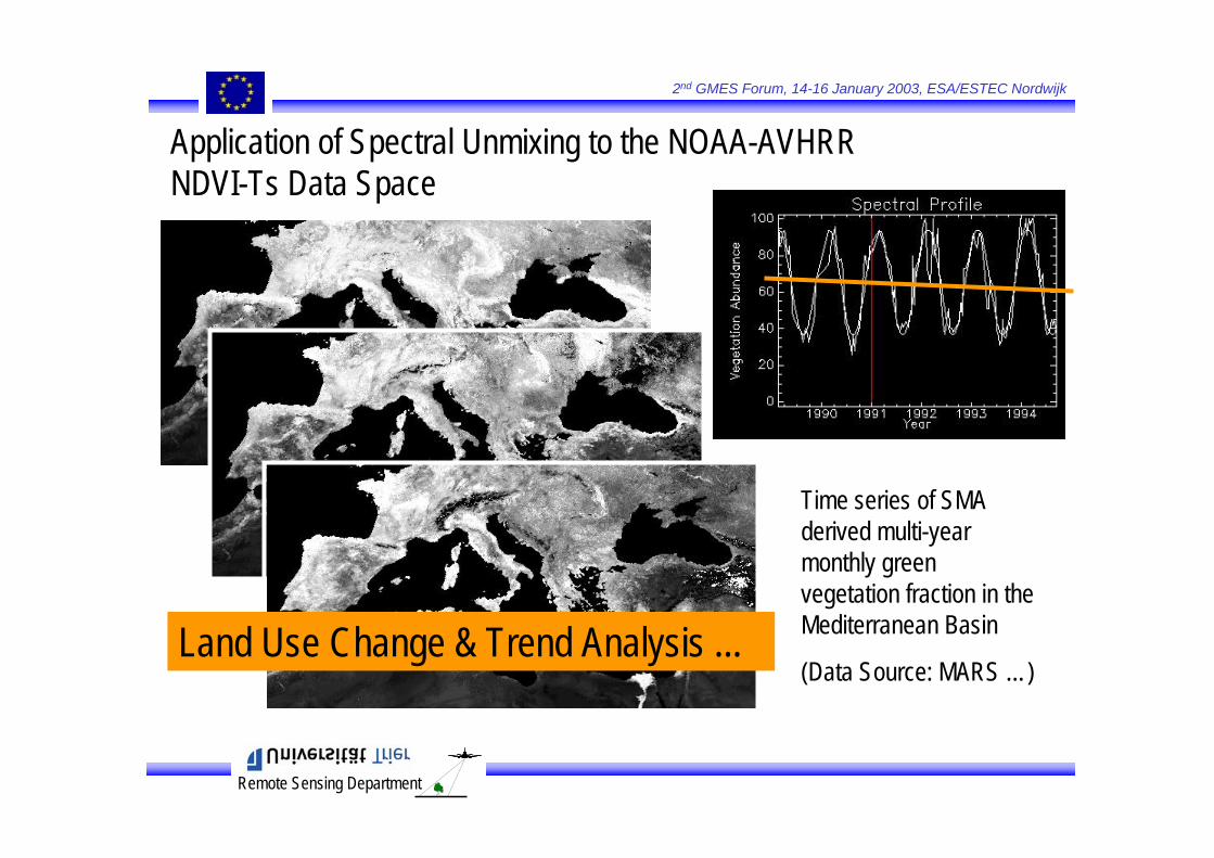
Time series of SMA derived multi-year monthly green vegetation fraction in the Mediterranean Basin
(Data Source: MARS …)
Application of Spectral Unmixing to the NOAA-AVHRR NDVI-Ts Data Space
Land Use Change & Trend Analysis ...
Remote Sensing Department
2nd GMES Forum, 14-16 January 2003, ESA/ESTEC Nordwijk
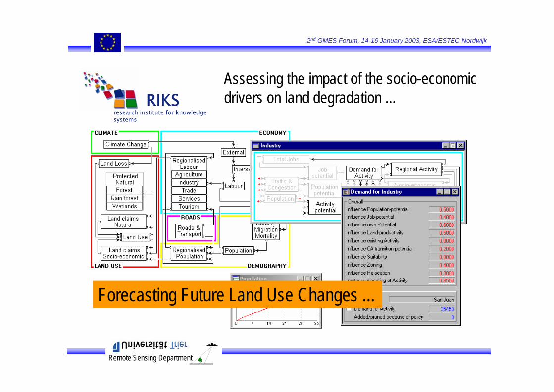
Assessing the impact of the socio-economicdrivers on land degradation ...
research institute for knowledge systems
RIKS
Forecasting Future Land Use Changes ...

Remote Sensing Department
2nd GMES Forum, 14-16 January 2003, ESA/ESTEC Nordwijk
Land use change is modelled;EU-Region consists of a grid with+/- 4 million 1 km2 cells;Overall growth and land claim of each land use function is determined at NUTS 3 levelNeighbourhood 8 cell-radius, 196 cells;Identical and coupled CA models, 1 per NUTS 3 region;Max. 32 land-use classes, some dynamic, some static;CA develops in a space defined by Suitability, Zoning and Infrastructure.
research institute for knowledge systems
RIKS
RIKS’ Cellular Automata Land Use Change Model to allocate growth to the individual 1 km plot
Remote Sensing Department
2nd GMES Forum, 14-16 January 2003, ESA/ESTEC Nordwijk
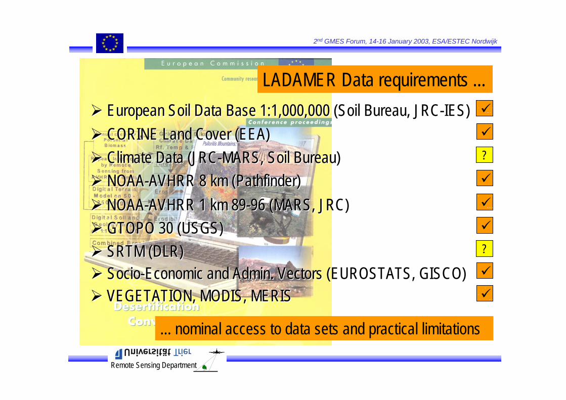
LADAMER Data requirements ...European Soil Data Base 1:1,000,000 (Soil Bureau, JRC-IES)European Soil Data Base 1:1,000,000 (Soil Bureau, JRC-IES)CORINE Land Cover (EEA)CORINE Land Cover (EEA)Climate Data (JRC-MARS, Soil Bureau)Climate Data (JRC-MARS, Soil Bureau)NOAA-AVHRR 8 km (Pathfinder)NOAA-AVHRR 8 km (Pathfinder)
GTOPO 30 (USGS)GTOPO 30 (USGS)NOAA-AVHRR 1 km 89-96 (MARS, JRC)NOAA-AVHRR 1 km 89-96 (MARS, JRC)
... nominal access to data sets and practical limitations
?
?SRTM (DLR)SRTM (DLR)Socio-Economic and Admin. Vectors (EUROSTATS, GISCO)Socio-Economic and Admin. Vectors (EUROSTATS, GISCO)VEGETATION, MODIS, MERISVEGETATION, MODIS, MERIS
Remote Sensing Department
2nd GMES Forum, 14-16 January 2003, ESA/ESTEC Nordwijk
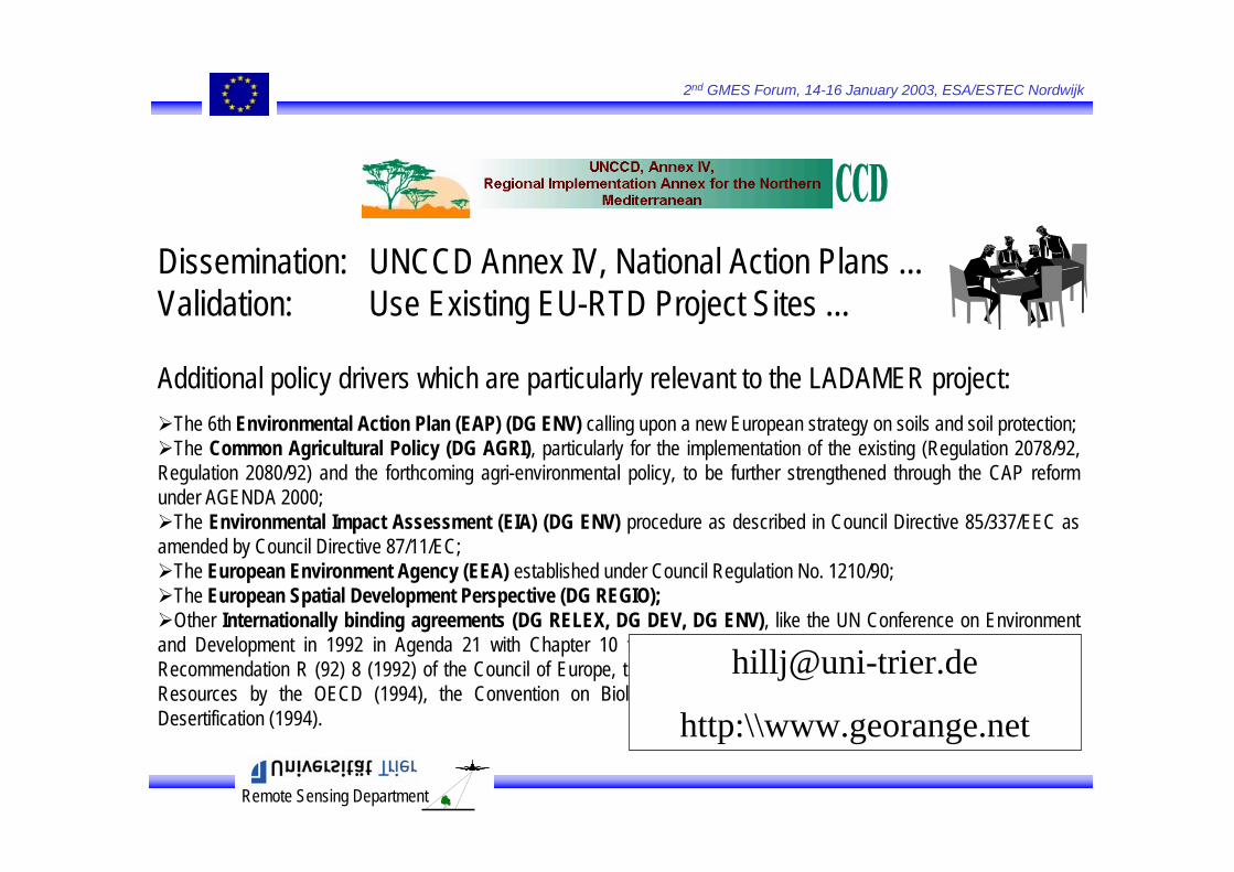
Dissemination: UNCCD Annex IV, National Action Plans ...Validation: Use Existing EU-RTD Project Sites ...
Additional policy drivers which are particularly relevant to the LADAMER project: The 6th Environmental Action Plan (EAP) (DG ENV) calling upon a new European strategy on soils and soil protection; The Common Agricultural Policy (DG AGRI), particularly for the implementation of the existing (Regulation 2078/92,
Regulation 2080/92) and the forthcoming agri-environmental policy, to be further strengthened through the CAP reformunder AGENDA 2000;
The Environmental Impact Assessment (EIA) (DG ENV) procedure as described in Council Directive 85/337/EEC as amended by Council Directive 87/11/EC;
The European Environment Agency (EEA) established under Council Regulation No. 1210/90; The European Spatial Development Perspective (DG REGIO);Other Internationally binding agreements (DG RELEX, DG DEV, DG ENV), like the UN Conference on Environment
and Development in 1992 in Agenda 21 with Chapter 10 focusing on soils, the European Soil Charter (1972) and Recommendation R (92) 8 (1992) of the Council of Europe, the recent work on Public Policies for the Protection of SoilResources by the OECD (1994), the Convention on Biological Diversity (1992), and the Convention to CombatDesertification (1994).
http:\\www.georange.net