kittson county local water management plan...
TRANSCRIPT

1
KITTSON COUNTY LOCAL WATER MANAGEMENT
PLAN
2010-2019

2
List of Figures…………….……………………………………………………………….4 List of Tables……………………………………………………………………………...4 Administration of Local Water Management Plan (LWMP)……………………………..6 Kittson County Commissioners…………………………………………………………...6 Kittson County Water Resource Advisory Committee……………………...……………7
I. Executive Summary.………………...………………………………………..8-14
Introduction…………………………………………………….…….…………...8 Watersheds in Kittson County…………………………………….….………….10 Purpose of the LWMP……………………………………..…………………....13 Consistency with other Local, State and Regional Plans………….……..……...14 Recommendations to Other Plans and Official Controls……………..……........14
II. Summary of Priority Concerns………………….........................................15-54
Priority Concern 1: Land Use……………………………………..………..…15 Poor Transparency in the Little Joe Diversion Subwatershed…………………...16 High Turbidity in the North Branch @ Outlet Subwatershed…………………...18
Great Erosion Potential in the Unnamed Coulee and JD 10 Subwatershed…..…20
Priority Concern 2: Surface Water……………………………………………24 Joe River Watershed District Natural Resource Enhancement Goal…………….24
Priority Concern 3: Groundwater……………………………………………..27
Land Use Assessment………..……………………………………………………...…...28 Surface Water Assessment…………………………………………………………….…35 Groundwater Assessment……………………………………………………………...…49 Implementation for Priority Concerns………………………………………………...…53
TABLE OF CONTENTS
Kittson County Local Water Management Plan

3
III. Goals, Objectives and Action Items…………….………………………….55-58
Land Use Goals and Objectives………………………………………………………….55 Implementation Schedule for Land Use Goals………………………………………..…56 Surface Water Goals and Objectives…………………………………………………….57 Implementation Schedule for Surface Water Goals……………………………………..57 Groundwater Goals and Objectives………..…………………………………………….58 Implementation Schedule for Groundwater Goals………………………………………58
IV. Appendix………………………..……………………………………......….59-70
Ongoing Projects and Initiatives…………………………………………………...…….59 Frequently Used Acronyms…………………………………………………………...…62 Kittson County Priority Concerns Scoping Document………………………………..…63

4
Figure 1: Location of Kittson County in Minnesota……………………………….5 Figure 2: Watershed Districts in Kittson County…………………………………..10 Figure 3: Subwatersheds in the Two Rivers Watershed District...........…………...11 Figure 4: Subwatersheds in the Joe River Watershed District……………………..12 Figure 5: Little Joe Diversion Subwatershed………………………………............17 Figure 6: North Branch @ Outlet Subwatershed…………………………………..19 Figure 7: Unnamed Coulee Subwatershed…………………………………………21 Figure 8: Judicial Ditch 10 Subwatershed…………………………………………22 Figure 9: Unbuffered Streams/Ditches of the Two Rivers Watershed District……23 Figure 10: Joe River Watershed District…………………………………………….25 Figure 11: CRP/CCRP in Kittson County…………………………………………..29 Figure 12: Land Use in Kittson County……………………………………………..34 Figure 13: FEMA Floodplain in Kittson County……………………………………38 Figure 14: Water Quality Monitoring Sites by Two Rivers Watershed District…….40 Figure 15: MPCA Impaired Streams for Kittson County…………………………...45 Figure 16: MPCA Impaired Streams for Red River Basin…………………………..46 Figure 17: MPCA Impaired Streams for Minnesota………………………………...47 Figure 18: MPCA Impaired Lakes/Wetlands for Minnesota………………………..48 Table 1: Turbidity & Dissolved Oxygen in the North Branch @ Outlet…………18 Table 2: Kittson County Registered Feedlots…………………………………….32 Table 3: MPCA Impaired Waters for Kittson County……………………………44
LIST OF FIGURES
Kittson County Local Water Management Plan
LIST OF TABLES
Kittson County Local Water Management Plan

5
Figure 1. Kittson County
LOCATION OF KITTSON COUNTY
Kittson County Local Water Management Plan

6
The administration of the Kittson County Local Water Management Plan (LWMP) is the responsibility of the Kittson Soil and Water Conservation District (SWCD), where the LWMP coordinator is housed.
Joe Bouvette 705 N. Douglas
Hallock, MN 56728
John Anderson 2291 270th Ave.
Hallock, MN 56728
Craig Spilde PO Box 173
Karlstad, MN 56732
Leon Olson 4430 340th St.
Lancaster, MN56735
Betty Younggren 2174 280th St.
Hallock, MN 56728
ADMINISTRATION OF LWMP
Kittson County Local Water Management Plan
KITTSON COUNTY COMMISSIONERS
Kittson County Local Water Management Plan

7
The Kittson Water Resource Advisory Committee (WRAC) is a made up of individuals from local, state and federal agencies. The WRAC members wear many hats. Scott Klein Kittson SWCD Supervisor Darren Carlson CLWP Coordinator Kelly Bengtson Kittson County Highway Department Chad Severts Board of Water and Soil Resources Marilyn Gustafson Kittson County Auditor Garry Bennett Department of Natural Resources
Cary Hernandez Minnesota Pollution Control Agency Dan Money Two Rivers Watershed District Shane Olson Kittson SWCD Holly Anderson Kittson County Environmental Services Jim Schwab Natural Resources Conservation Service Betty Younggren Kittson County Commissioner
WATER RESOURCES ADVISORY COMMITTEE
Kittson County Local Water Management Plan

8
This is the fourth generation Local Water Management Plan (LWMP) for Kittson County. The first plan was adopted in 1990, with the second plan adopted in 1995. The third generation plan went into effect Jan. 1, 2003. The fourth generation plan will be effective from Jan. 1, 2010 through Dec. 31, 2019. Kittson County is in the northwestern part of Minnesota on the North Dakota, Manitoba and Canadian border. Hallock, the county seat, is about 320 air miles northwest of St. Paul, the capital of Minnesota. The total area of the county is approximately 1,103 square miles, of which, 1,097 square miles of it is land and 6 square miles of it is water.
The 2000 Census listed Kittson County’s population at 5,285, but as of Feb. 4, 2008, that number was estimated to be at 4,691. Population projections show a continuation of the declining population for Kittson County. The total households in Kittson County are projected to fall to 1,810 in 2020 from 2,010 in 2000.
General land use in Kittson County is agricultural. According to the 2006 Minnesota Agricultural Statistics, there were 659 farms in Kittson County in 2002, for a combined total of 555,561 acres. In 2005, Kittson County ranked eighth in the state for wheat production. Livestock numbers have declined over the years. In 2005 Kittson County ranked 18th in the state with a beef cattle production number of 6,900.
According to Kelly Turgeon, Kittson County FSA director, there are currently 108,537 acres enrolled in the Conservation Reserve Program (CRP)(Figure 10) in Kittson County. That number is up from 95,802 acres at the time of the last water plan update in 2000.
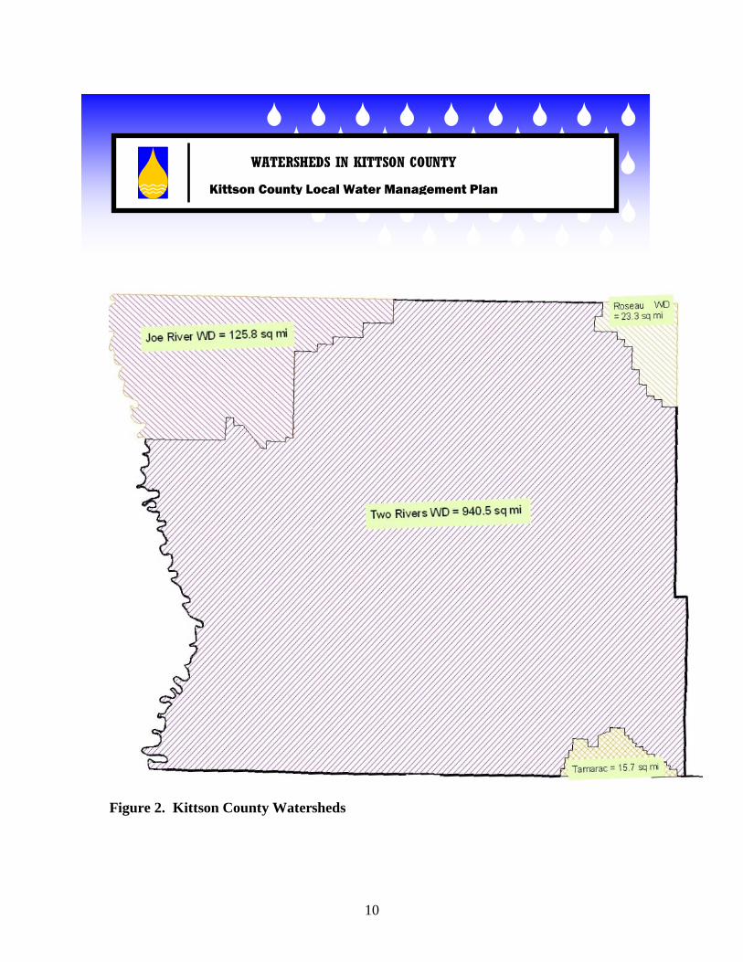
The Two Rivers Watershed District (Figure 3) is the largest watershed in the county. The District, which is located in Kittson, Marshall and Roseau counties, encompasses 1,454 square miles, and stretches 65 miles from the Red River on the western boundary to the eastern boundary just west of the City of Roseau. At its widest north-south point, the District stretches 33 miles. It is bordered to the north by the Joe River Watershed District; the south by Marshall County and the Tamarac River basin; and to the west by the Red River of the North, which is also the boundary with North Dakota. In Kittson County, the watershed covers about 940 square miles.
EXECUTIVE SUMMARY
Kittson County Local Water Management Plan

9
Historically, land cover was predominantly prairie/grassland (45%), wetland (24%), brush (15%) and forest (15%). Currently, land cover is dominated by cultivated land (66%), while prairie/grassland, wetland, brush and forest now only represent 6%, 13%, 2% and 11% of the land cover, respectively.
The Joe River Watershed District (Figure 4) makes up the northwestern corner of the Red River Basin in Kittson County. The principle drainage system in the District is the Joe River. The watershed covers about 125 square miles in Kittson County.
For the Joe River Watershed, historic land cover was primarily prairie/grassland (80%) and wetland (14%). Currently, land cover is dominated by cultivated land (89%), with prairie/grassland and wetland comprising only 4% and 2% of land cover, respectively.
The Tamarac River Watershed (Figure 2) in the northwest portion of the Red River Basin covers an area of about 333 square miles in mainly Marshall County, with a very small portion lying in Roseau and Kittson Counties. The watershed covers an area of about 15 square miles in Kittson County.
Historically, land cover in the Tamarac River Watershed was primarily prairie/grassland (46%), wetland (36%) and brush (16%). Land use has been converted to mainly cultivated land (73%) and forest (10%), with prairie/grassland, wetland and brush accounting for only 3%, 9% and 3% of land cover, respectively.
The Roseau River Watershed (Figure 2) is comprised of an area of about 1,892 square miles, located in Roseau and Kittson Counties in Minnesota and south central Manitoba, Canada. There is approximately 1,017 square miles or over 650,880 acres of the Roseau River Basin in the United States. About 64,640 acres are located in Kittson, Lake of the Woods, Beltrami, and Marshall Counties. The watershed covers an area of about 23 square miles in Kittson County.
Historically, land cover in the watershed was wetland (52%), forest (31%), brush (9%), and prairie/grassland (9%). Current land use is predominantly wetland (43%), cultivated land (40%), forest (6%) and prairie/grassland (5%).
As far as a bigger land use picture of the Red River Basin, the Two Rivers Watershed saw the largest increase in cultivated land acreage for the years 1969 through 1989. The jump amounted to an estimated 8.13% or an increase of cultivated acres from 565,721 to 615,760. The Roseau River Watershed District also saw an increase in cultivated acres of 6.44%. The Tamarac Watershed District listed an increase of 6.61%. Cultivated acreage in the Joe River Watershed District decreased by 6.02% during that same timeframe.
Unfortunately, all of the watersheds in Kittson County have impaired river reaches. A watershed-based approach has been designed to identify and address the cause(s) of the impairments.
10
Figure 2. Kittson County Watersheds
WATERSHEDS IN KITTSON COUNTY
Kittson County Local Water Management Plan

11
Figure 3. Two River Subwatersheds
SUBWATERSHEDS IN TWO RIVER WATERSHED
Kittson County Local Water Management Plan

12
Figure 4. Joe River Subwatersheds
SUBWATERSHEDS IN JOE RIVER WATERSHED
Kittson County Local Water Management Plan
13
The purpose of this Local Water Management Plan (LWMP) for Kittson County is:
1. To identify existing and potential problems or opportunities for protection, management, and development of water resources and related land resources in Kittson county.
2. To develop and implement a plan of action to promote sound hydrologic
management of water and related land resources in Kittson county.
3. To work toward effective environmental protection and management in Kittson county.
The essential constituent during development of this plan was the development of a continuing process whereby local government officials and the general public can understand the amount, characteristics, and distribution of their water resources. Based on this understanding of existing conditions, county officials can then decide what water resources are necessary and desired for future growth and development; and decide on a course of action to achieve and maintain the quality of life desired in the county. Kittson County recognizes that counties; whether growing, remaining stable or declining in population; must develop their own local plan for managing water resources. If not, they will eventually loose the opportunity to make intelligent, local choices that anticipate or prevent water resource problems before costs escalate and options narrow. Kittson County also recognizes that a well developed comprehensive water plan can also integrate local initiatives and existing state or federal water related programs and funding sources. This integration also allows more efficient management of all these programs for protection of water resources and the general environment.
PURPOSE OF LWMP
Kittson County Local Water Management Plan

14
Kittson County solicited copies of plans from various agencies and entities, including neighboring counties, watershed districts, rural water associations, etc. Local plans were received from the Two Rivers Watershed District, the Joe River Watershed District and the Roseau River Watershed District. After reviewing these plans, it is evident that the Kittson County LWMP is not only consistent with those plans, but also supports the objectives in those plans.
1. The new 3/8% sales tax could be used to help fund flowage easements that would pay landowners to temporarily impound water which can reduce flooding and improve water quality. 2. Additional funds should be directed from the new 3/8% sales tax to the state cost share program.
CONSISTENCY WITH OTHER PLANS
Kittson County Local Water Management Plan
RECOMMENDATIONS TO OTHER PLANS, CONTROLS
Kittson County Local Water Management Plan

15
The Kittson County WRAC identified the following priority concerns. These concerns were selected through public meetings, and local and state agency input. Priority Concern 1: Land Use The main objective in this category will be to focus on erosion and sediment control. Wind and water erosion is a big problem in Kittson County. Wind erosion is the biggest cause of siltation in watercourses, ditches, basins and wetlands in the county. Because of the flat topography, water erosion is also a concern. In recent years, the Kittson SWCD has seen a big demand for state cost share and LWMP cost share dollars for streambank erosion repairs. While the Kittson SWCD has been able to technically and financially help on several erosion projects, the cost share dollars are not enough to make a major impact on the problem. With the recent cut announced for 2010 cost share funding, this situation will only become a larger problem. Recommended actions include educating the public on programs that are available to aid in the erosion fight such as planting trees and working with watershed districts and other agencies within the county on funding sources for large erosion projects. One potential project may be a stretch near the Greenwood Cemetery in Hallock. Actions should also be taken to use State Cost Share dollars and water management funds to implement or continue best management practices and promote programs that would aid in reducing sediment and erosion such as buffer programs and filter strips.
SUMMARY OF PRIORITY CONCERNS
Kittson County Local Water Management Plan
16
Other potential projects are subwatersheds in the Two River Watershed District (Figure 2) will be targeted for areas of study and implementation of programs to reduce sediment loads. These subwatersheds will be the Little Joe Diversion, North Branch at Outlet, Judicial Ditch #10 and the Unnamed Coulee. The following bold, circle bulleted items are taken from the Overall Plan of the Two Rivers Watershed District (Revised July 6, 2004).
• The Little Joe Diversion sub watershed (Figure 5) consists of the Little Joe River
and three other intermittent coulee systems. These coulee systems are characterized by ridges in the upstream areas with steeper slopes which all outlet in to Kittson County Ditch #22. Flashy flows, susceptibility to extended low flow or no flow periods, unstable channels and a lack of riparian habitat limit the function the aquatic resources in this subwatershed.
o The Minnesota Pollution Control Agency’s (MPCA) Citizen Stream-
Monitoring Program (CSMP) began in 1998. In 2004 a new CSMP site (T02A) was started near the outlet (old county road 69) of the Little Joe Diversion subwatershed. Students from Hallock High School began to document the stream transparency at this site. Stream transparency is an indirect measure of the amount of dissolved and suspended materials present in water. Tracking water transparency is like monitoring your blood pressure because it tells us about the health of a stream. In general, a low transparency reading reflects a large amount of sediment (excessive soil material) or other suspended material like algae in the water. For this site in 2004 and 2005 the average stream transparency in centimeters was 21. MPCA has a guide to interpreting transparency readings: < 20 cm – Poor Transparency 20 cm – 40 cm – Fair Transparency 41 cm – 60 cm – Good Transparency >60 cm – Excellent Transparency.
With a score of 21 centimeters station T02A is at the poor to fair transparency stage. (2004 & 2005 Report on the Water Quality of Minnesota Streams)

17
Figure 5. Map of Little Joe Diversion Sub Watershed

18
• Four major coulees are direct tributaries to the North Branch @ Outlet subwatershed (Figure 6). These coulee systems enter the North Branch Two Rivers between the towns of Lancaster and Northcote. According to the Minnesota Pollution Control Agency (MPCA) the North Branch Two Rivers reach between Lancaster and just upstream of Northcote is impaired. The affected use of the impairment is aquatic life and the indicators are biota and dissolved oxygen. Kittson County Ditch #22 from the Little Joe Diversion sub watershed empties into the North Branch just upstream of Northcote.
o Water quality monitoring has been done by the District at one site in this
subwatershed. Station T02 is in the middle of this subwatershed. This site, located on Highway 75 at Northcote, has been monitored since 1991 for several parameters. Another water quality monitoring station, T01, is just downstream of the outlet to this subwatershed in the Two Rivers Main Stem subwatershed. Also there is a water quality monitoring station, T03, just upstream at the outlet of the North Branch @ Lancaster subwatershed. The following table (from the Two Rivers Watershed Impaired Waters Assessment, January 13, 2005) shows an overview of the status of water quality conditions, based on turbidity and dissolved oxygen (DO), decreasing from station T03 to T02 to T01. Basically as the water is moving east to west in this subwatershed turbidity is increasing. Results are reported at sites where there was a minimum of 10 data points within the most recent 10 years as required for impaired waters assessments:
Table 1. Turbidity & DO Levels in the North Branch @ Outlet
Sample Site
Number of DO samples
Number of DO
samples < 5 mg/l
% D.O. < 5
mg/l
Number of Turb samples
Number of Turb samples
>25 NTU
% Turb > 25 NTU
T01 @ Co. 16 108 4 4% 57 48 84% T02 @ Hwy. 75 78 8 10% 28 14 50% T03 @ Lancaster 90 2 2% 39 1 3% No shade Fully Supporting (< or = 10% of sample events exceeding) Partially Supporting (10-25% of sample events exceeding) Not Supporting (> 25% of sample events exceeding)
The impaired water assessment shows sites T01 and T02 as not supporting their designated uses when basing the use support on the turbidity guideline. Dissolved oxygen content also appears to be a problem at site T02. (Two Rivers Watershed Impaired Waters Assessment, January 13th, 2005)

19
Figure 6. Map of North Branch @ Outlet Sub Watershed

20
• In the Unnamed Coulee (Figure 7) and the Judicial Ditch 10 (Figure 8) great erosion potential exists in the eastern ½ of these subwatersheds where the fall is 20 to 30 feet per mile and the soils are sandy. In the western 1/2 the fall is from 2 to 10 feet in a mile and the soils are clay. The eastern ½ of these subwatersheds are the highest priority to control water erosion and prevent annual damages to infrastructure and cropland. Also these subwatersheds do not have any river system; rather they have a multitude of coulees and legal ditch systems. In places the coulees/ditches are wide and have a grass strip on either side of them and in other places they are narrow and are farmed up to the edge of the channel.
o Water quality monitoring has been done by the Two Rivers Watershed
District at where the Unnamed coulee intersects a township road in the NE corner of section 19 of Skane Township near the outlet of the subwatershed. Of the 27 sites in 2004 that were monitored, this site was the 2nd highest for Turbidity. (Two Rivers Watershed Impaired Waters Assessment January 13, 2005) Landowners/operators who farm up to the edge of the coulees/ditches will be contacted by a Kittson SWCD employee to discuss the benefits of grass buffer strips/AG BMP practices and the cost share programs that are available.
Summary of the plan objectives, goals and action items for the Little Joe Diversion, North Branch @ Outlet, Unnamed Coulee and Judicial Ditch 10 areas are:
• Promote Grass Filter Strips. • Promote wetland restorations. • Promote Best Management Practices (BMP) such as side inlets, streambank
stabilizations and grassed waterways to increase water quality. • Promote Field Windbreaks and Living Snow Fences. • Increase the average width of the natural habitat corridor along the river(s). • Create at least one large habitat block near the river corridor. • Promote use of buffers along waterways (Figure 8). In the Two Rivers
Watershed approximately 169 miles of perennial stream, 311 miles of intermittent streams and 649 miles of drainage ditches exist. (MN DNR GIS Dataset 2000 and Red River Basin Stream Survey Report April 2003)
• Promote Residue Management, Cover Crops, Prescribed Grazing and Field Borders with help from the federally funded Environmental Quality Incentives Program (EQIP).
• Support TMDL study and implementation plan. Other concerns that will be addressed that fall under the Land Use category include feedlot compliance, agricultural chemical use, natural resource preservation and enhancement, drainage issues and septic systems.

21
Figure 7. Map of Unnamed Coulee Sub Watershed

22
Figure 8. Map of Judicial Ditch 10 Sub Watershed

23
Figure 9. Map of Unbuffered Rivers/Stream in the Two River Watershed District

24
Priority Concern 2: Surface Water The main objective in this category will be to focus on impaired waters/Total Maximum Daily Loads (TMDL). The Minnesota Pollution Control Agency (MPCA) is completing a long-term monitoring study in Kittson County. Over the years the Kittson SWCD, watershed districts in the county, and high school students participating in the Riverwatch program, have also done water quality studies in the county. MPCA is now looking for local partners in putting together a study on the data collected, and beginning an implementation program of best management practices that will restore any impaired reaches. As the plan unfolds, the Kittson SWCD/water plan program will need to determine what role they will take in this partnership. Recommended actions include being a partner in the TMDL process, and to determine where best the Kittson SWCD/water plan program fits in the TMDL process. One of the watershed goals, objectives and desired outcome for the Joe River Watershed District (Figure 9) is stated in their overall plan (Revised September 13, 2004). Under the Natural Resource Enhancement goal the watershed would like to sustain and improve surface water quality. The following bullets are their priority issues and strategies. Priority Issues:
1. Reduce erosion and sedimentation to waterways and wetlands. 2. Reduce flashiness of waterways in watershed. 3. Restore and rehabilitate unstable stream channels in the watershed. 4. Identify potential sources of point and nonpoint pollution and monitor surface
water quality.
Strategies: 1. Monitor and assess the condition of existing drainage systems by doing annual
inspections and surveys and creating a data base of problems and possible solutions.
2. Inventory all side inlets to legal ditches and consider programs and funding to reduce erosion potential.
3. Investigate and utilize strategies such as culvert sizing, impoundments, wetland restorations and others to provide a more constant or even flow within watercourses.
4. Continue water quality monitoring program and seek expansion to monitor additional sites.
Other concerns that will be addressed that fall under the Surface Water category include flood damage reduction, water quality, and storm water issues.

25
Figure 10. Joe River Watershed District

26
Another potential project may be to look for funds to help with engineering assistance. Streambank stabilization projects are common and necessary in Kittson County but needs an engineer with job approval authority (JAA) to survey, design and then implement the plan. No staff members with the Kittson SWCD or local NRCS have a JAA to do such jobs and therefore engineers from outside the county are asked to help out. Currently engineers time spent on site are billed to the landowner. Kittson SWCD has a list of a half dozen landowners (NRCS has a couple more interested landowners) who would be interested in streambank stabilization project but do not want pay an engineer for the survey, design and implementation work. A funding source should be looked at so the landowners do not have to incur the cost of the engineer. An additional project is the Spring Brook Watershed Plan located in the Judicial Ditch 10 subwatershed of the TRWD. In October 2007 an Environmental Assessment (EA) was completed and the following is taken from.
• Floodwater damage is a major problem for several landowners/operators in Spring Brook Township. Flooding occurs during both spring snowmelt and the growing season therefore flood protection is needed. The primary purpose of this project is to reduce cropland flooding through the construction of setback dikes to the 10 year flood elevation. A secondary purpose of the project is to create a riparian buffer and wetland wildlife habitat corridor.

27
Priority Concern 3: Groundwater The main objective in this category will be to focus on protecting drinking water resources. All public water supplies in Kittson County come from underground water sources. None of the communities rely on surface water. Therefore, groundwater quality and quantity are big issues in Kittson County. Recommended actions include working with public water suppliers on wellhead protection areas. This can happen through education programs that educate property owners on the importance of using best management practices in wellhead protection areas. This may also include the implementation of land use programs designed specifically for the protection of those areas. Other concerns that will be addressed in the Groundwater category include the sealing of unused wells and developing a well inventory/database. Also an inventory for Individual Sewage Treatment Systems (ISTS) would like to be conducted in Kittson County. This inventory would see how many systems are in the county, which ones are not working properly and what to do with those not up to code.
28
LAND USE ASSESSMENT
CURRENT LAND USE There are currently 108,537 acres of CRP enrolled in Kittson County (Figure 10). That number is up from 85,000 planted into CRP at the time of the 1995 water plan. Established CRP decreases as you move from the East to the West in Kittson County. Most of the land currently in CRP is some of the most highly erodible land in the county, and is not the best suited for crop production. If it is taken out of CRP and tilled up without implementing conservation measures, it will undoubtedly begin to erode whenever the wind blows or it rains. This will have the effect of plugging ditches, increasing suspended solids in waterways, and reducing overall water quality. For this reason, the WRAC supports continuing the CRP program for riparian areas and highly erodible land in the county. A new program titled the Red River Valley Set-aside was started in 2000. This program involves 1,645 acres in Kittson County. The program, based closely on CRP, pays landowners to plant cover crops on soil classes 1, 2, and 3 throughout the Red River Valley under the 1999 presidential disaster declaration. A minimum of five percent of the landowner’s acres enrolled must also be planted to trees. A minimal amount of land is also enrolled in the Reinvest in Minnesota (RIM) program. The purpose of this program is to protect water quality, reduce soil erosion, and enhance fish and wildlife habitat by acquiring conservation easements on environmentally sensitive lands. The program, one of the first state programs of its kind in the country, began in 1986. The program has historically fostered partnerships with private organizations – including Pheasants Forever, Ducks Unlimited, and the Minnesota Waterfowl Association – and other government agencies including the U.S. Fish and Wildlife Service and the DNR. Riparian lands, sensitive groundwater areas, wetland restoration areas (drained wetlands), marginal cropland, and lands for living snowfences are all eligible land types for the program.
PRIORITY CONCERNS ASSESSMENT
Kittson County Local Water Management Plan

29
Figure 11. CRP in Kittson County

30
The Kittson SWCD targets critical areas and highly erosive areas in the county for many of its programs. Taking land out of production through RIM and CRP has been quite successful in reducing erosion potential in those areas. Keeping permanent cover on lands bordering streams or lakes and maintaining buffer strips along ditches helps keep sediment, nutrients, and chemical residue out of surface waters and groundwater recharge areas. Grassed waterways and sediment retention structures also improve the quality of runoff by allowing sediment to settle out and nutrients to be filtered from surface water. EROSION AND SEDIMENTATION High priority erosion is defined as erosion from wind or water occurring on class I-IV soils in excess of 2T tons per acre per year or any soil within 300 feet of a stream or 1,000 feet of a water basin designated as a protected water or wetland by the DNR eroding in excess of T tons per acre per year. T is defined as the tolerable loss of soil that allows long-term sustained productivity, or the amount of loss that can be regained by soil forming processes in one year. Wind erosion is the number one problem in Kittson County with 70 percent of the cropland acreage eroding at a rate greater than T. For the soils in Kittson County, T is between 2 and 5 tons per acre. Highly intensive farming systems in Kittson County include large acreage of low residue crops that are harvested too late in the fall to permit establishment of winter cover crops needed to control soil blowing. Since it’s beginning, the SWCD has been vitally concerned with water quality and watershed protection. The various conservation practices that have been applied have definitely helped control water quality. All of the practices help keep sediment and silt out of the lakes and streams. Working to solve critical erosion problems for both wind and water go a long way toward solving critical sedimentation problems. Soil particles carried by wind often deposit in nearby ditches and watercourses. It then either builds up there or is carried to the outlet of the watercourse. This causes problems with water quality and with the function of the drainage ditch itself. Because most coulees and ditches are dry most of the year, the sediment tends to build up until a spring flood or a major storm event begins to move it. It is at these times when water quality suffers.

31
As rivers travel from east to west through the county, sediment levels increase. This is due to the intense farming in the west versus the CRP and pasture in the east. This increased total suspended solid level is concern because it clouds the water and affects the water quality. Steps should be taken to reduce the amount of total suspended solids entering aquatic systems. IRRIGATED ACREAGE Irrigated land in Kittson County amounts to only about 2,000 acres. Most of the irrigation in the county occurs in Norway Township. Potatoes and native grasses are grown on the irrigated land. Irrigators generally use a water well or pump water out of gravel pits, which to date has not posed a water use conflict. Groundwater quality in irrigated areas is generally good. However, these areas need to be closely monitored to insure agricultural chemicals are not reaching the county water supply aquifers. This was one concern raised at a public informational meeting for the LWMP. In answer to this concern, new water quality testing sites may be added in the heavily irrigated areas. The Kittson LWMP will work with the Two Rivers Watershed District to set up new testing areas. DITCHES Kittson County is criss-crossed with numerous state, county, judicial, and private ditch systems. In many cases, these ditches use coulees and rivers both as inlets and as outlets. Most of these ditches were constructed in the early 1900s, and have been maintained to varying degrees over the years. Standard procedure for ditch maintenance has been to wait until a request for a cleanout or repair is made, and then deal with the problem. This has resulted in some ditches falling into a total state of disrepair, some ditches being only partly maintained, and some ditches being well maintained. Water quality and quantity has not been monitored or documented in most ditch systems. Generally speaking, watersheds of ditch systems are larger due to modern technology and larger equipment used to drain farm fields. This can have the effect of overloading some ditch systems if they are not maintained properly. An increased amount of water coming into Kittson County from ditch systems in Roseau County is also a major concern. Reduction or removal of riparian areas is also common in the Two Rivers watershed. Little or no buffer exists between most waterways and agricultural land. Healthy riparian areas can reduce the impacts of agricultural activities on stream stability by reducing sediment inputs, reducing bank erosion and slowing stormwater runoff. Stream segments without functional riparian “buffers” are more susceptible to erosion and sediment yields are generally higher compared to those with functional buffers. (Red River Basin Stream Survey Report April 2003)

32
As ditch systems are maintained, a series of best management practices should be required in erosion prone areas. These include grass buffer strips, rock chutes in outlets, rip rap, grassed chutes, drop structures, and other erosion control methods as suggested by the Kittson SWCD. FEEDLOT INVENTORY After 20 years, Minnesota’s feedlot rule was revised and went into effect on Oct. 23, 2000. A major component of the revised rule required most owners of animal feedlots and manure storage areas to register with the State of Minnesota. An animal feedlot capable of holding 50 or more animal units, or a manure storage area capable of holding the manure produced by 50 or more animal units are required to register. Feedlots capable of holding ten or more animal units or a manure storage area capable of holding the manure produced by ten or more animal units located within shoreland (land that is 1,000 feet or less from a lake or 300 feet or less from a river or stream) are also required to register. As part of Kittson County’s delegated feedlot program, a Modified Level One Inventory was completed to get feedlot producers to register by Jan. 1, 2006. Twenty-three producers registered their operations as feedlots through the Level One Inventory. Kittson SWCD is the County Feedlot Officer. Feedlots are inspected annually and the SWCD works with the NRCS if there are any problems. Currently feedlots are not determined not to be a problem. The following chart details where the registered feedlots in Kittson County are located.
Table 2. Registered Feedlots in Kittson County Township Number of Feedlots Total animal units Arveson 1 271 Cannon 1 360 Caribou 3 501.5 Clow 1 7 Deerwood 2 247.5 Granville 1 237.2 Hampden 1 360 Jupiter 1 102 McKinley 1 184 Norway 1 64.4 Pelan 1 575 Percy 1 24 Poppleton 2 113 Richardville 3 749.6 Springbrook 1 71 St. Vincent 1 40 Thompson 1 480 TOTAL 23 4,387.2

33
DEAD ANIMAL PICKUP PROGRAM Another program designed to reduce potential contamination is the Kittson County Dead Animal Pickup Program. This program reimburses producers up to 75 percent of the pickup fee for pickup of deceased animals. Environmental concerns and the spread of disease are the two main factors for offering this voluntary program to farmers in the region. The service area includes Roseau, Kittson, Marshall, Pennington, Red Lake and Polk Counties. The pickup fee is $90 for up to 4,000 pounds and $2.50 for each 100 pounds over 4,000. The animals are hauled to the Darling International, Blue Earth (MN) Rendering Plant. Unfortunately, because of Bovine Tuberculosis the program did not operate in 2008 and 2009. GRAVEL PIT INVENTORY Through the CLWP, a gravel pit inventory was conducted in 1999. The inventory lists 63 gravel pits in Kittson County. Specific information for each location is on file at the Kittson SWCD office. Kittson County also has funding available for the cleanup of public gravel pits. The money has been generated through gravel pit receipts since 1977. About $30,000 is currently available for this purpose.

34
Figure 12. Kittson County Land Use

35
SURFACE WATER ASSESSMENT
The Red River of the North drains 39,200 square miles in Minnesota and North Dakota, including all of Kittson County. The drainage basin in the United States is about 394 miles long, with a maximum width of about 300 miles.
The Red River begins at the confluence of the Otter Tail and Bois de Sioux Rivers near Breckenridge. It flows in a natural channel throughout its entire reach except for local leveeing at Breckenridge, Moorhead, and East Grand Forks, and agricultural dikes north of Grand Forks, including areas in Kittson County. The Red is a classic meandering river with very low slope in nearly homogeneous, fine-grained material. Slumping banks, natural cutoff channels, and scouring are evidence that the river is actively modifying its channel. Bank full capacity range is about 20,000 cubic feet per second at Grand Forks. This capacity, low for a river system this size, results in frequent flooding. Major tributaries of the Red River include the Mustinka, Otter Tail, Pelican, Buffalo, Wild Rice, Sand Hill, Red Lake, Thief, Clearwater, Snake, Middle, Tamarack, Two, Roseau, and Joe Rivers. Tributaries from the moraine region commonly flow from lake to lake in the upper reaches. Channels commonly change abruptly from shallow channels with very low inconspicuous banks to well-defined channels with high banks. Tributaries originating in and flowing across lake-washed till plain are generally contained by low banks and commonly have man-made modifications, such as channel straightening, for much of their length. Tributaries in the eastern lake plain flow in well-defined channels and are actively eroding. Nearly all of these tributaries flow within well-developed channels with low banks. Most streams meander, and many have had channel capacities increased to provide for flood flows. Lakes and wetlands are common in the moraine region and in low areas between beach ridges, and are virtually nonexistent in the Lake Agassiz Plain. Smaller lakes in the western moraine region are commonly referred to as potholes, although they have hydrologic characteristics similar to lakes. Wetlands in the area between beach ridges are fairly continuous, but do not cover a large area. In general, they are fed by seepage from precipitation that infiltrates sandy beach ridges. Wetlands in the lake-washed till plain are part of a vast peatland that covers much of North Central Minnesota. Most of this peat is nearly saturated, and drainage efforts in the 1920s met with varied success. Much of the ditch system was subsequently abandoned, and reverted back to wetlands.

36
SURFACE RUNOFF Surface runoff is precipitation that appears as natural flow in surface streams after evapotranspiration, infiltration, and surface and channel storage requirements are satisfied. Runoff is a function of basin size and shape and characteristics such as topography, geology, soils, and vegetation. Flood control reservoirs, channel modification and ditching, and changes in land use, soil cover, and water use can alter runoff rates. Average annual runoff is lowest in the lake plain region, and increases from west to east in a pattern similar to the distribution of precipitation. The greatest average annual runoff occurs in the moraine highlands south of the Red Lakes. Local variations of runoff occur in groundwater discharge areas along the west edge of the moraine region, in local areas of poorly defined surface drainage. Maximum runoff generally occurs in spring and early summer. Typical streams in the lake plain region have wide variations of flow, and in most years have long periods with no flow. Typical streams in the moraine region have more sustained flows and less monthly, seasonal, and yearly variation.
FLOODING The two areas with known flooding problems are along the Red River of the North and the Roseau River. These are areas with floodplains and are affected most often. Flooding and damage to land and other property is a particularly serious problem in the South Branch of the Two Rivers. Flooding of the Roseau River at times of excess runoff, causing overflow into the upper reaches of the South Branch and Middle Fork of the Two Rivers, poses a problem to the capacity of some of the drainage systems in the Two River system. In the Joe River Watershed the main area of concern on flooding is along the Red River of the North. Large historic floods were recorded in the area in 1826, 1852, 1861, 1882 and 1897, but few major floods occurred in the first half of the 20th century. Major flooding returned to the Valley in 1948. Widespread inundation also occurred in 1950, 1965, 1966, 1969, 1974, 1975, 1978, 1979, 1993, 1996, 1997, 1999, 2001, 2005, 2006, and 2009.

37
The 1997 spring flooding along the upper reaches of the Minnesota River and the Red River of the North broke most existing flood records in Minnesota. FEMA’s estimate of public infrastructure damage in Minnesota from the flood was approximately $300 million. Before the water receded, 58 of Minnesota’s 87 counties (including Kittson) were declared federal disaster areas. The American Red Cross reported that the massive floods affected 23,263 families. Total flood damages and associated economic impacts were estimated to be as high as $2 billion. Most floods on the Red River result from snowmelt. Rainfall generally does not produce large floods but these floods are often sudden and can cause extensive crop damage. Processes that control the magnitude of floods on the Red River Basin are numerous and complex. Infiltration, evapotranspiration, pocket storage, and interception will significantly reduce available rainfall and snowmelt precipitation before runoff during all but the wettest conditions in the Red River Basin. These processes are particularly variable during the snowmelt period. For example, infiltration rate is significantly affected by soil moisture content and the extent to which the soil is frozen. Although summer floods occur less frequently, they can cause high agricultural losses from soil erosion and crop damage, as well.

38
Figure 13. Kittson County Floodplain Map
39
BEAVER BOUNTY PROGRAM Flooding is also caused due to the abundance of beaver in the County, and the dams that they build. Because of this problem, the Kittson SWCD partnered with Kittson County and the Two Rivers Watershed District on a two-year grant through BWSR. The Watershed and the County were already giving bounty for beaver taken on their ditch systems. The goal of the SWCD was to help landowners who were having problems on private land that wasn’t already covered by the County and Watershed. The three entities received $10,000 to implement a bounty program together. It was decided that dam removal would not be part of the program. The grant was to run for two years. But after only one year, the funds were exhausted. Unfortunately, the beaver population was not. Therefore, the SWCD decided to continue with the program on its own. The County and the Watershed still pay bounty on their ditch systems, as in the past. The District now pays $40 per beaver tail brought into the office. The funds are dedicated through the LWMP.
SURFACE WATER QUALITY MONITORING PROGRAM Starting in May of 1991, Kittson SWCD conducted a surface water monitoring program on the Two Rivers, Joe River, and an unnamed coulee/ditch system. Water samples from a total of eleven locations on the two river systems are taken and analyzed for nitrogen, phosphorous, bacteria, suspended solids, alkalinity, ph, chloride, dissolved oxygen, dissolved solids, and color. Temperature and depth are also recorded. These samples are taken monthly between ice out and freeze up. The study was initiated to establish water quality trends and detect sources of point and non-point pollution. Samples are also analyzed three times per year for the presence of 26 different pesticides. As of 2001, results from this study show that general water quality is good in Kittson County. As river systems in the county flow from east to west, they enter intensely farmed areas. Consequently, more runoff occurs and suspended solids and sediment increases. This has the potential to bring in larger amounts of nutrients and chemicals that are foreign to the river systems. Results of water sampling, however, have shown for the most part low levels of contaminants. This monitoring program will continue indefinitely, although the Two Rivers Watershed District now does the monitoring. This was due to a LWMP program reduction in 2003. At that point, the Watershed offered to take over the monitoring program.

40
Figure 14. Two Rivers Watershed District Water Quality Monitoring Sites

41
DRINKING SUPPLIES All public water supplies in Kittson County come from underground water sources. None of the communities rely on surface water. DNR PERMITS DNR Water Appropriation Permits are required for withdrawals greater than 10,000 gallons per day or one million gallons per year. There are currently several water appropriation permits in Kittson County.
RECREATIONAL USE Lake Bronson, located in east-central Kittson County, is the only lake in the county with recreational value. This lake is used for fishing, boating, water skiing and swimming. It is located entirely within Lake Bronson State Park, and is managed by the DNR. In the early 1990s the lake was drawn down in an attempt to rehabilitate the lake and execute repairs to the dam. Rough fish species were eliminated and a fish stocking program was designed for walleye, bass, and panfish. DNR Fisheries will continue to monitor the fish population and habitat in Lake Bronson, taking appropriate management actions when necessary. Recreational uses of wetlands in the county consist mainly of hunting, particularly in the eastern half of the county. Rivers and watercourses are used for fishing, canoeing, and tubing. Walleye, Northern Pike, and other fish are caught near Lake Bronson and Hallock. Catfish can be caught in the Red River.
HIGH, MEAN, AND LOW FLOWS ON STREAMS Changes in distribution and volume of surface water affects both its use and quality. Information about low flow characteristics of rivers and streams is used for water supply use and water dilution planning for municipalities, industries, and irrigation. The U.S. Geological Survey published a report in 1987 to help define surface water yield characteristics by summarizing low-flow yield characteristics. The report presented low flow frequency curves for 175 continuous record stream flow stations in Minnesota with 10 or more years of continuous record. Low flow is defined as the lowest average flow for some consecutive day period. The one, seven and 30-day low flow series were from the record of each station for each climatic and seasonal period. The analysis was based on all available data (1892 through 1983) for 228 discontinued and current continuous record stream flow stations available from Water-Data Storage and Retrieval System maintained by the USGS.
42
The USGS maintains stream gauging stations on the Two Rivers in Lake Bronson and the Roseau River in Caribou. Yearly reports are published by the USGS that include these stations. The following rivers were reported to have had low-flow frequency curves: South Branch Two Rivers at Pelan, South Branch Two Rivers at Lake Bronson, Two Rivers below Hallock, North Branch Two Rivers near Lancaster, State Ditch #85 near Lancaster.
LAKES OR STREAMS WITH PROTECTED FLOWS A DNR report on the value of water in Minnesota (Minnesota DNR 1987) described the water balance within the 39 major watersheds of the state. The study compared total instream and offstream water requirements to the availability of water during normal flows and dry flows. These ratios of availability to total use can provide a theoretical indication of potential for constraint on water supplies in a given area. There are no rivers in Kittson County that have protected flows.
LAKES AND STREAMS MPCA is the primary state agency charged with pollution monitoring, control, and abatement. MPCA develops water quality standards for all water bodies in the state and sets effluent limits for each discharger that will maintain the appropriate standards. The primary regulatory tool for controlling wastewater discharge is a permitting program conducted by the MPCA Division of Water Quality where any municipal or industrial facility operating a disposal system discharging directly into state water is required to have a discharge permit. Requirements included in the permit are discharge effluent limitations based on water quality standards, monitoring requirements, and any special conditions necessary to protect water quality. Permits are issued for up to five years and public notice and comment periods regarding new permits, modified permits and changes in permit rules or procedures allow citizen involvement in the permitting process. MPCA’s Water Quality Division reviews self-monitoring reports of dischargers and conducts compliance surveys. Present surface water available for use in the county includes what is available in the Roseau, Two, Joe, and Red Rivers. Lake Bronson has water available, and numerous gravel pits are present on the eastern side of the county.

43
Uses of surface water are few, since all cities now rely on groundwater. The Two Rivers Golf Club, located in Hallock, uses river water to water fairways and greens. Some livestock operations use river water, and private individuals occasionally pump out of the river. Problems with water quality can arise when there is a surplus. Because of the very flat terrain in the county, water moves over land very slowly. Many ditches are too small to handle excessive volumes of water, and therefore water sits on both crop and non-cropland for long periods of time. This can be very detrimental for crops. Due to lack of water during mid-summer flows in the river systems, recreational use becomes a problem. Generally, Lake Bronson and the Red River sustain adequate levels, however, fishing and boating/canoeing suffer on the Two and Roseau Rivers. Surface water in Kittson County is generally considered to be of good quality. As river systems flow from east to west, they travel from wetland headwater areas through CRP and set-aside lands, into moderately farmed areas, then into intensely farmed and ditched areas, and finally outlet into the Red River of the North. As one may expect, they gradually pick up increasing amounts of sediment and runoff along the way, and water quality decreases from east to west as a result. Lakes and ponds are also a concern in the county. Lake Bronson, the only major lake in the county, is a manmade lake managed by the DNR. Water quality and fisheries management concerns in the lake are currently being addressed by the DNR.

44
INVENTORY OF ALL IMPAIRED STREAMS IN KITTSON COUNTY
Section 303(d) of the Clean Water Act requires states to publish and update a list of waters that are not meeting one or more water-quality standards. The list, known as the 303(d) or Impaired Waters List, is updated every two years.
Minnesota's 2008 TMDL list contains 1,475 impairments on 336 rivers and 510 lakes.
There are several reaches in Kittson County that are recognized on the impairment list:
Table 3. MPCA Impaired Waters for Kittson County
Impaired Water Year Impaired Pollutant/Indicator
Red River 1998 Turbidity
Roseau River 1998 Low Dissolved Oxygen
Two River North Branch 2002 Fish & Invertebrate IBI
Two River South Branch 2002 Fish & Invertebrate IBI
Two River Middle Branch 2002 Fish & Invertebrate IBI
Joe River 2006 Chloride & pH
Two River 2006 Turbidity
Red River 2008 Turbidity
Two River 2008 Turbidity
All of the impairments listed for Kittson County are listed as affecting aquatic life.
Only a small percentage of Minnesota's river miles and lakes have been assessed so far. The list of impaired waters is expected to grow as assessments continue throughout the state.

45
Map of Kittson County Impairments
Figure 15. Map of Kittson County Water Impairments

46
Figure 16. 2008 Impaired Waters in the Red River Basin

47
Figure 17. Minnesota Impaired Streams

48
Figure 18. Minnesota Impaired Lakes and Wetlands

49
GROUNDWATER ASSESSMENT
Although Minnesota is renowned for its surface water, the importance of groundwater is reflected in the state’s reliance on it for drinking water, industrial production, food processing, and irrigation. Water usage is directly related to population size and the types of use in a given area. The DNR has required water allocation permits since 1947 for withdrawals of more than 10,000 gallons per day or 1 million gallons per year (except for domestic use for 25 or fewer people). Usage categories identified in DNR permits include waterworks, irrigation, power generation, industrial processing, temporary construction, water level maintenance, air conditioning, and miscellaneous uses.
DRINKING SUPPLIES All public water supplies in Kittson County come from a underground water sources. The City of Karlstad has its own public water supply wells. All other cities in the county are users of the North Kittson Rural Water System, the Kittson-Marshall Rural Water System or the Marshall-Polk Rural Water System. A few private individuals have their own water supply wells. North Kittson Rural Water serves about 620 homes, in addition to the cities of Lake Bronson, Lancaster, Hallock, St. Vincent, Humboldt, Noyes, and Stephen in Marshall County. Daily production averages about 350,000 gallons. North Kittson Rural Water gets its water supply from four wells in two sites near Lake Bronson. Kittson-Marshall Rural Water System services the southwestern quarter of the county. It serves about 250 homes. Kittson-Marshall Rural Water gets its supply from two wells in Davis Township, Kittson County. According to the Minnesota Department of Health public water supply data, the system has an average daily production of more than 350,000 gallons. Marshall-Polk Rural Water began supplying Kittson County residents in Deerwood Township in 2000. The Marshall-Polk System currently serves 14 homes in Kittson County. The supply for those homes comes from a site located 7 miles east of Warren in Marshall County. The Marshall/Polk Rural Water System Wellhead Protection Plan was approved July 3, 2002 by the Minnesota Department of Health. The Plan was implemented immediately after approval. Administrators of the three water systems report that supply is adequate for the current demand from Kittson County.

50
GROUNDWATER CONTAMINATION The vulnerability of aquifers to contamination is dependent upon the protection provided by overlying soils. In general, areas of highest susceptibility to groundwater contamination in northwest Minnesota have sand and gravel aquifer materials, high to moderate recharge potential, and generally sandy soils. Aquifer susceptibility, in combination with certain land use practices or improper waste storage and disposal can cause local groundwater contamination. The chronic violation of nitrate standards in areas of southwestern Minnesota with high concentrations of feedlots illustrates the relationship between land use and groundwater quality. Improper storage, transport, and disposal of materials and waste in vulnerable areas can cause severe problems. The major potential threats to Minnesota groundwater are, in order of priority; industrial materials, solid waste landfills and dumps, storage and transportation of petroleum products, and ag activities. The most important aquifers in Kittson County consist of surficial-drift aquifers. These are generally 0-280 feet thick and essentially saturated. There are also buried-drift aquifers on the river channels and the Glacial Lake Agassiz beach ridge in the eastern half of the county. These aquifers are generally 40 feet thick and entirely saturated. Bedrock aquifers (Cretaceous and Red River – Winnipeg) are present under the drift aquifers but have generally low yields and are of poor water quality. Northwest Minnesota produces relatively small quantities of hazardous wastes. Kittson County does not have a high number of industrial businesses, landfills or ag activities, meaning lower contamination possibilities exist. STORM AND SANITARY SEWERS Both storm and sanitary sewers serve all the cities of Lancaster, Kennedy, Karlstad, and Hallock. The city of Lake Bronson is served only by sanitary sewers. According to MPCA statistics, 47.70 percent of Kittson County is without public sewer systems. GROUND AND SURFACE WATER RECHARGE AREAS Recharge areas for major aquifers in a portion of Kittson County have been outlined in some detail in the study “Groundwater Exploration and Test Pumping in the Halma-Lake Bronson Area’’ (Schiner, 1963). This is the most recent groundwater study available. According to this study, most recharge for the Halma-Lake Bronson area of the southeastern portion of the county is from downward percolation of precipitation and collection in Lake Bronson. This is because the sandy sufficial deposits and the relatively flat topography are particularly conducive to good recharge conditions. Most recharge occurs in the spring from snowmelt and rainfall, when groundwater demands by growing vegetation are minimal, allowing precipitation to soak through to the water table. There is generally little recharge during the active growing season.

51
Because the water table is close to the surface in much of the area, most of the natural discharge from the groundwater reservoir occurs through transpiration by plants and by evaporation from water table ponds, sloughs, gravel pits, and directly from the soil surface. Groundwater is also discharged by seeps and small springs along stream valleys and artificial drains that sustain the flow of streams during periods of no precipitation and by natural groundwater movement out of the area in response to the regional hydraulic gradient. Little has been done to define the recharge areas in the rest of the county. ABANDONED WELL SEALING PROGRAM As part of Kittson County’s goal to reduce contamination potential, an abandoned well sealing program has been established. Improperly sealed wells are potential sources of contamination to groundwater, and can consequently affect nearby drinking water wells. Abandoned wells can act as channels for surface pollutants to enter groundwater. Many abandoned wells are not covered or protected, which poses a physical danger to humans – mainly small children – falling into these open holes. Through the Kittson County SWCD, landowners can apply for up to 75 percent of the cost to seal an abandoned or unused well. OBSERVATION WELLS The DNR and the USGS have been cooperatively monitoring groundwater levels in the state since 1947 through the Observation Well Network. There is one DNR observation well listed as active in Kittson County. This well is monitored by the Kittson SWCD for fluctuations of static water level. The 1995 water plan suggested more observation wells be placed in the county. The plan stated: “There are many abandoned wells in the county that could serve this purpose. If existing wells were to be utilized it would save the DNR money and provide information the county is lacking. These observation wells should also be utilized for groundwater quality testing along with the quantity testing.’’ No observation wells have been added as a result of the 1995 plan.

52
GROUNDWATER QUALITY MONITORING Groundwater quality in Kittson County is monitored in a number of ways. All municipal wells are tested regularly for nitrates and bacteria, and many households have had water tested to determine hardness prior to installation of home water treatment systems. A comprehensive water testing program for wells other than municipal wells, and for parameters other than nitrates and bacteria does not exit. Natural water chemistry is generally good, consisting primarily of calcium magnesium bicarbonate water types. The water becomes richer in sodium sulfate where there is a mixing of water from surficial aquifers with underlying Cretaceous aquifers. The water is hard and contains high iron concentrations in the eastern area of the county and becomes softer and less mineralized to the west. Five wells were sampled by the MDH as part of a joint Pesticide Survey with the MDA. The wells were selected in areas where the groundwater was suspected of being contaminated with pesticides and nitrates. Pesticides were not detected in any of the sample wells in the county and only one well had detectible levels of nitrates, 0.4 – 10.0 mg/l (below the safe drinking water standards). A MDH study indicated that there were no areas in Kittson County that might be contaminated with Volatile Organic Compounds (oil, gasoline compounds, solvents, etc.). COUNTY WELL INDEX Kittson County is currently in the process of entering all information received on new and existing wells into the County Well Index (CWI). This index is a computer database of the information provided by well drillers on their well logs at the time of drilling a new well. This information provides geologic data, well depth, casing, and all other pertinent well information. Overall groundwater assessment: Kittson County enjoys a stable and reliable source of groundwater. The aquifer underlying the Halma – Lake Bronson area is a steady source of water well into the future. Current uses of this aquifer include the supply for wells for rural water users, irrigators, and private well owners. Since this aquifer supplies most of the county with water, great pains must be taken to protect it from contamination. Current programs to protect the groundwater include wellhead protection plans, abandoned well sealing programs, underground tank cleanups, and dump inventories and cleanups. Ongoing groundwater protection programs will ensure safe drinking water. The water planner and the WRAC have discussed briefly in the past pursuing the possibility of having a geologic atlas done for Kittson County. This study would better define the county’s groundwater supply, and help plan for the future.

53
Kittson County has developed a comprehensive, realistic, and achievable implementation program to accomplish its goals, objectives, and actions. This implementation plan also identifies existing private, state and federal programs that the county could utilize for assistance in identifying and resolving problems, as well as for funding plan implementation. A suggested timetable for implementation is included where appropriate. The implementation program is designed to provide the county board of commissioners with a realistic framework for protecting their water resources, while maintaining the flexibility to operate within the constraints of the county’s funding and tax base. ROLE OF KITTSON COUNTY IN IMPLEMENTATION Kittson County is responsible for the development and implementation of the goals, objectives, and actions in this comprehensive water plan. The significance of this comprehensive plan must not be underestimated. All future state or federal funding requests to support environmental activities in the county will be reviewed in the context of Kittson County’s plan. In cases where outside funding is limited, highest priority will be given to those counties who have a well formulated implementation plan, and who have demonstrated commitment and progress in reaching their goals. To accomplish the goals and objectives of this comprehensive water plan, the county will take ownership of the plan and implementation process. This means that Kittson County will: *take responsibility for applying for grants and other outside funding to fund implementation; *take the initiative to regularly review the status of water planning issues in the county and to modify existing goals or objectives, or add new goals or objectives, as required; *take the initiative in working with local, state, and federal groups or agencies to utilize those programs that would assist with implementation; *monitor progress during implementation to determine which goals have been met;
IMPLEMENTATON ACTIVITIES
Kittson County Local Water Management Plan

54
*develop measurable criteria to determine when and how successfully goals and objectives are met; and *update the plan when required or necessary Many of the goals, objectives, and actions outlined in this comprehensive water plan can be implemented or initiated by the county working closely with the Kittson County Soil and Water Conservation District, the Two Rivers and Joe River Watershed Districts, and other state and federal agencies. Implementation of this plan will be funded by the annual Natural Resources Block Grant obtained from the State of Minnesota. Many existing programs at the local and state level can be initiated at very little cost. ROLE OF OTHER INSTITUTIONS, AGENCIES IN PROGRAM IMPLEMENTATION There are many agencies in Minnesota at the local, regional, state, and federal levels that are involved with water and land use issues either in a regulatory capacity, or through an education and information development role. Programs administered by local agencies such as soil and water conservation districts, watershed districts, county extension services and local school districts; state agencies such as the Department of Natural Resources, Board of Water and Soil Resources, Minnesota Environmental Education Board, Minnesota Pollution Control Agency, Minnesota Geological Survey; and federal agencies such as the U.S. Army Corps of Engineers, U.S. Geological Survey, Natural Resources Conservation Service, and the U.S. Fish and Wildlife Service, are the most useful and helpful during implementation of Kittson County’s Local Water Management Plan. SPECIFIC IMPLEMENTATION INITIATIVES All goals, objectives, and actions outlined by the county in this comprehensive water plan, can be accomplished through several major initiatives. It is very important for Kittson County to work closely with those agencies or groups discussed previously, to assure efficient, cost effective, timely implementation of these strategies. These initiatives address issues identified throughout the plan. The top priority goals for Kittson County include:
1. Work to promote programs and practices to improve wind and water erosion problems in Kittson County.
2. Initiate and continue activities that improve surface water quality in the county. This includes working with the MPCA and other entities to work on impaired waters issues.
3. Protecting and improving the county groundwater resources by locating sources of contamination and establishing an extensive and complete county groundwater database

55
Priority Concern 1: LAND USE
GOALS AND OBJECTIVES Objective: Reduce erosion and sedimentation in Kittson County through enforcement of existing regulations, use of existing programs and development of new programs. GOAL 1: Contact landowners/operators one-on-one, (especially in the Little Joe Diversion, North Branch @ Outlet and Unnamed Coulee sub watersheds), and identify any resource protection needs on their properties. GOAL 2: Install 500 acres of buffer strips adjacent to eligible surface waters by the end of 2019 through the continuous CRP program and other grant monies. Priority of funds will go to landowners/operators in the Little Joe Diversion, North Branch @ Outlet and Unnamed Coulee sub watersheds. GOAL 3: Keep landowners/operators informed of incentive programs such as the federally funded EQIP. EQIP pays incentives for conservation measures such as no till farming, field borders and cover crop plantings. Sign at least 10 new EQIP applications per year depending on federal funding. GOAL 4: Install 25 field breaks and/or living snow fences and/or farmstead shelterbelts by the end of 2019 through the continuous CRP program and other grant monies. GOAL 5: Survey, design and install a best management practice at the Greenwood Cemetery in Hallock to subside the sediment and erosion issue. GOAL 6: Locate problem areas on perennial streams, ditches, rivers, etc. (giving priority to Little Joe Diversion, North Branch @ Outlet and Unnamed Coulee) and promote BMP such as side inlets, streambank stabilizations and grassed waterways to increase water quality.
PRIORITY CONCERNS, GOALS, OBJECTIVES & ACTION ITEMS
Kittson County Local Water Management Plan

56
GOAL 7: Complete 25 wetland restorations by the end of 2019 through the continuous CRP program and other grant monies. GOAL 8: Start conducting a crop residue survey inventory to monitor trends on tillage farm operations in Kittson County. GOAL 9: Seek funding from other agencies such as the Two Rivers Watershed District, Joe River Watershed District, Tamarac Watershed District, Roseau Watershed District, BWSR, MPCA, etc. to compliment other cost-share programs to assist in the installation of erosion control measures. GOAL 10: Promote said conservation programs at annual events where landowners will congregate, such as the Kittson County Crop Improvement Day, annual township meetings, and ag meetings held throughout the year. GOAL 11: Implement a procedure for choosing the most effective projects for the dollars that are given to the SWCD for cost share projects. Do not operate on a first-come-first-served basis.
Implementation Schedule Priority Concern - Land Use
Objective: Reduce erosion and sedimentation in Kittson County.
Goals Primary
Responsibility Projected Cost Potential Funding
Sources Duration Watershed
1 SWCD, NRCS, TRWD $ 40,000.00 Staff time & Grants
2010 - 2011 All*
2 NRCS, SWCD $ 775,000.00 CCRP, Staff Time & Grants
2010 - 2019 All*
3 NRCS, SWCD $ 40,000.00 EQIP, Staff Time & Grants
2010 - 2019 All
4 NRCS, SWCD $ 195,000.00 CCRP, Staff Time & Grants
2010 - 2019 All
5 SWCD, NRCS, TRWD $ 55,000.00
EQIP, SCS, Staff Time
2011 - 2012 TRWD
6 SWCD, NRCS, TRWD $ 90,000.00 Staff time & Grants
2010 - 2015 All*
7 NRCS, SWCD $ 195,000.00 CCRP, Staff Time & Grants
2010 - 2019 All
8 SWCD $ 11,000.00 Staff Time 2010 - 2019 All
9 SWCD N/A Staff Time 2010 All
10 SWCD, NRCS N/A Staff Time 2010 - 2019 All
11 SWCD, NRCS N/A Staff Time 2010 - 2019 All
Total Projected Cost = $ 1,401,000.00
* Priority of funds will go to landowners/operators in the Little Joe Diversion, North Branch @ Outlet and Unnamed Coulee sub watersheds.

57
Priority Concern 2: SURFACE WATER GOALS AND OBJECTIVES
Objective: Provide for protection of all surface waters in Kittson County. GOAL 1: Assist the TRWD with their water quality monitoring sites and keep data on the information in a ready to use format. GOAL 2: Assist all federal, state and local agencies with the development of Total Maximum Daily Load (TMDL) studies and implementation plans. GOAL 3: Assist the Joe River Watershed District in inventory all side inlets to legal ditches and look for funds to reduce erosion potential on them. Also inventory other erosion issues and document them in a database. GOAL 4: Install 100 acres of buffer strips adjacent to eligible surface waters by the end of 2019 through the continuous CRP program and other grant monies within the Joe River Watershed District. GOAL 5: Install 5 field breaks and/or living snow fences and/or farmstead shelterbelts by the end of 2019 through the continuous CRP program and other grant monies within the Joe River Watershed District. GOAL 6: Find a funding/grant source to help offset the cost of an engineer with streambank stabilization projects. GOAL 7: Help with the Spring Brook Project. Find additional funding to help the TRWD with their easements and dike building. GOAL 8: Develop a septic system inventory that determines which systems are failing.
Implementation Schedule Priority Concern - Surface Water
Objective: Protection of Kittson County surface waters
Goals Primary Responsibility Projected Cost Potential Funding
Sources Duration Watershed 1 SWCD, TRWD N/A Staff Time 2010 - 2019 TRWD 2 SWCD, TRWD N/A Staff Time & Grants 2010 - 2019 All 3 SWCD, NRCS $ 45,000.00 Staff Time & Grants 2010 - 2015 JRWD 4 NRCS, SWCD $ 155,000.00 CCRP, Staff Time & Grants 2010 - 2019 JRWD 5 NRCS, SWCD $ 5,000.00 CCRP, Staff Time & Grants 2010 - 2019 JRWD 6 SWCD $ 60,000.00 Grants, EQIP & SCS 2010 - 2015 All 7 TRWD, SWCD, NRCS $ 200,000.00 Grants, RIM, Staff Time 2010 - 2015 TRWD 8 SWCD $ 45,000.00 Staff Time & Grants 2010 - 2015 All
Total Projected Cost = $ 510,000.00

58
Priority Concern 3: GROUNDWATER GOALS AND OBJECTIVES
Objective: Provide for protection of ground waters in Kittson County GOAL 1: Continue the Kittson SWCD well sealing program. GOAL 2: Establish a more extensive and complete database concerning groundwater resources. GOAL 3: Work with rural water associations on wellhead protection plans. GOAL 4: Continue with the DNR Ob Well Readings. GOAL 5: Work with the Minnesota Geological Survey to determine if a geologic atlas would be appropriate for Kittson County.
Implementation Schedule Priority Concern - Ground Water
Objective: Protection of Kittson County ground waters Goals Primary Responsibility Projected Cost Potential Funding Sources Duration Watershed
1 SWCD, NRCS $ 50,000.00 EQIP, SCS & Grants 2010 - 2019 All 2 SWCD N/A Staff Time & Grants 2010 - 2019 All 3 SWCD N/A Staff Time & Grants 2010 - 2019 All 4 SWCD $ 150.00 Staff Time & DNR 2010 - 2019 TRWD 5 SWCD, DNR, MN Geological $ 150,000.00 Staff Time & Grants 2010 - 2015 All
Total Projected Cost = $ 200,150.00

59
In Kittson County there are several ongoing projects and initiatives that are not well defined in this plan because they are outlined in detail in their own individual plan or ordinance. The following are addressed in other documents: *Kittson County Countywide Zoning Ordinance *Kittson County Floodplain Ordinance *Kittson County Shoreland Ordinance *Kittson County Subsurface Septic Ordinance *Kittson County Solid Waste Ordinance *Wetland Conservation Act *Feedlot Program The following programs are ongoing through the LWMP in Kittson County, as well: *Well Sealing Program – 75 percent cost-share program for landowners with abandoned or unused wells in need of sealing. *Dead Animal Pickup Program – 75 percent cost-share program offered to producers for the pickup fee of dead animals. Pickups are made in the spring of each year. *LWMP Erosion Control Cost-Share – Funds are available for special projects designed to reduce erosion.
ONGOING PROJECTS AND INITIATIVES
Kittson County Local Water Management Plan

60
*Tree Cost-Share Program – Cost-share funds are available for planting trees in Kittson County. *DNR Obwell Monitoring – One water table well is monitored in Kittson County. The well is located near Kennedy. Monitoring data for the well dates back to October of 1963. *Rain Gauge Monitoring - Currently, 23 volunteers report rainfall amounts April through October of each year. The information is compiled through the SWCD office and forwarded to the Minnesota Climatology Office. *Well Testing – Periodically, a water quality testing day is held for homeowners in Kittson County. Homeowners may bring in water samples from their wells to be tested for nitrates and bacteria. The samples are tested by the Minnesota Department of Health at no cost to the homeowner. *Newsletter – The Northland Conservation News is mailed to 2,300 homes at least twice a year. The newsletter regularly contains articles from the SWCD (including zoning, feedlot and LWMP), NRCS, FSA and the Two Rivers Watershed District. *Envirothon – Kittson County has participated in the national Envirothon program since 1992. Through the Northwestern Area I Envirothon, high school students are tested on environmental issues. Local winners are given the opportunity to participate at the state level, and may advance from there. *Water Festival – Fourth grade students from Kittson, Red Lake, Marshall, Polk, Norman and Pennington Counties are offered a day of water education and fun each year in September. The festival is offered two different days to accommodate the 600+ kids that attend the event. *River Watch – River Watch is a hands-on science program for high school students designed to develop baseline water quality data for area rivers, and increase awareness of land and water stewardship practices affecting water quality. River Watch was started at Kittson Central and Kittson County North in 1999 and at Tri County in 2000. *Arbor Day Presentation – A presentation is given to elementary students in the county each year in honor of Arbor Day. Free trees are also given to students in grades 3-6.

61
*Establishment Of Outdoor Classroom – Moose Point Learning Center is an 80 acre tract of land located near the Kittson/Roseau County line. A trail system and ponds have been established, and a shelter has been built on the site. At this point, no educational activities have taken place at the learning center, due to very wet conditions. *Crop Improvement Day Booth – Each January a booth is set up at the Kittson County Crop Improvement Day held in Hallock. Information on various programs through the SWCD (including CLWP, zoning and feedlot) is available at the booth. Trees are also awarded as door prizes. *Kittson County Fair Booth – Each July a booth is set up at the Kittson County Fair in Hallock. Information on various programs through the SWCD is available at the booth. Trees are also awarded as door prizes. *Beaver Bounty Program – The SWCD implemented its own bounty program in 2008 with $5,000 of LWMP funds earmarked for the program each year.
62
BWSR - Board of Water and Soil Resources COE - Corps of Engineers CRP - Conservation Reserve Program DNR - Department of Natural Resources DTED - Department of Trade and Economic Development EPA - Environmental Protection Agency EQIP – Environmental Quality Incentive Program FEMA - Federal Emergency Management Agency FIRM - Flood Insurance Rate Map FSA - Farm Service Agency KCTC - Kittson County Tourism Coalition LGU – Local Government Unit LWMP – Local Water Management Plan MDA - Minnesota Department of Agriculture MGS - Minnesota Geological Survey MPCA - Minnesota Pollution Control Agency NFIP - National Flood Insurance Program NRCS - Natural Resources Conservation Service PWP - Permanent Wetland Preserves RIM - Reinvest in Minnesota RRWMB - Red River Watershed Management Board SCORP - Statewide Comprehensive Outdoor Recreation Plan SFHA - Special Flood Hazard Area SNA - Scientific and Natural Areas SWCD - Soil and Water Conservation District TMDL – Total Maximum Daily Load USDA - United States Department of Agriculture USFWS – U.S. Fish and Wildlife Service USGS - U.S. Geological Survey WCA - Wetland Conservation Act WMA - Wildlife Management Area WRAC - Water Resources Advisory Committee
LIST OF ACRONYMS
Kittson County Local Water Management Plan
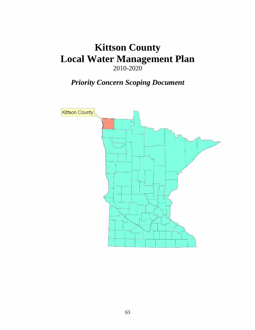
63
Kittson County Local Water Management Plan
2010-2020
Priority Concern Scoping Document

64
INTRODUCTION County Primer Kittson County is in the northwestern part of Minnesota on the North Dakota, Manitoba and Canadian border. Hallock, the county seat, is about 320 air miles northwest of St. Paul, the capital of Minnesota. The total area of the county is approximately 1,103 square miles, of which, 1,097 square miles of it is land and 6 square miles of it is water.
The 2000 Census listed Kittson County’s population at 5,285, but as of Feb. 4, 2008, that number was estimated to be at 4,691. Population projections show a continuation of the declining population for Kittson County. The total households in Kittson County are projected to fall to 1,810 in 2020 from 2,010 in 2000.
General land use in Kittson County is agricultural. According to the 2006 Minnesota Agricultural Statistics, there were 659 farms in Kittson County in 2002, for a combined total of 555,561 acres. In 2005, Kittson County ranked eighth in the state for wheat production. Livestock numbers have declined over the years. In 2005 Kittson County ranked 18th in the state with a beef cattle production number of 6,900.
According to Kelly Turgeon, Kittson County FSA director, there are currently 108,537 acres enrolled in the Conservation Reserve Program (CRP) in Kittson County. That number is up from 95,802 acres at the time of the last water plan update in 2000.
The Two Rivers Watershed District is the largest watershed in the county. The District, which is located in Kittson, Marshall and Roseau counties, encompasses 1,454 square miles, and stretches 65 miles from the Red River on the western boundary to the eastern boundary just west of the City of Roseau. At its widest north-south point, the District stretches 33 miles. It is bordered to the north by the Joe River Watershed District; the south by Marshall County and the Tamarac River basin; and to the west by the Red River of the North, which is also the boundary with North Dakota. In Kittson County, the watershed covers about 940 square miles.
Historically, land cover in the Two Rivers Watershed District was predominantly prairie/grassland (45%), wetland (24%), brush (15%) and forest (15%). Currently, land cover is dominated by cultivated land (66%), while prairie/grassland, wetland, brush and forest now only represent 6%, 13%, 2% and 11% of the land cover, respectively.
The Joe River Watershed District makes up the northwestern corner of the Red River Basin in Kittson County. The principle drainage system in the District is the Joe River. The watershed covers about 125 square miles in Kittson County.
For the Joe River Watershed, historic land cover was primarily prairie/grassland (80%) and wetland (14%). Currently, land cover is dominated by cultivated land (89%), with prairie/grassland and wetland comprising only 4% and 2% of land cover, respectively.

65
The Tamarac River Watershed in the northwest portion of the Red River Basin covers an area of about 333 square miles in mainly Marshall County, with a very small portion lying in Roseau and Kittson Counties. The watershed covers an area of about 15 square miles in Kittson County.
Historically, land cover in the Tamarac River Watershed was primarily prairie/grassland (46%), wetland (36%) and brush (16%). Land use has been converted to mainly cultivated land (73%) and forest (10%), with prairie/grassland, wetland and brush accounting for only 3%, 9% and 3% of land cover, respectively.
The Roseau River Watershed is comprised of an area of about 1,892 square miles, located in Roseau and Kittson Counties in Minnesota and south central Manitoba, Canada. There is approximately 1,017 square miles or over 650,880 acres of the Roseau River Basin in the United States. About 64,640 acres are located in Kittson, Lake of the Woods, Beltrami, and Marshall Counties. The watershed covers an area of about 23 square miles in Kittson County.
Historically, land cover in the watershed was wetland (52%), forest (31%), brush (9%), and prairie/grassland (9%). Current land use is predominantly wetland (43%), cultivated land (40%), forest (6%) and prairie/grassland (5%).
As far as a bigger land use picture of the Red River Basin, the Two Rivers Watershed saw the largest increase in cultivated land acreage for the years 1969 through 1989. The jump amounted to an estimated 8.13% or an increase of cultivated acres from 565,721 to 615,760. The Roseau River Watershed District also saw an increase in cultivated acres of 6.44%. The Tamarac Watershed District listed an increase of 6.61%. Cultivated acreage in the Joe River Watershed District decreased by 6.02% during that same timeframe.
Unfortunately, all of the watersheds in Kittson County have been found to have stretches of impairments. A watershed based approach has been designed to address the issue of these impairments with implementation plans to be put in place in the future.
Plan Information
The Kittson Soil and Water Conservation District houses the Comprehensive Local Water Plan Coordinator, Darren Carlson.
Direction for the plan is given by the Kittson County Water Resources Advisory Committee (WRAC). This committee is made up of individuals from private, local, state and federal agencies. The WRAC chose the goals and objectives for this plan.

66
This is the fourth generation CLWP for Kittson County. The first plan was adopted in 1990, with the second plan adopted in 1995. The County is currently operating under the third generation plan which is in effect until Dec. 31, 2009. The fourth generation plan will be effective Jan. 1, 2010, through Dec. 31, 2019.
PRIORITY CONCERNS
Priority Concern 1: Land Use The main objective in this category will be to focus on Erosion and Sediment Control. Wind and water erosion are a big problem in Kittson County. Wind erosion is the biggest cause of siltation in watercourses, ditches, basins and wetlands in the county. Because of the flat topography, water erosion is also a concern. In recent years, the SWCD has seen a big demand for State Cost Share and CLWP Cost Share dollars for streambank erosion repairs. While the SWCD has been able to technically and financially help on several erosion projects, the cost share dollars are not enough to make a major impact on the problem. Recommended actions include educating the public on programs that are available to aid in the erosion fight such as planting trees and working with watershed districts and other agencies within the county on funding sources for large erosion projects. One potential project may be a stretch near the Greenwood Cemetery in Hallock. Other potential projects would the Little Joe Diversion, North Branch @ Outlet and Unnamed Coulee. These subwatersheds of the Two River Watershed District will be targeted for areas of study and implementation of programs to reduce sediment loads. Actions should also be taken to use State Cost Share dollars and water management funds to implement or continue best management practices and promote programs that would aid in reducing sediment and erosion such as buffer programs, etc. Other concerns that will be addressed that fall under the Land Use category include feedlot compliance, agricultural chemical use, natural resource preservation and enhancement, drainage issues and septic systems. Priority Concern 2: Surface Water The main objective in this category will be to focus on impaired waters/Total Maximum Daily Loads (TMDL). The Minnesota Pollution Control Agency recently completed a long-term monitoring study in Kittson County. Over the years the Kittson SWCD, watershed districts in the county, and high school students participating in the Riverwatch program, have also done water quality studies in the county. MPCA is now looking for local partners in putting together a study on the data collected, and beginning an implementation program of best management practices that will improve any impaired areas. As the plan unfolds, the Kittson SWCD/water plan program will need to determine what role they will take in this partnership.

67
Recommended actions include being a partner in the TMDL process, and to determine where best the Kittson SWCD/water plan program fits in the TMDL process. Other concerns that will be addressed will be the Joe River Watershed District would like to sustain and improve surface water quality, seek additional funds to help with engineering assistance and help with the Spring Brook Watershed Plan. Additional concerns that fall under the Surface Water category include flood damage reduction, water quality, and storm water issues. Priority Concern 3: Groundwater The main objective in this category will be to focus on protecting drinking water resources. All public water supplies in Kittson County come from an underground water source. None of the communities rely on surface water. Therefore, groundwater quality and quantity are big issues in Kittson County. Recommended actions include working with public water suppliers on wellhead protection areas. This can happen through education programs that educate property owners on the importance of using best management practices in wellhead protection areas. This may also include the implementation of land use programs designed specifically for the protection of those areas. Other concerns that will be addressed in the Groundwater category include the sealing of unused wells and developing a groundwater database.
PRIORITY CONCERN IDENTIFICATION
On June 3, 2008, the Kittson County Board of Commissioners signed a resolution to update the County’s Comprehensive Local Water Management Plan. A Notice of Decision to Revise and Update the Kittson County Local Water Management Plan, along with a questionnaire, was mailed on June 3, 2008, to representatives from the Board of Water and Soil Resources, Department of Ag, Environmental Quality Board, Department of Health, Department of Natural Resources, Minnesota Pollution Control Agency, the neighboring counties of Marshall and Roseau, the Two Rivers, Roseau River and Joe River Watershed Districts, North Kittson Rural Water, Kittson Marshall Rural Water, the cities of Karlstad, Halma, Hallock, Lancaster, Lake Bronson, Kennedy, Donaldson, Humboldt, and St. Vincent.
An article explaining what the Kittson County CLWP is and the process for the next generation plan was also put in the Northland Conservation Newsletter in August. Along with the article, a citizen survey was also printed in the newsletter that goes out to the homes of 2,300 landowners in Kittson County. Citizen surveys were also available in the Kittson County Courthouse.

68
Local plans were received from the Two Rivers Watershed District, Joe River Watershed District and the Roseau River Watershed District. Priority concern suggestions came in from the Two Rivers Watershed District, Kittson County Environmental Services, DNR, MPCA, BWSR, Department of Health, and Department of Ag.
The following is a list of suggested priority concerns from the above agencies:
KITTSON COUNTY INPUT Two Rivers Watershed District
1. Flood Control 2. Water Quality 3. Natural Resource Enhancements
Kittson County Soil and Water Conservation District
1. Reduce erosion 2. Protect and restore water quality 3. Promote wildlife management 4. Educate the public on natural resource issues 5. Administer cost share to accomplish established priorities
STATE AGENCY INPUT DNR
1. Erosion and Sedimentation 2. Flood Damage Reduction 3. Protect Groundwater Resources
MPCA
1. Impaired Waters/Total Maximum Daily Loads 2. Stormwater Issues 3. Feedlot Compliance – finding/fixing feedlot and land application runoff problems 4. Subsurface Sewage Treatment Systems and Unsewered Areas
BWSR
1. Flood Damage Reduction 2. Erosion and Sediment Control 3. Natural Resource Preservation and Restoration in the Beach Ridge Area of the
County Department of Health
1. Protect groundwater-based drinking water sources 2. Seal unused, unsealed wells 3. Develop a local ground-water quality data base
69
Department of Ag
1. Address flooding issues to improve water quality 2. Improve drainage infrastructure and implement conservation drainage practices to
improve water quality 3. Manure management and individual septic treatment systems 4. Agricultural chemical use and potential impacts to unconfined shallow
groundwater 5. Agricultural chemical use and potential impacts to surface water
On Oct. 15, 2008, the Kittson County WRAC met to determine what the priority concerns would be for the fourth generation plan. Members at that meeting were: Holly Anderson, CLWP Coordinator, County Feedlot Officer, Zoning Administrator, ISTS Administrator, Shoreland Administrator, and SWCD Manager; Dan Money, Two Rivers Watershed Administrator and Hallock City Councilman; Jim Courneya, MPCA; Garry Bennett, DNR; Shane Olson, Kittson SWCD Technician, Wetland Conservation Act Administrator, County Ag Inspector and City of Halma Mayor; Scott Klein, Kittson SWCD Supervisor; Betty Younggren, Kittson County Commissioner; Jim Schwab, Kittson NRCS, Chad Severts, BWSR; Marilyn Gustafson, Kittson County Auditor and Treasurer; Kelly Bengtson, Kittson County Highway Engineer; Jeff Hrubes, BWSR.
PRIORITY CONCERN SELECTION
After reviewing all of the priority concerns submitted, and after much discussion, the WRAC determined that all of the priorities that were submitted are important. The WRAC also addressed the fact that most of the issues are already addressed in the current plan and that those priorities should continue to be addressed in the fourth generation plan. Therefore, the WRAC decided to go with three priorities: Land Use, Groundwater and Surface Water.
While the above three priorities are broad, the WRAC determined the best way to address the many important aspects of the plan would be to group them under these three categories. One priority will be the focus of each category. While there may not be new implementation plans for each priority submitted, each priority will at least be addressed in the plan.
Also, in an effort to not duplicate plans from other agencies – such as watershed districts – the water plan will define which agencies play roles in each objective.

70
PRIORITY CONCERNS NOT ADDRESSED BY THE PLAN
After reviewing all of the priority concerns that were submitted, it was determined that all of the concerns are important. Many of the submitted priorities are similar in nature or overlap. Most, if not all, have also been addressed in previous plans and will be addressed once again in the 2010 plan.