journée des thèses 2009 - lthe.fr · the thesis title: distributed modeling of hydrological and...
TRANSCRIPT

Journée des Thèses 2009
A Presentation on the Thesis Work
Agizew Nigussie ENGIDA
Advisor: Michel ESTEVESRIVER-LTHE
March 13, 2009
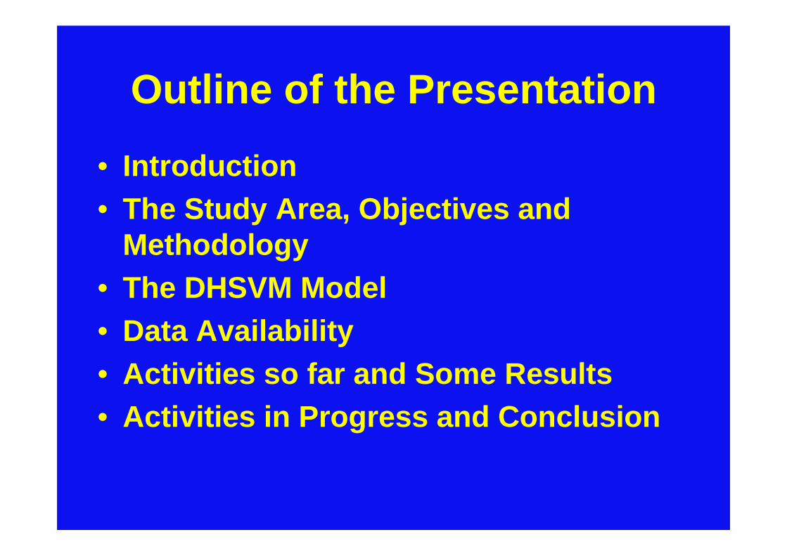
Outline of the Presentation
• Introduction• The Study Area, Objectives and
Methodology• The DHSVM Model• Data Availability• Activities so far and Some Results• Activities in Progress and Conclusion

The Thesis Title:
Distributed Modeling of Hydrological and Suspended
Sediment Fluxes in Lake Tana Sub-Basin, Ethiopia
Modélisation Hydrologique et du transport sédimentaire dans le bassin versant du Lac Tana,
Ethiopie
Organization: Sandwich program between France and Ethiopia

Location
The Nile Basin in Africa
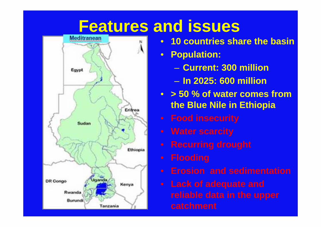
Features and issues• 10 countries share the basin• Population:
– Current: 300 million– In 2025: 600 million
• > 50 % of water comes from the Blue Nile in Ethiopia
• Food insecurity• Water scarcity• Recurring drought• Flooding • Erosion and sedimentation• Lack of adequate and
reliable data in the upper catchment

Initiatives and research needs
• Nile Basin Initiative– Shared vison program– Subsidiary action
program
• Blue Nile Predictions in Ungauged Basins (PUB)
• Impacts of climate variability and change on water resources & agricultual productivity
• Impacts of land use changes on water and sediment fluxes.
• Water uses and demands of different agro-ecosystems
• Best possible watershed management interventions

Planned and ongoing irrigation and dam projects
Dams
Irrigation areas

Description of the study area
Lake Tana Sub-basin with its major contributing catchments
Gilgel Abbay
Gummara
Ribb
Megech
• Total Catchment = 15000 km 2
• Unguaged = 40% of total
• Gauged = 40% of total
• Lake = 20% of total
•Altitude: 1786-4072 m.a.s.l
• Lake tana: max depth 14 m with diverse socio-economic & ecological values
• Mean annual RF: 1416 mm at BD
• Mean annual Temp: 20 °C at BD
• Mean annual RH: 58%

Objectives of the study• Overall objective
Acquire basic and scientific information that contribute to sustainable water resources and suspended sediment management in the Lake Tana Sub-Basin.
• Specific objectives
– Evaluation and analysis of existing data– Determination of water and sediment balance of
Lake Tana– Evaluation of climate and land use change impacts on
hydrological and sediment fluxes in the basin

• The study involves use of the following
– Critical evaluation of existing data and literature – Geostatistical methods– Weather data disaggregation models– Distributed hydrological model-DHSVM– Climate scenario development and downscaling– Land use scenario development
Methodology

Major Tasks
• Collection of relevant primary and secondary data • Organization and evaluation of exisiting data• Distributed modeling of hydrological and sediment
fluxes using DHSVM– Weather data disaggregation at sub-daily scale– Sensitivity analysis of DHSVM parameters– Calibration and validation of model parameters– Longterm modelling of hydrological and sediment
fluxes– Modeling under climate and land use change
scenarios• Water and sediment balance modeling for Lake
Tana
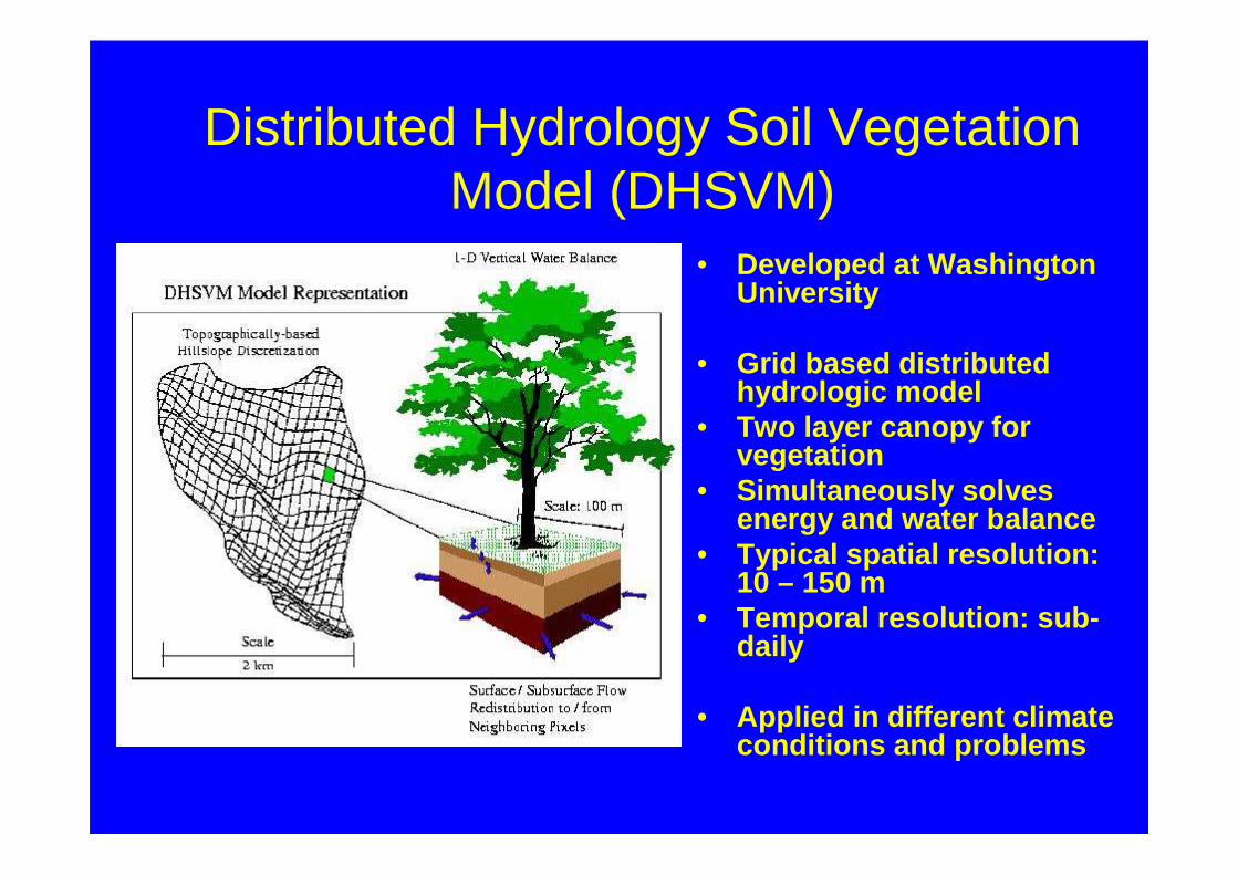
Distributed Hydrology Soil Vegetation Model (DHSVM)
• Developed at Washington University
• Grid based distributed hydrologic model
• Two layer canopy for vegetation
• Simultaneously solves energy and water balance
• Typical spatial resolution: 10 – 150 m
• Temporal resolution: sub-daily
• Applied in different climate conditions and problems

Meteo data
DEM, Mask,
Streams Roads
Soil type Soil depth
Vegetation type Sediment
Configuration files
DHSVM
Mass balances per simulation period:
Outflow
Soil moisture
Total evaporation, etc
Fluxes per simulation time step:
Stream flow, Saturated flow, Soil moisture in different zones, Transpiration, evaporation from soil, etc.
Topographic data
Land cover data
Geology & soil
Meteorological data
Pre-processingF
iles
& m
aps
inD
HS
VM
form
at
Raw
Dat
a
Out
puts
DHSVM: Inputs-Processes-Outputs
Post-processing

Hyro-Meteo Stations
Meteorological stations
Hydrological stations

Hydro-Meteo Data Availability

Spatial data
availability

Progresses so far• Survey of relevant literature • Sensitivity analysis of DHSVM model
parameters based on a virtual catchment
• Collection and organization of existing spatial and hydro-meteorological data
• Visit to the study basin
• Collection and laboratory analysis of suspended sediment samples
• Contribution to a DecWater collaborative research project proposal
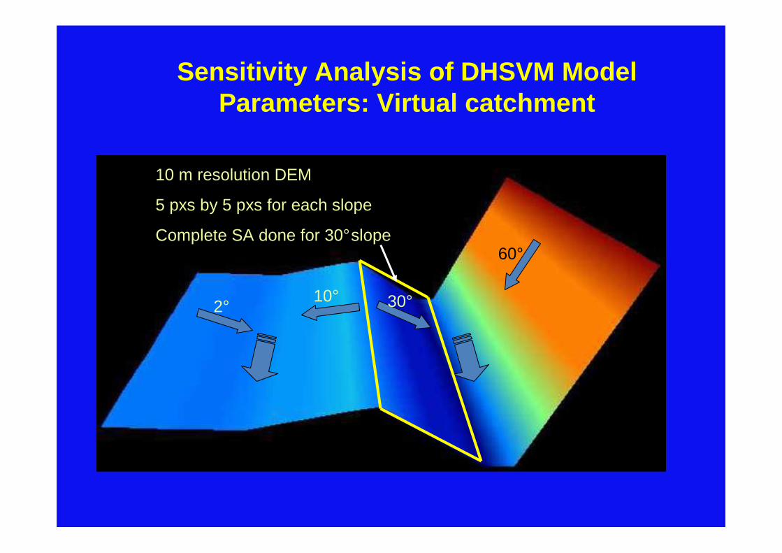
Sensitivity Analysis of DHSVM Model Parameters: Virtual catchment
60°
30°10°2°
10 m resolution DEM
5 pxs by 5 pxs for each slope
Complete SA done for 30°slope

Parameters sensitivity: Input data….
Land cover:– Bare soil with 10 cm thickness for soil parameters
– Mixed forest with 2 m thick soil for vegetation parameters
Soil type: – Sandy clay loam
Meteo data:– Hourly data for one year
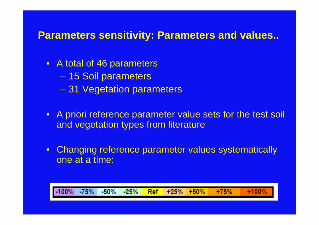
• A total of 46 parameters – 15 Soil parameters– 31 Vegetation parameters
• A priori reference parameter value sets for the test soil and vegetation types from literature
• Changing reference parameter values systematically one at a time:
Parameters sensitivity: Parameters and values..
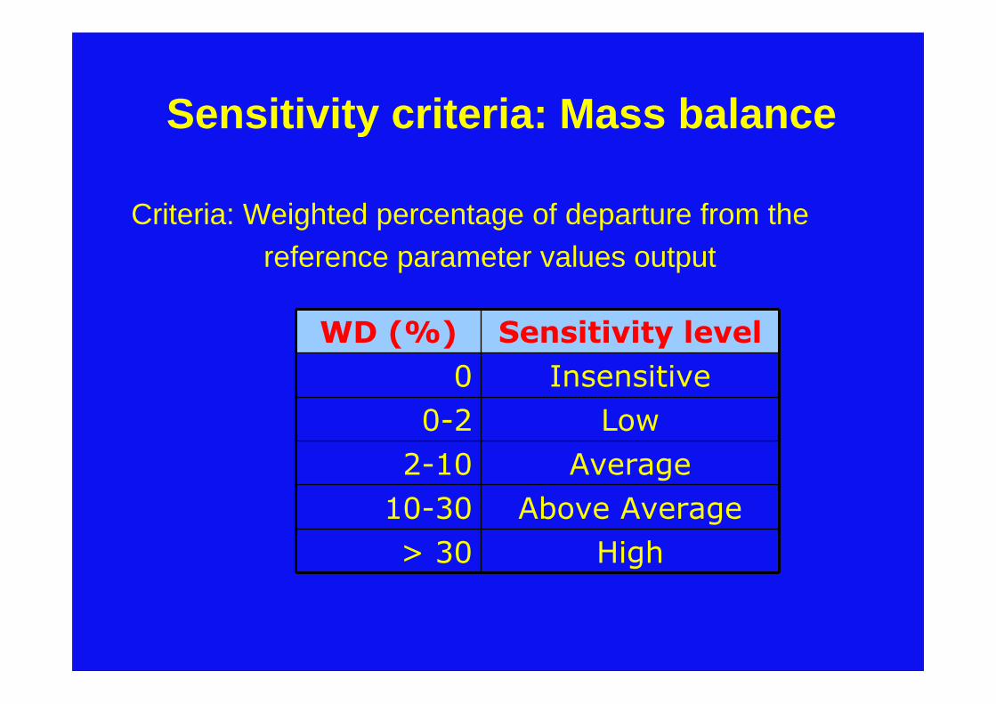
Sensitivity criteria: Mass balance
Criteria: Weighted percentage of departure from thereference parameter values output
WD (%) Sensitivity level
0 Insensitive
0-2 Low
2-10 Average
10-30 Above Average
> 30 High
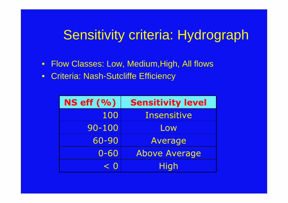
Sensitivity criteria: Hydrograph
• Flow Classes: Low, Medium,High, All flows• Criteria: Nash-Sutcliffe Efficiency
NS eff (%) Sensitivity level
100 Insensitive
90-100 Low
60-90 Average
0-60 Above Average
< 0 High
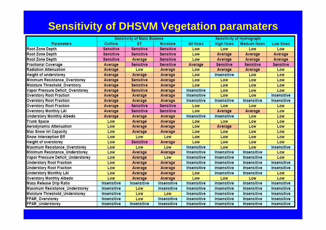
Sensitivity of DHSVM Vegetation paramaters

Sensitivity of DHSVM soil parameters

Field visit

Collection and laboratory analysis of suspended sediment samples

Typical Laboratory Analysis Results for Suspended Sed iments

Suspended Sediment Particle Size Distribution at Gilge l Abbay Station

Activities in progress…..
• Evaluation of existing data• Disaggreagtion of weather data• Creation of DHSVM input files• Calibration of model parameters for
selected test catchments• Preparation for the 2nd field campaign • Write-up of articles

Conclusions
• The sensitivity analysis results will facilitate the task of model calibration
• The field visit enabled to get a general picture of the watershed which may be of help in the parametrization of the model
• Need for collection of suspended sediment samples of longer duration at selected gauging stations

Merci Pour Votre Attention!