jeff lock, master mariner, thomas miller p&i · ecdis electronic chart display and information...
TRANSCRIPT

ECDIS
Electronic Chart Display and Information Systems
Jeff Lock, Master Mariner, Thomas Miller P&I
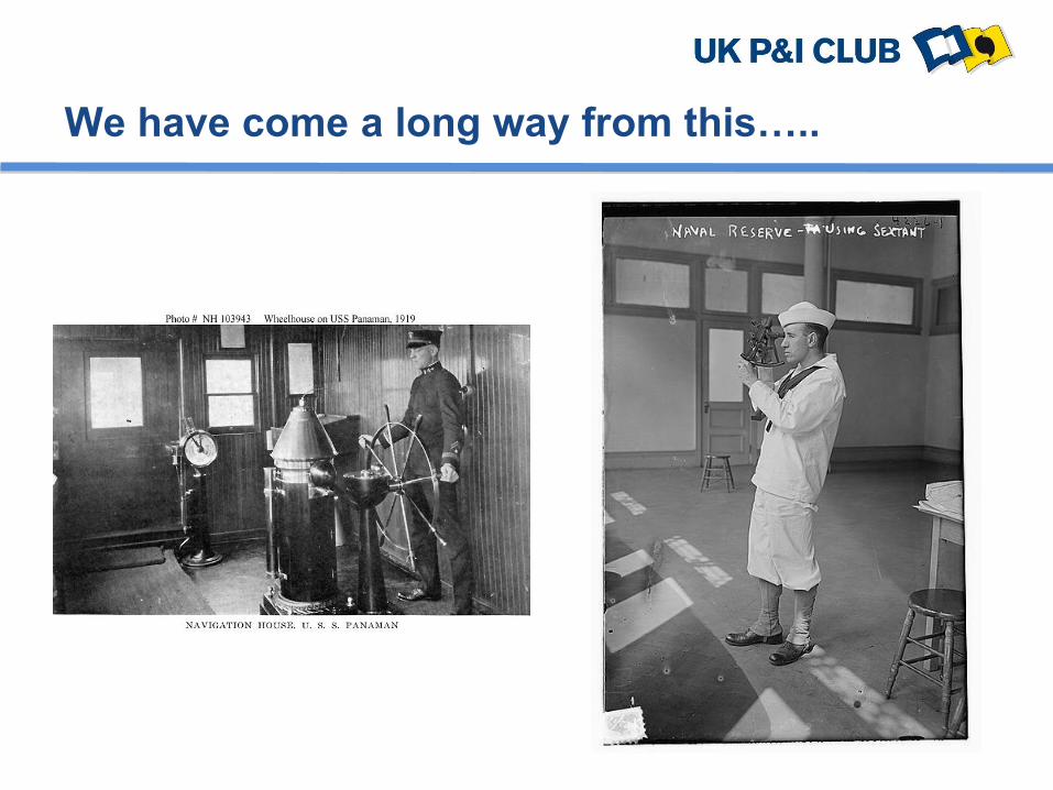
We have come a long way from this…..

…To this

IMO SOLAS V/19 1974 (as amended)
Text from January 1st 2011
2.1 All ships irrespective of size shall have:
2.1.4 nautical charts and nautical publications to plan and
display the ship’s route for the intended voyage and to plot
and monitor positions throughout the voyage; an
electronic chart display and information system
(ECDIS) is also accepted as meeting the chart carriage
requirements of this sub paragraph. Ships to which
paragraph [2.10] applies shall comply with the carriage
requirements for ECDIS detailed therein:

Para 2.10 further identifies a requirement for ships engaged on
international voyages to be fitted with an ECDIS system under the
following implementation schedule:
July 2012:
NEW PASSENGER SHIPS over 500 gross tons
NEW TANKERS over 3,000 gross tons
July 2013:
NEW CARGO SHIPS over 10,000 gross tons
July 2014:
EXISTING PASSENGER SHIPS over 500 gross tons
NEW CARGO SHIPS 3,000 gross tons

July 2015:
EXISTING TANKERS over 3,000 gross tons
_____________________________________EXISTING CARGO
SHIPS
July 2016
EXISTING CARGO SHIPS over 50,000 gross tons
July 2017
EXISTING CARGO SHIPS over 20,000 gross tons
July 2018
EXISTING CARGO SHIPS over 10,000 gross tons

Vector (ENC) and Raster (RNC) Charts

ECDIS Example screenshot – real time position

ECDIS example screenshot – passage planning

ECDIS example screenshot – passage planning
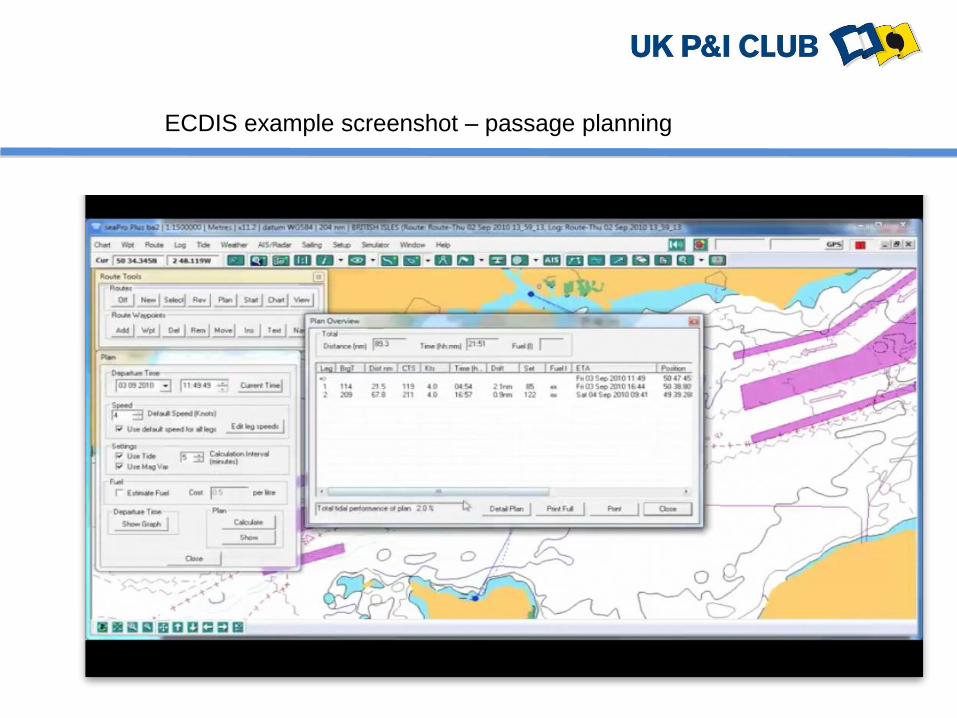
ECDIS example screenshot – passage planning
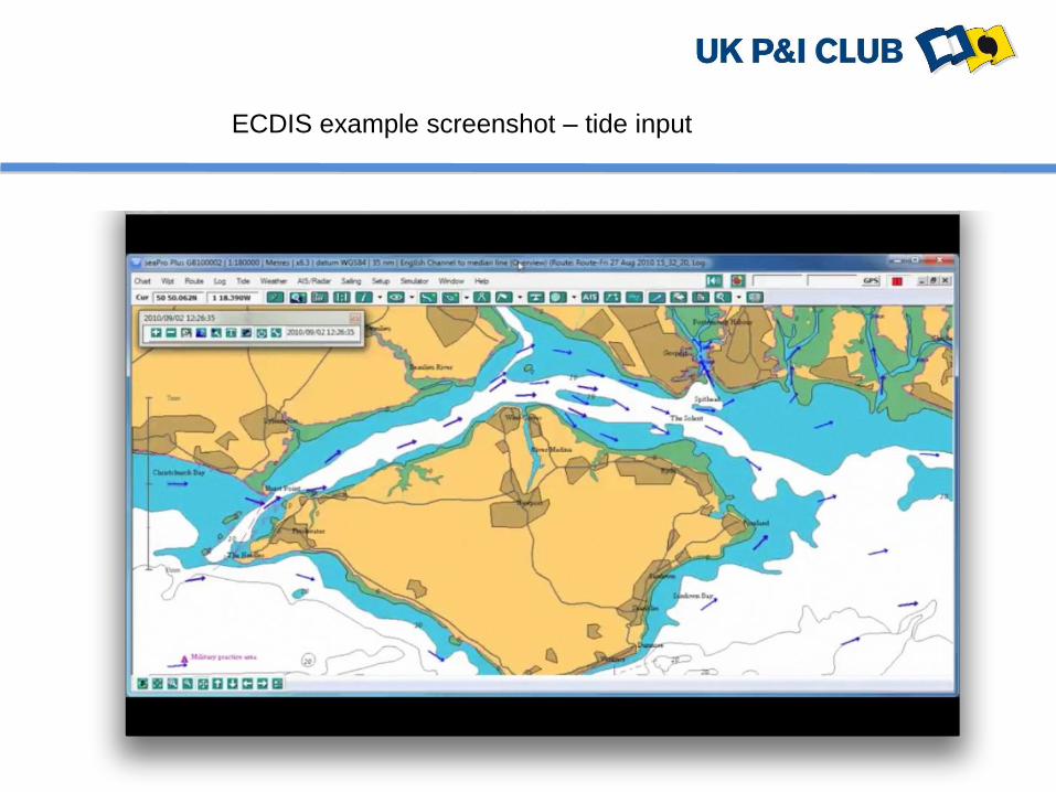
ECDIS example screenshot – tide input

ECDIS example screenshot – AIS overlay

ECDIS example screenshot – radar input

ECDIS example screenshot – detailed view

ECDIS example screenshot – panning and zooming

ECDIS example screenshot – panning and zooming

ECDIS example screenshot – panning and zooming

ECDIS example screenshot - zooming

ECDIS example screenshot - zooming

PASSAGE PLANNING (GOOD NEWS)
GROUNDING/STRANDING: ECDIS with ENC should make
accidental grounding of competently operated ships a thing
of the past:
Active monitoring of ship’s position on passage:
• Comprehensive and easy to interpret passage planning
• No more manual chart corrections
• Automatic route checking
• Monitoring and alarm systems
• Safety contours – depths, hazards

MAIN ADVANTAGES (GOOD NEWS)
Some Operator Feedback:
• You always know where you are or will be (false sense of
security?)
• Allows watch officers to focus on traffic not position fixing
• Reduces workload and fatigue
• Makes supplementary information about lights and tides
far more readily available
• Switching on the AIS overlay assists situational
awareness

MAIN DISADVANTAGES (BAD NEWS)
Some Operator Feedback
• Lack of standardisation – different ships in fleet have
different ECDIS units
• Passage planning takes longer
• Screen is too small
• Plotting positions manually is tedious
• Too many useless options or functions – gimmicks
• Lack of situational awareness
• Significant areas such as Great Barrier Reef where the
ECDIS/GPS do not give correct positions

RISK ANALYSIS (BAD NEWS)
THE EQUIPMENT: may suffer failure (both hardware and
software) including power outages, sensor input failure and
virus infection.
THE CHARTS: permits may expire, charts may not be
corrected up to date, ENC charts may not be available
requiring the system to be used in RCDS mode without
paper chart available.
THE OPERATION: may be carried out by poorly trained
crew following poor navigational practices and operational
procedures such as excessive zooming or operating the
chart for navigation with base information only displayed.

CASE STUDY
“CFL Performer”
Courtesy of MAIB

“CFL Performer”
Safety contour 30 metres, safety depth 6 metres. Note “red” title and track.

TRAINING
GENERIC ECDIS TRAINING
STCW Code Manila Amendments in force from 1 January 2012
• After 1 January 2012 ECDIS training following an IMO approved
course is a requirement. Syllabus will usually require 3 to 5 days
training.
• Flag states may, until 1 January 2017, continue to issue, recognise
and endorse certificates without ECDIS for seafarers who, as of 1 July
2013, have already begun their seagoing service or are undergoing
STCW required training.
• Certificates can be revalidated up to 1 January 2017 under transitional
provisions without ECDIS training subject to Flag requirements.
However, certain Flag States have issued requirements that if a ship
is using ECDIS as a primary means of navigation then officers must
have generic and type specific ECDIS training NOW.

TRAINING
TYPE SPECIFIC TRAINING
Type/model specific ECDIS training is a requirement of the
ISM Code under Section 6:
“The Company should establish procedures to ensure that
new personnel and personnel transferred to new
assignments related to safety and protection of the
environment are given proper familiarisation with their duties.
Instructions which are essential to be provided prior to sailing
should be identified, documented and given.”

KEEP A PROPER LOOKOUT BY ALL AVAILABLE MEANS
MONITOR SHIP’S TRACK AND LOOK OUT OF THE
WINDOW!