january 3-5 2008 west coast extratropical cyclone
DESCRIPTION
January 3-5 2008 West Coast Extratropical Cyclone. Henry D. Bartholomew San Francisco State University. The purpose of my study. I want to answer questions like… Why did the low rapidly intensify? Why did it produce strong negative omega?. Outline. Synoptic Overview Strong Winds - PowerPoint PPT PresentationTRANSCRIPT

January 3-5 2008 West Coast Extratropical Cyclone
Henry D. BartholomewSan Francisco State University

The purpose of my study
I want to answer questions like…
Why did the low rapidly intensify?
Why did it produce strong negative omega?


Outline Synoptic Overview Strong Winds Heavy Precipitation Quasigeostrophic Equations
Discussion Quasigeostrophic Diagnosis Summary and Conclusions

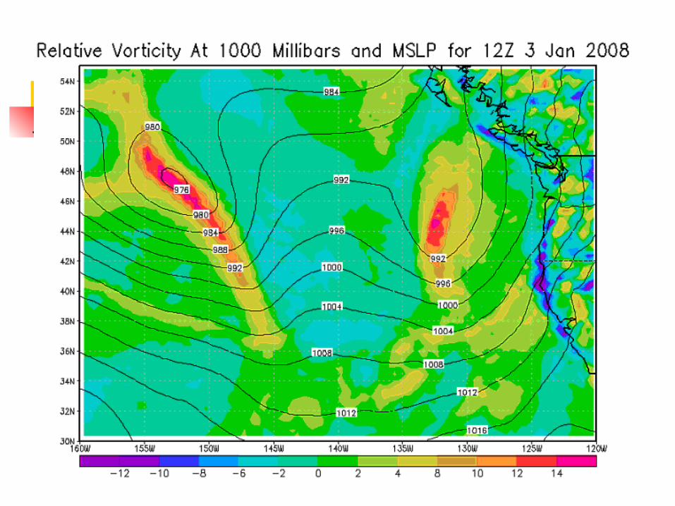
Synoptic Overview Formed on 3 Jan 2008 First located south of the Aleutian
Islands Moved east and strengthened Reached minimum pressure of 956
mb Impacted California on 4 Jan 2008 Brought heavy rain and strong winds
to CA

Outline Synoptic Overview Strong Winds Heavy Precipitation Quasigeostrophic Equations
Discussion Quasigeostrophic Diagnosis Summary and Conclusions

Strong Winds in California
Concord: 45 mph Chico: 58 mph SFO: 68 mph North Oakland: 71 mph Mt. Diablo: 117 mph
Generally, sustained winds of 20-50 mph

Note the increase in wind speeds with a corresponding pressure drop
Max Gusts:
65 to 70 mph
Minimum
Pressure:
997 mb

January 3-5 2008 West Coast Extratropical Cyclone Synoptic Overview Strong Winds Heavy Precipitation Quasigeostrophic Equations
Discussion Quasigeostrophic Diagnosis Summary and Conclusions

24-hour Precipitation Amounts12Z 4 Jan 08 to 12Z 5 Jan 08
San Francisco: 1.72” Napa: 1.98” Oakland: 2.07” Mt. Diablo: 3.69” Ben Lomond: 5.74”

January 3-5 2008 West Coast Extratropical Cyclone Synoptic Overview Strong Winds Heavy Precipitation Quasigeostrophic Equations
Discussion Quasigeostrophic Diagnosis Summary and Conclusions

Quasigeostrophic Analysis of Storm:QG-Omega Equation and SPDE
QG-Omega Equation LHS: Omega Term RHS: Differential vorticity advection,
temperature advection, sensible heating, friction terms
SPDE LHS: 1000 mb relative vorticity tendency RHS: 500 mb absolute vorticity advection, 1000 mb horizontal temperature advection
terms

QG equations, continued QG-Omega Equation
SPDE

January 3-5 2008 West Coast Extratropical Cyclone Synoptic Overview Strong Winds Heavy Precipitation Quasigeostrophic Equations
Discussion Quasigeostrophic Diagnosis Summary and Conclusions

Quasigestrophic Diagnosis Will be conducted at three times 0000 and 1200 UTC 4 Jan 0000 UTC 5 Jan Terms in each equation analyzed Find out general nature of omega,
and contributing factors Find out general nature of
development, and contributing factors

0000 UTC 4 Jan 2008SPDE Center of low Positive relative vorticity tendency Weak absolute vorticity advection Warm advection Development of system: 976 mb. 12 UTC 3 Jan 2008 964 mb. 00 UTC 4 Jan 2008


0000 UTC 4 J an 2008


0000 UTC 4 Jan 2008QG-Omega Equation San Francisco Negative omega Strong negative vorticity advection Weak warm advection Dominating Term: Temp Advection

1200 UTC 4 Jan 2008\SPDE Center of low Slight negative relative vorticity
tendency Weak absolute vorticity advection Weak temperature advection No change in intensity: Low remains at 964 mb.

1200 UTC 4 Jan 2008QG-Omega Equation San Francisco Negative omega Weak negative vorticity advection Strong warm advection Clear dominating term

0000 UTC 5 Jan 2008SPDE Center of low Slight negative relative vorticity
tendency Weak absolute vorticity advection Warm advection Low remains at 964 mb.

0000 UTC 5 Jan 2008QG-Omega Equation San Francisco Weak omega Negative along coast, positive
inland Mostly warm advection Weak vorticity advection

January 3-5 2008 West Coast Extratropical Cyclone Synoptic Overview Strong Winds Heavy Precipitation Quasigeostrophic Equations
Discussion Quasigeostrophic Diagnosis Summary and Conclusions

Summary and Conclusions QG-Omega Equation SF: Dominating factor: Warm
advection Contributed to strong negative
omega