james czyz thesis 2 - 2013
DESCRIPTION
James Czyz Thesis 2 - 2013TRANSCRIPT

JAMES CZYZ


JA
ME
S C
ZY
Z
| W
HE
RE
AB
OU
T
NY
C
WHERE IS BROADWAY ? WHICH WAY IS SOUTH ? WHAT TOWN IS THIS ? ANY MALLS AROUND HERE ? WHICH WAY IS WEST ? WHERE IS THE NEAREST TRAIN ? WHICH WAY IS NORTH ? ANY MUSEUMS NEARBY ? WHICH WAY IS EAST ? WHERE IS CEN-TRAL PARK ? TIMES SQUARE ? UNION SQUARE ? ANY FAMOUS LANDMARKS IN NYC ? HOW CAN I GET TO PENN STATION ?
HOW DO YOU FEEL WHEN YOU ARE LOST?What trains are near? Which way is west? What Neighborhood is this? Are there any parks nearby? Any malls?
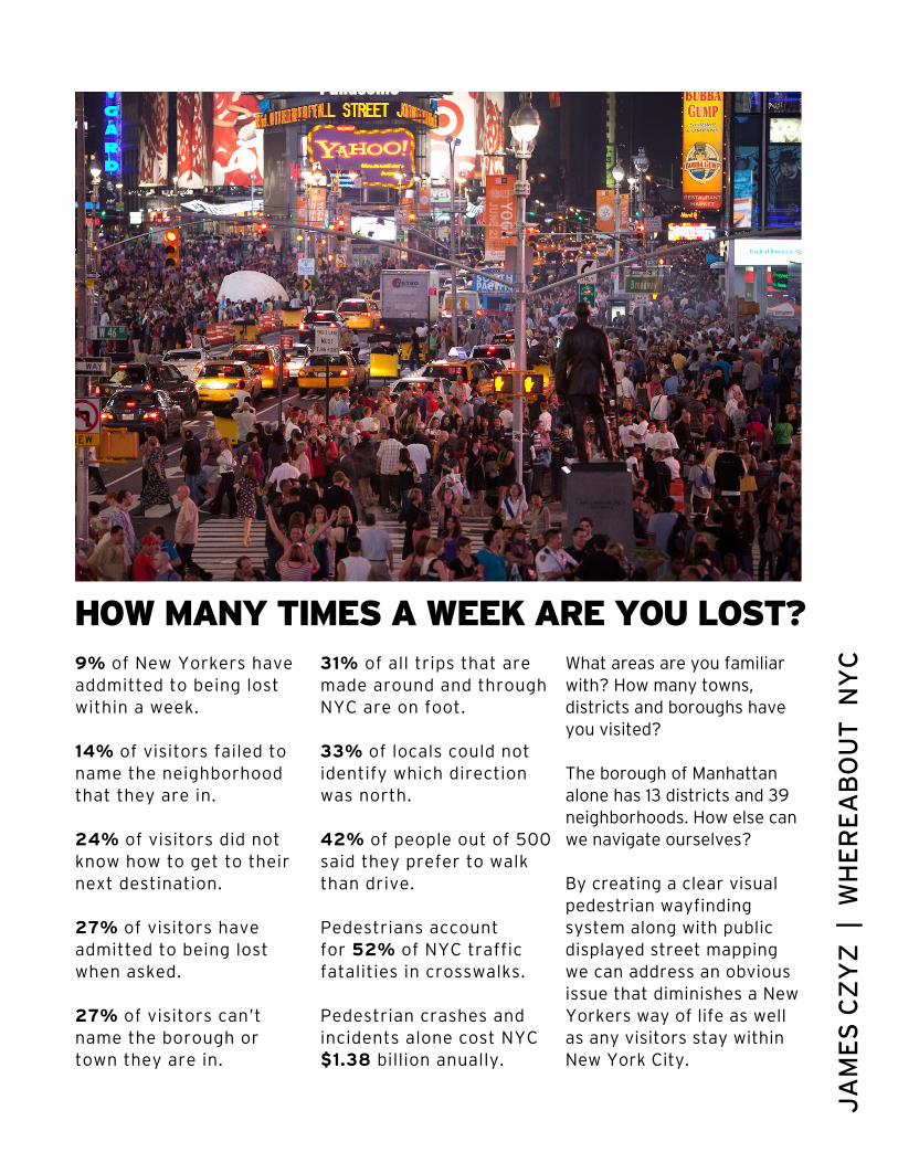
These are all common questions asked daily inNew York. By all locals, tourists and visitors. With such a large city, the 4th most populated in the world, It can be quite intimidating trying to navigate around all the towns and Boroughs of New York City.

DO ANY PUBLIC AIDS HELP GUIDE PEOPLE?With New York City being so large, why is there not a clear and unified navigation system that walking pedestrians can rely on? Are train and bus maps the only public aids we are given?
Housing millions of locals and tourists flowing daily through the streets, New York City is a major urban landscape that is always moving and changing.
Hosting so many visitors unfamiliar with their new environment as well asmany residents adapting to changing bus and subway routes, it is no wonder why New York City never sleeps, we are all lost!
Besides the subway map that we so heavily rely on. What visual indicators do we have to help guide us? Could they do more to help us? Do we even know what each sign color indicates?
JA
ME
S C
ZY
Z
| W
HE
RE
AB
OU
T
NY
C
HOW MANY TIMES A WEEK ARE YOU LOST?9% of New Yorkers have addmitted to being lost within a week.
14% of visitors failed to name the neighborhood that they are in.
24% of visitors did not know how to get to their next destination.
27% of visitors have admitted to being lost when asked.
27% of visitors can’t name the borough or town they are in.
31% of all trips that are made around and through NYC are on foot.
33% of locals could not identify which direction was north.
42% of people out of 500 said they prefer to walk than drive.
Pedestrians accountfor 52% of NYC trafficfatalities in crosswalks.
Pedestrian crashes and incidents alone cost NYC$1.38 billion anually.
What areas are you familiar with? How many towns, districts and boroughs have you visited?
The borough of Manhattan alone has 13 districts and 39 neighborhoods. How else can we navigate ourselves?
By creating a clear visual pedestrian wayfindingsystem along with public displayed street mapping we can address an obvious issue that diminishes a New Yorkers way of life as well as any visitors stay within New York City.

DO OTHER PLACES HELP GUIDE PEOPLE?Many cities even here in the United States offer information and navigation systems for their visitors as well as their citizens to comfortably and confidently travel through an area.
This system can also be very useful in bringing in more revenue to this great city. A few examples could be: Less confusion could stimulate more shopping, designating large chain store locations can bring in revenue through advertising and sales, A safer New York would help diminish accidents and medical
expenses and even to help tourists to better plan a day trip and be encouraged to stay longer. There are so many positive benefits that are completely overlooked by New York City.

JA
ME
S C
ZY
Z
| W
HE
RE
AB
OU
T
NY
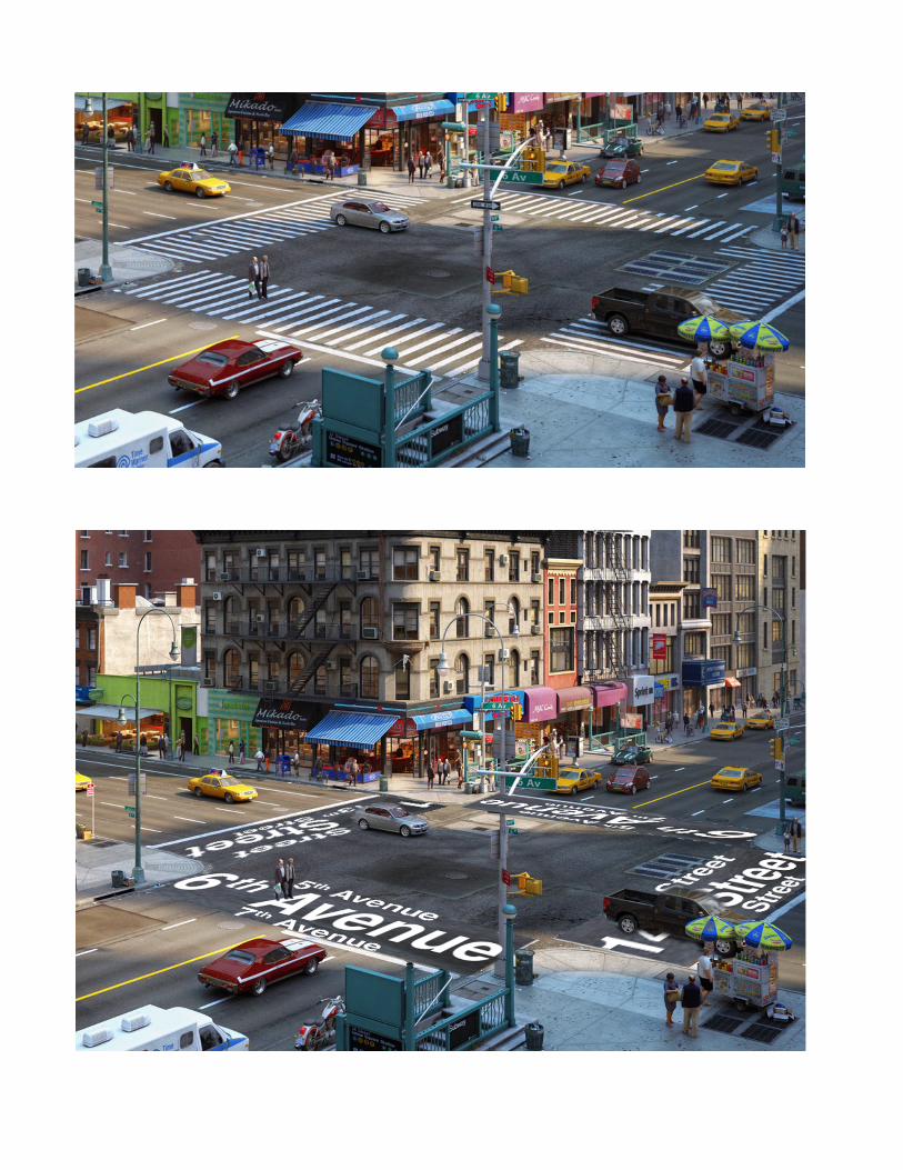
CWithin a wayfinding system of any usage or style, it is important to include visual elements to help guide a user through their environment.
The above image displays your typical New York Cityintersection. Along with our obvious problem of barely having any visual aids to help us navigate but also how and where could we implement a clear visual wayfinding system for allpedestrians to use?
New York City uses thousands of gallons of paint yearly to keep crosswalks and lane lines visible on the streets.
Besides creating “boundary” lines, how else can cross-walks be used?
By redesigning crosswalks we can still use a similar amount of tax dollars spent yearly while creating a clear way-finding system for all.
SO MANY COLORS AND PATTERNS, HOW?Implementing a pedestrian wayfinding system in New York City could greatly improve many facets of our day-to-day lives.
By strategically placed public display maps as well as visual indicators and reinventing crosswalks we can remove the unnecessary stress already inherent to all people within New York City making the pedestrian environment convenient, connected and comfortable.

JA
ME
S C
ZY
Z
| W
HE
RE
AB
OU
T
NY
C


JA
ME
S C
ZY
Z
| W
HE
RE
AB
OU
T
NY
C


JA
ME
S C
ZY
Z
| W
HE
RE
AB
OU
T
NY
C


JA
ME
S C
ZY
Z
| W
HE
RE
AB
OU
T
NY
C