introduction to gis and gps - aces.edu · outline • introduction to gps • introduction to gis...
TRANSCRIPT

GPS 101: Introduction to Geospatial TechnologiesAlabama Forest Owners’ Association Annual Meeting
Chris DillardGeospatial Extension SpecialistAlabama Cooperative Extension System
April 17th, 2010

Outline
• Introduction to GPS• Introduction to GIS• Introduction to the Garmin GPSMAP 60CSx• Low-Cost GPS units• Free and low-cost mapping software• Outdoor cruising/sampling exercise▫ Create a sampling grid/transfer to GPS unit▫ Navigate using grid and collect points▫ Transfer points to software and map

Waypoints
Waypoint 1
Waypoint 2
Waypoint 3
Latitude: 37° 16’ 18”Longitude: W80° 28’ 45”
Elevation: 2108 feet

Tracks (just start walking…)

Routes
1. Establish Waypoints at strategic locations
The GPS Receiver “Connects the dots” 1. Area and perimeter measurements are generated
#1
#4
#3
#2
#5
#6

Polygons (acreage calculation)
61.5 Acres

Waypoints at Field Corners
008
009
010002
003
004005
006
007
001
61.5 Acres


GPS/GIS Exercise
• Open an aerial image (freely available)• Create a sampling/cruising grid over a field• Transfer the grid to the GPS unit• Navigate through the field using the grid• Collect a waypoint within each grid square▫ Verifies that each grid square has been visited
• Transfer the waypoints into the GIS software
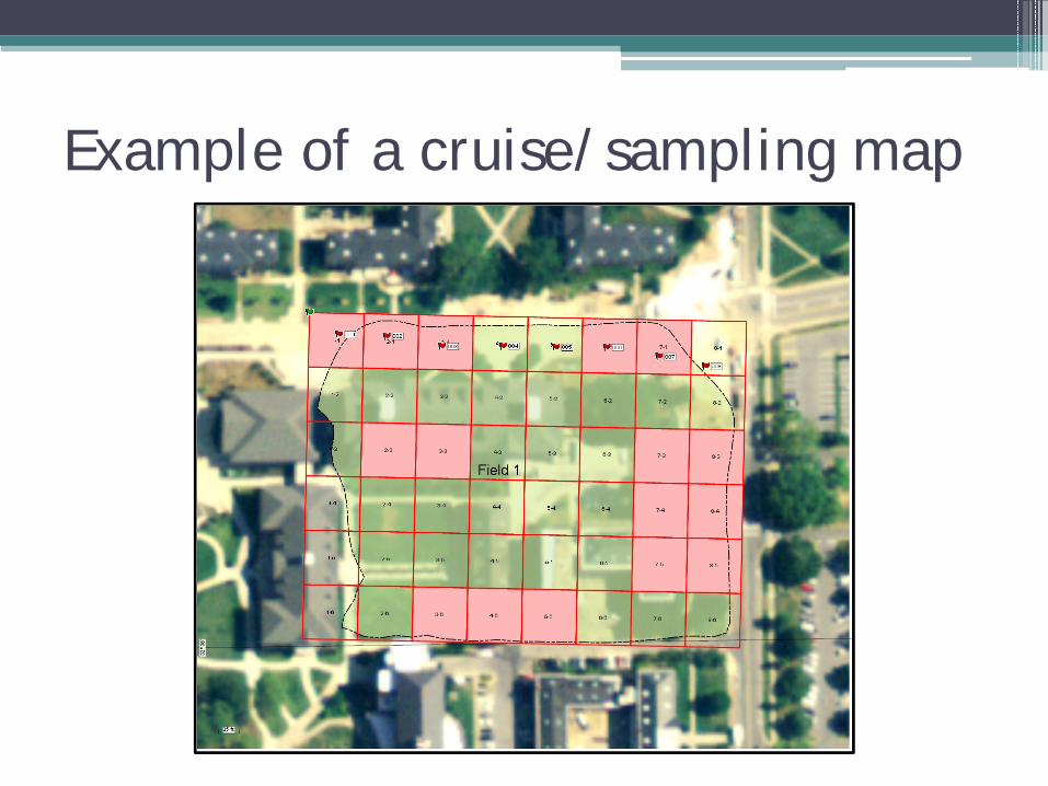
Example of a cruise/sampling map


Contact Information:
• Chris Dillard• Extension Specialist, Geospatial Technologies• Alabama Cooperative Extension System
110 Extension HallAuburn University, AL 36849
• Office: (334) 844-3921Mobile: (334) 728-3921Email: [email protected]