intro to geomorphology (geos 450/550) lecture 8: hillslope processes weathering and sed-transport...
TRANSCRIPT
Intro to Geomorphology (Geos 450/550)Lecture 8: hillslope processes • weathering and sed-transport processes on slopes• controls on weathering rates
regolith thicknessclimaterock type/structure
• slope transport processes

Problems with scarp writeups:• Survey data that did not show a scarp
some can be fixed (inversion of slope profile)“random” profiles cannot be fixed, so use GPS
• Good data but poor fitsneed to adjust x0, b, a, and κT in that order
• No reporting of results• No discussion of diffusion model• Confusing scarp age and terrace age
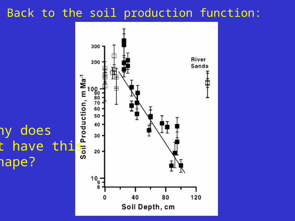
Back to the soil production function:
Why doesit have thisshape?

Model 1: Solve for the temperature as a function of depth and time given periodic changes in surface temperature.

scale factor =3 m for annual0.15 m for diurnal
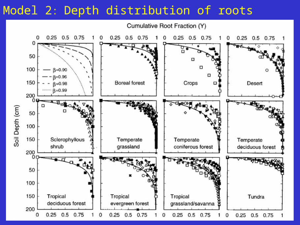
Model 2: Depth distribution of roots
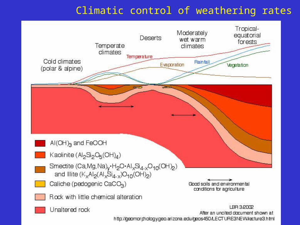
Climatic control of weathering rates
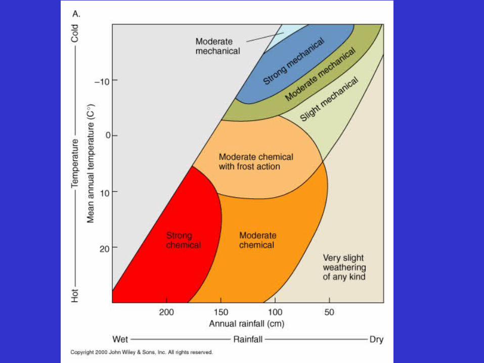
Climatic control of weathering rates
Climatic control of weathering rates

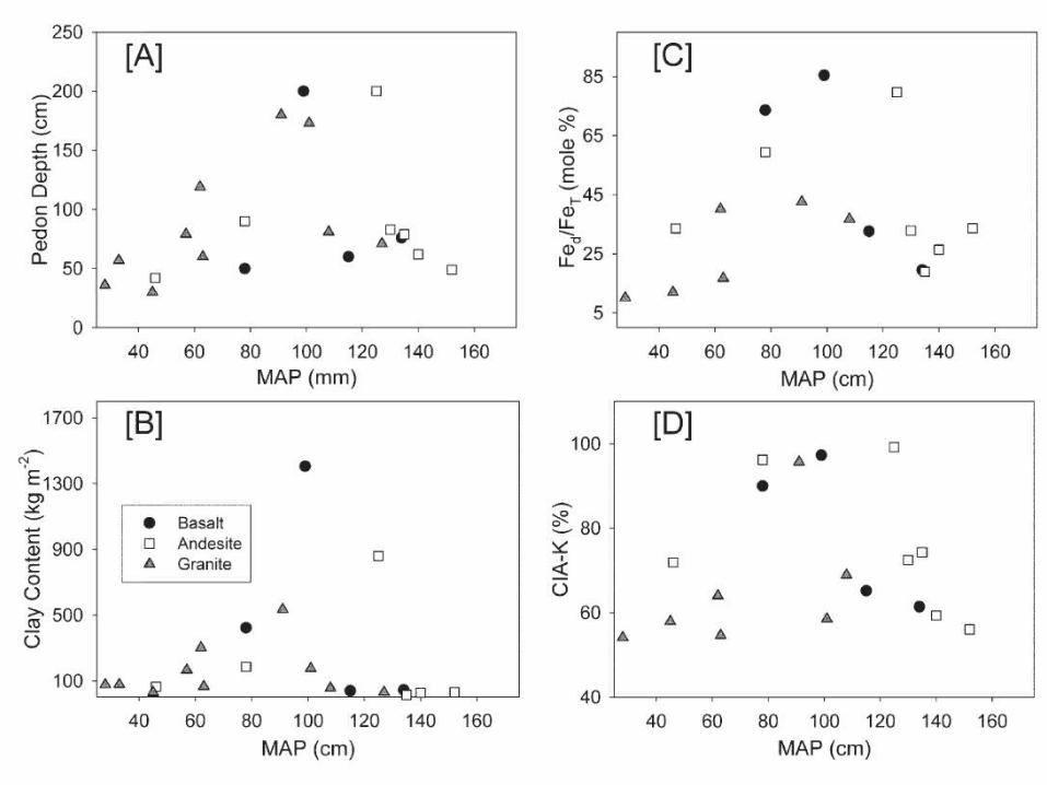
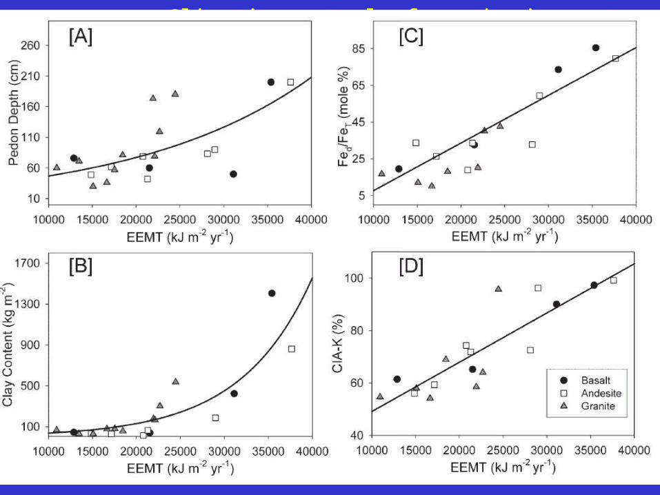
How does climate and rock type affect P0?Effective energy and mass transfer (EEMT) approach:
Is based on a conceptual model of energy input and flow through the soil profile, including thermal (temperature) and material (water and biomass) forms of energy (Rasmussen and Tabor, 2005).
Calibration data from Riebe et al. for granite
a and b are lithologically-dependent empirical parameters
162,260
0
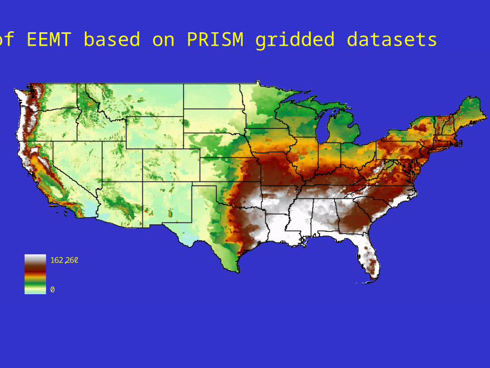
Map of EEMT based on PRISM gridded datasets
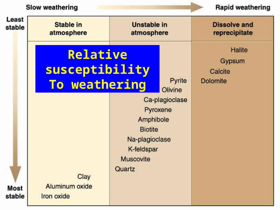
Relative susceptibilityTo weathering
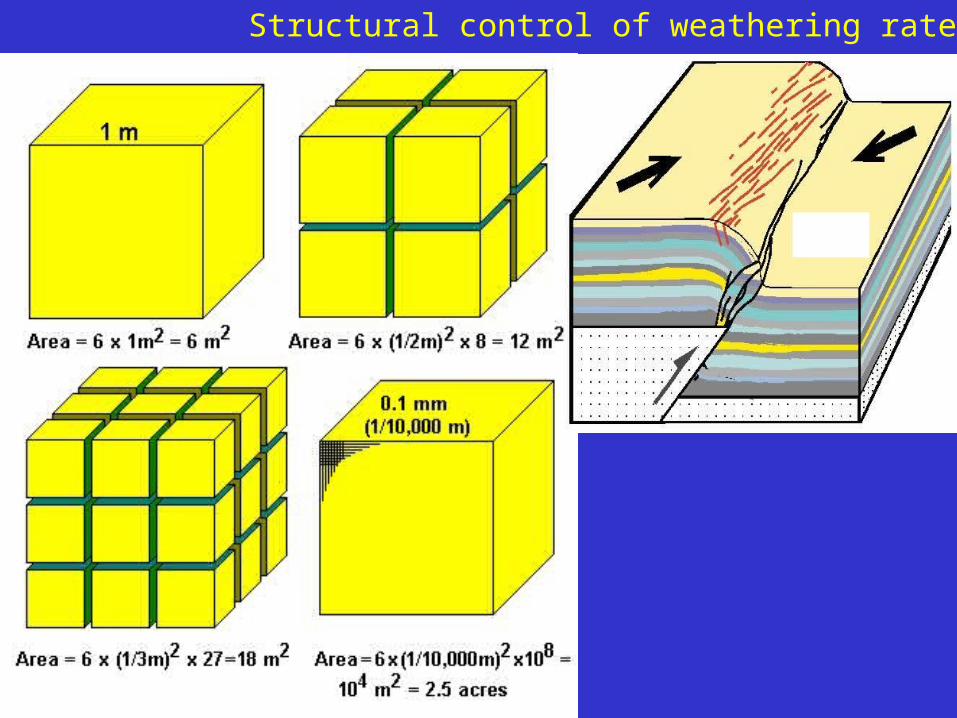
Structural control of weathering rates
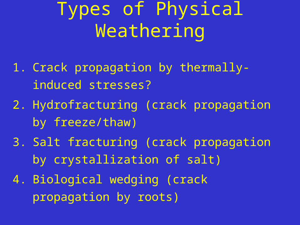
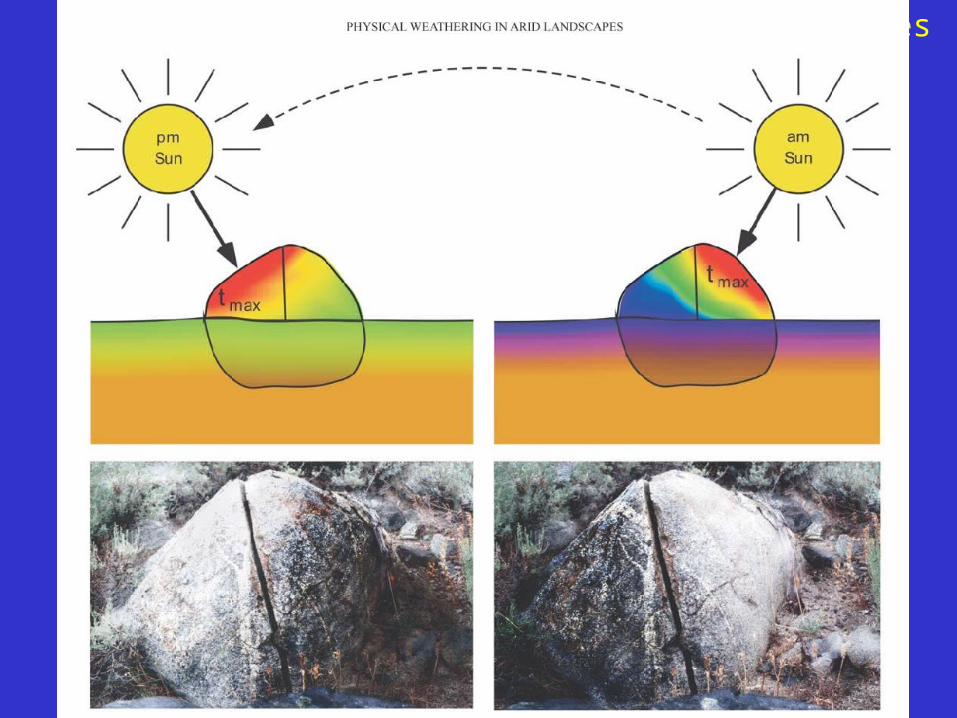
Types of Physical Weathering
1. Crack propagation by thermally-induced stresses?
2. Hydrofracturing (crack propagation by freeze/thaw)
3. Salt fracturing (crack propagation by crystallization of
salt)
4. Biological wedging (crack propagation by roots)
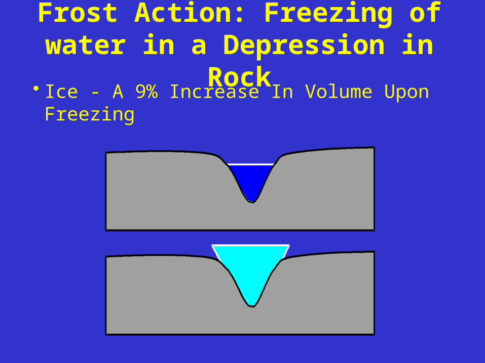
Frost Action: Freezing of water in a Depression in
Rock• Ice - A 9% Increase In Volume Upon Freezing
Climatic control of weathering rates
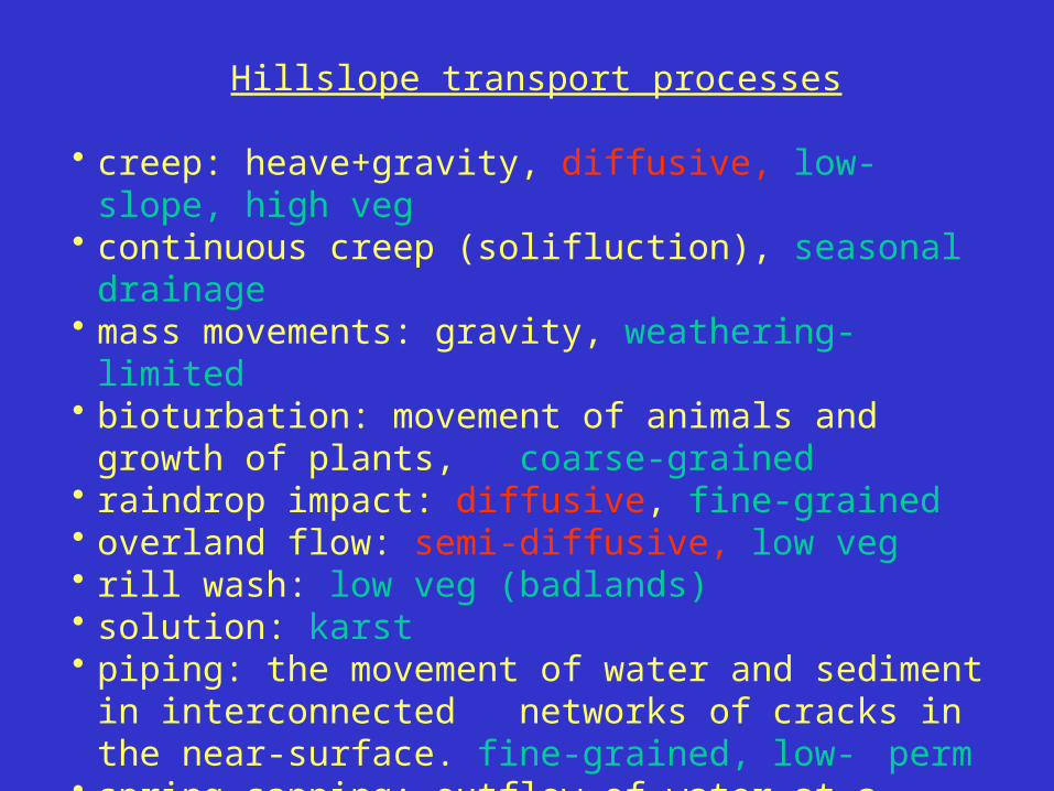
Hillslope transport processes
• creep: heave+gravity, diffusive, low-slope, high veg• continuous creep (solifluction), seasonal drainage• mass movements: gravity, weathering-limited• bioturbation: movement of animals and growth of plants,
coarse-grained• raindrop impact: diffusive, fine-grained• overland flow: semi-diffusive, low veg• rill wash: low veg (badlands)• solution: karst• piping: the movement of water and sediment in interconnected
networks of cracks in the near-surface. fine-grained, low- perm
• spring sapping: outflow of water at a spring where surface and water table meet. structural control

Erosion in fluvial systems: two basic regimes
1. Weathering (detachment) limited• low weathering rates relative to high transport
rates• high erosion rates• thin regolith or soil• slope landsliding• bedrock rivers (downcutting)
2. Transport limited• low transport rates relative to high weathering
rates• low erosion rates• thick regolith or soil• slope creep • alluvial rivers (transporting or depositional)
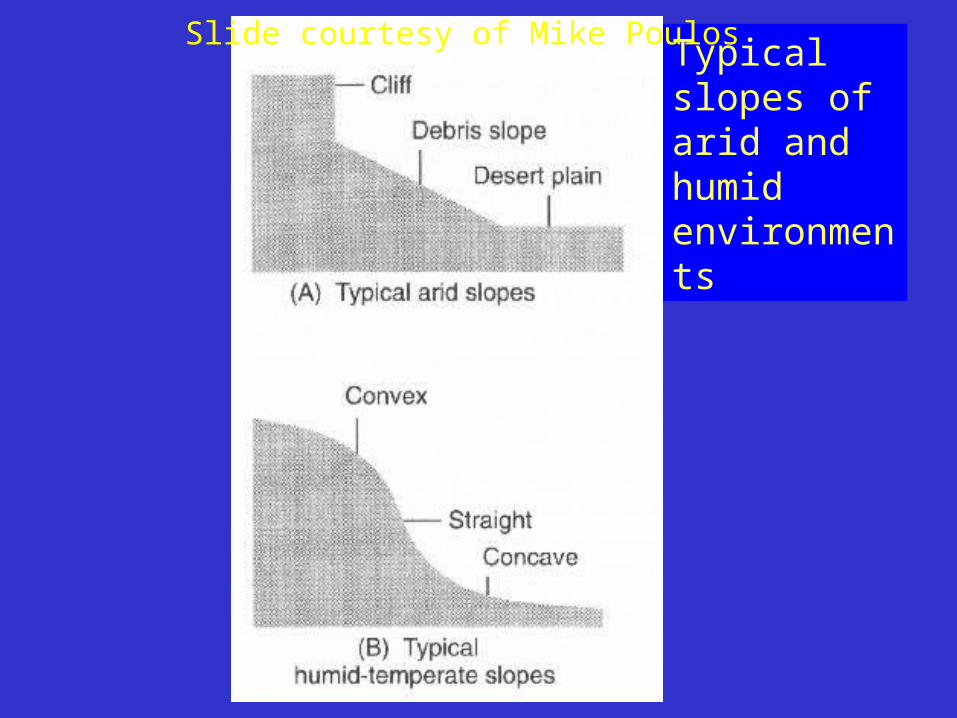
Typical slopes of arid and humid environments
Slide courtesy of Mike Poulos

Cinder cones provide unusually well-constrained initial condition
Slide courtesy Craig Rasmussen

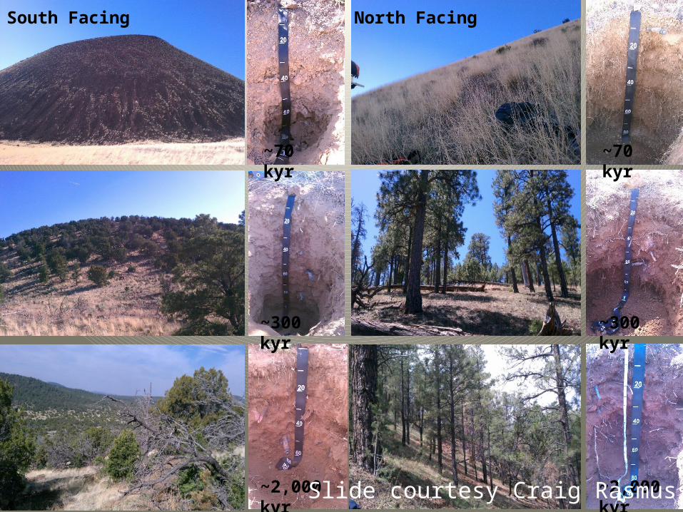
South Facing North Facing
~70 kyr
~300 kyr
~2,000 kyr
~70 kyr
~300 kyr
~2,000 kyrSlide courtesy Craig Rasmussen

Use both topo and soil variations with aspect to discriminate better among competing models
In water-limited environments:• Bioturbation is 1-2 orders of magnitude more
important that freeze-thaw-driven creep.• North-facing slopes have greater maximum
steepness.• Regolith is thicker on north-facing slopes but clay
clay accumulation more well developed on south-facing slopes (Rech, 2001; Rasmussen et al.)
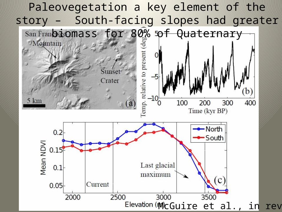
• Modern biomass density is greater on north-facing slopes BUT paleo-biomass density was greater on south-facing slopes (glacial climates are 80% of Quaternary).
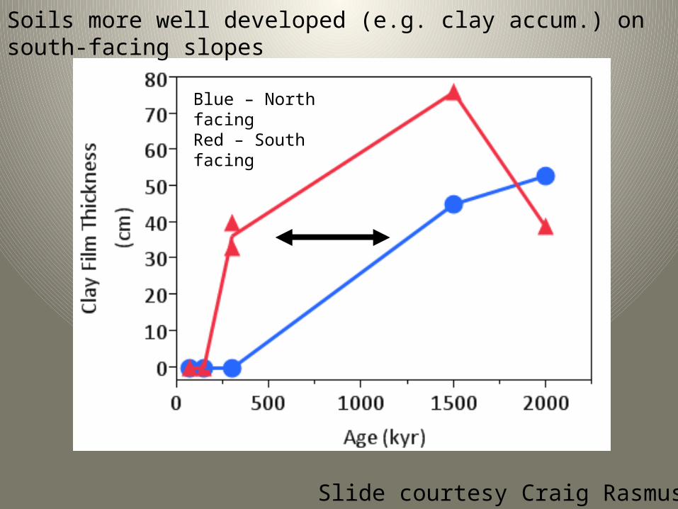
Blue – North facingRed – South facing
Soils more well developed (e.g. clay accum.) on south-facing slopes
Slide courtesy Craig Rasmussen
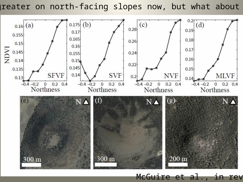
McGuire et al., in rev.
Biomass greater on north-facing slopes now, but what about the past?
McGuire et al., in rev.
Paleovegetation a key element of the story – South-facing slopes had greater biomass for 80% of Quaternary
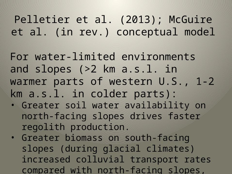
Pelletier et al. (2013); McGuire et al. (in rev.) conceptual model
For water-limited environments and slopes (>2 km a.s.l. in warmer parts of western U.S., 1-2 km a.s.l. in colder parts):• Greater soil water availability on north-facing slopes
drives faster regolith production.• Greater biomass on south-facing slopes (during
glacial climates) increased colluvial transport rates compared with north-facing slopes, leading to lower max gradients on north-facing slopes over time.
• Greater biomass led to greater dust (clay, quartz) accumulation in soils on south-facing slopes.