international 3d developments - 3dgi · pdf fileeurosdr 3d special interest group active...
TRANSCRIPT

Jantien Stoter
Professor 3D GeoInformation
International 3D Developments

www.eurosdr.net
European Spatial Data Research
EuroSDR 3D Special Interest Group
Active participants:Swisstopo, Ordnance Survey UK, Ordnance Survey Ireland, Kadaster NL, LM Sweden, IGN Belgium, ICGC Catalonia, NLS Finland, GUGIK Poland, IGN France, Denmark, Norway

3D is today!

But: Potentials of 3D are insufficiently used in geo


In 2D: important information gets lost

3D potentials are insufficiently used
De Volkskrant 6 January 2016
Planned situation
Realised situation

Interactieve 3D omgeving

Example of good practice of 3D –
Solarpotential (swissBUILDINGS3D 2.0)
14
Sonnendach.ch
www.sonnendach.ch

–Snyder, GI, 2012, The 3D Elevation Program—Summary of Program Direction
U.S. Geological Survey (Fact Sheet 2012-3089)
“3D data have the
potential to generate $13
billion in new benefits
annually.”

www.eurosdr.net
European Spatial Data Research
EuroSDR project on economic value of
3D geoinformation for NMAs (2016)
Main conclusion:
• significant positive return on investment from 3D geo-
information even when considering only two use cases in
isolation (flooding & urban planning)

If 3D techniques have
matured….

If 3D gives added value….

What is the problem?

Data, Data, Data
Solar potentialSolar potential
ShadowShadow
NoiseNoise
EnergyEnergy
urban heat islandurban heat island
Where do I find usefull
3D data?
FloodingFlooding

And thus it remains
expensive and
complicated to use 3D

What do we need?

3D Geoinformation
What do we need (and where are we working on)?
• 3D (national) standard
• 3D data maintenance & quality
• 3D base data
• 3D data integration

(National) 3D standard
Solar potentialSolar potential
ShadowShadow
NoiseNoise
EnergyEnergy
urban heat islandurban heat island
FloodingFlooding
• Solid, uniform base for 3D
• Makes 3D more efficient

In NL: 2D standard for large scale topography
Information Model Geography (IMGeo)
• Mandatory for governmental organisations

3D IMGeo?

Yes!
IMGeo modelled as CityGML ADE
IMGeo
CityGML
Building Module
CityFurniture Module
Relief Module
Transportat ion Module
Vegetat ion Module W aterBody Module
Tunnel Module Bridge Module
• 3D (national) standard• 3D data maintenance & quality
• 3D base data• 3D data integration

CityGML Levels of Detail
Filip Biljecki
• 3D (national) standard• 3D data maintenance & quality
• 3D base data• 3D data integration


2DIMGeo
LOD0
LOD1
3D
LOD2
Information Model Geography
BGTpand
BAGpand
Boom
2.5D
• 3D (national) standard• 3D data maintenance & quality
• 3D base data• 3D data integration

An improved LOD specification for 3D building models
Filip Biljecki, Hugo Ledoux, Jantien Stoter
Computers, Environment and Urban Systems, vol. 59, September 2016, pp.
25-37.
Specifying Levels of Detail of 3D data
Which one is optimal for the application?
• 3D (national) standard• 3D data maintenance & quality
• 3D base data• 3D data integration

www.eurosdr.net
European Spatial Data Research
Common definition (classification) of 3D
modelling
• To have same understanding (needed for collaboration)
• To be able to articulate our 3D needs to industry, standardisation
organisations, science

3D Geoinformation
What do we need?
• 3D national standard
• 3D data maintenance & quality
• 3D base data
• 3D data integration

3D data is required
• Beyond the “wow” effect
– Up to date (always)
– Consistent
– Authentic
– Nationwide
– Without errors
– etc
• 3D (national) standard• 3D data maintenance & quality
• 3D base data• 3D data integration

errors = common in 3D
3
7
• 3D (national) standard• 3D data maintenance & quality
• 3D base data• 3D data integration

Software to validate 3D data
• free & open-source
• web interface: http://geovalidation.bk.tudelft.nl
• According to international standards (ISO19107
& OGC)
• Reads CityGML
• free & open-source
• web interface: http://geovalidation.bk.tudelft.nl
• According to international standards (ISO19107
& OGC)
• Reads CityGML
By: Hugo Ledoux
• 3D (national) standard• 3D data maintenance & quality
• 3D base data• 3D data integration

• 3D (national) standard• 3D data maintenance & quality
• 3D base data• 3D data integration

• 3D (national) standard• 3D data maintenance & quality
• 3D base data• 3D data integration

3D Geoinformation
• What do we need?
• 3D national standard
• 3D data maintenance & quality
• 3D base data
• 3D data integration

3D data available
Provincie Noord Brabant
Den Haag
Utrecht
Eindhoven
Rotterdam
New York
Ettenheim, Germany (c)
Research Center Karlsruhe
Pariser Platz (c) City of Berlin,
Senate of Urban Development

3D data products
Two possibilities
• 3D as base -> 2D derived
• More often: 3D models are generated
from 2D
Provincie Noord Brabant
• 3D (national) standard• 3D data maintenance
• 3D base data• 3D data integration

3D NL: available for whole NL
+
TOP10NL Lidar point clouds
• 3D (national) standard• 3D data maintenance
• 3D base data• 3D data integration

3dfier• Open-source toolkit to construct (valid!)
large 3D city models
By: Hugo Ledoux
• 3D (national) standard• 3D data maintenance
• 3D base data• 3D data integration

Build and update virtual model NL
with 3dfier
• And link to applications (noise, water)
• 3D (national) standard• 3D data maintenance
• 3D base data• 3D data integration

3D Geoinformation
What do we need?
• 3D national standard
• 3D data maintenance & quality
• 3D base data
• 3D data integration

Data integration: power of 3D!
Smart cities: “The city knows what is happening where”
• 3D (national) standard• 3D data maintenance
• 3D base data• 3D data integration

BIM
Constructions
Designed
3D GIS
Geographical concepts: space, outdoor shell
Measured
Focus area:
Concepts:
Data:
• 3D (national) standard• 3D data maintenance
• 3D base data• 3D data integration

BIM-GIS integration
= more than geometric conversion from IFC (BIM) to
CityGML (GIS)
Automatic conversion of IFC datasets to geometrically and semantically correct CityGML LOD3 building, Sjors Donkers, Hugo Ledoux, Junqiao Zhao, and Jantien Stoter, 2014
Without interpretation With interpretation
• 3D (national) standard• 3D data maintenance
• 3D base data• 3D data integration
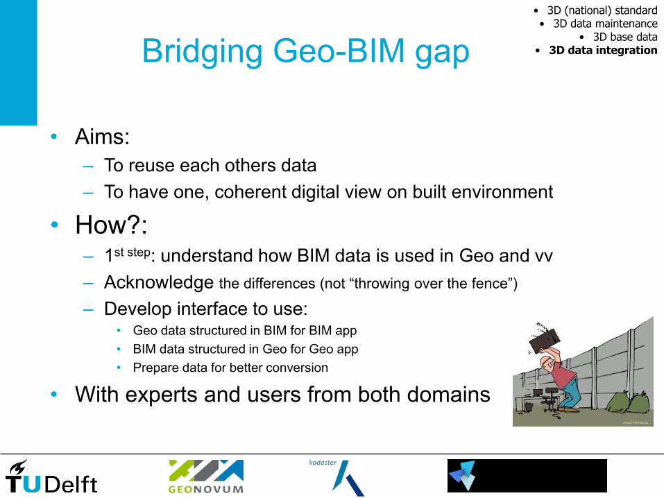
Bridging Geo-BIM gap
• Aims:
– To reuse each others data
– To have one, coherent digital view on built environment
• How?: – 1st step: understand how BIM data is used in Geo and vv
– Acknowledge the differences (not “throwing over the fence”)
– Develop interface to use:• Geo data structured in BIM for BIM app
• BIM data structured in Geo for Geo app
• Prepare data for better conversion
• With experts and users from both domains
• 3D (national) standard• 3D data maintenance
• 3D base data• 3D data integration

1. open-source API to represent IFC + CityGML
with the same data structure
2. Apply to use cases
3. Recommendations for future integration
Project GeoBIM
• 3D (national) standard• 3D data maintenance
• 3D base data• 3D data integration

www.eurosdr.net
European Spatial Data Research
EuroSDR Geo/BIM project
• Identify use cases
• Develop appropriate transformation in each use case
• Formulate recommendations for standardisation
organisations (OGC)
Partners:
OSUK
Swisstopo
OSI
Kadaster
ICGC
GUGiK
IGNF
Lantmateriet
NLS
• 3D (national) standard• 3D data maintenance
• 3D base data• 3D data integration

Example Geo&BIM integration1st 3D cadastral registration, Railway station Delft
Prorail
Gemeente Delft
Railinfratrust BV
NS Vastgoed (stations)
Real situation 2D registration 3D registration

Added value of 3D

Conclusion
Advances in 3D Geoinformation
Requires:
• Common 3D base with data beyond the wow effect
• Standardisation, validation: international collaboration!
• Most important challenge: 3D data integration
• Voxel-vector
• Below and above surface
• GIS/BIM
• Across domain boundaries
• ……
